A user commented on a Chile Lake District post of mine asking for more photos of Germany. This is striking, because German traveler who visited have made note of parallels between this area and Europe. In this series I will share photography taken from the tour bus window as we traveled to the Lake District and returned to Puerto Montt. I used a handheld Canon EOS 1Ds Mark III SLR with the Canon lens EF 70-300 f 4-5.6LIS. This is the third post of this series.
Click photograph for a larger view.
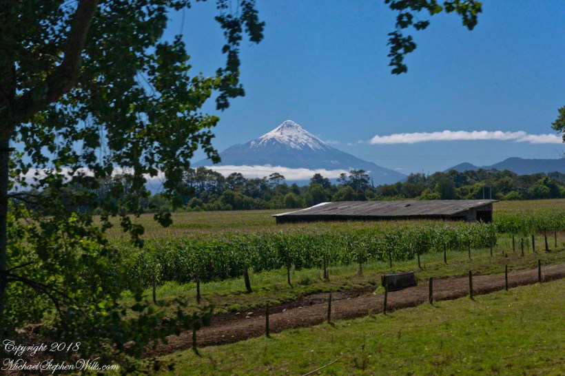
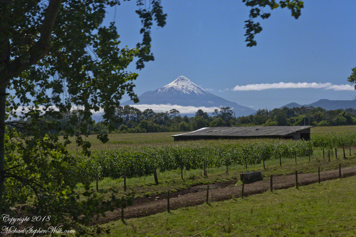
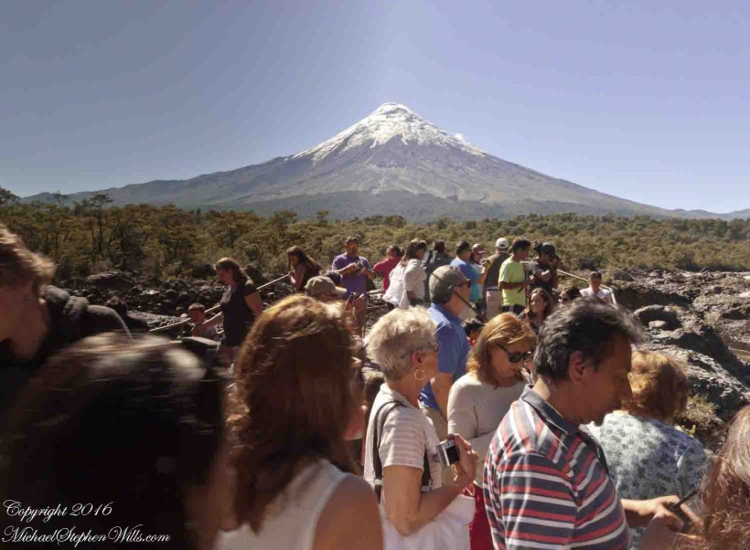
Orsorno Volcano, Lakes District, Chile
Copyright 2019 Michael Stephen Wills All Rights Reserved
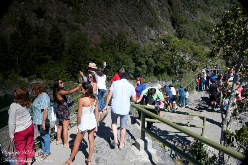
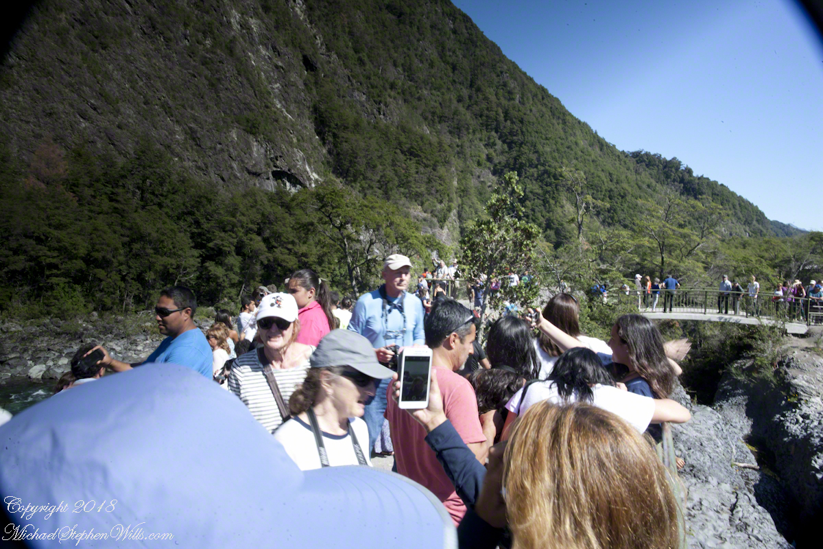
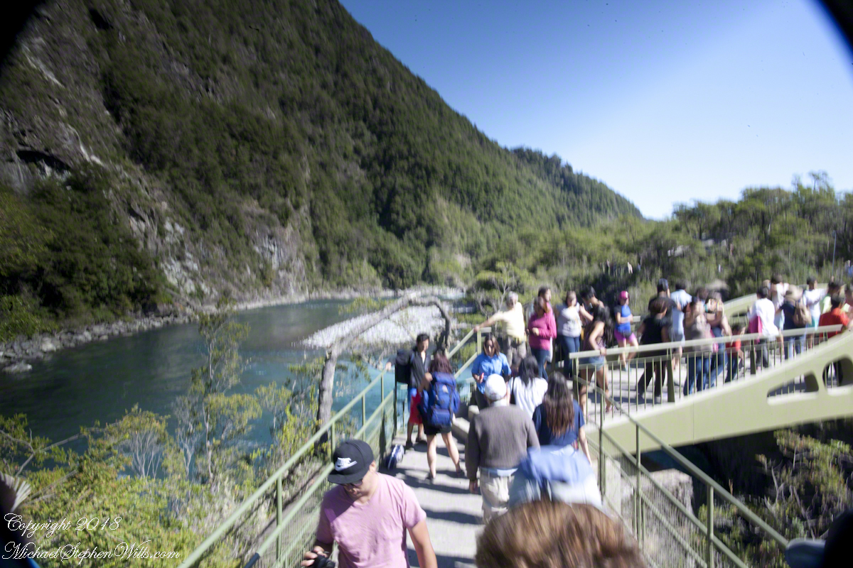
Petrohué Waterfalls are on the tourist track, traffic on the walkway was heavy on the southern hemisphere summer day, February 2016, of our visit. People were relaxed and friendly, the walkway well designed and safe. The wide angle lens was mounted on my Canon dslr, with a circular graduated neutral density filter. This is a filter with the upper third restrictive to light fading gradually to clear and mounted on a ring to rotated to cover the bright portion of the view. I used this successfully in the previous postings to obtain an exposure of the bright sky and darker land (for example, “Orsorno Volcano and Tourists.”). I could not resist capturing our fellow tourists. With a wide angle lens it is easy to do candid shots, such as the following. Most people are unaware of the capability of the 24 mm wide angle lens.
Click any photograph for a larger view.
Unfortunately, in the rush of the crowd and moment the dual use of a configuration for landscape and (candid) street photography lead to mistakes. I did not have the lens hood attached correctly, you can see the hood in each corner. Then there is the circular, graduated filter. In the above photograph, the shaded portion runs across the lower left to the upper right. The subject is watching me photograph the water.
Here, I turned around from photographing the Orsorno Volcano to capture these selfie fans leaning against the railing to capture themselves and the volcano through they are in the minority. The trail is a “dead end”, rising to the point above the falls, where I am standing.
Selfie Stick
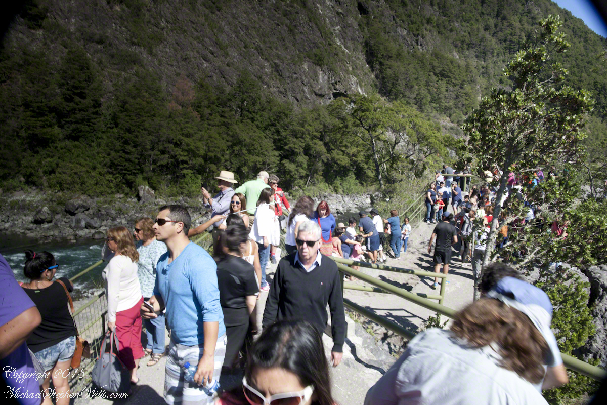
We started back down towards the point over the incredible emerald green water. There were three teenagers having fun with a selfie stick. Around them are people entranced by the water, as we werel.
Smile!! You’re on Candid Camera
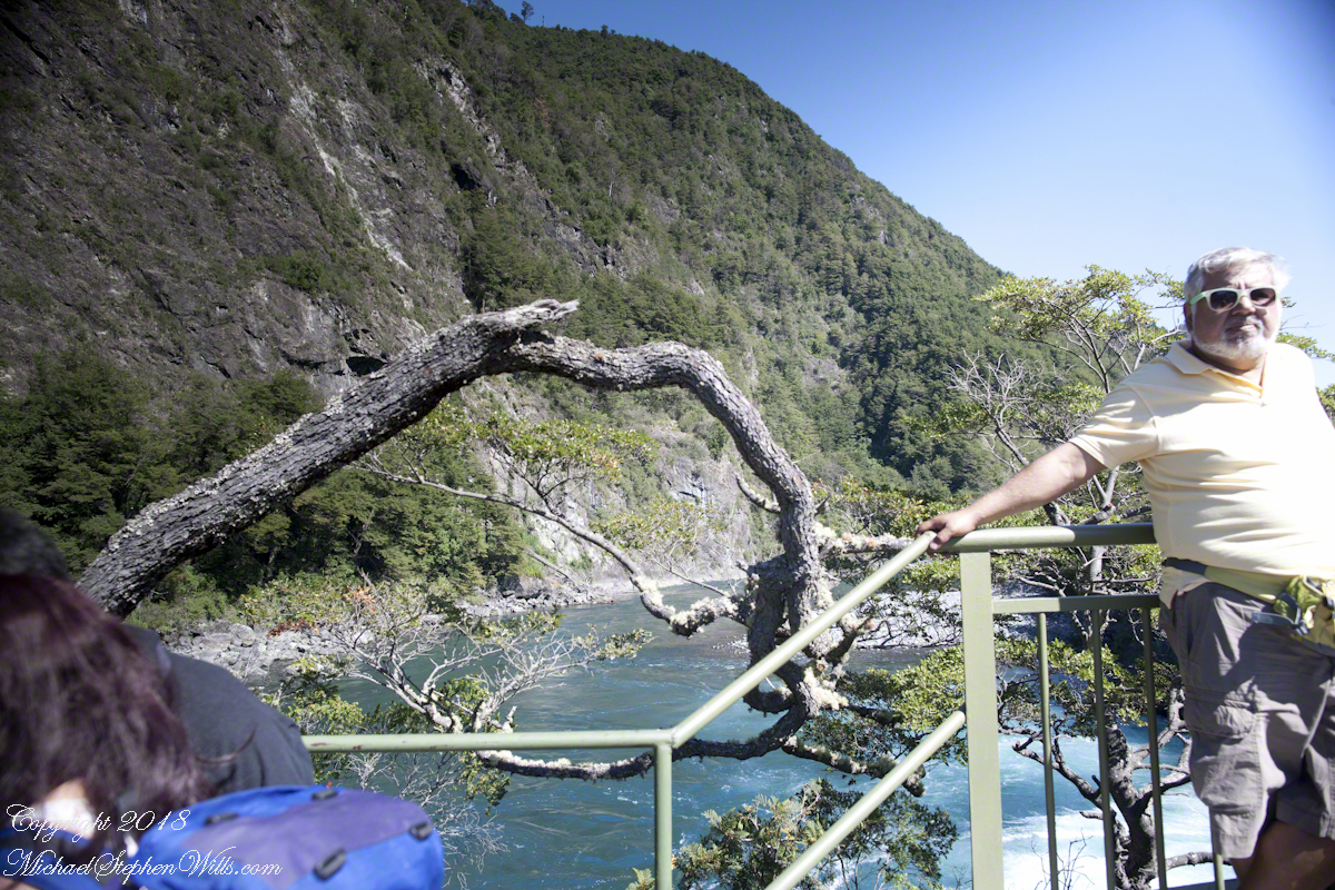
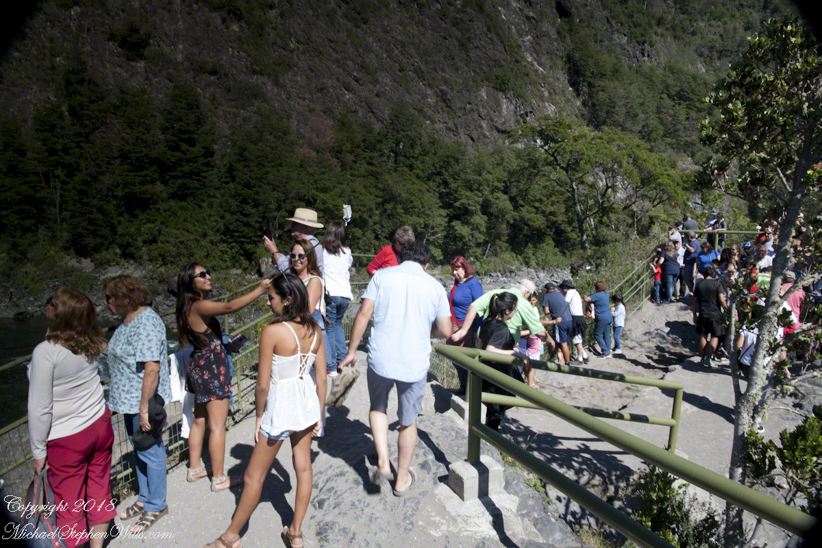
Headed back, I thought that curving tree was a good subject. Turned out, a fellow tourist heightened the interest of the shot. You see him, leaning against the railing next to the tree in the mid-distance of the following shot.
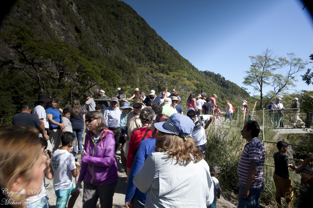
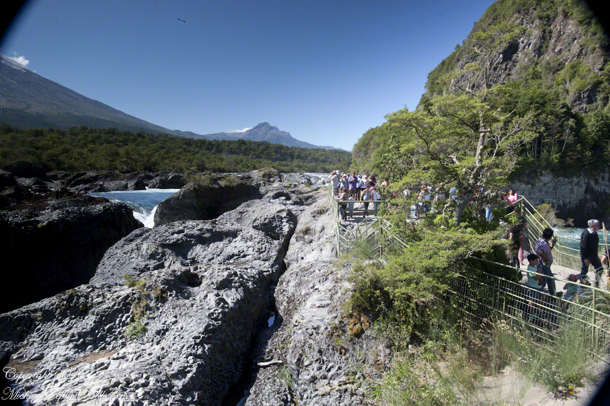
Here I am, looking back toward the child of Orsorno and the entire length of the observation walkway filled with people.
Copyright 2021 All Rights Reserved Michael Stephen Wills
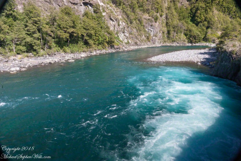
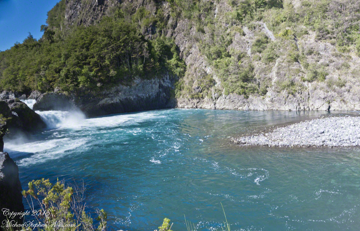
Glacial meltwater from Lake Todos los Santos (All Saints Lake) forms Petrohué River and, where the river flows over lava from the Orsorno Volcano, Petrohué Falls. This set of photographs features the emerald color the river originating from glacial minerals.
Click any photograph for a larger view.
A strangeness of these photographs is this is the middle of February, Chilean summertime.
Force of Nature
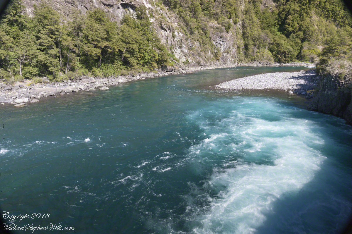
Another strangeness, not readily apparent, is the effect of the Coriolis force. Here in the Northern Hemisphere water (any moving mass, really) moving perpendicular to the rotating surface of the earth (a property of water is the surface follows the contour of the solid surface over which it flows) will tend to flow in a clockwise direction. Crossing the equator, in the Southern Hemisphere the tendency reverses, tending to flow to the left, counter-clockwise. With some imagination the effect of the Coriolis force can be seen in the following photograph.
Copyright 2021 All Rights Reserved Michael Stephen Wills
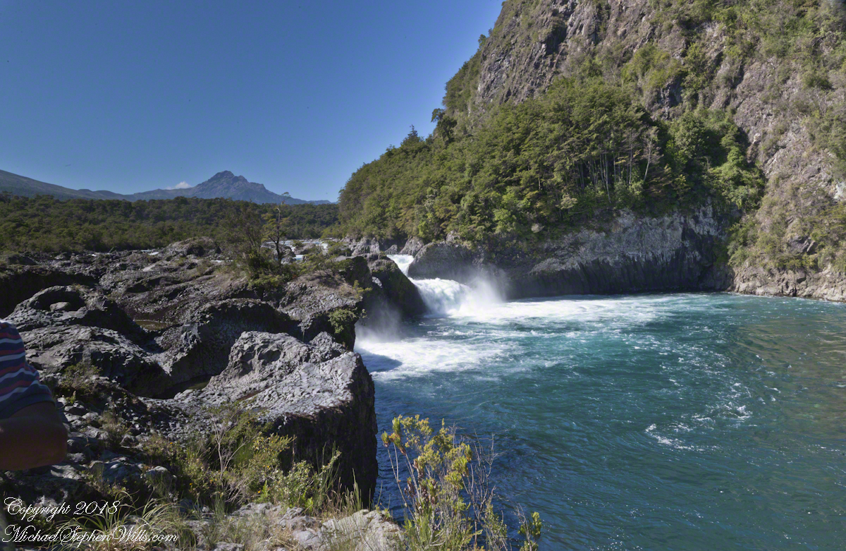
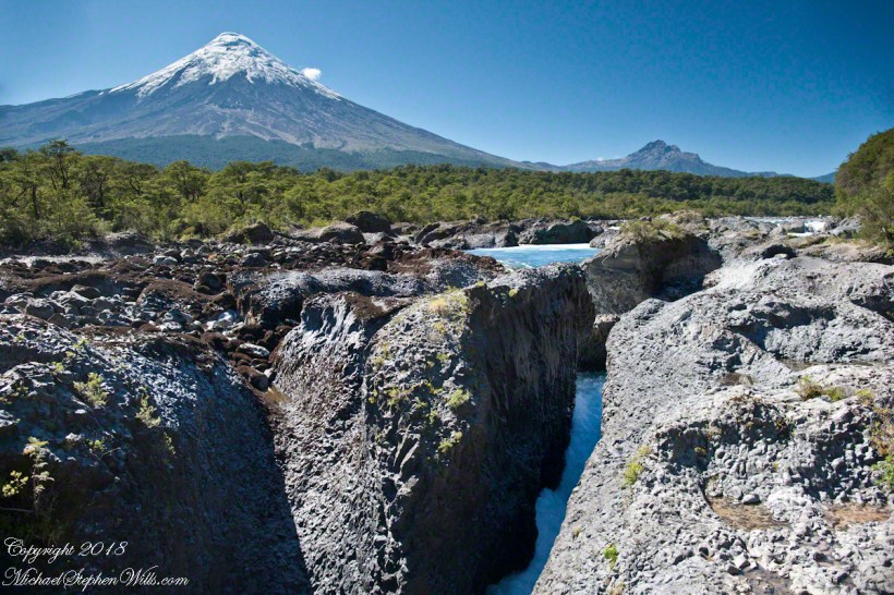
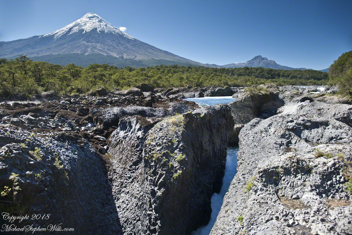
Petrohué Waterfalls (pronounced petro-WEH) is within Vicente Pérez Rosales National Park of Chile. For me, this view was one of the draws of our entire trip, that stratovolcano and its craggy children in the distance the same type as Mount Vesuvius, the volcano that wiped Pompeii off the map in 79 AD. Described by Pliny, the eruption type is named even today “plinian,” the most destructive and violent of all volcanic eruptions.
It was an irrational happiness I felt walking this place, I still smile to myself remembering it.
Click photograph for a larger view.
The mastery of water over volcanic rock deposited by ancient eruptions of the Orsorno Volcano.
Copyright 2021 All Rights Reserved Michael Stephen Wills
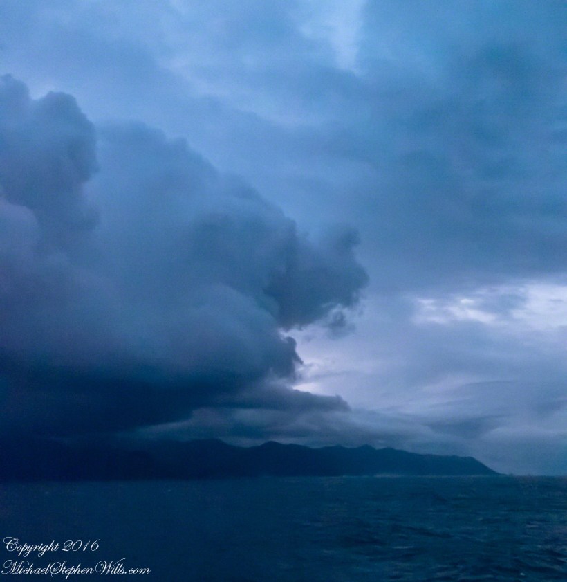
Rounding the Aysen Region headland of the Penas Gulf. Next land will be the Magellian Region extending to Cape Horn. In the Penas Gulf we will enter the Messier Channel and the fjords.
Taken with a tripod mounted Sony DSLR A 700 DT 18-200 variable lens set to 18 mm. 1/40 second at f4.5 ISO 6400. The sun was still low, after sunrise with gathering storm clouds from the terrace of our state room (a moving ship).
Our early morning traverse of the Penas Gulf was smooth sailing in route for Tarn Bar, entrance to the Messier Channel. We’ll pass Wager Isle where May 14, 1741 the H.M.S. Wager wrecked, stranding the crew. Speaking to the conditions on board, immediately some of the crew broke into the “Spirit Room, got drunk, armed themselves and began looting, dressing up in officers’ clothes and fighting,” many drowning the next day when the Wager flooded and sank.
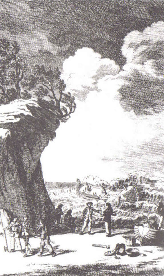
The original fronts piece to Byron’s Narrative; “Being an Account of the Shipwreck of The Wager and the Subsequent Adventures of Her Crew.”
The remaining 140 officers and crew manned the boat to make for shore in the Patagonian winter. Five years later, midshipman John Byron, grandfather to the poet Lord Byron, made it back to England with the Captain David Cheap. Just west of Wager Isle is the larger Byron Isle, named in his honor.
On this south heading our cabin on the port side faced east. In these early morning hours, I set up on the stateroom balcony, so for better or worse there is no views of either Wager or Byron Isle.
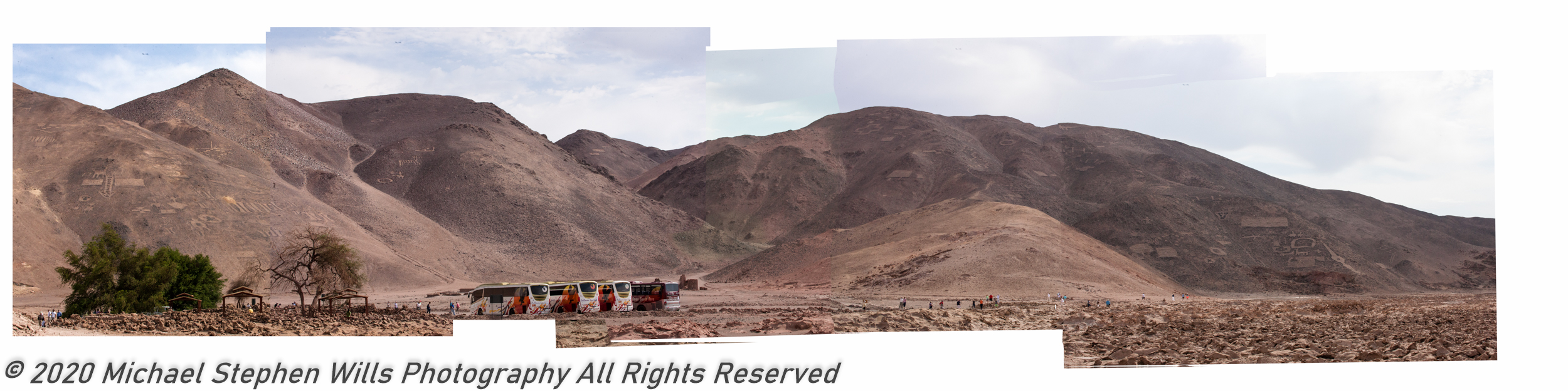
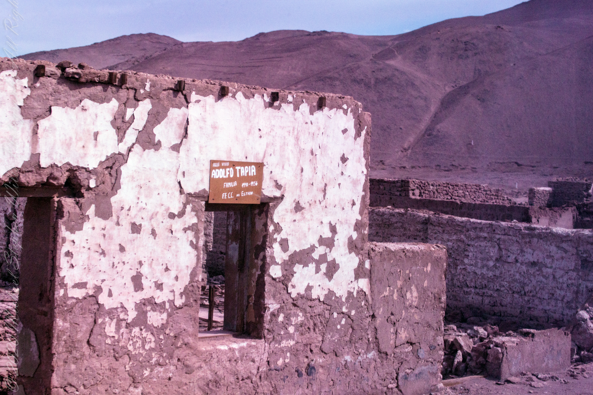
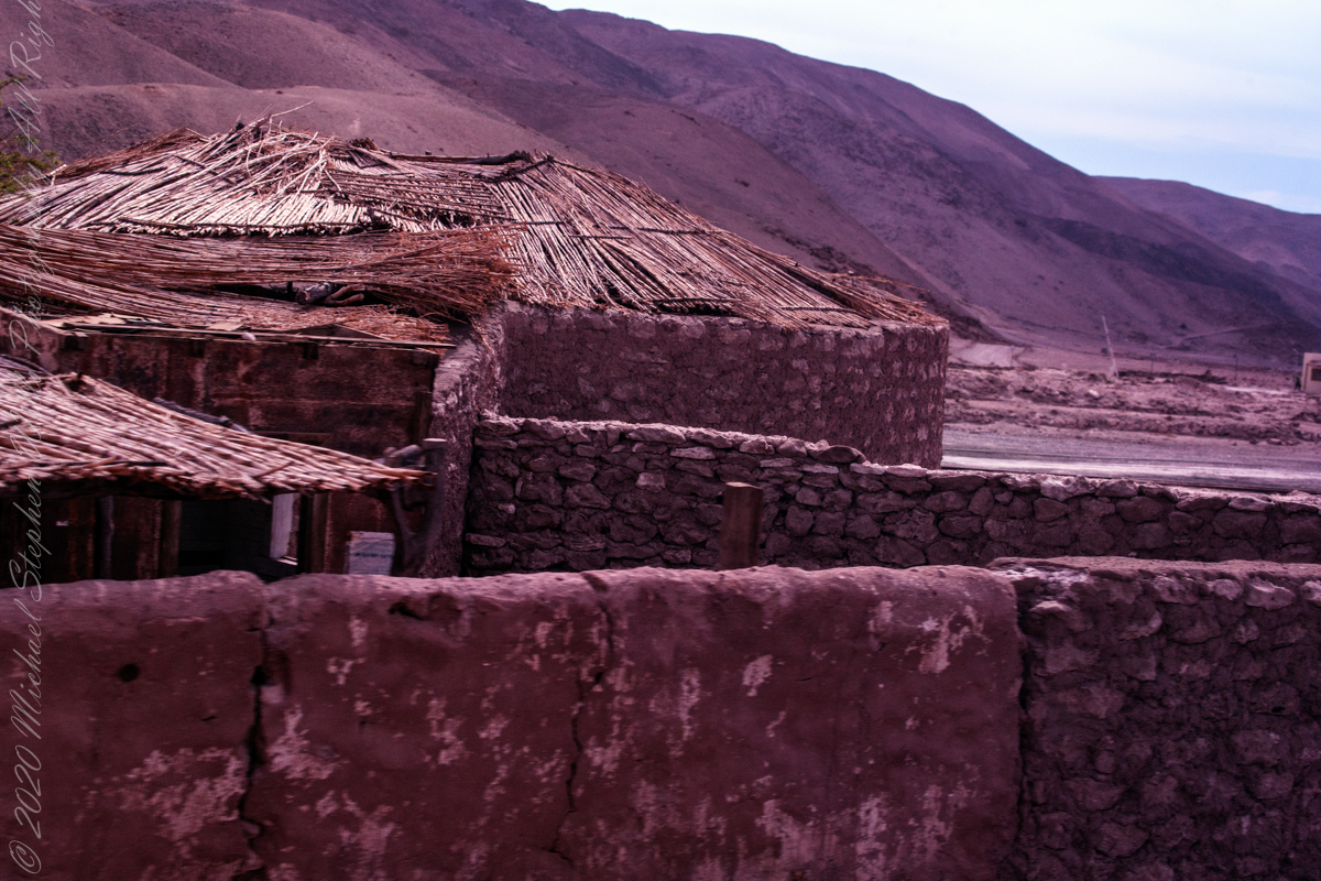
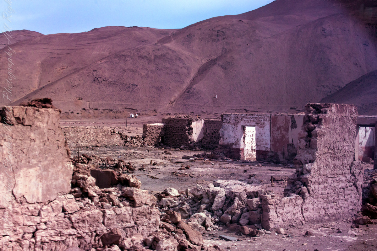
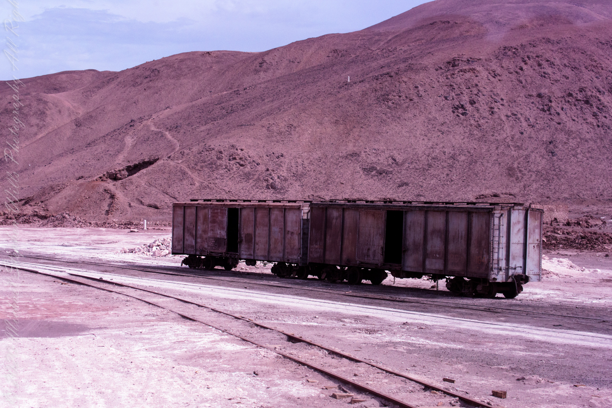
The Spanish word pintados translates to painted in English. There are many references to the word, in one it is a war loving tribe known for tattoos. Here, it is the name of a deserted town on an abandoned railroad running roughly parallel to the Pan American highway. As we passed through en route to Geoglifos de Pintados, I captured these shots of the ruined town.
The handprinted sign above the window, top photograph, says in translation, “Here lived the Adolfo Tapia Family, 1940-1956, F.F C.C. del Estado.” Searches on Adolfo Tapia turned up nothing, all we know is the sign attributes the designation to the state government.
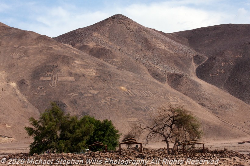
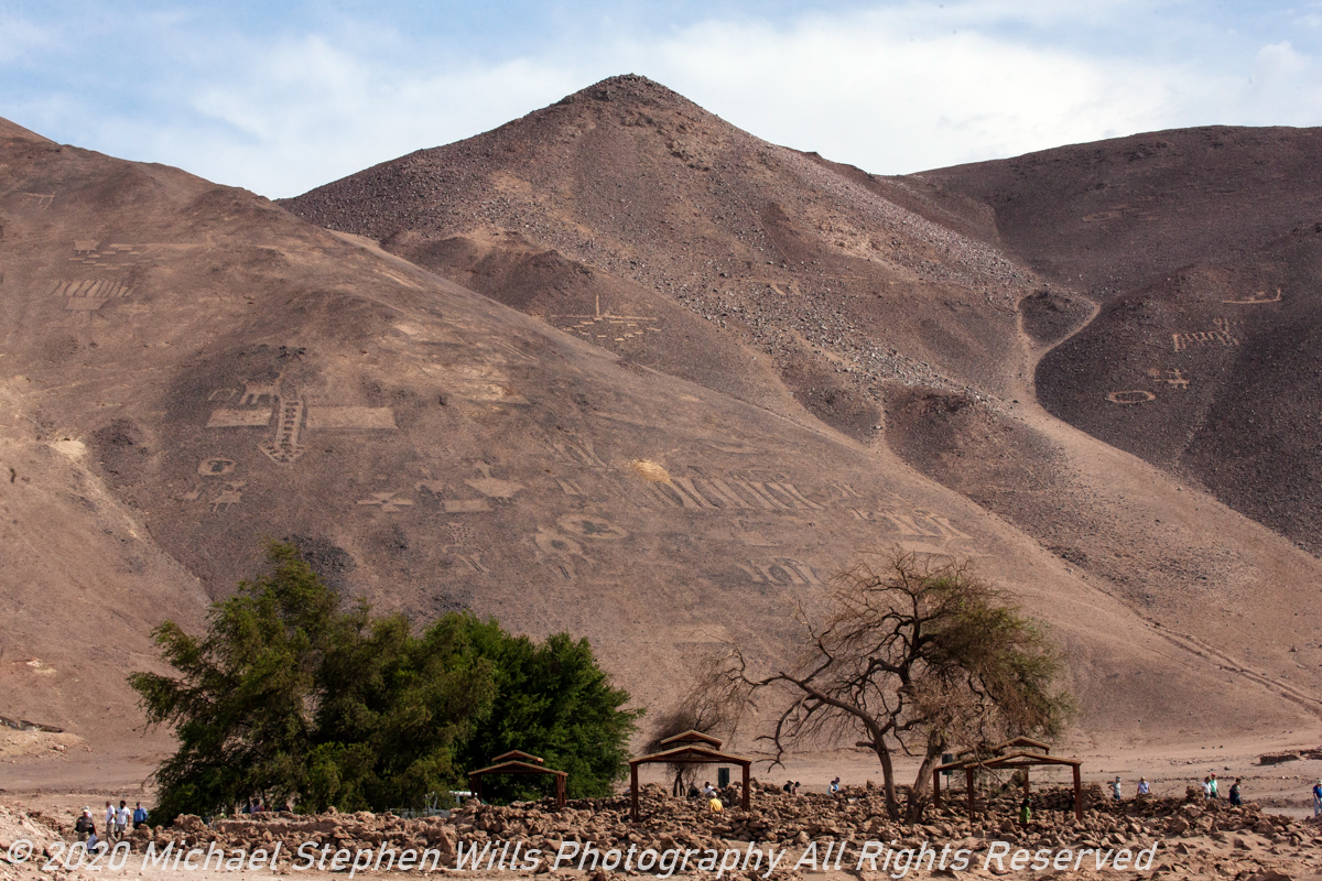
The hill of the geoglyphs are the background, some of the figures are visible. There will be more in later posts.
The railroad served the many Saltpeter factories dotting the Tarapacá region. To my knowledge all were closed in the mid-20th century.
Click any photograph for a larger view and use Ctrl-x to zoom in closer.
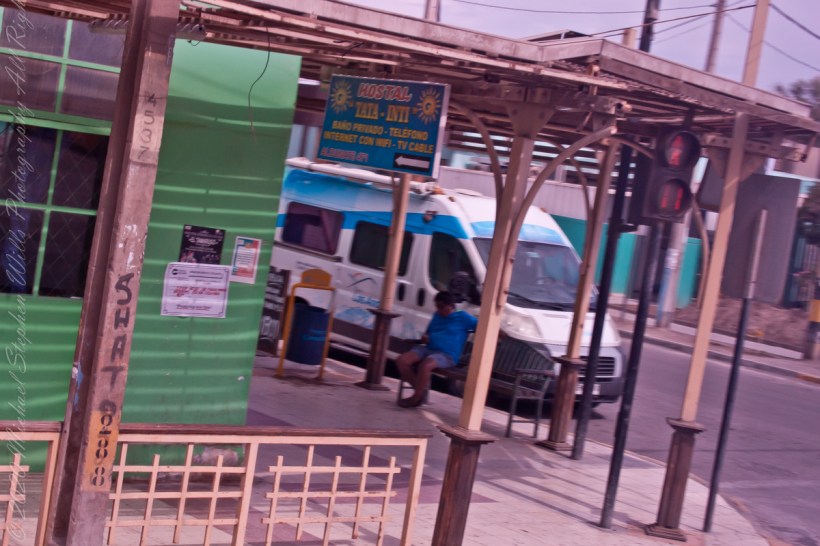
We passed this way between Humberstone and the geoglyph site, the town name can be roughly translated as “High Well.” A watering place, in other words. The sign advertises the “International Hostel” Tata with the convenience of private bathrooms.
Click any photograph for a larger view and use Ctrl-x to zoom in closer.