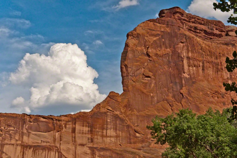
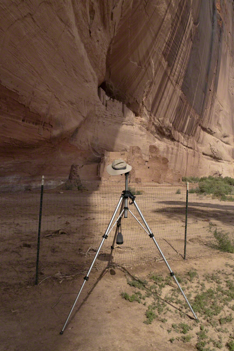
The Whitehouse Ruin of Canyon de Chelly is just visible at left in the far cliff, in the notch of the near cliff. The ruin trail is visible on the canyon floor. Notice the road following the canyon and the plantings with house on the right.
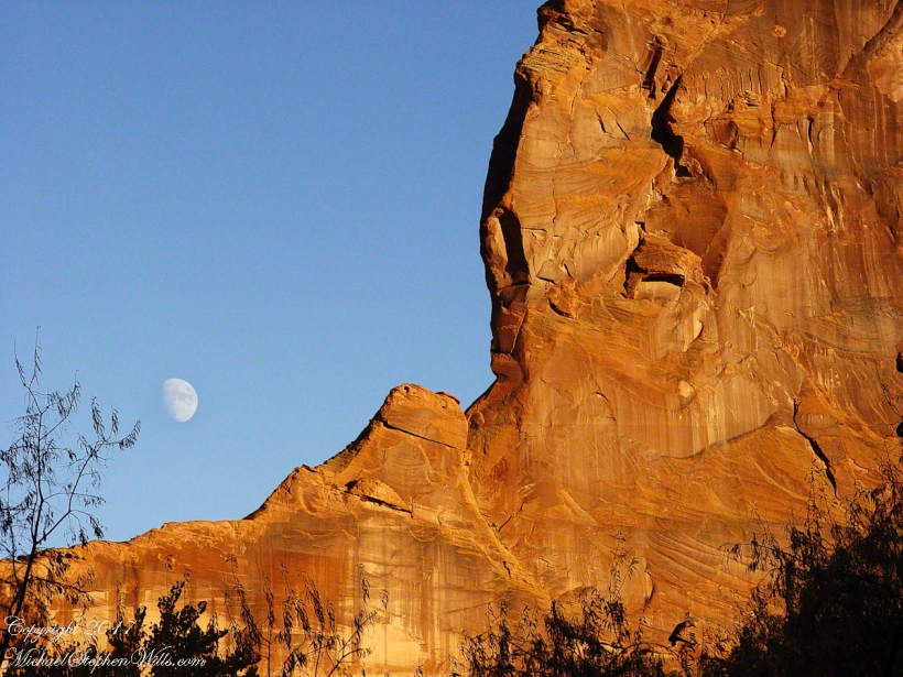
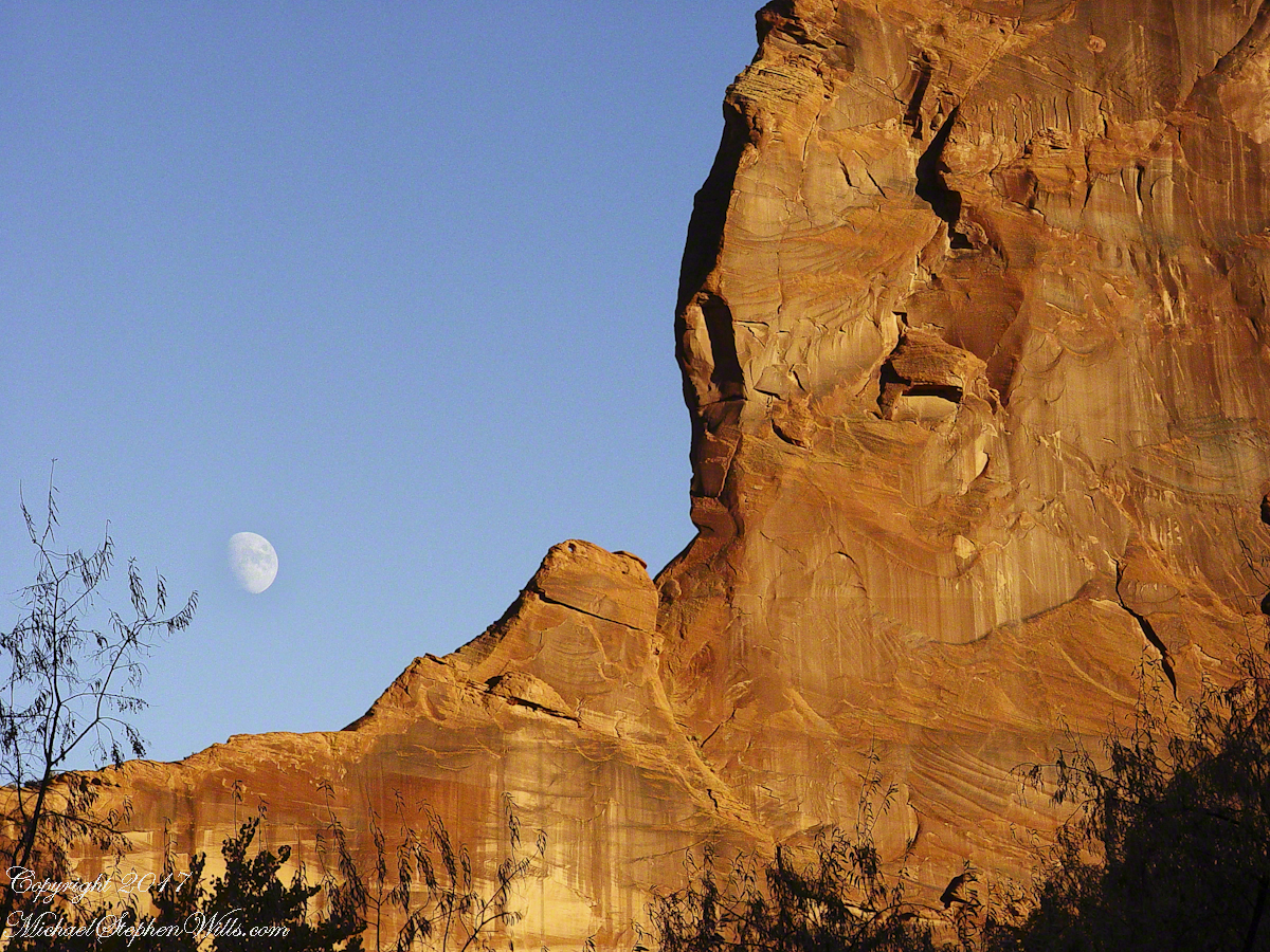
The landscapes I capture, like the face of a missing friend, fade gently from memory. My piece “Moon Fin Canyon de Chelly” became a mysterious vision. I remembered the context, the canyon topology was lost until I constructed the panorama, above, from three shots taken one evening, July 2008, from a cliff near the White House Overlook. Five years after my visit with Sean Wills, Pam and I returned to Canyon de Chelly to walk the same path.
At that time, a 50 mm lens was my widest angle, so I would take multiple images in sequence and use Photoshop later to construct a panorama. This past Sunday afternoon I spent stitching together my work from 2008. In doing so I see “my fin”, in the center, bordered by the canyon road, is attached to the White House Ruin cliff via a thin ridge.
During that session a photogenic thunderhead, lit by the evening, hovered behind the fin as the gibbous moon did that long ago evening.
November 2003 my son, Sean, and I drove up route 191 from the Petrified Forest National Part to arrived at Chinle on a November afternoon. In 2003 my photography kit included a Sony Point and Shoot 5 MP camera with filters, an over the shoulder (purse type) bag and an inexpensive “Kmart” tripod.
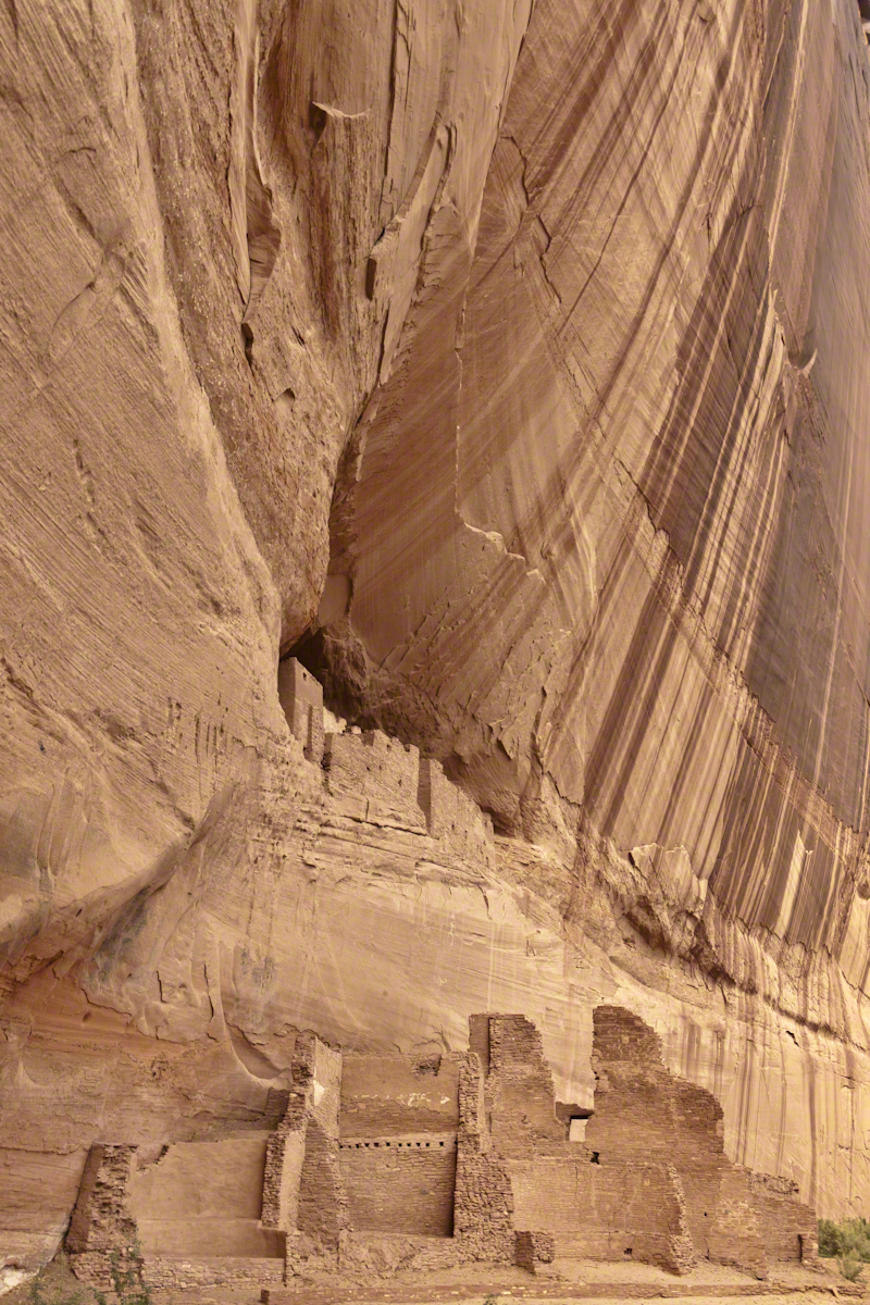
We found the White House trailhead, hiked down essentially alone as the sun set at 5:20 pm. At that time, a thick stand of Russian Olive trees choked the wash. We stopped at this point in the gathering dark. I took this distant shot of the White House Ruin against the Russian Olive autumn foliage. A stand of Cottonwoods growing near the canyon wall had yet to turn their brilliant yellow. At that time, the White House Ruin was painted white.
When Pam and I visited July 2008, in the intervening 4 years, 9 months the Russian Olives were removed as an invasive species, the ruin was no longer white.
There is one highway headed south in the Four Corners region of Northern Arizona, the same route 191 Sean and I took. In 2008 Pam and I came from Colorado south on 191, also arriving late afternoon.
That July day the sun set 8:33 pm as the Navajo Reservation observes daylight savings time. My goal was to photograph the White House Ruin I missed in 2003. We arrived at the trail head. My photography kit was expanded from 2003, now included a Kodak DSC Pro slr/C, the “C” meaning “Canon” lens mounting, a Sony 700 alpha slr (I only use a variable lens), Manfrotto tripod with hydrostatic ball head, and the backpack style Lowe camera case. With the tripod it is over 25 pounds.
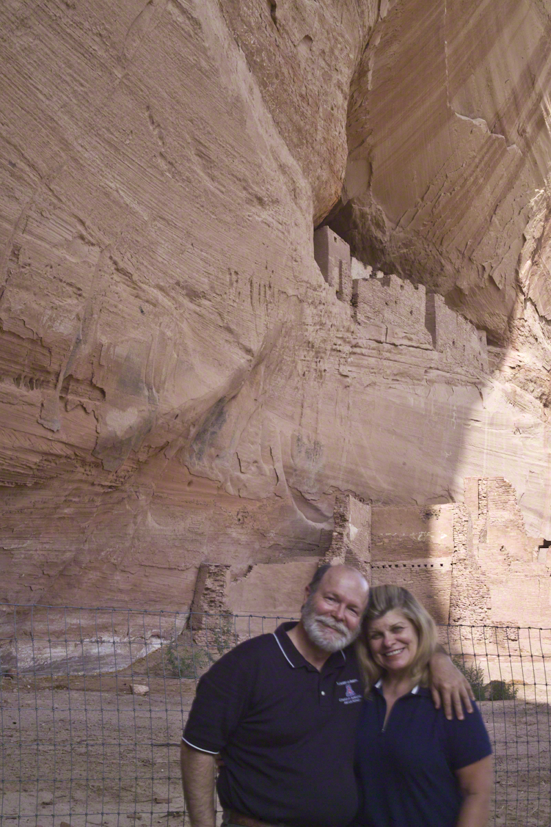
With this on my back I was prepared to boogie down the trail. At the height of tourist season there were many more people at the trailhead. Pam, being a friendly person, started a conversation while I ploughed ahead along the flat canyon rim. It is solid red sandstone, beautiful, generally level with enough unevenness to require attention. When Pam saw how far ahead I was she tried to catch up, tripped, fell hard.
I backtracked to Pam and we pulled it together. She thought, maybe, the fall broke a rib. We descended, slowly, together. Here we are in front of the ruin. The sun, low in the sky, is moving below the south canyon wall. This is a perfect time and I used both cameras.
Mike and Pam Wills with the White House Ruin, Canyon de Chelly, July 2008
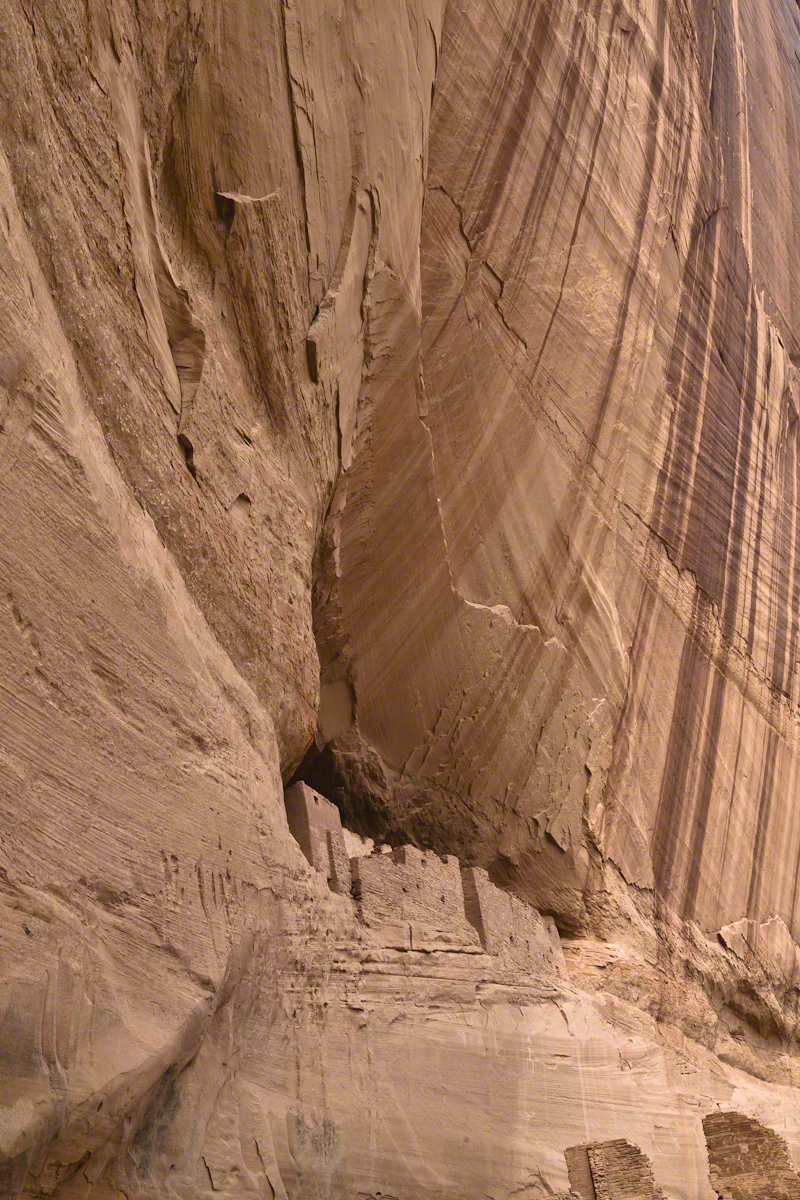
The sweep of cliff and desert varnish was my intent to capture. Here it is through the Canon 50 mm lens.
Driving from the Petrified Forest National Park my son, Sean, and I arrived at Chinle, Arizona the evening of Monday, November 2, 2003. No time to rest or eat after checking into the Best Western he and I reached the White House overlook and trail head with the sun low in the sky, the sun sets 6:45 pm these last few days of Daylight Savings. The Navajo Reservation observes Daylight Savings, so the click jumps crossing the border from Arizona to Reservation.
I was 50 at the time and with Sean graduated from SUNY Maritime and fresh from a tour at sea we made good time to the canyon floor. I wanted to catch the White House in the setting sun.
One morning, 14 years later, I published a fine art photograph from that trip.
Looking along the canyon, over thick stands of Russian Olives, I caught the risen moon, in gibbous phase, against a mid-canyon freestanding fin of red sandstone of the southern canyon wall. Today, those trees are gone, removed as an invasive species.
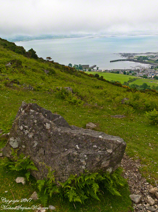
Rocks such as this are a favorite perch for leprechauns to rest and contemplate the works of man who have invaded their world. Inhabitants of Carlingford who wander Slieve Foye have come upon them often enough, their stories and certitude in the existence of the Little People are resistant to manifold doubters with their reasons and arguments.
Kevin Woods, aka McCoillte, was a doubter until worked on a stone wall on property he owned on Ghan Road, Carlingford. His belief did not arise on the discovery of the leather purse, covered with ages of dust and lime, nor with the gold coins inside. McCoillte pocketed the coins for luck. As luck would have it, McCoillte loved to walk on Slieve Foye. It was on one such walk he and his dog encountered Little People who paralyzed them to escape. His unexplained absence led to troubles with the wife.
This experience brought McCoillte around to enough of a belief that he, with lots of help, succeeded in petitioning the E.U. European Habitats directive to recognize leprechauns a protected species. According to a page on the Celtic Times web site, “The E.U. sent Madame Isobel Jeanne from Fecamp in Brittany France to Carlingford with the official letter declaring Carlingford Mountain (Note: otherwise known as Slieve Foye) protected, on the grounds that they could not prove or disprove their existence.” The page is titled “The Carlingford Leprechaun.” Google “Last Leprechauns” learn more about McCoillte’s stories.
I came upon this rock on June 9, 2014 on a day my cousin Sean Mills invited us to walk the Tain Way over Slieve Foye. It was such a finely shaped piece of what I suppose to be granite, the view of Carlingford, the lough and farmland so compelling, I spent time composing this landscape.
You can make out “King John’s Castle” just over the ridge and its yellow flowering gorse, on the margin of the blue lough. It is the boxy, grey structure; crenellations are visible on high resolution versions of the image. Carlingford is known for the castle, the popular name is for the English monarch who spent time there, although it was built by another.
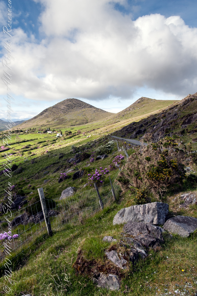
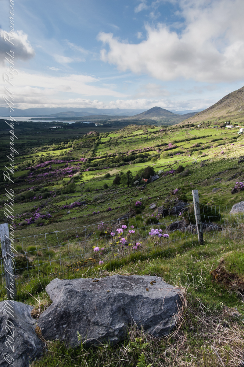
Number six of six from the Kerry County side on the descent Healy Pass, R574. Here we move away from, say goodbye (hopefully, for now) to these marvelous views, our first sight of County Kerry.
Two more strange, conical hills come into view, repeating those in the distance. These have a long story.
Beara Peninsula, Coolcreen townland, County Kerry, Republic of Ireland.
You can easily view a higher resolution versions by clicking on the photograph to open a browser tab.
Click photograph for a larger version.
Copyright 2021 Michael Stephen Wills All Rights Reserved
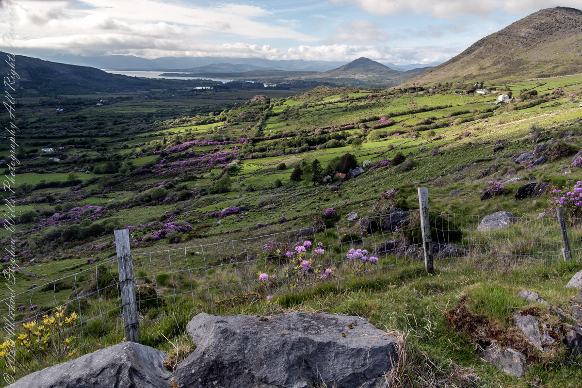
Number three of six from the Kerry County side on the descent Healy Pass, R574. I enhanced view three to level the horizon. A side by side comparison is provided, below.
Beara Peninsula, Coolcreen townland, County Kerry, Republic of Ireland.
You can easily view a higher resolution versions by clicking on the photograph to open a browser tab.
Click photograph for a larger version.
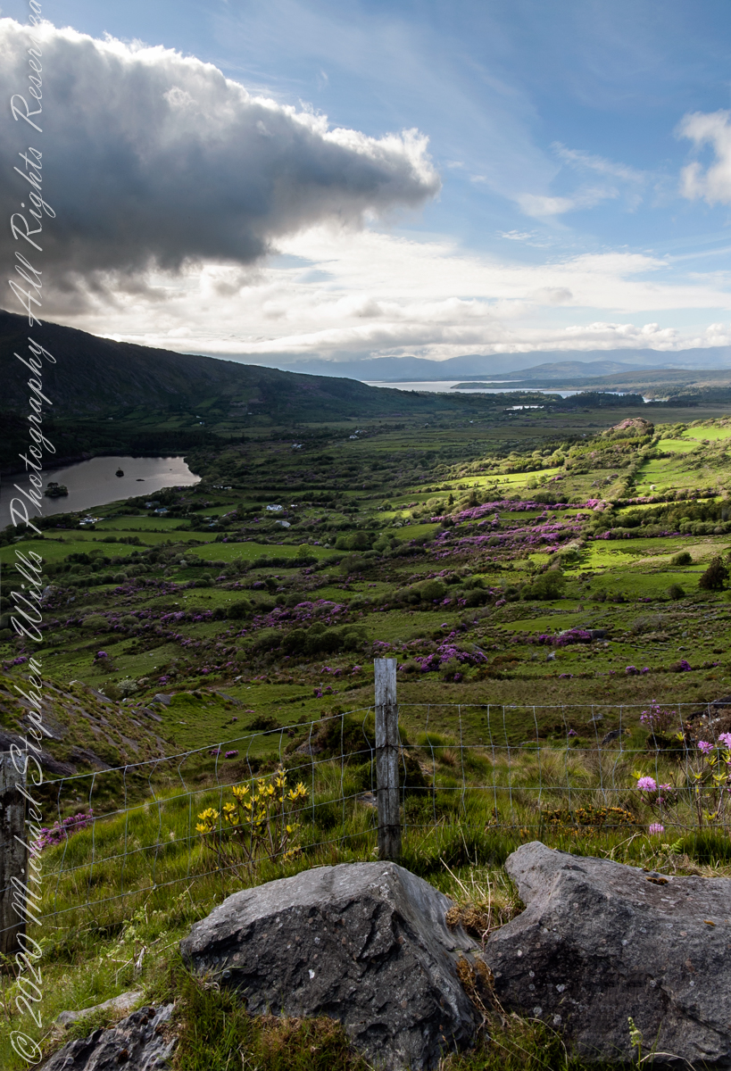
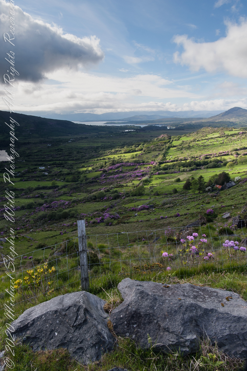
Visible from this point on R574, Healy Pass, is Glenmore Lake, the Rivers Drunminboy, Glanstrasna flowing into a sheltered inlet of the Atlantic Ocean. In 1911, the Irish National Census lists nineteen (19) persons of five (5) families listed with the names O’Sullivan, Sullivan and Shea. From this view this is a puzzle until the map is examined. The land transitions from this rock to a steep, then leveling slope down to Glanmere Lake and a stream running from the heights with plenty of reasonably level, fertile acreage. There is a glimpse of a lake. Like many of the Irish place names, Glenmore Lake has a connection to the Irish Language name, Loch an Ghleanna Mhóir. Roughly translated the name means Large Lake of the Glen. The names in use today, in English, are derived from the sounds of the Irish. It happens the Irish Ghleanna sounds link Glen (or in another version, Glan, roughly the same). Beara Peninsula, Coolcreen townland, County Kerry, Republic of Ireland.
Copyright 2021 Michael Stephen Wills All Rights Reserved
Number four of six from the Kerry County side on the descent Healy Pass, R574. Here I turn the camera on the Manfrotto studio tripod with hydrostatic ball head to the original view, a little less lit with a better leveling of the horizon.
Number three of six from the Kerry County side on the descent Healy Pass, R574. I turned the camera a few more degrees into the gathering darkness, under the cloud, for an almost complete view of Glanmore Lake.
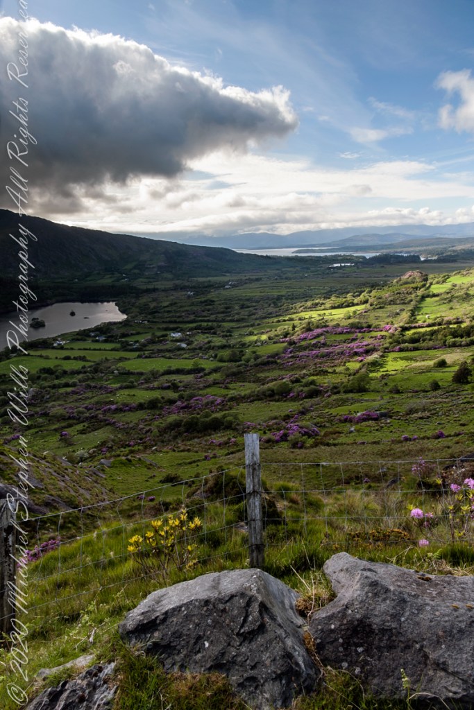
Number two of six from the Kerry County side on the descent Healy Pass, R574. The dynamic range is a photographic challenge: the scene darkens as a cloud covers the westering sun, I turn the camera toward Glanmore Lake. The large, distant water is a bay on the North Atlantic named for the city at the foot, Kenmare.
Beara Peninsula, Coolcreen townland, County Kerry, Republic of Ireland.
You can easily view a higher resolution versions by clicking on the photograph to open a browser tab.
Click photograph for a larger version.
Copyright 2021 Michael Stephen Wills All Rights Reserved