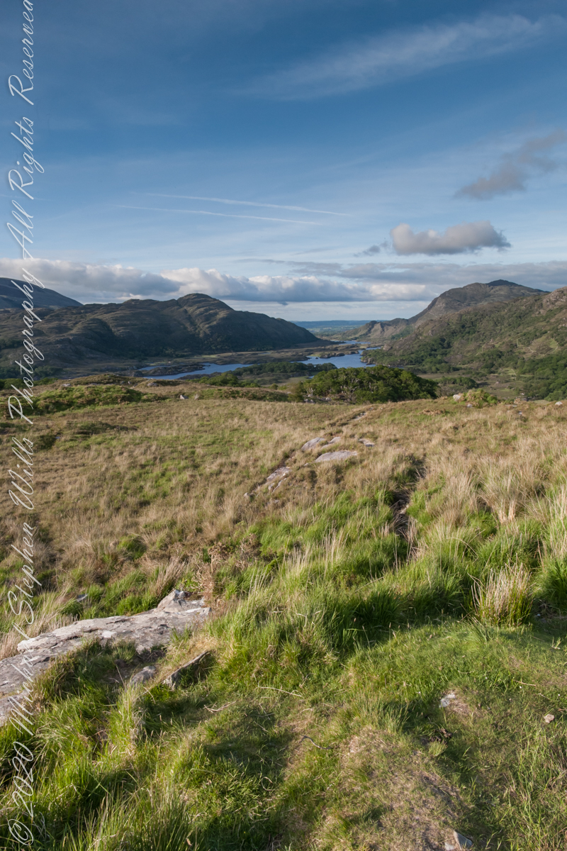
Here we are, on the road from Kenmare to Killarney, N71, part of the Ring of Kerry around the Iveragh Peninsula. The view was celebrated by Queen Victoria’s Ladies-in-Waiting during an 1861 tour of Ireland
Click pic for larger view in a new browser tab. If you are in WordPress Reader, open the post to use this feature.
Ladies View, Killarney National Park, Derrycunihy Townland, County Kerry, Republic of Ireland.
Copyright 2021 Michael Stephen Wills All Rights Reserved
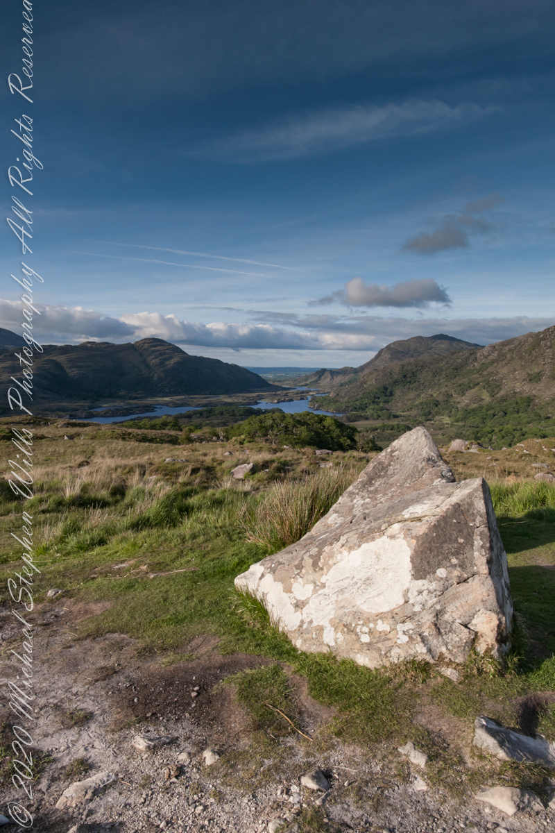
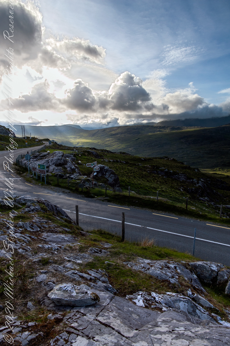
We are near Molls Gap on the Ring of Kerry. At our feet is Eric townland, there’s an epynmous Bog Nature Reserve down there.g of Kerry. At our feet is Eric townland, there’s an eponymous Bog Nature Reserve down there.
Townlands Derrylough, Crossderry and distant Bunbinnia take up most of the view. Those familiar with post-glacial topography will recognize the glacially oversteepened slopes of the distant through valley. The valley floor is a glacial outwash plain.
Click pic for larger view in a new browser tab. If you are in WordPress Reader, open the post to use this feature.
Copyright 2021 Michael Stephen Wills All Rights Reserved
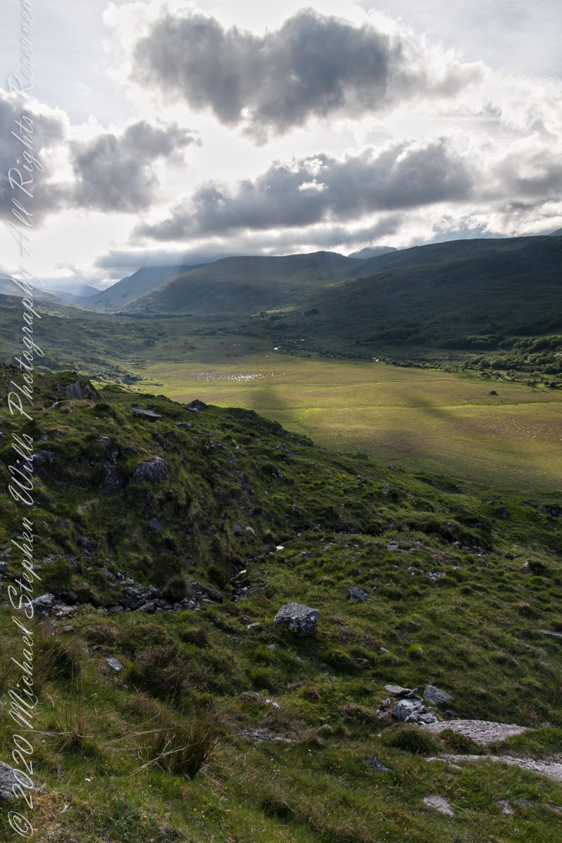
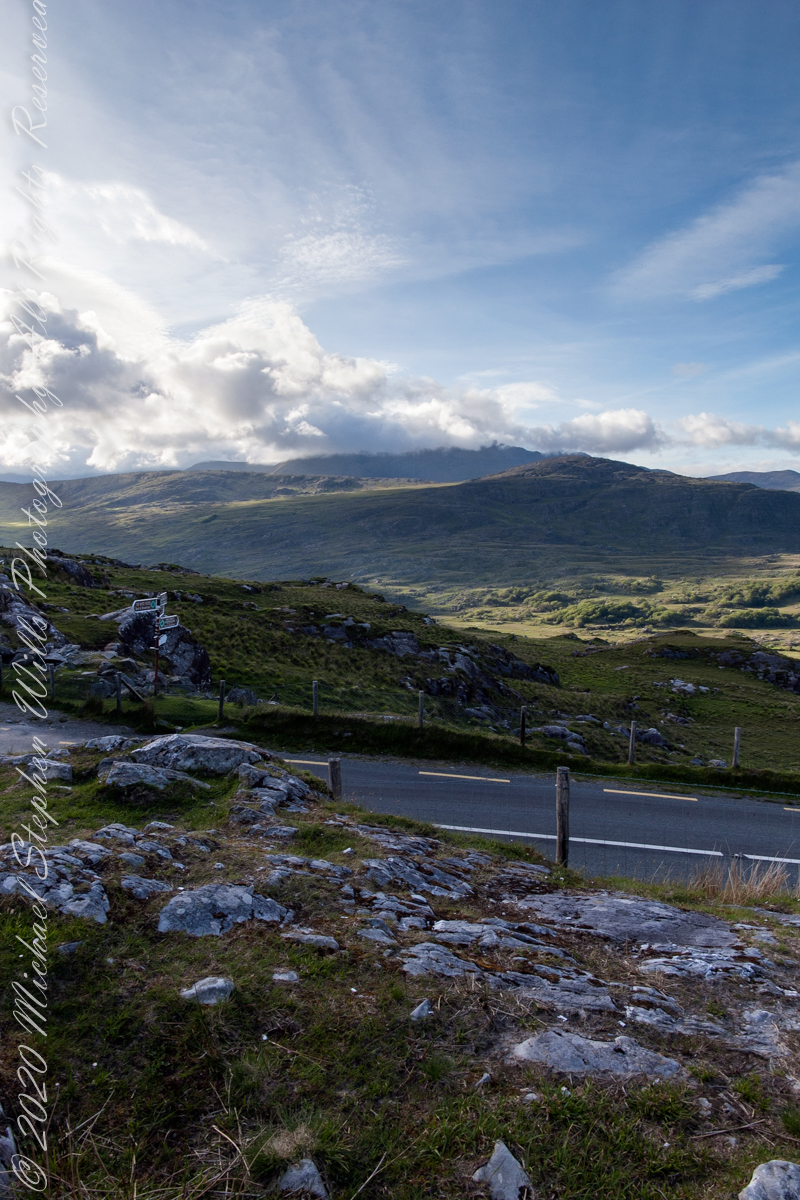
Here we are still standing in Moll’s Gap, looking a bit farther northwest into Black Valley than for View Two. Across the far mountains is Black Valley, a place so remote it was among the last, on the island itself (“mainland”) to be electrified or connected to telephone networks. Today Black Valley is a southerly route to the Gap of Dunloe well known to certain hikers and cyclists.
I am struggling here to deal with the vast range of light intensity from the glow of a westering sun, to the shadows cast by surrounding heights.
Beneath our feet are the slopes of Derrygarriff (in Irish Doire Gharbh) of the Mangerton range. Across the way is Crossderry peak of the Dunkerron mountains, the townland is named for the peak (or vice versa).
Click pic for larger view in a new browser tab. If you are in WordPress Reader, open the post to use this feature.
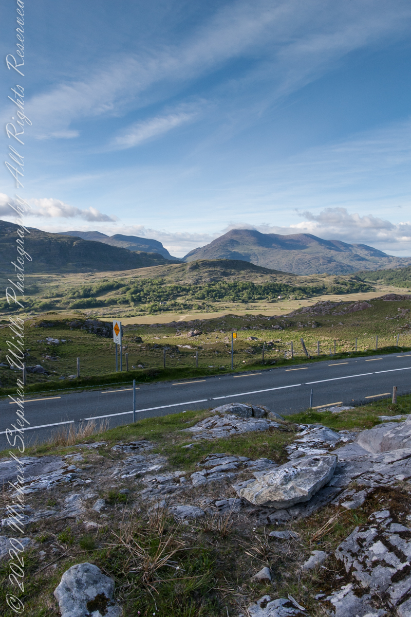
Here is a second try, a bit more successful as the clouds opened to shine on distant land. I did work in Photoshop to manage the brightest clouds.
Here are all three versions of the Black Valley view from Moll’s Gap. Enjoy
Copyright 2021 Michael Stephen Wills All Rights Reserved
Here we are standing in Moll’s Gap, looking northwest into Black Valley, a place so remote it was among the last, on the island itself (“mainland”) to be electrified or connected to telephone networks.
Beneath our feet are the slopes of Derrygarriff (in Irish Doire Gharbh) of the Mangerton range. Across the way is Crossderry peak of the Dunkerron mountains, the townland is named for the peak. Black Valley, now a southerly route to the Gap of Dunloe well known to certain hikers and cyclists, is beyond the far mountains.
Click pic for larger view in a new browser tab. If you are in WordPress Reader, open the post to use this feature.
Copyright 2021 Michael Stephen Wills All Rights Reserved
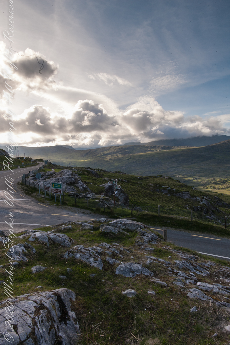
Here we are, on the road from Kenmare to Killarney, N71, part of the Ring of Kerry around the Iveragh Peninsula. The spot is the mountain pass Moll’s Gap, also known in the Irish language as Céim an Daimh (meaning, Gap of the Ox). In the Nineteenth Century a woman named Moll Kissane ran a public house here, operating illegally.
The mountain of this townland, named Eirk (also known as Adhard) , is composed of a fine grained sandstone found in a wide swath from North America’s northeastern coast, Greenland, Ireland, Great Britain — lands formerly part of the same ancient continent.
Click pic for larger view in a new browser tab. If you are in WordPress Reader, open the post to use this feature.
Iveragh Peninsula, Eirk townland, County Kerry, Republic of Ireland.
Copyright 2021 Michael Stephen Wills All Rights Reserved
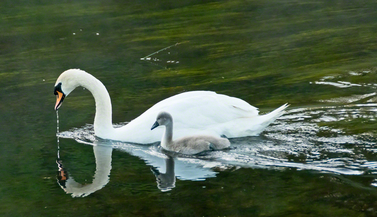
A parent swan and cygnet feeding on the River Cong outside the front door of Ashford Castle in County Mayo, in the west of Ireland. Click this link to read another Ireland story “The Cloigtheach of Glendalough.” Enter your email to receive notification of future postings. I will not sell or share your email address. […]
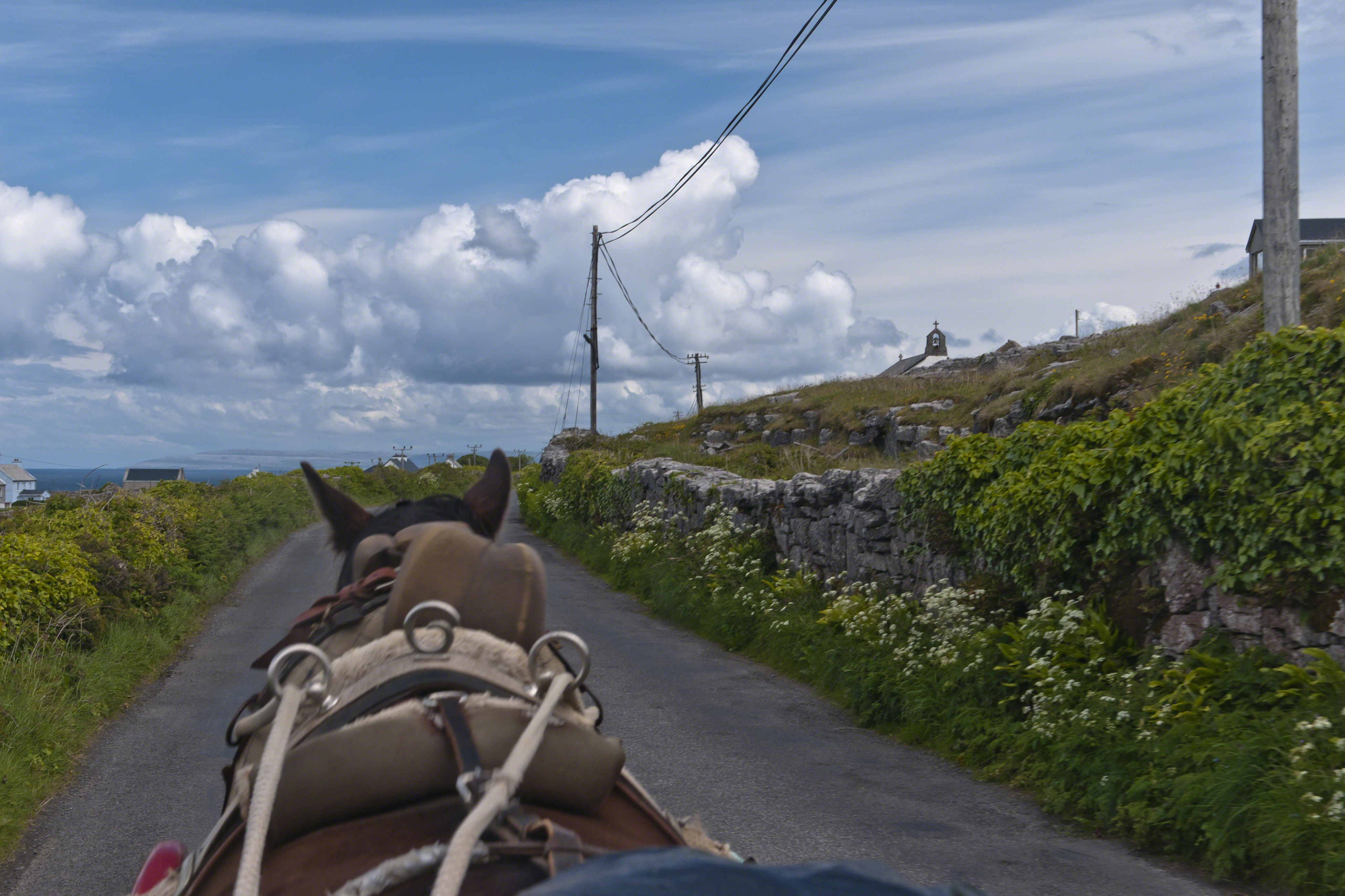
Enjoying travel on a horse trap, a type of carriage, on Inishmore (Inis Mór), the largest Aran Island in Galway Bay we headed up Cottage Road from Kilronan, the main island settlement. It was there we embarked from the ferry, hired the driver, his horse drawn trap. Our destination an iron age fort, Dun Aengus (Dún Aonghasa, the Irish language name) and the sights along the way.
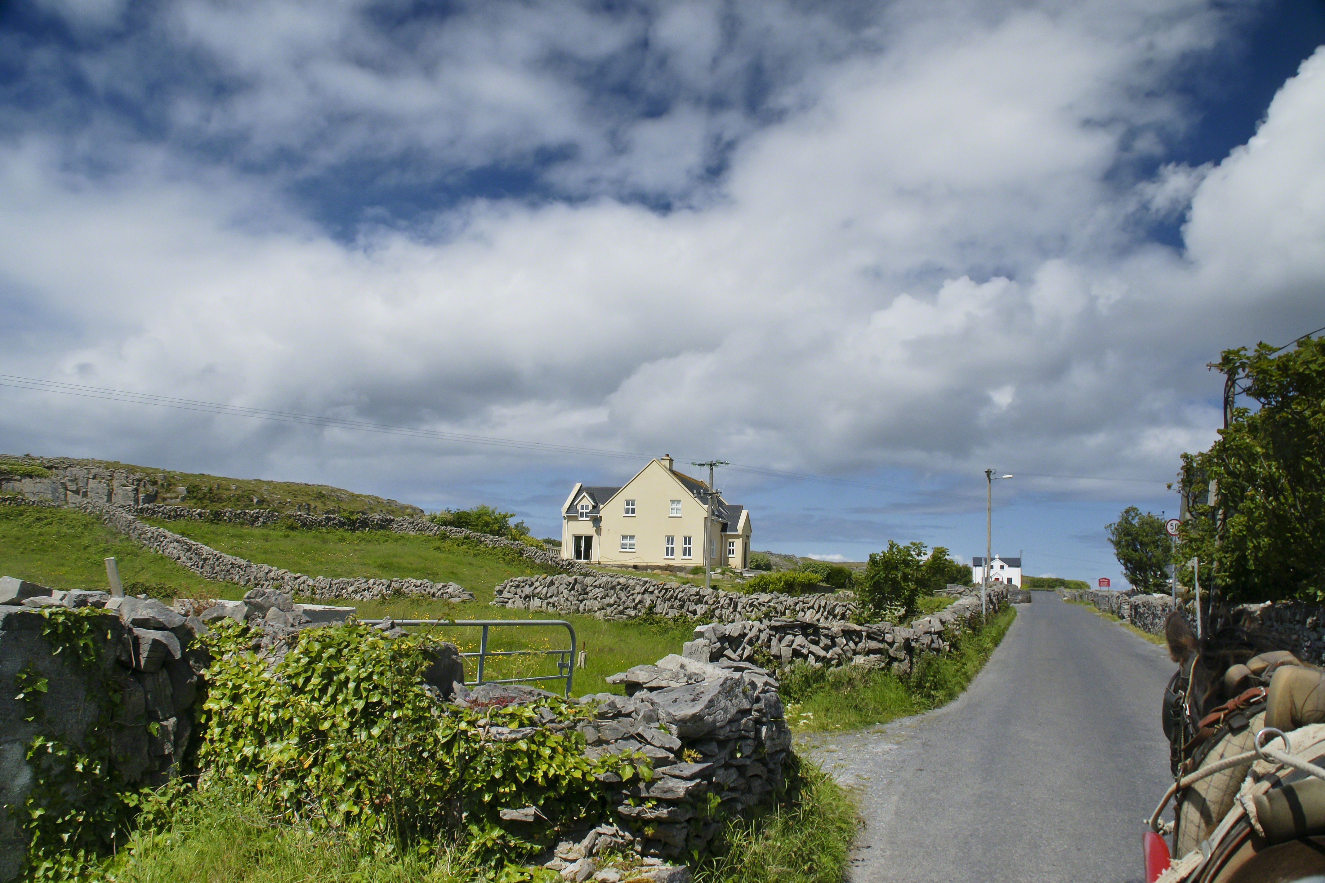
Headed up Cottage Road, I captured this view of dry stone walls and homes against the May sky over the shoulder of our horse.
In three, so far, postings on the cottage ruins at Loughan an Lochan (Loughan Bay) we explored a former community above the Irish Sea with a view of Scotland. For the third posting I shared some research on the last cottage people of that site with the intent of additional postings.
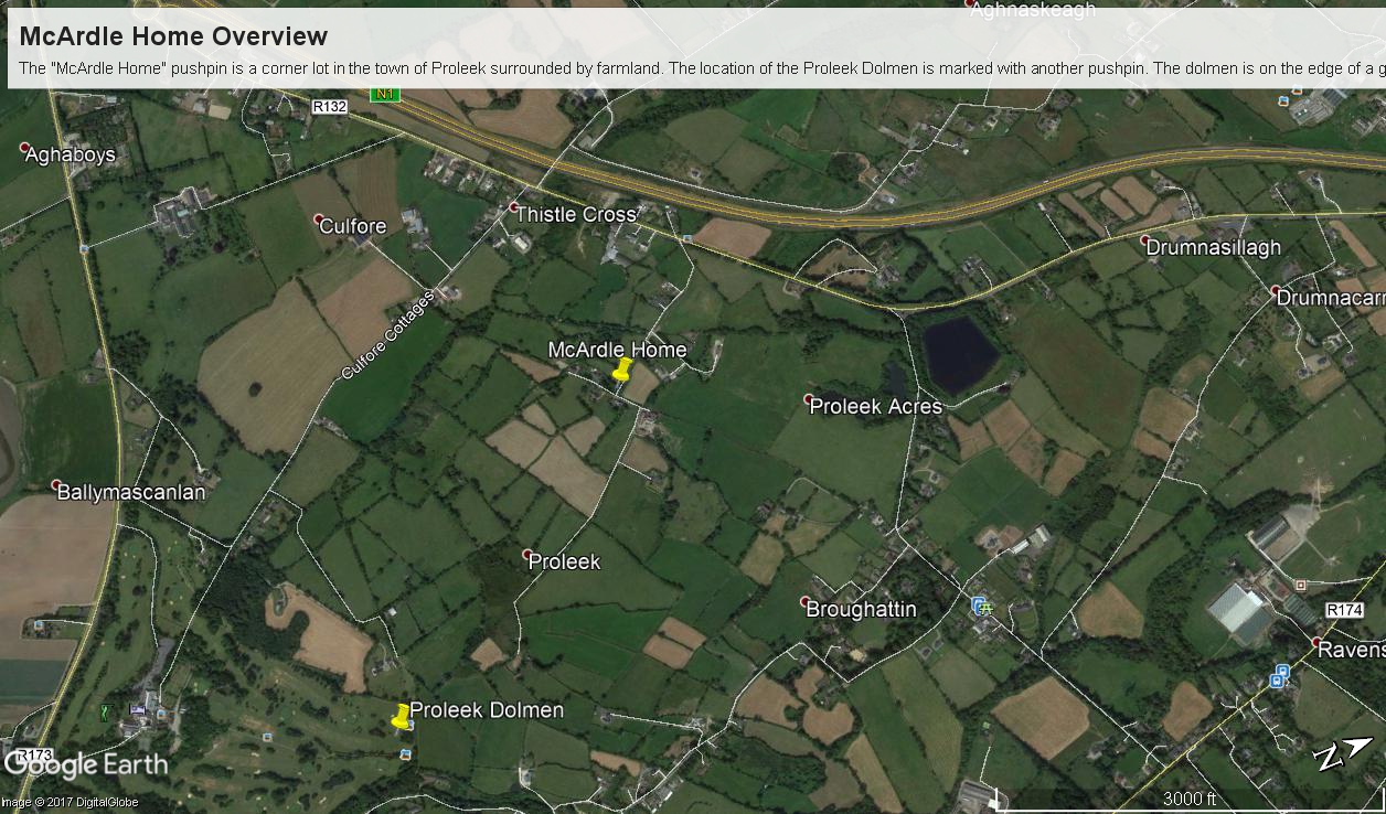
I wondered, “What motivates you to do this?” and remembered my mother’s Canadian passport in which, for place of birth “Proleek, Ireland” was written and my request to our cousin, John Mills, who invited us to stay with them after my mother passed away, June, 2013, the request being to visit the site of great grandfather James McCardle’s home, where grandfather Peter McCardle was raised, information since discovered from the Irish census.
On the morning of Sunday, May 25, John took us from mass on a tour of sites related to the family. One of these was the site of the McCardle home, Proleek Townland.
The ruins of the former home of Peter McArdle are on a corner of unnamed streets in Proleek, County Louth. This is a view of the southwest side.
There site is an anonymous corner on a unnamed street with no outlet. The street ends close to the Proleek Dolmen, an ancient passage tomb, after passing farms and fields.
The interior of the property. I see no evidence of great grandfather James McArdle’s home, It has returned to the earth.
The 1901 Irish Census provides these details from 116 years ago:
The walls were stone, brick or concrete.
The roof of thatch, wood or another perishable material.
Two rooms, with three windows facing the road.
Out buildings listed were:
cow house.
piggery.
Today, the site is another person’s property, it was not possible to explore further than when the camera lens reached when I leaned as far a possible into the brush. No sign of standing walls.
Across the road from the McArdle Plot is this ditch (stone wall) and a home. In the far distance, just visible across the plain, rising from it, is an unnamed land mark, a rounded hill 350 feet tall of the neighboring townland of Bellurgan.
Modern homes surround the corner, solid and prosperous.
The site is surrounded by homes on the west and south, farmland on the east and west.
For this posting I collected the following images from Google Earth. The site is marked with a pushpin, “McCardle Home.” A “Proleek Dolmen” pushpin marks the passage tomb.
A closer view suggests, if we trespassed and poked around, some remains of the structure were concealed by the trees and brush.
Between May 2014 and this image, from 2015, the center of the plot was gouged out. The area corresponds to the corresponds to the remains indicated in the 2013 image. From this we can understand were the structures stood in relation to the road.
Using the polygon ruler tool the size of the site is 413 feet in circumference, 9,619 square feet, and the gouge, indicating the ruins, is 1,368 square feet.
But for John and Betty Mills, their kind invitation to stay and John’s guidance that day, the “Proleek” notation on my mother’s Canadian passport would still be a mystery today.
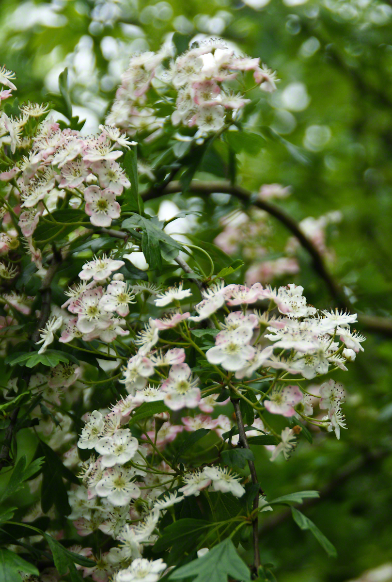
John Mills passed away the next year, September 26, 2015. Here are Hawthorne Blossoms from the corner of the former McCardle home in memory.