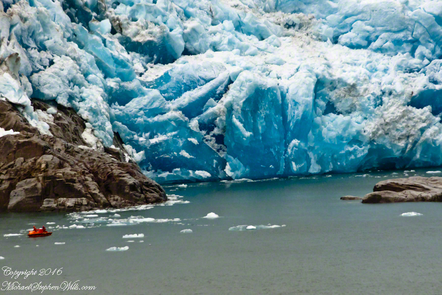
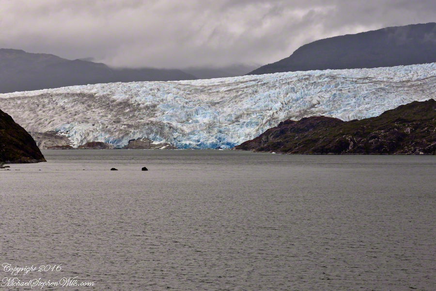
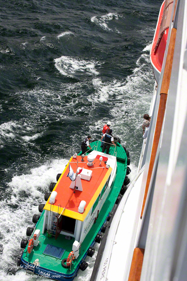
A glacier is more than ice; not alive, it crawls; not feeling, it groans, cackles, shouts; passive, it is dangerous to approach closely backed as it is by the southern ice field, over a mile high. The ship nudged as close as a half mile from the massed ice, navigating using the bow thrusters to face first port, then starboard and back to port. I was lucky enough to be on the 11th deck, pictured above, when we caught sigh of the fast ship’s launch, manned by ship’s crew.
Three person ship launch and glacier base at head of Tempanos Fjord
The crew prepared for a run to the rock face, almost 100 feet high, beneath 500 feet of glacier. Enjoy the views! Click any photograph to visit my online gallery. Purchase a photograph from this newly published series or any of my other popular works.
Copyright 2022 Michael Stephen Wills All Rights Reserved
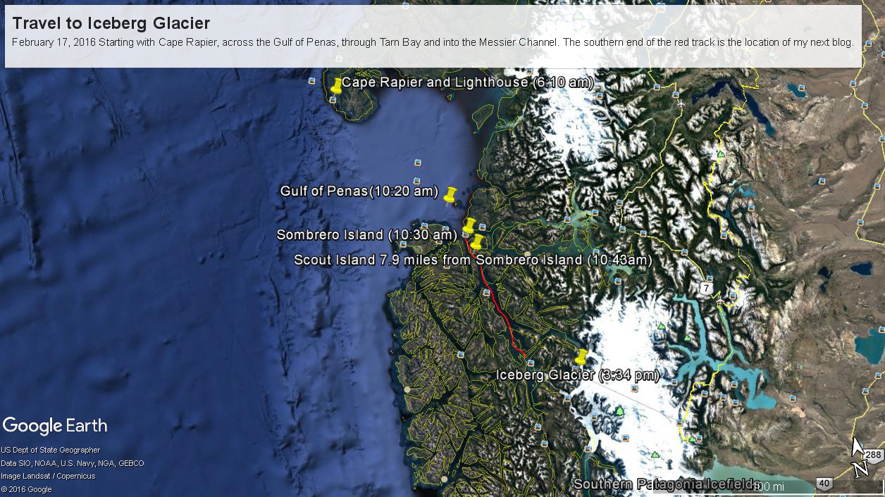
Here are a series of maps to aid your understanding of this series of blogs, starting with sunrise off Cape Rapier and ending with my next blog, the approach to Tempanos Fjord and the Iceberg Glacier.
Copyright 2022 Michael Stephen Wills All Rights Reserved
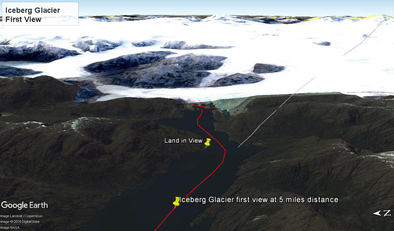
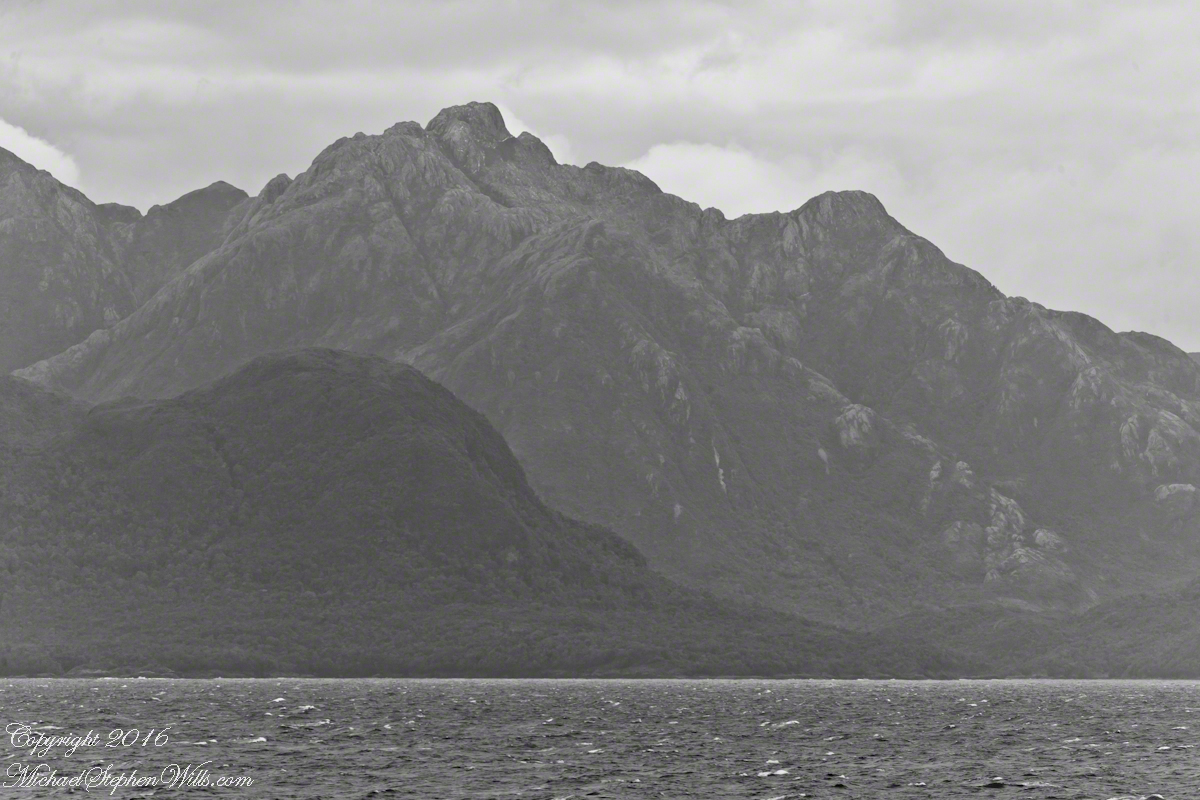
At 5:09 PM (daylight savings time for Chile) the Regatta turned to starboard to navigate around a headland of Farquhar Island. Iceberg Glacier came into view from our port side stateroom terrace. I was set up with the Canon 300 mm variable lens set to 120 mm (1/500 second, F11, ISO500), tripod mounted, to capture the ice from 5 miles distance. The location is marked on the above GoogleEarth view. The red line leading in is our course. On the right, the white line is the boundary between Chilean regions Aisen and Magellan.
Visible is the .75 glacier front, 500+ feet above the head of Tempanos Fjord. On the GoogleEarth view the front is marked with a red line. Yes, more than 500 feet above the water. In mid-view there are two rocks in the water. Behind them, under the glacier, is a rock face. That rock is 100+ feet tall.
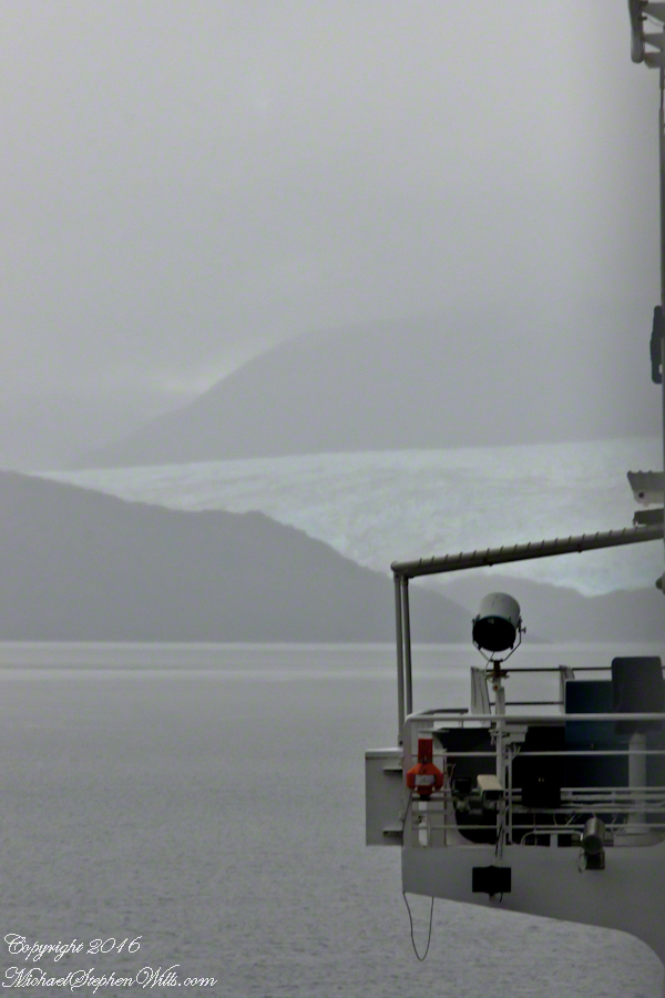
Twenty seven (27) minutes later I used a handheld Sony with variable lens set to 200 mm (1/500 second, F13, ISO800) to capture this image of the ship bridge superimposed on the glacier.
All you see is part of the Bernardo O’Higgins National Park. Named for a founding father of Chile, the country’s first head of state, the park covers 13,614 square miles.
Copyright 2022 Michael Stephen Wills All Rights Reserved
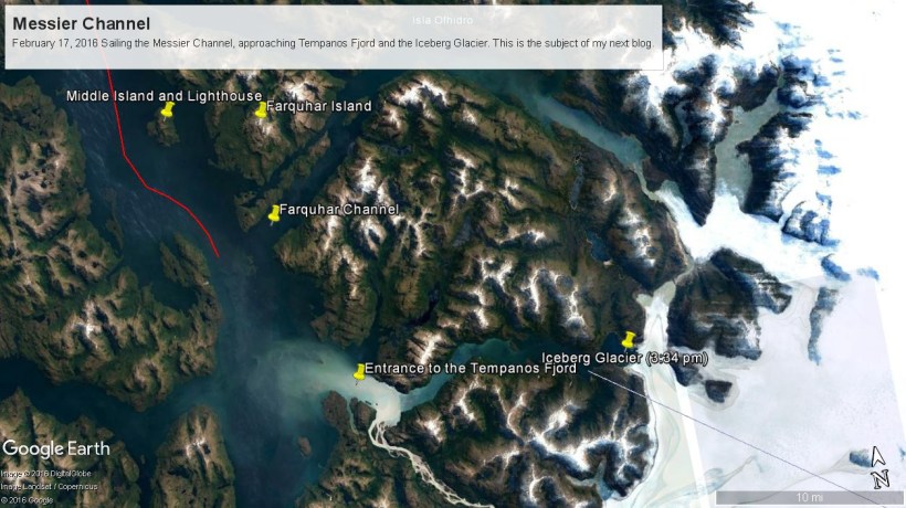
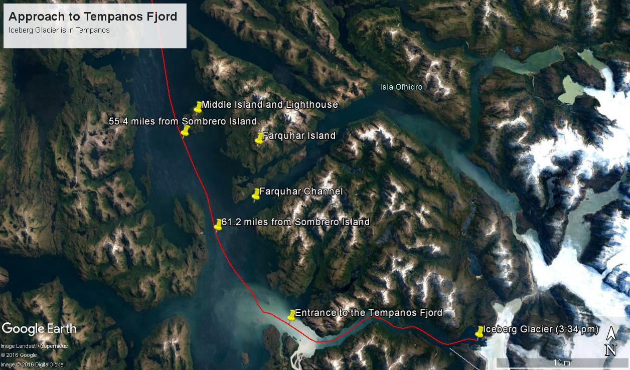
These photographs are most notable for the first sighting of the entrance to Fjord Tempanos and our day’s destination the Iceberg Glacier. At Middle Island Messier Channel is over 5 miles wide though studded with islets and navigational hazards. Here is a Google Earth map of the area with notable locations pinned with names. The red line is a ruler path from Sombrero Island.
In the previous blog, Orientation, Iceberg Glacier, February 17, 2016, you learned about the route the Oceania Regatta followed that day. We left off with photographs of Scout and Orlebar islands, the time was 12:43 pm Chilean Summer Time (daylight savings). The next photograph was time stamped 2:24 pm and, frankly, I had lost track of where we were, so it was necessary to determine the ship’s position.
Here is how to do it. From two known points, Sombrero Island at the northern end of Messier Channel and the Iceberg Glacier, our day’s destination, first a velocity from the total distance, in miles, (Google Earth) divided by the time duration (subtract time stamp of the starting from the final digital photograph and convert to minutes). This gives an average ship velocity in miles Using excel list the photographs with time stamps. For each photograph calculate the time from the starting photo, in minutes, and multiply this by the average velocity.
In this way, I determined the first photographs of this blog were Middle Island and obtained confirmation using Google Earth to view the location from ground level. The process is iterative in that the views showed the first calculated position to be behind the position matching the view.
This, I hypothesized, was because the ship velocity decreased on entering Tempanos Fjord. Noting a time gap between the last photograph of this blog and the next, taken within Tempanos Fjord. So, using Google Earth to establish the last photograph position, I recalculated velocity using that last position as the last time. Then, I recalculated the distances of the photographs and the calculated positions came into better agreement with the viewed positions. After Middle Island the ship slowed significantly in order to enter the fjord.
I still have opened questions because the calculated speed from Sombrero Island to Middle Island is 6 knots higher than the documented top speed of the Regatta.
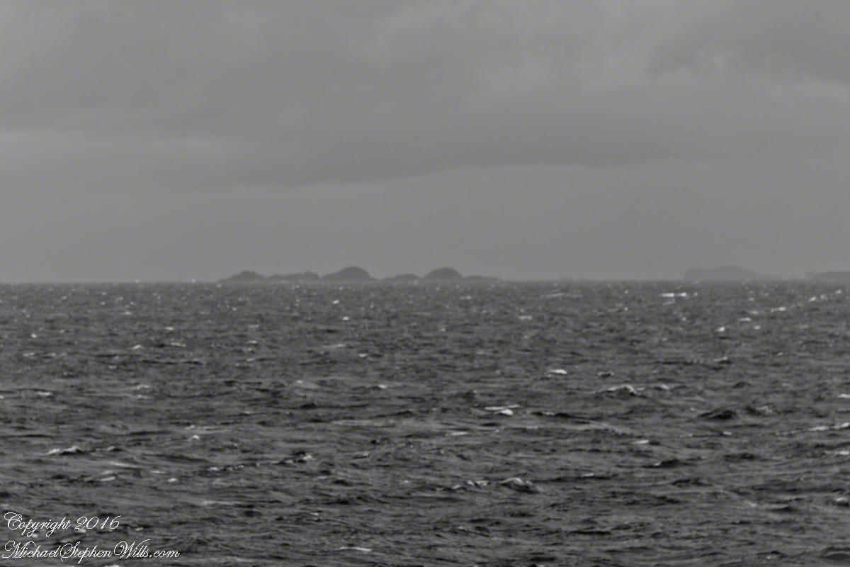
52.02 miles from Sombrero Island. View NorthEast toward Middle Island, Farquhar Island behind.
The lighthouse of Middle Island is not in view. The channel between the islands is Brazo del Este.
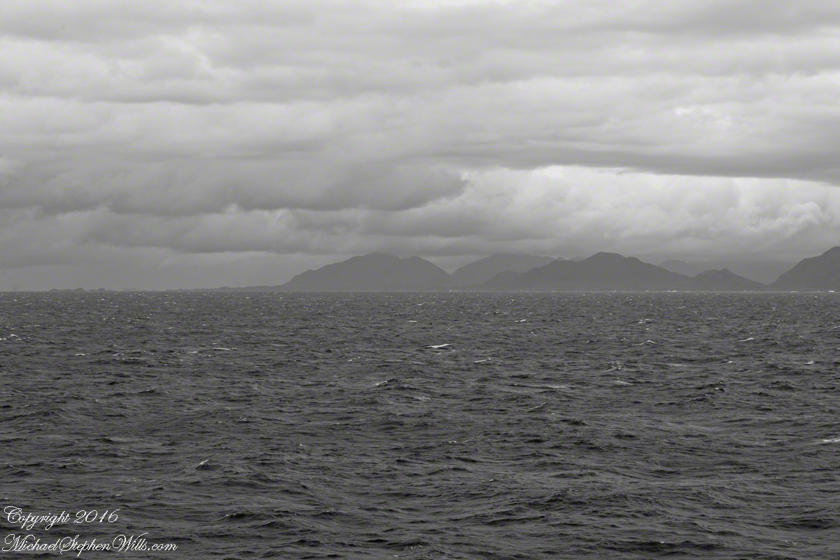
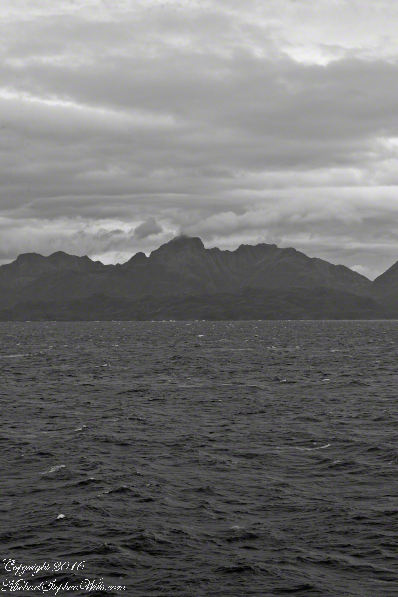
View NorthEast toward the peaks of Farquhar Island Over the shoulder of Middle Island is Riches Bay of the farther island.
View NorthEast toward the peaks of Farquhar Island. Across from us, on Farquhar Island, the George River flow into Connor Cove which opens onto the channel named Brazo del Este. The channel separates the islands.
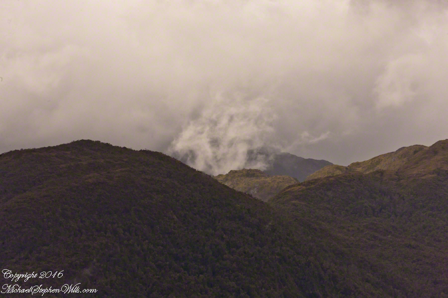
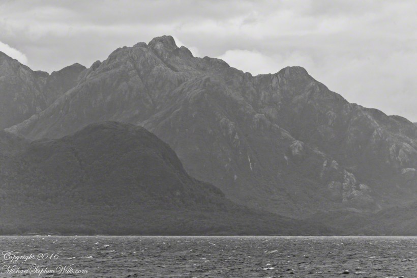
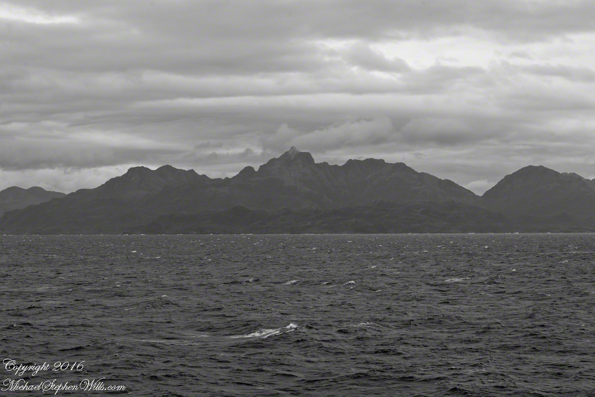
View east the steep cliffs of Farquhar Island rising abruptly from Messier Channel, to 3,200 feet in 2.7 miles.
Peaks of Farquhar Island. View east from Messier Channel using long lens. The island is named for Percival Farquhar, American entrepreneur active in South America, mostly Brazil and railroads, 1905 – 1930.
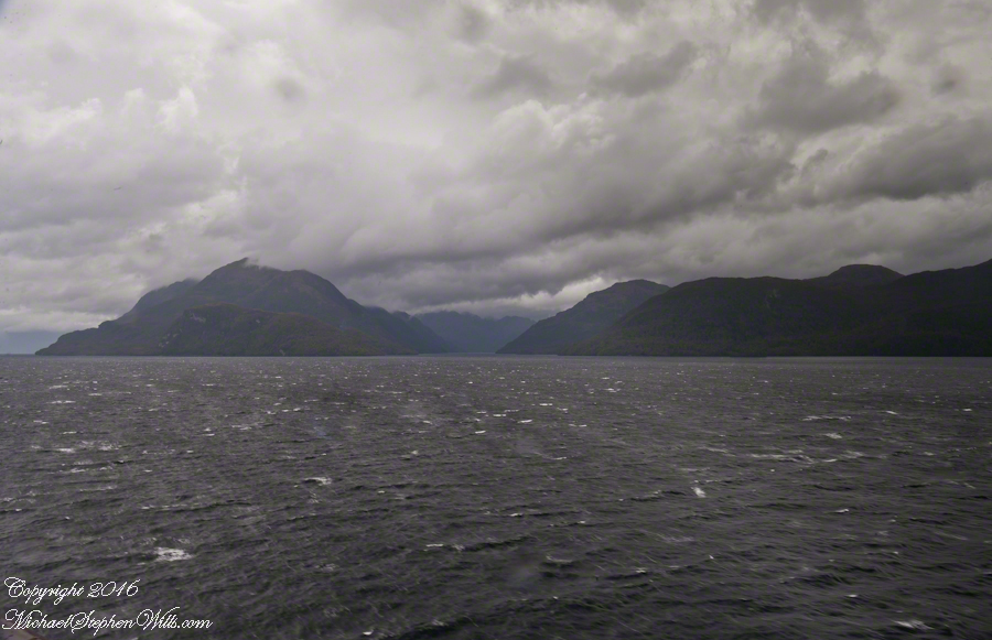
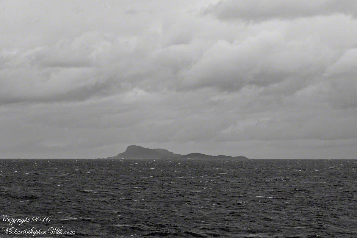
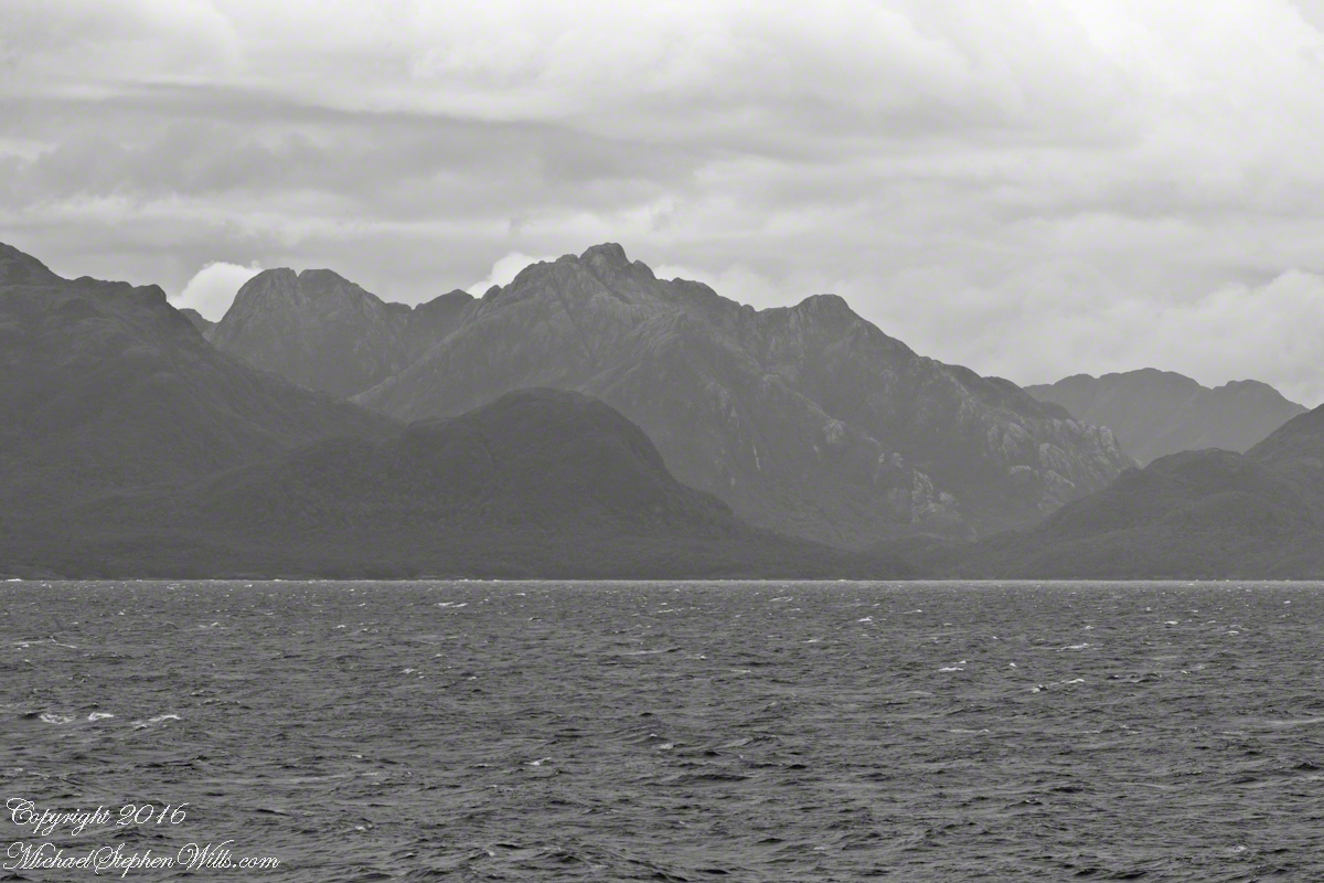
View north from mid-Messier Channel. Nearest on the right is Middle Island with lighthouse Farquhar Island behind with Palmer and Hens points. In the distance is Van Der Meulen island.
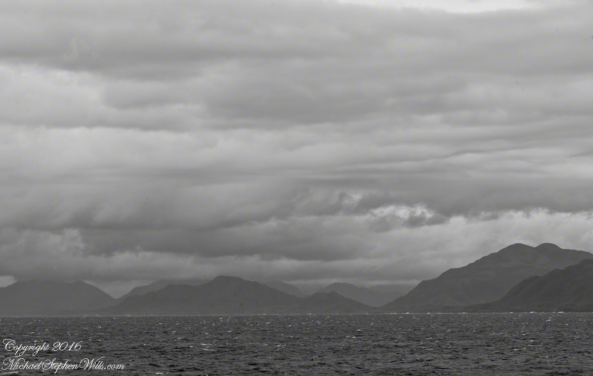
Farquhar Channel. View Northeast with Boxer Island, left foreground,Farquhar Island behind.
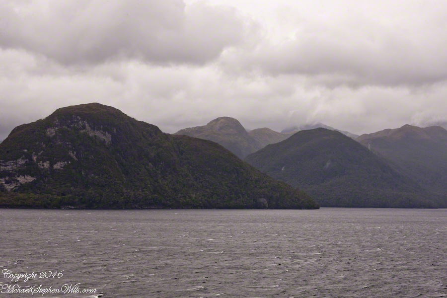
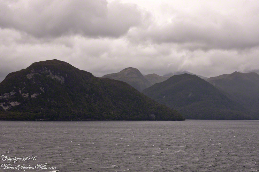
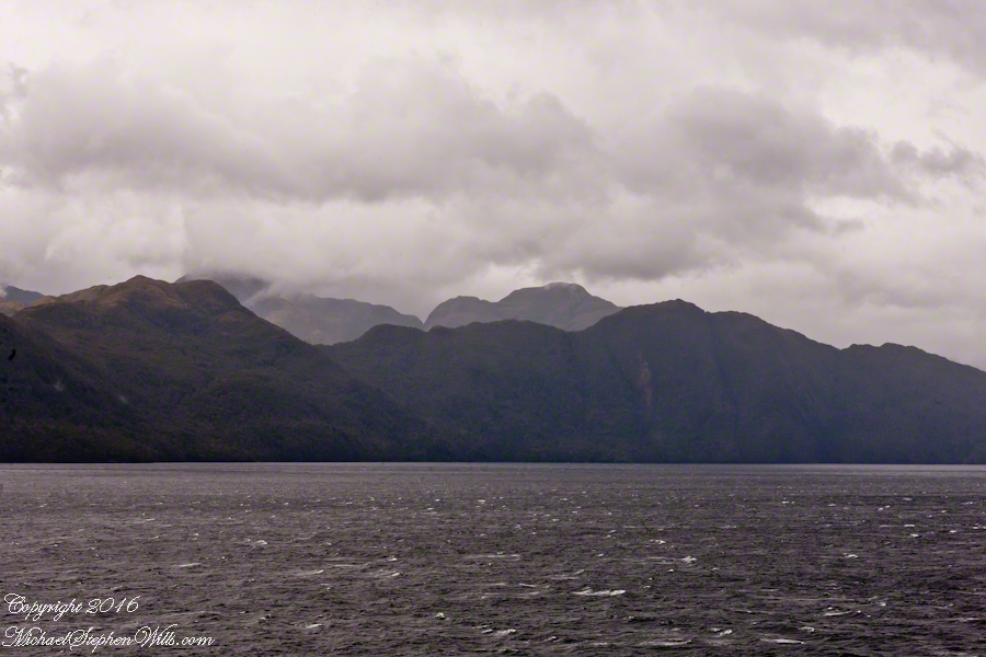
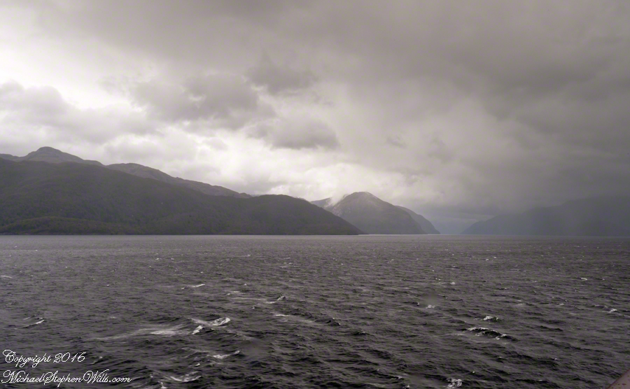
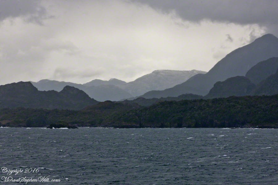
Tempanos Fjord. View Southeast with Estacion Point and Headland to left. Behind the headland is the entrance to Farquhar Fjord, not visible. Tempanos Fjord is framed by land on both sides.
On our way to Fjord Tempanos and the Iceberg Glacier…..
Background: on a ship, facing the bow (front), starboard is right and port is left).
In the 8 miles from Tarn Bay and Sombrero Island lands press closer, higher, islands increase in number. This is a listing of some of the islands we passed. These names reflect the history of Chile, the waves of immigrants touch the land with memories. After some of the names, below, I provide in parentheses the derivation.
On starboard was the northern Wellington Archipelago (English General): Pinochet (the Chilean dictator), Penguin, Juan Stuven (Spanish and German), Chang (the far east), Millar (German).
On port, the names have a military flavor: Zealous, Scout, Scylla (Sea Monster of Greek mythology), Alert, Orlebar (British Officer Augustus Orlebar).
These port side island names reflect what is on the minds of mariners as navigational options narrow with the channel. Innumerable channels, points, mid-channel islets, all looking very much the same, a potentially confusing jumble. Chilean maritime law demands ships have on board, working from the bridge, a certified Chilean maritime pilot to transverse the country’s dangerous channels and fjords. The combination of stopping distance (multiple nautical miles) and the loss of steering when a ship moves slowly make it essential to know, exactly, the route ahead. It was a Chilean maritime pilot who help keep us safe.
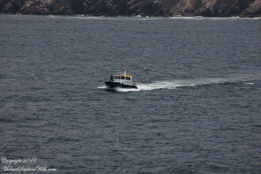
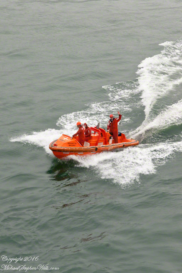
A great personal hazard for pilots is boarding the ship from the pilot boat. From our stateroom terrace we observed fast pilot boats in all seas approach the Regatta miles from port, the pilot on the bow, pull up alongside. Without a harness, the pilot transfers from boat to ship. We observed this several times from our stateroom veranda.
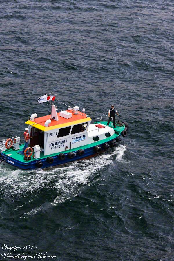
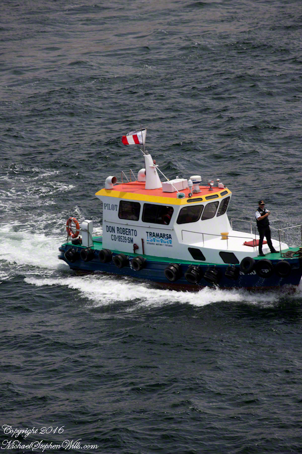
Here are shots of the pilot boat approaching the Regatta off the Peruvian port of Matarani. The boat was mirrored by the colorfully painted houses of Peru.
A fast pilot boat from Matarani approaches the Oceania Regatta. On the bow, the pilot will transfer from boat to ship. On board he will work with the Regatta crew to safely navigate the approach to the Matarani harbor and dock. The whiteness on the land is diatomaceous earth.The whiteness on the land is diatomaceous earth.
A cautious approach. In the third shot the boat turns to slowly approach the Regatta.
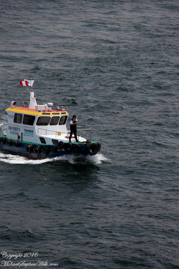
Alongside, boat crewmembers joint Don Roberto on the bow to assist in the transfer. I am not sure which of the two blue uniformed persons was “our” pilot.
I did not capture the boarding of the pilot who served the Regatta through the Chilean Fjords. Was is at Puerto Montt? Puerto Chacobuco? I am not sure. I do know a maritime pilot was on board as the channel narrowed to 2 miles, named Scout Channel were we passed Scout Island. I was facing generally east from our port side stateroom veranda while capturing these photographs as the Regatta headed south.
Scout Island. The water is Scout Channel
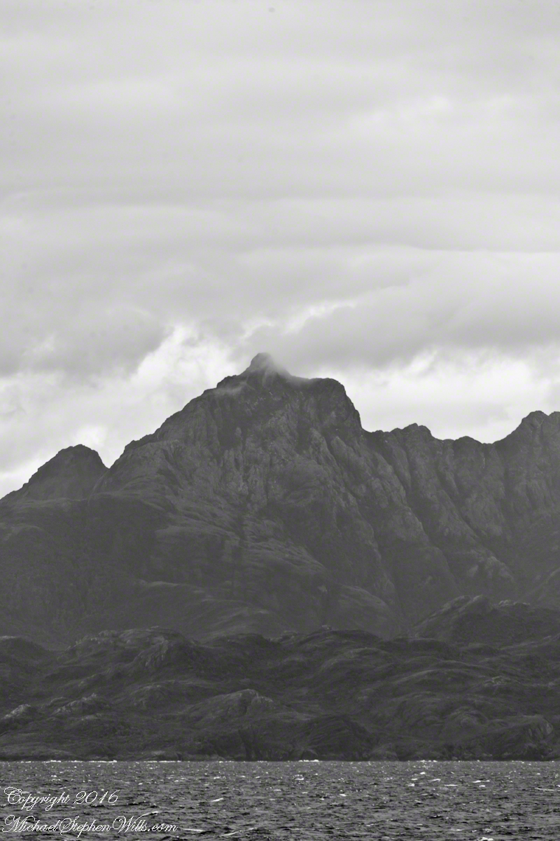
The peak on Scout Island is about 2,100 feet. The smaller peaks in front are about 1,200 and 1,500 feet. All rise straight up from Scout channel.
Scout Island lies on the Scout CanalLying just south of Scout Island, Scylla Island is between our ship, in the Scout Canal, and the Kruger Canal. The Kruger is short, between Islands Scout, Orebar, Zealous, Porcia and Tito.Islet Alert is between Canal Scout and Canal Kruger. On the far left there are waves breaking on Pilot Point of Orebar Island, marking the northern end of a small bay, named Hale. You can see the bay behind Islet Alert. On the far left there are waves breaking on Pilot Point
In English the Gulf of Penas means “Gulf of Distress.” Open to the storms of the western pacific ocean, ships seeking refuge sail this body of water to reach the shelter of the bays around the entrance of the Messier Channel.
Stargazing Chileans named the channel after Charles Messier (1730 – 1870), author of a catalog of 110 visually diffuse celestial objects such as the Great Cluster of Hercules, the Crab Nebula of Taurus, the Ring Nebula of Lyra. As Messier catalog objects these are listed on star charts as M13,M1,M57.
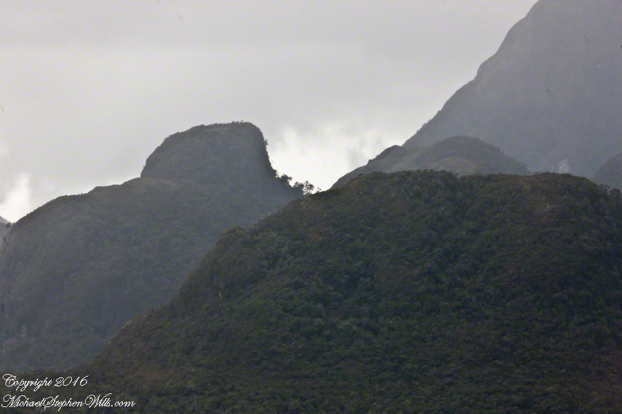
The Larenas and Fresia peninsulas of Aisen Province, Chile, on the southeastern shores of the gulf are seen here as we approach the Messier Channel. The shore is dotted with islets and islands. The Chilean pilot who came aboard at Puerto Chacobuco is earning his salary, keeping us safe. To reach the channel we pass through Tarn Bay, generally north to south. The southern margin of the bay is marked by Sombrero Island, the subject of my next blog.
Larenas Peninsula and Merino IsletsClose-up of the Merino IsletsAyautau IslesThe Northern Patagonian Ice Fields lay to the east and north of these mountains of the Larenas Peninsula.High Ridge of the Larenas PeninsulaLarenas Peninsula High Ridge 2Larenas Peninsula High Ridge Close 3The craggy heights of the Larenas Peninsula are in the rear. On the right are Fresia Point (of the eponymous peninsula) and the entrance to Fjord Eloisa.Larenas Peninsula High Ridge Closer 5
Copyright 2022 Michael Stephen Wills All Rights Reserved
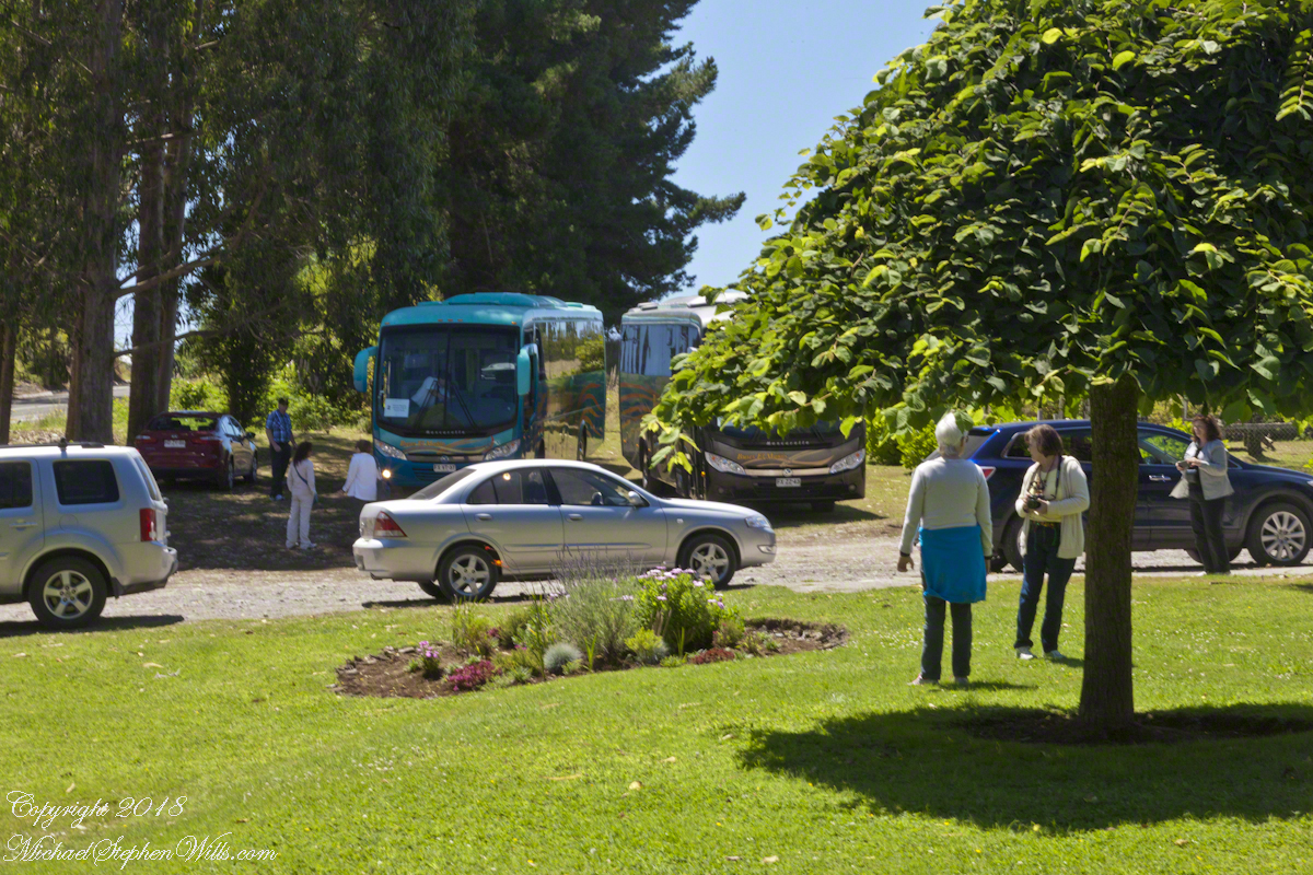
Our tour of Chilean Lake Country and Volcanoes began from the harbor of Puerto Montt, in the tender we boarded from the ship Regatta. This is a small boat carried in the hold and deployed to transport passengers to ports without docking facilities. Once on land, we met our guide for the day and boarded the bus.
I have yet to post about our first stop, Puerto Varas, a 20 minute ride and our first exposure to the influence of 19th Century German settlers seen, from our bus windows, in the architecture. Today’s post is about our lunch stop, a restaurant half way between Puerto Varas and Ensenada.
Click any photograph for a larger view.
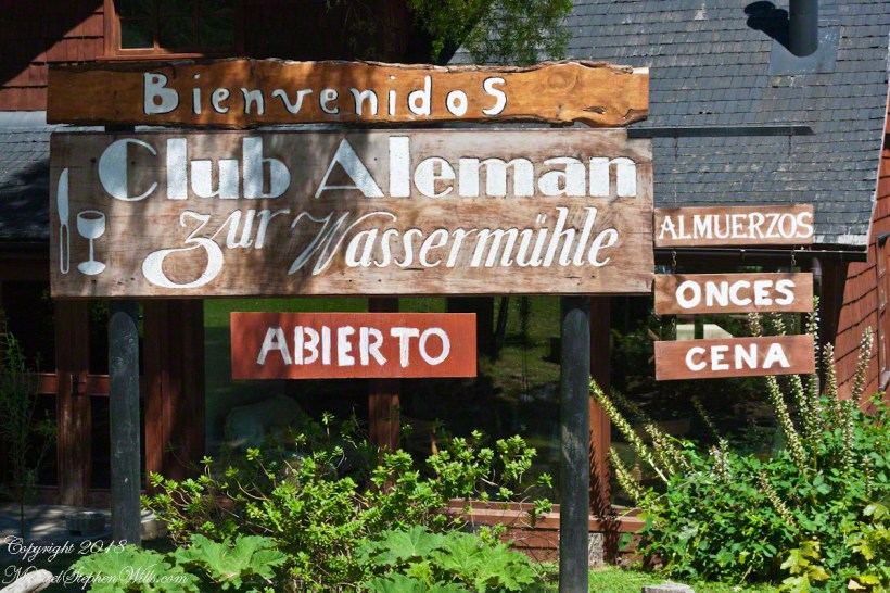
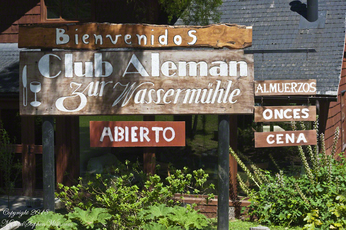
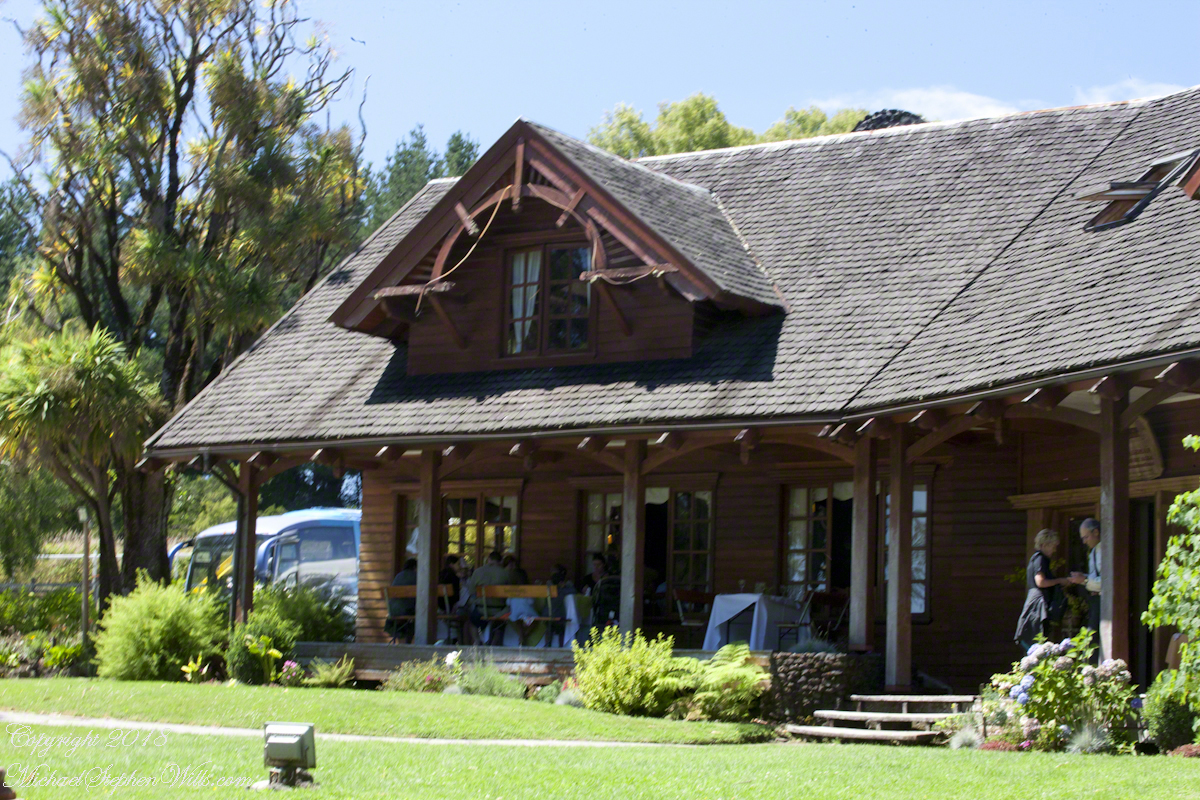
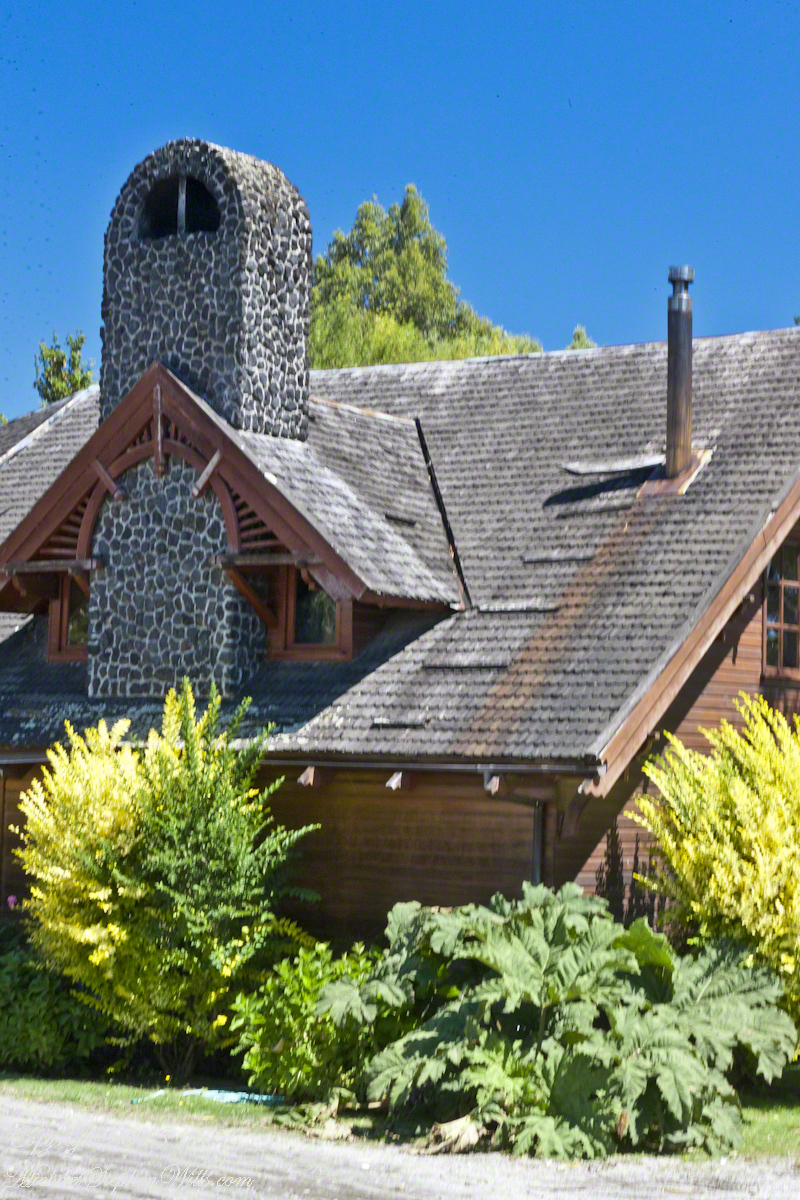
Club Aleman Molino de Agua
Club Alemans (German Clubs) are found in Puerto Montt, Puerto Varas, and here. Each is a gathering place for locals to celebrate their heritage, a feeling somewhat diluted over time to where, now, they speak of themselves as “Chileans of German extraction” and the great majority speak Spanish at home and are exposed to the German language as school courses.
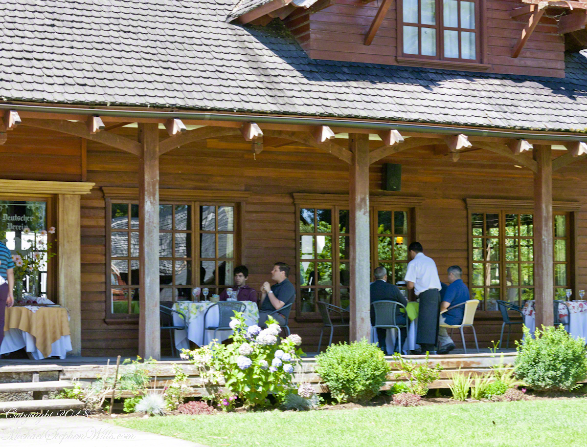
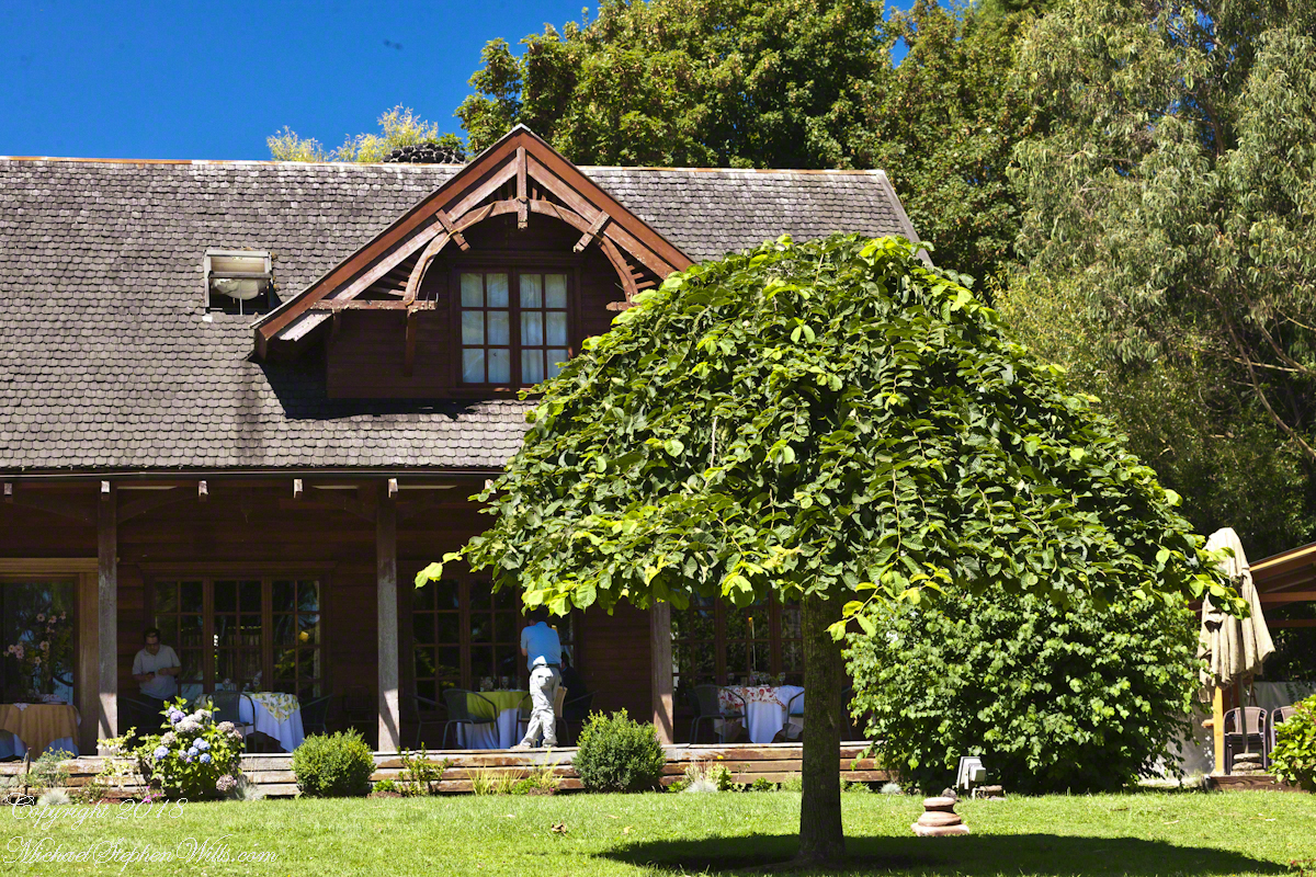
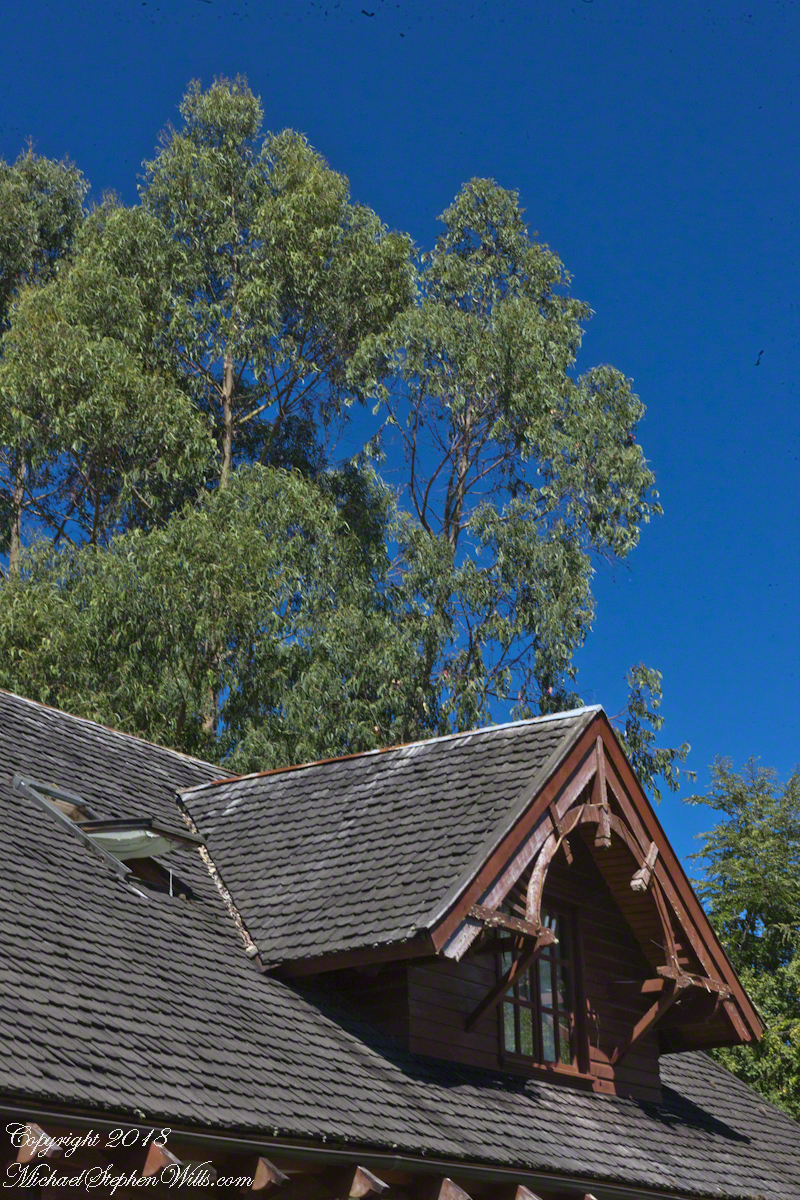
For past generations, the link was stronger, German was the language spoken at home and there was homesickness for the cultural traditions left behind and somewhat alleviated by the similarity of Chilean Lake Country to foothills of the Alps. Once established, the settlers duplicated the architectural features using local wood. Notably, many houses are clad with shingles from the Alerce (also known as Fitzroya cupressoides), a type of Cypress native to southern Chile and Argentina. The roof shingles of Club Aleman, seen below, were of this type.
The sign translates to “German Club: to the watermill” from the two languages used: Spanish and German. The sign reads “lunch, dinner, late night.” “Onces means Late Night.
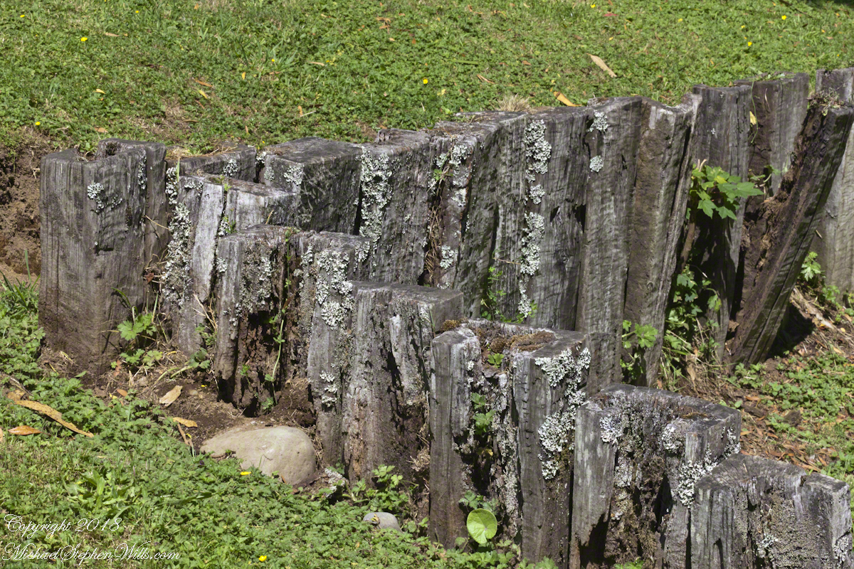
The “watermill” is a nostalgic, sentimental reference echoed in architectural and decorative details throughout the property, such as this series of posted set to suggest a device used to control water flow. There is no water flowing through the property.
Our lunch was excellent Chilean fare, but I don’t recall what it was, exactly and I didn’t photograph the interior. For us, an plus of using these cruise tours is all the details are taken care of, releasing us to maximize our enjoyment of the surroundings.
A dark side to these settings was the attraction the area had to un-remorseful Nazis fleeing war crime prosecution. In Chile and Argentina they found refuge in the 1940’s, 50’s and were supporters of the Pinochet dictatorship. None of this history was presented by our excellent guide, nor was it reflected in these rustic charms.
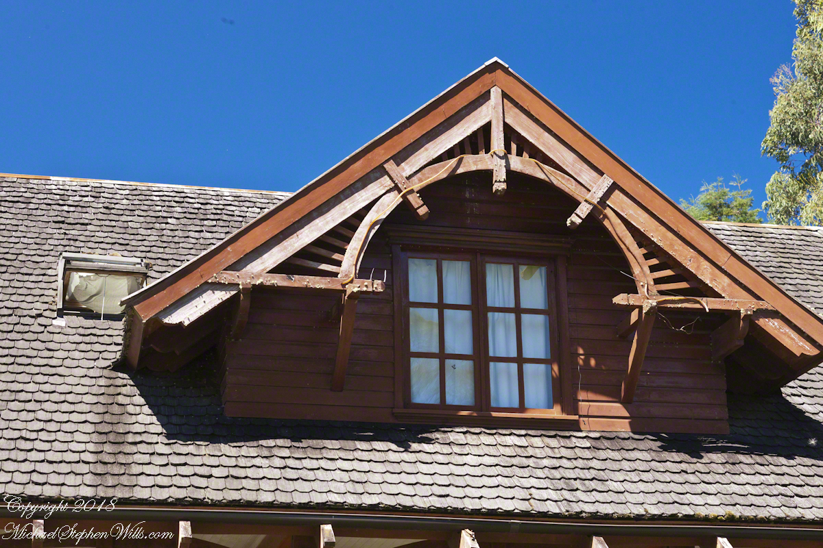
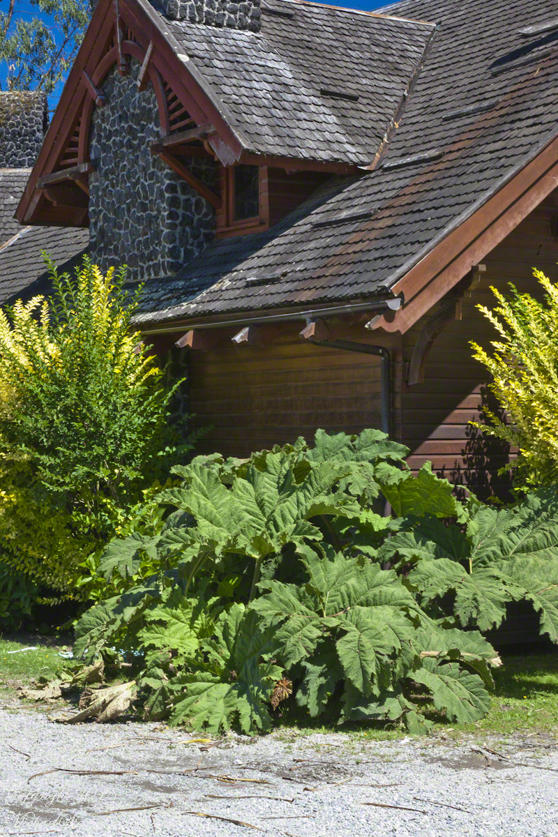
I was fascinated, for some reason, by the two dormers of the main building root with the wheel-like decoration.
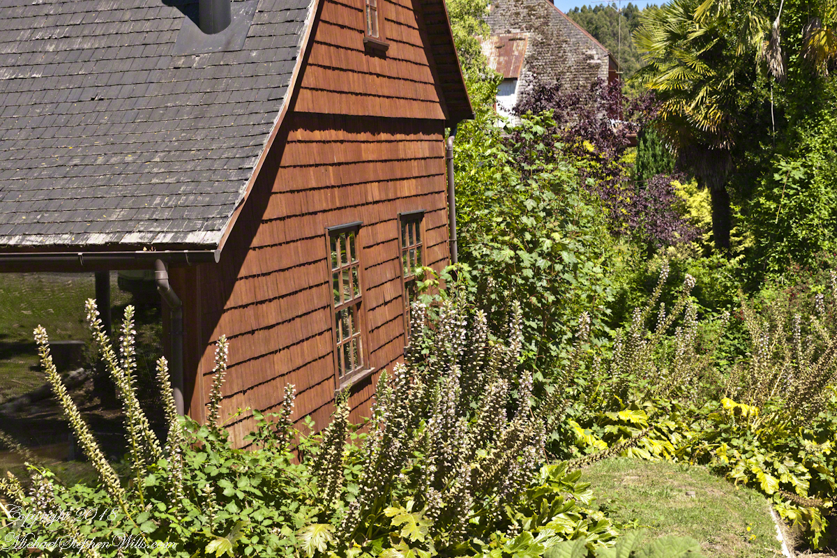
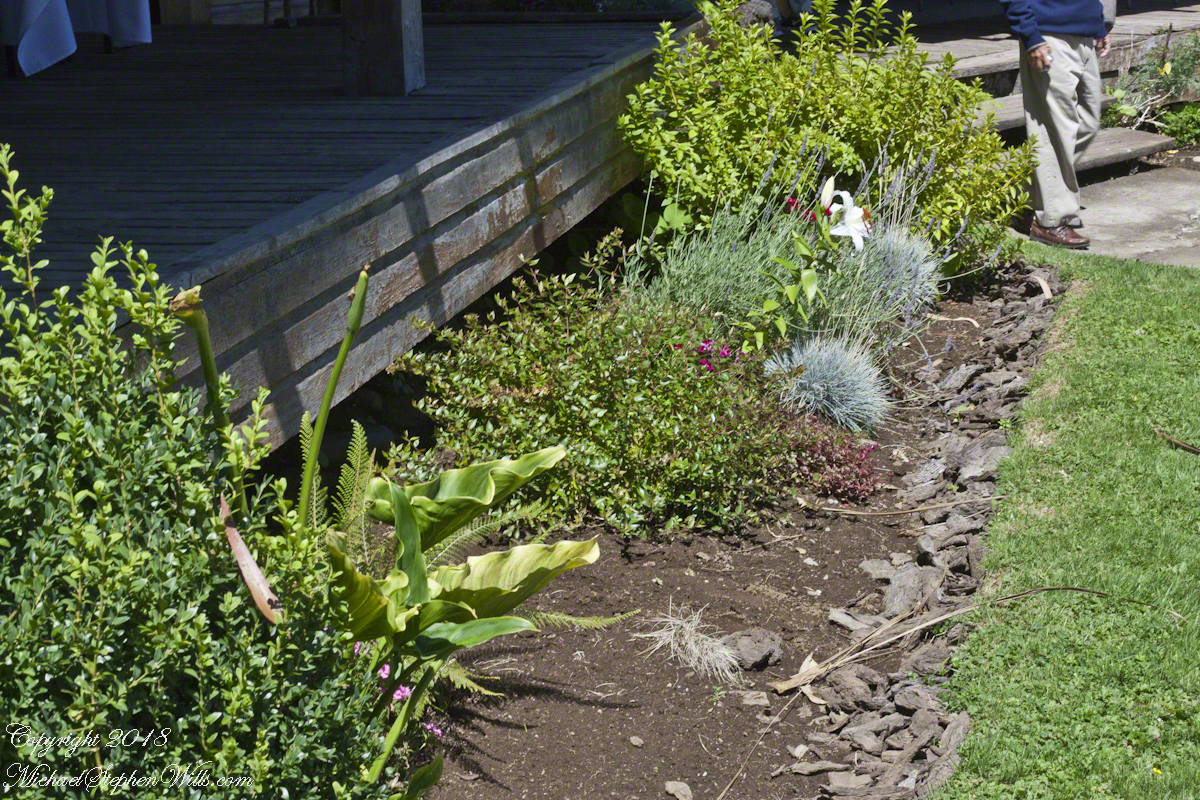
The Garden
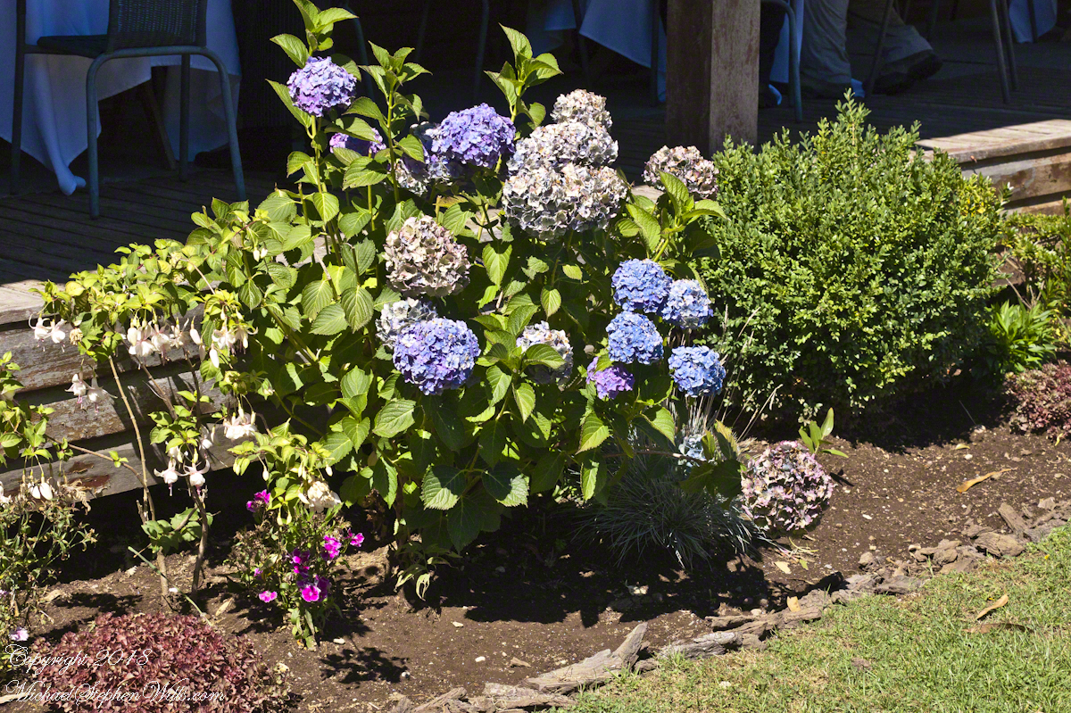
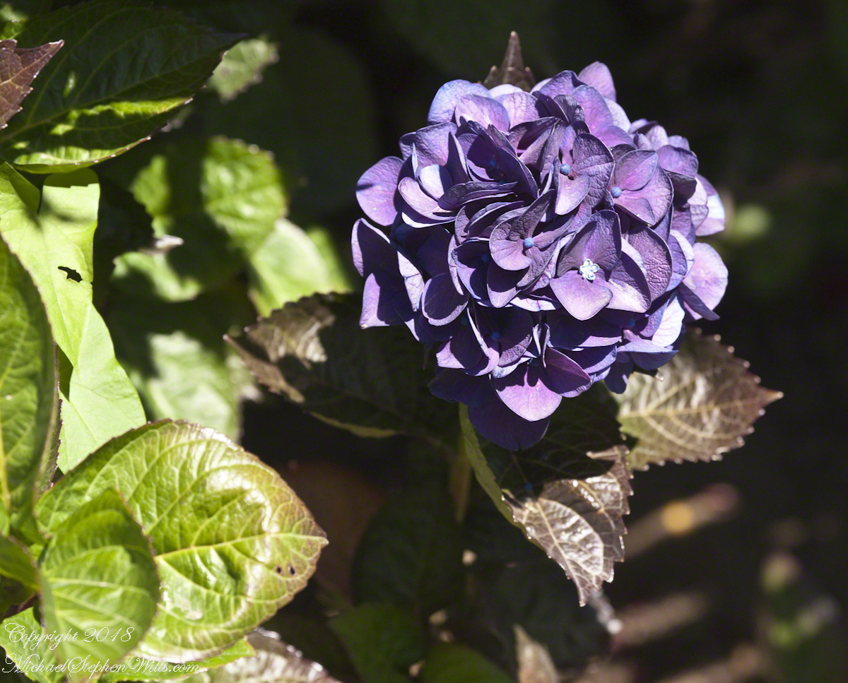
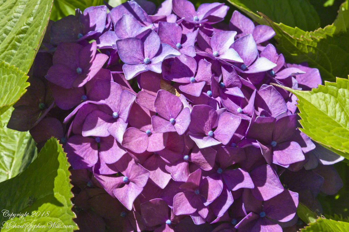
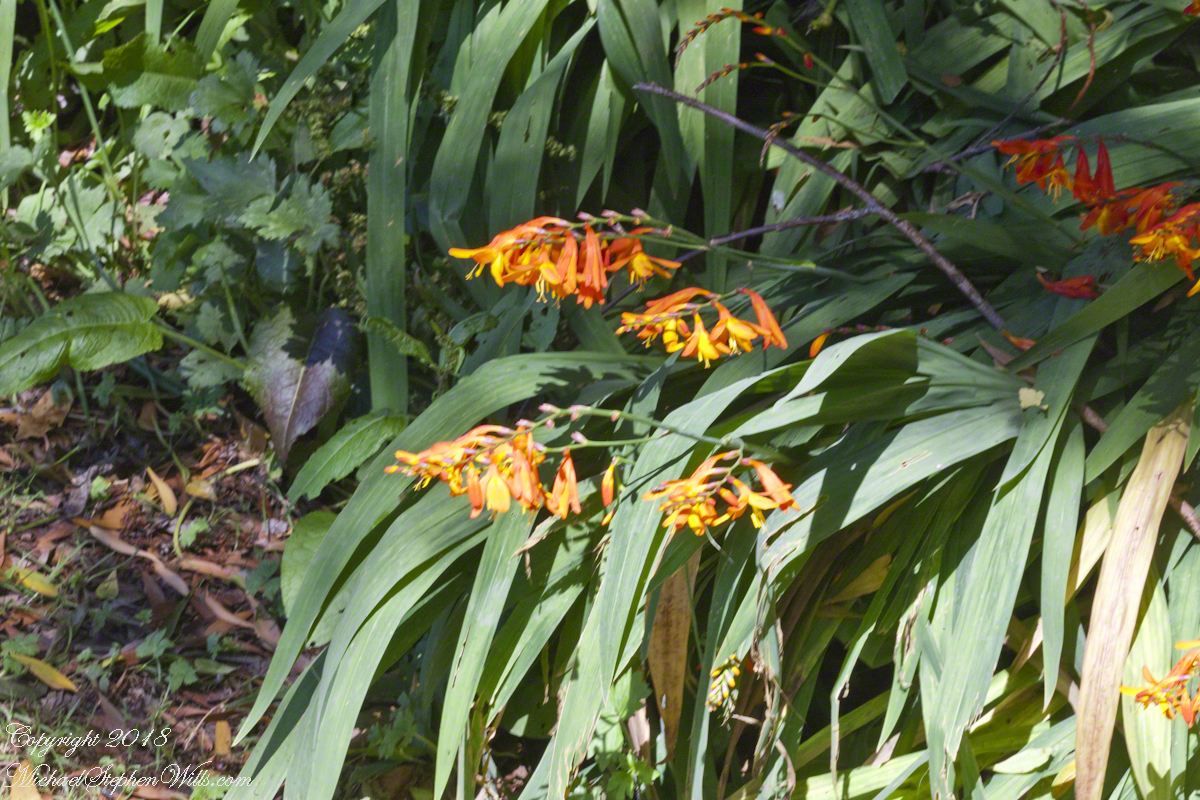
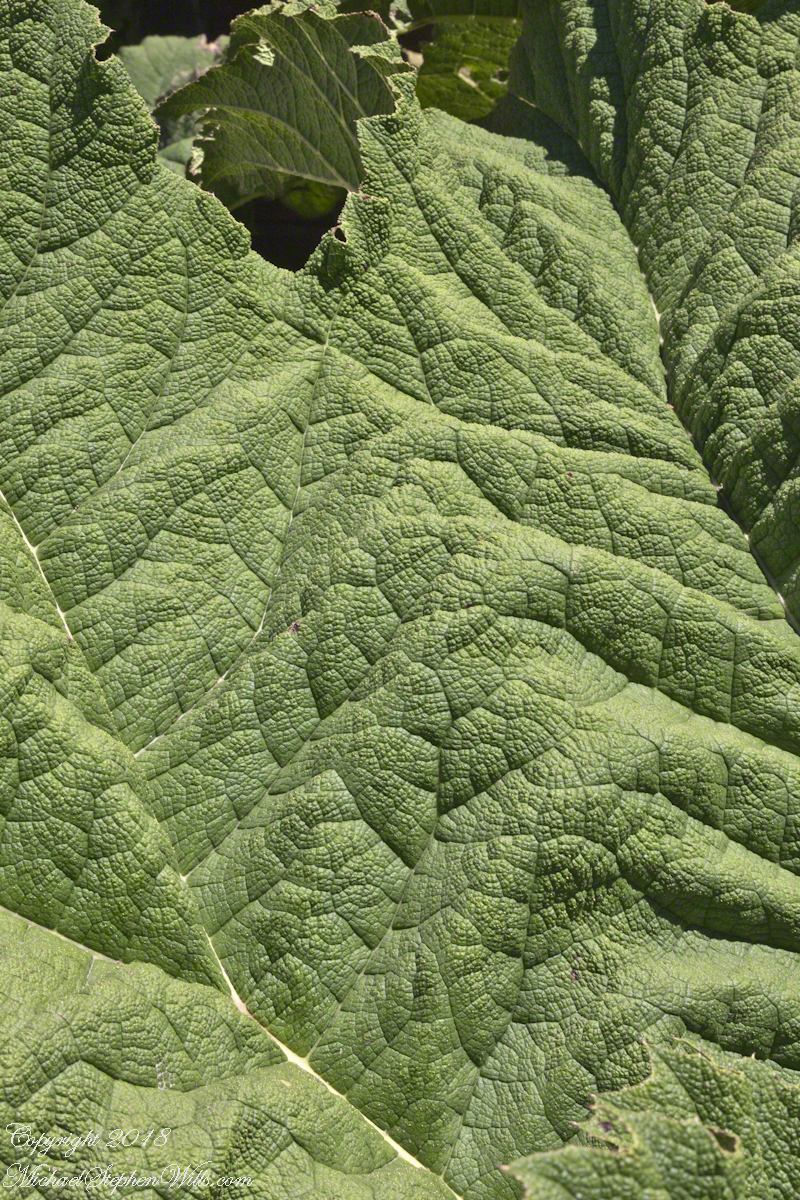
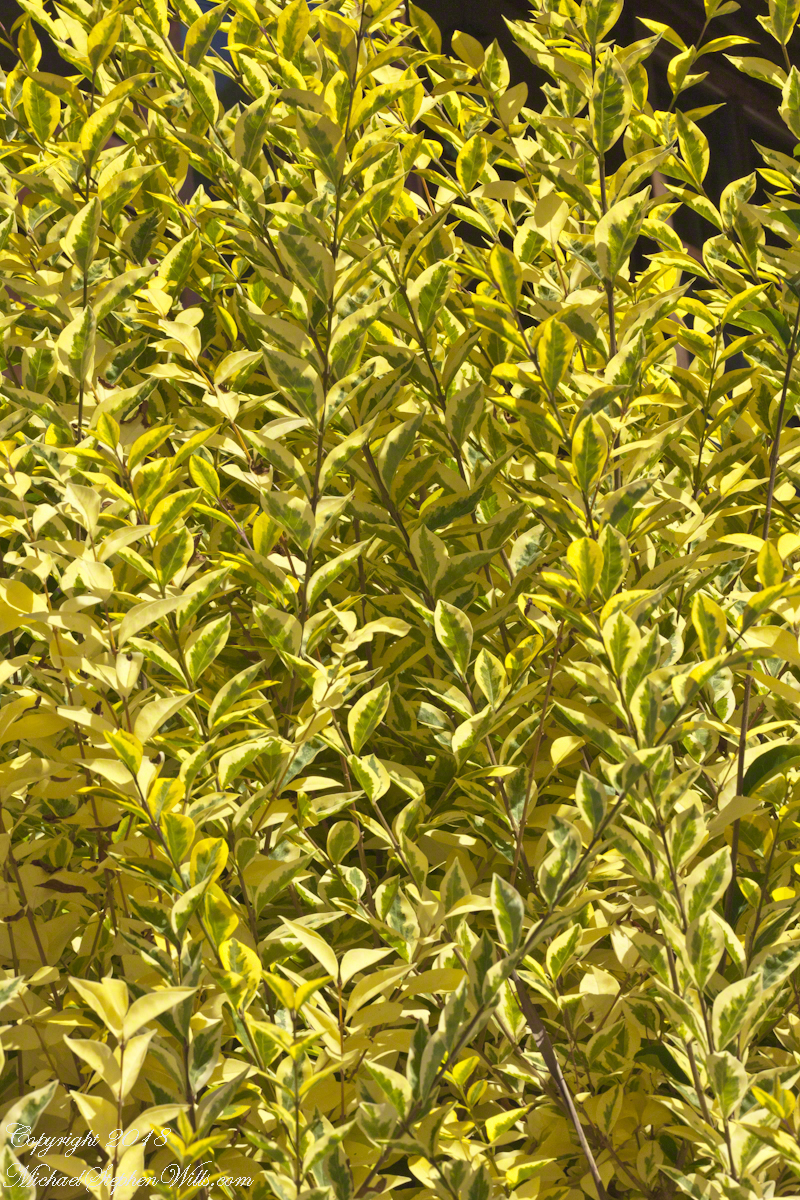
A native plant encountered frequently in our travels, growing wild, and here.Close-up of the shrub growing to either side of those large leaves.
Copyright 2022 All Rights Reserved Michael Stephen Wills
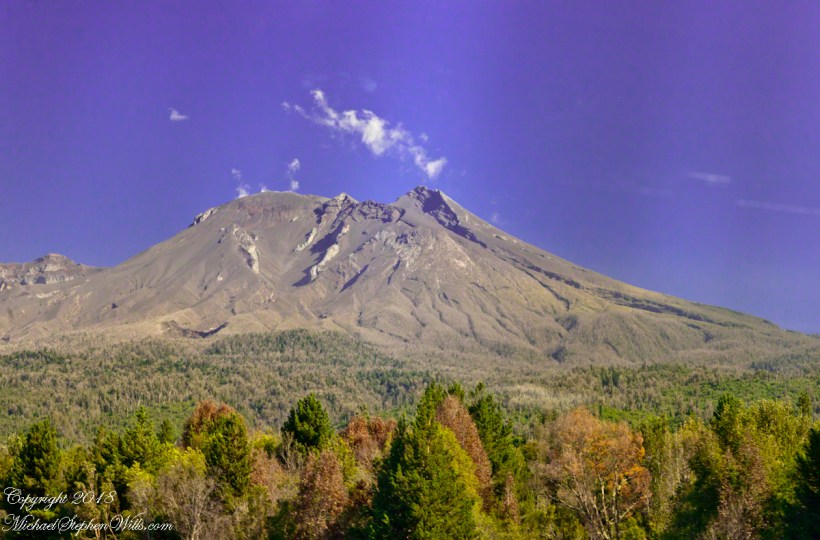
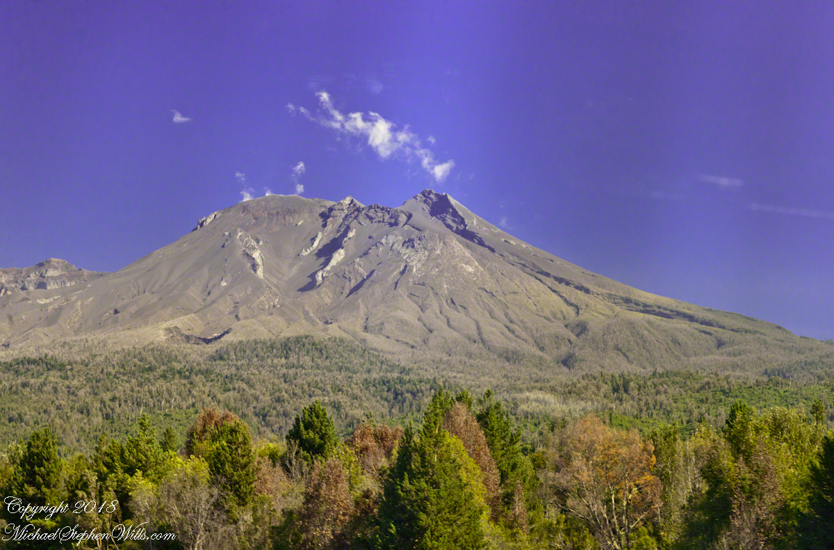
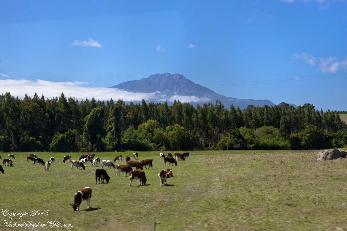
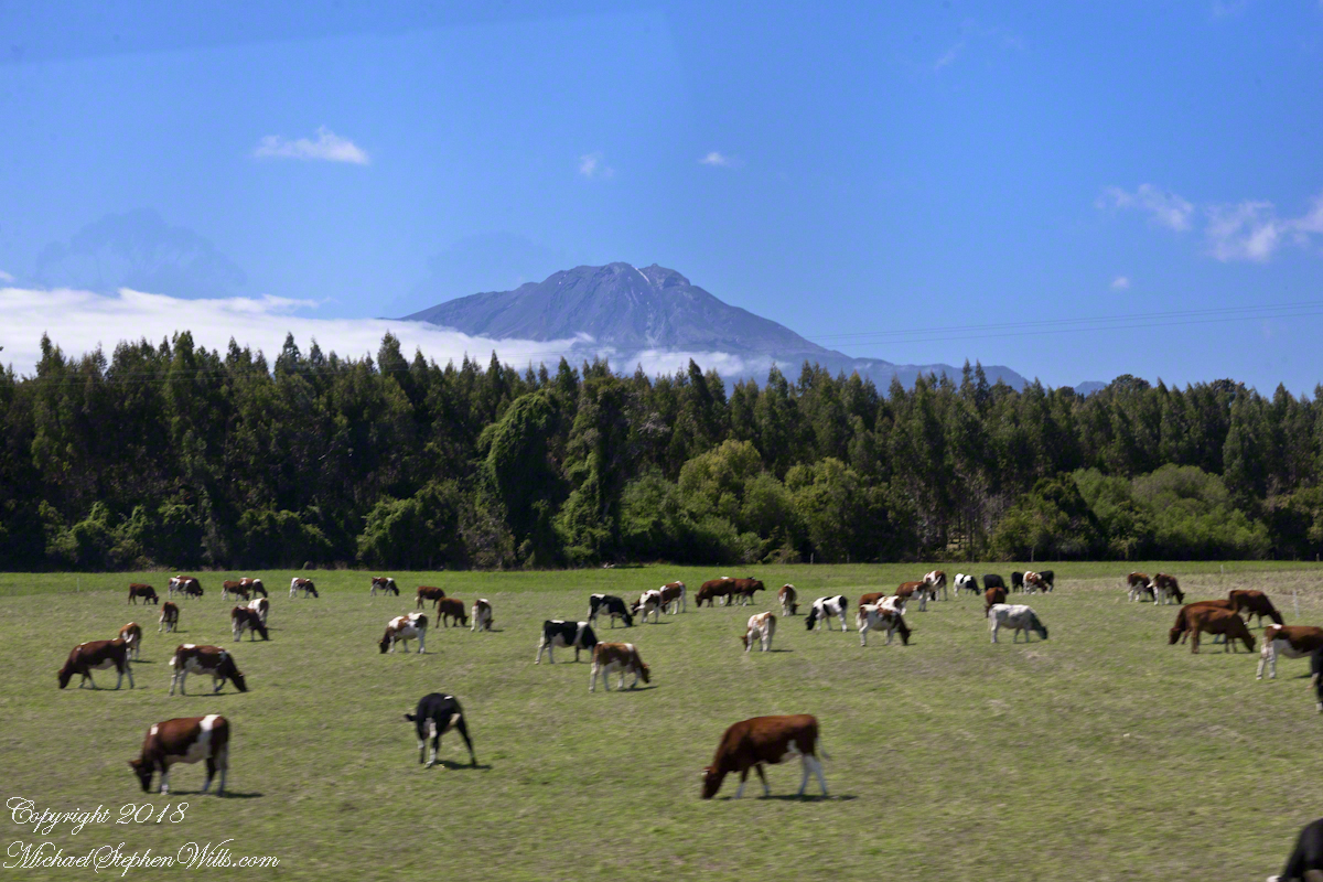
Postings last week featured the symmetrical, haunting cone of Orsorno and I have more images and stories to share of this quiescent horror in waiting. Today you will learn of another stratovolcano just 16 miles from Orsorno, also ancient; unlike Orsorno, misshapen and a current threat to local residents.
Calbuco is its name, taken from an indigenous language, “Blue Water” in English. It must refer to the water of Lake Llanquihe. As we drove Road 225 Calbuco was on one side, to the south, the lake on the other. When we visited Petrohué Falls, the river forms a southern boundary to the Llanquihue National Reserve from which Calbuco rises.
April 2015 Eruptions
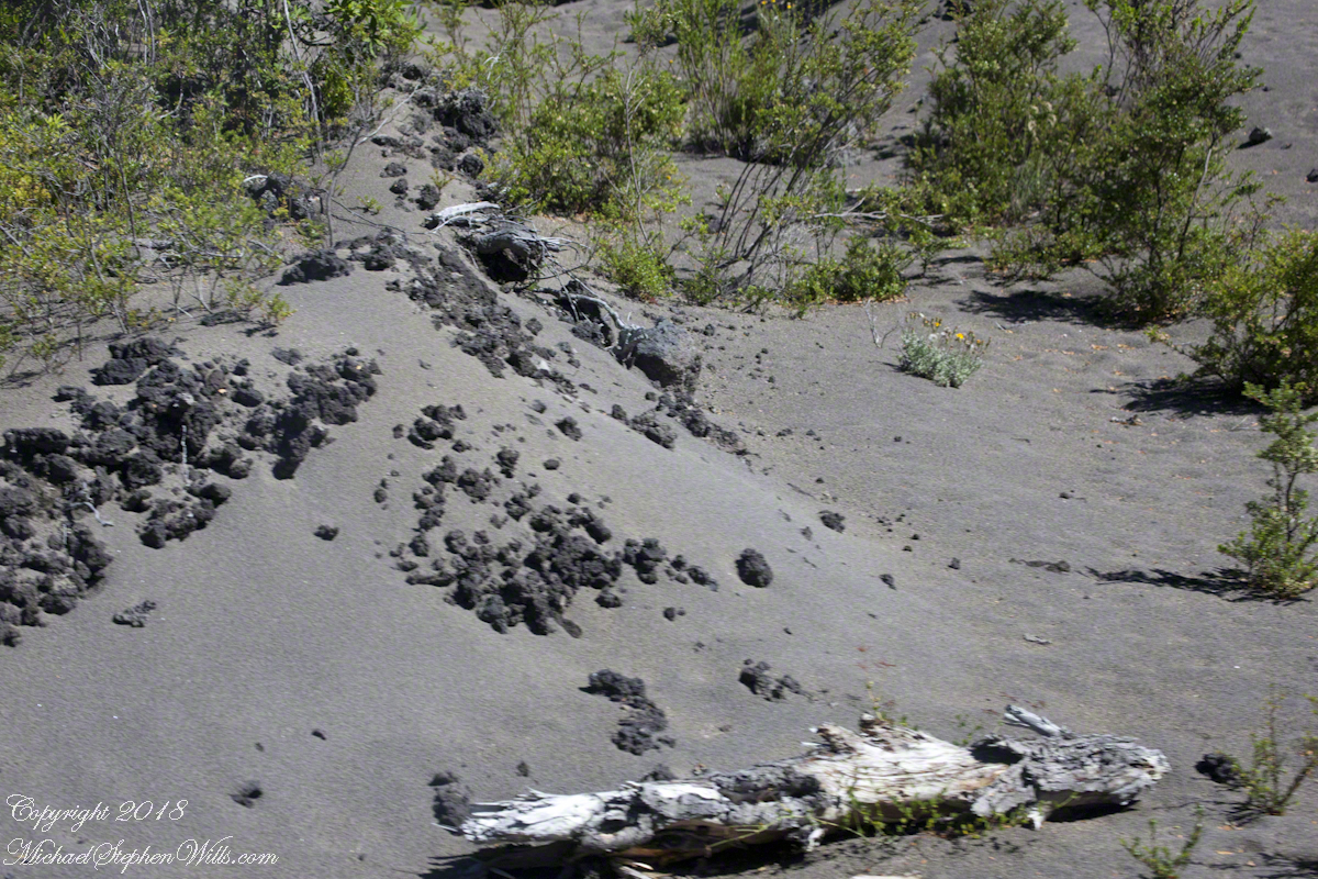
Where we planned out trip, nine months before this day in February 2016, Calbuco erupted without warning with explosions one step below that of Mount St. Helen’s 1980 event. The volcanic plume of ash and cinders reached more than 10 kilometers ( 6+ miles ) high. It was fortunate the wind direction took the ash away from the nearby cities of Puerto Varas and Puerto Montt. Each is about 17 miles from Calbuco. As it was, the catastrophe destroyed crops and made farmers lives difficult. Farmers and the residents of the rural village Ensenada, nine miles away, evacuated to save their lives. Abandoned farm animals perished. Village residents returned to homes, roads, gardens covered in ash.
Here is a photograph of an ash and cinder drift from the explosion, just off Road 555 on the slopes of Orsorno volcano, above Ensenada village.
Click any photograph for a larger view.
Settlement Beneath Active Volcanos
At the start of the 18th Century the provinces around Lake Llanquihe were thinly populated. The government of Chile, in anticipation of seizure of the land by European powers, cooperated with efforts of German emigres to resettle German families fleeing a disorderly revolution. Today the region show the cultural influence of these settlers. Here is the exterior of the Club Alemain (“German Club”), the restaurant along Road 225 were we had an excellent lunch.
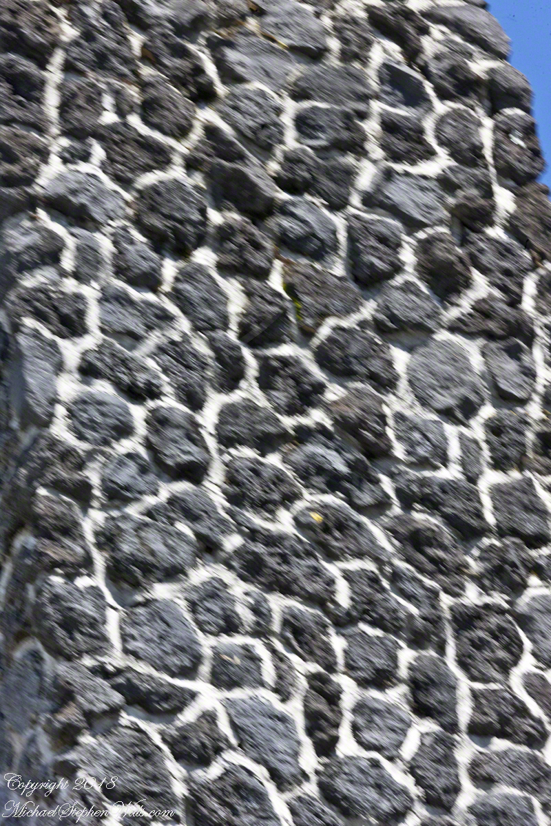
Look closely at the chimney. The stones are black and porous, volcanic cinders from Calbuco eruptions.
German settlers were there to witness, and suffer, the 1893-1895 Calbuco eruptions, one of the most explosive experienced in Southern Chile. Debris was ejected eight kilometers with large flows of hot mud. Farmers on the eastern shore of Lake Llanquihe petitioned the government to be resettled elsewhere. Without options, many remained.
Here is a view of the monster, a threatening presence to the south. That is vapor from the active caldera. Today, people live here, enjoying the current moments of their surroundings.
Calbuco Volcano, February 15, 2016
Click me for the first post in this series, “Orsorno Volcan
o and Tourists.”
Copyright 2022 All Rights Reserved Michael Stephen Wills
A user commented on a Chile Lake District post of mine asking for more photos of Germany. This is striking, because German traveler who visited have made note of parallels between this area and Europe. In this series I will share photography taken from the tour bus window as we traveled to the Lake District and returned to Puerto Montt. I used a handheld Canon EOS 1Ds Mark III SLR with the Canon lens EF 70-300 f 4-5.6LIS. This is the second post of this series.
Click any photograph for a larger view.
Chipped into Shingles?
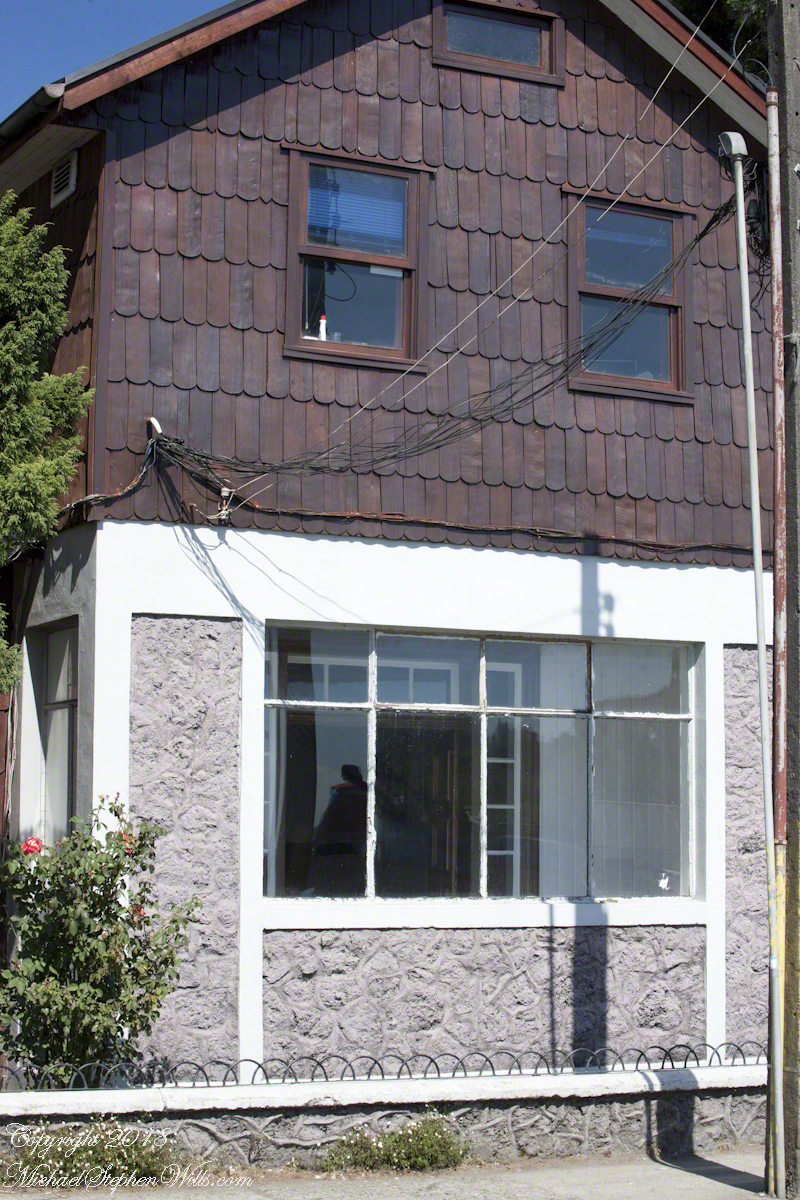
Wood is a building material the German pioneers had in abundance. They went to work clearing the forests, tilling the land and building structures such as this, a house in the town of Puento Varas on Lake Llanquihue. In face, those windows face the lake. I have our guide to thank for these photographs of the houses, early on as we drove through Puerto Montt she shared the significance of the shingles with us.
The shape is identical to that used in Germany and Switzerland wooden frame homes. It was the wood of a tree native to Chile and western Argentina that made these possible and in the course of surviving in a new land, a good portion of their natural patrimony was spent. Since the late 1960’s Chile has backed away from this and conservation of the slow growing Alerce is now paramount.
We can intuit how difficult the winters are from the view into this house provided by the window. There is a room outside the living area, sealed by a second door to prevent the escape of warmth. The use of metal embedded into the low concrete wall is common in the South American countries we visited.
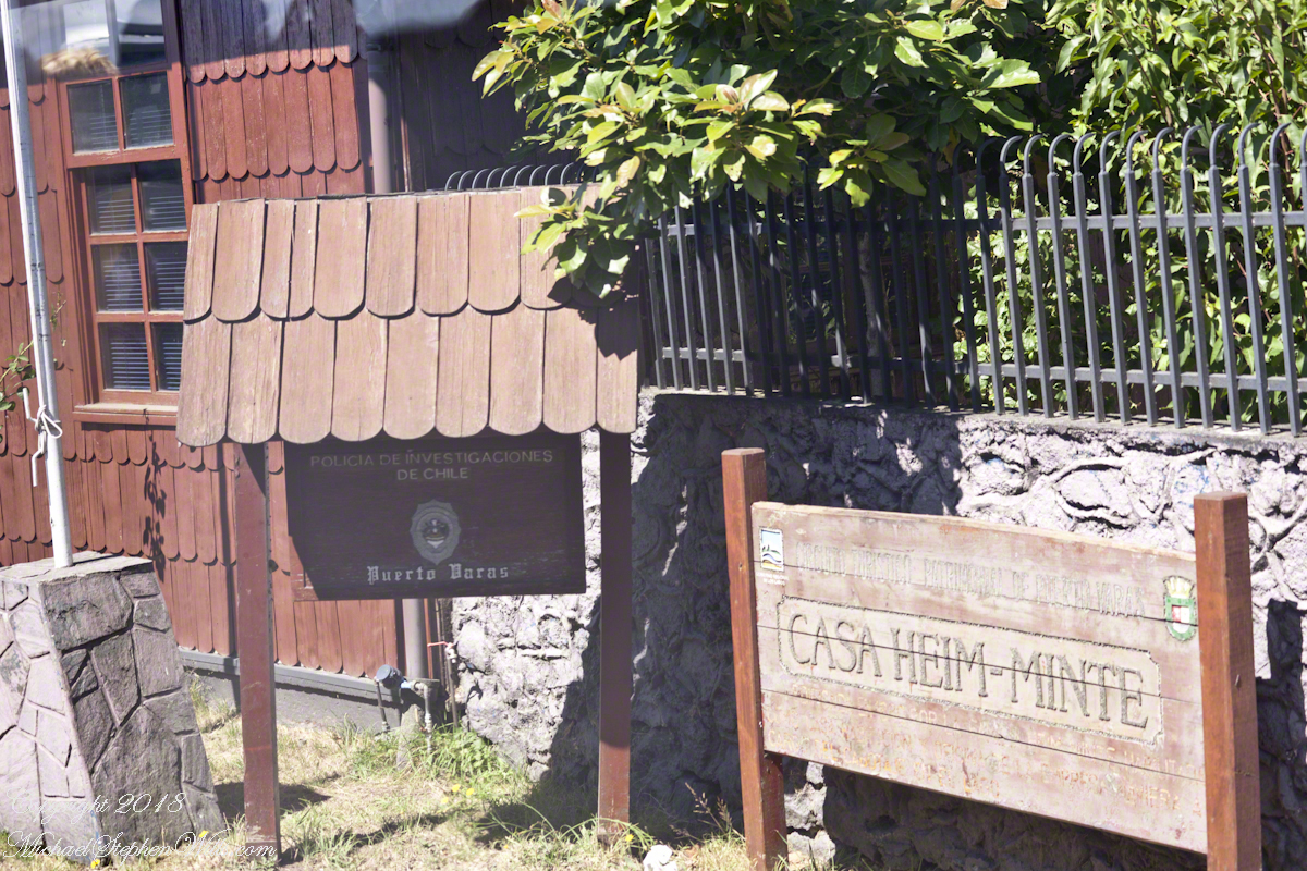
Close by, also facing the lake in Puerto Varas, is this police station, the “Civil Police,” whatever than means. It is a small, apparently historic, building. Rising around it are modern hotels.
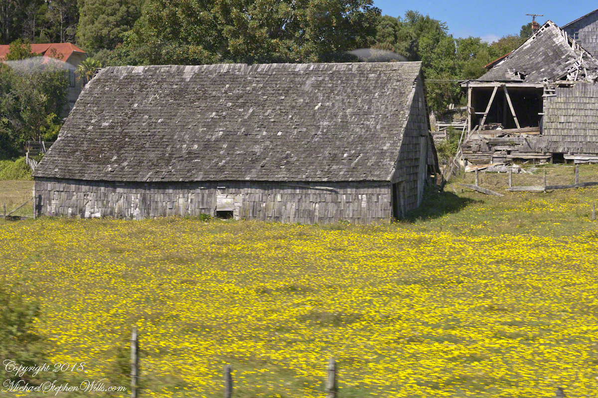
This large rural shed, on the outskirts of the town, appears to be a structure from the original 19th century settlers, a testimony to the durability of Alerce shingles covering the siding and the large, steeply sloped roof.
Open Country
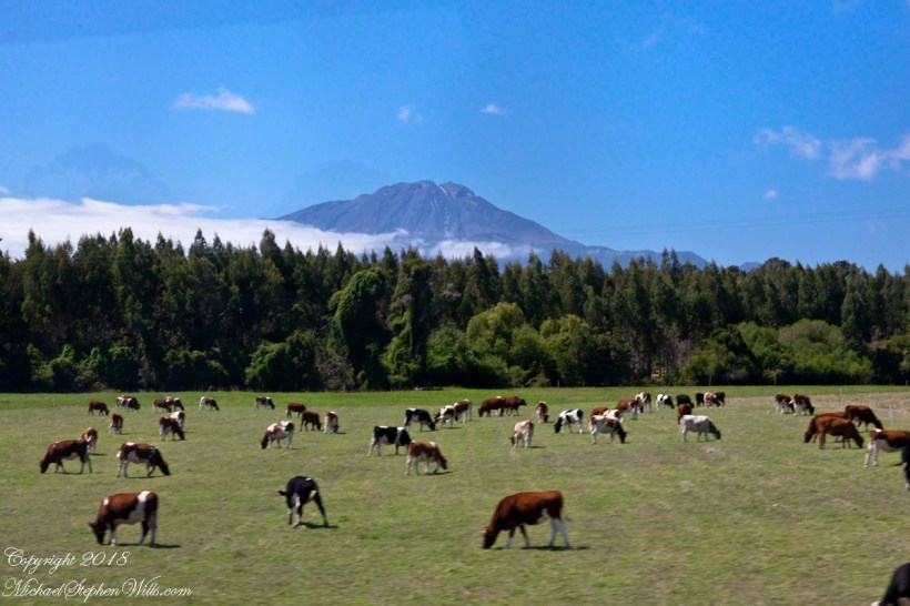
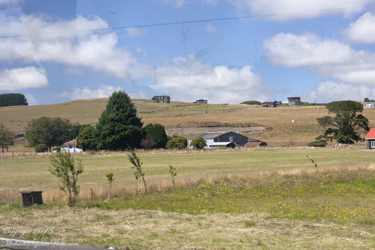
Suddenly we were graced with these cleared farm fields, here and there large modern homes high on the hill for a sweeping view of the lake.
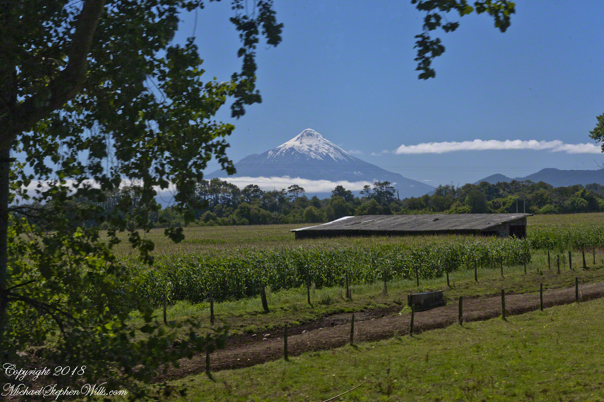
In the distance is Calbuco, the volcano whose eruption broke the peace ten months before our trip. The wind spared these lands the destructive effect of falling ash.
Copyright 2019 Michael Stephen Wills All Rights Reserved
A user commented on a Chile Lake District post of mine asking for more photos of Germany. This is striking, because German traveler who visited have made note of parallels between this area and Europe. In this series I will share photography taken from the tour bus window as we traveled to the Lake District and returned to Puerto Montt. I used a handheld Canon EOS 1Ds Mark III SLR with the Canon lens EF 70-300 f 4-5.6LIS. This is the third post of this series.
Click photograph for a larger view.
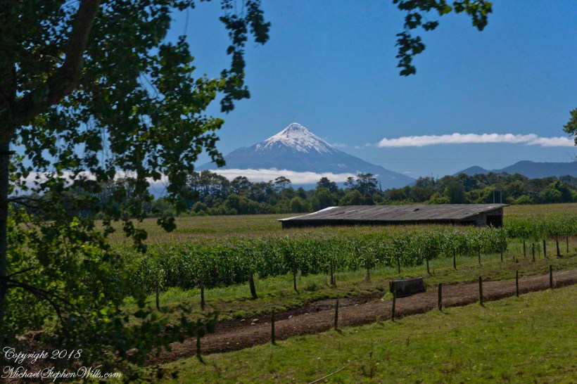
Orsorno Volcano, Lakes District, Chile
Copyright 2019 Michael Stephen Wills All Rights Reserved
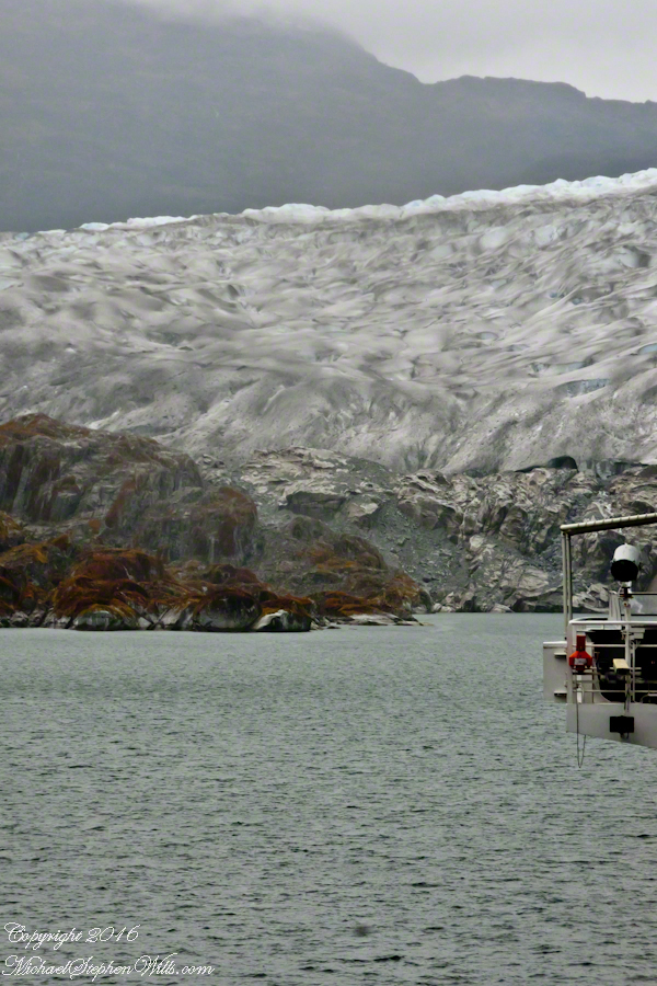
 A glacier is more than ice; not alive, it crawls; not feeling, it groans, cackles, shouts; passive, it is dangerous to approach closely backed as it is by the southern ice field, over a mile high. The ship nudged as close as a half mile from the massed ice, navigating using the bow thrusters to face first port, then starboard and back to port. I was lucky enough to be on the 11th deck, pictured above, when we caught sigh of the fast ship’s launch, manned by ship’s crew.