A portent of new beginnings in an ongoing journey for the last day of February, 2022


Iliad and Odyssey reference for Monday
A portent of new beginnings in an ongoing journey for the last day of February, 2022

Planet Thoughts
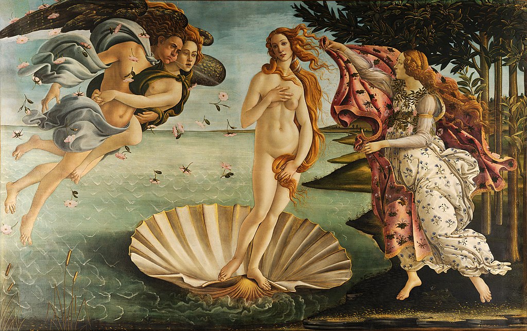
The planet we call Venus has ancient associations with fertility goddesses. The link has persisted at least from the 1600 century B.C. inscribed on Sumerian cuneiform tablets. Three thousand years later the Italian artist Botticelli created in tempura paint on canvas the image of Venus rising from the sea, as the planet Venus does today.
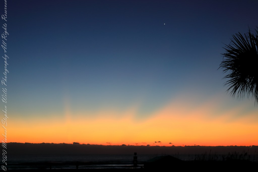
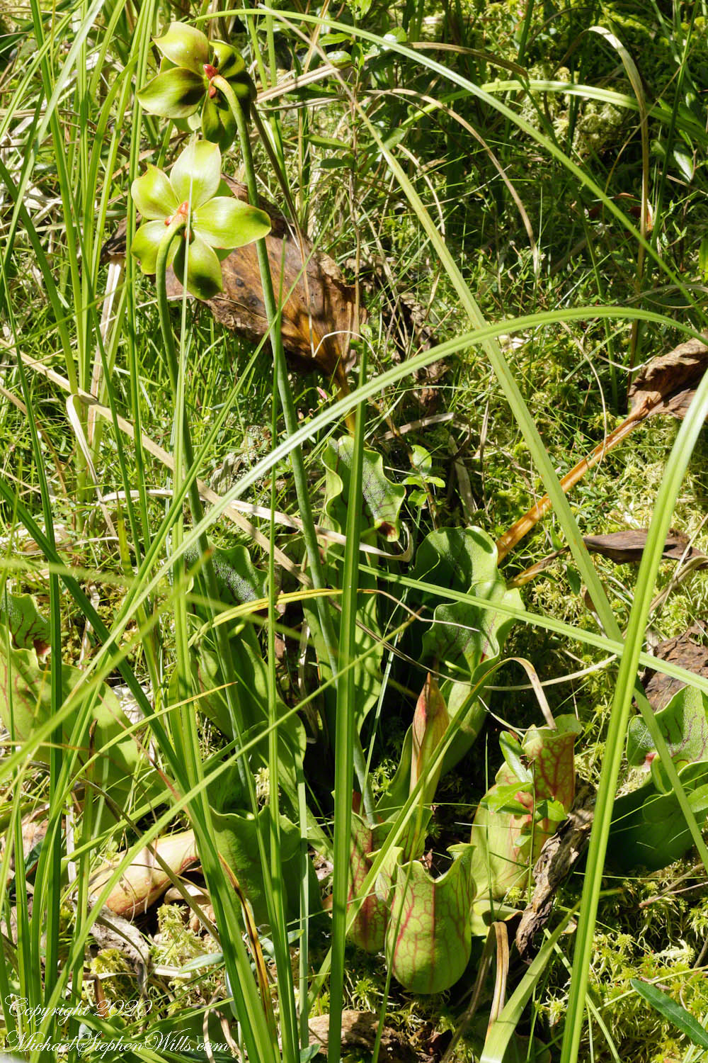
Here is Venus rising from the sea at dawn January 2022, at its brightest and most beautiful. Some mistake this new light in the east for airplane lights; the bright disk of Venus is 25 times brighter than Sirius, enough to cast shadows at night. As Venus proceeds in its orbit, the planet alternately sets after the sun and rises before it, seemingly appearing new each time.
This February I caught a newly risen Venus in this IPhone 7 video, reflected in the waves. It seemed to be a flashing headlight on the beach, the Venus reflection came and went with the passing waves. Venus is the upper, the reflection is beneath. Use the lower right control for the full view.
Looking from his window June 1889, Vincent VanGogh included Venus in his “Starry Night” painting, seen to the right of the Cypress tree.


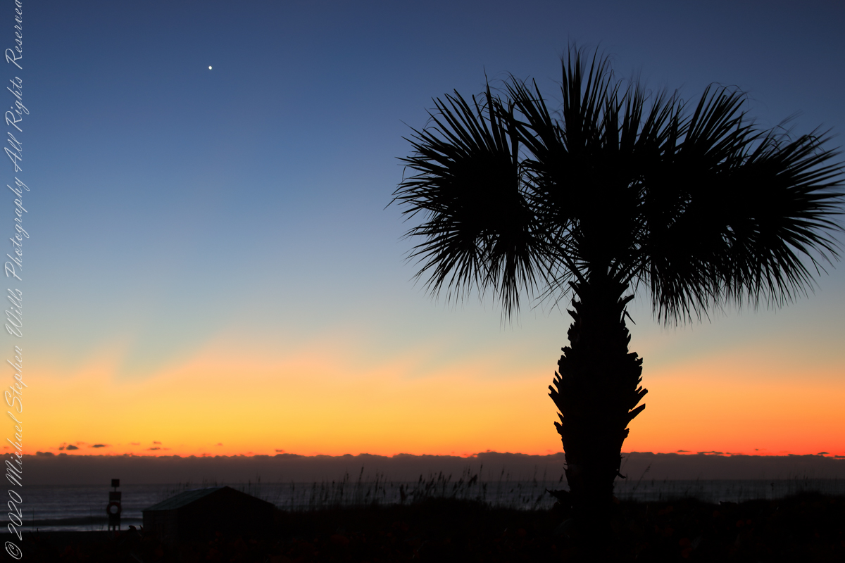
Here is a closer view of Venus last January, the planet disk is apparent, unlike even the closest stars, Venus is seen as a whole object. Click on image for a full view.
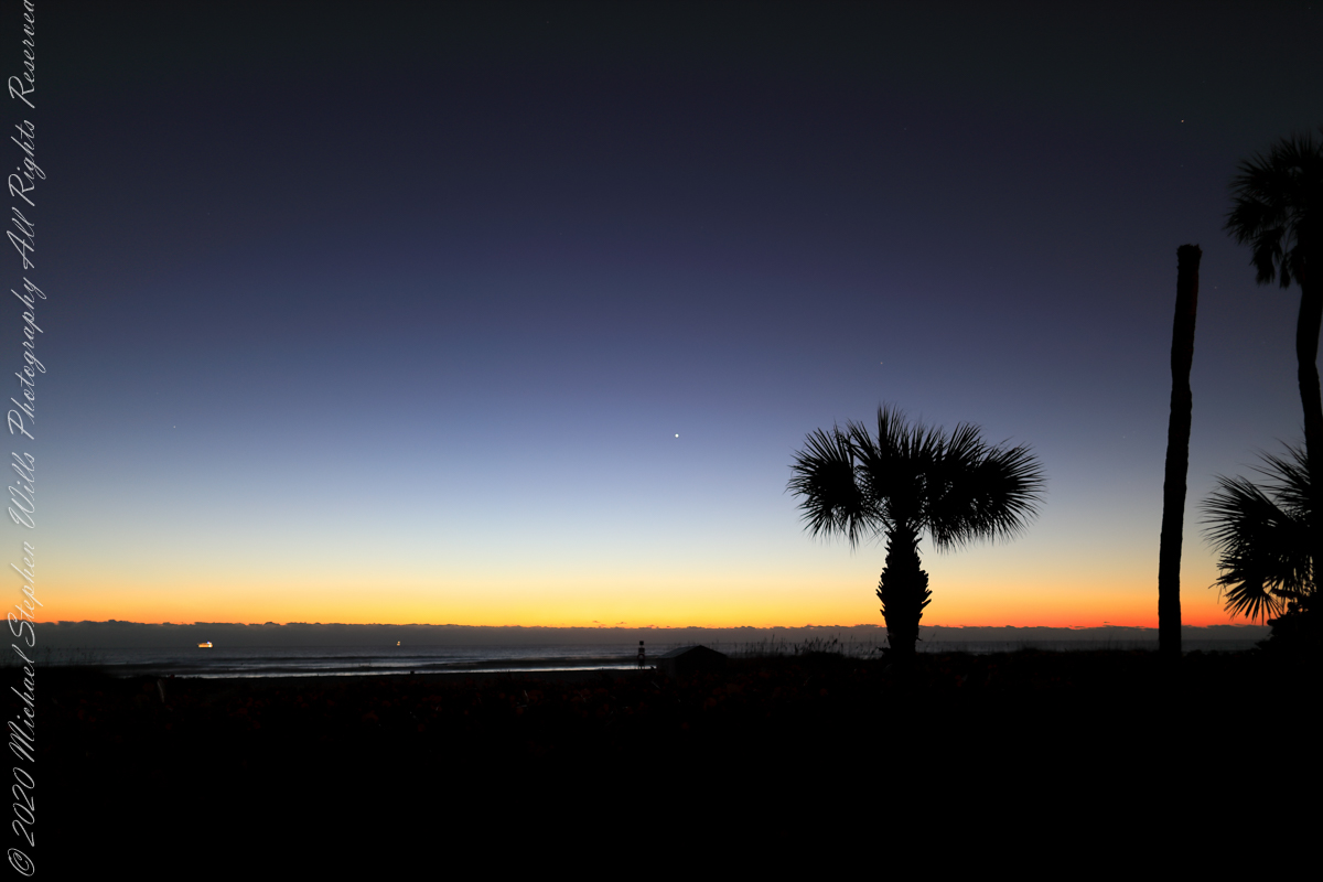
Venus and Mars shared 2022’s pre-dawn winter sky. Click on the first image for a full-size view. Mars is seen above the palm tree stump, on the right. In this photograph, from early February, Venus and Mar apparently moved closer. The closeness is an illusion, the planets are millions of miles apart, on either side of Earth’s orbit. Click on the photograph for a full-size view, Mars can just be made out to the right and above Venus.

This crop clearly shows the brightness of Venus compared to Mars.

Ancestral Byways
……click for “Pinelands Connections I”.
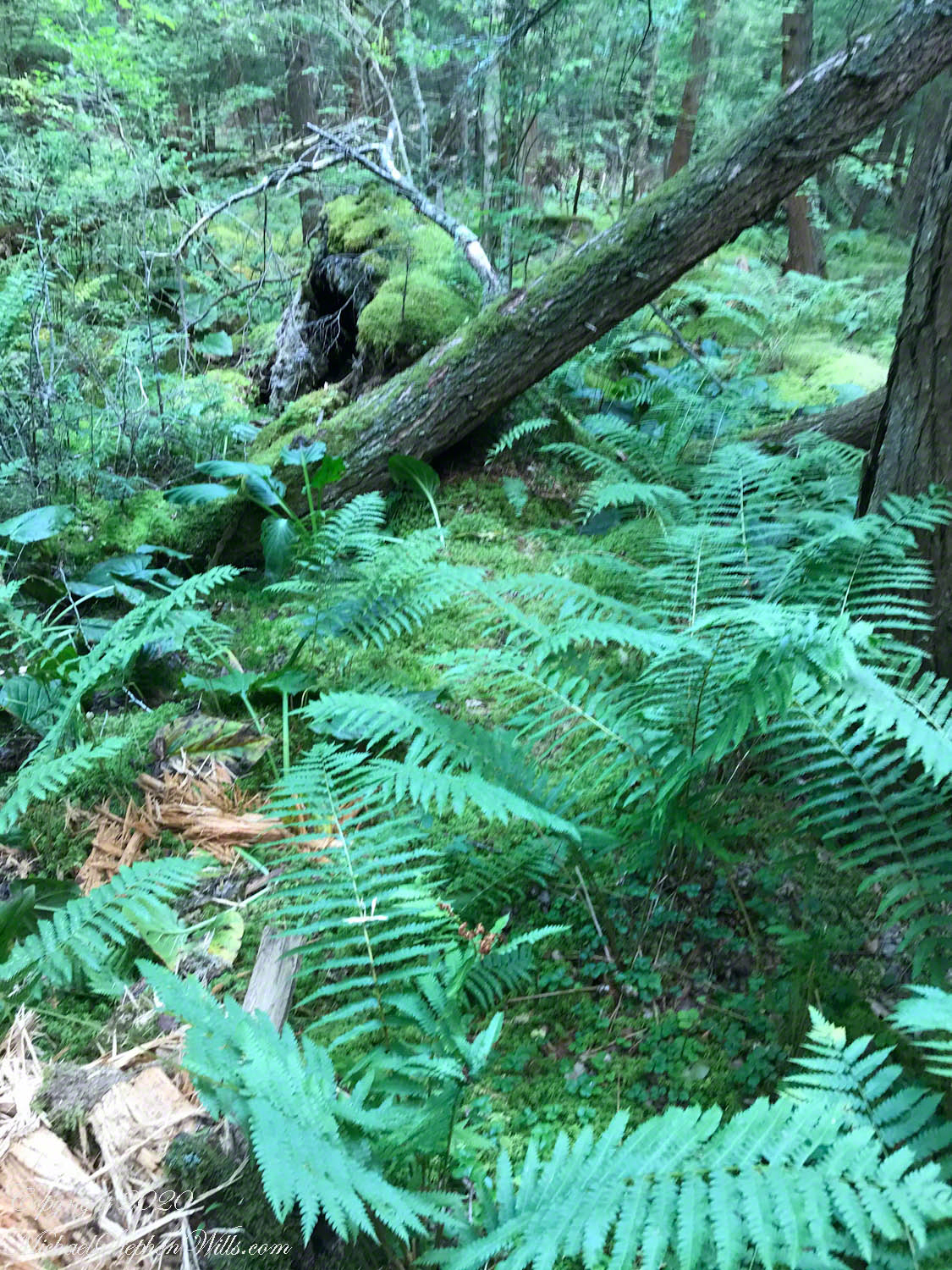
These photographs were taken the last days of August 2021, the 26th and 27th, while exploring Burlington County, New Jersey, with my sister. I will be writing about our Thursday and Friday for awhile, starting with today’s installment.
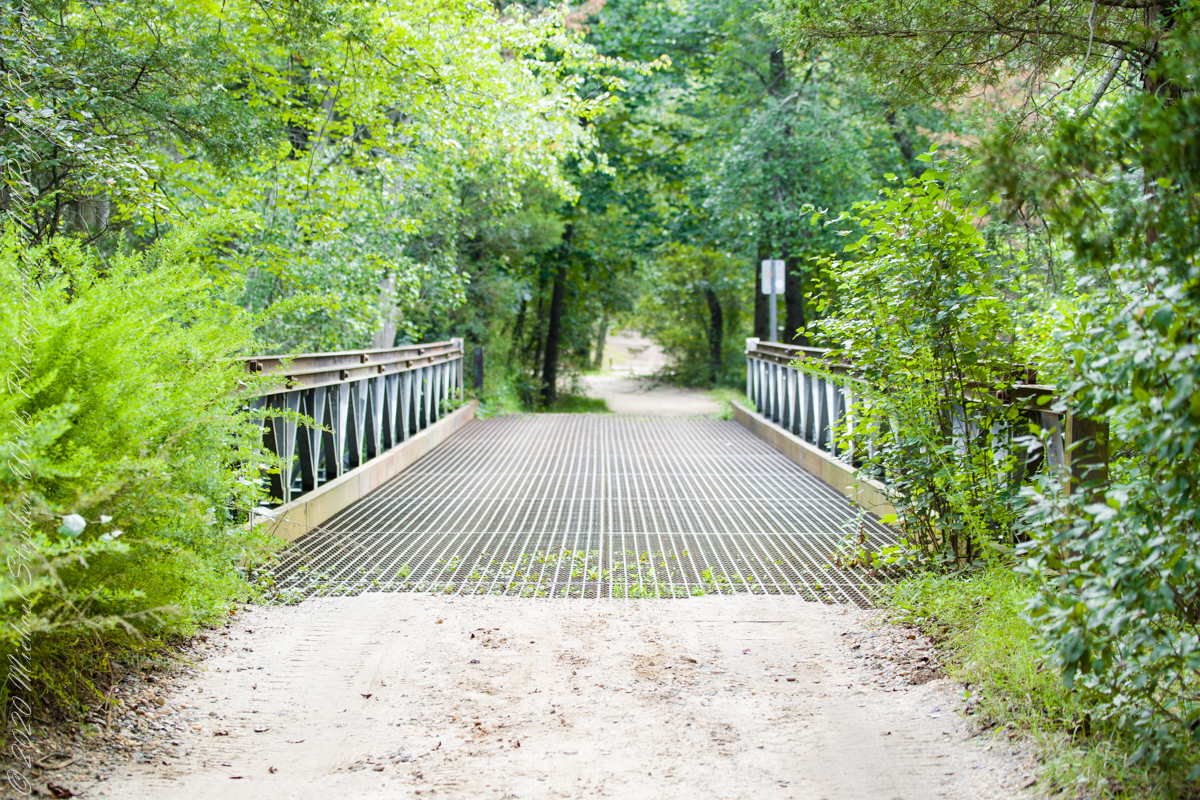
Quaker Bridge Road traverses the wilderness of Wharton State Forest with a beginning off Route 206, Atsion Mansion. Our planning included Jeep Wrangler rental, only high-clearance 4-wheel vehicles are appropriate, the road surface is humpy sand, water filled holes abound. Still, sitting there at the start, with Atsion Mansion house in view, I waited awhile until a high clearance tour bus packed with adventurers, kayaks passed into the pines and out of sight. We proceeded an uneventful ~4 miles to Quaker Bridge at a stately 5 miles per hour, invoking four-wheel drive low gear a mile or so in.
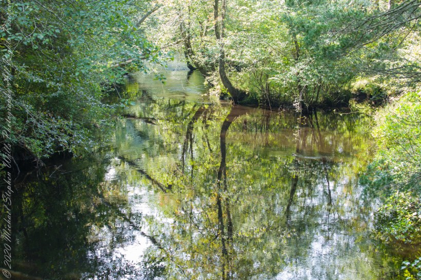
Here is Quaker Bridge over Mullica River today, facing East.
Quaker Bridge road was a well traveled main route through the Pines for almost a hundred years with an inconvenient crossing of The Mullica at this point. During the year 1774, some sa 1772, West Jersey Quakers travelling to the Little Egg Harbor Yearly Meeting, started “a day early”, built a bridge. From a c.1940 photograph it is clear in that “day” they felled large trees for pilings, smaller trees, pines and cedars, for the other bridge elements. Since then, the crossing has been called “Quaker Bridge.”
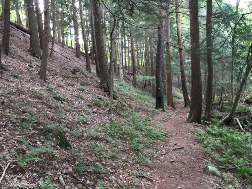
Over time, the east side became a resting place, with at least one Inn/Tavern. Here is the east side today.
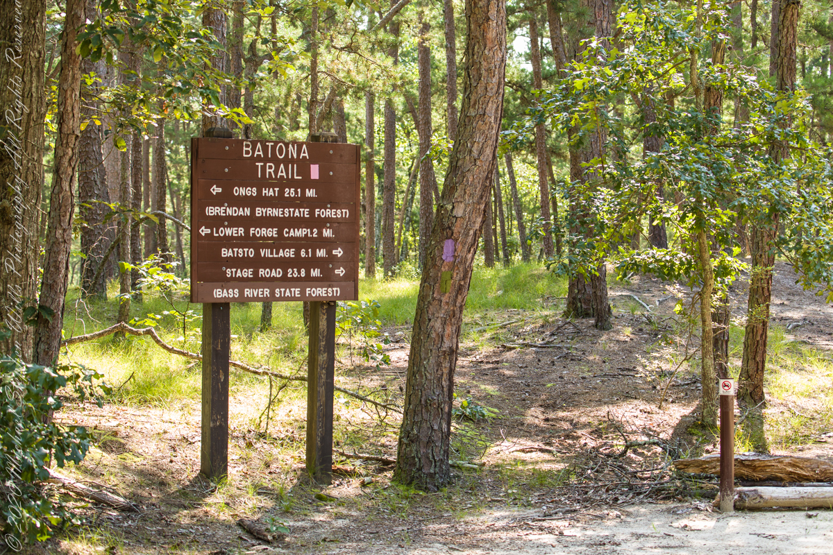
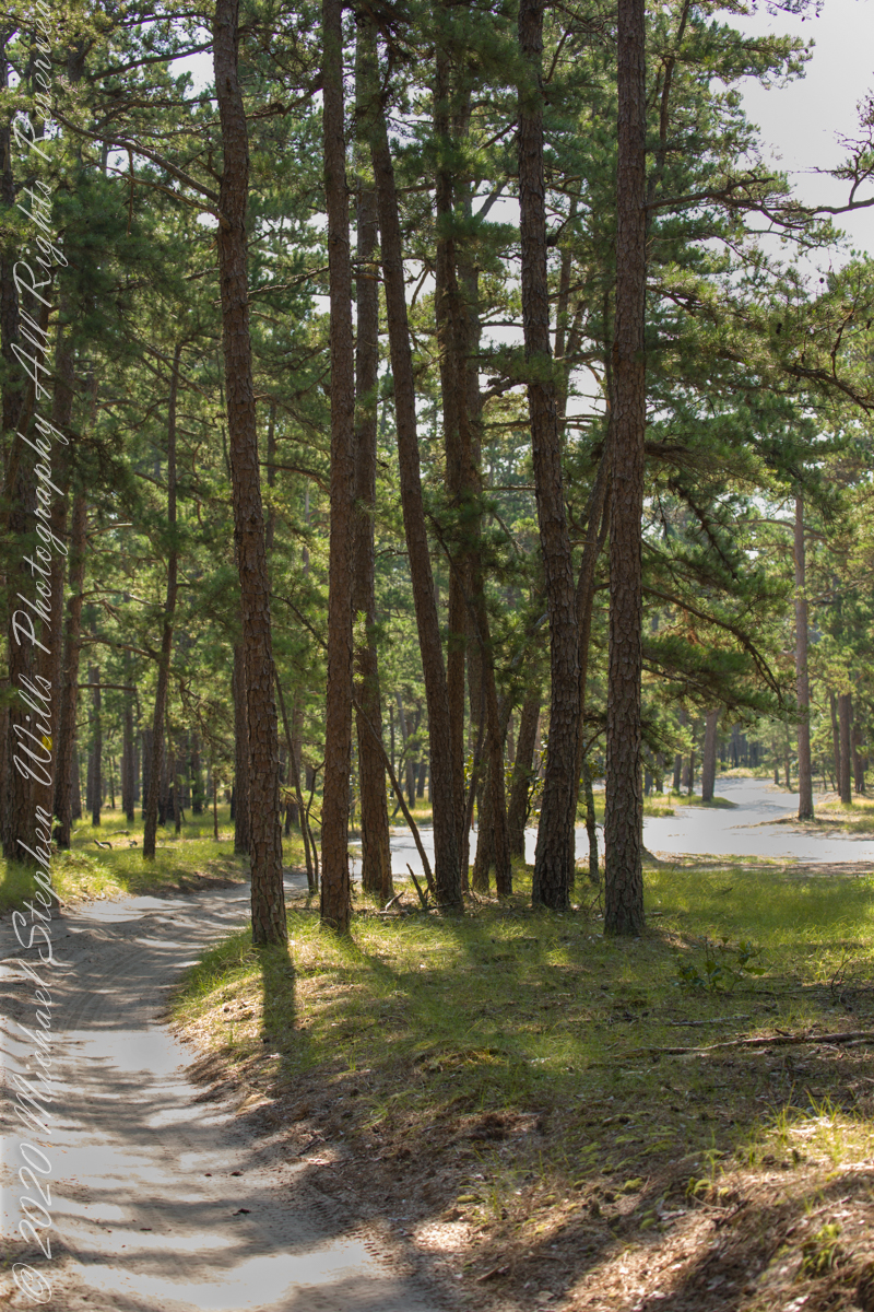
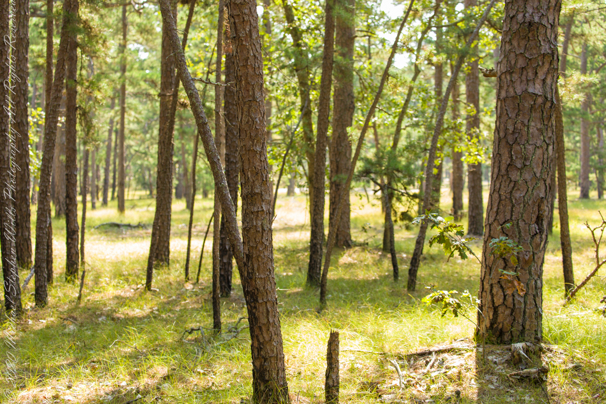
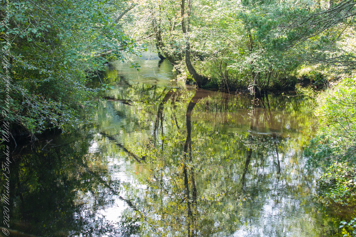
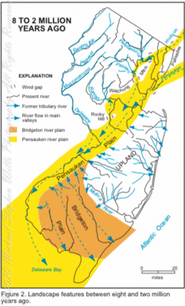
Even without hospitality and bustling humanity, after 4 miles of dreary road from Atsion this spot carries a sense of lightness, the well spaced straight pines over several acres conveying peace and rest. Over 35 miles from the ocean, the white sand presents as beach. There is a reason for this feeling, a 15 million year reason.
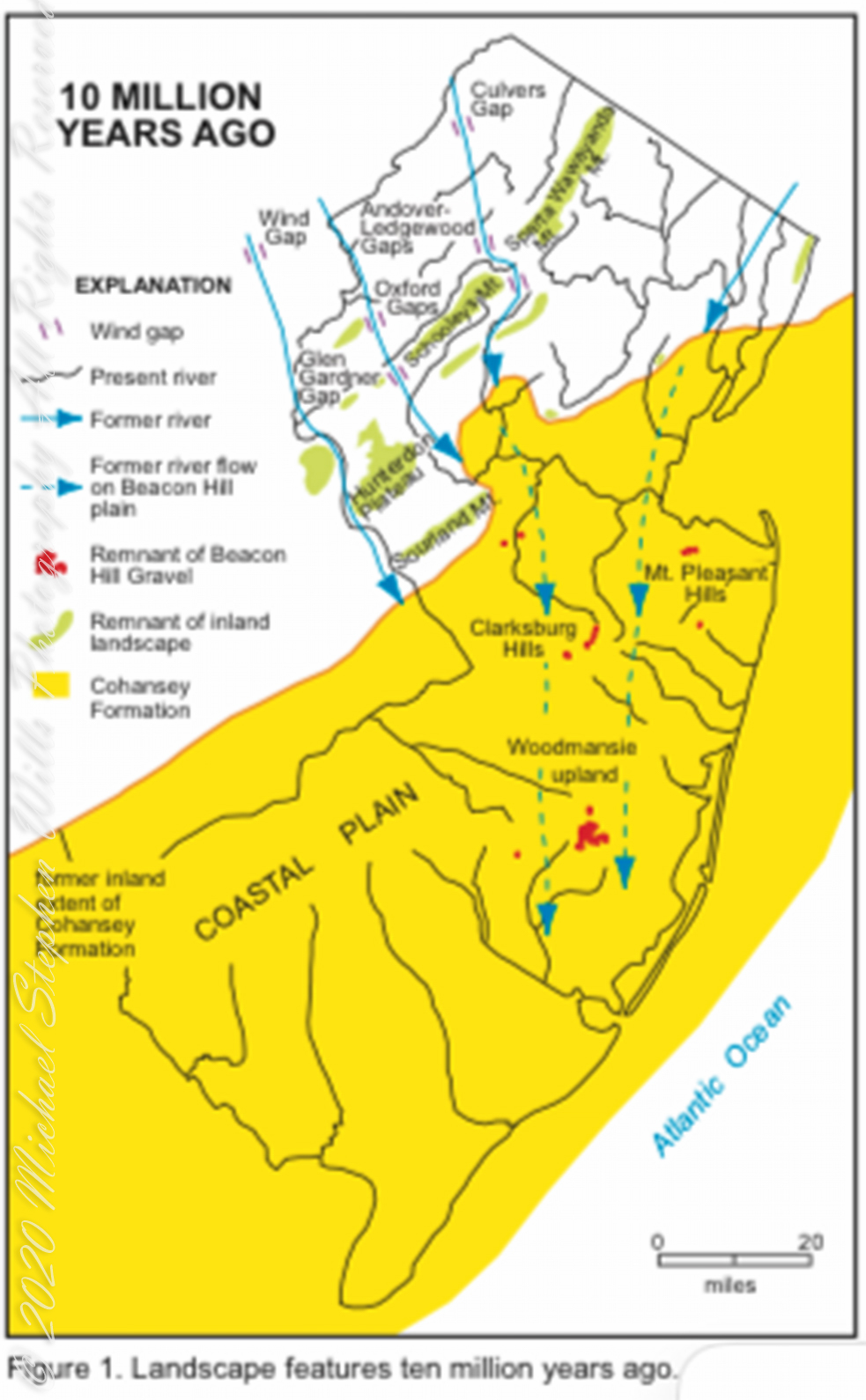
Between 15 and 10 million years ago the earth climate turned colder, so much water evaporated from the oceans to fall as snow and ice in the polar regions ocean levels fell 150 to 250 feet. As the ocean fell away, over eaons, mountains to the west were ground down, pulverized by the elements to flow, gather on the exposed plain. The white “beach” sand we see today, at Quaker Bridge and other Pinelands places, are surfaces of this “Cohansey” sands and clay ranging in thickness from 25 feet in the west to more than 300 feet at the Atlantic Ocean.
Over millions of years the land raised to become the drainage patterns we see today. The renewable resources of “bog iron” and water spring from this history.
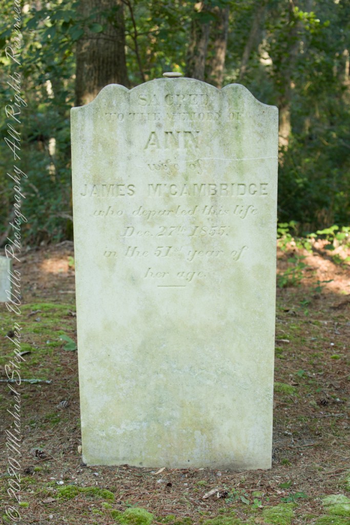
Standing there I imagined Great Great Grandmother Ann (Milley) McCambridge resting on the journey from the McCambridge home near Speedwell. I placed the pebble, collected from Long Island Sound, on Grandmother Ann’s headstone the evening of August 26th. Click this link for more about Ann McCambridge.
“Background information on the Cohansey Formation aquifer.”
Copyright 2021 Michael Stephen Wills All Rights Reserved
Buttonwood Hill Tavern and the Old Eagle Inn
……click for “Pinelands Connections I”.
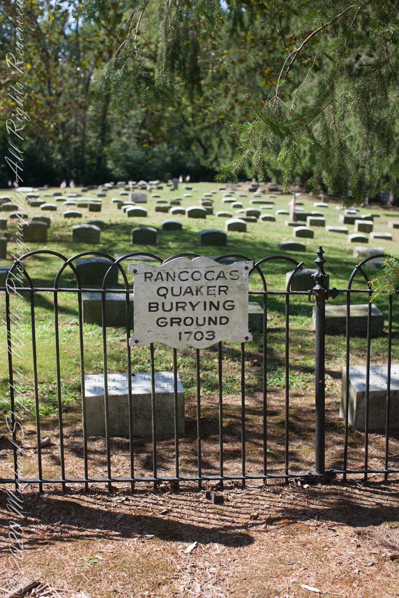
I am happy to share a breakthrough in my family research of our time in Western New Jersey, 225 years for my branch from the 1677 landing of the Kent on Rancocas Creek until my grandfather left for Asbury Park.
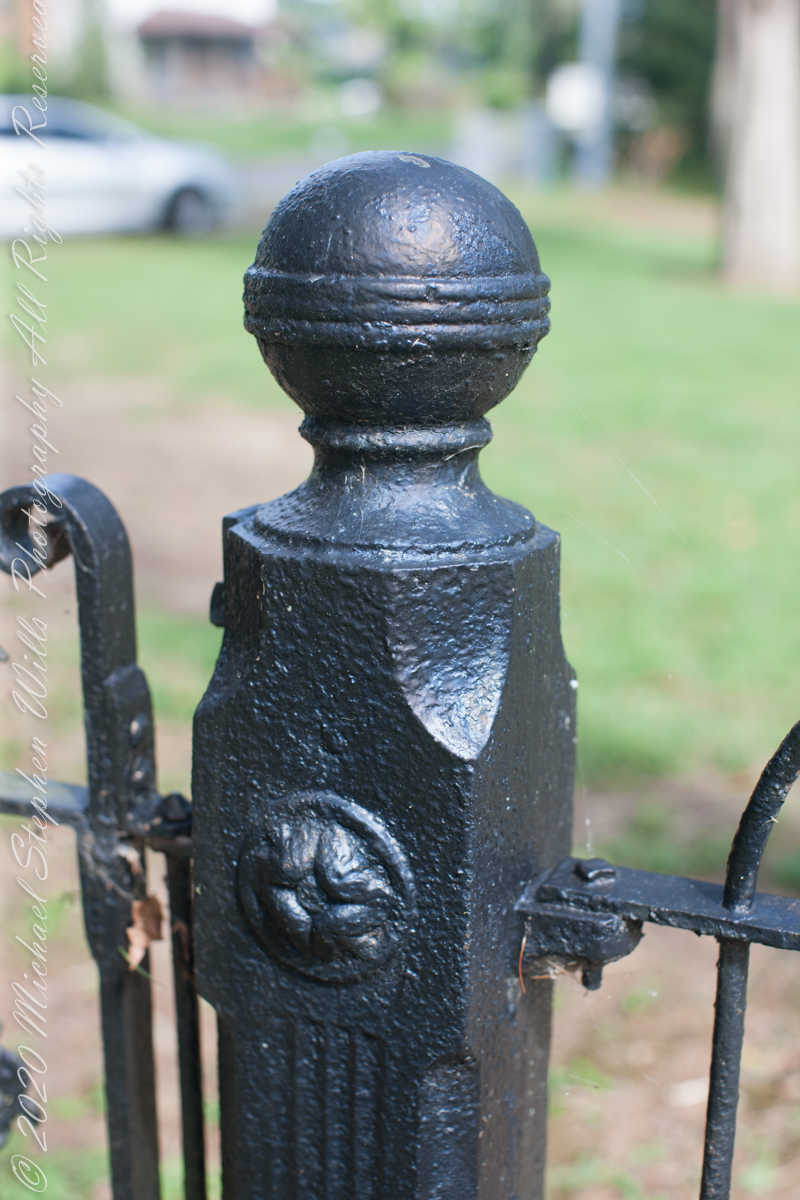
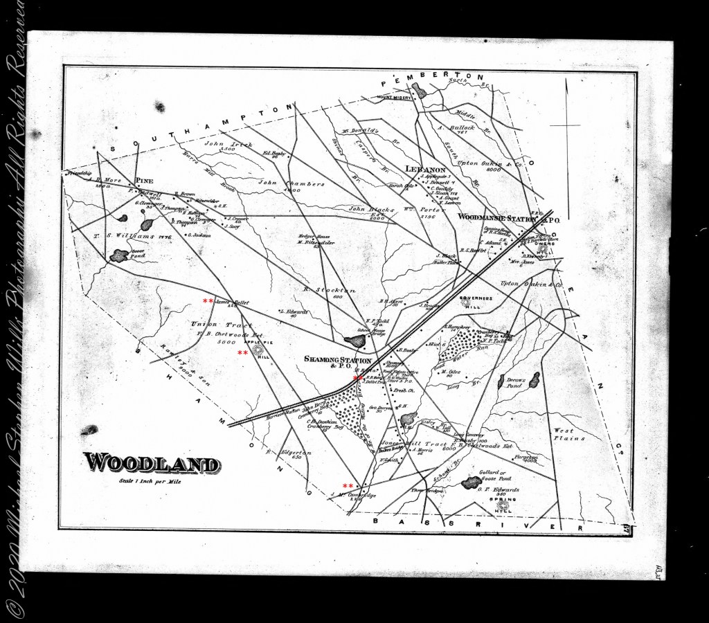
In this rectangle (10 miles by 15 miles) taken from the 1900 US Geological Survey, Rancocas Quadrangle, New Jersey topographic map is shown, upper right hand corner, Apple Pie Hill the starting point of this history where the author John McFee climbed the fire watchtower there, a view encompassing endless acres of pines. I learned an ancestor, third great-grandfather James McCambridge and his wife Mary owned the Old Eagle Tavern less than two miles south of there. The site is marked in red.
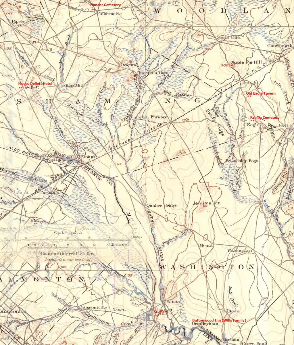
The Eagle Tavern existed for 28 years under various owners and names when James and Mary took over in 1926 serving a clientele, workers and visitors, from the struggling Speedwell Ironworks. Samuel Richards was a brother of Jessie Richards who owned the Batsto Ironworks and who provided the land for St. Mary of the Assumption (see my post Pineland Connections V). St. Mary’s is marked in red, bottom center. Samuel purchased Speedwell December 23, 1833 from Ann Randolph, made improvements and started operations without success before closing for good.

On June 30, 1850, James McCambridge purchased Speedwell from the estate, eight years after Samuel’s passing, for $1,750. At this time he had accumulated over 2,000 acres. In this same year his son, James and wife Ann (Milley) (see my post Pineland connections VI) are listed on the US Census. The family lived either in the Eagle Hotel or close by raising nine (9) children: John (20), Mary Ann (16), James (15), Sarah Jane (14), my great grandmother Margaret (11), William (8), George (6), Edward (5) and Catherine (3). The younger James is employment was making charcoal for the ironworks, most likely for Atsion where Ann was employed. By the 1860 US Census Ann had passed away at the age of 50 and James (97) was living with the younger James and family.
Here is a land ownership map from 1876 on which I marked with red asterisks James McCambridge, Apple Pie Hill, and the Delletts, the family of the second greatgrandmother, Mary Dellett. Dellett landownership is also indicated on the rectangle topographic map.
Around the 1850 US census George and Mary Wills lost their two month old son, Charles (See my post Pineland Connections III) who is buried in a family cemetery, land owned by James McCambridge marked in red on the rectangle topographic map. Charles was my greatUncle.


Another breakthrough was identification of the Buttonwood Hill Tavern, Crowleytown as the hotel run by George Wills on the 1850 census. Marked in red on the rectangle topographic map. There was not yet a family union between McCambridge and Wills. That would come with great grandparents George Wills and Margaret McCambridge. The family connection at this time was their shared Roman Catholic faith and Saint Mary of the Assumption church.
Copyright 2021 Michael Stephen Wills All Rights Reserved

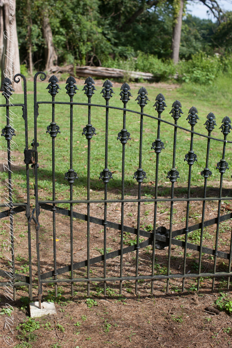
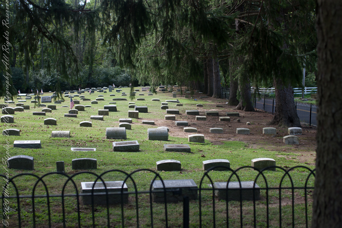
Saint Mary’s of the Pines (St. Mary of the Assumption)
……continued from “Pinelands Connections I.
The Pinelands chemical reactions / iron furnaces of Part III are elements of the warp and weft of our family’s story. Saint Mary Assumption (“Saint Mary’s of the Pine”) Roman Catholic church was another. Family members comprise 60% (60 percent) of the burials, comprising these family names: Dellett (see Pinelands Connections I), Milley, Wills, McCambridge.
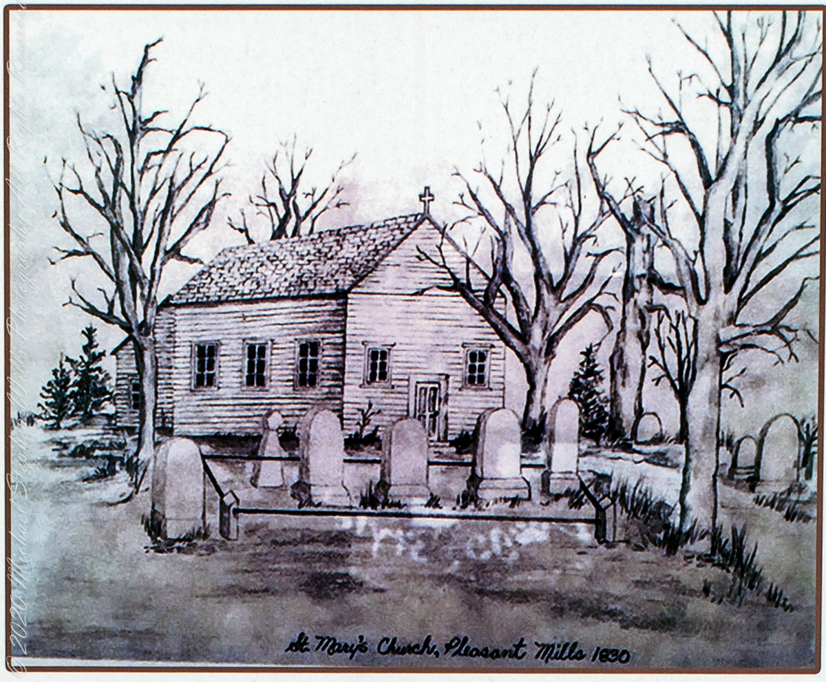
“Most of the settlers in the early 19th century were either Presbyterian or of a denomination that resulted from the Protestant Reformation. The Catholics that lived in this area, many of whom worked at Batsto, were at the time practicing their religion by gathering privately in their tiny homes. They had no money with which to buy land or build a church and were only able to have a mass in their homes if a priest from the Philadelphia area came to visit Pleasant Mills, which was not often. Set within the background of religious intolerance, the creation of St. Mary’s of the Assumption was due to one man’s compassion for his workers. That man was Jesse Richards of Batsto, a Protestant. In 1826 he donated a plot of land to his Catholic workers so that they could build their own church. It took a year for them to collect enough money to build St. Mary’s and supposedly Jesse Richards donated some money for the church, as well. The parishioners worked together with a young reverend, Edward R. Mayne, and erected St. Mary’s of the Assumption, which became known as St. Mary’s Roman Catholic Church in the Pines in Pleasant Mills and eventually St. Mary’s in the Pines. Father Mayne, a convert from Protestantism, became its original priest. The church was dedicated August 15, 1830. Bishop Francis Kendrick of Philadelphia performed the dedication. It was the first Catholic Church south of Trenton and probably the third in the state of New Jersey. Upon Jesse Richards’ death in 1854, Batsto’s industries, especially the glass factories, went into a decline. Many of the workers went elsewhere for employment which caused a decline in the number of St. Mary’s parishioners. The church closed from approximately 1860 through 1865 and after that only sporadic services were held because the area’s population was decreasing. Eventually, in 1867, the glass factories at Batsto were shut down permanently, which further affected St. Mary’s parishioners. In 1885, the Hammonton Parish was formed and St. Mary’s became part of that parish. St. Mary’s in the Pines remained empty until it was destroyed by forest fire around 1900.” From the sign “St. Mary’s Cemetery, St. Mary’s in the Pines”).
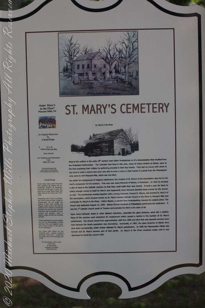
The historical sign includes an offer in support of the preservation and restoration of the cemetery and church site. An original water color (pictured above) by Carol Freas, 11×14 color print and mat, Price $40.00. For information, write or call Carol Freas, 39 John Street, Tuckerton, NJ 08087 (609) 294-0218
Copyright 2021 Michael Stephen Wills All Rights Reserved
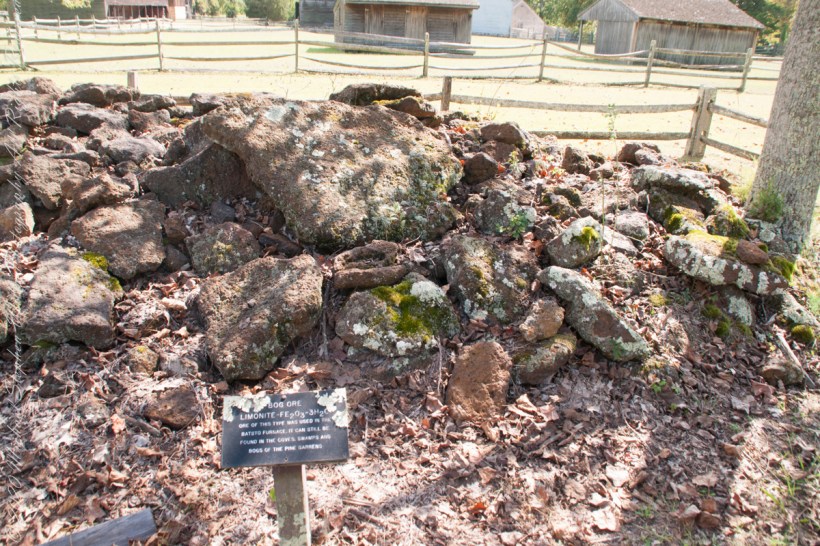
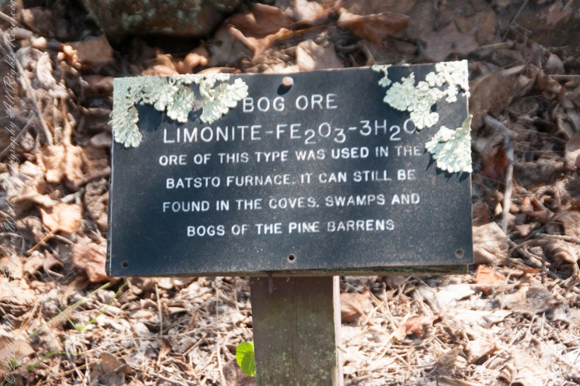
Bog Iron
This series starts here “Pinelands Connections I.
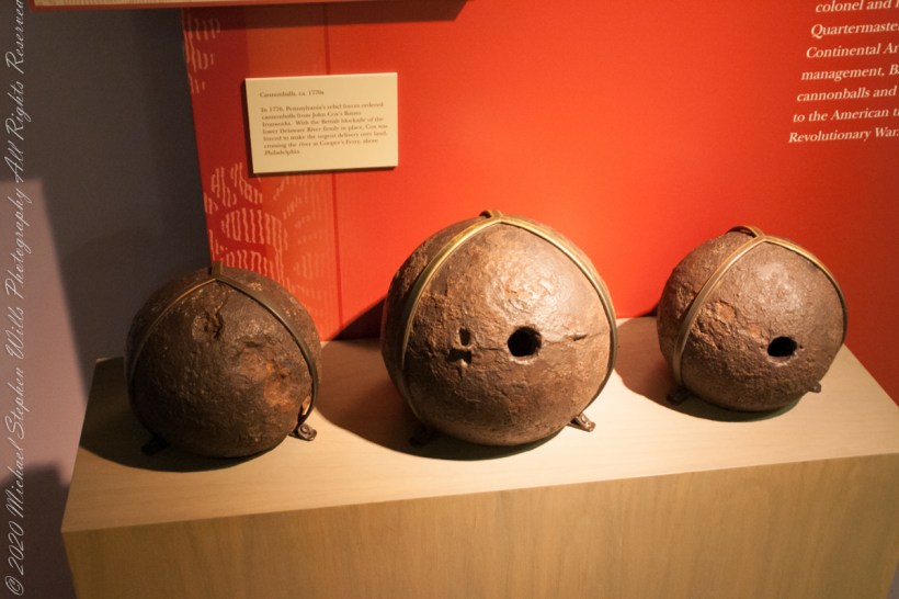
“There was also iron in the Pinelands. Most of the now vanished towns in the pines were iron towns — small, precursive Pittsburghs, in every part of the forest, where fine grade of pig and wrought iron were made. One of the geological curiosities of the Pine Barrens is that rainwater soaking down through fallen pine needles and other forest litter takes on enough acid to leach out iron from the sands below; the dissolved iron moves underground into the streams, where it oxidizes on contact with the air and forms a patch of scum on the surface that is partly rust brown and partly iridescent blue, and resembles an oil slick left by an outboard motor; drifting over to the edges of the streams, this iron-oxide film permeates the sands and gravels of the riverbanks and cements them together into a sandstone composite that has been known for centuries as bog iron. From it ironmasters of the Pine Barrens made cannonballs by the thousand and then them by wagon over the sand roads and on to the Continental Army at Valley Forge and elsewhere.” From The New Yorker magazine, November 26, 1967, “Profiles, The Pine Barrens I” creative non-fiction by the great John McPhee.
“In 1770, a Philadelphian named John Cox was a member of the first Committee of Correspondence and a member of the Council of Safety. With the coming of war, he became a lieutenant colonel and, eventually, assistant quartermaster general of the Continental Armies. His ironworks at Batsto flourished on war contracts from the Quartermaster Corps. In 1778, Cox sold Batsto for forth thousand pounds — a capital gain of about sixteen hundred per cent……Batsto was to reach its most developed stage in the eighteen-thirties and eighteen-forties, when the town had a population of eight hundred. Batsto is one of the few iron towns that remain in the Pine Barrens. …..The state has restored its water-powered sawmill, and sawyers cut white cedar there and make cedar shingles for use in restoration of Batsto buildings.” From The New Yorker magazine, November 26, 1967, “Profiles, The Pine Barrens I” by John McPhee.
Competition from more productive sources of iron and the coal-fired Pittsburg furnaces brought down the Pinelands iron works at their height. By 1848 the furnace at Batsto was cold.
Copyright 2021 Michael Stephen Wills All Rights Reserved

Hotel Keepers
“There are many hundreds of miles of unpaved roads through the pines–two tracks in the sand, with underbrush growing up between them. Hunters use them, and foresters, firefighters, and woodcutters A number of these sand roads have been there, and have remained unchanged, since before the American Revolution. They developed, for the most part, as Colonial stage routes, trails to charcoal pits, pulpwood-and-lumber roads, and connecting roads between communities that have disappeared from the world. In a place called Washington, five of these roads converge in the forest, as if from star points, and they suggest the former importance of Washington, but all that is left of the town is a single fragment of a stone structure..” From The New Yorker magazine, November 26, 1967, “Profiles, The Pine Barrens I” creative non-fiction by the great John McPhee.
……continued from “Pinelands Connections I.
That “single fragment of a stone structure” of 1967 may be all that’s left of the hotel run by Great-Great Grandparents George and Mary (Delette
U.S Census for Washington township, Burlington County, New Jersey, August 24, 1850 Nine (9) children living: William Henry and Aaron, both 16 though not twins. William Henry, born late in the year 1833, October 16, leaving Aaron with a birthday before the census date, making his birth year 1834. My great grandfather, George, 14 years. James (12), Moses (10), Mary Ann (8), Amos (6), Martha Jane (4), John Bishop (2).
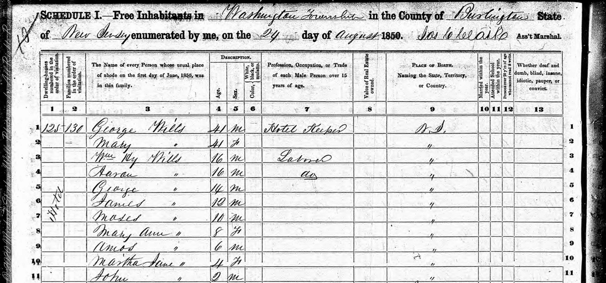
After this post was originally published I had a breakthrough, the identification of the Buttonwood Hill Tavern, Crowleytown as the hotel run by George and Mary Wills on the 1850 census.
Copyright 2021 Michael Stephen Wills All Rights Reserved

just around the corner
What is there, just beyond?
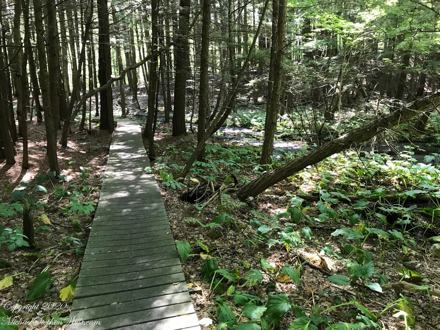
Click Me for another Malloryville post, “Formed By Water.”

Kettle and Kame Topography
Hard on the defunct gravel pit of the northwest side of the preserve is the deposit of glacial rocks washed to some extent by melting ice the former owners of the pit were turning over for profit with the averted result of destroying the water sources for the ecosystems of the future preserve.
The deposit is called a kame. Kames are the obverse of kettles, formed with an enormous remnant of glacial ice melts in place leaving a substantial depression. A kame is formed when earth gathers in a depression formed by meltwater running over a glacial surface. When the glacier melts (in this area the ice wash a mile high), the washed earth is left as a steeply sided pile we experience as a hill.
Water flowing beneath glaciers forms the long, ridged hills, eskers, we explored in yesterday’s post.
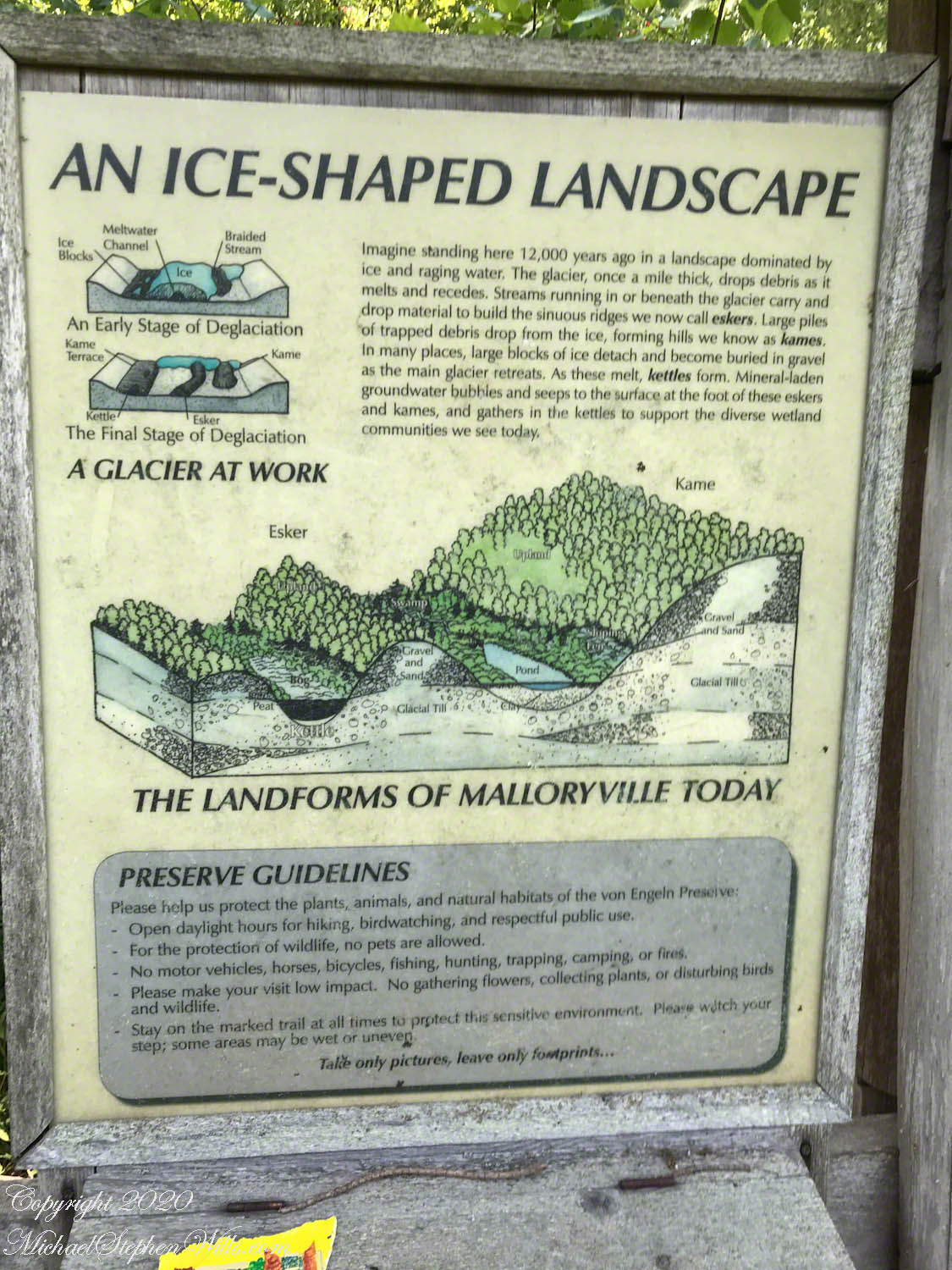
The forested land of this video the kame, upper left, shown in the header, an IPhone7 photograph of GoogleEarth. Also marked is a path for the primary esker, the bog formed by a kettle and another kettle that is now a pond. Click me to view a pdf file saved from GoogleEarth. It provides a clearer view of the header image.
Click me for better experience viewing the following video. To do this from WordPress Reader, you need to first click the title of this post to open a new page. Note the replay icon (an arrow circling counter-clockwise.
Click Me for the first post of this series.
Thank You for visiting. Here is a recapitulation of Malloryville Preserve.

A Look at an Esker
Well formed, sinuous, graded on both sides, eskers can be mistaken for man-made earthen structures, such as railroad embankments. Here is an example, nine-tenths (0.9) of a mile long substantial enough to direct the flow of Fall Creek. On entering the Malloryville esker bed the stream makes a right angle turn.
Here we are at the foot of the primary esker of Malloryville Preserve (it is marked as such on the information placard of this series first post). The slope to the right is the esker. A swamp lies to the right.
This video provides a better feeling for this esker.
Click me for better experience viewing the following video. To do this from WordPress Reader, you need to first click the title of this post to open a new page. Note the replay icon (an arrow circling counter-clockwise.
Click Me for the first post of this series.