Weathered Lava

Spheroidal weathering of Basalt

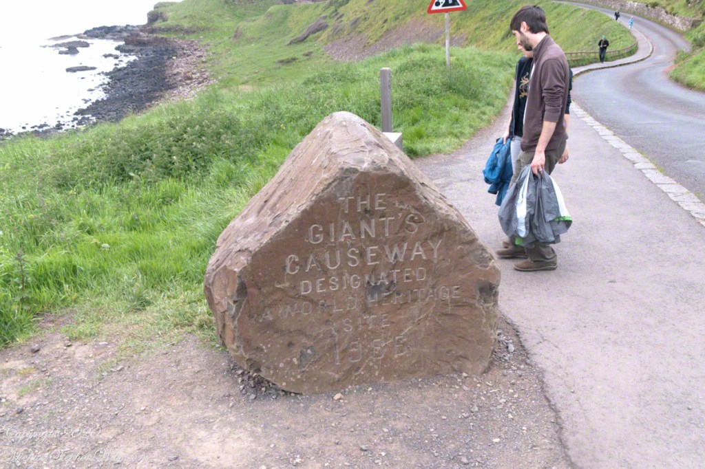
In preparation for our Ireland tour I woke before work to research each location, filling a leather bound notebook with facts and observations. Faced with the Giant’s Causeway I was woefully unprepared to comprehend the sights.

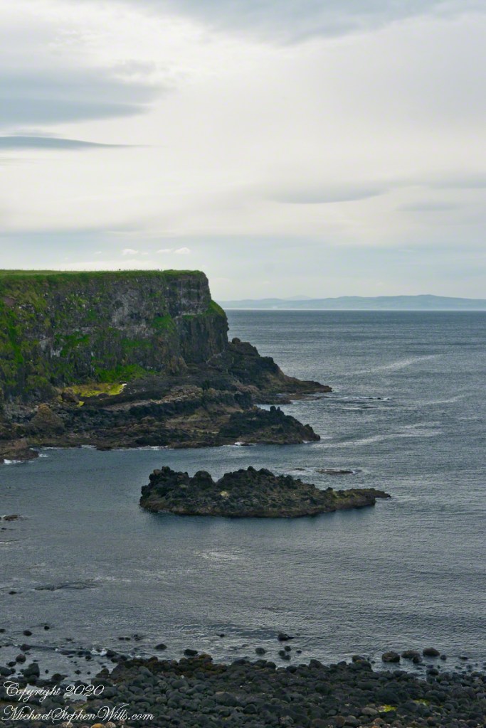
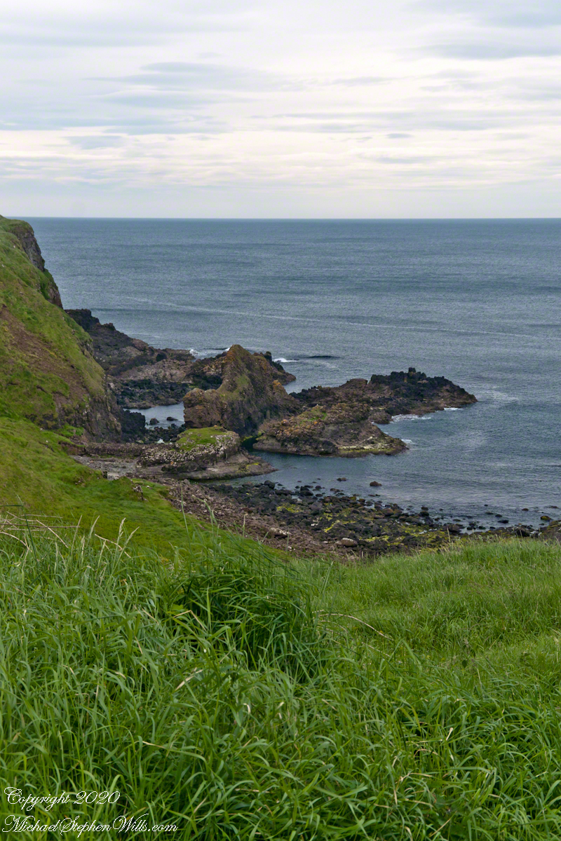
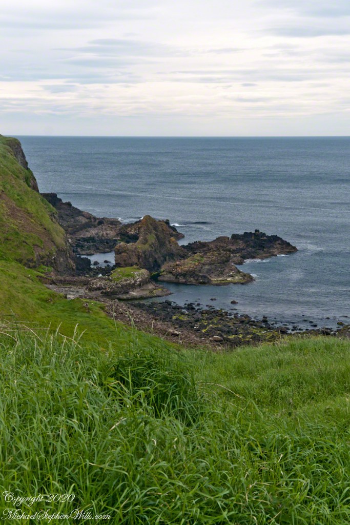
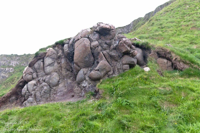
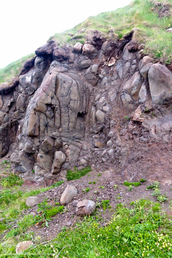
Walking down the Causeway path, the cliffs rise on the right, at the foot are these strange deposits. The Causeway is part of an enormous lava plateau formed during eruptions 50-60 million years ago. This lava was at bottom, eventually exposed to weather. As eons passed, the basalt reacted chemically with rainwater, the outer rock flaking off like layers of an onion to reveal these strange rounded forms.

Click photograph for a larger view. To do this from WordPress Reader, you need to first click the title of this post to open a new page.

Being here is like finding the abandoned workshop of a giant. The place lives up to the name.

Copyright 2020 All Rights Reserved Michael Stephen Wills

Volcanic Dike

A Bactrian Camel (?)

The entire northern Antrim coast is the remnant of an lava flow hundreds of feet deep, the depth corresponds to cliff height today. It made a great location for a defensive fort, or dun, featured in an earlier post. I say today because on a time scale of 50 million years the late Bronze age, 3000 years ago, was yesterday.

Here is another view from the Giant’s Causeway walk, wonders presented at every step. This lava dike, now surrounded by water, formed when flowing lava entered a crack though a layer of basalt from an earlier eruption. The lava cooled, over eons the surrounding material eroded, leaving a wall of rock. This formation has an irregular surface that resembles a two humped camel from some angles.

Click photograph for a larger view. To do this from WordPress Reader, you need to first click the title of this post to open a new page.

Copyright 2020 All Rights Reserved Michael Stephen Wills

Labrador

2,400 miles distant

Next stop Labrador, Canada, North America in this view from the Giant’s Causeway Walk.

Click photograph for a larger view. To do this from WordPress Reader, you need to first click the title of this post to open a new page.

The attraction has miles of footpaths, every inch with stunning views such as this.

Copyright 2020 All Rights Reserved Michael Stephen Wills

Broken

Enormous and Personal Scale

Volcanism formed much Ireland landscape and can be credited with a huge tourist attraction near Bushmills, Northern Ireland, UK (Click me for another post of volcanic Irish landscape). The opening of the mid-Atlantic rift and movement of continents dwarfs the origin story of a roadway built by giants to connect Ireland to Scotland.

Click photograph for a larger view. To do this from WordPress Reader, you need to first click the title of this post to open a new page.

On a prosaic scale, the granite curbs stones proved my undoing. On the walk out of the Causeway, in the falling light of dusk composing a shot, eye to the viewfinder, I fell off the curb. The camera fell, breaking the mount on both the flash and camera. To this day, I need to hold the flash in wireless mode when using the Sony.

Copyright 2020 All Rights Reserved Michael Stephen Wills

Dunseverick Castle Ruin, roadside info

Pride of History on display

On Causeway Road there is a turnoff an information placard for Dunseverick Castle near a cottage. This is the left side of the placard with the historical context. The right side is natural history of the area.

Click photograph for a larger view. To do this from WordPress Reader, you need to first click the title of this post to open a new page.

Click me for the first post of this series.

Reference: Wikipedia “Dunseverick Castle.”

Copyright 2020 All Rights Reserved Michael Stephen Wills

Dunseverick Castle Ruin, closer

Recollections of Saint Patrick

Slight pangs of regret recalled in my first Dunseverick Castle post are recalled this morning on remembering the long Slige Midluachra (aka “High King’s Road”) of which Dunseverick Castle was the terminus, beginning from the Hill of Tara. Walk the High King’s Road, “why not?.”

Here we can see the two partial wall, remains of a gate house, destroyed in the 17th century. I can imagine making the climb up the foot path, examine the earthworks from before the Viking invasions, middle of the first millennium A.D. Recall a visit by Saint Patrick, trodding the path from his Easter fire on the Hill of Slane.

Click photograph for a larger view. To do this from WordPress Reader, you need to first click the title of this post to open a new page.

Explore my photography on Shutterstock for use with your blogs

Reference: Wikipedia “Dunseverick Castle.”

Copyright 2020 All Rights Reserved Michael Stephen Wills

Torr Head Photos

My latest photos accepted into Getty IStock

Click me to view the latest batch of photos accepted into Getty….these are from Torr Head..

Copyright 2020 All Rights Reserved Michael Stephen Wills

Cushendun Published

Photography accepted this week by Getty

Click me to visit Getty, my recently accepted Cushendun photography.

Copyright 2020 All Rights Reserved Michael Stephen Wills

Cushendun, more information and good bye, for now

…upon the sea-sand….

The National Trust manages the heritage lands on this coast and throughout Great Britain. Looked up Cushendun on their web site and there is some useful information there. If you are touring Great Britain, a National Trust membership is a worthwhile investment. Sadly, there is a notice on the site about Coronavirus restrictions….and closures.

I learned Red Squirrels, an endangered species on the island, have an enclave at Cushendun. We didn’t visit the forested location where they live. We keep up with their antics looking out the window here at home where, thanks to our hemlocks, spruce and walnut trees the species is thriving.

Click photograph for a larger view. To do this from WordPress Reader, you need to first click the title of this post to open a new page.

Here are several more of the information placards near the harbor explaining some local natural and tourism information.

Our travels this day, on the chart, were from Cushendun to Giant’s Causeway.

The last view of Cushendun town as we mounted the steep hill, Torr Road. The dashboard and windshield of out tiny car in the foreground.

Copyright 2020 All Rights Reserved Michael Stephen Wills

Cushendun, a house

…upon the sea-sand….

Here is another information placard found near Cushendun harbor, with a lovely poem.

Click photograph for a larger view. To do this from WordPress Reader, you need to first click the title of this post to open a new page.

Here are several of the information placards near the harbor explaining some local history.

Here is a house on the Cushendun harbor road, windows opening to the Irish Sea. Doesn’t it go well with the poem?

Copyright 2020 All Rights Reserved Michael Stephen Wills