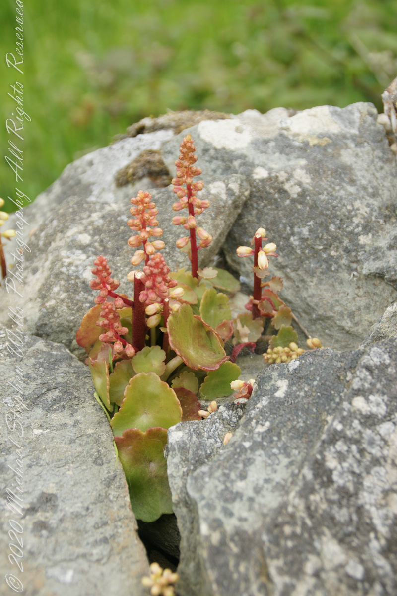
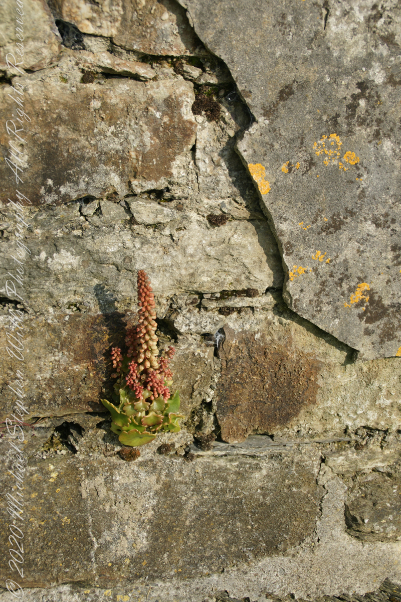
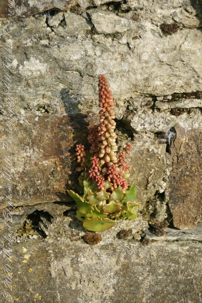
This unidentified spring of racemes, fleshy leaves and stalks, grew from the rock wall of the entry path to Drombeg Stone Circle. Here the climate is strongly influenced by the Celtic Sea, milder winters allow exotic plants to flourish.
My appraisal is this is in the Crassulaceae family, possibly the genus Kalanchoe or, more probably Umbilicus, from the fleshy, round, succulent leaves and form of the flowers. Species of Umbilicus are native to Western Europe and known to favor rock walls.
Click any pic for a larger view, in a new tab, or a slide show. When using WordPress Reader, you need to open the post first.
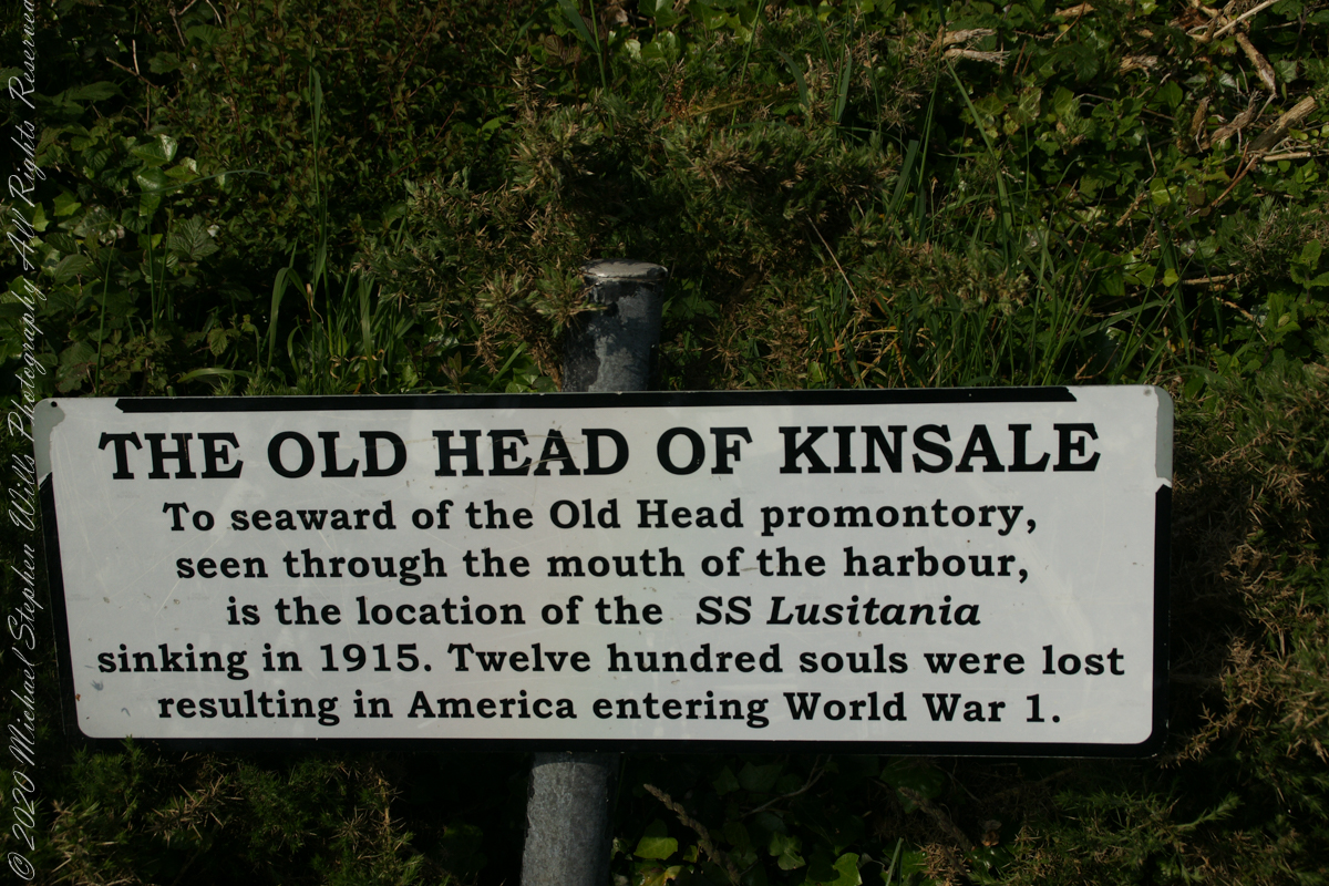
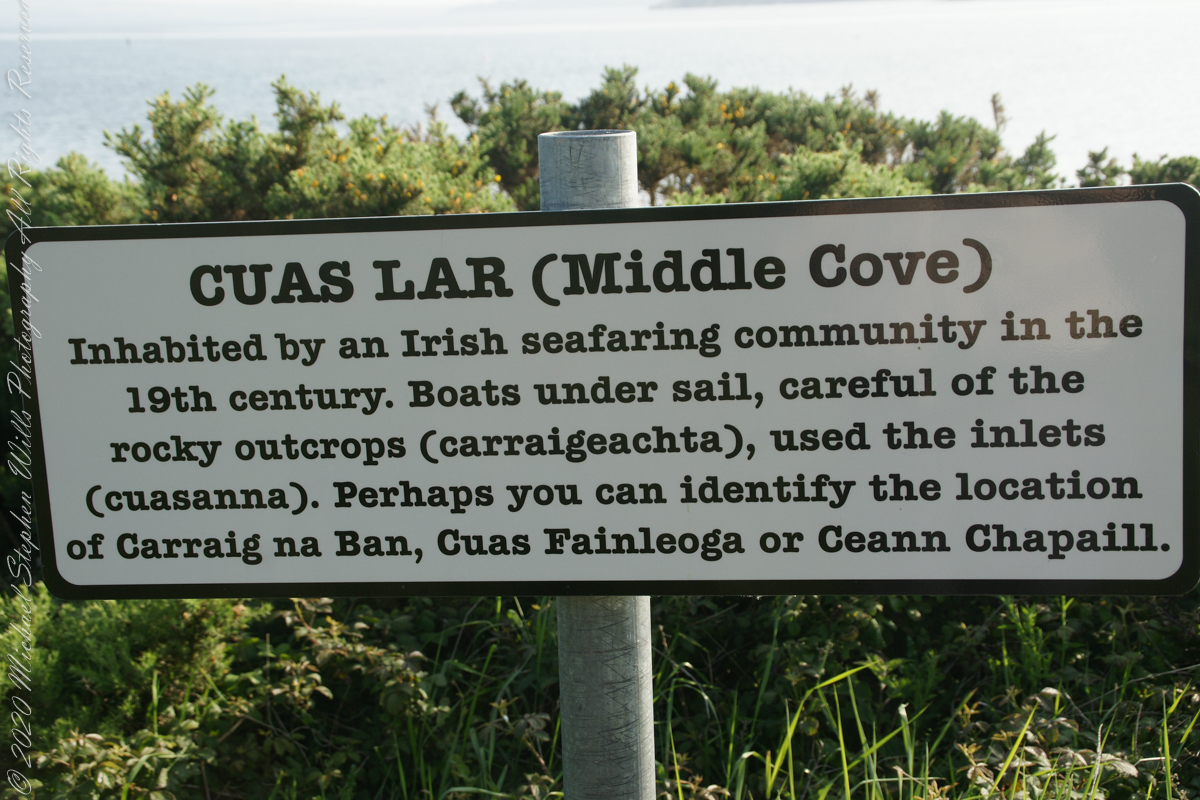
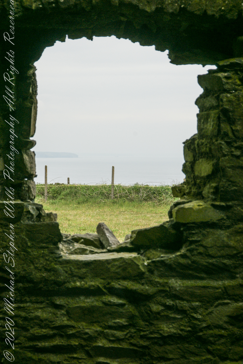
The view referred to by placard is to the right. The Old Head of Kinsale is the distant landform, looking right to left, is the portion that drops off to the ocean.
Click any pic for a larger view, in a new tab, or a slide show. When using WordPress Reader, you need to open the post first.
Here is a Google Maps screen capture showing the relationship of our position (the unnamed red drop-pin) on the right, and the Old Head of Kinsale landform, seen below the lable “Ballylane.”
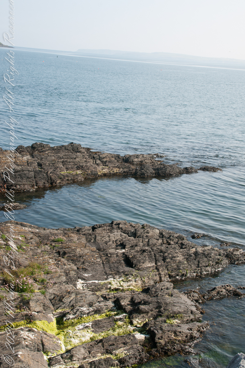
Here are the views looking toward the Celtic Sea, the Old Head of Kinsale and the cliffs at our feet.
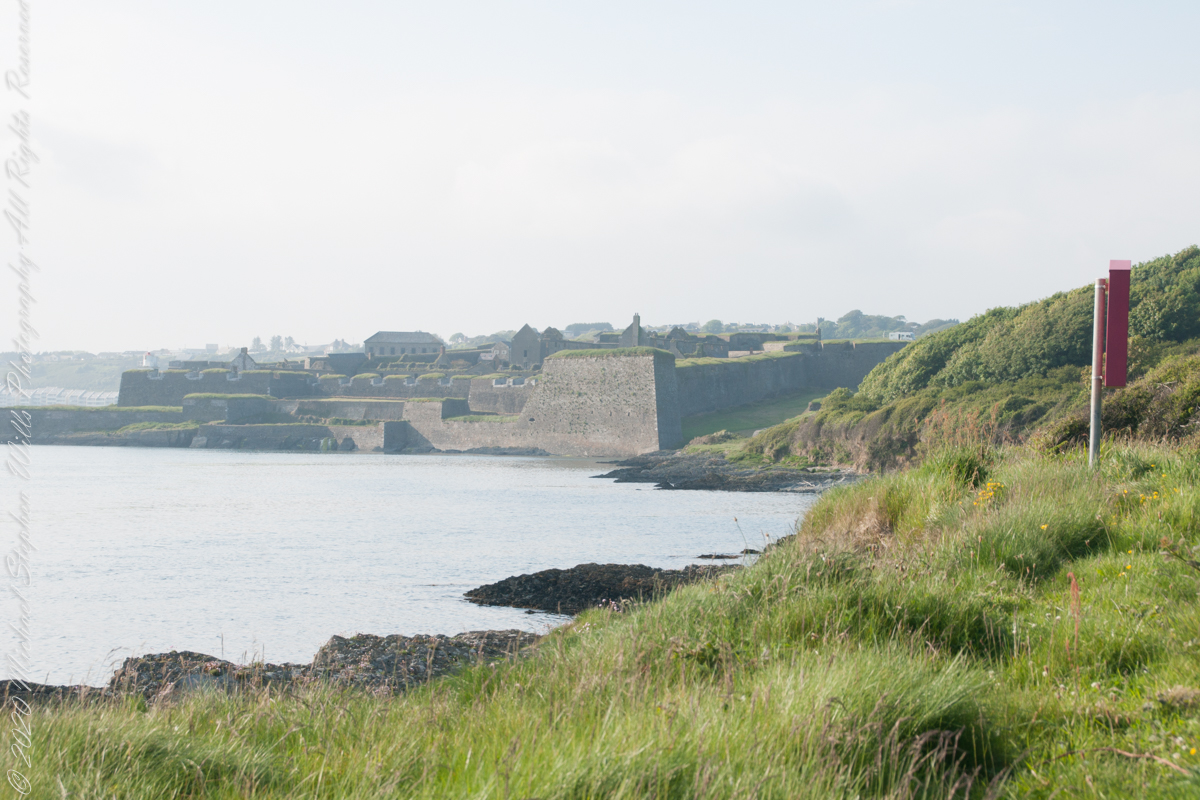
Looking back toward Charles Fort
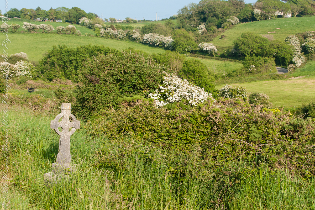
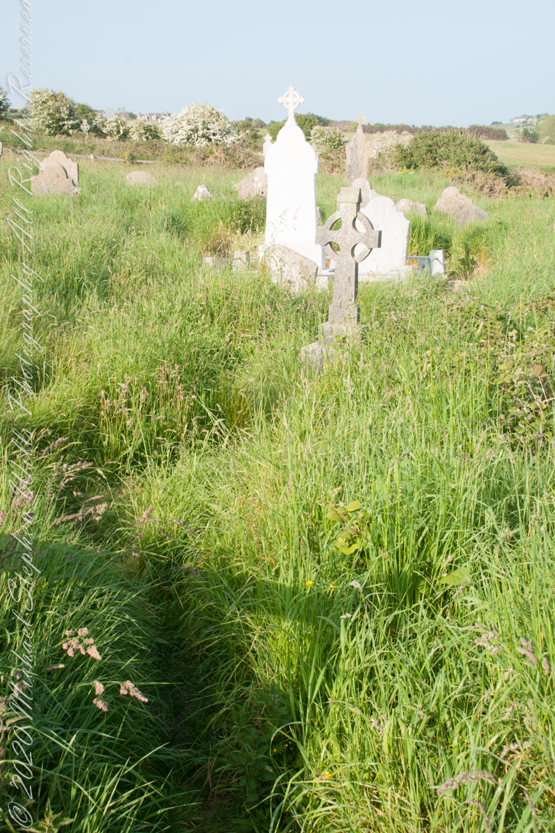
This cemetery is unmarked on the maps I use.
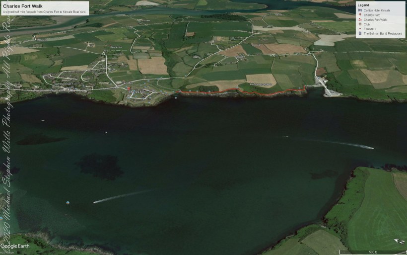
Here is a Google Earth view of our walk, the red line. The view is looking east from above the former “de Courcy family parkland.”
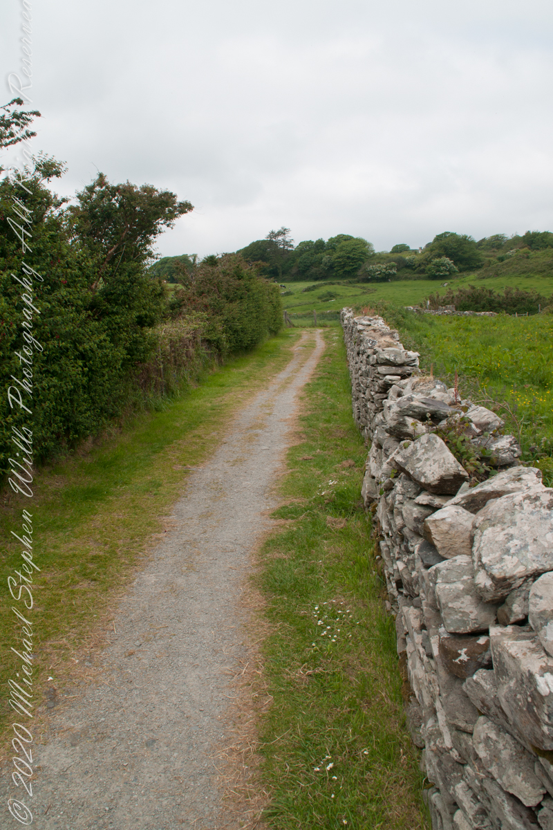
A half mile footpath, marked in red, leads from Charles fort along the shoreline cliffs, surmounted by working farmland.
Copyright 2021 Michael Stephen Wills All Rights Reserved
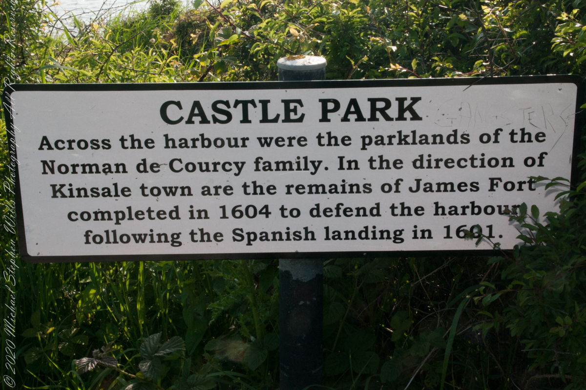
As Pam and I past the scenes of bucolic reverie this sign drew us back to the past. The reference to de Courcy is as a family of invading Normans. John de Courcy, without the King’s permission, launched an 1176 AD invasion of northeastern Ireland, what is now County Down, as an ultimately failed land grab. The history is murky, though apparently John de Courcy’s son Miles acquired the land referred to in the placard through the English King Henry II, awarded to Miles’ thieving, murderous Norman father-in-law Milo de Cogan in the 13th Century. Much later, the old (James) and new (Charles) Forts were constructed to defend Kinsale harbor.
Click any pic for a larger view, in a new tab, or a slide show. When using WordPress Reader, you need to open the post first.
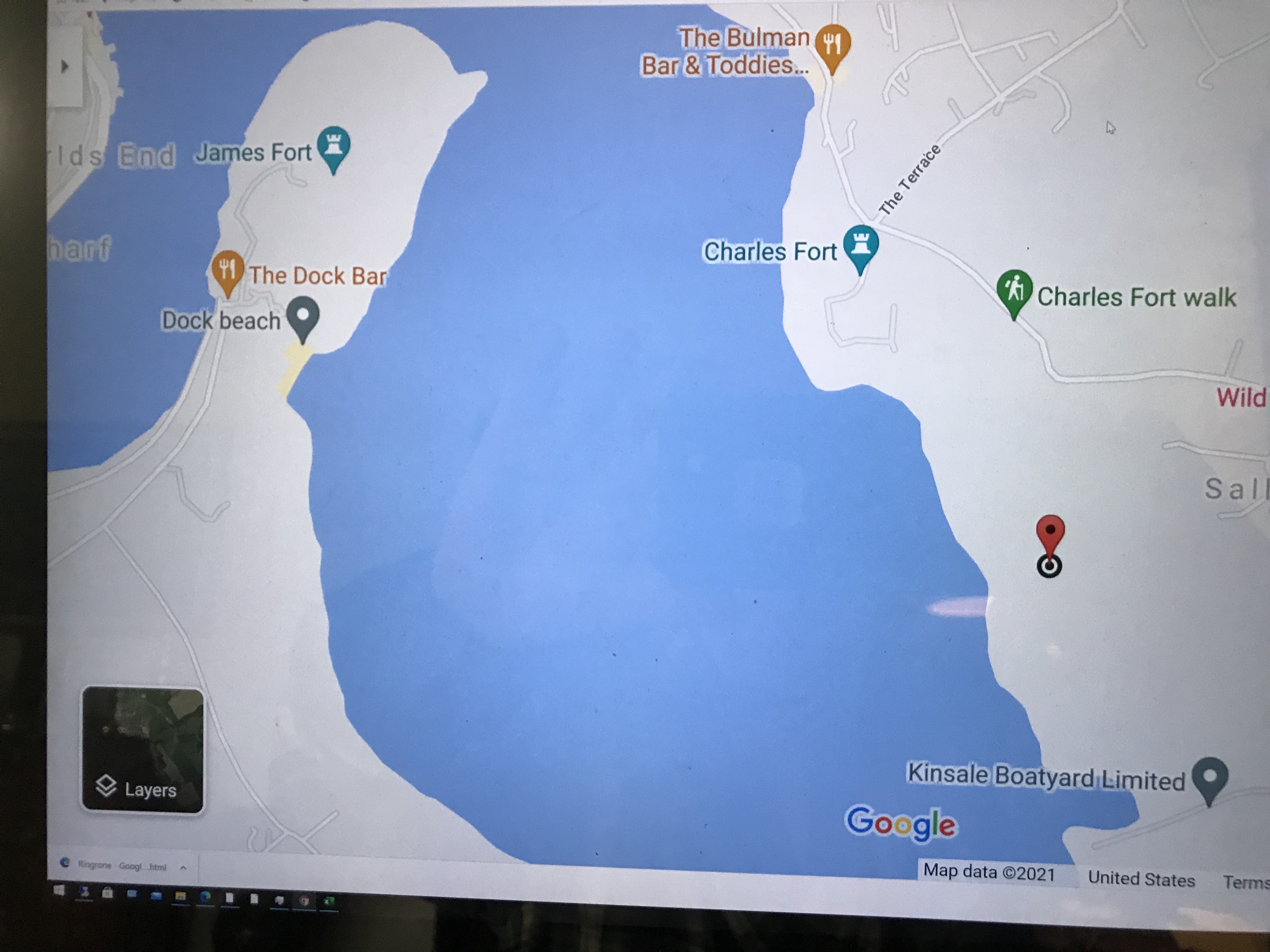
Here is a Google Maps screen capture showing the relationship of our position (the unnamed red drop-pin) on the right, Charles and James Forts and the de Courcy family parklands, the large blank area below the pin named “Dock beach.”
Here are the views looking toward the Celtic Sea, the Old Head of Kinsale and the cliffs at our feet.
Looking toward the Old Head of Kinsale in the far distance
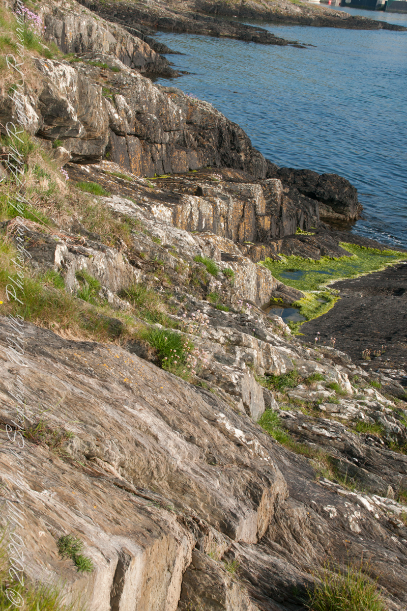
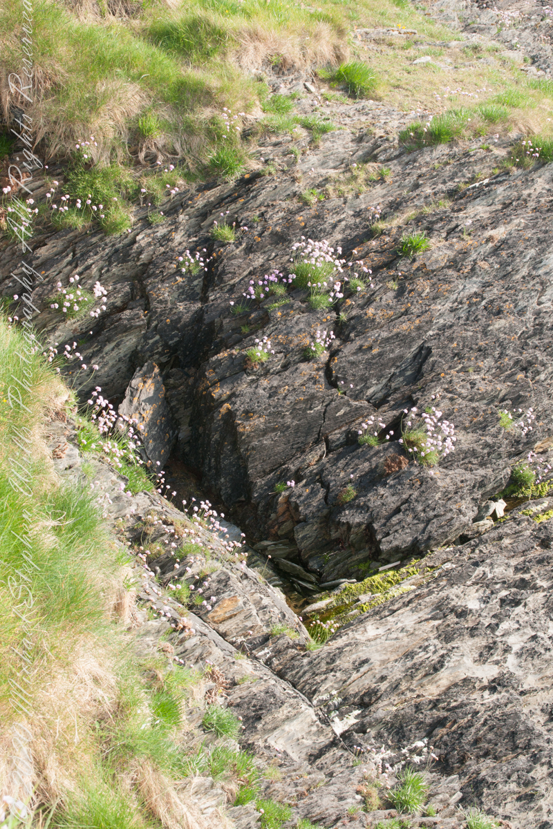
Rocky Cliffs at our feet
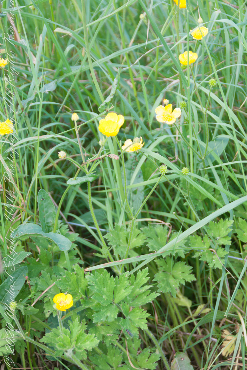
Cliff and Sea Pink
More Sea Pink decorating the rocks.
Here is a Google Earth view of our walk, the red line. The view is looking east from above the former “de Courcy family parkland.”
A half mile footpath, marked in red, leads from Charles fort along the shoreline cliffs, surmounted by working farmland.
Copyright 2021 Michael Stephen Wills All Rights Reserved
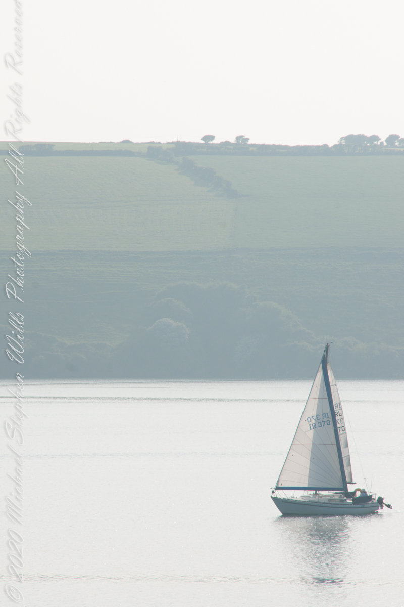
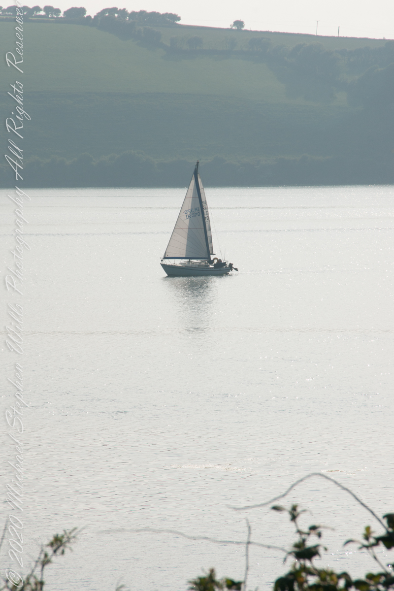
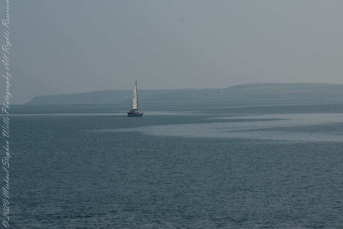
As Pam and I continued down the half mile “Sallyport” footpath, marked in red on the Google Earth view provided at the end of this post, we enjoyed the view across the Celtic Sea toward the distant Old Head of Kinsale and this sailboat headed to port.
Click any pic for a larger view, in a new tab, or a slide show. When using WordPress Reader, you need to open the post first.
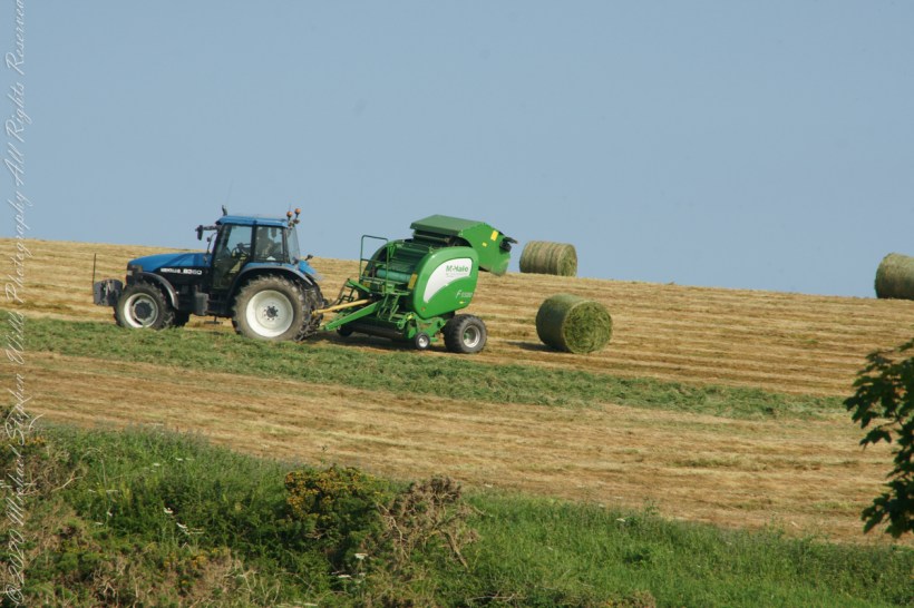
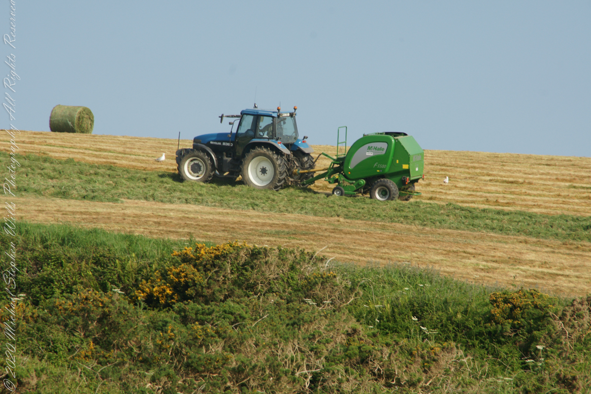
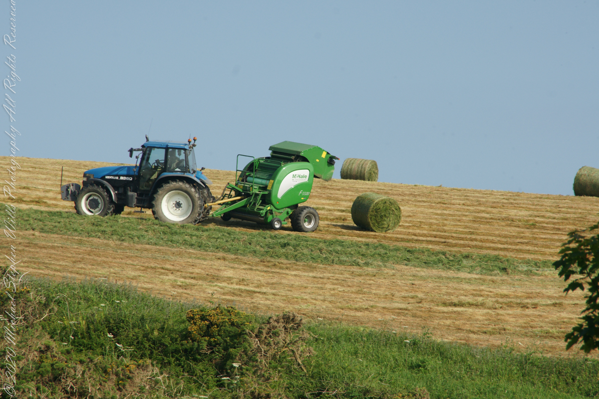
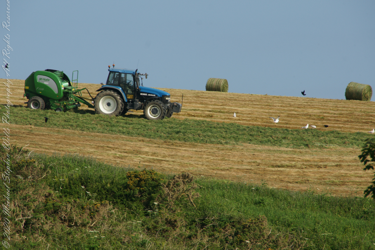
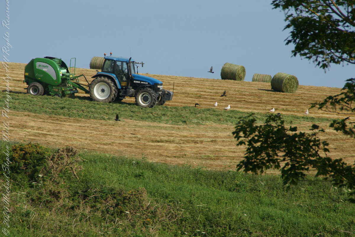
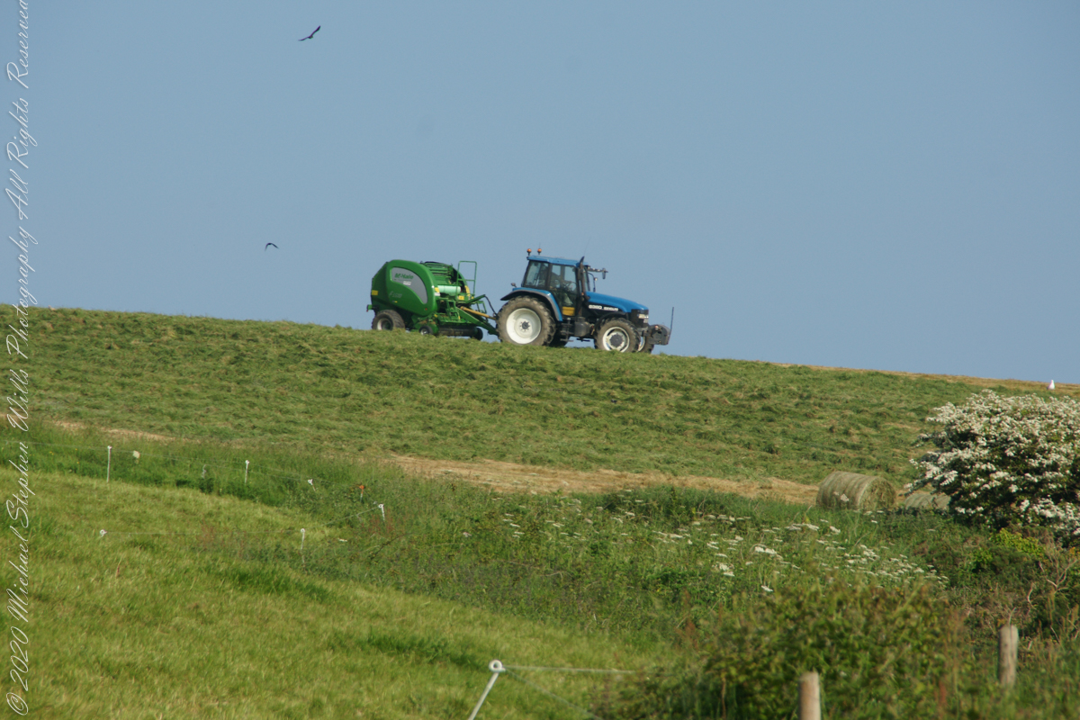
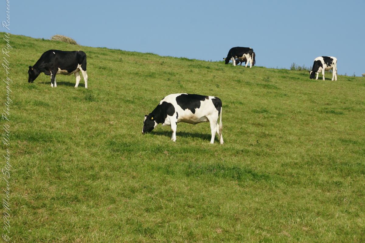
Landward, we enjoyed watching the progress of a farmer rolling hay bales while cows munched fresh green grass.
A half mile footpath, marked in red, leads from Charles fort along the shoreline cliffs, surmounted by working farmland.
Copyright 2021 Michael Stephen Wills All Rights Reserved
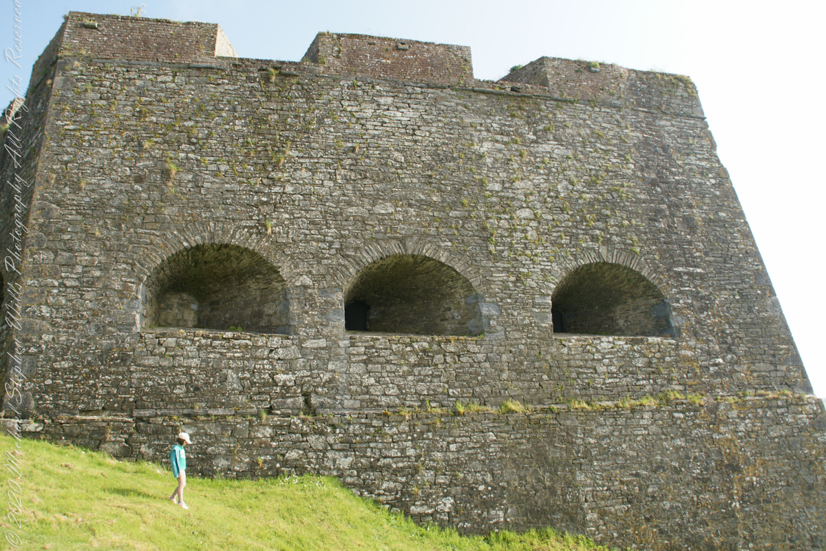
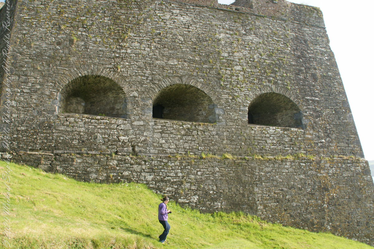
A “dun” is a larger fortification, few and far between on the island of Ireland. We saw one on the Arran Islands, from the Iron Age, Dun Angus, Charles Fort, or Dún Chathail in Irish, is from historical ages.
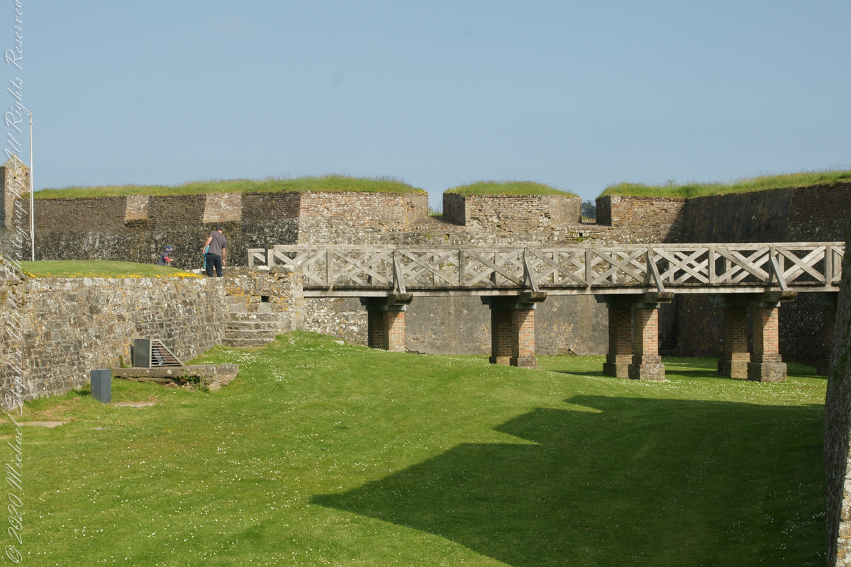
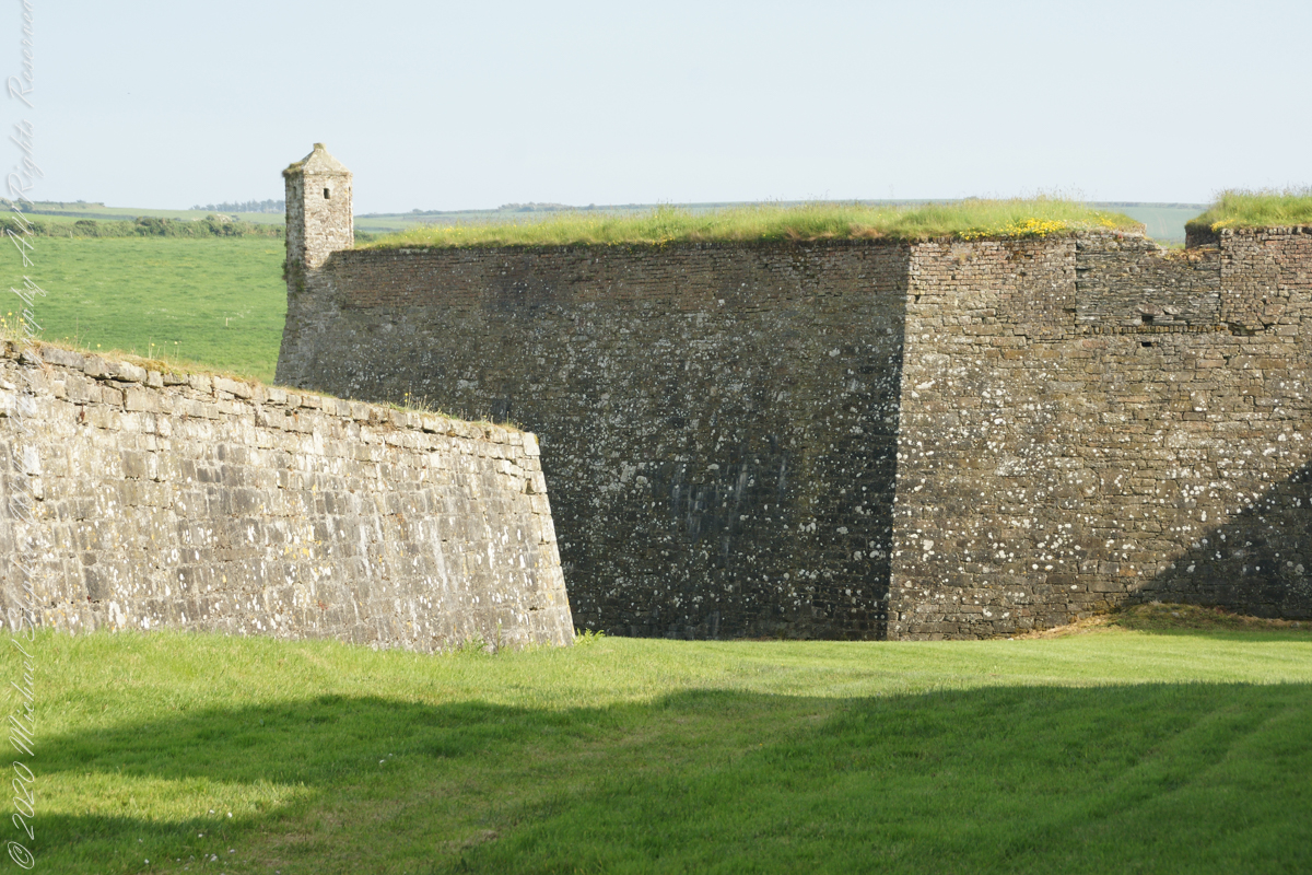
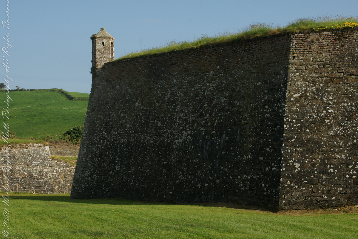
A cannot tell from my slide show, but the walls are star shaped with many salients, giving more positions to defend the walls.
Steps to bridge across defensive ditch
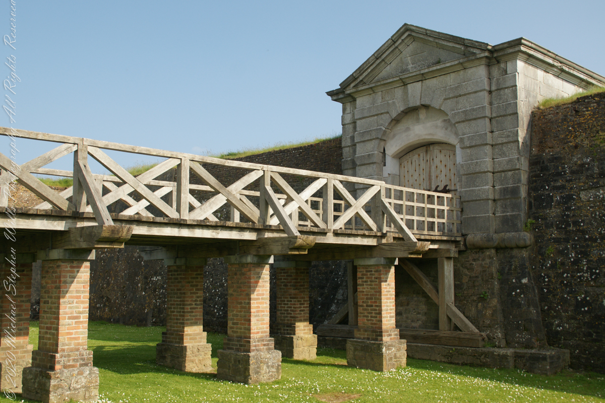
Bridge and gate to fort enclosure, closed this late in day
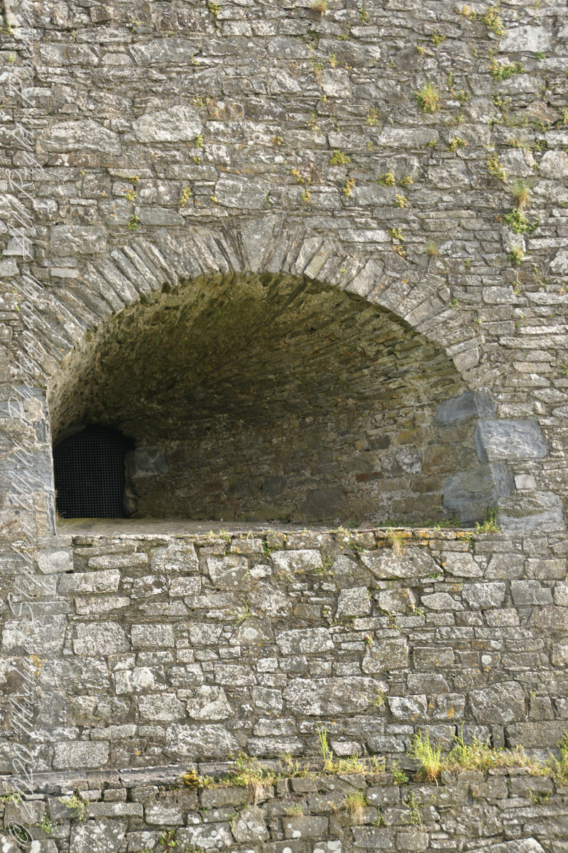
Embrasures
An opening in the fort walls which cannons can be fired. They were often flared outward to enlarge the field of fire.
Close-up of gun port
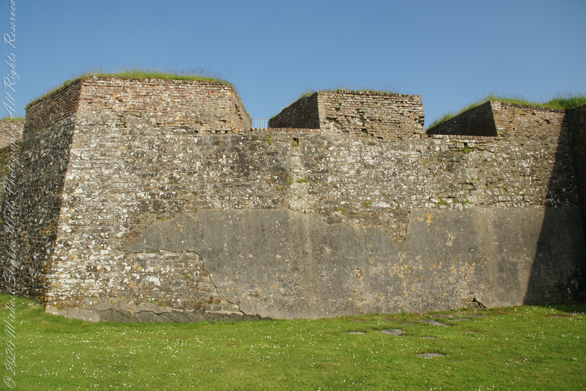
Crenellations
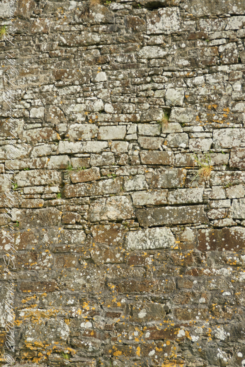
Tightly joined masonry
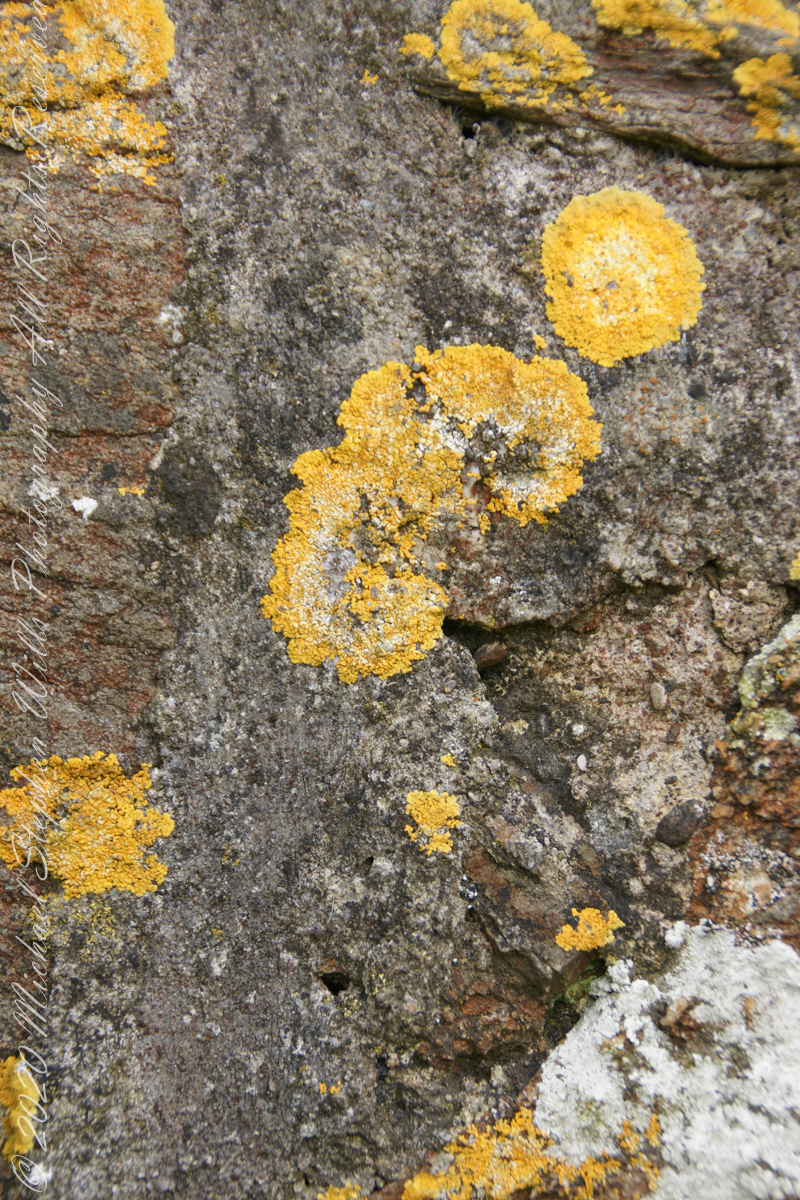
lichen
life has its way
seems to be a succulent
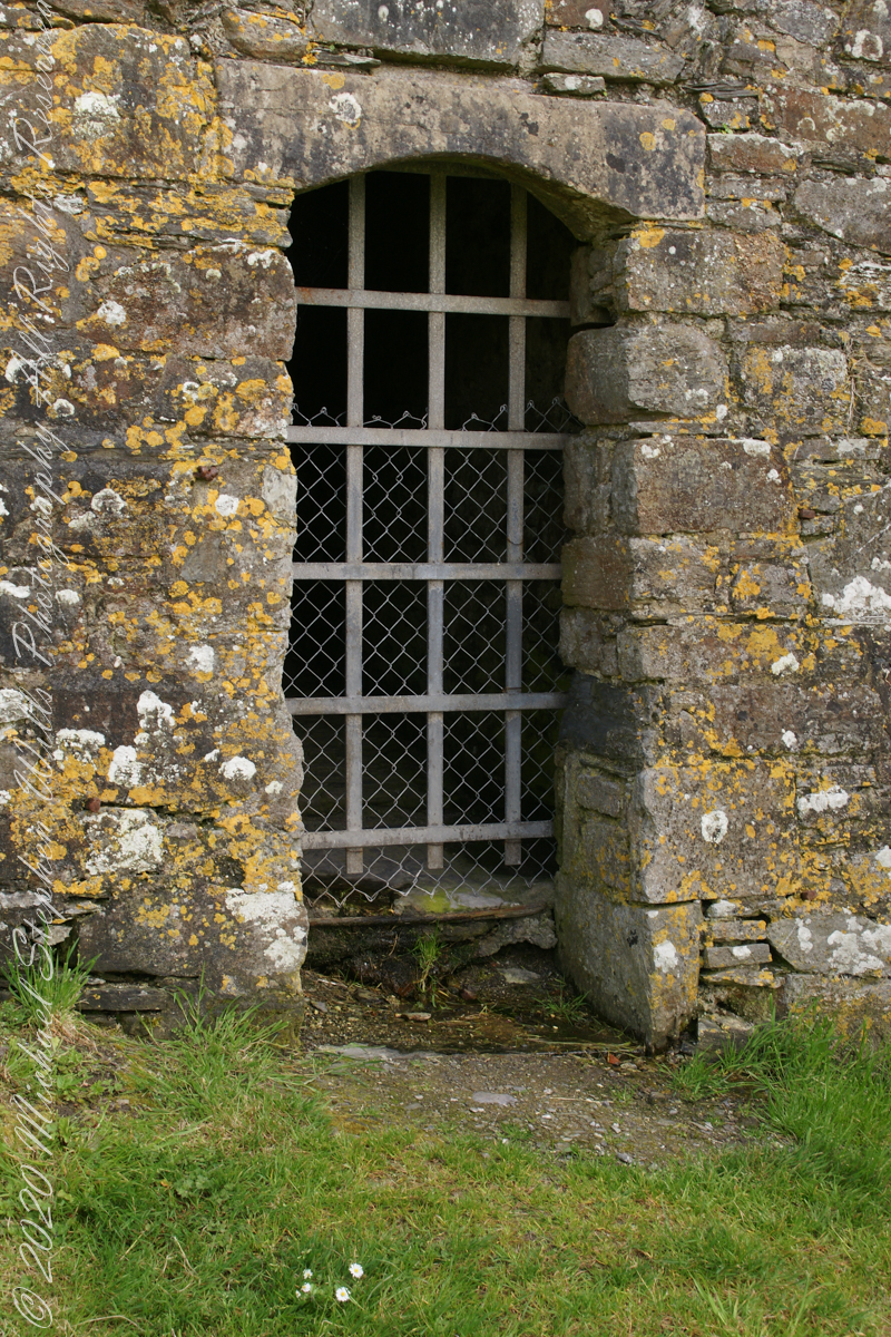
a doorway here seems a bad idea, but what do I know?
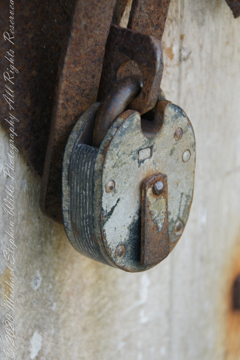
A pulley at first glance, look again and it is a lock
beneath the walls
Down to the Sallyport and the next post
References
“Charles Fort” – wikipedia
Copyright 2021 All Rights Reserved Michael Stephen Wills
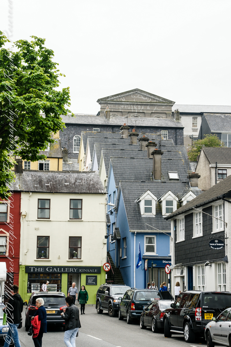
Kinsale, a historic seaport in County Cork, showcases unique architecture and geography, with its streets and houses built on steep inclines near the river Bandon.
The first of a series of idiosyncratic posts from a 2014 walking tour of Kinsale.
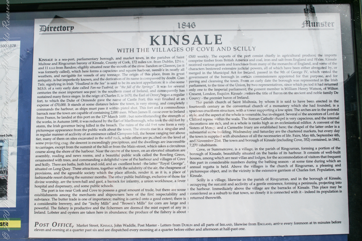
Text from an poster behind glass accessible to all and sundry. Directory 1846 Munster, Kinsale with the villages of Cove and Scilly. Kinsale is a seaport, parliamentary borough and market town in the parishes of Saint Multose and Ringcurran barony of Kinsale, County of Cork, 172 miles s.w. from Dublin, 121/2 s and 11 e.s.e. from Bandon; eligibly situated near the mouth of the river Bandon or Glasson, (as it was formerly called), which here forms a capacious and square harbor, accessible in nearly all weathers, and navigable for vessels of any tonnage. the origin of this place, from its great antiquity, is but imperfectly known, and the derivation of its name is compassed by doubt. Cean Taile (Cionn tSáile), signifying in Irish “Headland in the Sea” is said to be its ancient appellation. (see more in the photograph).
An informative poster behind glass accessible to all and sundry. Text: Directory 1846 Munster, Kinsale with the villiages of Cove and Scilly. Kindale is a sea-0ort, parlimentary borough and market town i the parishes of Saint Multose and Ringcurran barony of Kinsale, County of Cork, 172 miles s.w. from Dublin, 121/2 s and 11 e.s.e. from Bandon; elibibly situated near the mouth of the river Bandon or Glasson, (as it was formerly called), which here forms a capacious and square harbour, accessible in nearly all weathers, and navigable for vessels of any tonnage. the originn of this place, from its great antiquity, is but imperfectly known, and the derivaltion of its name is compassed by doubt. Cean Taile, signifying in Irish “Headland in the Sea” is said to be its anceient appellation. (see more in the photograph)./
Here we are on Emmet Place. There is a row of houses built along a steep alley named “The Stoney Steps.” At top is the aptly named Higher O’Connell Street.
The Gallery Kinsale
13 Main Street
Kinsale
West Cork
Ireland. From an informative poster…The streets rise in a singular and in regular manner of acclivity of an eminence called Compass Hill, the house ranging tier above tier, many of them on sites excavated in the solid rock, while other are perched on the level of some projecting crag: the descent is exceedingly precipitous, and the dwelling are inaccessible to carriages, except from the summit of the hill or from Main street, which takes a circuitous course along the shore of the harbor.
From the informative poster…The streets rise in a singular and in regular manner of acclivity of an eminence called Compass Hill, the house ranging tier above tier, many of them on sites excavated in the solid rock, while other are perched on the level of some projecting crag: the descent is exceedingly precipitous, and the dwelling are inaccessible to carriages, except from the summit of the hill or from Main street, which takes a circuitous course along the shore of the harbor.
Yesterday, I simultaneously published nine photographs on my ImageKind Ireland Gallery and Getty IStock (click the links to visit): nine views taken from the slopes of Slieve Gullion.
Sunday, May 25, 2014 was a happy day for Pam and I. It was the first full day of an eighteen (18) we filled with Ireland, travelling in a loop of the island following the coast from, naming the counties where we spent time on the ground, Louth, Armagh, Dublin, Meath, Wicklow, Cork, Kerry, Claire, Mayo, Antrim, Down and back to Louth. The counties of Northern Ireland are in italics. Indeed, at this time the politics allowed us to travel freely between the Republic and the North. That day, our morning was spent in Louth attending mass, enjoying our first meeting with the family over a substantial mid-day meal (click the link for my Facebook album of the meeting). We split off that afternoon to visit the home of my cousin, Mary and her husband Joseph in County Armagh, just over the border. When Joseph offered to drive us over to Slieve Gullion it was totally new to us, we had no conception of the place or what to expect.
It was such a gift, we are grateful to Joseph for this experience. Only in 2018 when, at 64 years of age and retired”, was I able to research the place and spend time developing the photographs for publication. Two of the photographs illustrate this posting, to view the others in my online gallery, click either photograph.
Slieve is the Irish language word for “mountain.” Slieve Gullion is a lone eminence, one remnant of volcanic eruptions about 60 million years ago during the rifting of continents that produced the Atlantic Ocean. Around the mountain is the Ring of Gullion, a string of hills, 26 miles by 11 miles, surrounding the mountain and formed from the ancient collapse of a volcanic caldera. The technical name for it is a Ring Dyke and it was the first of its kind to be recognized and mapped, well before the nature of the formation was understood of be volcanic. The name Gullion is derived, in one formulation, from the name of the metalsmith, Culann. In Irish Myth, Culann’s home and workshop was on the slope of Slieve Gullion. A wealthy and respected personage, Culann invited Conchobhar mac_Neasa, king of Ulster to feast. During his approach to the mountain, passing through the surrounding plain, the king stopped to watch boys play hurling. Among them was the future hero of Ulster, the young Sétanta. Impressed with Sétanta athletic abilities, the king invited him to join in the feasting at Culann and the boy promised to follow after the game. Later, while climbing the mountain to fulfill his promise Sétanta was attacked by the guard dog of Culann. The myth says the dog was killed by Sétanta in self-defense. Never the less, in compensation to Culann, Sétanta committed to rearing a replacement and to act as guard dog in the meantime. In this way he became known as Cu Culann, “the dog of Culann.” Click for more about Cu Culann.
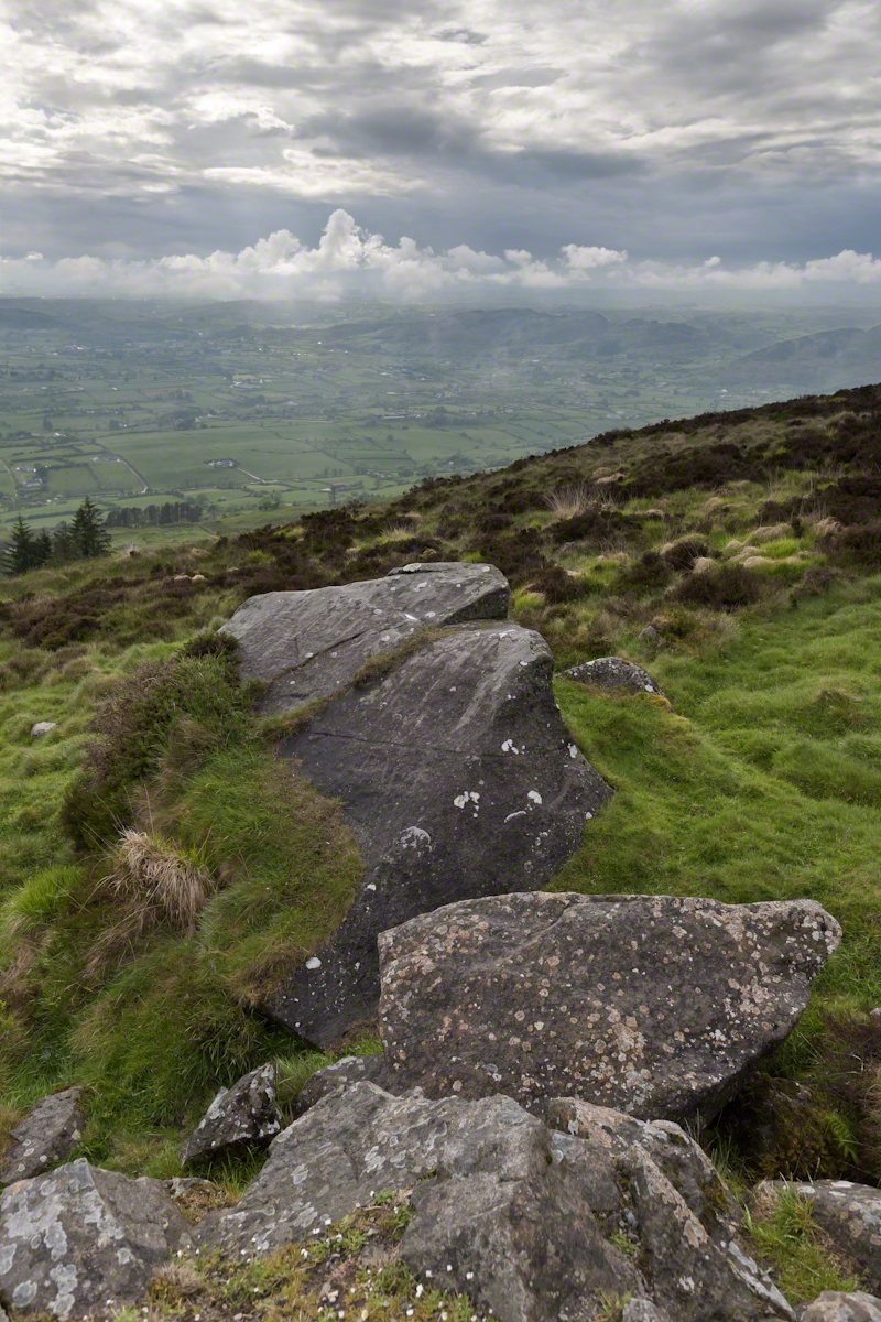
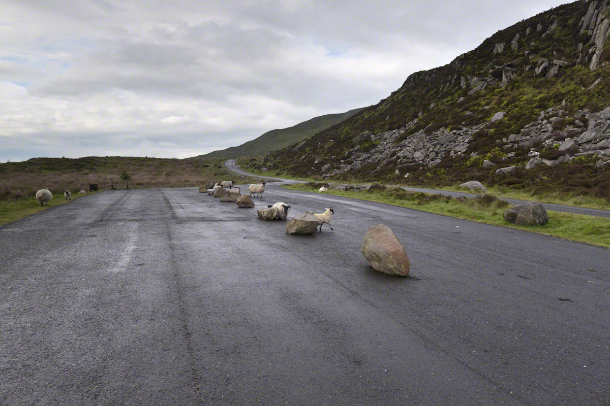
On the summit two cairns north and south of a small lake, tangible proofs of ancient peoples and beliefs. The north cairn is a more ancient passage grave, 90 feet wide, 16 feet high, the opening aligned with the setting sun on the winter solstice. The cairn north of the lake is less ancient containing two cist burials. For our visit Joseph drove us along the 8 mile drive. The following is an image of a viewing platform and the road. Just beyond, on the right, where the ridge meets the road, is the trail to the 1,880 foot summit of Slieve Gullion. Our arrival disturbed sheep resting on the asphalt. I’d have loved to spent a day climbing the summit, but it was not to be this trip.
The way is part of the Slieve Gullion Forest Park. Throughout are turnoffs to admire the view. It was during our frequent stops I pulled out the photography gear to grab the views. Here is one, looking southwest. For the other views, click either photograph to visit my Online Gallery of Ireland.
Copyright 2021 Michael Stephen Wills All Rights Reserved
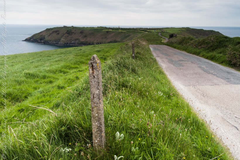
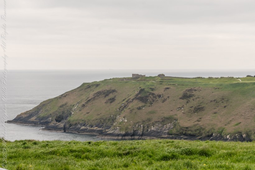
Our day of touring Kinsale and environs, the last day of May 2014, continues with our morning visit to the “Old Head of Kinsale.” Head is short for headland, a narrow strip of land projecting into the sea.
Road to the Old Head of Kinsale
Old Head of Kinsale
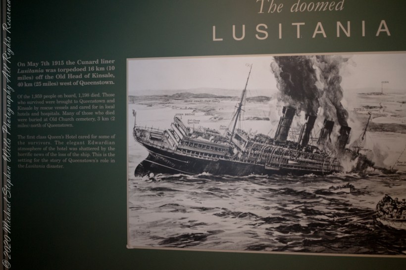
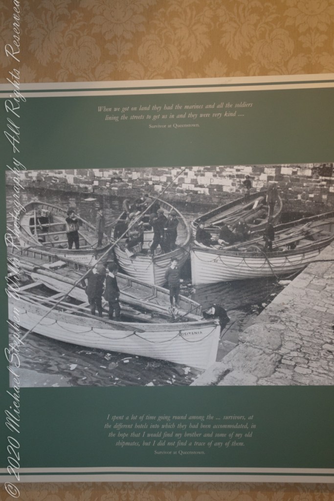
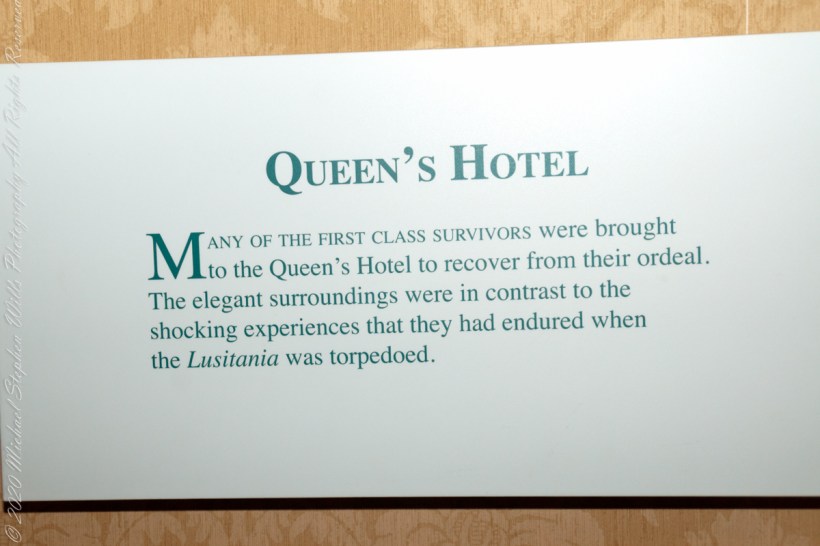
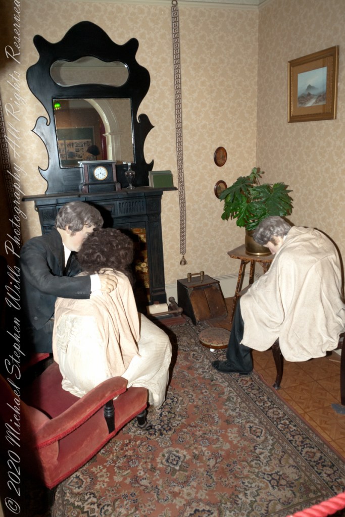
On May 7th, 1915 the Cunard liner Lusitania was torpedoed 16 km (10 miles) off the Old Head of Kinsale, 40 km (25 miles) west of Queenstown. Of the 1,959 people on board, 1,198 died. Those who survived were brought to Queenstown and Kinsale by rescue vessels and cared for in local hotels and hospitals. Many of those who died were buried at Old Church cemetery, 3 km (2 miles) north of Queenstown. The first class Queen’s Hotel cared for some of the survivors. The elegant Edwardian atmosphere of the hotel was shattered by the horrific news of the loss of the ship. This is the setting for the story of Queenstown’s role in the Lusitania disaster. –text from Cobh Heritage Center poster, see image below.
The Old Head is notable, in the contest of the Lusitania attack, for being the land closest to the incident. Cobh, then named “Queenstown”, was the focus of rescue operations. See text below, from a display of the Cobh Heritage Museum.
from Cobh Heritage Museum.
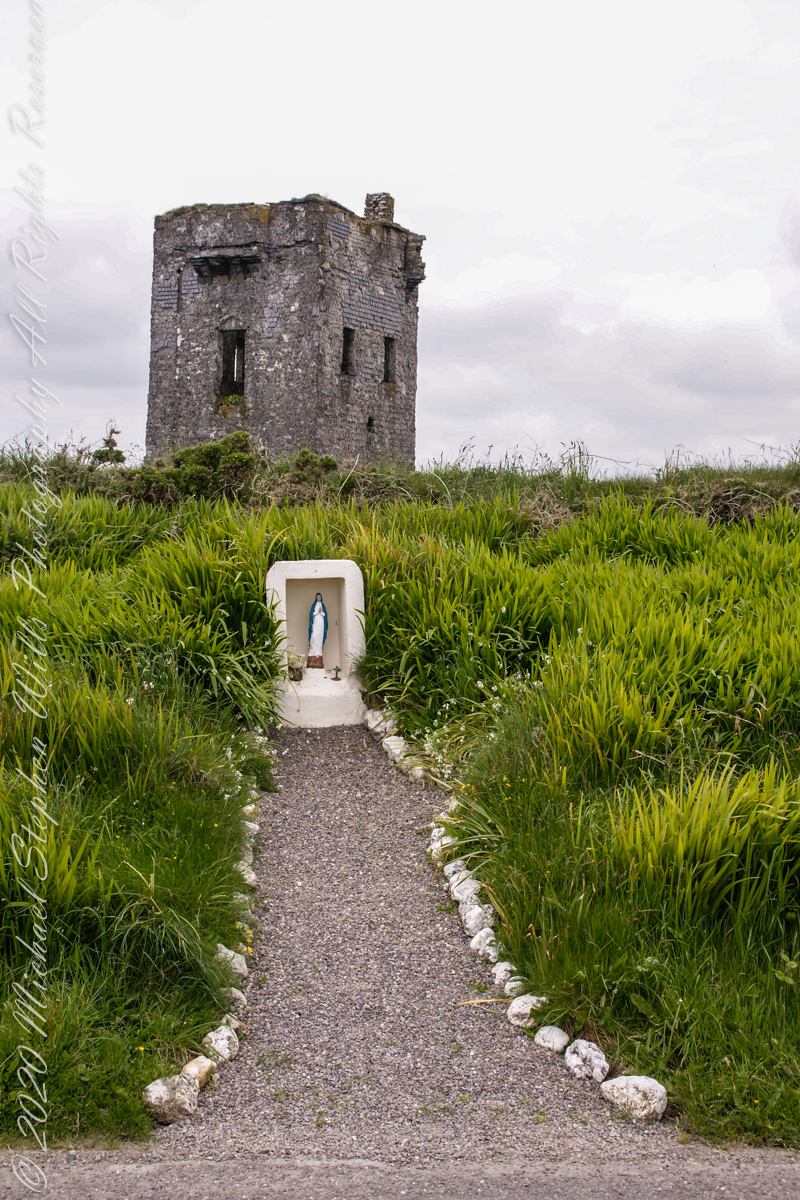
The Kinsale tower is just over nine meters high, with walls up to 80 cm thick. Records show a signal crew was in place in 1804 and the tower finished the following year, though severely affected by dampness. When Napoleon was defeated by Wellingtons forces at Waterloo, 1815. With the diminished threat these expensive installations were neglected. The 1899 Ordnance Survey map lists the site as being in ruins. During our 2014 visit the local community was renovating the tower and the work appears complete sometime before 2021.
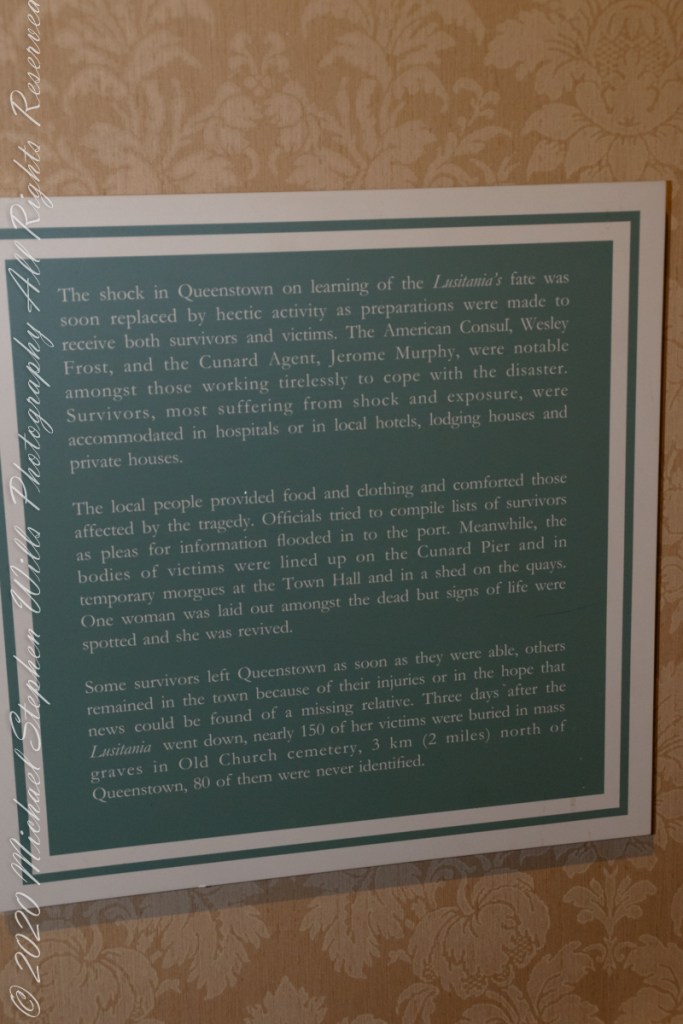
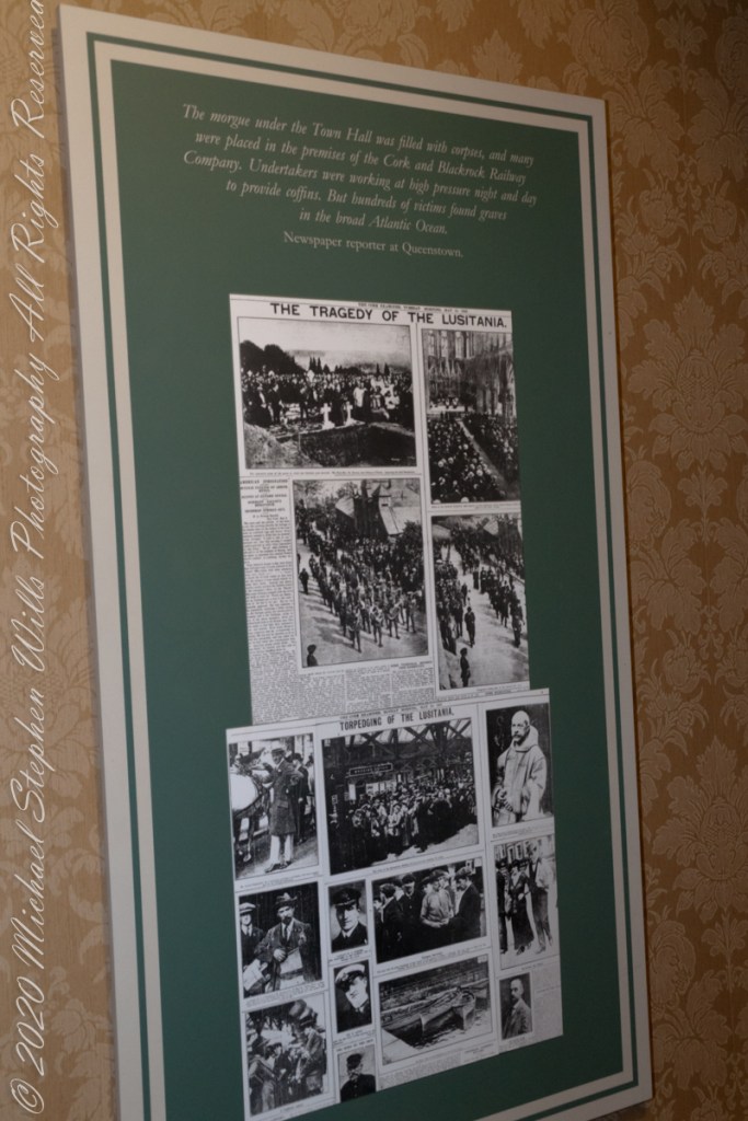
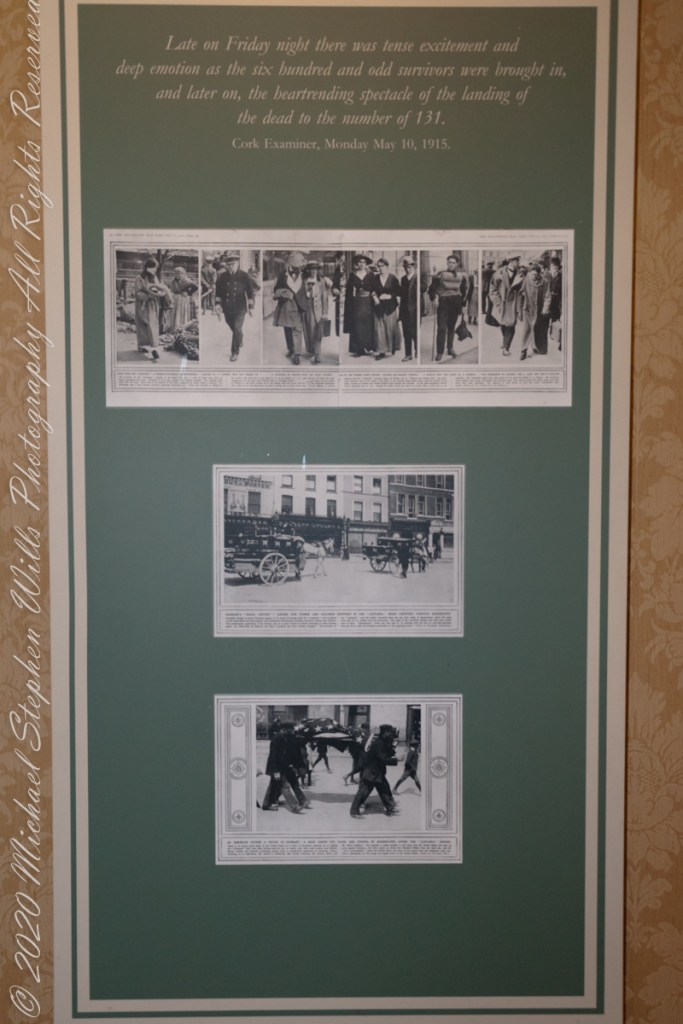
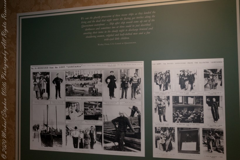
The morgue under the Town Hall was filled with corpses, and many were placed in the premises of the Cork and Blackstock Railway Company. Undertakers were working at high pressure night and day to provide coffins. But hundreds of victims found graves in the broad Atlantic Ocean. –Newspaper reporter at Queenstown. See images in the above gallery for more.
Cobh Heritage Center exhibit of survivor recovery, Queen’s Hotel
I did not see and/or recall much emphasis in the museum for pillorying Germany, after all a German U-boat was responsible. Curious, I did a Wikipedia search and found this text. The topic of Ireland, Germany and World War I is complicated.
On the afternoon of 7 May, a German U-boat torpedoed Lusitania 11 miles (18 km) off the southern coast of Ireland inside the declared war zone. A second internal explosion sank her in 18 minutes, killing 1,198 passengers and crew. The German government justified treating Lusitania as a naval vessel because she was carrying 173 tons of war munitions and ammunition, making her a legitimate military target, and they argued that British merchant ships had violated the cruiser rules from the very beginning of the war. The internationally recognized cruiser rules were obsolete by 1915; it had become more dangerous for submarines to surface and give warning with the introduction of Q-ships in 1915 by the Royal Navy, which were armed with concealed deck guns. The Germans argued that Lusitania was regularly transporting “war munitions”; she operated under the control of the Admiralty; she could be converted into an armed auxiliary cruiser to join the war; her identity had been disguised; and she flew no flags. They claimed that she was a non-neutral vessel in a declared war zone, with orders to evade capture and ram challenging submarines.
However, the ship was not armed for battle and was carrying thousands of civilian passengers, and the British government accused the Germans of breaching the cruiser rules. The sinking caused a storm of protest in the United States because 128 American citizens were among the dead. The sinking shifted public opinion in the United States against Germany and was one of the factors in the declaration of war nearly two years later. After the First World War, successive British governments maintained that there were no munitions on board Lusitania, and the Germans were not justified in treating the ship as a naval vessel. In 1982, the head of the Foreign Office’s American department finally admitted that, although no weapons were shipped, there is a large amount of ammunition in the wreck, some of which is highly dangerous and poses a safety risk to salvage teams.
T
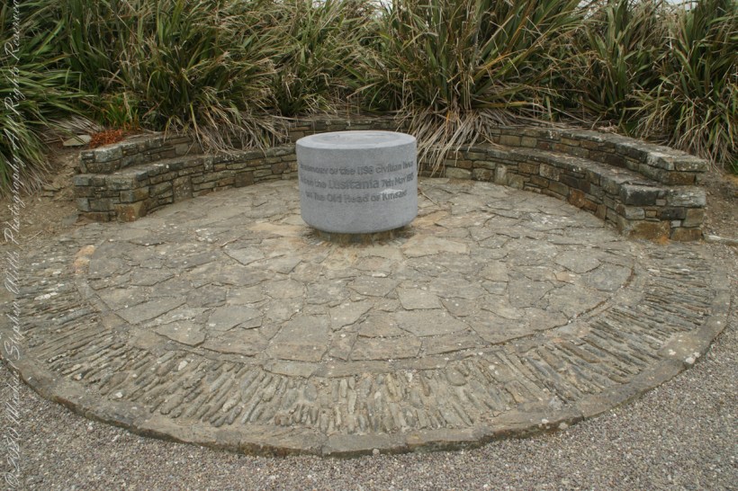
The original memorial to the Lusitania was unveiled on the 80th anniversary of the May 7th, 1915 sinking (May 7, 1995), Old Head of Kinsale, County Cork Ireland. The imemorial nscription reads “In memory of the 1198 civilian lives lost on the Lusitania 7th May 1915 off the Old Head of Kinsale.”
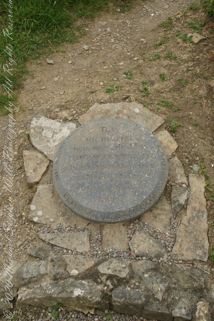
The inscription of the commemoration plaque accompanying the memorial reads, “This memorial was unveiled by Hugh Coveney D Minister of Defense and The Marine on 7 May 1995.” Around the edge of the medallion reads, “Brian Little Sculptor” “This (cannot read) donated by Lan and Mary Buckley”
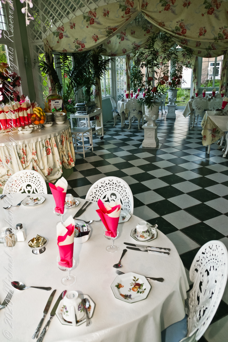
Our day of touring Kinsale and environs, the last day of May 2014, began with this elegant breakfast by Marantha House near Blarney, our base for County Cork.
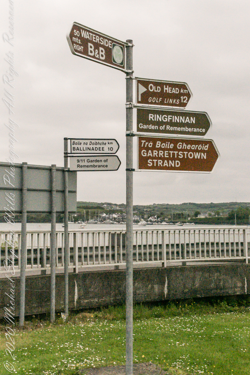
On the way to the Old Head of Kinsale. Located in Knocknacurra on the Kinsale side of Bridge Kinsale on R600. Looking toward the peninsula of Castle Park Village and James Fort. Coordinates 51°41’40.1″N 8°31’42.0″W
This tower, at the apex of the Old Head ring route, has extensive views. The next station at Seven Heads, to the southwest, is visible against the skyline on a clear day. These are two of the 81 stations planned for this signaling system implemented in the first years of the 19th century when a French naval invasion was a possibility.
The Kinsale tower is just over nine meters high, with walls up to 80 cm thick. Records show a signal crew was in place in 1804 and the tower finished the following year, though severely affected by dampness. When Napoleon was defeated by Wellingtons forces at Waterloo, 1815. With the diminished threat these expensive installations were neglected. The 1899 Ordnance Survey map lists the site as being in ruins. During our 2014 visit the local community was renovating the tower and the work appears complete sometime before 2021.