Pinelands Connections X

Finding Grandfather’s Final Resting Place

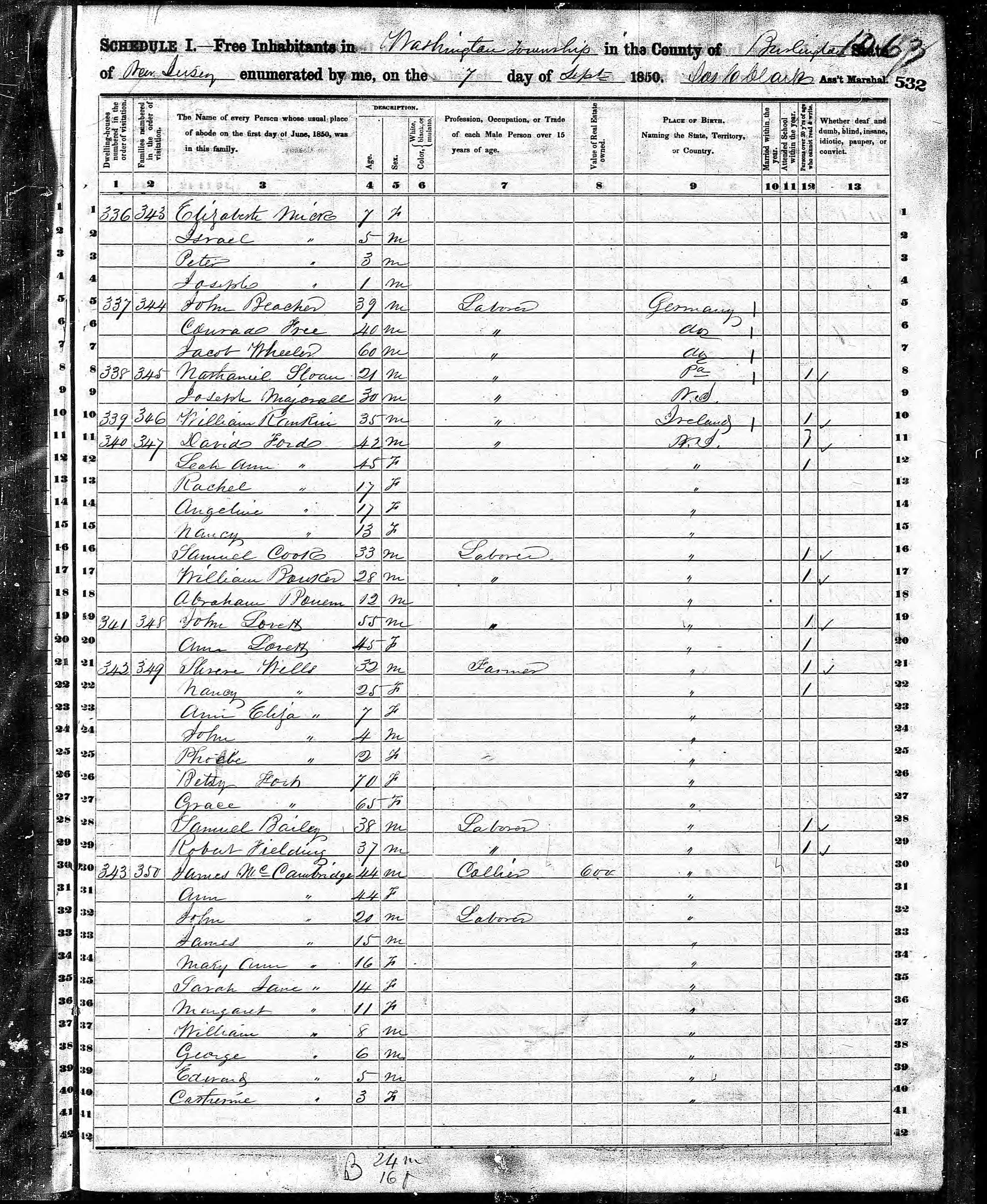
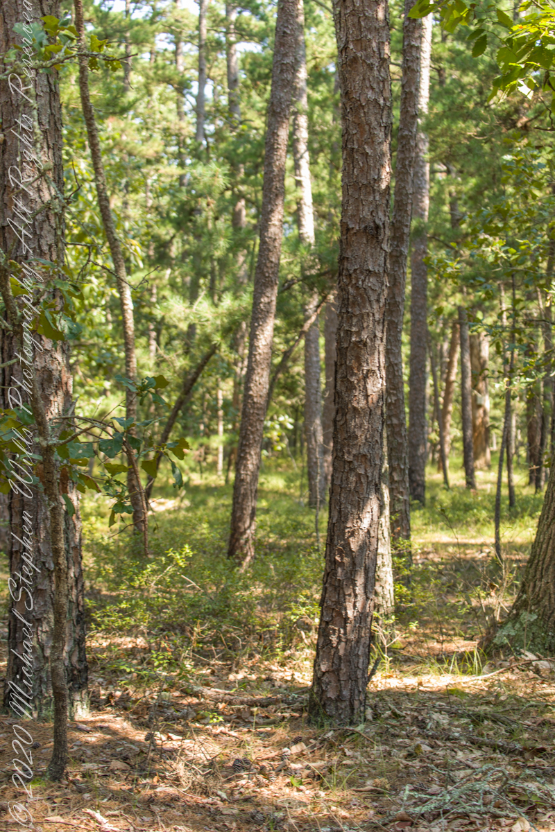
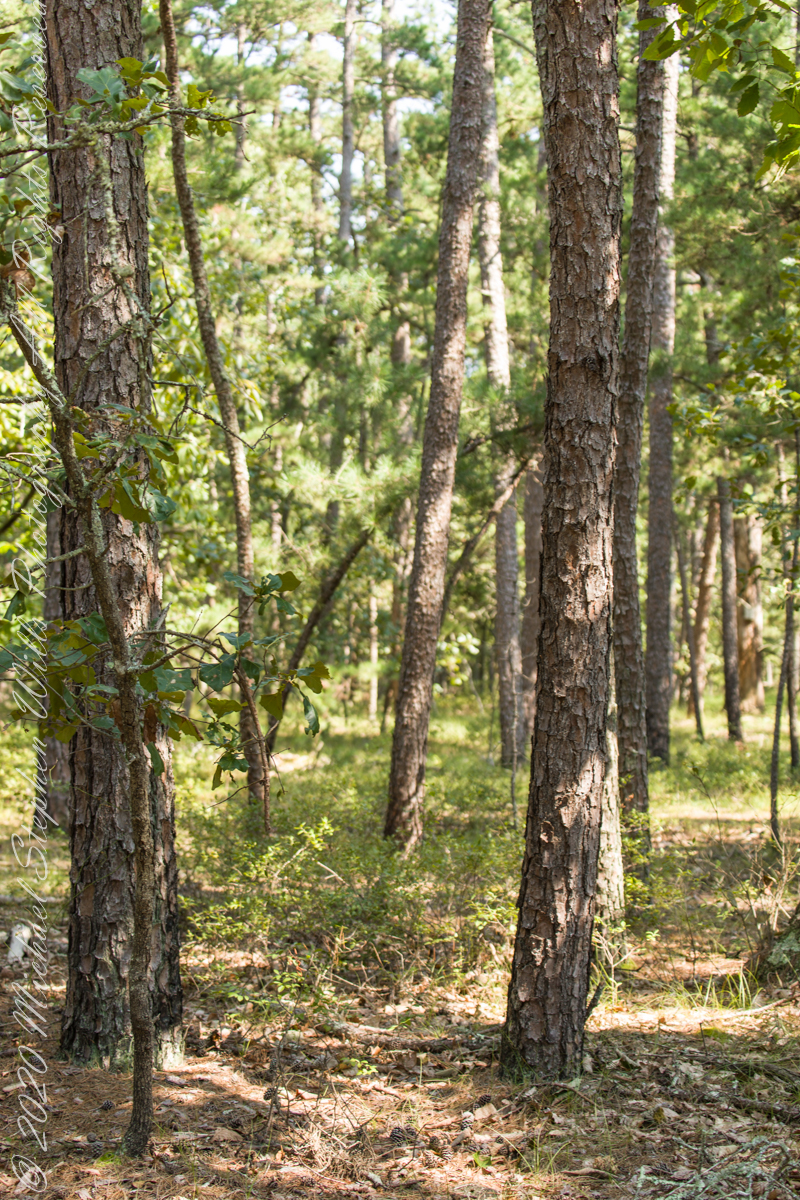
When I was a young adult Mom told me Grandfather Wills was buried in the Bronx. James Edward Wills died when my father was very young and they were poor, living in tenements on the upper West Side of Manhattan April 1916.. Looking through Dad’s papers after both he and Mom were gone, I found the grave receipt: “Saint Raymond’s Cemetery, Westchester, New York.” James Wills, born April 1877, the youngest of six children of George Wills and Margaret McCambridge, who were 43 and 38, their place of residence two years later cited in the 1880 Federal Census as Shamong, New Jersey. Today, Shamong Township is part of New Jersey Pinelands National Reserve. Atsion, the Iron Furnace town where James’ Grandmother Ann McCambridge (nee Milley) worked as a cook, is in Shamong Township.

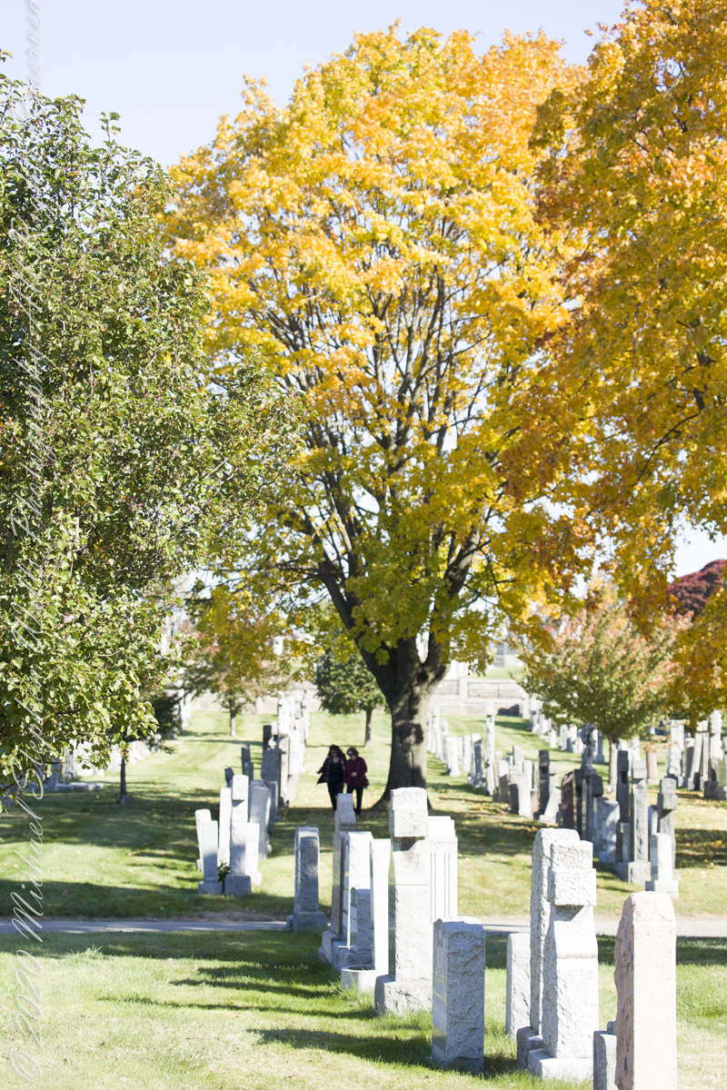
Finding and researching the grave receipt is what began my adventures in genealogy. What was, in 1916, Westchester is now the Schuylerville section of Bronx county, a borough of New York City. Saint Raymond’s Parish, still going strong, acquired more consecrated land for burials with now an “Old” and “New” cemetery separated by the confluence of interstates 95, 295, 678 including the approaches to the Whitestone and Throgs Neck Bridges, the superstructures of which are visible from the “Old” cemetery.

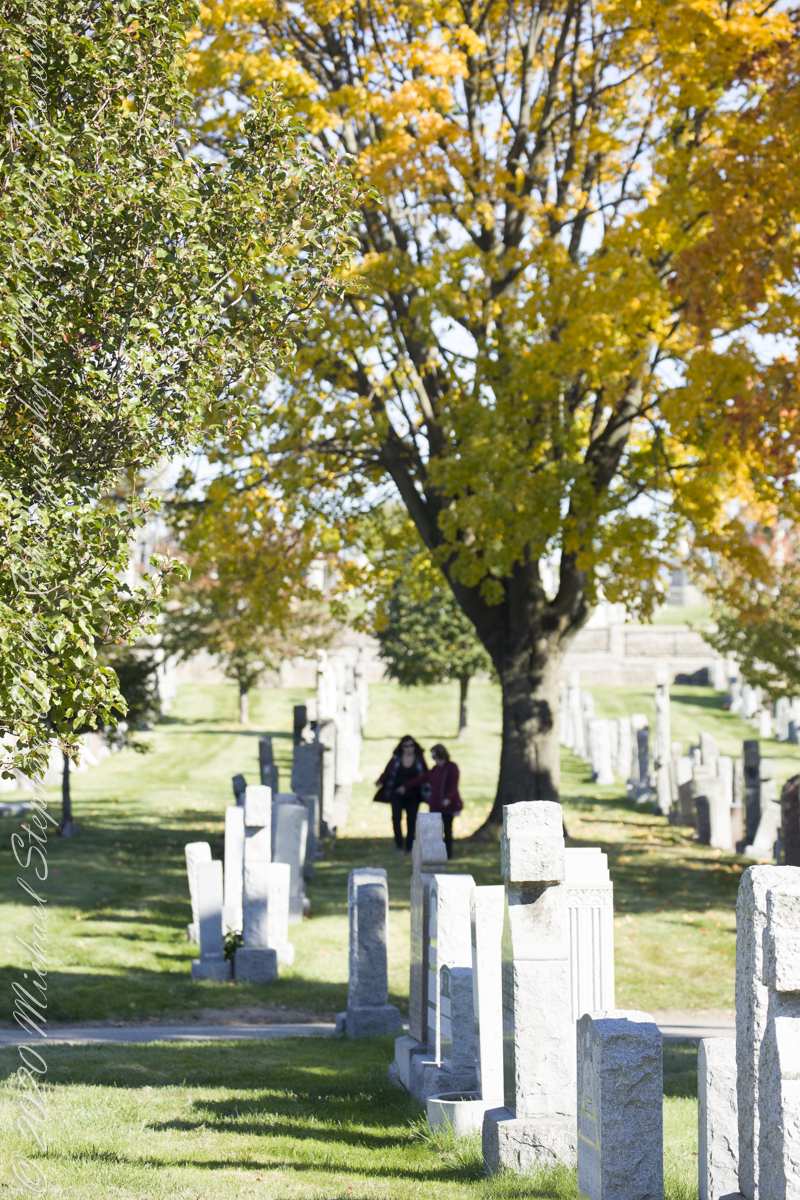
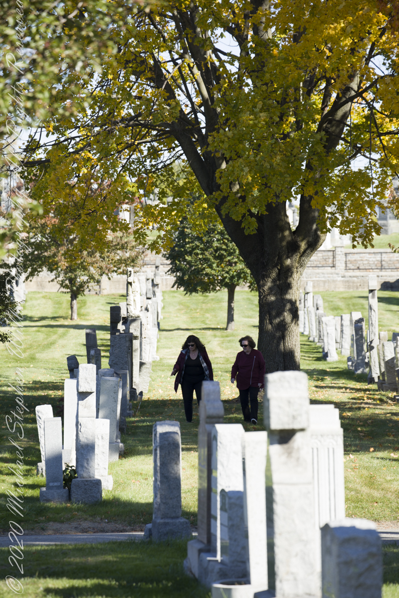
Having sorted out these details, I approach my cousin Mary at the October 2021 engagement party of my niece where we made arrangements to find Grandfather Wills’ final resting place the following month. On Wednesday, November 10th, Mary’s husband Peter drove us over the George Washington Bridge, through the incredible traffic of the Cross Bronx Expressway (a funny name for this moving parking lot, bumper to bumper trucks), to Schuylerville. We navigated to the “Google Maps” push pin I placed next to Section 7. Google Maps even has street views of the cemetery, in retrospect the view of Section 7, Ranges 35 – 51, includes grandfather’s grave.

We worked together, walking the rows, reading headstone inscriptions, on the expectation of finding Grandfather’s name without success. Peter and I took to counting the rows to find number 41, with success. With less success counting the headstones and spaces (unmarked graves) to find number 82. At the same time, Pam and Mary searched. I used the “Find A Grave” website to look up headstones in section 7, row 41 and found the only location provided was “Section 7.” I also called the cemetery office where they were most helpful. There is NO record of James Wills.

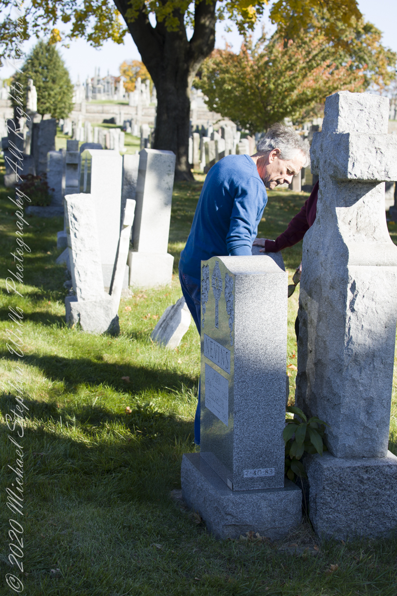
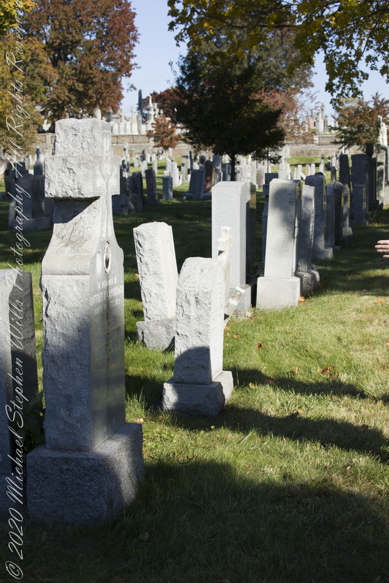
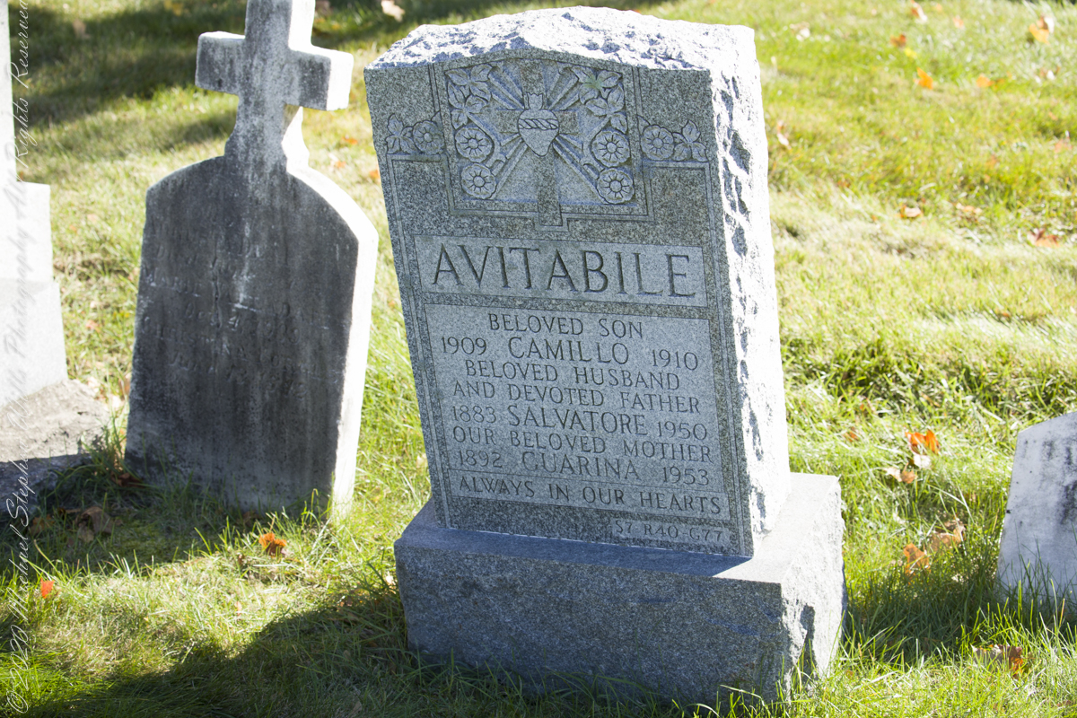
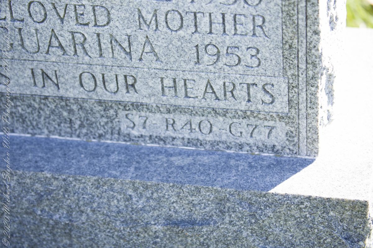
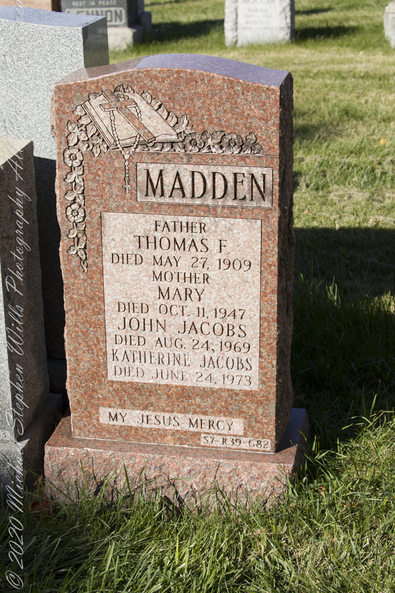
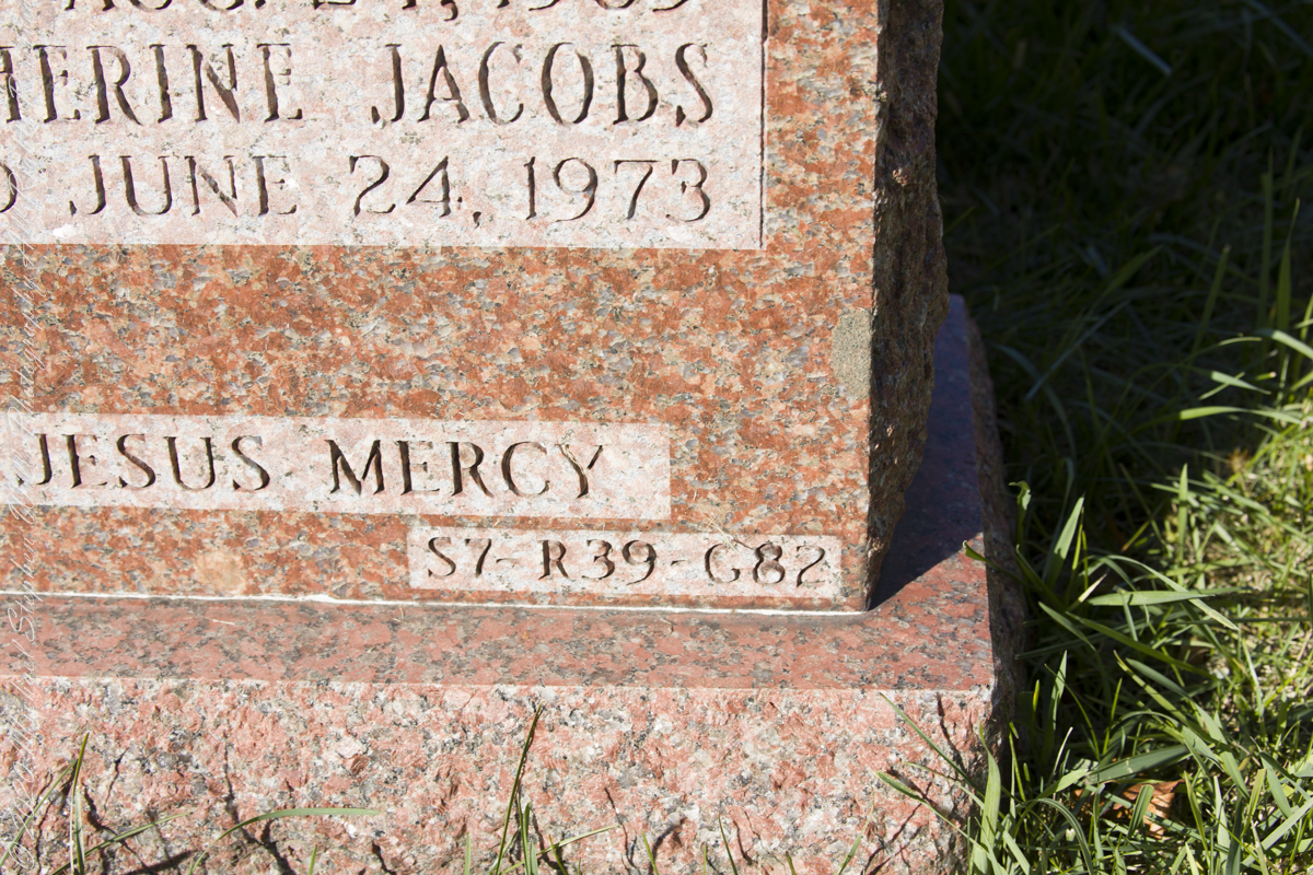
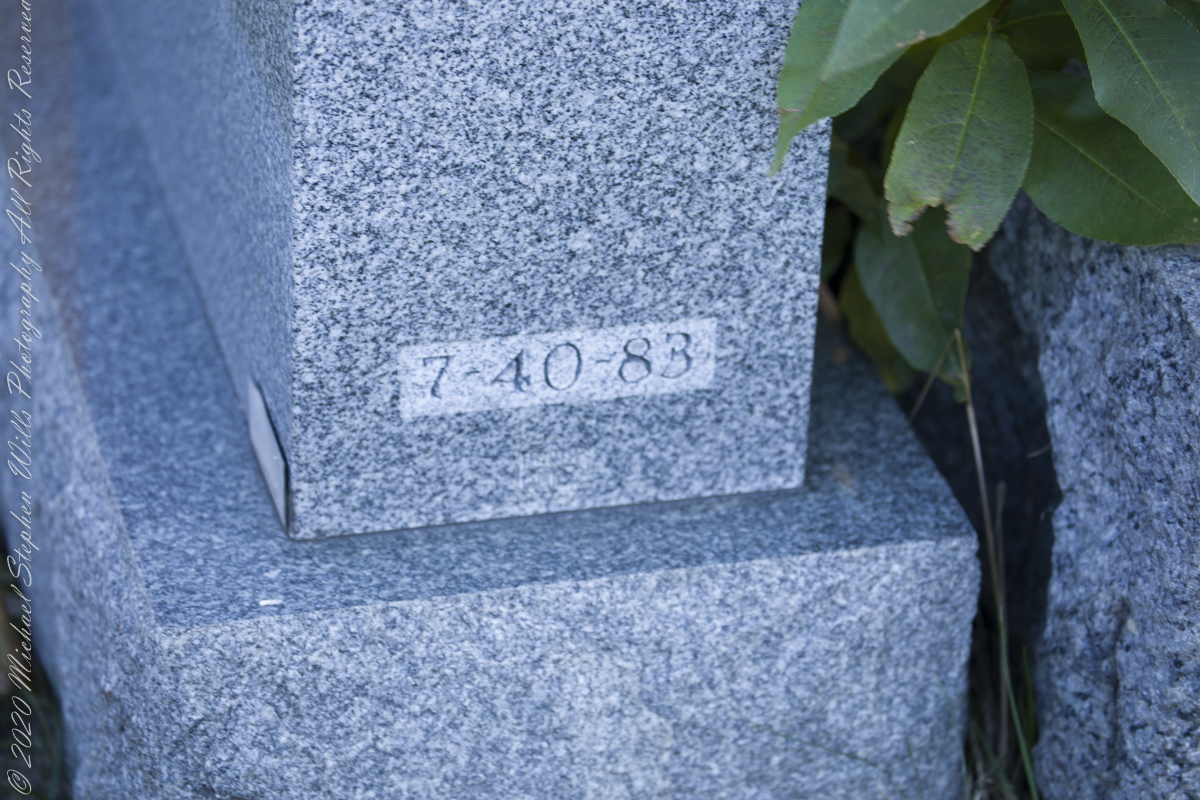
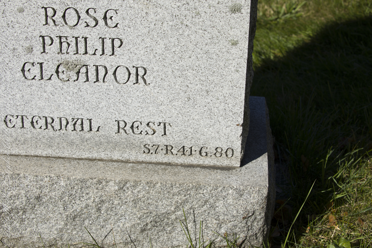
Then, Pam noticed some headstones inscribed with the exact location, Section, Range (Row) and Grave.  This was the key.  Here are the headstone references that pinpointed Grandfather Wills’ final, unmarked, resting place.  

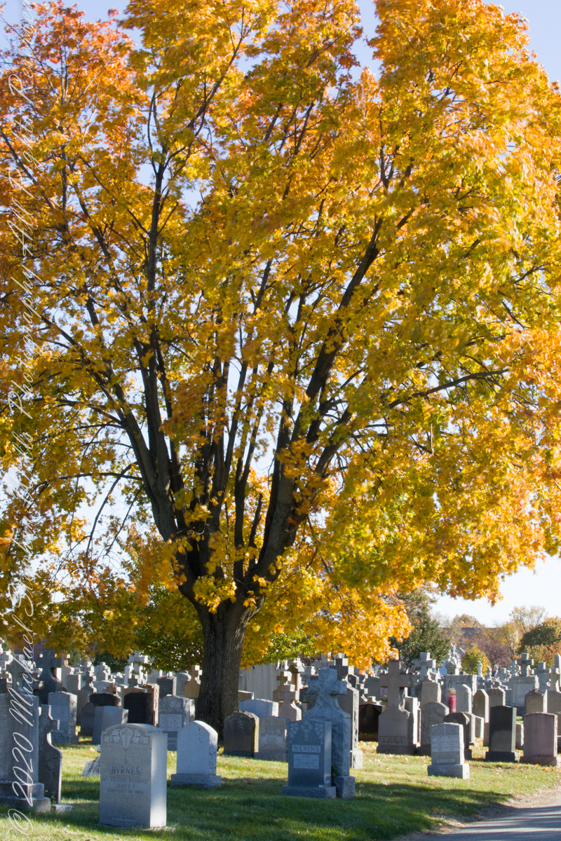
In the following photograph I am on the right with wife Pam. Cousin Mary next to her husband Peter on the right, Mary is standing on grave 82.

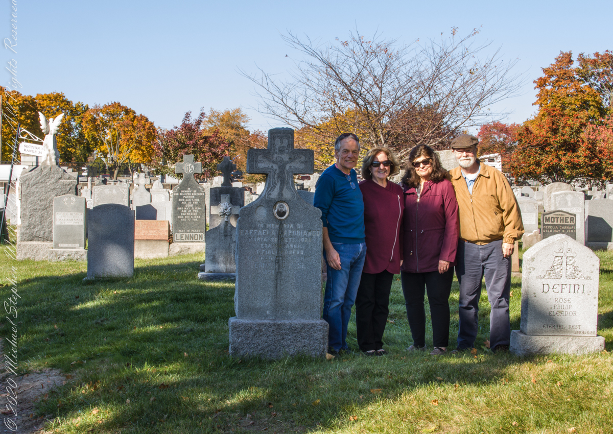
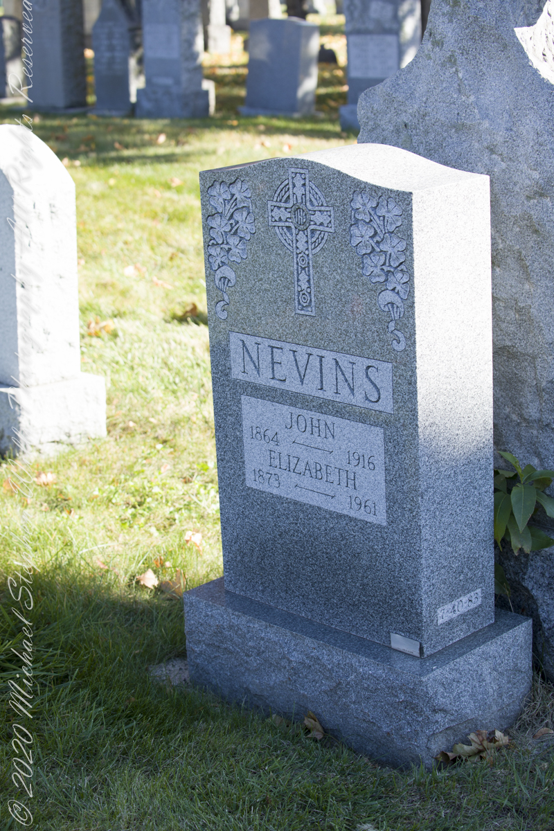
James Edward Wills unmarked grave, Section 7, Range (Row) 41, Grave 82, Old Saint Raymond’s Cemetery, Balcom Avenue, Schuylerville, Bronx, New York. Wednesday, November 10, 2021. Here we are facing south / southeast into Section 7, James Wills’ unmarked grave is to the left and just behind Nevins headstone (Row 40, Grave 83).

Pinelands Connections IX

What is a Collier?

Click for the first chapter “Pinelands Connections I”

Here my exploration of Wharton State Forest, Pitch Pine Forest III, branches to the genealogical exploration of this landscape as my sister, Theresa and I, proceed along the humped, pitted sand road Goodwater through the wilderness to emerge in Batsto Village, a recreation of lives that touched my great great grandparents, James and Ann McCambridge among them. Ann saved money earned as a cook for Atsion furnace, the historical site at the start of the road to Quaker Bridge. Her husband James worked as a collier, supplying fuel for the iron furnaces at Atsion and Batsto, among other enterprises. During our Batsto Village visit we found these reproductions of charcoal clamps.

Since earliest times charcoal was used for cooking and heating. It was the best heat source for metal furnaces. Entire deforested regions are attributed to the demand for charcoal. Thomas Jefferson experimented with charcoal clamp designs, modifying air flow from the base.

James and Ann lived on the land that provided a livelihood, enough to support themselves and nine (9) children. From September 7, 1850 is the US Census for this family of my second great grandparents. Great Grandmother Margaret was 11 years. James is listed as a Collier, the value of Real Estate owned was 6,000 (a fortune for the time).

Like his wife Ann, James had a savings account…..

Click for the next chapter, “Pinelands X”

Copyright 2021 Michael Stephen Wills All Rights Reserved

Pitch Pine Forest III

Road to Batsto

Leaving the jeep on the west side of Quaker Bridge, I walked over to inspect the structure and poke around the other side, carrying a Canon 5d Mark IV (camera body) / EF 70 – 300 mm f/4-5.6 L IMS (lens), shooting as I walked. My sister Theresa and Maxie, a little white dog, lagged behind taking in the surroundings. Here they are, in shadow, on the west side.

Click pic for larger view in a new browser tab. If you are in WordPress Reader, open the post to use this feature.

My work on the east side was shared in previous posts, “Pinelands Connections VIII,” I and II “Around Quaker Bridge,” and I and II “Pitch Pine Forest,” work interrupted by the sound of an approaching engine, a Humvee came into view. I waved my arm up and down, a sign to slow down, pulling alongside the driver looked up with dead eyes, no element of recognition of a fellow human, as I explained my sister was on the bridge. A stink of unfamiliar hydrocarbons, diesel fuel?, rose through the heat as they pulled forward with no acknowledgement of my request. Thankfully they slowed down as Theresa, Max in her arms, said, “hi.”

Multiple roads converge from all directions on Quaker Bridge, using GoogleMaps (surprising these unimproved, “jeep” sand roads were listed) I chose Goodwater Road as a route to Batsto Village, on the southern side of Wharton State Forest. The 6.1 mile road follows the east bank of Mullica River at a distance, a very rough passage through ancient Pitch Pine forest. Here are photographs of the enormous capacity of the pines to regrow after fire. Note a thick seeding growth among the mature pine trunks, lower portions fire blackened.

Copyright 2021 Michael Stephen Wills All Rights Reserved

Proleek, Grandfather McArdle’s home

Romance of Ruins

In three, so far, postings on the cottage ruins at Loughan an Lochan (Loughan Bay) we explored a former community above the Irish Sea with a view of Scotland.  For the third posting I shared some research on the last cottage people of that site with the intent of additional postings.

I wondered, “What motivates you to do this?” and remembered my mother’s Canadian passport in which, for place of birth “Proleek, Ireland” was written and my request to our cousin, John Mills, who invited us to stay with them after my mother passed away, June, 2013, the request being to visit the site of great grandfather James McCardle’s home, where grandfather Peter McCardle was raised, information since discovered from the Irish census.

On the morning of Sunday, May 25, John took us from mass on a tour of sites related to the family.  One of these was the site of the McCardle home, Proleek Townland.

Peter McArdle Former Home
The ruins of the former home of Peter McArdle are on a corner of unnamed streets in Proleek, County Louth. This is a view of the southwest side.

There site is an anonymous corner on a unnamed street with no outlet.  The street ends close to the Proleek Dolmen, an ancient passage tomb, after passing farms and fields.

Peter McArdle Former Home
The interior of the property. I see no evidence of great grandfather James McArdle’s home, It has returned to the earth.

The 1901 Irish Census provides these details from 116 years ago:

  • The walls were stone, brick or concrete.
  • The roof of thatch, wood or another perishable material.
  • Two rooms, with three windows facing the road.
  • Out buildings listed were:
    • cow house.
    • piggery.

Today, the site is another person’s property, it was not possible to explore further than when the camera lens reached when I leaned as far a possible into the brush.  No sign of standing walls.

Southeast view from McArdle former home
Across the road from the McArdle Plot is this ditch (stone wall) and a home. In the far distance, just visible across the plain, rising from it, is an unnamed land mark, a rounded hill 350 feet tall of the neighboring townland of Bellurgan.

Modern homes surround the corner, solid and prosperous.

View to the west from McArdle Former Home
The site is surrounded by homes on the west and south, farmland on the east and west.

For this posting I collected the following images from Google Earth.  The site is marked with a pushpin, “McCardle Home.”  A “Proleek Dolmen” pushpin marks the passage tomb.

McArdleHomeProleekCountyLouthOverview

A closer view suggests, if we trespassed and poked around, some remains of the structure were concealed by the trees and brush.

McArdleHomeProleekCountyLouth

Between May 2014 and this image, from 2015, the center of the plot was gouged out.  The area corresponds to the corresponds to the remains indicated in the 2013 image.  From this we can understand were the structures stood in relation to the road.

Using the polygon ruler tool the size of the site is 413 feet in circumference, 9,619 square feet, and the gouge, indicating the ruins, is 1,368 square feet.

McArdleHomeProleekCountyLouthToday

But for John and Betty Mills, their kind invitation to stay and John’s guidance that day, the “Proleek” notation on my mother’s Canadian passport would still be a mystery today.

John Mills passed away the next year, September 26, 2015.  Here are Hawthorne Blossoms from the corner of the former McCardle home in memory.

Here is some follow-up to my story in the posting “A Visit to Proleek Dolmen.”

Hawthorne Blossoms
Blooming Hawthorne on the former McArdle Home

Copyright 2024 Michael Stephen Wills All Rights Reserved

Around Quaker Bridge III

Poking Around

Multiple trails lead from where Quaker Bridge crosses the Mullica River. These are from a handheld Canon 5d Mark IV with the Canon EF 70 – 300 mm f/4.0-5.6 ISM lens.

Click pic for larger view in a new browser tab. If you are in WordPress Reader, open the post to use this feature.

lll

Copyright 2021 Michael Stephen Wills All Rights Reserved

Around Quaker Bridge II

Poking Around

Multiple trails lead from where Quaker Bridge crosses the Mullica River. These are from a handheld Canon 5d Mark IV with the Canon EF 70 – 300 mm f/4.0-5.6 ISM lens.

Click pic for larger view in a new browser tab. If you are in WordPress Reader, open the post to use this feature.

lll

Copyright 2021 Michael Stephen Wills All Rights Reserved

Around Quaker Bridge I

Poking Around

Multiple trails lead from where Quaker Bridge crosses the Mullica River. These are from a handheld Canon 5d Mark IV with the Canon EF 70 – 300 mm f/4.0-5.6 ISM lens.

Click pic for larger view in a new browser tab. If you are in WordPress Reader, open the post to use this feature.

lll

Copyright 2021 Michael Stephen Wills All Rights Reserved

Cedar Water

“Tree of Life”

In my last Pinelands post, “cedar water” was featured. This post is a exploration of the “cedar” in “cedar water.”

White Cedar, also known as Swamp Cedar, is a water loving tree seen here to the right of Quaker Brider, Wharton State Forest.

Click pic for larger view in a new browser tab. If you are in WordPress Reader, open the post to use this feature.

“Cedar water” is the dark, tea like, flow of Pinelands rivers colored by vegetable tannins.

White Cedar thrives along Pinelands waterways, lending color to the “cedar water.” 18th Century sea captains favored cedar water for long voyages, famours for staying fresh far longer than other waters. Also known as arborvite, “tree of life”, for the medicinal properties of the bark, well known throughout Native America.

Click me for another take (post) on this view.

Copyright 2021 Michael Stephen Wills All Rights Reserved

Mullica River from Quaker Bridge

A rare Pinelands maple tree over the cedar water of Mullica River looking upstream from Quaker Bridge on a warm August morning 2021.

Click pic for larger view in a new browser tab. If you are in WordPress Reader, open the post to use this feature.

Click me for another take (post) on this view.

Copyright 2021 Michael Stephen Wills All Rights Reserved

Pinelands Connections VIII

Ancestral Byways

……click for “Pinelands Connections I”.

These photographs were taken the last days of August 2021, the 26th and 27th, while exploring Burlington County, New Jersey, with my sister. I will be writing about our Thursday and Friday for awhile, starting with today’s installment.

Quaker Bridge Road traverses the wilderness of Wharton State Forest with a beginning off Route 206, Atsion Mansion. Our planning included Jeep Wrangler rental, only high-clearance 4-wheel vehicles are appropriate, the road surface is humpy sand, water filled holes abound. Still, sitting there at the start, with Atsion Mansion house in view, I waited awhile until a high clearance tour bus packed with adventurers, kayaks passed into the pines and out of sight. We proceeded an uneventful ~4 miles to Quaker Bridge at a stately 5 miles per hour, invoking four-wheel drive low gear a mile or so in.

Here is Quaker Bridge over Mullica River today, facing East.

Quaker Bridge road was a well traveled main route through the Pines for almost a hundred years with an inconvenient crossing of The Mullica at this point. During the year 1774, some sa 1772, West Jersey Quakers travelling to the Little Egg Harbor Yearly Meeting, started “a day early”, built a bridge. From a c.1940 photograph it is clear in that “day” they felled large trees for pilings, smaller trees, pines and cedars, for the other bridge elements. Since then, the crossing has been called “Quaker Bridge.”

Over time, the east side became a resting place, with at least one Inn/Tavern. Here is the east side today.

Even without hospitality and bustling humanity, after 4 miles of dreary road from Atsion this spot carries a sense of lightness, the well spaced straight pines over several acres conveying peace and rest. Over 35 miles from the ocean, the white sand presents as beach. There is a reason for this feeling, a 15 million year reason.

Between 15 and 10 million years ago the earth climate turned colder, so much water evaporated from the oceans to fall as snow and ice in the polar regions ocean levels fell 150 to 250 feet. As the ocean fell away, over eaons, mountains to the west were ground down, pulverized by the elements to flow, gather on the exposed plain. The white “beach” sand we see today, at Quaker Bridge and other Pinelands places, are surfaces of this “Cohansey” sands and clay ranging in thickness from 25 feet in the west to more than 300 feet at the Atlantic Ocean.

Over millions of years the land raised to become the drainage patterns we see today. The renewable resources of “bog iron” and water spring from this history.

Standing there I imagined Great Great Grandmother Ann (Milley) McCambridge resting on the journey from the McCambridge home near Speedwell. I placed the pebble, collected from Long Island Sound, on Grandmother Ann’s headstone the evening of August 26th. Click this link for more about Ann McCambridge.

Click for the next chapter, “Pinelands Connections IX”

Reference
I found Quaker Bridge background in “Heart of the Pines, ghostly voices of the Pine Barrens” by John E. Pearce, pp 748 – 750, Batsto Citizens Committee, 4110 Nesco Road, Hammonton, N.J. 08037-3814.

“The Geologic History of New Jersey’s Landscape”, Scott Stanford, Unearthing New Jersey Newsletter, Vol. 1, No. 2, Summer 2005, New Jersey Geological Survey, Department of Environmental Protection e, Scott Stanford

“Hydrostratigraphy of the Kirkwood and Cohansey Formations of Miocene Age in Atlantic County and Vicinity, New Jersey,” Peter J. Sugarman, 2001, New Jersey Geological Survey Report GSR 40, New Jersey Department of Environmental Protection

“Background information on the Cohansey Formation aquifer.”

Copyright 2021 Michael Stephen Wills All Rights Reserved