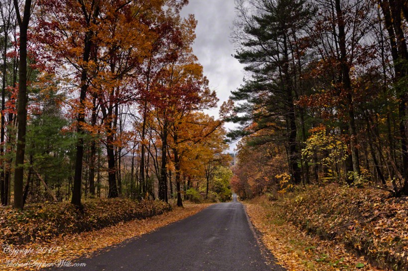
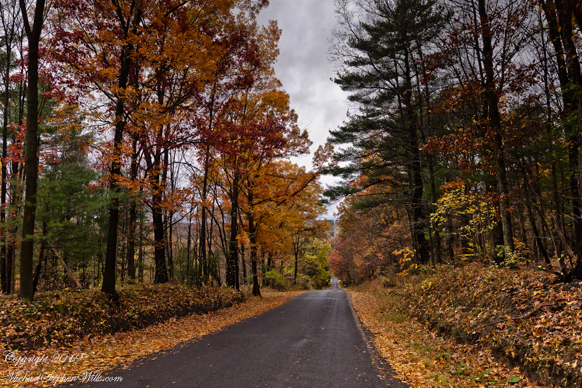
Here we have a vista of Bostwick Road descent off West hill into the Enfield valley and, then, in the distance, up Harvey Hill. Late autumn foliage graces the scene.
Click photograph for a larger view. To do this from WordPress Reader, you need to first click the title of this post to open a new page.
We are near Molls Gap on the Ring of Kerry. At our feet is Eric townland, there’s an epynmous Bog Nature Reserve down there.g of Kerry. At our feet is Eric townland, there’s an eponymous Bog Nature Reserve down there.
Townlands Derrylough, Crossderry and distant Bunbinnia take up most of the view. Those familiar with post-glacial topography will recognize the glacially oversteepened slopes of the distant through valley. The valley floor is a glacial outwash plain.
Click pic for larger view in a new browser tab. If you are in WordPress Reader, open the post to use this feature.
Copyright 2021 Michael Stephen Wills All Rights Reserved
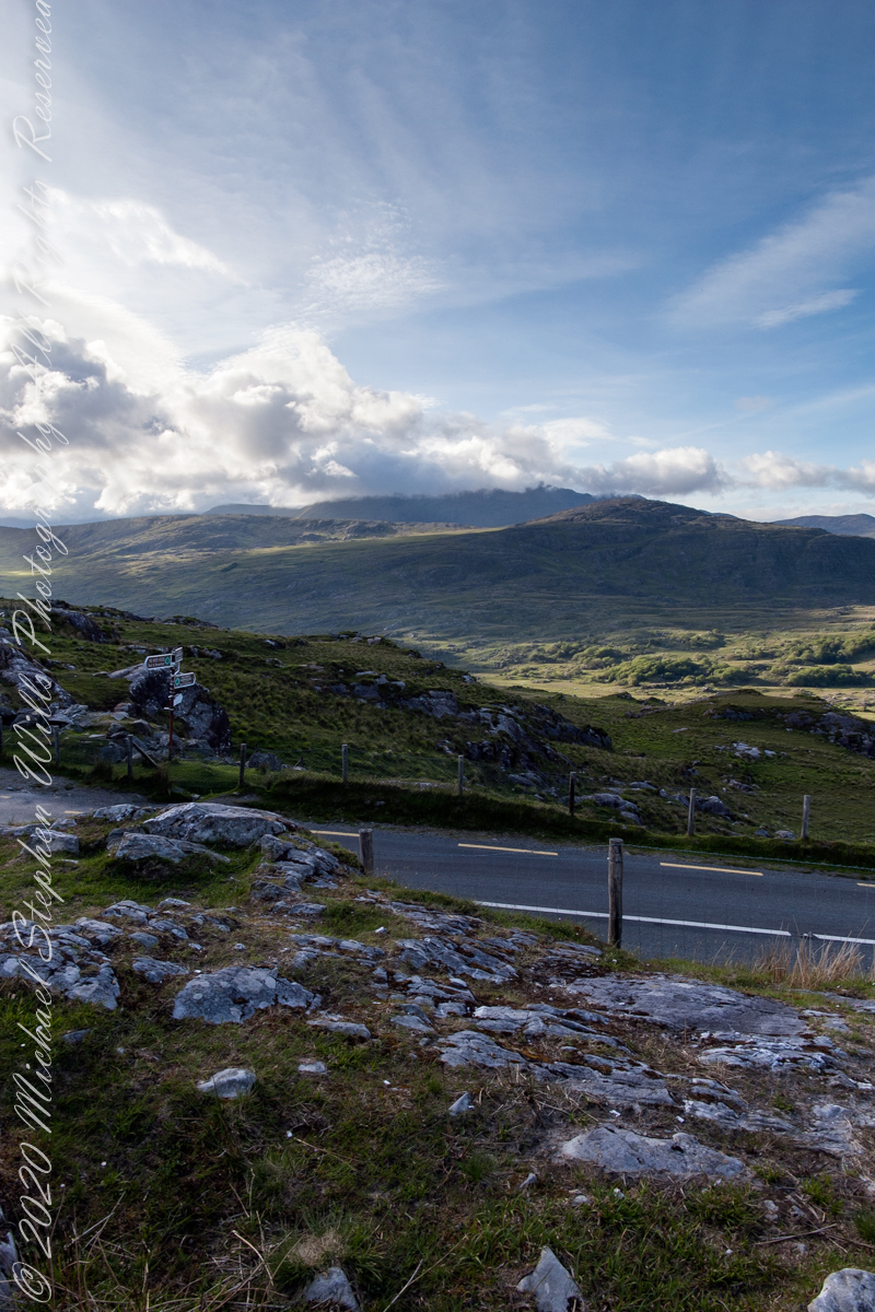
Here we are still standing in Moll’s Gap, looking a bit farther northwest into Black Valley than for View Two. Across the far mountains is Black Valley, a place so remote it was among the last, on the island itself (“mainland”) to be electrified or connected to telephone networks. Today Black Valley is a southerly route to the Gap of Dunloe well known to certain hikers and cyclists.
I am struggling here to deal with the vast range of light intensity from the glow of a westering sun, to the shadows cast by surrounding heights.
Beneath our feet are the slopes of Derrygarriff (in Irish Doire Gharbh) of the Mangerton range. Across the way is Crossderry peak of the Dunkerron mountains, the townland is named for the peak (or vice versa).
Click pic for larger view in a new browser tab. If you are in WordPress Reader, open the post to use this feature.
Here is a second try, a bit more successful as the clouds opened to shine on distant land. I did work in Photoshop to manage the brightest clouds.
Here are all three versions of the Black Valley view from Moll’s Gap. Enjoy
Copyright 2021 Michael Stephen Wills All Rights Reserved
Here is a postscript for my retrospective diary of the day I created my print “Ocotillo Sunset.” You can visit “Ocotillo Sunset” in my Online Gallery by clicking on any photograph .
In near total darkness, the last sunlight only enough for the far western sky, these are the last shots of this series.
Click photograph to view Ocotillo Sunset in my Online Gallery
Afterglow I
Click photograph to view Ocotillo Sunset in my Online Gallery
Afterglow II
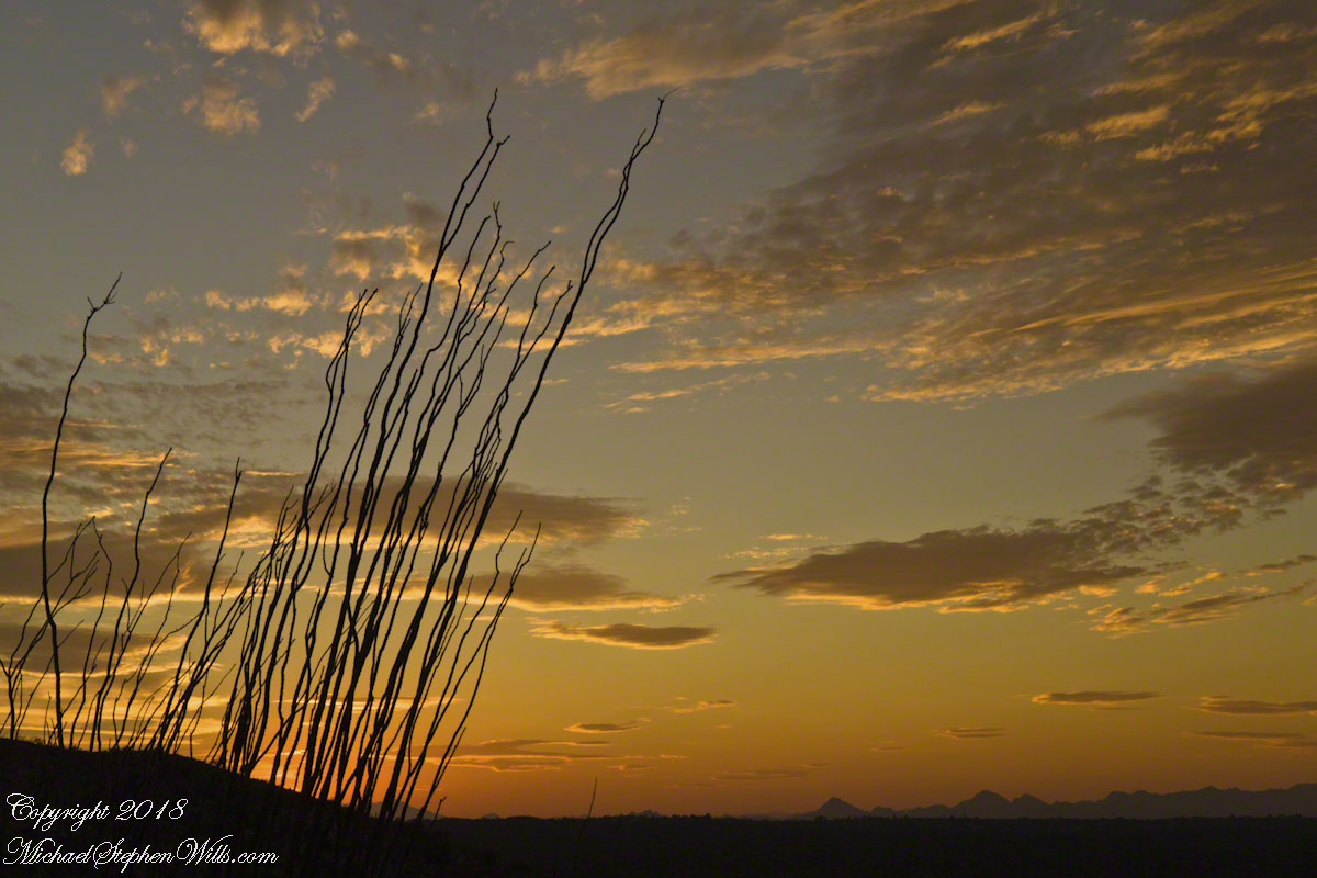
The final result of the day’s work, “Ocotillo Sunset.”
Click photograph to view Ocotillo Sunset in my Online Gallery
The penultimate posting of my retrospective diary of the day I created my print “Octillo Sunset.” You can see a large version of “Ocotillo Sunset” by clicking on any of my blog photographs.
The Flag in Formation and Realization
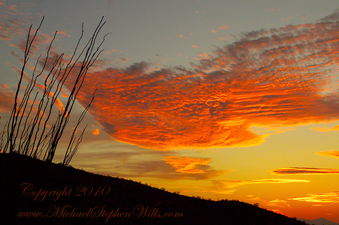
Then, for reasons I can only speculate about, a spectacular shape came together in the clouds. In the following photograph I have yet to recognize, to see, this cloud sculpture. Do you see part of “Ocotillo Sunset” coming into shape? As far as I remember, at the time I had only a dim realization of what was forming in my view finder and in front of me.
Click photograph to view Ocotillo Sunset in my Online Gallery
The Flag Forms
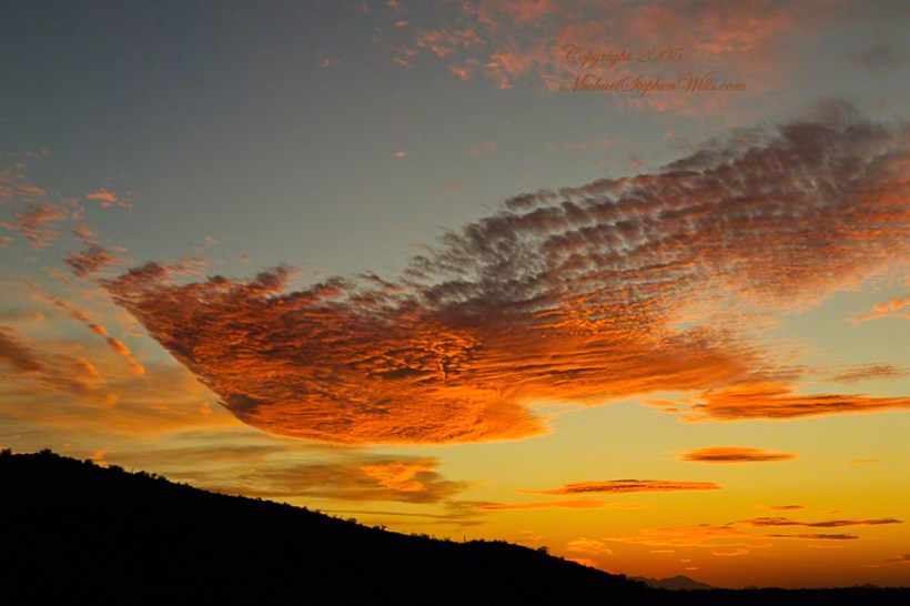
Then, I changed camera orientation and shifted the view a few degrees to the left and there it was: a coherent shape of something. Here it is in full, untethered.
Click photograph to view Ocotillo Sunset in my Online Gallery
Unanchored, a Flag or Ship
The final result of the day’s work, “Ocotillo Sunset.”
Click photograph to view Ocotillo Sunset in my Online Gallery
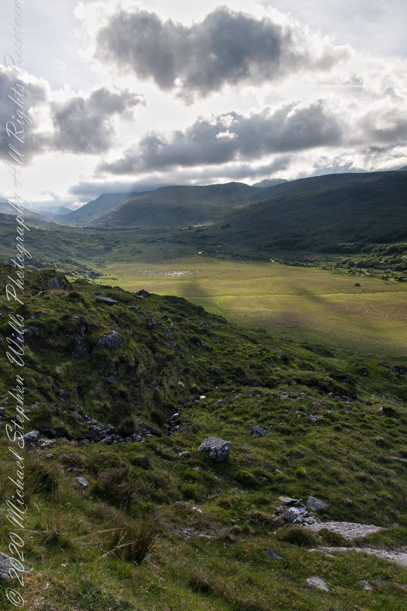
Here we are standing in Moll’s Gap, looking northwest into Black Valley, a place so remote it was among the last, on the island itself (“mainland”) to be electrified or connected to telephone networks.
Beneath our feet are the slopes of Derrygarriff (in Irish Doire Gharbh) of the Mangerton range. Across the way is Crossderry peak of the Dunkerron mountains, the townland is named for the peak. Black Valley, now a southerly route to the Gap of Dunloe well known to certain hikers and cyclists, is beyond the far mountains.
Click pic for larger view in a new browser tab. If you are in WordPress Reader, open the post to use this feature.
Copyright 2021 Michael Stephen Wills All Rights Reserved
This is a retrospective diary of the day I created my print “Ocotillo Sunset.” You can see a large version of “Ocotillo Sunset” by clicking on any of my blog photographs.
Shooting as the World Turns
In Part 5, we enter the final phase of this day’s work with darkening of the land while in the sky sunlight reflects off high clouds. The length of this moment when twilight is over, just before night falls, varies with latitude and time of year. Near the poles (high latitude) this light can last for days while here, at about 32 degrees north, it is less than 15 minutes. As I wrote in Part 4, after this light, the desert is absolutely dark. This is why I chose to set up by the roadside.
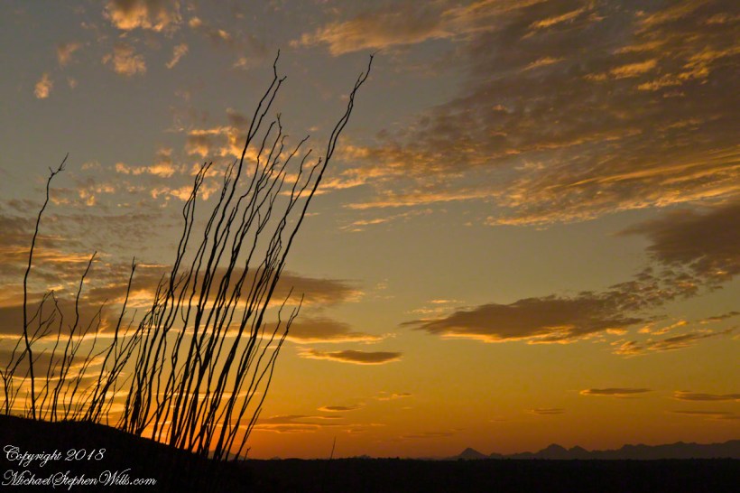
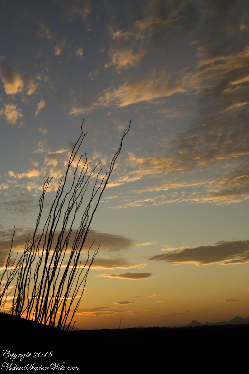
In the following two photographs I experimented with camera placement and foreground elements. Starting in Part 4 I became aware of Ocotillo branches, using them for the effect of reaching for and, here, anchoring the clouds.
Click photograph to view Ocotillo Sunset in my Online Gallery
Saguaro Sunset II
Lead Around by an Ocotillo
These earth-bound Ocotillo branches lead me to the darkened earth. How much to include in the shot? I searched for a balance between the vastness and complete blackness and needed a point of interest. Time was running out.
Click photograph to view Ocotillo Sunset in my Online Gallery
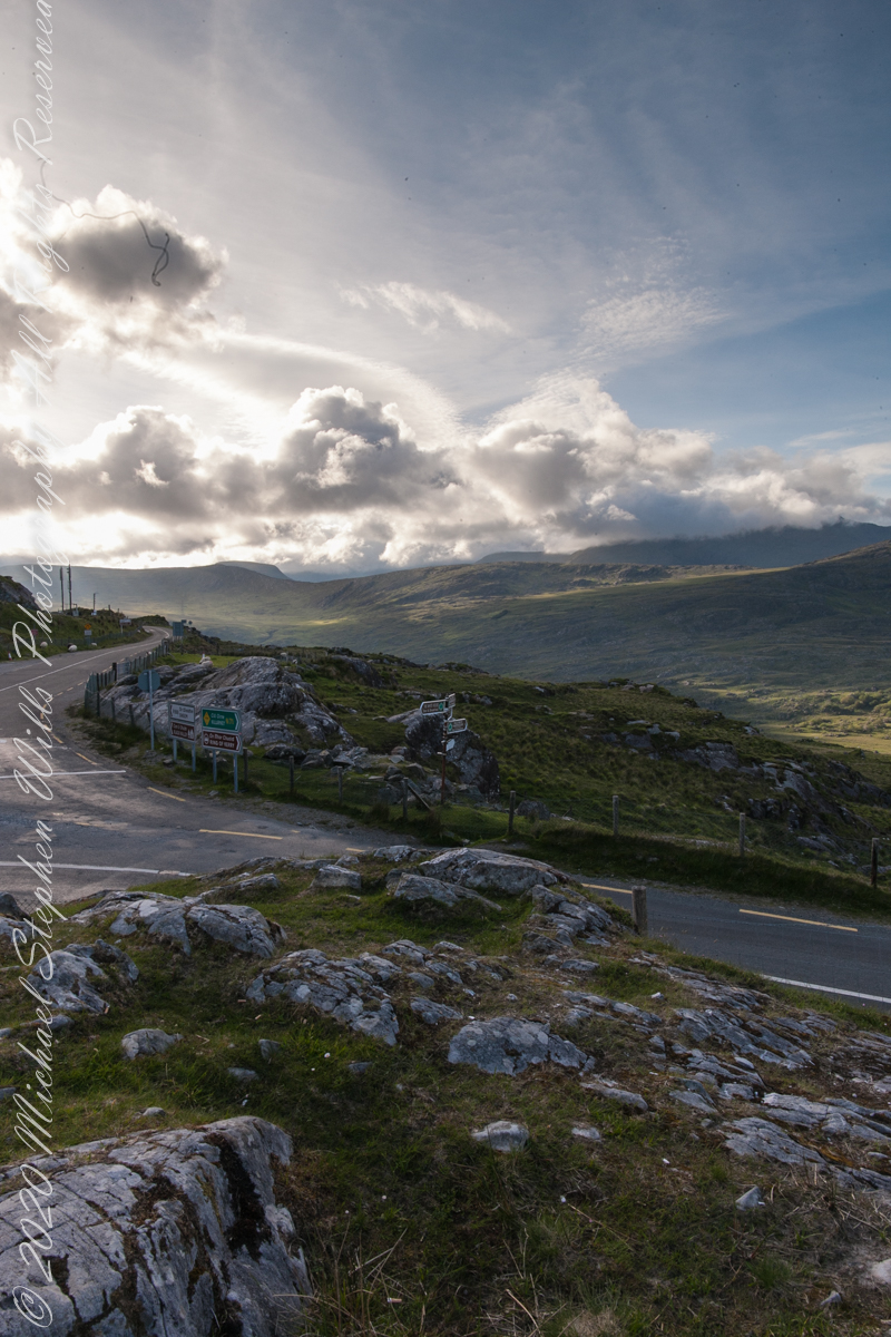
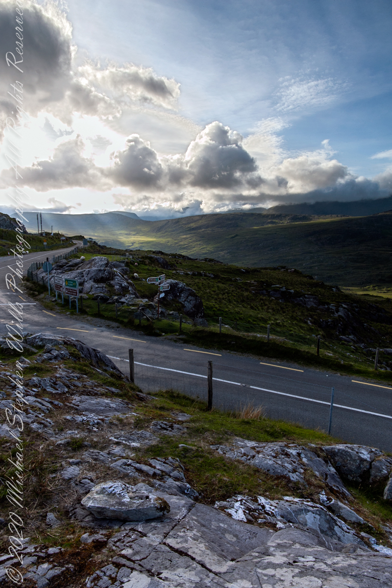
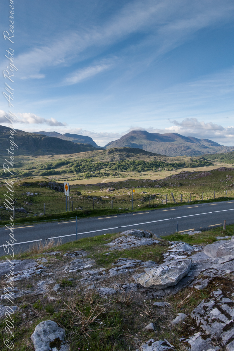
Here we are, on the road from Kenmare to Killarney, N71, part of the Ring of Kerry around the Iveragh Peninsula. The spot is the mountain pass Moll’s Gap, also known in the Irish language as Céim an Daimh (meaning, Gap of the Ox). In the Nineteenth Century a woman named Moll Kissane ran a public house here, operating illegally.
The mountain of this townland, named Eirk (also known as Adhard) , is composed of a fine grained sandstone found in a wide swath from North America’s northeastern coast, Greenland, Ireland, Great Britain — lands formerly part of the same ancient continent.
Click pic for larger view in a new browser tab. If you are in WordPress Reader, open the post to use this feature.
Iveragh Peninsula, Eirk townland, County Kerry, Republic of Ireland.
Copyright 2021 Michael Stephen Wills All Rights Reserved
This is a retrospective diary of the day I created my print “Ocotillo Sunset.”
Choices of the Evening
The next few blogs are a set of photographs from the developing sunset of that November evening. Once set up, my practice is to stay in place until there is nothing left of capture; all the while evaluating the results and adapting the camera settings, framing and lenses to the environment.
Happening in the Twilight
By this point, twilight is over and only the sky is lit. According to file metadata posted at capture, thirteen minutes passed from the following photograph till the last. I mounted my camera on a simple tripod, purchased from a mall chain store, with the standard controls. I prefer to specify ISO and set it at 160 (the lowest value) throughout. The sky was calm and, with the tripod, I used the aperture setting with higher values. This was f13 / 1/60.
Click photograph to view Ocotillo Sunset
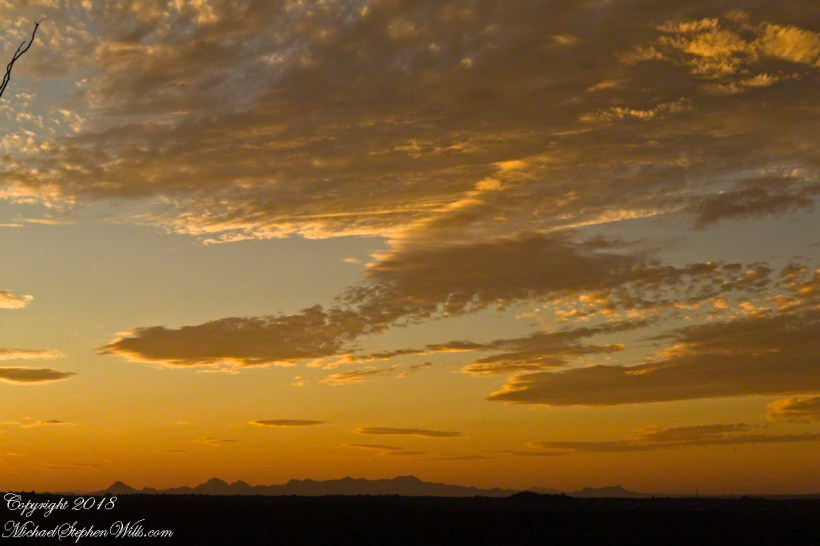
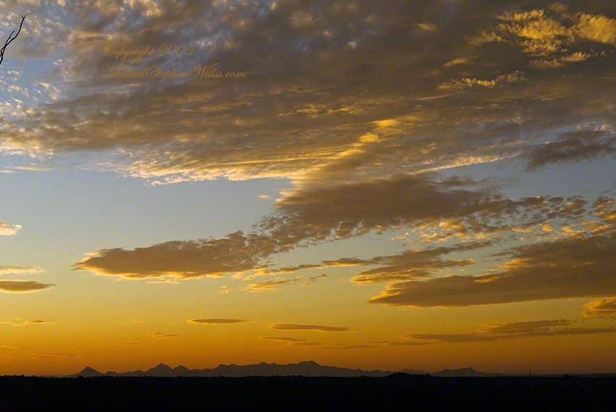
The clouds are forming up. I need some foreground. Vastness on vastness is a bit much. Those are the Tucson Mountains in the distance. If you look closely, on the right the Tucson Mountains dip down, revealing Kitt Peak, at least 60 miles distant. It is the defined peak on the left of that range. In early morning light, the Mayall 4 meter telescope building gleams white on that point.
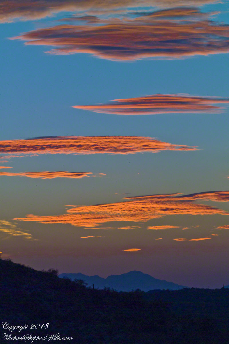
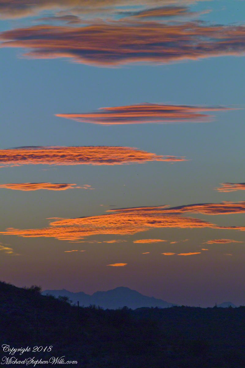
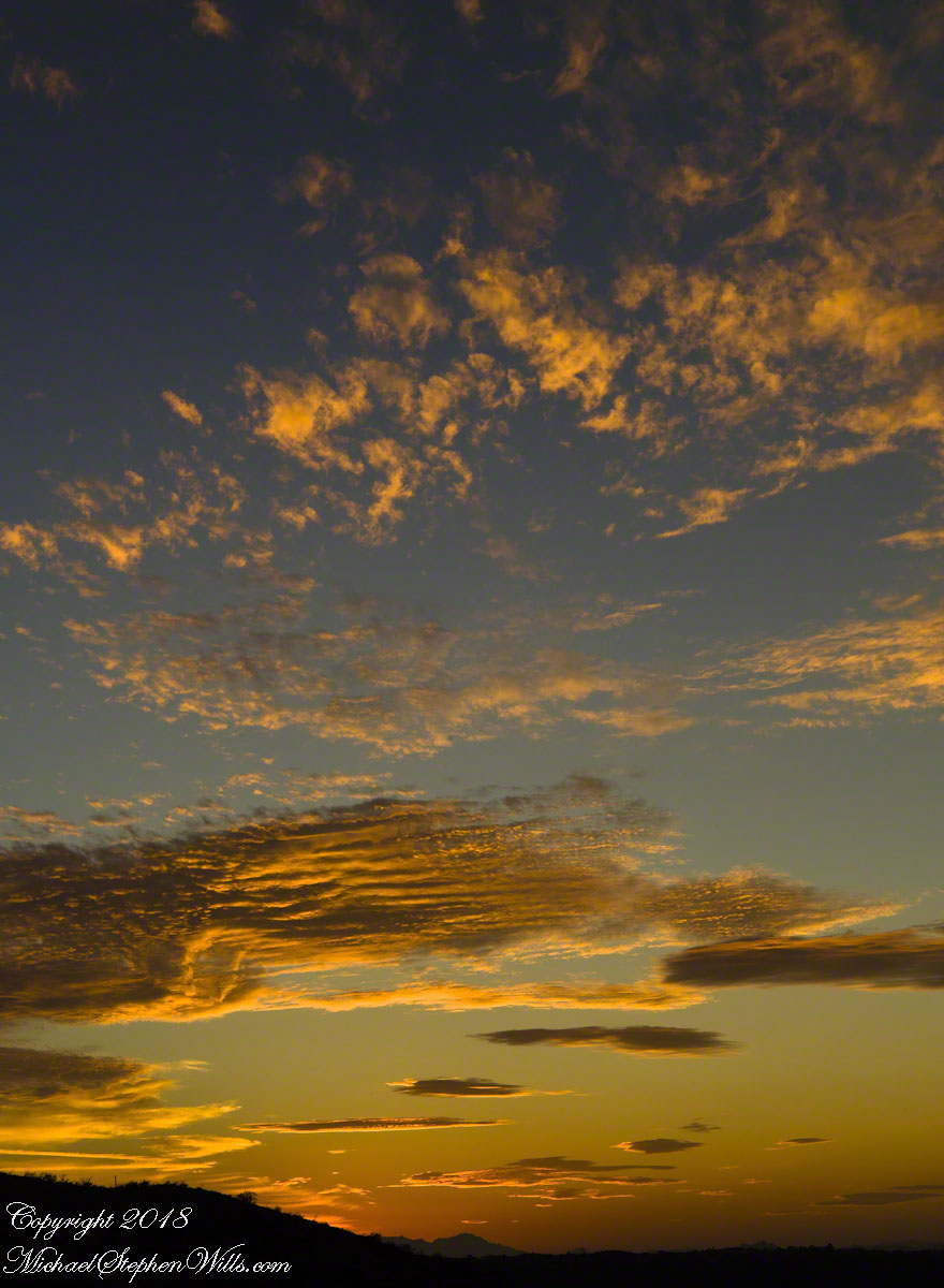
The sun illuminates different levels of clouds as the earth turns toward night. These are altostratus cloud types, at 6,500 to 20,000 feet, formed by strong winds.
The elements of my print “Ocotillo Sunset” are coming together. Do you recognize them from this image of my print?
This is a retrospective diary of the day I created my print “Ocotillo Sunset.”
Choices of the Evening
As the Golden Hour approached I had a choice to make.
My perch on Lime Kiln Falls was not safe. As the sunset developed, while I focused on the work, the trail would be lost in the gathering darkness and, even with a headlamp, I decided to avoid picking a way down a 1+ mile pitch dark deserted desert trail. Choosing not to stay, for the second time I packed up and was on the move.
That time of day wildlife is also moving and, in a short time, a rattlesnake, javalina (wild pig of the desert) and jack-rabbit crossed my path. Part of my photography kit is a Sony digital camera with a variable lens carried across the front in a readily accessible “fanny pack.” That day, I walked with the camera out and ready. I needed to be in place for an increasingly promising sunset and so spent a minimum of time with wildlife photography.
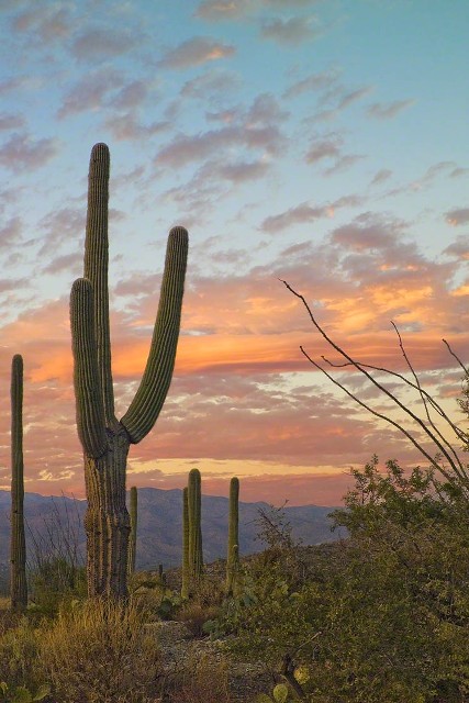
Saguaro Sky
I was only half way to the car at the time when the sun was a few degrees above the western horizon and sunlight raked across the desert. The northeast sky lit up. In these perfect moments I captured this personable saguaro on Lime Kiln ridge with a tripod mounted Kodak SLR body with an excellent 50 mm (“portrait”) lens (EF 50mm f/1.2L USM) fitted with a flexible hood. ISO 160, f13 with auto settings choosing 1/5 second.
The ocotillo branches, to the right, caught my eye. “A nice effect”, I thought. There were some high level winds shaping the clouds that evening. The Santa Catalinas are in the distance.
Click any photograph to view Ocotillo Sunset
Saguaro Sky
Nurse Tree
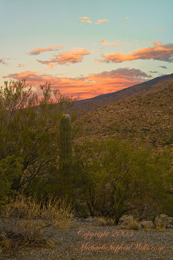
I set up back against the Tanque Verde ridge, the highest point of the road, on the western shoulder.
Front and center was this “adolescent” saguaro still growing in the shelter of a “nurse” Palo Verde tree. This saguaro benefited from the shade and protection of the tree as a seedling and juvenile. It has grown beyond the need for this protection. Eventually, the requirements of the larger cactus will starve the tree and it will be left alone, as you see it in the previous photograph. That is the shoulder of the Rincon Mountains in the distance. The direction if between northeast and east.
I am using the same camera and lens, ISO 160, f13 and auto exposure choosing .6 second. It is twilight.