Glacial Kettle Bog Wonders: Photographing Pitcher Plants at the O.D. Engeln Preserve in Freeville

Step onto Freeville’s O.D. Engeln Preserve boardwalk and meet purple pitcher plants in a glacial kettle bog—carnivorous beauty, hidden blooms, and macro-photo magic.

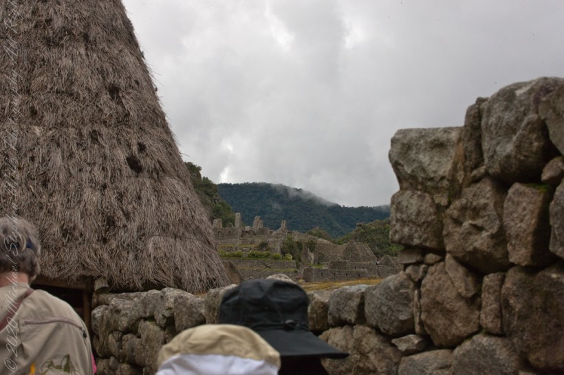
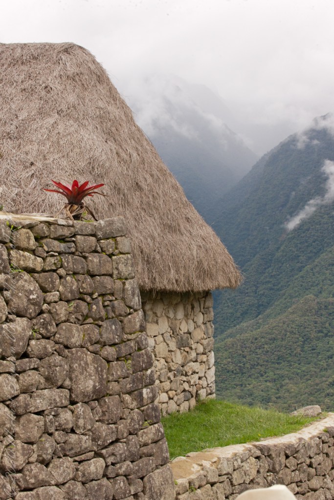
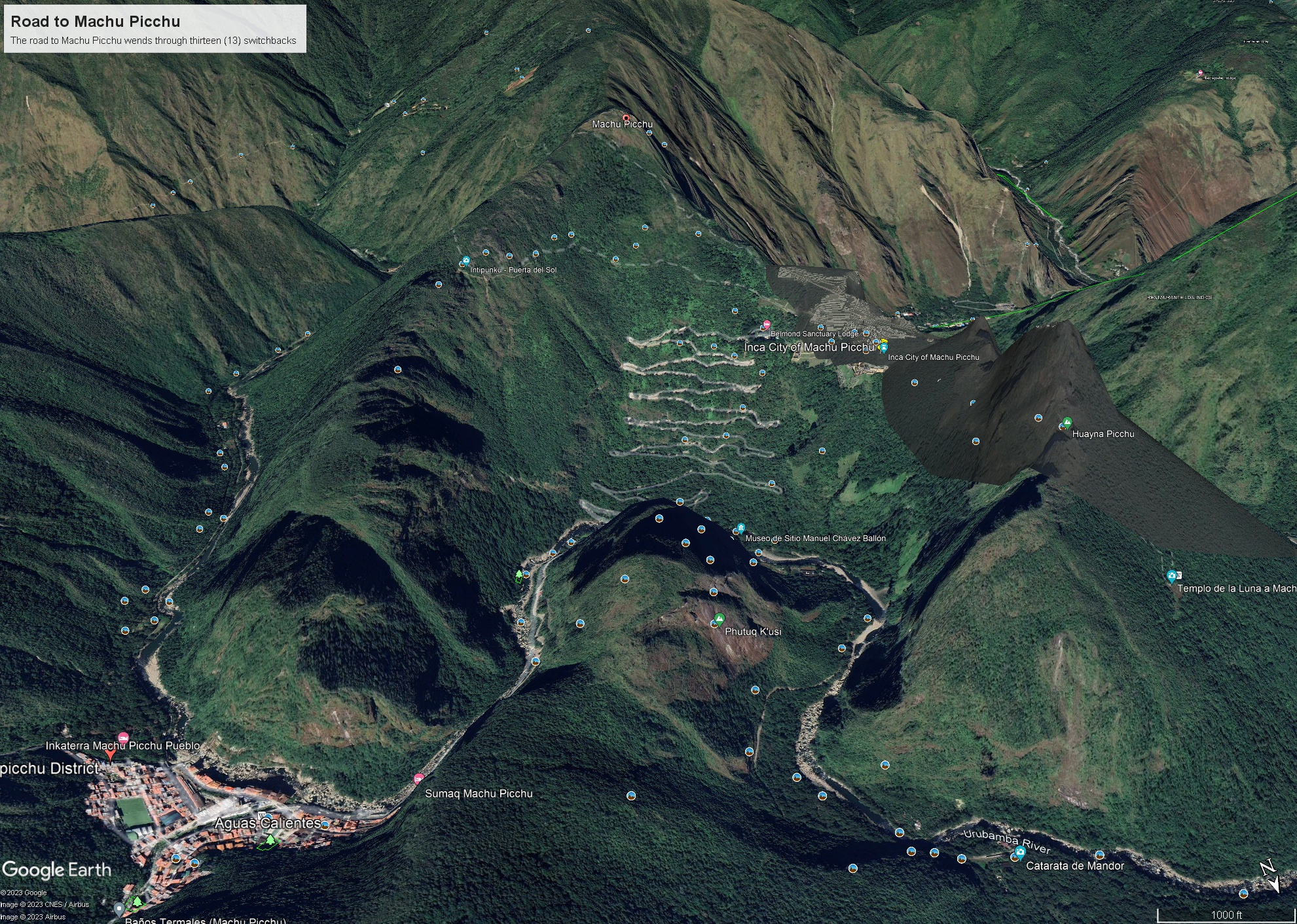
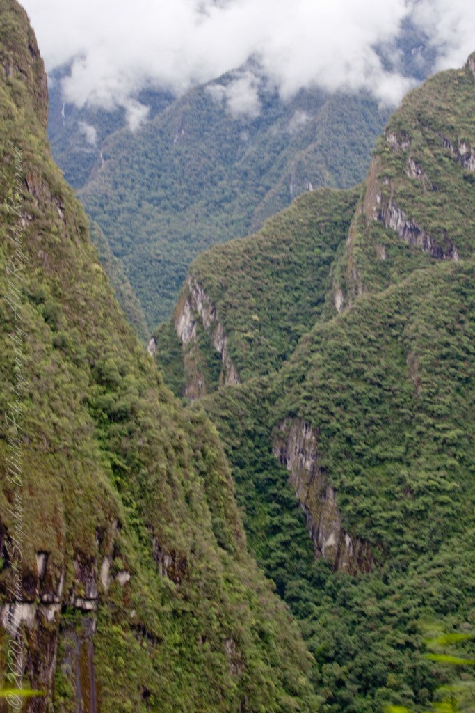
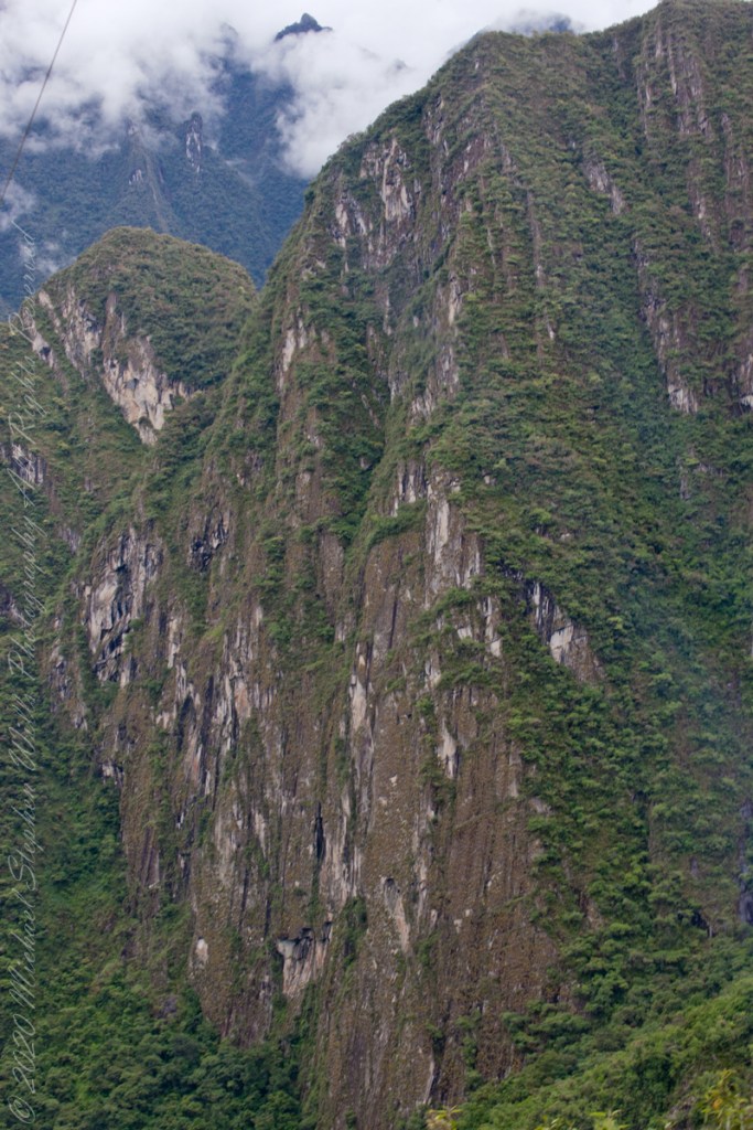
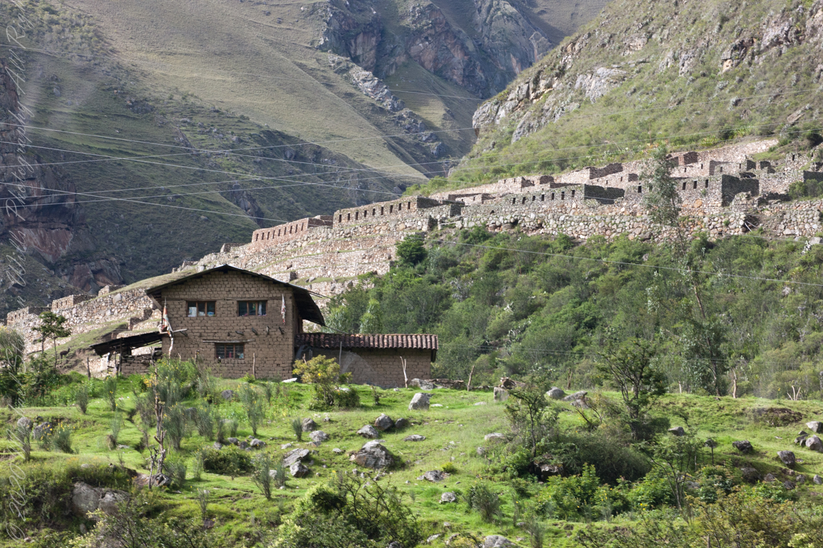
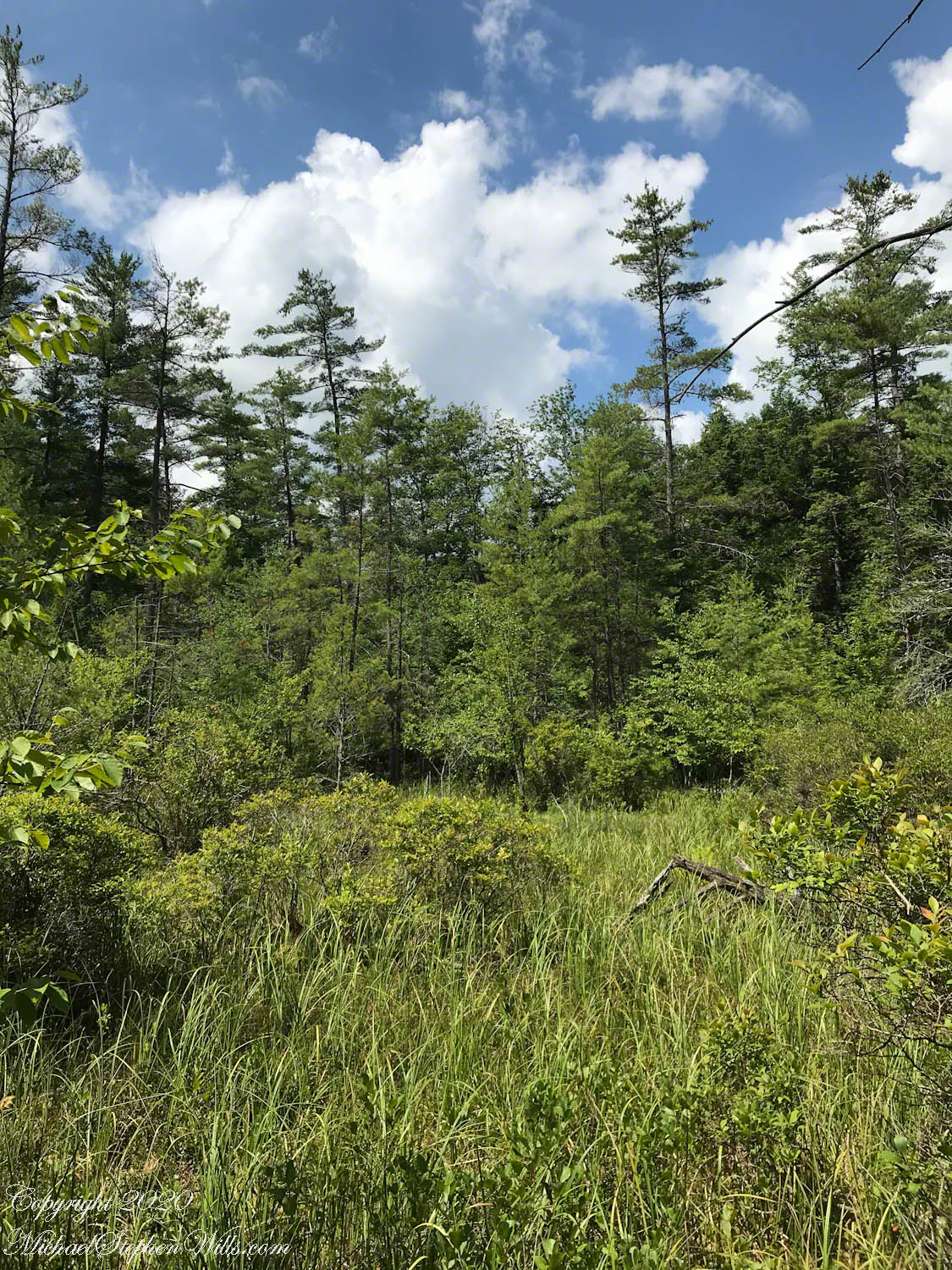
Seen from 1000 feet above in Google Earth, the O.D. (Von) Engeln Preserve at Malloryville Road lays itself out in two glacial “kettles,” pond and bog; a simple diagram drawn by ice and time, then complicated by everything that has happened since. In my photograph, taken from the bog observation platform on a July morning, the sky is rinsed blue, clouds billow, conifers stitch along the rim around open space. Step closer, or lower your lens, and the openness resolves into a crowded, intimate architecture of sedges and moss, twigs and standing water, sunlight and shadow.

I came here for a plant that does not announce itself the way wildflowers often do. The purple pitcher plant, Sarracenia purpurea, is a quiet scandal: a green vessel in a place where green should be satisfied simply to survive. I arrived equipped for attentiveness—an iPhone for the broad scene, and a Canon DSLR with the F2.8 100 mm macro lens for the stars of this bog. The macro lens is an instrument of humility. It forces you to admit that the important drama is often no bigger than your palm.

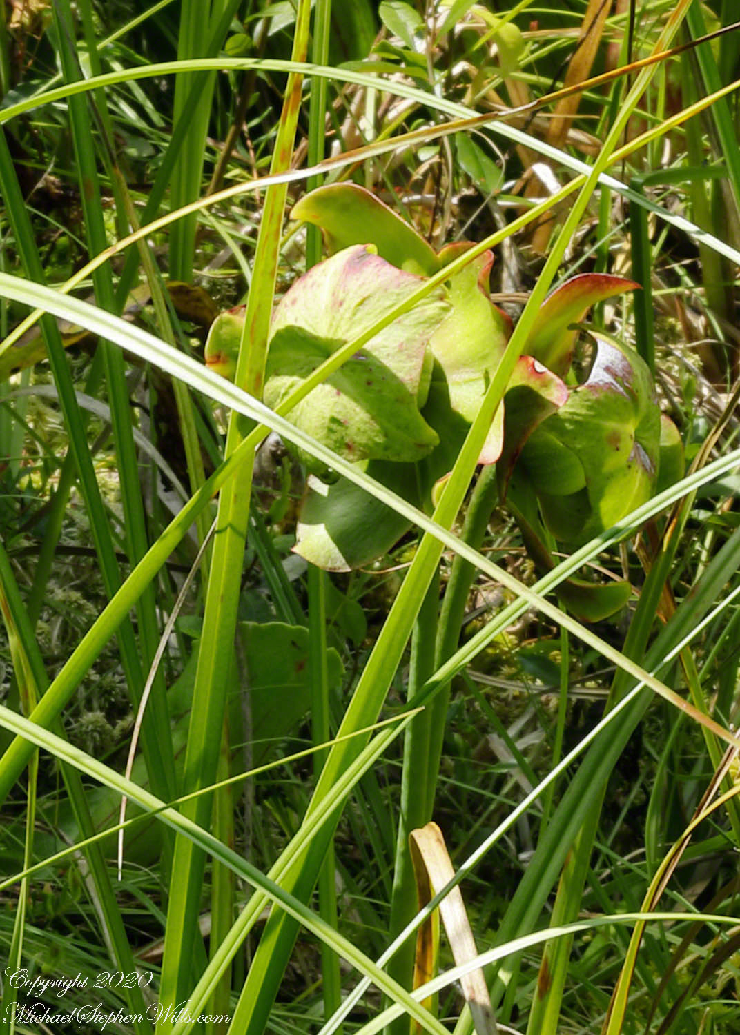
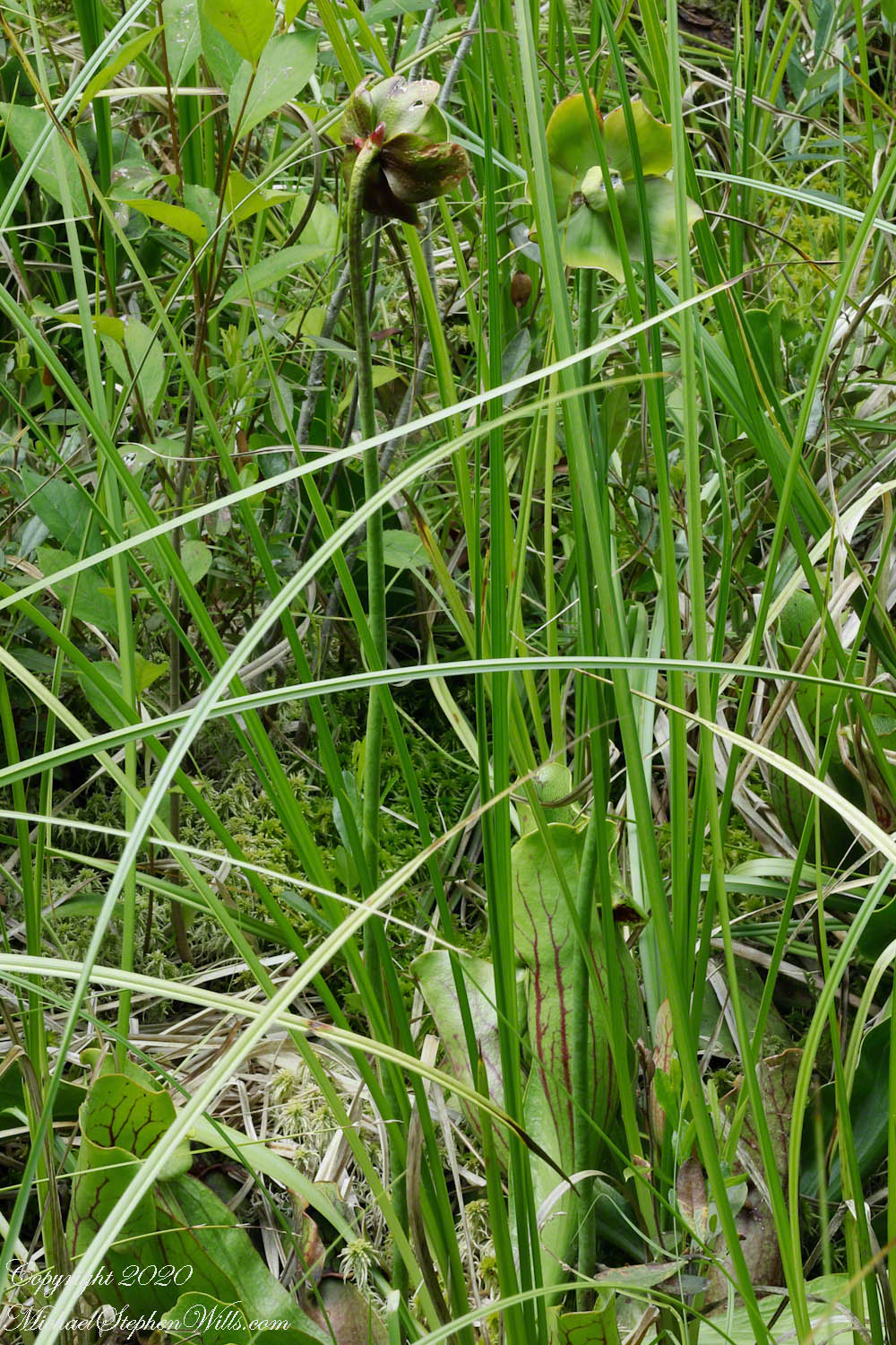
In earlier years, the pitchers could be found right where a visitor naturally looks—within the central cut-out of the observation deck, close enough to lean over and study. But the bog is not a museum display; it is a living negotiation. This season, highbush blueberries pressing in from the margin had crowded the pitchers out, pushing the flowering plants into the grasses eight to ten feet away. The shift is small in human terms, the kind of distance you cross without thinking. In bog terms, it is displacement—an erasure of a familiar scene, a reminder that rarity is not only about numbers but also about space.

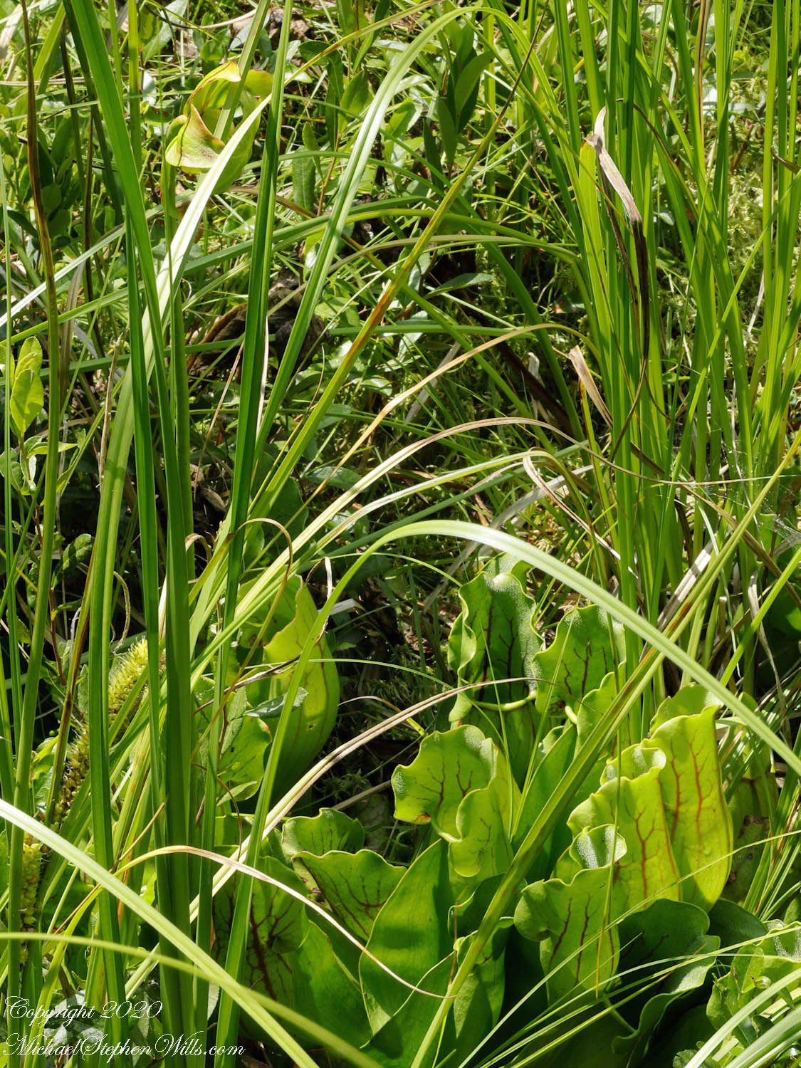
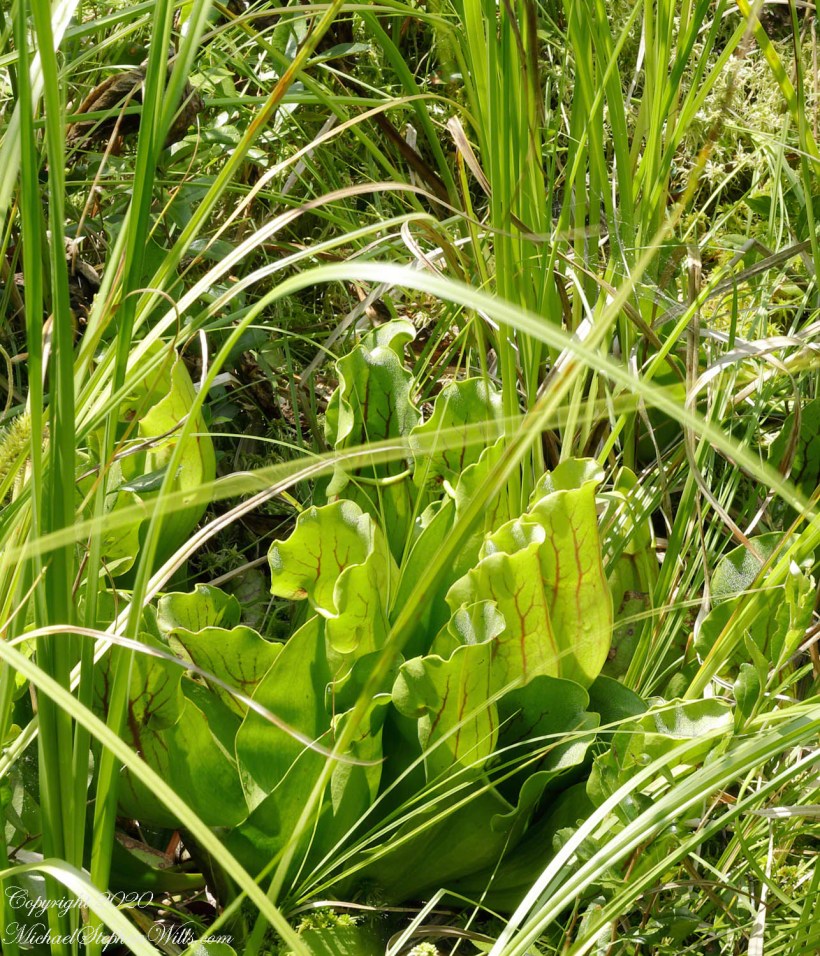
The pitchers themselves—those “turtle socks,” as they’ve been nicknamed—sit at ground level in a rosette, their mouths open to weather. Sunlight floods the cups and turns them into something both domestic and uncanny: a set of green, veined slippers left out to air, or a cluster of small amphorae awaiting an offering. In the bog’s thin soil, nourishment is hard-won. The pitcher plant answers that poverty with invention. Instead of arguing with the chemistry of peat, it borrows from the animal world—luring and taking what the air can spare. The cup is a trap, yes, but also a reservoir: rainwater gathered and held, a miniature wetland that mirrors the preserve’s larger one.

There is a tension here that never quite resolves: the plant’s beauty, and the plant’s appetite. We admire the cup’s red veining, the glossy rim, the way the opening flares like a lip; then we remember what the lip is for. We admire the flower’s elegant sheltering forms; then we realize the shelter is also a funnel, a choreography. This is not cruelty—no more than winter is cruelty. It is adaptation made visible, a lesson in how form follows need, and how need can produce something unexpectedly lovely.

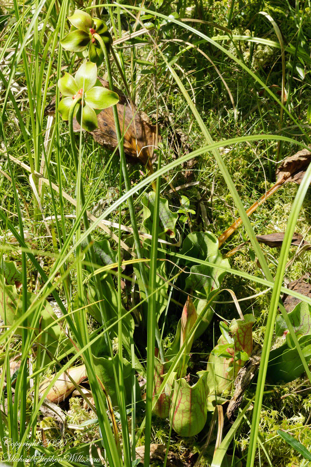
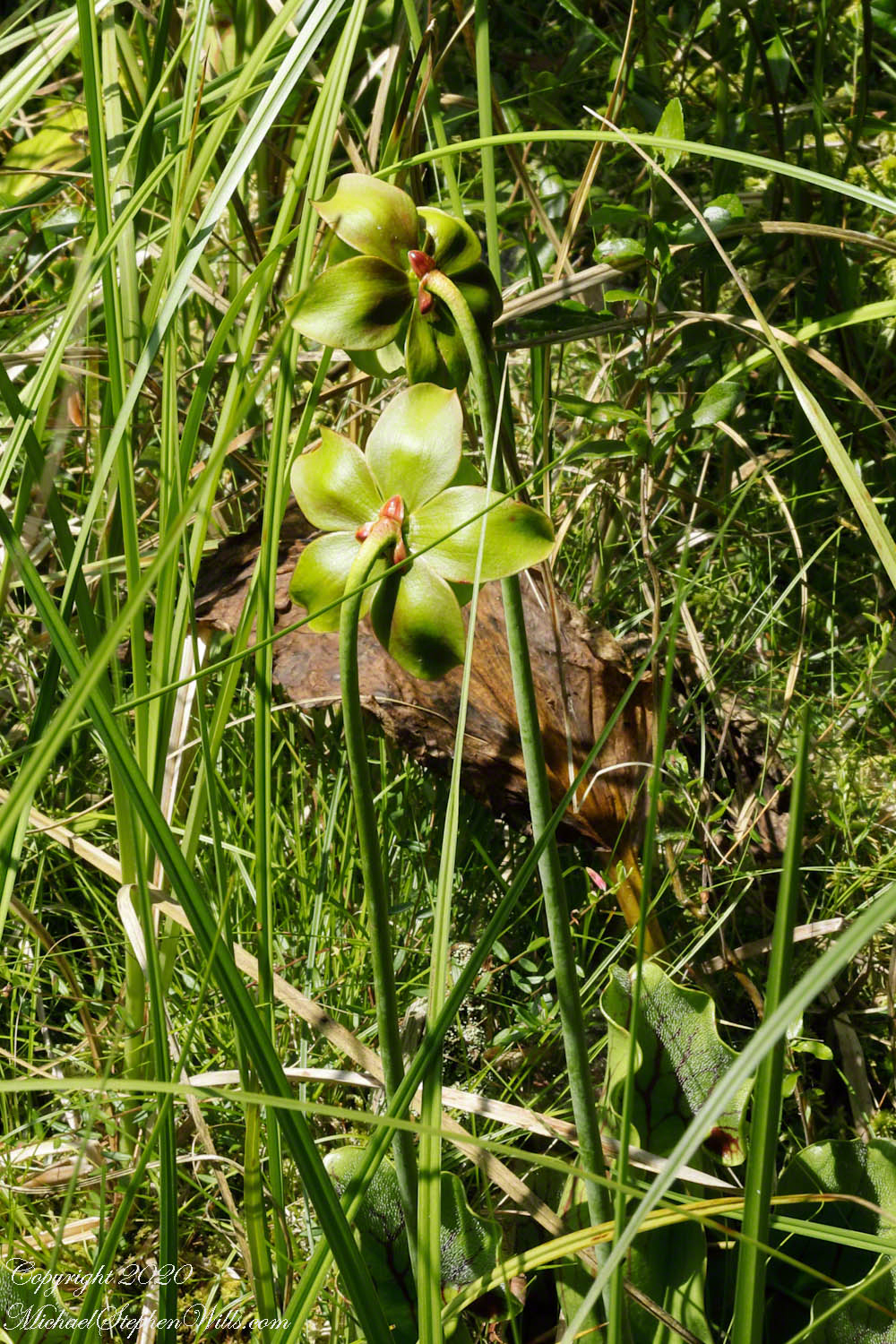
And yet the real marvel—the reason I came that day—rises above the traps on a strong stalk, lifted clear of the dangerous mouths below. The flower is not purple in the obvious way its common name promises. It is subtler and stranger: a suspended structure with the poise of a lantern and the protective logic of armor. It struck me as a flower unlike any I have experienced, resembling an insect carapace, with the reproductive element underneath a hood. That hooded design feels less like ornament than strategy—an architecture that guides a pollinator’s route, controlling entrances and exits the way the pitcher controls the fall of an insect.

Even the flower’s back side refuses to perform for the camera. From the posterior angle, “there are only bracts”—plain supporting structures, the botanical equivalent of scaffolding left in place once the facade is finished. The bog, too, shows its scaffolding everywhere: dead stems, old wood, peat-dark water, last year’s leaves. A preserve is never only what is blooming. It is what persists.

I found myself thinking about the details I wanted but could not quite capture that day: the downward facing hairs inside the pitcher—those one-way bristles that make retreat difficult once a victim has slipped in. I or my lens was not up to this challange. The shortcoming was minor, but instructive. The bog offers glimpses, not guarantees. It invites return visits, different light, different seasons, a different kind of patience.

Standing on the platform I felt the preserve’s central truth: these are landscapes shaped by constraint—by ice, by water, by nutrient scarcity, by the slow encroachment of shrubs—and yet they keep producing improbable forms. The purple pitcher plant is one of those forms: a green cup that drinks rain, a flower that wears a hood, a turtle sock that turns hunger into design. In a place where the ground itself seems to refuse abundance, the plant answers with a different kind of richness—an elegance that is also a solution.

Enter your email to receive notification of future postings. I will not sell or share your email address.

The Prison Group

Studded with tourists

Click Me for my Online Gallery

The wall with six rectangular windows is part of the “Prison Group”, a labyrinthine complex of cells, niches and passageways, positioned both under and above the ground. A portion of agricultural terraces is to the right and foreground. Look closely to see a group of tourists in the “Industrial Zone” district.

Copyright 2023 Michael Stephen Wills All Rights Reserved

Agricultural Terraces

These terraces were a work of considerable engineering….

Click Me for my Online Gallery

These agricultural terraces, built in the 15th century, were still in limited use by local farmers when Bingham arrived in the early 20th century. These terraces were a work of considerable engineering, built to ensure good drainage and soil fertility while also protecting the mountain itself from erosion and landslides. Modern soil studies reveal the major crops were corn and potatoes. These terraces are below the districts named “Industrial Zone” and “Factory Houses.” A cliff of Huayna Picchu is in the background.

Copyright 2023 Michael Stephen Wills All Rights Reserved

Houses of Factories First Look

Click Me for my Online Gallery

Our Excellent Guide

Thatched Hut

Houses of Factories in distance

Copyright 2023 Michael Stephen Wills All Rights Reserved

Guardhouse of Machu Picchu

…and medical evacuation.

Click Me for my Online Gallery

We enter Machu Picchu Sanctuary from the trail leading from Intipunku (the Sun Gate), which nowadays is the finish of the classic 4 days Inca Trail hike. There is also an entrance from the west from Vilcabamba.

The Guardhouse also known as the Caretakers Hut was a thatched roofed building constructed from crude stones and featured 3 walls and one open long side. The Guardhouse was a building used by soldiers who guarded two main entrances to Machu Picchu.

Below the Guardhouse are three thatch-roofed stone huts, the entrance trail passed beneath the lowest, shown here. A cliff of Huayna Picchu forms the background.

The Guardhouse is one of the first attractions on the upper tourist circuit around Machu Picchu. From its commanding high position in the south of the citadel, it is one of the best places for panoramic views of Machu Picchu, Huayna Picchu and surrounding mountains. On the stretcher descending the steps below the Caretaker’s Hut is a woman who collapsed during the tour. In attendance is her family and medical personnel.

Touring the site requires some stamina and care, there are many steep stone stairs to negotiate at approximate 8,000-foot altitude.

This is another view of the lowest stone hut with Urubamba River valley in background. We visited during rainy season and were well equipped with raincoats and umbrellas. By way of orientation, the red bromeliad in in the first photograph.

Copyright 2023 Michael Stephen Wills All Rights Reserved

Sun Gate of Machu Picchu

Inti Punku means “Sun Gate” in the native Quechua language.

Click Me for my Online Gallery

This was as close as we came to the Sun Gate, an important viewpoint in the Inca citadel. As Machu Picchu was originally designed and built, the Sun Gate was one of the main entrances to the citadel.

It was also considered at that time as a strategic point to protect the magical Inca citadel. It is one of the most incredible archaeological constructions of the archaeological complex. This usually connects directly with the Inca citadel of Machu Picchu. Its location makes historians think that the entrance to Machu Picchu was restricted and guarded by the military at that time, making it accessible only to visitors from the Imperial Inca Elite.

The Sun Gate in Machu Picchu is an ancient archaeological complex located on the outskirts of the Machu Picchu map. The actual name is Inti Punku and Its name means Sun Gate in the native Quechua language. It was dedicated to the worship of the Sun God or “Inti”. The sun illuminates the door during the winter solstice, giving all who visit the place a wonderful view. The construction is made up of a few walls, doors, windows, and terraces, all made of rustic stone. To get there, the Incas built a series of terraces, stairs, and many other minor buildings. The Sun Gate in Machu Picchu is located at a height of about 2745 meters above sea level. It is about 300 meters higher than where Machu Picchu is located. Being able to see the Inca citadel from Inti Punku is one of the best things to do in Machu Picchu.

Copyright 2023 Michael Stephen Wills All Rights Reserved

Machu Picchu Entrance Dedications

Plaques found at entrance to Machu Picchu

Click Me for my Online Gallery

In 1911 American historian and explorer Hiram Bingham traveled the region looking for the old Inca capital. On July 24, 1911 Bingham, led to Machu Picchu by a villager, Melchor Arteaga, crossed the Urubamba river on a rickety wood bridge. Bingham found the name Agustín Lizárraga and the date 1902 written in charcoal on one of the walls. Though Bingham was not the first to visit the ruins, he was considered the scientific discoverer who brought Machu Picchu to international attention.

“Humanidad Rinde Homenaje a diestros hijos del inti que edificaron MachuPicchu, monumento esplendoroso sign o de la cultura americacana 1911 – 1986 En el LXXV Aniversario Descubrimiento Cientifico Direccion Departmental de Industria, turismo e integracion del Cusco 24 de Julio de 1986” Translation “Humanity pays tribute to skilled sons of the Inca who built Machu Picchu, splendid monument sign or of American culture 1911 – 1986 In the LXXV Anniversary Scientific Discovery Departmental Directorate of Industry, Tourism and Integration of Cusco July 24, 1986”

“Considerada una obra maestra de ubicacion, planificacion urbana, diseno y construccion de senderos, edificios, andenes y un canal de agua con muchas fuentes, la infraestructura de Machu Picchu ilustra las avances en ingenieria civil, hidraulica y geotecnica de pueble incaico. Sus empinados andenes, solidas paredes de piedra, drenaje superficial y subterraneo, y las tomas de sus manantiales son todos ejemplos excelentes de la ingenieria civil incaica.” Translation “Considered a masterpiece of location, urban planning, design and construction of trails, buildings, platforms and a water channel with many fountains, the infrastructure of Machu Picchu illustrates the advances in civil, hydraulic and geotechnical engineering of Inca village. Its steep platforms, solid stone walls, surface and underground drainage, and intakes of its springs are all excellent examples of Inca civil engineering. September 20, 2006.”

Top: El Cuzco Agradecido a Hiram Bingham Descubridor Cientifico de MachuPicchu en 1911. October 1948 (made by C Ubquizo) Translation (The City of ) Cuzco (is) Grateful to Hiram Bingham Scientific Discoverer of Machu Picchu in 1911. October 1948 Bottom: 1911 2011 El Rotary Club del Cusco En el Centenario del Descubrimiento Cientifico co “AMachuPicchu” Sintesis de la Culture Inca Cusco Julio 2011 Translation: The Rotary Club of Cusco In the Centenary of the Scientific Discovery of “MachuPicchu” Synthesis of the Inca Culture Cusco July 2011.

Credits:
“Machu Picchu” Wikipedia
Translations Spanish are from Google Translate (with my editing).

Copyright 2023 Michael Stephen Wills All Rights Reserved

Switchbacks

940 foot climb to the Machu Picchu ruins

Click Me for my Online Gallery


GoogleEarth: switchbacks look like a ladder to the top

Our modern bus climbed the thirteen (13) switchbacks up the steep 940 foot climb to the Machu Picchu ruins from the Sacred Valley floor.

Copyright 2023 Michael Stephen Wills All Rights Reserved

PeruRail to Machu Picchu X

Intipata is an Inca archaeological site in Peru, two kilometers south of Machu Picchu, the eponymous peak of the archaeological site it dominates, to the north.

Click Me for my Online Gallery


GoogleEarth: The approach to Aguas Calientes with Intipata Ruins at lower left

After passing Toronto Ruins, the train rounded a curve into the Amazonian rainforest. It was, frankly, boring, oppressive to proceed with greenery on either side blocking even the Sacred Valley walls rising on either side of the tracks. Thank goodness for the large roof viewing windows. I captured this photograph of the Intipata ruins on Machu Picchu peak by looking backwards through the roof window.

Intipata is an Inca archaeological site in Peru, two kilometers south of Machu Picchu, the eponymous peak of the archaeological site it dominates, to the north. It seems to be, at the current stage of research, a set of agricultural terraces, without the presence of habitat nearby.”

Similar to many Incan archaeological sites, Intipata shows great evidence of having canals to water crips. These canals are distributed among each of the levels of stairs in the Intipata ruins. These stairs or terraces are quite large and would have accommodated many different kinds of crops on different levels. Each level might have been specific to a certain plant. These ruins were mostly used for the domestication of wild plant species.”

When you visit Intipata you will be able to see over 150 types of edible plants along the way. Among the plants, the Inca domesticated would be the common potato. There are also quite a few aromatic plants and flowers in this region, so if you are into botany, this section should be quite entertaining. Among some of the local flowers, you will see over 200 types of orchids along this stretch of the Inca trail, some can only be found right in this part of the cloud forest.”

The purpose of the multi-leveled Intipata ruins was also to avoid the natural erosion of the mountain since this area was also used for religious ceremonies.”

The Incas tried to use as much land as effectively as possible in their crop growing ventures. The ever-increasing Incan empire needed food and this was the best way to secure it. The Inca conquered new tribes very often and instead of killing them would offer to have them join their empire. Intipata is located near the Inca Trail in Machu Picchu. Intipata is formed on two parts, Inti meaning the manifestation of the sun in Inca mythology, and pata which means in Quechua “high”, the “ledge”, the “platform”, the “place” or “square”, the “terrace” or “staircase”, so that the name means more.

Intipata is formed on two parts, Inti meaning the manifestation of the sun in Inca mythology, and pata which means in Quechua “high”, the “ledge”, the “platform”, the “place” or “square”, the “terrace” or “staircase”, so that the name means more or less “the terraces of Inti”.

Copyright 2023 Michael Stephen Wills All Rights Reserved

PeruRail to Machu Picchu IX

Urubamba River or Vilcamayo River (possibly from Quechua Willkamayu, for “sacred river”)

Click Me for my Online Gallery

As we crossed the border of the Historic Sanctuary of Machu Picchu the valley walls rose steeply on either side, the land transitioning to rain forest.

Google Earth We approach the border of the Historic Sanctuary of Machu Picchu

We entered a short tunnel through a mountain ridge, providing us this close view of the Urubamba River.

Next we came upon the Toronto Ruins.

The Toronto complex includes seven (7) archaeological groups and is in front of the Q’ente Complex, separated only by the Urubamba River, possibly they were independent chiefdoms with a strong economic bond.

The seven (7) archaeological groups are Torontoy: The local farmers call it Inkaperqa or Inca raqay, alluding to what they see. In this place we can find a main doorway, several groups of enclosures, patios or free areas separating the buildings, vestiges of a liturgical bath and a central enclosure with a lithic piece of more than 40 angles that joins other twenty-eight pieces with exact interlocking in the joints.

Salapunku: means hall door in the Inca language, because what is most obvious is a wide door that is on a platform that runs as a street in front of the wall. Behind the door we find cyclopean platforms and plains with remains of stairways, interior roads and remains of aqueducts. Qhanabamba translates to pampa where the grass “qhana” grows. It is at the height of Km. 85 of the railroad line. We can find a series of one-story buildings and a two-story building which is the largest. Wayrajpunku: meaning windy door (alluding to a windy place). In this group we find remains of buildings and a partially standing enclosure, there are vestiges of aqueducts, paths and overcrowding of canted stones that were part of constructions.

Pincha Unuyuj: Here were made the best hydraulic works of the zone, the crystalline waters that descend, appear channeled by wide lithic channels; also we find from the bank of the river a succession of parallel platforms, a road that leads to an adoratory carved in the rock insitu, ascending some houses and an observation tower. Qoriwayrachina It means gold winnowing. We can find the following: A huge staircase with more than one meter wide, semicircular ramparts, platforms as retaining walls and a vertical slope worked that is on the turbulent waters of the river.

Retamayuj, having a broom, in this group we can find long platforms with semi-cyclopean walls, tombs that are desecrated at the base of the mountain and others intact. In 2008 A team from Peru’s National Institute of Culture (INC) working on the ruins of Torontoy in the Historic Sanctuary of Machu Picchu, discovered the tomb of an Inca with full funerary regalia. The gender and age of the tomb’s owner has not yet been determined but found with the body were a number of decorated ceramics and two pins.

Copyright 2023 Michael Stephen Wills All Rights Reserved