We’ll start in the parking lot of the Valparaiso Passenger Terminal, introduced in my last posting, “Valparaiso Old and New”. The terminal was our first stop in Valparaiso, it services cruise ship passengers, it was in the parking lot we met Ricardo, a guide and city native. In his late sixties, Ricardo lived through numbing changes: the political turn left and election of Allende, followed by a military coup d’état (called golpe de estado in Spanish) and rise of a military officer, Pinochet, to dictator. From the 70’s through 80’s Pinochet ruled, abolishing the congress in Santiago, enjoying ruthless suppression of opponents with the full support and assistance of the military. In the late 80’s Pinochet allowed a return to democracy, a new constitution with a bi-cameral (two houses) congress in Valparaiso and elected president. Ricardo was quiet about these times, as are most Chileans and we did not press him.
Click any photograph to open my Fine Art Gallery.
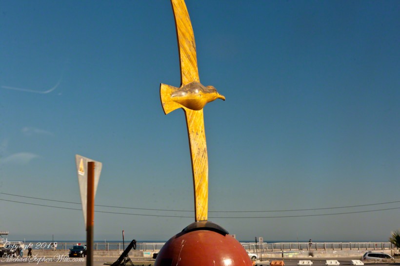
The bus passed a carved wooden statue of the albatross, near the terminal entrance. A bird of the southern ocean, familiar to mariners for the habit of following ships, this aspect of soaring the a familiar posture.
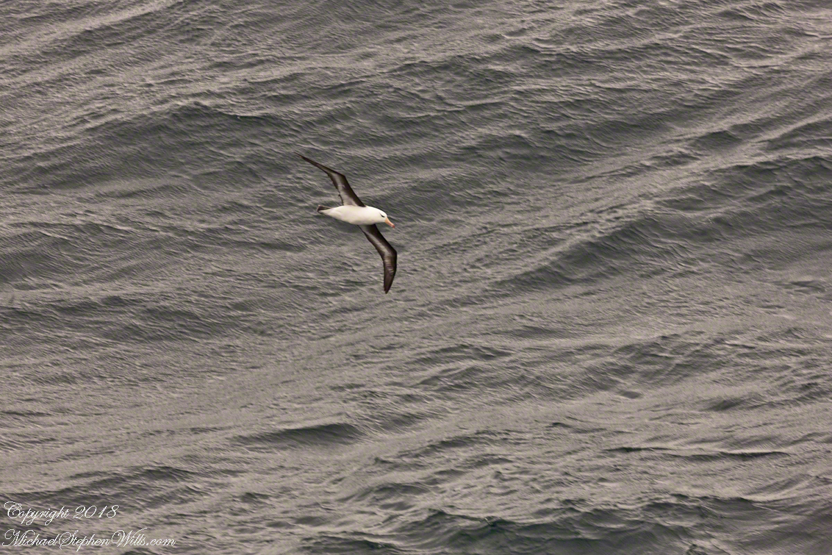
Here is a specimen in this posture following the Regatta on February 22 as we traversed the Southern Atlantic between the Falkands and Punta del Este. That day, many albatross soared among the 20+ foot waves, the wingtips very close to the water surface.
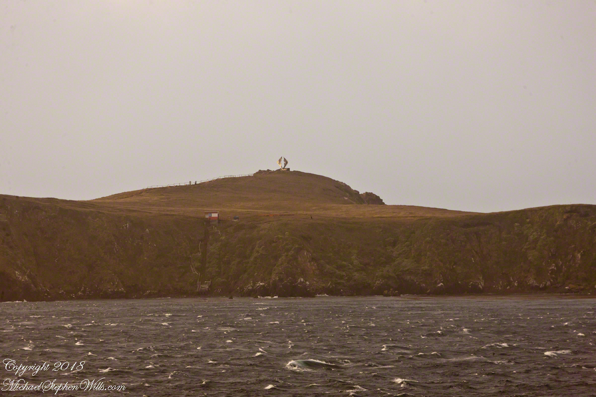
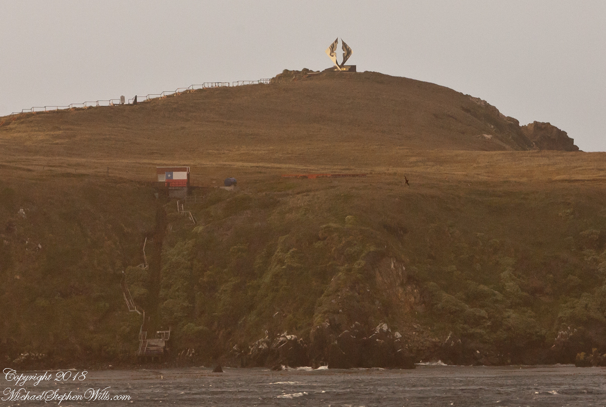
The day before, February 21, the Regatta approached the southern most point of the western hemisphere, Cape Horn, coming within a mile of the landing point and monument. At the top you can see the steel sculpture of the outline of an albatross set in a stone plinth.
A cropped version of the above image, the albatross outline is easier to see. Also visible, at the cliff base, the landing, stairs, a platform painted as a Chilean flag, the railings leading up to the Albatross Monument.
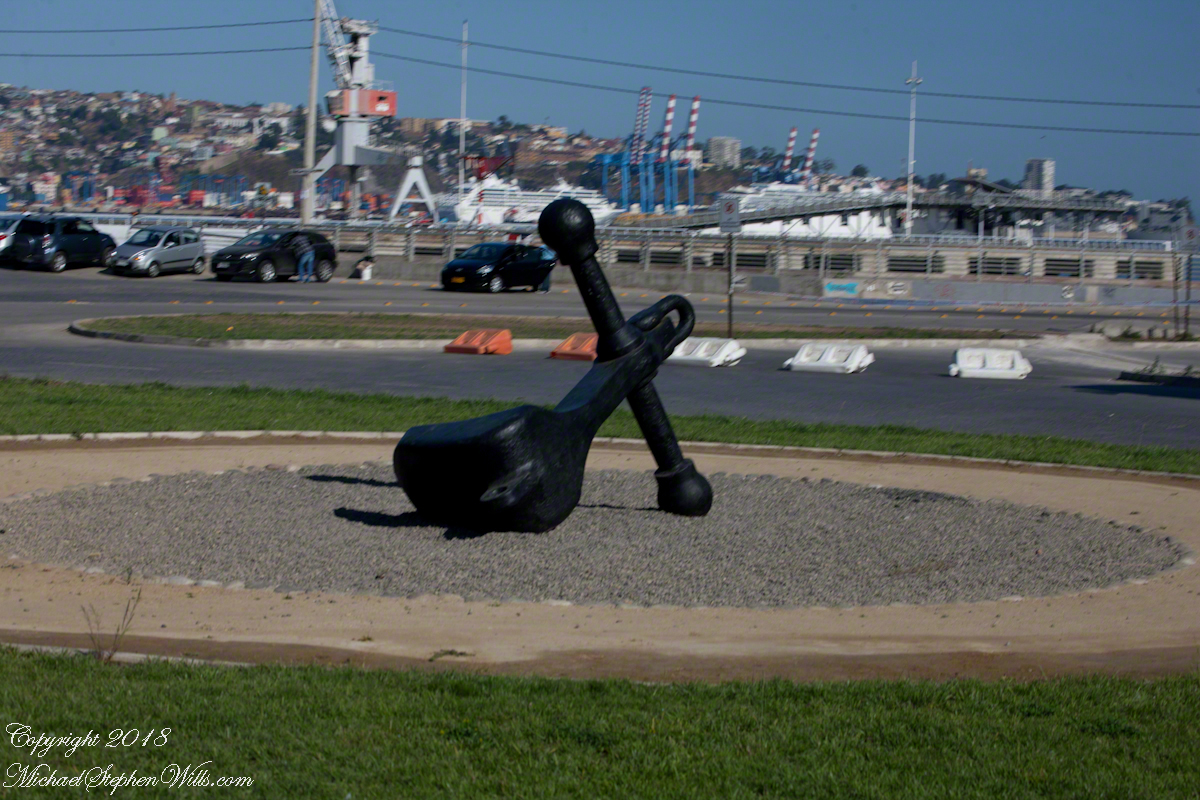
All of this to emphasize the unique position and reason for being of Valparaiso of the eastern South Pacific, made evident by the recurring motif of an albatross soaring among the waves. This retired anchor, close to the albatross sculpture, on our way to Argentina Avenue and the weekend street fair (to be continued).
Copyright 2022 Michael Stephen Wills All Rights Reserved
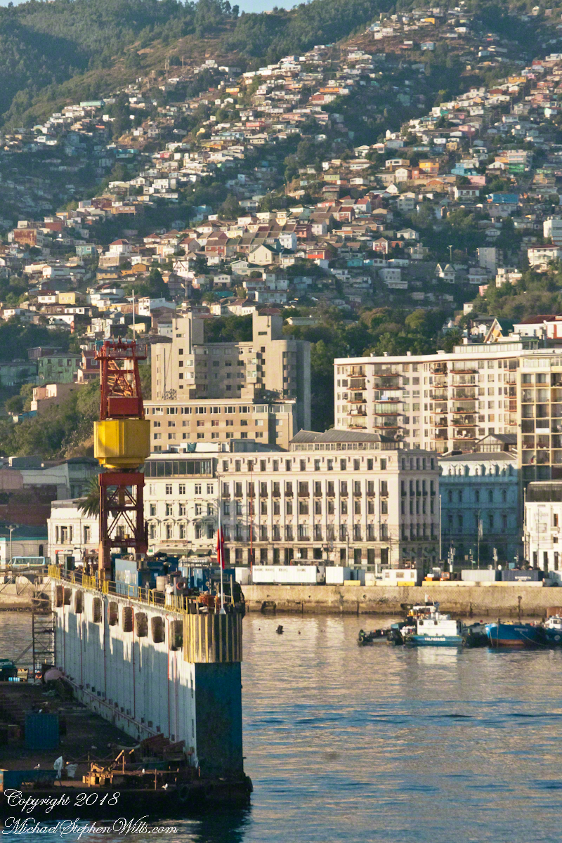
Shortly after breakfast Pam and I were among a gathering of travelers, several friends made in the last ten days among them, waiting in the Regatta lounge for tour assignments. In my previous posting, “Valparaiso Separation, you can see exactly where the Regatta was docked among the orderly chaos of the port as seen from the Ascensor Conception. “Valparaiso Separation” also includes several photographs from my early morning hours on our port side stateroom terrace photographing the approach to Valparaiso and the city itself.
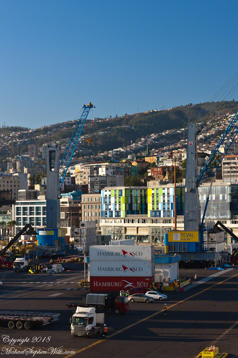
Walking down the gang plank, our bus assignment in hand, number 17, we boarded a shuttle to take us through the port, to customs. See the upper left corner? Here is part of a loading crane, seemingly the underside of a bridge. In “Valparaiso Departure I” you saw it loading rolls of wire.
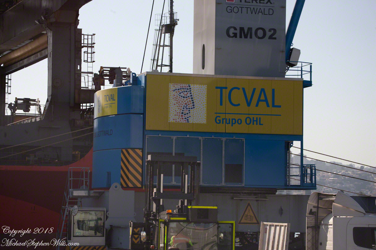
The structure labeled TCVAL is called the Gottwald, a mobile harbor crane from the TEREX based in Dusseldorf, Germany. TCVAL is an acronym, “Terminal Cerros de Valparaíso” (Hills Terminal of Valparaiso), and stands for the port management company.
Click any photograph to open my Fine Art Gallery.
I caught two overviews of the area from our stateroom balcony.
Looking along the port side of the Regatta. Our room was on the same level as the bridge, visible on the right with several Regatta officers enjoying the Valparaiso port view. From here, the shipping containers (“Hamburg SUD”) are loaded onto semi-tractor trailers for points all around South America, they call the southern most land “The Cone.”
We are surrounded by labels, the #17 in our hands, “Regatta” on the ship bow, all with a story to tell.
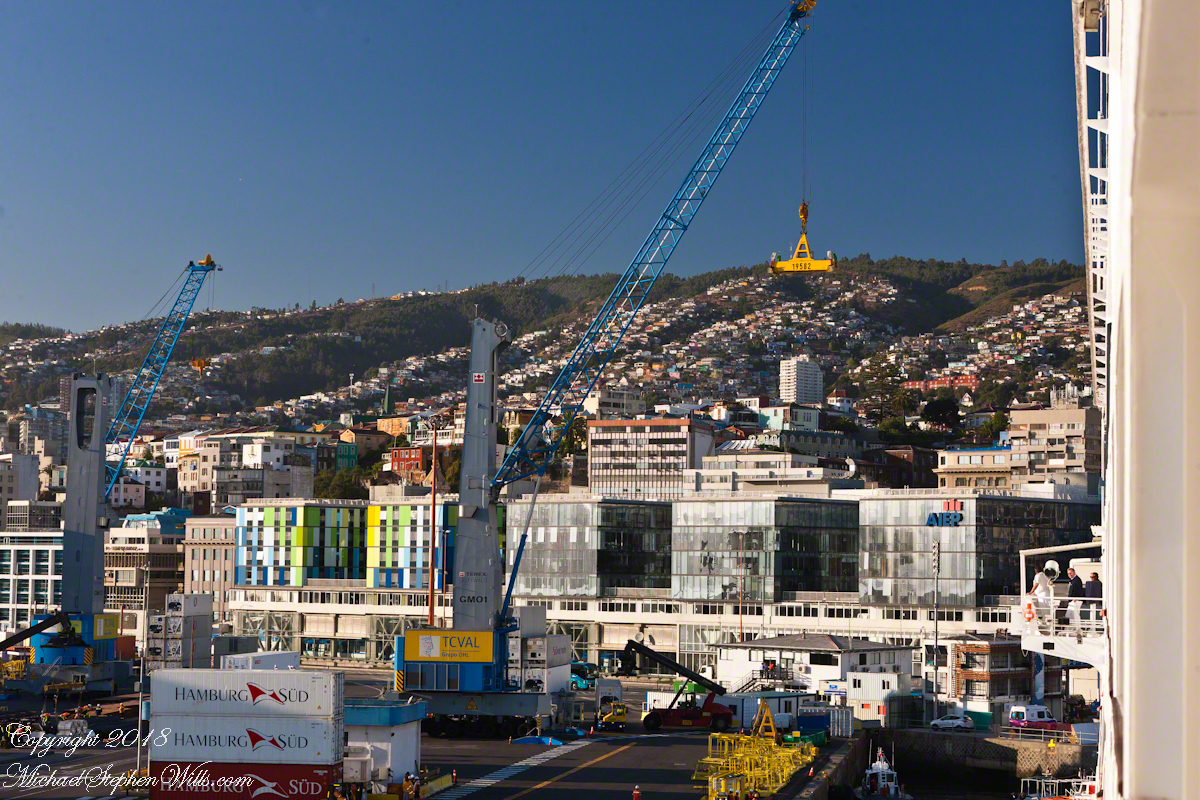
Unlabeled from this side, two towers covered with multi-colored panels, shades of green and blue with white, the Hotel ibis Valparaiso. I looked it up on Google Maps.
To the right is AIEP Valparaiso, a technical college, founded just three years before, 2013. We are seeing them from behind, the side that faces the harbor, both the hotel and school front a street named Errázuriz.
Take note of the lower floors with the large, crisscrossed supporting struts.
Click any photograph to open my Fine Art Gallery.
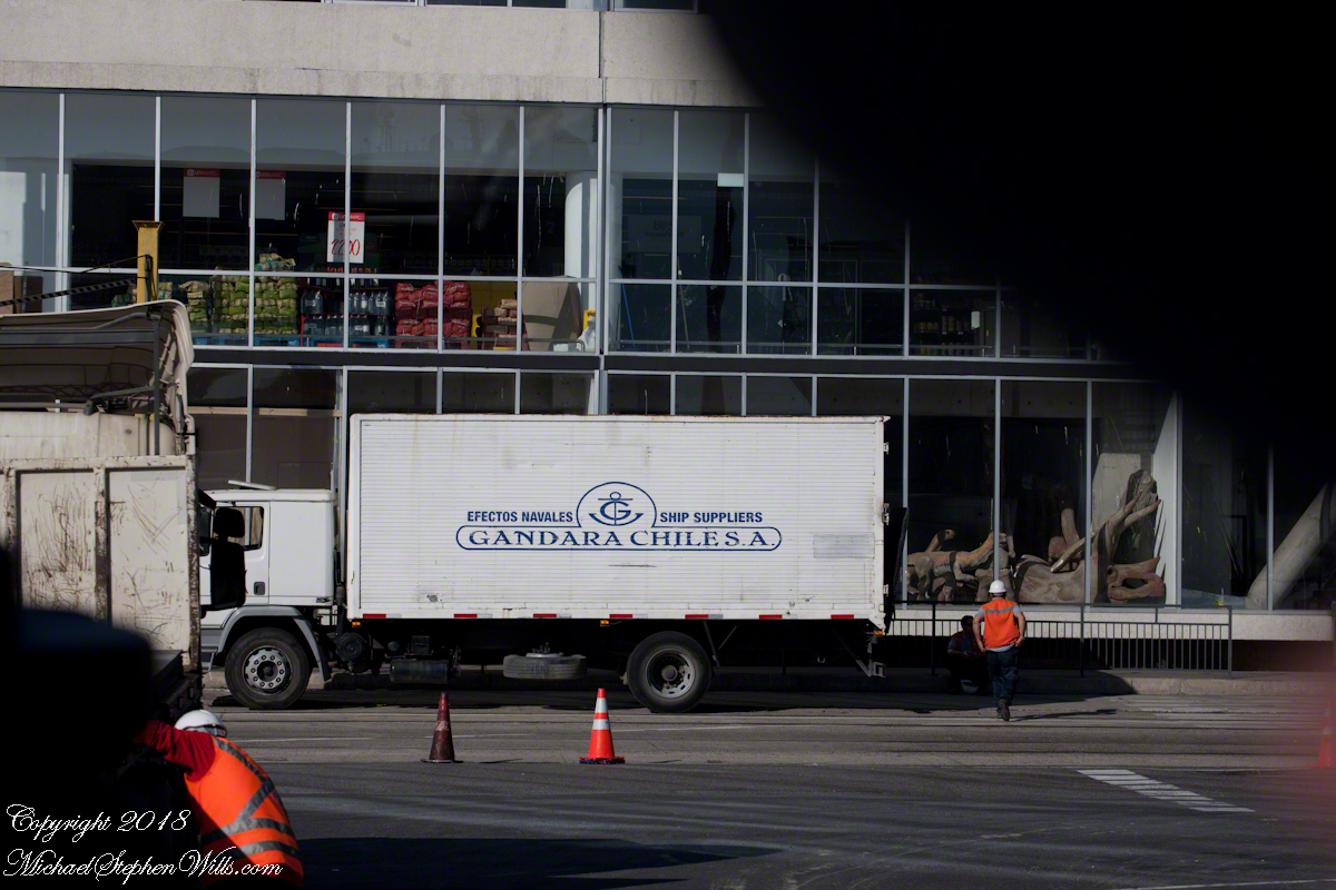
Back on the shuttle, we pass along those lower floors. Look to the right of the Gandara Chile, SA truck….dinosaur models. The floor above seems to be retail displays of bulk packaged products.
Everywhere stacked shipping containers….
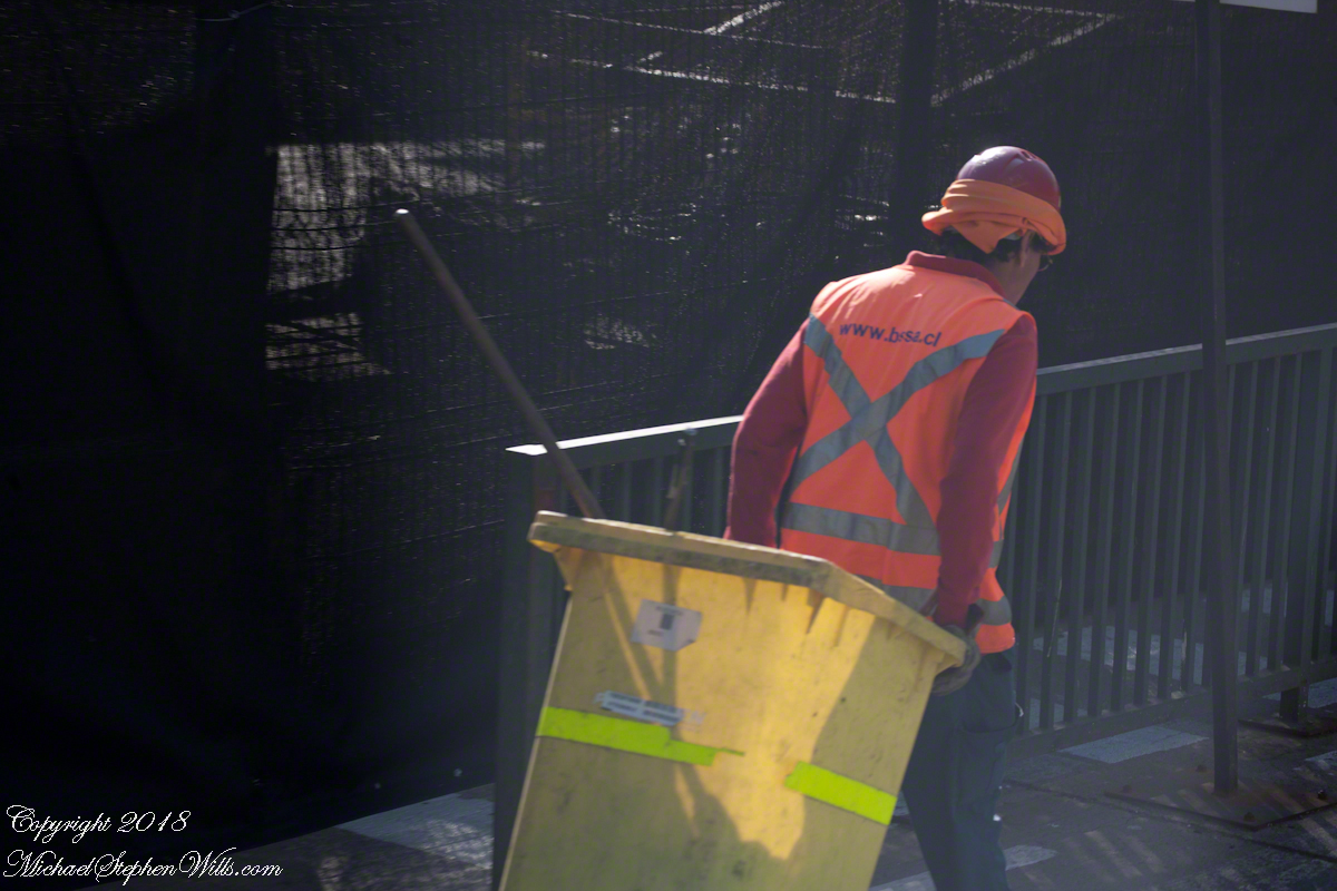
…throngs of busy workers. This fellow works for “Building Services”, a cleaner.
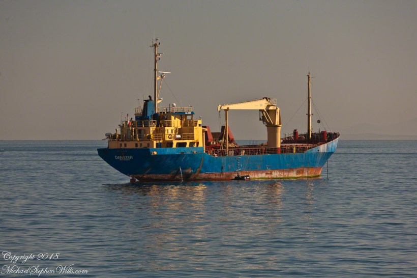
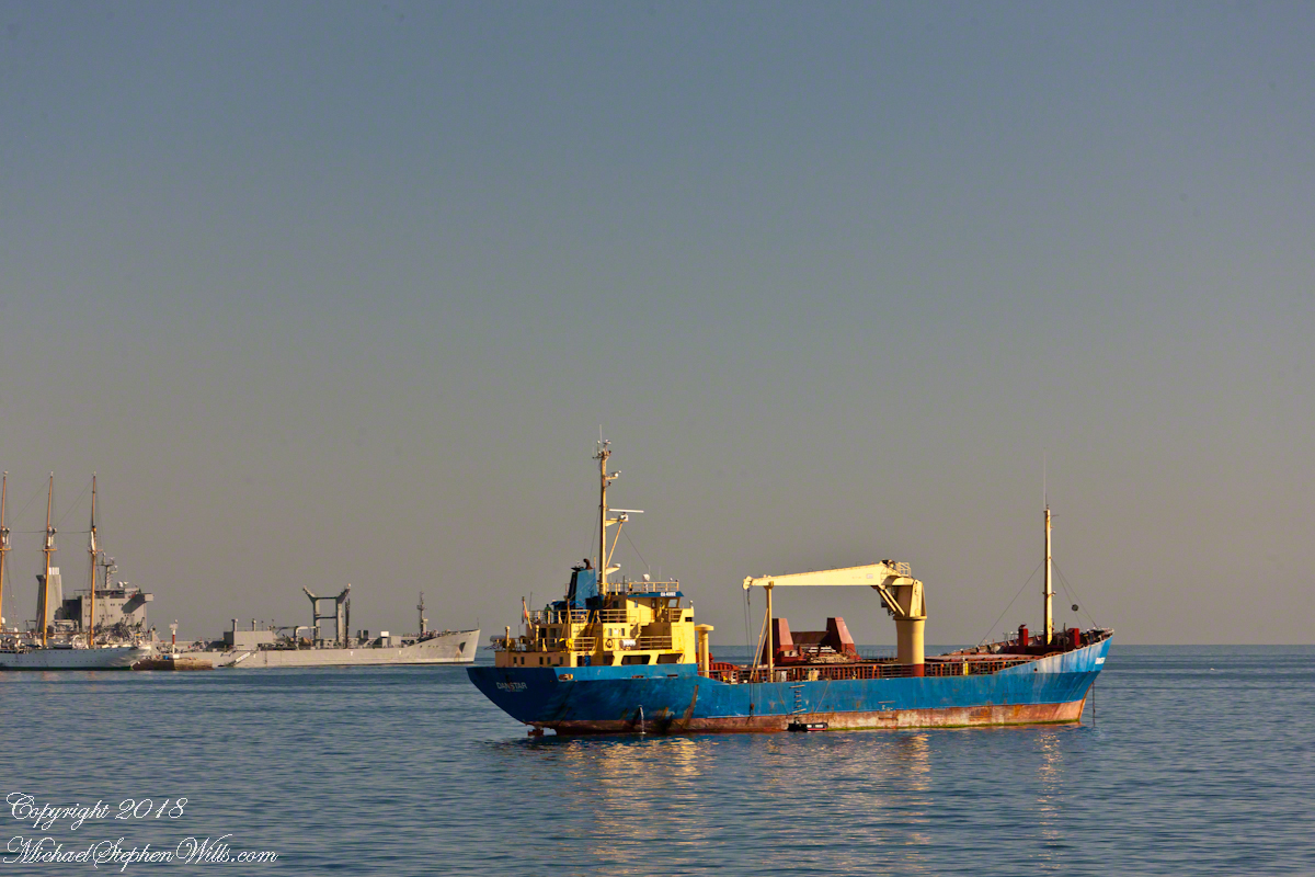
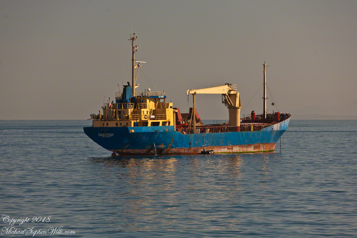
We’ve looked right. To the left a view of the port opens. War ships in the distance. Foreground is a general cargo ship, the crane midship is used for unloading in smaller ports. Currently unloaded, we can tell by how high it is riding. There is a rope ladder on the visible starboard side, a landing boat with an outboard motor along side. One person is visible on the upper deck, wearing a baseball cap.
Named “Danstar” home port Valparaiso, the Chilean flag hangs stern side. A general cargo ship, I looked it up. On the day I started this post, it was sailing the southern pacific heading from Hanga Roa, Easter Island. The label on the bridge, CA 4392, is the radio call sign. The bilge pump is working….wonder how strict the pollution stands are for Valparaiso harbor?
Click any photograph to open my Fine Art Photography Gallery.
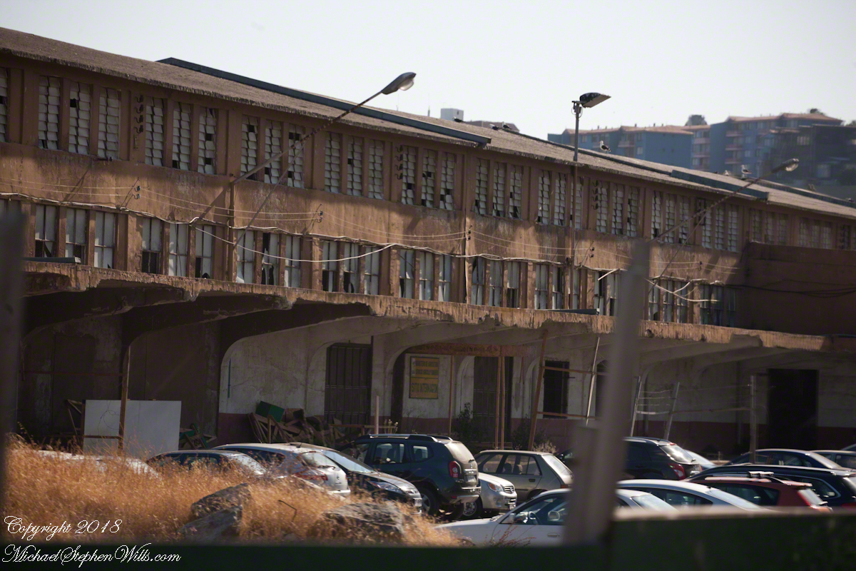
Back to the left, an unpromising aspect. No labels here. Shortly after the transport unloaded us for customs. I generally do not photograph those workings, no use being pulled aside for questioning by unsympathetic officers. Just a precaution, the entire trip the customs people were friendly and the inspections cursory.
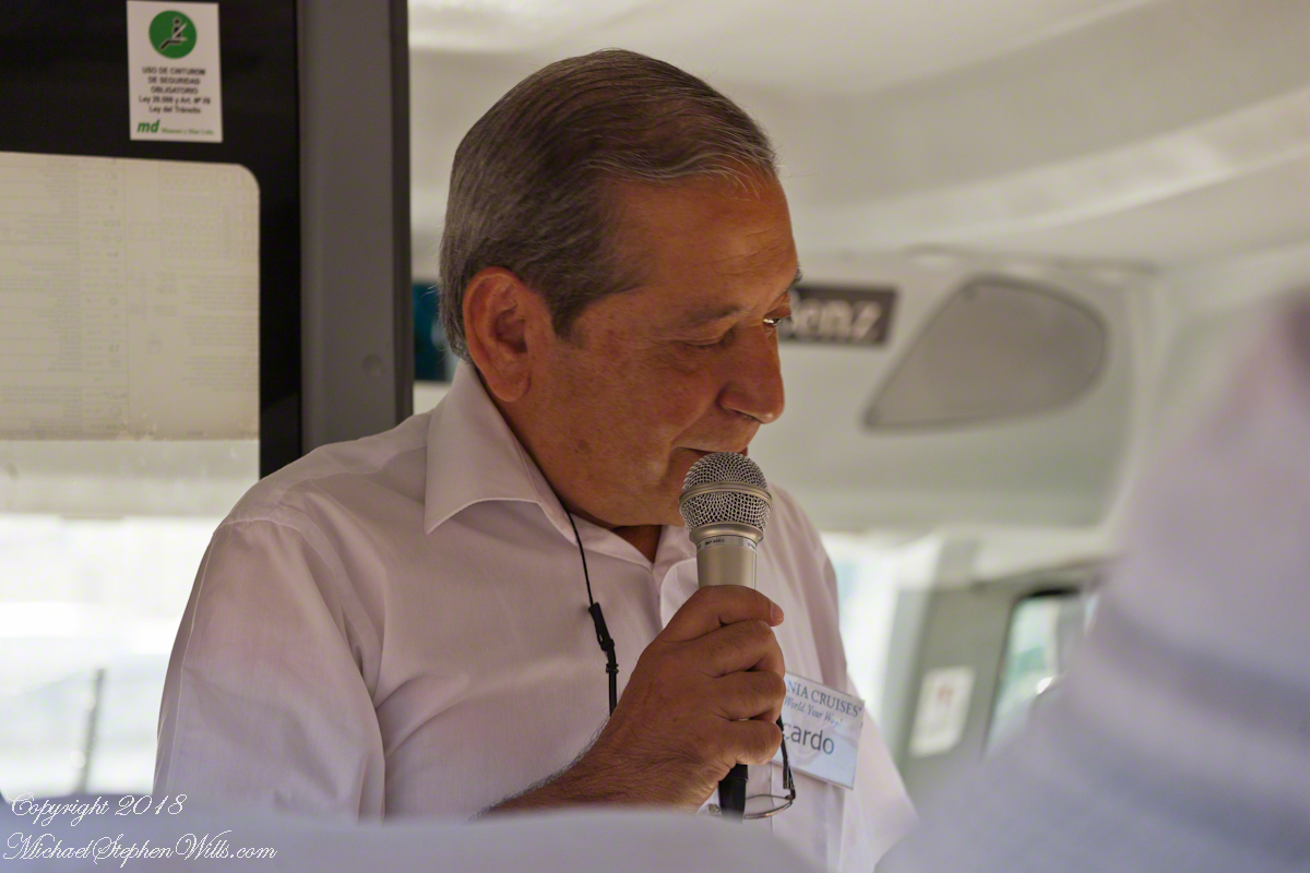
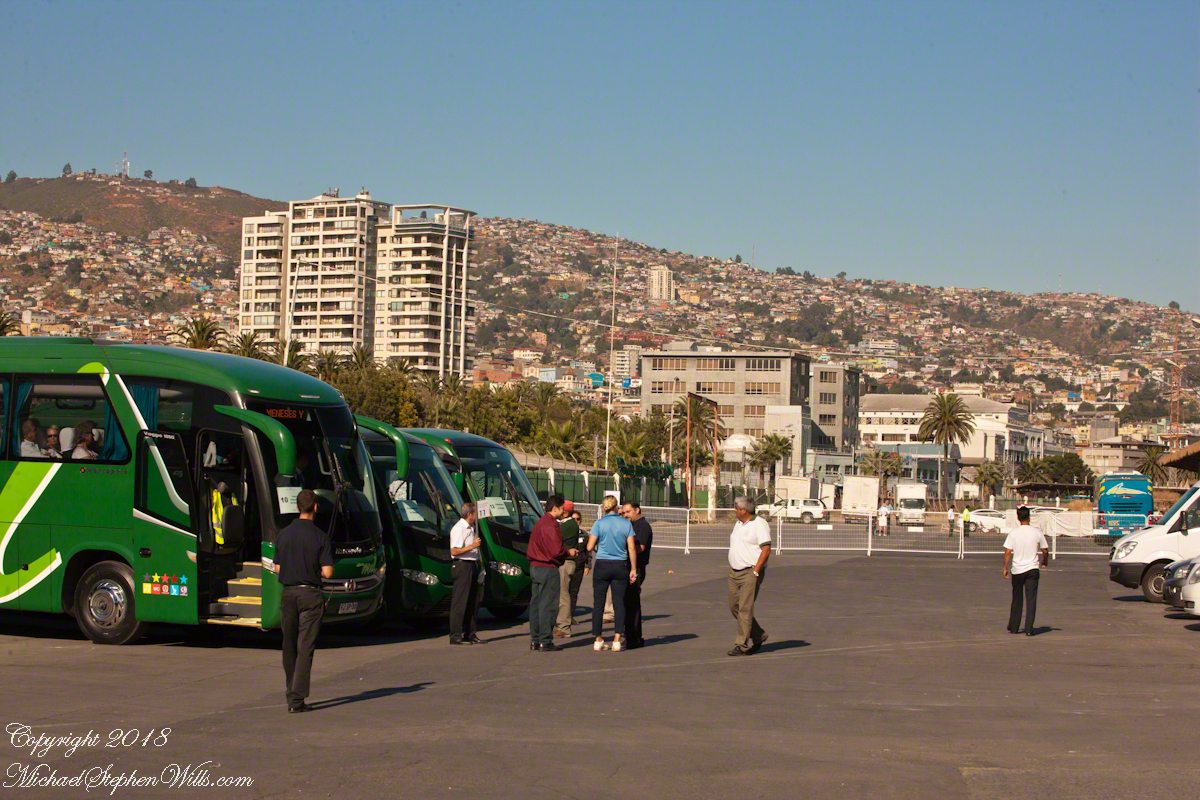
Here is where our slip of paper, #17, is used just in case we forget the number. Here is wonderful guide, Ricardo, holding a loft the #17 flag in from of bus #17. The wonderful city of Valparaiso laid out for us in the morning sun, the sky cloudless.
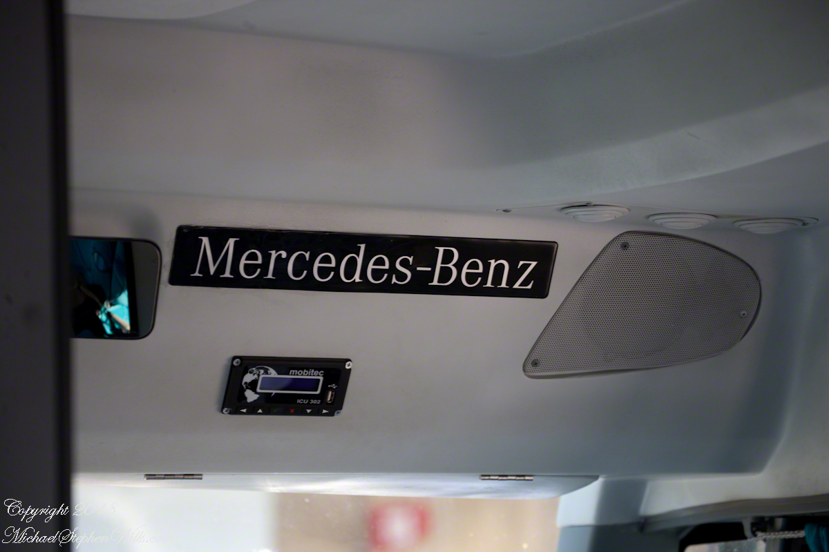
New buses, nice!!!
Ricardo introduces himself. His name tag “Oceania, Your World, Your Way.” Cannot help getting some humor from that.
Click any photograph to open my Fine Art Gallery.
Copyright 2018 All Rights Reserved Michael Stephen Wills
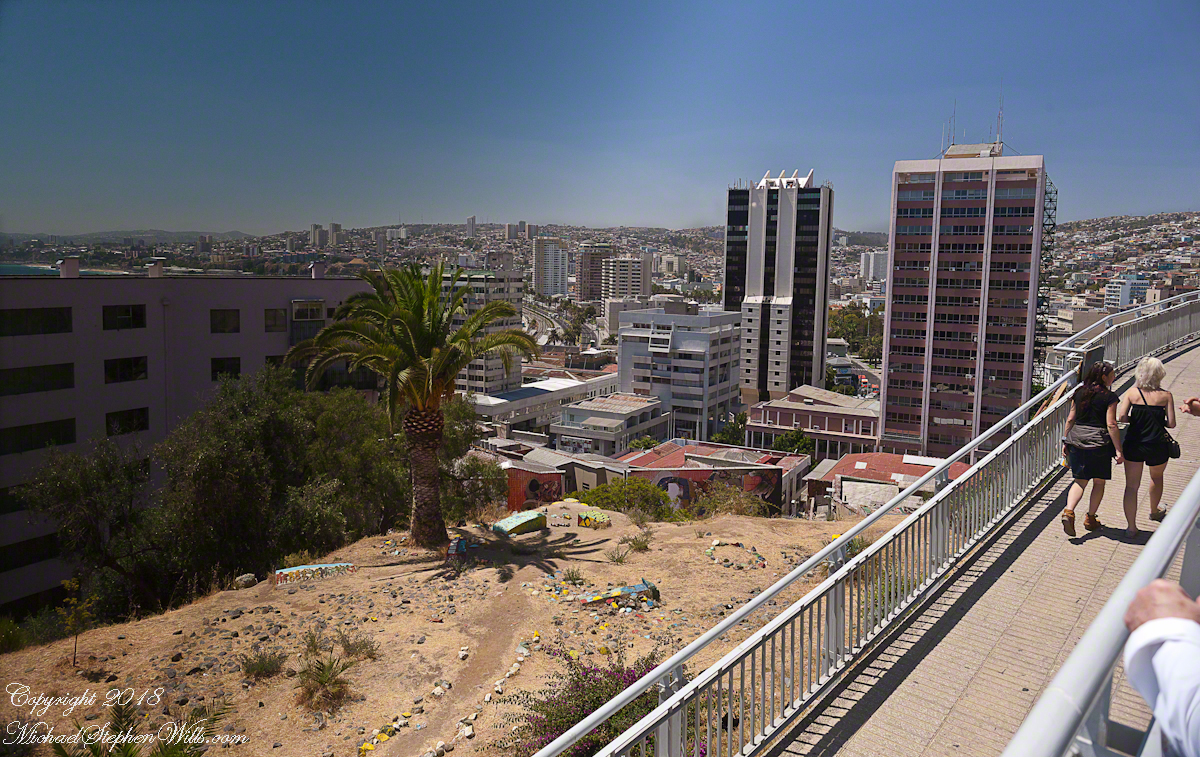
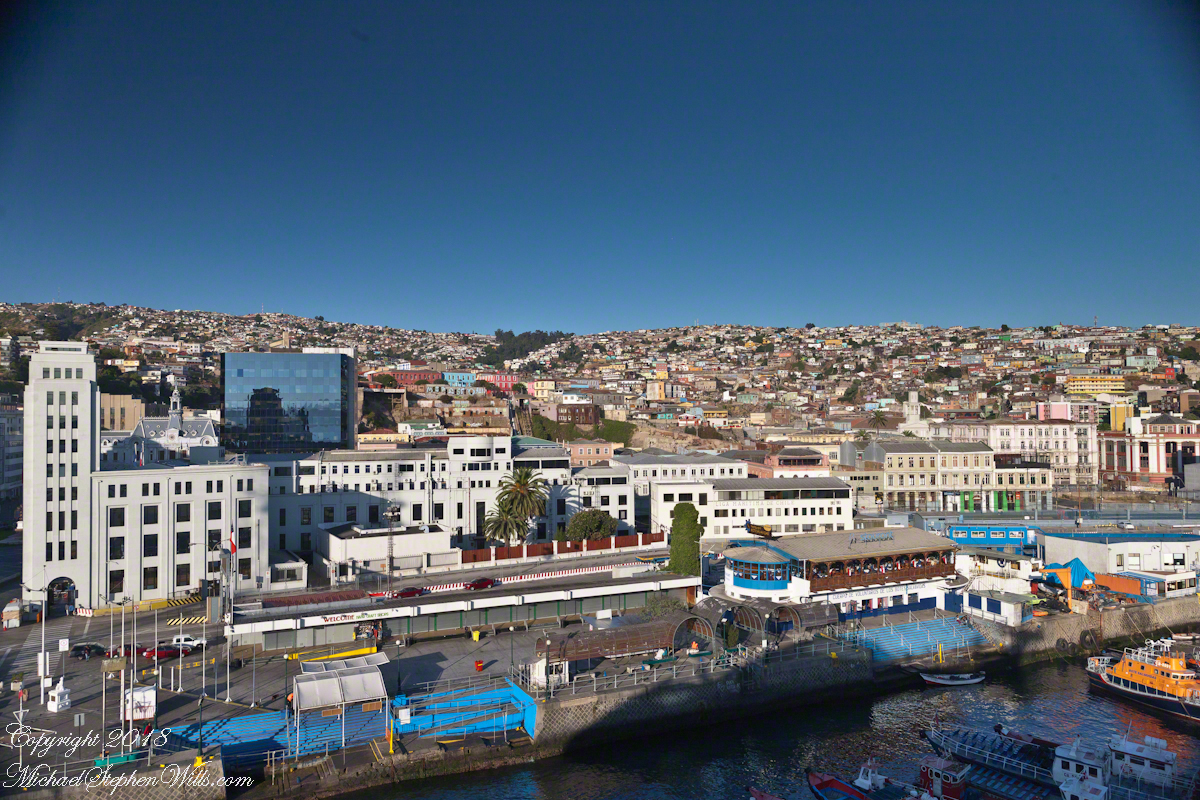
To begin with an epilogue to my last post, “Our Fifteen Minutes of Fame on Conception Hill” , our meeting with the El Mercurio reporter never appeared. Inquiries to the newspaper were promptly and courteously replied to, there was nothing. They suggested a search of the online archive and only a January 2014 fashion show, the article featured a photo from the same terrace. After our pleasant time we walked off some calories on Gervasoni Promenade, a showcase of city harbor and hillside views.
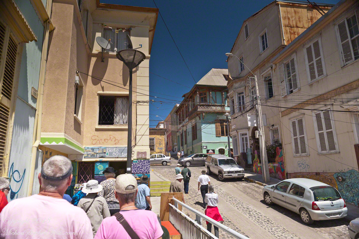
Most city visits on this cruise we traded independence and flexibility for the convenience of the guided tour. Ricardo, our guide, was a knowledgeable, good humored companion to our small group. After we left the promenade for Calle Conception Ricardo was most helpful.
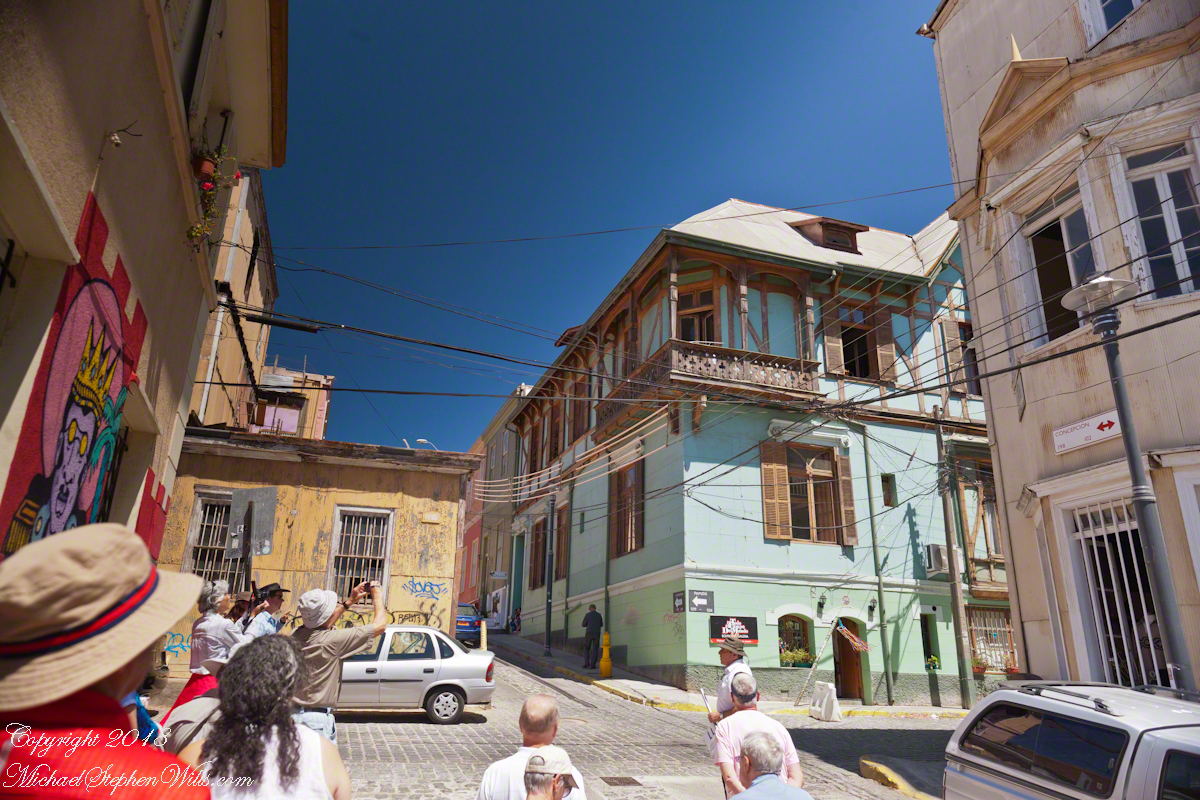
It was here I entered a photographic fugue, losing touch with my surroundings through concentration on capturing the moment.
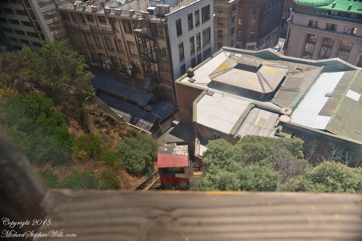
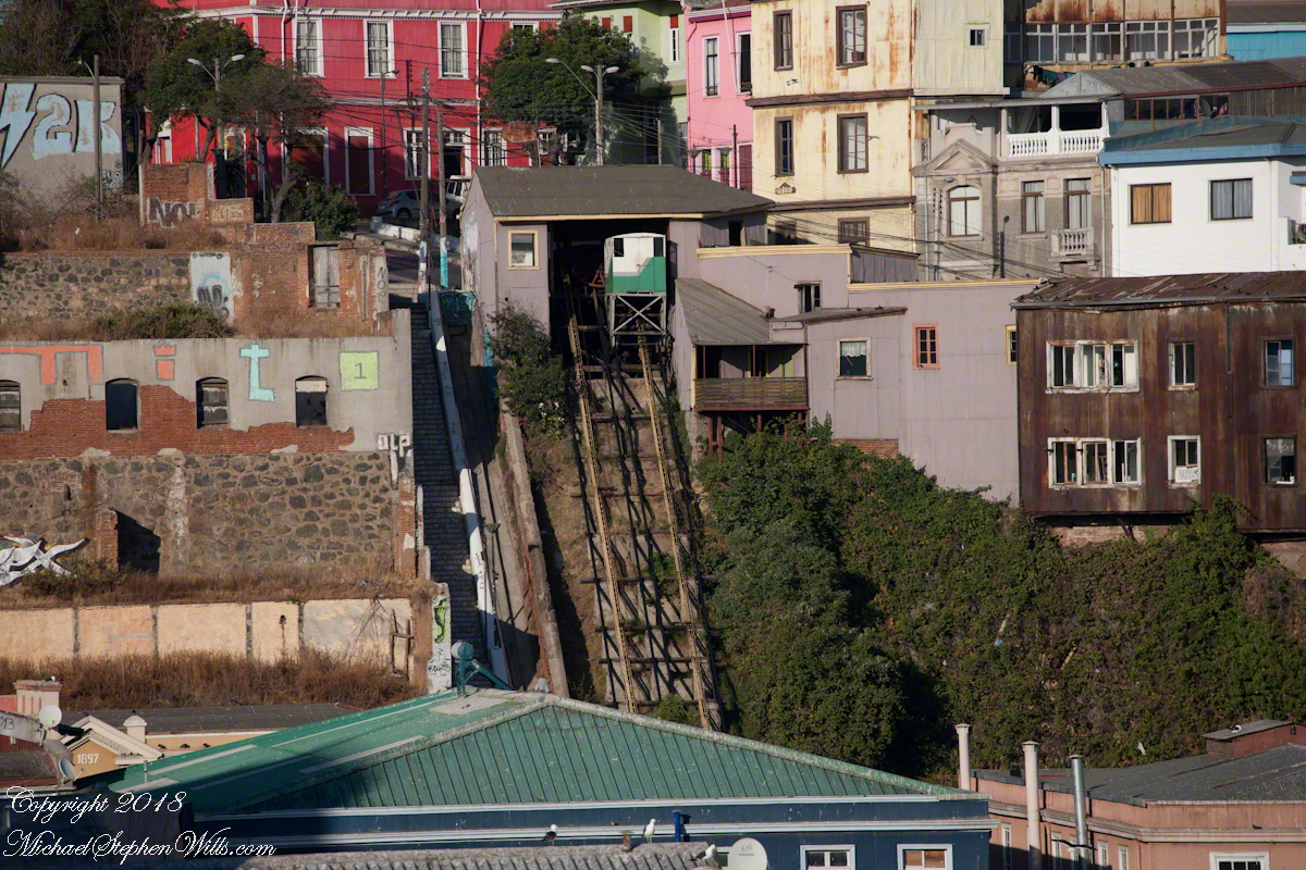
I walked ahead of Pam, expecting her to follow, and caught the view of the arriving care of the Conception funicular.
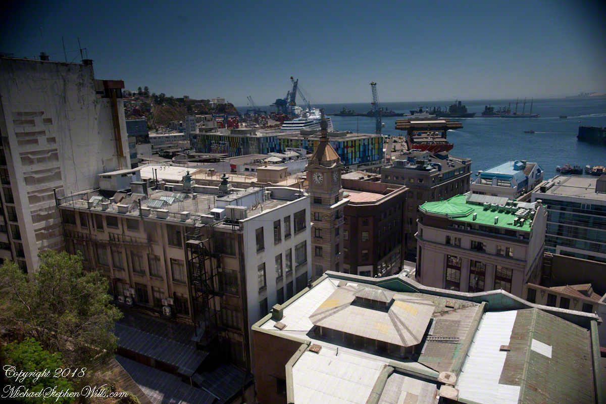
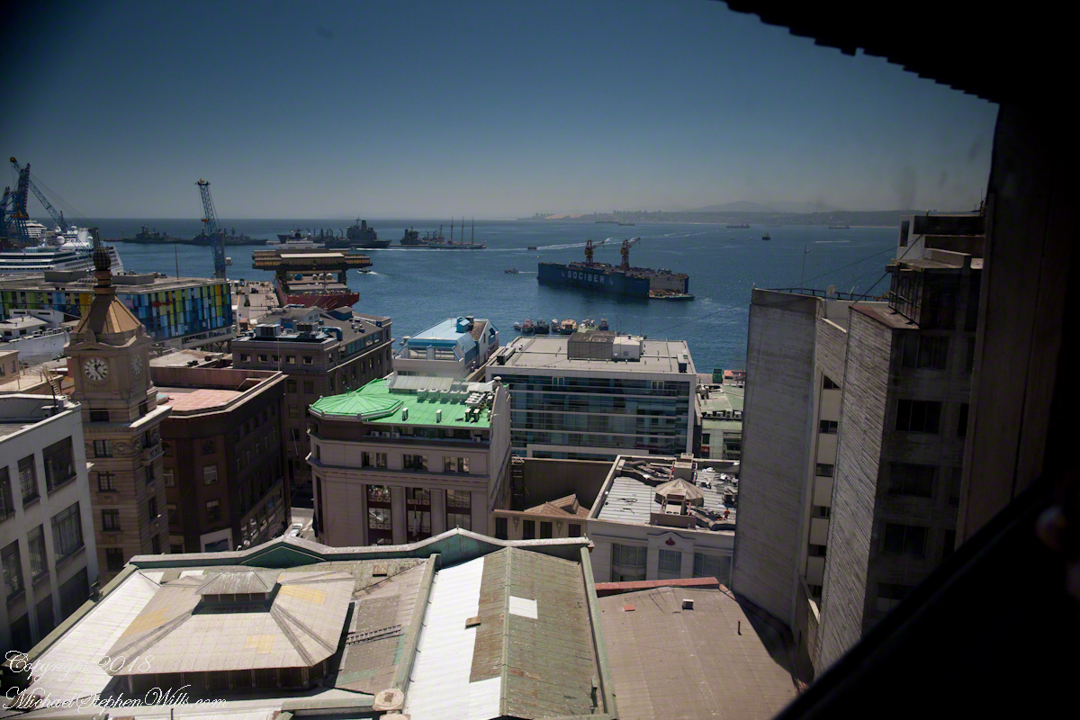
Wow, that’s the Regatta at dock. Other elements of this vista are the harbor, of course, then the famous Turri clock tower. Hmmm, almost 1:30 pm.
I was fascinated by the view of a drydock the Regatta passed while docking early that morning. It is the red structure with the letters “Sociber”, it even has a Facebook page!!!
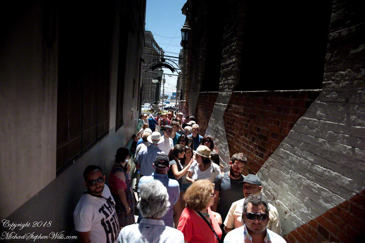
Once at street level the experience of the crowd on the alley opening onto Calle Prat, waiting for the ride up, brought back reality. “Where’s Pam?” I could not go back up because of the crowd, the views from the car fell from my mind.
I was on the street, disoriented and alone.
I fell back on photography to pass the time. Nowhere near the charm of Cerro Conception, typical downtown urban environment.
A man approached the family across Prat, “What is going on?” I wondered when the tour bus arrived. Still no Pam.
Oh, it is an ice cream vendor. Delicious. “Where’s Pam?” Ricardo not around, either. Back on the bus, waiting, a younger member of the tour was an Irish wag who declaimed on the benefits of freedom, even temporary.
Finally, Ricardo arrived followed by a few other tour members and Pam. Whew!! I’ll never live down “deserting” her. She was not able to find the entrance to the Conception funicular. Along with a few others they kept each other company until Ricardo rounded them up. That was a long 20 minutes (reading from the photograph metadata), I was worried. As I mentioned, at the time I was clueless about my whereabouts. Reviewing the numerous photographs, I found the “Servicio Nacional de Aduanas” (National Customs) building across the where Calle Esmeralda joins with Cochrane and pieced it together from there.
About the Conception funicular, that morning while the Regata docked I caught this view of Valparaiso hillside. It is a microcosm of the Andean topography, ravines cut through the heights. This is when I noted the Sociber drydock, it is on the lower left…look down into it — the business is to sell that dry space in the middle of the harbor for ship repair. The space and be flooded, opened to allow entry of a ship, then drained for work on the hull or whatever.
The city pioneers adapted to this terrain. As a entrepreneurial endeavor, in 1882 Mr. Liberio E. Brieba Pacheco founded the Mechanical Elevators Company of Valparaíso. Conception funicular opened the following year to facilitate the urbanization of Alegre and Concepción hills. Conception funicular is closed for repairs currently, from 1883 until recently this, the oldest and first funicular of Valparaiso lifted people from the downtown Plan (plain) to the hilltop for a small fee.
Funicular is derived from latin “funis” for rope. It is an elevator that runs two counter balanced cars on a rails on a steep, less than vertical, slope. As one car rises the other lowers.
Here are some views of the Conception funicular and environs as seen from the upper Regatta deck. First, a 24 mm wide angle view. Look to the center for the rails and one car at the top. Above are the buildings of Cerro Conception (Conception Hill).
The funicular emerges from downtown on the right in the following view. The prominent church is Parroquia Perpetuo Socorro, just above the midpoint. It rises from Cerro Cordillera, above Cerro Conception. A Catholic church founded by the Redemptionist Fathers, the first stone was laid down 1905. Learning from the devastating earthquake of 1906, the engineer Juan Tonkin chose construction of Oregon pine and concrete to stand tall today. What a view (I’ve seen photographs).
A view a bit to the right, many of the colorful exteriors are zinc panels brought from early sailing ships, repurposed as siding.
After the wide angle shot I used the variable “zoom” lens for the rest. Here is a close view of the Conception funicular. The business of building and running these services thrived, over the years up to 29 funiculars and one elevator, served the city portenos (people of the port). In 2018 seven are in operation, nine are under a process of restoration and modernization, including Conception.
Copyright 2022 Michael Stephen Wills All Rights Reserved
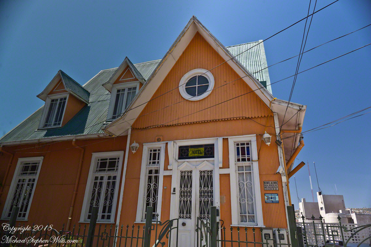
Posting about our departure from Valparaiso, Chile (see Valparaiso Departure III “The Sunset”) brings us to the time spent wandering this World Heritage Site, added to the UNESCO list in 2003. Within the amphitheater of hills is Cerro Conception (Conception Hill), historically settled by English and German immigrants. The façade of the Hotel Brighton, a building from the 19th century heyday of Valparaiso when it was a stopping point for shipping through the Straits of Magellan, reveals why so many of the buildings are alike: all are constructed from materials dropped off from sailing ships.
The theme of the Hotel Brighton evokes thoughts of immigrants remembering their origins, emigres claiming a spot of real estate to mold a sense of place for themselves. This goes both ways, Valparaiso, Indiana was formerly Porterville of Porter County. The motive force behind the renaming were the memories of the retired Captain David Porter, the sole survivor of an attack on his ship USS Essex by the British frigates Phoebe and Cherub in the War of 1812, within sight of Valparaiso. Fifty eight (58) United States Marines lost their lives in that sea battle. To point out the obvious, Captain Porter is the namesake of Porter County.
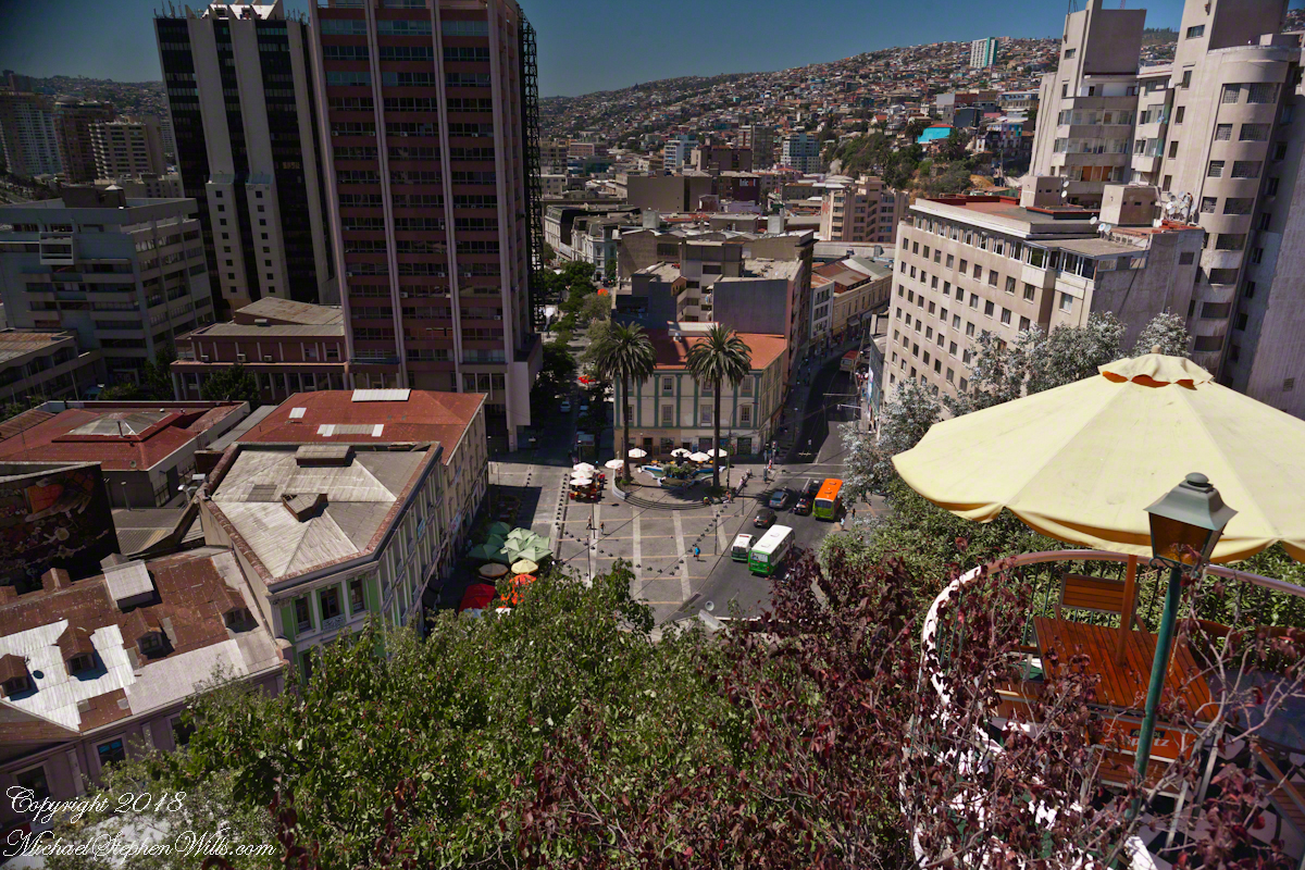
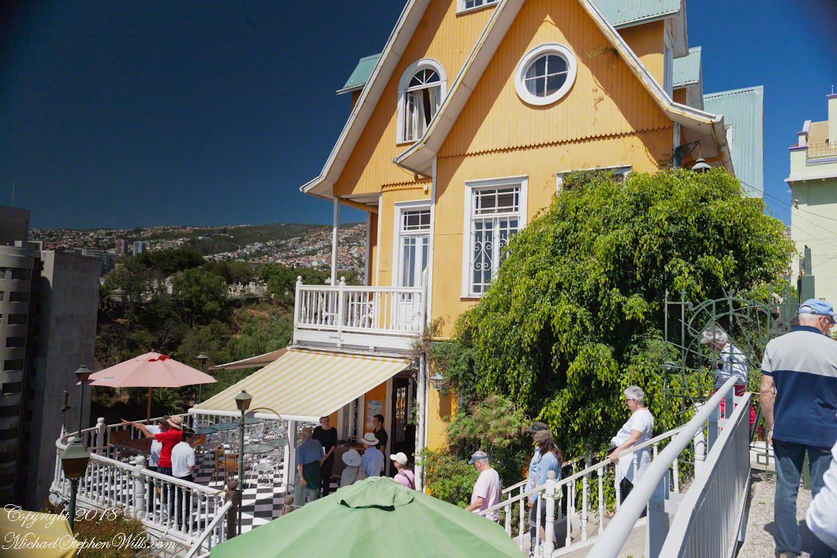
Pam corrects me when I say we “stopped for lunch” at the Hotel Brighton, pointing out we “only” had a glass of red wine and an empanada. Both were tasty, even more so with this marvelous view looking north into the other hills of the city. The yellow umbrella is on the hotel restaurant terrace.
I missed capturing the signature wrought iron gate forming the word “Brighton” among decorative scrolls. Built on the edge of Conception Hill it overlooks the coastal plain almost all of which is man-made.
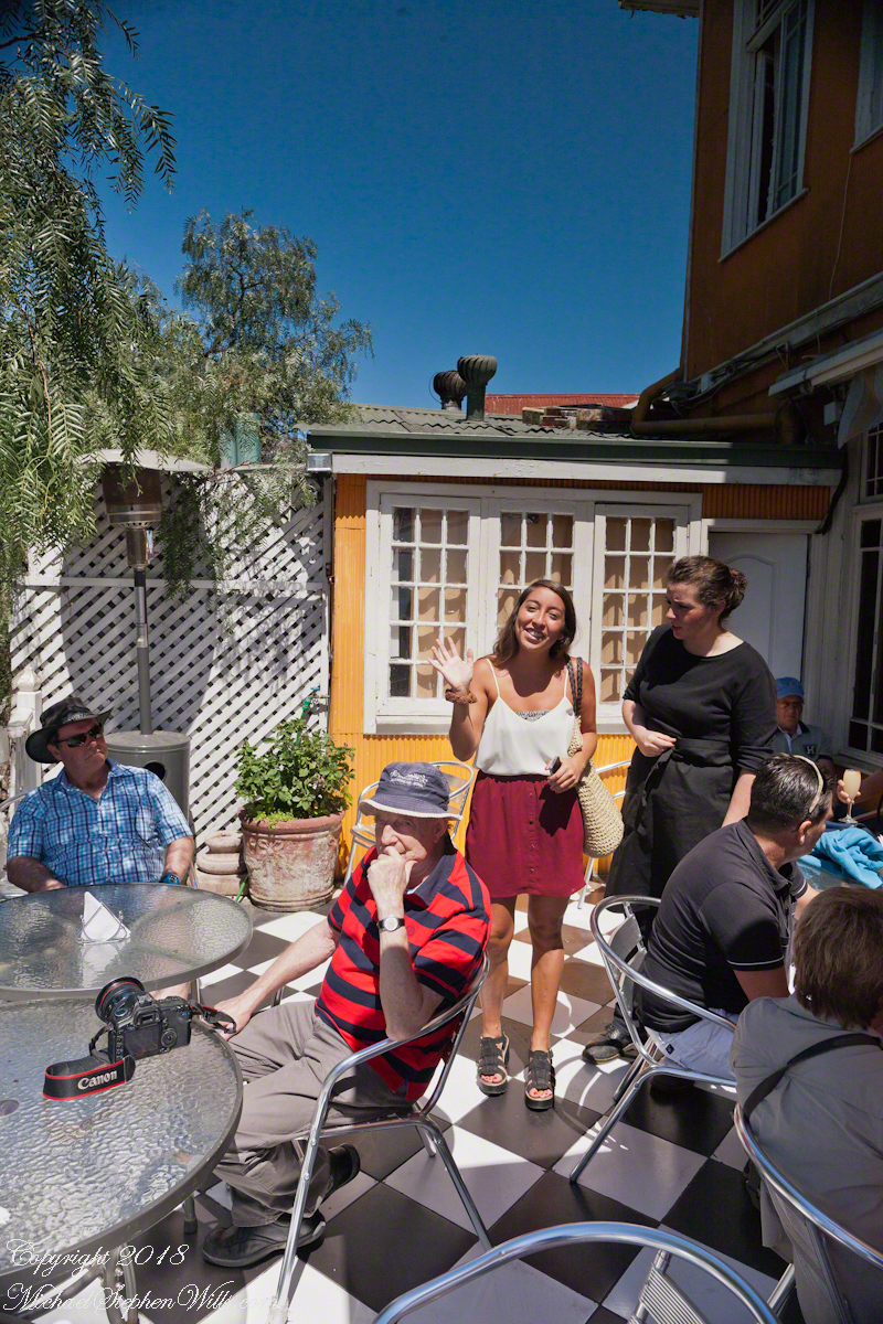
During our refreshment, this young lady (see photograph below) introduced herself as a reporter for El Mercurio. Accompanied by a photographer, she interviewed us and we had our photograph taken, I returned the favor with the following photograph saying the story might appear in the next edition. Standing next to her, with a puzzled look, is our waitress who was from the States.
El Mercurio de Valparaiso is the oldest continuously published Spanish language newspaper in the world. In my research for these photographs I discovered the newpaper officers were a short walk from the landing of the Ascensor Conception.
Copyright 2022 Michael Stephen Wills All Rights Reserved
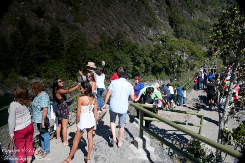
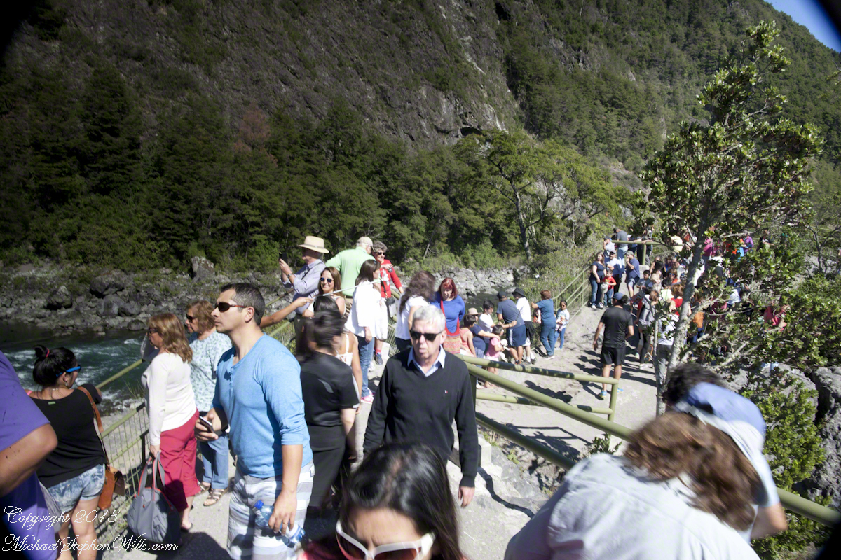
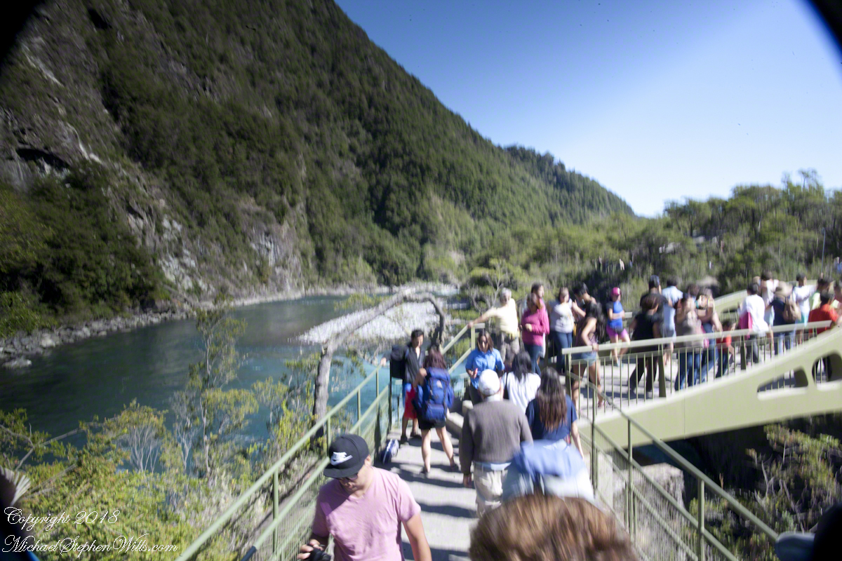
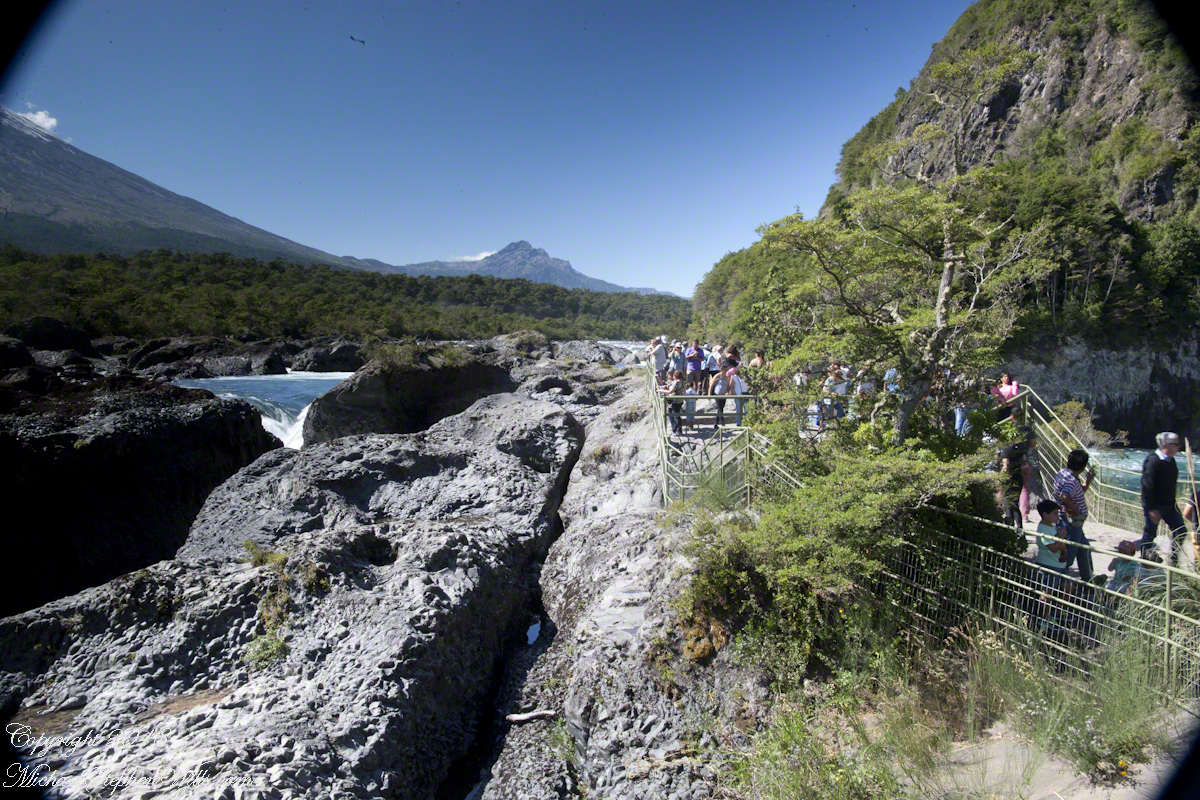
Petrohué Waterfalls are on the tourist track, traffic on the walkway was heavy on the southern hemisphere summer day, February 2016, of our visit. People were relaxed and friendly, the walkway well designed and safe. The wide angle lens was mounted on my Canon dslr, with a circular graduated neutral density filter. This is a filter with the upper third restrictive to light fading gradually to clear and mounted on a ring to rotated to cover the bright portion of the view. I used this successfully in the previous postings to obtain an exposure of the bright sky and darker land (for example, “Orsorno Volcano and Tourists.”). I could not resist capturing our fellow tourists. With a wide angle lens it is easy to do candid shots, such as the following. Most people are unaware of the capability of the 24 mm wide angle lens.
Click any photograph for a larger view.
Unfortunately, in the rush of the crowd and moment the dual use of a configuration for landscape and (candid) street photography lead to mistakes. I did not have the lens hood attached correctly, you can see the hood in each corner. Then there is the circular, graduated filter. In the above photograph, the shaded portion runs across the lower left to the upper right. The subject is watching me photograph the water.
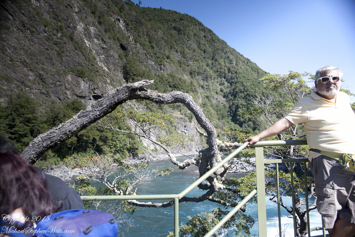
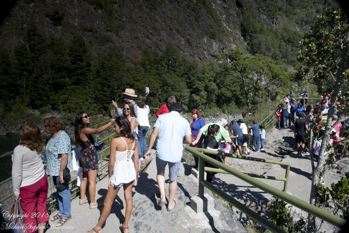
Here, I turned around from photographing the Orsorno Volcano to capture these selfie fans leaning against the railing to capture themselves and the volcano through they are in the minority. The trail is a “dead end”, rising to the point above the falls, where I am standing.
Selfie Stick
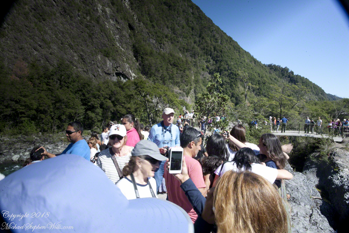
We started back down towards the point over the incredible emerald green water. There were three teenagers having fun with a selfie stick. Around them are people entranced by the water, as we werel.
Smile!! You’re on Candid Camera
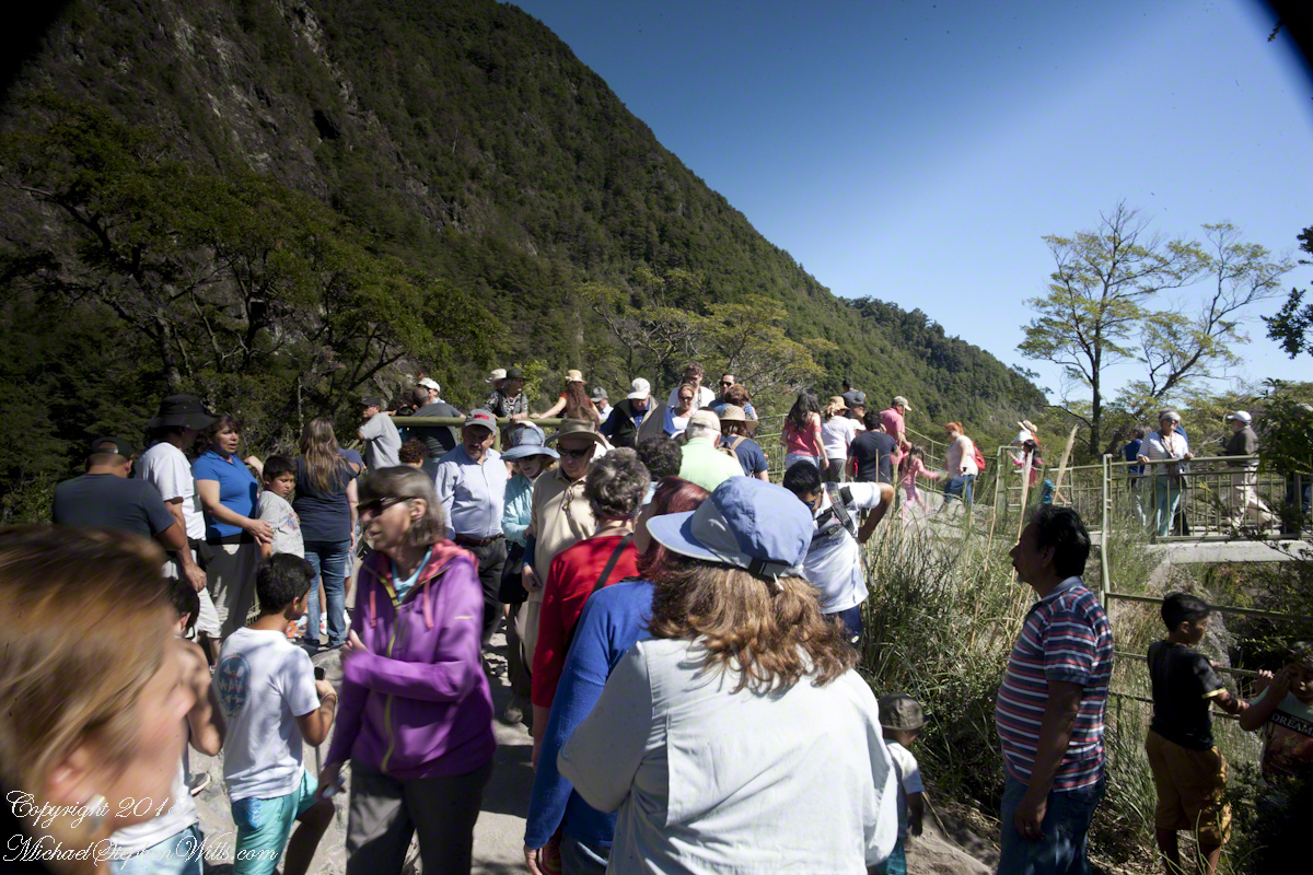
Headed back, I thought that curving tree was a good subject. Turned out, a fellow tourist heightened the interest of the shot. You see him, leaning against the railing next to the tree in the mid-distance of the following shot.
Here I am, looking back toward the child of Orsorno and the entire length of the observation walkway filled with people.
Copyright 2021 All Rights Reserved Michael Stephen Wills
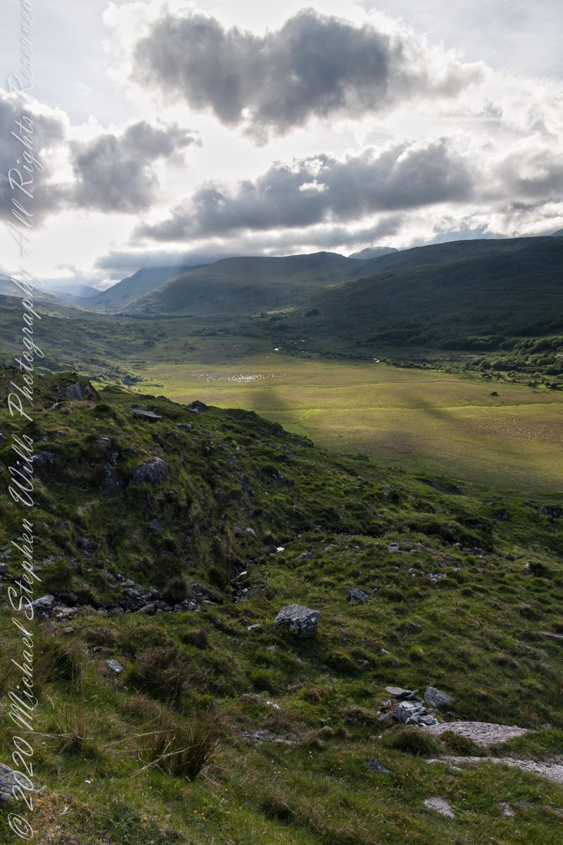
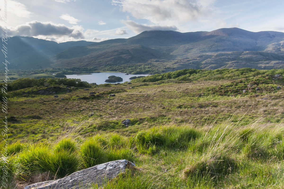
We are near Molls Gap on the Ring of Kerry. At our feet is Eric townland, there’s an eponymous Bog Nature Reserve down there. At our feet is Eric townland, there’s an eponymous Bog Nature Reserve down there.
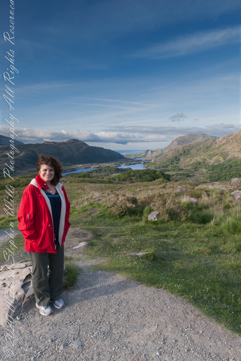
Here we are, on the road from Kenmare to Killarney, N71, part of the Ring of Kerry around the Iveragh Peninsula. The view was celebrated by Queen Victoria’s Ladies-in-Waiting during an 1861 tour of Ireland
Here we are, on the road from Kenmare to Killarney, N71, part of the Ring of Kerry around the Iveragh Peninsula. The view was celebrated by Queen Victoria’s Ladies-in-Waiting during an 1861 tour of Ireland
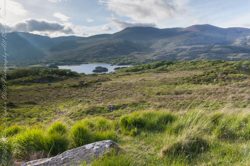
Here the camera, link #9, is turned toward the sun, low in the evening sky, emerging from clouds with a bright sunbeam on Upper Killarney Lake. The previous view was portrait orientation. This is landscape orientation.
Click pic for larger view in a new browser tab. If you are in WordPress Reader, open the post to use this feature.
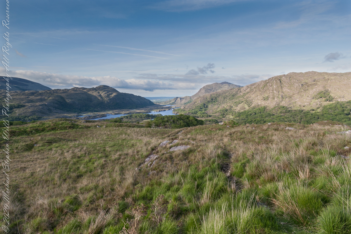
Ladies View, Killarney National Park, Derrycunihy Townland, County Kerry, Republic of Ireland.
Copyright 2021 Michael Stephen Wills All Rights Reserved
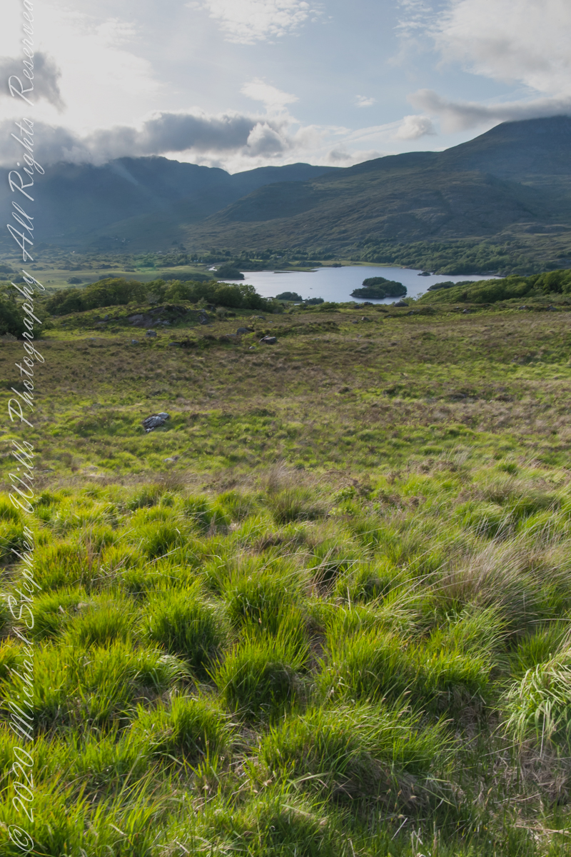
Here we are, on the road from Kenmare to Killarney, N71, part of the Ring of Kerry around the Iveragh Peninsula. The view was celebrated by Queen Victoria’s Ladies-in-Waiting during an 1861 tour of Ireland
Here the camera is turned toward the evening low sun, behind clouds, with subtle light beams. That is Upper Killarney Lake, the Gap of Dunloe behind the far hills.
Click pic for larger view in a new browser tab. If you are in WordPress Reader, open the post to use this feature.
Copyright 2021 Michael Stephen Wills All Rights Reserved
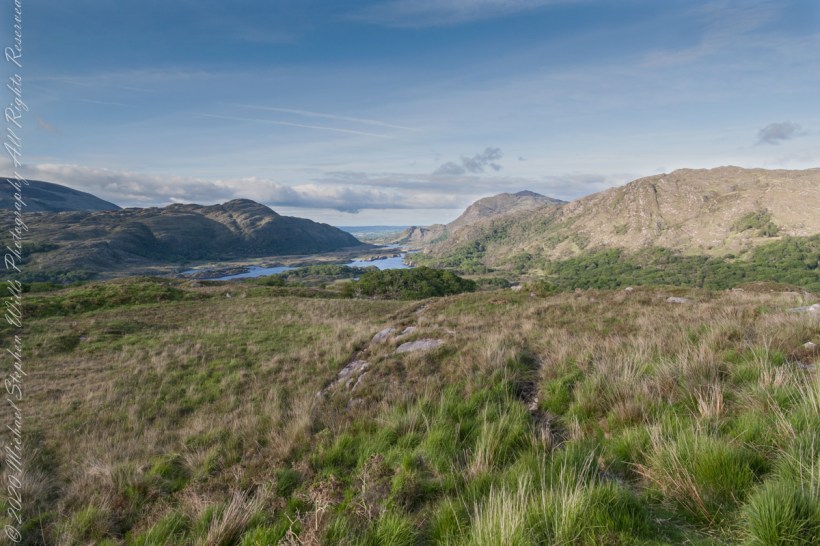
Here we are, on the road from Kenmare to Killarney, N71, part of the Ring of Kerry around the Iveragh Peninsula. The view was celebrated by Queen Victoria’s Ladies-in-Waiting during an 1861 tour of Ireland
We are almost done with this series….sorry to leave this place.
Click pic for larger view in a new browser tab. If you are in WordPress Reader, open the post to use this feature.
Ladies View, Killarney National Park, Derrycunihy Townland, County Kerry, Republic of Ireland.
Copyright 2021 Michael Stephen Wills All Rights Reserved