In my last Pinelands post, “cedar water” was featured. This post is a exploration of the “cedar” in “cedar water.”
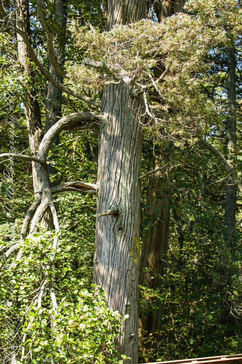
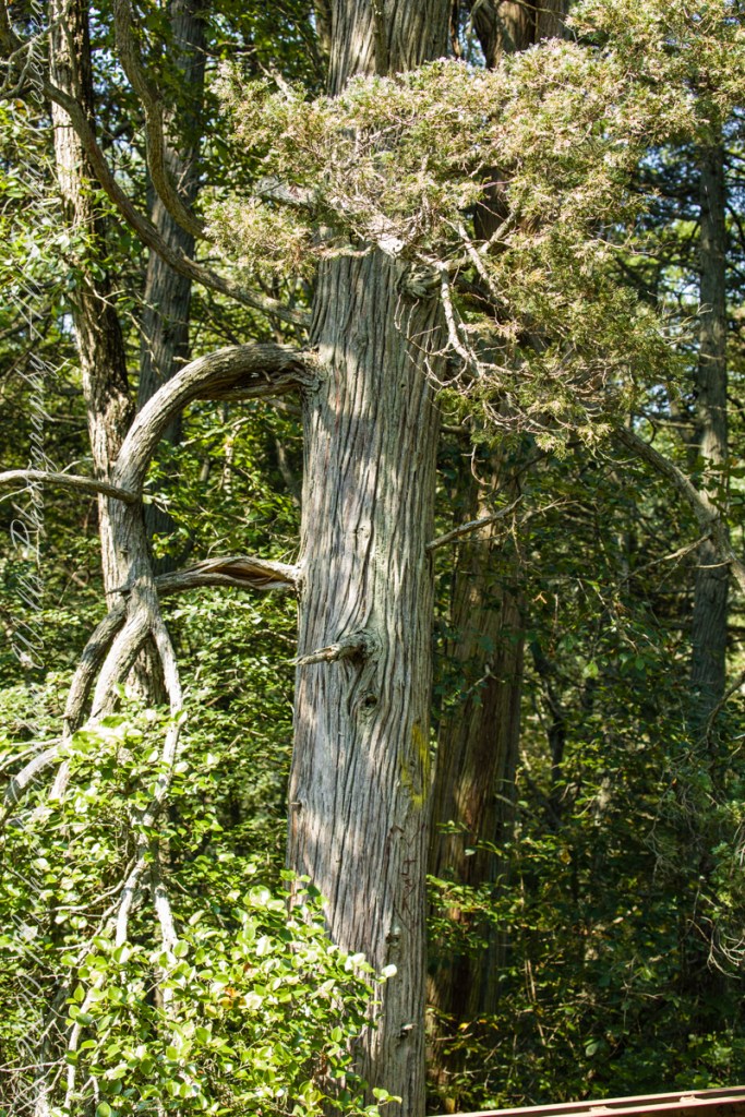
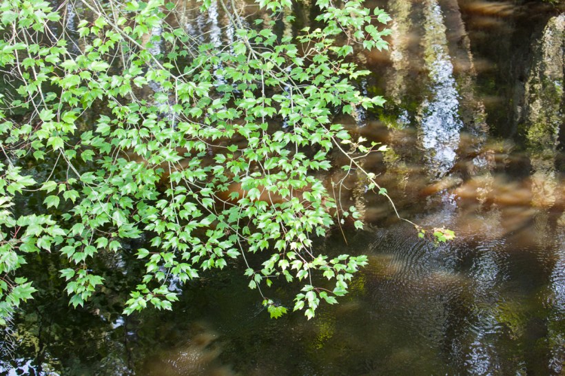
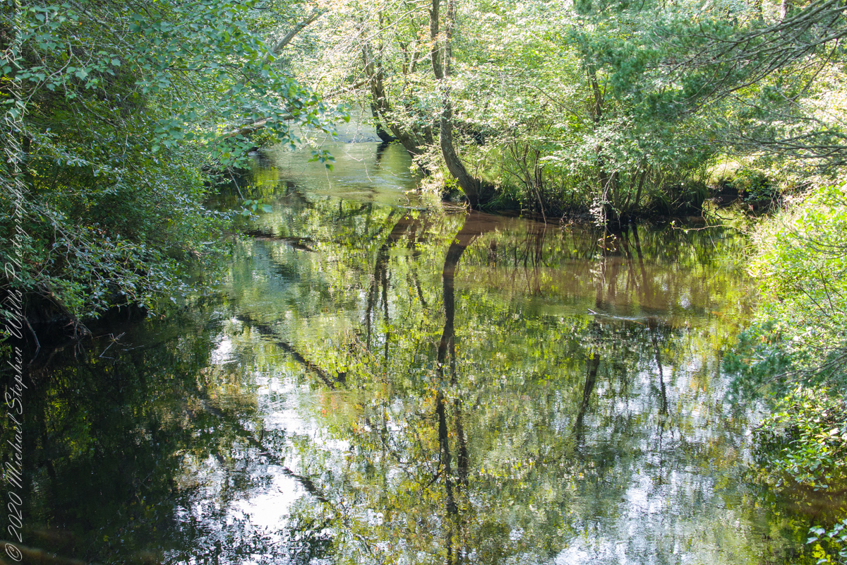
White Cedar, also known as Swamp Cedar, is a water loving tree seen here to the right of Quaker Brider, Wharton State Forest.
Click pic for larger view in a new browser tab. If you are in WordPress Reader, open the post to use this feature.
“Cedar water” is the dark, tea like, flow of Pinelands rivers colored by vegetable tannins.
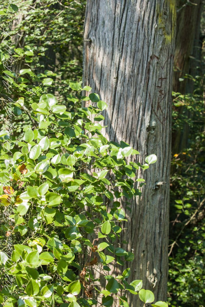
White Cedar thrives along Pinelands waterways, lending color to the “cedar water.” 18th Century sea captains favored cedar water for long voyages, famours for staying fresh far longer than other waters. Also known as arborvite, “tree of life”, for the medicinal properties of the bark, well known throughout Native America.
Known for flat sprays of scaley leaves
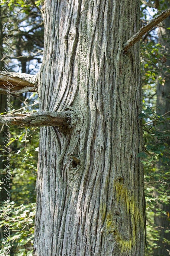
The Pinelands are under siege from attacks much worse than this defacement
These photographs were taken the last days of August 2021, the 26th and 27th, while exploring Burlington County, New Jersey, with my sister. I will be writing about our Thursday and Friday for awhile, starting with today’s installment.
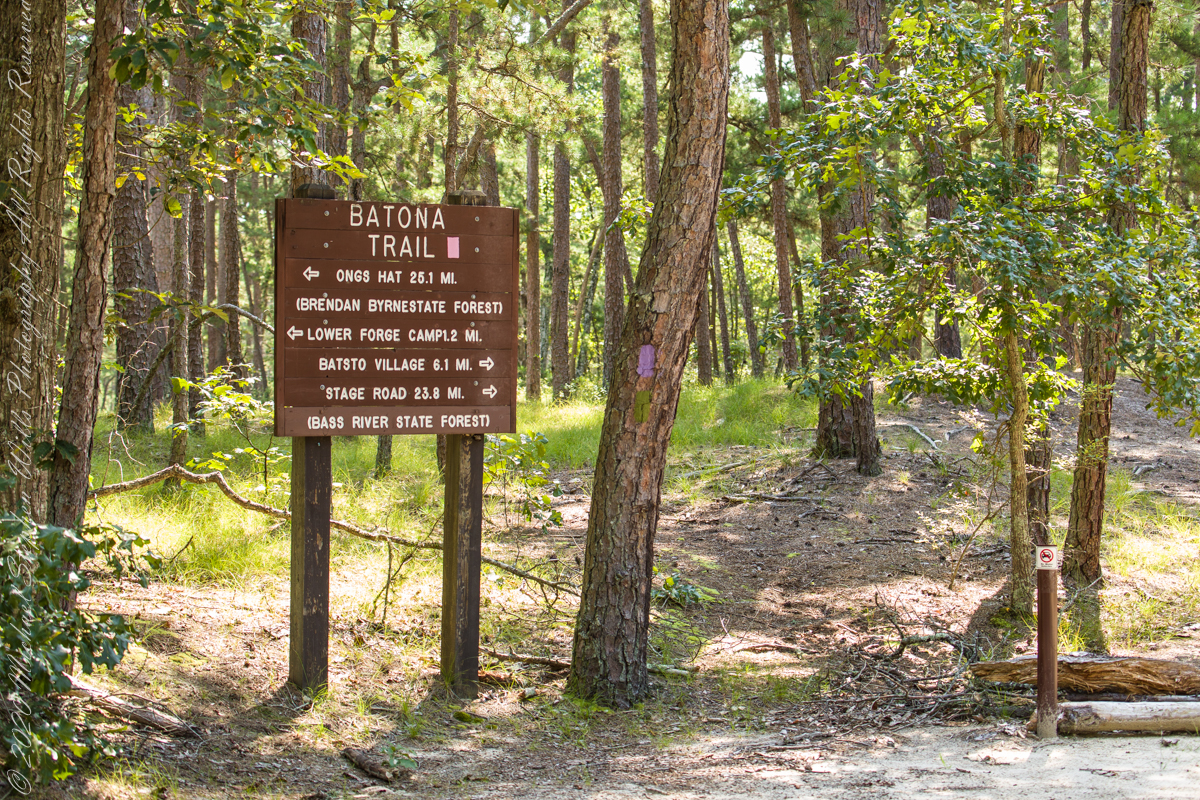
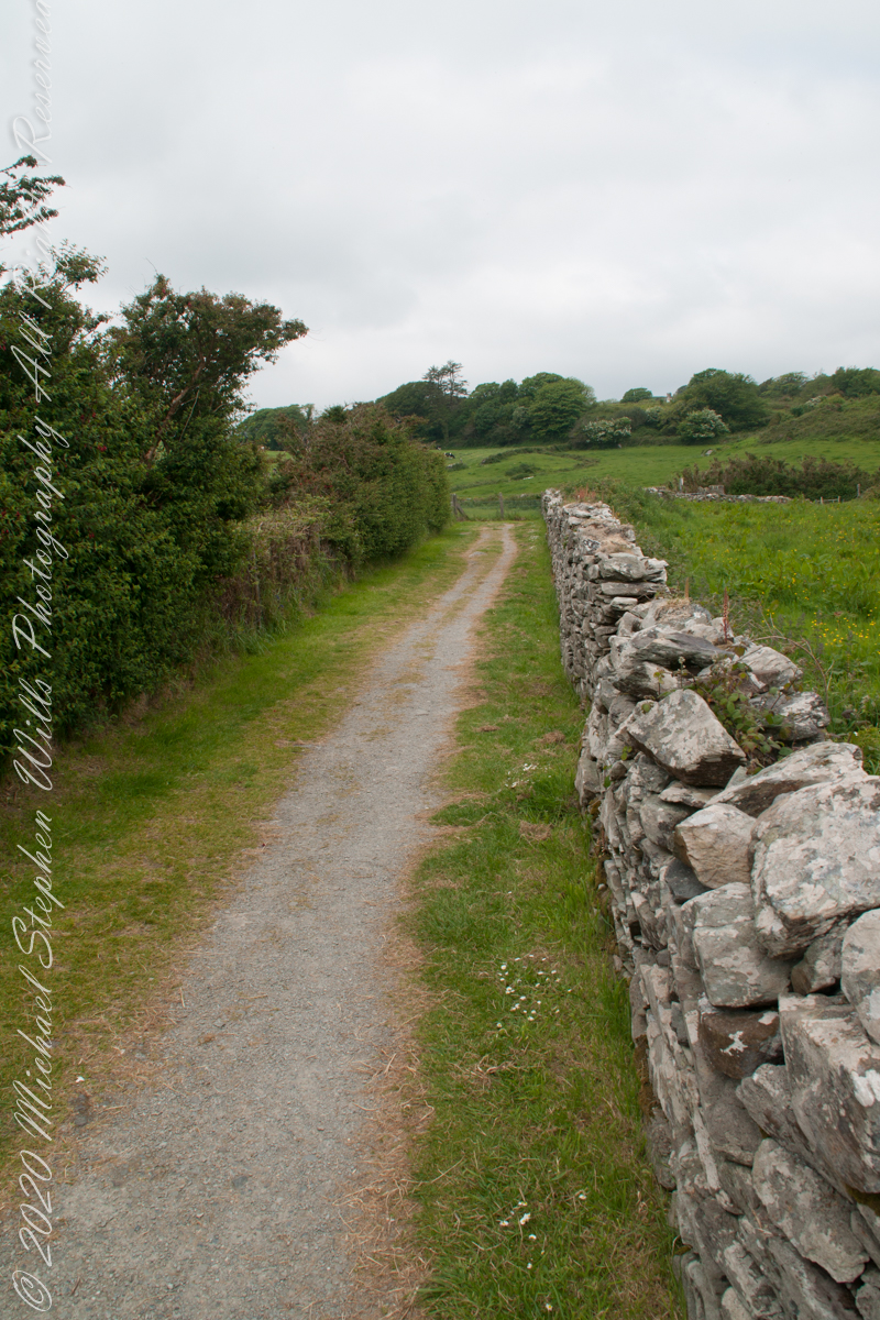
Quaker Bridge Road traverses the wilderness of Wharton State Forest with a beginning off Route 206, Atsion Mansion. Our planning included Jeep Wrangler rental, only high-clearance 4-wheel vehicles are appropriate, the road surface is humpy sand, water filled holes abound. Still, sitting there at the start, with Atsion Mansion house in view, I waited awhile until a high clearance tour bus packed with adventurers, kayaks passed into the pines and out of sight. We proceeded an uneventful ~4 miles to Quaker Bridge at a stately 5 miles per hour, invoking four-wheel drive low gear a mile or so in.
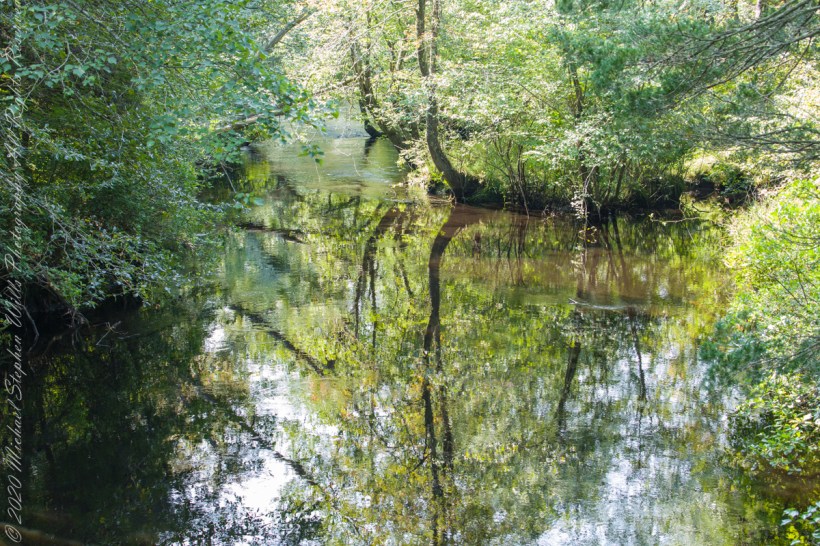
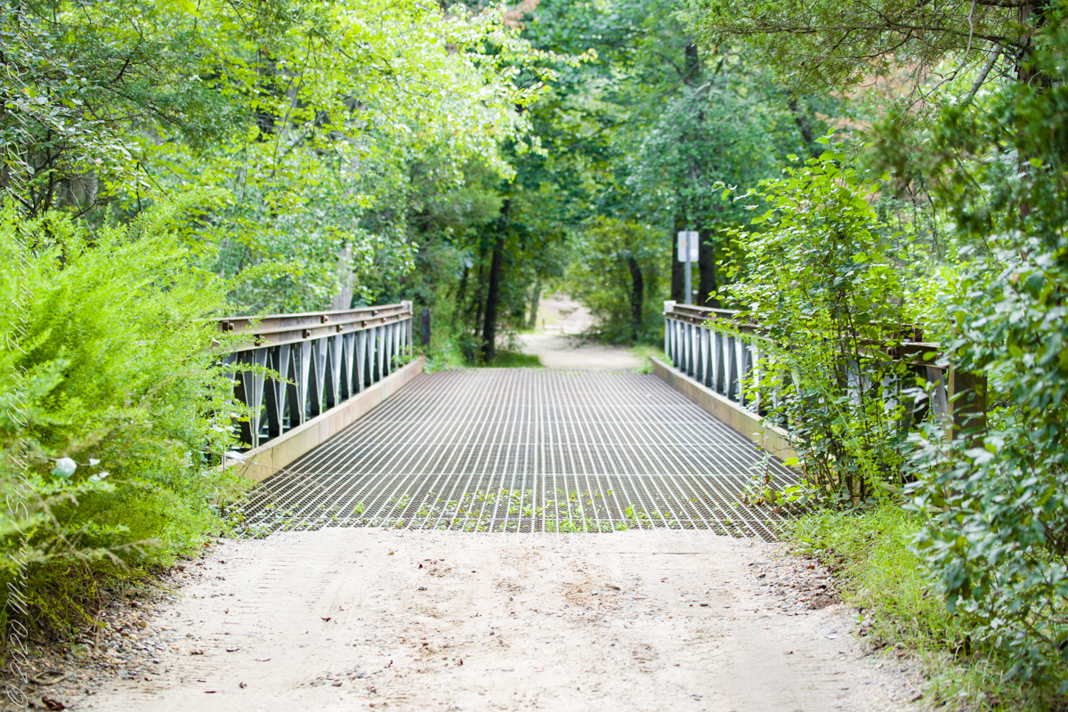
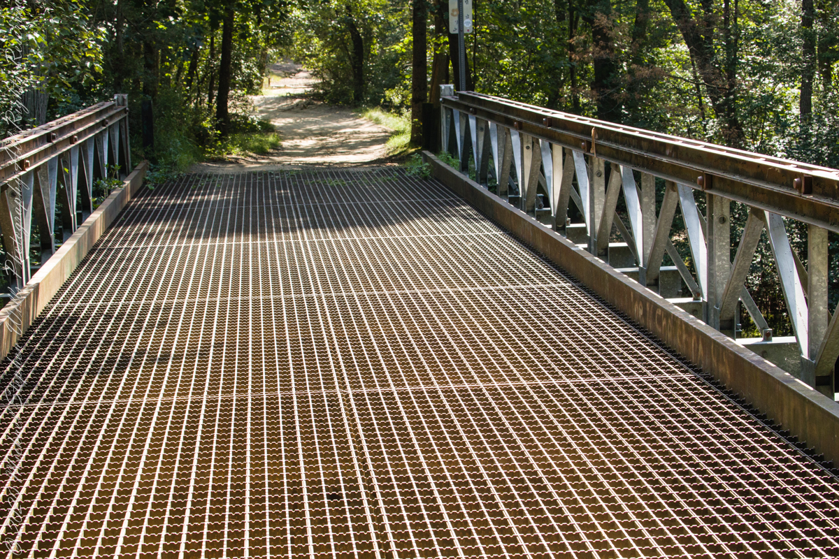
Here is Quaker Bridge over Mullica River today, facing East.
Mullica River from Quaker Bridge facing downstream
Quaker Bridge road was a well traveled main route through the Pines for almost a hundred years with an inconvenient crossing of The Mullica at this point. During the year 1774, some sa 1772, West Jersey Quakers travelling to the Little Egg Harbor Yearly Meeting, started “a day early”, built a bridge. From a c.1940 photograph it is clear in that “day” they felled large trees for pilings, smaller trees, pines and cedars, for the other bridge elements. Since then, the crossing has been called “Quaker Bridge.”
Over time, the east side became a resting place, with at least one Inn/Tavern. Here is the east side today.
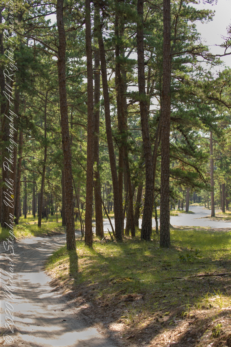
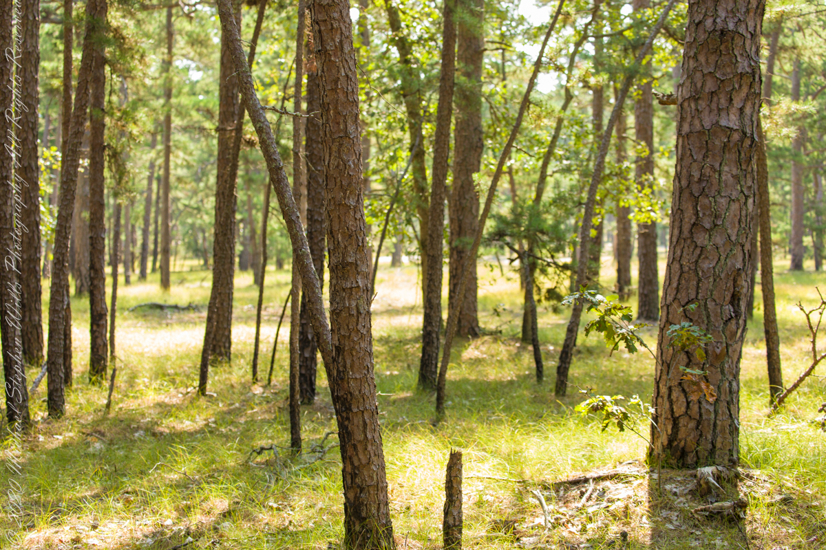
Even without hospitality and bustling humanity, after 4 miles of dreary road from Atsion this spot carries a sense of lightness, the well spaced straight pines over several acres conveying peace and rest. Over 35 miles from the ocean, the white sand presents as beach. There is a reason for this feeling, a 15 million year reason.
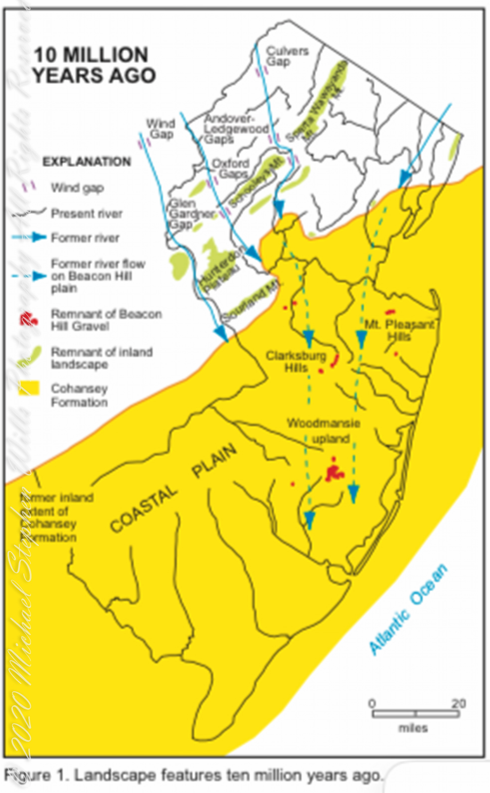
Visual presentation of Pinelands geologic origins, from New Jersey Geologic Survey, Scott Stanford author, 2005.
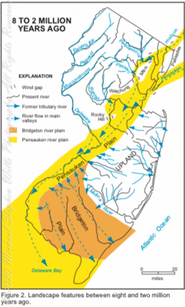
Between 15 and 10 million years ago the earth climate turned colder, so much water evaporated from the oceans to fall as snow and ice in the polar regions ocean levels fell 150 to 250 feet. As the ocean fell away, over eaons, mountains to the west were ground down, pulverized by the elements to flow, gather on the exposed plain. The white “beach” sand we see today, at Quaker Bridge and other Pinelands places, are surfaces of this “Cohansey” sands and clay ranging in thickness from 25 feet in the west to more than 300 feet at the Atlantic Ocean.
Over millions of years the land raised to become the drainage patterns we see today. The renewable resources of “bog iron” and water spring from this history.
Visual presentation of Pinelands geologic origins, from New Jersey Geologic Survey, Scott Stanford author, 2005.
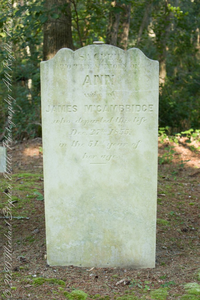
Standing there I imagined Great Great Grandmother Ann (Milley) McCambridge resting on the journey from the McCambridge home near Speedwell. I placed the pebble, collected from Long Island Sound, on Grandmother Ann’s headstone the evening of August 26th. Click this link for more about Ann McCambridge.
Sacred to the Memory of ANN wife of James McCambridge who departed this life December 27th 1855 in the 51st year of her age.
Reference
I found Quaker Bridge background in “Heart of the Pines, ghostly voices of the Pine Barrens” by John E. Pearce, pp 748 – 750, Batsto Citizens Committee, 4110 Nesco Road, Hammonton, N.J. 08037-3814.
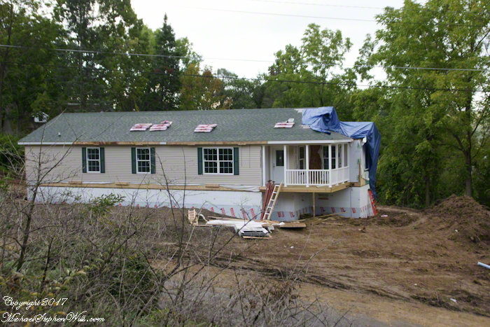
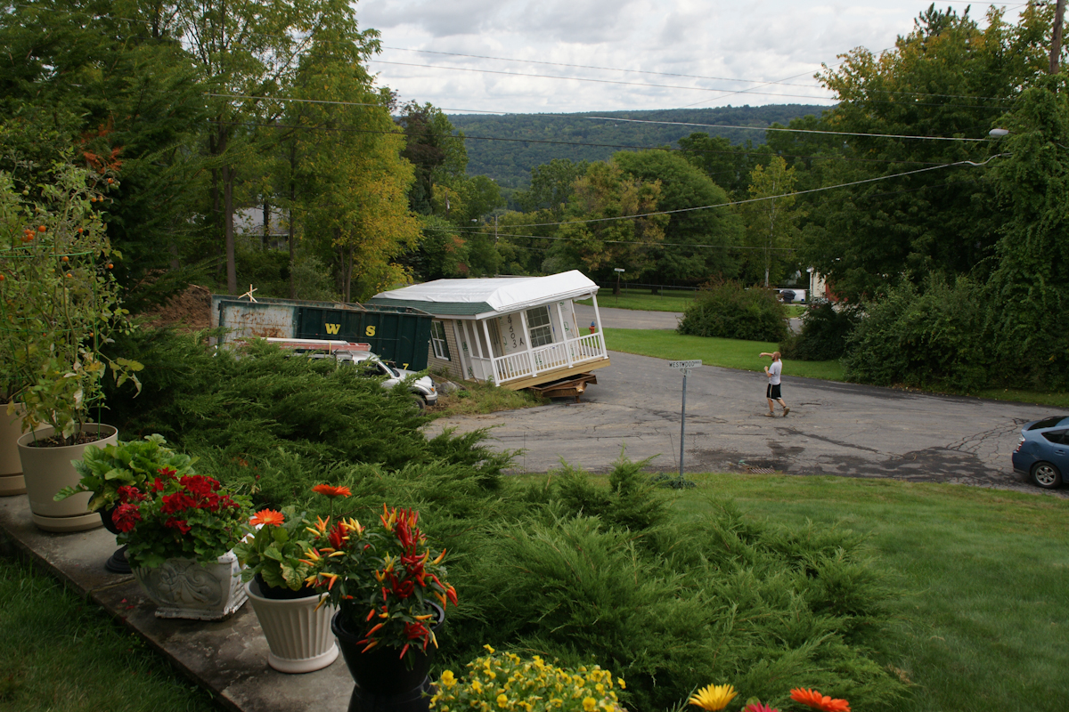
When Pam and I made Westwood Knoll our home in 2011, to the north, across the street, was an empty wooded lot that has since been subdivided into three of the last home sites in Ithaca. This summer, the corner lot was razed of all its trees, the lovely mature cherry, sycamore, ash, maple reduced to stumps to be cut up and carted away. There was a positive in that the lot was overgrown and unsightly, but every spring the upper reaches were masses of blooms and young green leaves.
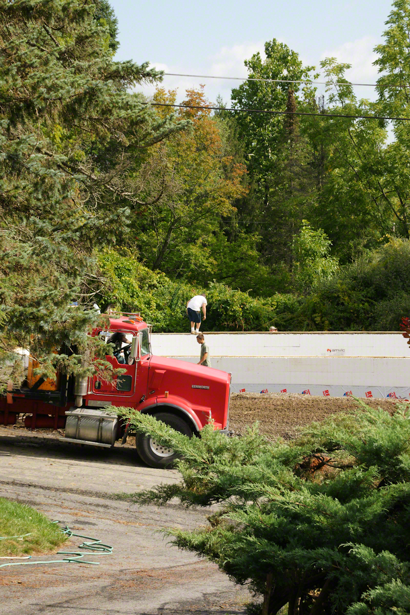
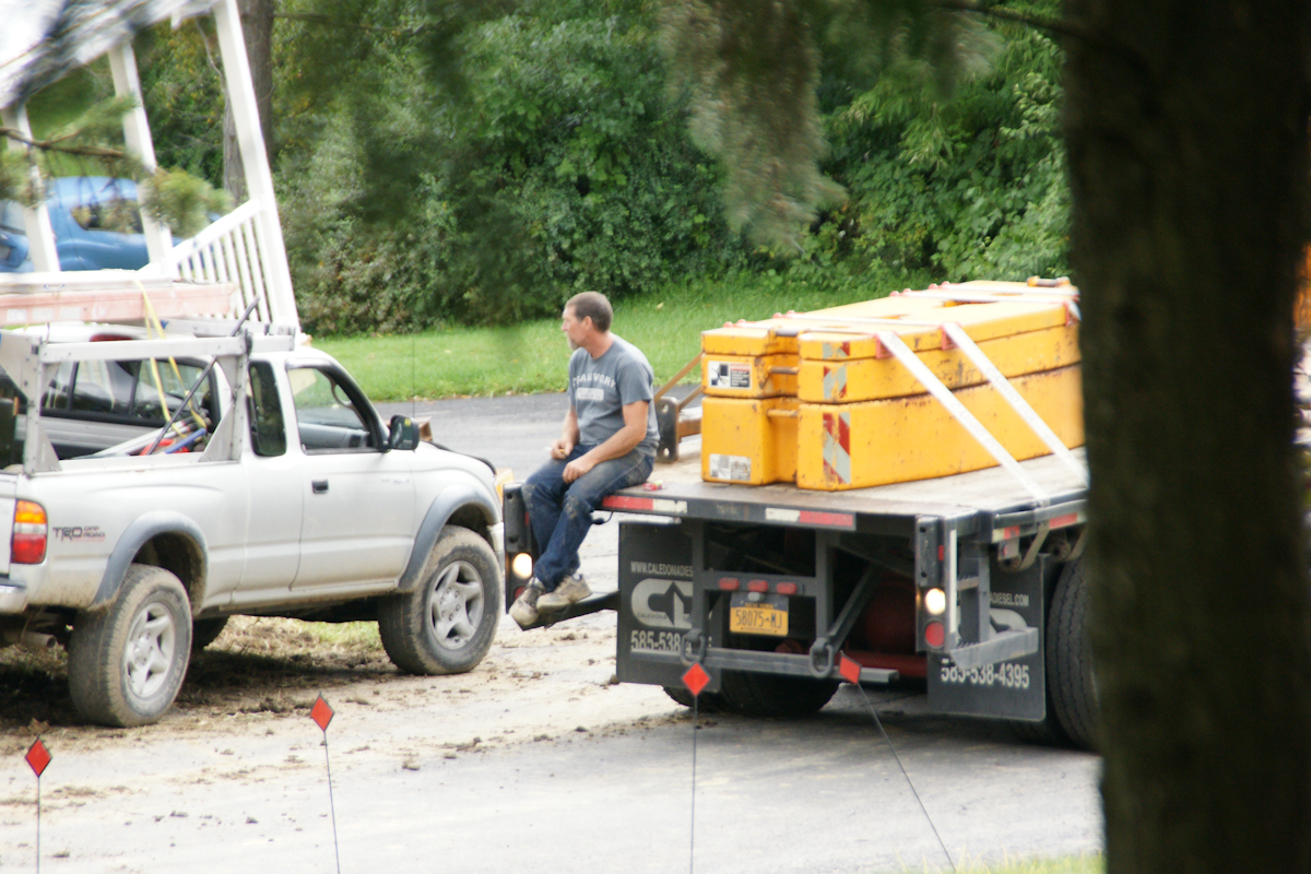
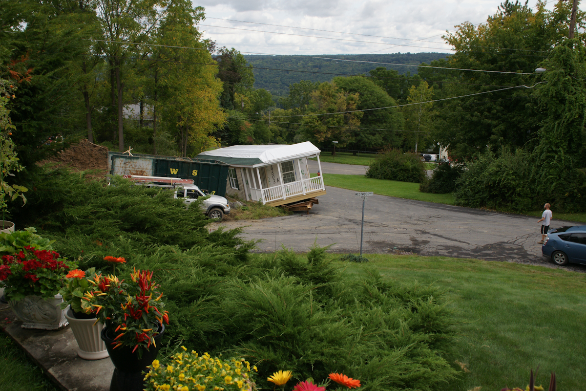
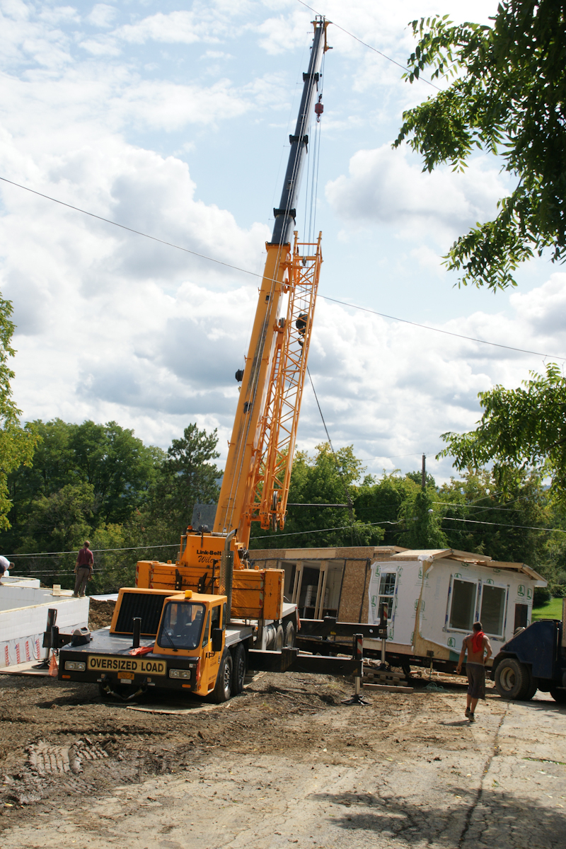
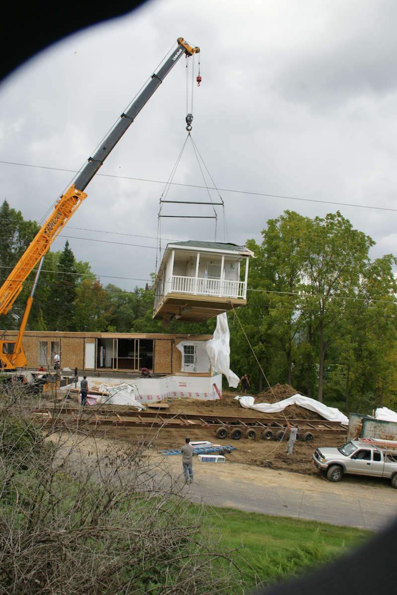
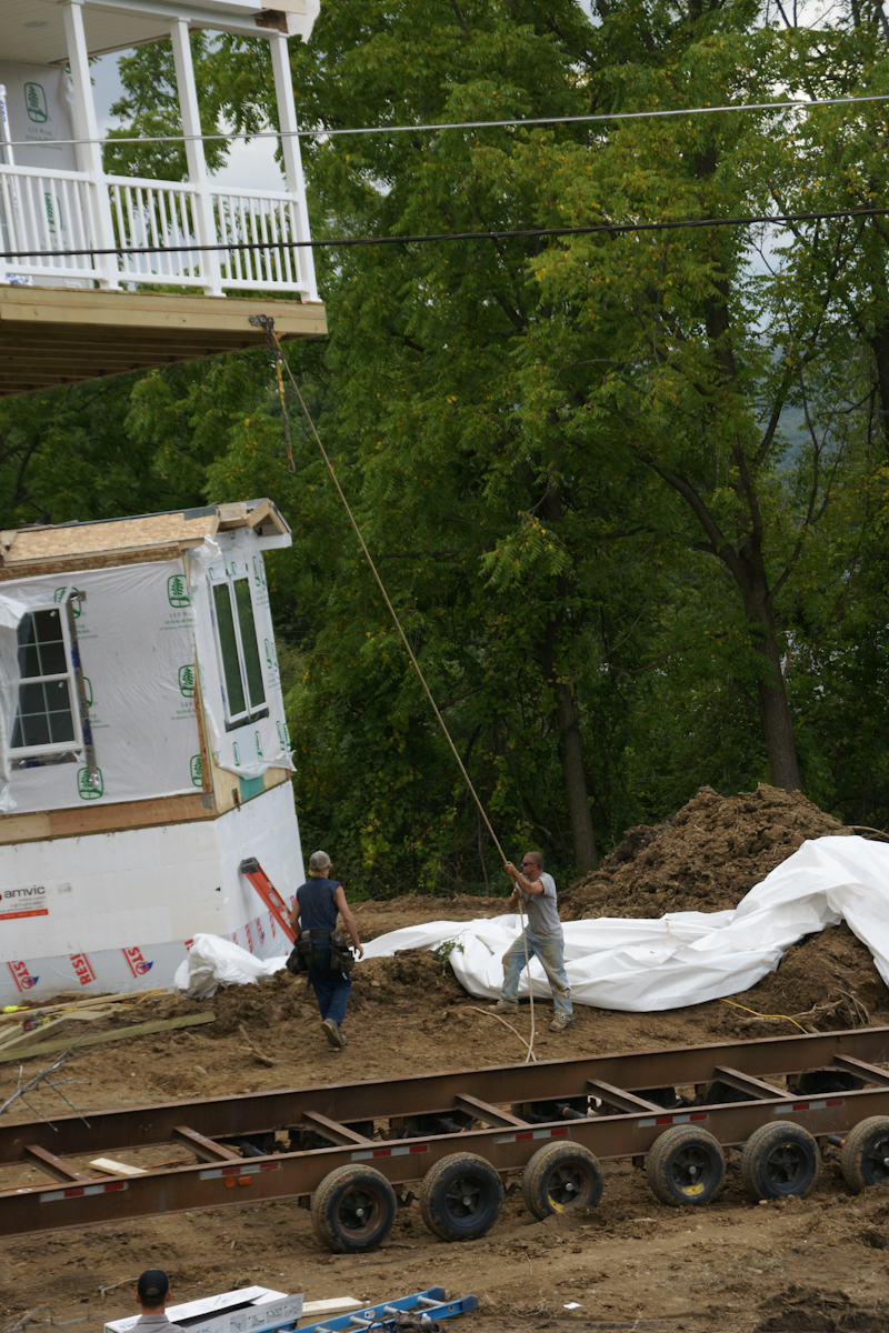
In a heavy rain on September 5th, 2017 the two parts, call them “modules”, were delivered, and then sat until September 7th to be assembled in one day. The process itself was interesting to witness and, while being otherwise occupied, I came out now and then to document the progress.
Here are my photographs. What do you think? Please leave comments.
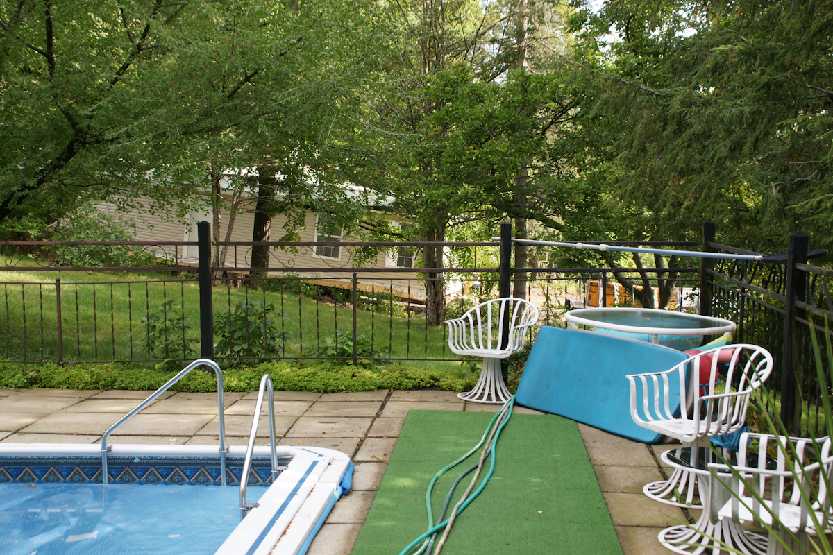
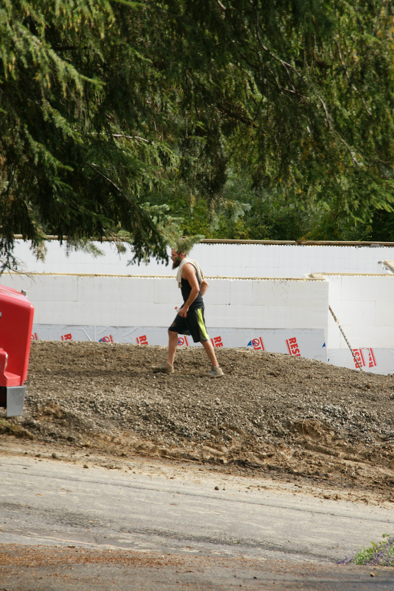
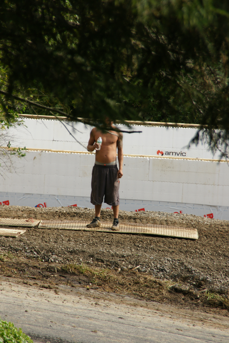
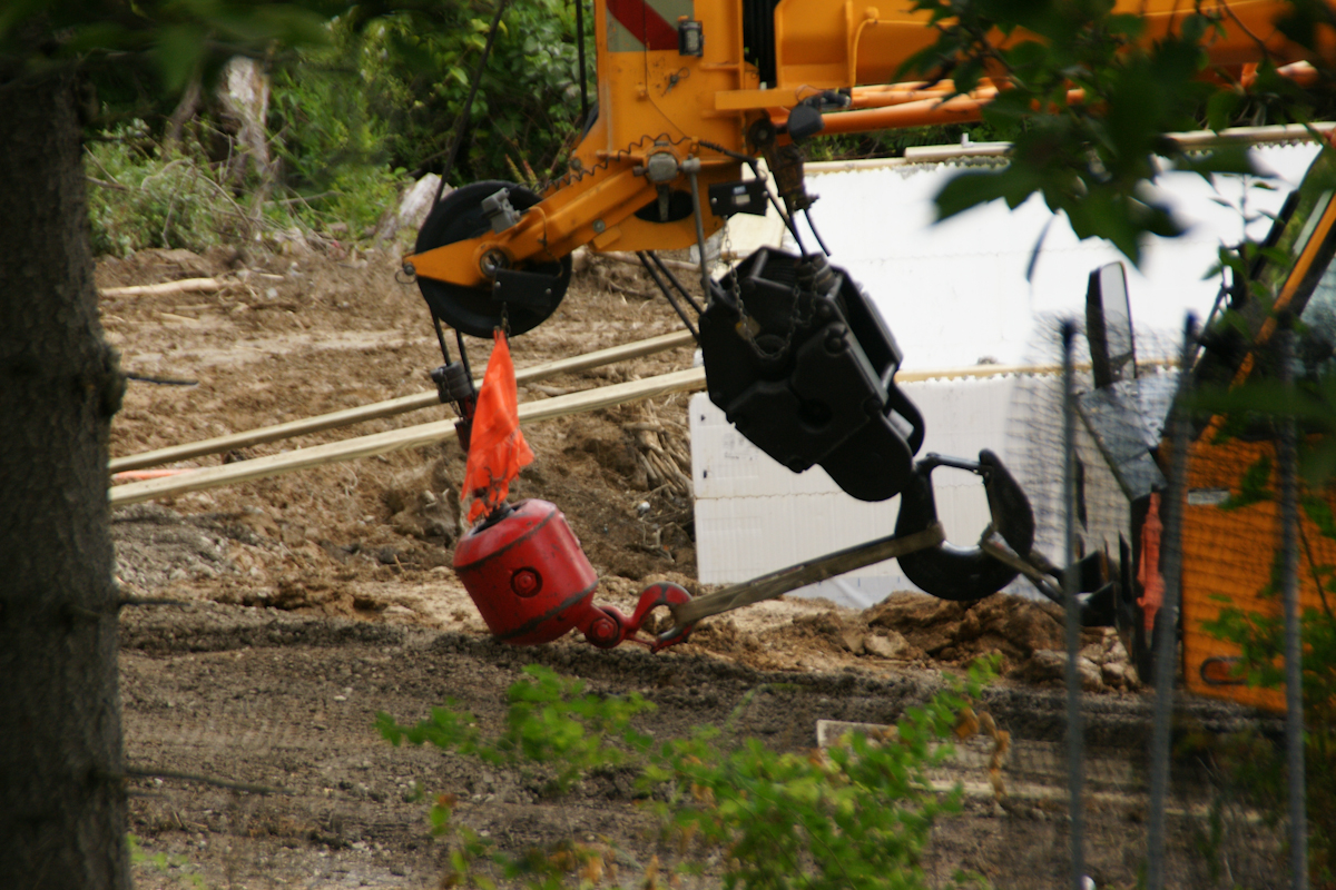
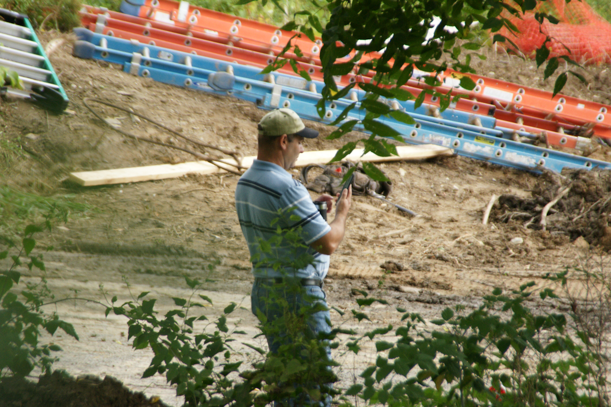
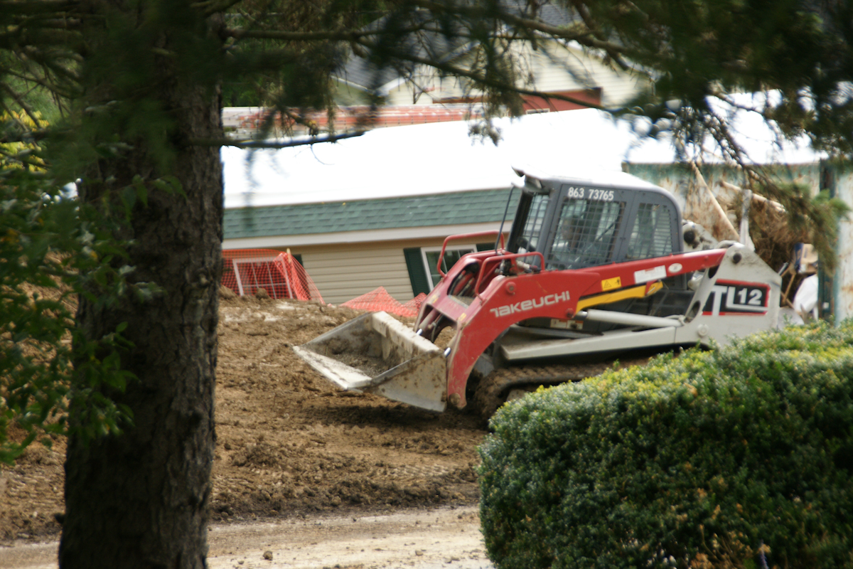
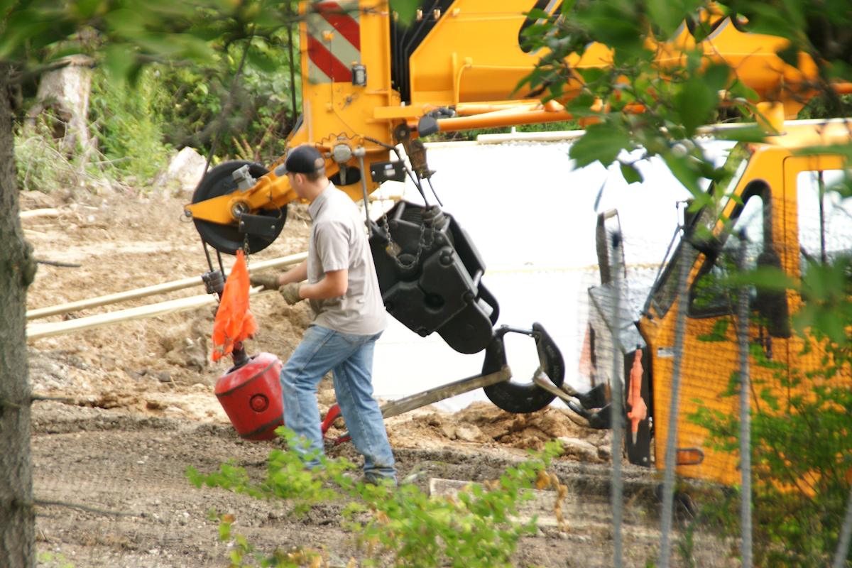
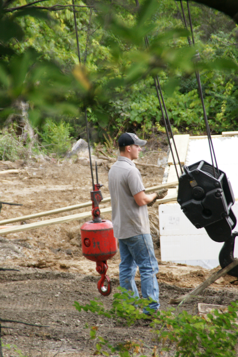
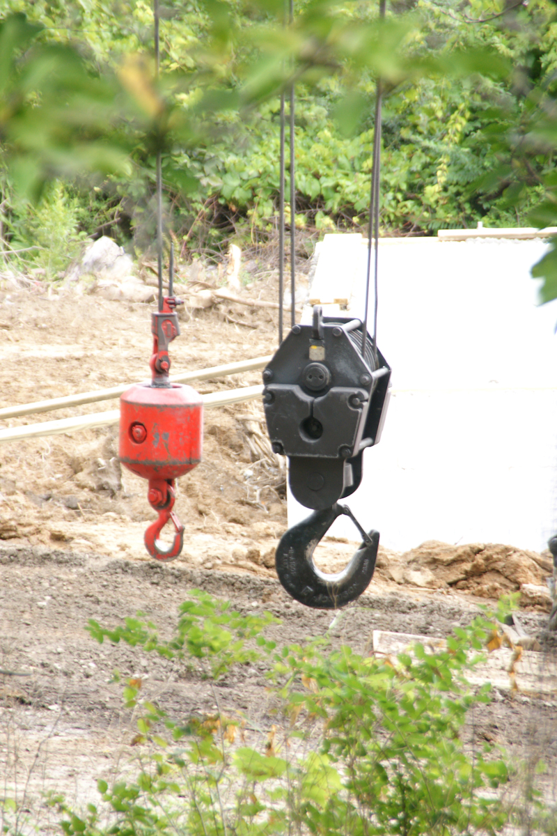
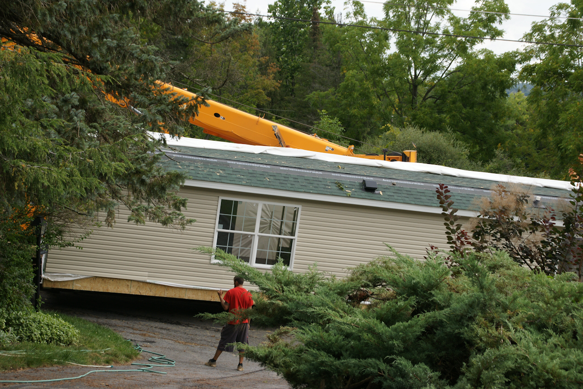
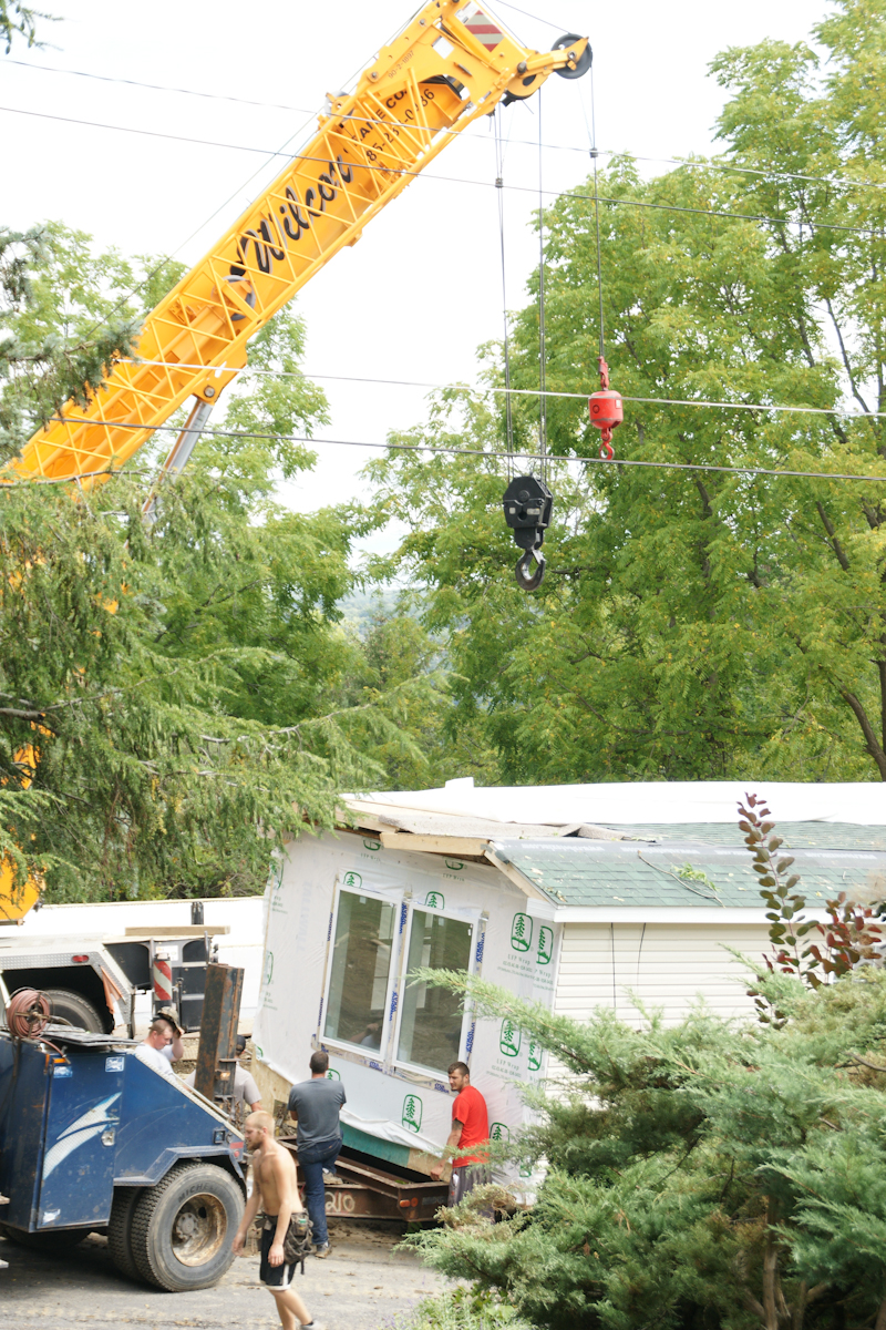
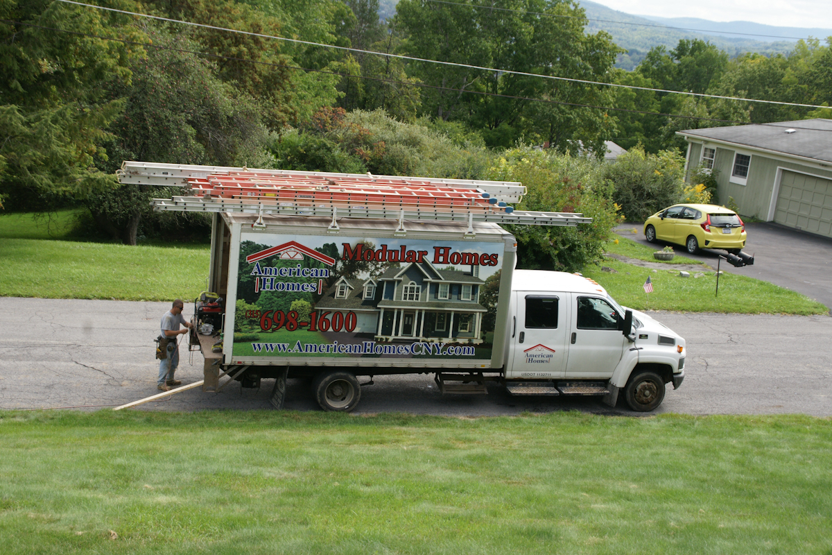
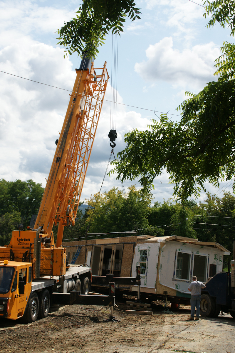
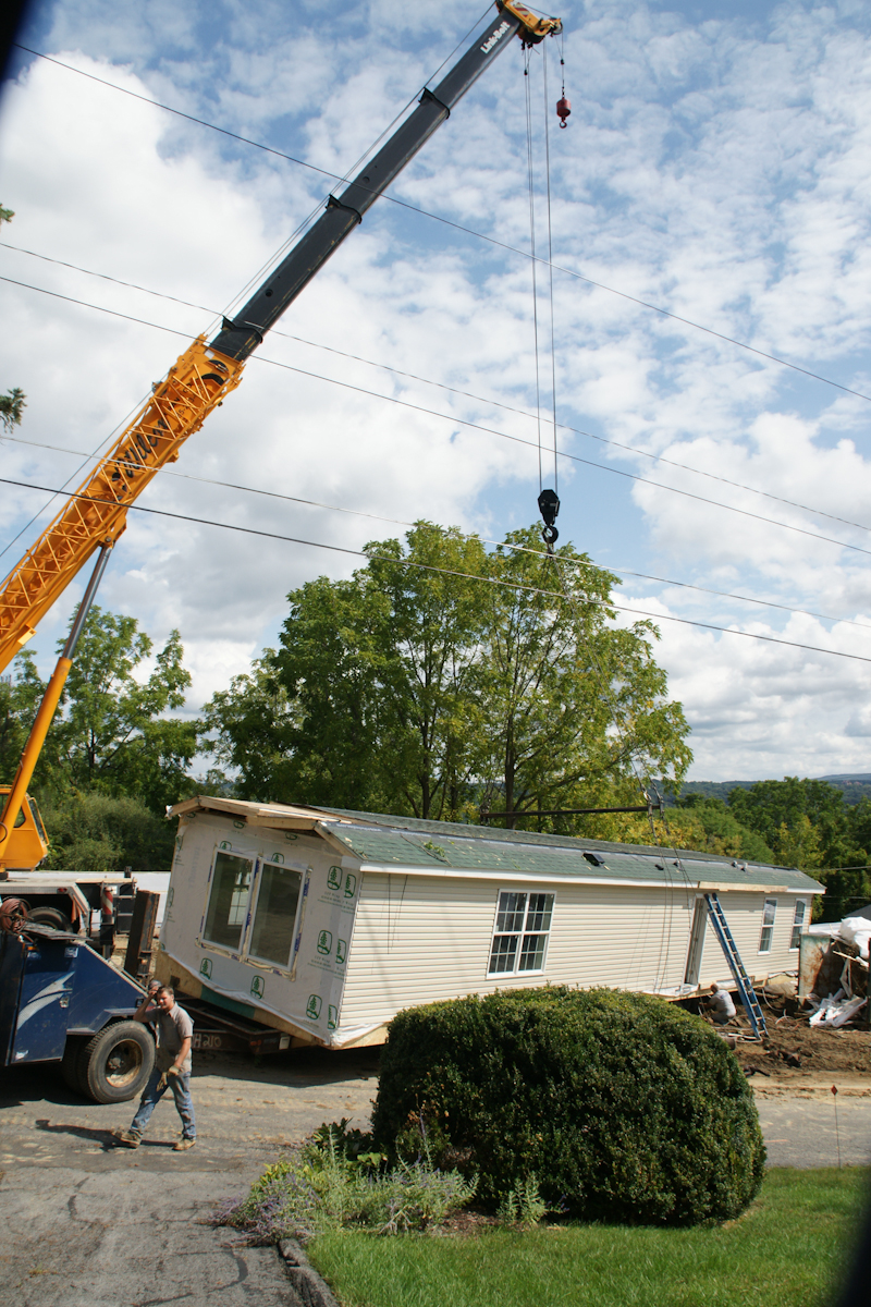
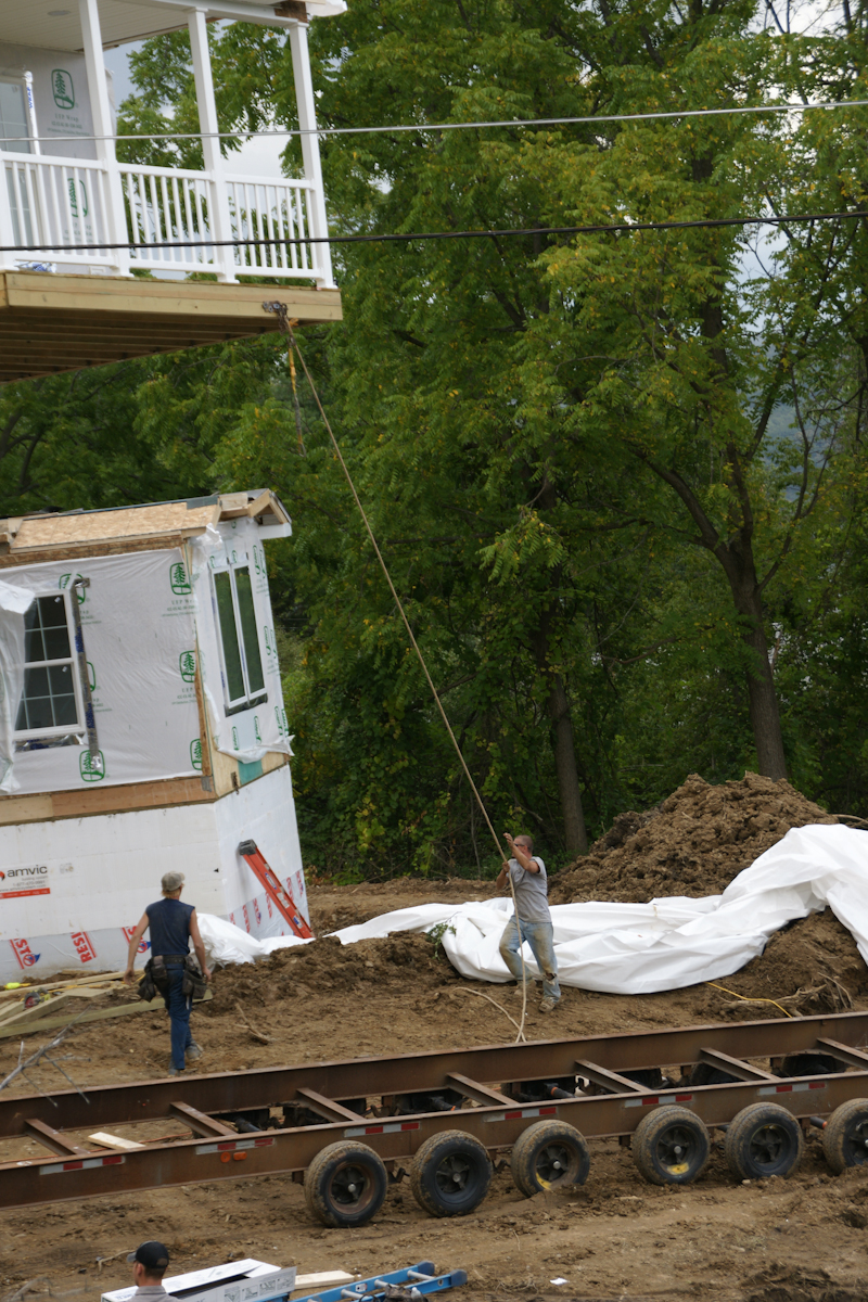
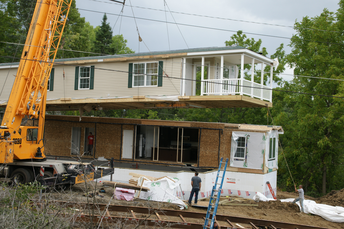
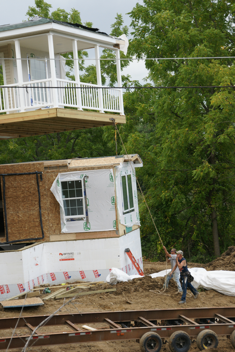
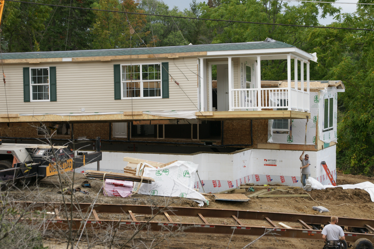
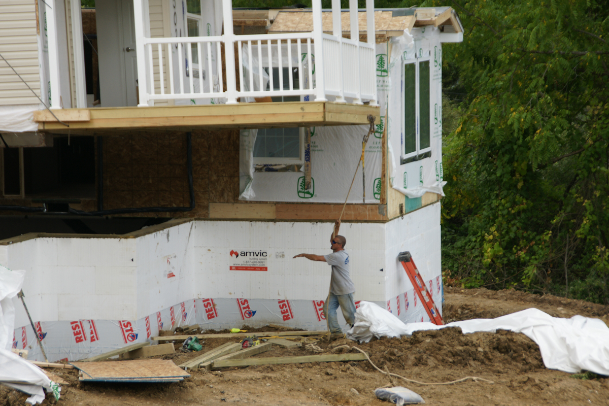
The foundation installation took a week to construct. It started with, literally, blocks of styrofoam held together with plastic and assembled by hand, like a child’s block set. There is an 8 inch gap in between filled with concrete. There was NO rebar used. bolts were inserted for attaching the modules.Module Two was delivered on wheels and moved into position by this semi.Module Two will eventually face the opposite direction. That will be the rear door. This is our swimming pool, I use garden hoses to siphon excess rainwater.Most of the workers were dressed like this, casually, no protection for feet or head. We were concerned with this. No one was injured this day, as far as we know.The worker is standing on a board on which the crane wheels will rest.Crane Boom End with hooks in transport configuration. These are attached to the modules for positioning over and lowering onto the foundation.This fellow arrived to take pictures from that smart phone.A versatile tracked loader used throughout the foundation construction and module installation.A worker prepares the hooks for use. No head protection was a concern to us.Yellow blocks of metal used to support the crane.. A railing of Module One is above the truck, to left.The red hook is ready.The hooks hang free, ready to use.This is where Module One was dumped on the side of the road on September 5th, two days before installation.We are looking here over the edge of our patio and landscaped yard to the site of module one, pre-installation, a worker approaching.The first step was to extricate module two from the mud and haul it up the street. A construction worker foreground, the boom of crane beyond.The semi backed Module Two into position, the crane boom and hooks loom.The workers were considerate of our lawn. There was minimal damage. The modules installed this day looks nothing like this image.From here Module Two will be lifted onto the foundation.Workers prepare foundation to receive Module Two while the unit is readied.I see only the black hook is in use.Another View of Module Two with worker. That is the bottom of our driveway.Module One was delivered with construction materials inside.The porch and entry door of Module One with worker and rope. The worker needs to negotiate the carrier.A 180 degree turn orients Module One to Module Two. The porch overhangs the foundation.
Positioning module one over foundation.
A worker observes from the interior of Module Two. Here is a closer view of the wire harness.
Final positioning of the module to form a whole structure.
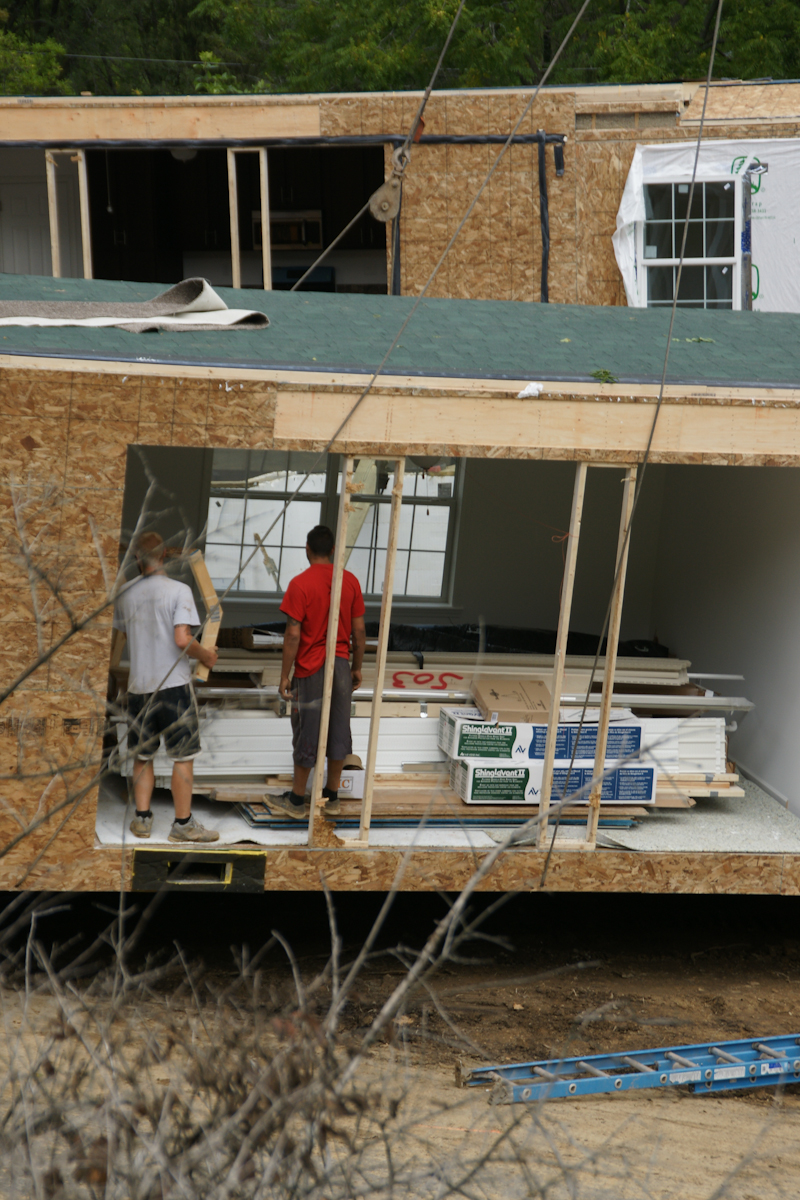
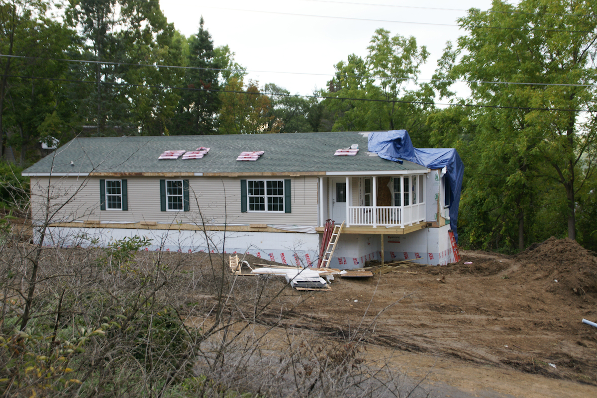
The roof panels are here lifted to a peak. The shingles and such in place for installation. These are the materials delivered inside Module One.
Update: since this post was first published September 2017 the original owners moved to the southern USA after selling the property at an inflated price to a young Cornell professor.
Copyright 2021 Michael Stephen Wills All Rights Reserved
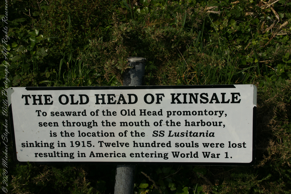
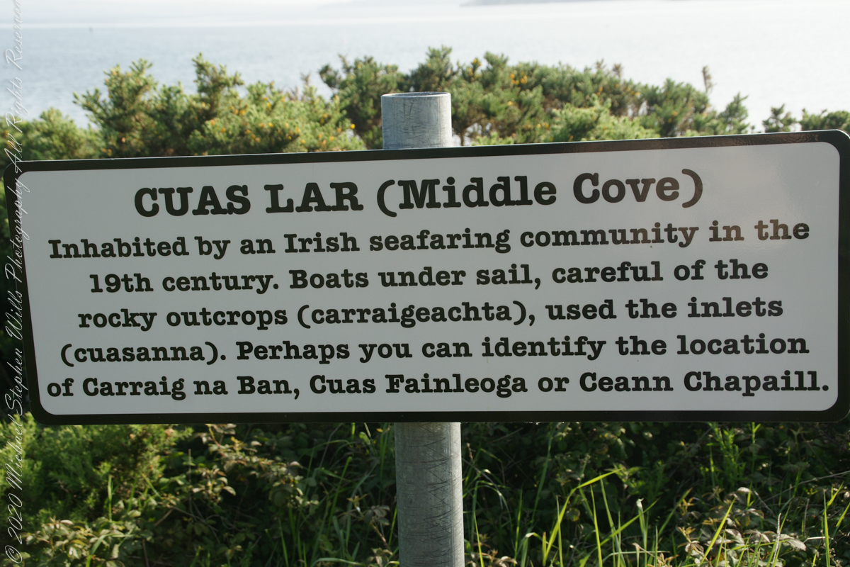
The view referred to by placard is to the right. The Old Head of Kinsale is the distant landform, looking right to left, is the portion that drops off to the ocean.
Click any pic for a larger view, in a new tab, or a slide show. When using WordPress Reader, you need to open the post first.
Here is a Google Maps screen capture showing the relationship of our position (the unnamed red drop-pin) on the right, and the Old Head of Kinsale landform, seen below the lable “Ballylane.”
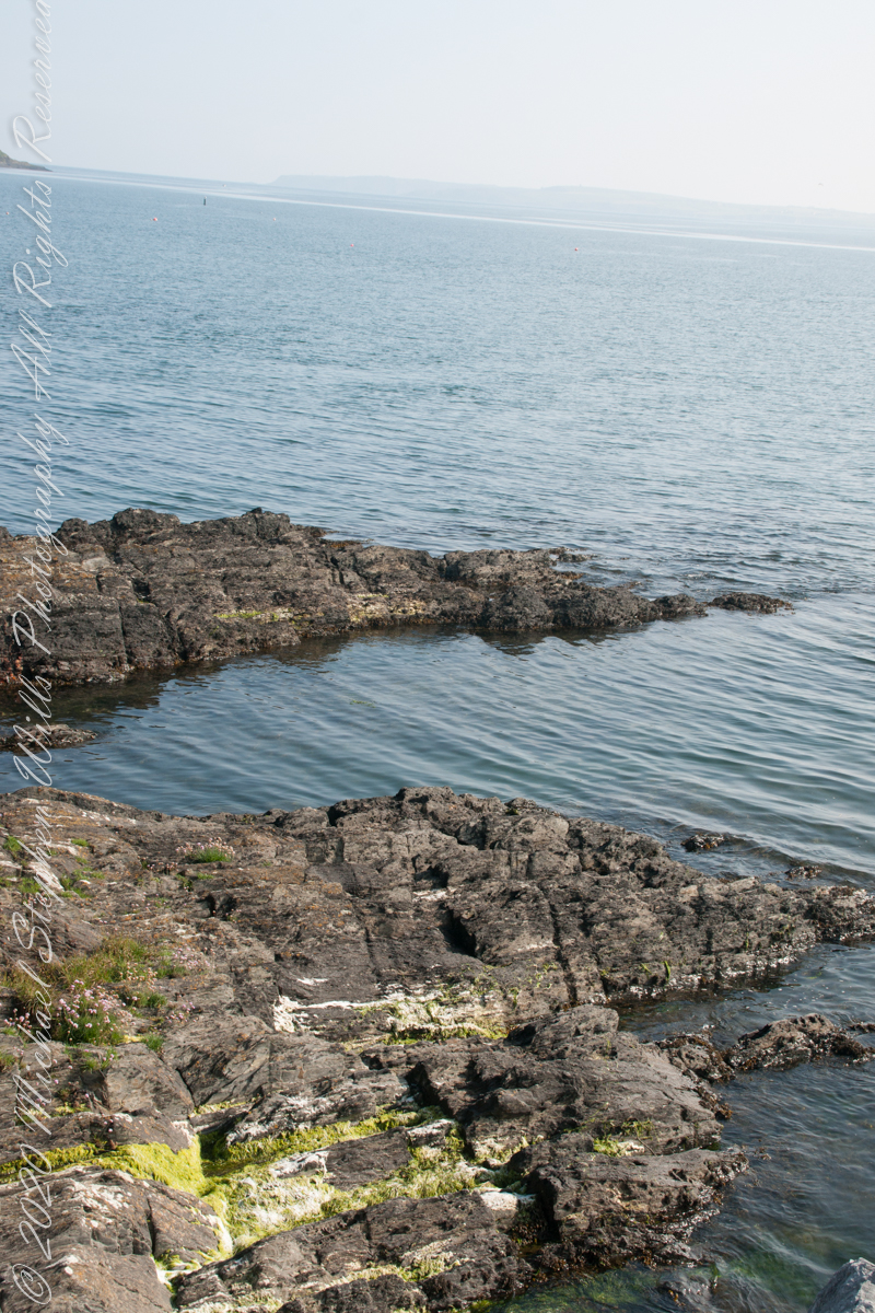
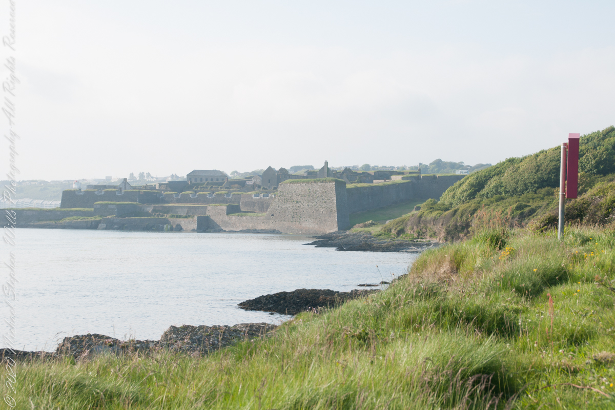
Here are the views looking toward the Celtic Sea, the Old Head of Kinsale and the cliffs at our feet.
Looking back toward Charles Fort
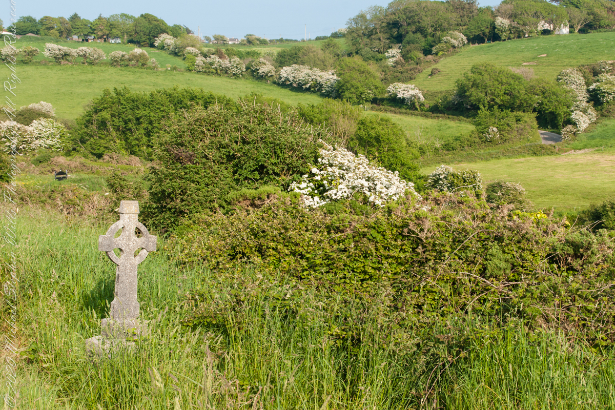
This cemetery is unmarked on the maps I use.
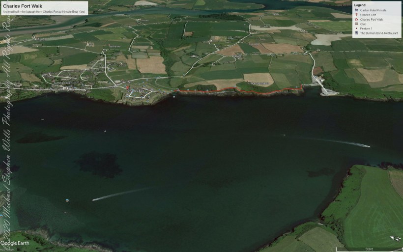
Here is a Google Earth view of our walk, the red line. The view is looking east from above the former “de Courcy family parkland.”
A half mile footpath, marked in red, leads from Charles fort along the shoreline cliffs, surmounted by working farmland.
Copyright 2021 Michael Stephen Wills All Rights Reserved
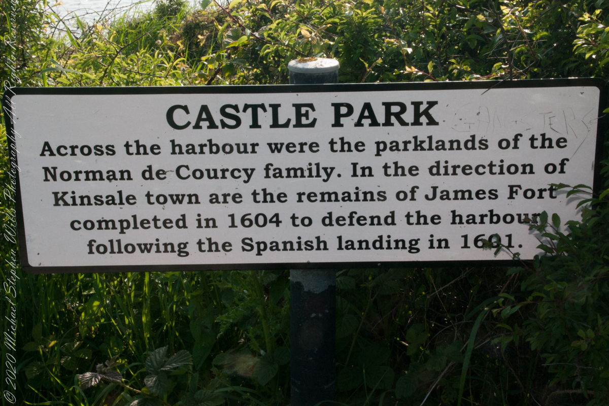
As Pam and I past the scenes of bucolic reverie this sign drew us back to the past. The reference to de Courcy is as a family of invading Normans. John de Courcy, without the King’s permission, launched an 1176 AD invasion of northeastern Ireland, what is now County Down, as an ultimately failed land grab. The history is murky, though apparently John de Courcy’s son Miles acquired the land referred to in the placard through the English King Henry II, awarded to Miles’ thieving, murderous Norman father-in-law Milo de Cogan in the 13th Century. Much later, the old (James) and new (Charles) Forts were constructed to defend Kinsale harbor.
Click any pic for a larger view, in a new tab, or a slide show. When using WordPress Reader, you need to open the post first.
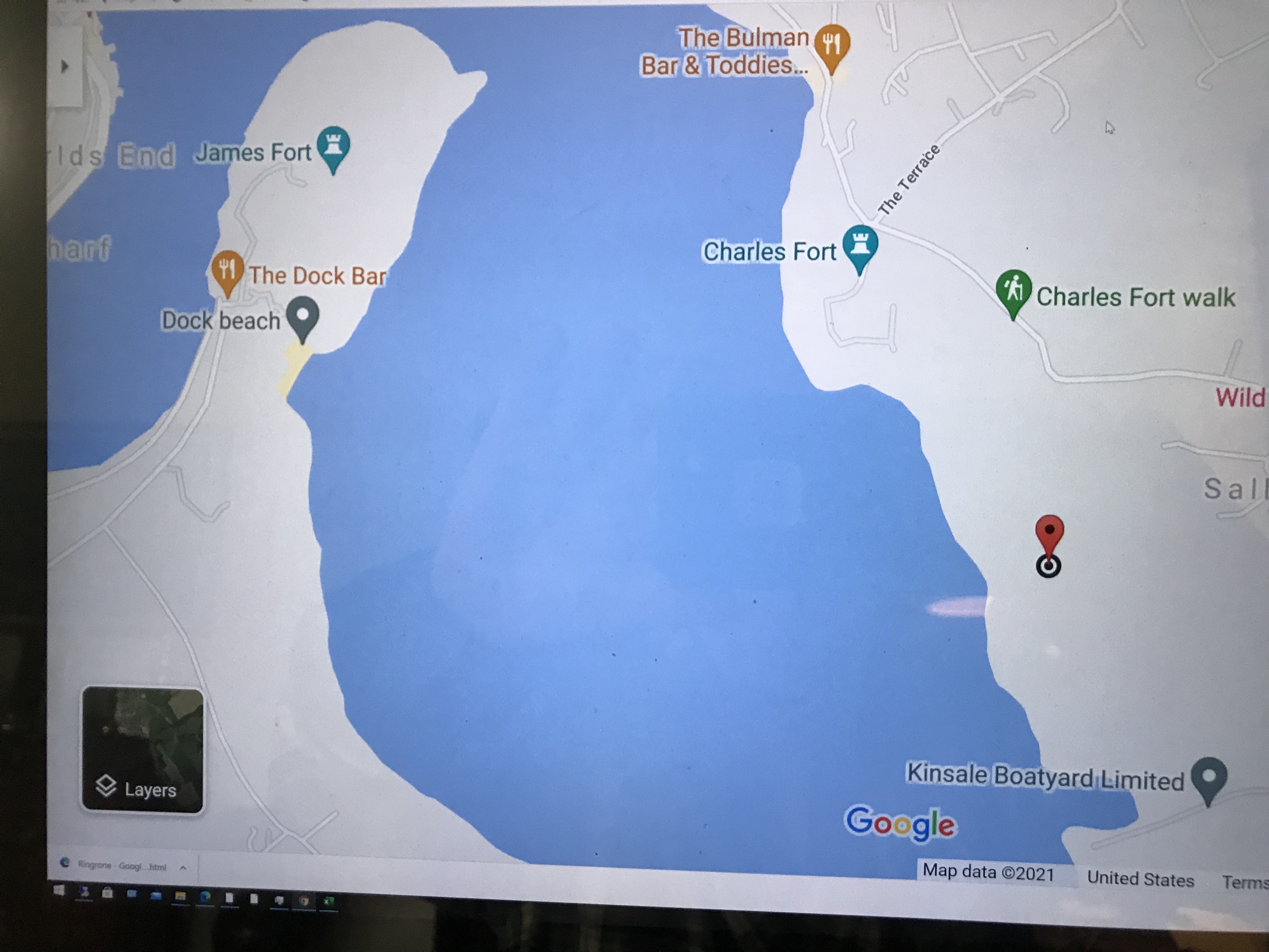
Here is a Google Maps screen capture showing the relationship of our position (the unnamed red drop-pin) on the right, Charles and James Forts and the de Courcy family parklands, the large blank area below the pin named “Dock beach.”
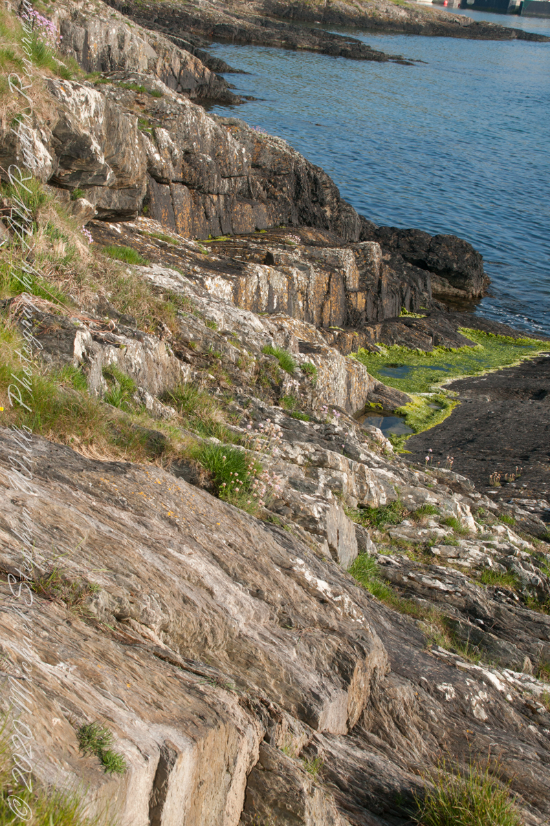
Here are the views looking toward the Celtic Sea, the Old Head of Kinsale and the cliffs at our feet.
Looking toward the Old Head of Kinsale in the far distance
Rocky Cliffs at our feet
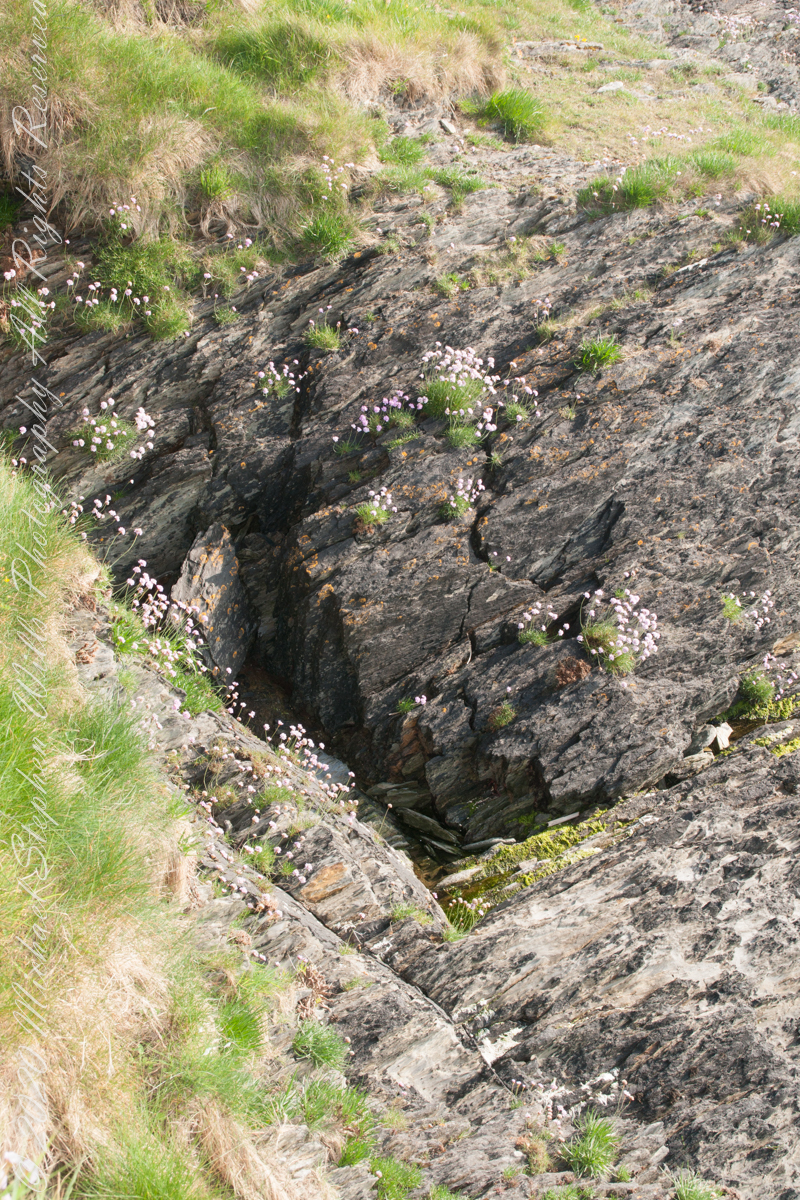
Cliff and Sea Pink
More Sea Pink decorating the rocks.
Here is a Google Earth view of our walk, the red line. The view is looking east from above the former “de Courcy family parkland.”
A half mile footpath, marked in red, leads from Charles fort along the shoreline cliffs, surmounted by working farmland.
Copyright 2021 Michael Stephen Wills All Rights Reserved
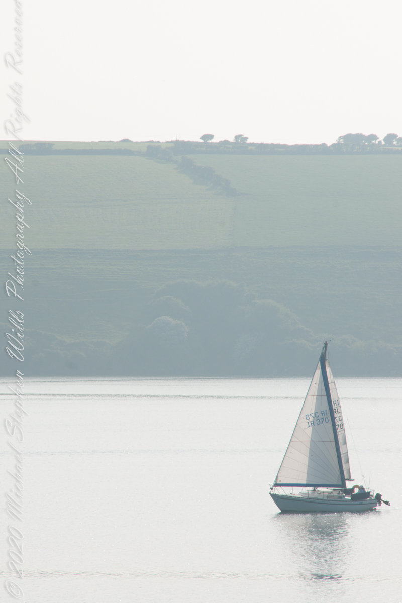
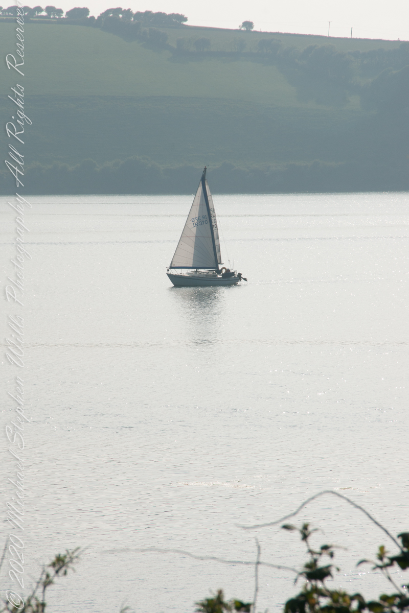
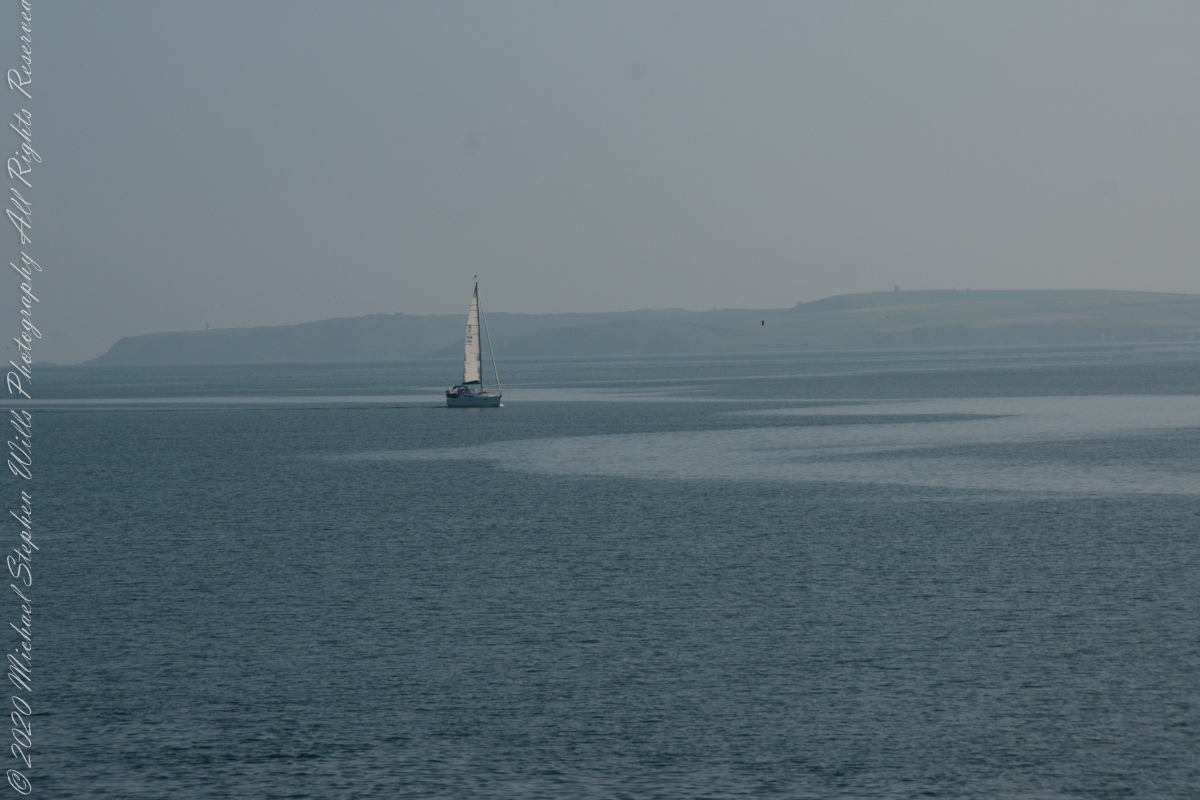
As Pam and I continued down the half mile “Sallyport” footpath, marked in red on the Google Earth view provided at the end of this post, we enjoyed the view across the Celtic Sea toward the distant Old Head of Kinsale and this sailboat headed to port.
Click any pic for a larger view, in a new tab, or a slide show. When using WordPress Reader, you need to open the post first.
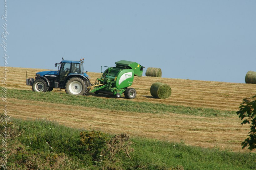
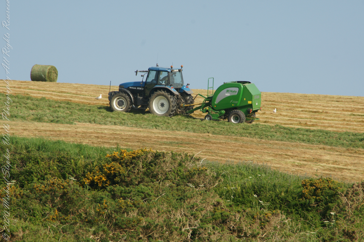
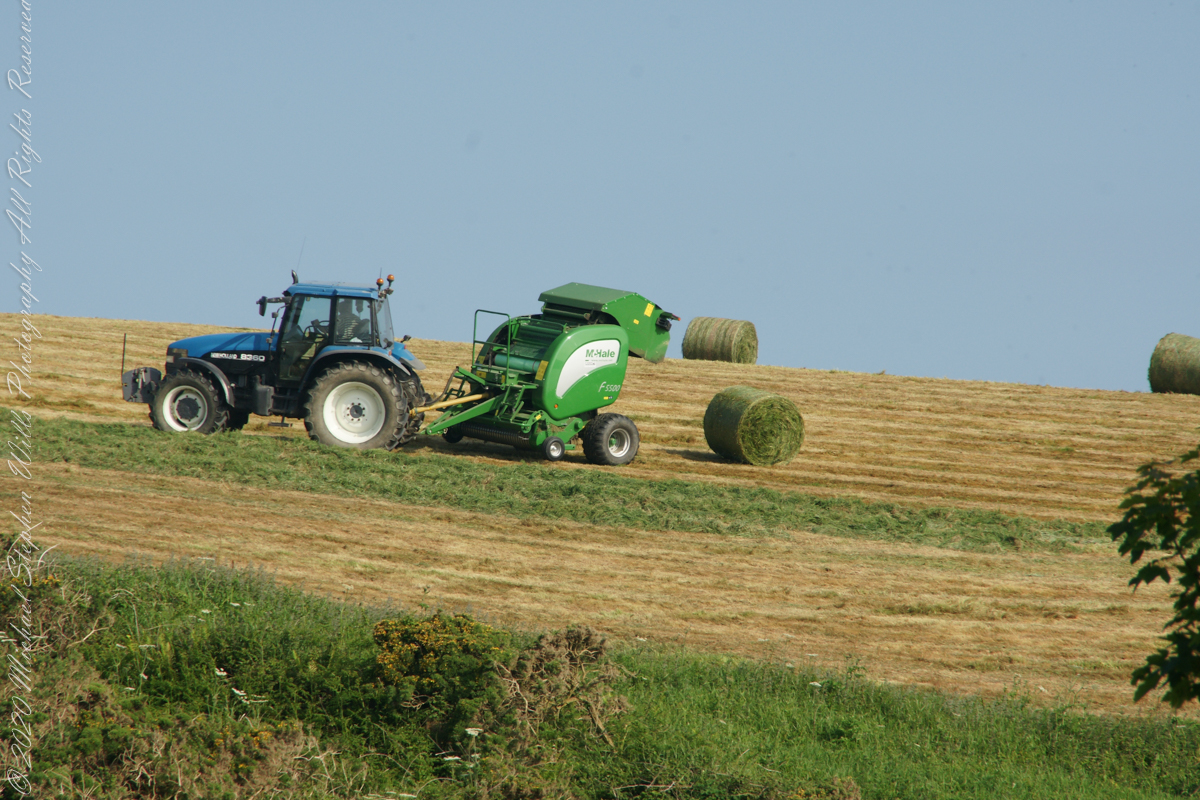
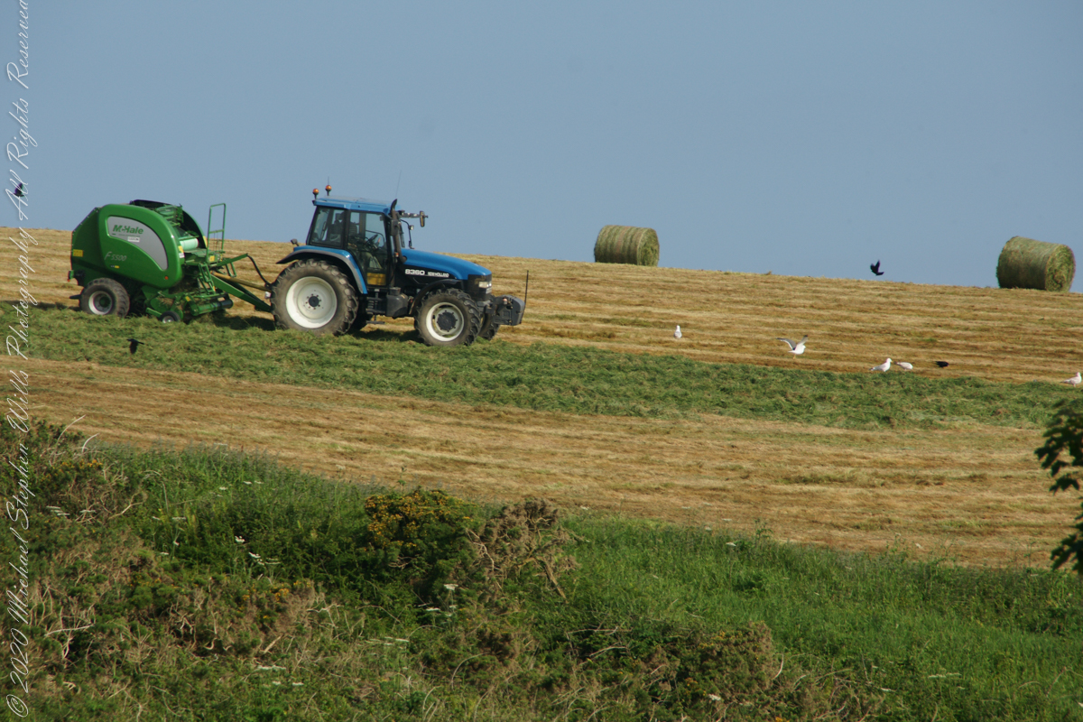
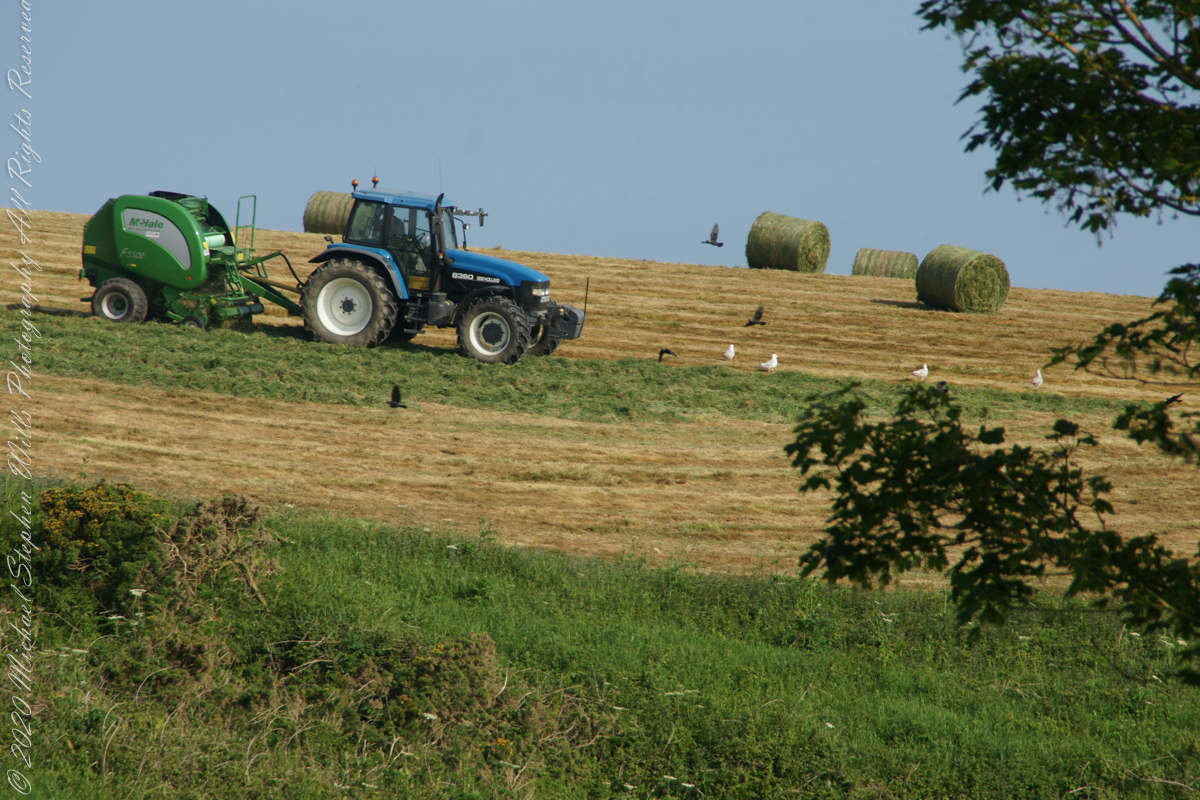
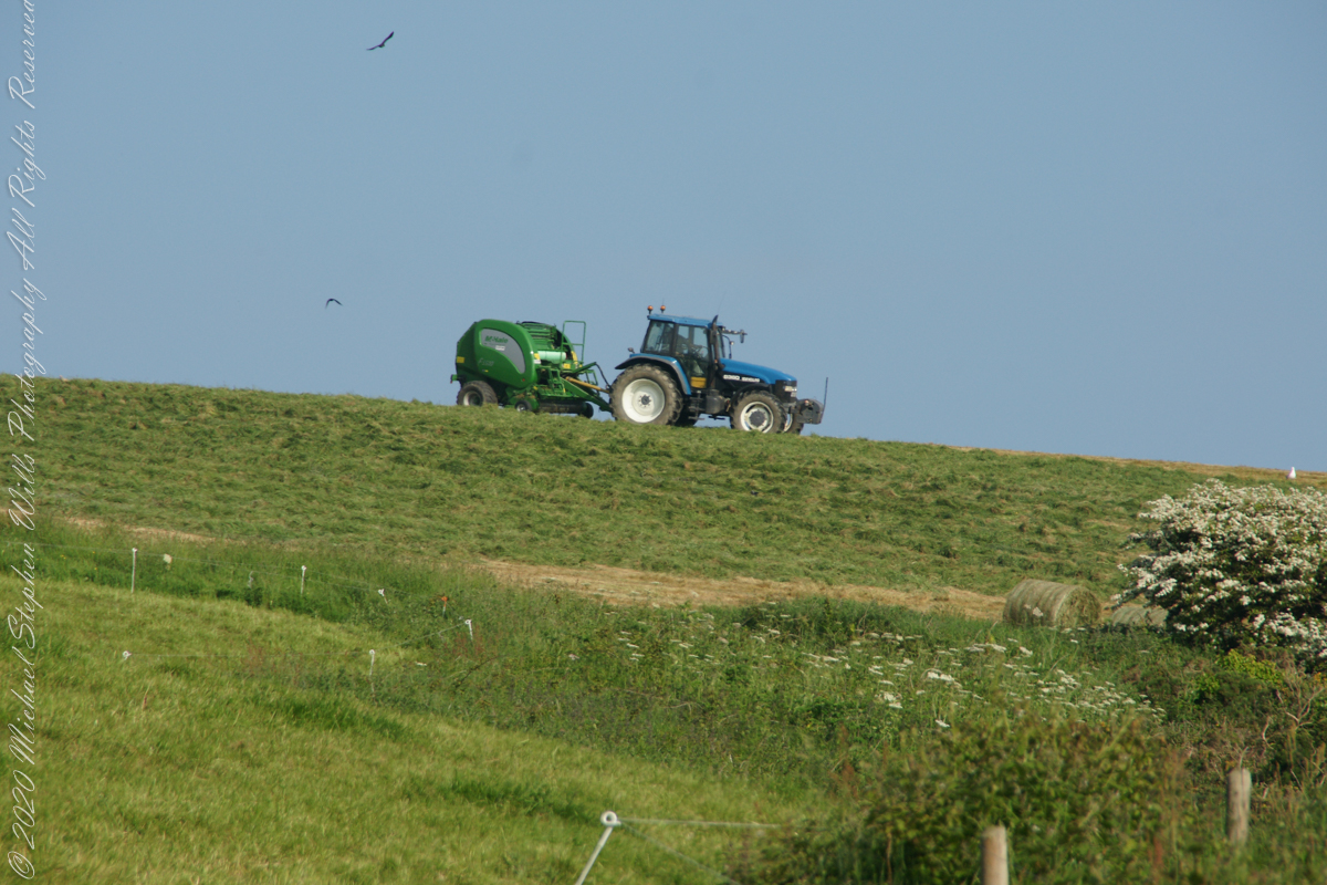
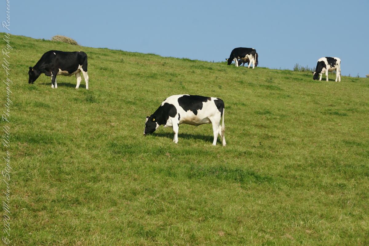
Landward, we enjoyed watching the progress of a farmer rolling hay bales while cows munched fresh green grass.
A half mile footpath, marked in red, leads from Charles fort along the shoreline cliffs, surmounted by working farmland.
Copyright 2021 Michael Stephen Wills All Rights Reserved
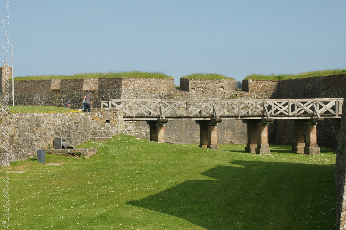
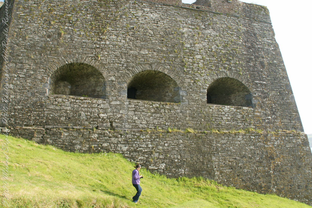
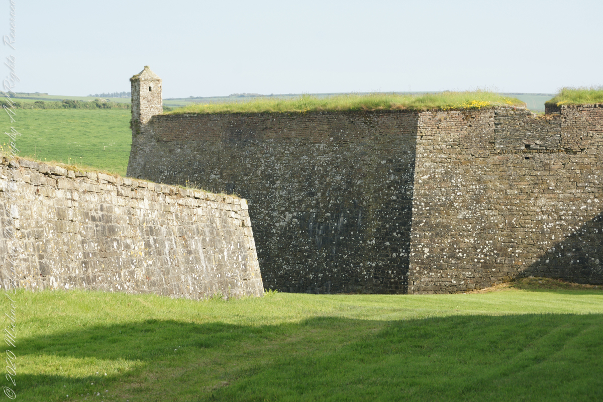
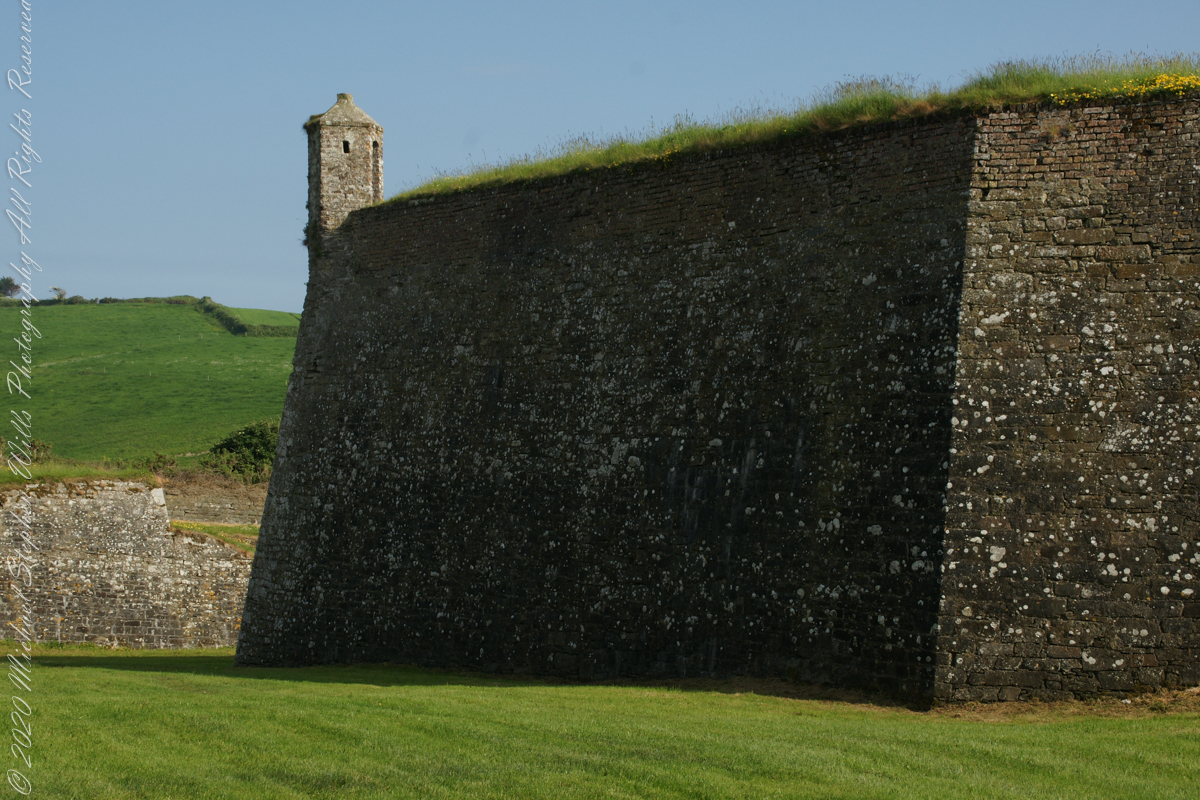
A “dun” is a larger fortification, few and far between on the island of Ireland. We saw one on the Arran Islands, from the Iron Age, Dun Angus, Charles Fort, or Dún Chathail in Irish, is from historical ages.
A cannot tell from my slide show, but the walls are star shaped with many salients, giving more positions to defend the walls.
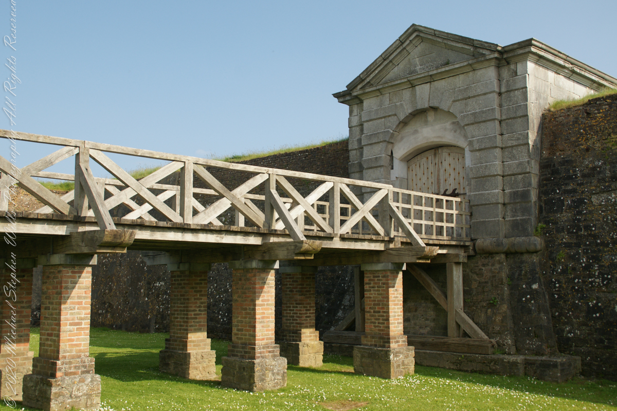
Steps to bridge across defensive ditch
Bridge and gate to fort enclosure, closed this late in day
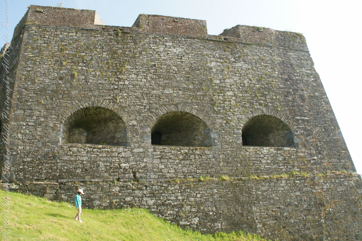
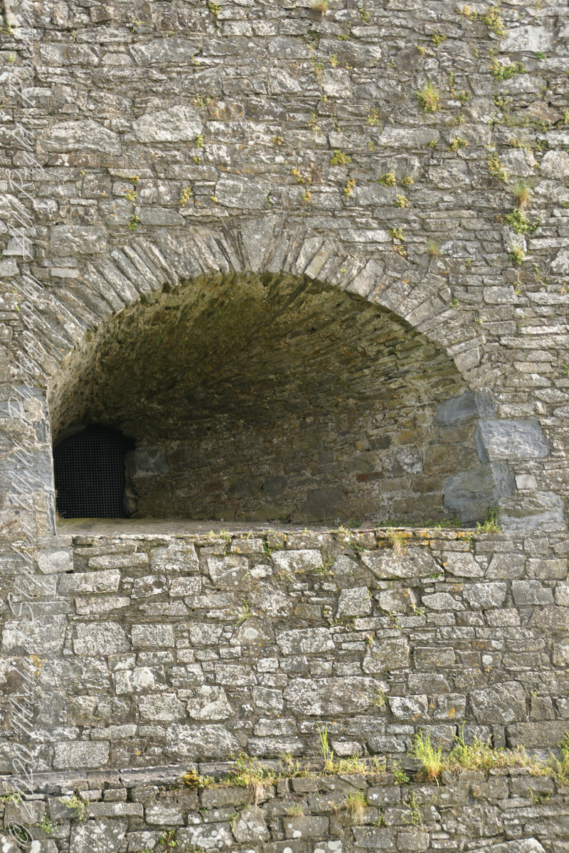
Embrasures
An opening in the fort walls which cannons can be fired. They were often flared outward to enlarge the field of fire.
Close-up of gun port
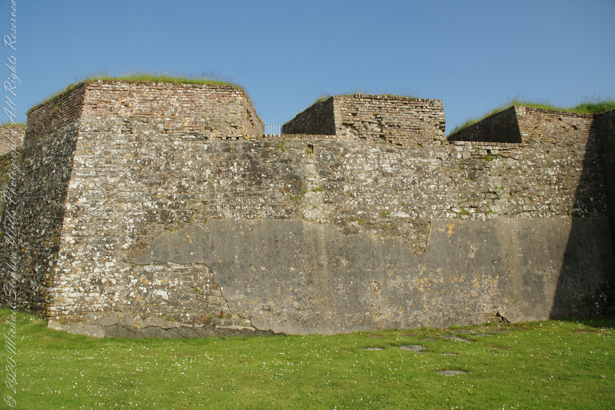
Crenellations
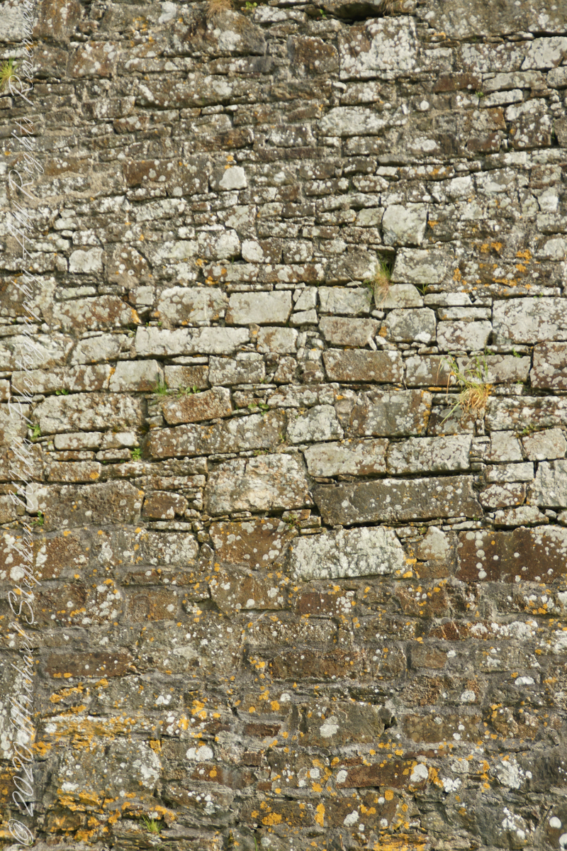
Tightly joined masonry
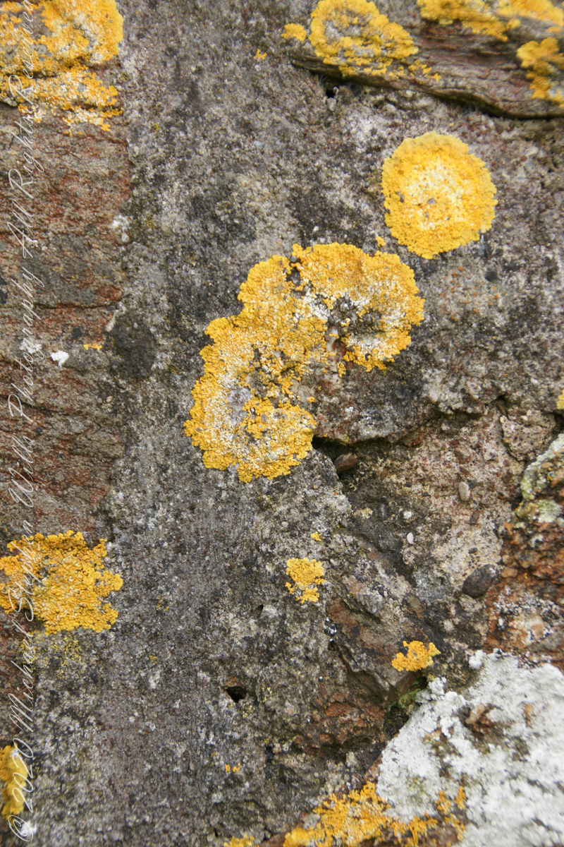
lichen
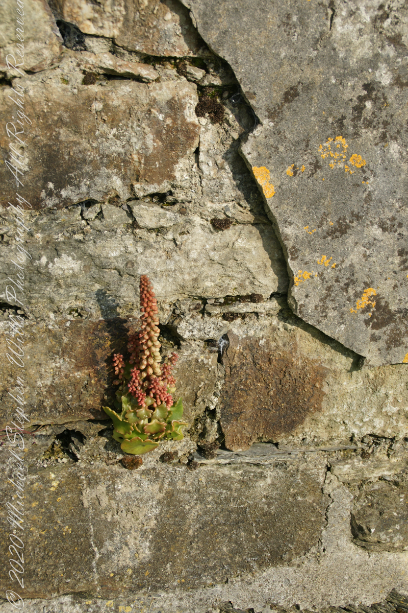
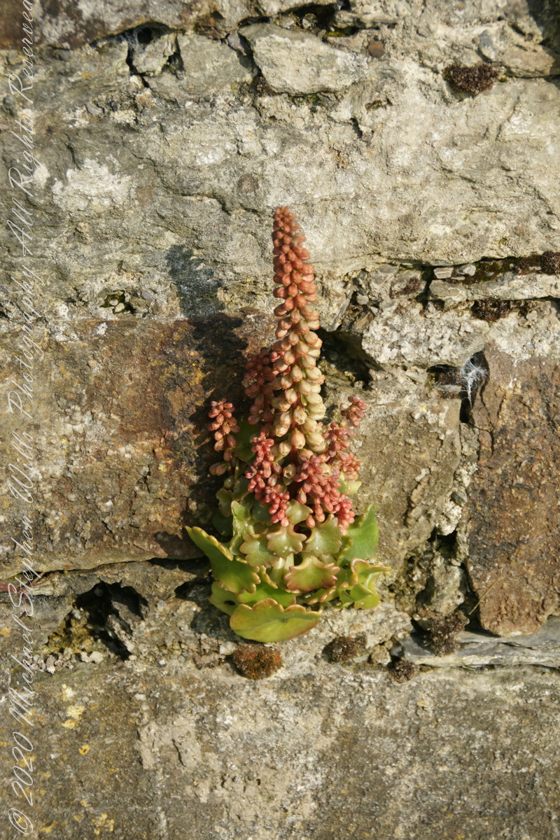
life has its way
seems to be a succulent
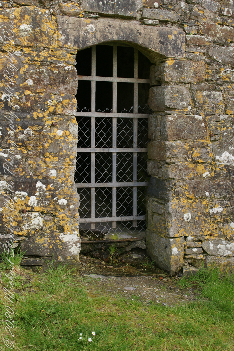
a doorway here seems a bad idea, but what do I know?
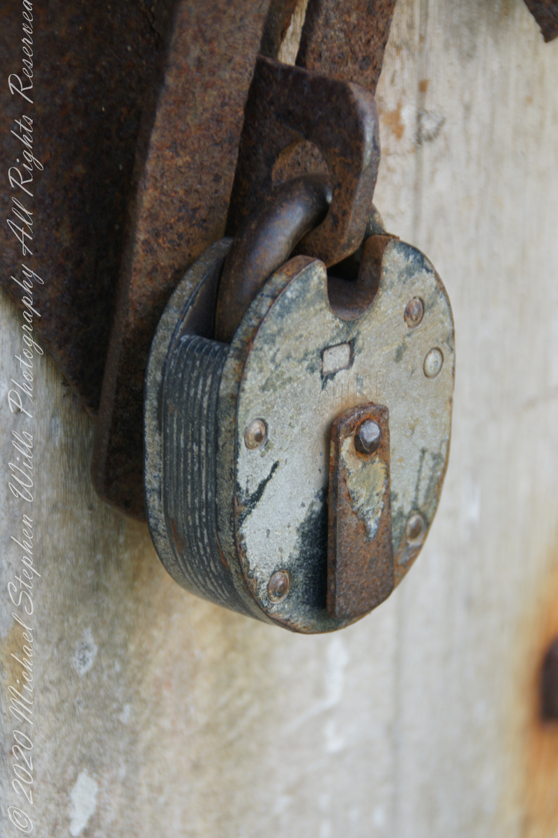
A pulley at first glance, look again and it is a lock
beneath the walls
Down to the Sallyport and the next post
References
“Charles Fort” – wikipedia
Copyright 2021 All Rights Reserved Michael Stephen Wills
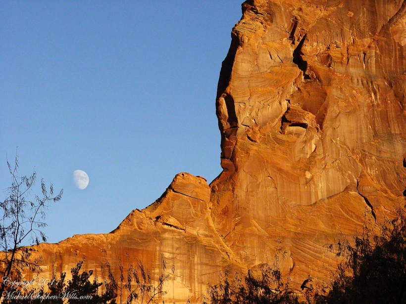
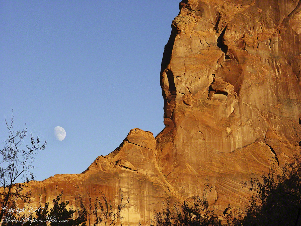
Driving from the Petrified Forest National Park my son, Sean, and I arrived at Chinle, Arizona the evening of Monday, November 2, 2003. No time to rest or eat after checking into the Best Western he and I reached the White House overlook and trail head with the sun low in the sky, the sun sets 6:45 pm these last few days of Daylight Savings. The Navajo Reservation observes Daylight Savings, so the click jumps crossing the border from Arizona to Reservation.
I was 50 at the time and with Sean graduated from SUNY Maritime and fresh from a tour at sea we made good time to the canyon floor. I wanted to catch the White House in the setting sun.
One morning, 14 years later, I published a fine art photograph from that trip.
Looking along the canyon, over thick stands of Russian Olives, I caught the risen moon, in gibbous phase, against a mid-canyon freestanding fin of red sandstone of the southern canyon wall. Today, those trees are gone, removed as an invasive species.