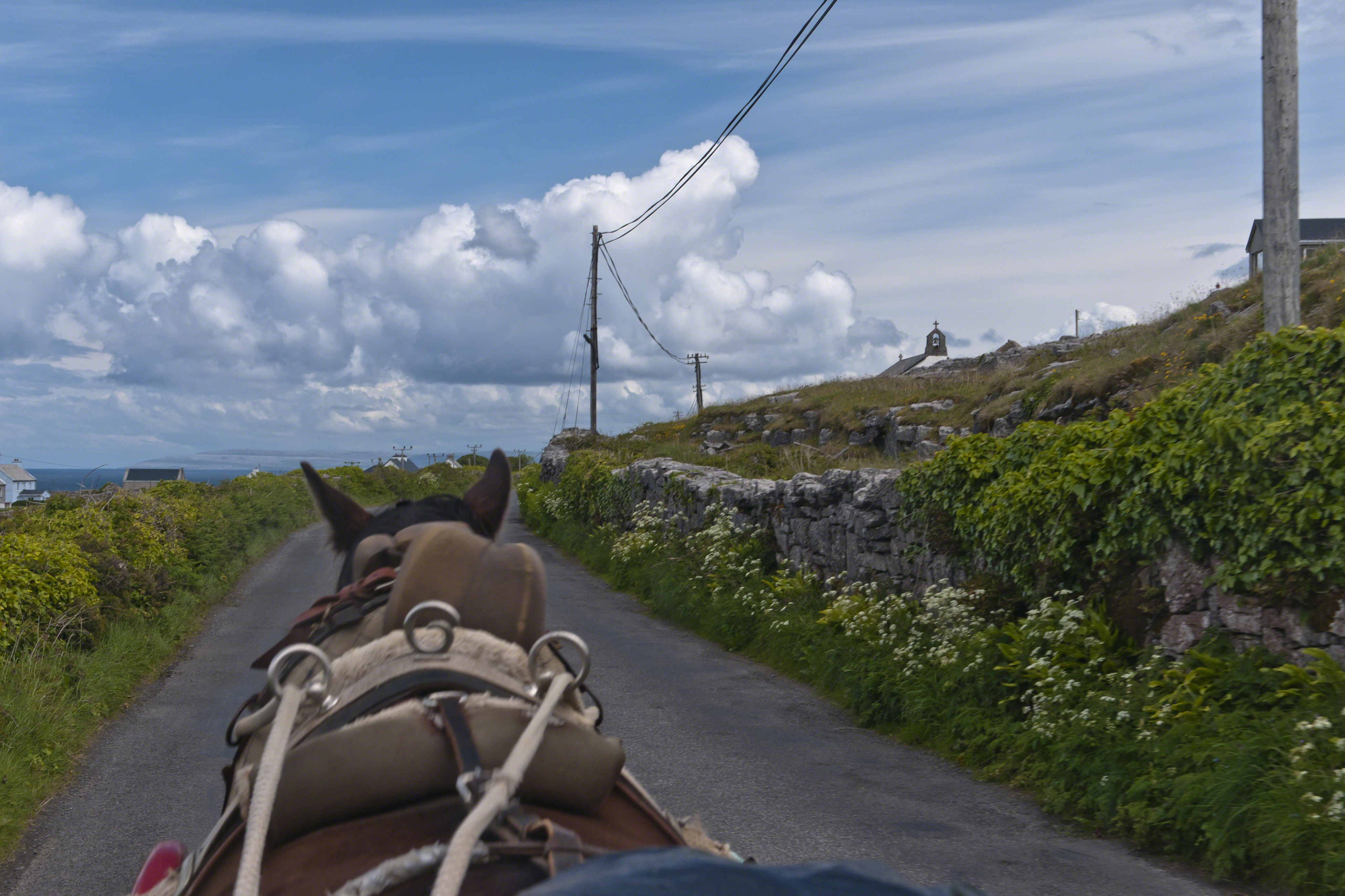
Enjoying travel on a horse trap, a type of carriage, on Inishmore (Inis Mór), the largest Aran Island in Galway Bay.
Click the link for my Getty IStock photography of the Aran Islands
Copyright 2019 All Rights Reserved Michael Stephen Wills

Travel at its best
Enjoying travel on a horse trap, a type of carriage, on Inishmore (Inis Mór), the largest Aran Island in Galway Bay.
Copyright 2019 All Rights Reserved Michael Stephen Wills

What is a Collier?
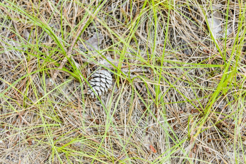
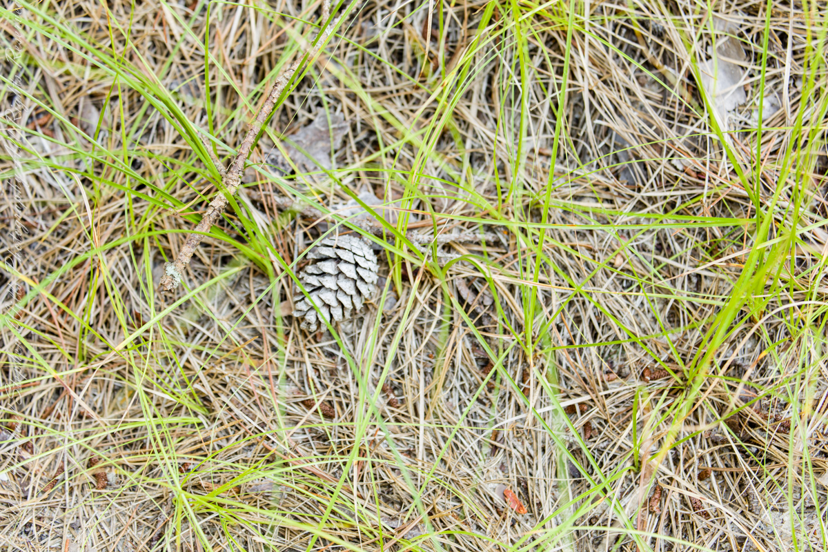
Here my exploration of Wharton State Forest, Pitch Pine Forest III, branches to the genealogical exploration of this landscape as my sister, Theresa and I, proceed along the humped, pitted sand road Goodwater through the wilderness to emerge in Batsto Village, a recreation of lives that touched my great great grandparents, James and Ann McCambridge among them. Ann saved money earned as a cook for Atsion furnace, the historical site at the start of the road to Quaker Bridge. Her husband James worked as a collier, supplying fuel for the iron furnaces at Atsion and Batsto, among other enterprises. During our Batsto Village visit we found these reproductions of charcoal clamps.
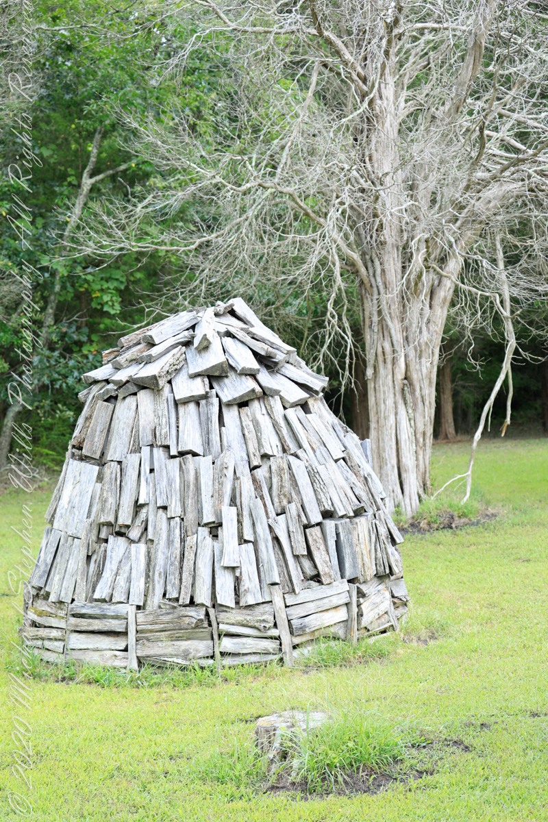
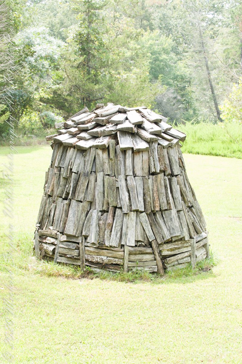
Since earliest times charcoal was used for cooking and heating. It was the best heat source for metal furnaces. Entire deforested regions are attributed to the demand for charcoal. Thomas Jefferson experimented with charcoal clamp designs, modifying air flow from the base.
James and Ann lived on the land that provided a livelihood, enough to support themselves and nine (9) children. From September 7, 1850 is the US Census for this family of my second great grandparents. Great Grandmother Margaret was 11 years. James is listed as a Collier, the value of Real Estate owned was 6,000 (a fortune for the time).
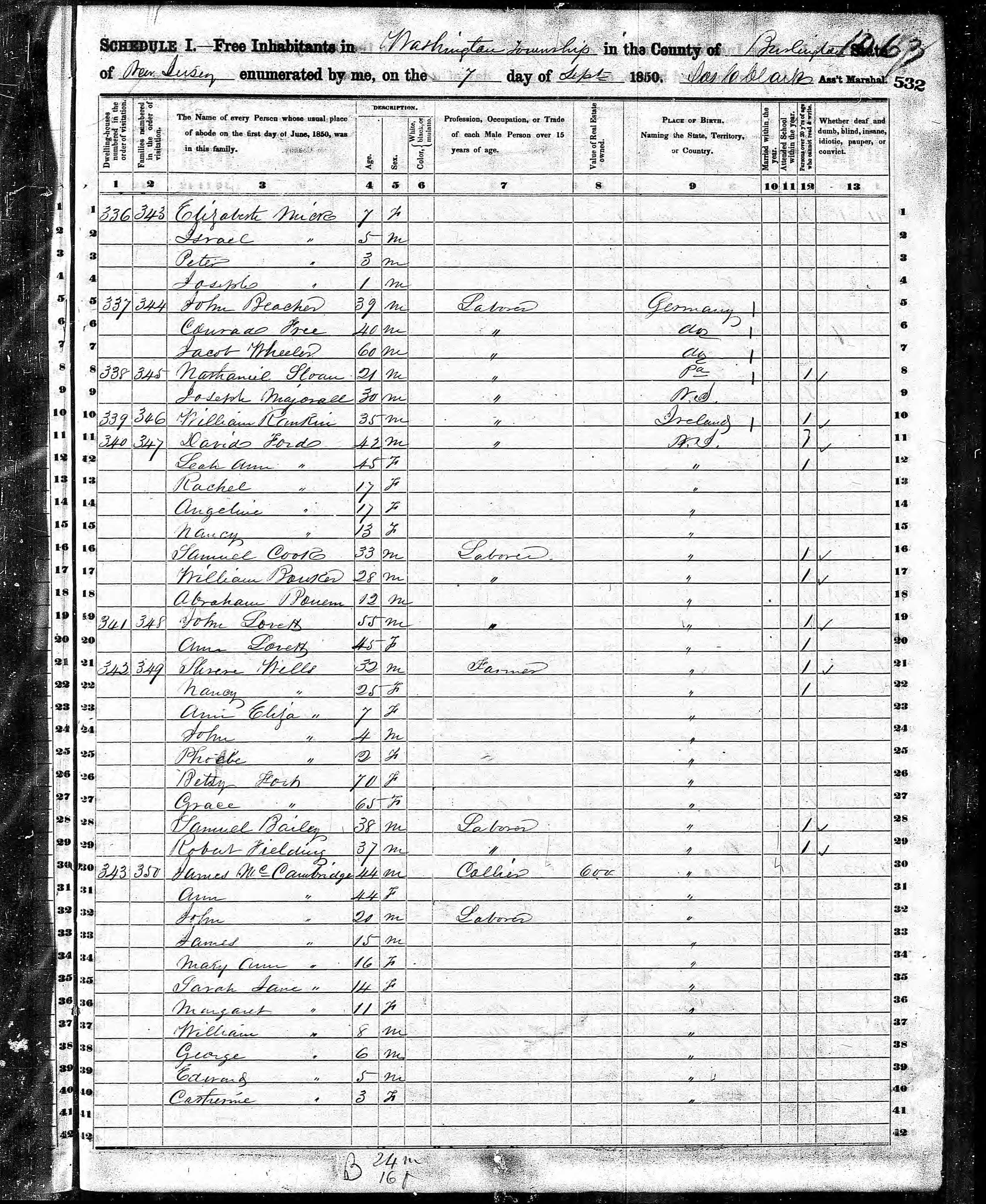
Like his wife Ann, James had a savings account…..

Copyright 2021 Michael Stephen Wills All Rights Reserved
Road to Batsto
Leaving the jeep on the west side of Quaker Bridge, I walked over to inspect the structure and poke around the other side, carrying a Canon 5d Mark IV (camera body) / EF 70 – 300 mm f/4-5.6 L IMS (lens), shooting as I walked. My sister Theresa and Maxie, a little white dog, lagged behind taking in the surroundings. Here they are, in shadow, on the west side.

My work on the east side was shared in previous posts, “Pinelands Connections VIII,” I and II “Around Quaker Bridge,” and I and II “Pitch Pine Forest,” work interrupted by the sound of an approaching engine, a Humvee came into view. I waved my arm up and down, a sign to slow down, pulling alongside the driver looked up with dead eyes, no element of recognition of a fellow human, as I explained my sister was on the bridge. A stink of unfamiliar hydrocarbons, diesel fuel?, rose through the heat as they pulled forward with no acknowledgement of my request. Thankfully they slowed down as Theresa, Max in her arms, said, “hi.”
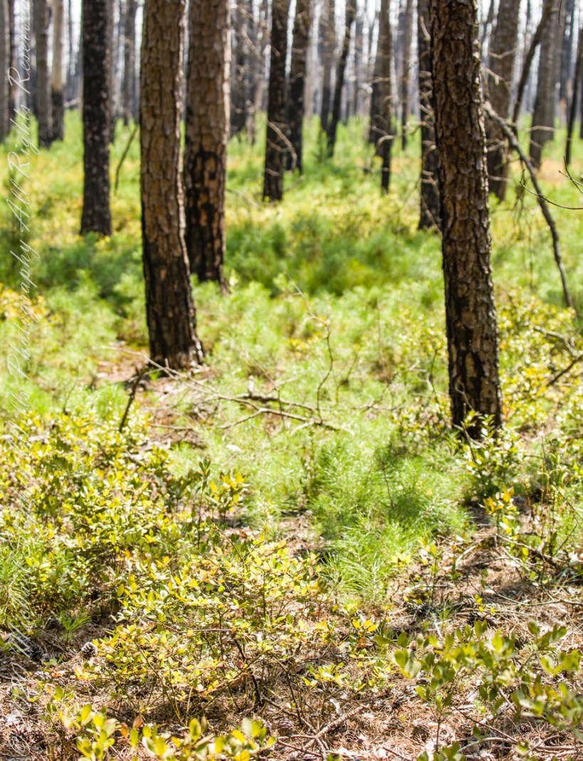
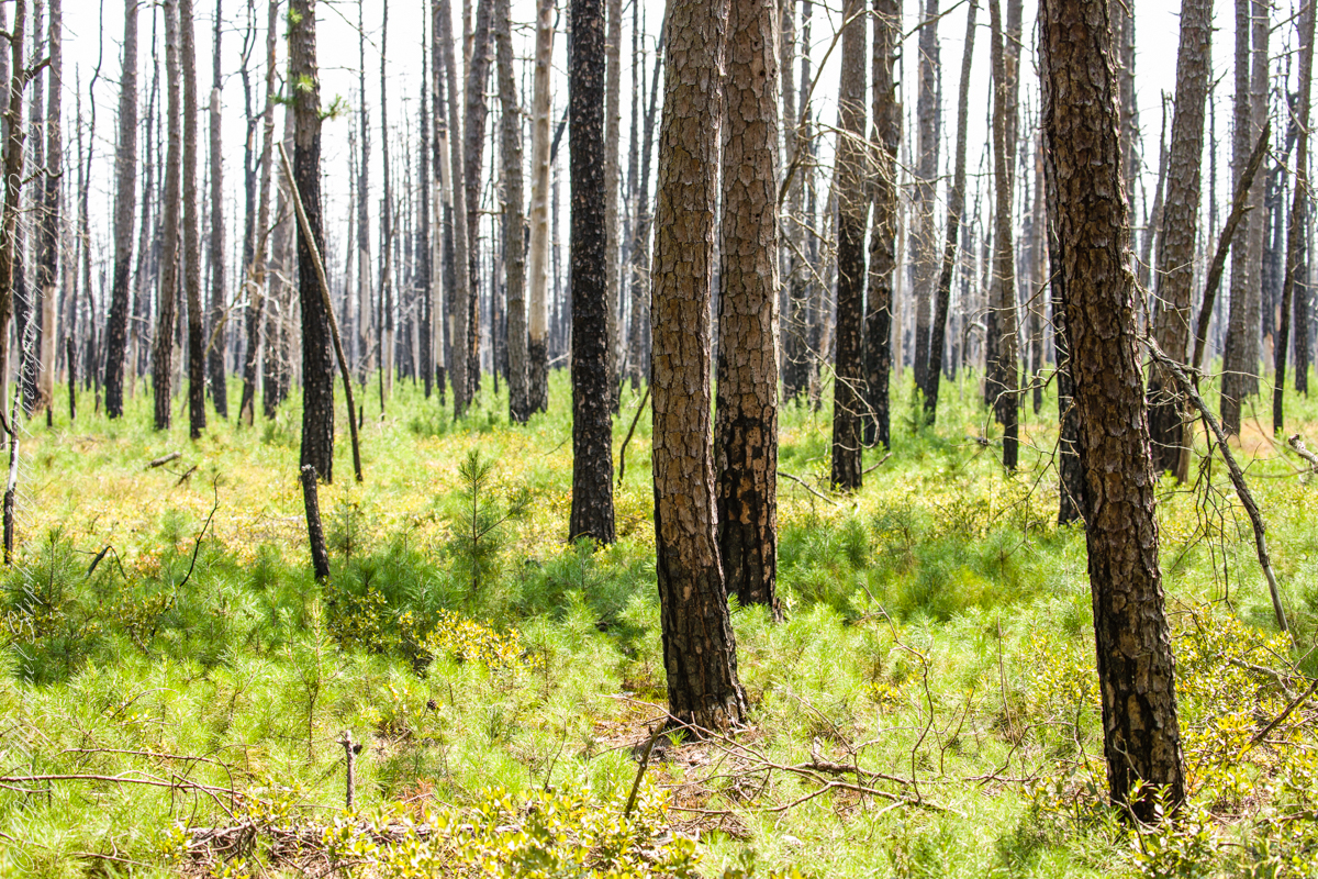
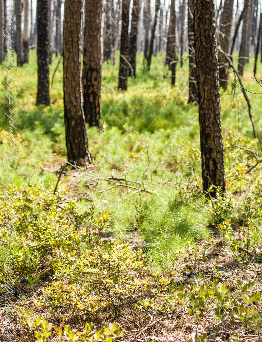
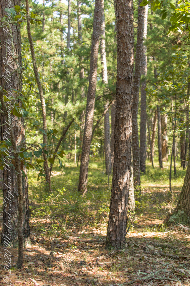
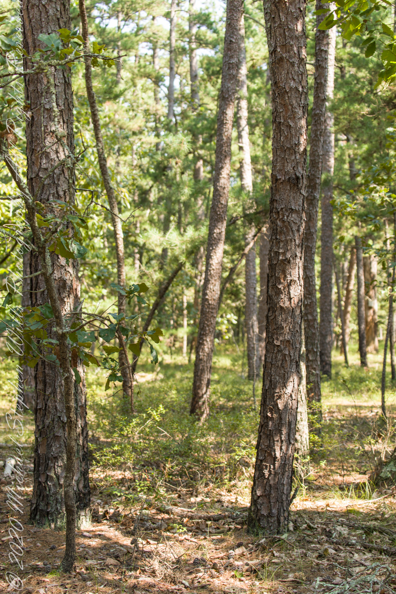
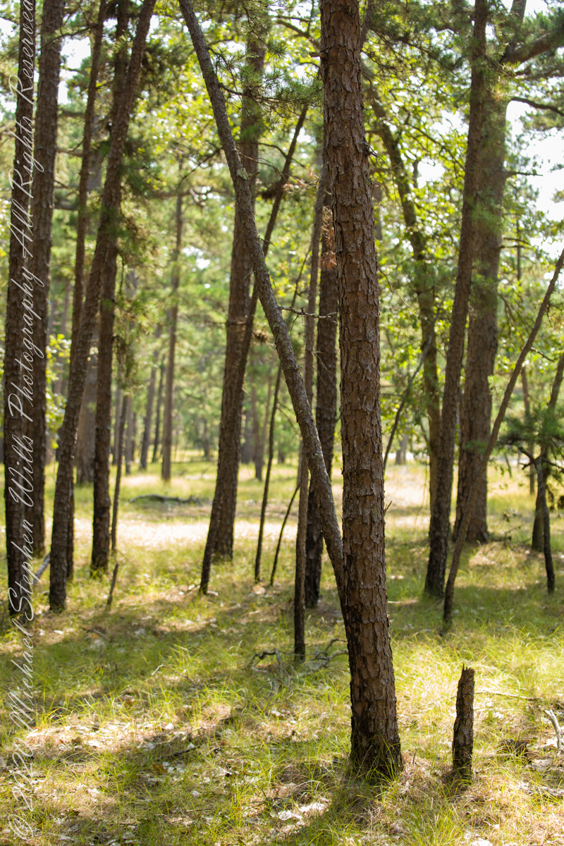
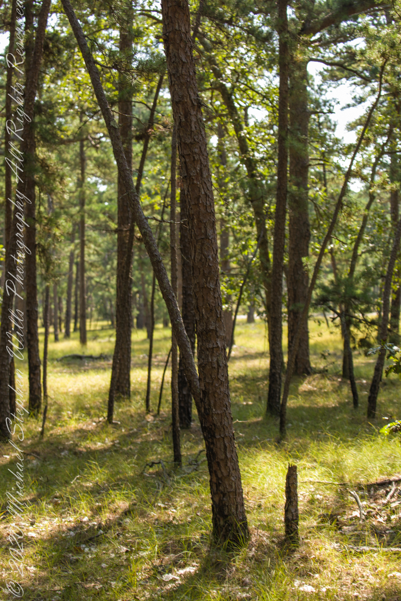
Multiple roads converge from all directions on Quaker Bridge, using GoogleMaps (surprising these unimproved, “jeep” sand roads were listed) I chose Goodwater Road as a route to Batsto Village, on the southern side of Wharton State Forest. The 6.1 mile road follows the east bank of Mullica River at a distance, a very rough passage through ancient Pitch Pine forest. Here are photographs of the enormous capacity of the pines to regrow after fire. Note a thick seeding growth among the mature pine trunks, lower portions fire blackened.
Copyright 2021 Michael Stephen Wills All Rights Reserved
Poking Around
Multiple trails lead from where Quaker Bridge crosses the Mullica River. These are from a handheld Canon 5d Mark IV with the Canon EF 70 – 300 mm f/4.0-5.6 ISM lens.
lll
Copyright 2021 Michael Stephen Wills All Rights Reserved

a season of wildflowers across a karst landscape
Another aspect of the gradual 1/2 mile inclined path to the central ring of the prehistoric Dun Aonghasa ruins of County Galway, Ireland.
The view north, northwest from this way to Dun Aonghasa (Dun Aengus). In early June, looking across wildflowers, karst landscape, walled fields, farms, the North Atlantic Ocean, coast of Connemara and the 12 Bens (12 Pins) mountains.
Note the doorway (with long lintel) in the surrounding wall, to left of center in middle distance.
Click the photograph for a larger view.

References: search wikipedia “Dún Aonghasa.”
Poking Around
Multiple trails lead from where Quaker Bridge crosses the Mullica River. These are from a handheld Canon 5d Mark IV with the Canon EF 70 – 300 mm f/4.0-5.6 ISM lens.
lll

Copyright 2021 Michael Stephen Wills All Rights Reserved

Poking Around
Multiple trails lead from where Quaker Bridge crosses the Mullica River. These are from a handheld Canon 5d Mark IV with the Canon EF 70 – 300 mm f/4.0-5.6 ISM lens.
lll
Copyright 2021 Michael Stephen Wills All Rights Reserved
An 84-degree October walk up Cascadilla Gorge—quiet paths, bluestone porches, fresh paint on the bridge—waiting for the footbridge to catch the last, warm evening sunlight.
Every fall I make a point of walking Cascadilla Gorge at least once. On an 84-degree October 9 afternoon, Pam was tied up with chores, so I parked downtown and stopped to see the grandchildren. They were with their mom. Two were “too tired” after school to do anything. The youngest, at the age of four, was not yet in school and he floated the idea of the skateboard park; for me, that wasn’t in the cards. So I set off on foot up Court Street, past the residence of Buddhist monks at the gorge entrance.
Cascadilla Gorge is part of Cornell Botanic Gardens (formerly the Plantations), the university unit that stewards natural areas and gardens across campus. Foot traffic was light. A sign explained why: the lower trail was closed at Stewart Avenue, where the bridge spans the ravine. I crossed to the north side by the Christian Science church and wound up Cascadilla Park Road to the rim trail that climbs East Hill toward campus.
Homes line this stretch, porches facing the gorge where the constant music of creek and falls carries up. Not feeling ambitious, I made a few phone snapshots. Here the path squeezes past a porch built of local “bluestone,” a feldspathic sandstone native to the region—around town it’s sometimes called “Llenroc,” Cornell in reverse.

That pot you see in the previous photo gets a closer look here, with more of the same weathered bluestone.

The drop to the gorge floor is steep, sheer in places. The barrier fence looks stout in some sections and thins to almost nothing in others. A few years ago, a recent Cornell graduate walking home late along this path fell to his death. I continued to the fork for the Ithaca City Cemetery, climbed to Stewart Avenue, turned right to cross the Cascadilla bridge, then right again onto the Gorge Rim Trail back toward town. At the bridge I noticed part of the closure work: fresh paint on the bridge and on the suicide-prevention netting beneath. On September 24—just fifteen days earlier—a Cornell senior had jumped; the net caught him, and the fire department brought him to safety.

From the concrete barrier in that photo you can peer into the gorge: a beautiful view, the steady voice of water rising from below. I try to leave the darker stories where they belong—at least until the sight of fresh paint pulls them back to mind.

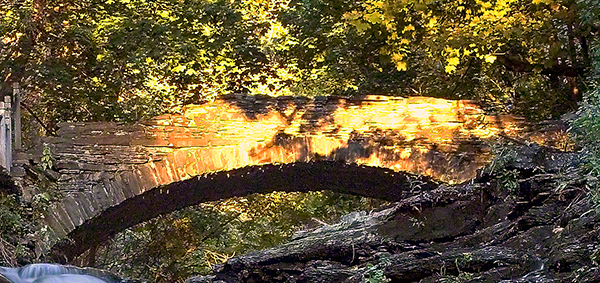
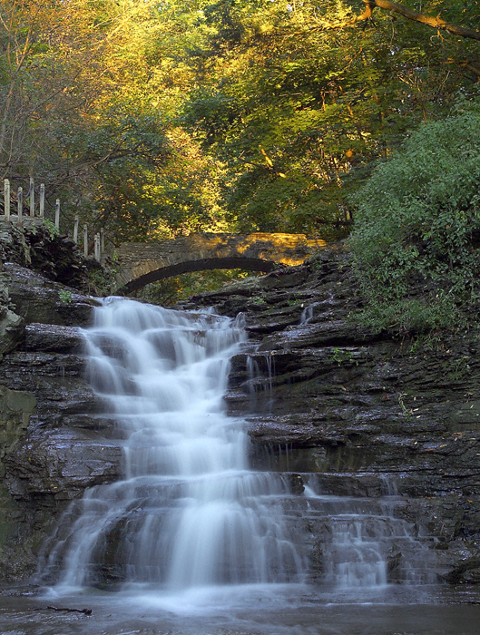
I took the following photograph in 2005, the September before my previous post, “Autumn Stroll in Sapsucker Woods” with the Kodak DSC pro slr-c, an ND filter, 50 mm lens and a tripod. It was a planned session, I work waterproof boots and was able to stand in the creek after a series of rain-free days. At this time of the year the gorge opens to the setting sun. I waited, taking a series of photographs for the perfect amount of light on the footbridge. The feature photograph (the header to this posting) is a detail from a shot with the bridge more fully lit.
The header image for this post comes from a planned session in September 2005, just before the photograph of my “Autumn Stroll in Sapsucker Woods” post. I used a Kodak DCS Pro SLR/c with an ND filter, a 50 mm lens, and a tripod. After several rain-free days I wore waterproof boots and stood mid-creek. In autumn the gorge opens to the setting sun; I waited and shot a sequence until the light laid perfectly across the footbridge. The banner image is a detail from a frame where the bridge is more fully lit.
We have a framed print of that photograph at home. I mounted it as a gift to Pam on our first Valentine’s Day.
If you’ve walked Cascadilla Gorge in autumn, I’d love to hear your favorite vantage points—porches along the rim, the lower stone steps, or the footbridge at golden hour. Do you know any stories about Llenroc bluestone on these houses, or remember the Stewart Avenue Bridge before its safety upgrades? Photographers: what helps you balance deep shade and bright water from the designated trails? Share a tip or a memory in the comments.


Survey of elements
The previous post was an overview the Fulacht Fiadh associated with the Drombeg Stone Ring of County Cork, Republic of Ireland.
In this post, we explore the elements of these fascinating remnants from the late Bronze Age, over 3,000 years ago.
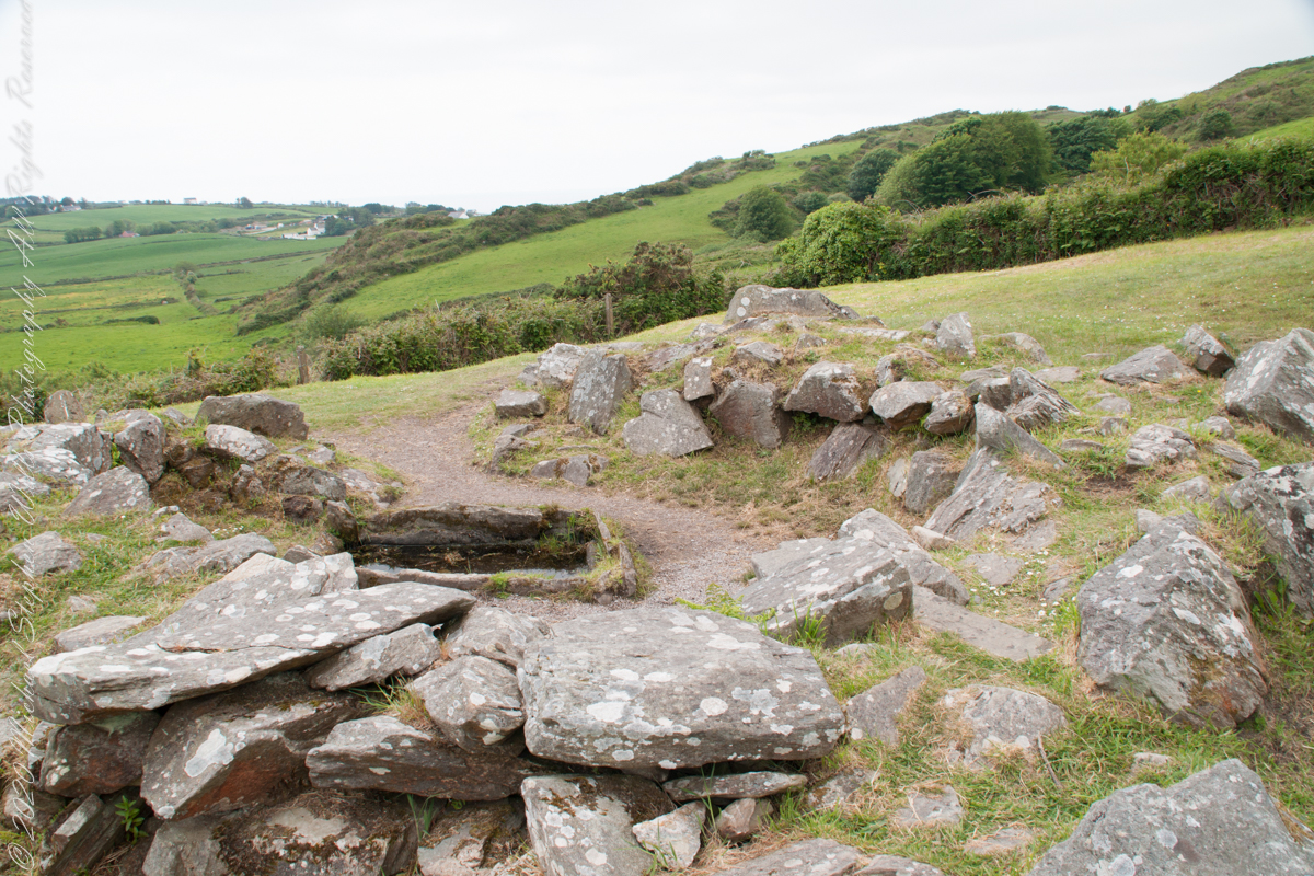
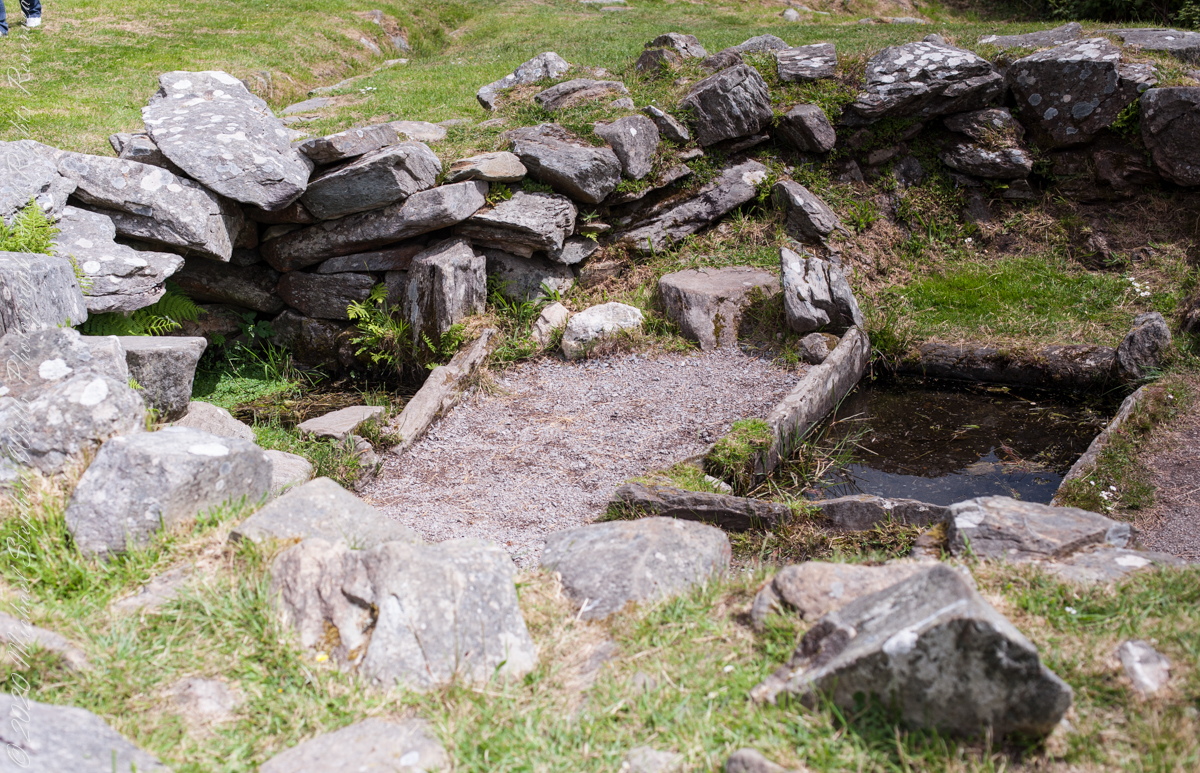
It is amazing the rock wall survived human need for the valuable wall stones. Portions were stolen, though for the most part we can see enough to understand.

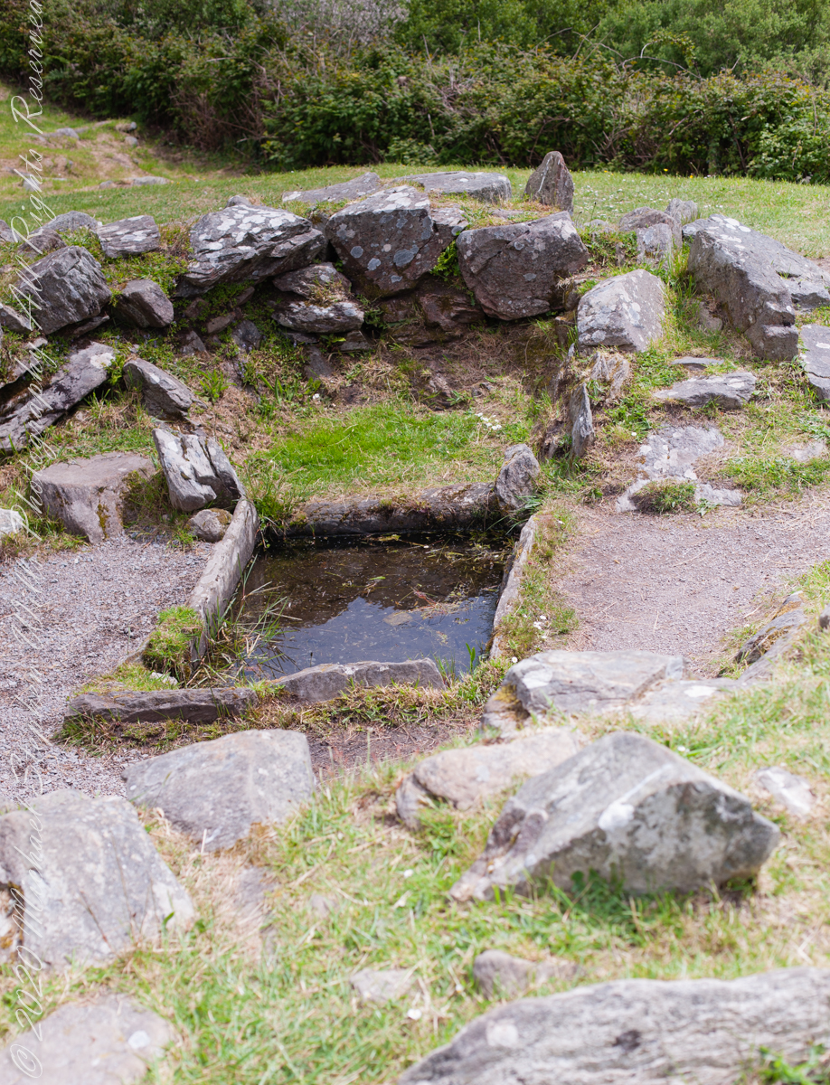
Drombeg’s Fulacht Fiadh, a Bronze Age cooking site, used heated stones to boil water for cooking, dyeing, and brewing.
Notice the groupings of visitors in the middle distance of Pam’s photograph, gathered around remains of late Bronze age elements.

There is a sign to explain…
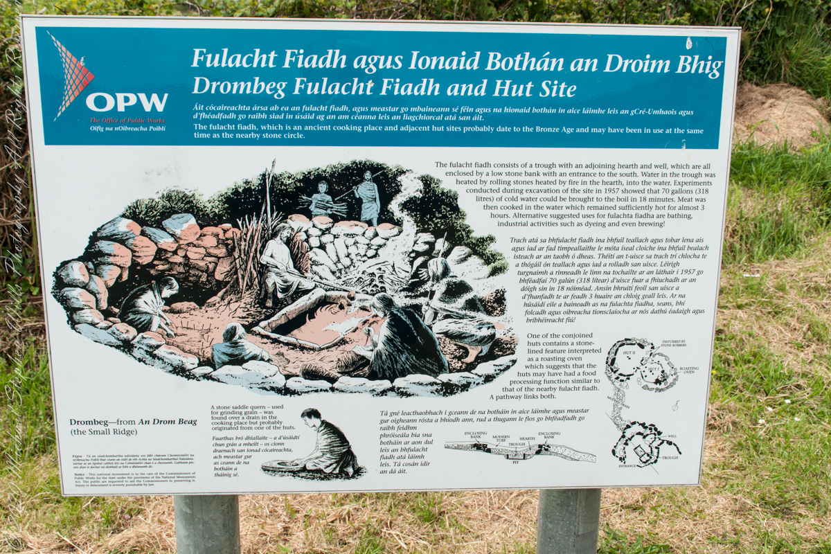
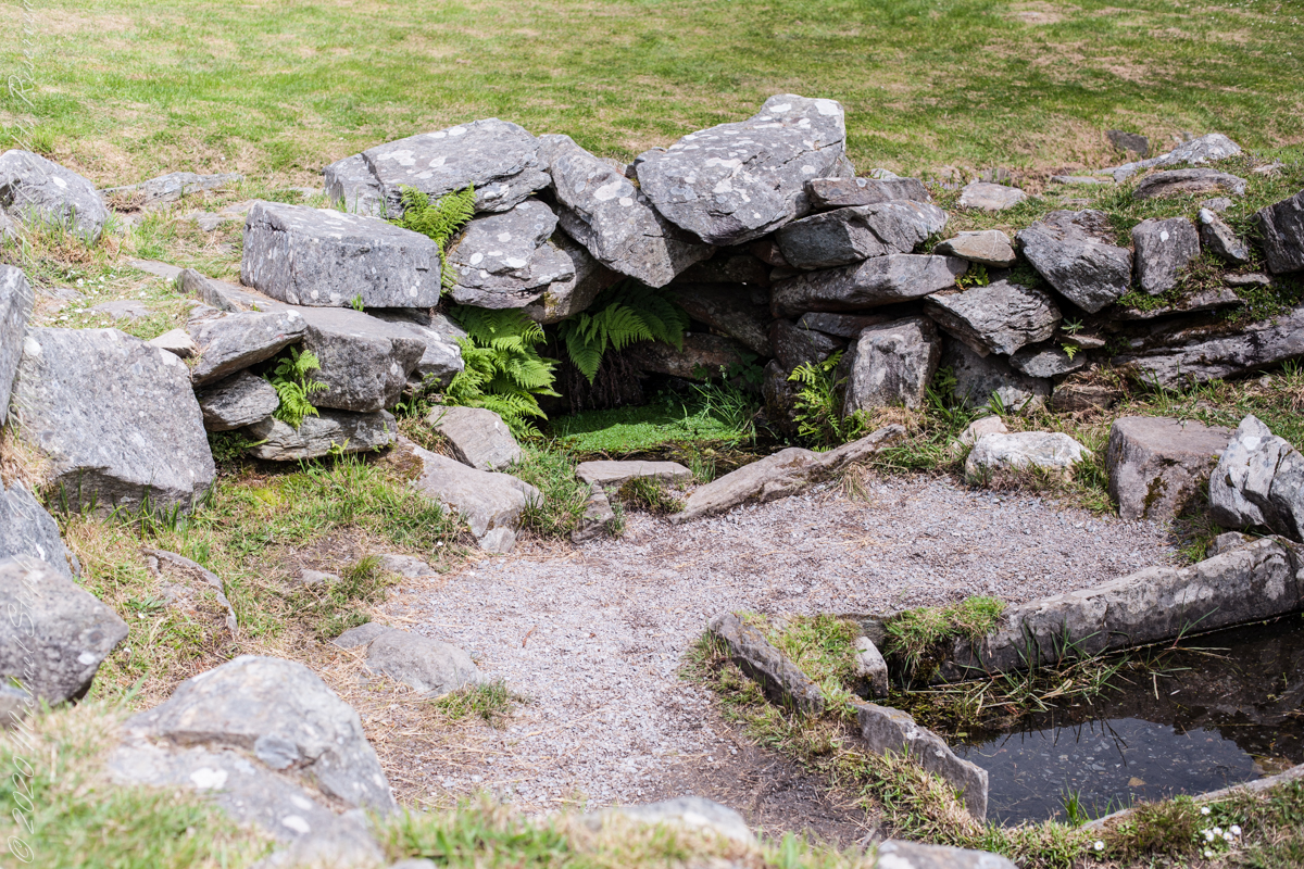
In modern Ireland the word fulacht means barbeque and the archeological sites with characteristics in common, such as a water source, health and pit, are named “Fulacht fiadh,” derived from Old Irish sources. In all cases the link is to some kind of preparation activity involving heat and moisture. Found throughout Ireland, Great Britan and the Isle of Man where the sites are called burnt mounds. The Drombeg Fulacht fiadh exemplifies all characterists. There is a horseshoe shaped rock walled/banked, now a remnant, enclosure, entrance to the south. In the middle is a pit, at Drombeg lined with rock, a spring on one side, a hearth on the other. A stone saddle quern, used for grinding grain, was nearby Adjacent huts, rock walls with post holes, do not suggest a settlement, but rather a temporary use.