A span of 10,000 years spreads between now and the first possibility of settlement on the island of Eire, then swept clean to bare rock by the weight of ice. Current scholarship of the Dún Aonghasa ruins, Inishmore, County Galway, the Irish Republic place a settlement within the inner of the four dry stone rings after 6,500 years (1,500 BC or 3,500 years ago). By way of scale, the first settlement took about 30 times the duration of the U.S. Constitution ratification through 2025: the last state, Rhode Island, ratified the Constitution 1789.
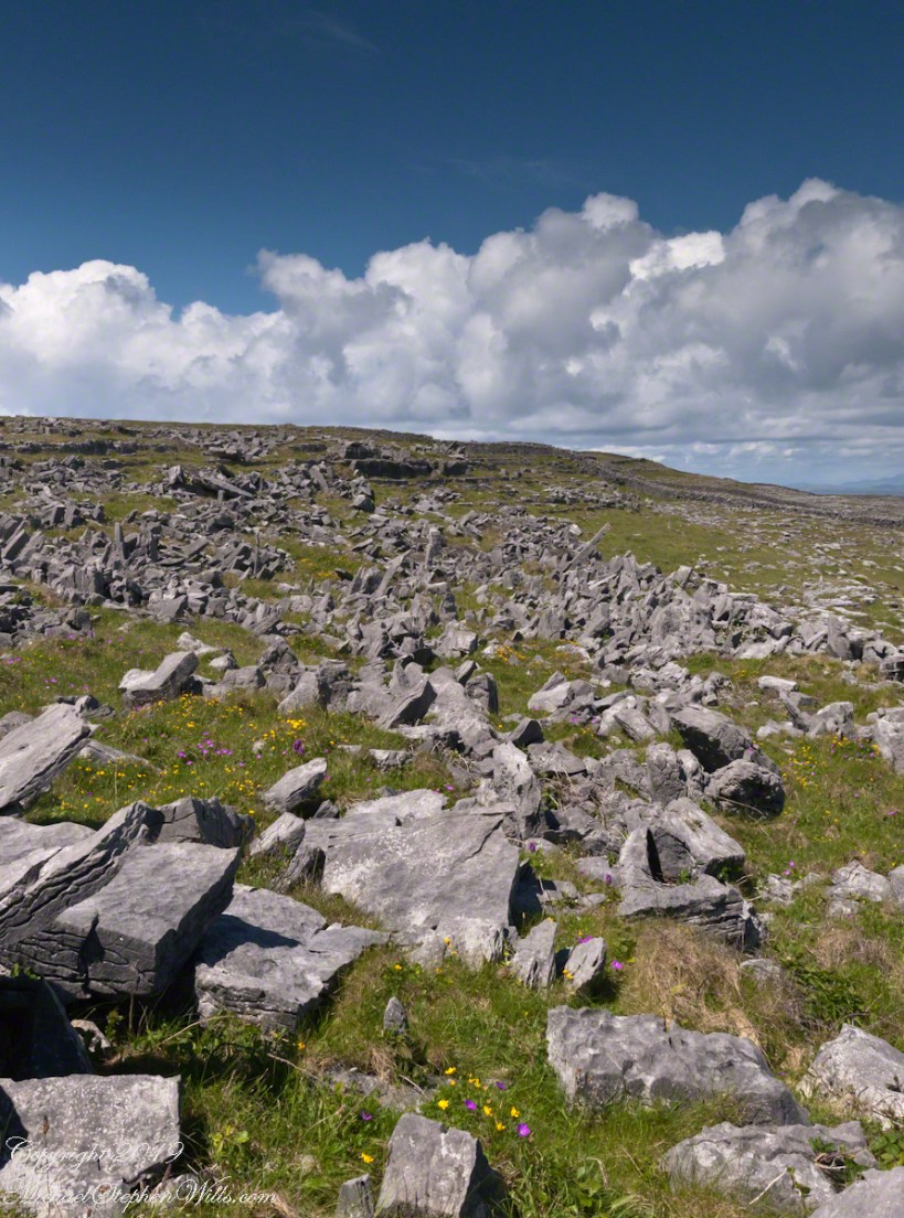
By 700 BC, 2,700 years ago, a series of upright, closely placed stones, were erected between the second and third rings called a cheval de fries field (“Frisian horses” in English) today, this defensive structure evokes the enormous scale of the struggles around this place of defense.
This is a portion of that field, I believe, taken as Pam and I approach the inner ring entrance, walking a wide path cleared of barriers. Click the photograph for a larger image with caption.
A roadside shrine on Cottage Road, Inishmore. The faith brought by the saints has deep roots here.
A large crucifix set with wet stone walls with cut flowers. The walls are the native limestone.
It is a spring (early June) afternoon and there are fern and wildflowers. The white flowers are Greater Burnet saxifrage (Scientific Name: Pimpinella major).
The existing dry stone wall was interrupted by the shrine. In the distance are dry stone walls around fields, a stone shed, feeding horses and the sea, being Galway Bay, storm clouds with distant rain.
Aran Islands, County Galway, Ireland.
Roadside Shrine and Island Landscape, Inishmore, Aran Islands, County Galway, Ireland
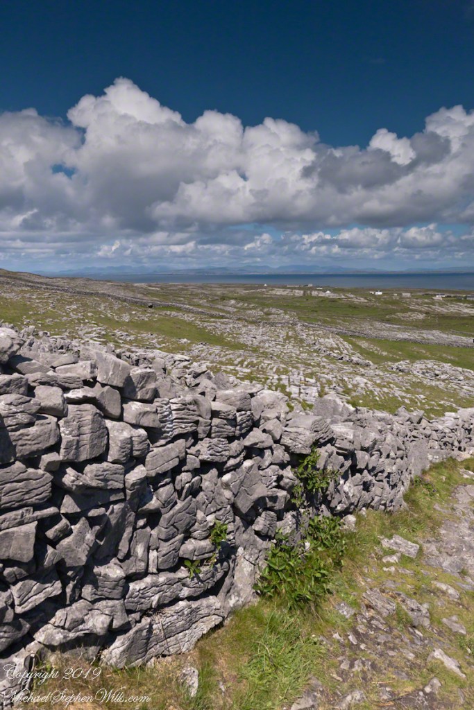
Modern stonework borders the 1/2 mile path to the inner Dún Aonghasa walls, keeping tourists off delicate plants, maintaining the integrity of this ancient site.
The view north, northwest over the walled path to Dun Aonghasa (Dun Aengus) looking across karst landscape, walled fields, farms, the North Atlantic Ocean, coast of Connemara and the 12 Bens (12 Pins) mountains. Aran Islands, County Galway, Ireland.
This is an answer for those of who responded to my last post Valparaiso Connections VI with “what does that desert in Peru have to do with Valparaiso?” It starts with the Plaza Victoria at the end of Pedro Montt Avenue. Victoria, as in victory not Queen Victoria. At the beginning of the 19thcentury this was a beach, the site of several ship wrecks. It was set aside as a gathering place by the Mayor, named Plaza Nueva (New Plaza), for a bullring until bullfights a law banned bullfighting on September 1823. The plaza became a place of public executions and, after Chile’s victory in the Battle of Yungay, a place of celebration, formally renamed for the victory.
The Central Valley of Chile is an exception to the topology north through Lima where agriculture and population centers follow river valleys watered by the Andes and surrounded by waterless wastes. Yungay, is among one of those watered desert valleys. Located 120 miles north of Lima, Peru at about 8,000 feet just below a summit of the Western Andes, remnants of cultures from 10,000 B.C. are proof of agriculture and human settlement. It was near Yungay, on January 20, 1839 (summer in the southern hemisphere) a force of Chilean and Peruvian dissidents called the United Restorative Army defeated a Peru-Bolivian Confederation Army to end the War of Confederation. The resulting split into different countries of Peru and Bolivia weakened a threat to Chile and Argentina, aimed in large part toward the broad and fertile Central Valley of Chile. The desperation in view in my post Valparaiso Connections VI was in large measure a motivation war, this motivation is still powerful today.
The subsequent prosperity allowed reclamation of the land of Plaza Victoria from the sea. For example, in my post Valparaiso Connections V we learned how French immigrants arrived and developed Central Valley wineries in the 19th century. Around the time of the victory Chacobuco Street was built adjacent to the plaza on reclaimed land, the Plaza Victoria was pulled from the sea.
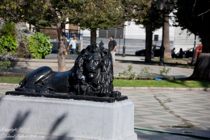
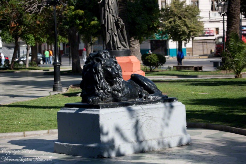
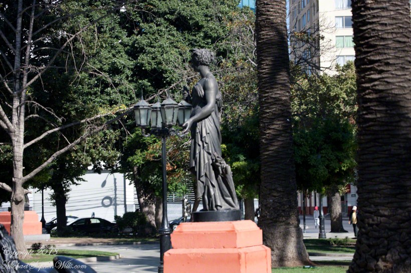
The concrete Lions and bronze statue captured in the above gallery, were elements of a round of enhancements to Plaza Victoria begun 1870.
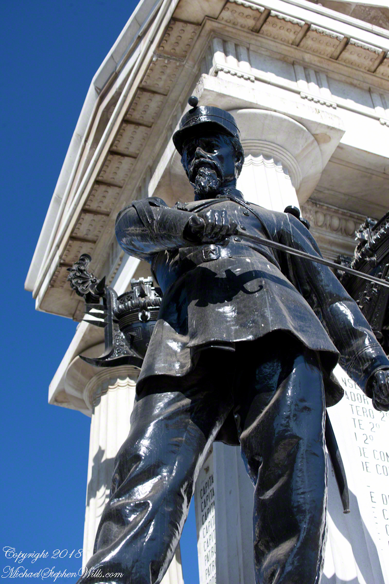
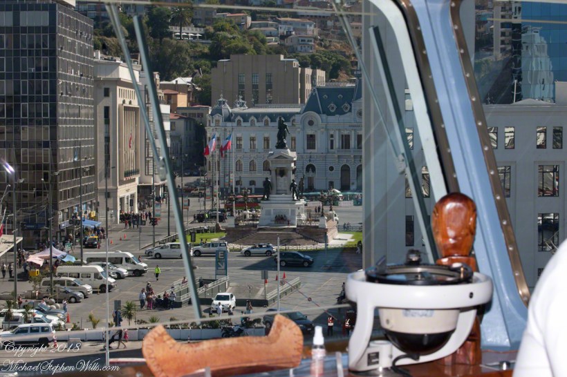
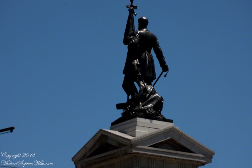
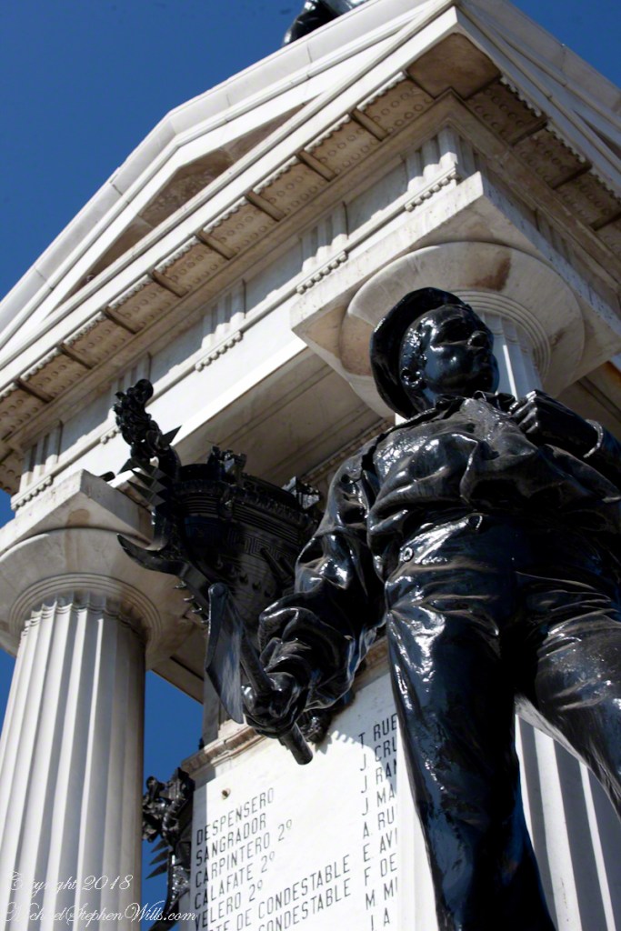
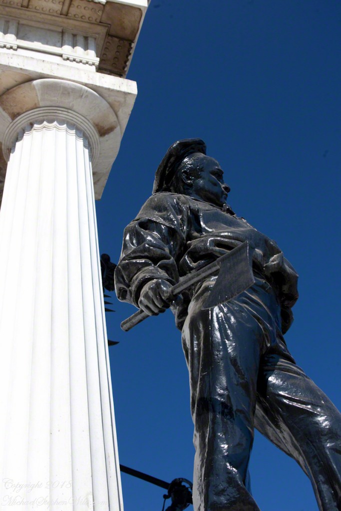
Monument to the Heroes of Iquique
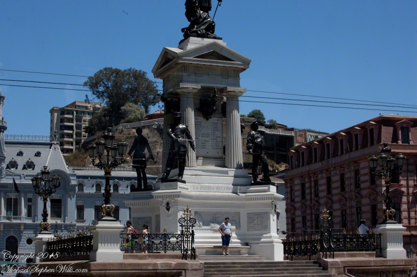
Here we see from the Regatta bridge a monument to the Heroes of Iquique. The Battle of Iquique, May 21, 1879, is remembered annually as Naval Glories Day (Dia de las Glorias Navales) .
This monument commemorates the destruction of the Chilean warship Esmeralda. At the monument peak is Arturo Prat Chacón, captain of the Esmeralda who perished with his wooden ship. He and the crew were blockading the then Peruvian port of Iquique along with another ship, the Covadonga.
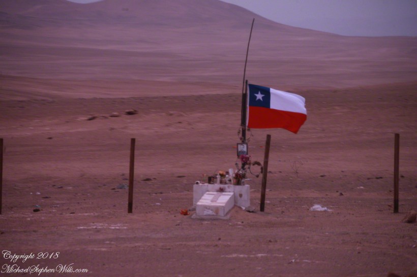
May 1879 was in the initial phase of the War of the Pacific, fought over rich mineral deposits of the Atacama desert. Today, the Chilean flag is over these barren wastes, seen here flying over a roadside memorial to an automobile accident victim. The desert is the backdrop, there are no animals or plants here, only red dirt. NASA uses the Atacama in simulations of the Martian environment.
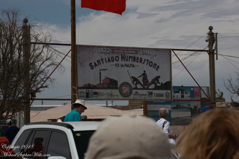
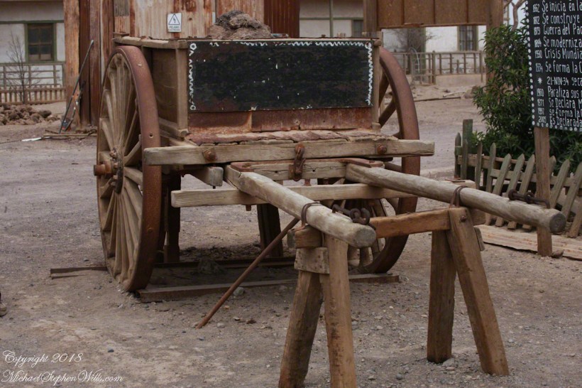
There are deposits of the mineral saltpeter, mined by large operations. Here is the entrance of a World Heritate site we visited while docked at Iquique.
The mining operation was literally scraping the deposits lying on the ground and processing it into, among other products, nitrogen fertilizer. At that time the operation was hugely lucrative, employing thousands in very difficult conditions. That is a different story.
Captain Prat faced two armored Peruvian warships, one the iron clad Huáscar. Over the course of four hours the Esmeralda was overpowered and sunk. The Huascar and the 22,500 mountain peak at Yungay, Huascarán, are named for an Inca chief.
The monument honors the bravery of Captain Prat and his crew, all of whom are named on plaques.
After the Huáscar rammed Esmeralda a third time to sink it, the Huáscar captain, Miguel Grau Seminario, rescued Chilean survivors in danger of drowning. In the meantime, the armored Peruvian warship was lured into the shallows and destroyed. Although the blockage on Iquique was lifted Peru lost one of its most powerful ships at the cost to Chile of an older wooden ship.
The defeat and examples of the Esmerelda crew and captain brought a wave of recruits to the Chilean forces. Chile was the victor of the War of the Pacific, vast tracks of the Atacama desert were taken from Bolivia, including the Saltpeter mines, shutting that country off from the Pacific Ocean. There is a connection between these memories and the Training Ship anchored in the harbor, the sixth ship to carry the name, Esmeralda (BE-43).
See my posting Valparaiso Connections V for the more recent history of the Esmeralda.
Copyright 2022 Michael Stephen Wills All Rights Reserved
Another aspect of the gradual 1/2 mile inclined path to the central ring of the prehistoric Dun Aonghasa ruins of County Galway, Ireland.
The view north, northwest from this way to Dun Aonghasa (Dun Aengus). In early June, looking across wildflowers, karst landscape, walled fields, farms, the North Atlantic Ocean, coast of Connemara and the 12 Bens (12 Pins) mountains.
Note the doorway (with long lintel) in the surrounding wall, to left of center in middle distance.