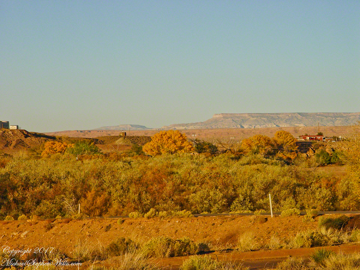
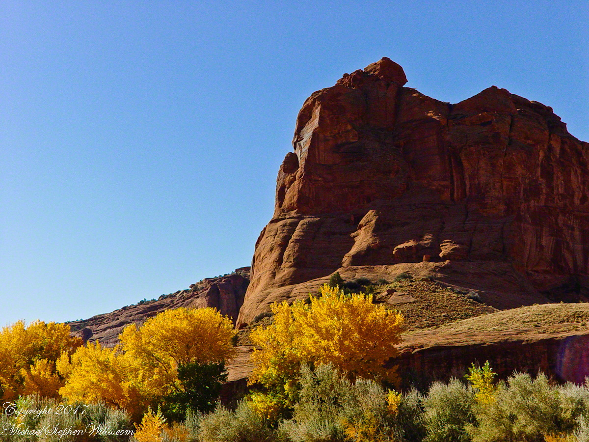
Looking southwest from the Canyon de Chelly visitor center toward the eastern escarpment of Black Mesa of the Hopis.
The village of Chinle is a “census designate place”, in other words it only exists because people live there, it was not formally recorded in “official” records. On the Navajo reservation, people lived here beyond recorded time. It is called in their language “flowing out”, where live giving water flows out from the canyons.
There is a fine Best Western in Chinle, better than most of that brand and the only choice for mile and miles and miles.
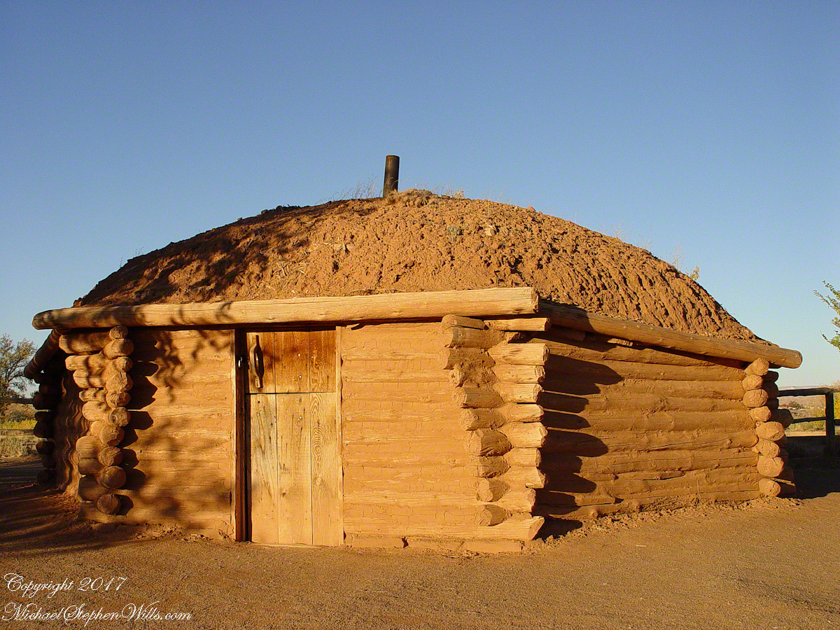
This is a cribbed log hogan. The domed earthen roof keeps the interior cool in hot weather and, along with a fire, warm in the winter. The Navajo hogan entrance faces east.
In Junction Ruin Musings, the previous post, a ruin from the Anasazi people was contemplated. Above is a traditional Navajo dwelling from a later, more secure, time.
A good place to cook, read and sleep in hot weather. The entrance faces east and, for this one, the view was superb.
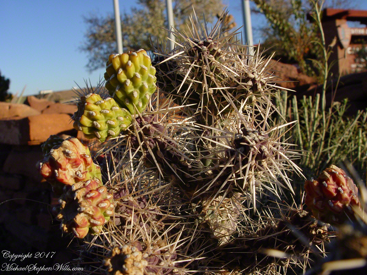
Ouch!! Everywhere in the southwest, watch where you tread.
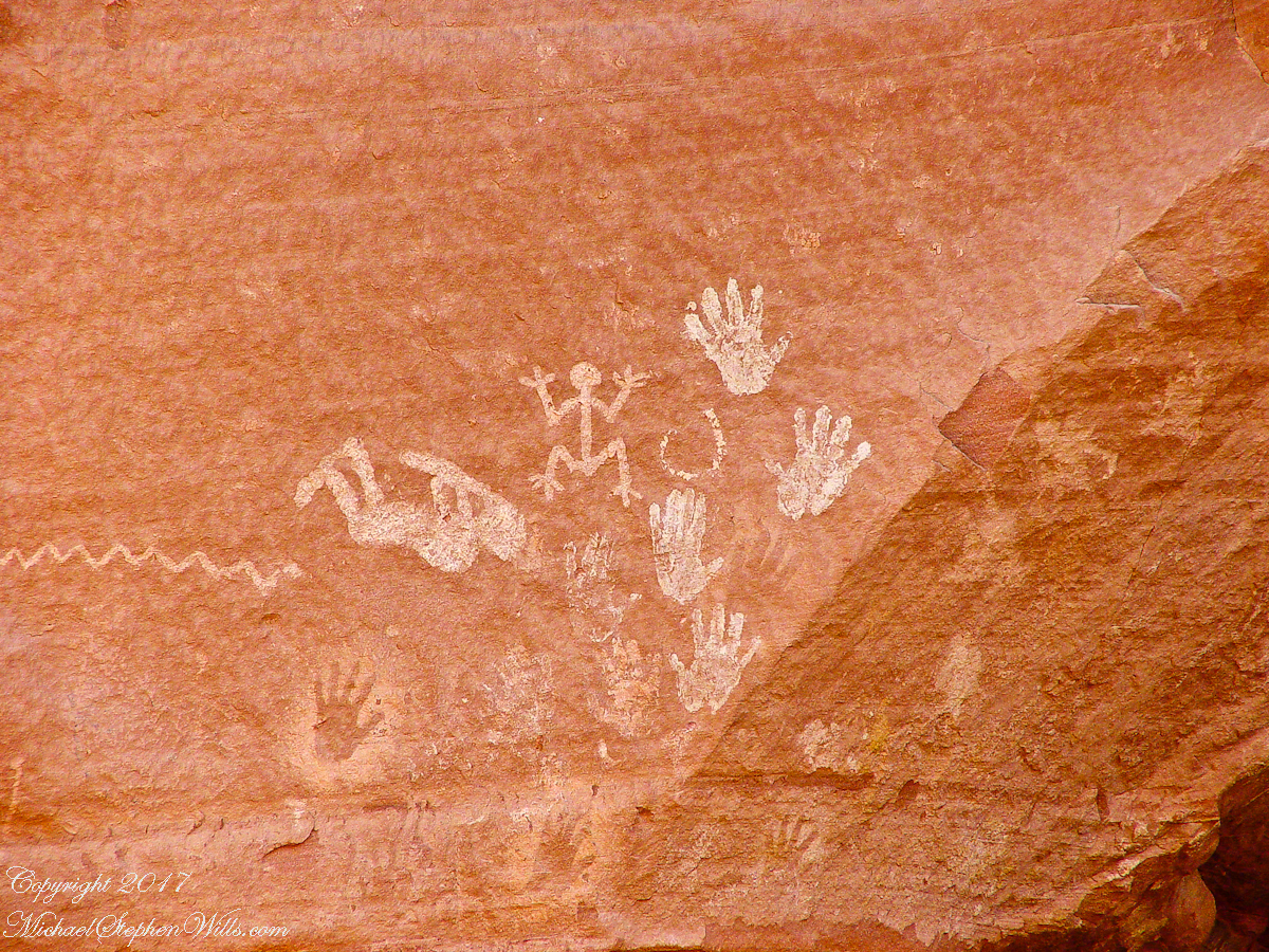
A Native American, seeing the flute playing Kokopelli, hears in the mind the sonorous melodies of their native flutes carried in as if on the wind. The hands waving in rhythm, “Here we are.”
Canyon de Chelly symbol carved into red sandstone cliff representing a clan sign.
I recall our guide, Peter, describes this as a scorpion.
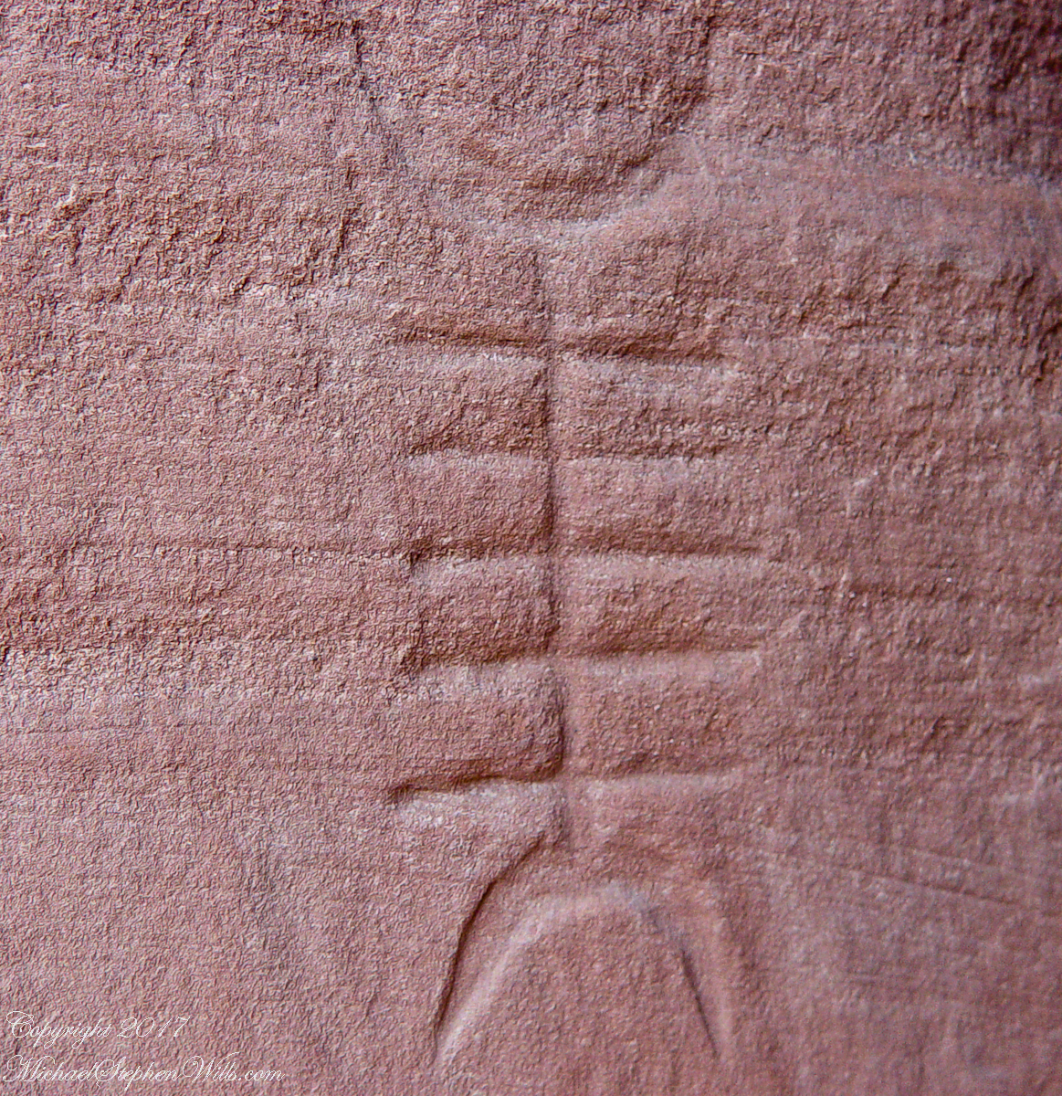
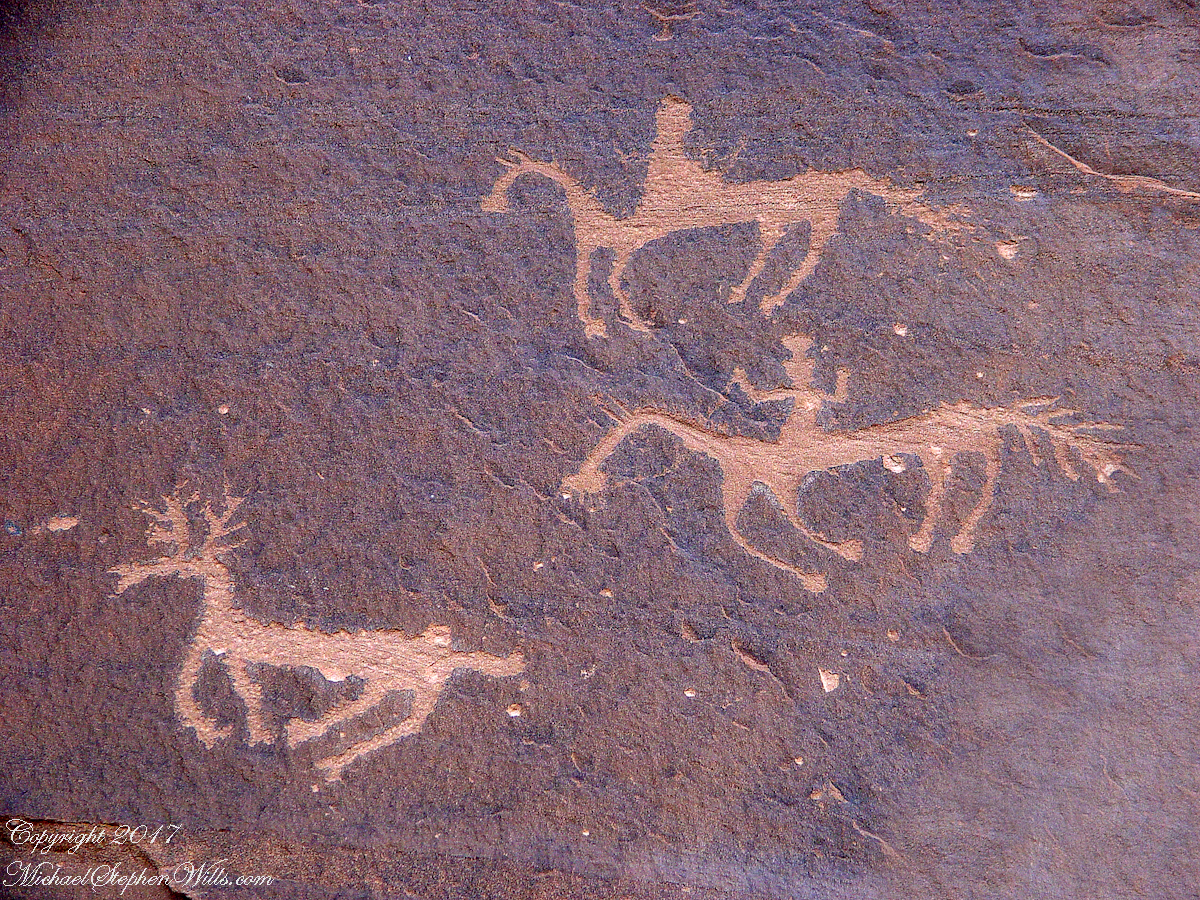
Canyon de Chelly petroglyph, desert varnish over red sandstone. Image is dated by representation of horses, brought by europeans.
The feeling of movement and the story invoked viewing this drawing etched carefully on the rock demonstrates we are in the presence of an accomplished artist. The story of the times for us to learn from.
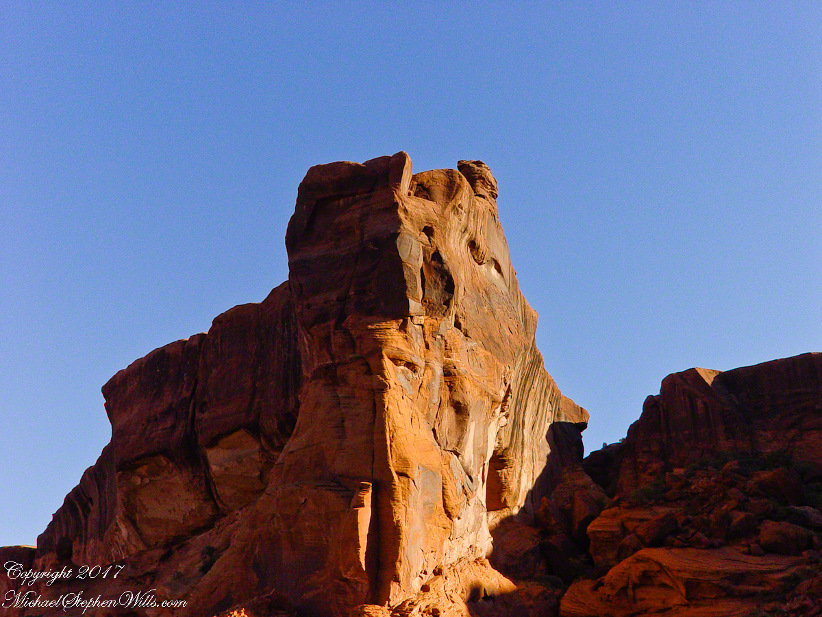
Red sandstone formation on ridgeline, north side of Canyon de Chelly is remember by the Navajo for the story of the Raven Woman.
A Navajo woman, fleeing Apache captors, flew over this cliff, or seemed to. Survival depended on knowing how to run over slickrock without stumbling and to know where and how to disappear into the rocks.
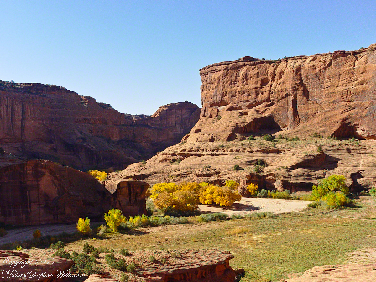
Canyon de Chelly below the first division into tow arms, the junction. This is looking south east. The cottonwoods are in autumn foliage.
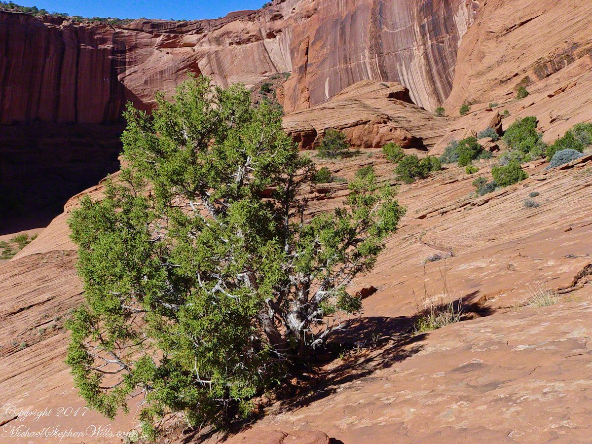
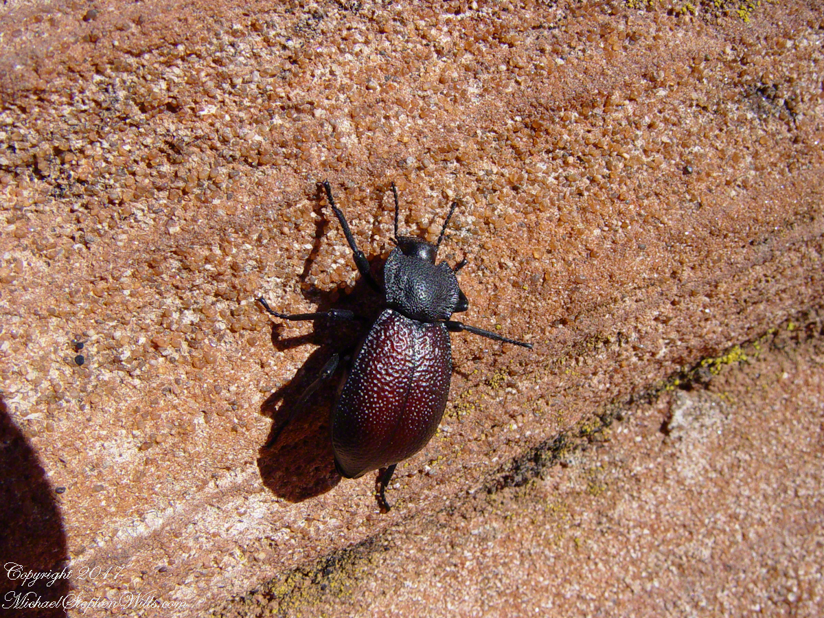
Cahyon de Chelly is is possible here to climb out of the canyon over these lower slopes over what is called slickrock. In the foreground is a juniper tree.Canyon de Chelly vista from a slickrock ledgeA two inch dung beetle crawls up sandstone slickrock, the origin of this stone apparent from the visible sand granules within an apparent clay matrix. The stone grain, described as cross bedded, suggests this was a former dune of wind blown sand composed of remnants of the Ancestral Rock Mountains.
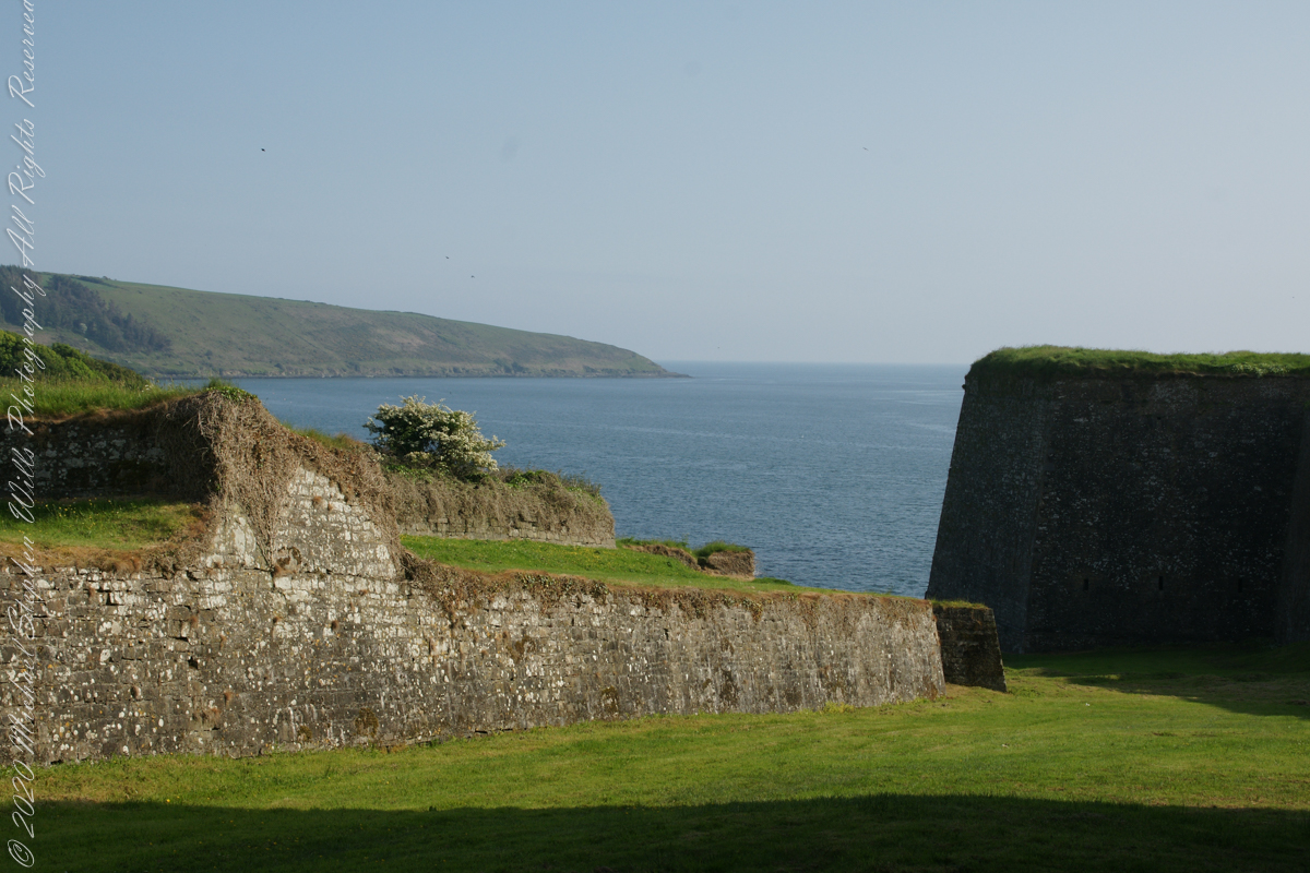
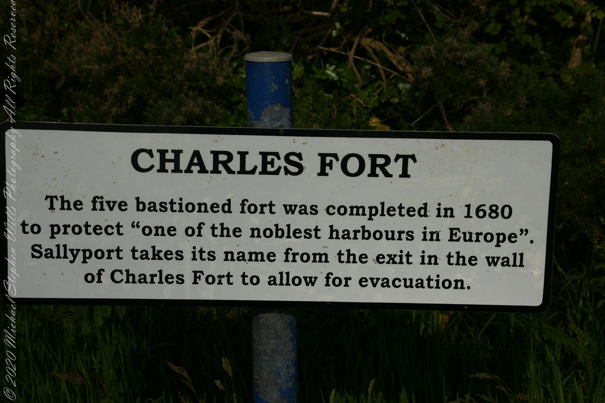
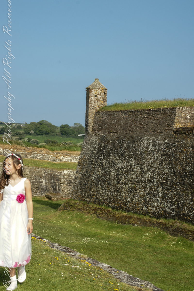
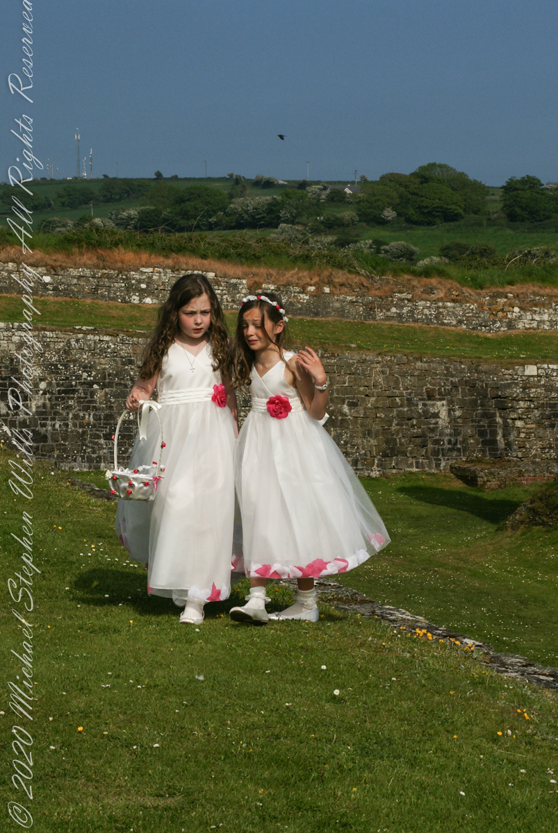
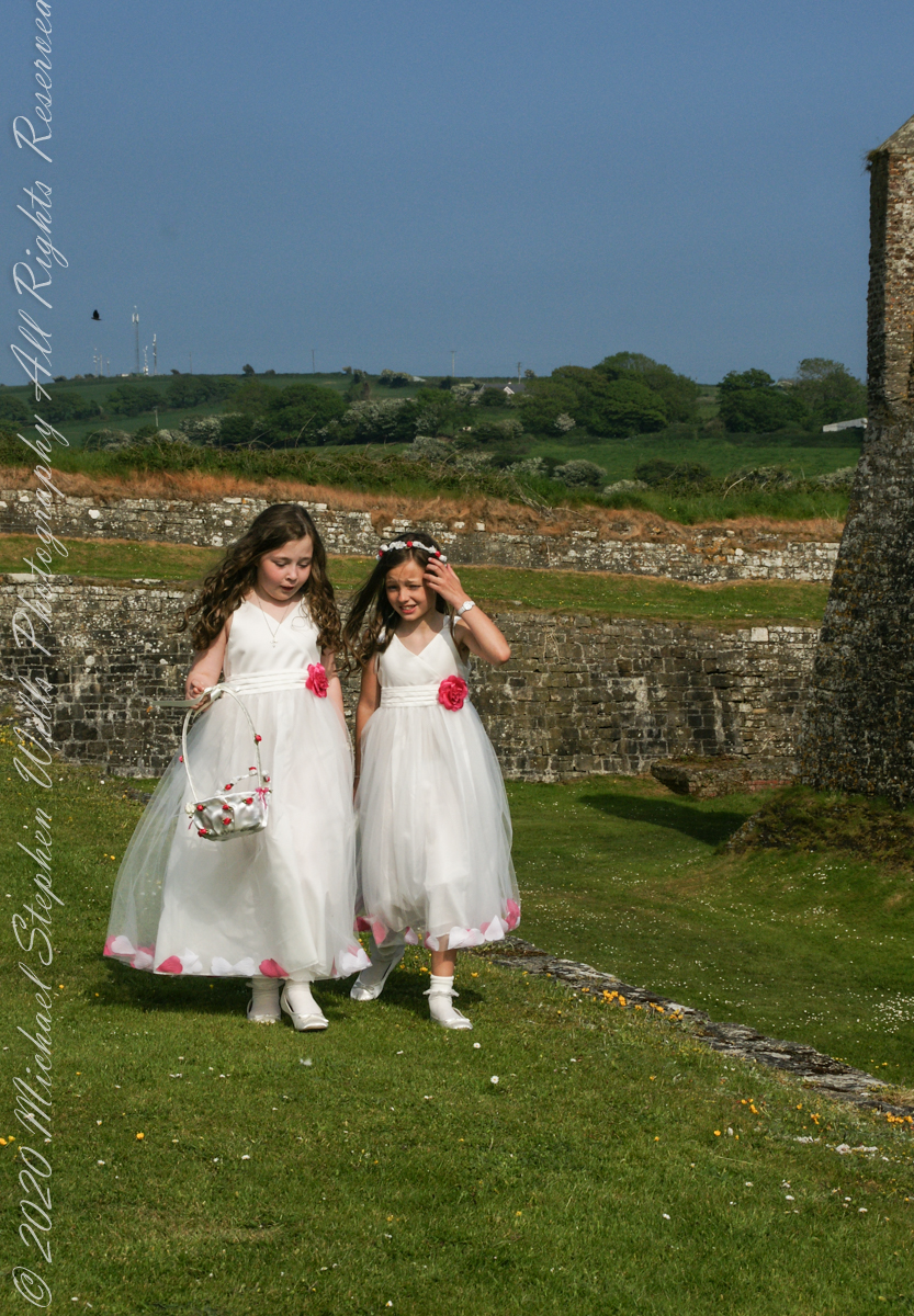
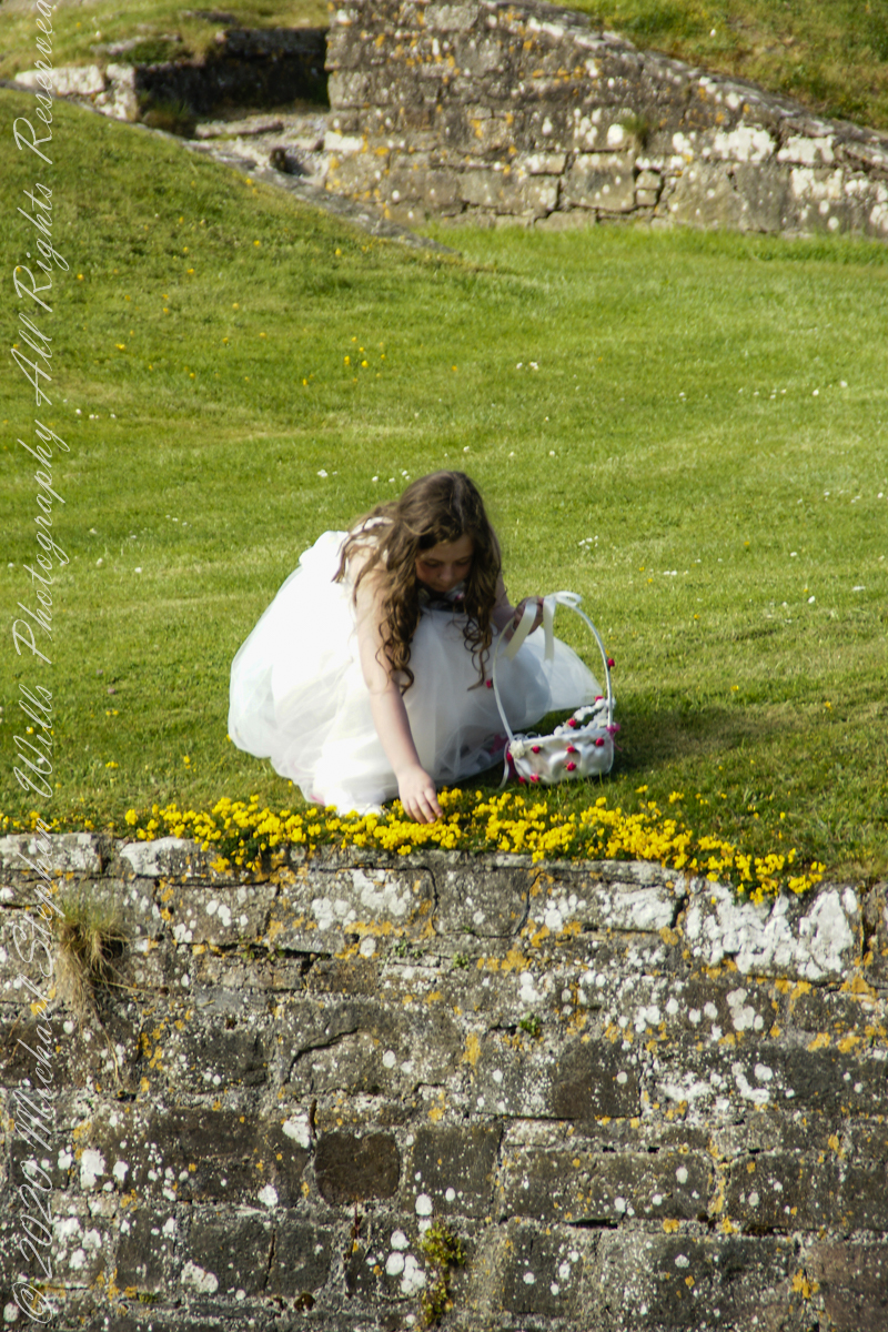
A half mile footpath, marked in red on the following Google Earth view, leads from the Charles fort sallyport, along the shoreline cliffs, surmounted by working farmland and looks toward the Celtic Sea.
To “sally” is to suddenly charge out from a besieged place against the enemy. The word is also used as a noun. It can also be used to describe our walk, as a sally to an unusual place.
The town above the walk is named Sallyport
Here is a view of the Celtic Sea from the Sallyport
From Wikipedia: “The Celtic Sea receives its name from the Celtic heritage of the bounding lands to the north and east. The name was first proposed by E. W. L. Holt at a 1921 meeting in Dublin of fisheries experts from Great Britain, France, and Ireland. The northern portion of this sea was considered as part of Saint George’s Channel and the southern portion as an undifferentiated part of the “Southwest Approaches” to Great Britain. The desire for a common name came to be felt because of the common marine biology, geology and hydrology of the area. It was adopted in France before being common in the English-speaking countries; in 1957 Édouard Le Danois wrote, “the name Celtic Sea is hardly known even to oceanographers.”[3] It was adopted by marine biologists and oceanographers, and later by petroleum exploration firms. It is named in a 1963 British atlas.. A 1972 article states ‘what British maps call the Western Approaches, and what the oil industry calls the Celtic Sea […] certainly the residents on the western coast [of Great Britain] don’t refer to it as such.'”
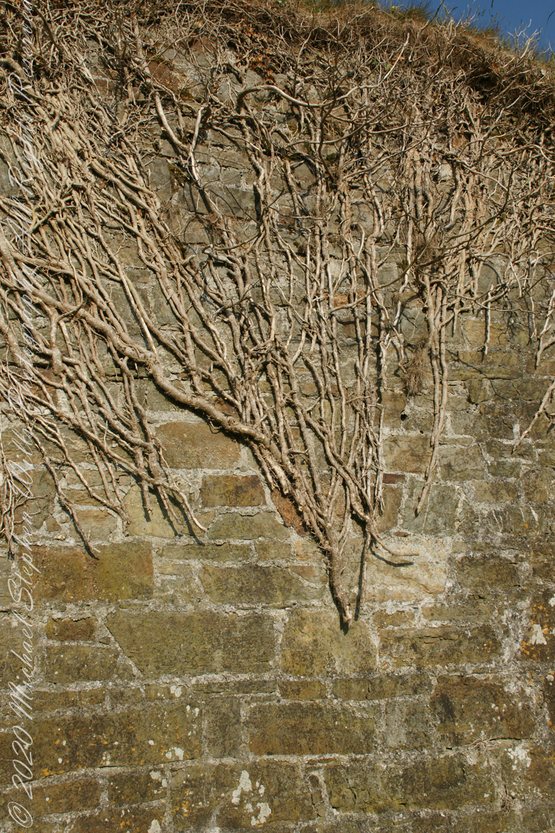
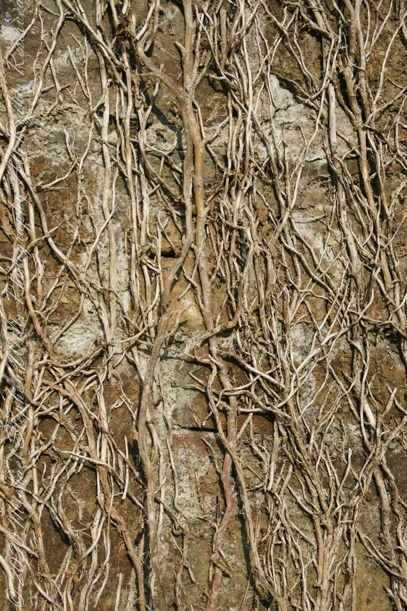
Views of the wall from previous photograph. The vines were separated from roots to preserve the walls, leaving interesting patterns.
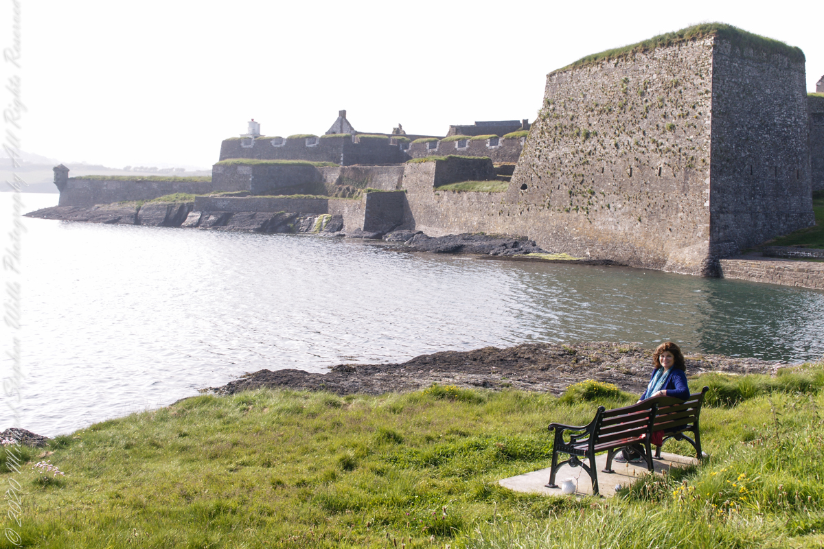
The distant land to the right, beyond the walls, is the Old Head of Kinsale.
Informational placards along the walk give background to the views enjoyed by hikers.
Here is the above view.
SONY DSC
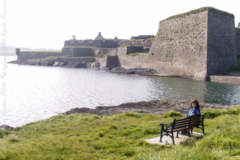
Pam, at start of our walk. Poking above the walls is the Charles Fort Lighthouse. “This lighthouse is a directional light marking the way to safe anchorage close to Kinsale. In 1665 King Charles II granted letters patent to Sir Robert Reading to erect six lighthouses on the coast of Ireland, including one at Barry Oge’s castle, near Kinsale later to become Charles Fort. The original structure would have had a coal fire on its roof. In 1810 powers given to the Commissioners for Barracks and others between 1767 and 1806 were all vested in the Corporation for Preserving and Improving the Port of Dublin or the Ballast Board. This board took over the general lighting and marking of the coast when fourteen lighthouses were transferred to it including that at Charles Fort. This lighthouse, built in 1929, is one of the more recent to be found along the coast, with most dating to the nineteenth century. A new mains powered light at Charles Fort Lighthouse was put into operation on the 14 April 2004 marking the end of a long era of gas and oil powered lights in Ireland.” Quote is from the link provided in references.
May 30, 2014 outside of Charles Fort, Kinsale, County Cork, Republic of Ireland
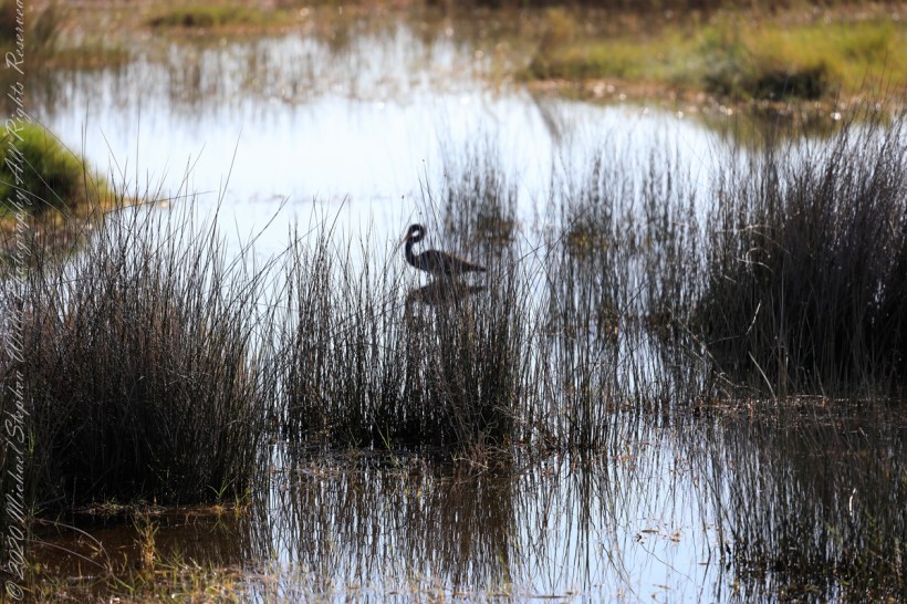
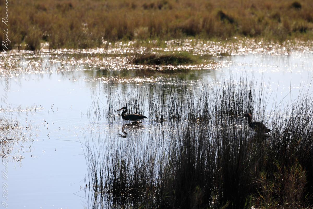
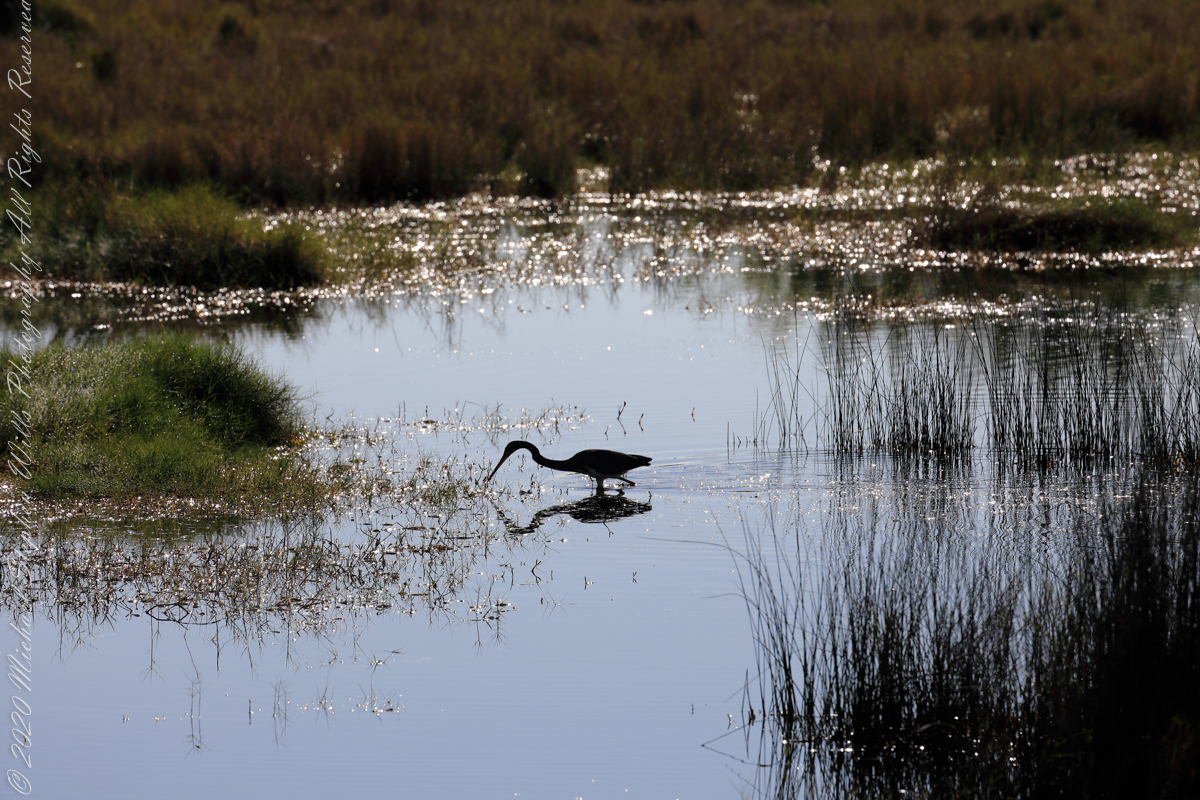
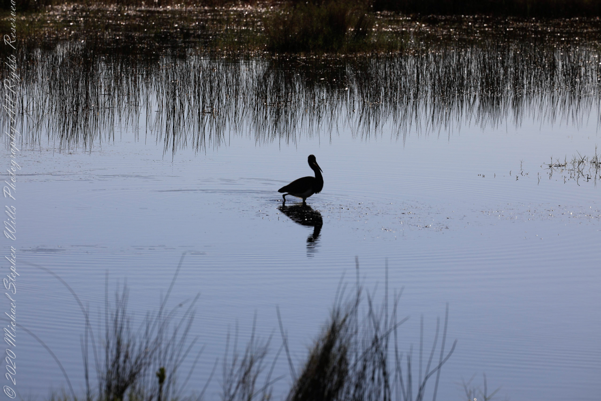
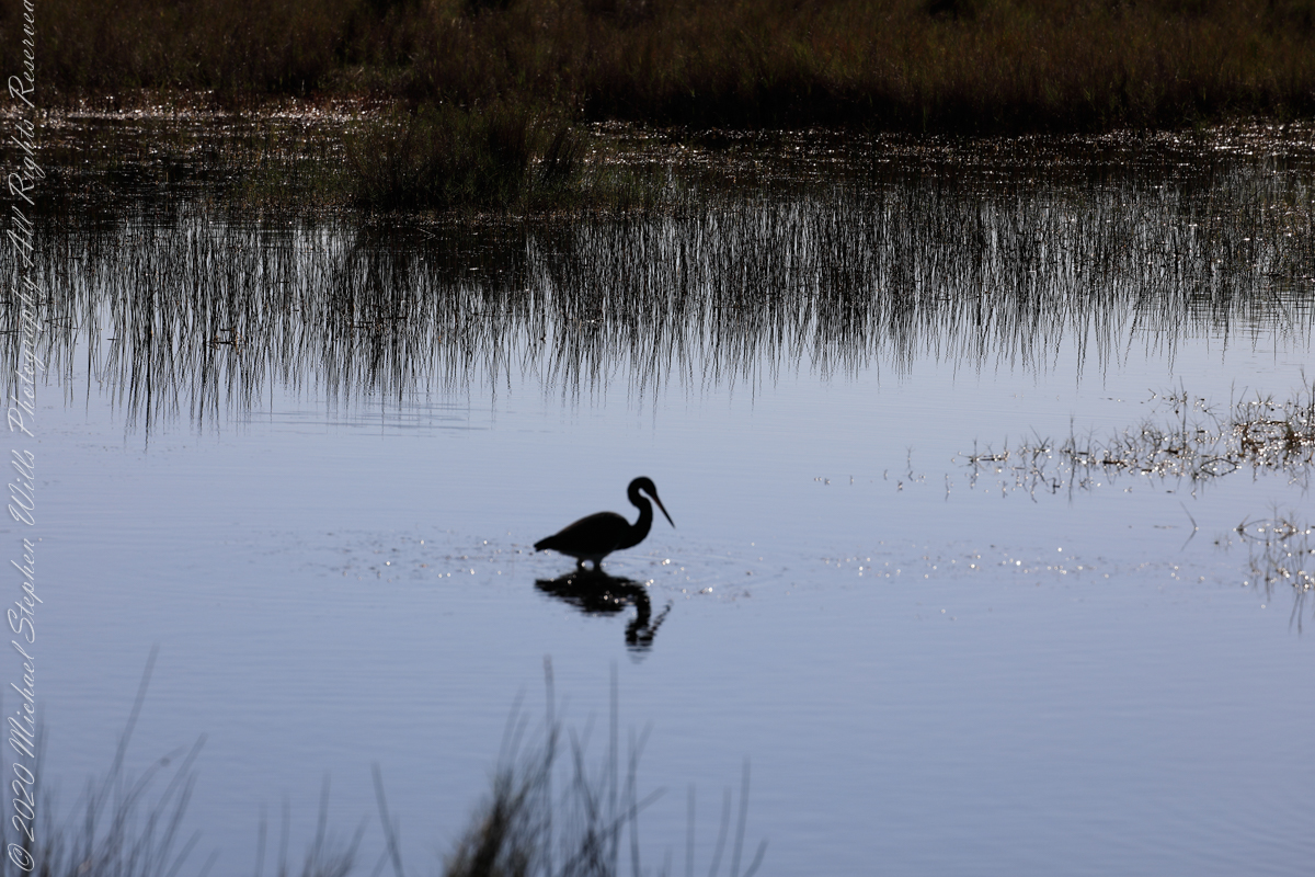
This series of wading shorebirds are from a mash alongside Blackpoint Wildlife Drive.
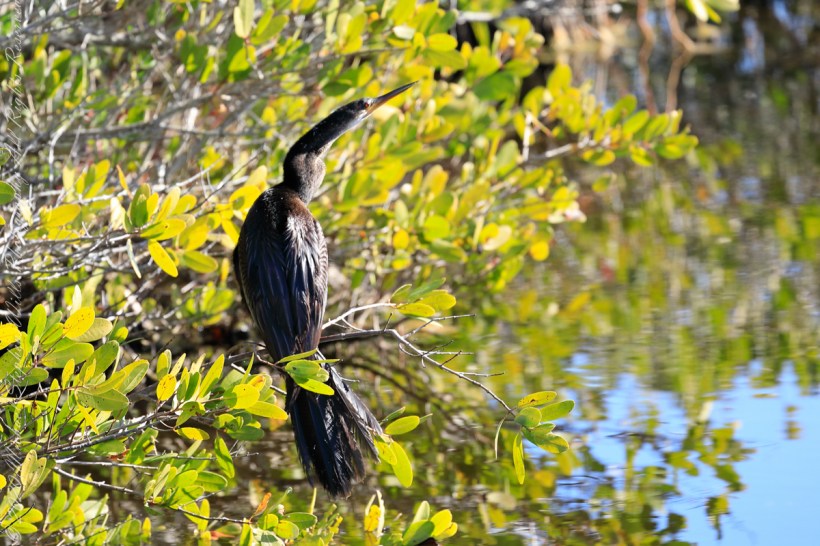
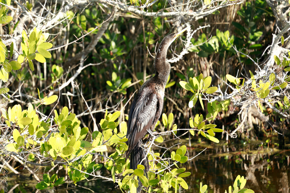
This Anhinga basked on a marsh bush just off Blackpoint Wildlife Drive on a January morning. Soaking in sunlight is most important for this waterbird as Anhinga features are not waterproof, after a session of diving, the bird is soaked through to the skin and need to warm up and dry off.
“The Anhinga sometimes called snakebird, darter, American darter, or water turkey, is a water bird of the warmer parts of the Americas. The word anhinga comes from the Brazilian Tupi language and means “devil bird” or “snake bird”. The origin of the name is apparent when swimming: only the neck appears above water, so the bird looks like a snake ready to strike. They do not have external nares (nostrils) and breathe solely through their epiglottis. Anhinga species are found all over the world in warm shallow waters.”
The American anhinga has been subdivided into two subspecies, Anhinga anhinga anhinga and Anhinga anhinga lleucogaster, based on their location. Anhinga anhinga anhinga can be found mainly east of the Andes in South America and also the islands of Trinidad and Tobago. Anhinga anhinga lleucogaster can be found in the southern United States, Mexico, Cuba, and Grenada.
“A kettle of Anhingas often migrate with other birds and have been described as resembling black paper gliders.”
The text in quotes is from the Anhinga wikipedia article.
Merritt Island National Wildlife Refuge, Titusville, Brevard County, Florida
Copyright 2022 Michael Stephen Wills All Rights Reserved
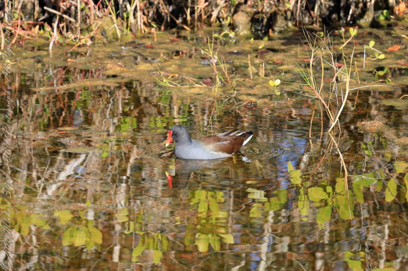
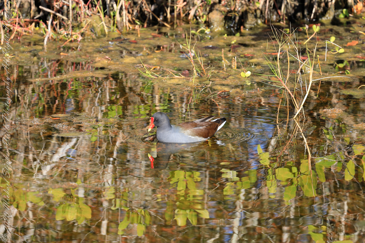
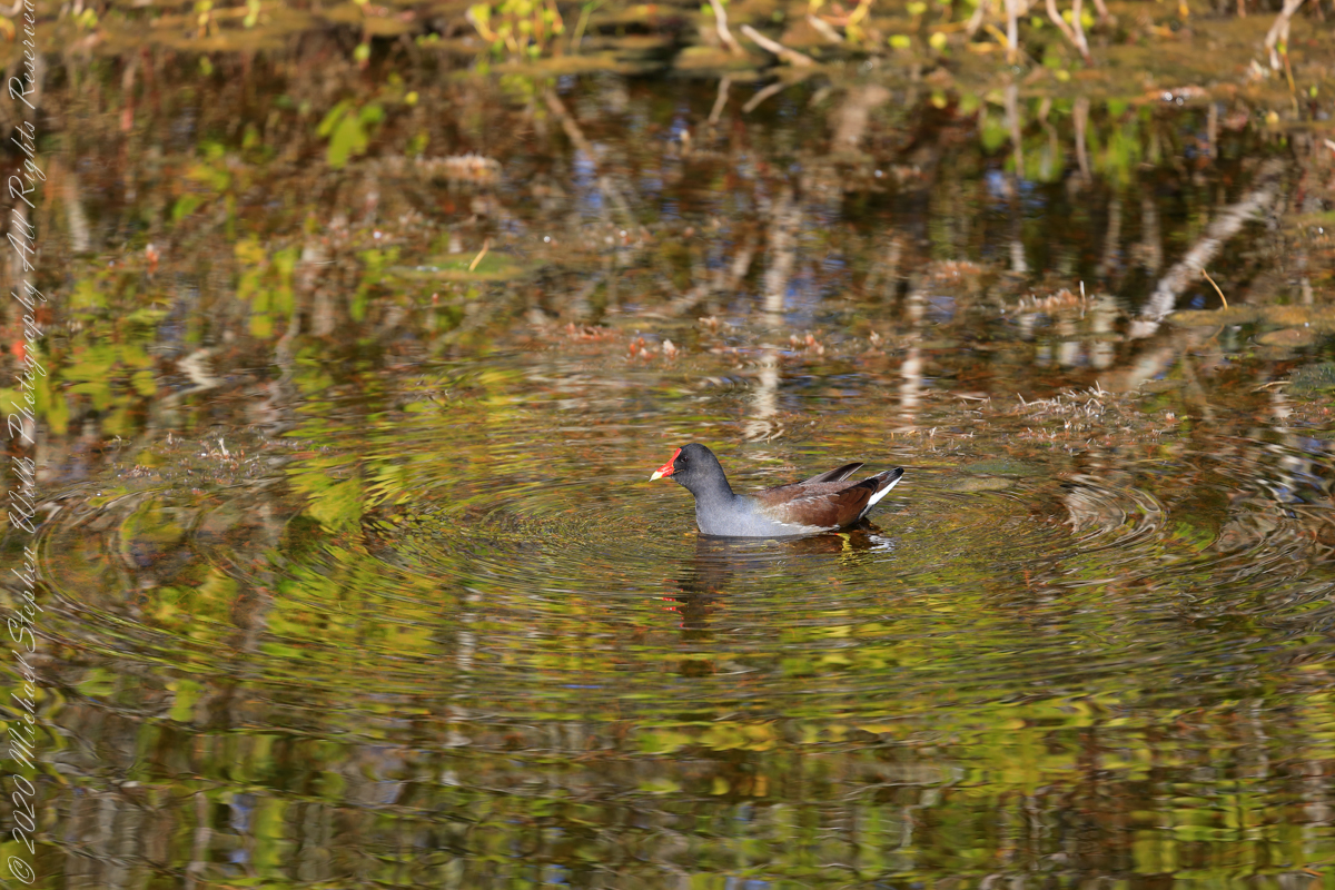
This video of a Common gallinule feeding was taken from Blackpoint Wildlife Drive.
The family Rallidae (aka rails) includes crakes, coots, and this member of the gallinules. Found worldwide, this species, Gallinula galeata, was recognized in 2011 as separate from the closely related “Old World” Moorhens.
Here it is in a favored habitat, feeding on underwater vegetation of the Florida marsh in sight of rockets launching from Kennedy Space Center. The exceptional lighting, bright reflective water, are created by the low winter sun and southern exposure of the location just north of the road.
The taxonomic Order is derived from the Latin word Gallinula meaning a small hen or chicken that, since the 13th century at least, as revealed in the names “Moorhen,” “Waterhen,” and “Swamp Chicken.”
The spread of Gallinula is attributed to breeding habits. “Laying starts in spring, between mid-March and mid-May in Northern hemisphere temperate regions. About 8 eggs are usually laid per female early in the season; a brood later in the year usually has only 5–8 or fewer eggs. Nests may be re-used by different females. Incubation lasts about three weeks. Both parents incubate and feed the young. These fledge after 40–50 days, become independent usually a few weeks thereafter, and may raise their first brood the next spring. When threatened, the young may cling to the parents’ body, after which the adult birds fly away to safety, carrying their offspring with them.”
The text in quotes is from the Wikipedia article for “Common Moorhen.”
Copyright 2022 Michael Stephen Wills All Rights Reserved
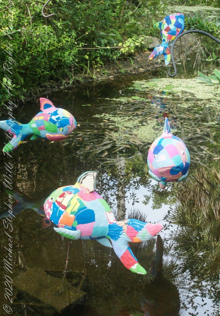
50 recycled flip flops were used by Ocean Sole Africa Project artists to create each Reef Fish sculpture from a 2019/2020 exhibit hosted by McKee Botanical Gardens, Vero Beach, Indian River County, Florida.
Coral reef fish live among or in close relation to coral reefs. Coral reefs form complex ecosystems with tremendous biodiversity. Among the myriad inhabitants, the fish stand out as colorful and interesting to watch. Hundreds of species can exist in a small area of a healthy reef, many of them hidden or well camouflaged.
Reef fish have developed many ingenious specializations adapted to survival on the reefs. Safe habitats, many different species of fish inhabit coral reefs where they are protected from predators and find food. In turn, reef fish eat algae, preventing overgrowth and smothering of the coral animals. Common fish in Caribbean reefs have interesting names: parrot, angel, puffer, surgeon and clown.
Coral reefs occupy less than 1% of the surface area of the world oceans but provide a home for 25% of all marine fish species. Reef habitats are a sharp contrast to the open water habitats that make up the other 99% of the world oceans. Loss and degradation of coral reef habitat, increasing pollution, and overfishing including the use of destructive fishing practices, are threatening the survival of the coral reefs and the associated reef fish.
Copyright 2022 Michael Stephen WillsAll Rights Reserved
This series of wading shorebirds are from a mash alongside Blackpoint Wildlife Drive.
“The exposed mudflats on tidal wetlands attract a variety of shorebirds. Shorebirds are seasonal residents that make long migratory journeys between their breeding grounds in the Artic and their wintering area in South America. Merritt Island National Wildlife Refuge provides an important resting and feeding area for this group of birds. Some stay for the winter, others use the refuge as a fuel stop before continuing on their journey.”
“In tidal areas, shorebird feeding schedules are influenced by the cycle of tides. Changes in tidal cycles expose foraging areas in mudflats for a period during the day. At other points during the cycle, the water in these same areas becomes too deep or the ground too dry for shorebirds to feed effectively.”
The text in quotes is from a roadside information placard, Merritt Island National Wildlife Refuge, Titusville, Brevard County, Florida
Copyright 2022 Michael Stephen Wills All Rights Reserved
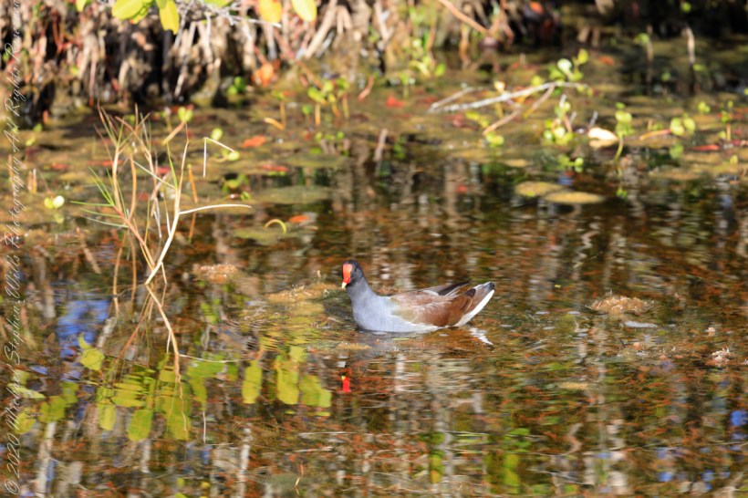
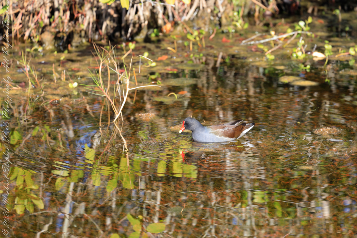
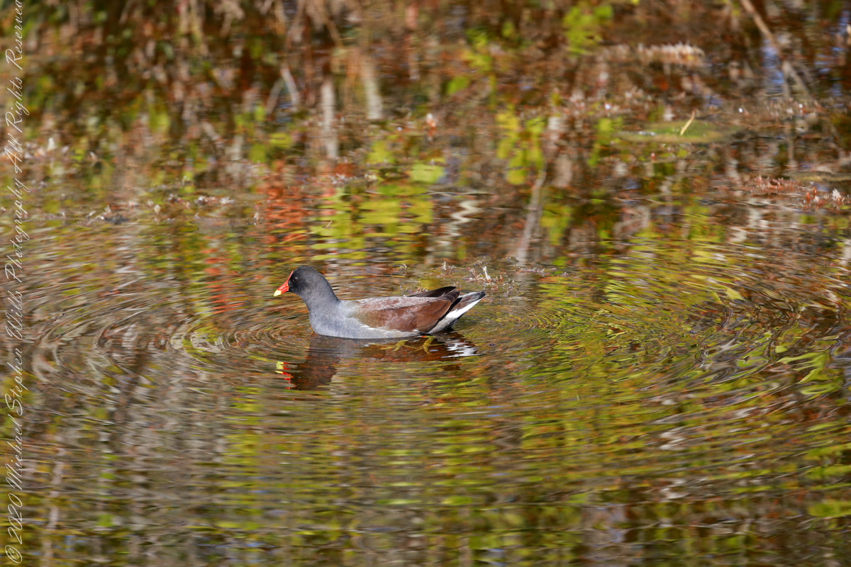
This Common gallinule was feeding from the mash alongside Blackpoint Wildlife Drive.
The family Rallidae (aka rails) includes crakes, coots, and this member of the gallinules. Found worldwide, this species, Gallinula galeata, was recognized in 2011 as separate from the closely related “Old World” Moorhens.
Here it is in a favored habitat, feeding on underwater vegetation of the Florida marsh in sight of rockets launching from Kennedy Space Center. The exceptional lighting, bright reflective water, are created by the low winter sun and southern exposure of the location just north of the road.
The taxonomic Order is derived from the Latin word Gallinula meaning a small hen or chicken that, since the 13th century at least, as revealed in the names “Moorhen,” “Waterhen,” and “Swamp Chicken.”
The spread of Gallinula is attributed to breeding habits. “Laying starts in spring, between mid-March and mid-May in Northern hemisphere temperate regions. About 8 eggs are usually laid per female early in the season; a brood later in the year usually has only 5–8 or fewer eggs. Nests may be re-used by different females. Incubation lasts about three weeks. Both parents incubate and feed the young. These fledge after 40–50 days, become independent usually a few weeks thereafter, and may raise their first brood the next spring. When threatened, the young may cling to the parents’ body, after which the adult birds fly away to safety, carrying their offspring with them.”
The text in quotes is from the Wikipedia article for “Common Moorhen.”
Copyright 2022 Michael Stephen Wills All Rights Reserved
This series of wading shorebirds are from a mash alongside Blackpoint Wildlife Drive.
“The exposed mudflats on tidal wetlands attract a variety of shorebirds. Shorebirds are seasonal residents that make long migratory journeys between their breeding grounds in the Artic and their wintering area in South America. Merritt Island National Wildlife Refuge provides an important resting and feeding area for this group of birds. Some stay for the winter, others use the refuge as a fuel stop before continuing on their journey.”
“In tidal areas, shorebird feeding schedules are influenced by the cycle of tides. Changes in tidal cycles expose foraging areas in mudflats for a period during the day. At other points during the cycle, the water in these same areas becomes too deep or the ground too dry for shorebirds to feed effectively.”
Though only one bird appears in each photo, “shorebirds of different species can and do forage together. Because bill length and shape vary from species to species, birds can pursue different prey in the same area at the same time without completing with each other. Because of varying bill lengths, different birds species find their food at different depths in the substrate. Mixed species of shorebirds are a common sight.”
The text in quotes is from a roadside information placard, Merritt Island National Wildlife Refuge, Titusville, Brevard County, Florida
Copyright 2022 Michael Stephen Wills All Rights Reserved
Arriving at Charles Fort, the “new” fort compared to the “old” James Fort across the cove, late in the day after our walking tour of Kinsale and lunch, the gate to the interior was closed. Pam and I made do with exploring the outer battlements where the citizens of Kinsale were enjoying themselves.
A shortcoming of Charles Fort was the high ground you can see behind the figures. The defenses are strong on the seaward side and open to attack from the land.
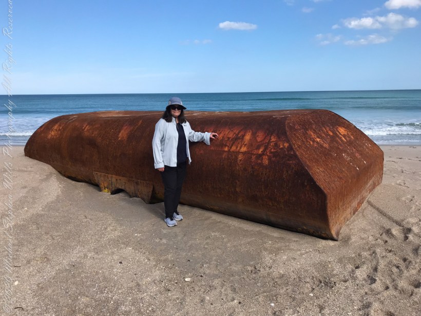
From a November 2021 article by James Sparvero of ClickOrlando(dot com). “Recent storms may have pushed a big part of a ship onto a secluded Central Florida beach. The Canaveral National Seashore said the metal object washed ashore at boardwalk No. 7 of Playalinda Beach. It is about 8 feet tall and 20 feet long.
Pam provides a sense of scale
“Seashore’s resource manager Kristen Kneifl said it might be a ballast tank from a ship, which is a compartment on a floating structure that holds water to help stabilize the vessel. “
Still a mystery
’That’s our best guess at this point,’’ Kneifl said.
As far as removing the giant box, the Seashore said it could be difficult. Meaning it will probably stay on the beach for a while until it gets figured out.
‘’Unlike maybe some boats or other things that wash up, where we can kind of chain saw it apart and get it over one of our boardwalks, it doesn’t look like it can be cut up,’’ Kneifl said. ‘’So, it’s going to have to be removed from the water, from the oceanside.”
Kneifl said, chances are, the strange object will be removed on a barge and transported elsewhere by sea.
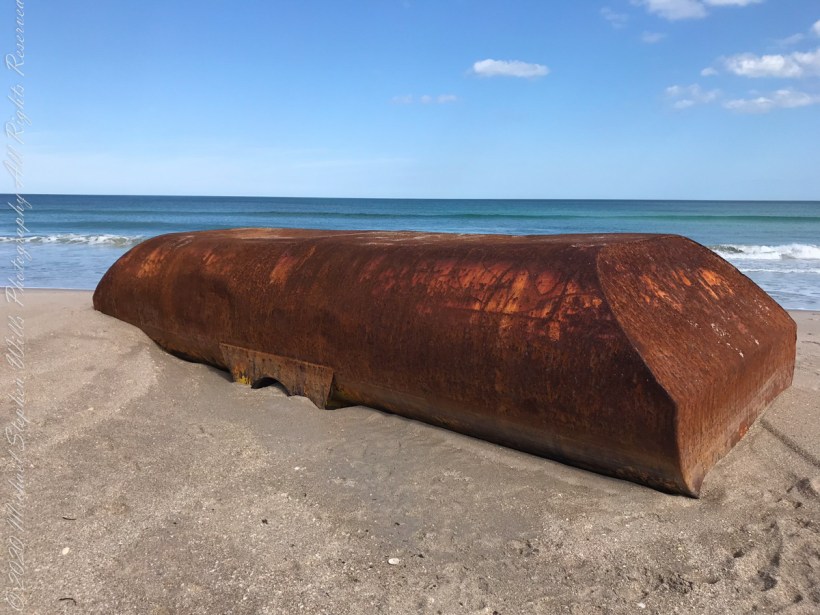
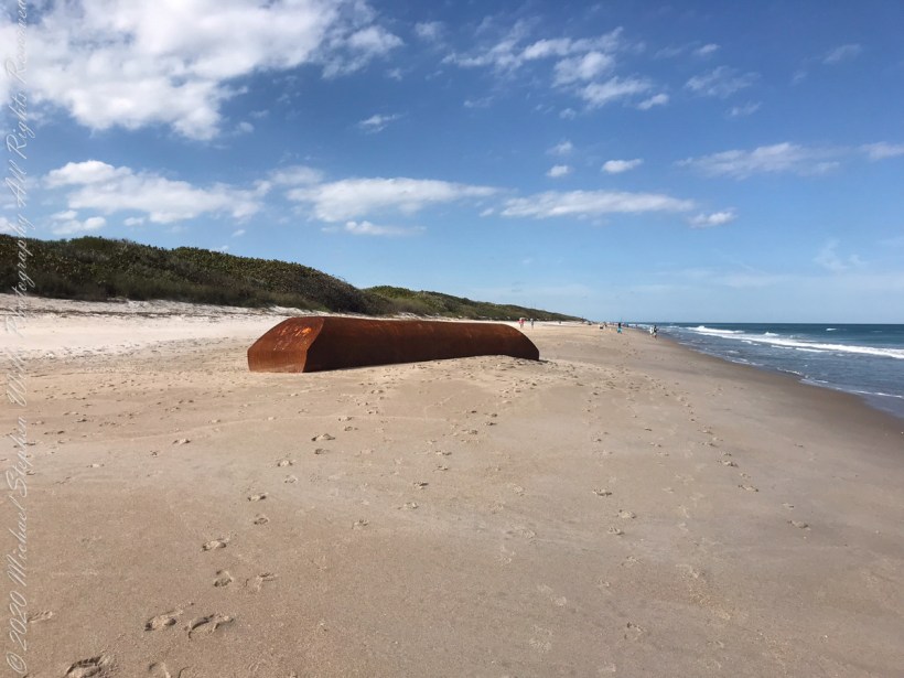
Here is a photo for a sense of place.
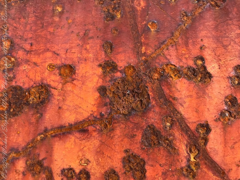
Artistic macros of the rusty surface.
Cape Canaveral National Seashore, Titusville, Brevard County, Florida
Copyright 2022 Michael Stephen Wills All Rights Reserved