Valparaiso Connections V

A Deeper Understanding

Monuments Then and Now

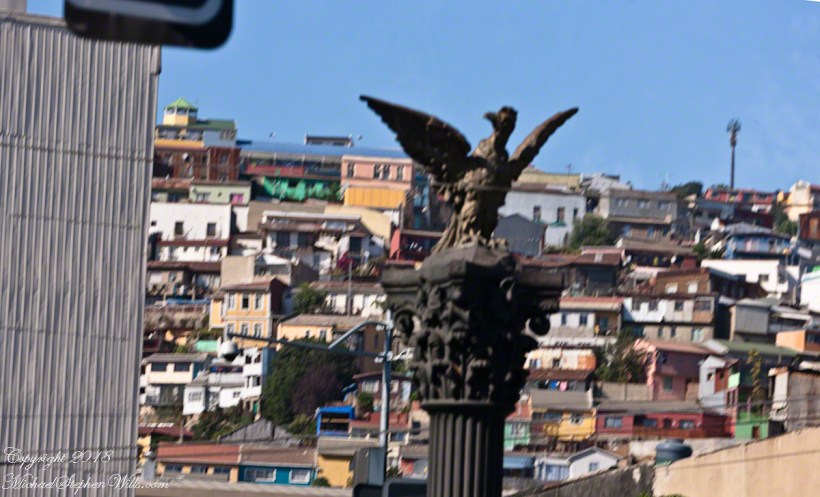
Trundled along within our bubble, the Mercedes tour bus proceeded up Avenue Montt when Ricardo pointed out this statue for ridicule.  A depiction of the Chilean national bird, the Condor, porteños derisively call it “The Chicken,” and in truth the wingspan is undersized.  From the vantage of the above photograph, the statue form does capture an impression of soaring among the hills of Valparaiso.  Keep in mind, beyond those hills is Aconcagua, the highest mountain of the western hemisphere, home to Condors.  

A reason for writing multiple Varparaiso “connection” posts is to better understand the jumbled impressions from that day.  In a previous post I coined the term Varparasians for natives of the city.    I found in researching this post the residents, as for Buenos Aires, call themselves porteños (people of the port).  This cast iron statue speaks to the contributions of French immigrants to the city and nation.

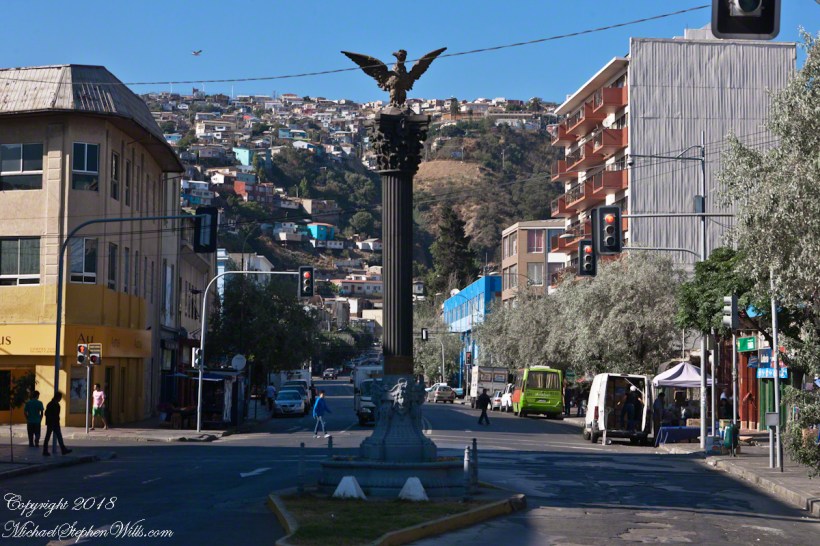
Gift of the French Colony for the Centennial of Chile – Valparaíso, 1810 – 1910.

Here the view is south towards (what I believe is) Cerro Florida (Florida Hill).  France Avenue continues, beyond the monument, following a steep and winding path up the hills, at the crest intersecting with German Avenue.  Adjacent, on the right, is Park Italia where we’ll visit in part VI.  Above a cast iron basin, at each corner of the commemorative column base is a female mask, above them a gold band inscribed (from the) “The French of Valparaiso” with 1810 – 1910 to denote the centennial.  A condor with outspread wings surmounts the column.

The artist, Nicanor Plaza, born in Santiago, Chile was living in Florence, Italy at the time of this commission.  He was a natural choice for the commission.  Trained in Chile and Paris, Plaza taught for the Academy of Fine Arts of Santiago.  It is of cast iron, produced by the French company Val Osne, an art foundry dating back to 1835.  The owner, Jean Pierre Andre Victor, invented a cast iron ornamental technique originally used to produce street furniture.  

 From 1854 to 1895 immigration from France burgeoned, from a country total of 1,654 to 8,266.  This cohort is credited with developing the vineyards of the Central Valley, still famous today.  The Chilean president Augusto Pinochet descended on his father’s side from an 18th-century French Breton immigrant from Lamballe and his mother was a descendant from 17th century immigrants, partially Basque.  Pinochet’s legacy can only be attributed to himself and the ruling Junta.  What is of concern is (1) Pinochet was protected against prosecution throughout his life. (2)  The same people who protected him still hold power.  A case in point is the Esmeralda, still in service.

The Naval Training Vessel Esmeralda

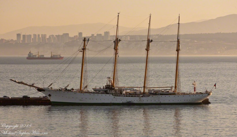
 I took this photograph at dawn from our stateroom balcony, it is the
Esmeralda, a four-masted  top sail schooner, from Spain, christened May 12, 1953.  From 1973 to 1980 it was a floating torture chamber where up to 100 persons were subjected to hideous treatment by the Pinochet regime.  Protests erupt wherever it docks in a foreign port yet it remains in service.  A relatively small part of the puzzle, yet it serves as an unacknowledged monument to the failure of Chile’s ruling elite to come to terms with the recent past.

Click for my Fine Art Gallery.

Valparaiso Connections IV

The O’Higgins Carrera Feud

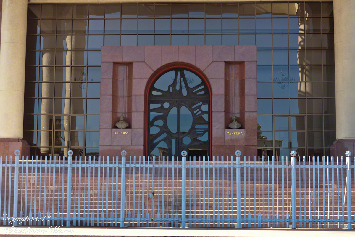
“Valparaiso Connections III” brought us to Pedro Montt Avenue and the building of this imposing façade, Congreso Nacional de Chile (National Congress of Chile).  The very fact it is in Valparaiso is a recollection of the former National Congress, disbanded by the ruling Junta on September 13, 1973.  During the final years the Pinochet dictatorship chose Valparaiso for the site of a new congress building.  The former National Congress building still stands in Santiago, now housing the offices of both houses of congress.

I am fascinated the façade is shared by two founding fathers of Chile, Bernardo O’Higgins and José Miguel Carrera.  O’Higgins father never married his mother (in other words, Bernardo was a bastard).  Cared for by his mother’s privileged family, he used his mother’s family name until the death of his father.  Carrera, was also born of privilege, the acknowledge son of his father who attended the best schools, well positioned to lead the movement for Chilean independence.  Benefactors looked after O’Higgins, they sent the seventeen year old to Europe to finish his education.

In the chaos of war, in spite of ill-health and lack of military training, O’Higgins out performed Carrera as an officer through reckless bravery; surviving, he became an admired military leader through this example and ultimate victories. Carrera resented being overtaken (by a bastard), did not respect O’Higgins leadership and the two feuded. O’Higgins became the first head of the independent Chile while Carrera gathered a force.  Exiled in Paraguay, Carrera marched across the intervening wastes battling indigenous forces.  Eventually captured by those loyal to O’Higgins, Carrera suffered a mock trial and execution.

All five of Carrera’s legitimate offspring married and prospered, today his descendants number in the hundreds, being the majority of Chile’s ruling class.  Today, the followers of Carrera (Carreristas) fight for his recognition against the O’Higginistas, who they despise.  The balance is on display on the National Congress façade on Pedro Montt Avenue.  The building is next to Plaza O’Higgins.

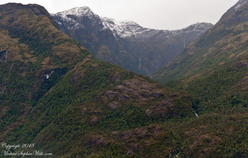
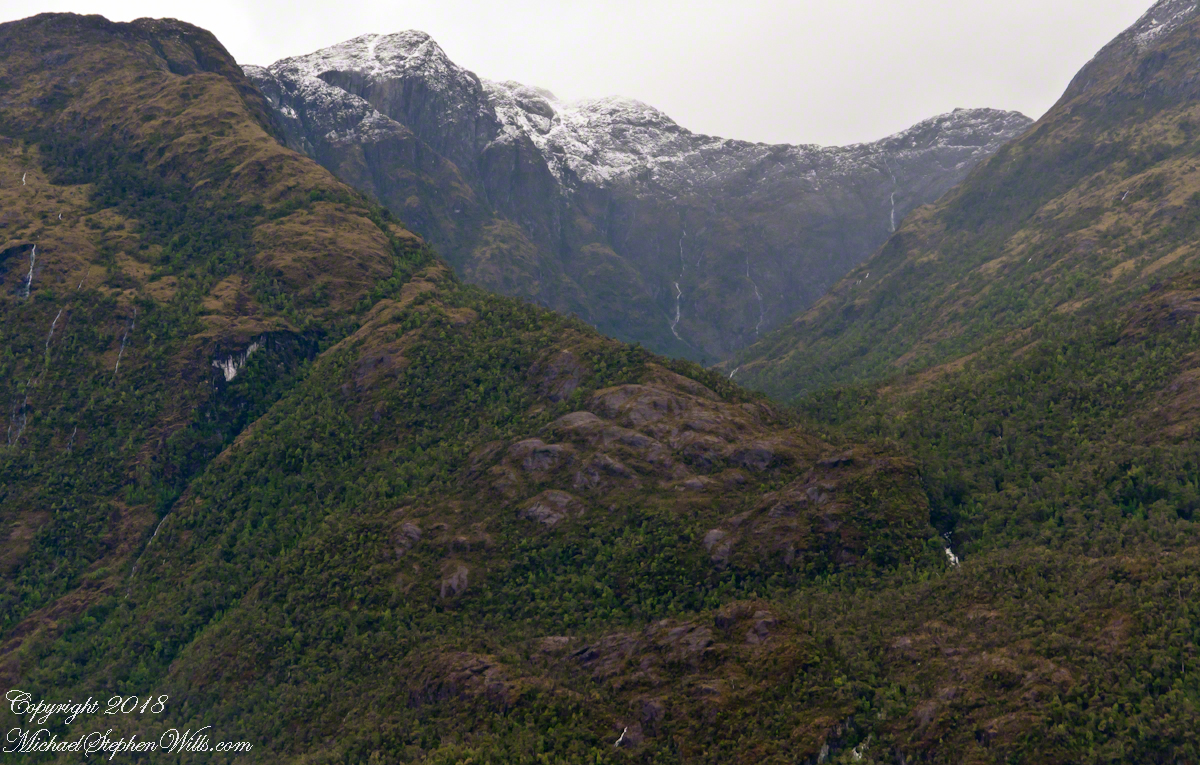
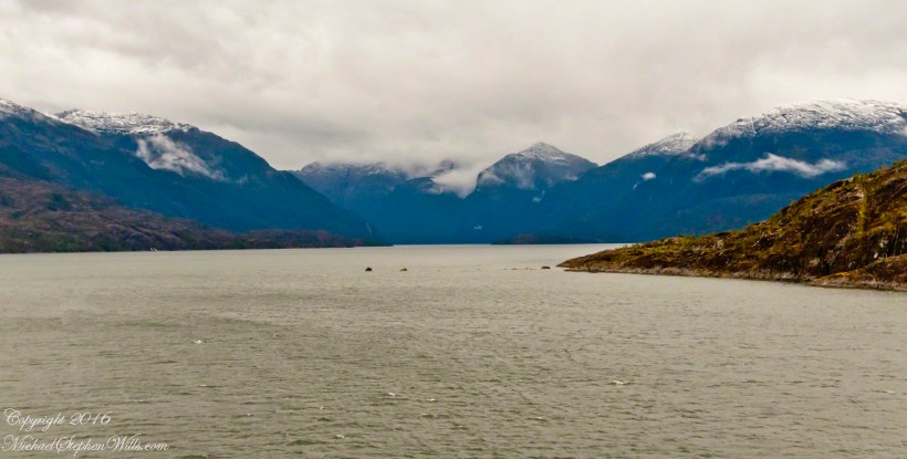
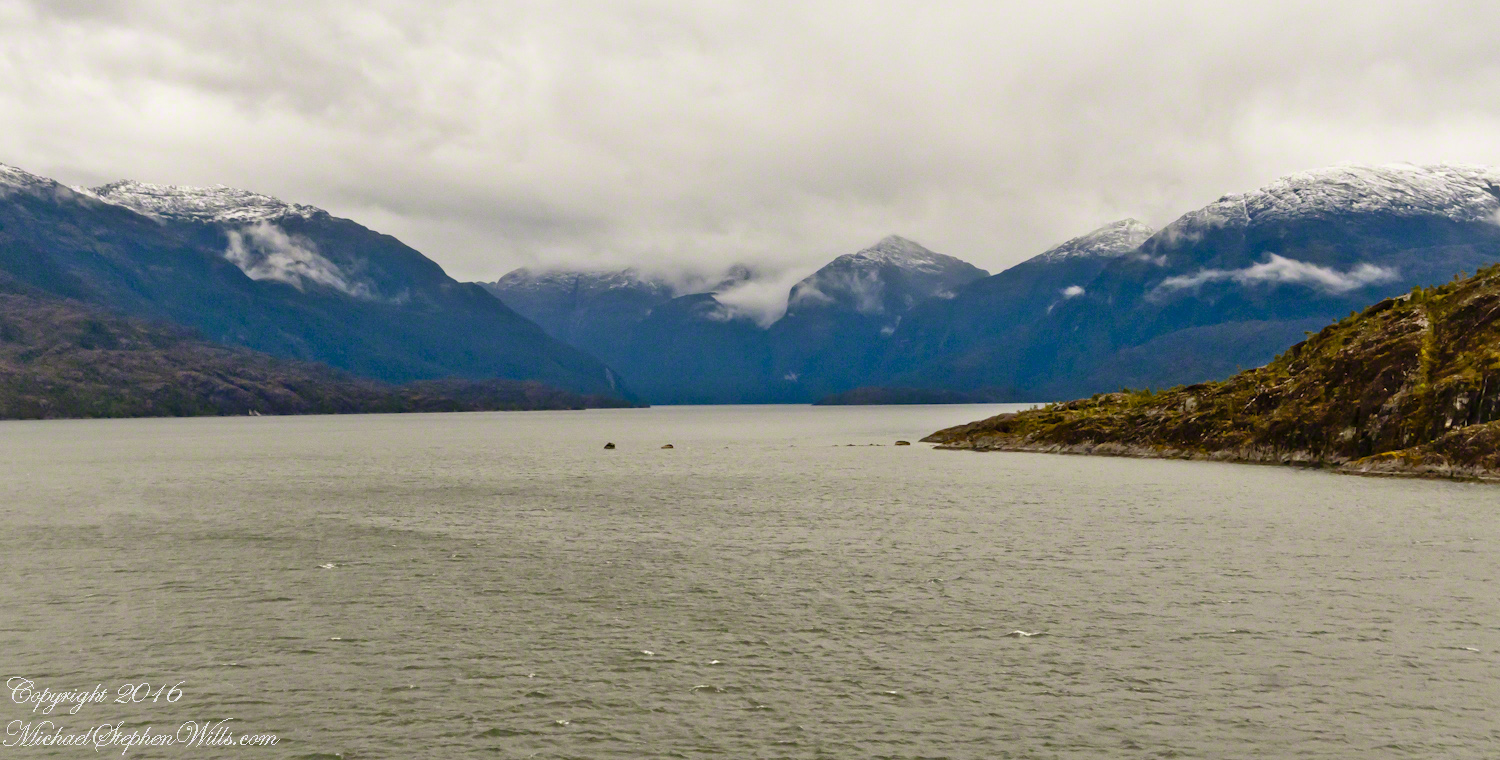
Measured by acreage, O’Higgins is far ahead of Carrera.  The following photograph, from my posting “A Far Country VII: View of Tempanos Fjord” is from within Bernardo O’Higgins National Park, the largest protected land in Chile.

A large lake in Patagonia is named after General Carrera.

Valparaiso Connections III

Copper Cable and History

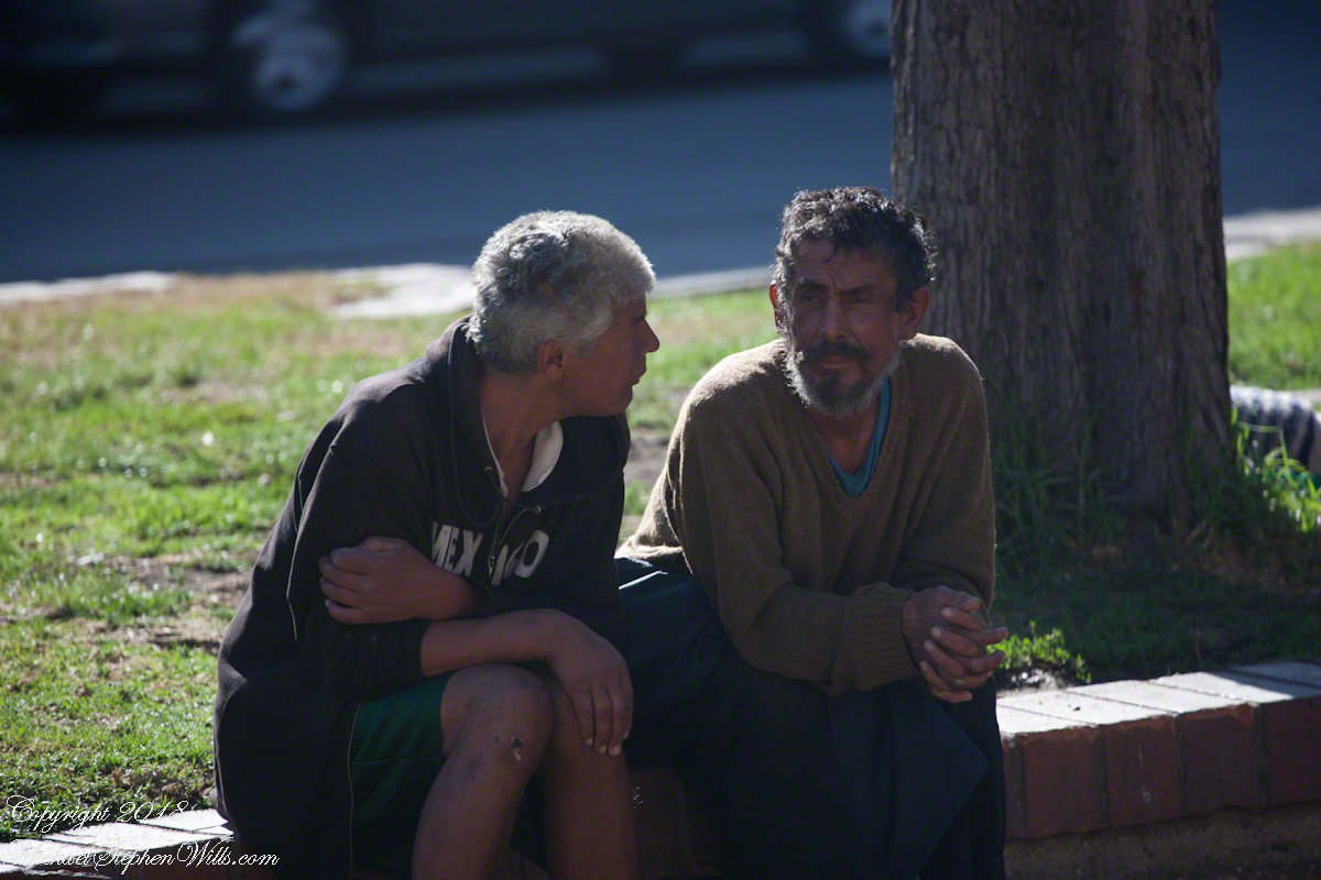
“Valparaiso Connections II” left us with these friendly Valparasians, if such a word can be used to describe residents of the city, chatting on Argentina Avenue.

It was Saturday, the happy occasion of the weekend street fair, kiosks sprouting like mushrooms, thinly attended this early morning.

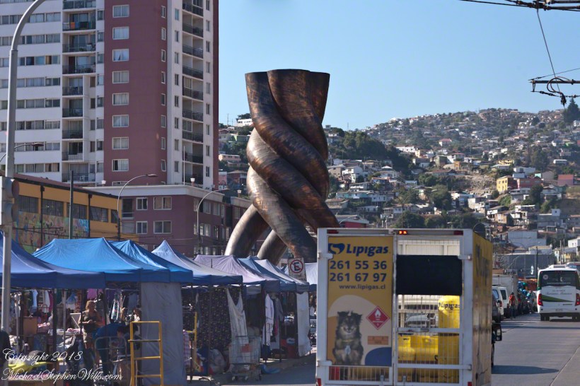
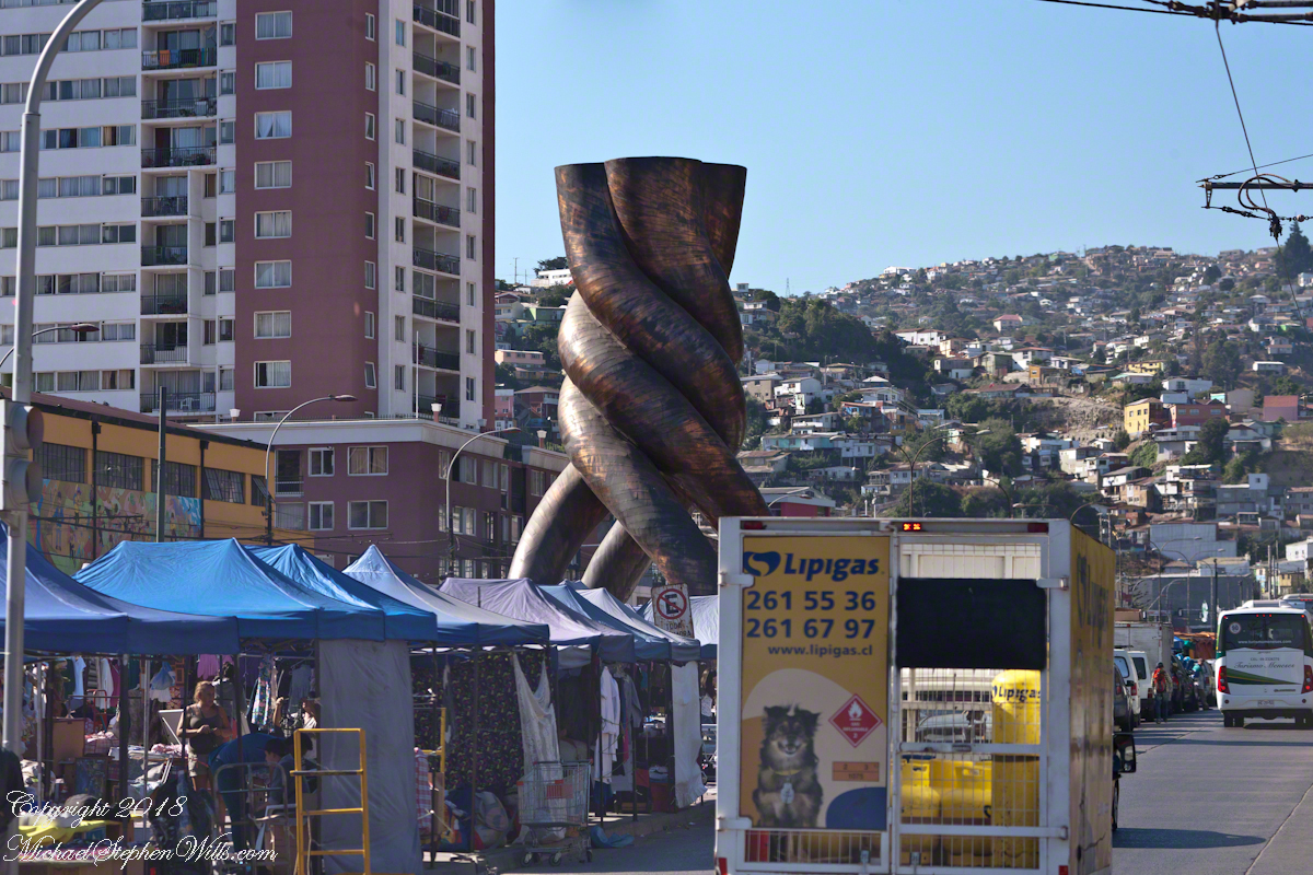
We did not pause to wander, instead turned up a street known as Pedro Montt, named for a Chilean president of the early 2oth century.  Was we turned, monumental street sculpture, rising from the kiosks, caught my eye.

A creation of the great national artist Mario Irarrzabal, it invokes solidarity through the image of four thick copper cables twisted together to form one, the union that can happen to achieve bigger things.  Opened in 1995, crafted of iron, wood and copper, after Pinochet passed power to a new democratic constitution and still held office as a Senator, protected from extradition, in the National Congress located just to the west of the monument.

The imagery works on multiple levels.  Known as “Copper Cable Monument” or “Copper Column,” the monument also stands for Chilenización del cobre (Chileanization of copper), a movement began during the presidency of General Carlos Ibáñez del Campo.  Concluded in the presidency of Salvador Allende, the takeover of foreign owned mines lead to the isolation of Chile and was a component of the support of the USA, via the CIA, for the Pinochet 1973 Chilean coup d’état.  Pinochet retained state control of the mines in the face of strong popular support for the huge contribution to state coffers.  To this day CODELCO (in English National Copper Corporation of Chile) operates as a corporate entity.

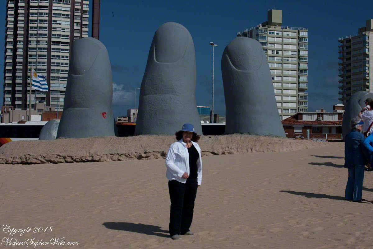
As with our guide, Ricardo (“Valparaiso Departure I”) and the companions at the start of today’s post, Irarrzabal was profoundly affected by the Pinochet dictatorship.  Under its influence as well as the sculpture of Easter Island, the artist began work on monumental sculptures.  Pam and I visited one on the other side of the South America “cone,” Punta del Este, Uruguay.

Built from Brava beach at the height of the dictatorship, 1982, of concrete, steel rebar, mesh covered with a corrosion resistant coating, the artist title it “Man Emerging to Life.”  He was a young man at the time, the work built his reputation and he repeated the theme internationally as well as, in 1992, 1,181 miles away the “Hand of the Desert.”  At that time while Chile was emerging from the Pinochet dictatorship the palm as well as fingers are visible.  The “cone” of South American, Chile and Argentina, are encompassed by the left hand of the east, a right hand of the west.

A Far Country XI: Gondwana Part 1

amazing resolution with the Canon 24 mm lens

(Click any photograph to visit my online gallery)

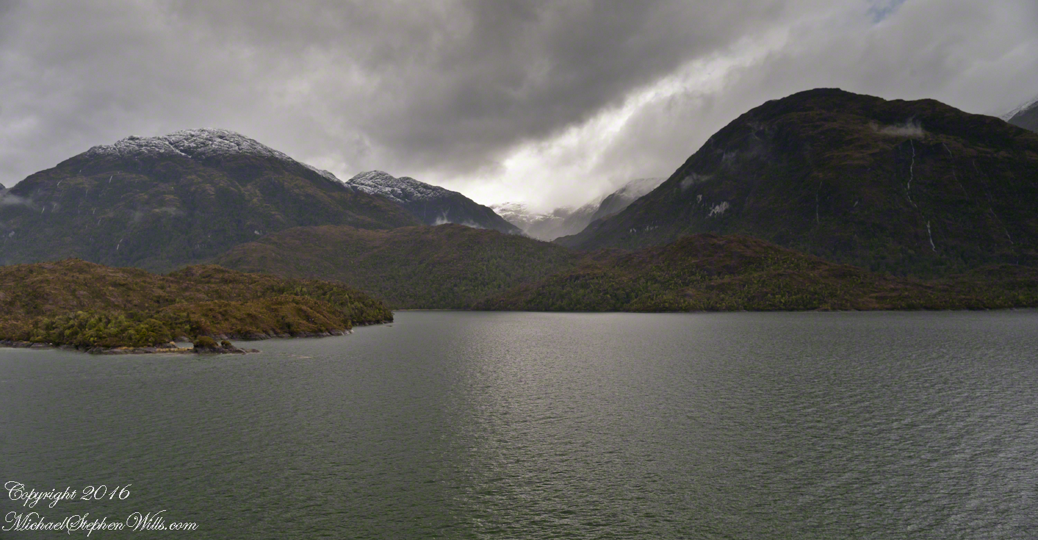
The resolution of the Canon EF 24mm f/1.4L II USM makes this lens a favorite of mine for landscape work.  Let me show you why.

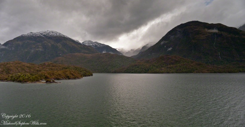
The valley today’s posting lies behind the tree.  It is a broad valley shaped by ancient glaciers.

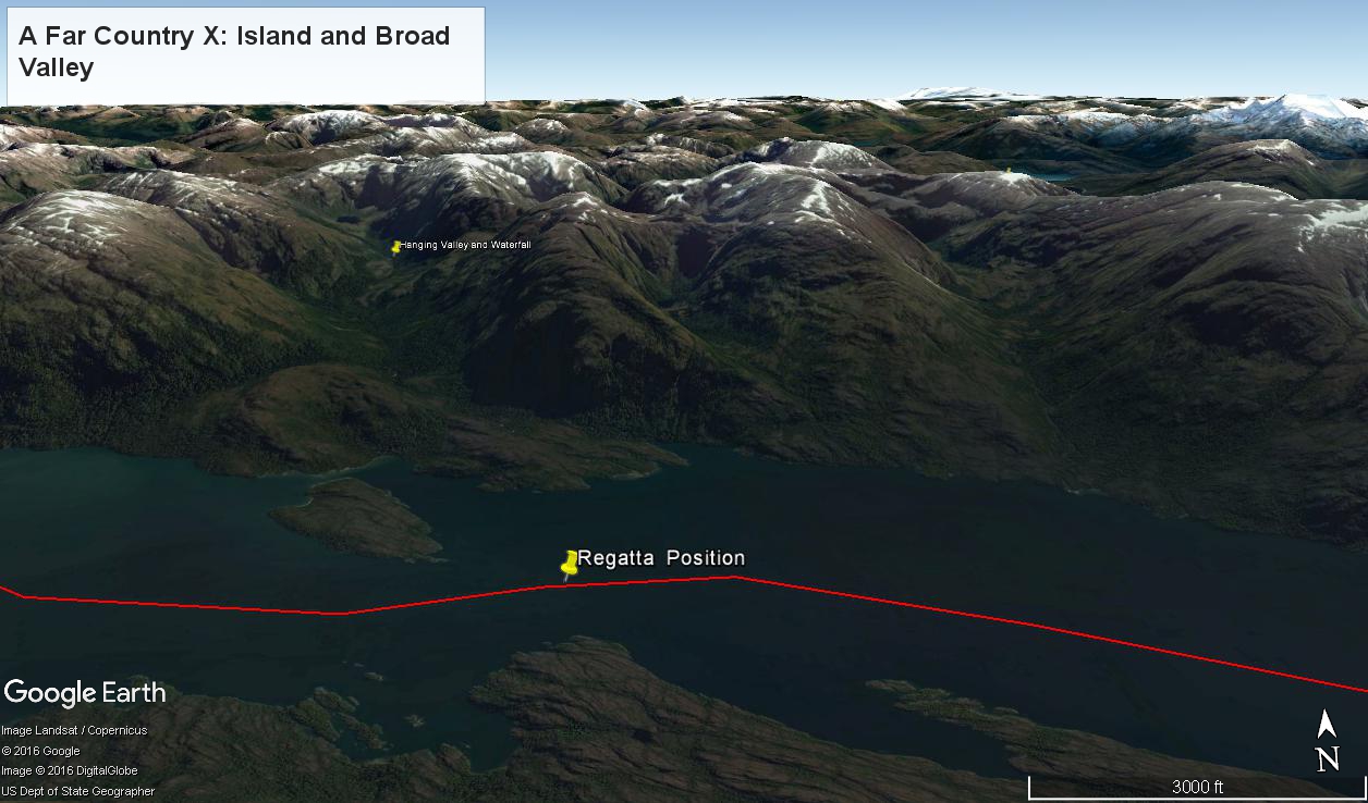
Here is the Google Earth view, from an elevation of 9,400 feet, with the ship position marked.  Northwest is a pushpin titled, “Hanging Valley and Waterfall.”

A Far Country X– CLICK ME!!!!

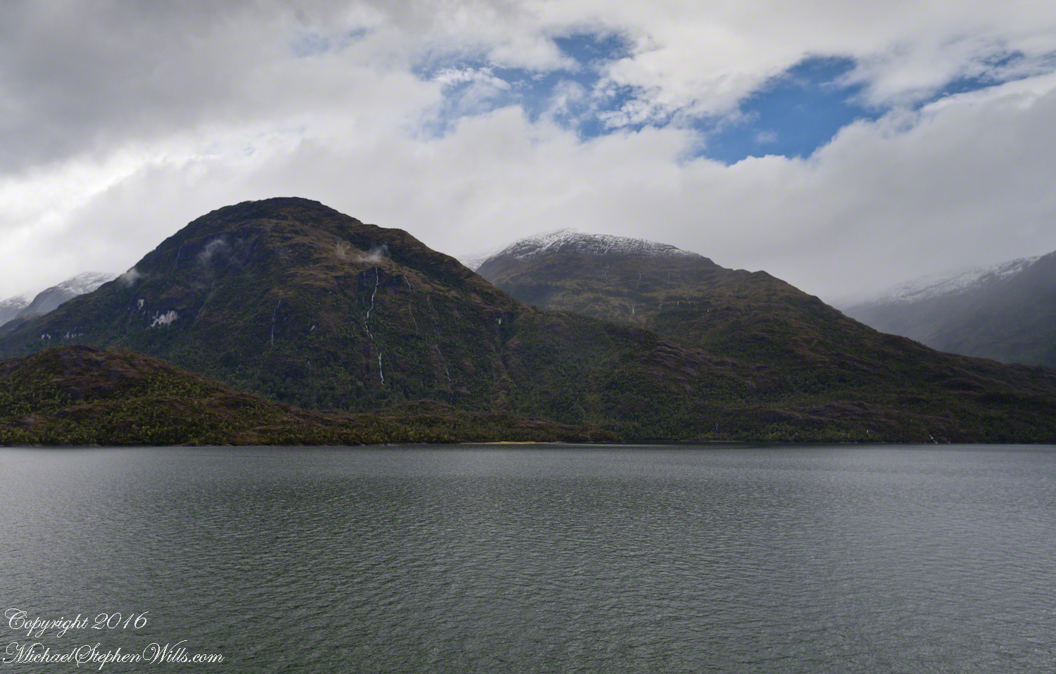
The waterfall marking the hanging valley is visible in the following photograph.   All photographs in this posting are from a Canon EOS-1Ds MarkIII, 24 mm lens (see above for complete name), on a Manfrotto travel tripod.  ISO 500, f5.6 or f6.3.

With a point of view about 50 feet above the water the valley bottom is hidden behind an 800 foot hill and the water fall is just above the hill.  See it?  …..I didn’t think so.

There is the island with the tree, to the left.  The following image is the same photograph, with the central section enlarged.

Fjord Island and Broad Valley– CLICK ME!!!!

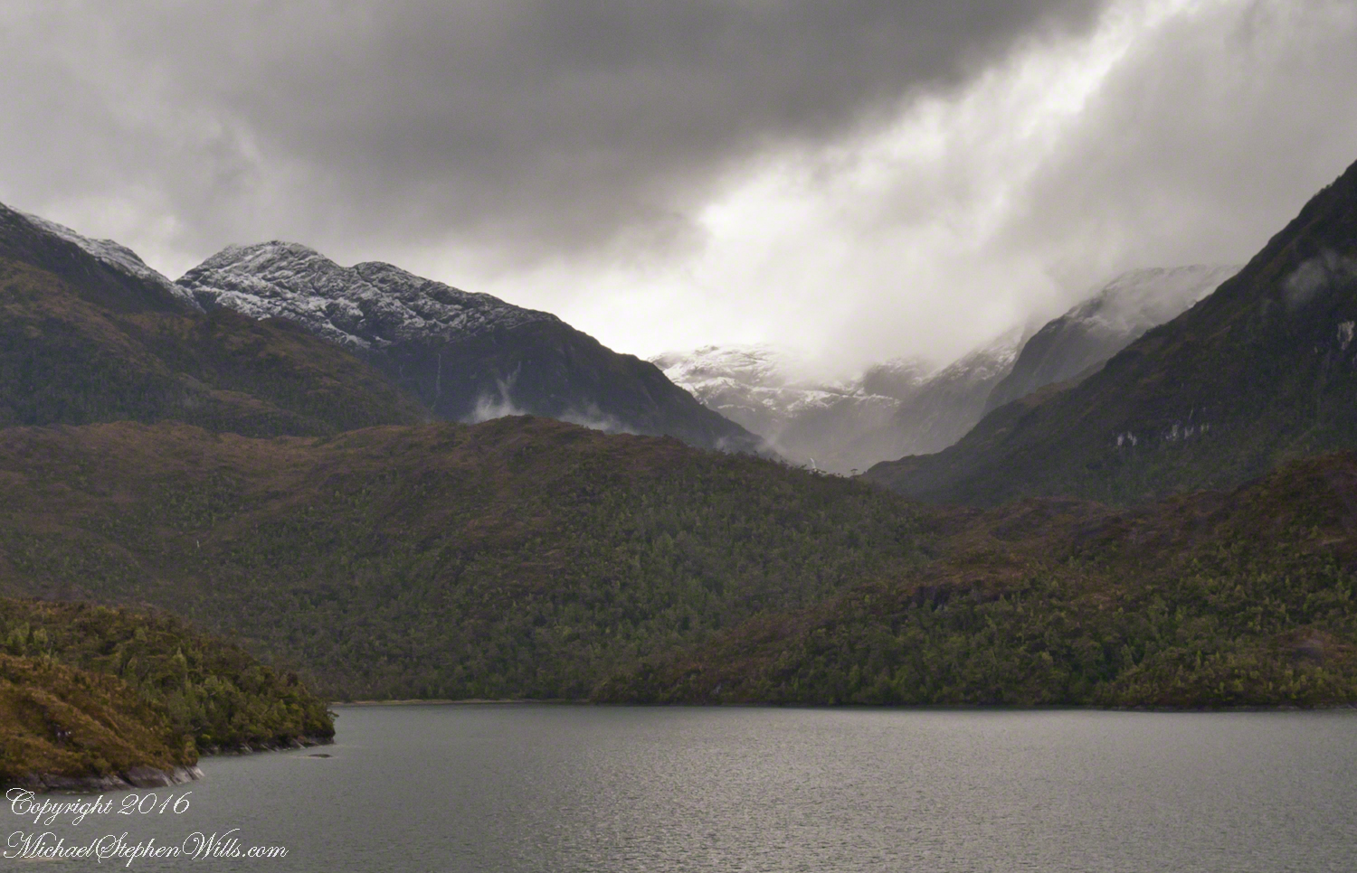
The enlargement brings out the play of light, the low clouds, deep in the valley.  To provide scale, know those are full sized pines on the hillside, foreground.  The waterfall is just about visible.  I will enlarge the image one more time.

Fjord Island and Broad Valley– CLICK ME!!!!

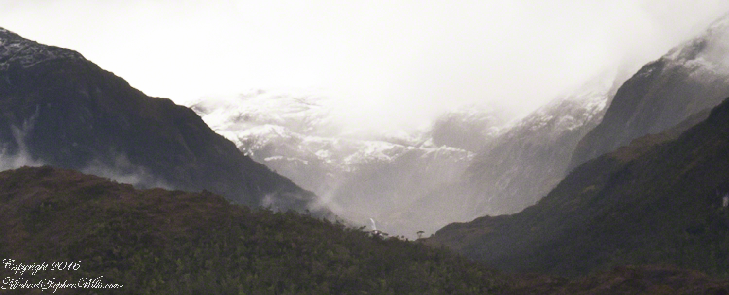
There it is!!  I stepped up contrast, as well.

Fjord Island and Broad Valley– CLICK ME!!!!

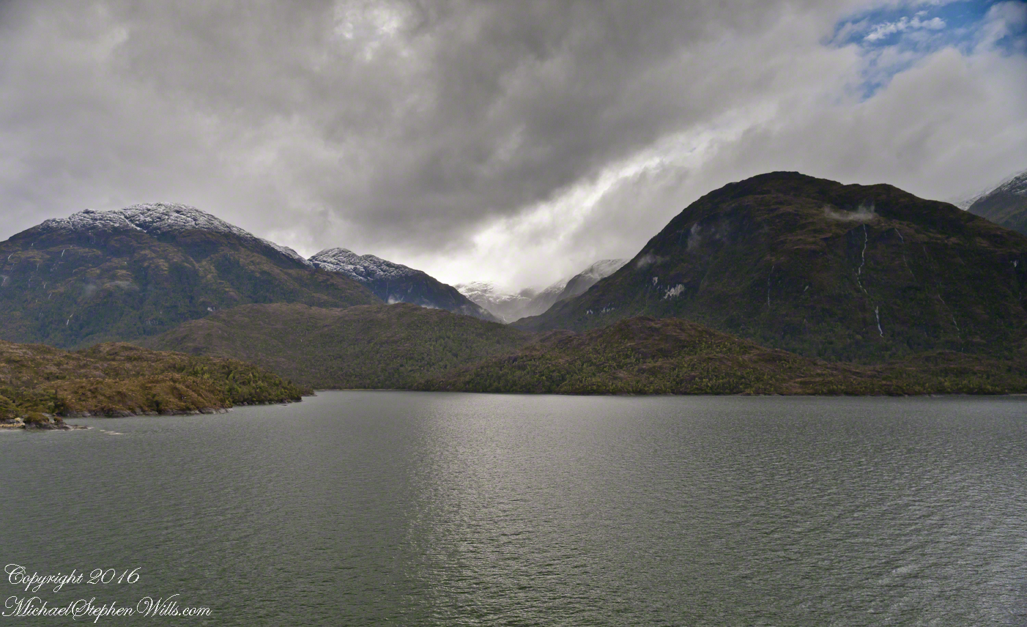
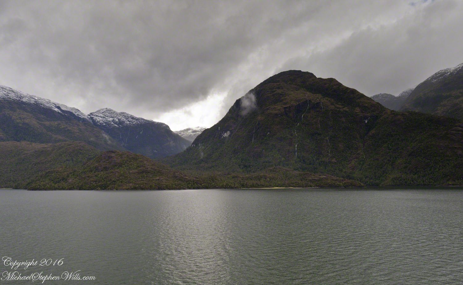
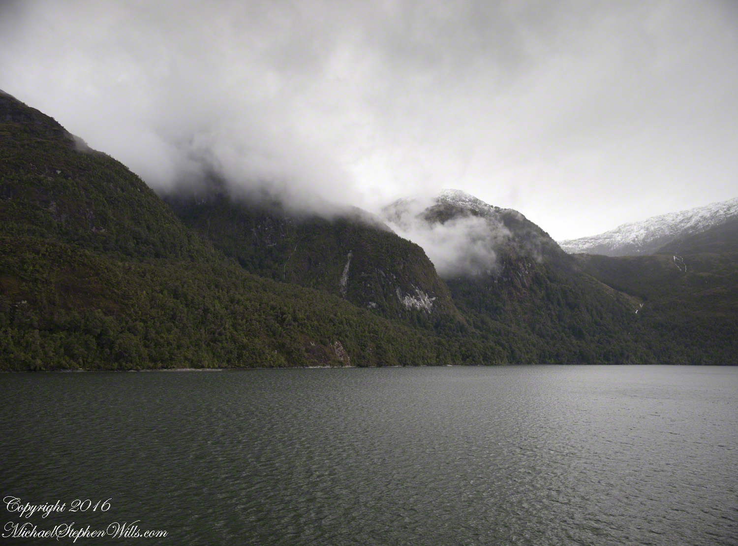
Here is another version of the original view.  That patch of sky had opened up seconds after the first shot and, as a result, the 3,000 door mountain and waterfalls, on right, are better lit.  Notice the bare rock face on the mountain slope, marking a landslide.

Click this image for a high resolution version, in your browser.

Fjord Island and Broad Valley– CLICK ME!!!!

A different landslide Scar is featured in two previous blogs,

A Far Country V: Landslides!!

A Far Country VI: View of Tempanos Fjord

The Regatta’s course brought us closer for the two following shots.

The lovely sky is still visible…..

Mountain and Waterfalls

….one minute later the clouds gather and relative darkness returns.

(Click any photograph to visit my online gallery)
Copyright 2022 Michael Stephen Wills All Rights Reserved

A Far Country X: Hanging Valley

amazing resolution with the Canon 24 mm lens

(Click any photograph to visit my online gallery)

The resolution of the Canon EF 24mm f/1.4L II USM makes this lens a favorite of mine for landscape work.  Let me show you why.

The valley today’s posting lies behind the tree.  It is a broad valley shaped by ancient glaciers.

Here is the Google Earth view, from an elevation of 9,400 feet, with the ship position marked.  Northwest is a pushpin titled, “Hanging Valley and Waterfall.”

A Far Country X– CLICK ME!!!!

The waterfall marking the hanging valley is visible in the following photograph.   All photographs in this posting are from a Canon EOS-1Ds MarkIII, 24 mm lens (see above for complete name), on a Manfrotto travel tripod.  ISO 500, f5.6 or f6.3.

With a point of view about 50 feet above the water the valley bottom is hidden behind an 800 foot hill and the water fall is just above the hill.  See it?  …..I didn’t think so.

There is the island with the tree, to the left.  The following image is the same photograph, with the central section enlarged.

Fjord Island and Broad Valley– CLICK ME!!!!

The enlargement brings out the play of light, the low clouds, deep in the valley.  To provide scale, know those are full sized pines on the hillside, foreground.  The waterfall is just about visible.  I will enlarge the image one more time.

Fjord Island and Broad Valley– CLICK ME!!!!

There it is!!  I stepped up contrast, as well.

Fjord Island and Broad Valley– CLICK ME!!!!

Here is another version of the original view.  That patch of sky had opened up seconds after the first shot and, as a result, the 3,000 door mountain and waterfalls, on right, are better lit.  Notice the bare rock face on the mountain slope, marking a landslide.

Click this image for a high resolution version, in your browser.

Fjord Island and Broad Valley– CLICK ME!!!!

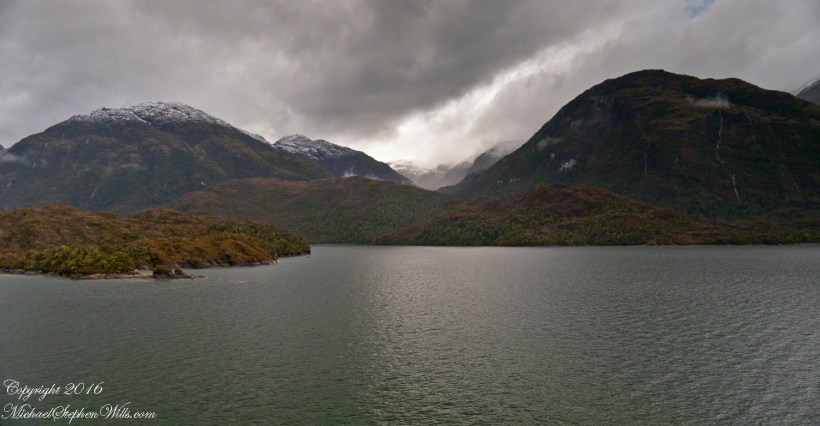
The Regatta’s course brought us closer for the two following shots.

The lovely sky is still visible…..

Mountain and Waterfalls

….one minute later the clouds gather and relative darkness returns.

Fjord and Valley

(Click any photograph to visit my online gallery)
Copyright 2022 Michael Stephen Wills All Rights Reserved

A Far Country IX: Bonsai Shape

Compelling Plant Shapes

(Click any photograph to visit my online gallery)

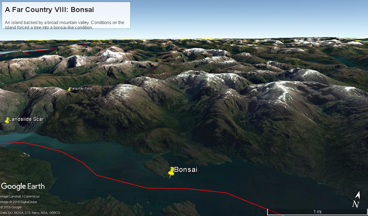
Here is a Google Earth view of Tempanos Fjord from 9,400 feet, looking north, northwest over a point on the fjord 6.5 miles from Iceberg Glacier, at 4 pm local time on February 17, 2016.  This view is interesting for the insignificant island, .75 mile long, and broad mountain valley to the north fringed with waterfalls.

Marked is the location of a tree, “bonsai”, a feature of the fjord cliffs, “Landslide Scar” and a neighboring Fjord, “Farquhar Fjord.”

This blog features the tree.

Tempanos Fjord View West, Northwest– CLICK ME!!!!

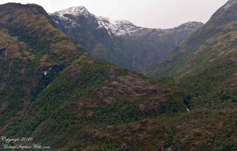
The Farquhar Fjord entrance opens onto the entrance of Tempanos Fjord and is the last photograph.

Tempanos Fjord View West, Northwest– CLICK ME!!!!

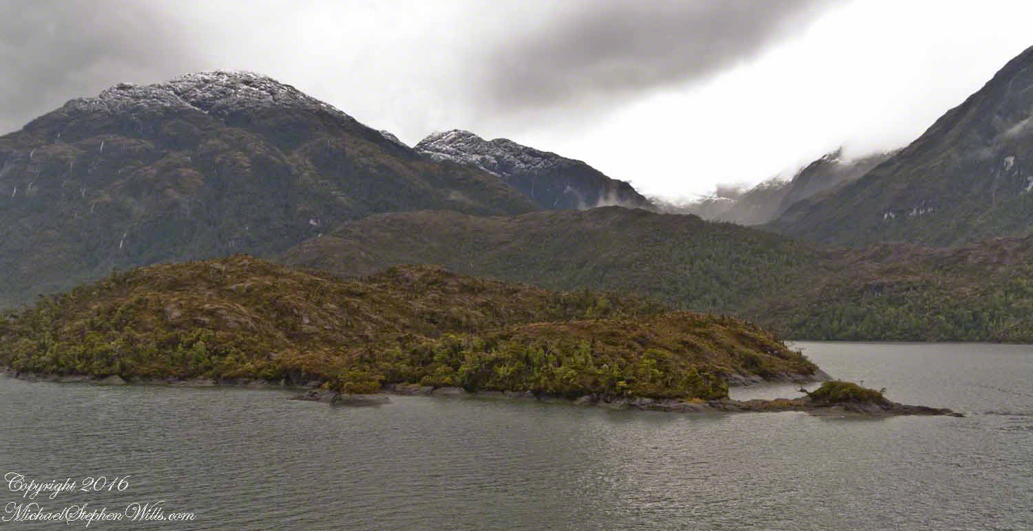
A photograph from our port side stateroom deck includes both the island and broad valley.  The misshapen tree, the “bonsai”, is on an islet to the right and in front of the island.  It is the small stump backlit by water reflection.  The stump is more interesting than can be seen in this image from a handheld camera, at 24 mm.  I used the variable lens for a closer look.

24 mm bonsai view– CLICK ME!!!!

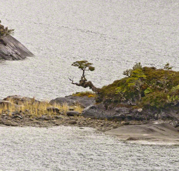
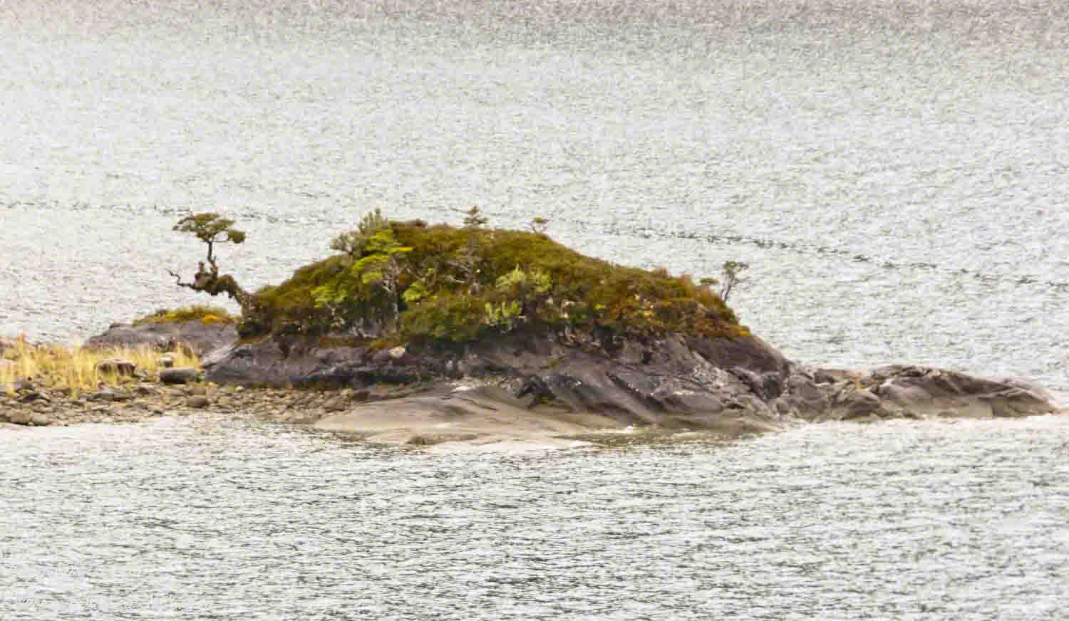
From this 133 mm, f8.0, 1/250 sec and ISO 800, still handheld, interesting details come into view.  The islet is a rock on which clings a bed of moss.  Several ferns, a sapling (on the far side) and a stump, on the right, are surviving.  The stump presumably supported a small tree of which a “bonsai-like” twig remains.

Bonsai are fascinating, created through the art and skill of emulating pleasing natural forms.  Here the moss encrusted twists and miniature tree crown were formed from a difficult environment.  Bonsai of Japan originated from an ancient Chinese tradition of penjing (“tray plant”).  The inspiration for this are, at origin and now, must be, in part, from admiration of the tenacity and beauty of these plants.

133 mm bonsai view– CLICK ME!!!!

At the 200 mm maximum my Sony Alpha 770 (1/400, f9, ISO 800) image is a little fuzzy, still with great details.

From my interest in bonsai I am on the lookout for shapes such as this. Travelling the challenging environment of the Chilean Fjords I found examples here and there.

200 mm bonsai view – CLICK ME!!!!


Click any photograph to visit my online gallery)
Copyright 2022 Michael Stephen Wills All Rights Reserved

A Far Country VII: View of Tempanos Fjord

A mountain and waterfall ringed bowl.

(Click any photograph to visit my online gallery)

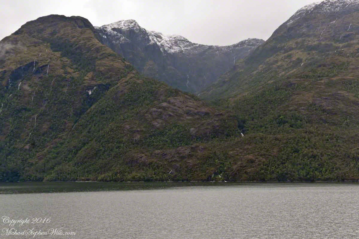
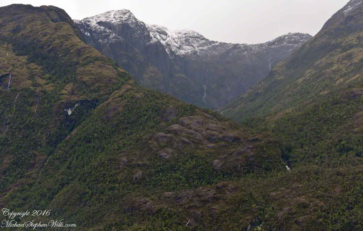
4:00 pm local time the Oceania was approximately 5 miles from the Iceberg Glacier, moving forward at a slow rate of speed, 4.6 knots.  Here are more views of the mountain-ringed bowl behind a 1,000 foot cliff.

Tempanos Fjord View West, Northwest– CLICK ME!!!!

Both photographs are handheld using my Sony Alpha700, ISO 800, variable lens set to 45mm, 1/250 f13.  At the same time I shot from a tripod mounted Cannon, 24 mm wide angle fixed focus lens.

Tempanos Fjord View West, Northwest– CLICK ME!!!!

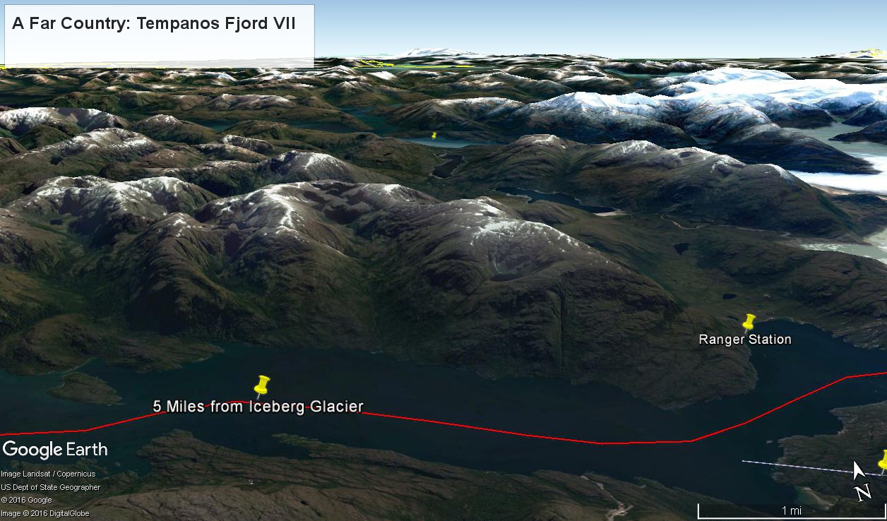
The following capture from Google Earth is the view from 12,200 feet.  Regatta’s position is the “5 miles from Iceberg Glacier” pushpin.  The formation is almost due north.  We were surprised to see a ranger station in this uninhabited area, not yet in view.  The white line, lower right, is the border between the Aisen (north) and Magellanic (south) Chilean regions.

Tempanos Fjord View West, Northwest– CLICK ME!!!!

(Click any photograph to visit my online gallery)
Copyright 2022 Michael Stephen Wills All Rights Reserved

A Far Country VI: View of Tempanos Fjord

Fjord View

(Click any photograph to visit my online gallery)

By 3:20 pm local time the Oceania was approximately 1.75 miles from the Iceberg Glacier and the captain positioned the ship for a starboard side glacier view.  From our port side stateroom terrace Pam and I had this sweeping view of the way we had come.

Tempanos Fjord is a mile across here and we have a clear view of the landslide scar feature in my last blog.  It is 7.75 miles distant, a small white patch on the fjord wall.  The landscape scar marks where the fjord bends, changing north, northeast course to an east, southeast direction.  Before the bend, the Iceberg glacier is not visible.  Turn the bend and the glacier is plainly visible in the distance if the viewer is looking over the ship bow.

Tempanos Fjord View West, Northwest– CLICK ME!!!!

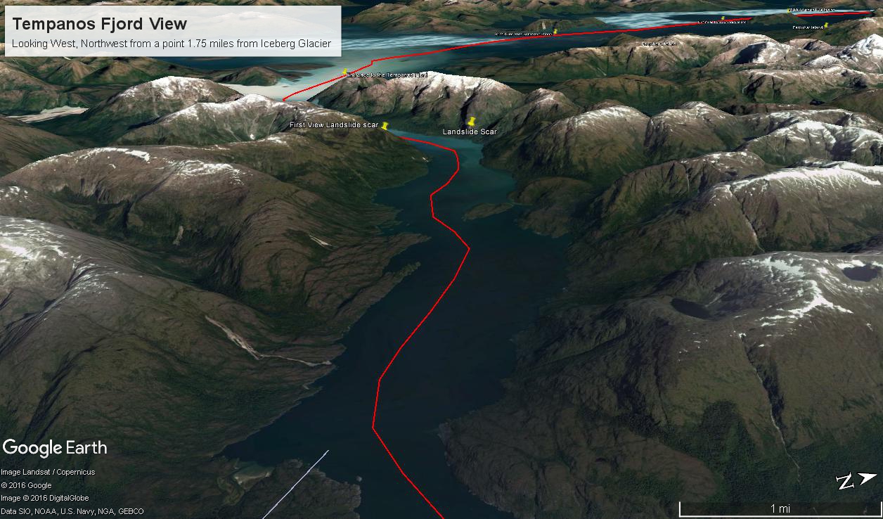
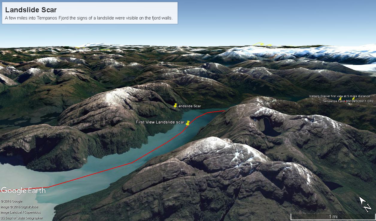
The following capture from Google Earth is the view from 14,000 feet.  Marked are the locations of the landslide scar and the ship position were I first photographed the scar on our way into Tempanos Fjord.  The red lined ship’s course may be followed out of the fjord back to the Messier Channel.  The fjord follows a course among mountain peaks and deep valleys.   A great pleasure of sailing Tempanos Fjord is the many vistas opening one to another.

Tempanos Fjord View West, Northwest– CLICK ME!!!!

(Click any photograph to visit my online gallery)
Copyright 2022 Michael Stephen Wills All Rights Reserved

A Far Country V: Landslides!!!

All is Larger than it First Appears

(Click any photograph to visit my online gallery)

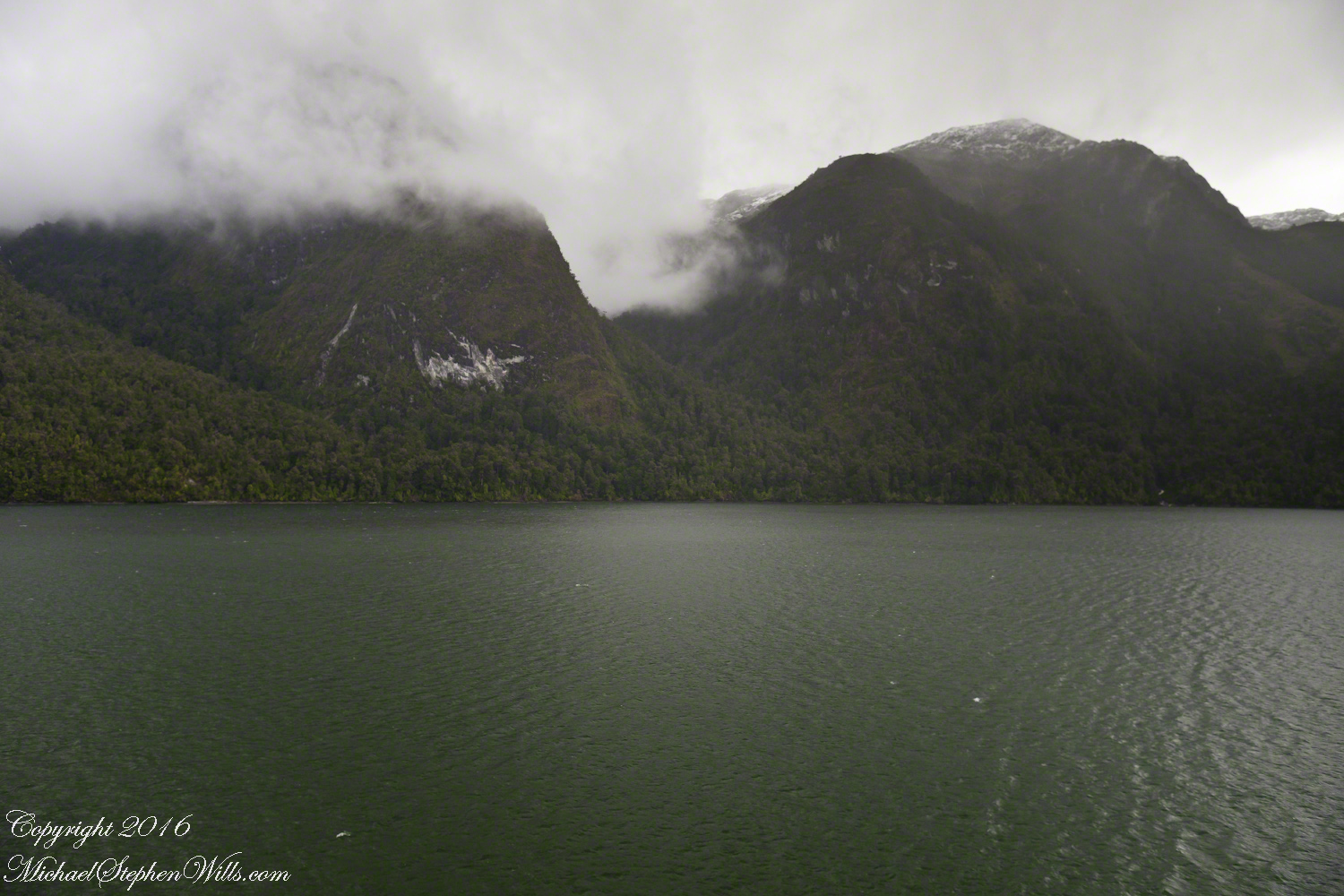
By 2:45 pm local time the Oceania was almost 4 miles into Tempanos Fjord, 10.5 miles from the Iceberg Glacier, when this telling gash on a mountain buttress forming the side of one of many glacial valleys.

First View of the Landslide scar– CLICK ME!!!!

Here is the Google Earth overview of our course that day through Tempanos Fjord, as the red line. Visible is the Farquhar Fjord, to the north. Marked is the position of the scar and the approximate position where I took the first view. Where the fjord bends to the southeast the glacier is not yet visible.

Overview of Mouth of Tempanos Fjord– CLICK ME!!!!

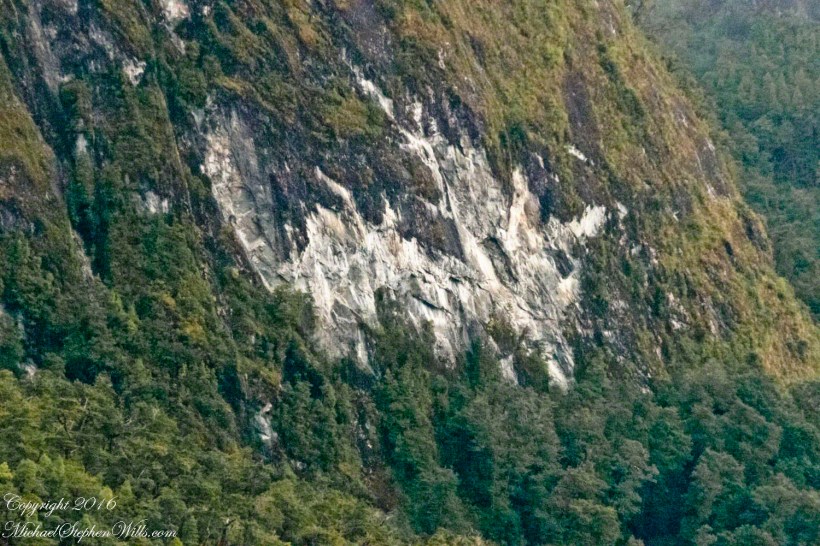
The scar, for all the rawness of the stone, is not recent. There was time for a forest to cover the destruction. The Oceania steamed past, making steady progress. The gash appeared ahead, unremarked. I wonder what the effect was after the cracks, slowly widened over decades by the ice, forced friction to give way to gravity, the mountainside sliding, perhaps, into the fjord. Hard to tell. There is no remnants of the slide visible.

Approaching the Scar -- CLICK ME!!!!

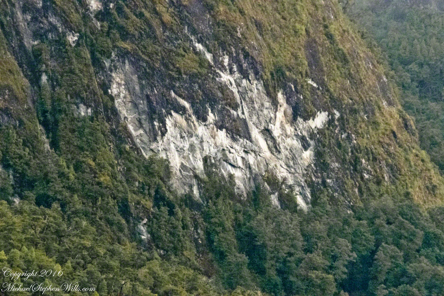
All is larger than it first appears.  Those are full size pines below the scar.  It is the steepness of the cliff face that holds off the vegetation, the whiteness of the rock the source of the apparent freshness of the gash.

Long Lens on the Scar -- CLICK ME!!!!

The mountainsides are threaded with waterfalls. Look closely to the left of the gash for a very thin line ending in a spray.

(Click any photograph to visit my online gallery)
TCopyright 2022 Michael Stephen Wills All Rights Reserved

A Far Country IV: Tempanos Fjord

The environment around Iceberg Glacier….

This is a view of the fjord countryside from the Oceania Regatta position about 4.75 miles from Iceberg Glacier . As the Regatta proceeded at the slow rate of 4.6 knots, I captured this high valley and waterfall from the position marked with the central pushpin in the following GoogleEarth image from 14,000 feet altitude.

CLICK ME!!!!

The following photograph is the view North.  The far waterfalls are fed by two mountain top lakes, waters that feed into Tempanos Fjord.  We are in the Chilean Aisen (also spelled Aysen) Region (XI) looking into a valley between Tempanos, Farquhar and Bernardo fjords.  This island and valley has NO name, as far as I can tell.  The region is uninhabited, part of the Bernardo O’Higgins National Park.

A Far Country: Tempanos Fjord 004

This was taken with a handheld Sony DSLR-A700, the variable lens at 200mm, 1/800 sec at f/13.