Galway Bay View from Dún Aonghasa

a season of wildflowers across a karst landscape

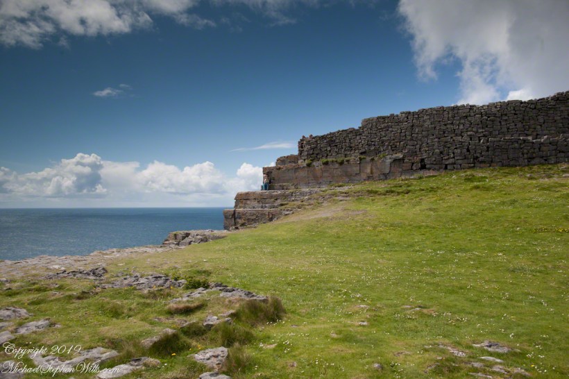
Another aspect of the gradual 1/2 mile inclined path to the central ring of the prehistoric Dun Aonghasa ruins of County Galway, Ireland.

The view north, northwest from this way to Dun Aonghasa (Dun Aengus).  In early June, looking across wildflowers, karst landscape, walled fields, farms, the North Atlantic Ocean, coast of Connemara and the 12 Bens (12 Pins) mountains. 

Note the doorway (with long lintel) in the surrounding wall, to left of center in middle distance.

Click the photograph for a larger view.

Click the link for my Getty IStock photography of the Aran Islands
Click me for the first post of this series, “Horse Trap on Inishmore.”

References: search wikipedia “Dún Aonghasa.”

Copyright 2021 Michael Stephen Wills All Rights Reserved

Where a fort falls away

An abrupt emptiness

Here is the east side of the inner enclosure wall of Dun Aonghasa (Dun Aengus) where it ends at a cliff edge over the Atlantic ocean.

Visible are the last 60 feet or so of the limestone strata supporting the inner ring.

When first constructed, the inner ring was complete, the western side 1,000 feet from the cliff.. Today’s form of a semi-circle was created by nature when the force of Atlantic Ocean waves eroded the cliff, undercutting the strata.

Look close to see a fracture where the next block of limestone will fall into the waves.

Wishing a blessed All Saints Day (November 1st) for all my readers.

Click me for the first post of this series, “Horse Trap on Inishmore.”

Reference: wikipedia Dún Aonghasa, Sea Campion

Copyright 2019 Michael Stephen Wills All Rights Reserved