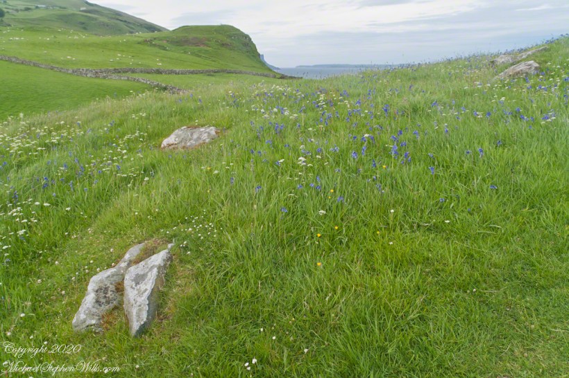
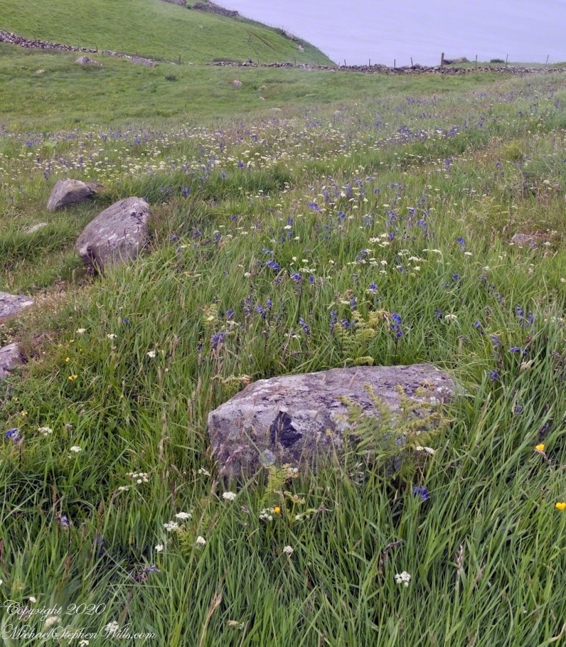
We parked below the Coast Guard station, headed toward the height of Torr Head. I was stopped in my tracks by the hillside meadow wildflower profusion.
Here are a few I identified, listed by common name: Bluebell, Daisy, Meadow Buttercup, Sea Campion, Yarrow. We love daisies and buttercups around home. We spotted Sea Campion on the Dingle Peninsula, as well. Yarrow is common through Ireland. I don’t recall seeing bluebells anywhere else.
It was the bluebells in this photograph that clued me into why I took a photograph of the hillside. The view north takes in coastal sheep pasture looking on a portion of North Channel and the Irish island Rathelin.
The web page I used for identification was wildflowersofireland.net . Great information and links to the Botanical Society of Britain and Ireland with a distribution map.
Copyright 2022 All Rights Reserved Michael Stephen Wills
From the commanding location of Dun Aonghasa, looking northeast across Inishmore island, we can understand why the ancient builders chose this location.
We also see the transition from exposed limestone to the fields built literally from the ground up (see my post “The How of Soil”). For a closer view of island houses see my posts “Settled In” and “Cottage Road Cottage.”
My previous post, “Inner Ring, at last”, lowered the horizon. Here, we study the base of the inner wall.
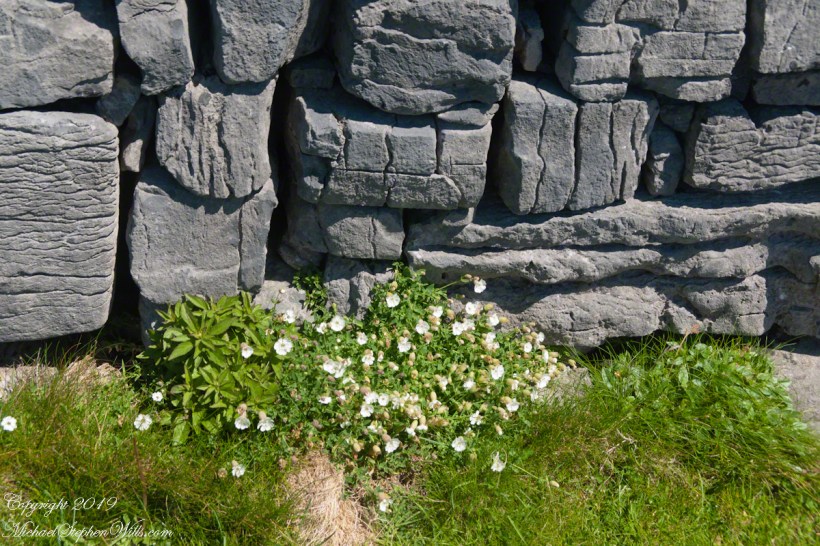
A detail of the interior wall of Dun Aonghasa (Dun Aengus) in springtime. White flowers of Sea Campion (Scientific Name: Silene uniflora) (Irish Name: Coireán mara) set against the ancient dry stone wall. Inishmore, Aran Islands, County Galway, Ireland.
We found Sea Campion throughout the west Ireland coast.
Detail of Dun Aonghasa Dry Stone Wall with White Flowers of Sea
Wishing a blessed All Saints Day (November 1st) for all my readers.
A third technique to solve a tilted horizon, first described this post, is the counterpoint to the second technique and a variation of the first technique. Instead of building out, this solution is to crop the blank space also removing a portion of the image.
Here is a Photoshop screen capture from just before the crop is executed. The grid of fine lines is the Crop tool. For example, on the upper right corner a portion of Rathlin Island, the water, a slice of land are removed along with the blank portion.
Note from the Photoshop screen capture, the blank space along the upper margin is NOT removed. To do so will ruin the composition, the top of the hill on the upper left would be removed. Instead, I used the second technique to copy the sky over the blank portion left after cropping.
Click photograph for a larger view. To do this from WordPress Reader, you need to first click the title of this post to open a new page.
The second solution post describes how copying content onto the blank space can cause duplication of image features. In the above example, I need to perfect the image, modifying the clouds OR perfect the copy process to avoid the duplication.
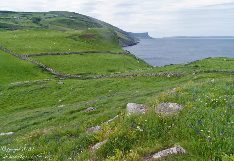
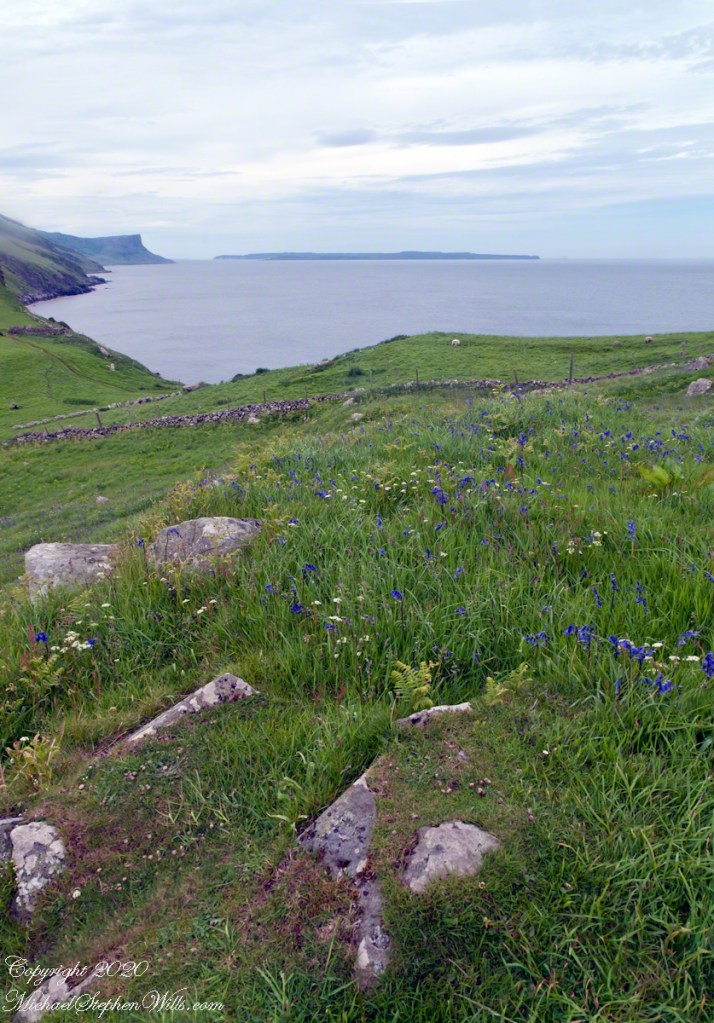
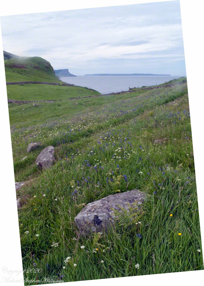
The end result is a view of wildflower meadow, foreground, coastal sheep pastures running up the high hill. Named Greenanmore, the hill is a site notable for a neolithic passage tomb. The distant land across the North Channel water is Rathelin Island.
Here is a slideshow of the corrected images of this series. To visit from WordPress Reader, you need to first click the title of this post to open a new page.
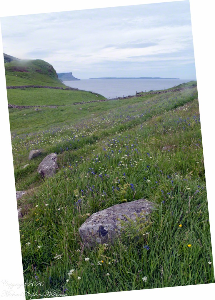
I worked around the crooked horizon, cropping to the wildflower meadow.
Another solution to the crooked horizon is to level, crop, and build out the lost portions, as I did here. Very time consuming….better to keep the horizon level in the camera, difficult for me to remember.
Taking in a wildflower meadow, foreground, coaster sheep pastures. The high hill, midground, is Greenanmore, a site notable for a neolithic passage tomb. The distant land across the North Channel water is Rathelin Island.
Copyright 2020 All Rights Reserved Michael Stephen Wills
Click photograph for a larger view. To do this from WordPress Reader, you need to first click the title of this post to open a new page.
Another solution to the crooked horizon is to level, crop, and build out the lost portions, as I did here. Very time consuming….better to keep the horizon level in the camera, difficult for me to remember.
Here is the second approach to correction of the tilted horizon problem that was first described this post.
A time intensive technique is, after straightening the image, to build out the blank sections. Here is an image after straightening. Corrected image size increases with degree of tilt, measured by the degrees of correction with the area of size increase being blank. It is this blank space that is filled by this technique.
The technique is to open a copy of the image, leaving the original unchanged, then, with Photoshop Lasso tool, select a portion to copy to clipboard, then to the blank space. A great deal of time is consumed by the trail-and-error approach required.
The sky was the simplest, the cliffs most difficult. The grass and flowers were not a difficult as they first appear. I varied feathering with sky the highest (30 pixels), grass and flowers at 10 pixels. Another general maxim is to run the lasso line through pixels the most similar to each other. After pasting use the Move tool to place the new layer.
A common effect to avoid is duplication of image elements. For example, after copying there are duplicates of flowers. This can be corrected through use of the Erase tool to reveal original image elements under the copied layer.
The cliffs on the upper left were impossible to correct. I solved this corner by running the Lasso line through the sky, water and grass. As a result the space between Rathlin and the “mainland” is wider.
Here is a slideshow a straightened, uncorrected and straighted, corrected images. To visit from WordPress Reader, you need to first click the title of this post to open a new page.
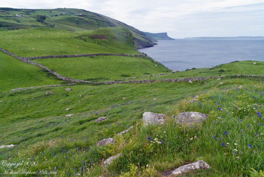
Taking in the foreground, I neglected to maintain a level horizon. Leveling the image results in too much cropping. View from Torr Head, north.
Another solution to the crooked horizon is to level, crop, and build out the lost portions, as I did here. Very time consuming….better to keep the horizon level in the camera, difficult for me to remember.
Copyright 2020 All Rights Reserved Michael Stephen Wills
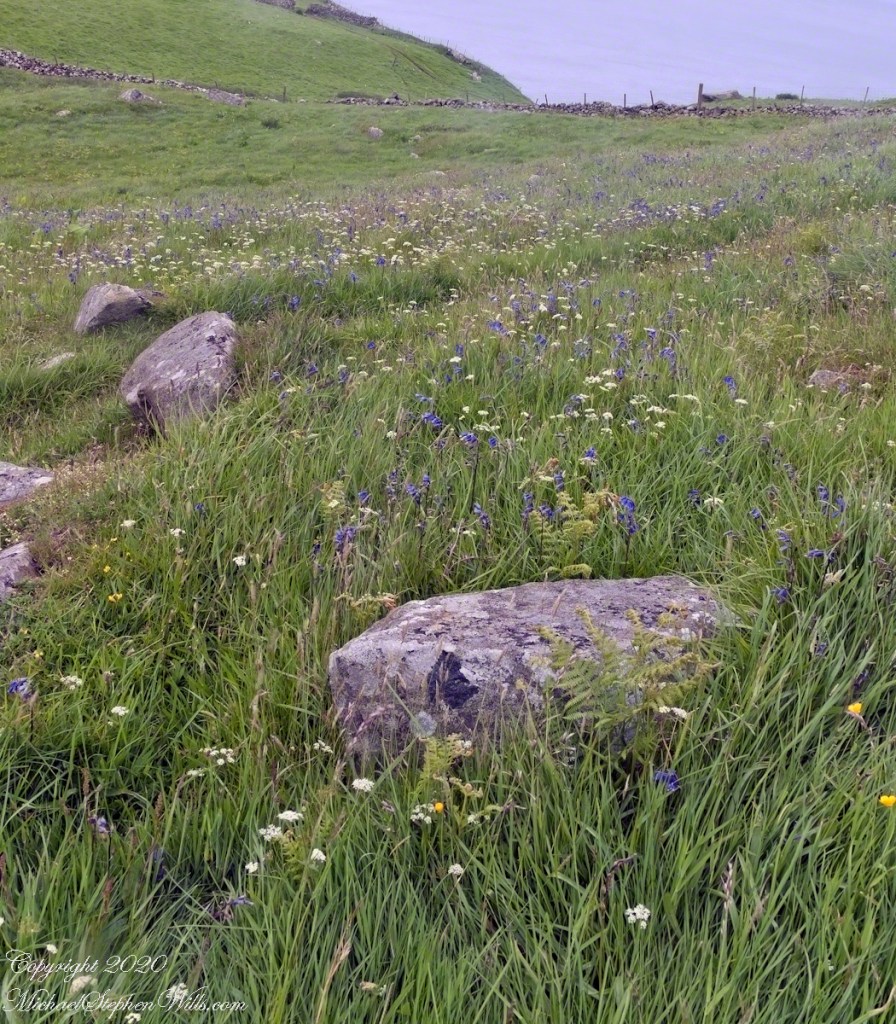
In Photoshop, make a copy of the file and crop out reference to the crooked horizon. In this case, my focus is the wild flower meadow. The raw image was large enough leave enough pixels for a usable image.
Here is a slideshow a straightened, uncorrected and straighted, corrected images. To visit from WordPress Reader, you need to first click the title of this post to open a new page.
Taking in the foreground, I neglected to maintain a level horizon. Leveling the image results in too much cropping. View from Torr Head, north.
I worked around the crooked horizon, cropping to the wildflower meadow.
Copyright 2020 All Rights Reserved Michael Stephen Wills
Click photograph for a larger view. To do this from WordPress Reader, you need to first click the title of this post to open a new page.
For this photograph using a handheld Sony Alpha 700 dslr, taking in the foreground wildflower meadow, I neglected to maintain a level horizon.
Leveling the image results in too much cropping of this view from Torr Head, north. The best approach is to level the camera. When using the handheld technique, I found many lenses have guides in the view finder the horizon can be lined up against. This technique is useful for a tripod mount. Later camera models have a feature that displays a level, handy for use with a tripod. For the handheld technique, these cameras provide a viewfinder leveling grid.
The next few days I will explore some solutions to the problem of corrected for a crooked horizon.
Copyright 2020 All Rights Reserved Michael Stephen Wills
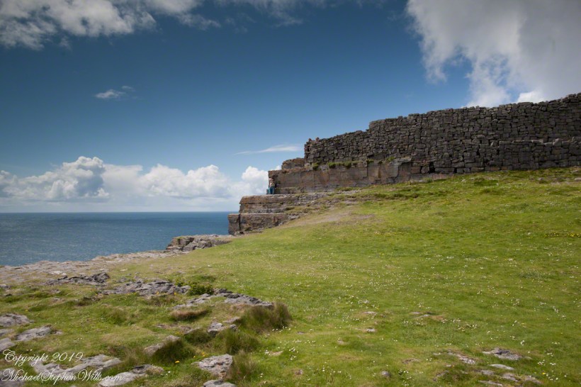
Here is the east side of the inner enclosure wall of Dun Aonghasa (Dun Aengus) where it ends at a cliff edge over the Atlantic ocean.
Visible are the last 60 feet or so of the limestone strata supporting the inner ring.
When first constructed, the inner ring was complete, the western side 1,000 feet from the cliff.. Today’s form of a semi-circle was created by nature when the force of Atlantic Ocean waves eroded the cliff, undercutting the strata.
Look close to see a fracture where the next block of limestone will fall into the waves.
Ancient fort wall with tourists and Cliff Edge of Dun Aonghasa (Dun Aengus)
Wishing a blessed All Saints Day (November 1st) for all my readers.