Dawn’s Gift: A Beachcomber’s Tale
As the first light of dawn stretched its golden fingers across the horizon, I made my way down the familiar path to Cocoa Beach. It was an early January morning, and the air was crisp, with a hint of salt carried on the gentle breeze. The tide was high, giving the beach an intimate feel, as if the ocean itself was reaching out to share its secrets.
I’ve always found beachcombing to be a meditative experience, but today’s stroll was particularly enchanting. The beach was deserted, save for the scuttling sandpipers searching for their breakfast. The rhythmic crash of the waves provided a soothing soundtrack to my thoughts. As I walked, my eyes scanned the shoreline, seeking treasures among the flotsam of the sea.
A Striped Treasure Unveiled
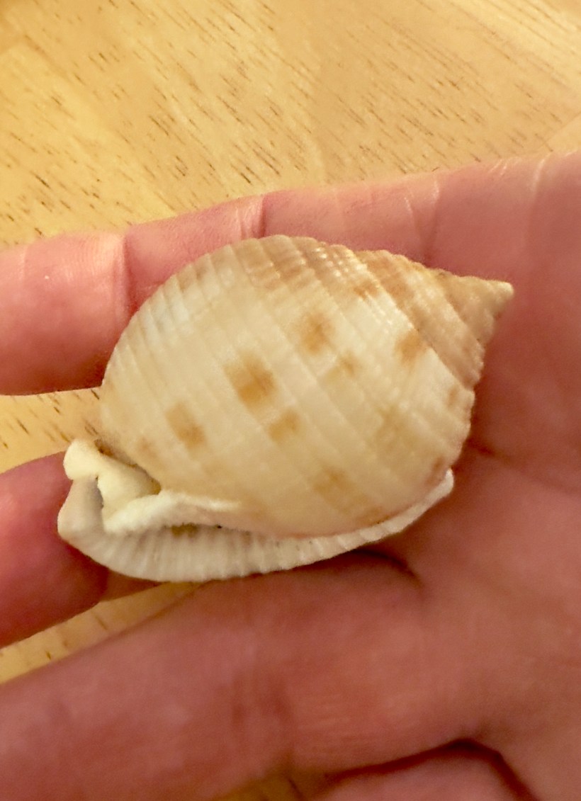
And then, I saw it—a distinctive shell caught between the ebb and flow of the waves. Its bold pattern and unique shape were unmistakable even from a distance. I quickened my pace, eager to claim my prize before the sea could reclaim it. As I picked it up, water cascading off its curved surface, I marveled at the beauty in my hand: a Scotch Bonnet shell, a rarity to behold, especially here in Florida.
The Allure of the Scotch Bonnet
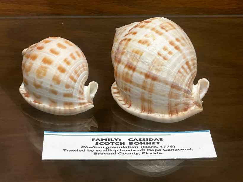
The Scotch Bonnet, named for its resemblance to the traditional Scottish tam o’ shanter hat, is a shell as fascinating as it is beautiful. Its scientific name, Phalium granulatum, speaks to the granulated texture that adorns its exterior. In my hand lay a symphony of creamy white and tan, with bold, brownish squares that resembled a carefully woven tartan. It was a mature specimen, its wide aperture and thickened outer lip suggesting it had lived a full life before arriving at my feet.
A Journey Through Nature’s Cycle
Fascinated by my find, I visited the Brevard County Museum of Natural History later that day. There, I learned that the Scotch Bonnet is more than just a pretty shell—it’s the former home of a gastropod, a creature that once crawled along the ocean floor of the Atlantic, from North Carolina to Brazil. These mollusks begin life as tiny larvae, floating in the currents until they grow large enough to settle on the seabed. They feast on sea stars, their radula—a toothy tongue—scraping their prey into digestible pieces.
The Scotch Bonnet’s predators are as varied as the ocean itself, from fish to other sea snails that prey upon the young or unsuspecting. Yet, the shell’s thick construction provides a sturdy defense, a fortress that serves its inhabitant well during its life.
Death Gives Life
The end of the Scotch Bonnet’s life cycle often provides a beginning for others. After death, the empty shell becomes a sought-after real estate for hermit crabs and a canvas for encrusting organisms like barnacles. It’s a reminder of the interconnectedness of the marine ecosystem, where even in death, life flourishes.
In the quiet of the museum, I reflected on the journey of the shell in my pocket. It was not just a Scotch Bonnet; it was a chronicle of survival, adaptation, and ecological significance. It was a legacy of the ocean’s depth and a symbol of life’s tenacity.
The Scotch Bonnet: A Symbol of Coastal Beauty
As I left the museum, I thought about the Scotch Bonnet’s significance to beachcombers and collectors. Its scarcity makes it a coveted find, a gem among shells. To hold one is to touch a piece of the ocean’s mystery, to connect with a world that is often beyond our reach.
That January morning on Cocoa Beach, the high tide had gifted me a treasure. But it wasn’t just the discovery of the Scotch Bonnet that was precious—it was the reminder that beauty and wonder can be found in the smallest of ocean’s offerings. Every shell has a story, a past woven into the fabric of the marine world. And as I pocketed my find, I carried with me not just a shell, but the echoes of an underwater tapestry, rich and alive, just waiting to be discovered.