An expert surfer takes a wave near Jetty Pier Park, Cape Canaveral, Florida. Taken with an Apple IPhone 8.
Long Ride
An expert surfer takes a wave
An expert surfer takes a wave
An expert surfer takes a wave near Jetty Pier Park, Cape Canaveral, Florida. Taken with an Apple IPhone 8.
Ghosts from the future?
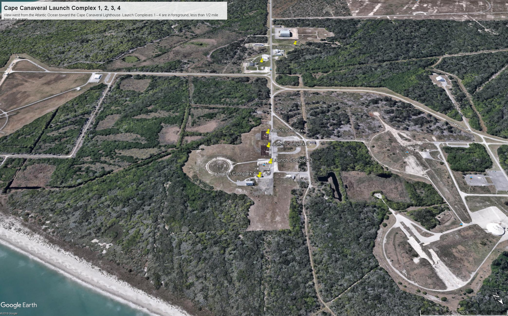
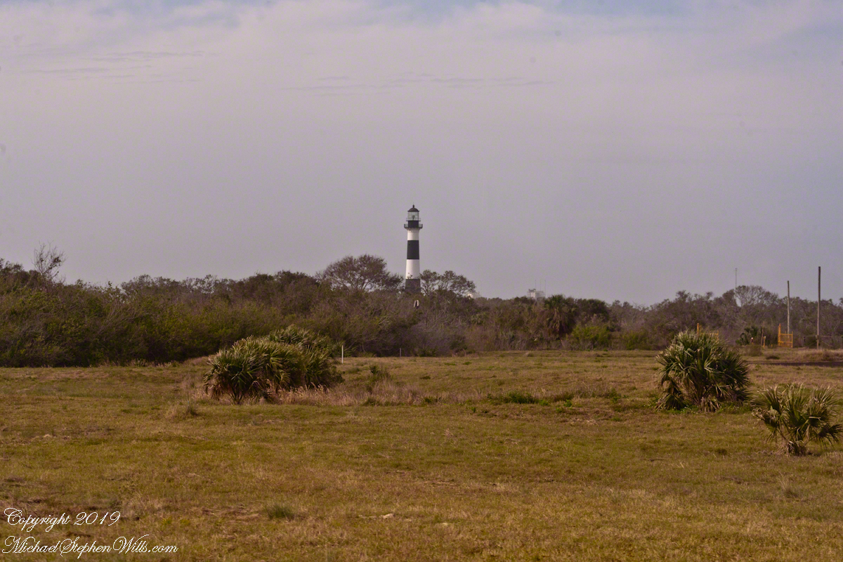
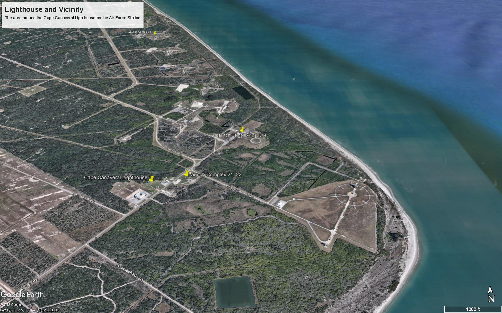
Here is the fifth in a series of photographs centered on the early history of space flight on Cape Canaveral mostly taken during a tour organized by the Cape Canaveral Lighthouse Foundation. “Google” the foundation for details of future tours. Here we explore the sites of the first launches on the Cape, Launch Complexes 1, 2, 3, 4. (LC 1 – 4).
Our bus proceeded east on Lighthouse Road past Launch Complexes 21 and 22 in less than half a mile we were within the first sites of the United States Space age, sites with the lowest numbers, LC 1 – 4.
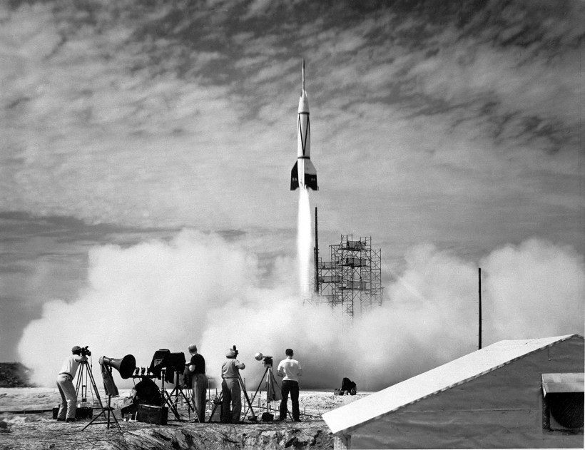
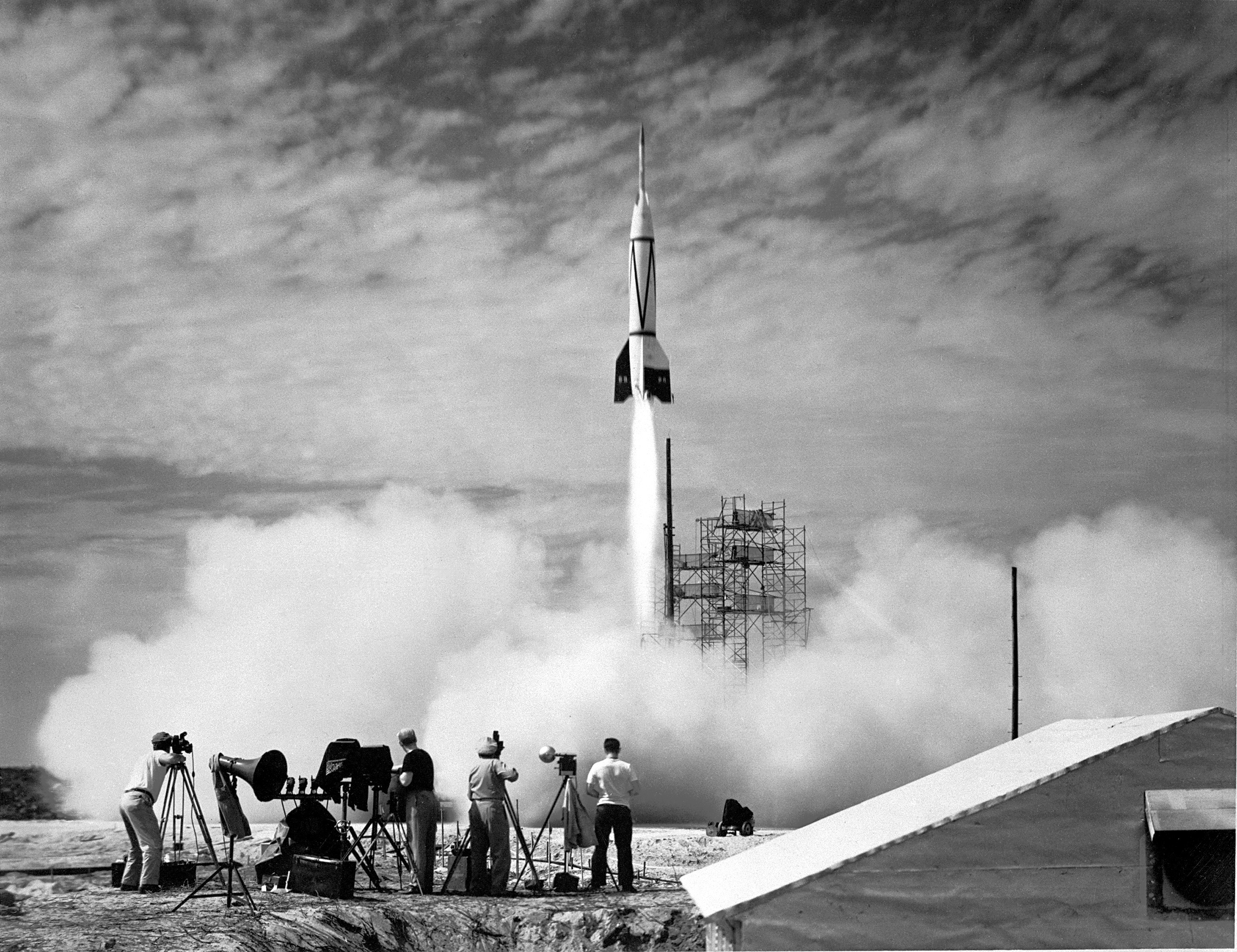
If, instead of distance, the bus traveled back in time 68 years to July, 1950 we would be witness to the first United States space launch of the two-stage “Bumper 8”, a former “V2” missile topped by a WAC Corporal that reached 248 miles above the earth, about where the International Space Station circles now.
Almost certainly, the man who designed and directed the production of the Nazi V2, Werner vonBraun, was perched on the lighthouse a half-mile distant.
The Nazi “vengeance weapon 2”, the V2, a device so horrifying British authorities claimed the first V2 attacks to be “gas explosions” rather than admit a Nazi weapon descended without warning. Beginning September, 1944, over 3,000 V2’s landed on London, Antwerp and Liège resulting in an estimated 9,000 deaths, mostly civilians. 12,000 forced labor and concentration camp slaves died in the construction of the production facilities captured by the Soviet Union during the collapse of the Nazis. These victims, arms linked, will form a circle 15.9 miles in circumference around the Bumper 2 launch.

von Braun and key V2 personnel surrendered to the Americans and, along with enough parts to construct 80 V2s, were taken to the United States. His direction of US missile development lead eventually to the enormous Saturn rocket that lifted three men to the moon, so good came from our bet on vonBraun and the V2.
In January, 2018, firmly in the present, our bus approached these now “deactivated” sites driving down Lighthouse Road. Confined to the bus, I used my Canon EOS 1Ds Mark III and the EF 70-300mm f/4-5.6 IS USM lens to capture these scenes.

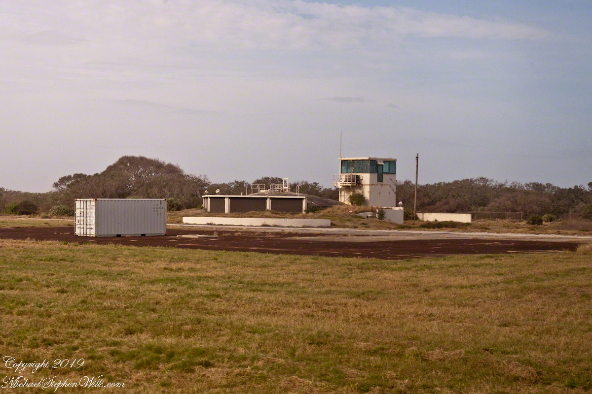
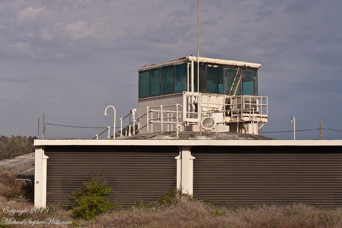
I can almost see someone behind the glass, enjoying a blast of air-conditioned air, dry and cool.

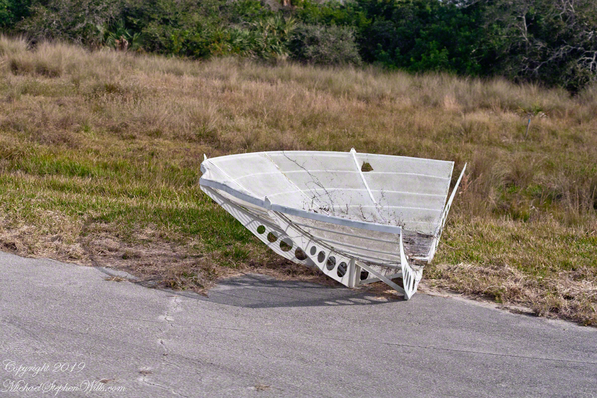
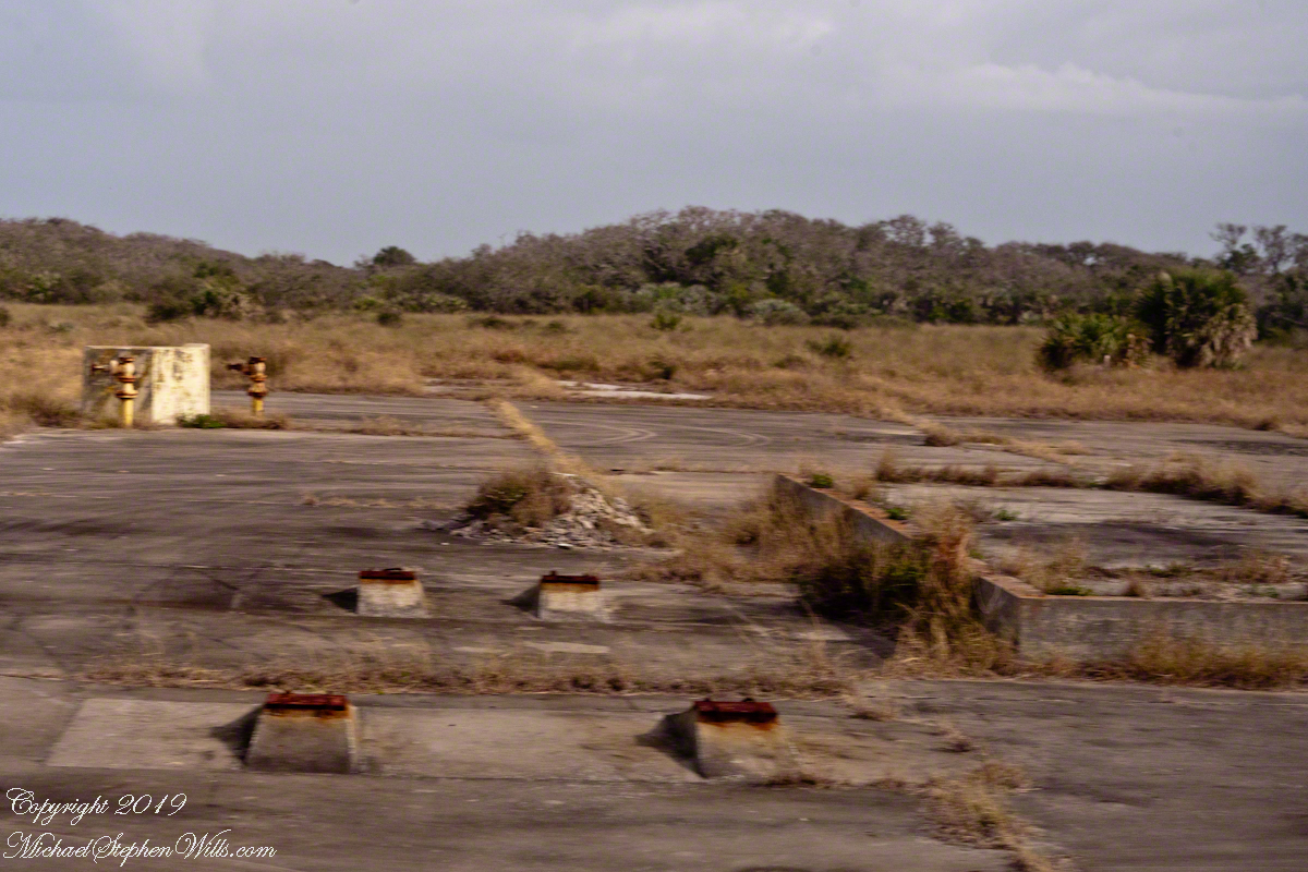
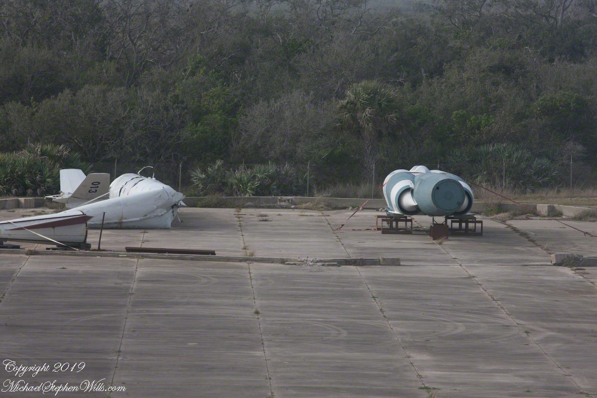
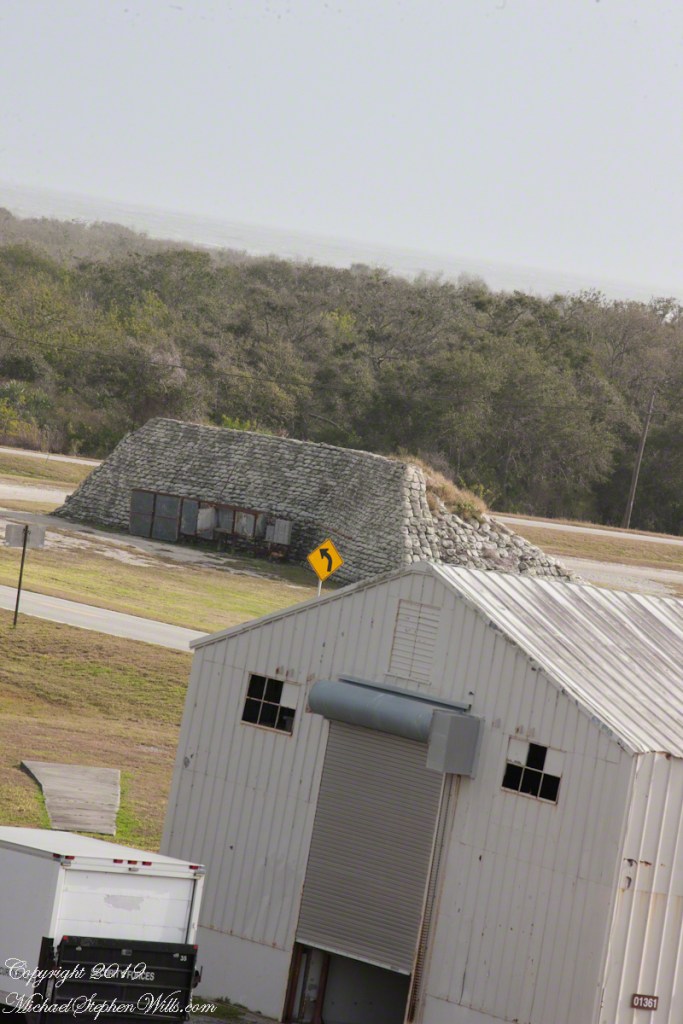
From 1950 into the 1960’s LC 1-4 saw launches of cruise missiles, some of which were able to maneuver and land on the “skid strip” you can pick out on the “21,000 V2 Victims” image, above. A positive discovery from my research on wikipedia the weapon systems tested here were not fired in anger. Continued development in other places lead to production of generations of cruise missiles launched by Presidents Clinton and Bush against Afghanistan, Iraq and (??) other targets. What victim ghosts, arms linked in ever growing circles, are lurking in our future?
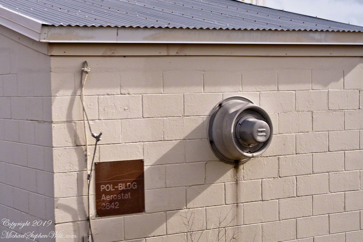
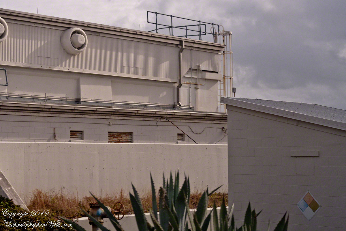
A building on LC 4 has the designation “Aerostat”, one of the last projects supported. I saw an aerostat in action in the early 2000’s over Fort Huachuca, Arizona near the border with Mexico. An aerostat is a flying craft that does not rely on moving air to achieve lift, balloons for example.
The Goodyear blimp is a memory from my childhood on Long Island, the Fort Huachuca aerostat was a smaller version, outfitted with advanced technology for monitoring the surrounding environment. “Google” aerostat mexican border to learn more about the current deployment.
With the development of Intercontinental Ballistic Missiles (ICBMs) the facilities of LC 1 – 4 became obsolete. ICBMs are a theme of the next installment of this series.
Sources of information for this post: I used information from the Wikipedia site for the key words V-2, Launch Complex 1, Launch Complex 2, Launch Complex 3, Launch Complex 4. The Bumper 8 launch photograph caption includes a source citation.
Decoys and Cruise Control
Here is the fourth in a series of photographs centered on the early history of space flight on Cape Canaveral mostly taken during a tour organized by the Cape Canaveral Lighthouse Foundation. Google the foundation for details of future tours. Here we explore the sites closests to the Lighthouse: Launch Complex 21 and 22.
Vergeltungswaffe 1 (Vengance Weapon 1 AKA V-1), produced at Peenemünde on the Baltic Sea was first used against Great Britan by Germany one week after the D-day landings. 8,025 of these flying bombs, the first cruise missles, caused the death of 22,892 people, mostly civilians. The first cruise missles for the USA were developed less than 1,000 feet away from the lighthouse. After touring the lighthouse we boarded the bus to visit these sites, Launch Complex 21 and 22.
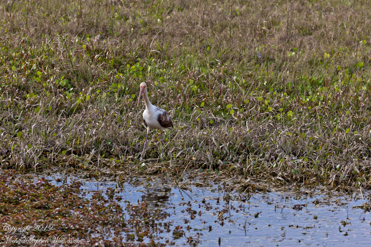
Nature abounds in Cape Canaveral Air Force Station. This ibis hunted near the lighthouse on our way to Launch Complexes 21,22.
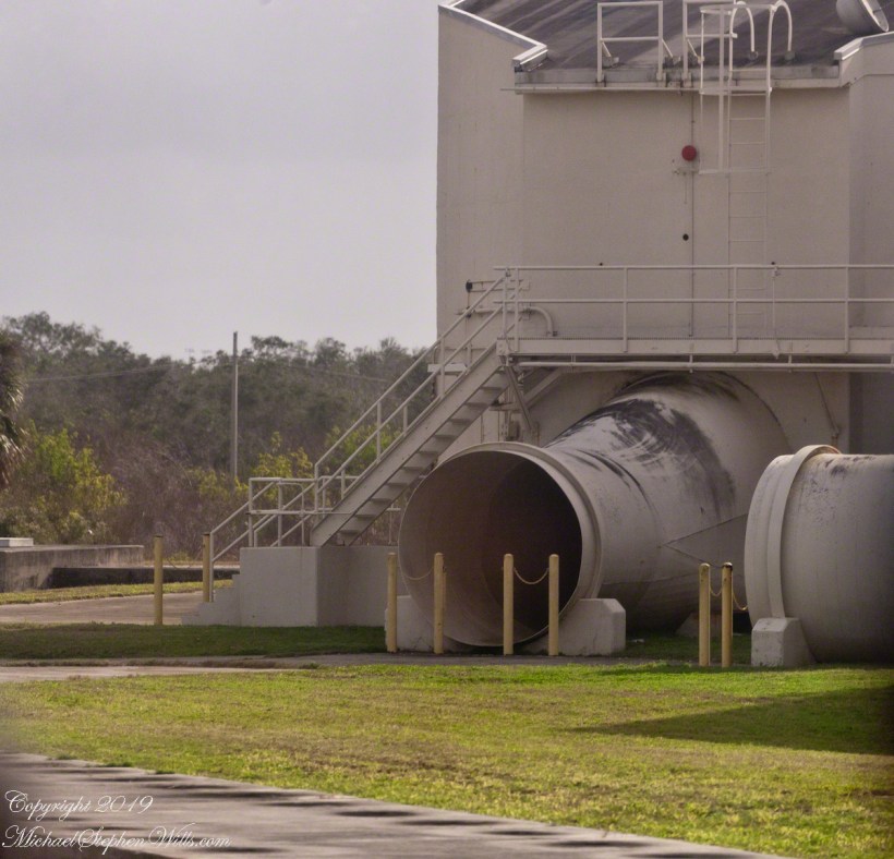
We passed close to the blockhouse first viewed in my post, “Lighthouse and Rockets,” and I captured this detail of the long abandoned structure. The last test launch of a Mace missle was June, 1960.
This wreckage photograph was part of my,“Lighthouse and Rockets” post. It was taken from a lighthouse portal. It is a type of cruise missle, although I cannot identify the exact type, comparing the engine, on the right, with available photographs of the “Bull Goose” and “Mace” missles developed here.
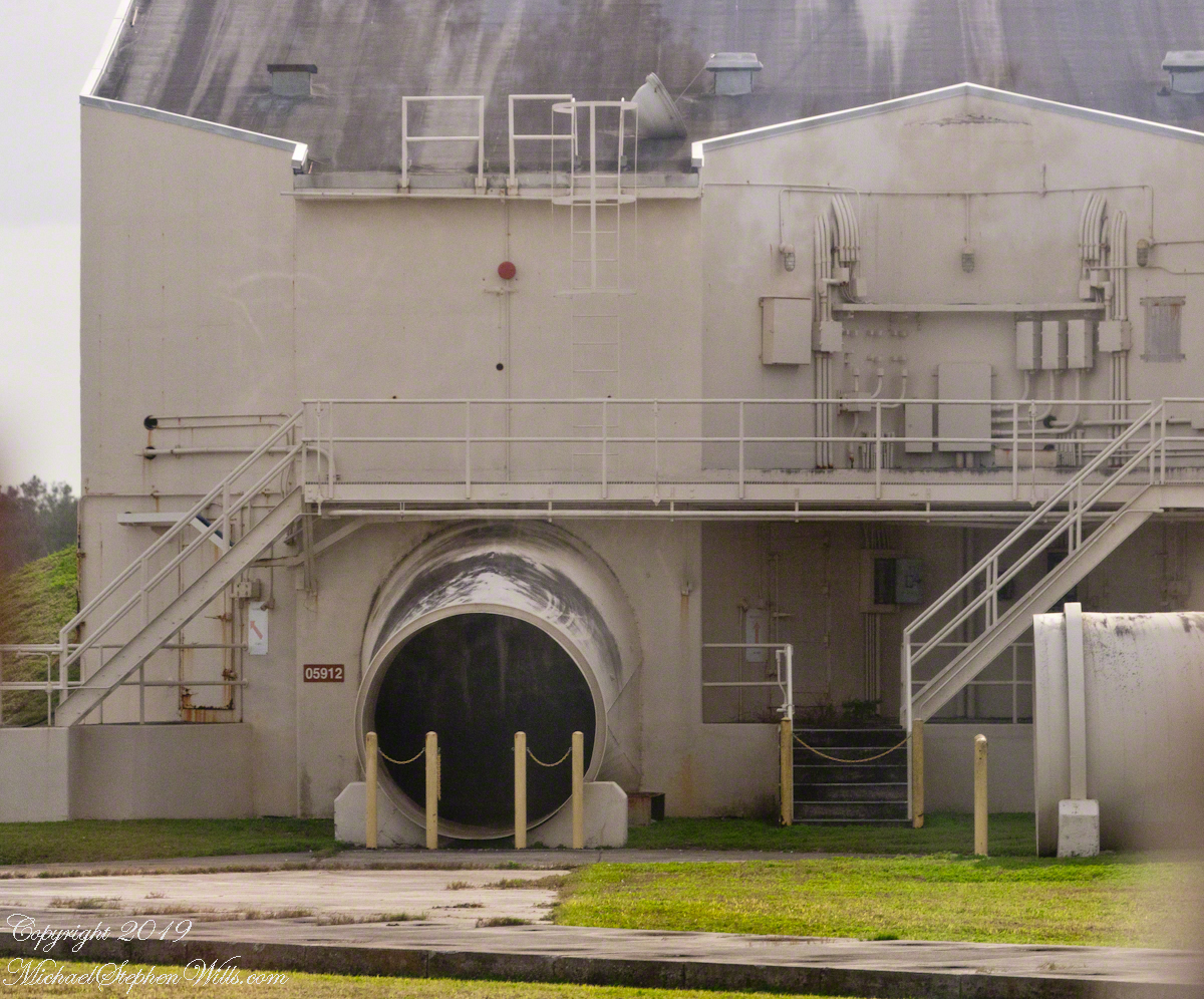
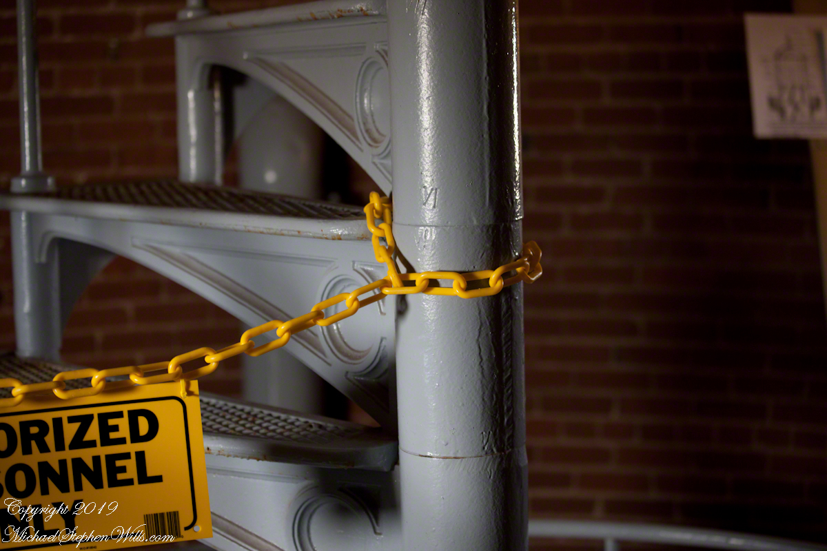
Rail launched, as was the German V-1, the missles developed here were called “Bull Goose” and “Mace.” Bull Goose was a delta winged craft intended as a decoy, to appear on radar as a strategic bomber during a nuclear attack. At that time, the rails were in the open. The building here was a revampment of the site for development of the Mace. The other side of this structure is open, the launch rail pointed up from the rear. There are two launch rails, numbered 1 and 2. The building placard is “05961,” the numeral “1” designates site 1. The use of numbers of designate a site is unusual. Letters are used elsewhere on Cape Canaveral and Kennedy Space Center.
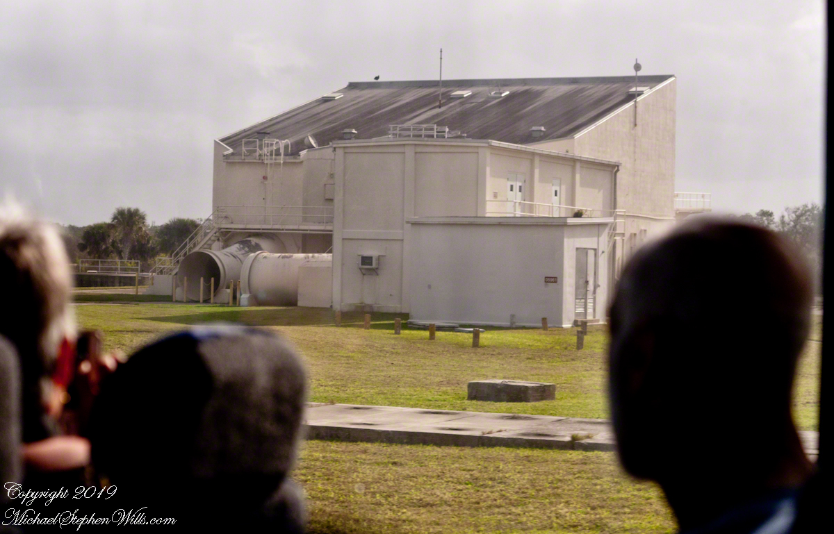
The powerful rocket exhause was directed though these pipes. Site 1 is on the right.

Navigation is a crucial requirement for cruise missles. The Bull Goose used a gyroscope with no reference to surroundings. The guidance system held the launch bearings, a successful flight was completed within 115 nautical miles of the target.
If deployed, the plan was for thousands of these missles to launch 1 hour before the attack craft set out and 1 hour after. The missles were not armed, but would descend in the thousands around the targets. Similar to what the Germans did to civilians in England.
After three years and 136.5 million dollars the Bull Goose was cancelled because it could not simulate either the B-47 Stratojet or B-52 Stratofortress nuclear bomb delivery aircraft. Not a single decoy was fired in anger.
The Mace, for which this building was created, used a guidance ATRAN (Automatic Terrain Recognition And Navigation, a radar map-matching system). The map was produced on a 35 mm film strip carried on the missle, the live radar returns were “matched” against the film with course correction made for differences. The Mace was of limited usefulness due to the lack of radar maps for target areas within the Soviet Union. The Mace was deployed to Germany and South Korea until phase out in 1969.
Sources of information for this post: I used information from the Wikipedia site for the key words V-1, Launch Complex 21, Launch Complex 22, Mace, Bull Goose.
from Roman Numerals to Rockets
Here is the third in a series of photographs centered on the early history of space flight on Cape Canaveral mostly taken during a tour organized by the Cape Canaveral Lighthouse Foundation. Google the foundation for details of future tours. Here we start with Roman Numerals and end with Rocket Research.
We were lucky to be on this tour, for a period of time the Air Force closed off the Lighthouse. The Lighthouse Foundation obtained permission to start this tour in 2016 (this was January 2018) and I happened to discover it while poking around in preparation for the SpaceX “Falcon Heavy” launch in early February 2018.
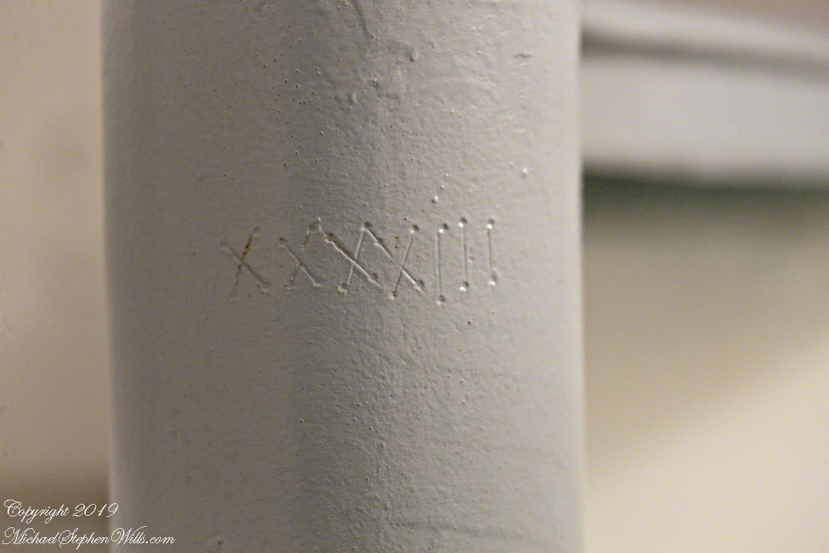
As Pam and I climbed, each floor docent (volunteer guide) was so helpful with information and hospitality. At the last floor, the stairway to the upper floors was roped off. Top levels were closed, Cape Canaveral Lighthouse is operational. Here is a photograph of the closed off staircase. There is a roman numeral “6” (VI) inscribed in the staircase column. This is the numbering system described in the first post, “Cape Canaveral Lighthouse,” by which the entire 151-foot lighthouse can be disassembled/reassembled as was done in the 19th century.
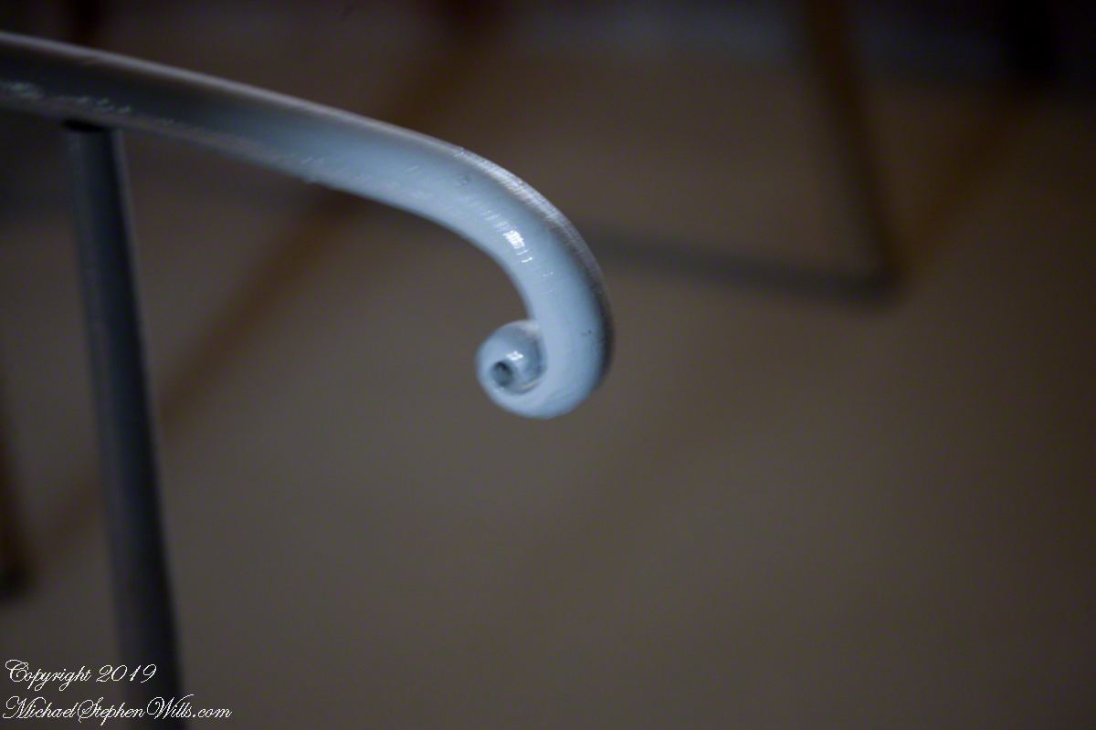
The fine finish of the handrail termination for the stairs to upper floors is an example of 19th century attention to detail.
Macro of numeral inscription on a lower floor stairway column.
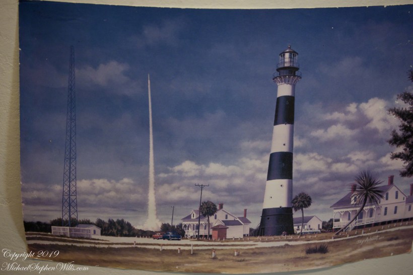
The lower staircase support column was much wider with space for illustrations and displays. Here is a reproduction of a watercolor of the lighthouse from the earliest days of rocketry on the cape. The lighthouse keeper, assistant and their families lived alongside the tower. The housing was later razed. The Lighthouse Foundation is raising money to build reproductions of the housing.
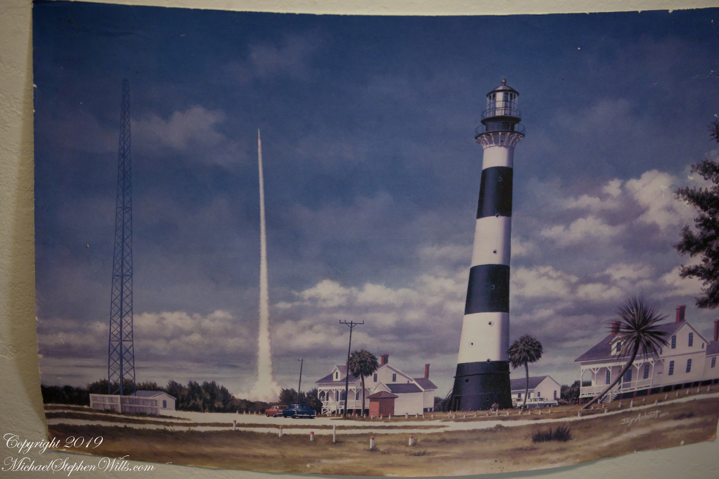
The painting is an accurate representation of the tower. The dark spots are the windows, or portals, captured in my last post, “Lighthouse Details.” Every portal offered a view of historical or current rocketry. In the following photograph, beyond the outbuilding, is a blockhouse, protection for the early rocket scientists, now abandoned. The structure services launch complex 21 and 22. More in a later post.
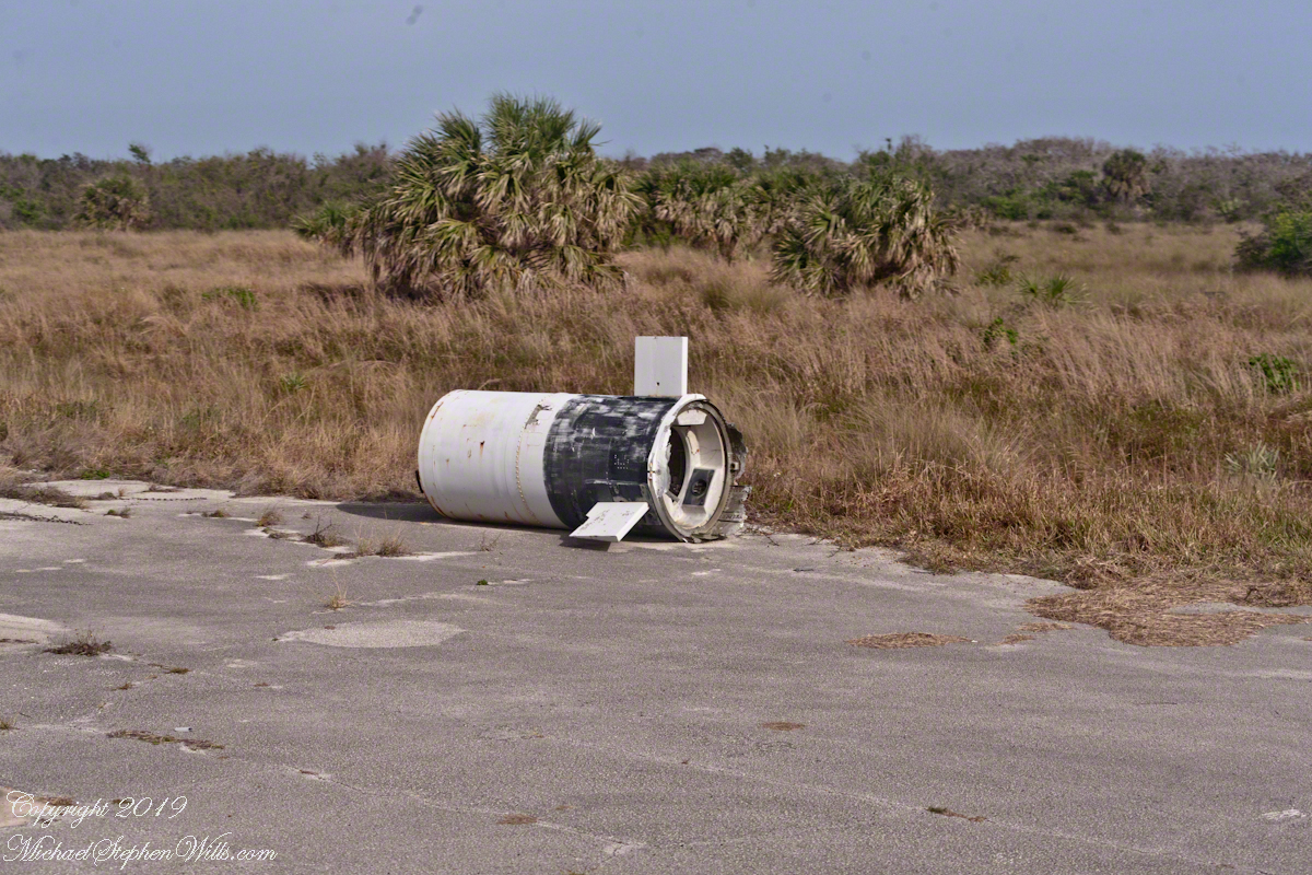
Depending on your viewpoint, the landscape around the tower is either littered with or graced by relics such as the wreckage in the following photograph.
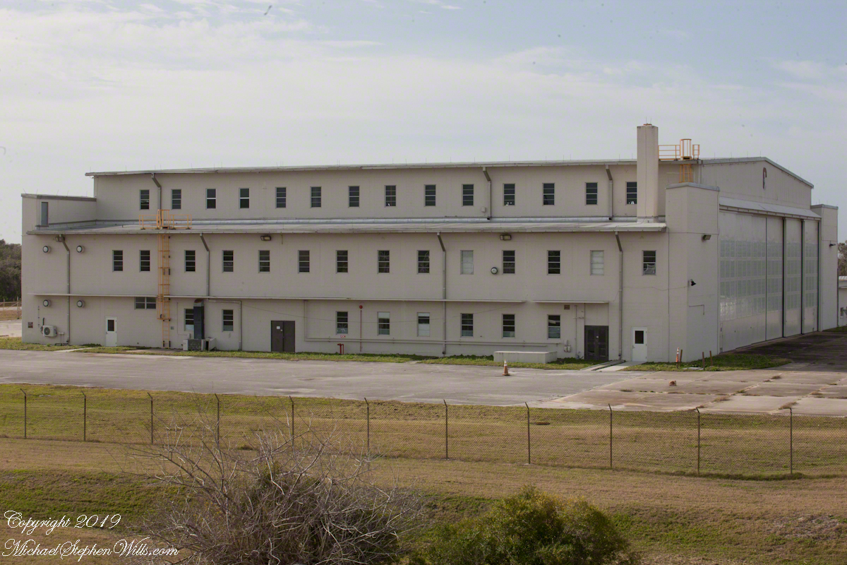
As we stood on the exterior staircase, looking toward the building in the following photograph, the docent told a story of Werner von Braun, how he loved to smoke cigarettes and watch rocket tests from the top of the lighthouse. After some spectacular failures, for reasons of personal safety he was excluded from the tower. His office during the development of the Minute Man and Persing missiles was in this building.
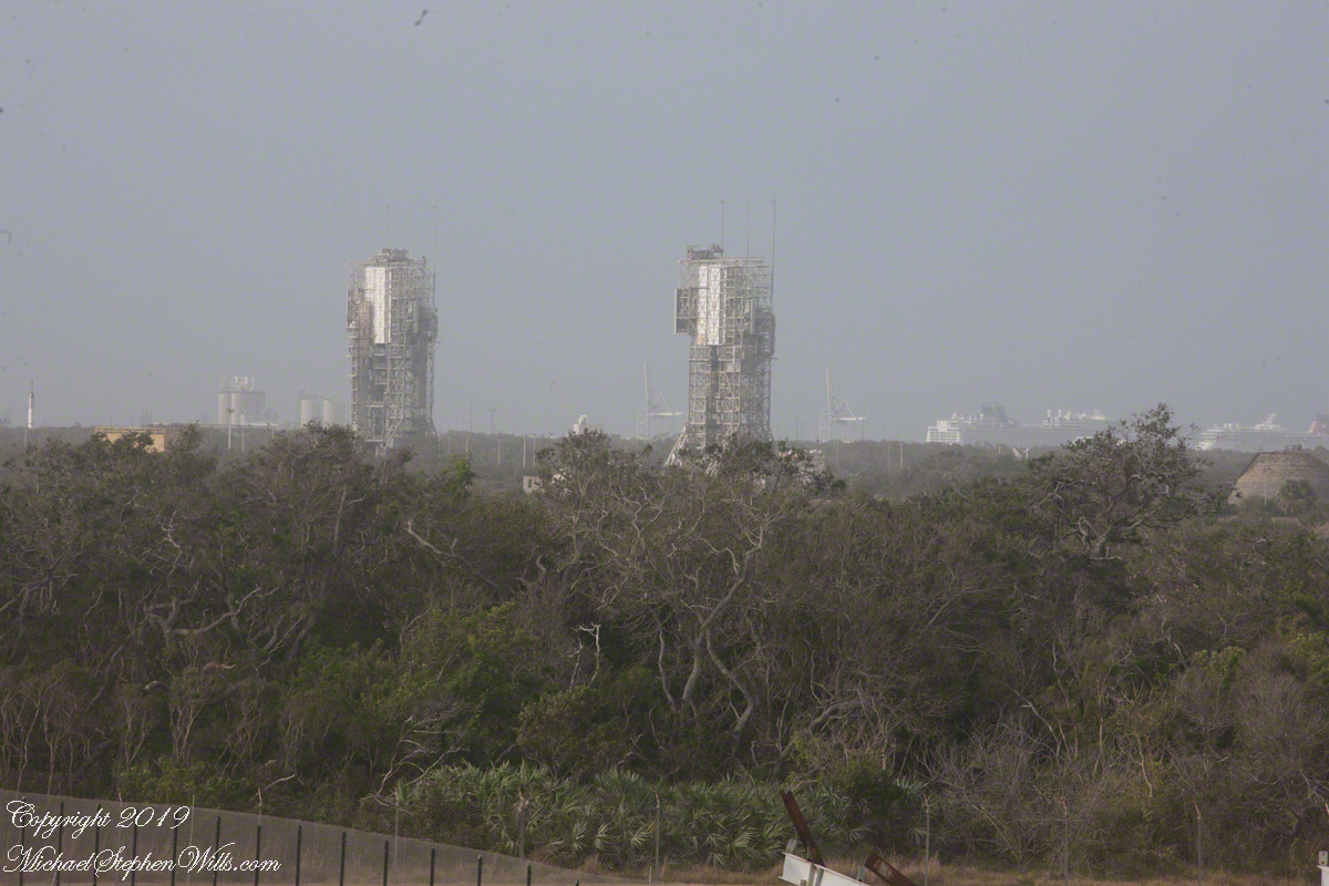
This view overlooks the former sites of Minute Man and Persing rocket development. Beyond the launch towers is Port Cape Canaveral, visible to the right are large cruise ships.
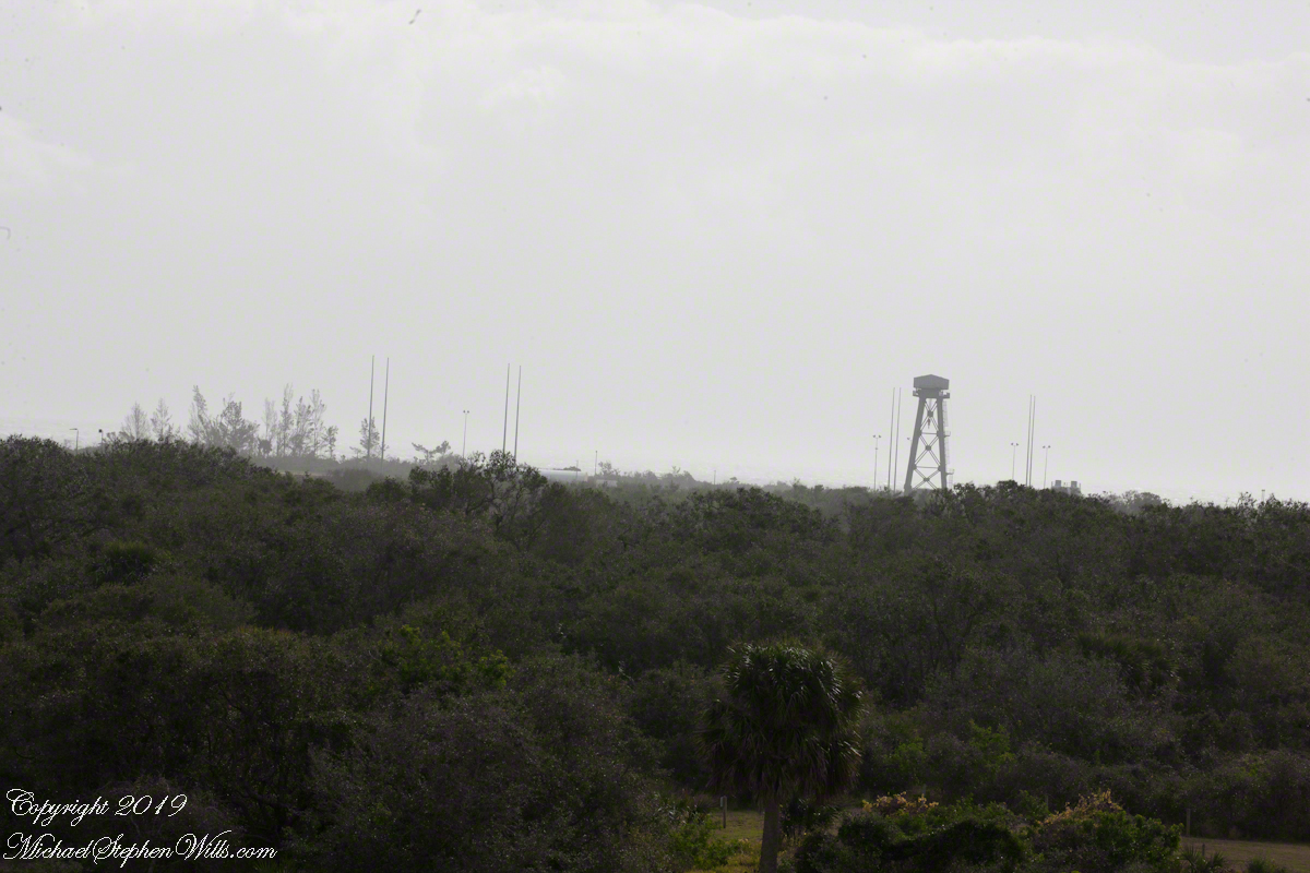
Looking from portals facing northeast is this view across ICBM road and its many launch sites. We will visit these in a future post.

Step onto the sands of Cape Canaveral and witness the majestic departure of the Adventure of the Seas—feel the sea’s call in this tranquil yet vibrant maritime farewell.
As I walk along the stretch of Cape Canaveral Beach, the soft crunch of shells underfoot and the rhythmic lull of the waves create a symphony of natural tranquility. The sand is cool and firm, a consequence of the tide’s playful retreat.
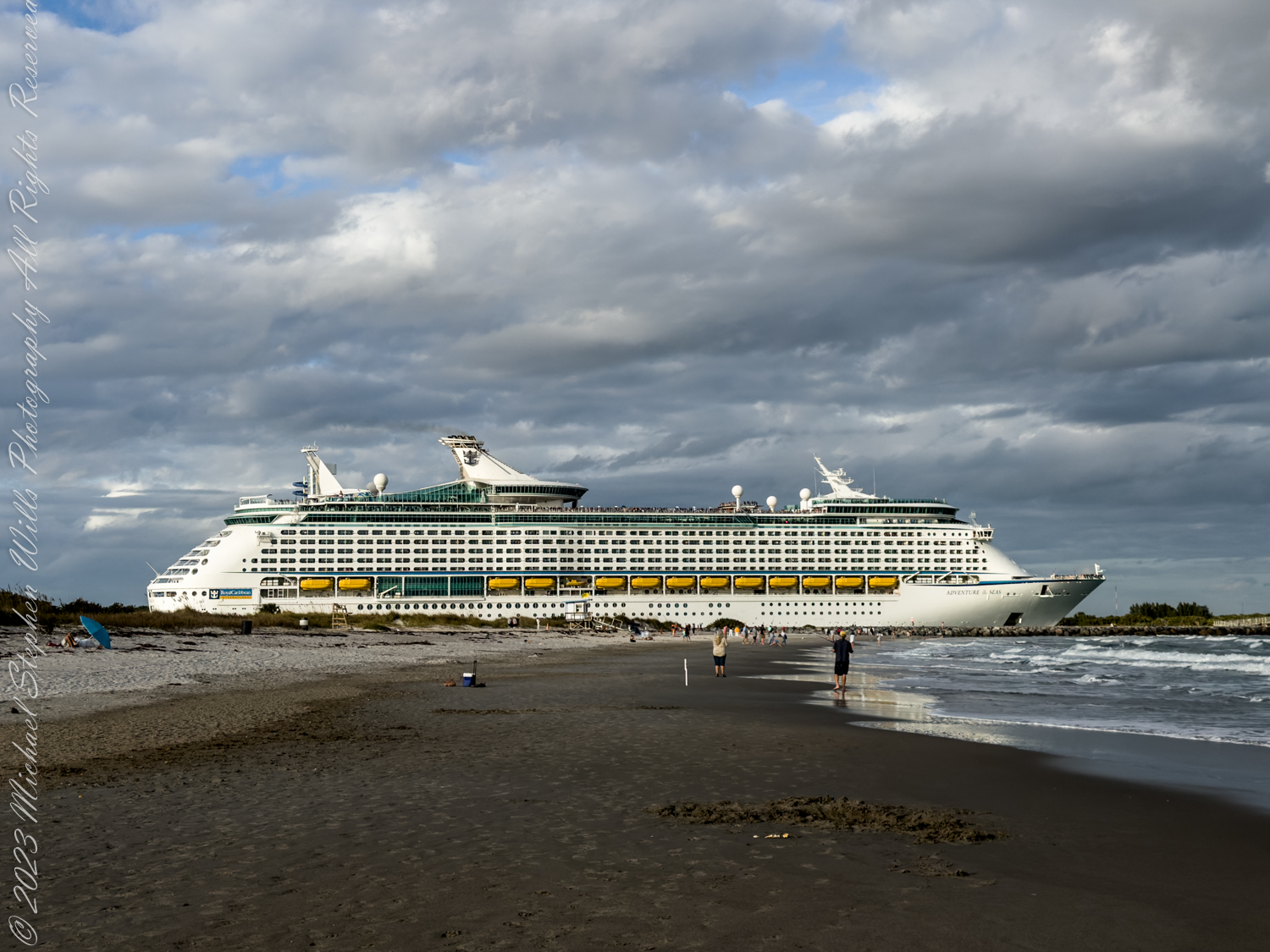
The beach is a canvas of human relaxation. Families are sculpting sandcastles, while others are sprawled on towels, soaking up the hesitant sun that plays peek-a-boo with the clouds. The beachgoers are a mix of the attentive and the oblivious, the latter lost in books or surrendering to the lull of the ocean breeze. Children’s laughter punctuates the air, as unfettered as the seagulls that dance above.
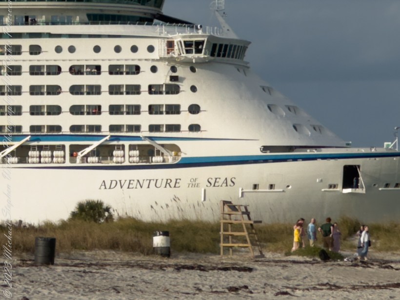
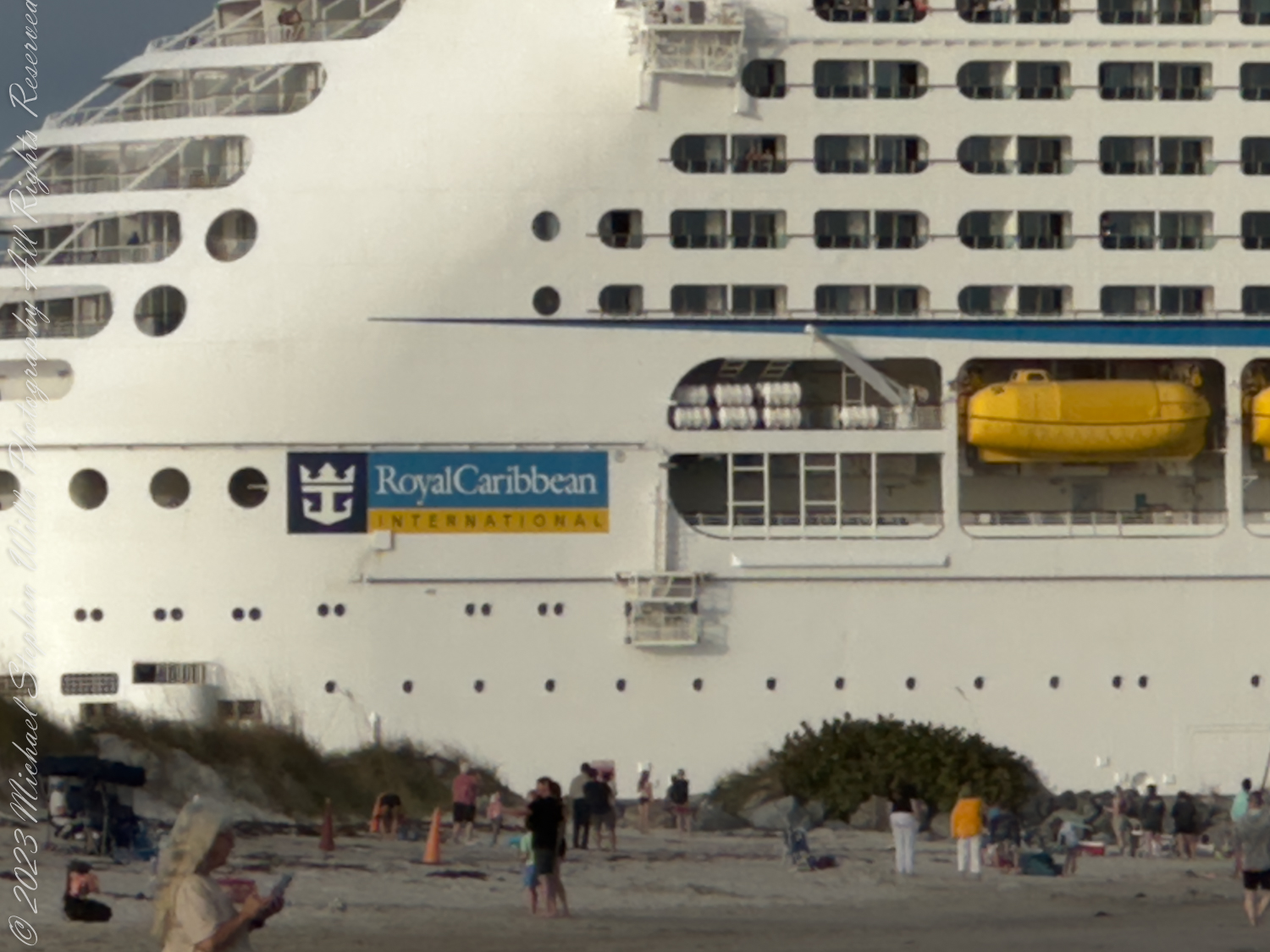
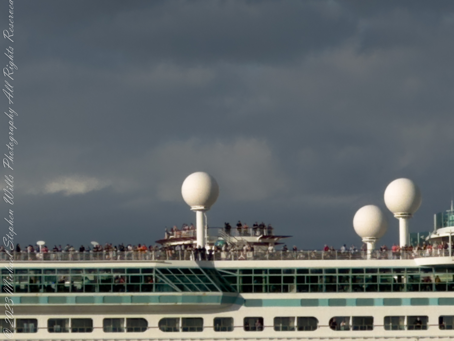
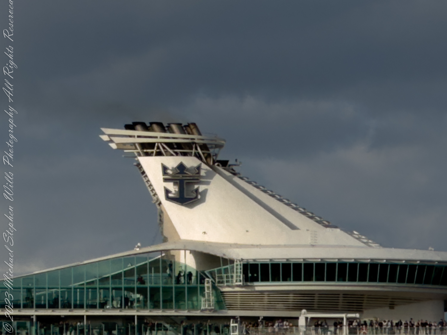
And then, there it is—the grandeur of the ‘Adventure of the Seas,’ a Royal Caribbean marvel, cutting a fine figure, dwarfing the jetty. The juxtaposition is startling. Here on the shore, life is leisurely and measured in moments and tides. Out there, on that floating citadel, time is about to be sliced into days and nights of Caribbean adventure. The ship, immense and sovereign, is like a skyscraper laid on its side, a testament to human ingenuity and the desire to explore beyond the water’s edge.
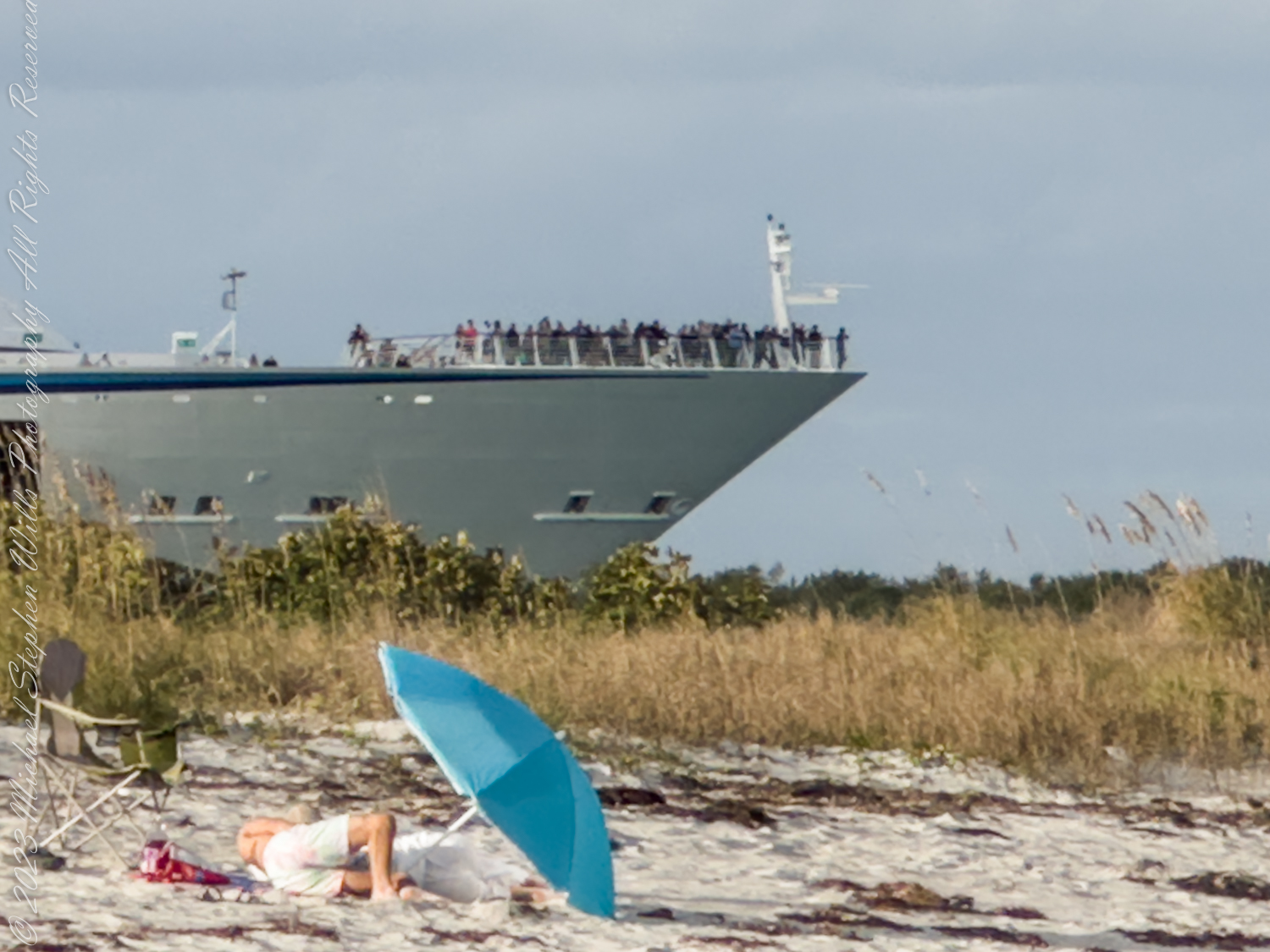
I can’t help but feel small as I watch the ship’s gentle departure, a behemoth gliding on the water with a grace that belies its size. On its decks, the passengers are tiny figures, distant and yet full of stories. Among them stands one passenger on the bow, just outside the safety of the fence—a silhouette against the vastness of the sea. A soul brave enough to step out of the bounds, perhaps seeking a moment of solitude before melding into the ship’s communal tapestry.
The air is laden with the salty tang of the ocean and the murmur of human voices. The beach, a haven of repose, and the ship, a vessel of discovery, create a harmony of contrasts. It’s a poignant reminder of life’s beautiful dichotomies—the stillness and the movement, the familiar and the unknown.
As the ship picks up pace, making its way towards its first destination on an 8-night voyage through the Eastern Caribbean, I’m captivated by the thought of the worlds it will touch. Ports like Labadee, Puerto Plata, and Charlotte Amalie await the footprints of those aboard, each stop an opportunity for stories yet to be written.
I imagine the passengers, soon to be awash in the colors, sounds, and textures of distant lands, while I remain, feet buried in the sand, a keeper of the threshold between land and sea. The vessel’s wake is a fading signature on the water, a reminder of the paths we choose and the adventures we seek.
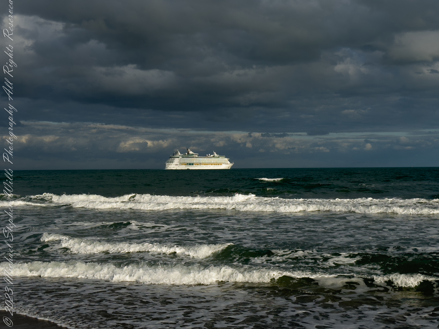
The last glimpse of ‘Adventure of the Seas’ is a postcard-perfect vision, a snapshot of human endeavor set against the canvas of nature’s immensity. And as it disappears from sight, the beach slowly reclaims its quietude, the momentary disruption of departure ebbing away like the tide.
In the quiet aftermath, I’m left with a sense of wonder and a yearning for the unknown. The ship’s journey has stirred a wanderlust within me, a desire to set sail on my own journey, to find new horizons beyond the comforting embrace of the shore. But for now, I’m content to walk this beach, to carry the image of that grand departure, and to dream of the day when I, too, will step beyond the fence and into the vast embrace of the sea.

This post shares photographs and stories from the early history of spaceflight at Cape Canaveral including the tragic Apollo 1 mission and astronaut John Glenn’s first orbital flight.

The post provides historical insight into the early space flights at Cape Canaveral, emphasizing their significance and risks.
Dive into our captivating photo series for a closer look at Cape Canaveral’s lighthouse daymark—your visual gateway to a beacon of history and humanity’s reach for the stars.
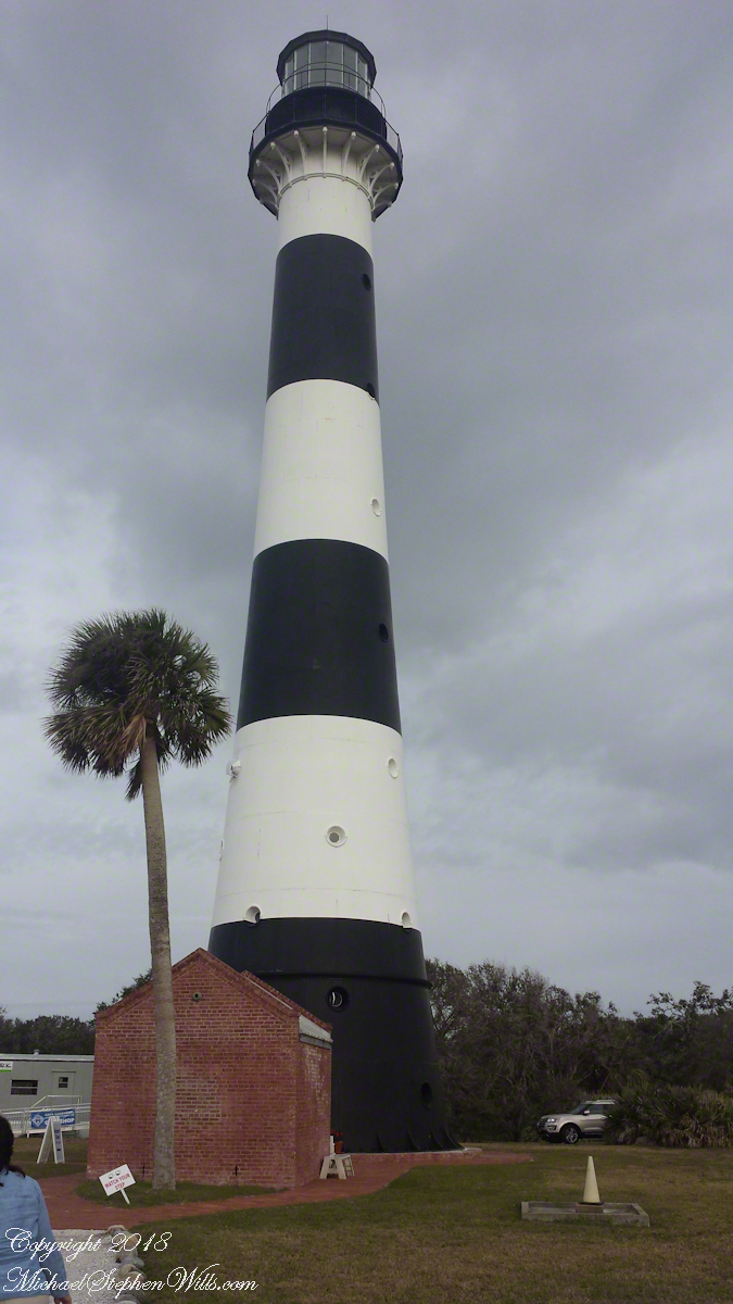
Step into a snapshot of history with the first of a series on early space flight at Cape Canaveral, where the lighthouse stands as a silent guardian over tales of sea and sky.
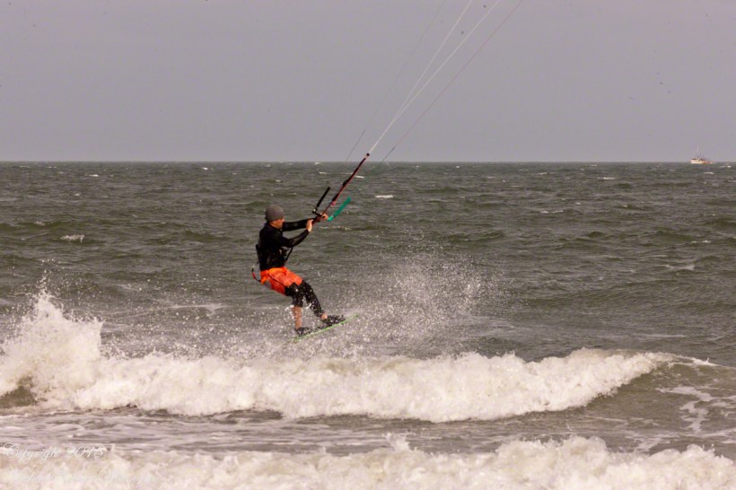
three shots in one second
For a change of scene we visited Cape Canaveral, the beach at Cherie Down Park were an informal gathering of Kite Surfers was underway. Here is a series of action shots, one second elapsed from first to last.
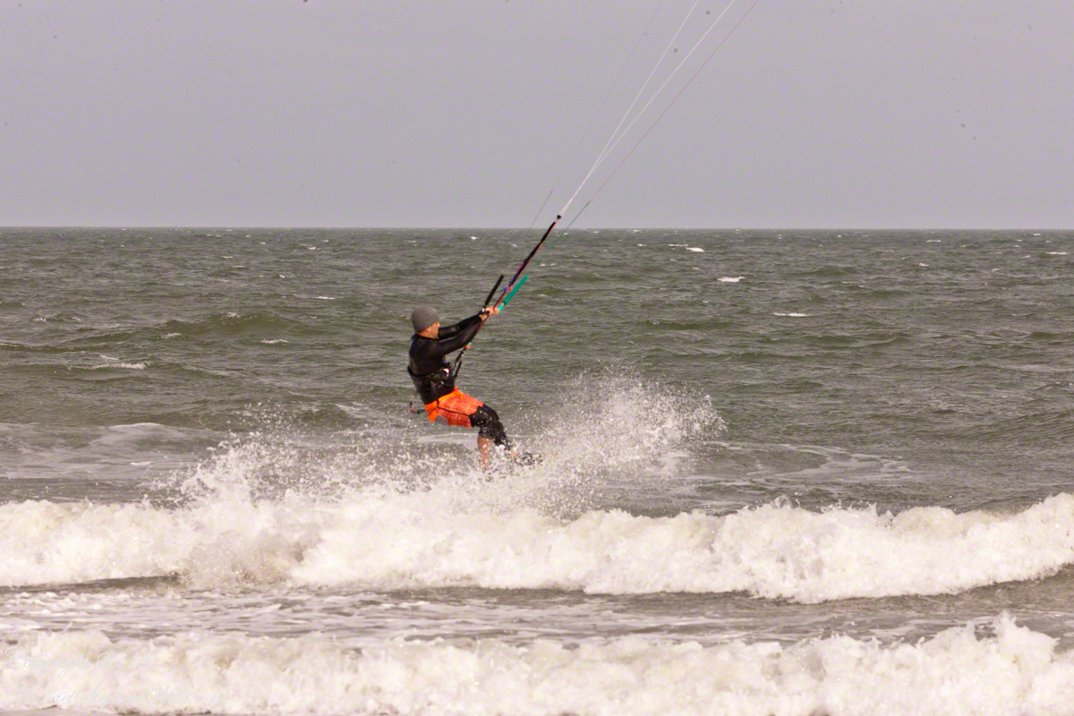
Conditions were excellent: good northerly wind, the sun overcast and, it being afternoon, in the west. Surfers stayed relatively close to shore, near their starting point. I had packed the “heavy gun” camera with a tripod.

Panning the scene (swiveling on the tripod), the camera in rapid exposure mode, I pressed the shutter release and held it down.
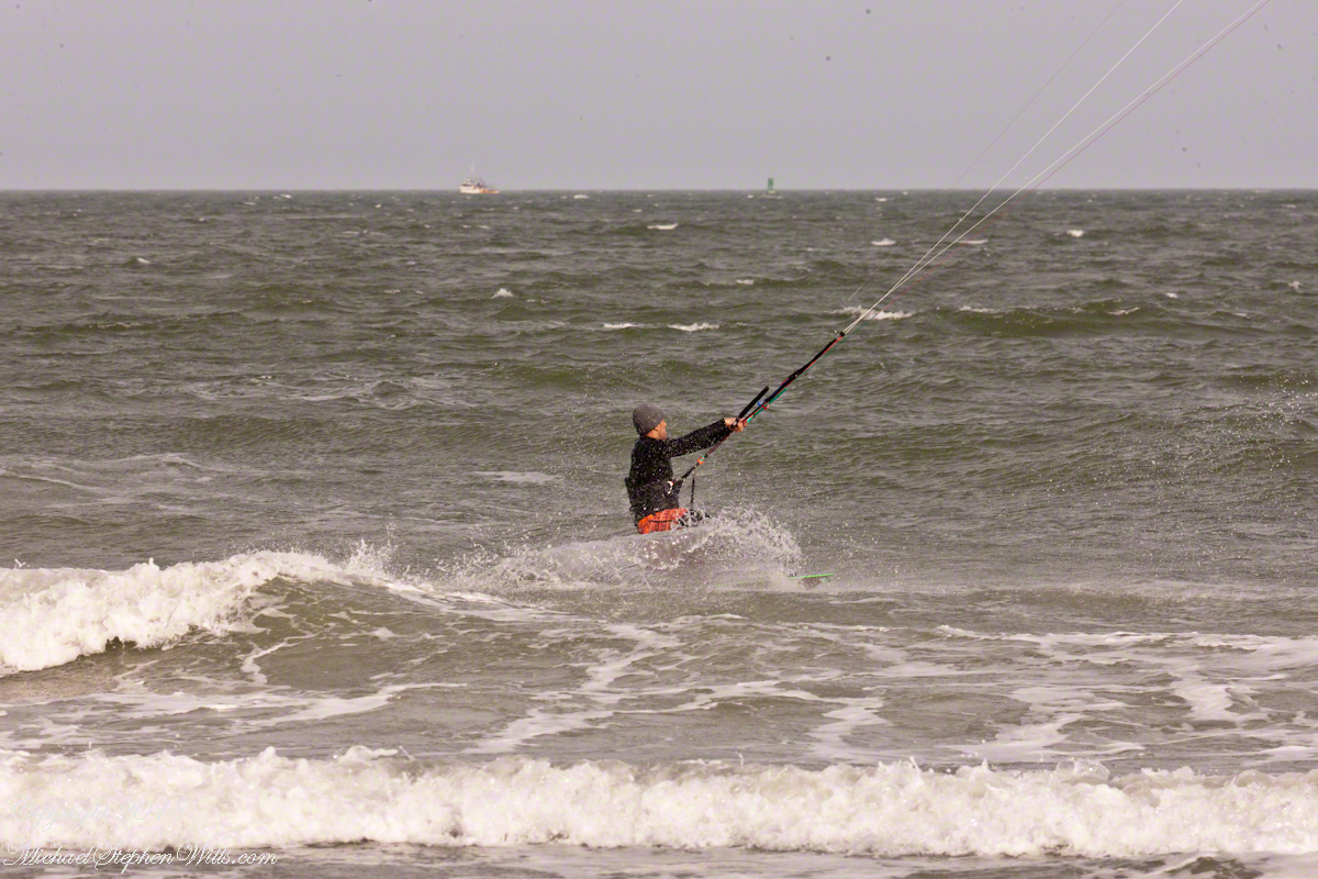
The surfer was captured mid-jump to landing.
