Iquique by Sea VI

Experience the breathtaking approach to Iquique, Chile, capturing the vibrant life of fishermen, the majestic beauty of Punta Negra, and the resilient spirit of this coastal community. Join us on a journey from sea to shore.

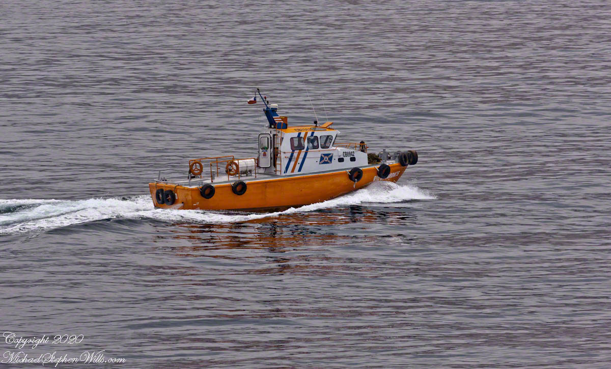
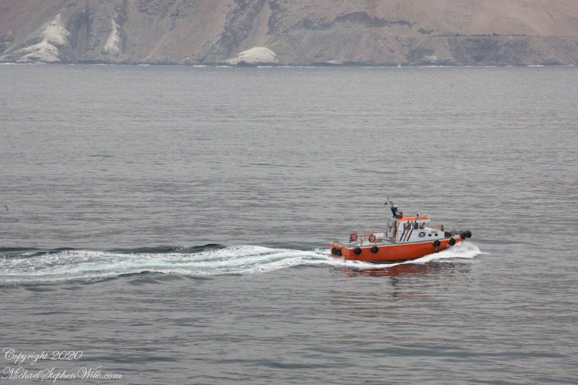
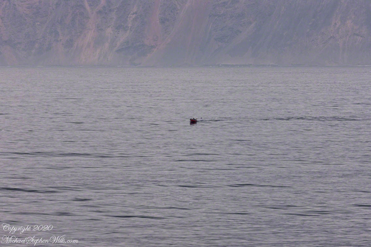
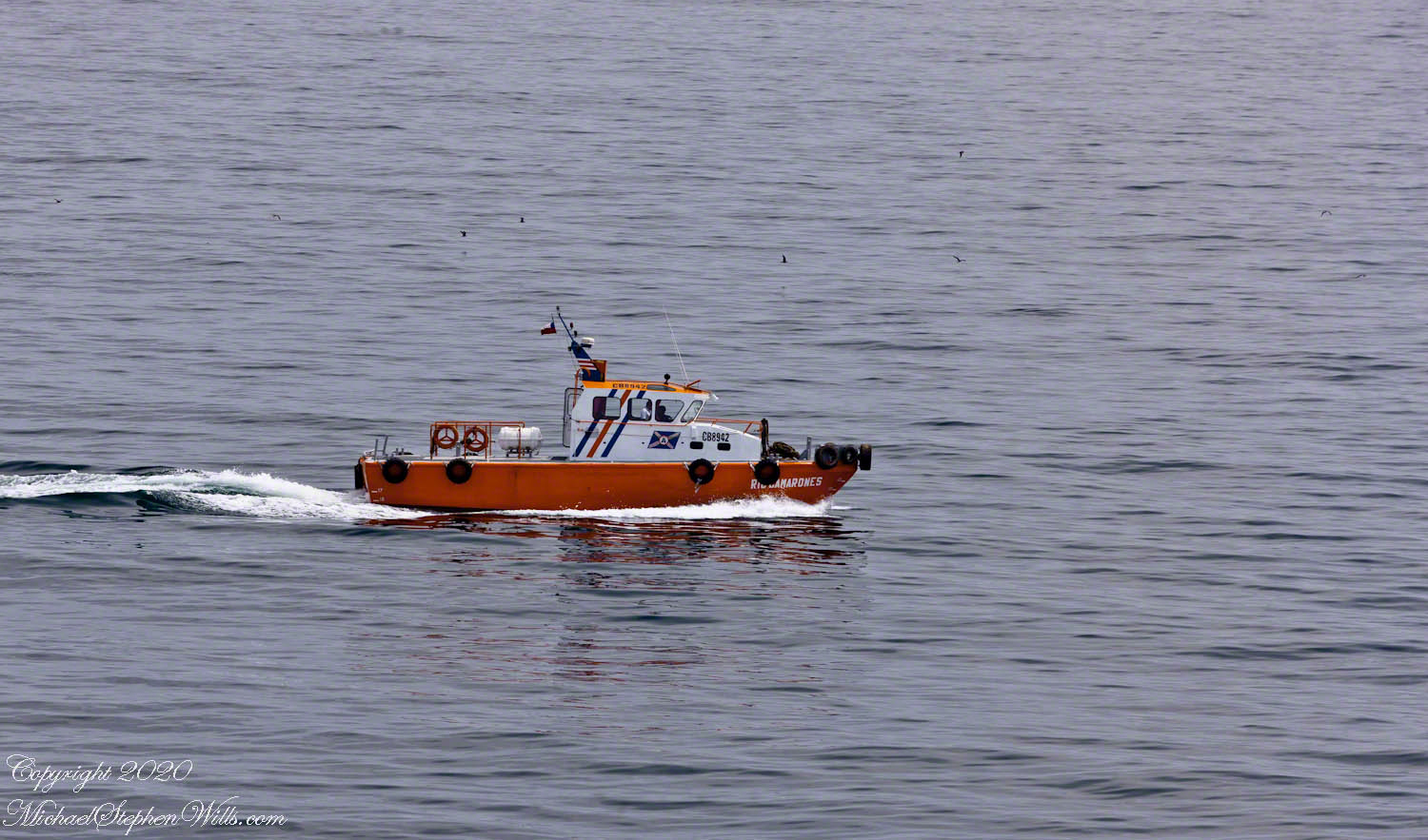
Forty-one minutes have passed, and we are now close to the anchorage site. The pilot boat, with its vibrant orange hull, cuts a striking figure against the serene blue gray of the sea. This small but vital vessel plays an essential role in the complex choreography of maritime navigation, guiding larger ships safely through treacherous waters.

Click any photograph for a larger view and use Ctrl-x to zoom in closer.

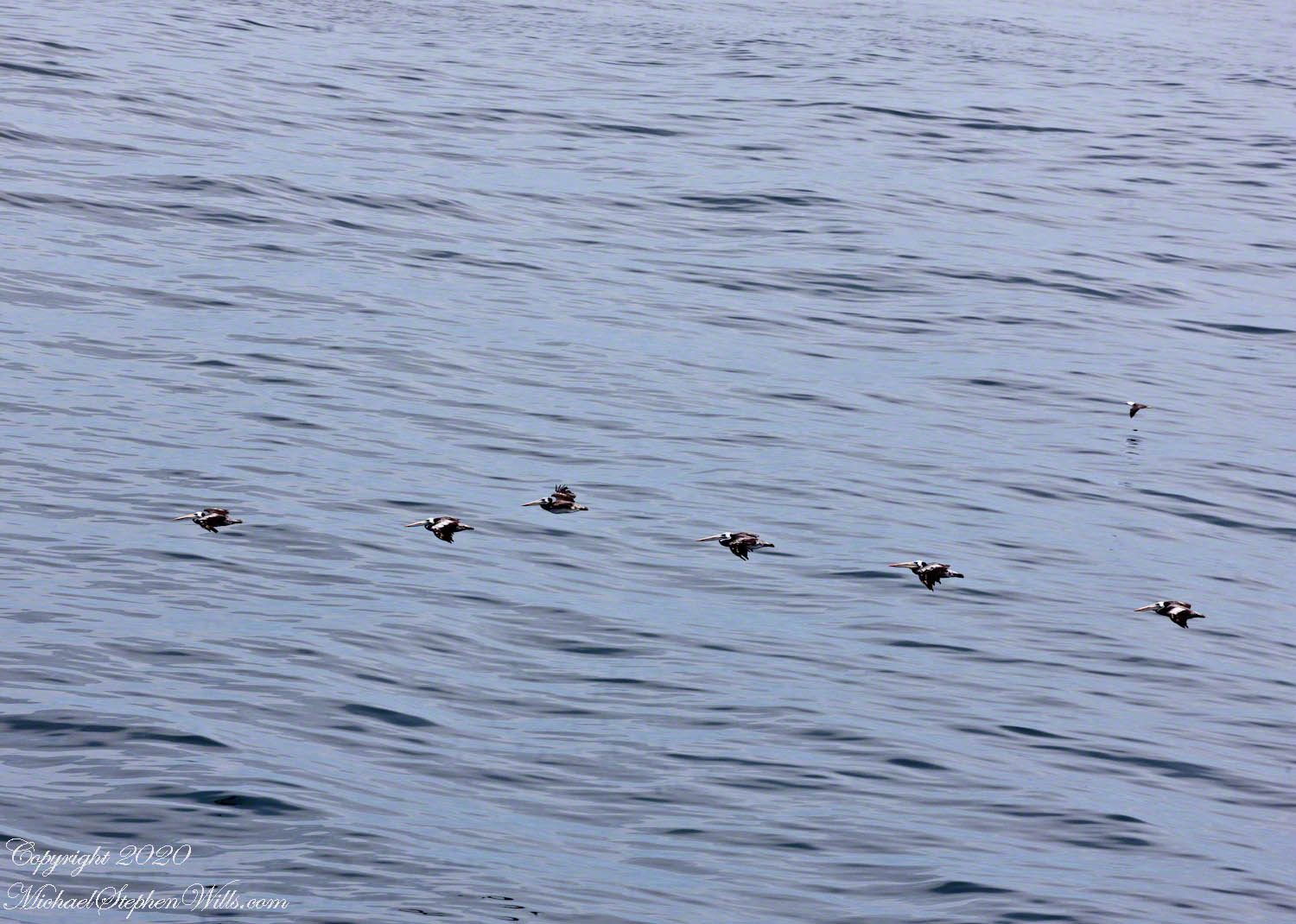
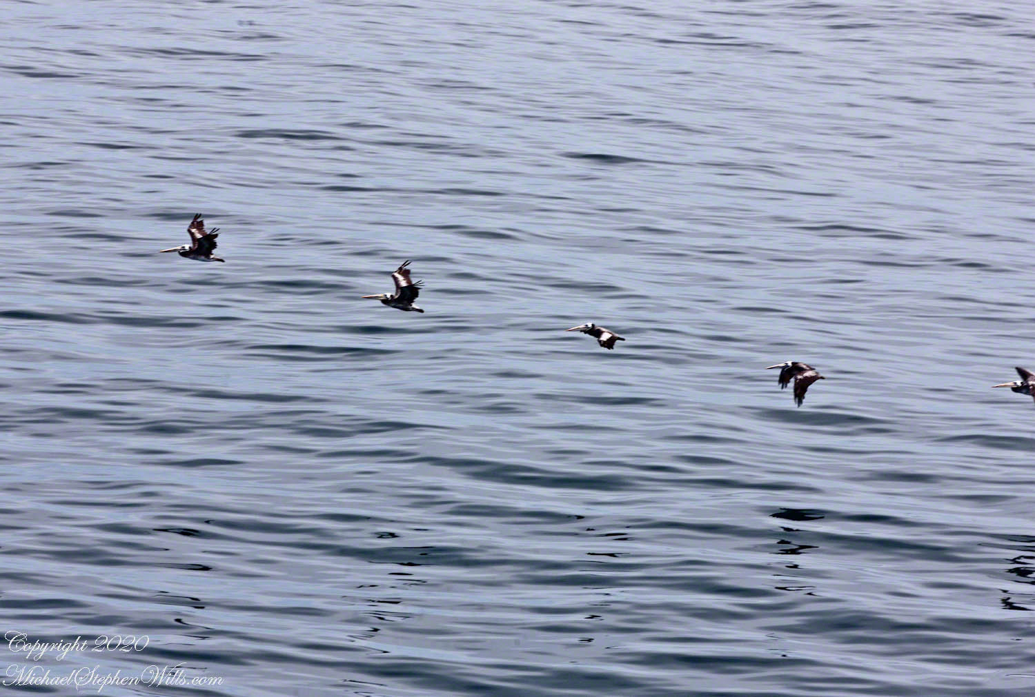
Beyond the pilot boat, shorebirds fly in rhythmic formation, a sight both familiar and comforting. Using the zoom (300mm) of my variable zoom lens, I identify these birds as pelicans, their elegant, synchronized flight a mesmerizing display against the vast expanse of water.

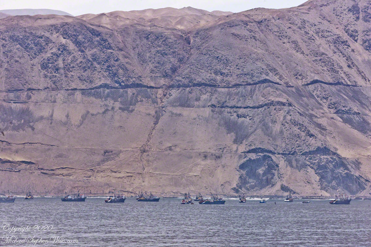
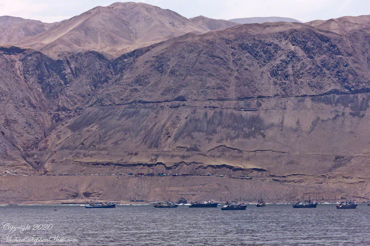
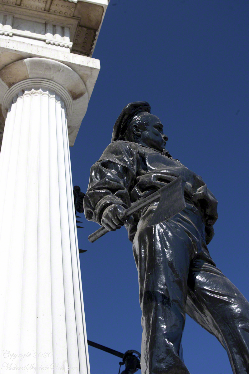
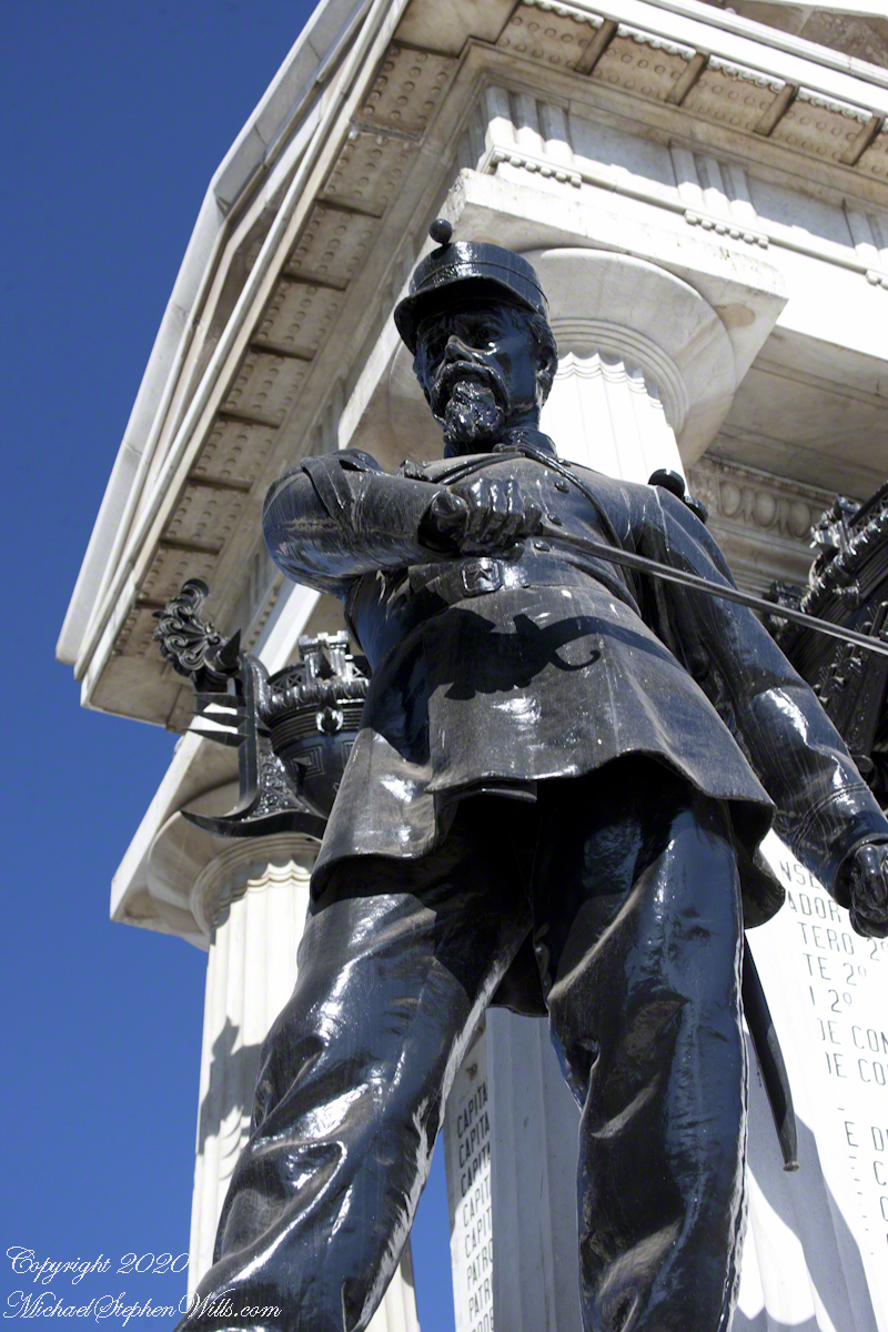
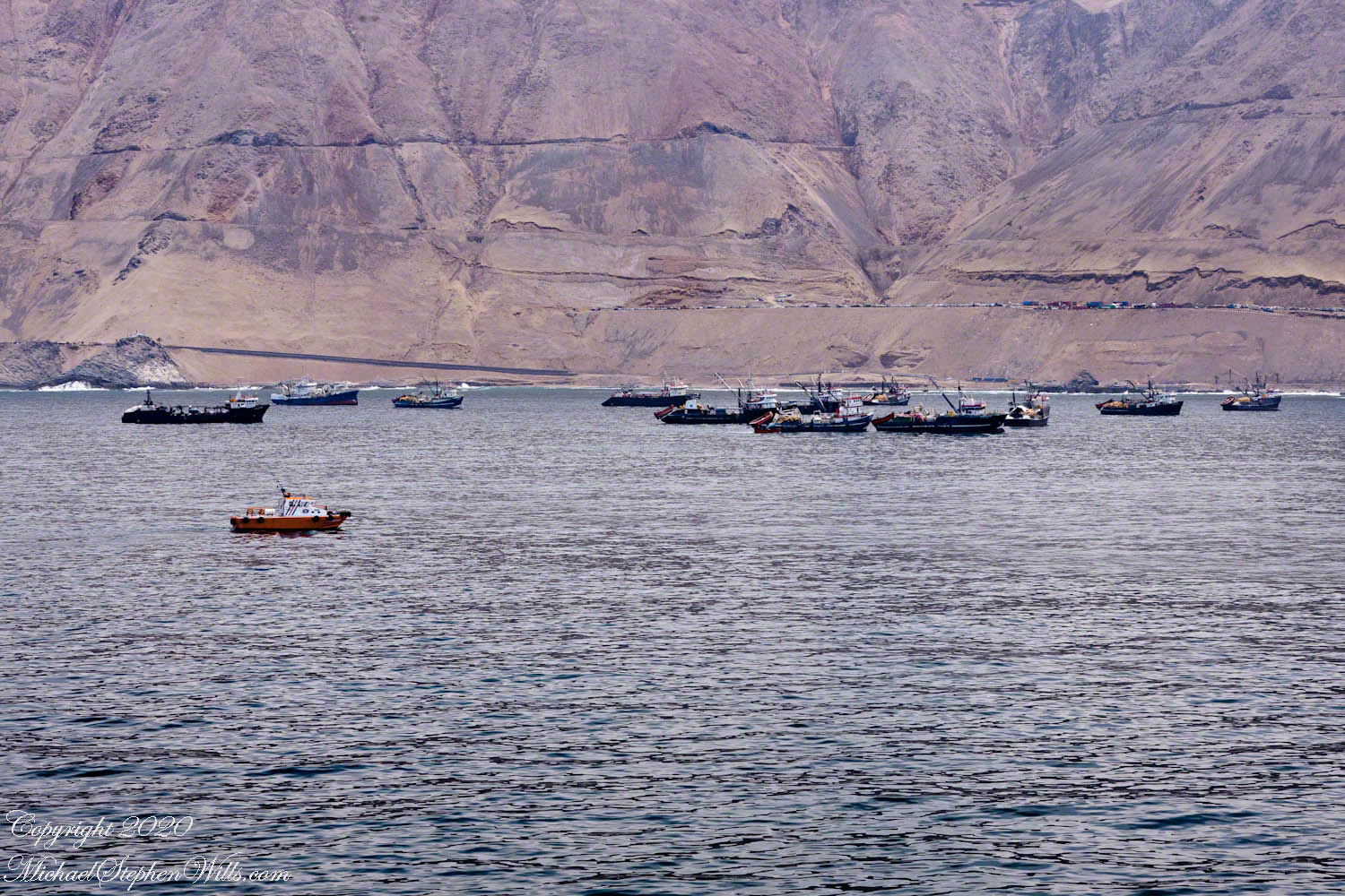
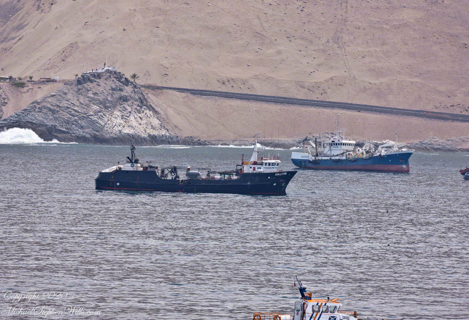
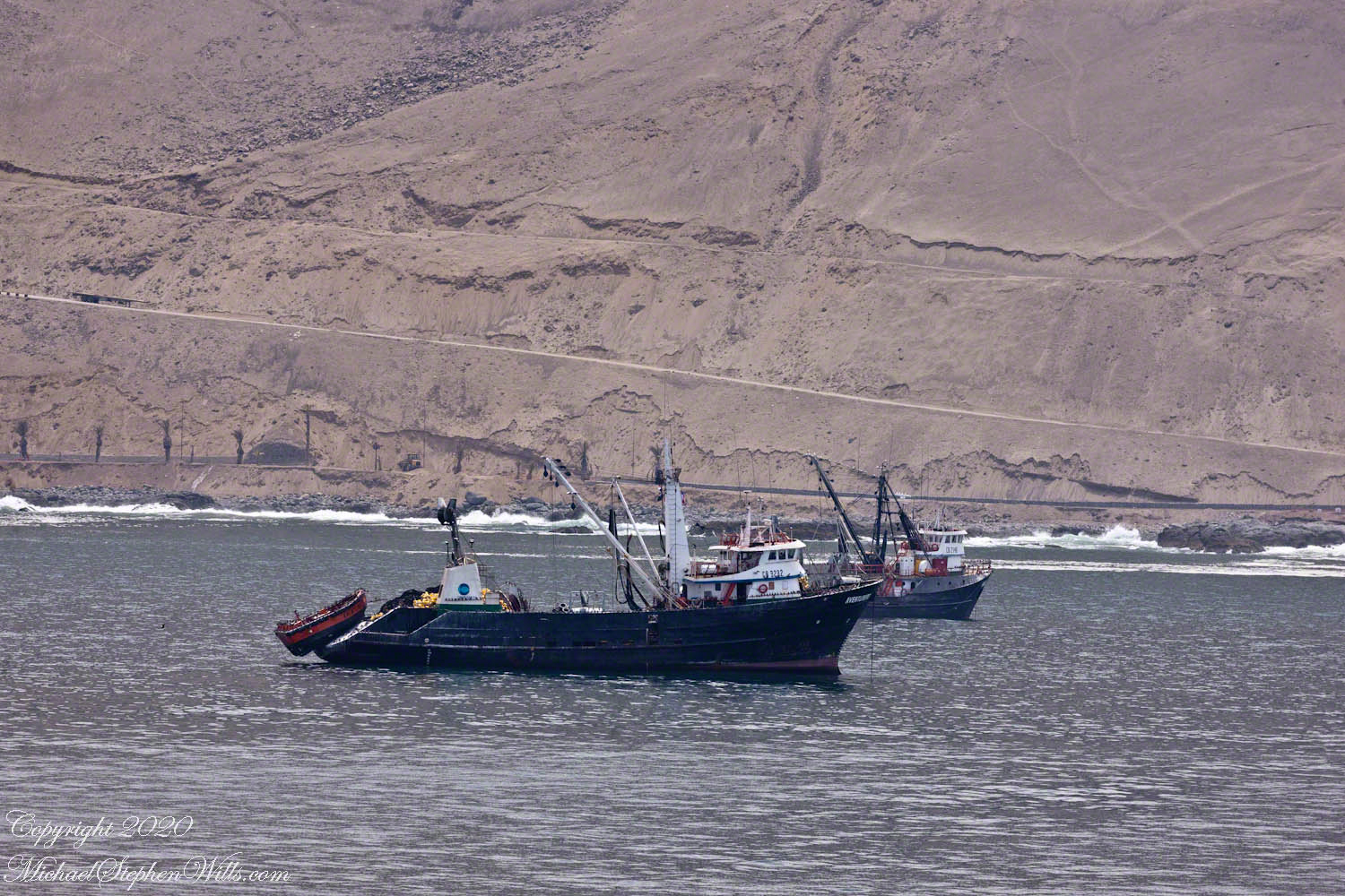
The pilot boat comes to a stop between us and anchored fishing boats, a cluster of vessels that seem to float effortlessly on the waves. Each boat, with its unique character and history, tells a story of countless journeys and the lives of those who depend on the sea for their livelihood. The fishermen, with their weathered faces and hands skilled in the art of the catch, embody a resilience born from years of facing the sea’s many moods. These boats are tools of the trade, lifelines for the families and communities they support, each one a testament to the enduring human spirit.

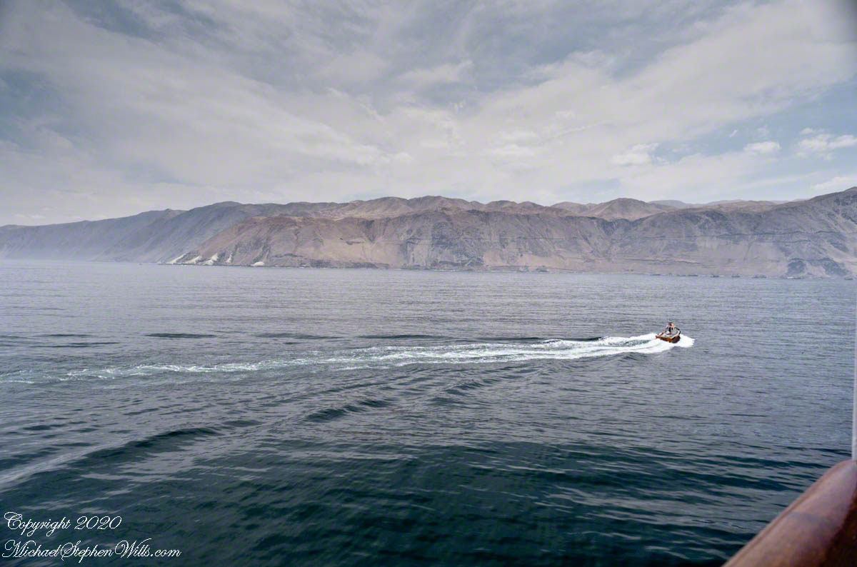
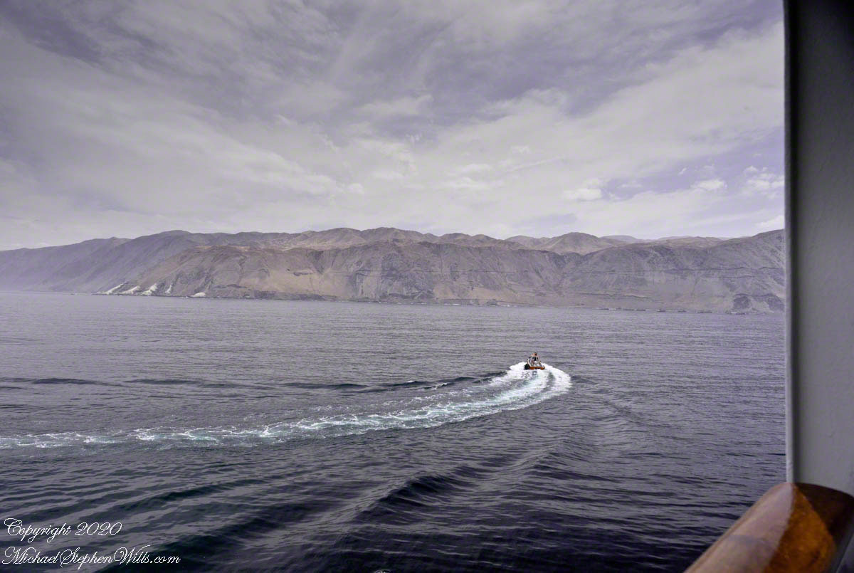
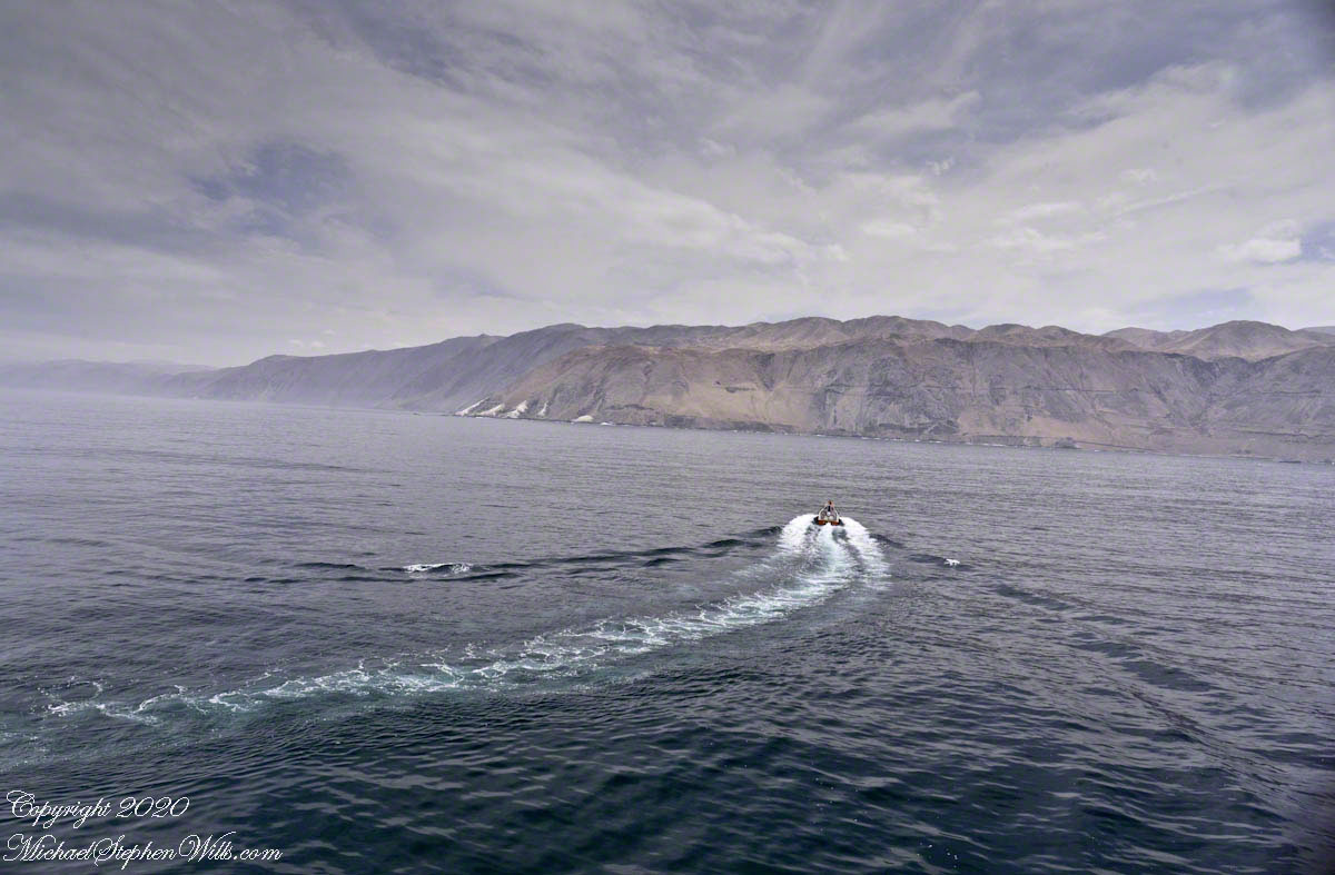
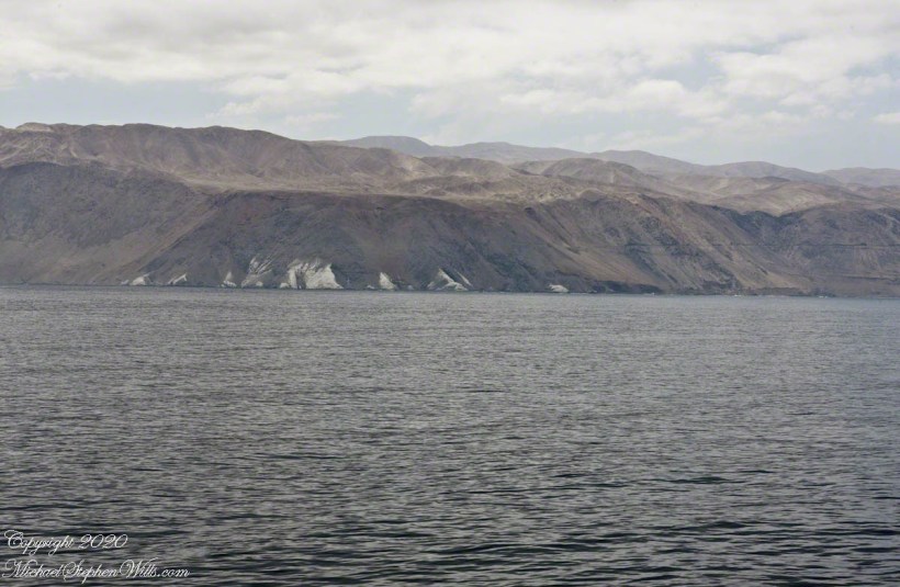
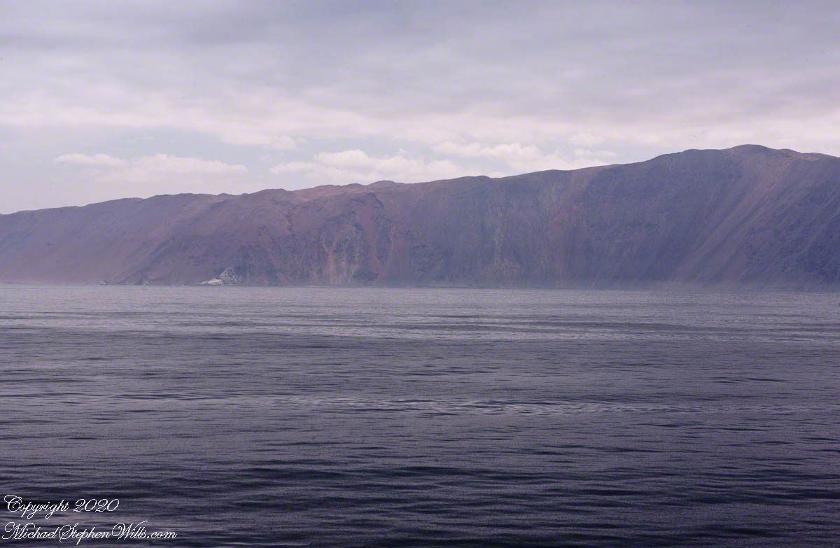
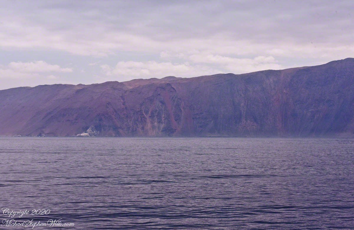
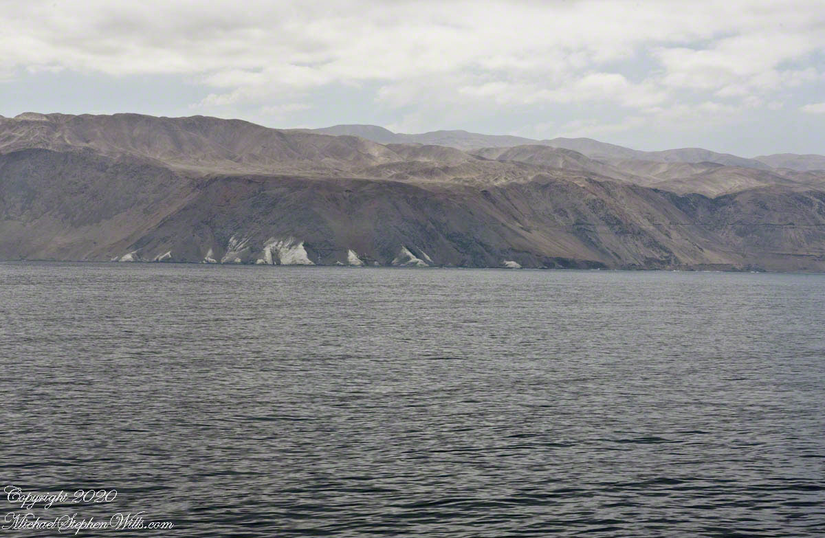
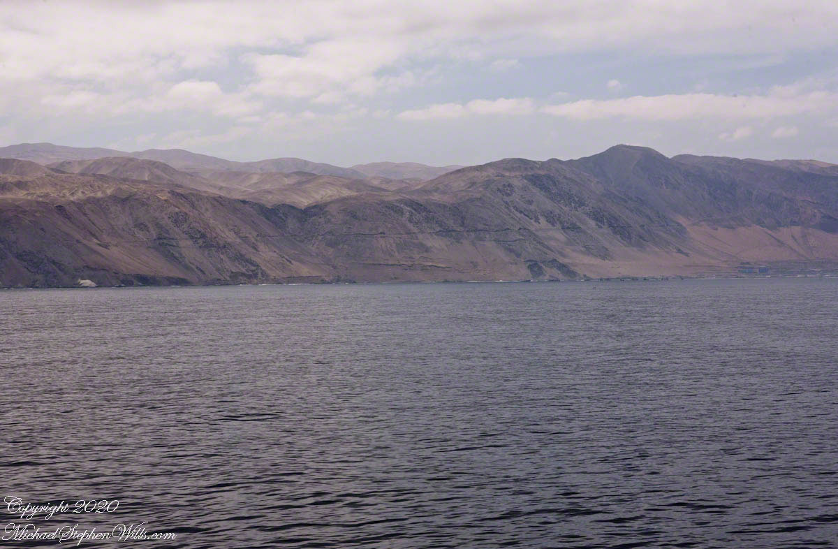
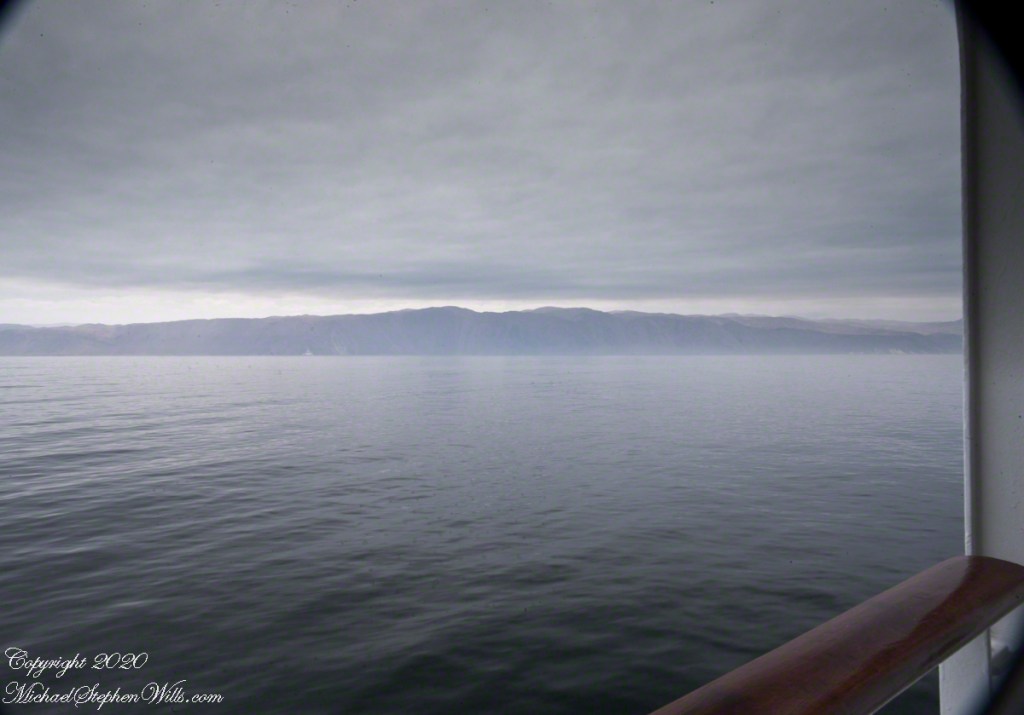
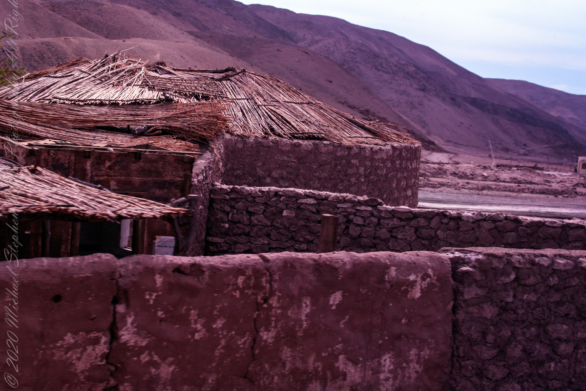
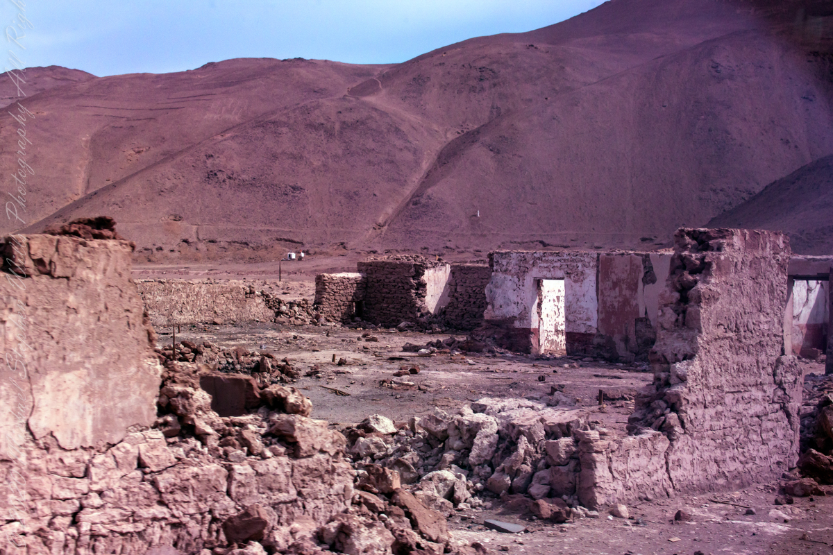
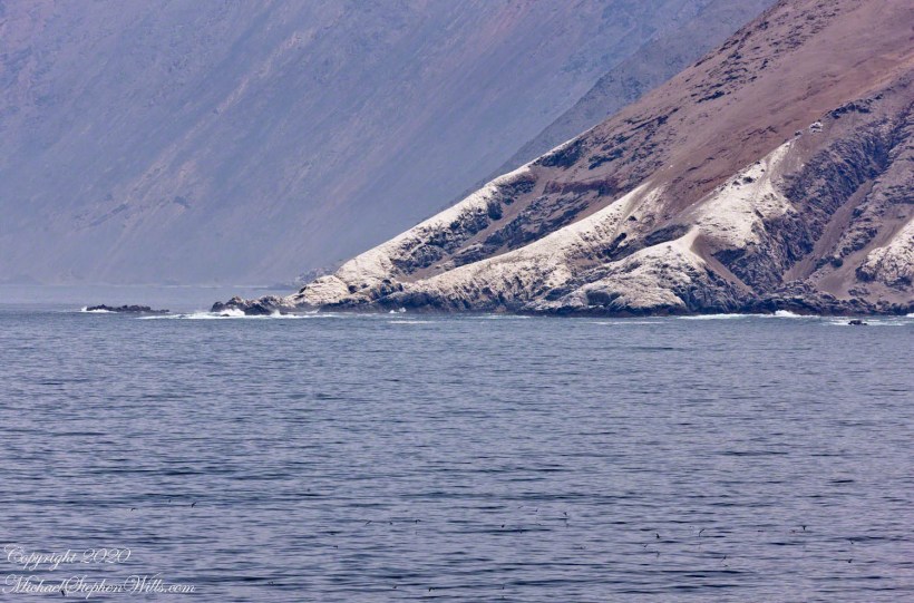
The post header photograph captures Punta Negra, the northern boundary of the harbor. The rugged, imposing cliffs of Punta Negra rise sharply from the water, their stark beauty accentuated by a white layer of diatomaceous earth running along the coast. This geological feature, first encountered at our last port in Mollendo, Peru, adds a unique texture to the landscape, a silent testament to the natural history of the region. The white layer, created by the accumulation of microscopic algae over millennia, stands out vividly against the darker rock, a reminder of the Earth’s ancient past.

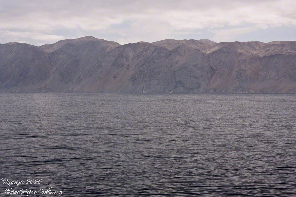
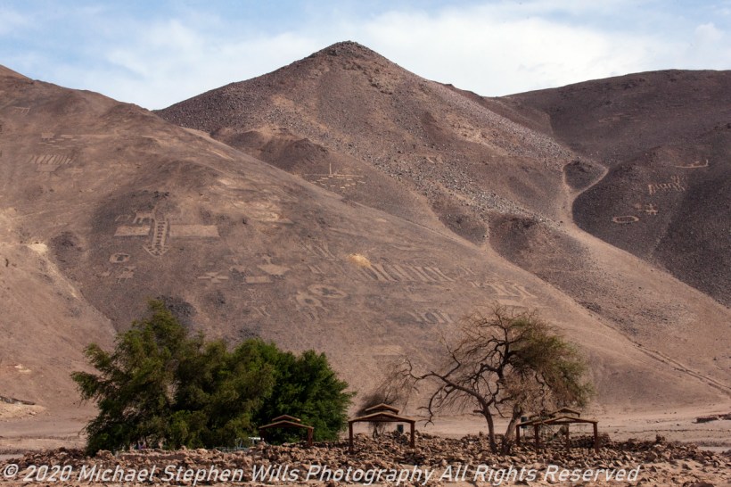
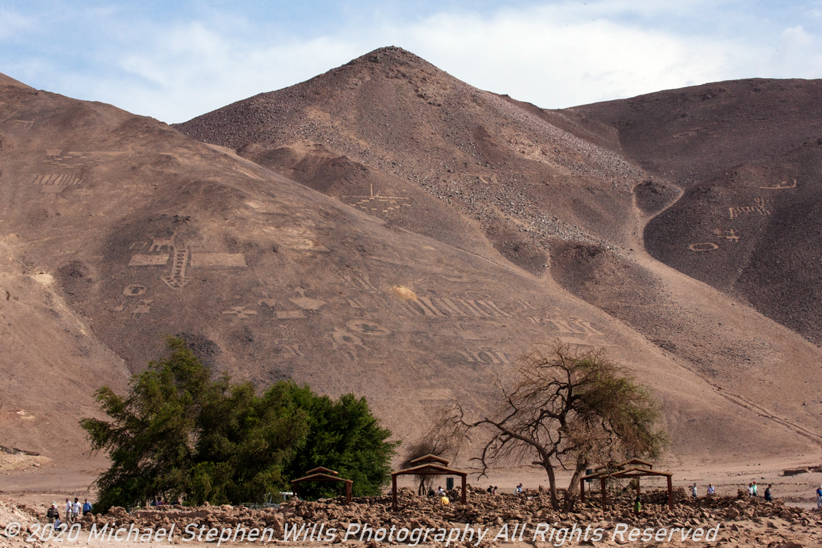
Look closely, can you make out the distinctive shape of a Monkey Puzzle tree along the shoreline road? This ancient tree, with its unique and resilient form, mirrors the endurance of those who live and work in this challenging environment. The Monkey Puzzle tree, native to Chile, is known for its hardiness and longevity, thriving in conditions where few other trees can survive. It stands as a metaphor for the people of this region, who have adapted to and thrived in one of the world’s most inhospitable landscapes.

As I zoom in further, using the full 300mm power of my lens on a stable tripod, I capture close views of the fishing boats. Each detail comes into sharp focus – the rusted hulls, the nets hanging in preparation, the names of the boats proudly painted on their sides. These vessels, with their worn and weathered appearances, have a beauty all their own. They are symbols of perseverance, of the daily struggle and triumphs of those who brave the sea to make a living. The fishing boats, though seemingly small in the vast ocean, are powerful symbols of human resilience and adaptability.

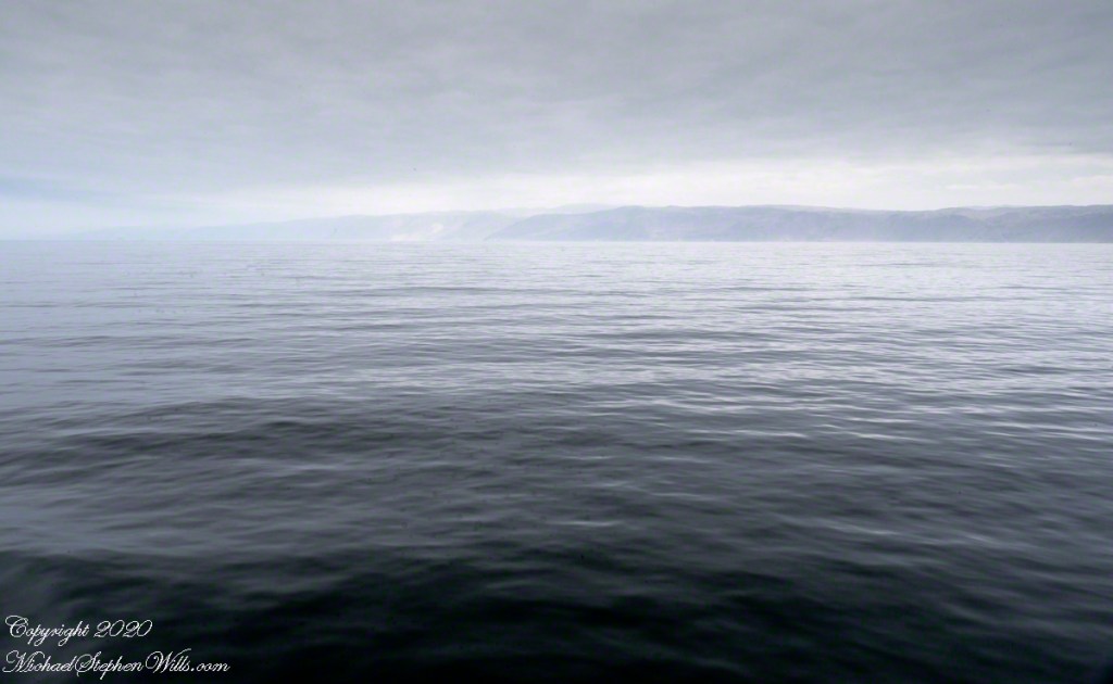
The sea, a constant presence in the lives of these people, shapes their days and their destinies. The fishermen head out each morning, guided by the tides and the weather, their knowledge of the sea passed down through generations. Each catch brings hope and sustenance, a reward for their hard work and skill. Yet, the sea is also unpredictable, capable of turning fierce and unforgiving in an instant. This duality – the sea as both provider and adversary – is a fundamental part of life here, woven into the fabric of daily existence.

Our ship’s anchor has dropped, signaling that we are ready to board the tender for the trip from anchorage to port. This marks the start of our day’s activities, a journey that will take us from the vast, open sea to the vibrant life of Iquique. As we prepare to disembark, I reflect on the interconnectedness of these moments – the precision of the pilot boat, the flight of the pelicans, the stories of the fishermen, and the enduring landscape. Each element weaves together to create a tapestry of life on the sea, a testament to the resilience and beauty of this remarkable region.

The tender ride offers a closer look at the fishing boats and the shore. I notice the intricate details of the boats – the colorful paint, the weather-beaten wood, the names that reflect the hopes and dreams of their owners. Each boat is a microcosm of life, carrying the weight of daily struggles and the promise of future catches. The fishermen, now preparing their gear for the day’s work, move with practiced ease, their actions a ballet of efficiency honed by years of experience.

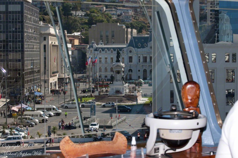
As we approach the port, the city of Iquique comes into view, a bustling hub of activity nestled between the sea and the mountains. The contrast between the natural beauty of the landscape and the vibrant energy of the city is striking. Here, in this meeting place of land and sea, past and present, we see the resilience of the human spirit, the ability to adapt and thrive in even the most challenging conditions.

This journey, from the open sea to the heart of Iquique, is more than just a physical passage. It is a journey through time and history, a glimpse into the lives of those who call this place home. As we step onto the shore, ready to explore the city and its rich heritage, I carry with me the stories of the sea, the echoes of the past, and the promise of new discoveries.

Click me for the first post of this series.

Copyright 2024 Michael Stephen Wills All Rights Reserved

Iquique by Sea V

Join us on a mesmerizing journey as we approach Iquique, Chile by sea, capturing the stark beauty of the coastal landscape and exploring the fascinating history of the Atacama Desert and Humberstone’s ghostly remains.

Thirty minutes have passed since Part I, and the pilot boat from Part IV is pulling away. The pilot has climbed the rope ladder up the side of the Regatta, and now the boat is pulling away, its job done for the moment.

Click any photograph for a larger view and use Ctrl-x to zoom in closer.

I use the wide angle (70mm) of the variable zoom lens to provide a panorama of the scene.

With the pilot at the helm, watched intently by the Regatta crew, the ship slowly makes its way towards the anchorage, just outside the bustling harbor. The precision and skill involved in navigating these waters are palpable. Every movement is deliberate, calculated to ensure our safe arrival.

The ship will anchor outside the navigation lane, joining a cluster of fishing boats that seem to be both close yet worlds away. This juxtaposition of large cruise ships and smaller, hardworking fishing vessels highlights the diverse marine activity in these waters.

As we edge closer, I zoom into the scene to get a better look at the “dead end” highway built into the steep escarpment above the fishing boat anchorage.

This road, carved into the rugged terrain, is where service vehicles are parked. It’s a stark reminder of the isolation and the challenges faced by those living and working in this region. The road, seemingly clinging to the side of the escarpment, underscores the harsh, arid landscape that surrounds Iquique.

There is only one road linking Iquique to the outside world, a lifeline that snakes its way through the unforgiving Atacama Desert. This single route is vital, not just for the movement of people, but for the transport of goods and services that sustain the city and its inhabitants. The resilience required to thrive in such an environment is evident everywhere you look.

In the distance, the fishing boats bob gently on the waves, a stark contrast to the imposing cliffs that rise sharply from the sea. The boats, though dwarfed by the natural landscape, exude a quiet dignity, representing the enduring spirit of those who make their living from the ocean. The water, a deep, reflective blue, mirrors the sky above, creating a seamless blend of sea and sky, interrupted only by the rugged coastline.

Our journey today will take us beyond the city, along this solitary road to the World Heritage Site of Humberstone. Once a bustling nitrate mine, Humberstone sits on a plane above the city, a stark reminder of Chile’s rich industrial history. The site, now a ghost town, tells the story of the nitrate boom that once powered the region’s economy. As we drive, the landscape will transition from the coastal beauty of Iquique to the stark, desolate beauty of the Atacama Desert.

This is a journey through time, from the modern-day hustle and bustle of Iquique to the silent echoes of Humberstone’s past. The road a connection to the history and heritage of this remarkable region. As we venture into the heart of the desert, the stories of those who lived and worked in these harsh conditions will come alive, offering a glimpse into the resilience and determination that define the spirit of Chile.

The anchorage, with its mix of modern and traditional vessels, serves as a microcosm of Iquique itself – a city where the past and present coexist, where the sea provides a livelihood, and the land tells a story of survival and adaptation. As the Regatta settles into its temporary home on the water, I feel a sense of anticipation for the adventures that lie ahead. The pilot boat, now a small speck in the distance, has done its job, guiding us safely to this point. From here, the journey continues, both on land and through the annals of history, as we set out to explore the wonders of Iquique and beyond.

Click me for the first post of this series.

Copyright 2024 Michael Stephen Wills All Rights Reserved

Iquique by Sea IV

Discover the vibrant blend of history and modern maritime traditions in Iquique. From the dramatic escarpment backdrop to the bustling harbor, join us on a journey exploring the city’s past and present, anchored in seafaring tales.

Continue reading “Iquique by Sea IV”

Iquique by Sea III

Explore the dramatic events of May 21, 1879, when Captain Arturo Prat’s heroic stand at the Battle of Iquique turned the tide of the War of the Pacific, shaping South American history. Discover the legacy of this pivotal naval encounter.

Iquique was a Peruvian city under Chilean naval blockade in May 1879 during the War of the Pacific, also called the Saltpeter War, for control of valuable nitrate deposits in the Atacama Desert. The conflict primarily involved Chile, Peru, and Bolivia, with Chile aiming to secure the resource-rich coastal regions of Bolivia and southern Peru.

The photographs illustrating this post feature Valparaiso, beginning with an overview of Plaza Sotomayor from the bridge of the ship Regatta docked in the harbor. Centered in the square is a memorial to the heroes of Iquique, a tribute to those who fought valiantly during the naval confrontations.

Click any photograph for a larger view and use Ctrl-x to zoom in closer.

View of the Monument to the Heroes of Iquique from the bridge of the Regatta.

On the morning of May 21, 1879, two older wooden Chilean ships were stationed blockading the Iquique harbor: the corvette Esmeralda, captained by Arturo Prat Chacón, and the schooner Covadonga. Out of the thick morning fog emerged two Peruvian ironclad ships, the Huáscar and the Independencia. The Huáscar, commanded by Admiral Miguel Grau, posed a significant threat to the Chilean blockade due to its superior firepower and armor.

The Heroes’ Names are listed in large letters

Facing the formidable Peruvian ironclads, the Covadonga withdrew to avoid certain destruction. Captain Prat, however, stood his ground aboard the Esmeralda. Despite being heavily outgunned and outmatched, Prat chose to engage the Huáscar. In a courageous but ultimately futile effort, Prat attempted to board the Huáscar but was killed in the process, and the Esmeralda was subsequently destroyed with a great loss of life.

Each corner features a larger than life statue representing the heroes

The Battle of Iquique ended with a Peruvian victory, temporarily lifting the blockade and opening the port. However, the heroism displayed by Captain Prat and his crew had a profound impact on Chilean morale. News of their bravery spread rapidly, galvanizing the Chilean population and military. Prat’s sacrifice became a symbol of national pride and determination, fueling Chile’s resolve to win the war.

One figure is Captain Prat

The outcome of the War of the Pacific was a decisive victory for Chile. By the end of the conflict in 1884, Chile had gained significant territories from Peru and Bolivia, including the nitrate-rich provinces of Tarapacá and Antofagasta. These territorial acquisitions provided Chile with substantial economic benefits due to the lucrative nitrate mines, which were crucial for agricultural fertilizers and explosives.

The War of the Pacific had far-reaching consequences for the region. Bolivia lost its coastal territory, becoming a landlocked country, which has had lasting implications on its economic development and geopolitical strategy. Peru, on the other hand, was forced to cede valuable territories and endured a period of economic hardship and political instability following the war.

Today, the Battle of Iquique is commemorated annually in Chile on Naval Glories Day (Día de las Glorias Navales) on May 21st. This national holiday honors the bravery of Captain Prat and his men, serving as a reminder of their sacrifice and the pivotal role the battle played in Chilean history.

In summary, the blockade of Iquique and the ensuing naval battle were significant events in the War of the Pacific. They highlighted the strategic importance of naval power and the impact of individual heroism on national morale. The war reshaped the territorial boundaries in the region, with lasting economic and political effects that continue to influence the countries involved.

Click me for the first post of this series.

Copyright 2020 Michael Stephen Wills All Rights Reserved

Iquique by Sea II

Explore the rugged beauty of Chile’s Atacama Desert coast as we approach Iquique. Discover the historical significance of ghost towns and the stunning natural landscapes captured through a zoom lens from our cruise ship.

As we continue our approach to Iquique, the landscape unfolds with increasing clarity and detail after I swapped out the 24 mm lens with a variable “zoom”, 70 – 300mm. The ship’s slow progress offers ample time to observe and absorb the stark beauty of the coastline. The variable lens captures the rugged intricacies of the cliffs and the subtle hues of the arid landscape that rise abruptly from the Pacific Ocean.

Click any photograph for a larger view and use Ctrl-x to zoom in closer.

Caleta Buena, the ghost town perched at the foot of a 750-foot escarpment, is no longer in sight. This once-thriving nitrate shipping point is a haunting reminder of the region’s historical significance in the nitrate mining industry. The small bay, or “caleta,” provided just enough shelter to construct piers and docks, facilitating the transportation of this valuable mineral. The remnants of this enterprise are barely visible, blending seamlessly into the harsh terrain.

The juxtaposition of the nutrient-rich Humbolt Current against the barren cliffs is a sight to behold. The current, teeming with marine life, supports the local fishing industry. I manage to capture a small fishing boat setting out for the day, its solitary presence emphasizing the vastness and solitude of the surrounding ocean. The boat’s journey highlights the symbiotic relationship between the sea’s bounty and the livelihood of those who brave its waters.

Moving southward, the cliffs give way to a formidable pediment, a broad, sloping surface that forms the base of the coastal mountains. This pediment, barren and uninviting, is a testament to the geological forces that have shaped this region. The harsh environment, with its minimal vegetation and arid conditions, stands in stark contrast to the vibrant marine ecosystem just offshore.

Our ship’s slow advance allows for contemplation of this unique landscape. The term “the imprint of God’s thumb on the land” resonates deeply as I witness the natural formations that seem almost intentional in their design. The cliffs and pediment, while imposing, serve as a prelude to the more hospitable terrain that lies ahead.

Approaching Punto Negro, the cliffs begin to recede, revealing a more accessible coastline. This geographical shift creates a natural harbor that has enabled the establishment and growth of Iquique. The city, with its deep-rooted history in the nitrate industry, emerges as a beacon of human resilience and adaptation in an otherwise unforgiving landscape.

Iquique’s strategic location, nestled between the receding cliffs and the ocean, provides a unique blend of natural beauty and industrial significance. The city’s development is intricately linked to the geographical features that surround it, from the nutrient-rich waters of the Humbolt Current to the protective embrace of the coastal cliffs.

As the Regatta inches closer to port, the anticipation builds. The approach to Iquique is not merely a physical journey but a voyage through time and nature’s grandeur. Each photograph, each observation, adds a layer to the rich tapestry of this experience. The slow, deliberate pace of the ship allows for a deeper appreciation of the intricate interplay between land and sea, history and progress.

In these moments of quiet reflection, I feel a profound connection to the land and its stories. The approach to Iquique is a reminder of the delicate balance that sustains life in this harsh yet beautiful corner of the world. It is a journey that underscores the resilience of both nature and humanity, each adapting to and shaping the other in an ongoing dance of survival and growth.

Click me for the first post of this series.

Copyright 2024 Michael Stephen Wills All Rights Reserved

Iquique by Sea I

Join me on an early morning approach to Iquique, Chile, as we sail past the stark, mesmerizing Atacama Desert coastline. Experience the serene isolation and rugged beauty captured from the balcony of our cruise ship.

Standing on the balcony of our port side stateroom, the early morning light casts a subdued, almost ethereal glow over the vast expanse of the Pacific Ocean. The Oceania Regatta glides smoothly through the cold, dark waters, making its way toward Iquique, our first Chilean port of call. The sense of anticipation is palpable as we approach the coast of the Atacama Desert, a region renowned for being the driest place on Earth.

The view is both stark and mesmerizing. The coastline of the Atacama Desert rises sharply from the Pacific, a dramatic contrast to the vast, cold ocean that stretches out before us. The Humbolt current, a cold, nutrient-rich flow of water from southern Chile to northern Peru, swirls beneath the ship, adding a sense of dynamic movement to the scene. The chilly air, the muted colors of the sea and sky, and the barren, rugged landscape all combine to create an atmosphere of serene isolation.

In the distance, I imagine a dark point of land—the remnants of the abandoned town of Caleta Buena. Perched on a 750-foot escarpment, the town was once a bustling hub of nitrate mining, a vital industry that shaped the history of Iquique. The remains of piers jutting out into the ocean stand as silent witnesses to a bygone era, their weathered structures blending into the rugged coastline.

The sequence of photographs I’ve captured from this vantage point, working north to south, offers a panoramic view of this desolate yet captivating landscape. Using a 24 mm “wide angle” Canon lens mounted on a tripod, I’ve been able to frame the vastness of the ocean and the stark beauty of the Atacama coastline in a single, sweeping seascape.

Reflecting on our overnight journey from Matarani, Peru, I’m struck by the profound sense of isolation that accompanies travel along this desolate coast. During the 250-mile sail, the darkness was absolute, the inky blackness of the night broken only by the occasional glimmer of stars reflected in the ocean below. It was a journey through a void, a stark reminder of the sheer scale and remoteness of this part of the world.

As we draw closer to Iquique, the coastal mountains rise up, marking the transition from the Pacific to the arid plains of the Atacama Desert. The stark beauty of this landscape, with its rugged cliffs and barren expanses, is both humbling and awe-inspiring. It’s a reminder of the harsh conditions that have shaped this region, and of the resilience of the people who have carved out a living here over the centuries.

From the balcony of our stateroom, I feel a deep sense of connection to this place. The vastness of the ocean, the stark beauty of the desert coastline, and the rich history of the region all combine to create a profound sense of place. This is a land of extremes, a place where the forces of nature have sculpted a landscape of breathtaking beauty and unforgiving harshness.

As we approach Iquique, I feel a sense of gratitude for the opportunity to witness this unique corner of the world. The journey is a reminder of the incredible diversity and beauty of our planet, and of the importance of preserving these natural wonders for future generations. This approach to Iquique is a journey to a new port, a journey into the heart of one of the world’s most remarkable landscapes.

Copyright 2024 Michael Stephen Wills All Rights Reserved

Valparaiso Connections VII

Fertile Land and Saltpeter, spoils of war

Plaza Victoria

This is an answer for those of who responded to my last post Valparaiso Connections VI with “what does that desert in Peru have to do with Valparaiso?”  It starts with the Plaza Victoria at the end of Pedro Montt Avenue.  Victoria, as in victory not Queen Victoria.   At the beginning of the 19thcentury this was a beach, the site of several ship wrecks.  It was set aside as a gathering place by the Mayor, named Plaza Nueva (New Plaza), for a bullring until bullfights a law banned bullfighting on September 1823. The plaza became a place of public executions and, after Chile’s victory in the Battle of Yungay, a place of celebration, formally renamed for the victory.

The Central Valley of Chile is an exception to the topology north through Lima where agriculture and population centers follow river valleys watered by the Andes and surrounded by waterless wastes.  Yungay, is among one of those watered desert valleys.  Located 120 miles north of Lima, Peru at about 8,000 feet just below a summit of the Western Andes, remnants of cultures from 10,000 B.C. are proof of agriculture and human settlement. It was near Yungay, on January 20, 1839 (summer in the southern hemisphere) a force of Chilean and Peruvian dissidents called the United Restorative Army defeated a Peru-Bolivian Confederation Army to end the War of Confederation. The resulting split into different countries of Peru and Bolivia weakened a threat to Chile and Argentina, aimed in large part toward the broad and fertile Central Valley of Chile. The desperation in view in my post Valparaiso Connections VI was in large measure a motivation war, this motivation is still powerful today.

 The subsequent prosperity allowed reclamation of the land of Plaza Victoria from the sea.  For example, in my post Valparaiso Connections V we learned how French immigrants arrived and developed Central Valley wineries in the 19th century.   Around the time of the victory Chacobuco Street was built adjacent to the plaza on reclaimed land, the Plaza Victoria was pulled from the sea.  

The concrete Lions and bronze statue captured in the above gallery, were elements of a round of enhancements to Plaza Victoria begun 1870.

Monument to the Heroes of Iquique

Here we see from the Regatta bridge a monument to the Heroes of Iquique.   The Battle of Iquique, May 21, 1879, is remembered annually as Naval Glories Day (Dia de las Glorias Navales) .

  Click this Link for the Fine Art Photography Gallery.

This monument commemorates the destruction of the Chilean warship Esmeralda.  At the monument peak is Arturo Prat Chacón, captain of the Esmeralda who perished with his wooden ship.  He and the crew were blockading the then Peruvian port of Iquique along with another ship, the Covadonga.

May 1879 was in the initial phase of the War of the Pacific, fought over rich mineral deposits of the Atacama desert.  Today, the Chilean flag is over these barren wastes, seen here flying over a roadside memorial to an automobile accident victim.  The desert is the backdrop, there are no animals or plants here, only red dirt.  NASA uses the Atacama in simulations of the Martian environment. 

There are deposits of the mineral saltpeter, mined by large operations.  Here is the entrance of a World Heritate site we visited while docked at Iquique. 

The mining operation was literally scraping the deposits lying on the ground and processing it into, among other products, nitrogen
fertilizer.  At that time the operation was hugely lucrative, employing thousands in very difficult conditions.  That is a different story. 

Captain Prat faced two armored Peruvian warships, one the iron clad Huáscar.  Over the course of four hours the Esmeralda was overpowered and sunk.  The Huascar and the 22,500 mountain peak at Yungay, Huascarán, are named for an Inca chief.  

The monument honors the bravery of Captain Prat and his crew, all of whom are named on plaques.

After the Huáscar rammed Esmeralda a third time to sink it, the Huáscar captain, Miguel Grau Seminario, rescued Chilean survivors in danger of drowning.  In the meantime, the armored Peruvian warship was lured into the shallows and destroyed.  Although the blockage on Iquique was lifted Peru lost one of its most powerful ships at the cost to Chile of an older wooden ship.

The defeat and examples of the Esmerelda crew and captain brought a wave of recruits to the Chilean forces.  Chile was the victor of the War of the Pacific, vast tracks of the Atacama desert were taken from Bolivia, including the Saltpeter mines, shutting that country off from the Pacific Ocean.  There is a connection between these memories and the Training Ship anchored in the harbor, the sixth ship to carry the name, Esmeralda (BE-43). 

See my posting Valparaiso Connections V for the more recent history of the Esmeralda.

Copyright 2022 Michael Stephen Wills All Rights Reserved

With and Without People

always without water

Pampa del Tamarugal National Reserve

Getty requires a signed photo release for each human in a photograph.

For this, the single best overview from our time with the Pintado Geoglyphs, I carefully painted out every human figure, our fellow tourists.

Here are the versions with and without human figures.

Click any photograph for a larger view and use Ctrl-x to zoom in closer.

Click me for the first post of this series.

Copyright 2020 Michael Stephen Wills All Rights Reserved

Geoglyph Panorama

Rain never falls here

Pampa del Tamarugal National Reserve

Eternal high clouds that never yield water, we visited these hills just off the Pan American highway, to view shapes formed by moving stones.

The shapes are multifarious, mysterious and majestic. Hundreds of them, rendered for reasons known only to the makers.

I stitched together five images to yield an overall impression.

Click any photograph for a larger view and use Ctrl-x to zoom in closer.

Click me for the first post of this series.

Copyright 2020 Michael Stephen Wills All Rights Reserved

Ghost of a Ghost Town

A place that exists because of water and a roa

Adolfo Tapia Live Here (?)

The Spanish word pintados translates to painted in English. There are many references to the word, in one it is a war loving tribe known for tattoos. Here, it is the name of a deserted town on an abandoned railroad running roughly parallel to the Pan American highway. As we passed through en route to Geoglifos de Pintados, I captured these shots of the ruined town.

The handprinted sign above the window, top photograph, says in translation, “Here lived the Adolfo Tapia Family, 1940-1956, F.F C.C. del Estado.” Searches on Adolfo Tapia turned up nothing, all we know is the sign attributes the designation to the state government.

The hill of the geoglyphs are the background, some of the figures are visible. There will be more in later posts.

The railroad served the many Saltpeter factories dotting the Tarapacá region. To my knowledge all were closed in the mid-20th century.

Click any photograph for a larger view and use Ctrl-x to zoom in closer.

Click me for the first post of this series.

Copyright 2020 Michael Stephen Wills All Rights Reserved