Leaving the jeep on the west side of Quaker Bridge, I walked over to inspect the structure and poke around the other side, carrying a Canon 5d Mark IV (camera body) / EF 70 – 300 mm f/4-5.6 L IMS (lens), shooting as I walked. My sister Theresa and Maxie, a little white dog, lagged behind taking in the surroundings. Here they are, in shadow, on the west side.
Click pic for larger view in a new browser tab. If you are in WordPress Reader, open the post to use this feature.
My work on the east side was shared in previous posts, “Pinelands Connections VIII,”I and II “Around Quaker Bridge,” and I and II “Pitch Pine Forest,” work interrupted by the sound of an approaching engine, a Humvee came into view. I waved my arm up and down, a sign to slow down, pulling alongside the driver looked up with dead eyes, no element of recognition of a fellow human, as I explained my sister was on the bridge. A stink of unfamiliar hydrocarbons, diesel fuel?, rose through the heat as they pulled forward with no acknowledgement of my request. Thankfully they slowed down as Theresa, Max in her arms, said, “hi.”
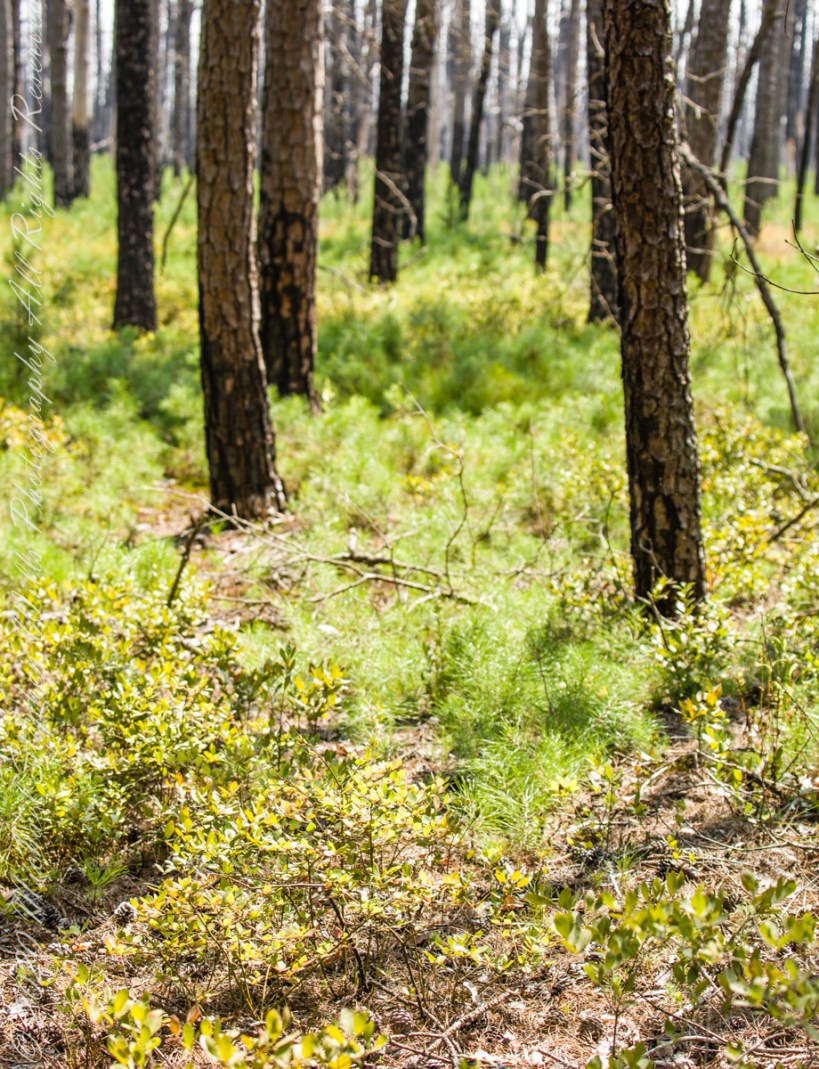
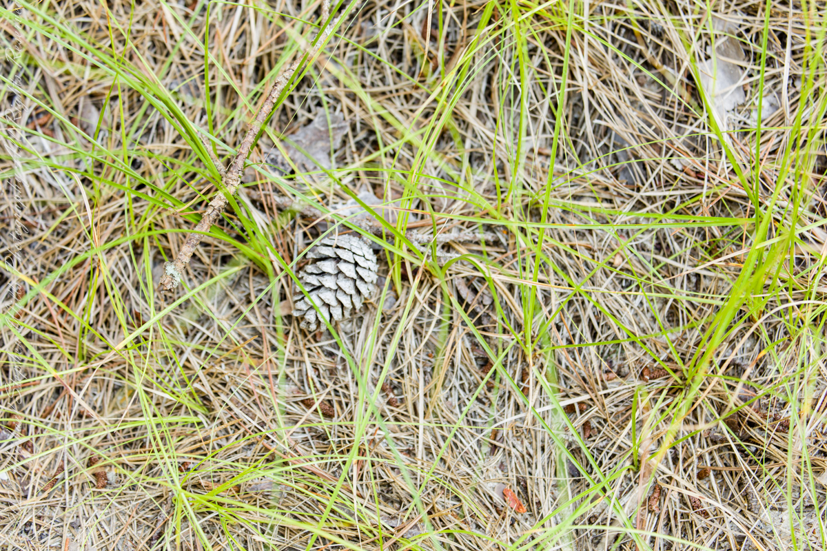
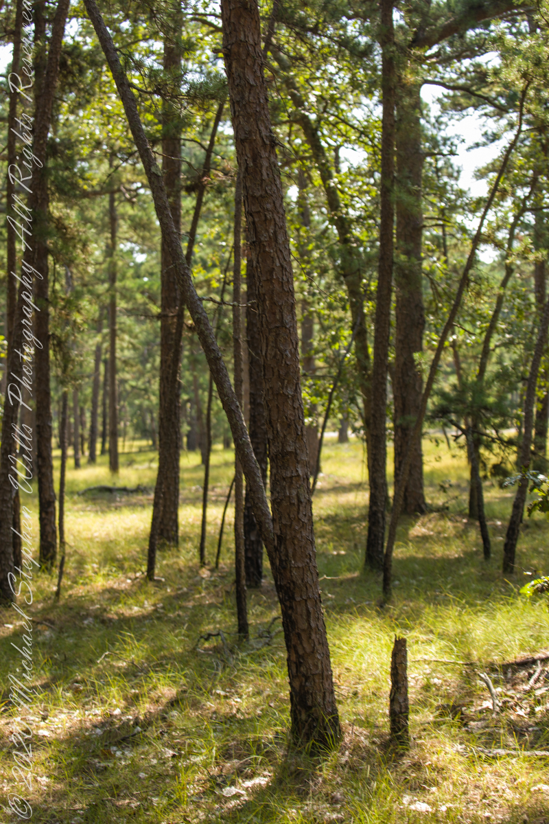
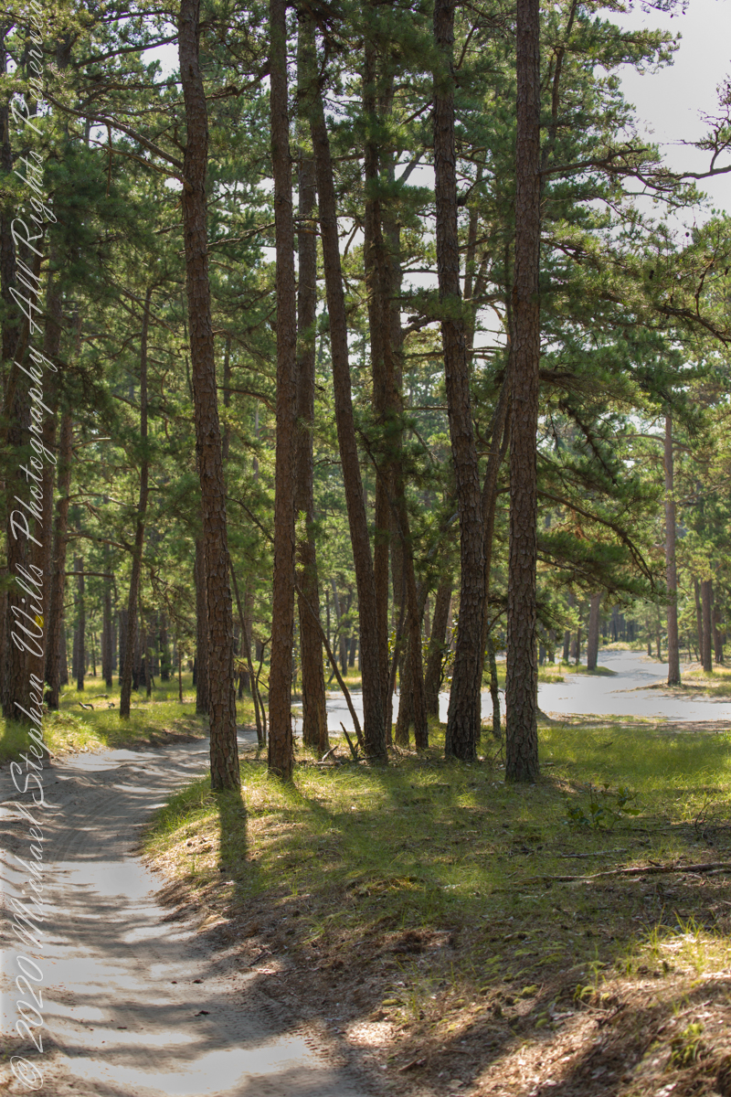
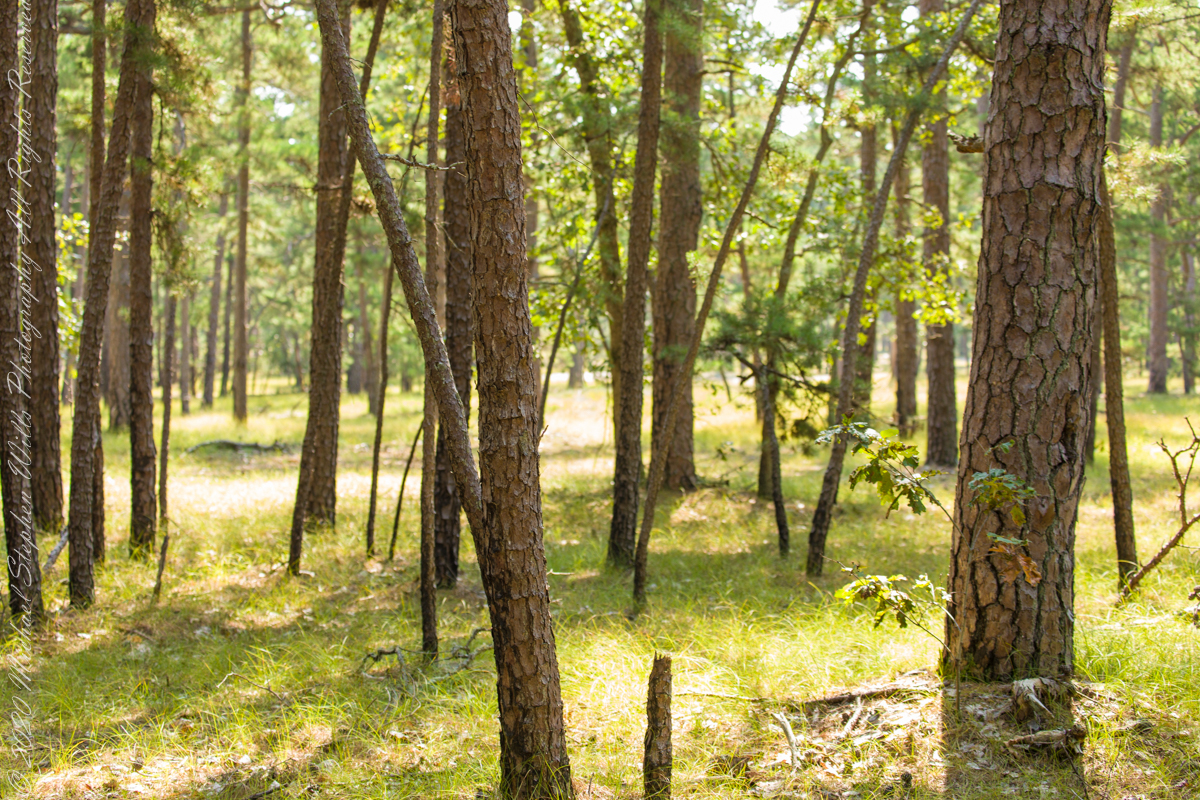
Multiple roads converge from all directions on Quaker Bridge, using GoogleMaps (surprising these unimproved, “jeep” sand roads were listed) I chose Goodwater Road as a route to Batsto Village, on the southern side of Wharton State Forest. The 6.1 mile road follows the east bank of Mullica River at a distance, a very rough passage through ancient Pitch Pine forest. Here are photographs of the enormous capacity of the pines to regrow after fire. Note a thick seeding growth among the mature pine trunks, lower portions fire blackened.
Copyright 2021 Michael Stephen Wills All Rights Reserved
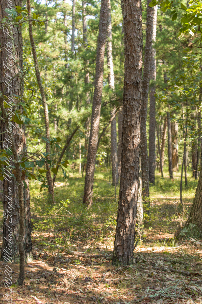
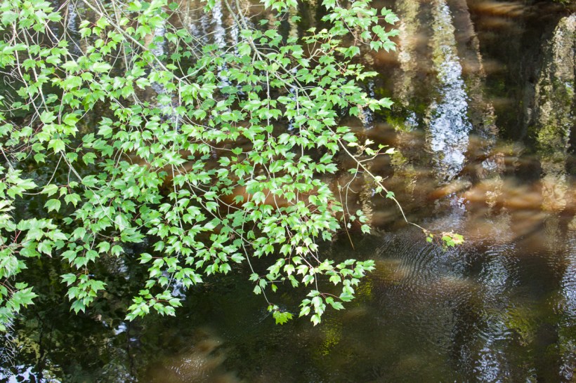
Multiple trails lead from where Quaker Bridge crosses the Mullica River. These are from a handheld Canon 5d Mark IV with the Canon EF 70 – 300 mm f/4.0-5.6 ISM lens.
Click pic for larger view in a new browser tab. If you are in WordPress Reader, open the post to use this feature.
70 mm, ISO 200 , 1/40 sec at f / 4.5
lll
Copyright 2021 Michael Stephen Wills All Rights Reserved
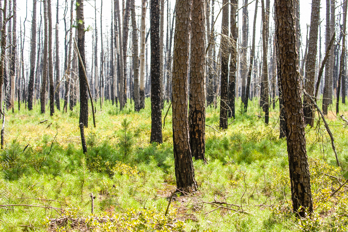
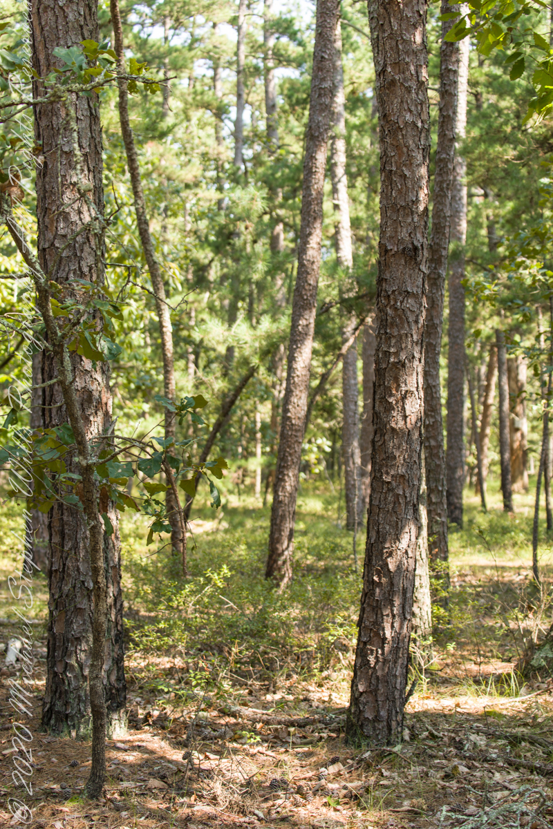
Multiple trails lead from where Quaker Bridge crosses the Mullica River. These are from a handheld Canon 5d Mark IV with the Canon EF 70 – 300 mm f/4.0-5.6 ISM lens.
Click pic for larger view in a new browser tab. If you are in WordPress Reader, open the post to use this feature.
70 mm, ISO 200 , 1/60 sec at f / 4.0
lll
70 mm, ISO 200 , 1/80 sec at f / 4.0
Copyright 2021 Michael Stephen Wills All Rights Reserved
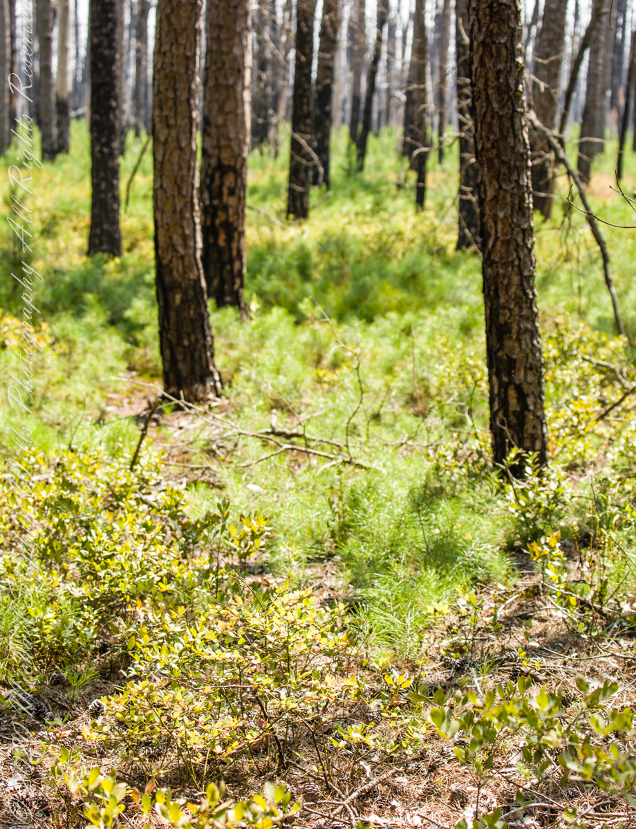
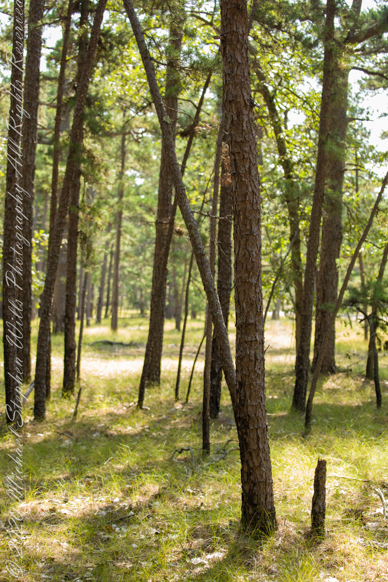
Multiple trails lead from where Quaker Bridge crosses the Mullica River. These are from a handheld Canon 5d Mark IV with the Canon EF 70 – 300 mm f/4.0-5.6 ISM lens.
Click pic for larger view in a new browser tab. If you are in WordPress Reader, open the post to use this feature.
70 mm, ISO 200 , 1/80 sec at f / 4.5
lll
70 mm, ISO 200 , 1/80 sec at f / 4.5
Copyright 2021 Michael Stephen Wills All Rights Reserved
In my last Pinelands post, “cedar water” was featured. This post is a exploration of the “cedar” in “cedar water.”
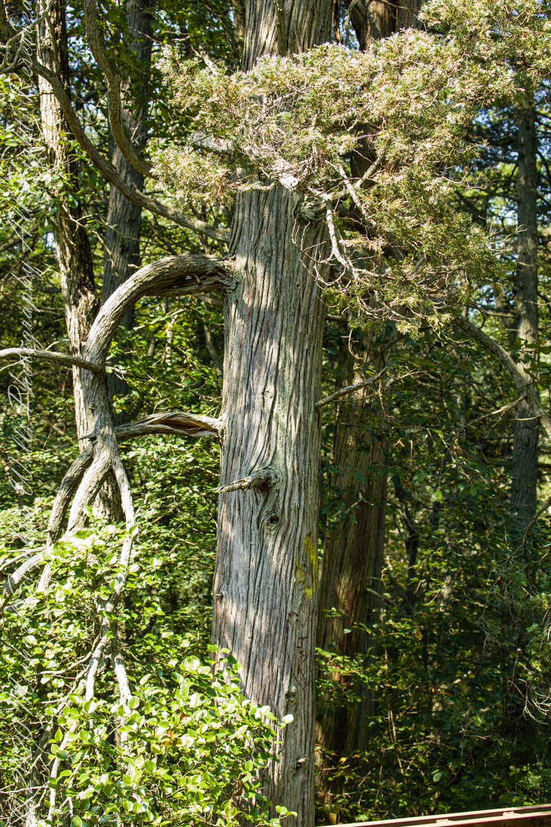
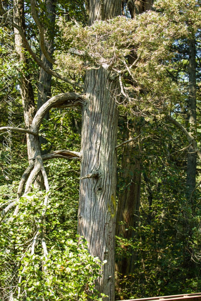
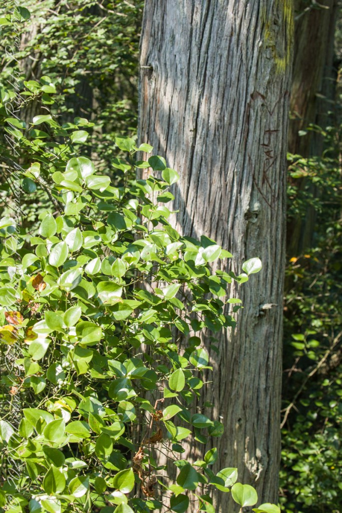
White Cedar, also known as Swamp Cedar, is a water loving tree seen here to the right of Quaker Brider, Wharton State Forest.
Click pic for larger view in a new browser tab. If you are in WordPress Reader, open the post to use this feature.
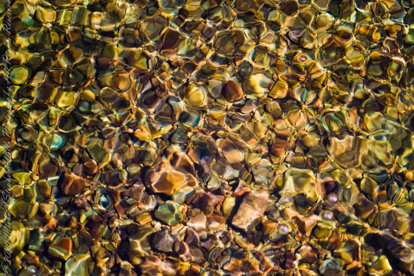
“Cedar water” is the dark, tea like, flow of Pinelands rivers colored by vegetable tannins.
White Cedar thrives along Pinelands waterways, lending color to the “cedar water.” 18th Century sea captains favored cedar water for long voyages, famours for staying fresh far longer than other waters. Also known as arborvite, “tree of life”, for the medicinal properties of the bark, well known throughout Native America.
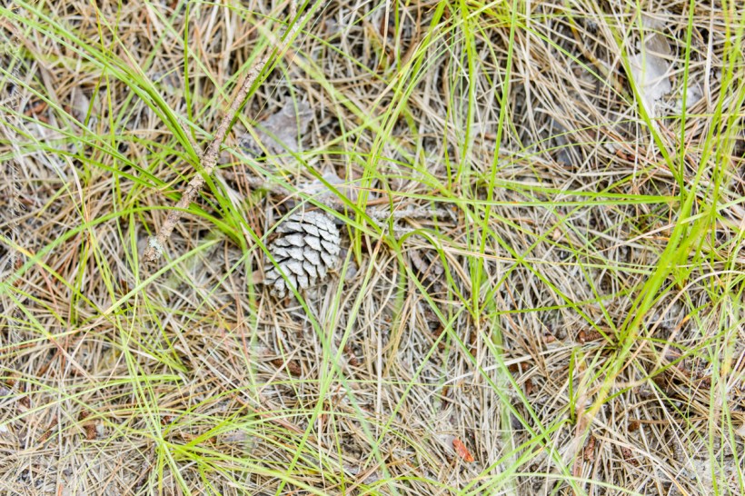
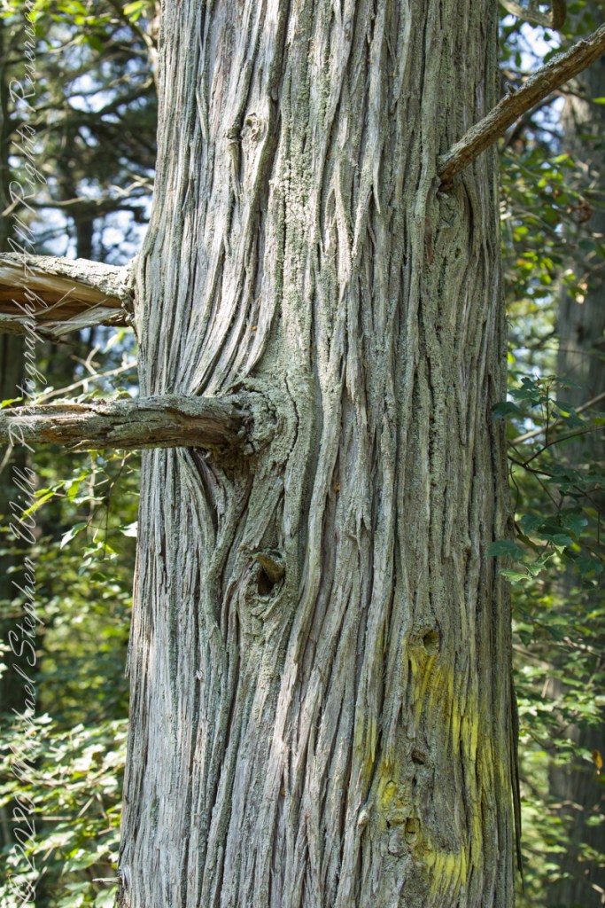
Known for flat sprays of scaley leaves
The Pinelands are under siege from attacks much worse than this defacement
These photographs were taken the last days of August 2021, the 26th and 27th, while exploring Burlington County, New Jersey, with my sister. I will be writing about our Thursday and Friday for awhile, starting with today’s installment.
Quaker Bridge Road traverses the wilderness of Wharton State Forest with a beginning off Route 206, Atsion Mansion. Our planning included Jeep Wrangler rental, only high-clearance 4-wheel vehicles are appropriate, the road surface is humpy sand, water filled holes abound. Still, sitting there at the start, with Atsion Mansion house in view, I waited awhile until a high clearance tour bus packed with adventurers, kayaks passed into the pines and out of sight. We proceeded an uneventful ~4 miles to Quaker Bridge at a stately 5 miles per hour, invoking four-wheel drive low gear a mile or so in.
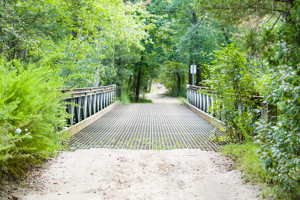
Here is Quaker Bridge over Mullica River today, facing East.
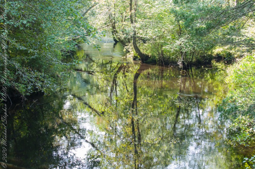
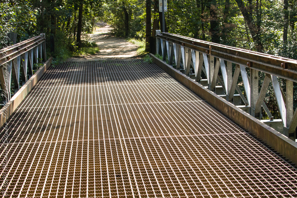
Mullica River from Quaker Bridge facing downstream
Quaker Bridge road was a well traveled main route through the Pines for almost a hundred years with an inconvenient crossing of The Mullica at this point. During the year 1774, some sa 1772, West Jersey Quakers travelling to the Little Egg Harbor Yearly Meeting, started “a day early”, built a bridge. From a c.1940 photograph it is clear in that “day” they felled large trees for pilings, smaller trees, pines and cedars, for the other bridge elements. Since then, the crossing has been called “Quaker Bridge.”
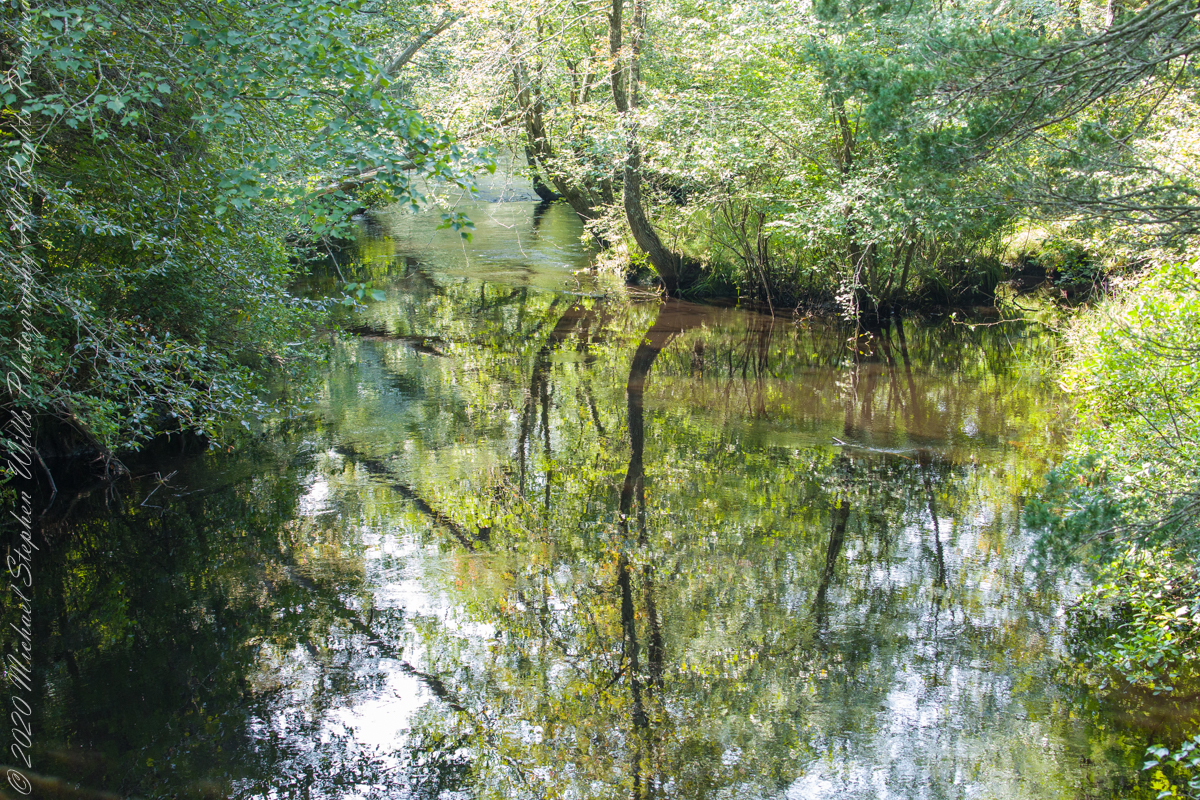
Over time, the east side became a resting place, with at least one Inn/Tavern. Here is the east side today.
Even without hospitality and bustling humanity, after 4 miles of dreary road from Atsion this spot carries a sense of lightness, the well spaced straight pines over several acres conveying peace and rest. Over 35 miles from the ocean, the white sand presents as beach. There is a reason for this feeling, a 15 million year reason.
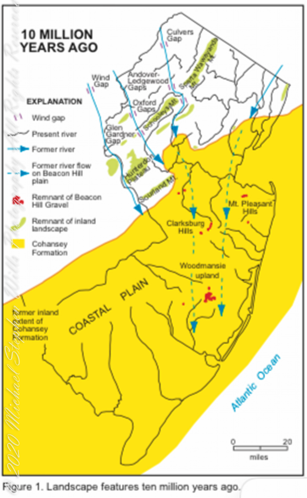
Visual presentation of Pinelands geologic origins, from New Jersey Geologic Survey, Scott Stanford author, 2005.
Between 15 and 10 million years ago the earth climate turned colder, so much water evaporated from the oceans to fall as snow and ice in the polar regions ocean levels fell 150 to 250 feet. As the ocean fell away, over eaons, mountains to the west were ground down, pulverized by the elements to flow, gather on the exposed plain. The white “beach” sand we see today, at Quaker Bridge and other Pinelands places, are surfaces of this “Cohansey” sands and clay ranging in thickness from 25 feet in the west to more than 300 feet at the Atlantic Ocean.
Over millions of years the land raised to become the drainage patterns we see today. The renewable resources of “bog iron” and water spring from this history.
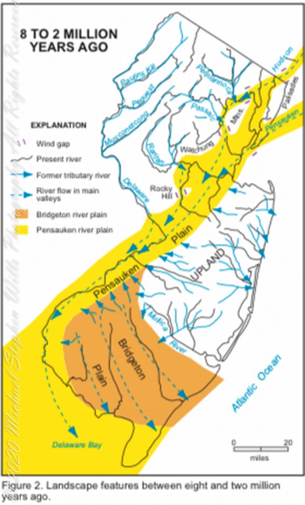
Visual presentation of Pinelands geologic origins, from New Jersey Geologic Survey, Scott Stanford author, 2005.
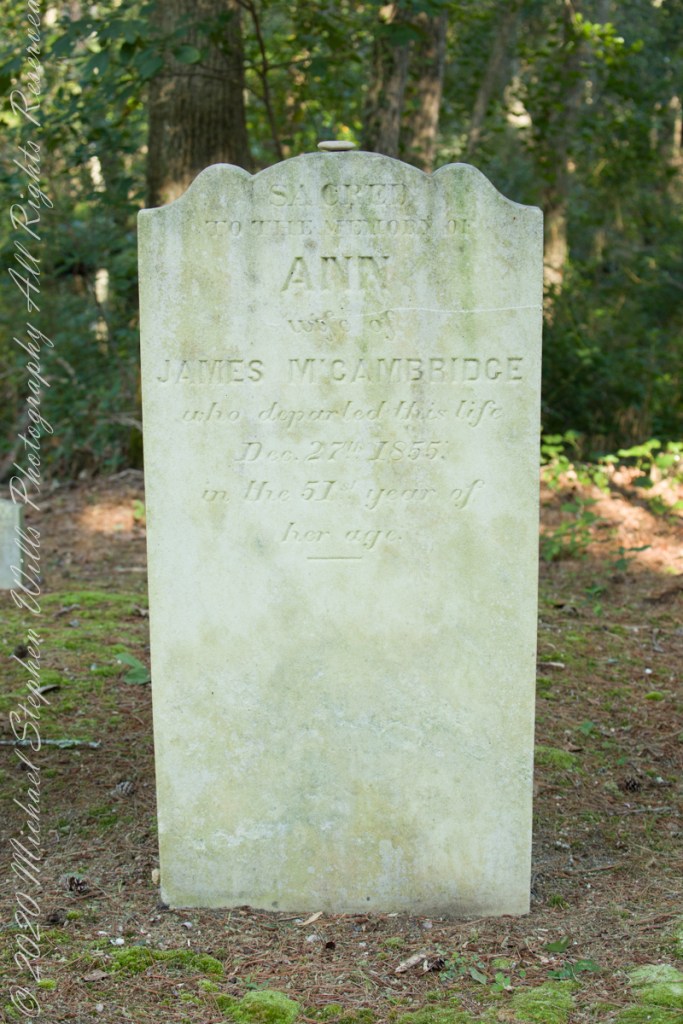
Standing there I imagined Great Great Grandmother Ann (Milley) McCambridge resting on the journey from the McCambridge home near Speedwell. I placed the pebble, collected from Long Island Sound, on Grandmother Ann’s headstone the evening of August 26th. Click this link for more about Ann McCambridge.
Sacred to the Memory of ANN wife of James McCambridge who departed this life December 27th 1855 in the 51st year of her age.
Reference
I found Quaker Bridge background in “Heart of the Pines, ghostly voices of the Pine Barrens” by John E. Pearce, pp 748 – 750, Batsto Citizens Committee, 4110 Nesco Road, Hammonton, N.J. 08037-3814.
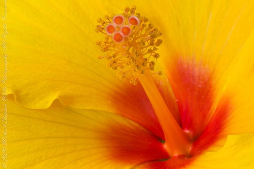
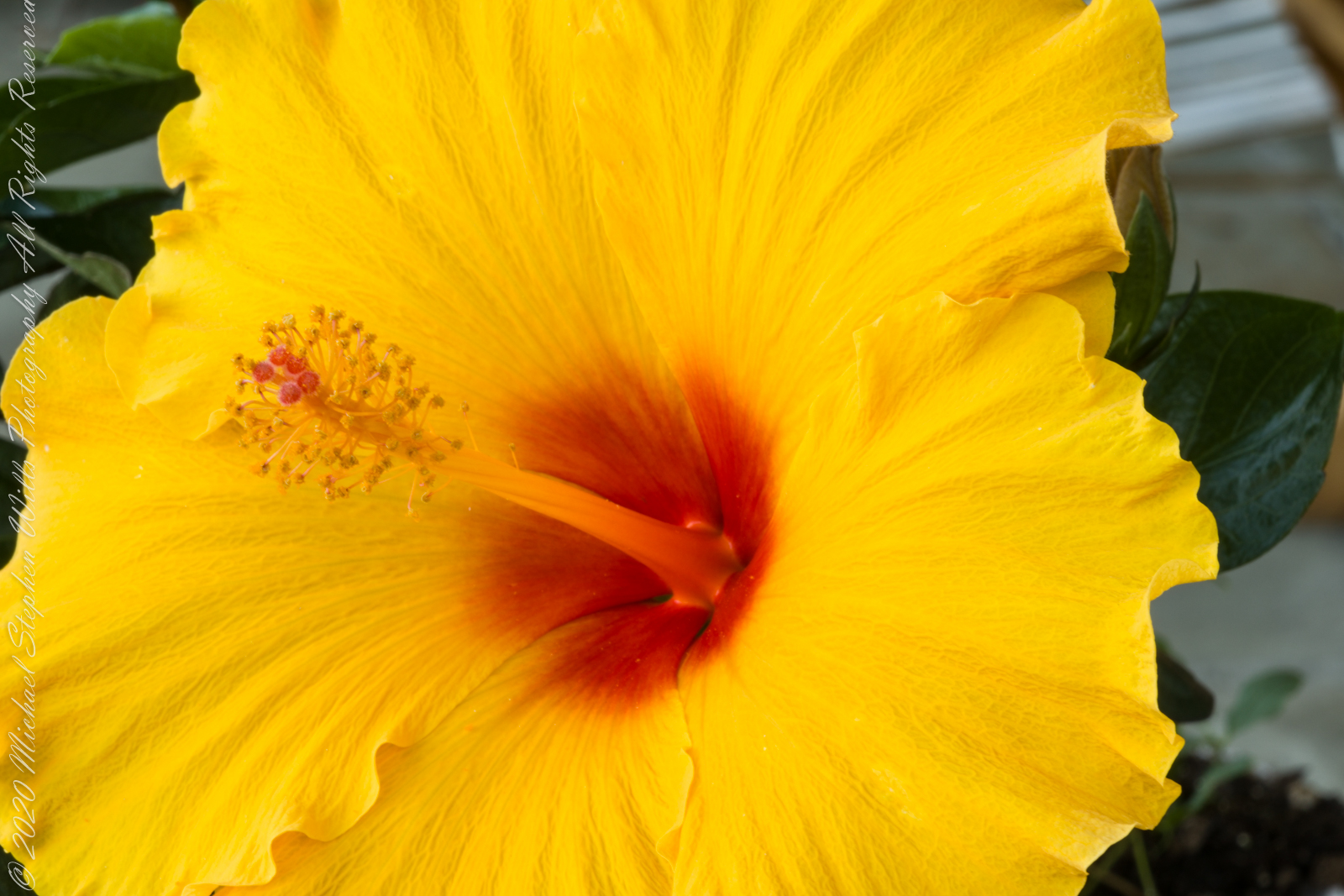
Evening breezes brought to a halt my series of hibiscus bloom photographs, that bloom faded and shriveled, to be replaced by another. I captured the images of this post on a very quiet summer evening. This bloom was facing up closer to vertical that the previous.
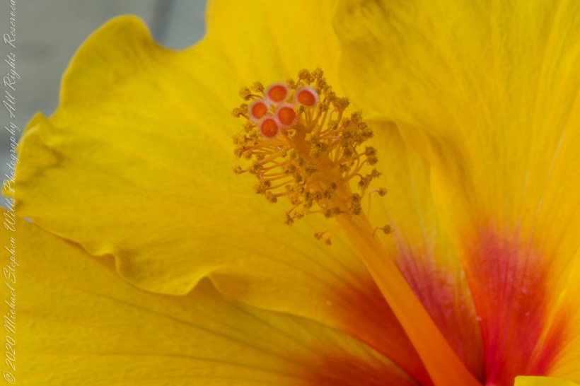
A key identification for all 300 species of hibiscus is the long stamen tube. I have yet to see a local insect interacting with the stamen, always they are in the flower throat. In the tropics, pollination is thought to proceed from large butterflies and birds.
Click photograph for larger view in new tab. From WordPress Reader you need to open the post to use this feature.
ISO 100, 1/10 sec at f / 14
ISO 100, 1/6 sec at f / 14
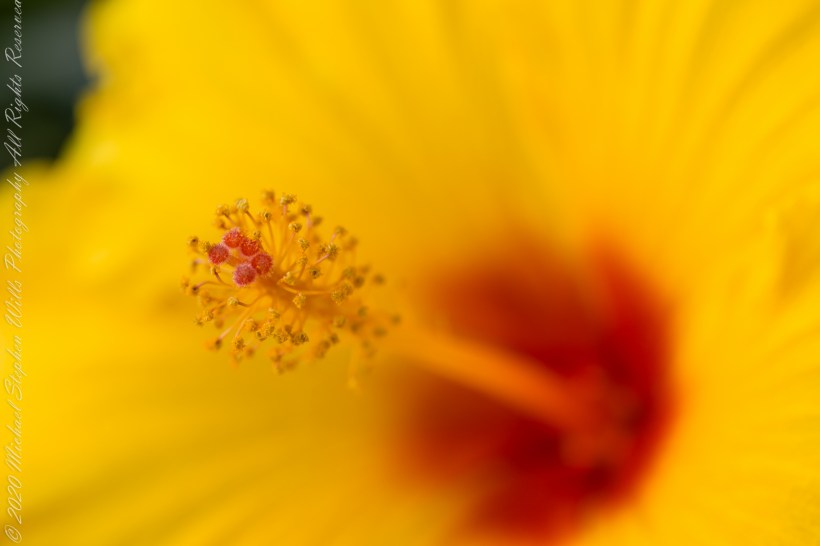
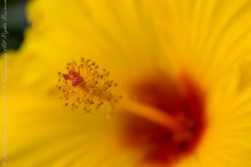
Here are three macro photographs of this bloom, all from the Canon 100 “macro” lens. I learned by experience to tamp down the diaphragm to the smallest setting, f / 32 for this lens. The different aspects were achieved by moving the lens objective closer to the bloom. This is a “fixed” lens, it has one focal length.
ISO 100, 1.0 sec at f / 32
ISO 100, 1.3 sec at f / 32
ISO 100, 1.3 sec at f / 32
References
Wikipedia – “hibiscus.”
Copyright 2021 Michael Stephen Wills All Rights Reserved
Nyctinasty (flower response to light: opening with or closing without light) in hibiscus plants is a mechanism to protect against adverse conditions such as cool temperatures that can be damaging. Through a lack of light stimulus and circadian rhythms the plant is able to trigger the molecular movement of ions to allow for the closing of the flower.
Click photograph for larger view in new tab. From WordPress Reader you need to open the post to use this feature.
ISO 100, 1.3 sec at f / 29
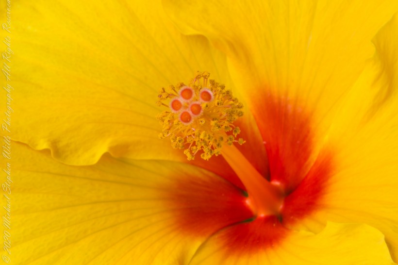
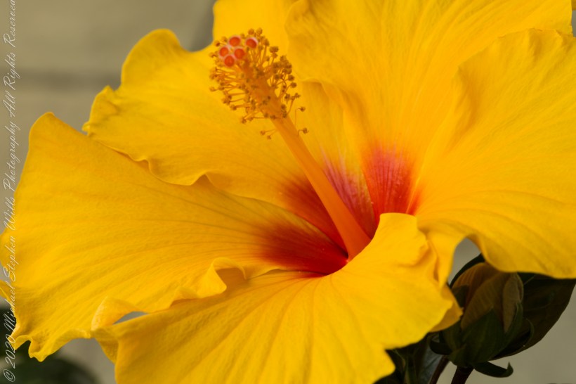
Here are three macro photographs of this bloom, all from the Canon 100 “macro” lens. I start with the shutter diaphragm open at 4.0 (“F-stop”), a little narrower at 4.5 and a bit more at 9.0. For this lens the maximum opening is at 2.8, the narrowest is 32. As the opening narrows (F-stop increases) the exposure time needed to capture enough light lengthens and the range of the image in focus increases.
ISO 100, 1/30 sec at f / 4.0
ISO 100, 1/25 sec at f / 4.5
ISO 100, 1/6 sec at f / 9.0
References
Wikipedia – “hibiscus.”
Copyright 2021 Michael Stephen Wills All Rights Reserved