Twilight Serenade: Experiencing the Eclipse Amidst Nature’s Splendor

Step into the enchanting world of the VanRiper Conservation Area during a total solar eclipse. Witness nature’s grand spectacle, where daylight fades into an ethereal twilight, and the cosmos whispers secrets to those who listen.

Standing within the serenity of the VanRiper Conservation Area, we had the rare privilege to witness a celestial marvel—the total solar eclipse. The coordinates, 42°43’8.62″N 76°45’30.41″W, marked not a unique vantage point on the southern edge of the total eclipse zone. Here, the total eclipse enveloped the sky for an awe-inspiring 50 seconds, a fleeting yet unforgettable spectacle that we were fortunate enough to experience.
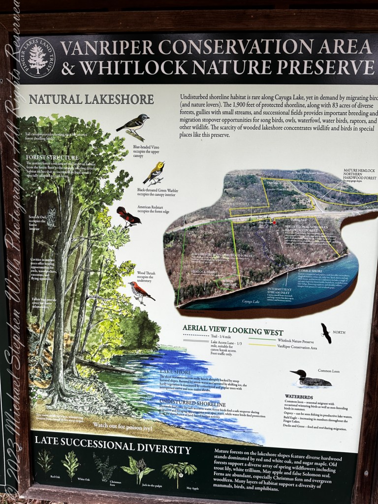
The VanRiper Conservation Area served as a magnificent backdrop to this astronomical event. Known for its diverse habitats, including wetlands, forests, and meadows, the area is a haven for wildlife and a sanctuary for those who seek solace in nature; a place where the sky seems vast, unobstructed by the trappings of urban life, offering a clear canvas for the eclipse to paint its momentary magic.
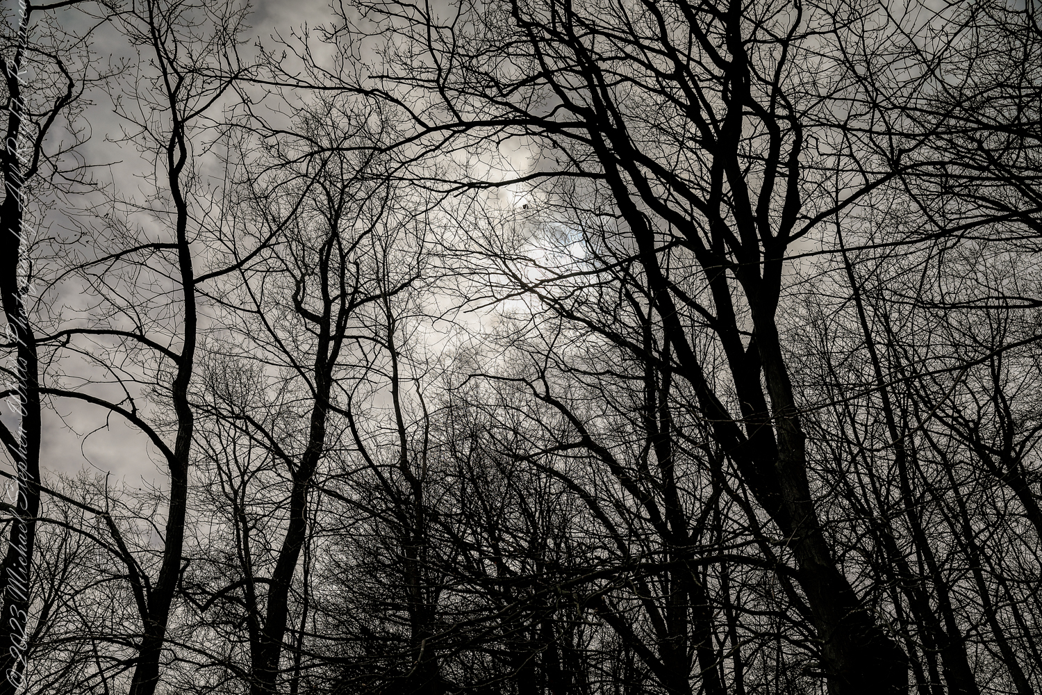
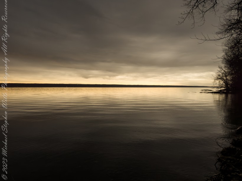
13:38:07, 39 minutes 41 seconds before the moon’s edge touched the sun. From the shoreline of VanRipen Conservation Area, Town of Romulus, Seneca County, Finger Lakes Region, New York State

As the time for the eclipse approached, a thick blanket of clouds enveloped the sky, obscuring our view of the sun entirely. This unexpected veil not only robbed us of the celestial spectacle but also intensified the darkness, casting a deeper shadow over the landscape and amplifying the surreal, twilight ambiance.

As the moon began its slow sweep over the sun, an eerie twilight descended upon the conservation area. The temperature dropped noticeably, a testament to the sun’s masked radiance. The birds, momentarily confused by the sudden dusk, fell silent, heightening the surreal atmosphere. This was the moment I had been waiting for, the total eclipse, where day momentarily turns to night, and the ordinary becomes extraordinary.
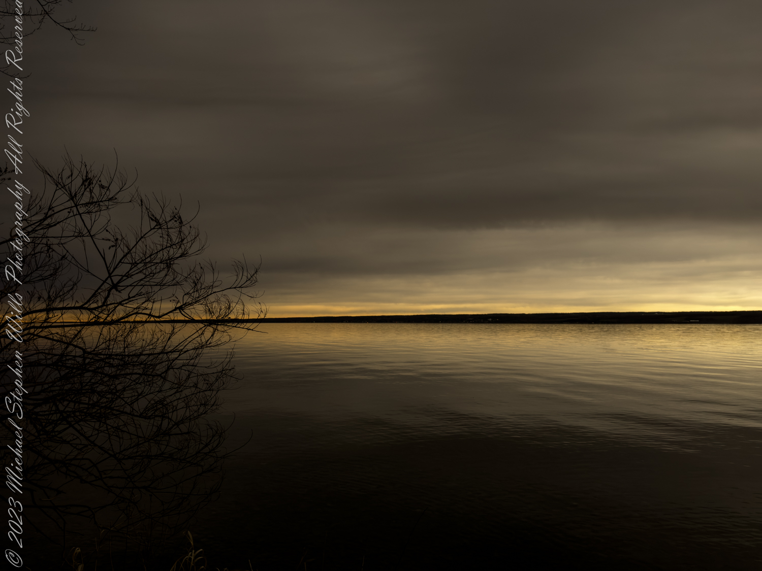
15:21:37, 56 seconds to totality. From the shoreline of VanRipen Conservation Area, Town of Romulus, Seneca County, Finger Lakes Region, New York State

Positioned on the southern edge of the total eclipse zone, I observed a fascinating phenomenon: the southern side of the horizon retained a brighter hue compared to the north, which veiled itself in deeper shades of twilight. This luminous gradient painted across the sky was a direct consequence of our location’s proximity to the eclipse’s path of totality.

In this captivating 4-minute YouTube video, you’re whisked away to the shores of Cayuga Lake, beneath a cloudy sky, on the day of the Total Eclipse, April 8, 2024 viewed from the VanRiper Conservation Area Cayuga Lake Shoreline in the town of Romulus, Seneca County of the Finger Lakes of New York State. As the moon dances across the sun at 5 times normal speed you witness the gradual darkening of the lake. On the opposite shore, the town of Aurora lights wink with the total eclipse of the sun. In normal time Loons herald the Sun’s return with a bright and eerie serenade, a natural symphony celebrating light’s triumph over darkness. Join us on this remarkable journey, where day turns to night and back again, all within the embrace of the Finger Lakes Region.

The totality lasted for a mere 50 seconds, when time seemed to stand still, yet it was a period rich with emotion and wonder. To witness the total eclipse was to see the universe align in a rare spectacle of shadow and light, a reminder of our place in the cosmos.

Reflecting on the experience, the VanRiper Conservation Area was a portal to a deeper understanding and appreciation of the natural world. Its untouched Cayuga Lake shoreline provided a setting for observing the eclipse with a reminder of the beauty and fragility of our planet.

As the eclipse passed and daylight returned the silence was filled with Loon calls, a celebration of life and the return of light. The solar eclipse was a convergence of time, place, and celestial mechanics, offering a spectacle for the eyes, a moment of introspection about our existence in this vast universe: a reminder of the ephemeral nature of life and the enduring awe of the cosmos. In the heart of the conservation area, I stood at the crossroads of science, nature, and spirituality, left to reflect on the dance of shadows and light.

Copyright 2024 Michael Stephen Wills All Rights Reserved

A Glimpse into Steamboat Landing, Ithaca, New York

Discover the enchanting beauty of Steamboat Landing in Ithaca, New York. From the quiet winter majesty to the vibrant warmth of spring, this historical waterfront is a testament to the city’s rich past and evolving present.


Historical Significance and Transformation


Steamboat Landing in Ithaca, New York, is steeped in historical significance, serving as a testament to the city’s rich past and its evolving present. At the dawn of the 20th century, it was a bustling hub where steamboats carried passengers and freight, linking Ithaca to an ever-growing nation. These vessels were vital for the development of commerce, aiding travelers as they embarked and disembarked on their journeys that continued by stagecoach or later, by train.

In 1790, this spot marked the beginnings of commerce in the area, with the establishment of Ithaca’s first store. Over the years, Steamboat Landing has transformed from a pivotal commerce point to a recreational area, housing Ithaca’s Farmers Market—a vibrant hub that mirrors the liveliness of its heyday.

The Evolving Landscape


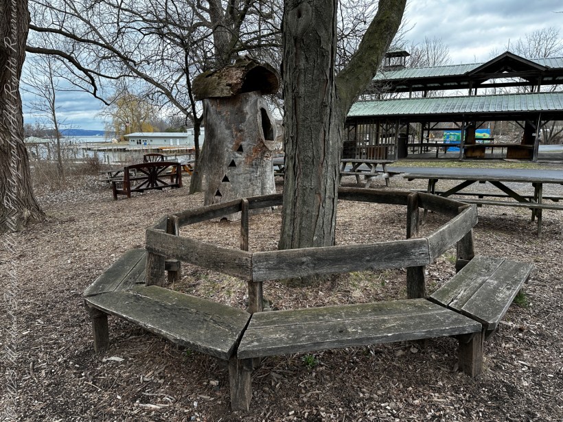
Today, Steamboat Landing is a place of gathering and serenity. My photographs showcase a tranquil setting moving through winter. In one scene, the rustic benches encircle a barren tree, standing as silent guardians of the land. It’s a still image, almost reminiscent of a painting, where the leafless trees stand vigil over the quiet benches.

A circular bench that has seen better days, a hollowed out tree trunk repurposed as a children’s playgound house, picnic benches and, in background, a portion of the Farmer’s Market pavilion, to the right is Johnson Boatyard, Cayuga Inlet and lake. This is the Steamboat Landing, historically the southern port on Cayuga Lake. Cayuga Waterfront Trail, Ithaca, Tompkins County, Finger Lakes Region, New York State.

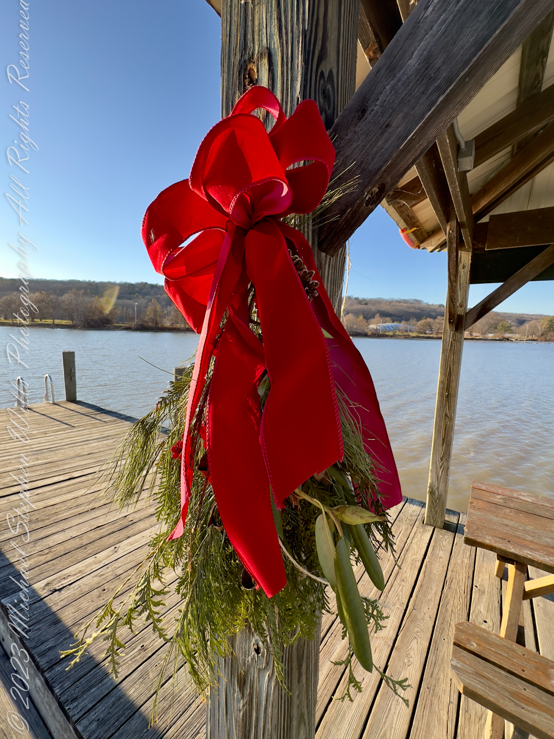
Switching seasons, we see the docks adorned with festive wreaths, injecting life and celebration into the scenery. The bright red ribbons stand out against the crisp blue of the water and the sky, suggesting a community that embraces tradition and the joy of the moment.

Connection with Nature and Community


The pictures depict how the landing is woven into the natural tapestry of the area. It is a place where one can sit and watch the placid waters of Cayuga Lake or stroll along the docks, feeling the crisp air against their skin. The images of the clear skies, the open waters, and the flight of birds in the distance are a subtle reminder of nature’s continuous presence.

Steamboad Landing on the Cayuga Waterfront Trail, Farmers Market, Ithaca, Finger Lakes Region, New York State

The waterfront trail exemplifies the community’s efforts to merge history with modernity, providing a space where people can connect with the environment and each other. The docks, once a stage for industrial exchange, now serve as a peaceful retreat, hinting at the deep-seated human desire for connection—not only to each other but also to the very essence of the environment we inhabit.

Seasonal Beauty and Reflection


The change in seasons at Steamboat Landing brings a unique beauty, which the photographs showcase poignantly. From the barren coldness of winter to the lush warmth of spring, each season imbues the landing with a distinct character. The winter images reveal a quiet majesty, with the bare branches and gray skies reflecting the introspective nature of the season. The springtime shots, however, burst with promise and vitality, as greenery begins to cloak the landscape and the water shimmers under the strengthening sun.

Enduring Legacy and Future Prospects


Steamboat Landing’s legacy as a historical transport hub has set the stage for its future as a cherished community locale. The images and historical texts paint a picture of a place that has embraced its past while looking forward to a vibrant and inclusive future. It is a locale that pays homage to its roots through the Farmers Market and other community events, ensuring that the spirit of the old steamboats continues to thrive in the hearts of Ithacans.

In conclusion, Steamboat Landing is a geographic location and a chronicle of Ithaca’s journey through time. Through its transformation, it has become a place where history breathes, nature speaks, and the community finds its heartbeat. It stands as a beacon of heritage, recreation, and beauty—a corner of the world where past and present dance together in harmony.

Copyright 2024 Michael Stephen Wills All Rights Reserved

A Shoreline Spectacle: The Power and Grace of Military Aviation

While beachcombing I witnessed an awe-inspiring moment where tranquility meets military prowess.
Discover the captivating blend of nature and technology in my latest post.

As I approached the placid stretch of sand known as Second Beach, adjacent to the Patrick Space Force Base, the Atlantic breeze carried a tang of salt that mixed with the distant, almost imperceptible hum of powerful engines. The sand, still cool beneath my feet, bore the imprints of morning walkers and the scuttle marks of sandpipers. It was a peaceful canvas, soon to be underscored by the might of aviation prowess.

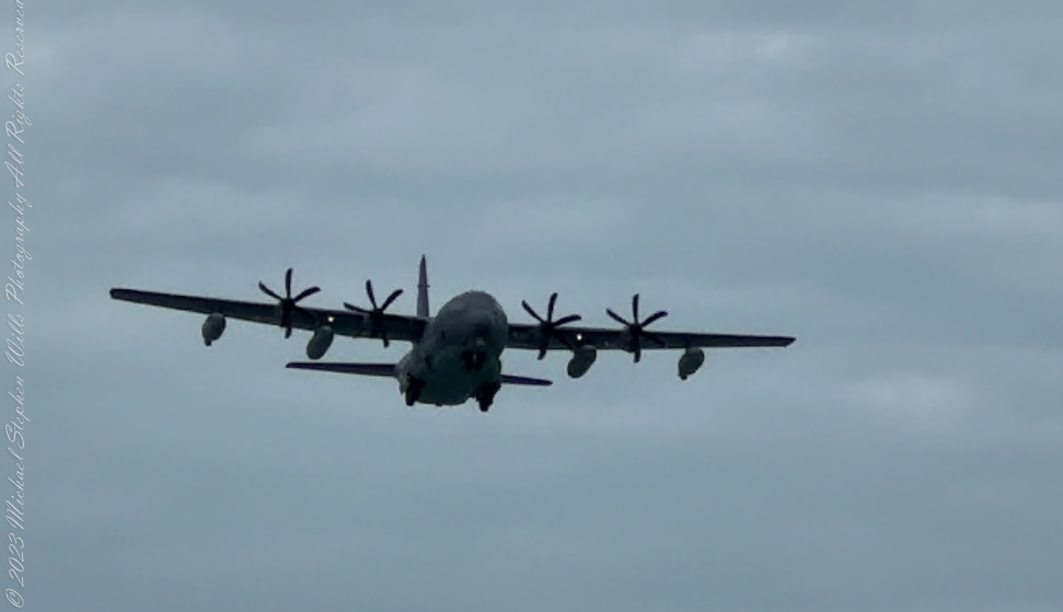
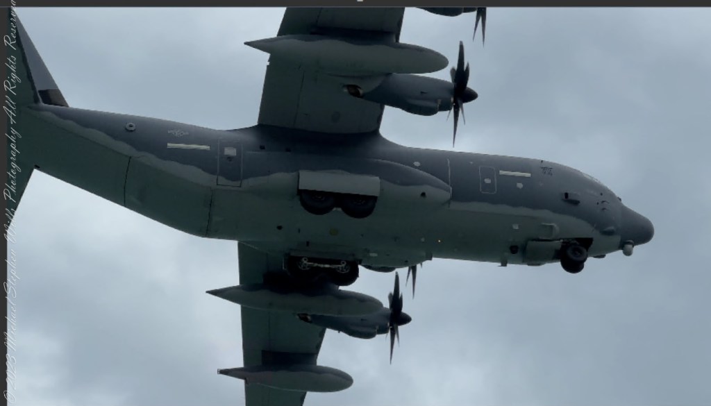
Having walked barely a tenth of a mile along the shoreline, the tranquil horizon was interrupted by the advancing silhouette of the Lockheed Martin C-130J Super Hercules. The Hercules, a titan of the skies, made its approach, its four Rolls-Royce AE 2100D3 turboprop engines altering the cadence of the ocean’s whispers. There’s a unique blend of awe and humility one feels in the presence of such human engineering, a craft capable of touching the farthest reaches of the globe, delivering hope or strategic might with equal prowess.

As the Hercules descended, its shadow enveloped my position, transient and thrilling. The aircraft’s formidability was evident in the robust structure and the propellers cutting through the air with surgical precision. The six-bladed composites, in harmonious rotation, seemed like the spokes of some celestial chariot, ushering the giants of the sky onto the earthly stage. Even as it neared the runway, the versatility of the Super Hercules was unmistakable; crafted for austere conditions, yet here it was, gliding over a picturesque landscape, a sentinel on a peaceful mission.

The Hercules passed overhead with a display of grace uncharacteristic of such a large aircraft, the whirring of its engines a testament to the ceaseless vigil it keeps across the skies. As it touched down, the craft transformed from a spectral giant back into a tangible instrument of air superiority and logistical support.

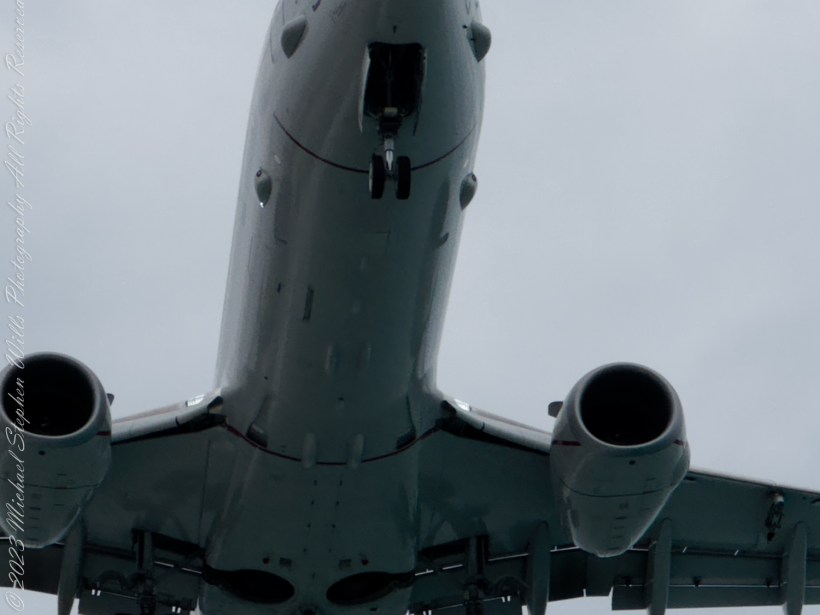
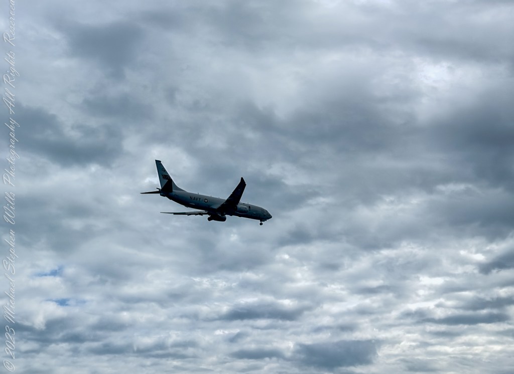
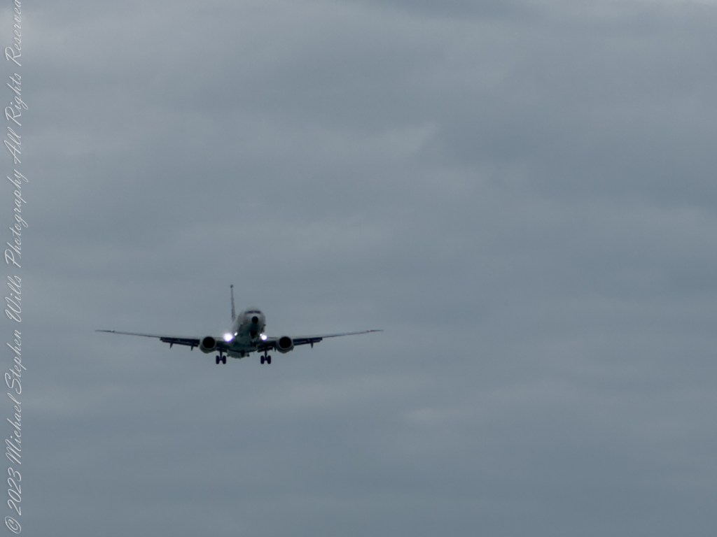
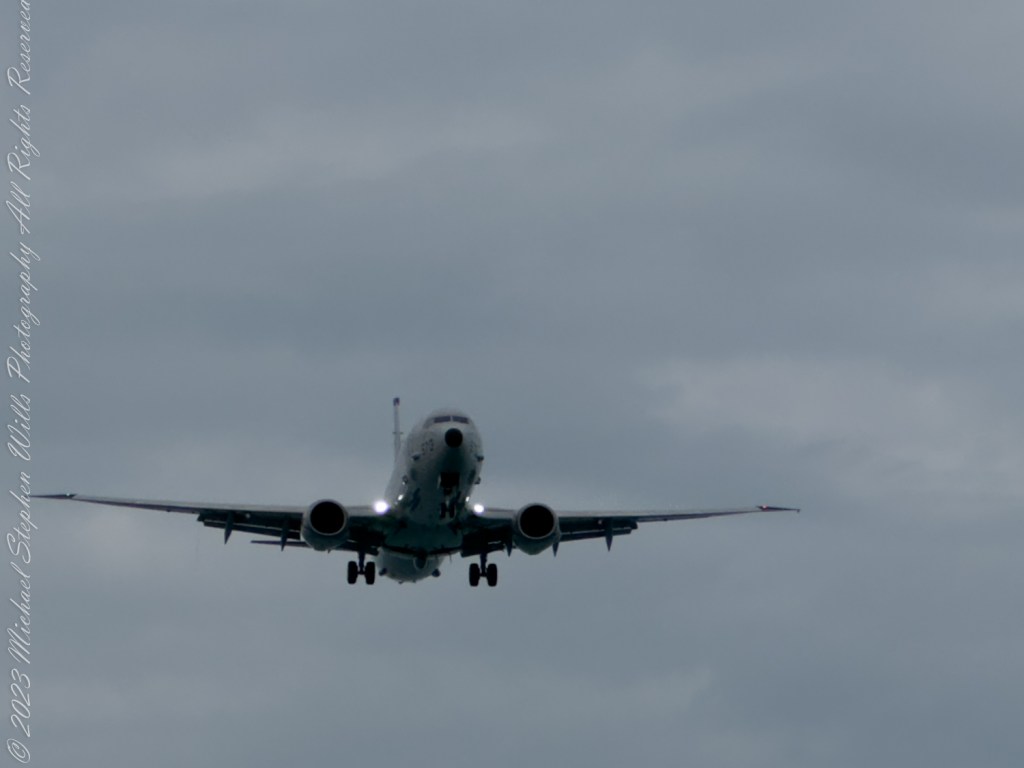
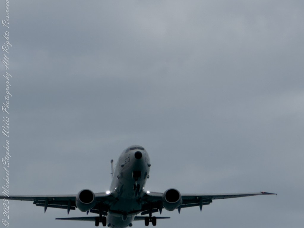
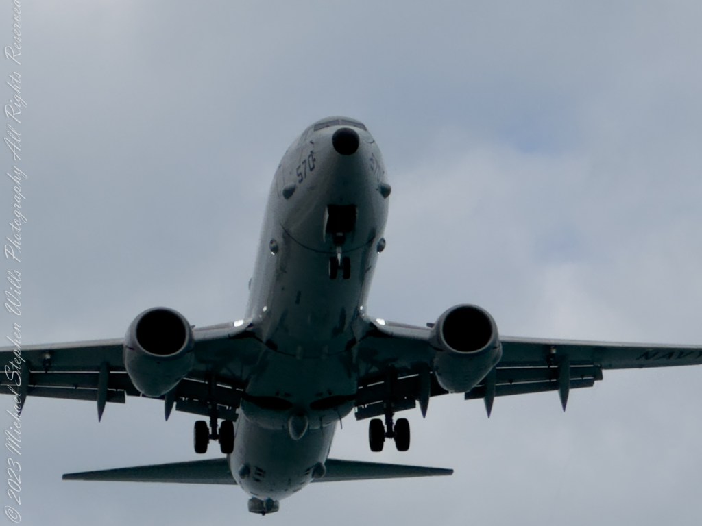
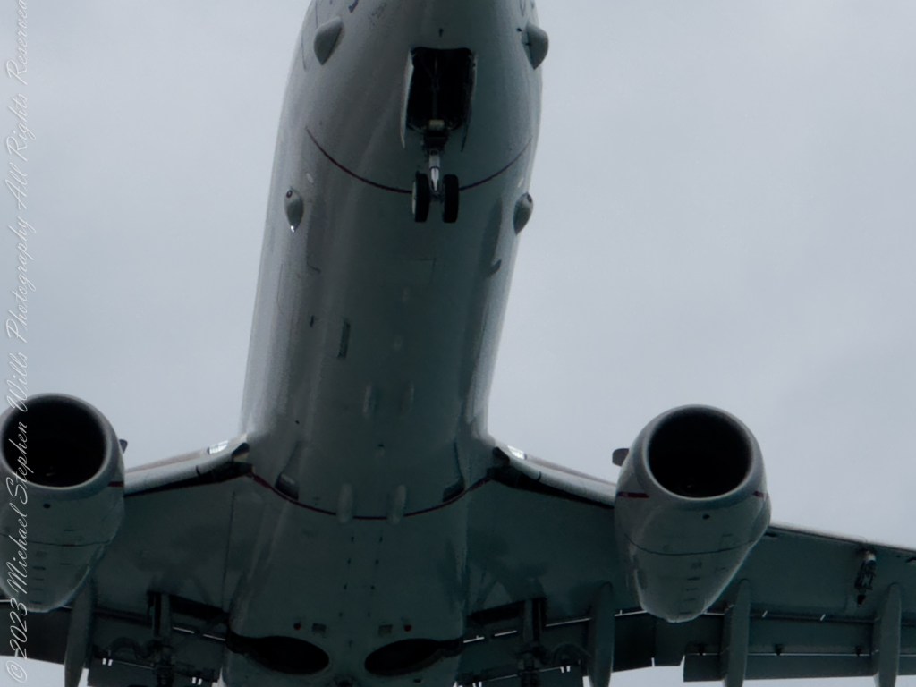
After an interlude of peaceful wave breaks another form caught my eye. The sleek, more modern contours of the Boeing P-8 Poseidon emerged from the azure, its twin engines a whisper of progression against the roar of the Hercules before it. This maritime patrol aircraft, with its lineage traced back to the reliable Boeing 737, represents the evolution of aerial surveillance and anti-submarine warfare.

As the P-8 Poseidon drew closer, descending with an elegant ease, its profile cut a striking contrast against the gray clouds above. Its advanced radar arrays, mounted under the wings and fuselage, hinted at the craft’s hidden eyes—eyes that watch over the ocean’s expanse with vigilance. There was an undeniable presence of precision and technological advancement that surrounded the Poseidon as it sailed through the air.

It passed over with a smoothness that belied its tactical purpose, a guardian of the seas ensuring the unseen threats remained held at bay. It was an ethereal sight, the embodiment of modern warfare’s stealth and strategic intelligence. The Poseidon’s landing gear, deployed and ready, connected with the tarmac in a seamless dance of man, machine, and purpose.

Standing there, I felt enveloped in a narrative much larger than myself—a narrative of human ingenuity, the relentless pursuit of security, and the silent promise of guardianship from above. With the passing of these large warplanes, I was reminded of the thin line between serene shores and the turbulent skies, and the ever-vigilant watch kept by these titans of the sky.

Copyright 2024 Michael Stephen Wills All Rights Reserved

Spring Renewal and the Buoys of Change

As you glimpse the strewn buoys at Cayuga’s shore, consider the tales they hold—witnesses to history, guiding vessels through New York’s storied waters. Delve into their journey from the Erie Canal’s birth to today’s spring awakening.

As the crisp air of spring begins to soften and the last remnants of winter recede, you might find yourself drawn to the outdoors, eager to participate in the age-old tradition of spring cleaning. It is a time of renewal, of clearing away the old to make way for the new. In Ithaca, this period of rejuvenation extends beyond the confines of cluttered homes and into the expansive natural landscape, as shown in the photograph before you.

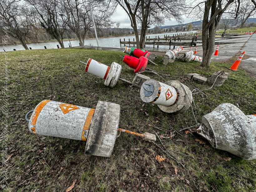
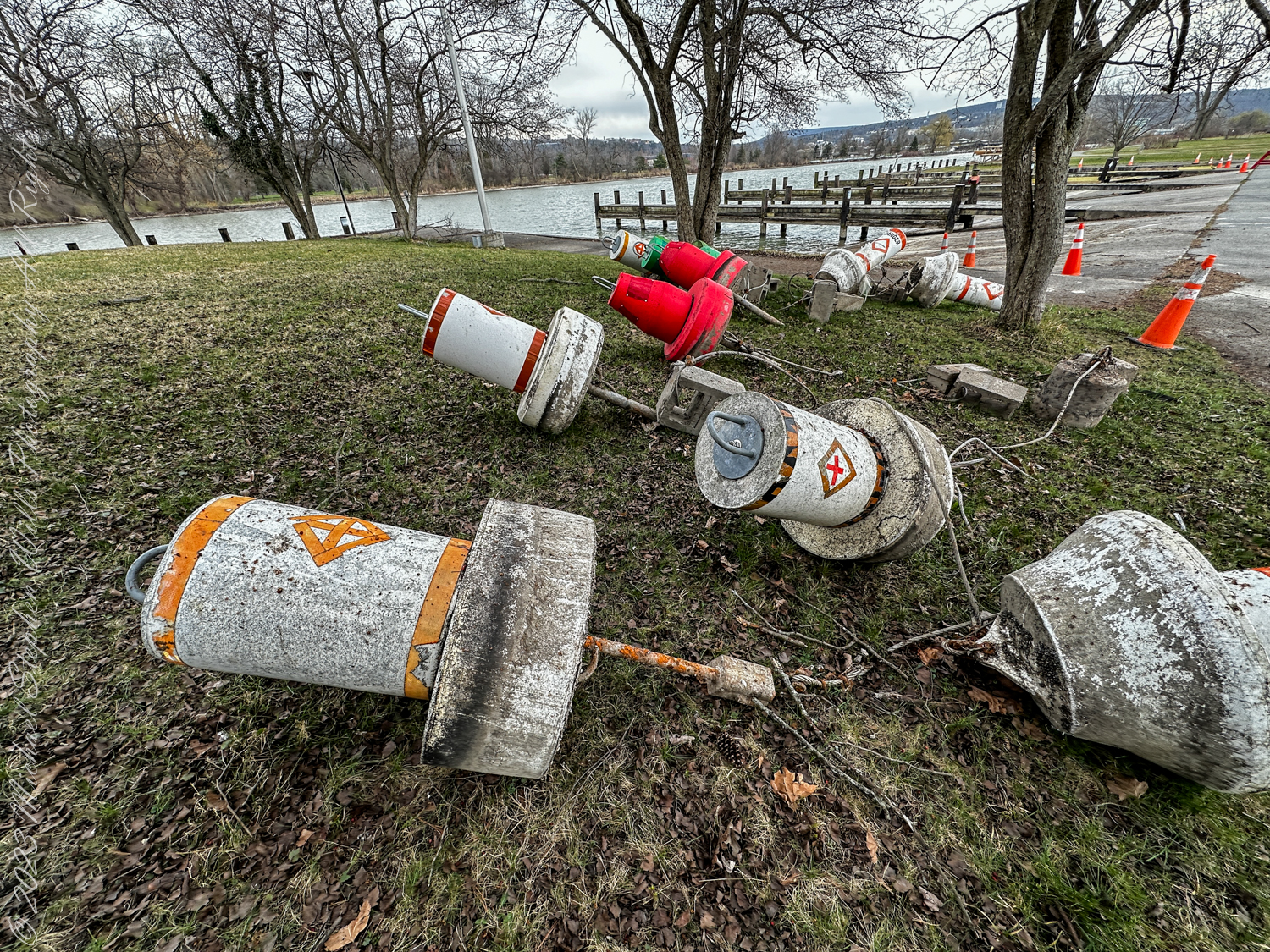
Spring cleaning and repair at the Alan H. Treman Marine Boat Park. Ithaca, New York, Tompkins County

Tidying the Shores


There, on the shores of Cayuga Lake, the scene is a stark contrast to the neat rows of daffodils you admired yesterday. Instead, navigation buoys, those steadfast guides of the waterways, lie upended and scattered – casualties of the winter’s harshness or perhaps the diligent work of park employees preparing for the upcoming boating season. These buoys, usually afloat, marking safe passage for vessels, are now being tended to, maintained, and readied. It is an essential process, akin to the annual spring clean, ensuring the safety and smooth sailing in the months to come.

Guardians of the Waterways


Let’s delve into the history these buoys are part of. You, as a curious observer, are witnessing a fragment of a narrative that stretches back over a century. These navigational buoys are descendants of the earliest markers that adorned the inland waters of New York State and the Erie Canal, of which Cayuga Lake is an integral part.

The Erie Canal and Cayuga’s Connection


The Erie Canal, an engineering marvel of the 19th century, opened in 1825, transforming New York and the entire Great Lakes region. It was the superhighway of its time, connecting the Atlantic Ocean to the Great Lakes, and thereby shaping the course of economic and social history in the United States. Cayuga Lake, connected to this system via the Cayuga-Seneca Canal, was part of this vast network of navigable waters.

Navigation Buoys: Beacons of Progress


As commerce flourished, so too did the need for reliable navigation. The buoys, then as now, served as critical signposts, ensuring that vessels could traverse these waterways safely. Imagine the countless boats that relied on these markers – from the large freighters carrying goods to the smaller craft bearing passengers – each buoy a sentinel ensuring their safe passage.

Modern Sentinels


Today, the navigation buoys on Cayuga Lake and other inland waters continue this legacy. They are the modern sentinels of the deep, equipped with the latest technology to guide the way. Just as the Erie Canal once heralded a new era of travel and trade, these buoys now symbolize the enduring importance of safe and efficient water transportation.

The Future of Inland Navigation


As you reflect upon the photograph, consider the ongoing narrative of these buoys and the waterways they mark. In a world increasingly concerned with sustainable modes of transportation, the historical importance of these channels resurfaces. The waterways that once fueled the expansion of a nation may once again play a pivotal role, this time in the quest for greener alternatives to overland routes.

Conclusion: A Cycle of Renewal


The upturned buoys in Cass Park, ready for their spring cleaning, are a microcosm of the cyclical nature of life and progress. They remind you that renewal is not just about beauty; it is also about preserving the functionality and safety that allow society to move forward. Just as the spring cleaning in your home ushers in a new season of clarity and freshness, the maintenance of these navigational aids renews the commitment to a legacy of safe passage – a promise made by the generations that have sailed these waters since the days of the Erie Canal.

A Path Lined with Promise: Spring’s Embrace in Ithaca

Happy April 1, 2024

You find yourself on the cusp of spring, the earth slowly awakens from its wintery slumber, and life begins to stir in the subtlest of forms. Imagine strolling through a park in Ithaca, the evidence of spring’s tender handiwork unfolding before your eyes. As you traverse this liminal space where the grey of winter meets the vibrant hues of spring, you are greeted by a cheerful brigade of daffodils, a sure harbinger of warmer days.

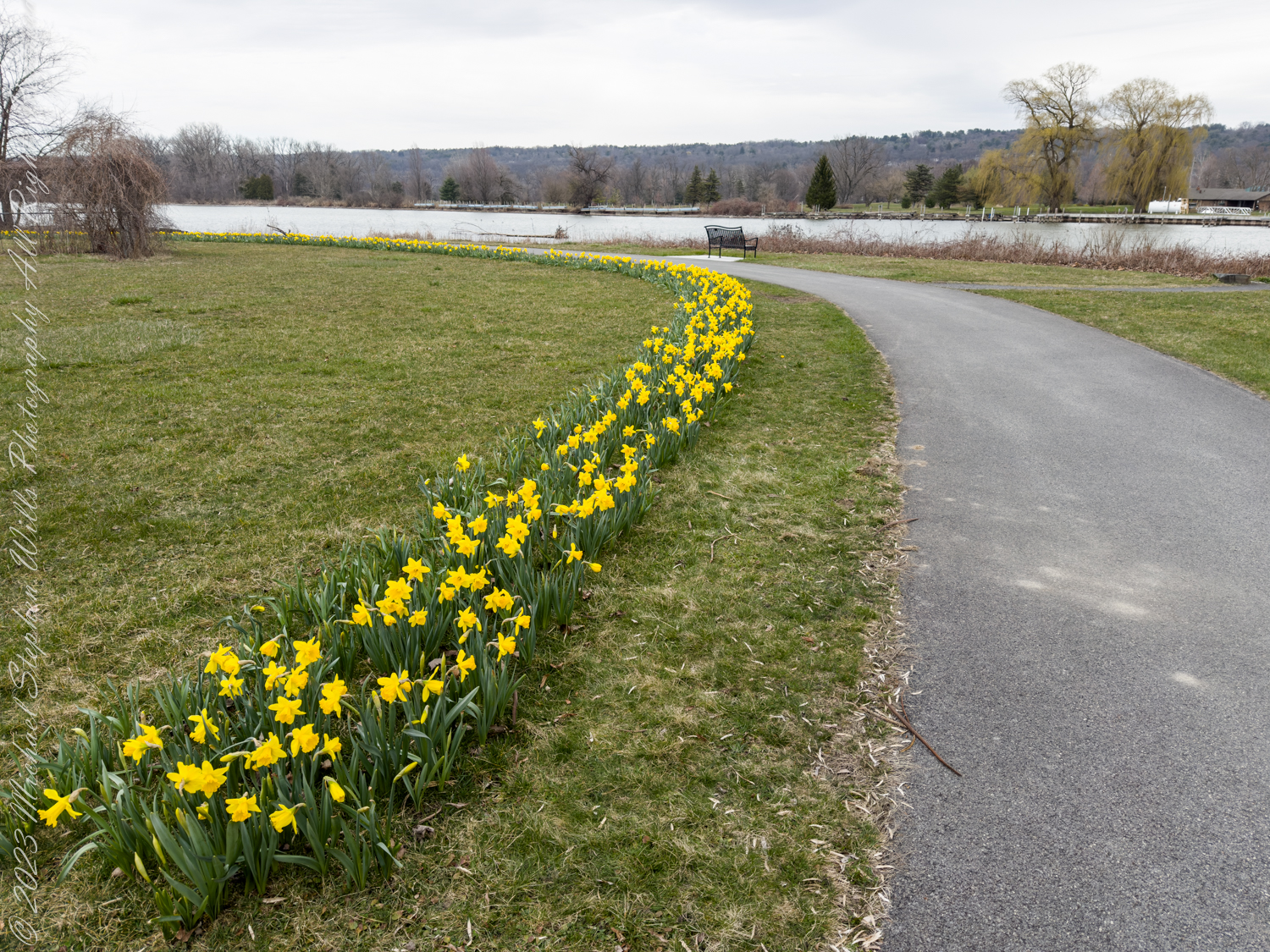
These daffodils are blooming along the Cayuga Waterfront Trail within Cass Park, Ithaca, Tompkins County, New York

Through the above image, it’s as though you are leaning in, your gaze just inches above the blooms. These daffodils are not merely flowers; they are the golden trumpets of spring, each one a burst of joy amidst the still-dormant earth. You can almost feel the softness of the petals, the coolness of the air, and the promise of renewal that each bud encapsulates. With their faces eager to bask in the strengthening sun, they seem to resonate with your own readiness for change, for the fresh possibilities that each new season brings.

As you stand up and take a few steps back, the following image grants you a wider perspective. Here lies a path, winding gently alongside a burgeoning line of daffodils. They stand in unity, a vivid yellow line drawn against the canvas of awakening green. The bench in the distance is vacant, an invitation to sit and appreciate the tranquility of Cass Park, the expanse of water beyond serving as a mirror to the open sky. It’s a scene that calls for contemplation, urging you to appreciate the simplicity of the moment, the serenity of nature’s process.

These daffodils are blooming along the Cayuga Waterfront Trail within Cass Park. Here the trail has passed over Linderman Creek and we are looking toward the Cayuga Lake inlet. Ithaca, Tompkins County, New York

These photographs are more than visual delights; they’re sensory experiences. Can you hear the subtle sounds of the park? The distant call of birds returning home, the soft rustle of grass stirred by a gentle breeze, the hushed murmur of water lapping at the shore? Each sound is a note in the symphony of spring, played just for you.

The images you see are not frozen in time; they carry within them a narrative of life’s perseverance. The daffodils, with their bright faces and sturdy stems, have weathered the cold, the snow, and the frost. They emerge, not just as survivors of winter, but as its conquerors. Each flower is a testament to resilience, a living metaphor for the human spirit that you, too, possess.

This is the season of rejuvenation, where the old is shed, and the new embraced. With each day, the sun lingers a bit longer, casting its golden glow upon the earth. It’s the time to set aside the grayness of yesterday and look forward to the spectrum of tomorrow. The photographs are not just to be viewed; they are to be felt, to remind you that no winter lasts forever, no spring skips its turn.

As you walk away from this scene, you carry with you the warmth of the sun and the cheer of the daffodils. Let the images serve as a reminder of the perennial cycle of life, the undying hope, and the enduring beauty that awaits just outside your door. Feel encouraged to seek these moments, these fragments of beauty, in your everyday wanderings, and hold onto the message of the daffodils: after every winter, no matter how harsh, comes the gentle kiss of spring.

Copyright 2024 Michael Stephen Wills All Rights Reserved

Behind the Scenes of the Final Frontier: Our Tour with NASA’s “Launch Director” – 6

Step behind the scenes of space exploration with this dive into the awe-inspiring details of the Space Shuttle Atlantis, its thermal-protected wings to the onboard engines.

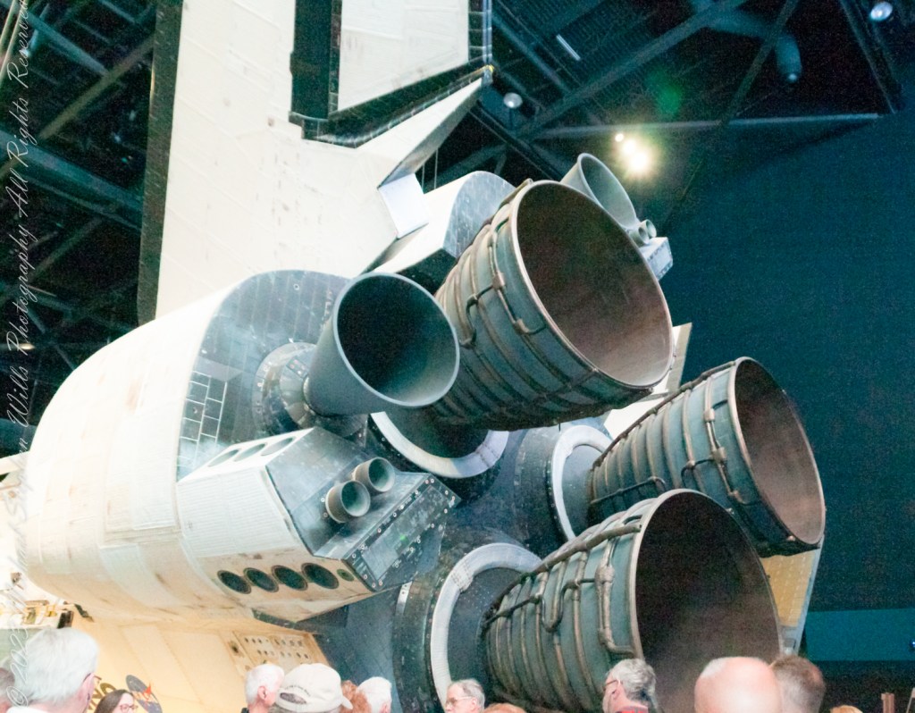
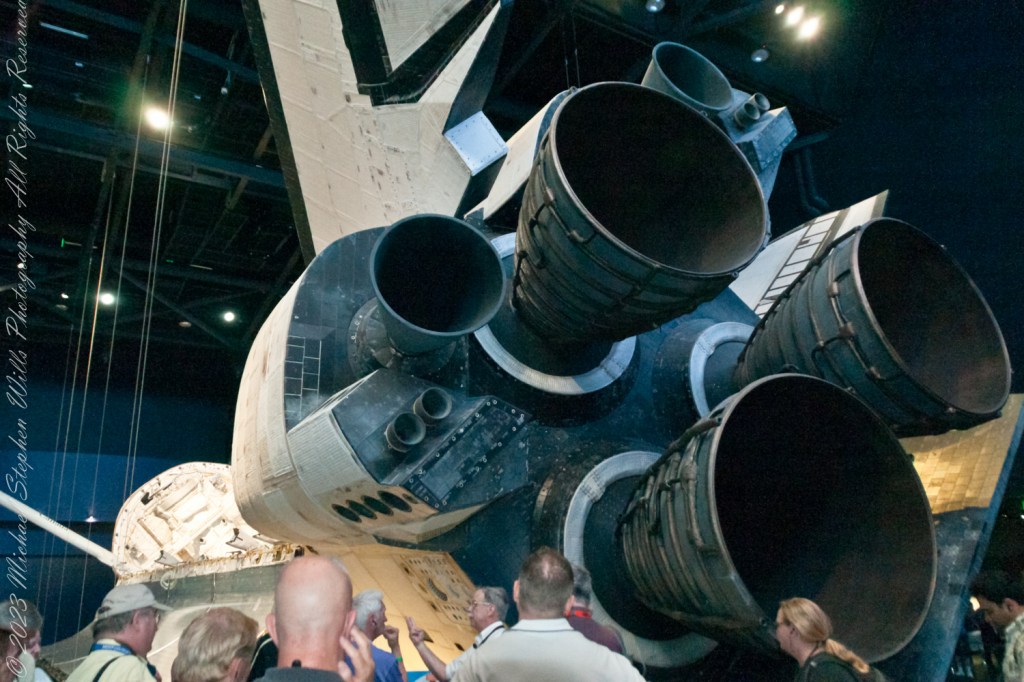
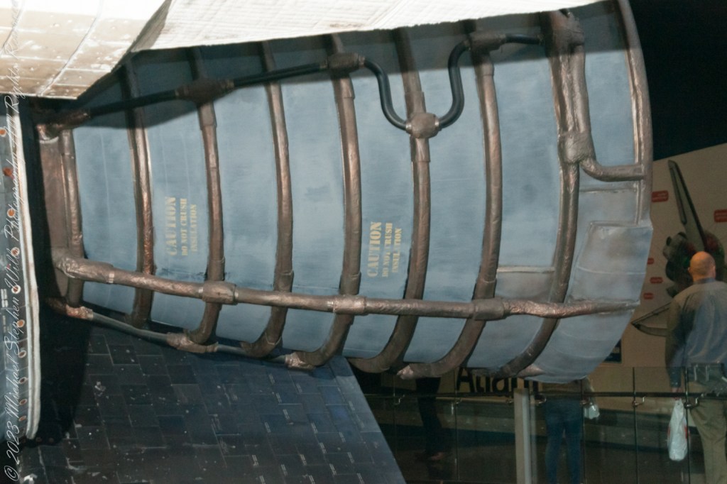
Imagine, if you will, stepping onto the grounds of NASA, where the air buzzes with the legacy of space exploration and the spirit of human achievement. It’s a place where dreams of the cosmos turn into reality. Our 2017 Launch Director tour not only brought us face-to-face with the marvels of space travel but allowed me to delve into the intricate details of one of NASA’s most iconic spacecraft: the Space Shuttle Atlantis. In this episode 6 of our adventure, we continue exploring the engineering marvel that is Atlantis, focusing on its wings, rear stabilizer, and onboard engines—elements critical to its legendary missions.

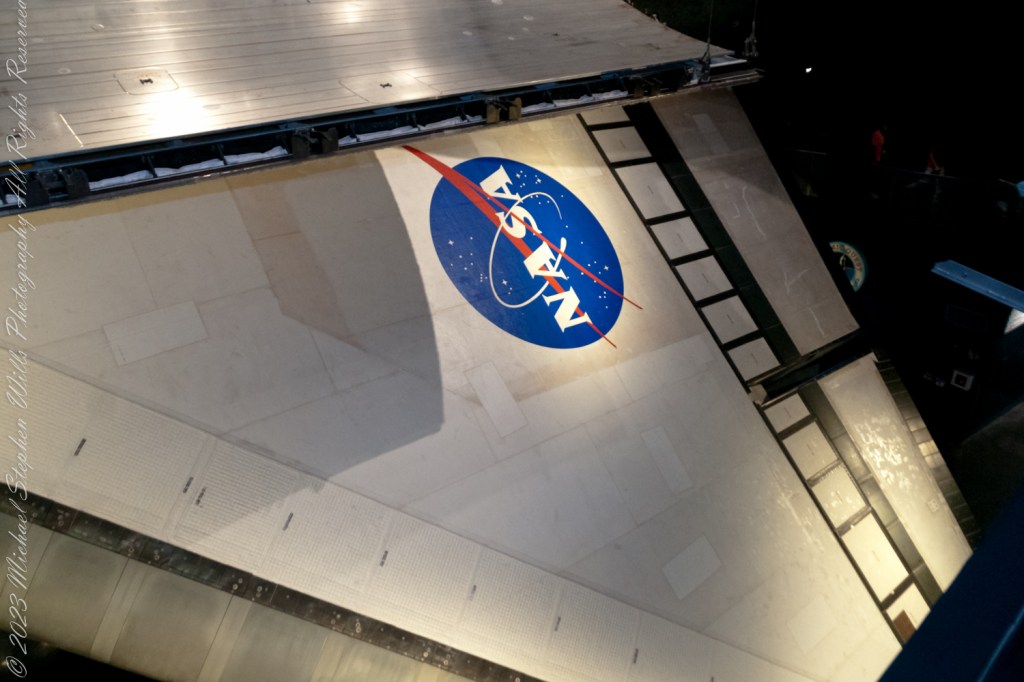
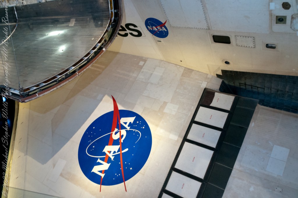
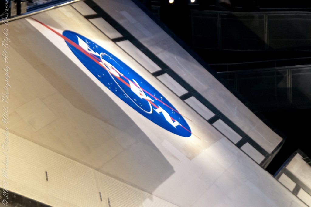
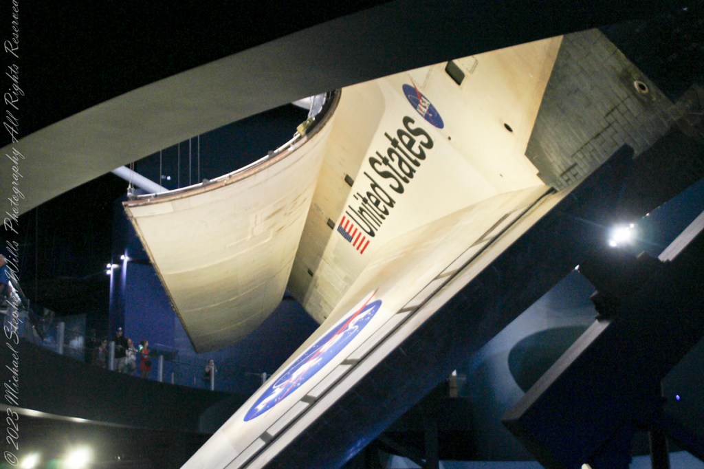
The Space Shuttle Atlantis, a name synonymous with discovery and exploration, represents a pinnacle of human ingenuity. As you walk around the Atlantis exhibit, you can’t help but be awed by the shuttle’s design, particularly its wings. The wings of Atlantis, with a wingspan of about 78 feet, are not just structures of metal and composite materials; they are the shuttle’s lifeline during re-entry into Earth’s atmosphere. These delta-shaped wings are designed to withstand the scorching temperatures of re-entry, allowing Atlantis to glide back to Earth with grace and precision. The material covering the wings, known as the Thermal Protection System (TPS), consists of thousands of heat-resistant tiles and reinforced carbon-carbon panels, safeguarding the shuttle and its crew from temperatures exceeding 1,650 degrees Celsius.

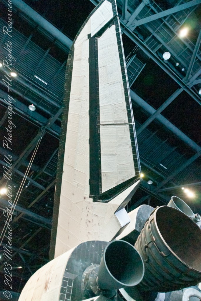
As your gaze shifts towards the rear of Atlantis, the vertical tail fin, or the rear stabilizer, commands attention. Standing about 17 feet tall, this stabilizer is more than just a rudder; it’s a critical component for maintaining the shuttle’s stability during the different phases of its mission. During the launch, it helps keep the shuttle on course as it ascends through the atmosphere. In space, it plays a minimal role, but upon re-entry, it becomes vital again, ensuring the shuttle remains stable and oriented correctly as it descends through the atmosphere, allowing for a safe landing.

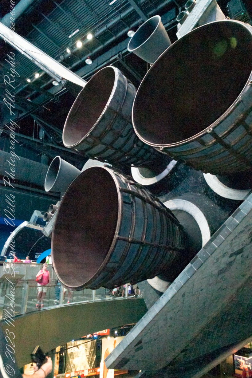
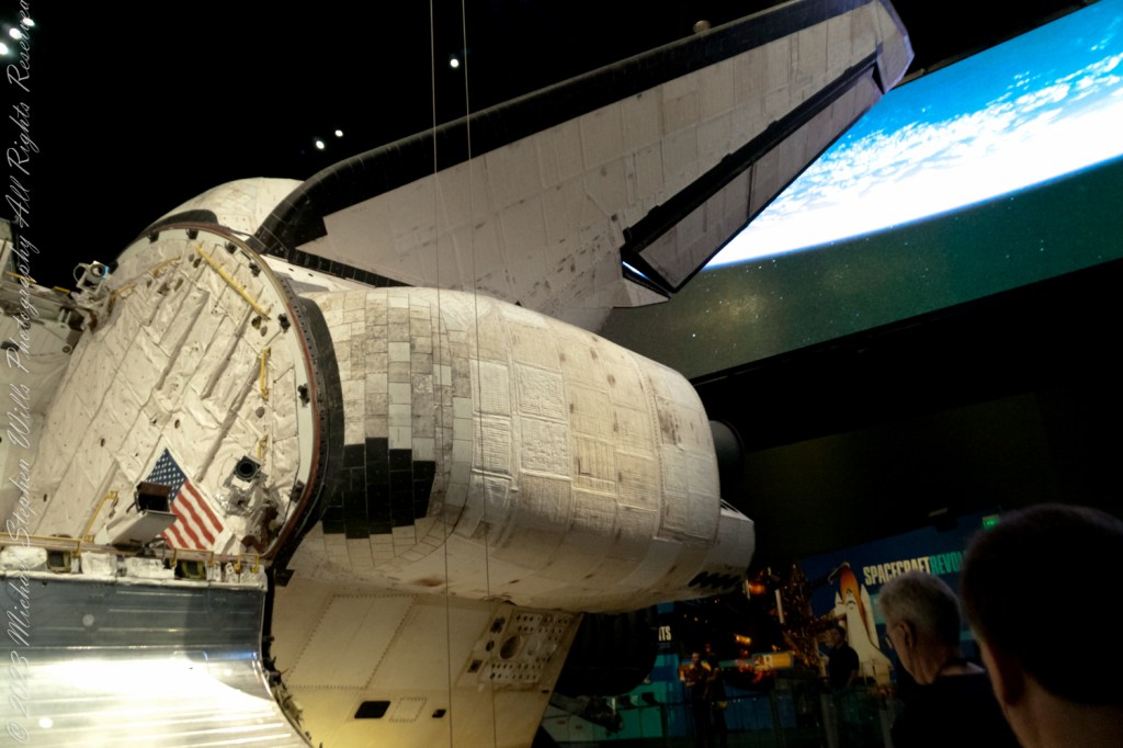
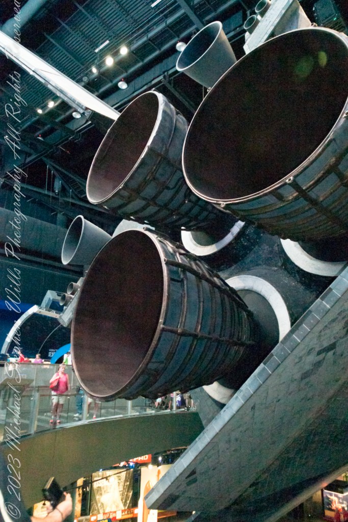
In this exploration of Atlantis, after the wings and stabilizer, we encounter the heart of the shuttle’s propulsion system: its onboard engines. The Space Shuttle Main Engines (SSMEs), three in total, are marvels of engineering, capable of producing a combined thrust of over 1.2 million pounds. These liquid-fueled engines play a crucial role in propelling the shuttle from the launch pad into orbit. What’s fascinating is their ability to throttle up or down depending on the phase of the launch, providing the precise amount of power needed at any given moment. The engines are fed by the External Tank, the only part of the shuttle not reused, which carries the liquid hydrogen and liquid oxygen needed for combustion. Upon reaching orbit, the Orbital Maneuvering System (OMS) engines take over, allowing Atlantis to navigate the vacuum of space with finesse, adjusting its orbit and facilitating the meticulous maneuvers required for satellite deployment or docking with the International Space Station.

Walking away from the Atlantis exhibit, what stays with you is not just the sight of this magnificent spacecraft but an appreciation for the ingenuity and dedication that went into its design. Every wing, every tile on the stabilizer, and every roar from the engines tell a story of human curiosity, the drive to explore beyond our confines, and the relentless pursuit of knowledge. The Space Shuttle Atlantis is more than a machine; it’s a symbol of what humanity can achieve when we dare to dream big and work tirelessly towards those dreams. So, as you look up at the night sky, remember the wings that carried our dreams, the stabilizer that kept us on course, and the engines that propelled us into the unknown, reminding us that the final frontier is not so final after all.

Copyright 2024 Michael Stephen Wills All Rights Reserved

Passing…..

…remembering our time on the cusp of the pandemic

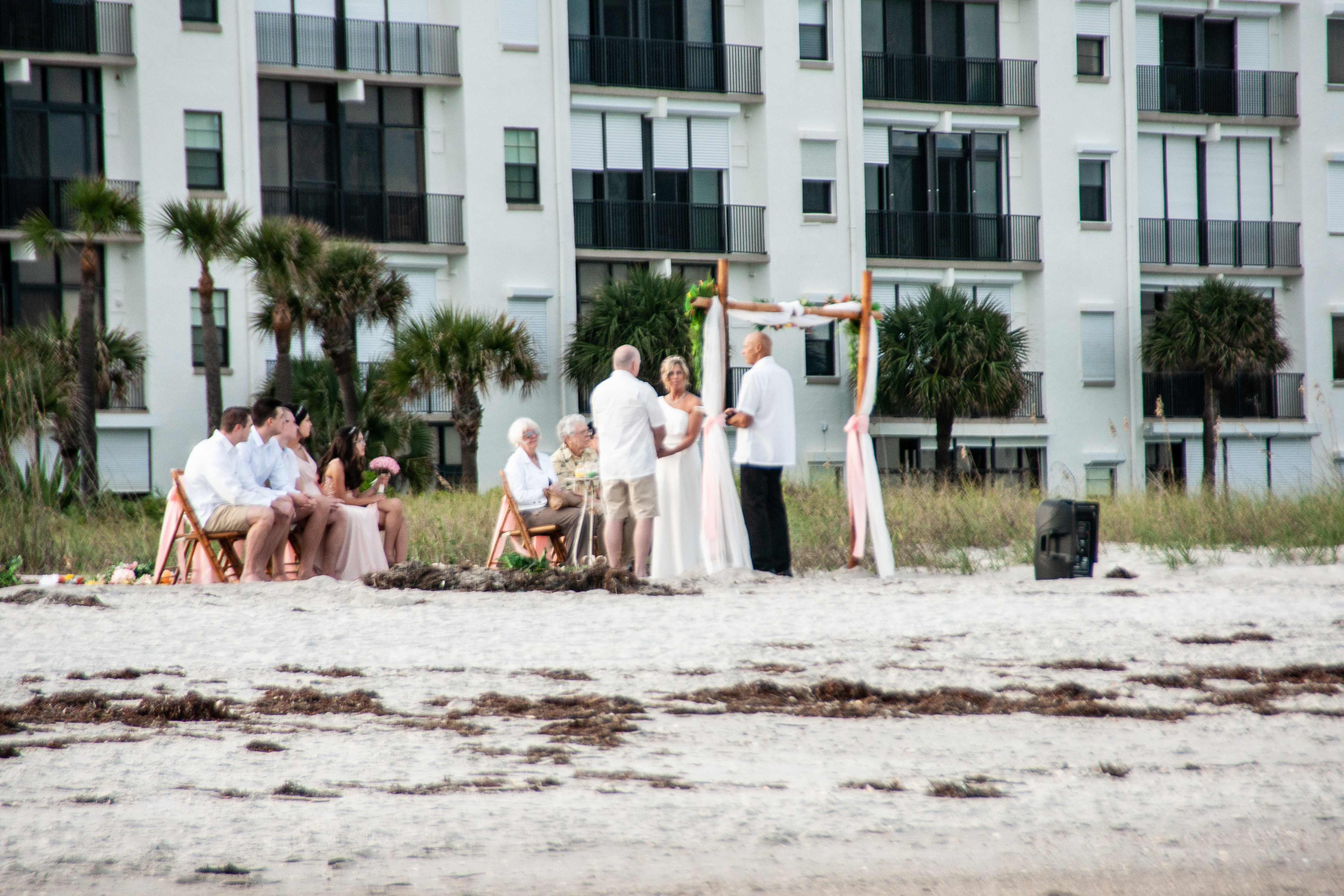
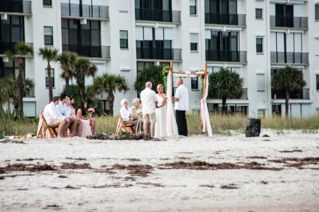
After 2 pm check in we interrupted unpacking for a sundown beach walk, IPhones and Sony Alpha 700 camera in hand on the last evening of 2019. There is a business on A1A, the main road through town, advertising “beach weddings” and “elopements.” Here, using the 18 – 200 mm f3.5-6.2 lens, I spied this grouping of a mature couple holding hands, minister in attendance, for a wedding ceremony witnessed by young adult children on the right, parents (?) left. The groom’s shorts contrast with the bride’s white gown.

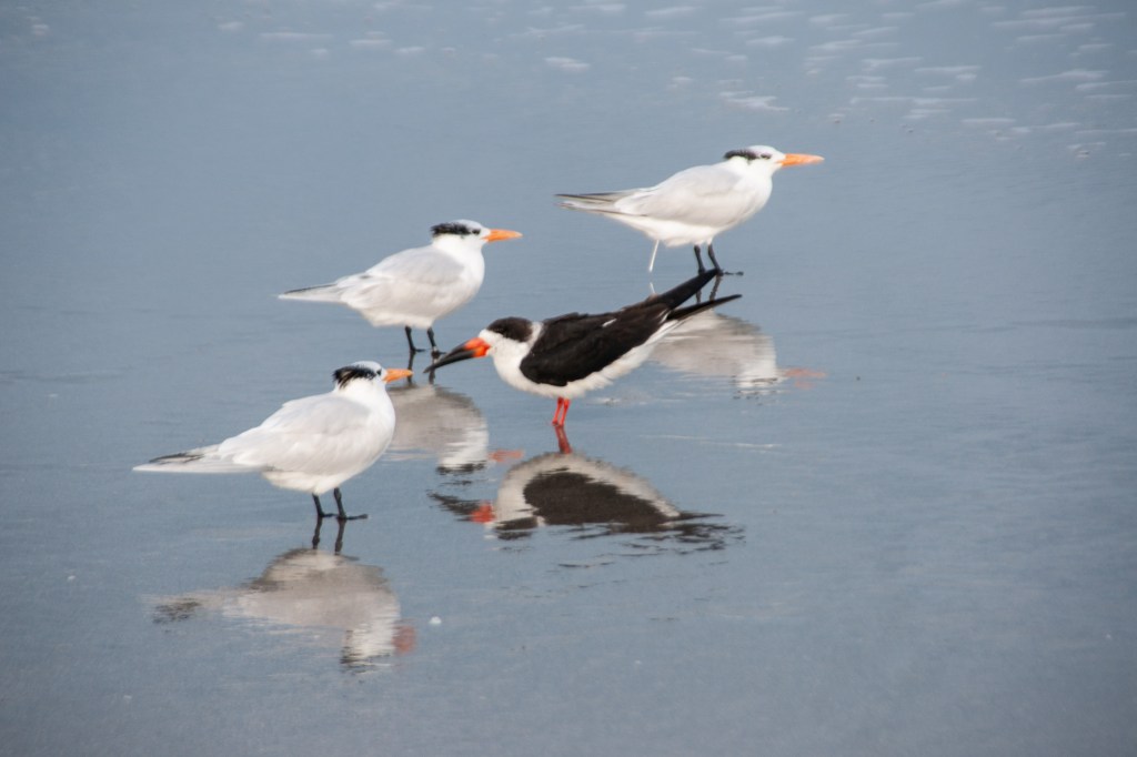
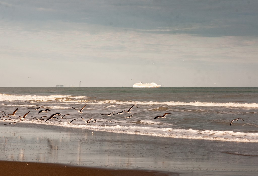
Sunlight, low in the western sky, was perfect for mirror-like reflections in the retreating surf.

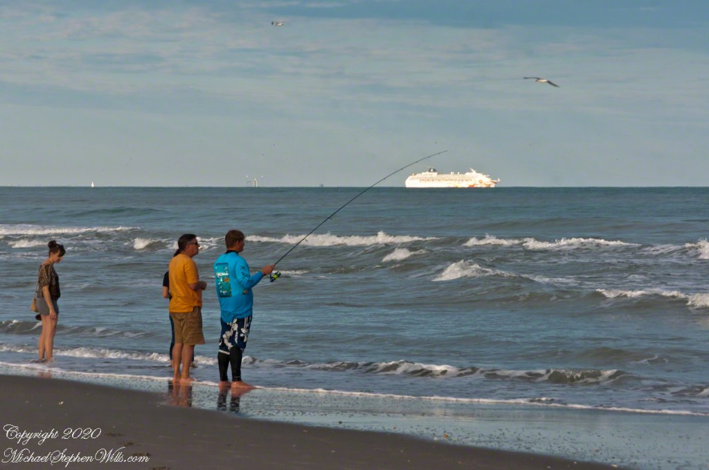
A given of the Atlantic beach is the late afternoon light, best for capturing figures against the ocean.

Written below the high tide mark, a message inscribed, impermanent in spite of the deep cuts.

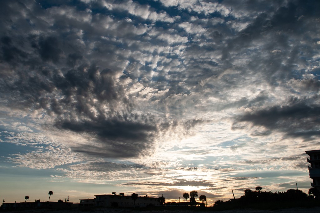
I have practice framing sunsets against beach development. Cannot complain as we enjoy our beach side condo.

A slide show of these images.

Copyright 2024 All Rights Reserved Michael Stephen Wills

Behind the Scenes of the Final Frontier: Our Tour with NASA’s “Launch Director” – 5

Ever wondered about the iconic robotic arms that gracefully danced in space, tethered to the Space Shuttle? Meet Canadarm, a marvel of engineering that transformed space missions. Born from a NASA invitation to Canada in 1969, this robotic arm did more than just move payloads; it became a symbol of international collaboration in space exploration. After the Columbia disaster, its role expanded, ensuring the safety of astronauts with critical inspections. Dive into the captivating journey of Canadarm, where technology meets the stars. Click to discover how a Canadian innovation became a pivotal part of space history.

The Canadarm

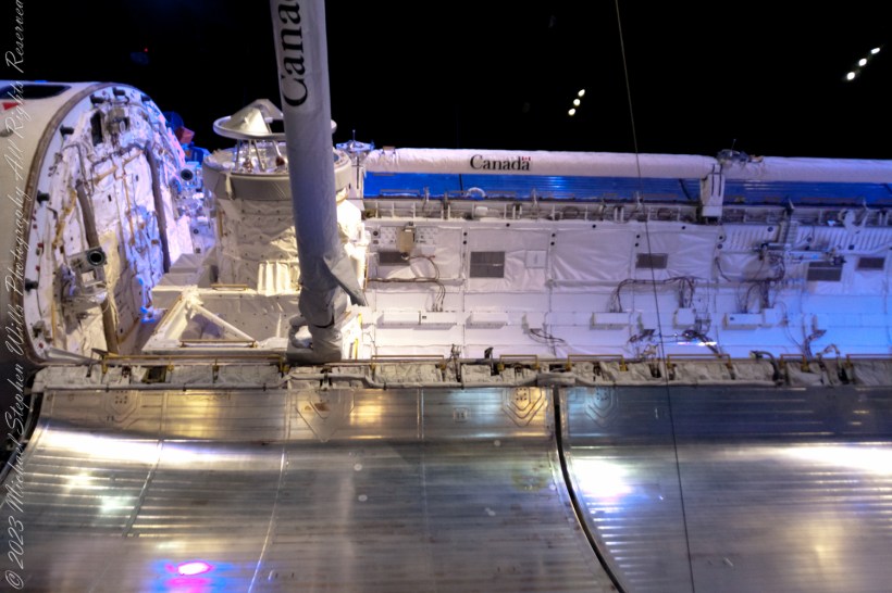
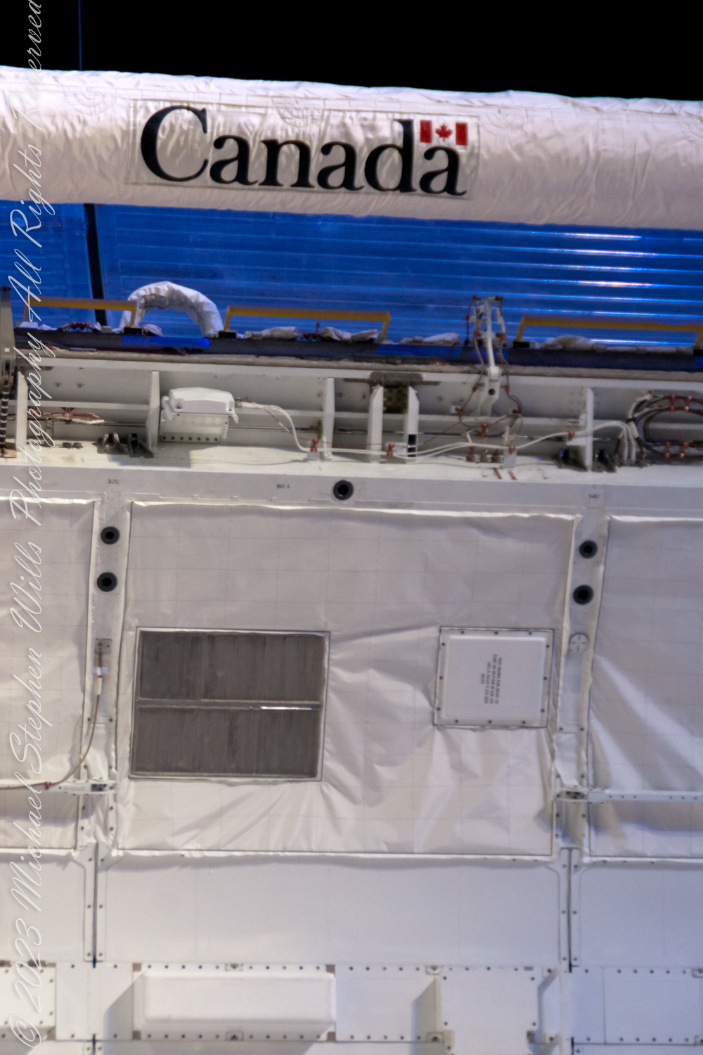
The Canadarm is here extended in the foreground and docked in background

The Canadarm, or Canadarm1, officially known as the Shuttle Remote Manipulator System (SRMS) and sometimes referred to as the SSRMS, represents a series of robotic arms utilized aboard the Space Shuttle orbiters. These arms were instrumental in deploying, manipulating, and retrieving payloads. Following the tragic Space Shuttle Columbia disaster, the use of Canadarm became invariably linked with the Orbiter Boom Sensor System (OBSS). The OBSS played a crucial role in examining the shuttle’s exterior for any damages to its thermal protection system, enhancing the safety of subsequent missions.

The genesis of Canada’s involvement in the Space Shuttle program dates back to 1969 when the National Aeronautics and Space Administration (NASA) extended an invitation to Canada. At the outset, the specifics of Canada’s role were unclear, though the need for a manipulator system was immediately recognized as vital. The Canadian firm DSMA ATCON had previously made strides in robotics with the development of a robot designed to load fuel into CANDU nuclear reactors, capturing NASA’s interest. By 1975, a formal agreement was reached between NASA and the Canadian National Research Council (NRC), under which Canada would undertake the development and construction of the Canadarm.

The NRC subsequently awarded the contract for the manipulator to Spar Aerospace (currently known as MDA), under which three distinct systems were to be developed: an engineering model to aid in design and testing, a qualification model for environmental testing to ensure the design’s suitability for space, and a flight unit destined for use in missions. This collaborative effort marked a significant milestone in the use of robotics in space exploration, showcasing international cooperation in advancing space technology.

Copyright 2024 Michael Stephen Wills All Rights Reserved

Post WWII Launch Complexes on Cape Canaveral

Ghosts from the future?

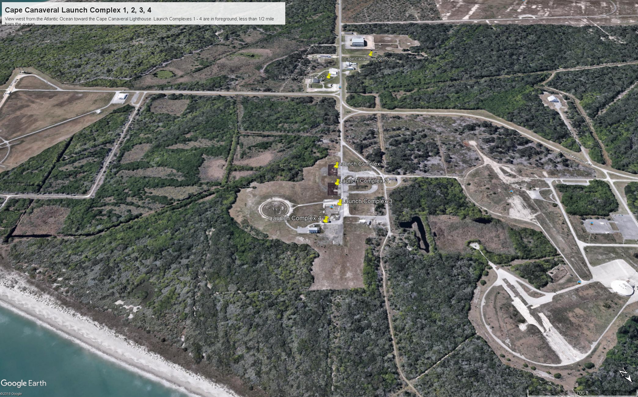
Here is the fifth in a series of photographs centered on the early history of space flight on Cape Canaveral mostly taken during a tour organized by the Cape Canaveral Lighthouse Foundation. “Google” the foundation for details of future tours. Here we explore the sites of the first launches on the Cape, Launch Complexes 1, 2, 3, 4. (LC 1 – 4).

From Vengeance To Space

Our bus proceeded east on Lighthouse Road past Launch Complexes 21 and 22 in less than half a mile we were within the first sites of the United States Space age, sites with the lowest numbers, LC 1 – 4.

Click Any Image for a larger viewe

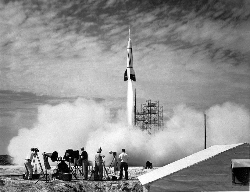
If, instead of distance, the bus traveled back in time 68 years to July, 1950 we would be witness to the first United States space launch of the two-stage “Bumper 8”, a former “V2” missile topped by a WAC Corporal that reached 248 miles above the earth, about where the International Space Station circles now.

July 1950 Bumper 8 Launch
By NASA/U.S. Army – NIX 66P-0631, GPN-2000-000613; http://solarsystem.nasa.gov/multimedia/display.cfm?IM_ID=385, Public Domain, https://commons.wikimedia.org/w/index.php?curid=2892820

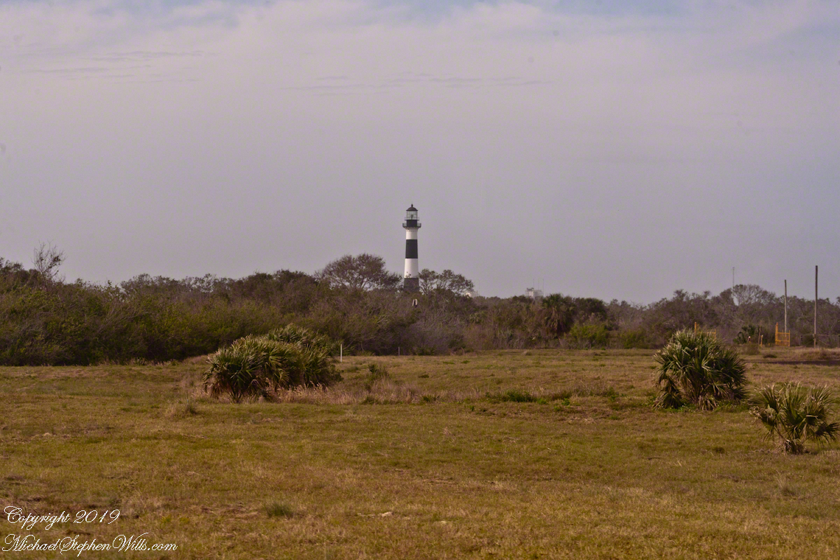
Almost certainly, the man who designed and directed the production of the Nazi V2, Werner vonBraun, was perched on the lighthouse a half-mile distant.

Cape Canaveral Lighthouse from Launch Complex 3

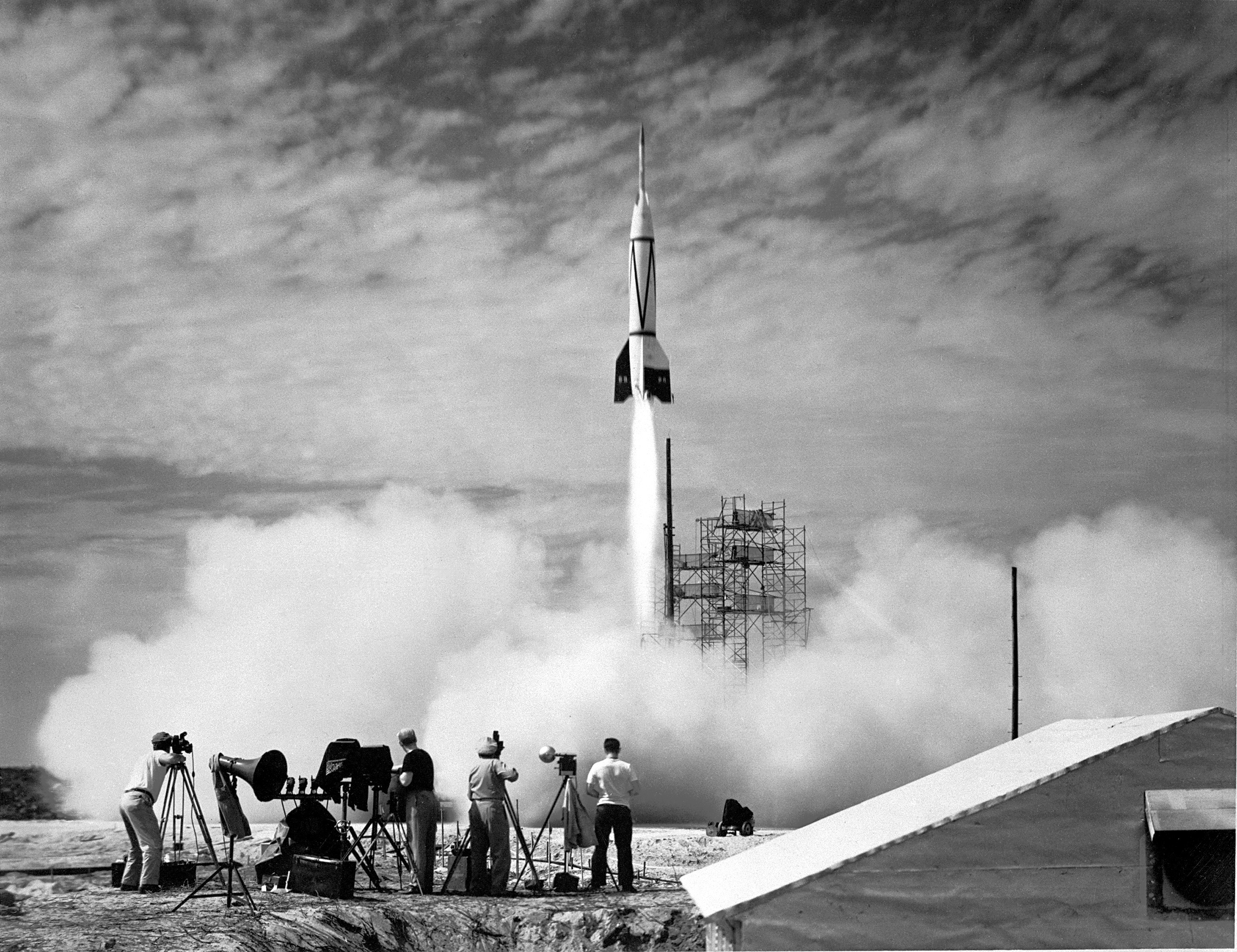
The Nazi “vengeance weapon 2”, the V2, a device so horrifying British authorities claimed the first V2 attacks to be “gas explosions” rather than admit a Nazi weapon descended without warning. Beginning September, 1944, over 3,000 V2’s landed on London, Antwerp and Liège resulting in an estimated 9,000 deaths, mostly civilians. 12,000 forced labor and concentration camp slaves died in the construction of the production facilities captured by the Soviet Union during the collapse of the Nazis. These victims, arms linked, will form a circle 15.9 miles in circumference around the Bumper 2 launch.

The 21,000 V2 victims, linked arm in arm, make a circle 15.9 miles in circumference.

von Braun and key V2 personnel surrendered to the Americans and, along with enough parts to construct 80 V2s, were taken to the United States. His direction of US missile development lead eventually to the enormous Saturn rocket that lifted three men to the moon, so good came from our bet on vonBraun and the V2.

Observation Bunker

In January, 2018, firmly in the present, our bus approached these now “deactivated” sites driving down Lighthouse Road. Confined to the bus, I used my Canon EOS 1Ds Mark III and the EF 70-300mm f/4-5.6 IS USM lens to capture these scenes.

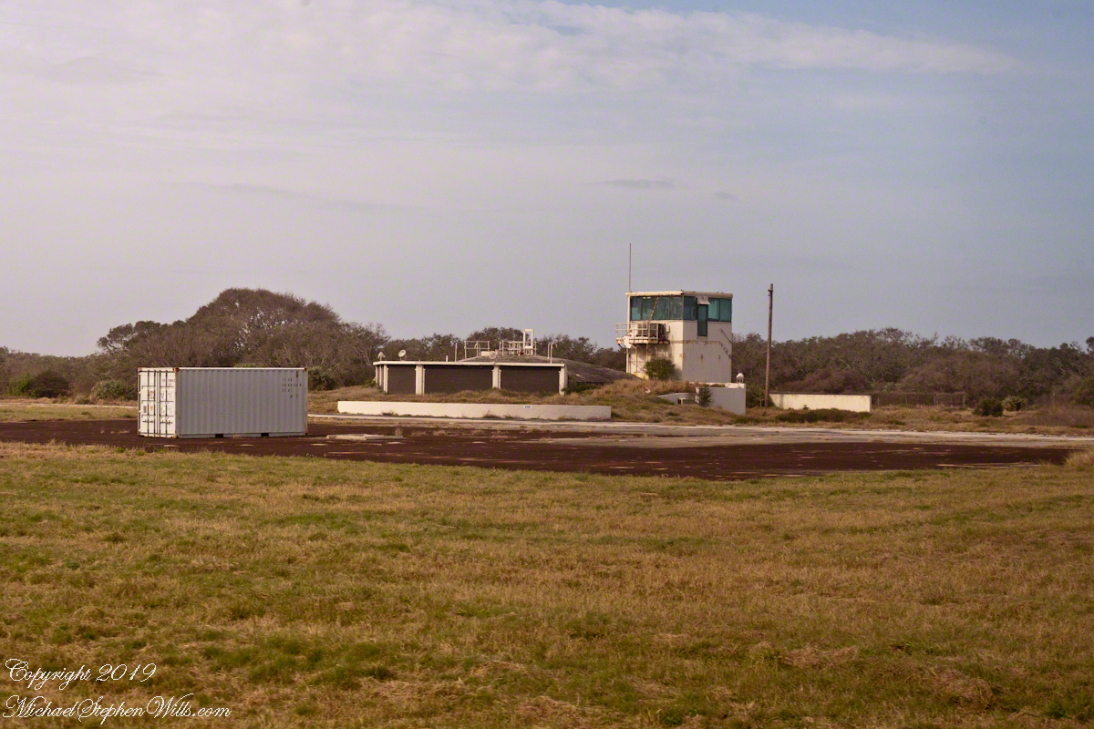
Looking across Launch Complexes 1 and 2 to Lighthouse Road and the tower. An observation bunker
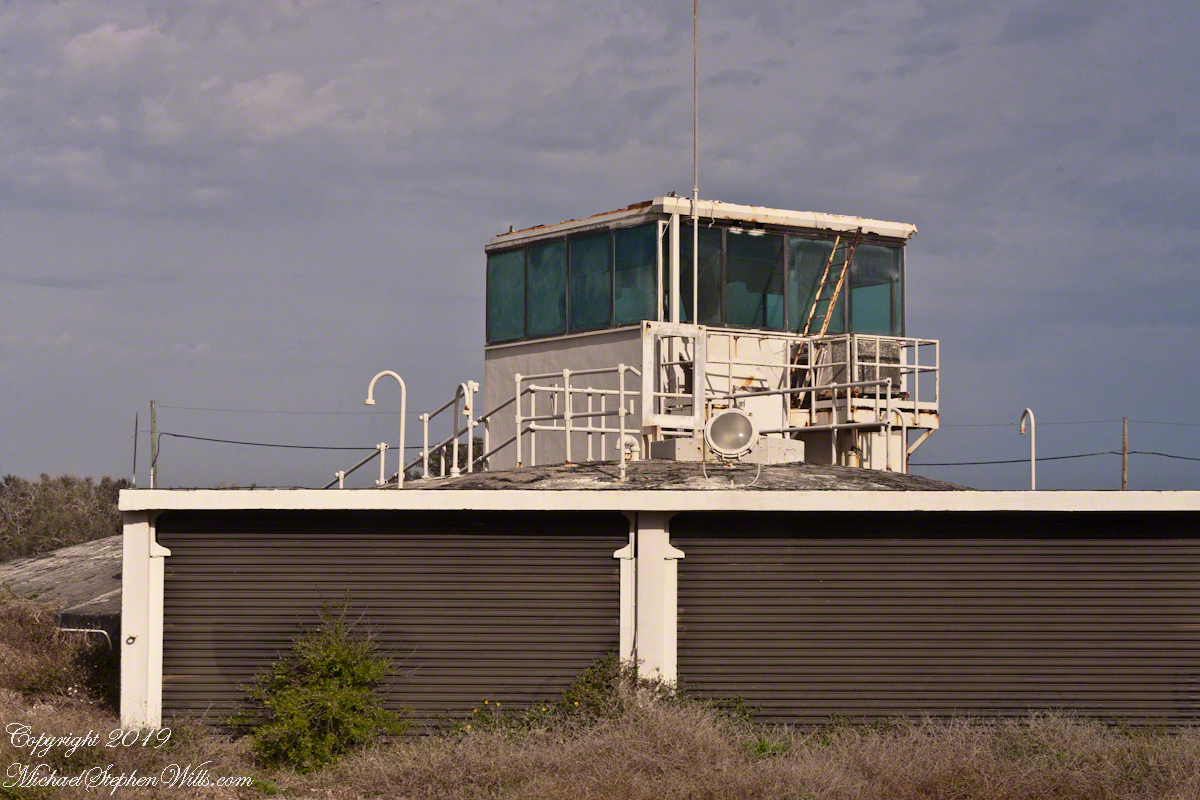
Observation Bunker from Launch Complex 3, looking across Launch Complex 1.

I can almost see someone behind the glass, enjoying a blast of air-conditioned air, dry and cool.

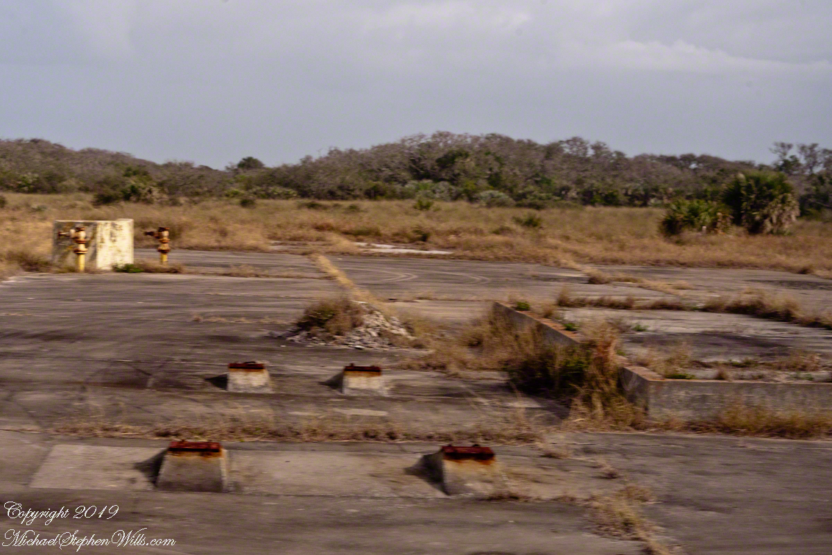
Litter on and around Launch Complex 4

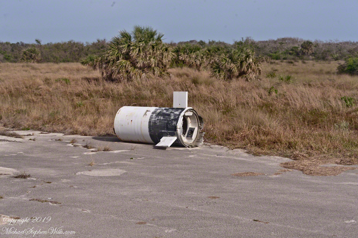
Missile Housing without Engine
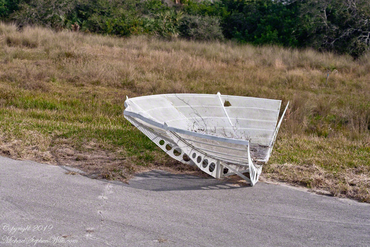
Radar Parabola Fragment
Cement Blacked by Rocket Launch Blasts

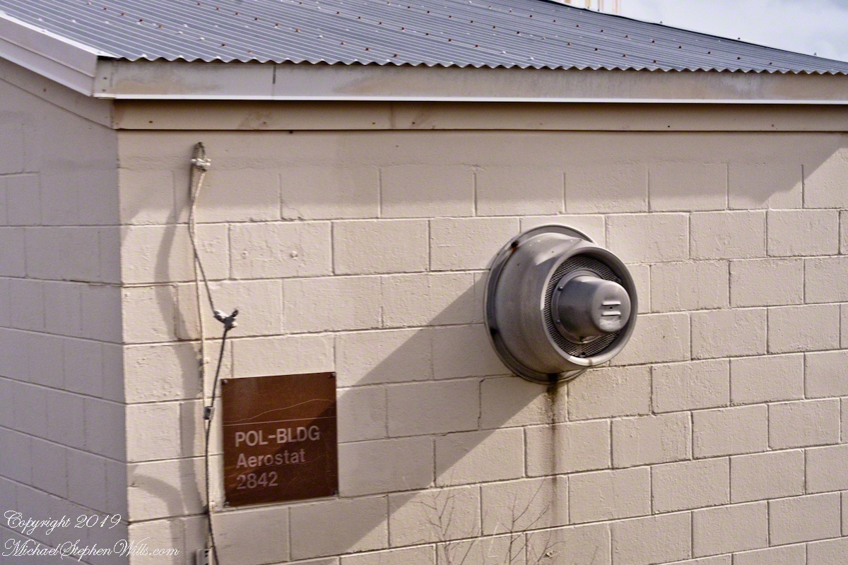
Aerostat

From 1950 into the 1960’s LC 1-4 saw launches of cruise missiles, some of which were able to maneuver and land on the “skid strip” you can pick out on the “21,000 V2 Victims” image, above. A positive discovery from my research on wikipedia the weapon systems tested here were not fired in anger. Continued development in other places lead to production of generations of cruise missiles launched by Presidents Clinton and Bush against Afghanistan, Iraq and (??) other targets. What victim ghosts, arms linked in ever growing circles, are lurking in our future?

A building on LC 4 has the designation “Aerostat”, one of the last projects supported. I saw an aerostat in action in the early 2000’s over Fort Huachuca, Arizona near the border with Mexico. An aerostat is a flying craft that does not rely on moving air to achieve lift, balloons for example.

The Goodyear blimp is a memory from my childhood on Long Island, the Fort Huachuca aerostat was a smaller version, outfitted with advanced technology for monitoring the surrounding environment. “Google” aerostat mexican border to learn more about the current deployment.

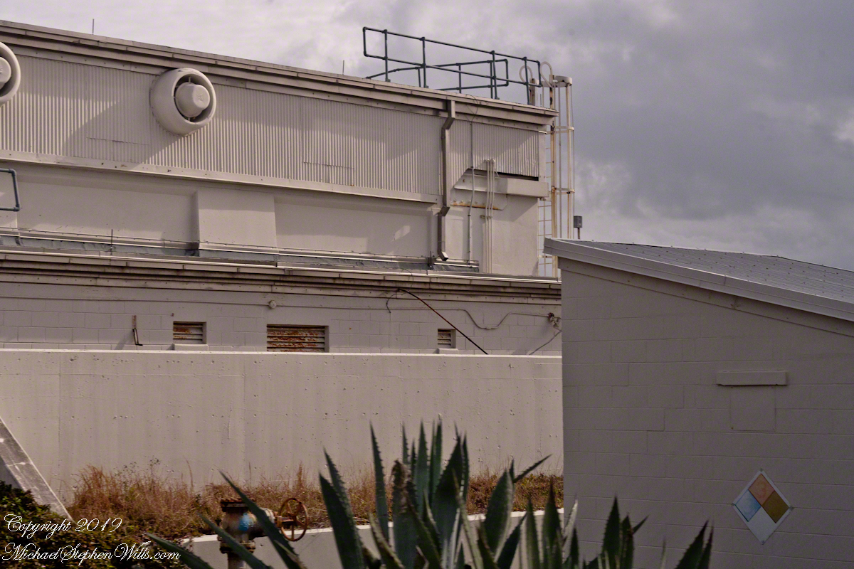
Another view of the abandoned aerostat building on LC 4

With the development of Intercontinental Ballistic Missiles (ICBMs) the facilities of LC 1 – 4 became obsolete. ICBMs are a theme of the next installment of this series.

ClickMe for another post in this series, “Mercury 7 Pre-Launch Facilities.”

ClickMe for the first post in this series, “Cape Canaveral Lighthouse.”

Sources of information for this post: I used information from the Wikipedia site for the key words V-2, Launch Complex 1, Launch Complex 2, Launch Complex 3, Launch Complex 4. The Bumper 8 launch photograph caption includes a source citation.

Copyright 2024 Michael Stephen Wills All Rights Reserved.

Cruise Missiles

Decoys and Cruise Control

Here is the fourth in a series of photographs centered on the early history of space flight on Cape Canaveral mostly taken during a tour organized by the Cape Canaveral Lighthouse Foundation. Google the foundation for details of future tours. Here we explore the sites closests to the Lighthouse: Launch Complex 21 and 22.

“Vengance Weapons” re-purposed

Vergeltungswaffe 1 (Vengance Weapon 1 AKA V-1), produced at Peenemünde on the Baltic Sea was first used against Great Britan by Germany one week after the D-day landings. 8,025 of these flying bombs, the first cruise missles, caused the death of 22,892 people, mostly civilians. The first cruise missles for the USA were developed less than 1,000 feet away from the lighthouse. After touring the lighthouse we boarded the bus to visit these sites, Launch Complex 21 and 22.

Click Any Image for a larger viewe
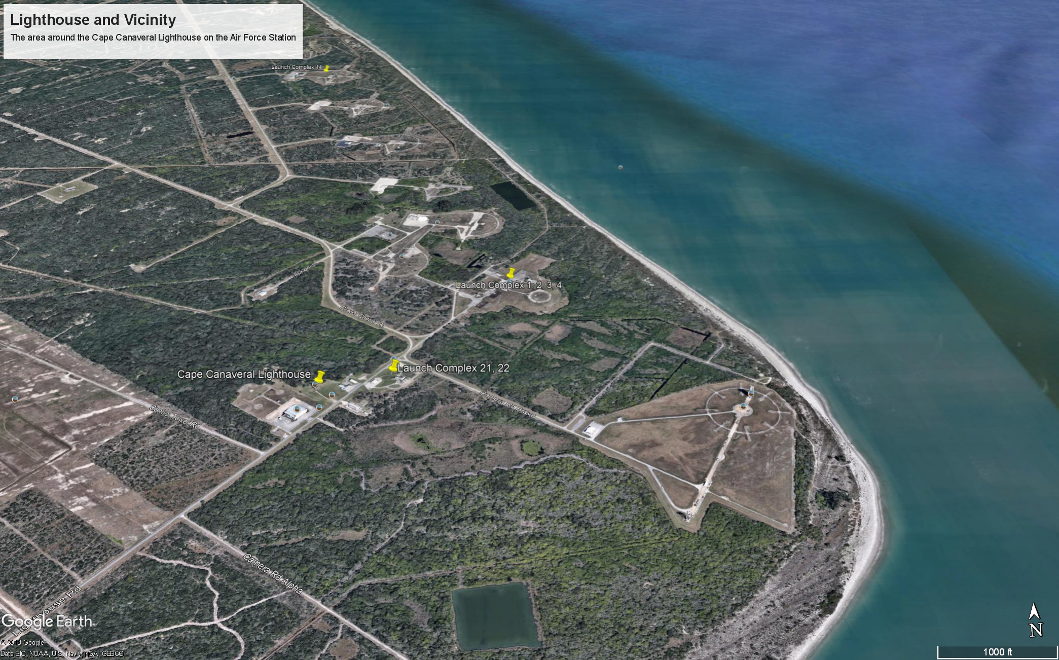
Launch Complex 21 and 22 are marked with a labled “pin” on this image from Google Earth.

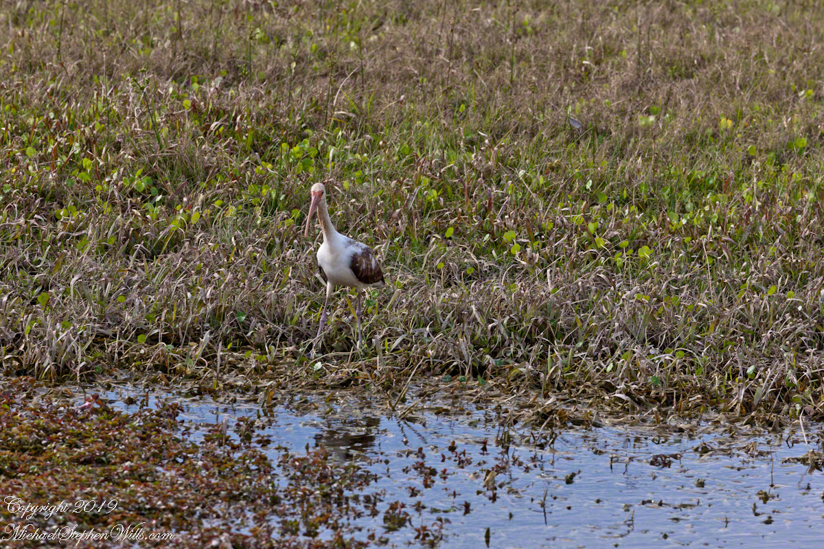
Nature abounds in Cape Canaveral Air Force Station. This ibis hunted near the lighthouse on our way to Launch Complexes 21,22.

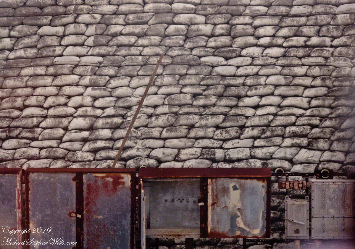
We passed close to the blockhouse first viewed in my post, “Lighthouse and Rockets,” and I captured this detail of the long abandoned structure. The last test launch of a Mace missle was June, 1960.

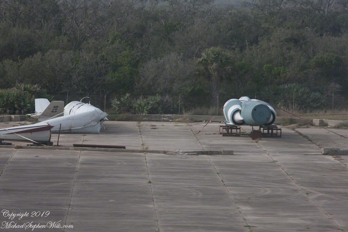
This wreckage photograph was part of my,“Lighthouse and Rockets” post. It was taken from a lighthouse portal. It is a type of cruise missle, although I cannot identify the exact type, comparing the engine, on the right, with available photographs of the “Bull Goose” and “Mace” missles developed here.

Bull Goose and Mace

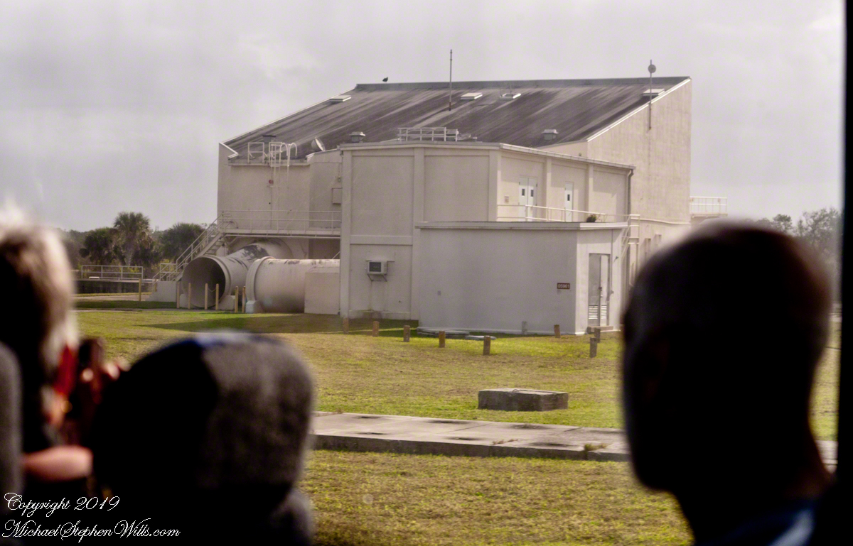
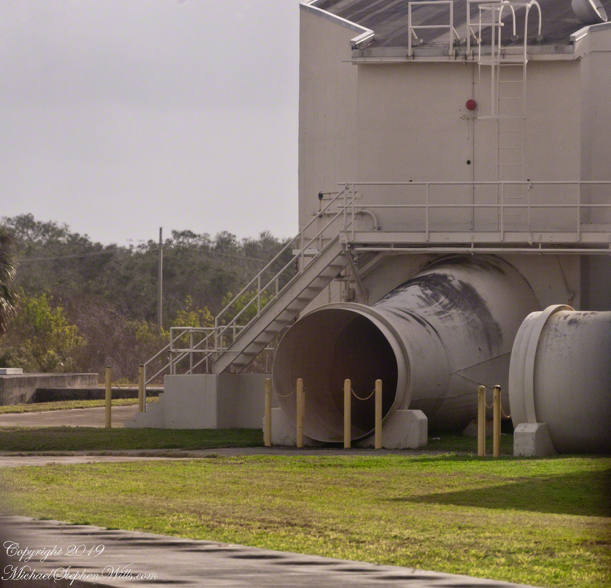
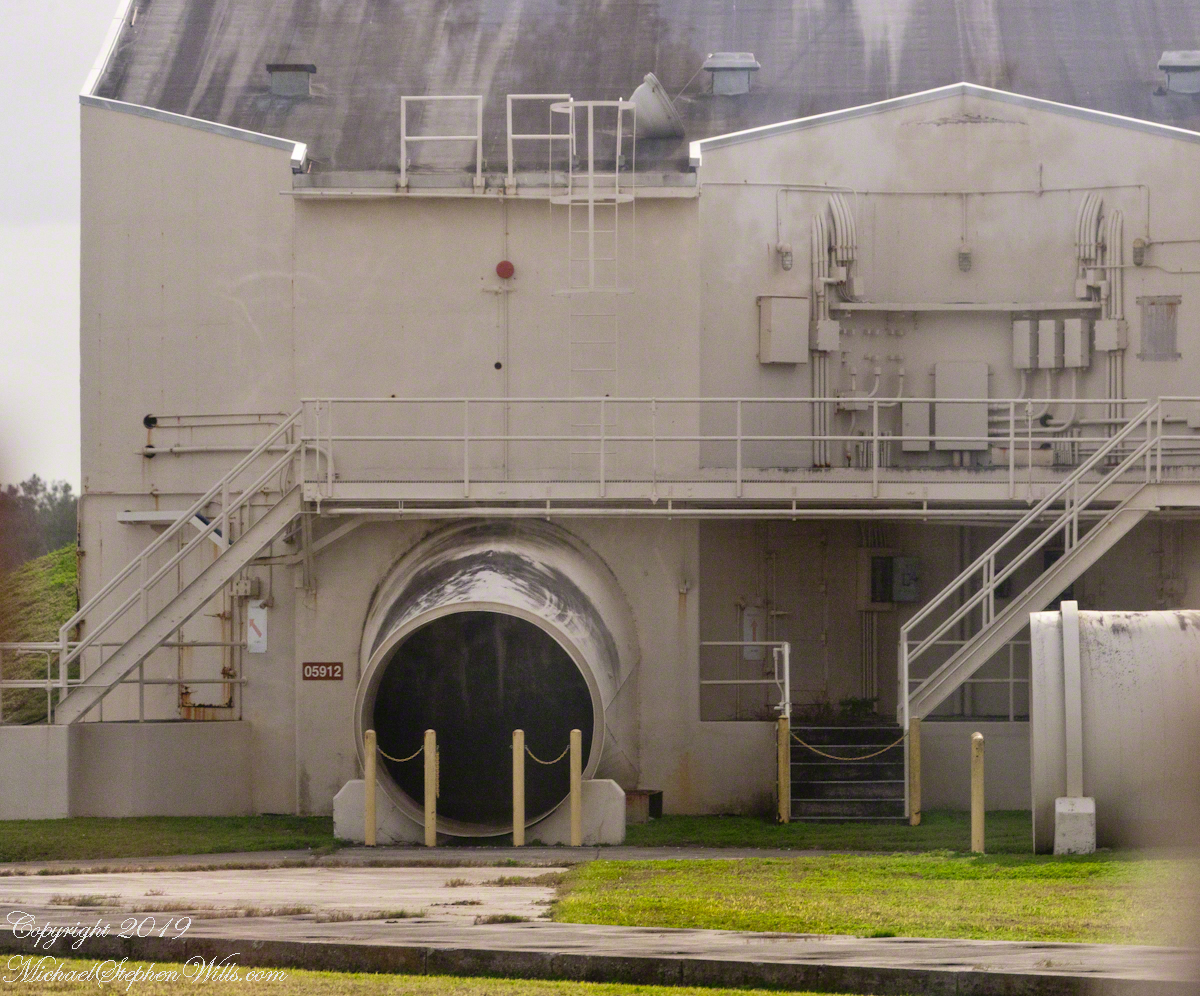
Rail launched, as was the German V-1, the missles developed here were called “Bull Goose” and “Mace.” Bull Goose was a delta winged craft intended as a decoy, to appear on radar as a strategic bomber during a nuclear attack. At that time, the rails were in the open. The building here was a revampment of the site for development of the Mace. The other side of this structure is open, the launch rail pointed up from the rear. There are two launch rails, numbered 1 and 2. The building placard is “05961,” the numeral “1” designates site 1. The use of numbers of designate a site is unusual. Letters are used elsewhere on Cape Canaveral and Kennedy Space Center.

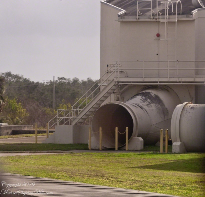
The powerful rocket exhause was directed though these pipes. Site 1 is on the right.
Guidance or “Cruise Control”

Navigation is a crucial requirement for cruise missles. The Bull Goose used a gyroscope with no reference to surroundings. The guidance system held the launch bearings, a successful flight was completed within 115 nautical miles of the target.
If deployed, the plan was for thousands of these missles to launch 1 hour before the attack craft set out and 1 hour after. The missles were not armed, but would descend in the thousands around the targets. Similar to what the Germans did to civilians in England.
After three years and 136.5 million dollars the Bull Goose was cancelled because it could not simulate either the B-47 Stratojet or B-52 Stratofortress nuclear bomb delivery aircraft. Not a single decoy was fired in anger.

The building sign “05912” identifies this exhaust tube as being launch site 2.

The Mace, for which this building was created, used a guidance ATRAN (Automatic Terrain Recognition And Navigation, a radar map-matching system). The map was produced on a 35 mm film strip carried on the missle, the live radar returns were “matched” against the film with course correction made for differences. The Mace was of limited usefulness due to the lack of radar maps for target areas within the Soviet Union. The Mace was deployed to Germany and South Korea until phase out in 1969.

ClickMe for the first post in this series, “Cape Canaveral Lighthouse.”

Sources of information for this post: I used information from the Wikipedia site for the key words V-1, Launch Complex 21, Launch Complex 22, Mace, Bull Goose.

Copyright 2024 Michael Stephen Wills All Rights Reserved.