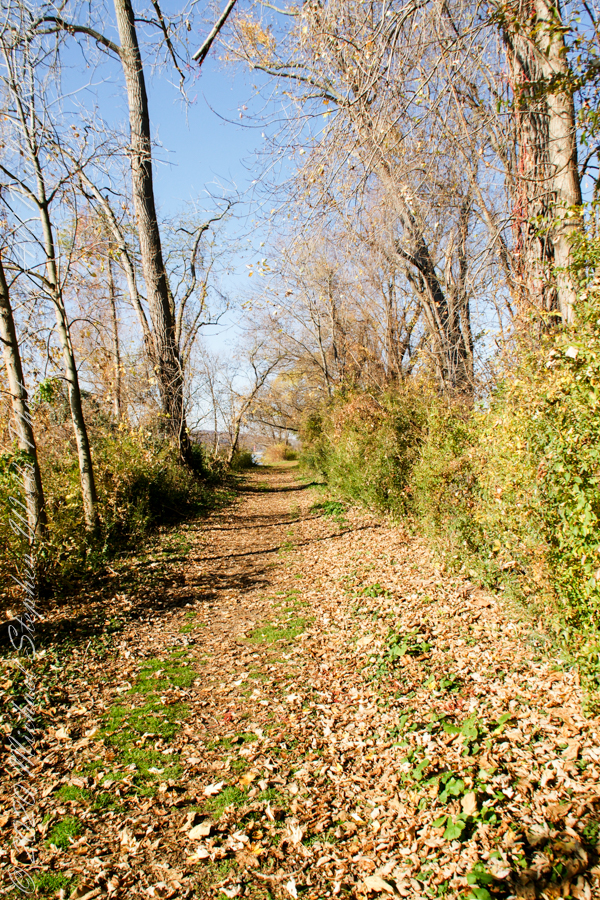
Post 1 of Lighthouse Point provided an impression of our hike along the golf course, from there we turned onto this wooded path on the shores of Cayuga Inlet.
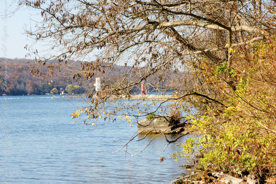
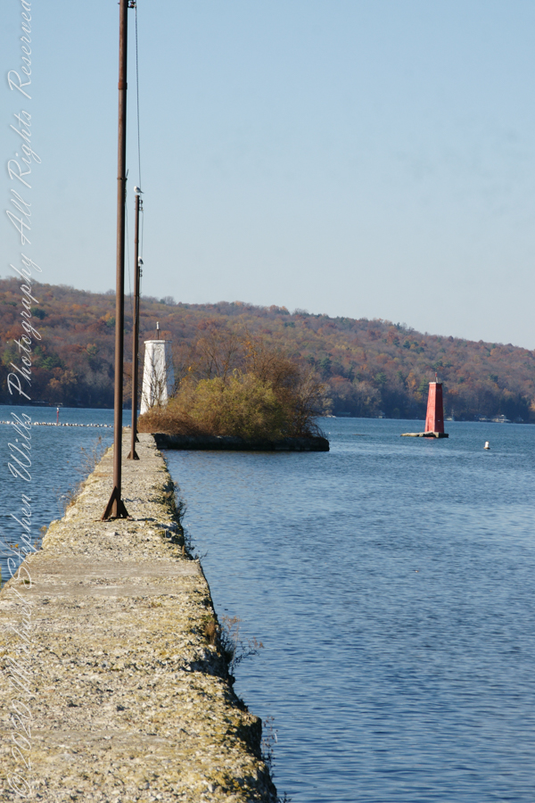
First view of the paired Lighthouses marking the Cayuga Inlet. The white tower is connected to shore by a causeway something less than a quarter mile in length. The red tower marks the other side. These navigation guides allow boats to safely enter the channel exiting the south end of Cayuga Lake. The Erie Canal connects to the north end, allowing access to the Great Lakes and, eventually, the Atlantic Ocean.
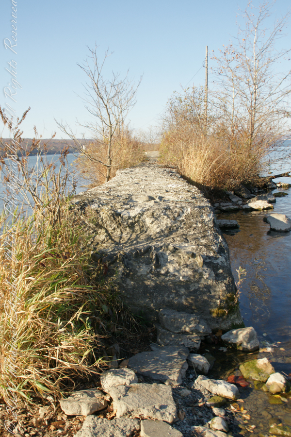
The 4-foot-high step up to the concrete causeway path is an insurmountable obstacle to some. I managed to clamber over.
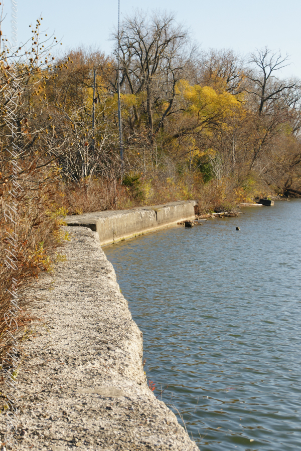
Looking back to shore….
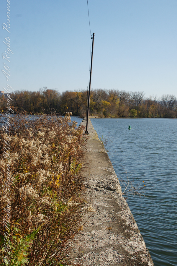
Rusted iron poles support the electric line for the white tower. They remind me of ship masts.
The straight shot back to shore.
Copyright 2022 Michael Stephen Wills All Rights Reserved
November 3rd, 2022, Blessed Us with an azure sky, an Indian Summer Day. During our walks on Cass Park Shorts we’d look across to see hikers emerging from the gold course to walk the Lighthouse causeway. After decades of longing, these Ithaca residents took upon themselves the adventure of finding the path and walking it. This series of posts documents the walk and some treasures discovered on the way.
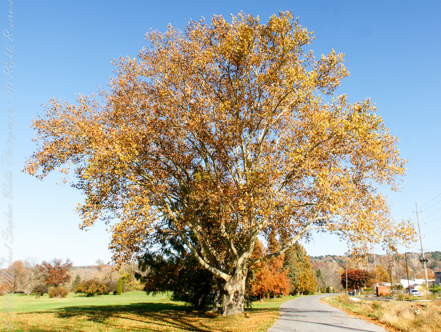
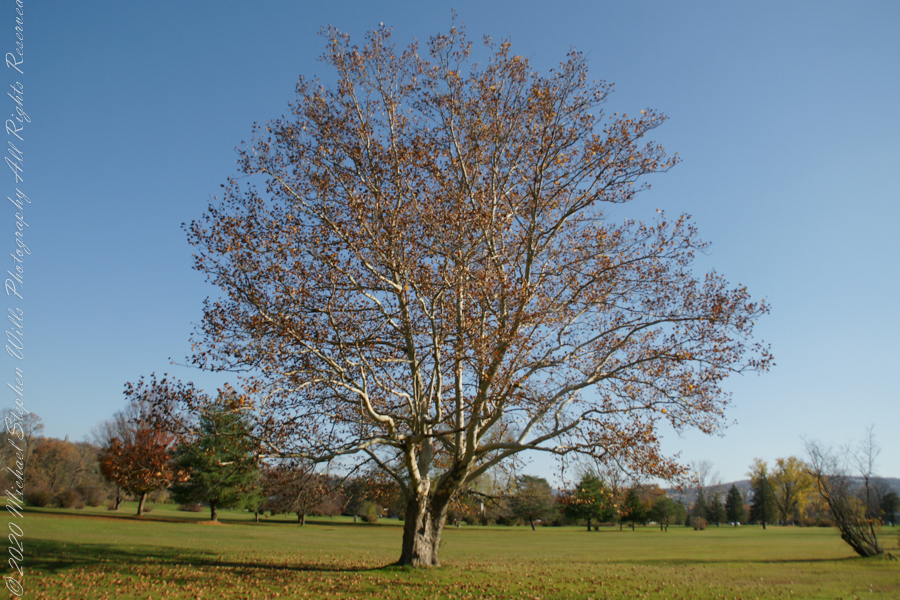
Sycamore, aka Plane Tree
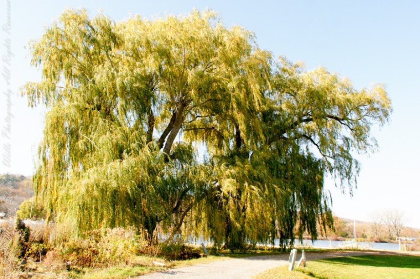
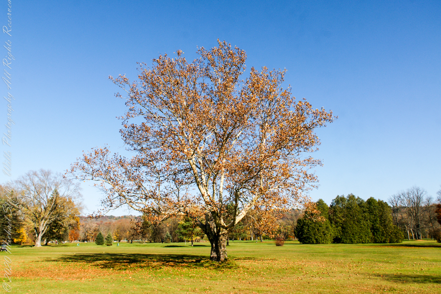
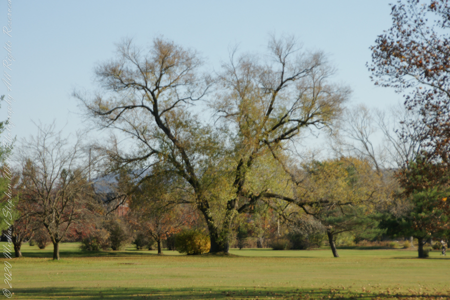
Willow on Cayuga Inlet and Newman Golf Course
might be another Sycamore on the golf course
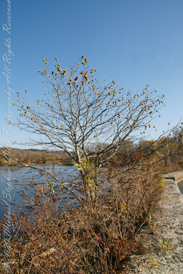
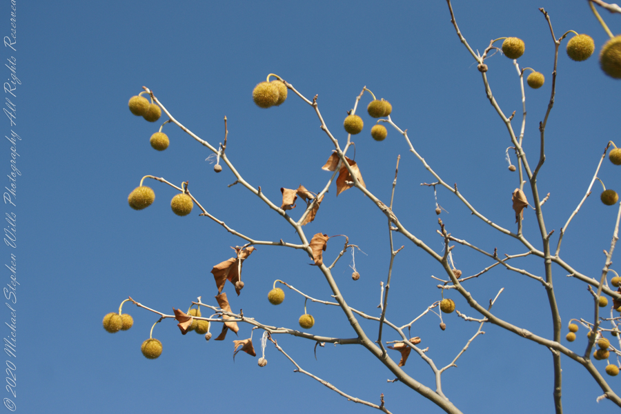
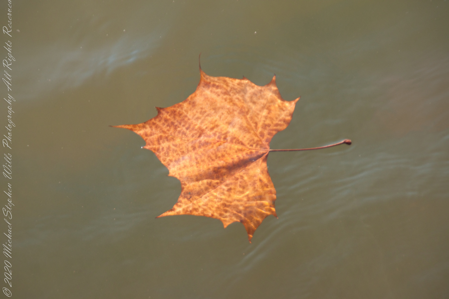
An uncultivated Sycamore sprouting from the causeway leading to the lighthouse “The reason Sycamores are also called “Buttonwood”. Children love to throw these seed heads at each other, sometimes “exploding”The reason Sycamores are also called “Buttonwood”. Children love to throw these seed heads at each other, sometimes “exploding” on impactSycamore leaf floating in Cayuga Inlet
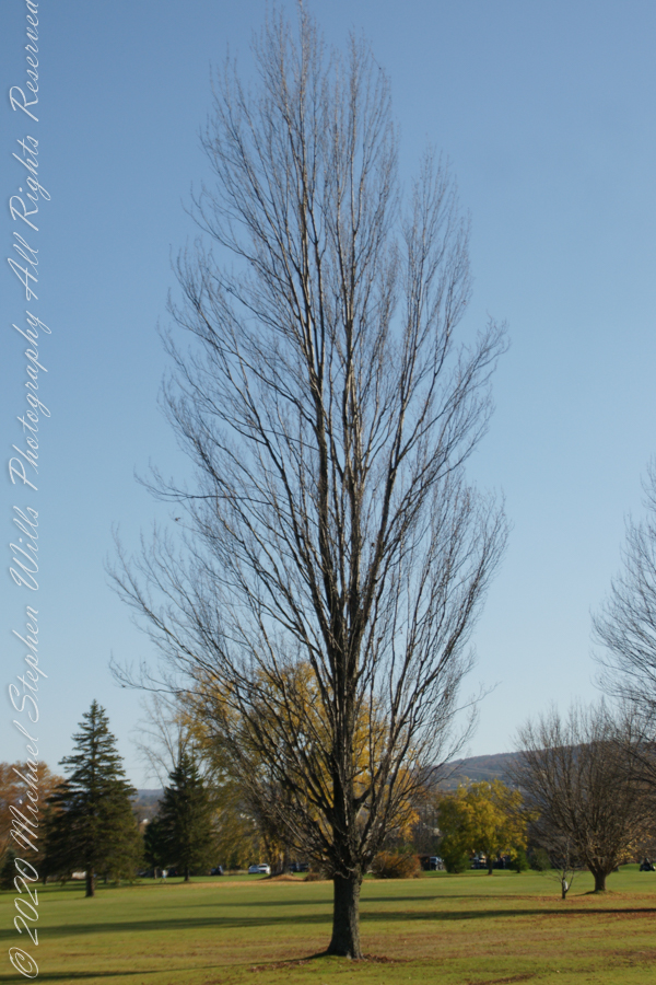
Unidentified tree on golf course
Unidentified tree on golf course
Unidentified tree on golf course
Copyright 2022 Michael Stephen Wills All Rights Reserved
In November 2004, a visit to Canyon de Chelly with guide Hadley Tsosie revealed ancient petroglyphs and ruins, highlighting Navajo culture and the canyon’s unique beauty.
On November 3, 2004 my son, Sean, and I made our way to Chinle, Arizona on the Navajo Reservation at the mouth of Canyon de Chelly.
The next day, driving a rented 4 wheel drive, we arrived at the visitor center, at dawn, and there met Hadley Tsosie who worked as a guide. This is how you do it, if learning about the Canyon is your goal. It is possible to walk, unaccompanied, into the canyon to view the “White House” and this I highly recommend. Tourists can also drive around the rim to various overlooks. This is what most people do.
The canyon is still farmed and the tribe only allows visitors when accompanied by a guide. Only Diné (Navajo) are certified as guides. They know the rights of way and the preferences of the landowners.
We negotiated with Hadley to take us for half a day for our interest in petroglyphs and ruins. It is important to start early when the sun is low in the sky, when directly overhead the details of ruins and petroglyphs are washed out by the light. Catching the late afternoon/evening sun is also an approach that requires detailed knowledge of the route, taking into account the time of year.
Hadley was an excellent choice, though he was our only option on that day. He was fluent in Navajo beliefs, the lore of the canyon and generous in sharing what he knew.
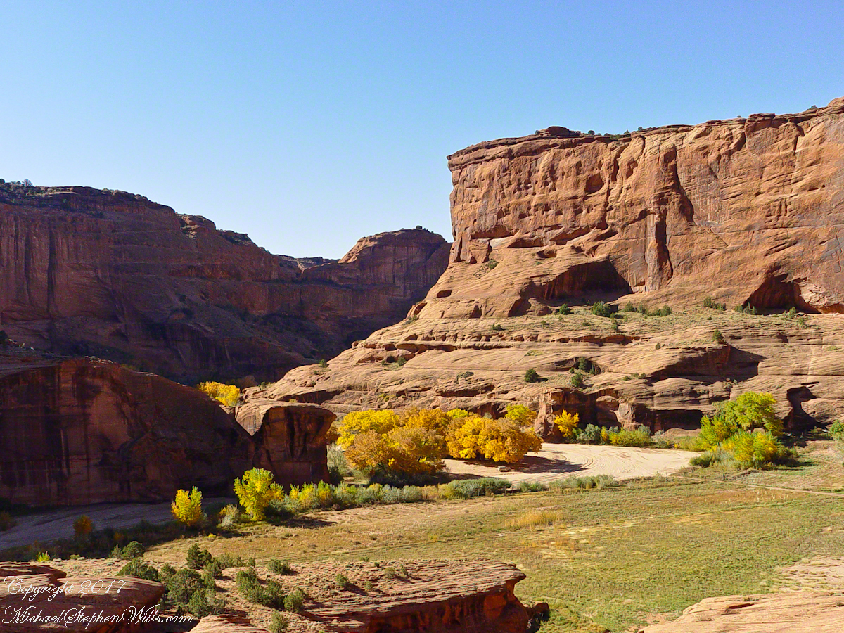
Here is Hadley, approximately 6.2 miles into the canyon with the “Ledge Ruin” behind. We arrived at the junction just in time, before the sun was high enough to wash out the ruin. It is slow going into the canyon what with the deep sand and water that must be negotiated. Hadley did the driving and was expert. We passed other parties bogged down in the wet sand. I do not believe it was luck that kept us moving . We stopped many times to talk and admire the petroglyphs and pictographs.
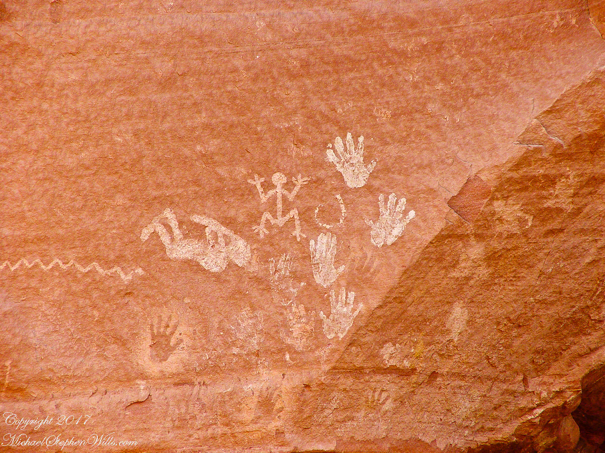
Petroglyphs are symbols incised, or cut, into the surface (the name means petro, “rock”, glyph, “symbol”). In the desert climate of the southwestern USA a thin, dark pigment forms on rock surfaces of overhanging cliffs. The pigment forms from infrequent precipitation, in the form of water, flowing downward over the surface or even dew. The high heat of the desert drives a chemical reaction between water, clays, iron and manganese oxide to form a coating on the rock surface. The dark coating, called “desert varnish”, contrasts with the underlying rock. When it is scraped away a line forms. Many of the petroglyphs were of this form. Others were carved into the rock itself, more time consuming and durable. No one knows when the petroglyphs were made, they were always there are respected. People have inhabited Canyon de Chelly for over a thousand years. The word pictograph has a different meaning when used to describe prehistoric art. The earliest writing were symbols incised in wet clay, then allowed to harden. The pictographs we viewed was prehistoric art, mostly white pigment on the red rock, outlines of hands. There were also kokopelli, the outline of a flute player and jagged lines, symbolizing, Peter told us, lightening.
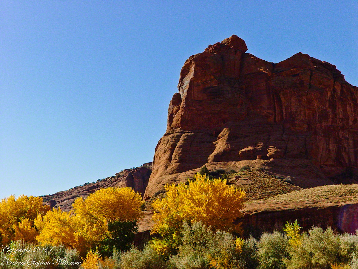
In November the cottonwoods were in fall foliage, a brilliant yellow under a cloudless sky. The sun is lower in the south and rises later. The Navajo Reservation follows daylight savings time, unlike Arizona. This November morning the sun rose around 7:45 am, so if you are not an early riser this time of year is an excellent choice for a Canyon de Chelly tour.
Looking southwest from the Canyon de Chelly visitor center toward the eastern escarpment of Black Mesa of the Hopis.
The village of Chinle is a “census designate place”, in other words it only exists because people live there, it was not formally recorded in “official” records. On the Navajo reservation, people lived here beyond recorded time. It is called in their language “flowing out”, where live giving water flows out from the canyons.
There is a fine Best Western in Chinle, better than most of that brand and the only choice for mile and miles and miles.
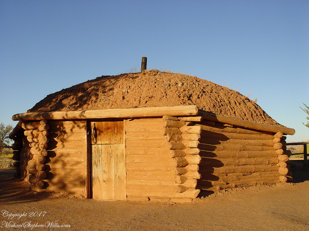
This is a cribbed log hogan. The domed earthen roof keeps the interior cool in hot weather and, along with a fire, warm in the winter. The Navajo hogan entrance faces east.
In Junction Ruin Musings, the previous post, a ruin from the Anasazi people was contemplated. Above is a traditional Navajo dwelling from a later, more secure, time.
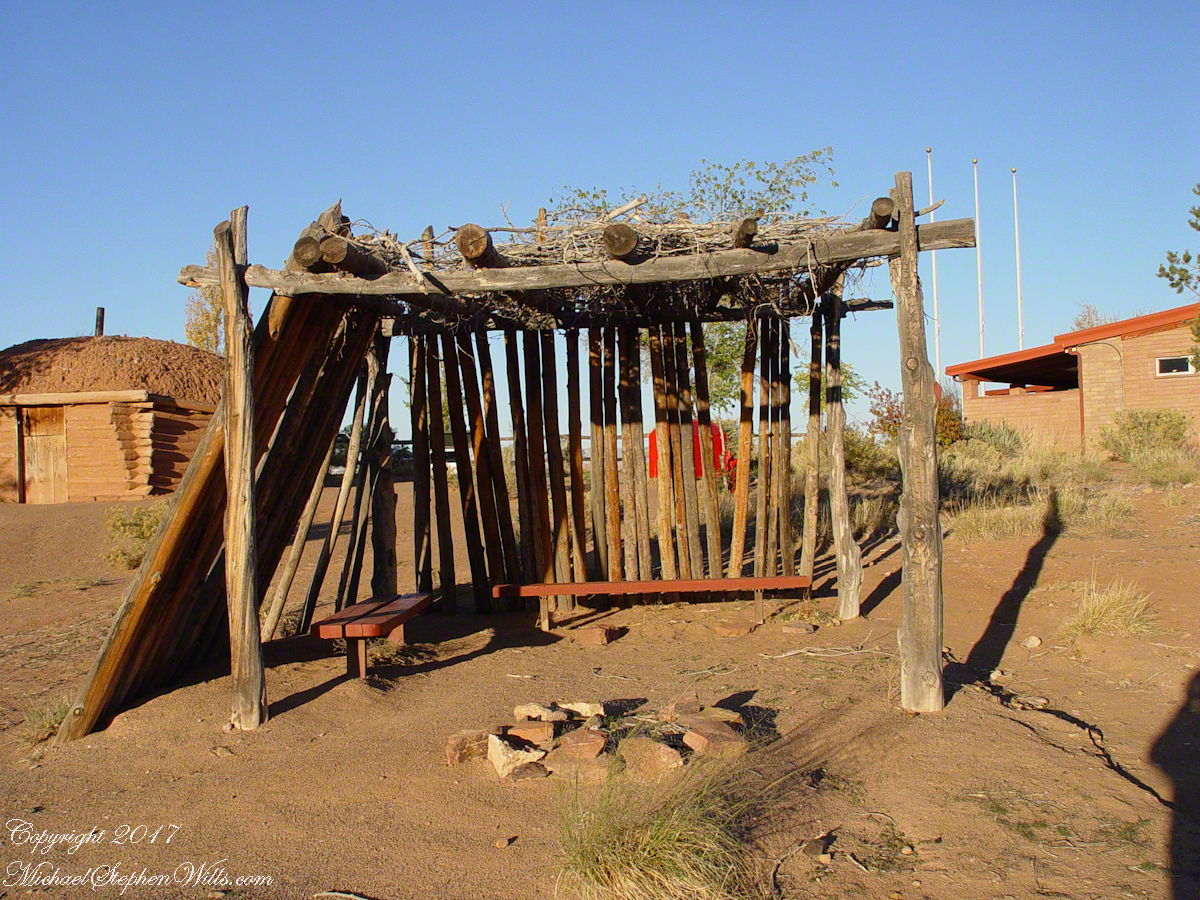
A good place to cook, read and sleep in hot weather. The entrance faces east and, for this one, the view was superb.
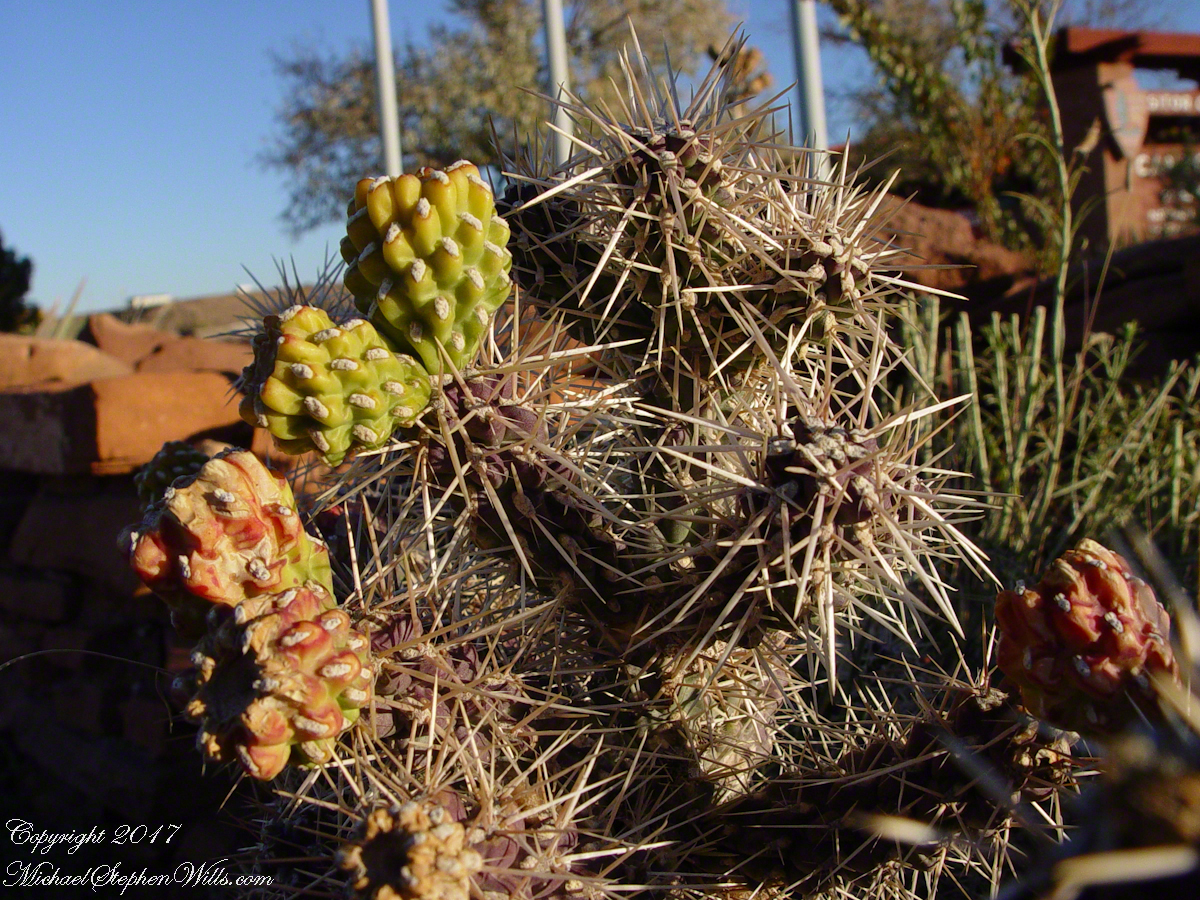
Ouch!! Everywhere in the southwest, watch where you tread.
A Native American, seeing the flute playing Kokopelli, hears in the mind the sonorous melodies of their native flutes carried in as if on the wind. The hands waving in rhythm, “Here we are.”
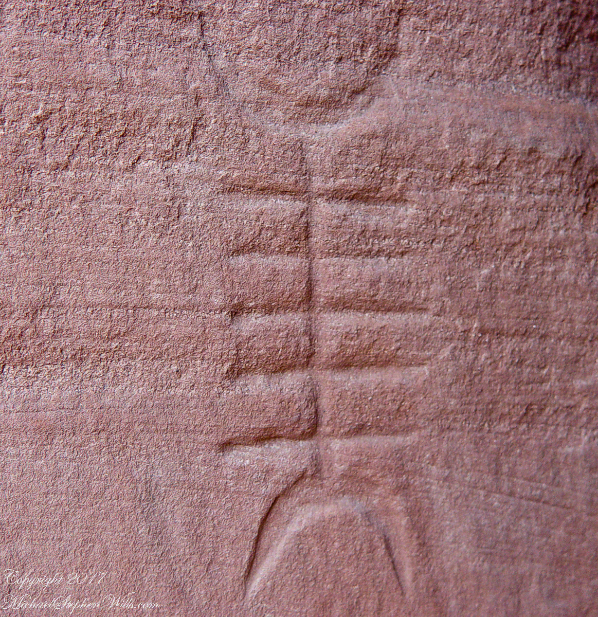
Canyon de Chelly symbol carved into red sandstone cliff representing a clan sign.
I recall our guide, Peter, describes this as a scorpion.
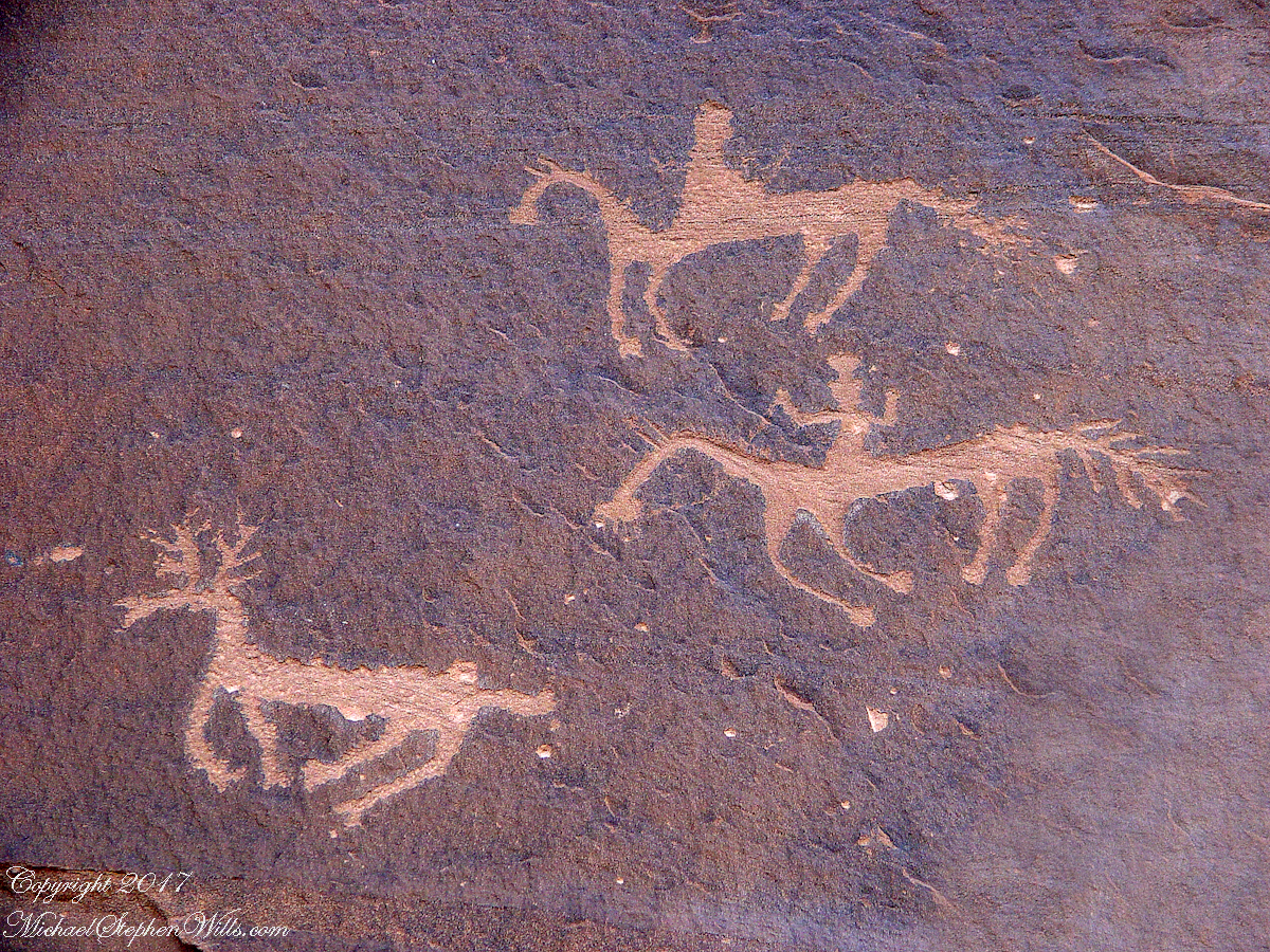
Canyon de Chelly petroglyph, desert varnish over red sandstone. Image is dated by representation of horses, brought by europeans.
The feeling of movement and the story invoked viewing this drawing etched carefully on the rock demonstrates we are in the presence of an accomplished artist. The story of the times for us to learn from.
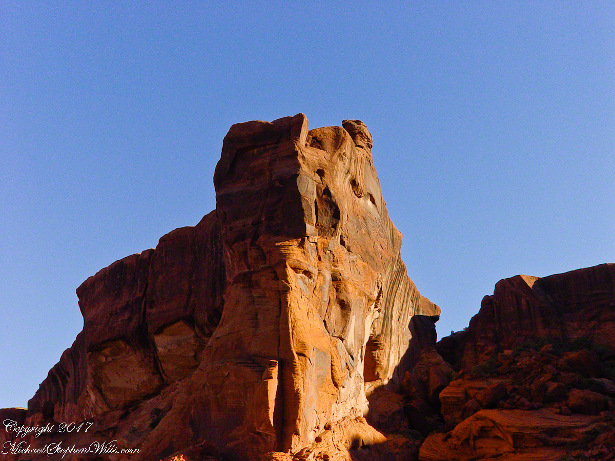
Red sandstone formation on ridgeline, north side of Canyon de Chelly is remember by the Navajo for the story of the Raven Woman.
A Navajo woman, fleeing Apache captors, flew over this cliff, or seemed to. Survival depended on knowing how to run over slickrock without stumbling and to know where and how to disappear into the rocks.
Canyon de Chelly below the first division into tow arms, the junction. This is looking south east. The cottonwoods are in autumn foliage.
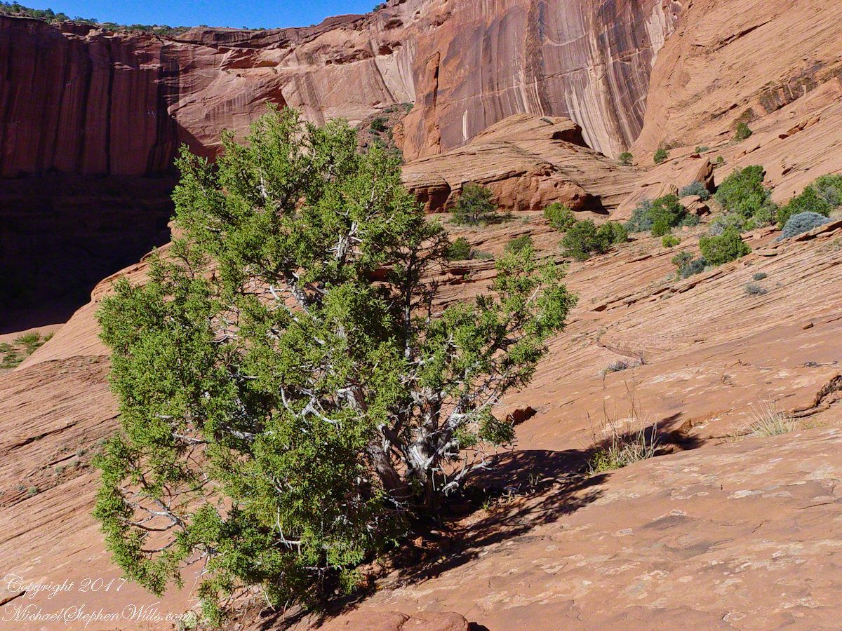
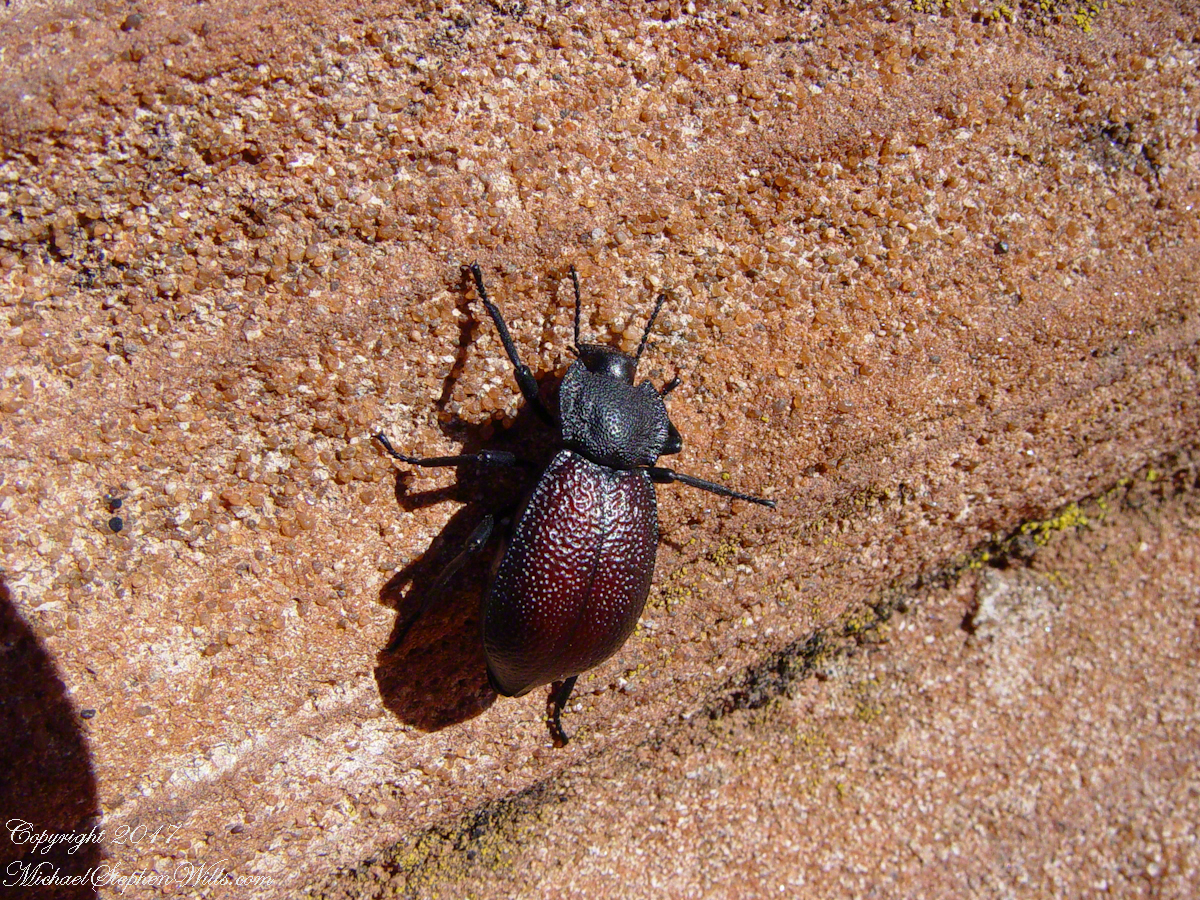
Cahyon de Chelly is is possible here to climb out of the canyon over these lower slopes over what is called slickrock. In the foreground is a juniper tree.Canyon de Chelly vista from a slickrock ledgeA two inch dung beetle crawls up sandstone slickrock, the origin of this stone apparent from the visible sand granules within an apparent clay matrix. The stone grain, described as cross bedded, suggests this was a former dune of wind blown sand composed of remnants of the Ancestral Rock Mountains.
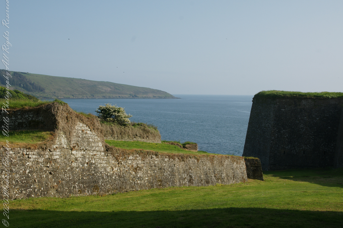
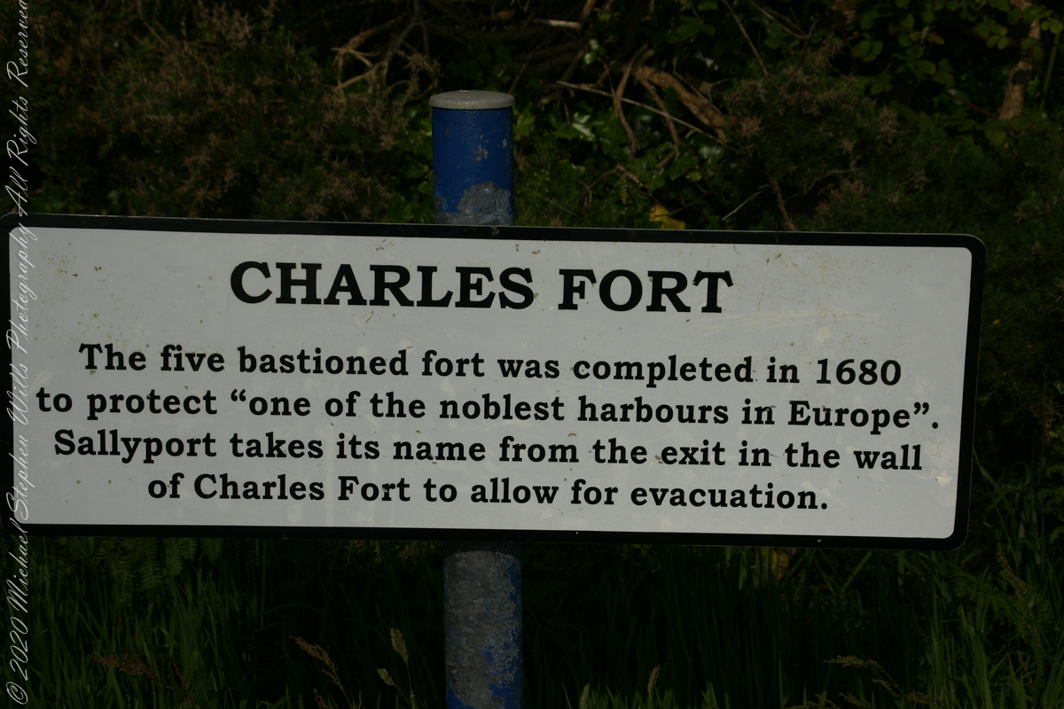
A half mile footpath, marked in red on the following Google Earth view, leads from the Charles fort sallyport, along the shoreline cliffs, surmounted by working farmland and looks toward the Celtic Sea.
To “sally” is to suddenly charge out from a besieged place against the enemy. The word is also used as a noun. It can also be used to describe our walk, as a sally to an unusual place.
The town above the walk is named Sallyport
Here is a view of the Celtic Sea from the Sallyport
From Wikipedia: “The Celtic Sea receives its name from the Celtic heritage of the bounding lands to the north and east. The name was first proposed by E. W. L. Holt at a 1921 meeting in Dublin of fisheries experts from Great Britain, France, and Ireland. The northern portion of this sea was considered as part of Saint George’s Channel and the southern portion as an undifferentiated part of the “Southwest Approaches” to Great Britain. The desire for a common name came to be felt because of the common marine biology, geology and hydrology of the area. It was adopted in France before being common in the English-speaking countries; in 1957 Édouard Le Danois wrote, “the name Celtic Sea is hardly known even to oceanographers.”[3] It was adopted by marine biologists and oceanographers, and later by petroleum exploration firms. It is named in a 1963 British atlas.. A 1972 article states ‘what British maps call the Western Approaches, and what the oil industry calls the Celtic Sea […] certainly the residents on the western coast [of Great Britain] don’t refer to it as such.'”
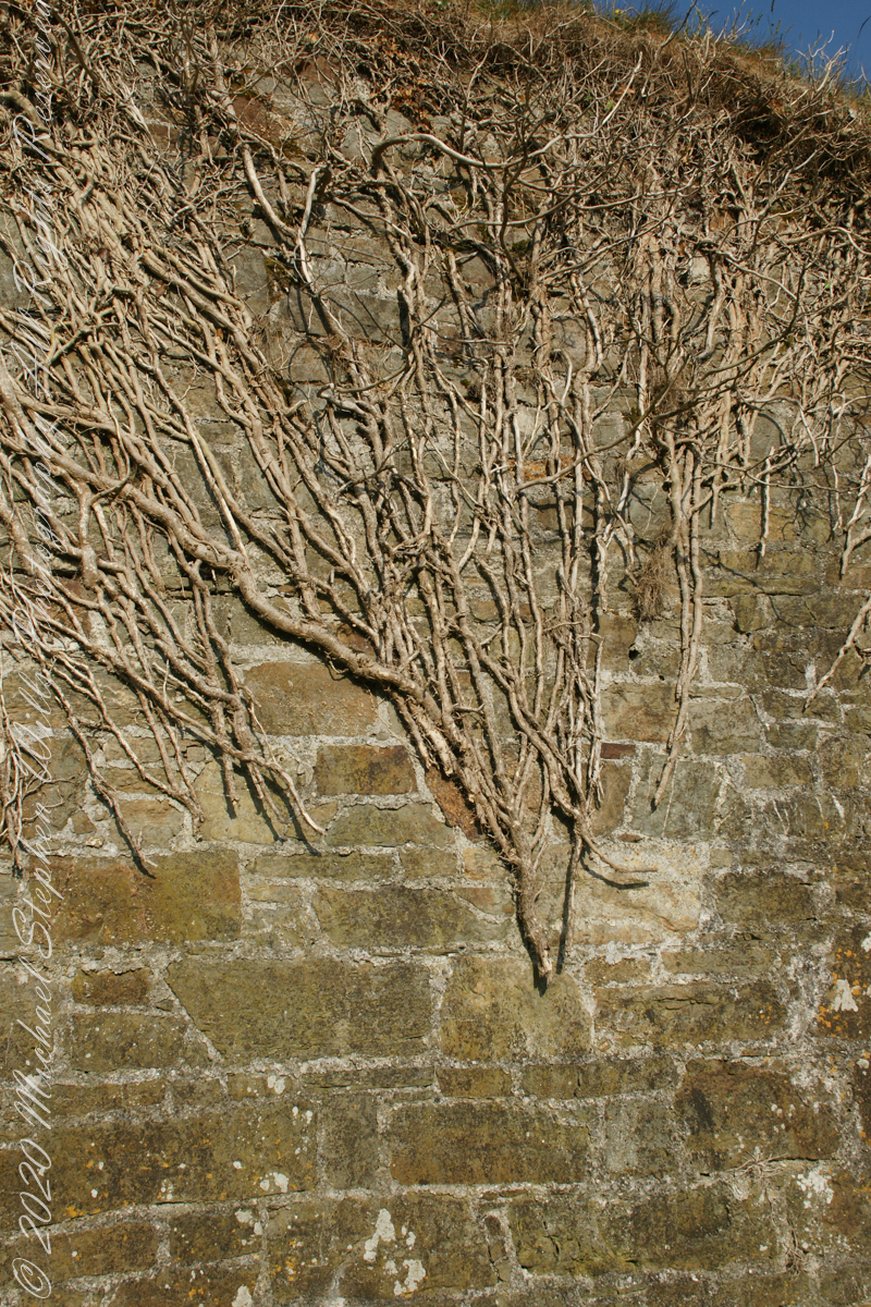
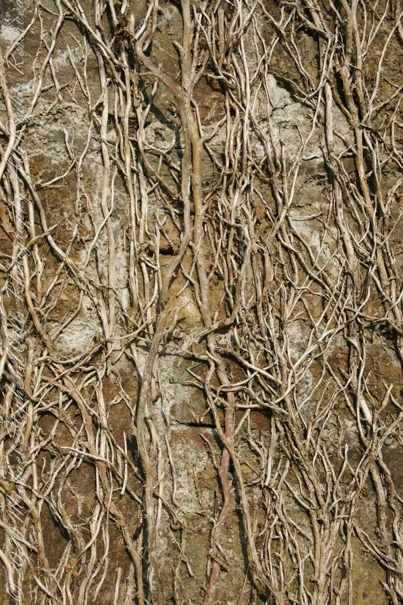
Views of the wall from previous photograph. The vines were separated from roots to preserve the walls, leaving interesting patterns.
The distant land to the right, beyond the walls, is the Old Head of Kinsale.
Informational placards along the walk give background to the views enjoyed by hikers.
Here is the above view.
SONY DSC
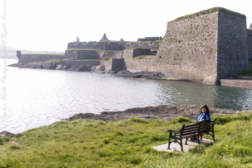
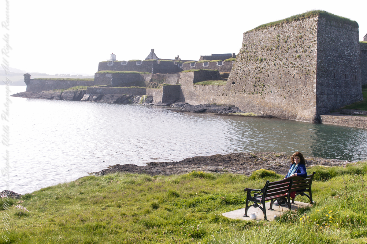
Pam, at start of our walk. Poking above the walls is the Charles Fort Lighthouse. “This lighthouse is a directional light marking the way to safe anchorage close to Kinsale. In 1665 King Charles II granted letters patent to Sir Robert Reading to erect six lighthouses on the coast of Ireland, including one at Barry Oge’s castle, near Kinsale later to become Charles Fort. The original structure would have had a coal fire on its roof. In 1810 powers given to the Commissioners for Barracks and others between 1767 and 1806 were all vested in the Corporation for Preserving and Improving the Port of Dublin or the Ballast Board. This board took over the general lighting and marking of the coast when fourteen lighthouses were transferred to it including that at Charles Fort. This lighthouse, built in 1929, is one of the more recent to be found along the coast, with most dating to the nineteenth century. A new mains powered light at Charles Fort Lighthouse was put into operation on the 14 April 2004 marking the end of a long era of gas and oil powered lights in Ireland.” Quote is from the link provided in references.
May 30, 2014 outside of Charles Fort, Kinsale, County Cork, Republic of Ireland
Arriving at Charles Fort, the “new” fort compared to the “old” James Fort across the cove, late in the day after our walking tour of Kinsale and lunch, the gate to the interior was closed. Pam and I made do with exploring the outer battlements where the citizens of Kinsale were enjoying themselves.
A shortcoming of Charles Fort was the high ground you can see behind the figures. The defenses are strong on the seaward side and open to attack from the land.
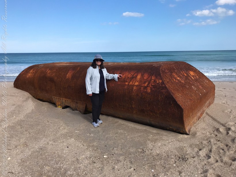
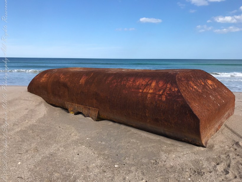
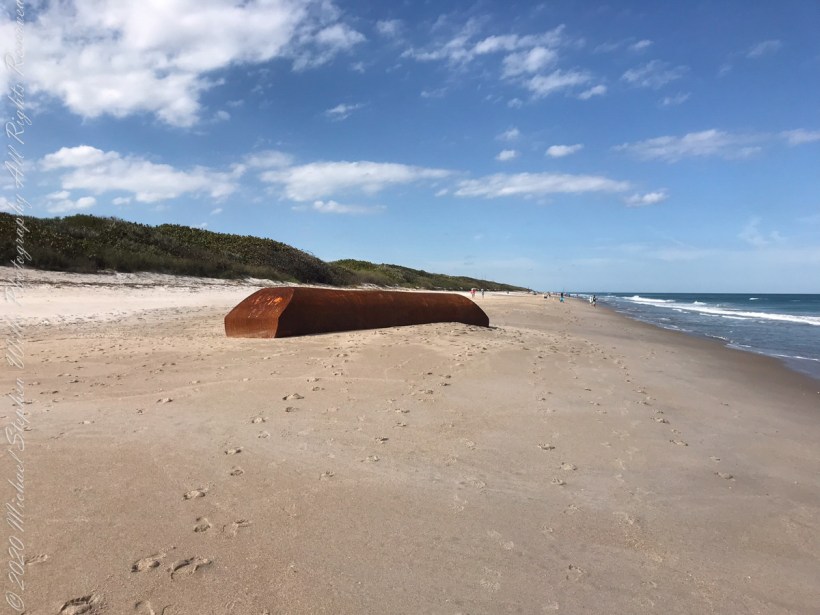
From a November 2021 article by James Sparvero of ClickOrlando(dot com). “Recent storms may have pushed a big part of a ship onto a secluded Central Florida beach. The Canaveral National Seashore said the metal object washed ashore at boardwalk No. 7 of Playalinda Beach. It is about 8 feet tall and 20 feet long.
Pam provides a sense of scale
“Seashore’s resource manager Kristen Kneifl said it might be a ballast tank from a ship, which is a compartment on a floating structure that holds water to help stabilize the vessel. “
Still a mystery
’That’s our best guess at this point,’’ Kneifl said.
As far as removing the giant box, the Seashore said it could be difficult. Meaning it will probably stay on the beach for a while until it gets figured out.
‘’Unlike maybe some boats or other things that wash up, where we can kind of chain saw it apart and get it over one of our boardwalks, it doesn’t look like it can be cut up,’’ Kneifl said. ‘’So, it’s going to have to be removed from the water, from the oceanside.”
Kneifl said, chances are, the strange object will be removed on a barge and transported elsewhere by sea.
Here is a photo for a sense of place.
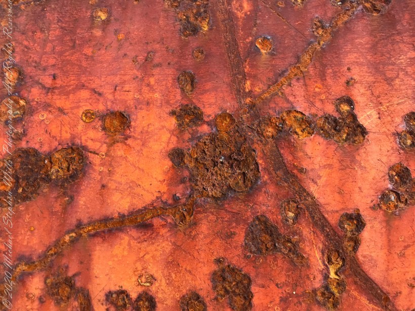
Artistic macros of the rusty surface.
Cape Canaveral National Seashore, Titusville, Brevard County, Florida
Copyright 2022 Michael Stephen Wills All Rights Reserved
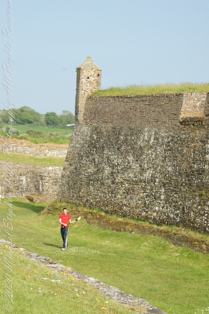
After exploring Kinsale town and lunch Pam and I drove two miles, along the east side of the cove, to the ruins of Charles Fort, one of a pair of fortifications protecting Kinsale from seaward attack. The “New Fort,” Charles, faces the “Old Fort”, James, across the cove.
Built in the 17th century on the site of an older fortification, Ringcurran Castle, it is named for Charles II, the English monarch of the time. The fort was burned during by retreating anti-treaty forces in 1922 during the Irish Civil war. It lay derelict until today’s 1971 until now restoration.
Upon our arrival this young man was handling a hurley and sliotar beneath the fort wall, an incarnation of Cúchulainn playing hurling at Emain Macha. From Wikipedia, “Hurling is older than the recorded history of Ireland. It is thought to predate Christianity, having come to Ireland with the Celts. The earliest written references to the sport in Brehon law date from the fifth century. Seamus King’s book A History of Hurling references oral history going back as far as 1200 BCE of the game being played in Tara, County Meath. The tale of the Táin Bó Cuailgne (drawing on earlier legends) describes the hero Cúchulainn playing hurling at Emain Macha.”
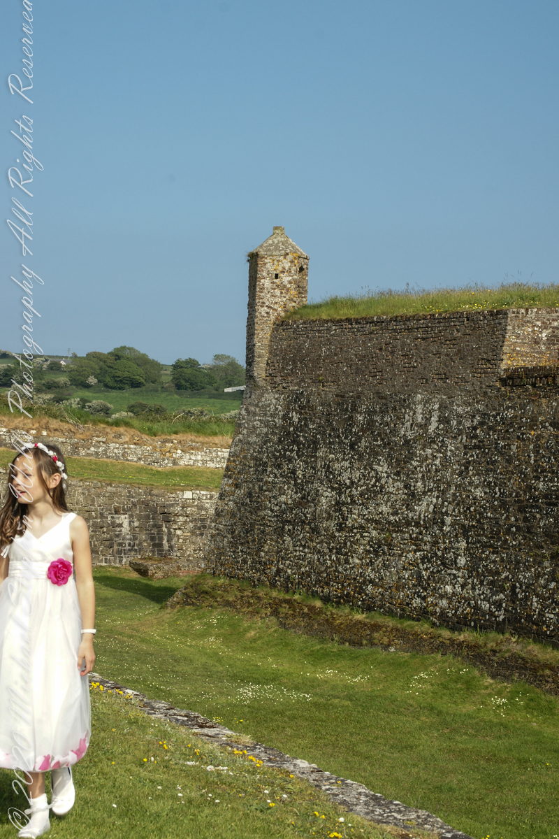
The tenth and final of a series of idiosyncratic posts from a walking tour of Kinsale by Dermot Ryan. My Sony Alpha 700 captured the events back in May 2014.
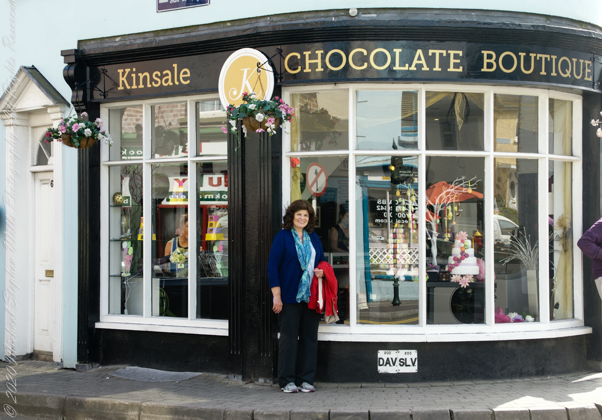
We are headed toward lunch along the River Bannon. The Kinsale Chocolate Boutique, Exchange Buildings, 6 Market Square, did not survive the pandemic. This iconic corner is now the First South Credit Union (sigh).
SONY DSC
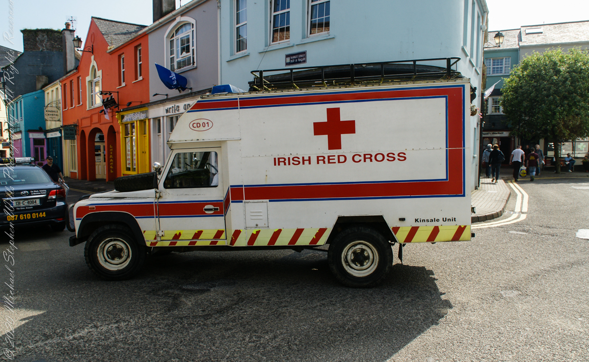
With headquarters in Dublin, the Irish Red Cross provides in Ireland (click the links to learn more):
Come out of the center town to walk along Pier Road, River Bannon on its way to the harbor, on one side, town parks on the other.
Taking a walk along the river Bannon and Pier Road, Kinsale Town, County Cork, Ireland
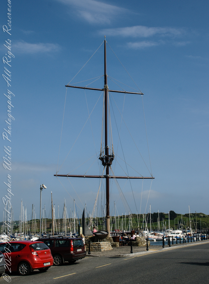
Across from Kinsale Town Park rises this Tall Ship mast and other memorabilia from Kinsale’s maritime heritage.
A few hundred feet away are moorings for the Kinsale Yacht club, ” located in Kinsale, County Cork lies just 120 nautical miles from Wales, 240 from North West France and only 500 from the Galician Coast of North Spain. Most significantly it is only 30 km by road from Cork, Ireland’s second city, and between the two lies one the region’s main assets – Cork International Airport – with its daily links to many European capitals. Keelboats and Dinghies. The club runs inshore and offshore races, has active cruising and powerboat sections and most significantly for any real club, a strong and dynamic junior training program. Kinsale Yacht Club and marina are only a few minutes walk from every shop, hotel, pub and restaurant in Ireland’s gourmet capital.” — from the Yacht Club web site.
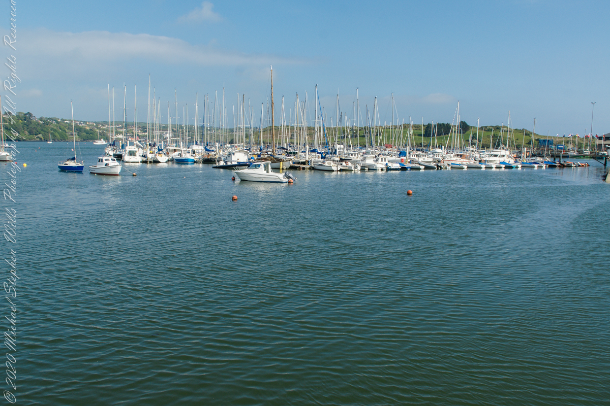
Moorings for pleasure craft on the River Bannon, off Pier Road (R100), the town of Kinsale, County Cork, Republic of Ireland
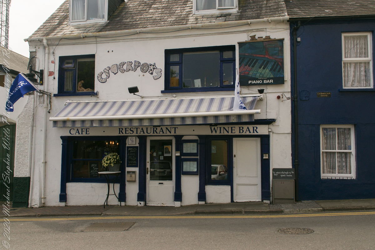
Look closely to see this quote “The Onion is the truffle of the poor.” –Robert J. Courtine. Crackpots was decorated with unusual pottery, a casualty of Covid-19.
“The Onion is the truffle of the poor.” –Robert J. Courtine Crackpots is closed post Covid-19, Kinsale, County Cork, ireland
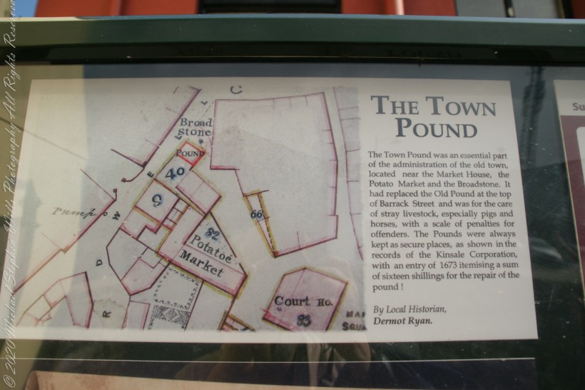
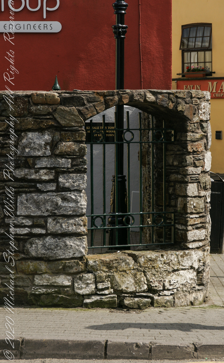
From a placard inside the stone walled “Town Pound.” “The Town Pound was an essential part of the administration of the old town, located near the Market House, the Potato Market and the Broadstone. It had replaced the Old Pound at the top of Barrack Street and was for the care of stray livestock, especially pigs and horses, with a scale of penalties for offenders. The Pounds were always kept as secure places, as shown in the records of the Kinsale Corporation, with an entry of 1673 itemizing a sum of sixteen shillings for the repair of the pound!” By Local Historian, Dermot Ryan.
Outer wall of “the Town Pound” historical site. Corner of Marketplace and Guardwell, Kinsale, County Cork Ireland
The Tan Tavern is on the other side of Guardwell street, seen here over the stone wall of “The Old Town Pound” historical site.
The Tan Tavern is on the other side of Guardwell street, seen here over the stone wall of “The Old Town Pound” historical site. Corner of Market Place and Guardwell. Kinsale, County Cork, Ireland.
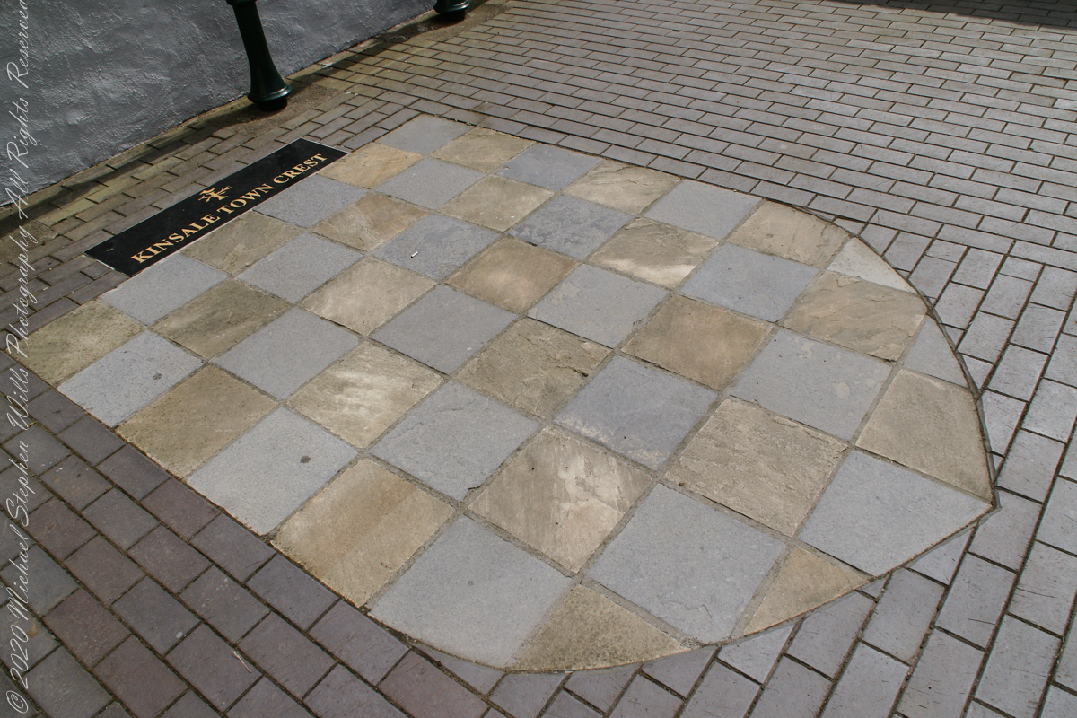
“Kinsale Town Crest
Within walls of the historical site, “The Town Pound.”. Kinsale, County Cork, Republic of Ireland
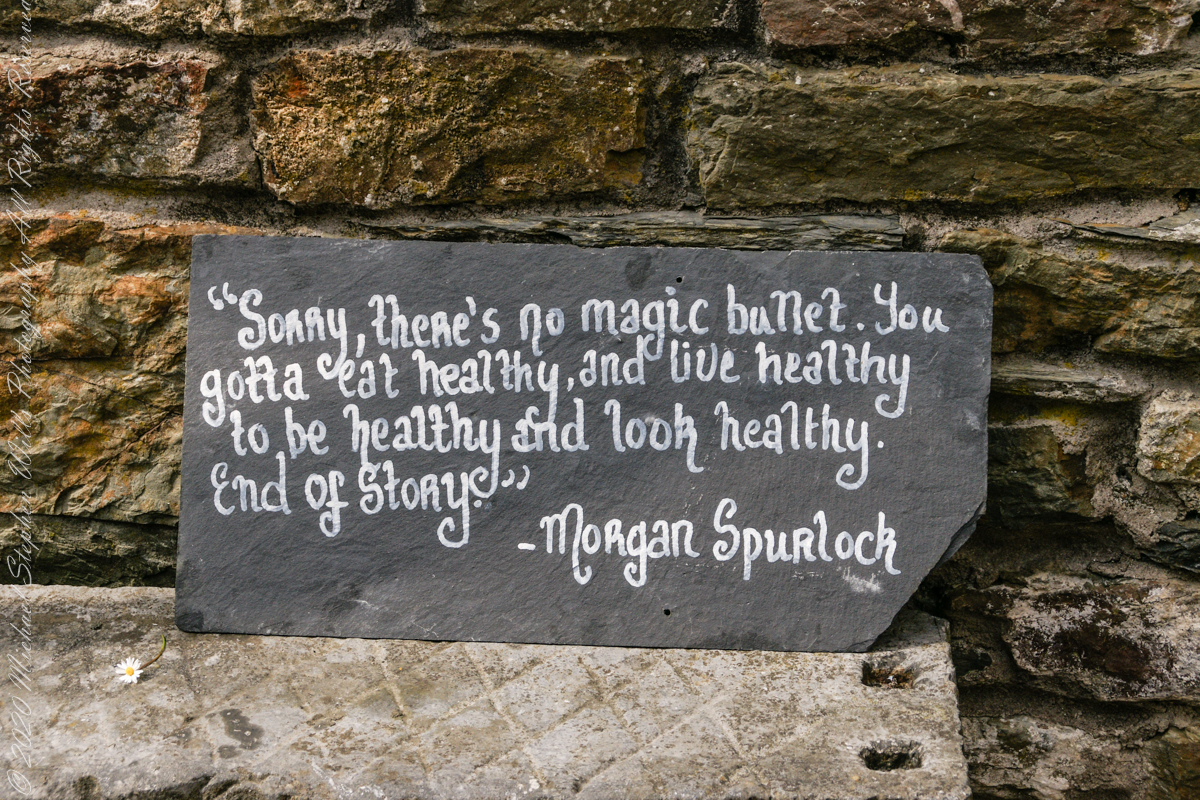
I don’t recall where exactly this quote was placed. It is associated in time with the Town Pound (photo time stamps). Morgan Spurlock of the documentary “Supersize Me” is an American of Irish descent.
Morgan Spurlock of “Supersize Me”, an American of Irish descent.