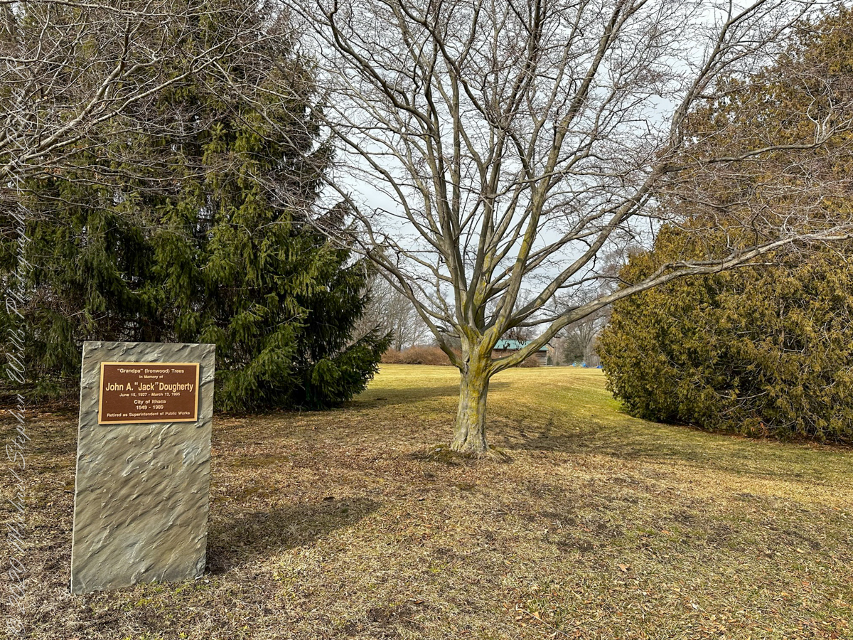
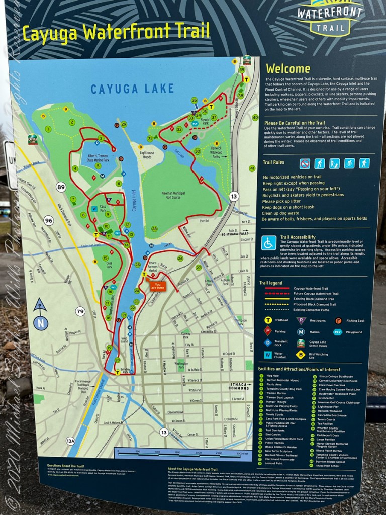
Another Cayuga Waterfront Trail stop is this memorial. The plaque reads ” ‘Grandpa’ (Ironwood) Trees in memory of John A. ‘Jack’ Dougherty; June 15, 1927 – March 12, 1995; City of Ithaca 1949-1989, Retired as Superintendent of Public Works.” Located near the intersection of Pier Road and Willow Avenue, Newman Golf Course, Ithaca, Tompkins County, New York. That is an Ironwood tree, midgound center.
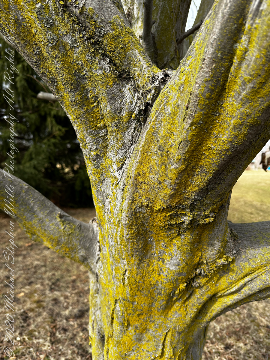
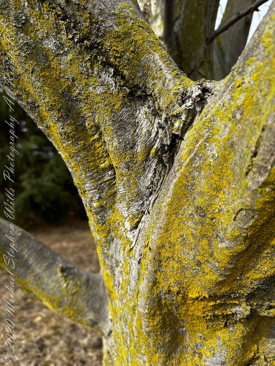
The American Hornbeam (scientific name: Carpinus caroliniana) is also known as Musclewood for the rippled surface of the mature trunk. Other names are blue-beech, ironwood and muscle beech.
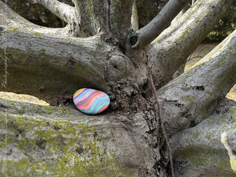
Nestled on the trunk……
Copyright 2023 Michael Stephen Wills All Rights Reserved
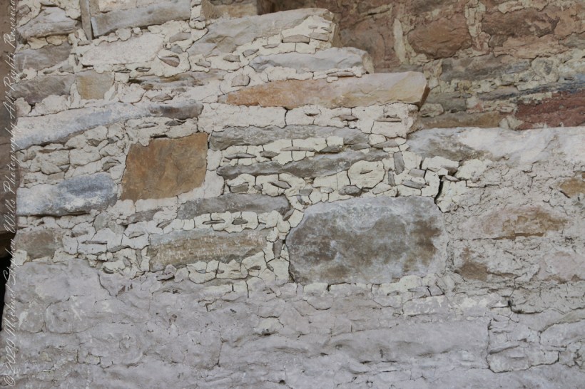
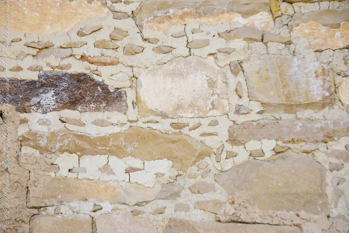
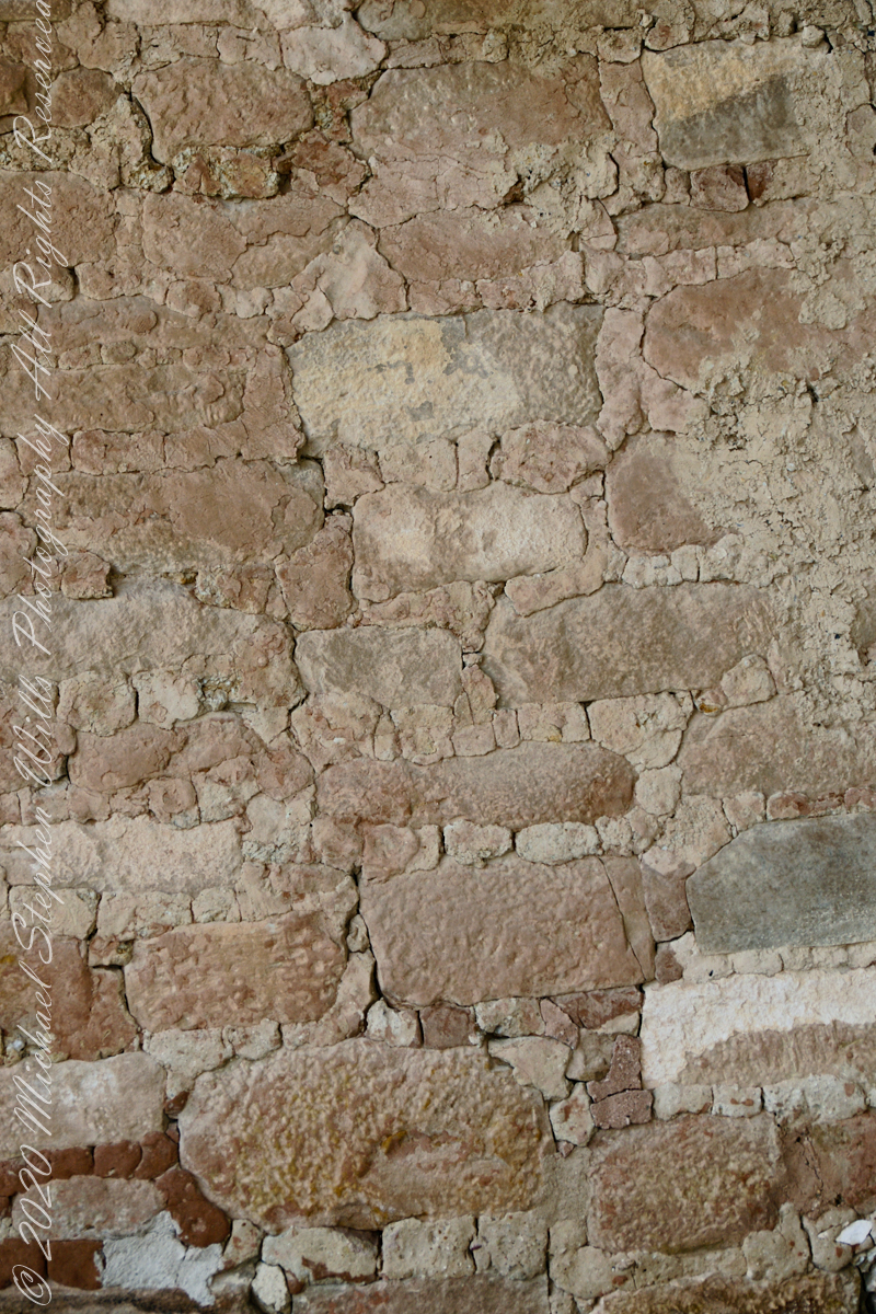
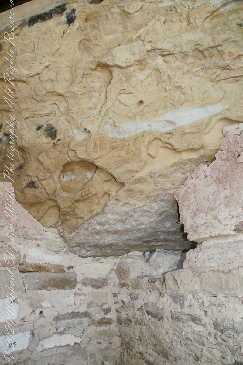
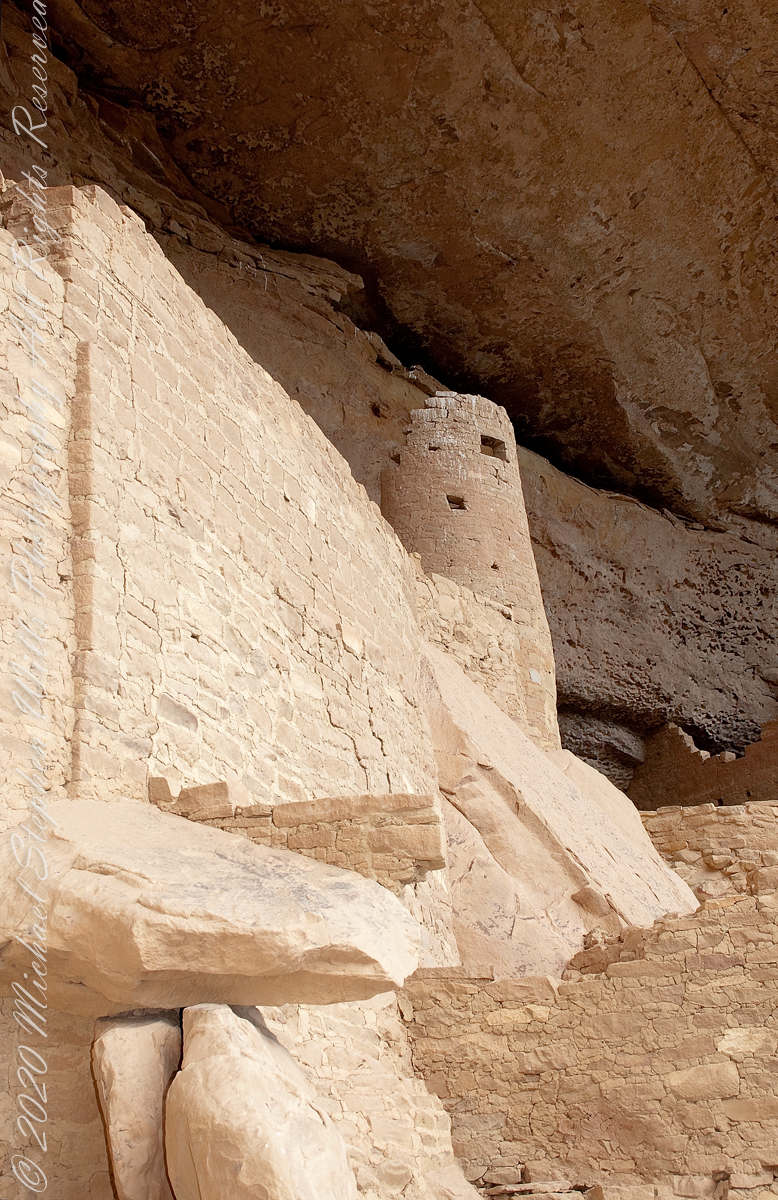
When the ancestral Puebloans moved from living next to their fields, in adobe structures, to these cliff dwellings, their building techniques were left behind.
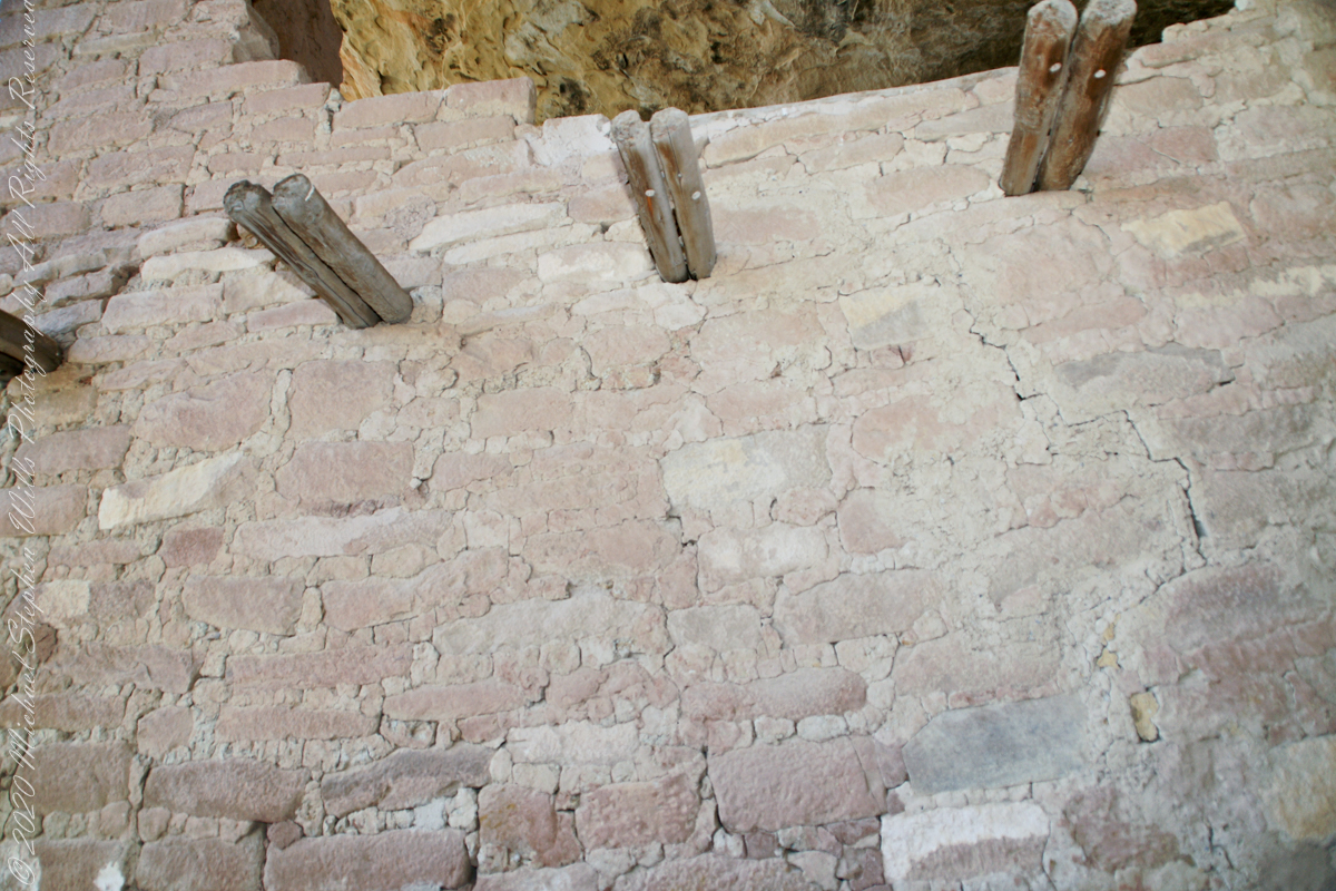
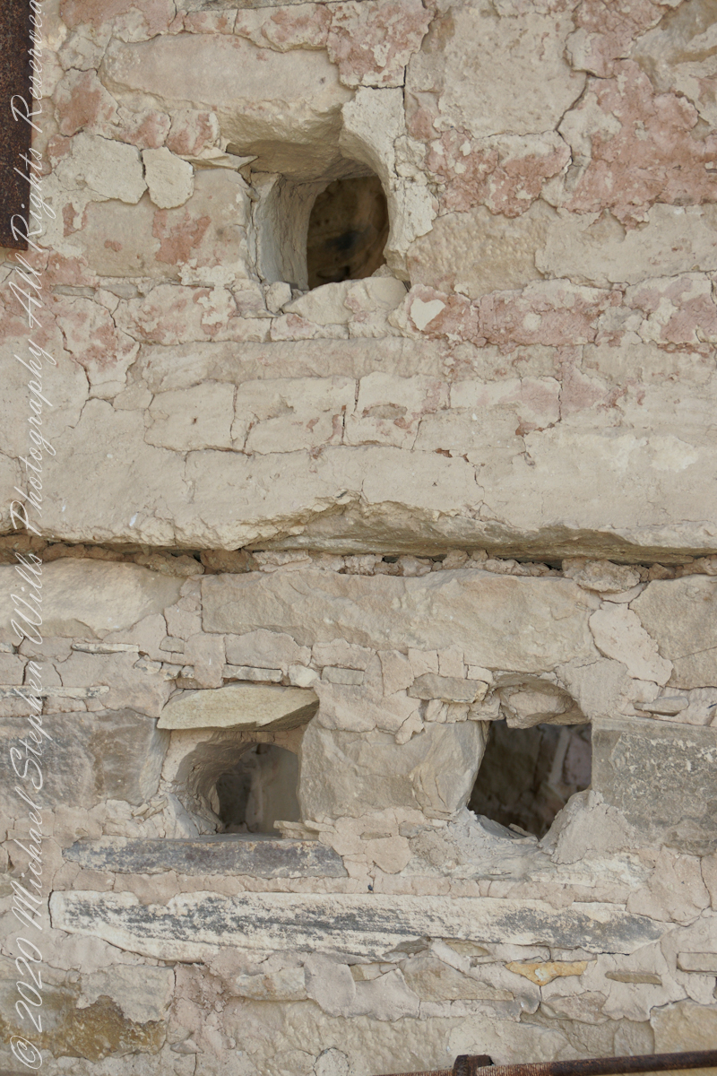
Stone and Mud Mortar with wood beams. Mesa Verde National Park, Montezuma County, near Cortez, Colorado.
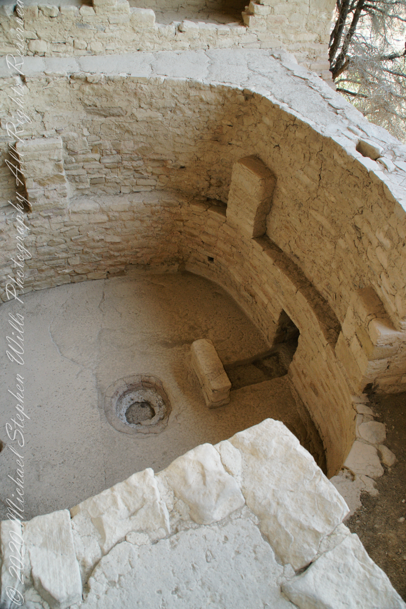
Mud mortar was used to bind stones. Wood poles were used for to construct floors. These are walls captured during the Ranger guided tour of Balcony House.
..
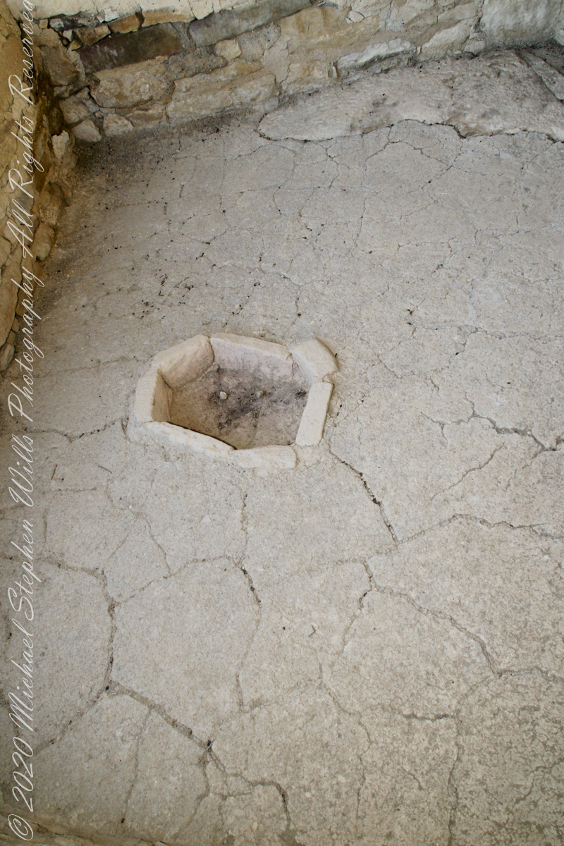
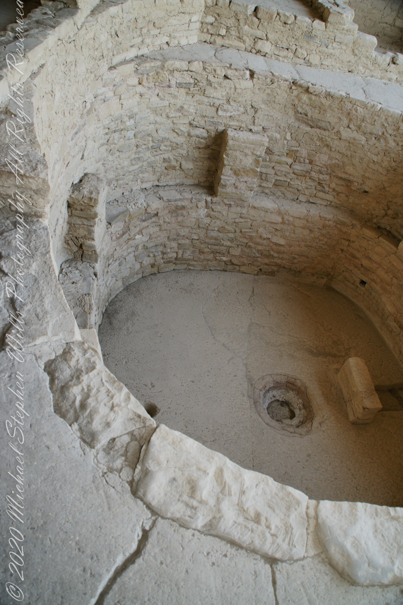
This flat Kiva floor was achieved through clay, softened with water, formed and allowed to dry.
Clay Kiva Floor. Mesa Verde National Park, Montezuma County, near Cortez, Colorado.
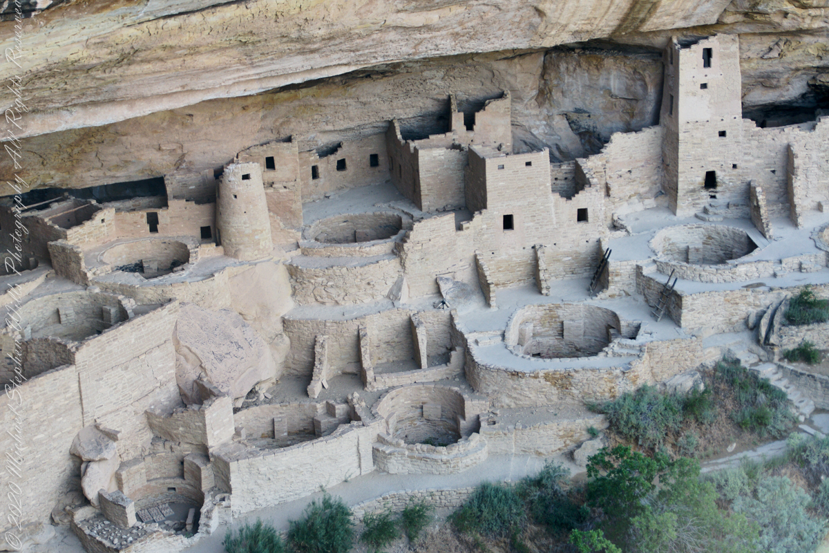
Cliff Palace
In this wall the poles rotted and crumbled, leaving behind these characteristic holes.
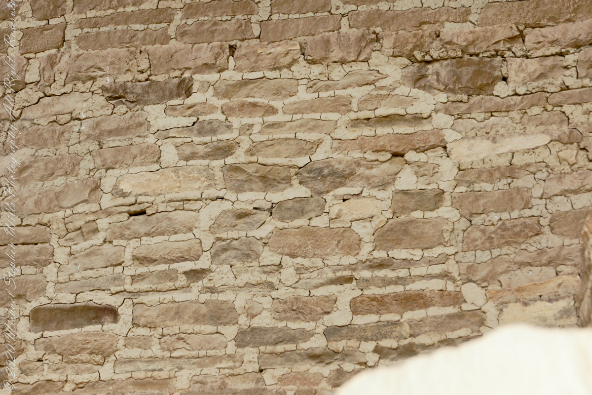
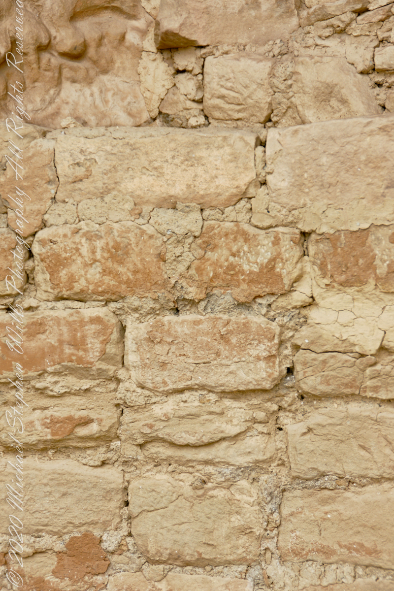
These architects excelled with adapting to the materials at hand.
.
The walls demonstrate an enormous variety around basic patterns.
Copyright 2023 Michael Stephen Wills All Rights Reserved
A kiva is a space used by Puebloans for rites and political meetings, many of them associated with the kachina belief system. Among the modern Hopi and most other Pueblo peoples, “kiva” means a large room that is circular and underground and used for spiritual ceremonies.
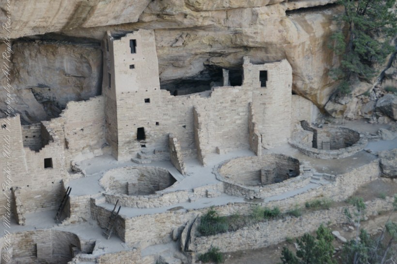
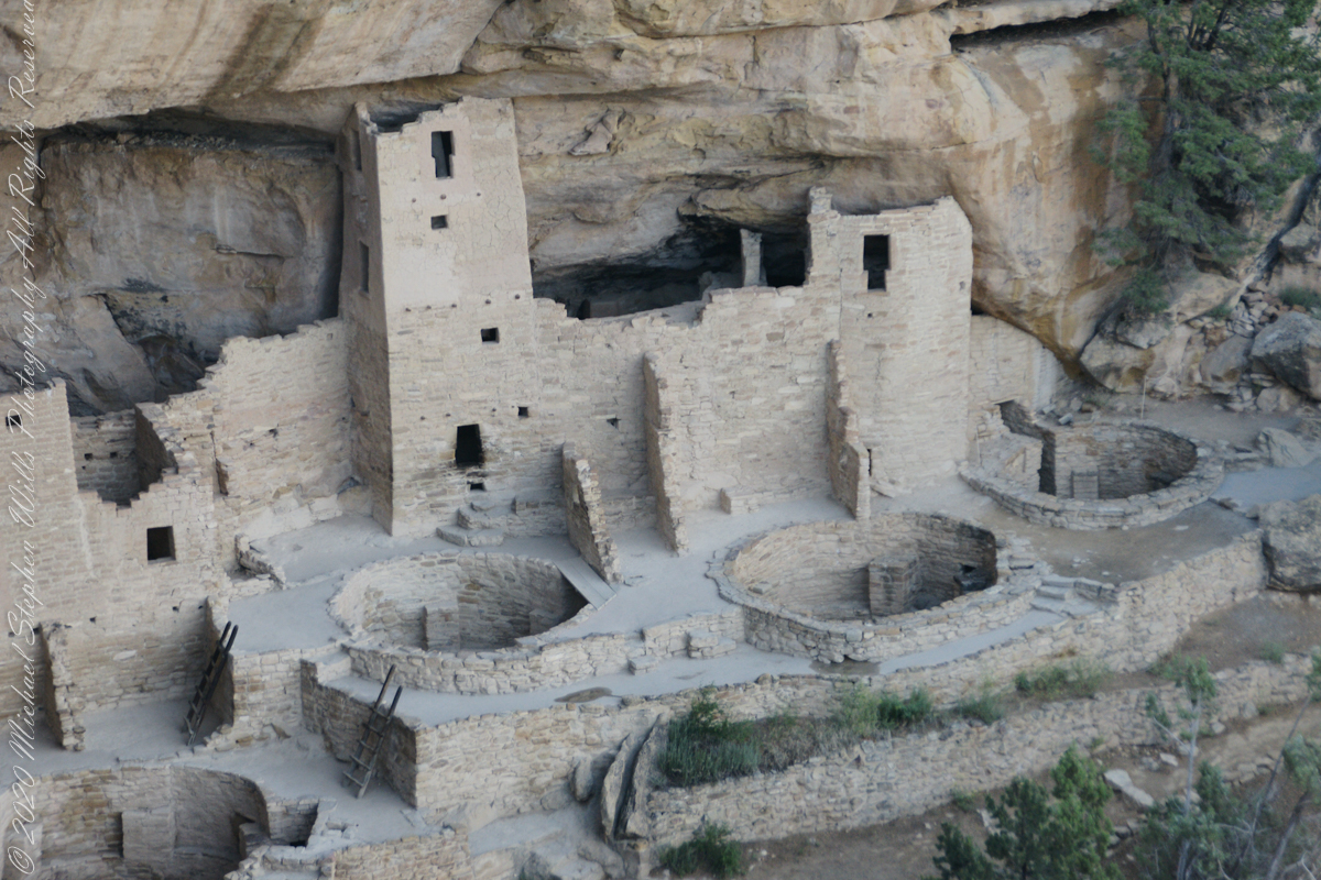
The Square Tower with four Kivas
Similar subterranean rooms are found among ruins in the North American South-West, indicating uses by the ancient peoples of the region including the ancestral Puebloans, the Mogollon, and the Hohokam.
A portion of Cliff Palace including many Kivas, the round and square towers.
Those used by the ancient Pueblos of the Pueblo I Period and following, designated by the Pecos Classification system developed by archaeologists, were usually round and evolved from simpler pit-houses.
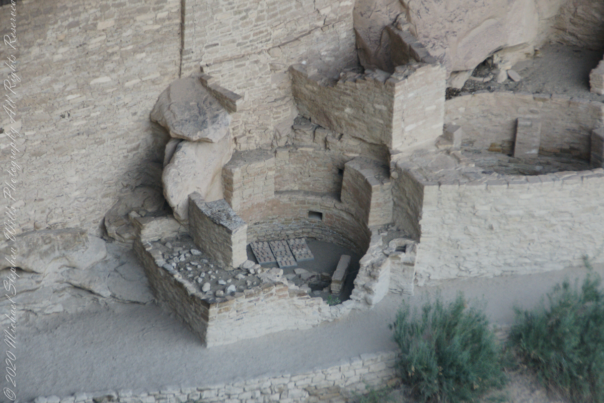
Two Kivas, one with broken wall.
For the Ancestral Puebloans, these rooms are believed to have had a variety of functions, including domestic residence along with social and ceremonial purposes.
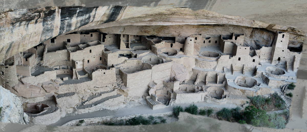
The entire Cliff Palace from the overlook, from a single wide-angle image.
During the late 8th century, Mesa Verdeans started building square pit structures that archeologists call protokivas. They were typically 3 or 4 feet (0.91 or 1.22 m) deep and 12 to 20 feet (3.7 to 6.1 m) in diameter. By the mid-10th and early 11th centuries, these had evolved into smaller circular structures called kivas, which were usually 12 to 15 feet (3.7 to 4.6 m) across.
Sipapu
Mesa Verde-style kivas included a feature from earlier times called a sipapu, which is a hole dug in the north of the chamber that is thought to represent the Ancestral Puebloans’ place of emergence from the underworld
Here is a close-up of the kiva floor of the Balcony House.
Balcony House Kiva
The sipapu is the smaller pit in the floor to the left (north side) and partially blocked by the kiva wall. The larger is a firepit. The small wall to the right is placed to deflect airflow from a floor vent.
Balcony House Kiva, to the right is the floor vent in wall and deflector stone. There is the firepit and a tiny portion of the sipapu at the left edge.
I count 14 Kivas in the Cliff Palace panorama, including some with broken walls.
What is the Connection, if any, between Omphalos and Sipapu?
The global coordinate system was known to ancient Greeks, in fact they are credited with the discovery a system to locate any place on earth, an insight contained in myths of how Zeus founded Delphi as the “center of the world,” the place from which divinity irrupts, by setting two eagles at opposing ends of the world to fly, starting at the same time, same speed, the central world point identified by where the eagles’ paths crossed.
Bronze Coin from the Ptolemaic Kingdom of Egypt, reign of Ptolemy VI 2nd Century BC with the head of Zeus on one side and double eagles riding a thunderbolt on the other
To signify Delphi as this center a religious stone artifact, called an omphalos, was placed.
Most accounts locate the Delphi omphalos in the adyton (sacred part of the temple) near the Pythia (oracle). The stone sculpture itself (which may be a copy) is there to this day. The surface is a carving of a knotted net, the center hollow and widening towards the base. The omphalos represents the stone which Rhea wrapped in swaddling clothes, pretending it was newborn Zeus, in order to deceive Cronus. (Cronus was the father who swallowed his children so as to prevent them from usurping him as he had deposed his own father, Uranus).
The omphalos stone was believed to allow direct communication with the gods. Historians theorize the stone was hollow to allow intoxicating vapors breathed by the Oracle (priestess) to channel through it. However, understanding of the use of the omphalos is uncertain due to destruction of the site by Theodosius I and Arcadius in the 4th century CE.
That leaves us with the word, omphalos. In Greek the original meaning is navel, the anatomical reminder to humans of their source.
Comparing and contrasting these terms used by cultures separated widely by geography and time:
— sipapu is a religious symbol of the place ancestral peoples irrupted, born, into this world, emerging from the earth. From my readings, the word sipapu is a direct reference to the symbol. There are many sipapu, small holes in the floor of kivas (timetimes a hole in a wooden plank), representing a single place.
— omphalos is a religious symbol of where the divine irrupts into the world, from the earth, with direct linguistic natal (birth) associations. A single omphalos stone designates a single place.
Copyright 2023 Michael Stephen Wills All Rights Reserved
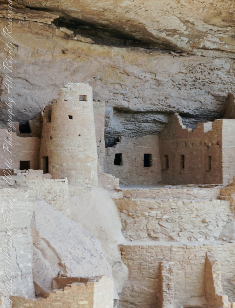
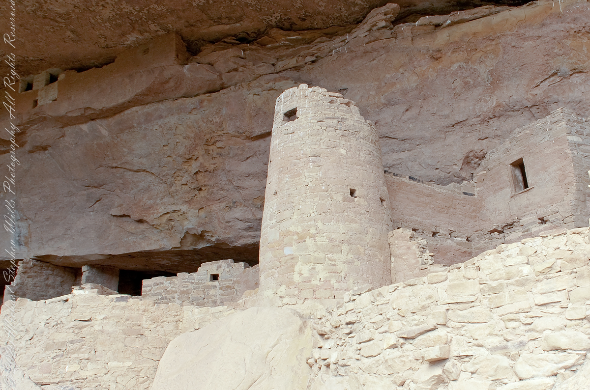
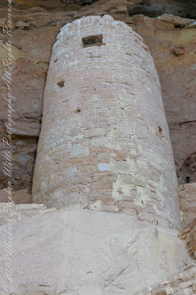
Looking over my photographs from Mesa Verde National Park I find the Cliff Palace Round Tower to be a unique structure. You can see it in this shot taken from the Cliff Palace Loop overlook…..
The Round Tower is on the upper left, between two kivas (appearing to be two round pits). The round shape of the tower is not readily apparent from this angle.
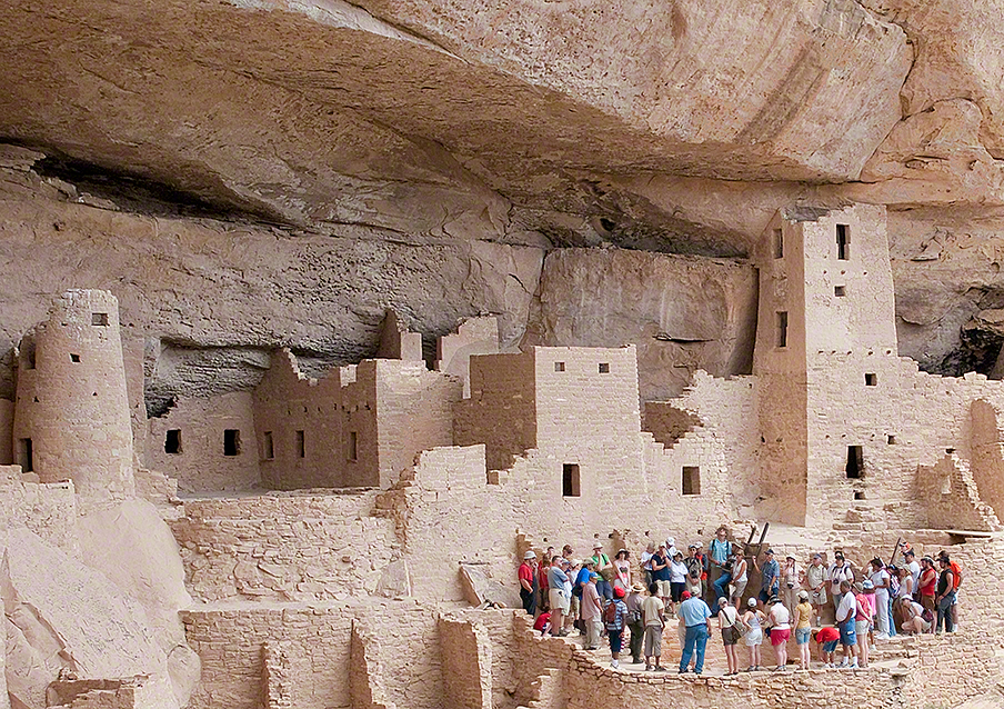
It is easier to see here from this photograph taken from the Cliff Palace footpath from the mesa top.
The Round Tower is on the left.
Here is a closer view, with surrounding structures for context.
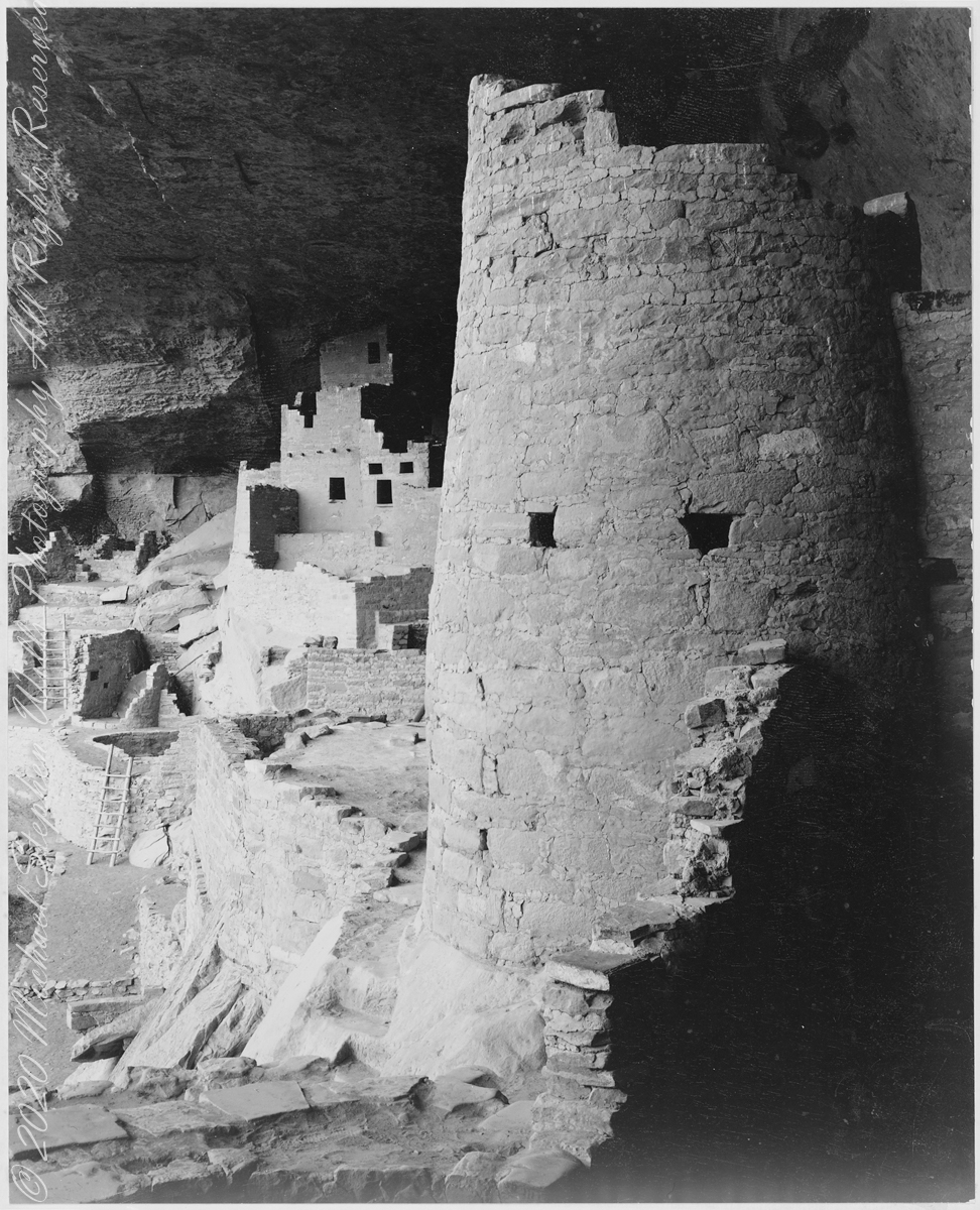
In 1941 the National Park Service commissioned noted photographer Ansel Adams to create a photo mural for the Department of the Interior Building in Washington, DC. The theme was to be nature as exemplified and protected in the U.S. National Parks. The project was halted because of World War II and never resumed.
The holdings of the National Archives Still Picture Branch include 226 photographs taken for this project, most of them signed and captioned by Adams (the following photograph had neither title or caption). Almost all are in the public domain, as is the following image. Adams was allowed free access to the ruins and had the luxury of time to stage perfect lighting.
The creator compiled or maintained the parent series, Ansel Adams Photographs of National Parks and Monuments, between 1941–1942. Ansel Adams provided no caption to this photograph; this information was compiled by Michael Stephen Wills from the United States National Archives Catalog “Series: Ansel Adams Photographs of National Parks and Monuments”.
Mary Elizabeth Jane Colter’s Desert View Watchtower (1932), on the Grand Canyon’s South Rim, was inspired in part by this round tower. She traveled throughout the southwest to find inspiration and authenticity for her buildings. The architecture of the ancestral Puebloan people of the Colorado Plateau served as her model. This particular tower was patterned after those found at Hovenweep and the Round Tower of Mesa Verde. Colter indicated that it was not a copy of any that she had seen, but rather modeled from several cliff dwellings.
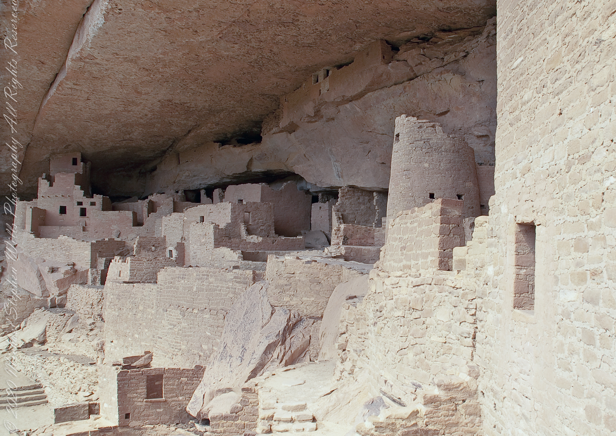
The following photographs are my closest approximation to Ansel Adams composition. Taken during a public Ranger guided tour of Cliff Palace, I was standing next to the Square Tower (see my post “Square Tower as Viewed from the Kiva.”
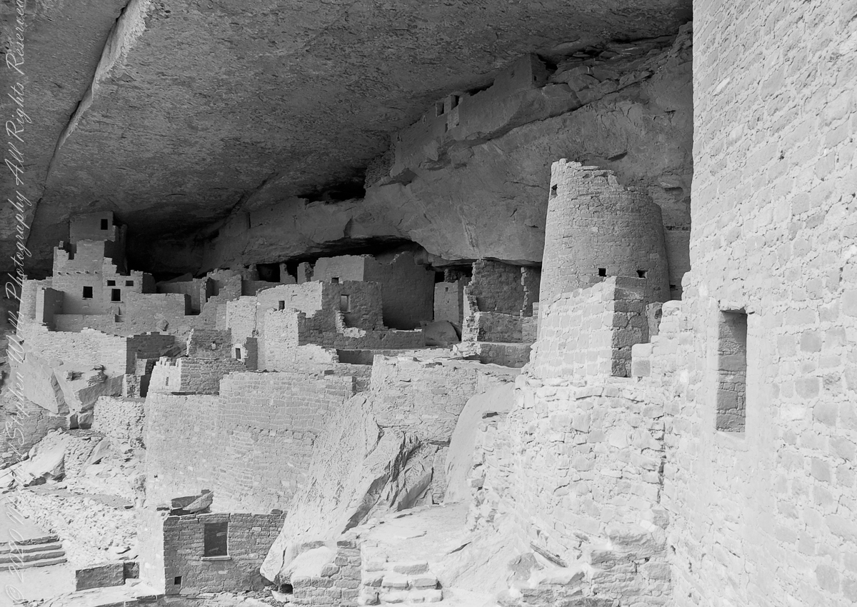
The same image produced as Black and White.
Extension
The Round Tower is more compelling when viewed from below, in the following photographs.
Looking through these images I challange you, the reader, to compare the Round Tower with the right angles, straight walls of the other above ground structures and, then, the round Kivas in the grounds, essentially the Round Tower is an extension of the round kiva and sipapu toward the heavens.
“From the fire tower on Bear Swamp Hill, in Washington Township, Burlington County, New Jersey, the view usually extends about twelve miles. To the north, forest land reaches to the horizon. The trees are mainly oaks and pines, and the pine predominate. Occasionally, there are long, dark, serrated stands of Atlantic white cedars, so tall and so closely set that they seem spread against the sky on the ridges of hills, when in fact they grow along streams that flow through the forest. To the east, the view is similar, and few people who are not native to the region can discern essential differences from the high cabin of the fire tower, even though one difference is that huge areas out in this direction are covered with dwarf forests, where a man can stand among the trees and see for miles over their uppermost branches. To the south, the view is twice broken slightly — by a lake and by a cranberry bog — both otherwise it, too, goes to the horizon in forest. To the west, pines, oaks, and cedars continue all the way, and the western horizon includes the summit of another hill — Apple Pie Hill — and the outline of another fire tower, from which the view three hundred and sixty degrees around is virtually the same as the view from Bear Swamp Hill, where, in a moment’s sweeping glance, a person can see hundreds of square miles of wilderness. The picture of New Jersey that most people hold in their minds is so different from this one that, considered beside it, the Pine Barrens, as they are called, become as incongruous as they are beautiful.” From The New Yorker magazine, November 26, 1967, “Profiles, The Pine Barrens I” creative non-fiction by the great John McPhee.
This quote captures the contours of a place, now known as “The Pinelands,” a corner of Burlington County, New Jersey my English, Irish, Scottish ancestors settled from 1677 until my grandfather, James Edward Wills, left for northern New Jersey, Asbury Park, in the first years of the twentieth century. This past decade, more so since retirement 2017, I’ve explored these two hundred and twenty (220) or so years beginning with amorphous asides over the years from my father and second hand through my sisters then through online research via Ancestry.com (Ancestry) and other searches.
From my father and sisters I knew to search southern New Jersey. The United States decennial census, “thank you Constitution,” listed a George and Margaret Wills with my grandfather among their children. Great Grandfather George Wills was listed as a 14 year old child of George and Mary Wills in the 1850 census. How could I be sure? DNA technology with internet based social interaction helped there. I was contacted by a Dellett descendant, identified by DNA as a fourth cousin, who claimed Mary Wills as a double great aunt, the daughter of James and Ann Dellett. Here is a screen capture of an Ancestry “ThruLines” analysis showing the six living ancestors of James and Ann in the database. I removed the names and photos of the other five to preserve privacy. The DNA fourth cousin relationship was an exact match to the family tree.
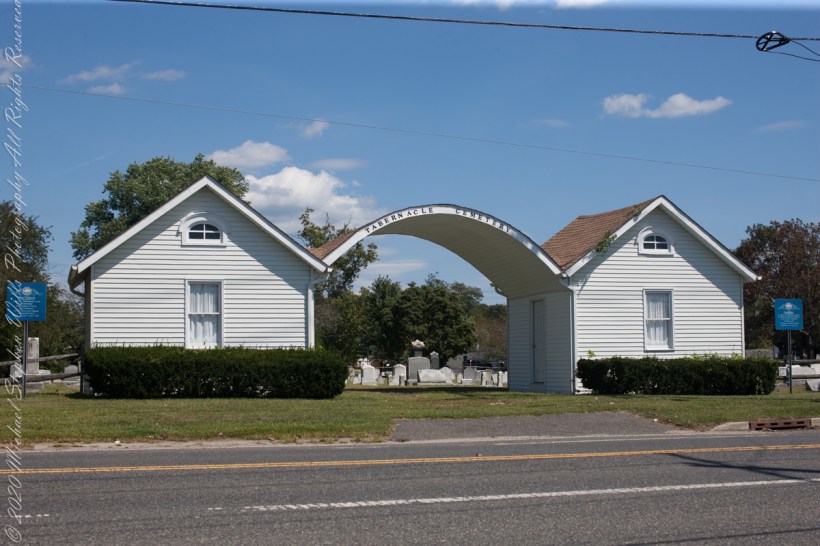
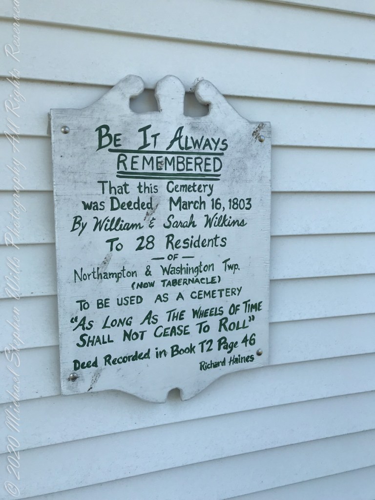
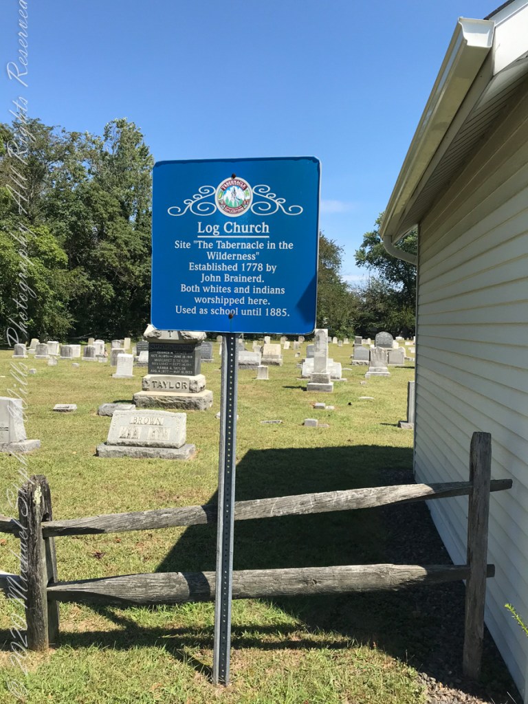
Cousin Delette provided antique photographs of George and Mary. I did a “FindAGrave” search, their final resting place is in a place named Tabernacle, Burlington County, New Jersey. September 2019 my wife Pam and I did a weekend tour with a bed and breakfast base in the city of Burlington, New Jersey. The rest of the photos in the following slideshow are from that weekend.
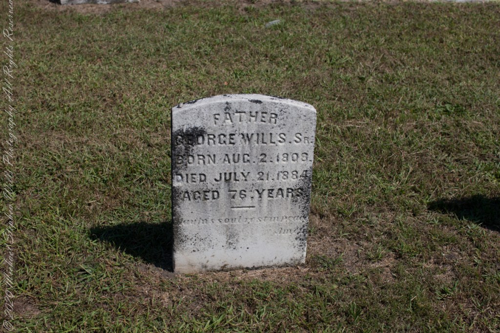
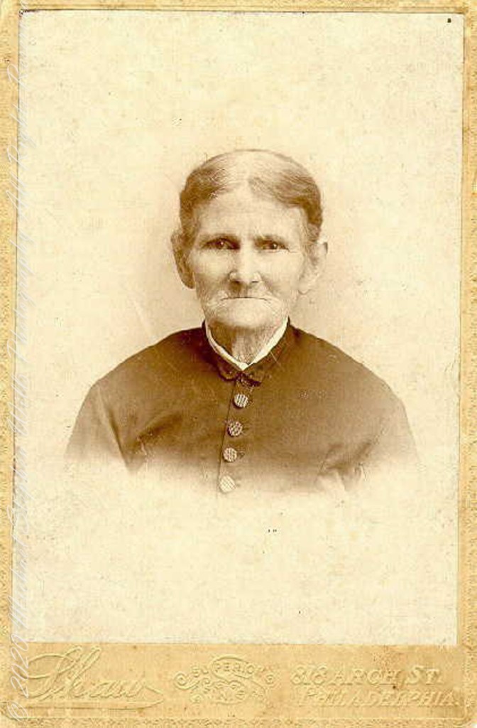
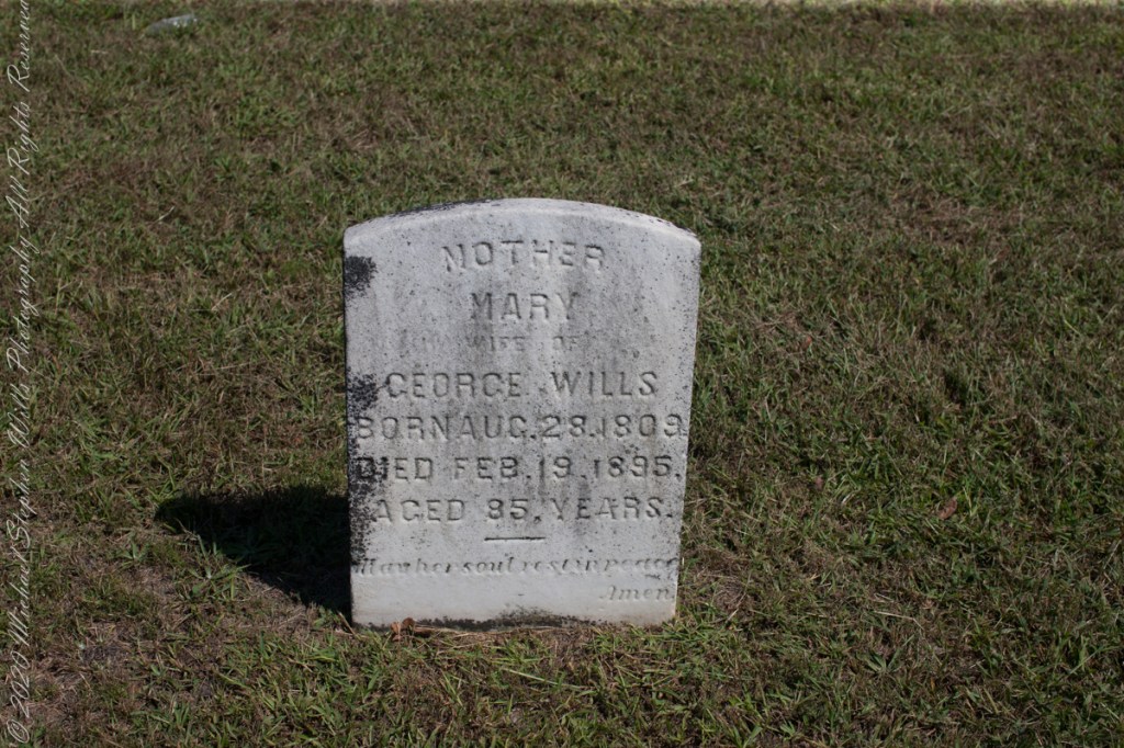
Resting place of double great Grandparents George and Mary WillsWooden Plaque on left sdie of entry pavilion. Sign to left of pavilionGeorge Wills, Hotel Keeper, around 1850Father, George Wills, Sr., Born August 2, 1809, Died July 21, 1884 Aged 76 years., May his soul rest in peace, AmenMary Dellett Wills, as widow after 1894Mother Mary wife of George Wills, Born August 28, 1809, Died February 18, 1895 Aged 85 years. May her soul rest in peace, Amen
Here is the same Ancestry “ThruLines” analysis with the immediate family links exploded. through my “first cousin 1 time removed” I was able to communicate with a “lost” niece of my father who shared reminiscences of him from the time he was just released from World War II Naval Service, before meeting Mom.
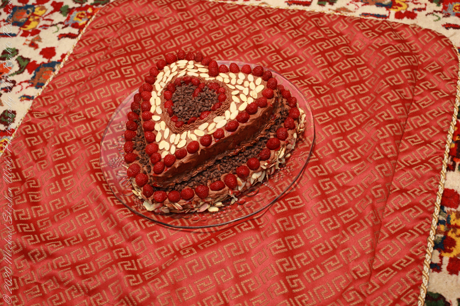
Theresa (2), Michael (5), Christine (4) in the livingroom of 107 Deepdale Parkway, Albertson, New York on Valentines Day 1959Chocolate Valentines Day cake by Pamela WillsPam and I aboard the Oceania Regatta sailing the Pacific Ocean off Chile. The following day we reached Puerto Montt.
Copyright 2025 Michael Stephen Wills All Rights Reserved
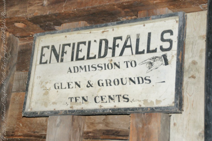
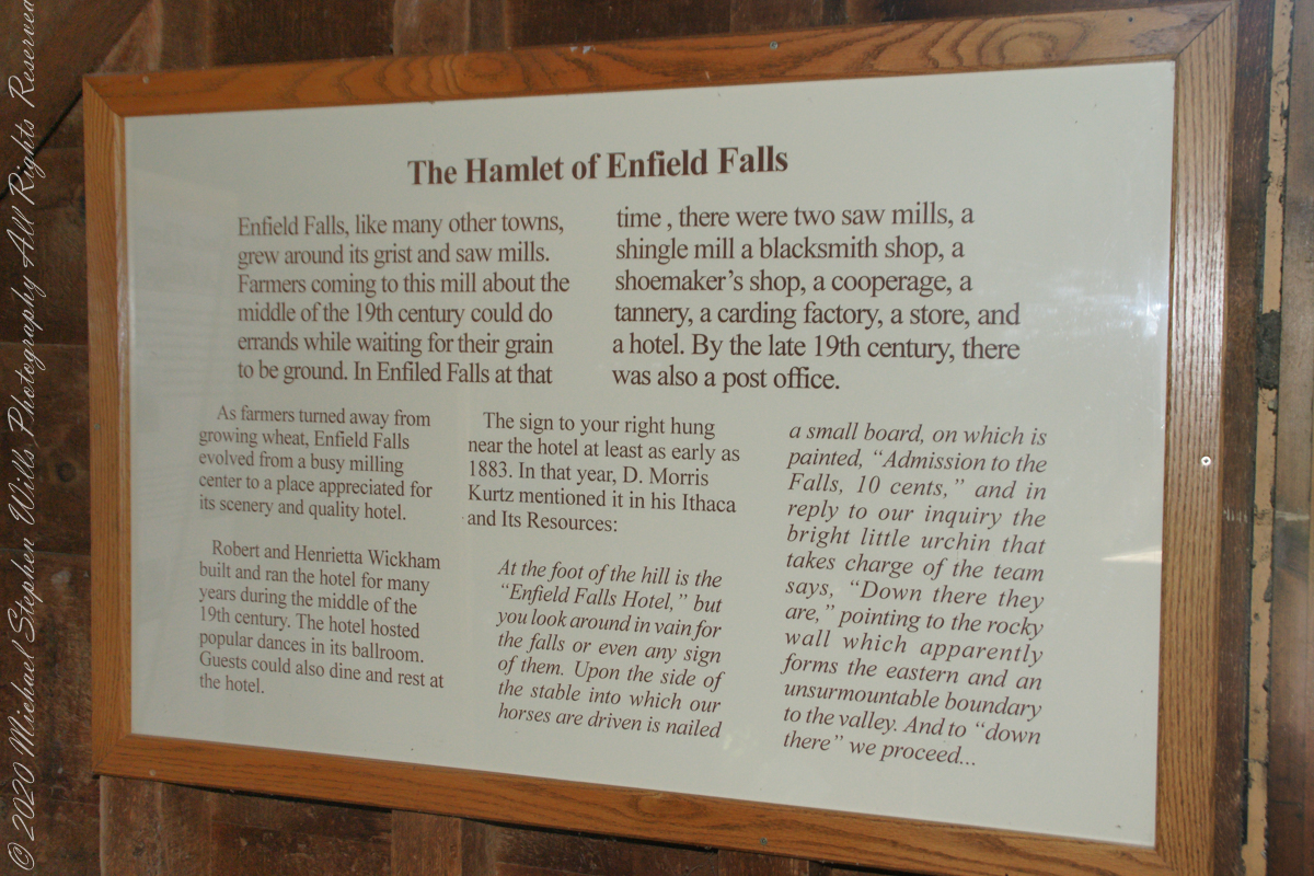
“Enfield Falls, like many other towns, grew around its grist and sawmills. Farmers coming to this mill about the middle of the 19th century could do errands while waiting for their grain to be ground. In Enfield Falls at that time, there were two sawmills, a shingle mill, cooperage, tannery, carding factory, store and hotel. By the late 19th century there was also a post office.”
“As farmers turned asway from growing wheat, Enfield Falls evolved from a busy milling center to a place appreciated for scenery and a quality hotel. Robert and Henrietta Wickham build and ran the hotel for many years during the middle of the 19th century. The hotel hosted popular dances in its ballroom. Guests could also dine and rest at the hotel.”
This placard from the Mill Museum at Treman Park is the source of much of today’s information. I used italics and quotes to attribute this source.
The sign in the heading of this post “hung near the hotel at least as early as 1883. In that year, D. Morris Kurtz mentioned it in his “Ithaca and Its Resources”: “At the foot of the hill is the Enfield Falls Hotel, but you look around in vain for the falls or even any sign of them. Upon the side of the stable into which our horses are driven is nailed a small board, on which is painted ‘Admission to the Falls, 10 cents.’ In reply to our inquiry the bright little urchin that takes charge of the team says, ‘Down there they are,’ pointing to the rocky wall which apparently forms the eastern and an unsurmountable boundary to the valley. And to ‘down there’ we proceed……“
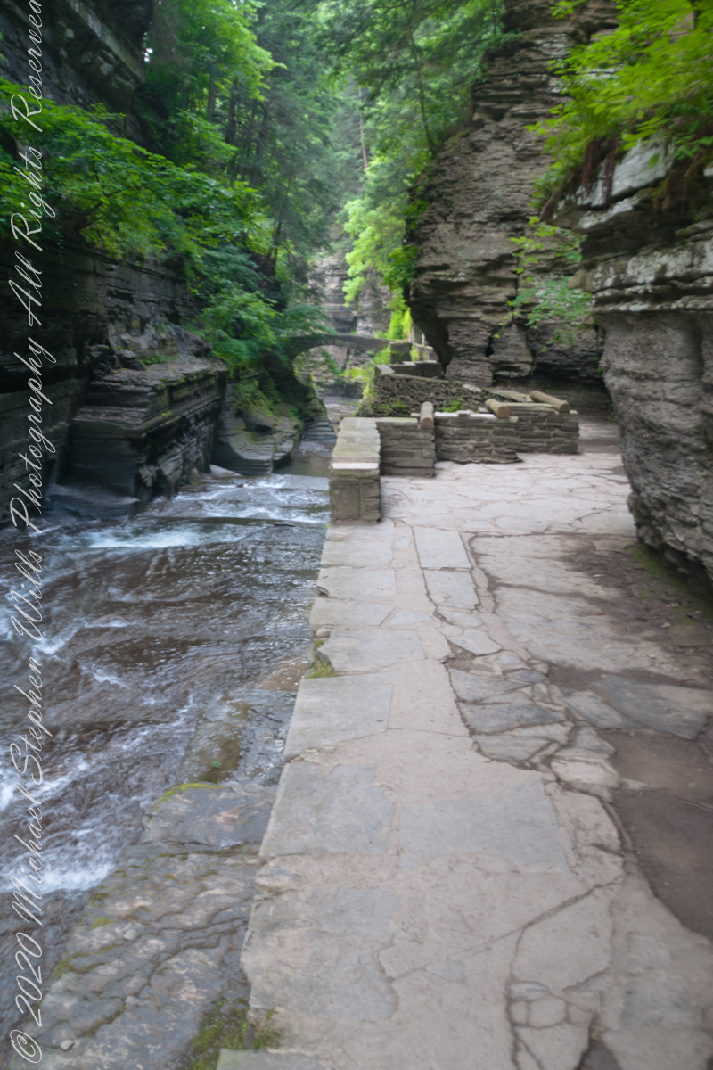
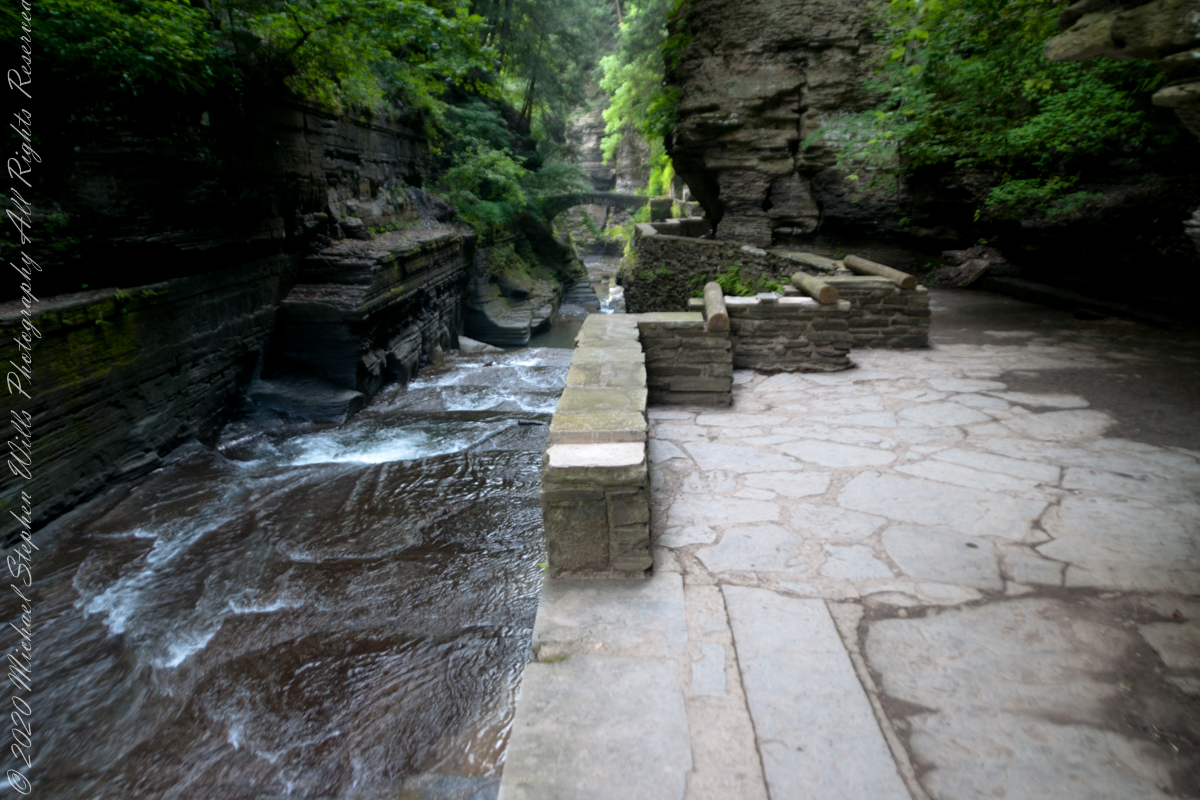
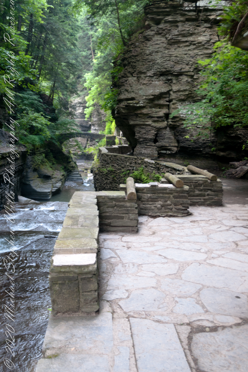
Treman Gorge Trail from the Old Mill enters a narrow gallery looking here southeast along Enfield Creek, passing over a stone footbridge. This was the control point in the 19th century for collecting the ten cent admission fee. Here are some photographs of the entrance as it exists today. The retaining wall, footpath and stone bridge were constructed in the 1930’s by the Civilian Conservation Corps. The site was far rougher for those earlier visitors.
The Gorge Trail next to Enfield Creek on a midsummer morning. Robert H. Treman State Park, Ithaca, Tompkins County, New YorkThis walkway, retaining wall, path, stone bridge were built by the Civilian Conservation Corps, “Roosevelt’s Tree Army,” during the Great Depression in the 1930’s. The north side is sedimentary rock worn through over the ages by what we call Enfield Creek today.
Photograph captured on a midsummer morning. Robert H. Treman State Park, Ithaca, Tompkins County, New York
Copyright 2023 All Rights Reserved Michael Stephen Wills
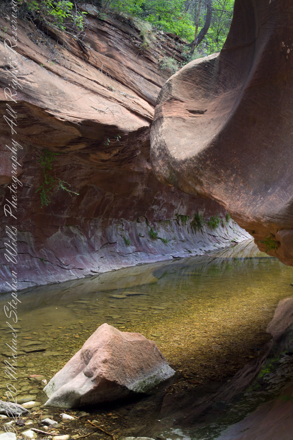
The fault of Oak Creek changes direction, here it forms a north/south gallery through Schnebly Hill Formation red sandstone for which Sedona is famous.
West Fork (108) Trail, Sedona, Yavapai County, Arizona
“Hello” from Oak Creek Canyon, “Photo by Pam Wills”