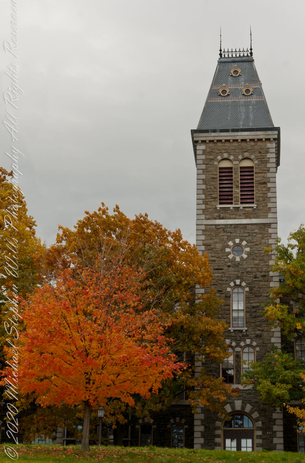
Named for founding trustee John McGraw, who gave $120,000 for construction of the building, McGraw Hall, designed by architect Archimedes N. Russell, opened in 1872.
Built of an Ithaca stone known as Lenrock, the four-story building was the first on campus to include a tower and today is home to the American Studies Program, Department of History, Department of Anthropology, and Archaeology Intercollege Program.
Jennie McGraw, daughter of John McGraw, donated the chimes to be placed in the tower, where they stayed until McGraw Tower was built in 1891.
This year the College of Arts and Sciences inaugurated a comprehensive renovation of McGraw Hall.
Copyright 2023 Michael Stephen Wills All Rights Reserved
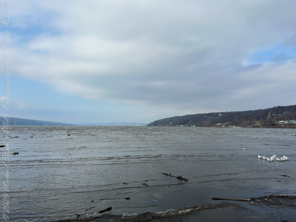
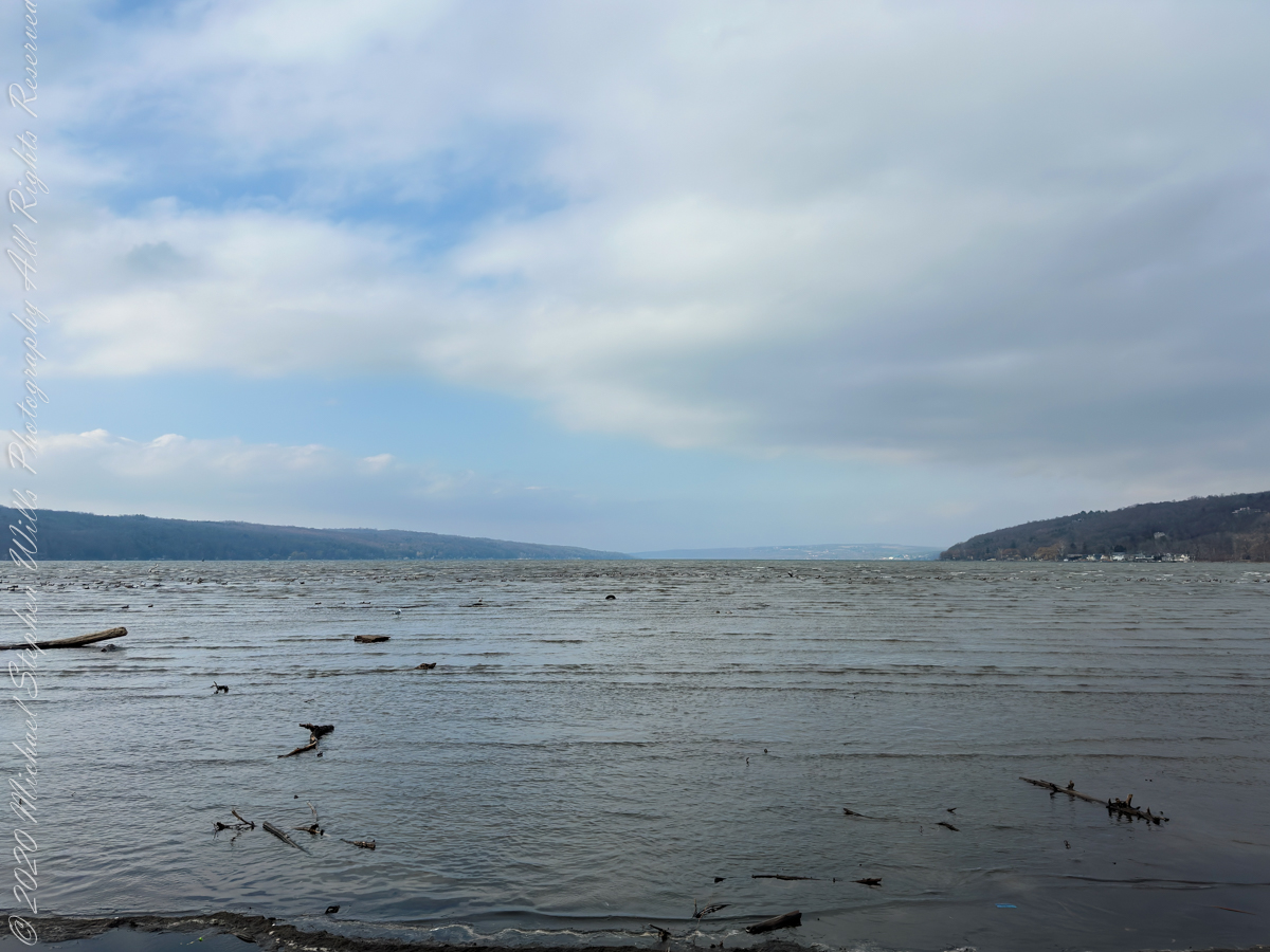
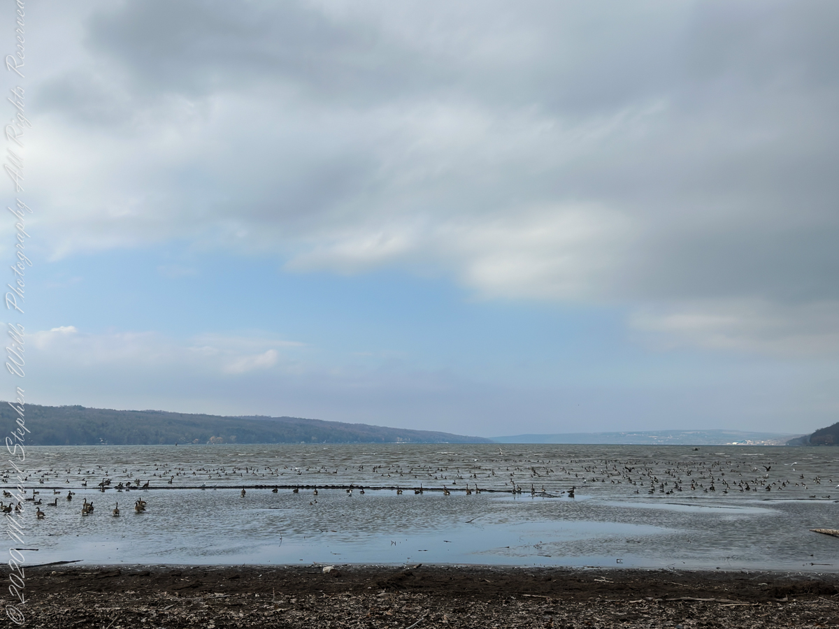
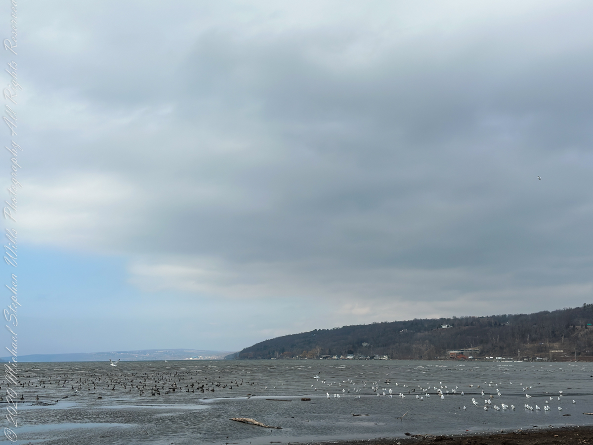
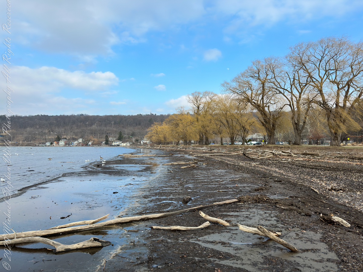
Pam and I have sailed past Crowbar Point, the arm of land projecting into the lake on left, so we know this end of Cayuga Lake well. The lake reach northward is deceiving as the bulk of the 39-mile reach is north of the headlands of the west lakeshore visible in the distance as the apparent end of the lake.
I love the pale blue of late February / early March skies.
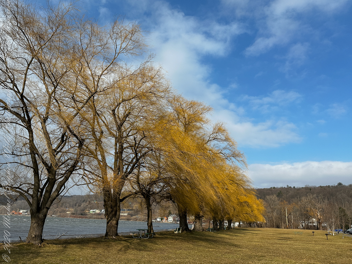
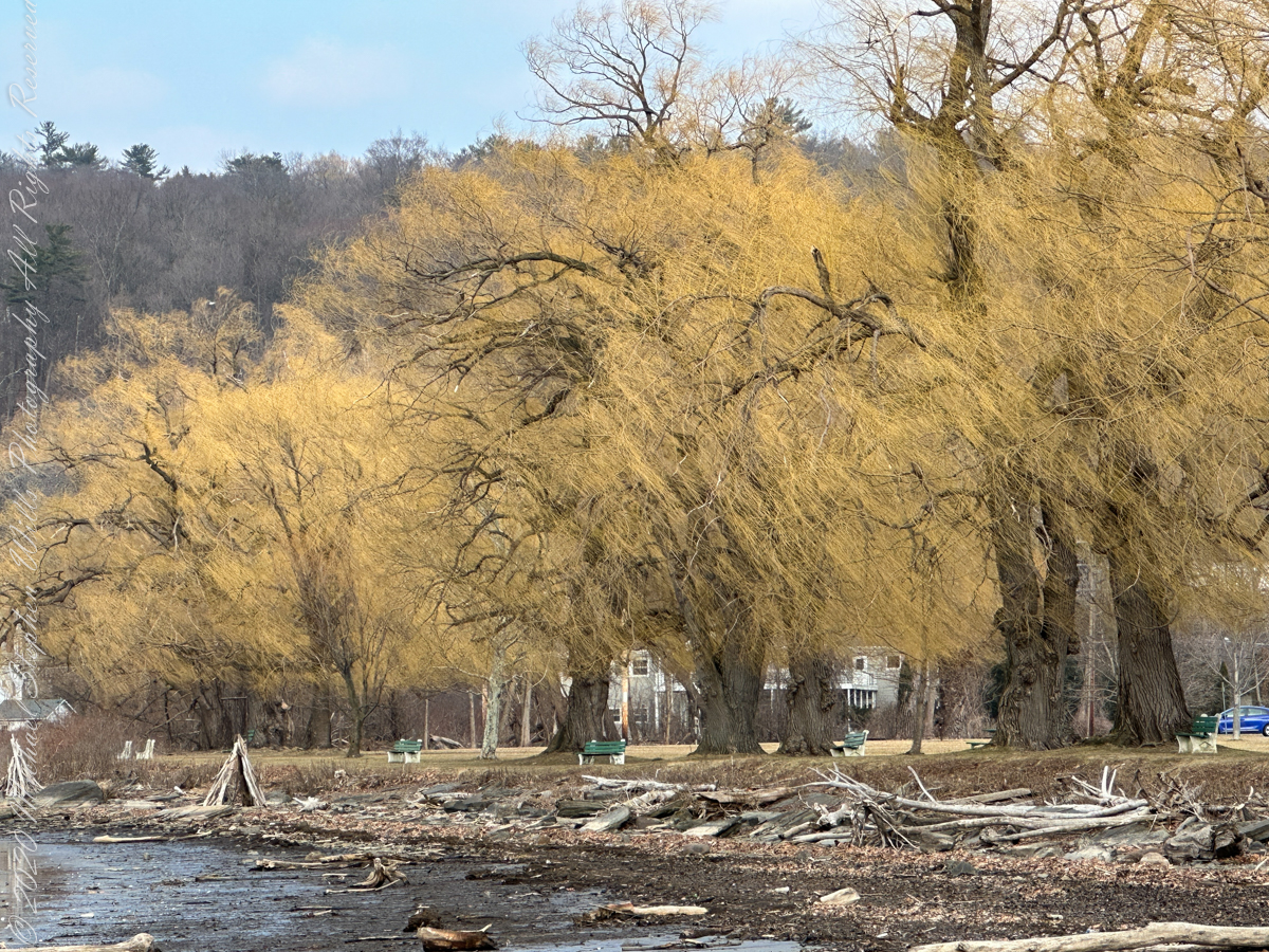
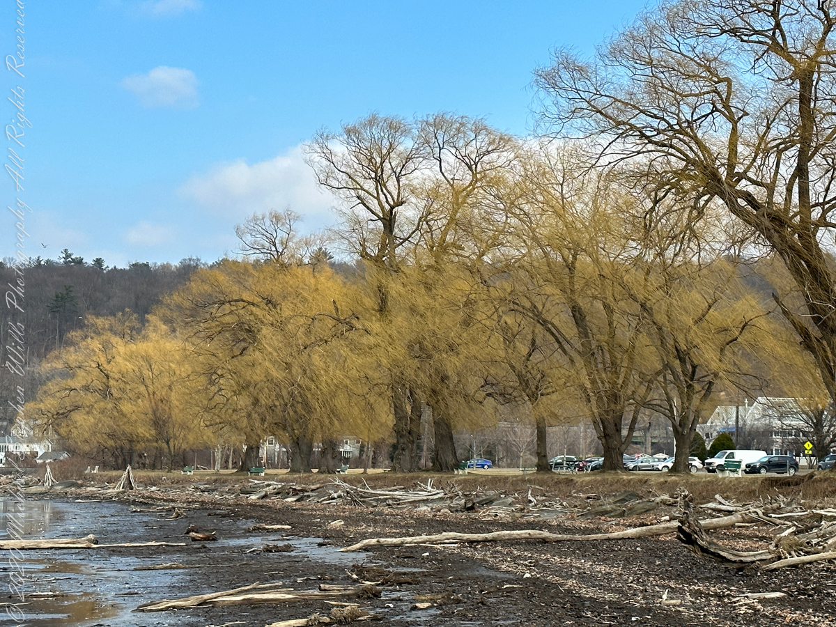
Also known as White Willow, for the white undersides of the leaves that flash in the wind. These flourish on the southernmost shore of Cayuga Lake.
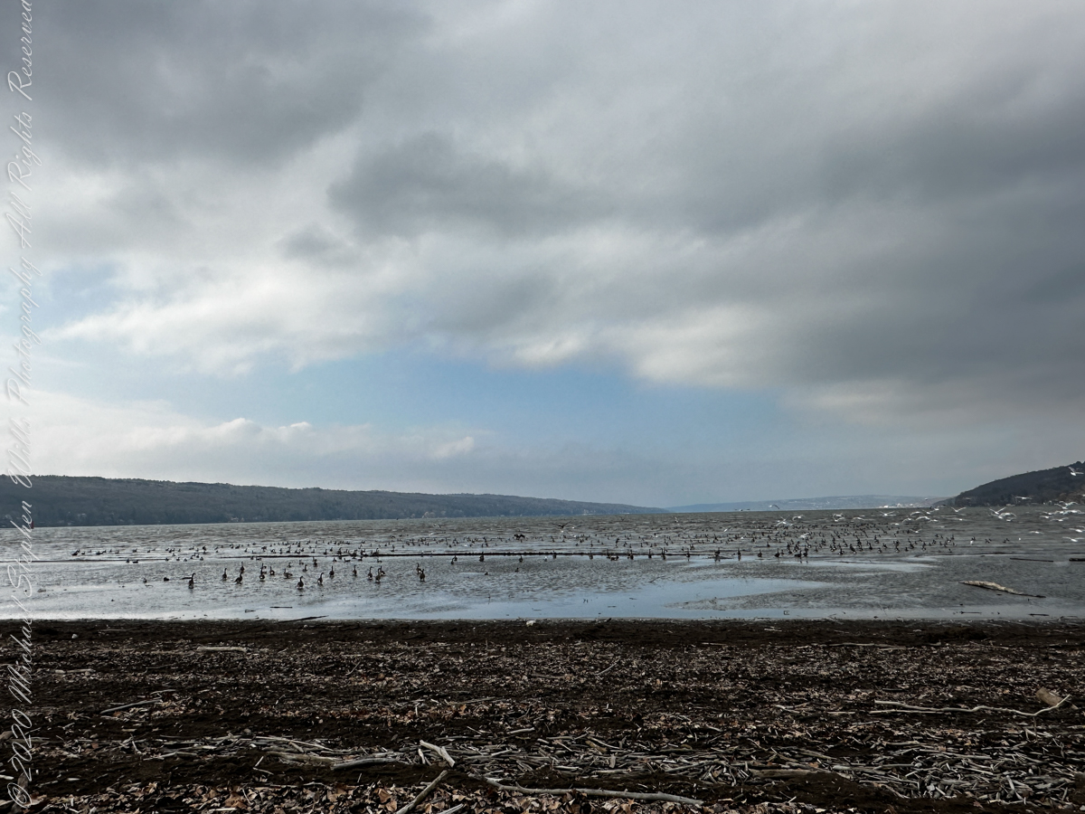
Here is a video of a large gathering of Canadian Geese, multitudes landing to ride lake waves on an unsettled, windy March afternoon.
Copyright 2023 Michael Stephen Wills All Rights Reserved
Among the earliest plants to flower, brilliant yellow willows (Salix alba ‘Tristis’) are glorious early spring as new growth sprouts.
Willows native to New York State are all shrub-like, the homeland of these large trees is Europe and Asia.
Also known as White Willow, for the white undersides of the leaves that flash in the wind. These flourish on the southernmost shore of Cayuga Lake.
Willow bark does NOT have analgesic properties. The genus name, Salix, is the root for acetylsalicylic acid (aka aspirin), a chemical that does not appear in nature, originally synthesized from salicylic acid extracted from Meadowsweet.
Movement of budding willow branches in a north wind off Cayuga Lake
Copyright 2023 Michael Stephen Wills All Rights Reserved
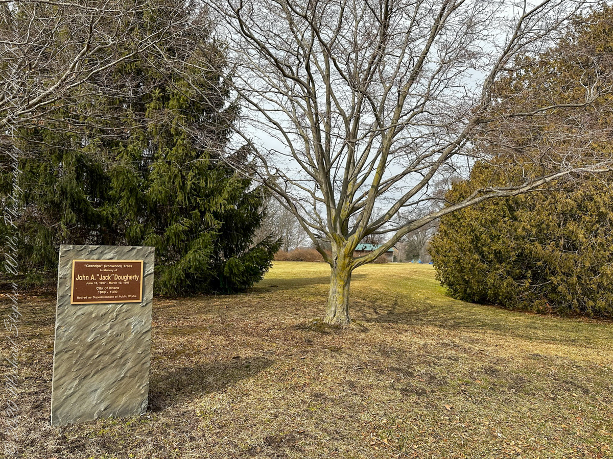
Another Cayuga Waterfront Trail stop is this memorial. The plaque reads ” ‘Grandpa’ (Ironwood) Trees in memory of John A. ‘Jack’ Dougherty; June 15, 1927 – March 12, 1995; City of Ithaca 1949-1989, Retired as Superintendent of Public Works.” Located near the intersection of Pier Road and Willow Avenue, Newman Golf Course, Ithaca, Tompkins County, New York. That is an Ironwood tree, midgound center.
The American Hornbeam (scientific name: Carpinus caroliniana) is also known as Musclewood for the rippled surface of the mature trunk. Other names are blue-beech, ironwood and muscle beech.
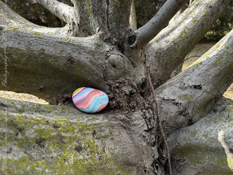
Nestled on the trunk……
Copyright 2023 Michael Stephen Wills All Rights Reserved
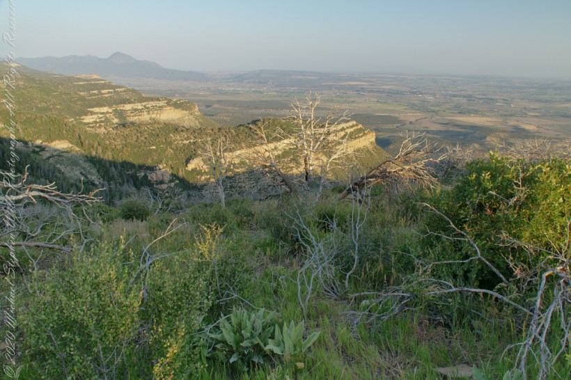
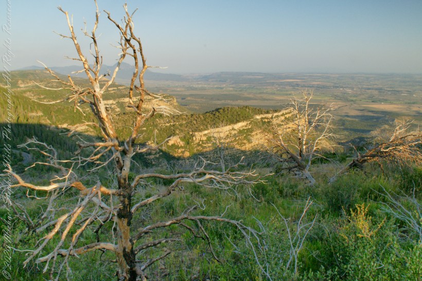
A pullover on the park road proves this, northwest morning view of the Mancos Valley. The lush grass in foreground is a reason the mesa is called “verde,” meaning green in the Spanish language.
The Mancos Valley has been settled since at least the 10th century AD, although various severe conditions in the mid to late 13th century saw the area and its multitude of small villages abandoned by the Ancient Pueblo People (Anasazi).
The Mancos area is dotted with inventoried and un-inventoried archeological sites, including both isolated houses and shelters and small village complexes. Mancos Valley residents were probably among those who withdrew to the cliff dwellings on Mesa Verde, perhaps for defensive purposes, due to climate change, or as part of concentration policy of possible invaders and occupiers of the region.
Control of the area was contested by nomadic Navajo and Ute people for centuries. Spanish friars and military passed through the area as part of the Old Spanish Trail connecting New Mexico and California in the 18th century. The name “Mancos” comes from the Domínguez–Escalante expedition of 1776, though the reason for the name remains unclear (see below). By some unverified accounts, the name Mancos refers to the crippled nature of the Spanish explorers’ horses after they crossed the San Juan Mountains. According to unverified lore, the horses were rejuvenated by the lush green grass in the Mancos Valley. Somewhere in the town is the point at which the expedition crossed the Rio Mancos on its way to California from Old Mexico. Mesa Verde National Park, Montezuma County, near Cortez, Colorado.
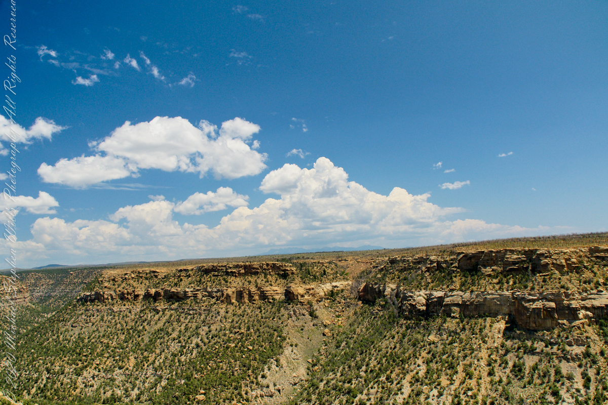
Chapin Mesa is the site of the Mesa Verde Anasazi ruins Balcony House and Cliff Palace. These are the views you see before the descent below the cliff rim to visit Balcony House.
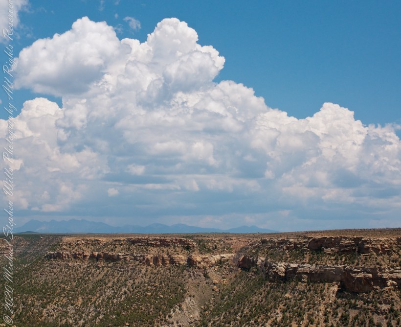
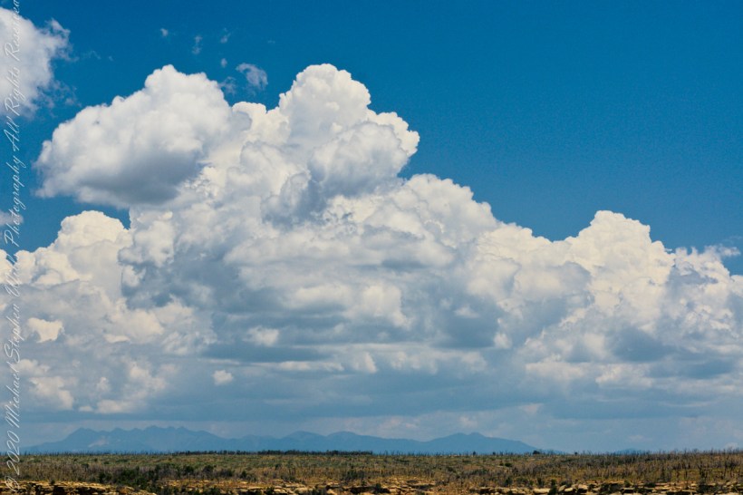
These views from the Chapin Mesa rim are companions to two photographs of Balcony House, taken on the same morning. You are looking northeast across Soda Canyon, to a thunderstorm building above the San Juan mountains in the distance. Route 550 from Durango to Silverton climbs passes into these peaks, on the way to Telluride. Chapin Mesa is part of Mesa Verde National Park.
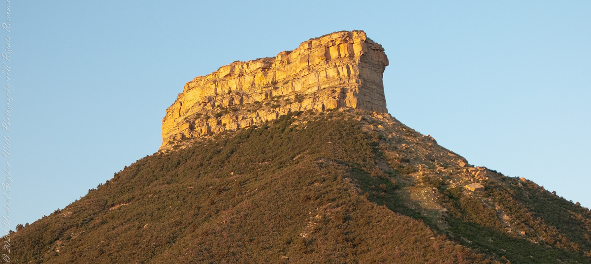
The following fine art image is a combination of the previous photographs
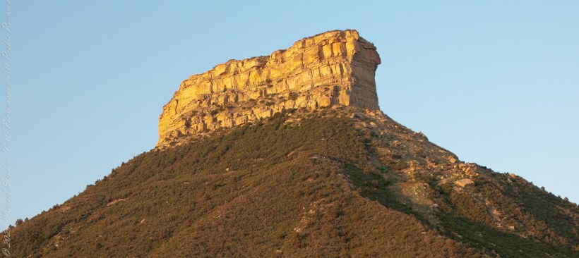
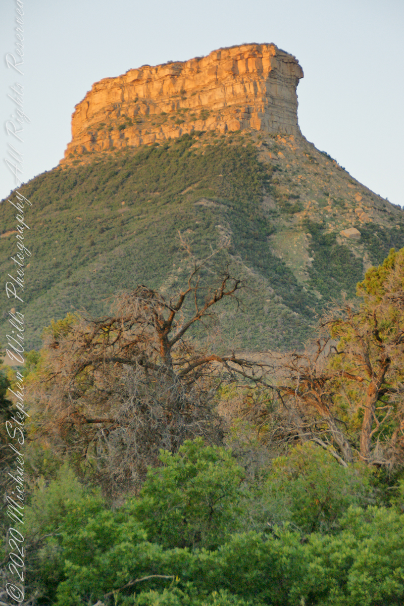
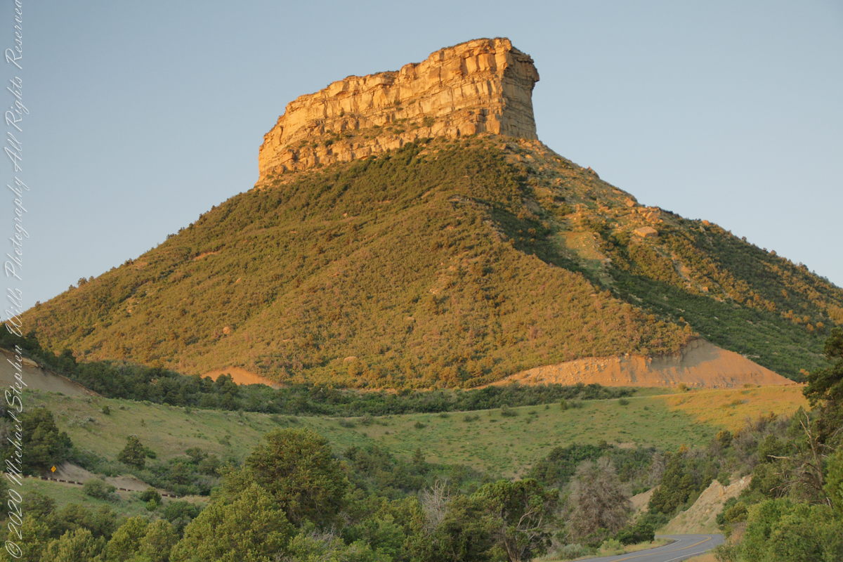
This dramatic butte at the entrance to Mesa Verde National Park, golden in the first light of a July morning. My wife, Pam, and I were on this road in the pre-dawn hours. Our delight with this surprise view was worth it.
In this Point Lookout area, near the park’s entrance, the Mancos Shale is about 2,000 ft thick, and this is what this butte is composed of. Mancos Shale is the lowest formation of the park and is a thick sequence of gray to black marine shale containing minor tan siltstone and fine sandstone beds. On steep slopes, such as those near the northern and eastern boundaries of the park, this formation is prone to landslides and debris flows. This is the base of the butte. The lovely golden rock is Point Lookout Sandstone of the Mesaverde Group, a predominantly yellowish-gray or pale-orange, fine- to medium-grained marine sandstone, approximately 300-400 ft thick. The Point Lookout Sandstone forms much of the cap rock in the northern park area.
I reworked the above image into this Fine Art image of Point Lookout.
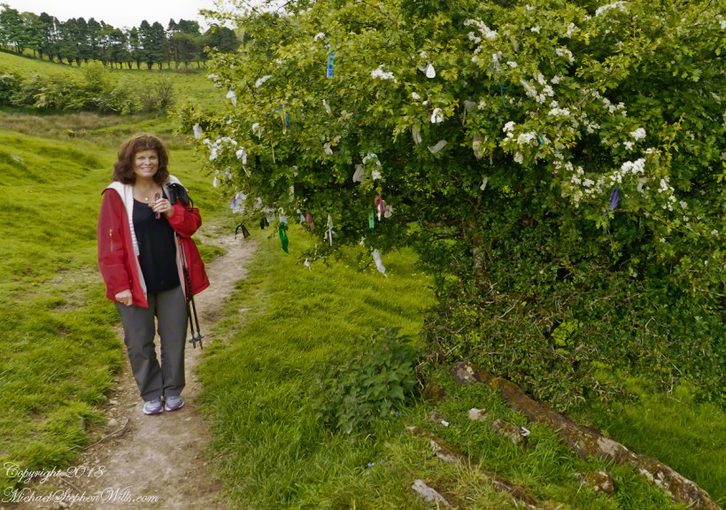
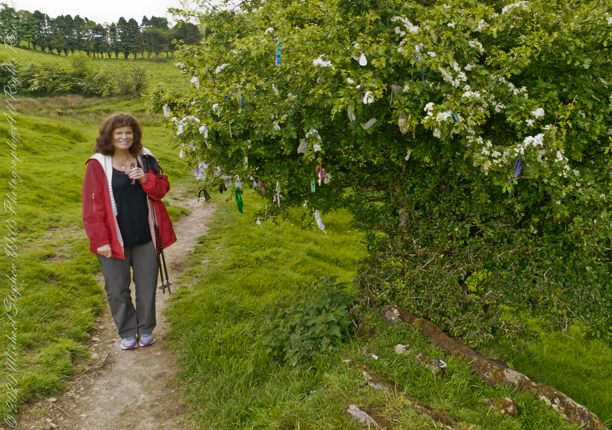
Pam and I were lucky enough to plan our tour of Ireland for May and June when the Hawthorne trees are in bloom. Named sceach gheal in Gaelic, the white clusters of blossoms symbolize hope. Hawthorns are plentiful throughout the island. The Irish revere the tree and associate each Hawthorn with the Little People. There are roads in Ireland that curve around a Hawthorn tree because the local people convinced the engineers to do so, to save the tree.
This specimen, covered with offerings (to the Little People?), is on the trail to Loughcrew. Even with her knee trouble, Pam made it to the top of the Hag’s Mountain to visit Cairn T of the Loughcrew Passage tombs.
The steep path to Loughcrew passes a hawthorn covered with flowers and may offerings.
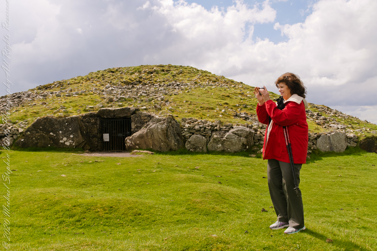
Pam loves to capture images and returned from Ireland with a large collection. Most of the photos of me at work are by Pam. Here Pam is capturing the summit view of Hag’s Mountain with the Cairn T entrance gate in the background. Lucky for us, a fellow visitor made the trip to Loughcrew Gardens and picked up the gate key from the café. In a later post I will share my work from inside this passage tomb.
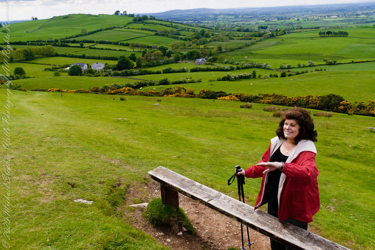
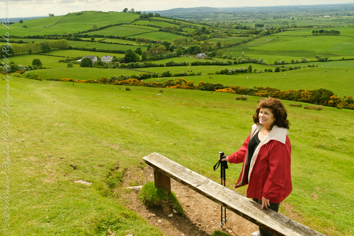
Pam makes friends wherever we go. She started down the mountain before me to take it easy on her knees. When I caught up, Pam and a young Irish family were deep in conversation. I took the opportunity to capture Pam with that gorgeous view to the northwest, Irish countryside with Lake of the Branches in the far distance.
Copyright 2023 Michael Stephen Wills All Rights Reserved
I created a series of fine art prints from a visit my wife Pam and I made to Natural Bridges National Monument in Utah. Here are a few of these prints which grace fine homes around the world. Click any of the photographs to visit the gallery.
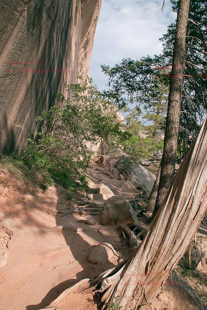
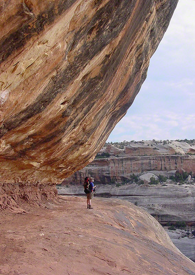
We walked a narrow cliff patch climbed a series of weathered pine ladders to achieve these views of Sipapu Bridges National Monument.
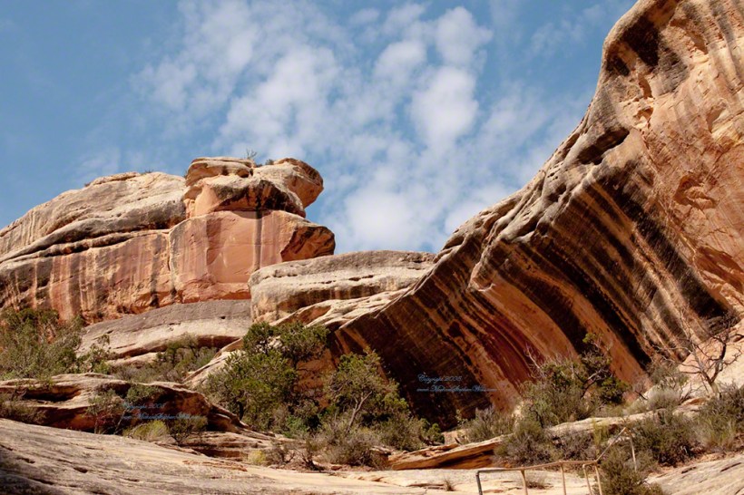
While the sky is unchanged, below the canyon rim is another world. The black stripes of the cliffs is desert varnish, a thin deposit of clay, iron and manganese oxides. The rock supporting the varnish is resistant to wear and protected from direct precipitation (in this case by the overhanging cliff).
Eventually we came to a ledge with a view of Sipapu Bridge. Pam took the opportunity to capture this amazing experience.
Mike at Sipapu BridgeSONY DSC
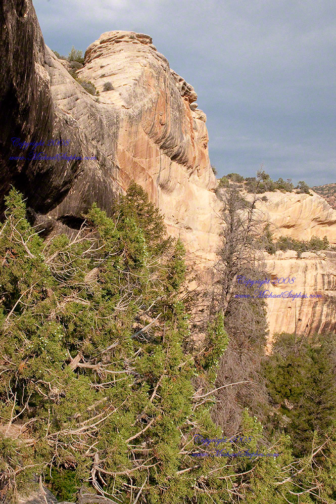
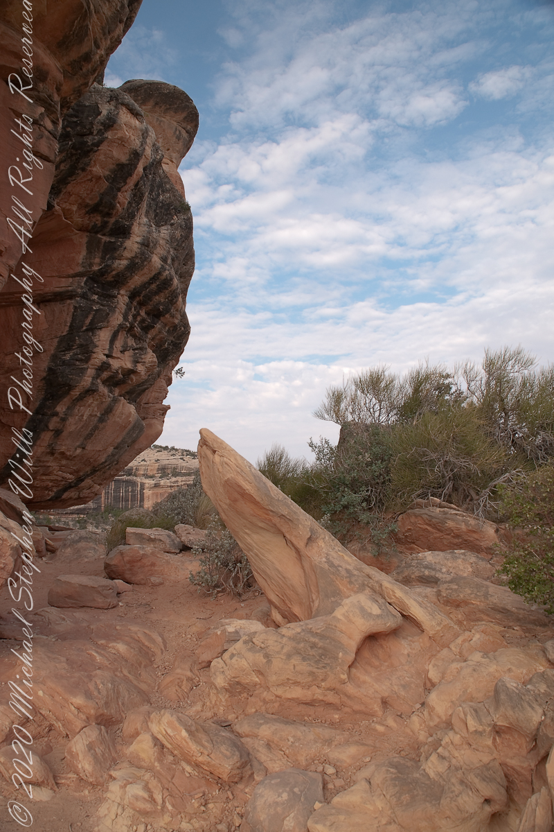
A Utah Juniper (Juniperus osteosperma). Historically, across the west, Native Americans used the wood in building their houses. They ate the berries; smoked the bark; made shoes, clothing, and rope from it.
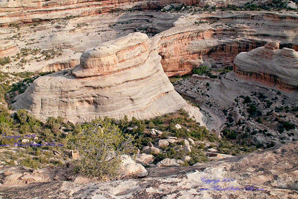
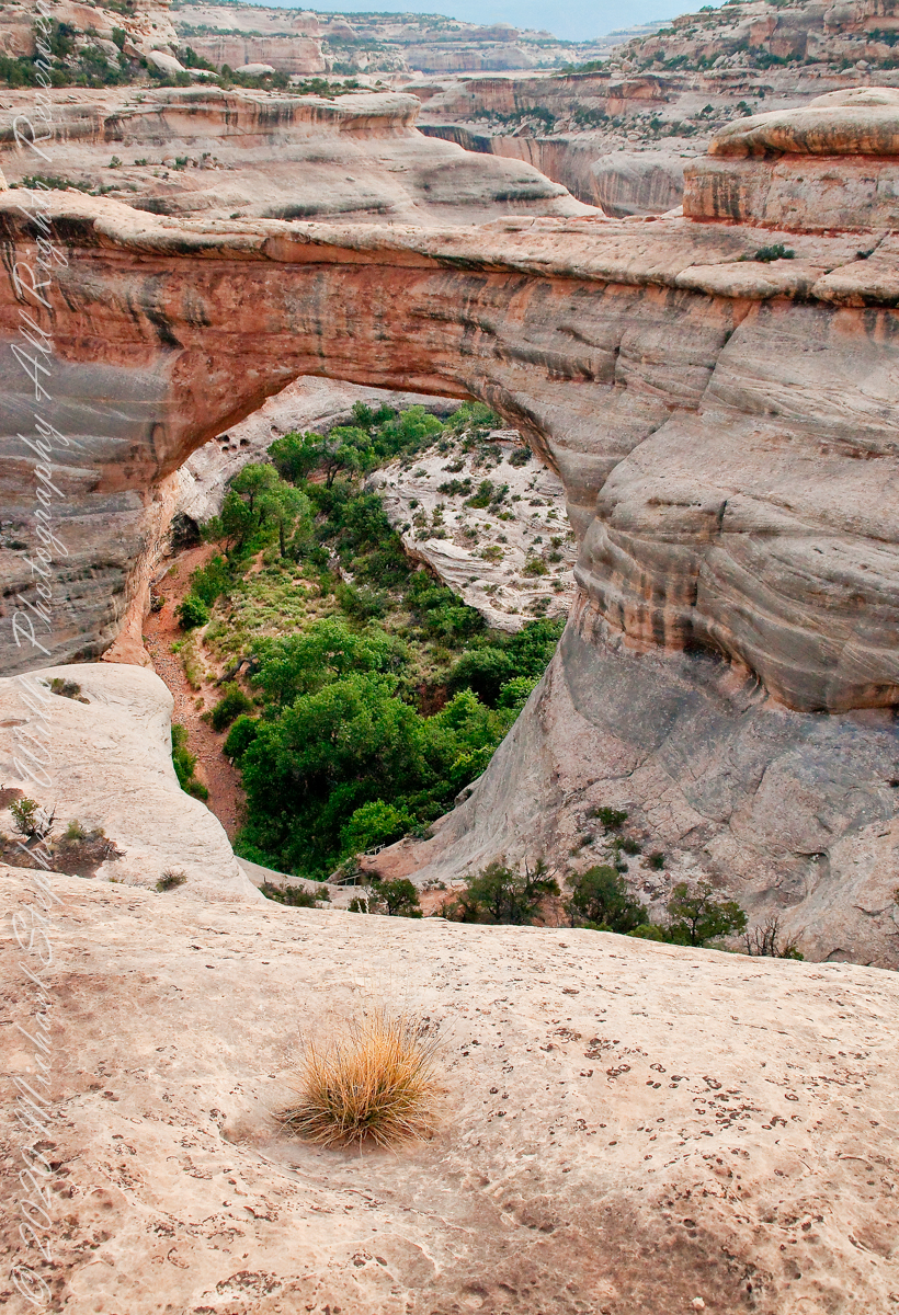
Sipapu is a Hopi word for the small hole or indentation in the floor of kivas used by the Ancient Pueblo Peoples and modern-day Puebloans. It symbolizes the portal through which their ancient ancestors first emerged to enter the present world. A natural bridge is formed through erosion by water flowing in the stream bed of the canyon. Sipapu Bridge is 268 feet across and, standing in the stream bed, it is 220 feet above your head.
Here is a close up of the white Permian sandstone of the bridge arch. The entire canyon is carved from this stone and named after it.
Sipapu is one of the largest natural bridges known.
Part of the Natural Bridges National Monument in Utah, a place inaccessible until the “uranium boom” of the 1950’s and the road was only paved in 1976.
We visited on a July day of thunderstorms, which you see building here. If you look closely at the base of the bridge, you can see the railings my wife and I used to climbed the steep sides of White Canyon.
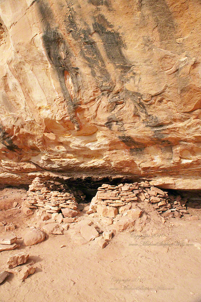
We hiked a few miles along an unmaintained trail. On the way we passed ancient cliff dwellings. The area is a maze of canyons throughout which these ruins are scattered.
Sipapu is a Hopi word for the small hole or indentation in the floor of kivas used by the Ancient Pueblo Peoples and modern-day Puebloans. It symbolizes the portal through which their ancient ancestors first emerged to enter the present world.
A natural bridge is formed through erosion by water flowing in the stream bed of the canyon.
Sipapu Bridge is 268 feet across and, standing in the stream bed, it is 220 feet above your head. That is white Permian sandstone, after which White Canyon is named.
Copyright 2023 Michael Stephen Wills All Rights Reserved