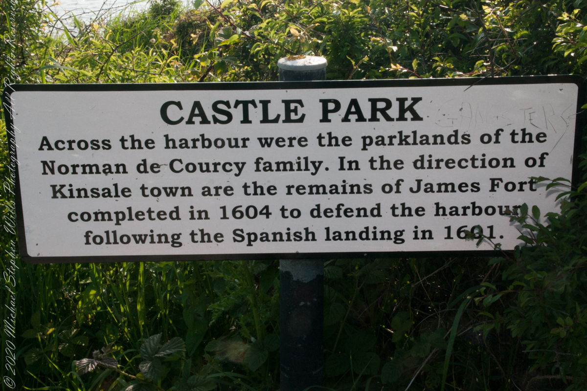
As Pam and I past the scenes of bucolic reverie this sign drew us back to the past. The reference to de Courcy is as a family of invading Normans. John de Courcy, without the King’s permission, launched an 1176 AD invasion of northeastern Ireland, what is now County Down, as an ultimately failed land grab. The history is murky, though apparently John de Courcy’s son Miles acquired the land referred to in the placard through the English King Henry II, awarded to Miles’ thieving, murderous Norman father-in-law Milo de Cogan in the 13th Century. Much later, the old (James) and new (Charles) Forts were constructed to defend Kinsale harbor.
Click any pic for a larger view, in a new tab, or a slide show. When using WordPress Reader, you need to open the post first.
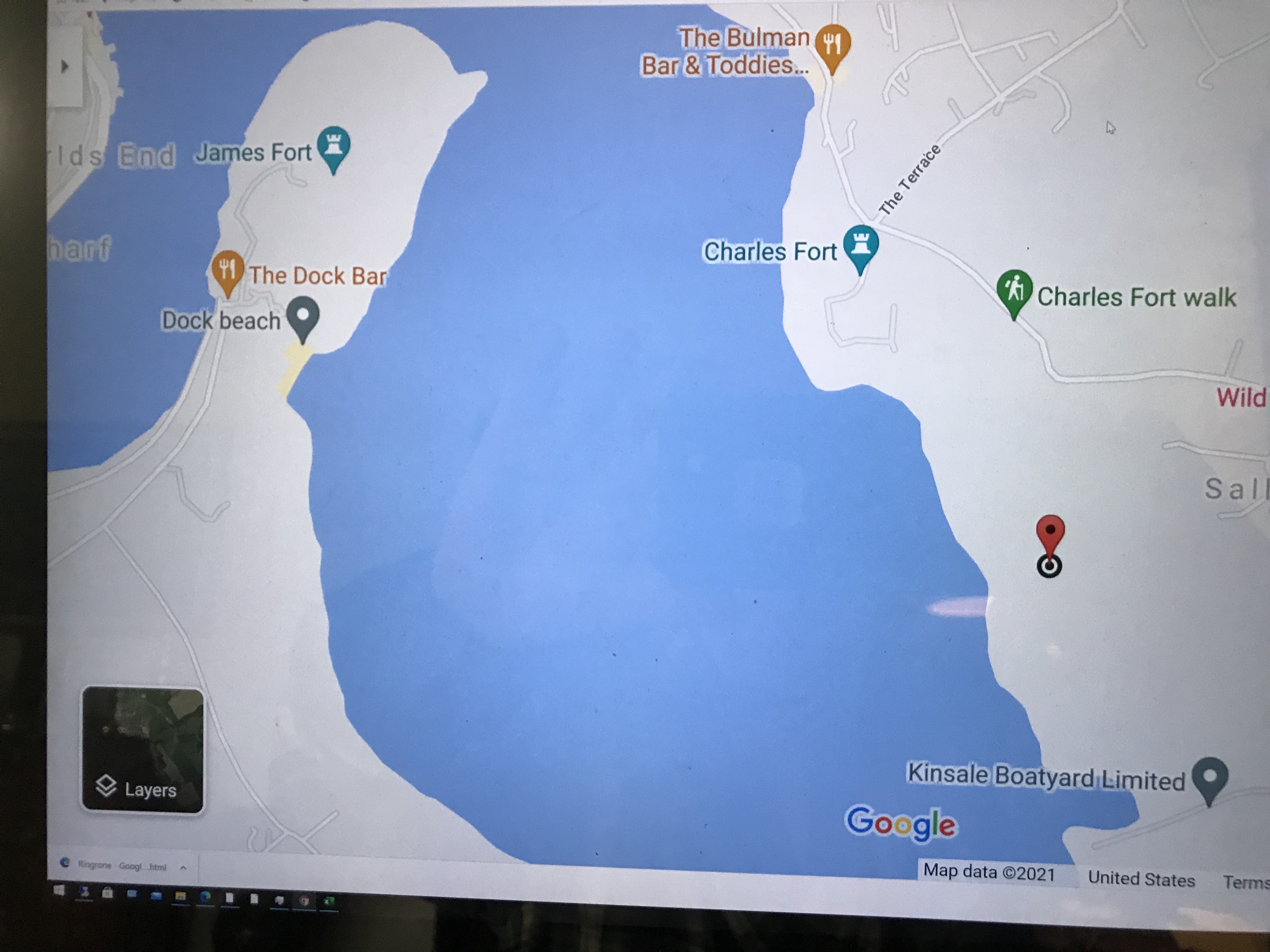
Here is a Google Maps screen capture showing the relationship of our position (the unnamed red drop-pin) on the right, Charles and James Forts and the de Courcy family parklands, the large blank area below the pin named “Dock beach.”
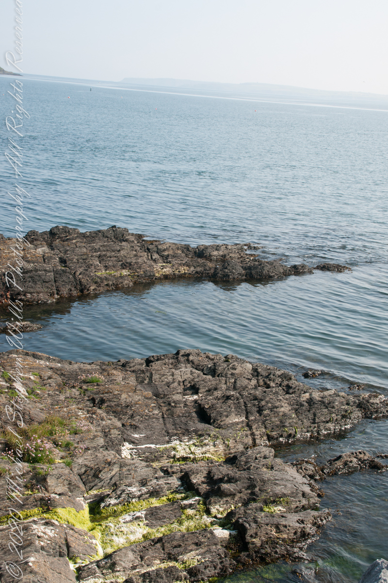
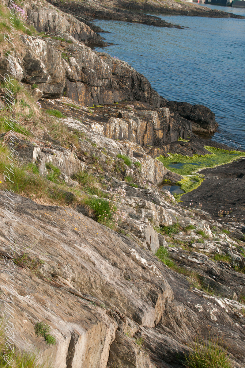
Here are the views looking toward the Celtic Sea, the Old Head of Kinsale and the cliffs at our feet.
Looking toward the Old Head of Kinsale in the far distance
Rocky Cliffs at our feet
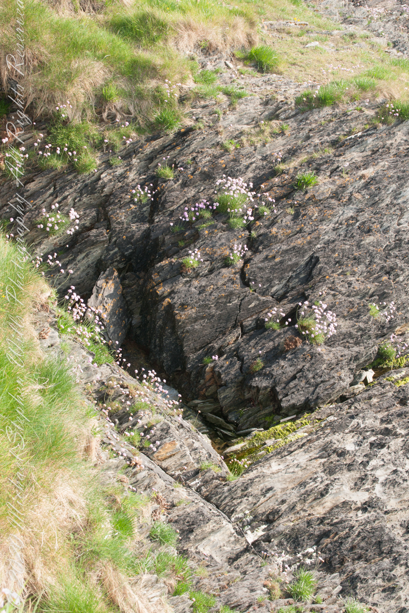
Cliff and Sea Pink
More Sea Pink decorating the rocks.
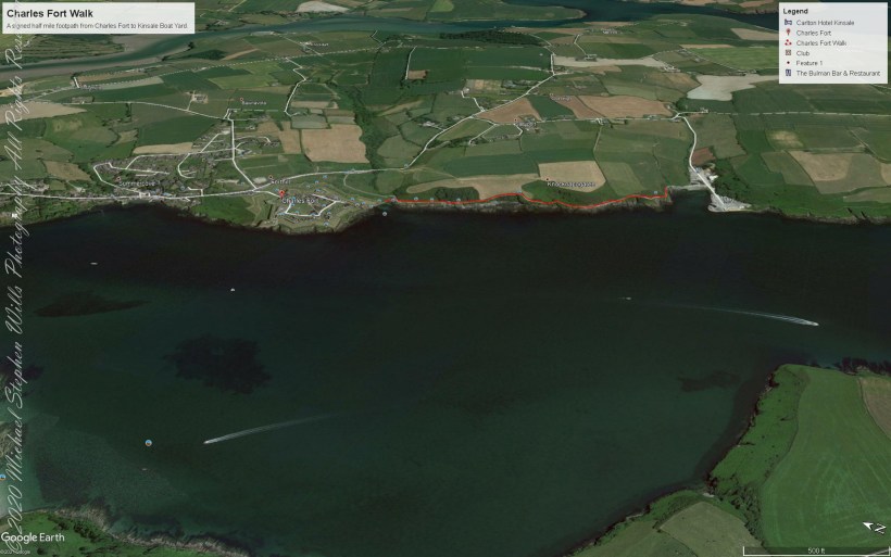
Here is a Google Earth view of our walk, the red line. The view is looking east from above the former “de Courcy family parkland.”
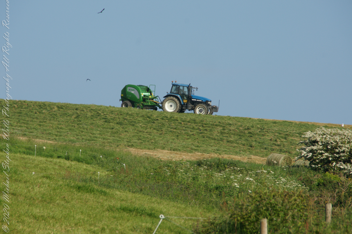
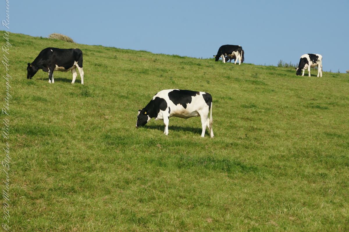
A half mile footpath, marked in red, leads from Charles fort along the shoreline cliffs, surmounted by working farmland.
Copyright 2021 Michael Stephen Wills All Rights Reserved
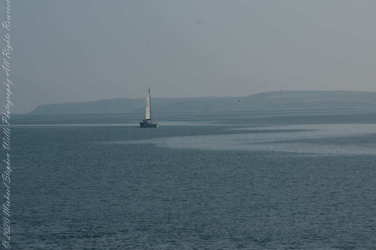
As Pam and I continued down the half mile “Sallyport” footpath, marked in red on the Google Earth view provided at the end of this post, we enjoyed the view across the Celtic Sea toward the distant Old Head of Kinsale and this sailboat headed to port.
Click any pic for a larger view, in a new tab, or a slide show. When using WordPress Reader, you need to open the post first.
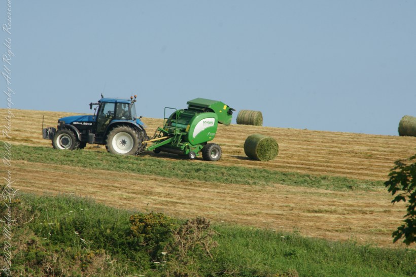
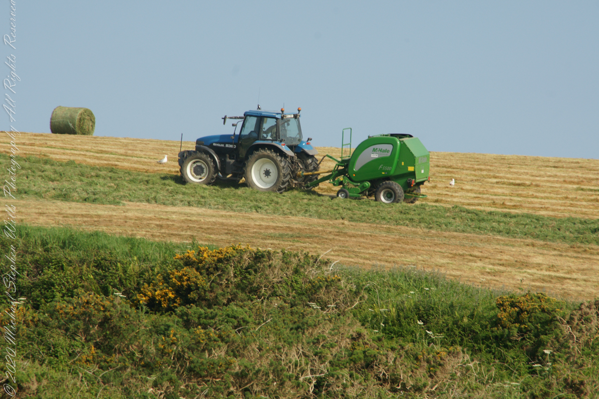
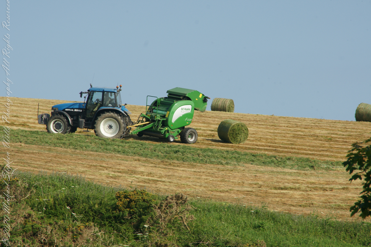
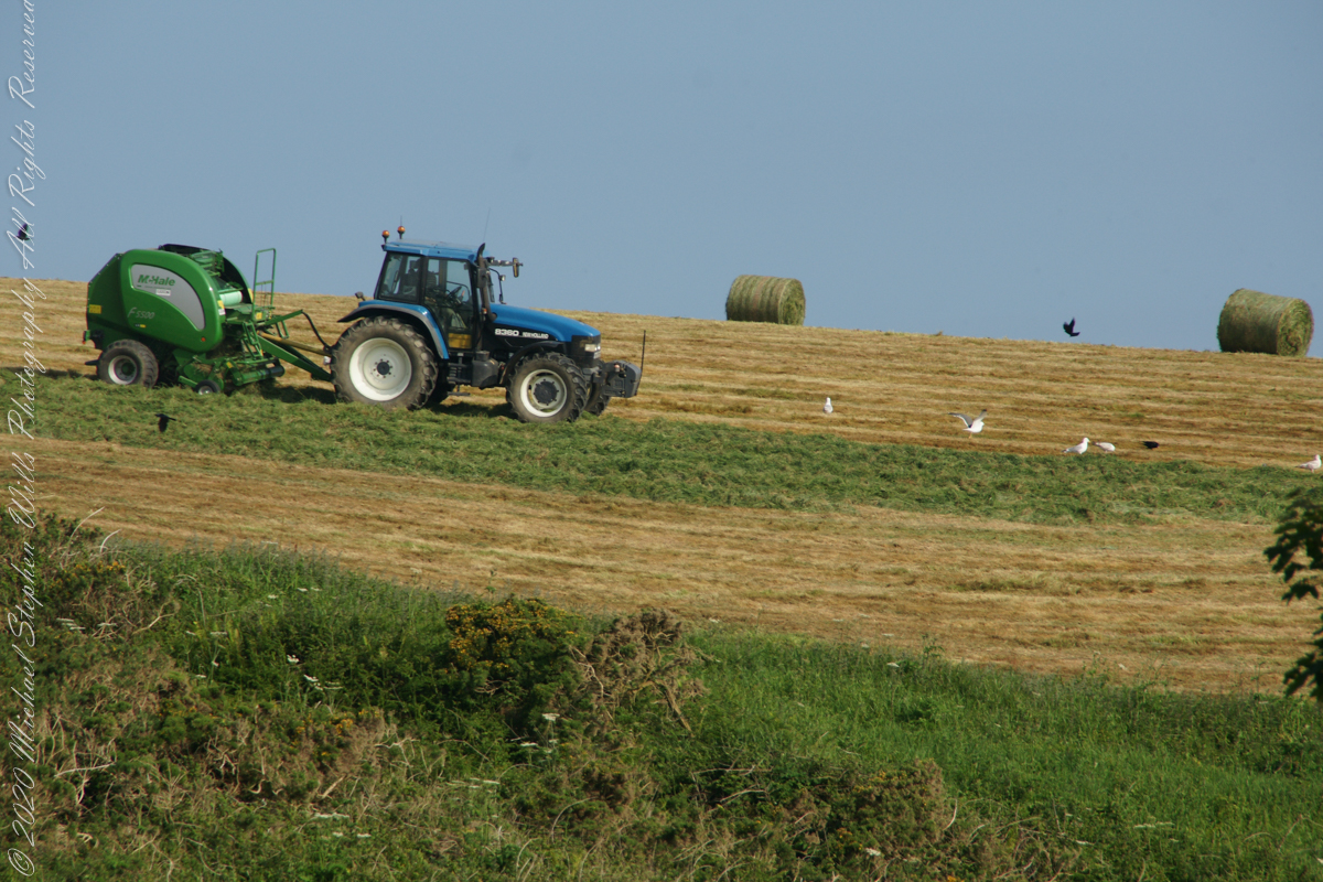
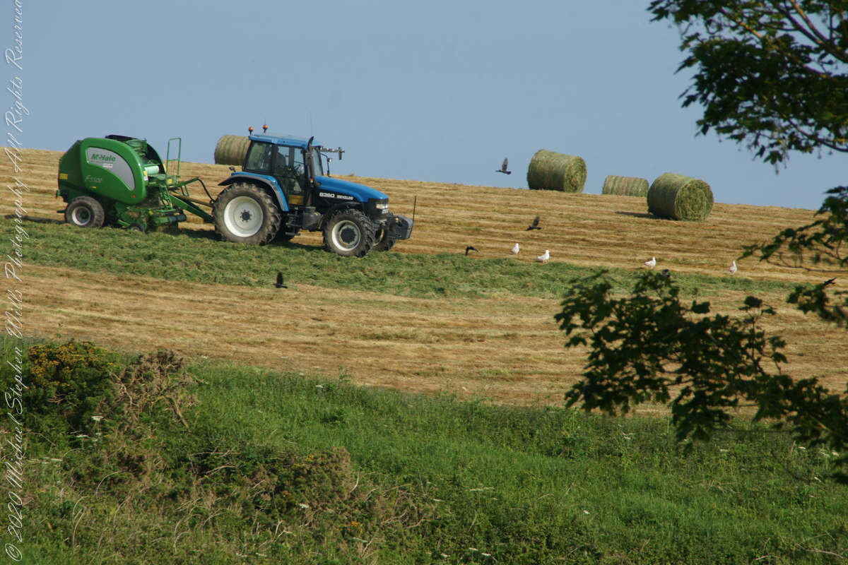
Landward, we enjoyed watching the progress of a farmer rolling hay bales while cows munched fresh green grass.
A half mile footpath, marked in red, leads from Charles fort along the shoreline cliffs, surmounted by working farmland.
Copyright 2021 Michael Stephen Wills All Rights Reserved
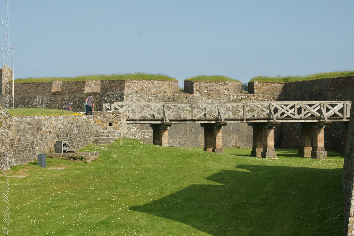
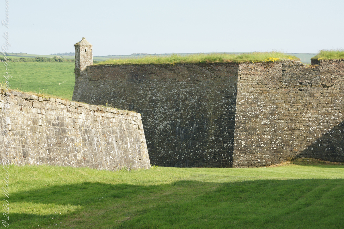
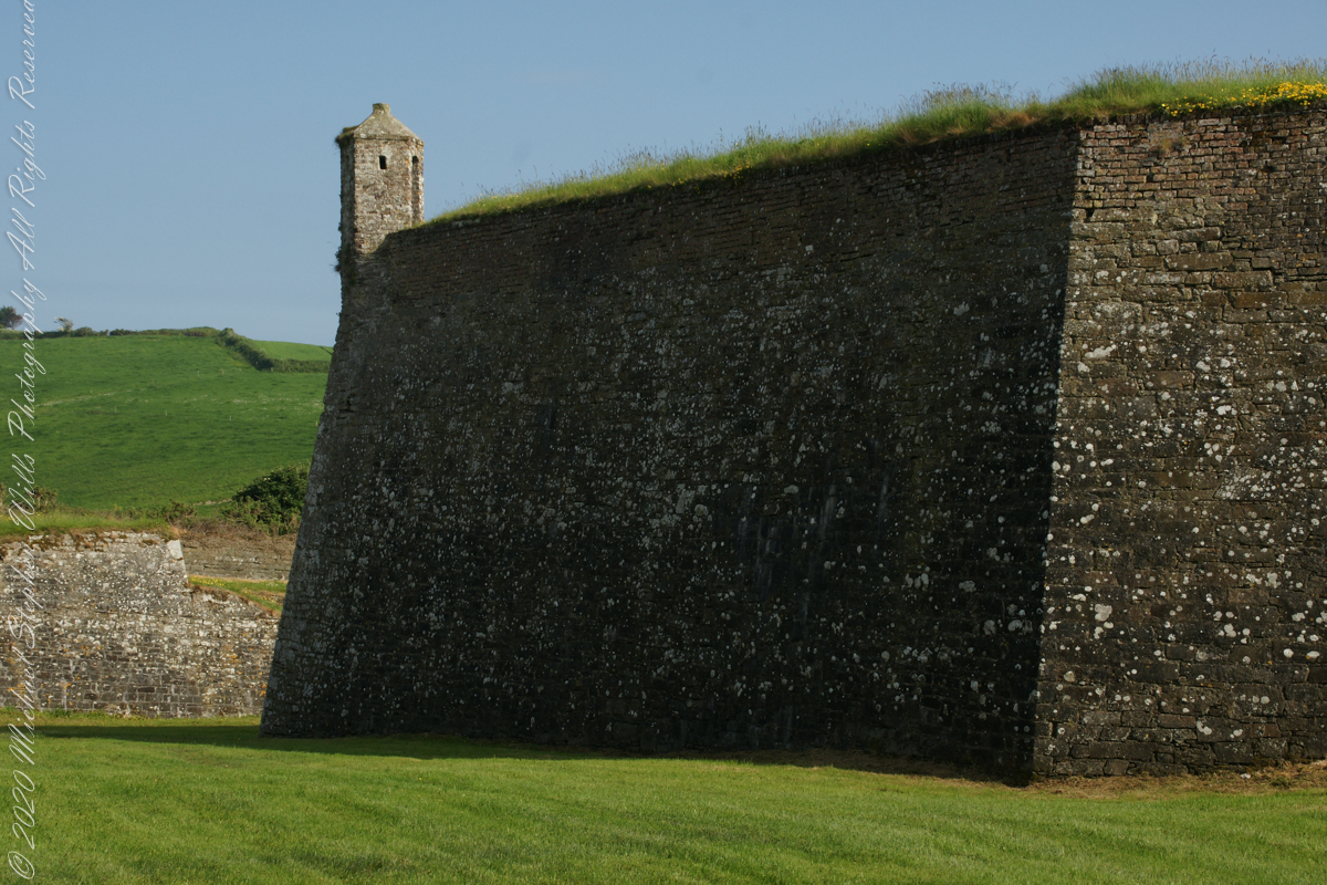
A “dun” is a larger fortification, few and far between on the island of Ireland. We saw one on the Arran Islands, from the Iron Age, Dun Angus, Charles Fort, or Dún Chathail in Irish, is from historical ages.
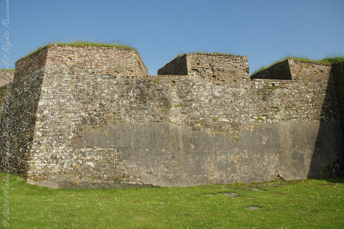
A cannot tell from my slide show, but the walls are star shaped with many salients, giving more positions to defend the walls.
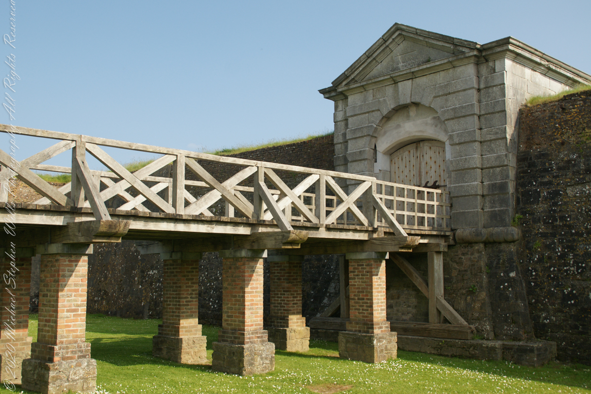
Steps to bridge across defensive ditch
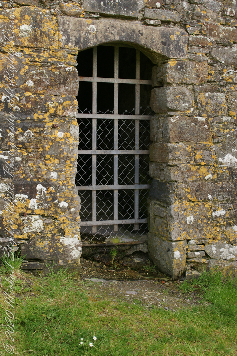
Bridge and gate to fort enclosure, closed this late in day
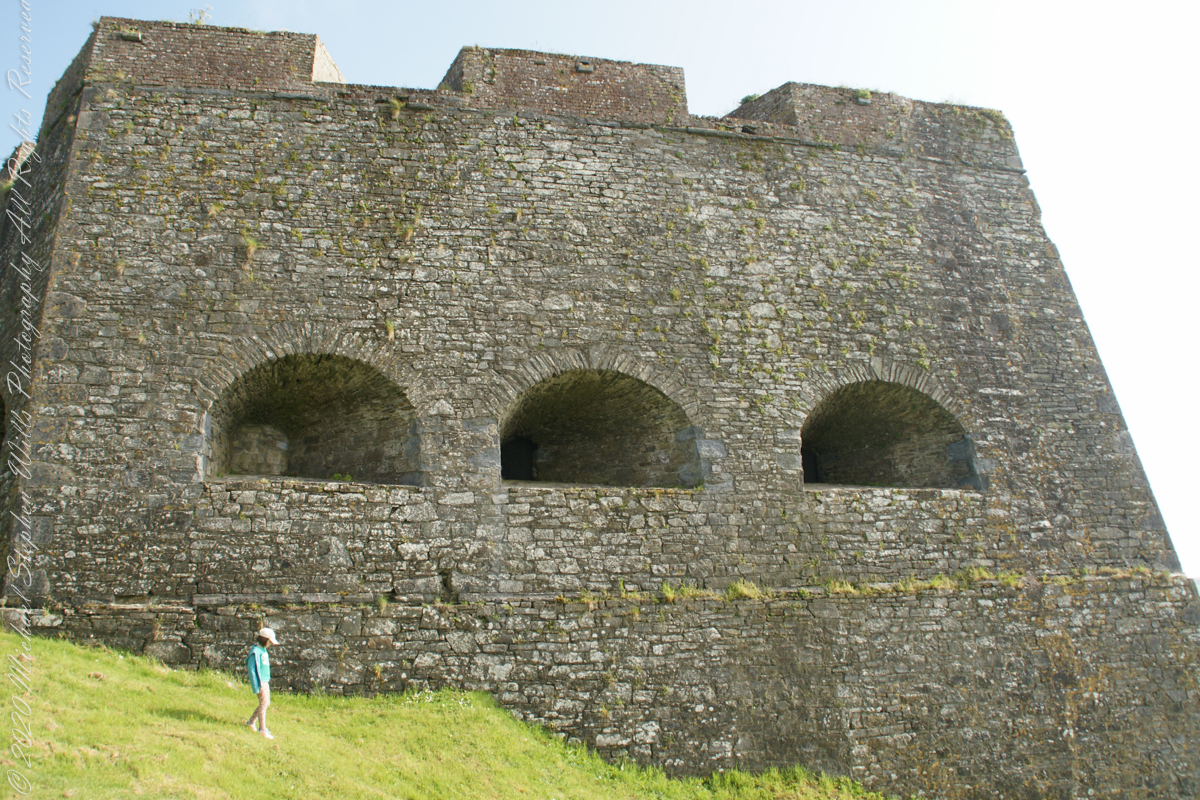
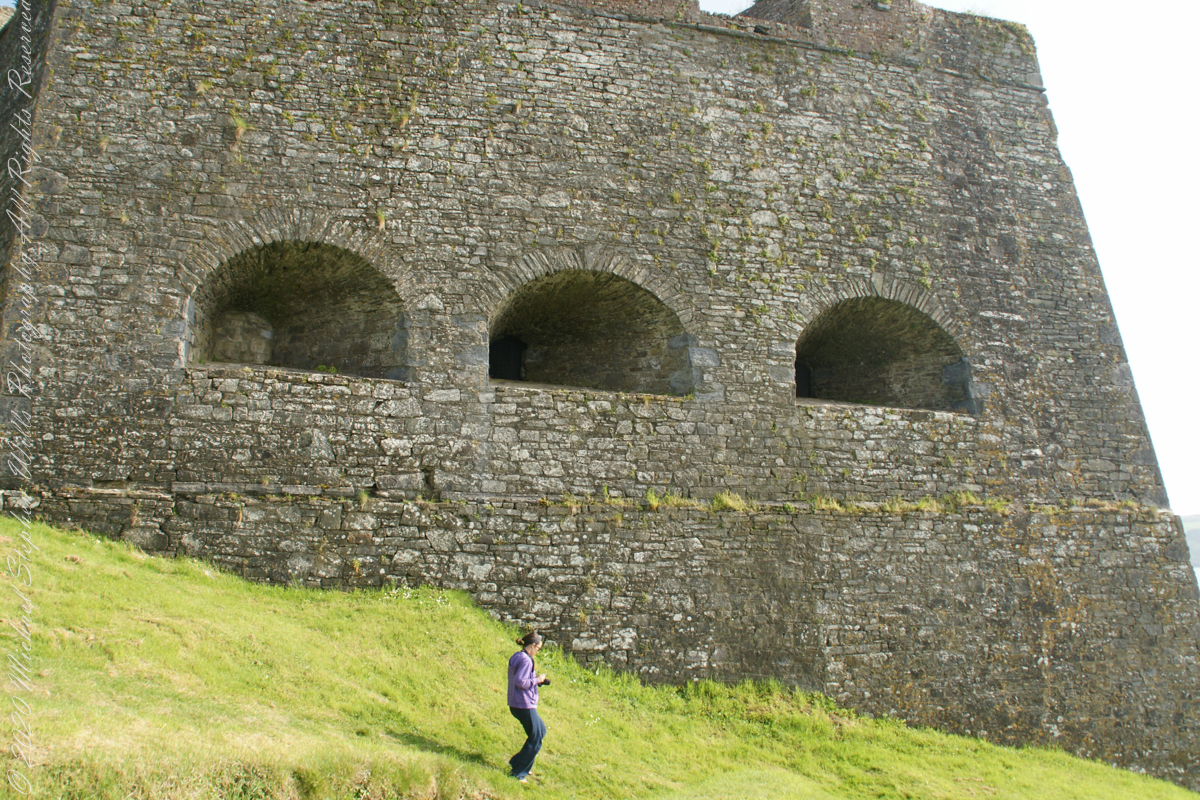
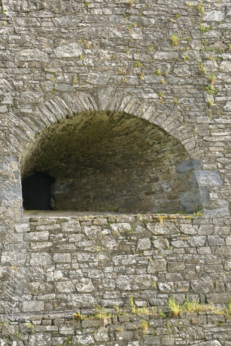
Embrasures
An opening in the fort walls which cannons can be fired. They were often flared outward to enlarge the field of fire.
Close-up of gun port
Crenellations
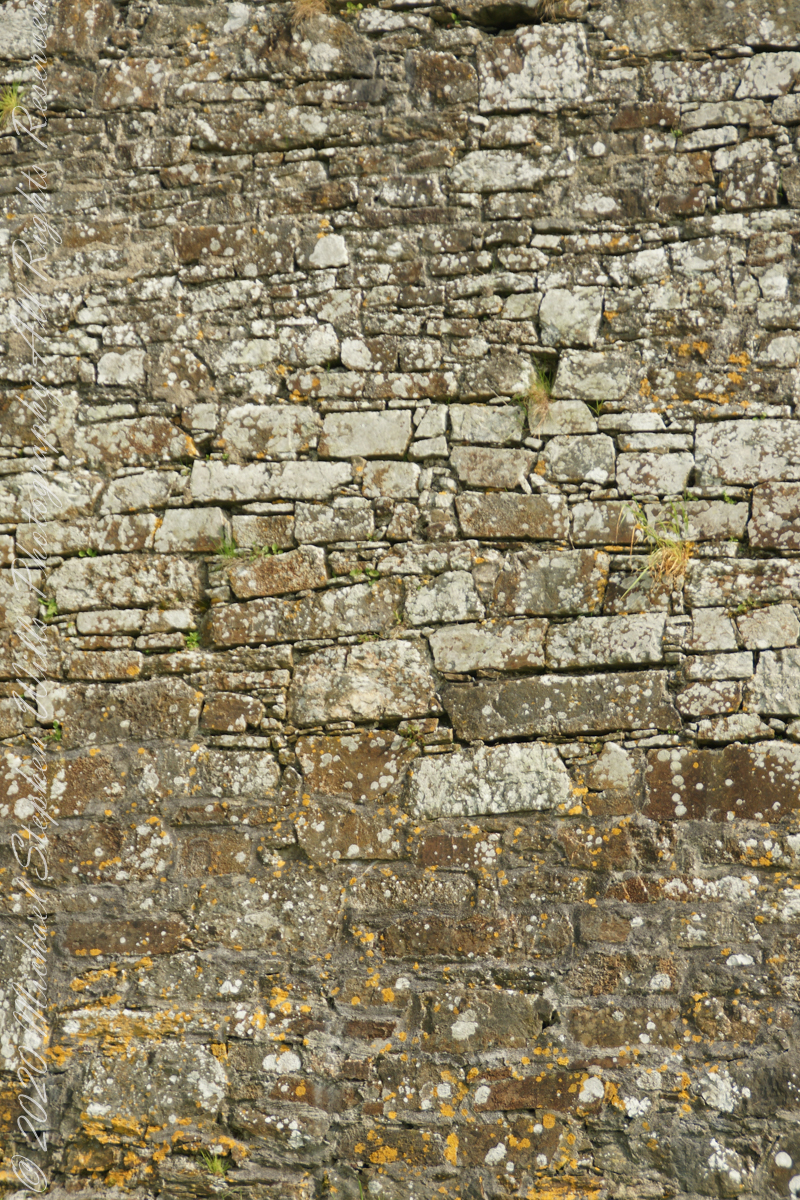
Tightly joined masonry
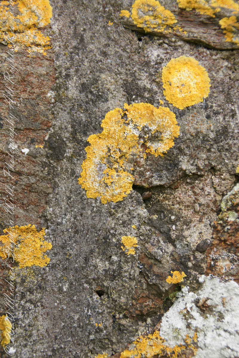
lichen
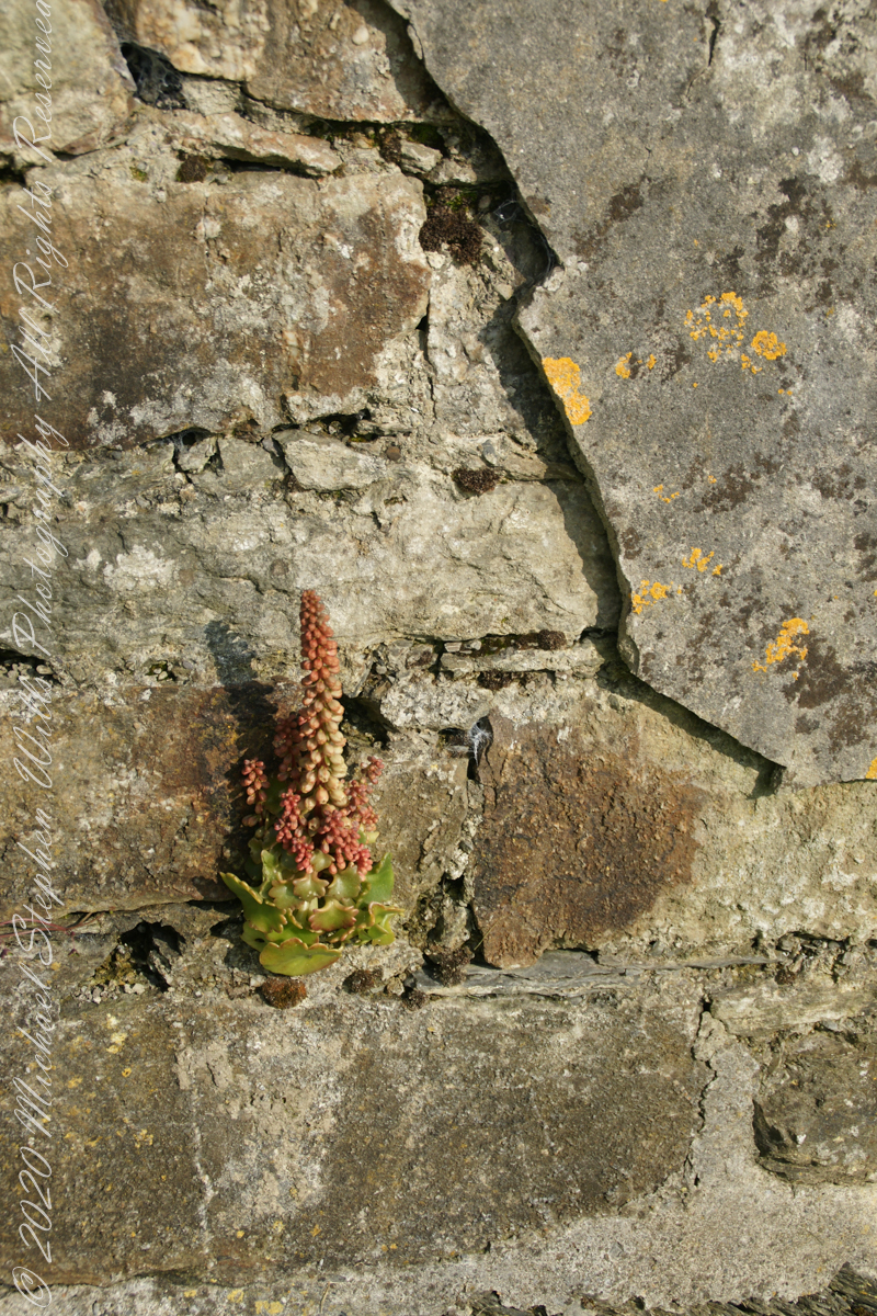
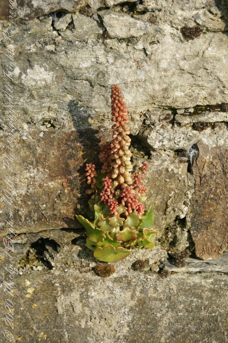
life has its way
seems to be a succulent
a doorway here seems a bad idea, but what do I know?
A pulley at first glance, look again and it is a lock
beneath the walls
Down to the Sallyport and the next post
References
“Charles Fort” – wikipedia
Copyright 2021 All Rights Reserved Michael Stephen Wills
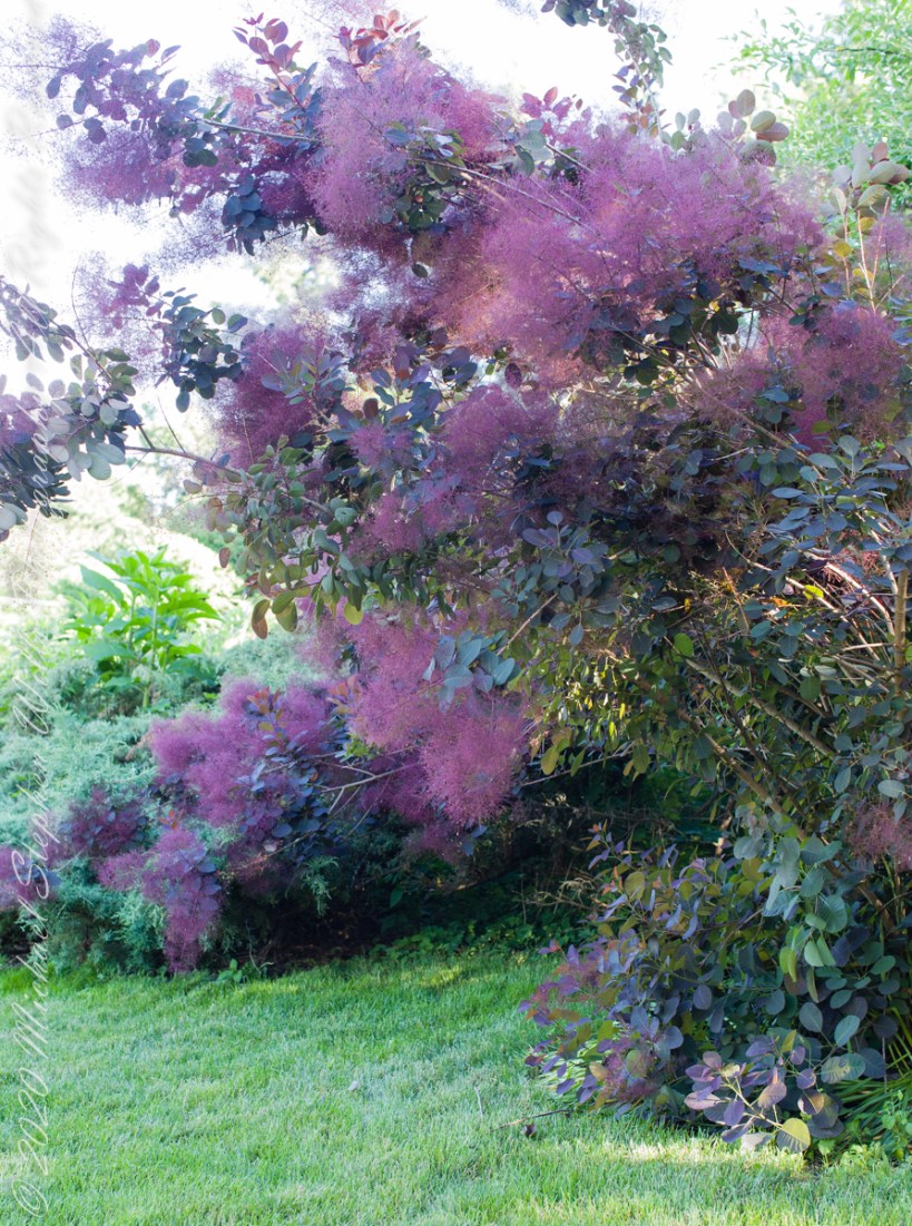
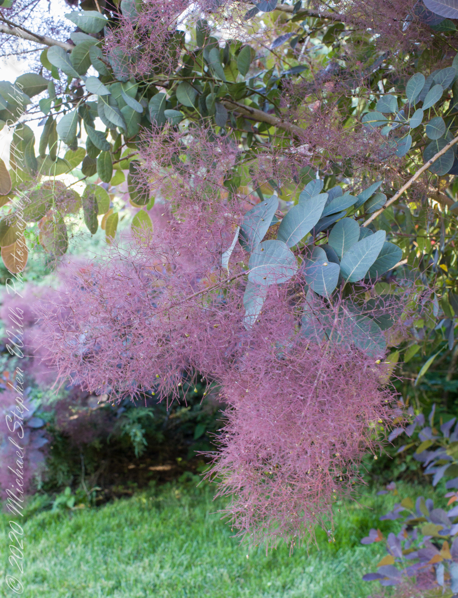
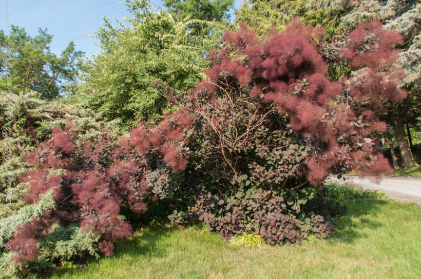
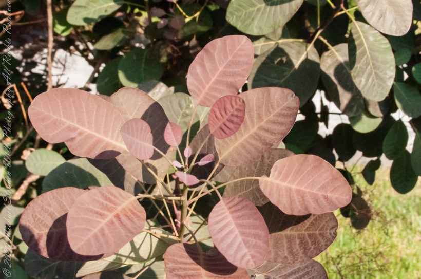
Three species of the genus Cotinus, commonly called “Smoke Tree,”in the family Anacardiaceae exist in North America, Europe and Asia. Ours is more like a shrub with numerous, long branches. Flowers with profuse filaments in clusters resembling whiffs of smoke. Here we see the flower filaments, interspersed with small drupes, each containing a single seed.
ISO 2500, 1/40 sec at f/13
The post header, and these photographs were made from the Canon EOS 5D Mark IV, Canon Lens EF 50mm f/1.2L USM stabilized with a Manfrotto 468ZMZ tripod with hydrostatic head. Late afternoons, evenings the tree is shaded by a hemlock hedge (line of trees running north/south) this is the shade here. This Canonn dslr excels in color rendition. The flower masses are a burgundy wine color, the leaves have a purple tinge. I do not directly fertilize, as the plant is said to do best with unfertile soil though the surrounding cedars do get fertilizer stakes.
ISO 800, 1/125 sec at f/5.0
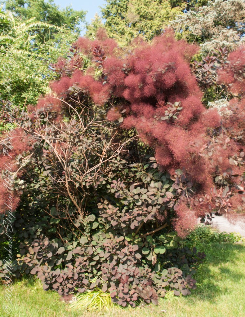
Eight AM a following morning I followed up with a handheld session using a Sony DSLR-Alpha700, Sony Lens DT 18-200 mm F3.5-6.5. Took these two shots with a lower ISO and tweaked the images in Lightroom, reducing the exposure. The flower smoky effect is well captured, the color in bright sunlight is not as wine-like as in shade.
ISO 200, 1/250 sec at f/5.0
ISO 200, 1/200 sec at f/5.6
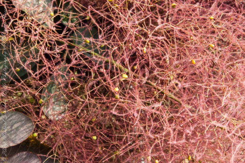
By the time I proceeded to macros, a morning breeze kicked up, handled by upping the ISO to 3200 for a faster shutter speed to stop the movement. The bright sun helped with this.
Fertilized flowers develop into fruit stalks with radiating filaments, the yellow dots are the drupes (fleshy bodies surrounding a single seed). Fresh leaves are purple, turning to dark green with age. The leaves are as unusual as the flowers: aromatic, simple and round on long stalks. Autumn, the leaves turn a stunning bright red-orange, a scarlet shade. In winter some stalks die off, new growth appears from the roots in spring.
Flower Filaments with drupes. ISO 3200, 1/100 sec at f20
New leaves with aged in background, ISO 3200, 1/320 sec at f20
References
“The Botanical Garden Vol 1 Trees and Shrubs”, Roger Phillips and Martyn Rix, Firefly Books, Buffalo NY, 2000, p 361
Wikipedia, “Smoke Tree”
Copyright 2021 Michael Stephen Wills All Rights Reserved
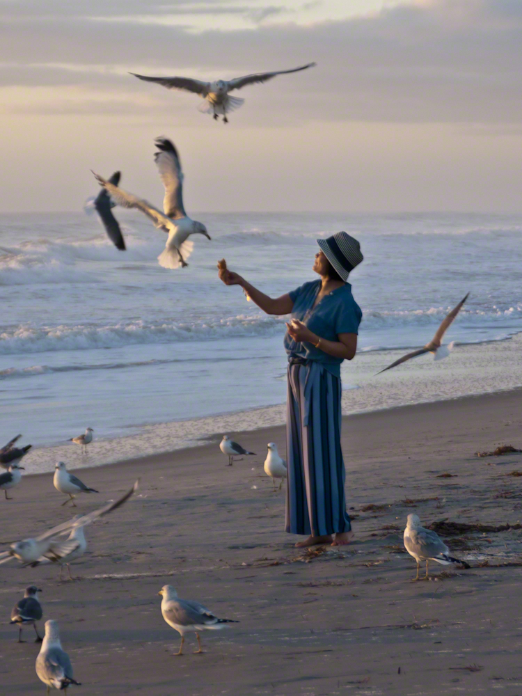
Gulls, an omnipresent element of any beach stroll. Pestiferous, abounding and incessant the gull is simple to deal with. Keep any and all foodstuffs under wraps.
Conversely, for those who adore a crowd of raucous opportunists simply pull out the food and offer it to the air. There is more about this photograph at this post, “Lady Feeding Gulls, Cocoa Beach Dawn.”
Click any photograph for a larger view.
Beach Walking
Pam and I developed a habit of hanging out in Florida during Finger Lakes Winters when the gorges are closed for safety and even walking the streets is perilous, stray black ice encounters abound. We trade icy falls for beach walks.
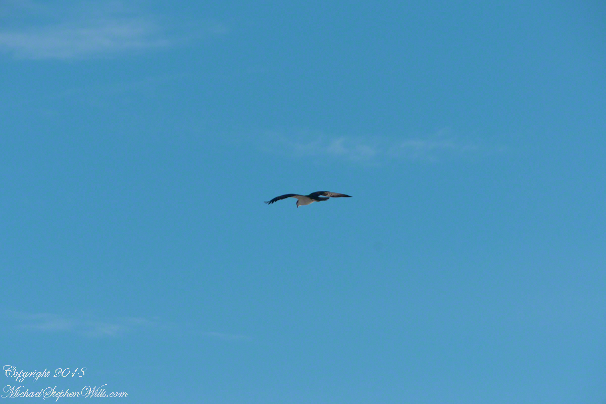
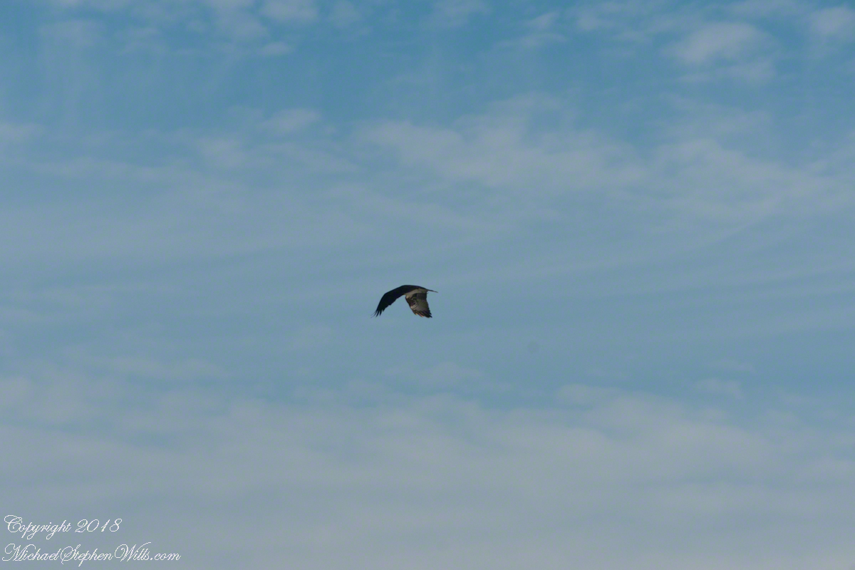
It is natural to become inured to the flight of gulls along the shore. For all my carting along the Sony Alpha 700 with a variable lens ( 18 – 200 mm) there is not a single photograph of a gull in flight. Yet, I have my eye on them until my blindness was lifted by a peculiar individual. It seemed to be a white gull, yet it had a watchful eye.
Gliding shoreline parallel with head down, how could I have mistaken it for a gull?
Osprey occupy an environmental niche along 700,000+ shoreline miles worldwide as a single species Pandion haliaetus. A unique bird with its own family, Pandionidae, and genus, Pandion, some experts recognize sub-species in geographic regions. Ours is the Western Osprey.
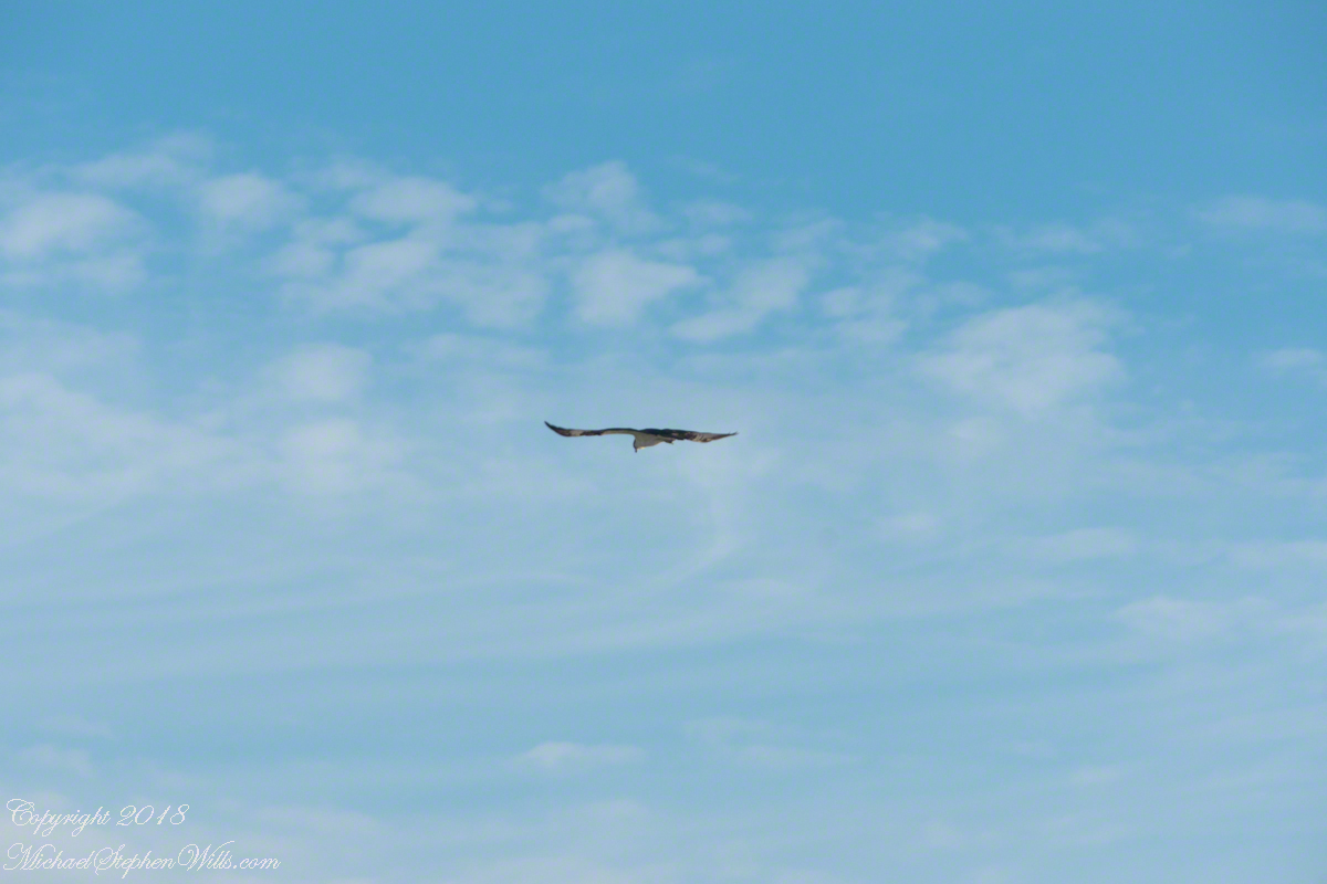
The following photograph is of a wing shape very different from the gull.
Osprey Stalking Behavior
IPhone 8 always in my pocket, I captured this clip of an Osprey stalking fish in the Atlantic Ocean surf. You will have a better viewing experience by clicking on the title of the embedded YouTube, then click on the Full Screen icon at the lower right.
Enter your email to receive notification of future postings. I will not sell or share your email address.
Copyright 2025 All Rights Reserved Michael Stephen Wills
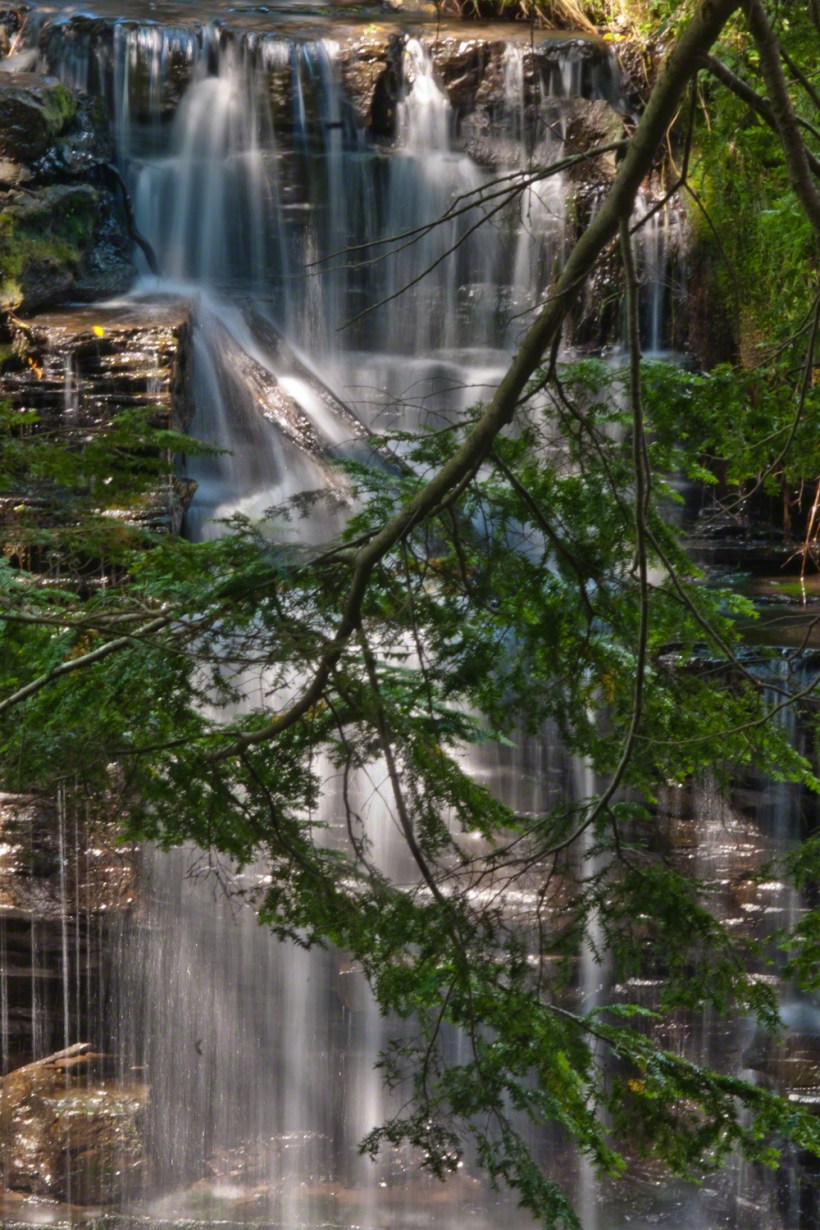
The Dry Creek dam is across the upper, eastern, end of Fillmore Glen. Historical records of the dam construction must exist someplace. My opinion is, somewhere in the federal bureaucracy there is a record proving this dam was constructed by Roosevelt’s Civilian Conservation Corps in the 1930’s. That is when the gorge trails were dramatically improved and it is logical a dam was necessary to control water flow during times of heavy rainfall and the spring thaw, to allow a full appreciation of the gorge beauty. It is a substantial concrete structure with cast iron controls, two spillways: one never, the second always flowing. This day the reservoir is full, frequented by beavers, stocked trout, herons, blue jays, crows, hermit thrush. The reservoir banks are thick with wildflowers of the season. This afternoon I noticed purple flowering raspberries: a past prime bloom or two, ripe fruit growing in the late afternoon shade on the south side of the dam.
Unlike its name, Dry Creek is perennial, fed by a broad drainage of pastures, cornfields and forests. Year round the spillway runs, feeding into the gorge a constant, reliable supply of water for the many waterfalls for which Fillmore Glen State Park is known. The very first waterfall is on the rocks supporting the north side of the dam, formed where water from the spillway flows over these rocks into a deep, east west gorge overhung on the south side by mature hemlock trees.
I first encountered Fillmore Glen in the 1980’s with my young son, Sean. On Sundays he and I walked as far as he tolerated, about half way to the dam site, where the gorge makes a turn to the south, the trail on an unstable clay bank against a crumbling shale cliff. Rediscovering the park in the early 2000’s, along with my interest in photography, I noticed the waterfall just below the dam many times and admired it for how the water caught late afternoon light over the many grace points created by rock crags like a wedding cake. The angle from the dam path is wrong for capturing this effect. Today was a first for me to leave the safety of the dam path to climb into the gorge, on the south gorge wall, for a shot.
Here is a view of the spillway fall on a mid-August afternoon, 2017. My photography kit for this walk with my wife, Pam, was minimal: a Sony Alpha 700 with a variable lens, the flash and a Manfrotto carbon fiber tripod. For this version of the spillway I climbed into the gorge on the south wall, about 40 feet above the creek. A hemlock tree branch fell across the view, incorporated into the composition. These hemlocks are not a biological relative of the Socratic, poisonous, hemlock. The relationship is a similar aroma when the leaves are crushed. The f stop is cranked to 36, ISO set to 100 so slow exposure time to 1.6 second. Post shot processing via Photoshop.
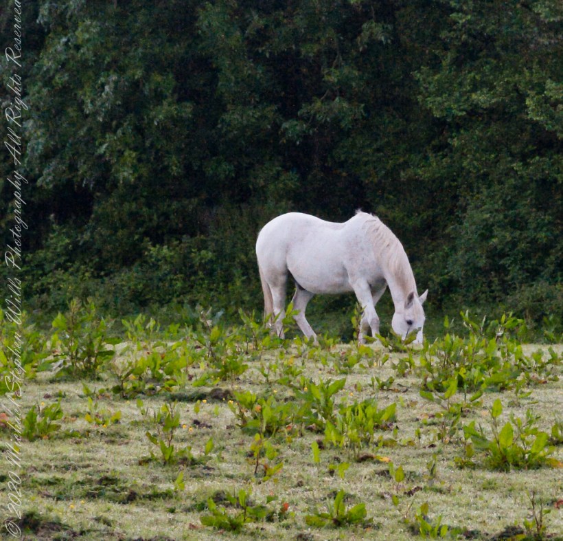
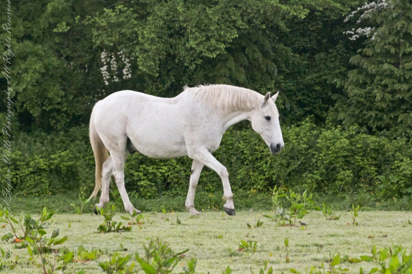
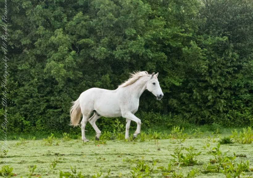
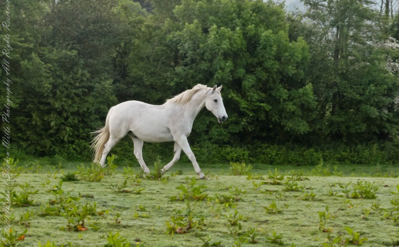
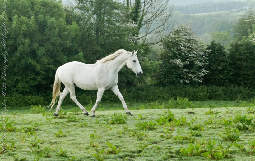
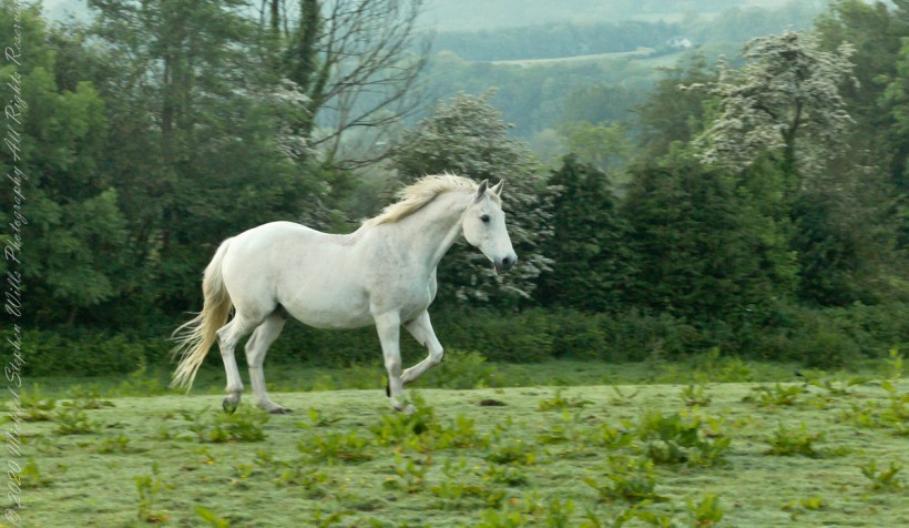
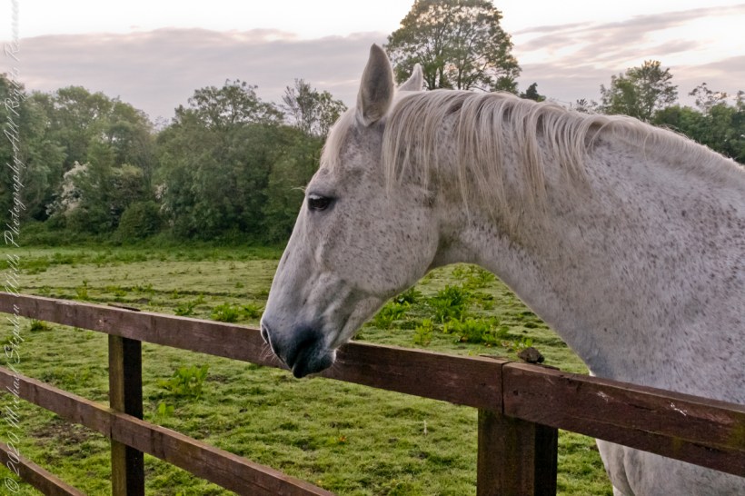
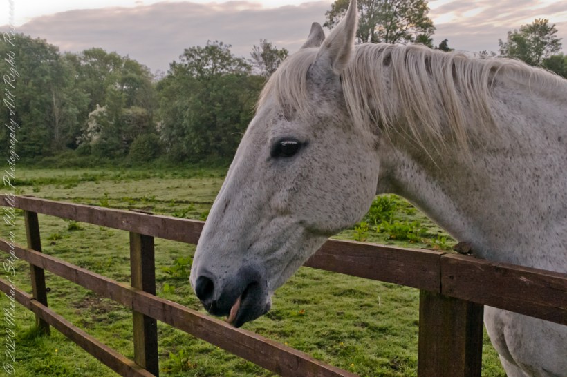
Continued….yesterday included a view along a fairway of Saint Ann’s Hill on which Marantha House B&B is sited. Not far away was a pasture where Charlemagne, a rescued former show horse lives. Our first evening, the one just before this morning, I brought an apple out to Charlemagne. The next morning I returned with another apple to share. Charlemagne rewarded me with a brilliant approach I captured below with my Sony Alpha DSLR with variable lens.
.
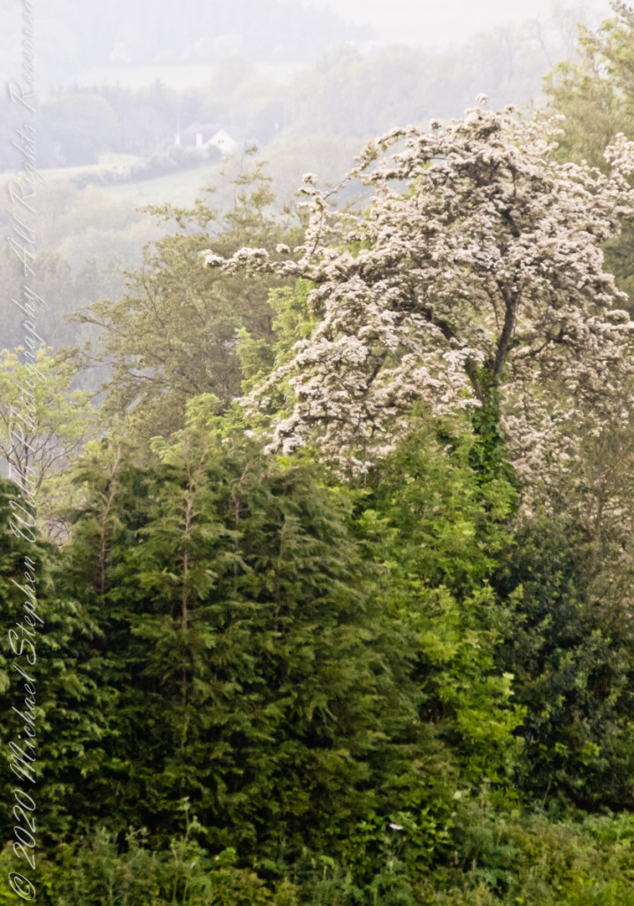
Hawthorn Tree in flower
The “perfect” shot with flowering hawthorn trees
“Hello Charlemagne”
Copyright 2021 Michael Stephen Wills All Rights Reserved
Hard on the Ithaca City Cemetery is our version of the crookedest street. Cascadilla Park road ascends East Hill as a series of switchbacks, charming homes cut into the hillside. A foot path overlooks the gorge, seen here.
Today, two young teens used the hill bottom for skateboarding. Taking turns on watch, each sped onto intersecting University Avenue. A dangerous game.
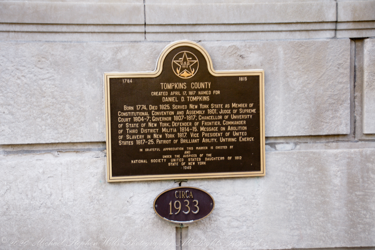
A brass plaque commemorates Daniel D Tompkins on eponymous Tompkins County courthouse. When the county was formed, 1817, Daniel Tompkins was a former governor of New York and Vice President to James Monroe. Tompkins never visited “his” county, there is no other connection between him. His family and life was rooted in eastern part of New York, around “The City.”
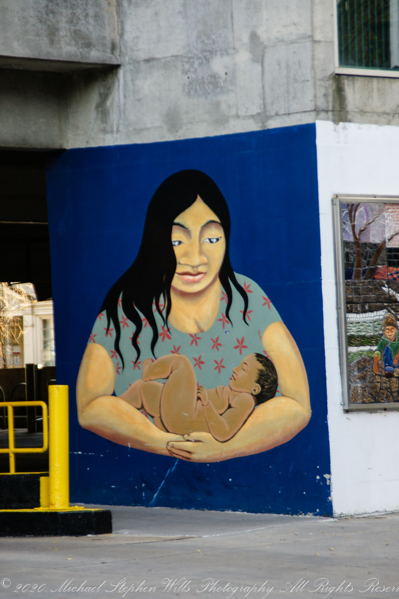
“Maternidad”, Seneca Street Garage, a mural by Nick Gilbert was the 2014 winner of 2014 @culturaithaca Latinx Mural Design Contest.
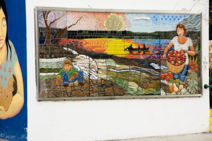
Mosaic Mural “Feels Like Ithaca” by Annamarie Zwack, Seneca Street Garage Also known as “Spirit of Ithaca”
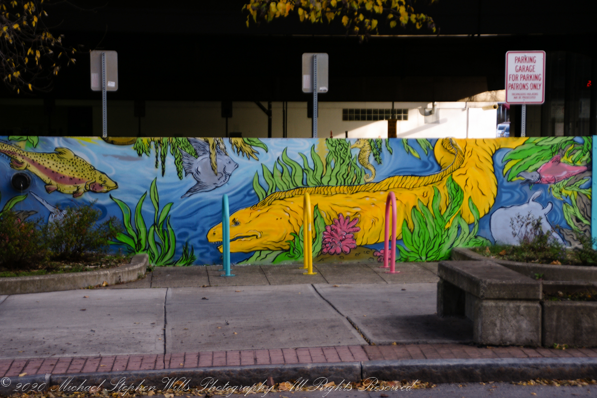
I am not finding the attribution for this undersea idyll, also on the Seneca Street garage adjoining “Feels Like Ithaca.”
This completes my Sunday afternoon walk around Ithaca.
Copyright 2021 Michael Stephen Wills All Rights Reserved
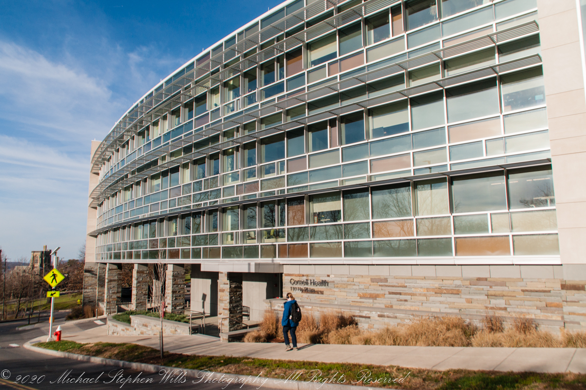
We pick up this walk through Ithaca from the December 23rd post, next to a waterfall and the “Theory Center,” starting with the spiffed up rear façade of the Cornell Health Building, renamed from Gannett Health after a right wing newspaper publishing magnate. The building fronts “Ho Plaza” thus carries an address with unfortunate allusions, named for a distinguished Cornell alumna who’s family name is Ho. I included this building in appreciation to Cornell University and students for being good neighbors during this COVID-19 pandemic, controlling the virus.
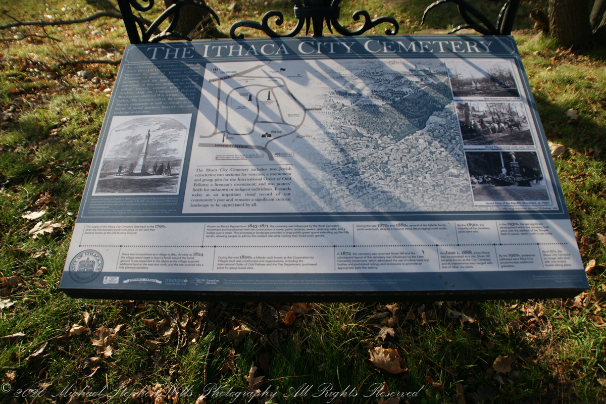
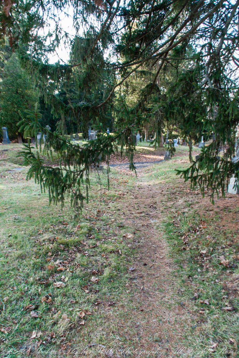
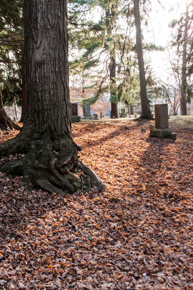
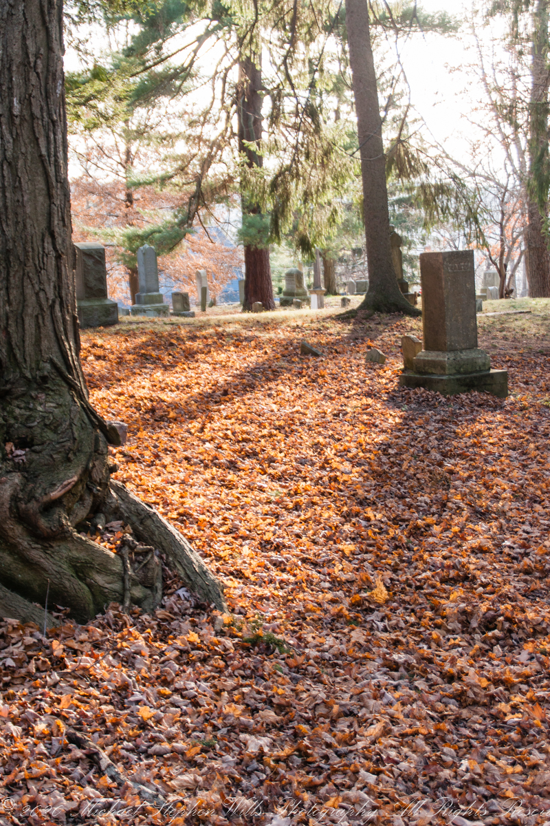
Today, I avoided the views of the popular Lib Hill to minimize personal contact. Instead, descending the hill on footpaths, found myself on Stewart Avenue and the eastern side of City Cemetery.
Enjoying the solitude and long shadows of our northern afteroon.
Traversed a gate of hemlock branches….
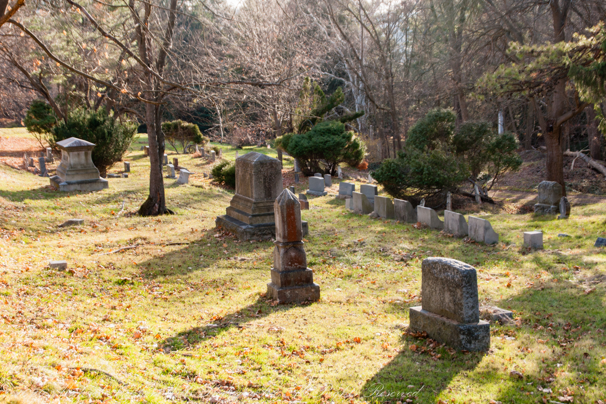
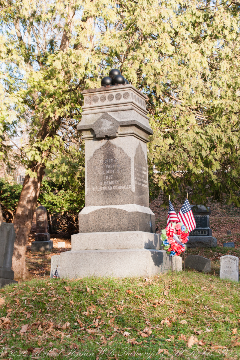
Admired random monuments. By the way, George Washington Schuyler, whose family anecdote I shared in a previous post, rests here under an impressive stone. Not this one.
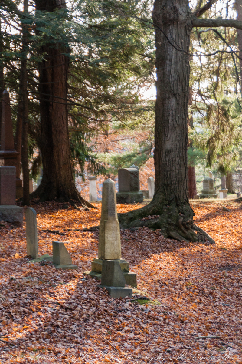
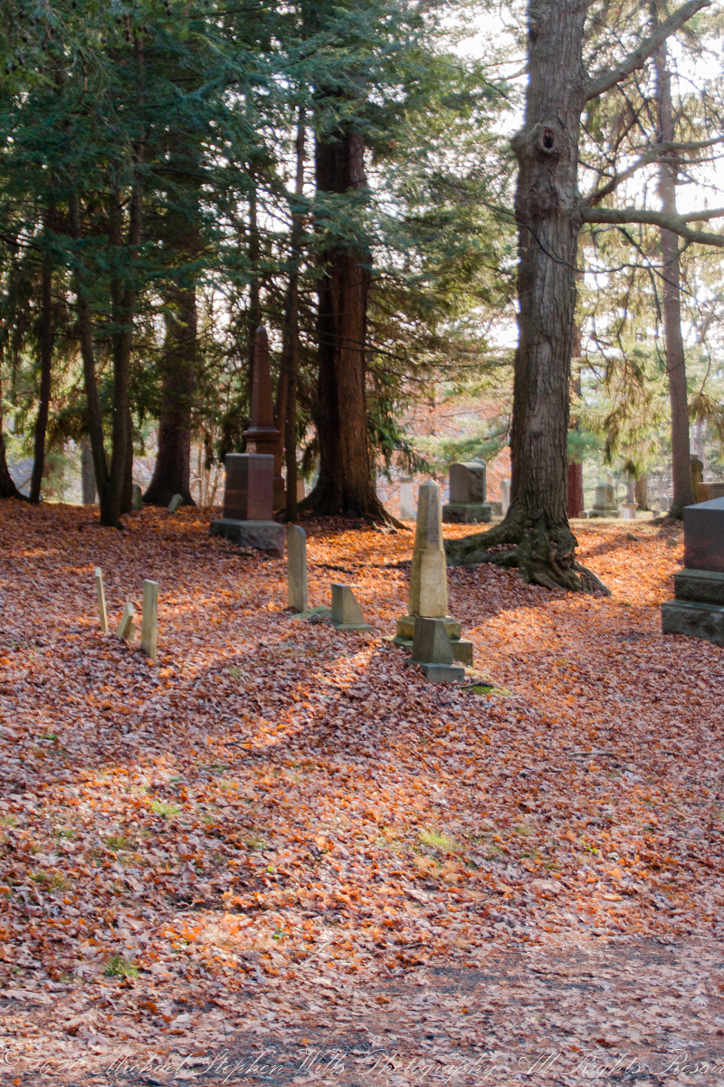
More afternoon light, fallen leaves, hemlocks.
Copyright 2021 Michael Stephen Wills All Rights Reserved
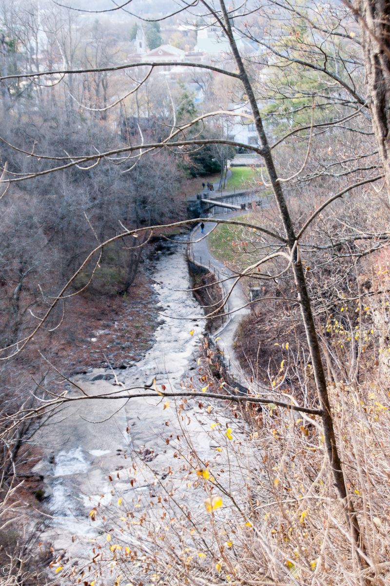
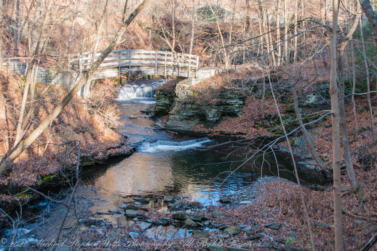
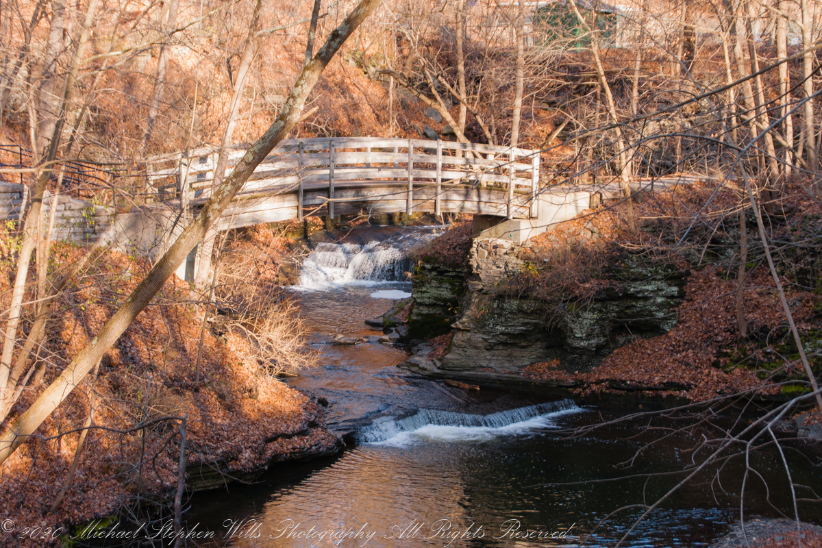
Walking the Lower Cascadilla Gorge Trail from the end of Court Street, downtown Ithaca, named for the Tompkins County Court is a favorite way for students to walk from the Cornell Campus.
I avoided the route today, the trail is narrow, much less than the 6 foot minimum distance. The footpath from Eddy Gate to College Avenue passes where the trail climbs up from the gorge. I did opt to catch the Upper Cascadilla Gorge trail, much wider. The trail passes two footbridges accessing the Engineering Quadrangle and the main Cornell Campus. Photographed here is the approach to the second, smaller, footbridge.
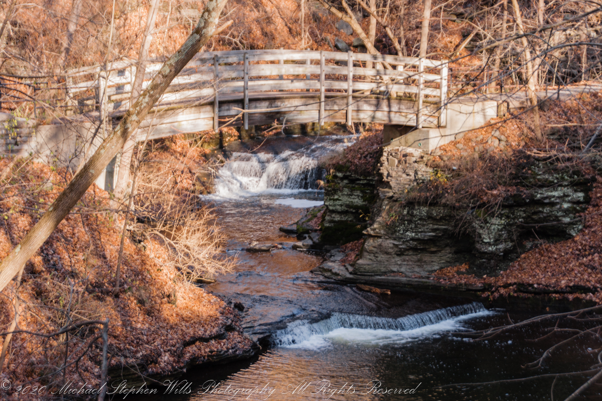
Late fall/winter afternoons the “Golden Hour” is hours long for this view of the footbridge and waterfall.
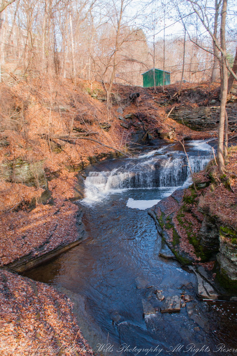
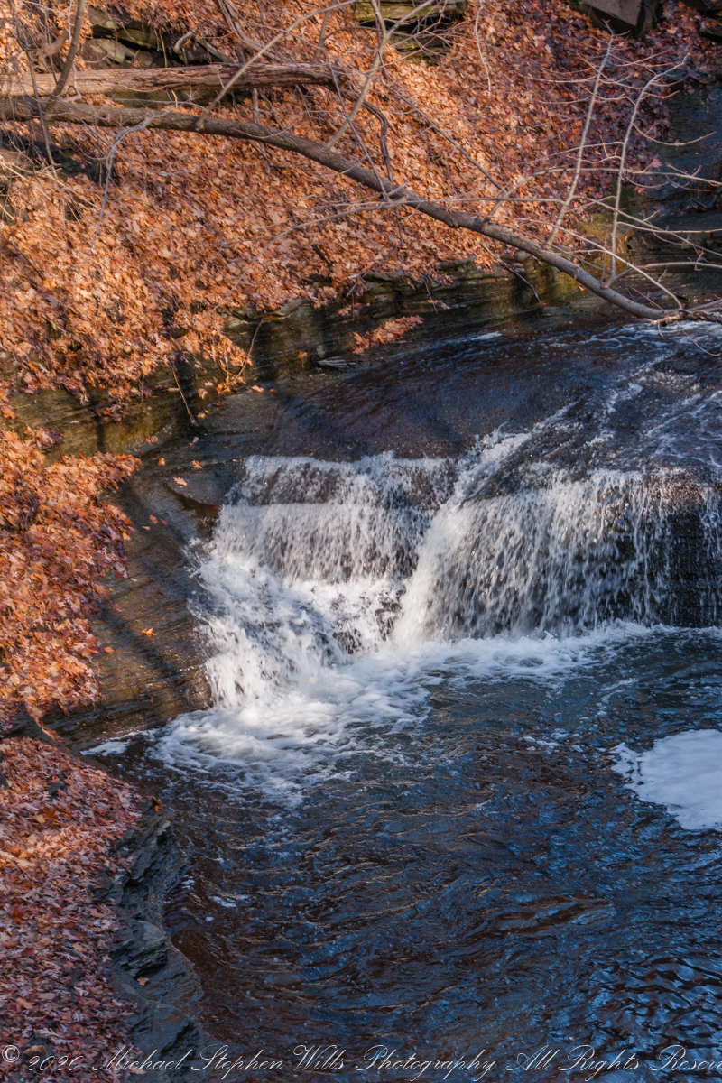
Waterfall views from the bridge. I left the tripod at home, so these exposures “freeze” water motion.
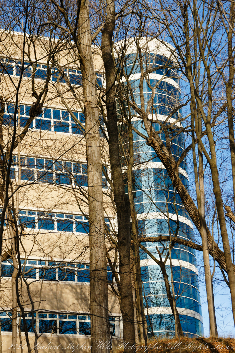
Look up from the other side for this view. Baptized 1985 as “The Theory Center,” 2007 saw the name changed to the more evocative, “Center for Advanced Computing.” It always filled with supercomputers. Socially, the culture of the place was retrograde from the beginning with “faculty only” lounges that kept out the lowly staff members. As if on cue, I came upon a group of the privileged, unmasked, strutting down the hill toward me, like vacuous moles.
Copyright 2021 Michael Stephen Wills All Rights Reserved