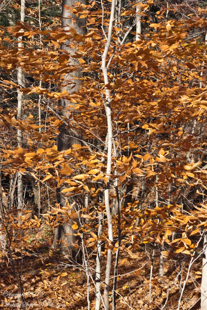
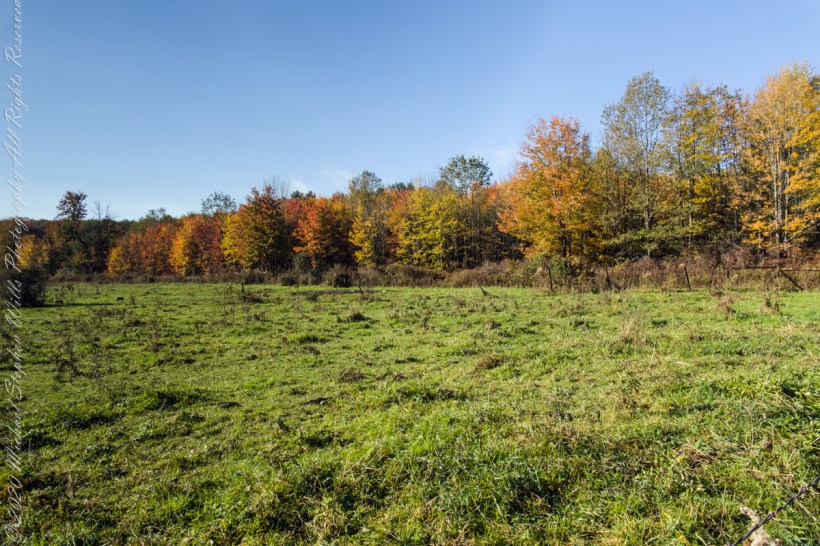
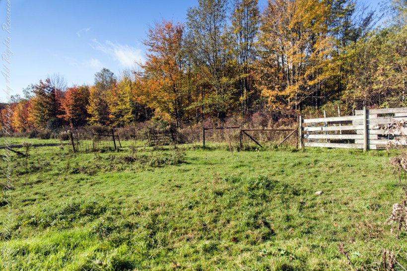
Elms thrive in the understory, turning late to catch autumn sunlight.
Click photograph for a larger view. To do this from WordPress Reader, you need to first click the title of this post to open a new page.
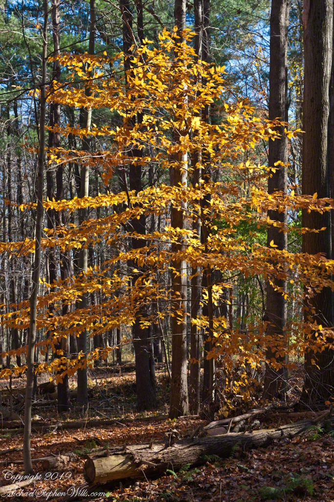
Rock Elm, autumn
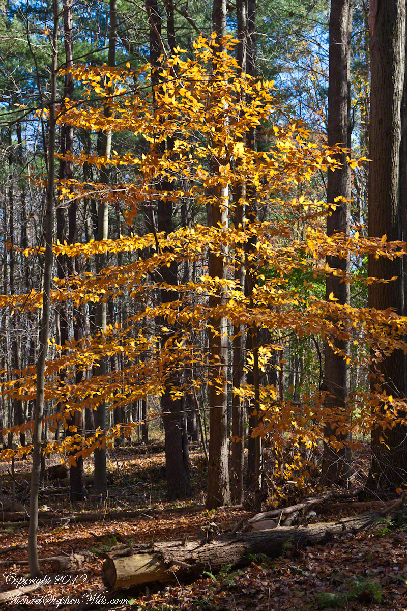
Elms thrive in the understory, turning late to catch autumn sunlight.

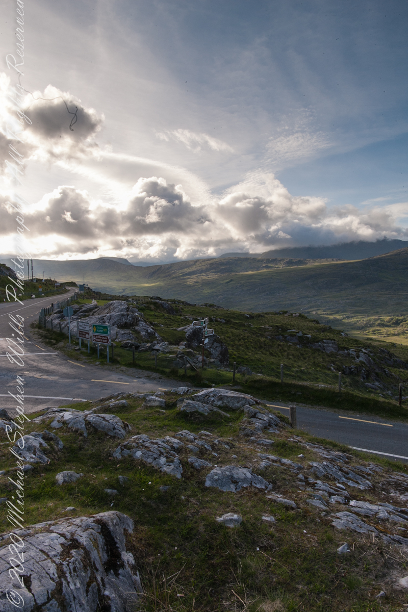
Across the far mountains is Black Valley
Here we are still standing in Moll’s Gap, looking a bit farther northwest into Black Valley than for View Two. Across the far mountains is Black Valley, a place so remote it was among the last, on the island itself (“mainland”) to be electrified or connected to telephone networks. Today Black Valley is a southerly route to the Gap of Dunloe well known to certain hikers and cyclists.
I am struggling here to deal with the vast range of light intensity from the glow of a westering sun, to the shadows cast by surrounding heights.
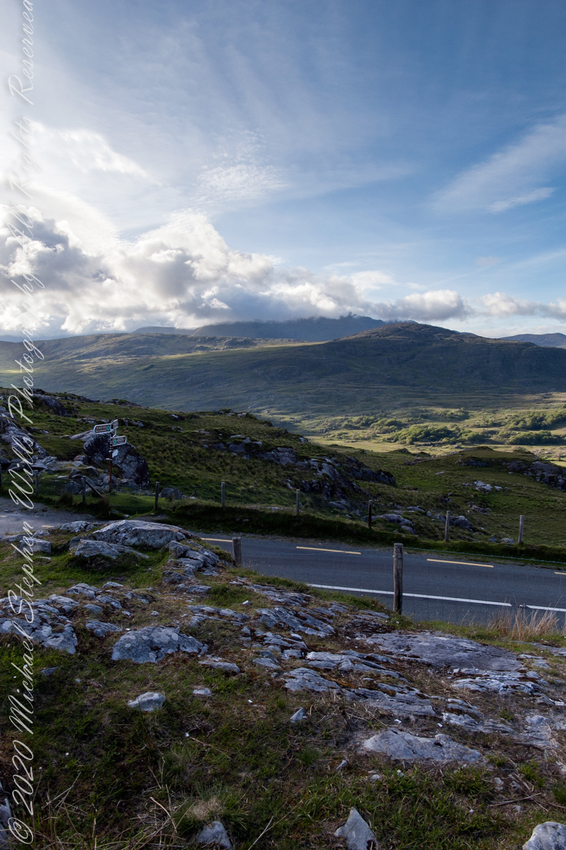
Beneath our feet are the slopes of Derrygarriff (in Irish Doire Gharbh) of the Mangerton range. Across the way is Crossderry peak of the Dunkerron mountains, the townland is named for the peak (or vice versa).
Click pic for larger view in a new browser tab. If you are in WordPress Reader, open the post to use this feature.
Here is a second try, a bit more successful as the clouds opened to shine on distant land. I did work in Photoshop to manage the brightest clouds.
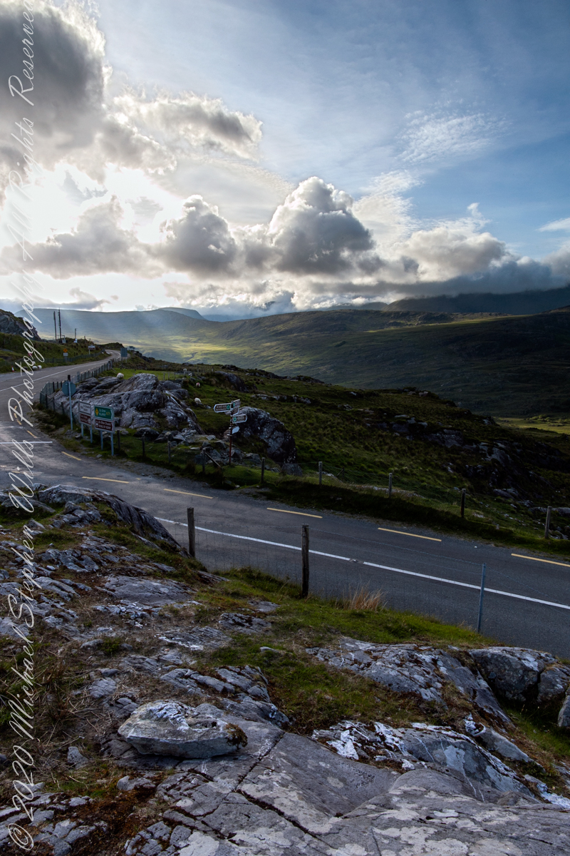
Here are all three versions of the Black Valley view from Moll’s Gap. Enjoy
Copyright 2021 Michael Stephen Wills All Rights Reserved
A Natural Wonder
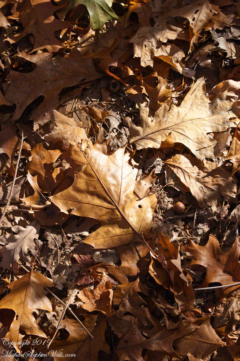
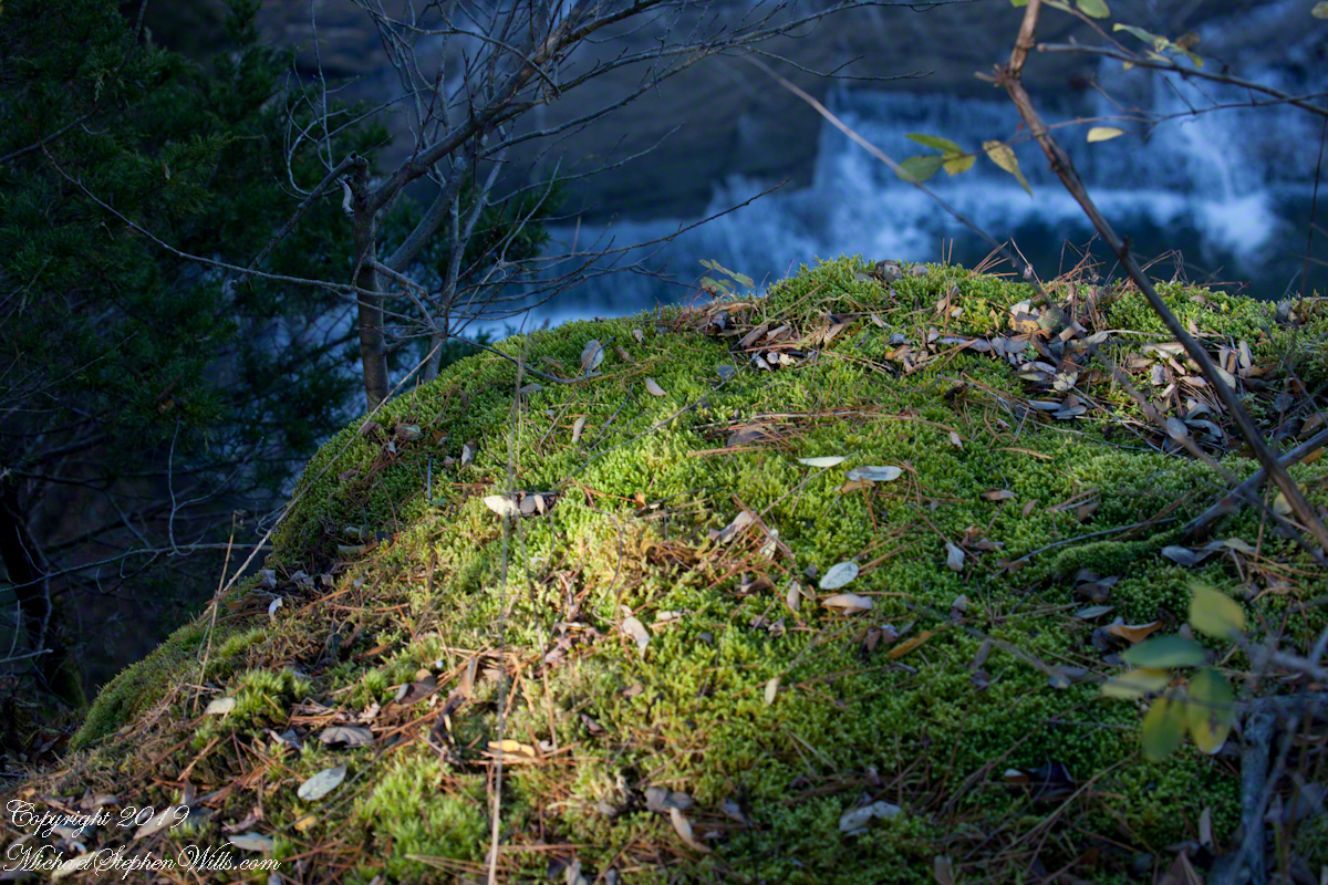
Wednesday last I enjoyed shuffling along a forest carpet along the South Rim Trail of Taughannock Falls Park. It is a lost pleasure now the first snow is with us.


The Flag Forms
Here is a postscript for my retrospective diary of the day I created my print “Ocotillo Sunset.” You can visit “Ocotillo Sunset” in my Online Gallery by clicking on any photograph .
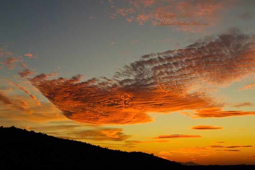
In near total darkness, the last sunlight only enough for the far western sky, these are the last shots of this series.
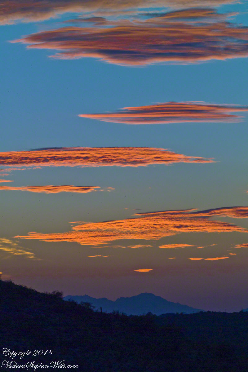
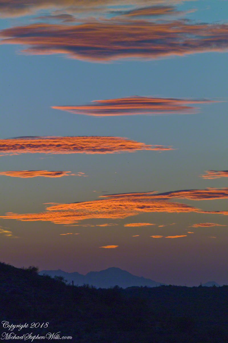
The final result of the day’s work, “Ocotillo Sunset.”
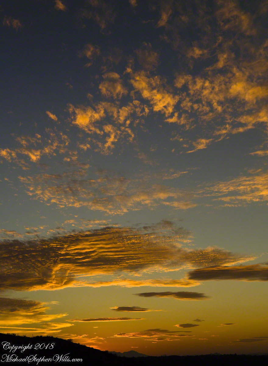
compare portrait vs. landscape orientation.
In the long history of this forested ridge two Iroquois tribes relied on this land for tree nuts and hunting, the soil did not support agriculture. After the Revolutionary War, the British siding Iroquois tribes were driven away and the land given as one mile square blocks to soldiers, in payment for service. During the Depression era, many of these farms were abandoned and others sold to the Federal government.
Today, there is a patchwork of private land and National Forest. This line of color marks the forest boundary on the eastern ridge side.

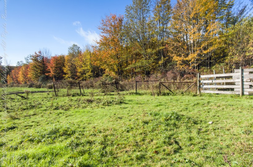
I positioned the tripod against the barbed wire fence marking the posted property. A few barbs and sear goldenrod flowers just visible in the lower right corner.
The Flag Forms
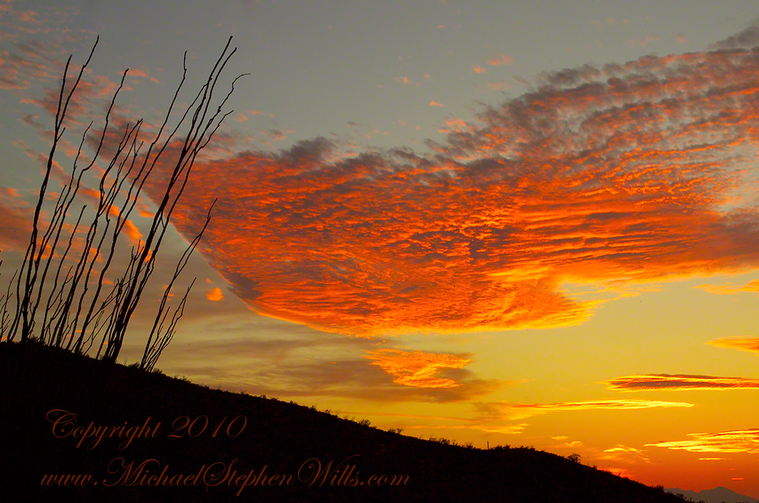
The penultimate posting of my retrospective diary of the day I created my print “Octillo Sunset.” You can see a large version of “Ocotillo Sunset” by clicking on any of my blog photographs.
Then, for reasons I can only speculate about, a spectacular shape came together in the clouds. In the following photograph I have yet to recognize, to see, this cloud sculpture. Do you see part of “Ocotillo Sunset” coming into shape? As far as I remember, at the time I had only a dim realization of what was forming in my view finder and in front of me.
Then, I changed camera orientation and shifted the view a few degrees to the left and there it was: a coherent shape of something. Here it is in full, untethered.

The final result of the day’s work, “Ocotillo Sunset.”

No Pun Intended
Some sights from last post.
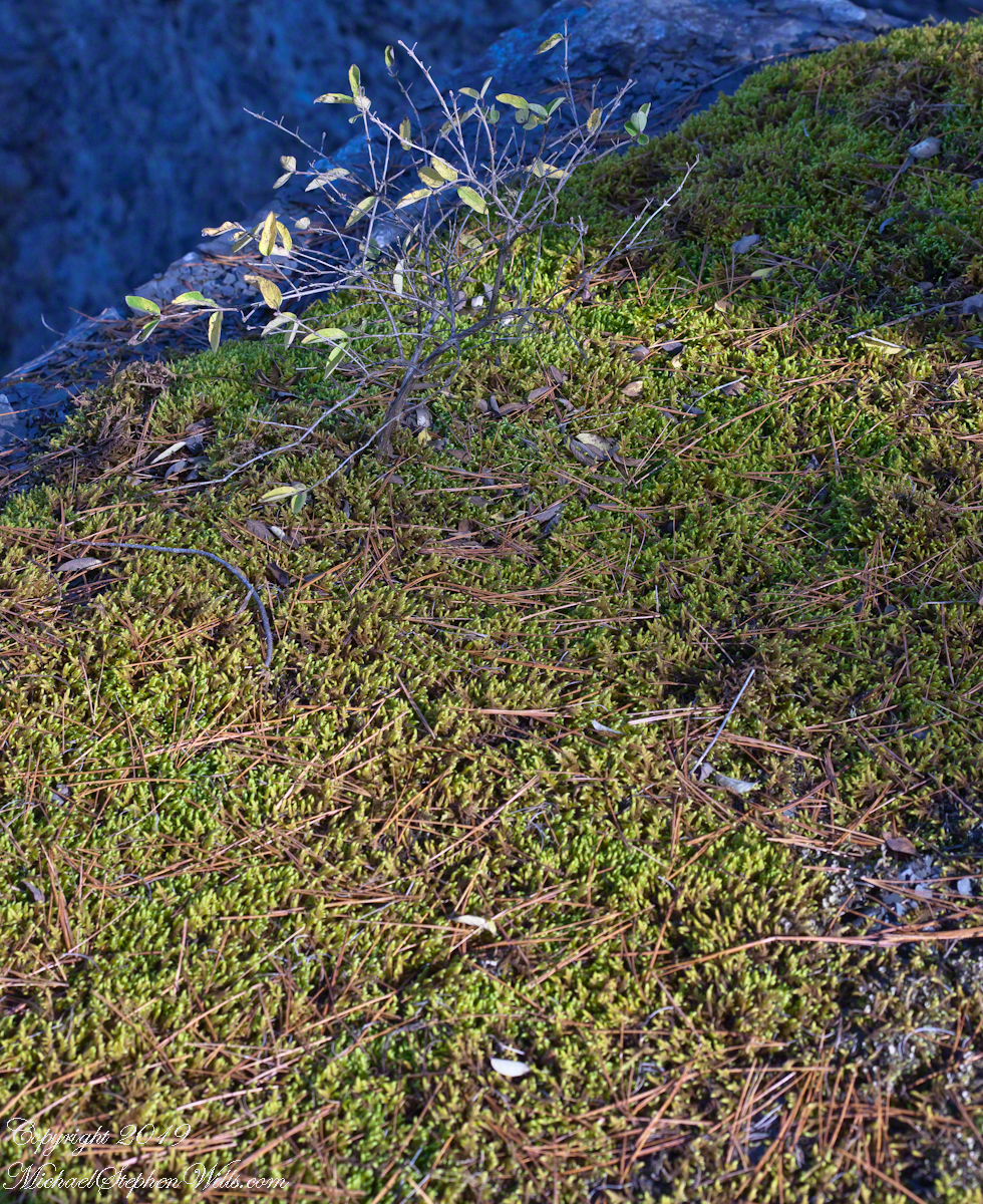
Moss on the edge of upper Taughannock Gorge cliff, with the falls in background far below.
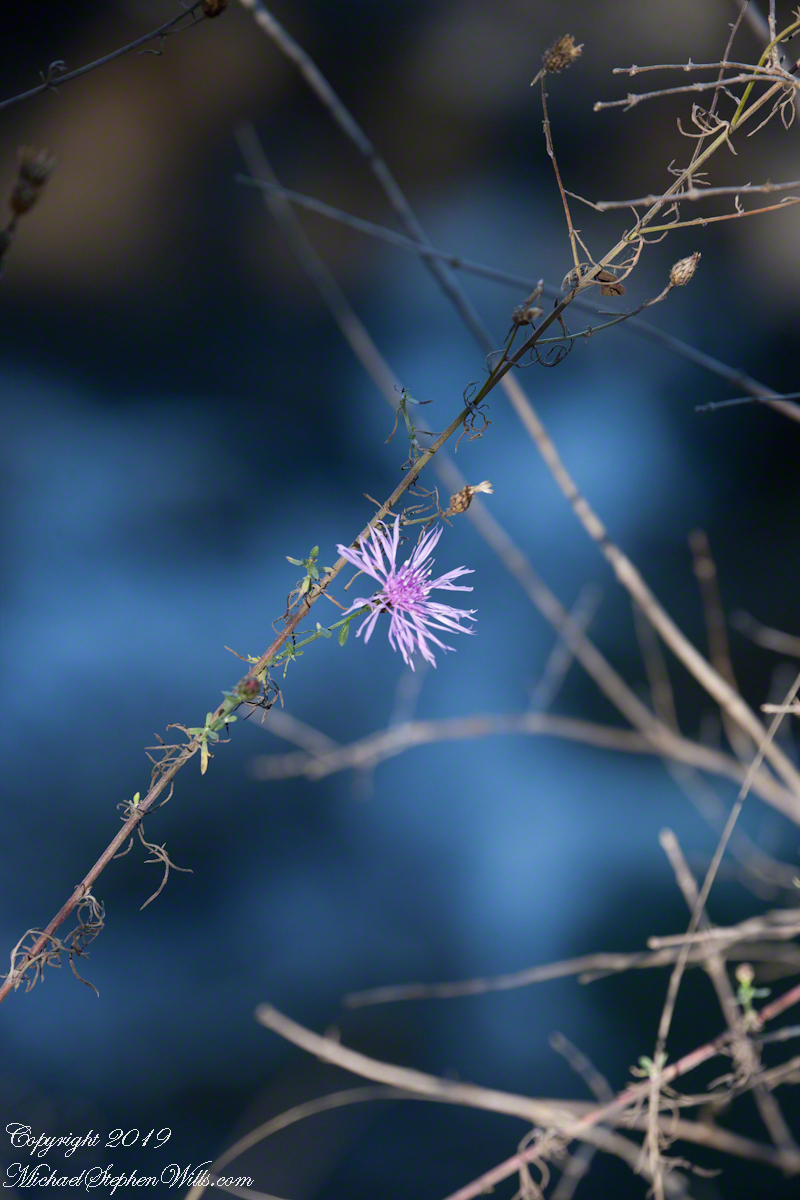
The last flower of autumn, a single bloom of Ironweed.
An Autumn Revalation
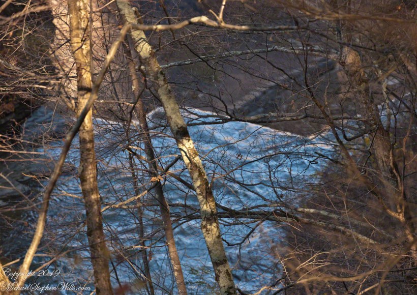
After leaf fall abrupt emptiness of Taughannock Falls is visible from the south rim. Beyond, you can just make out the enormous carved limestone slabs that protect visitors from the constant infall from the gorge walls allowing them to approach the falls.

compare portrait vs. landscape orientation.
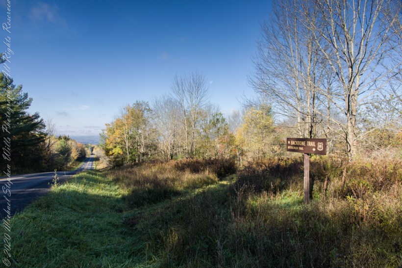
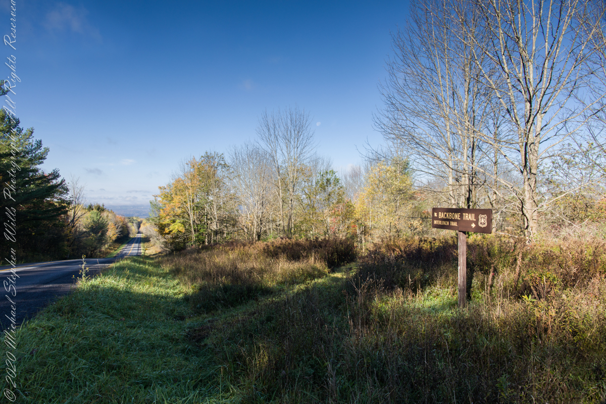
An open road, autumn morning, a hiking trail under a setting moon. Thirty miles of hiking trails thread these 16,212 acres. Some, like the Backbone trail, traverse farmland reverted to forest and meadow, popular for horseback riding.

Black Valley
Here we are standing in Moll’s Gap, looking northwest into Black Valley, a place so remote it was among the last, on the island itself (“mainland”) to be electrified or connected to telephone networks.
Beneath our feet are the slopes of Derrygarriff (in Irish Doire Gharbh) of the Mangerton range. Across the way is Crossderry peak of the Dunkerron mountains, the townland is named for the peak. Black Valley, now a southerly route to the Gap of Dunloe well known to certain hikers and cyclists, is beyond the far mountains.
Click pic for larger view in a new browser tab. If you are in WordPress Reader, open the post to use this feature.
Copyright 2021 Michael Stephen Wills All Rights Reserved
