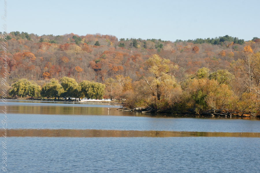
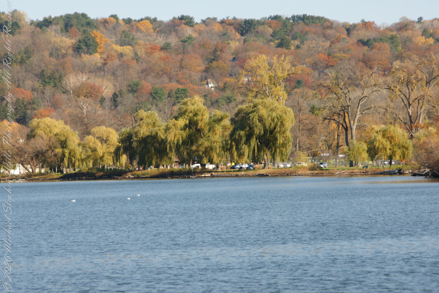
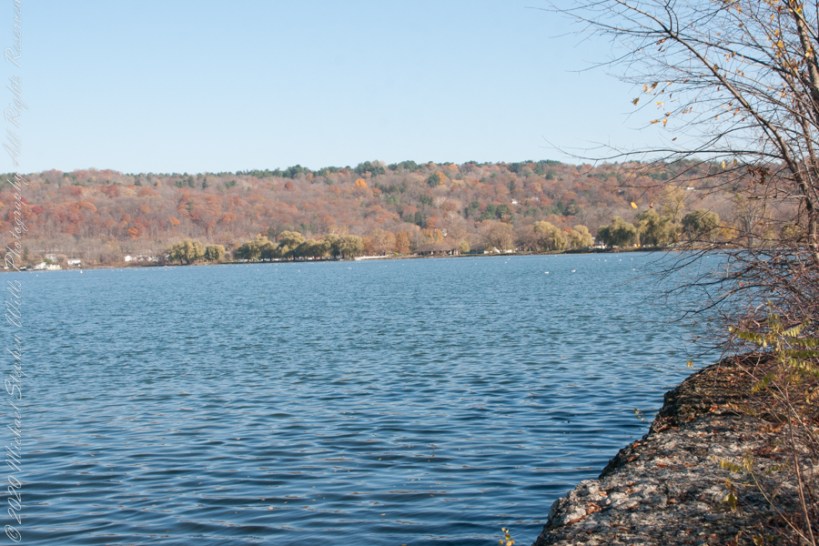
Here is the south end of Cayuga Lake on a bright November afternoon. Stewart Park is enjoyed by Ithacans year round.
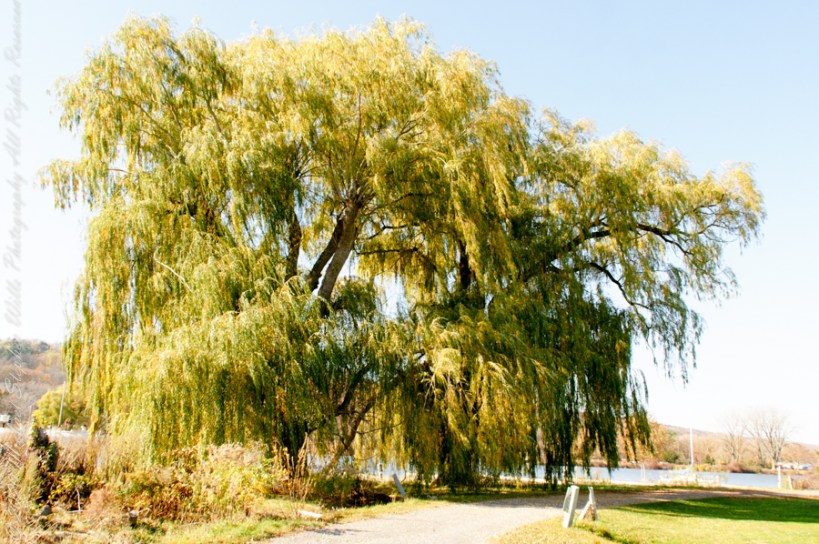
Everyone is a fan of the Willows framing the lake views.
Can’t get enough of Stewart Park..
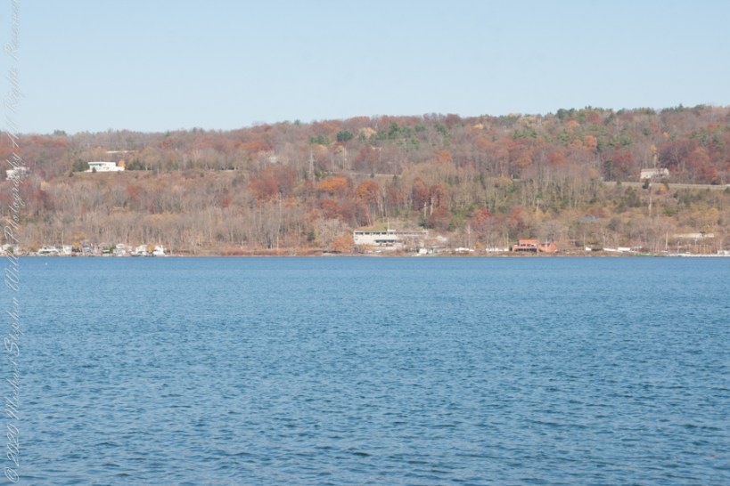
An unzoomed view, to give an idea of the distance across the water.
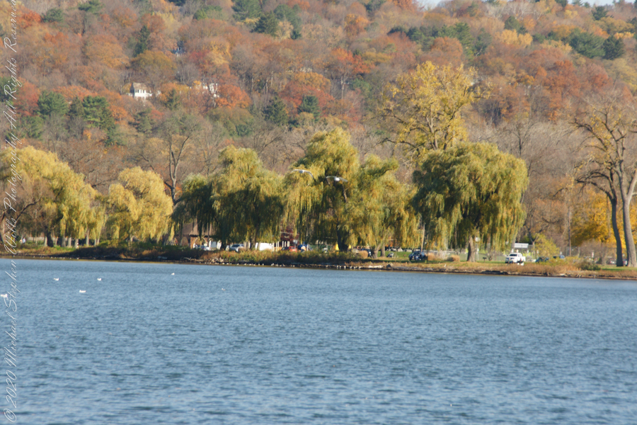
Pam and I have great memories of sailing this stretch from our years of membership in Cornell Family Sailing.
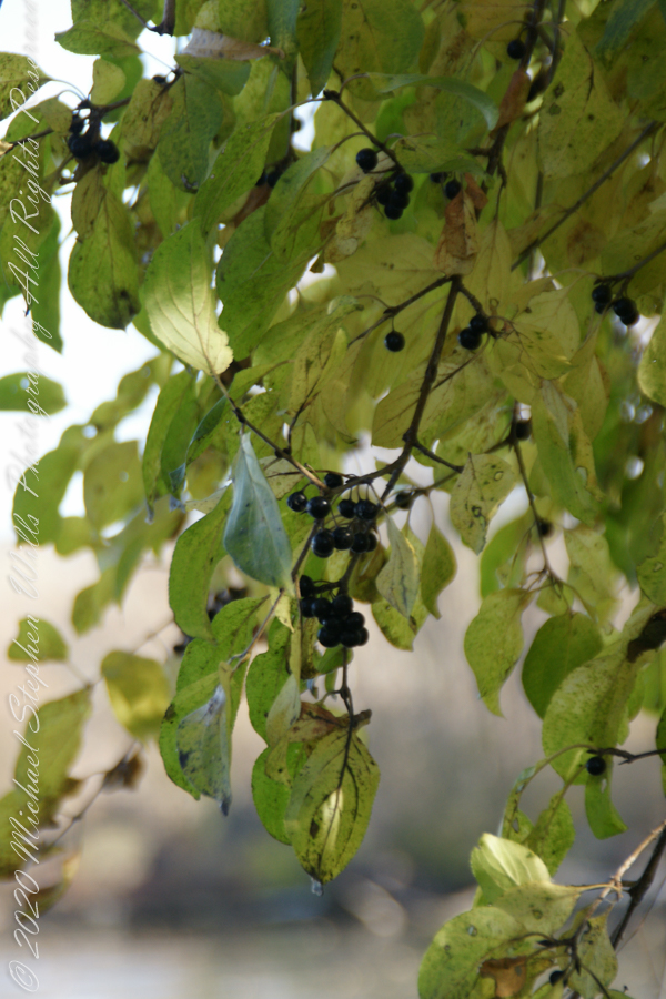
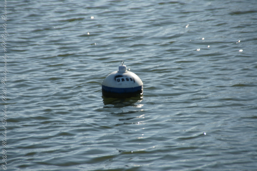
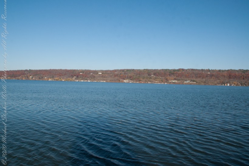
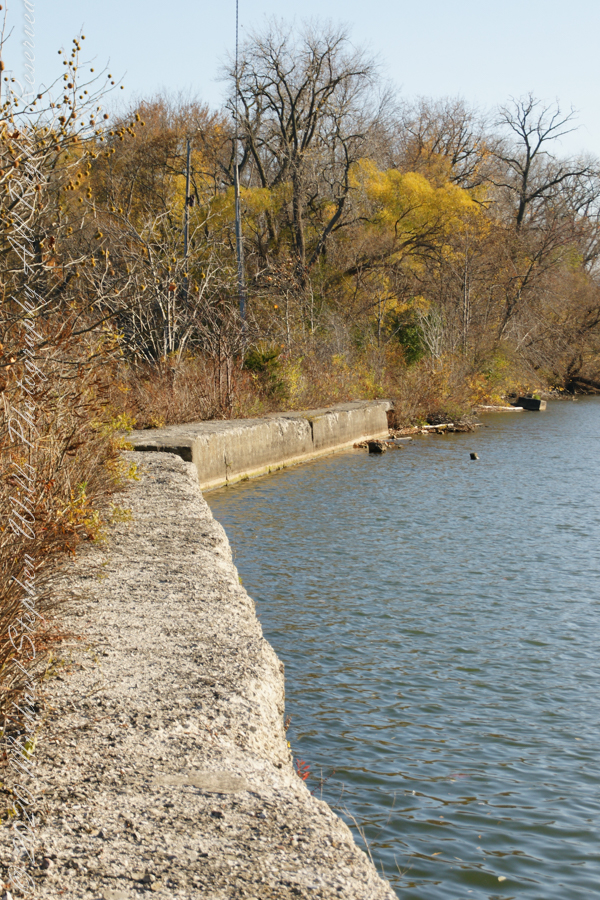
The east lake shore.
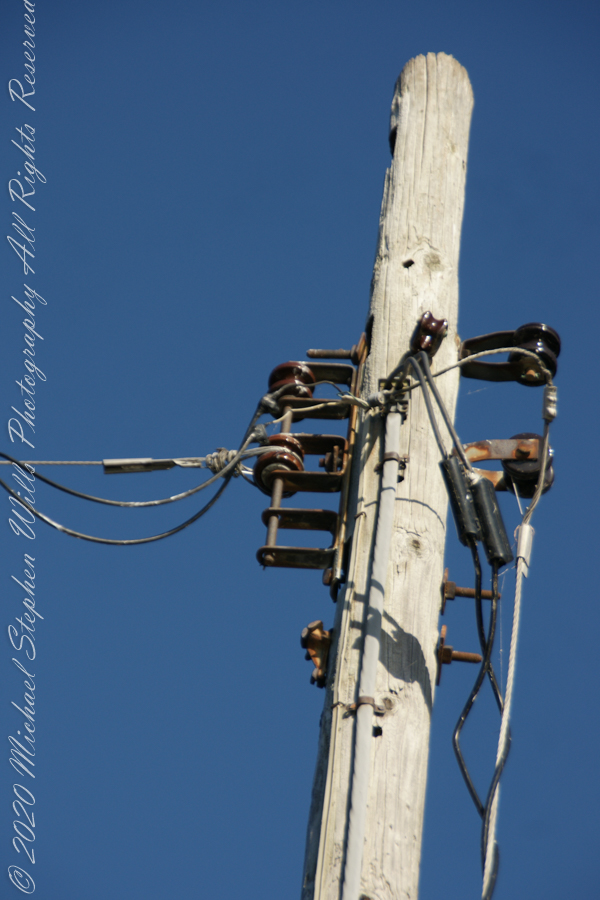
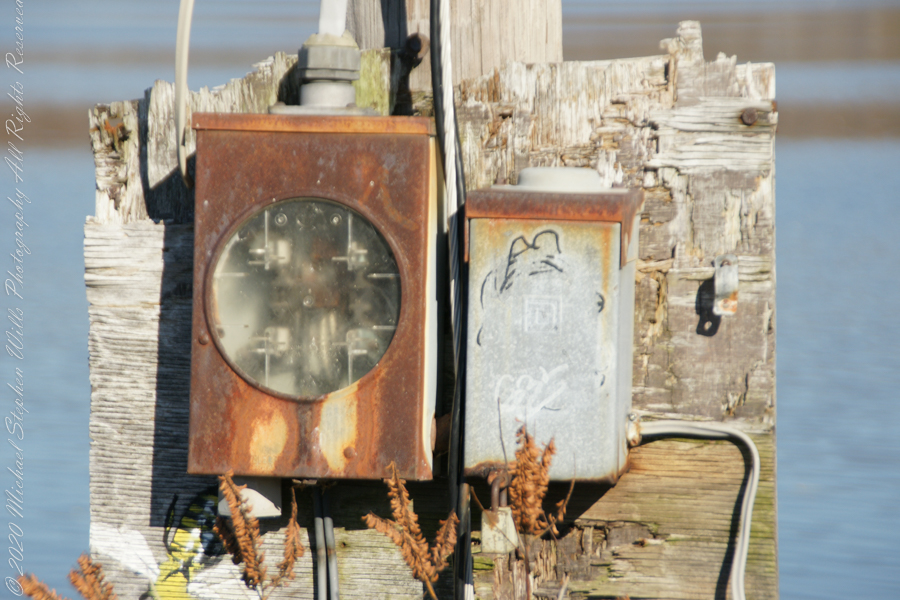
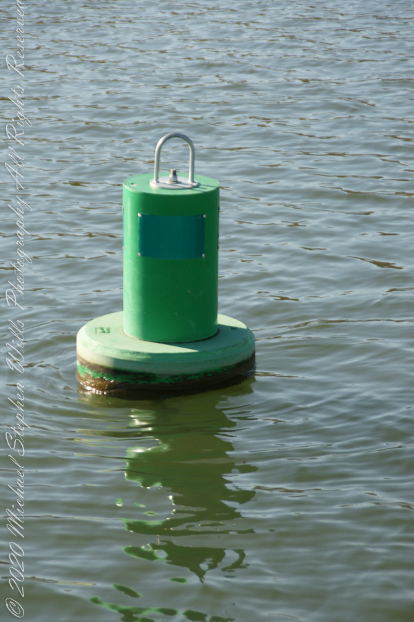
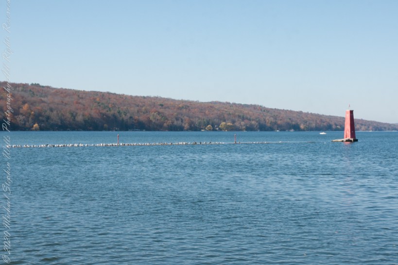
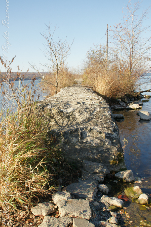
The West Lake Shore. This photograph captures the electric line that powers the Red Tower light. Seagulls enjoy that causeway…I’ve never seen humans walk it.
Copyright 2022 Michael Stephen Wills All Rights Reserved
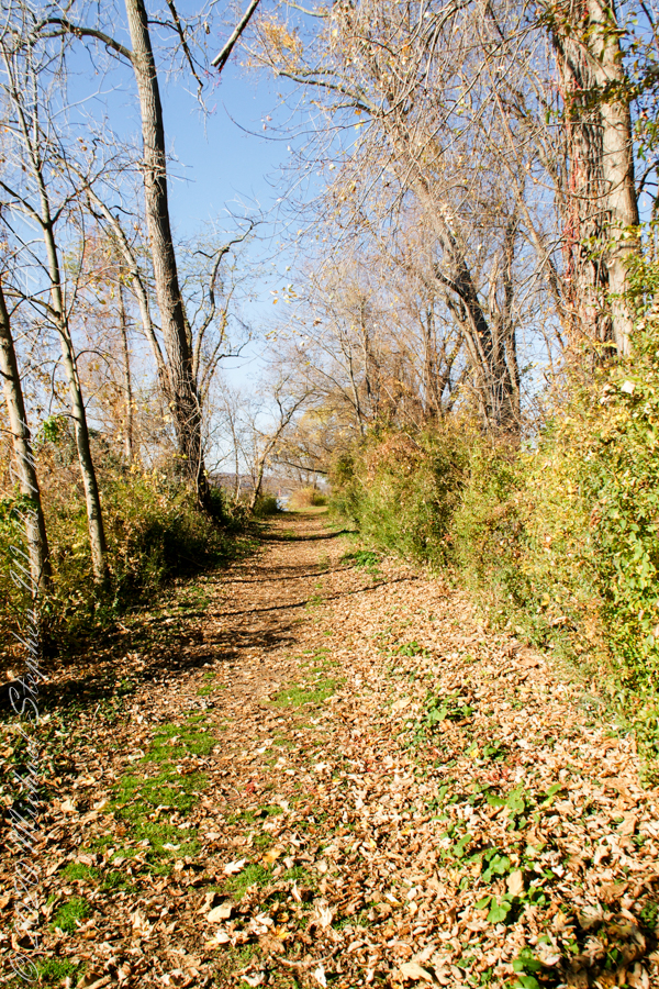
Post 1 of Lighthouse Point provided an impression of our hike along the golf course, from there we turned onto this wooded path on the shores of Cayuga Inlet.
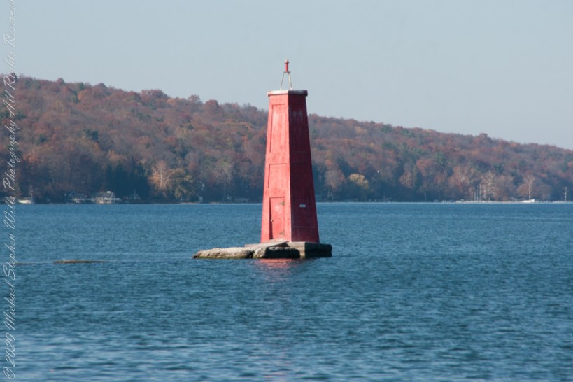
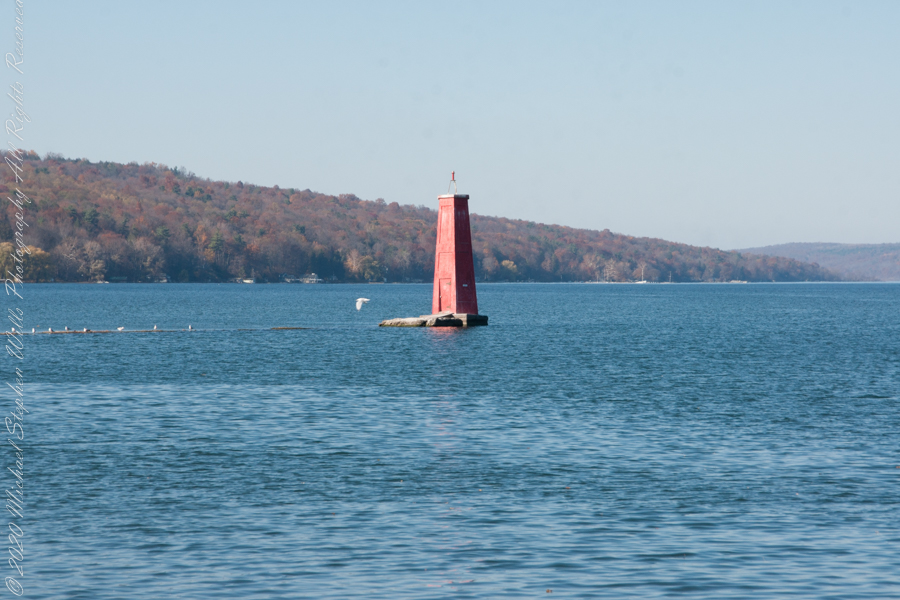
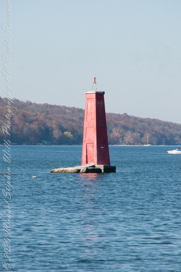
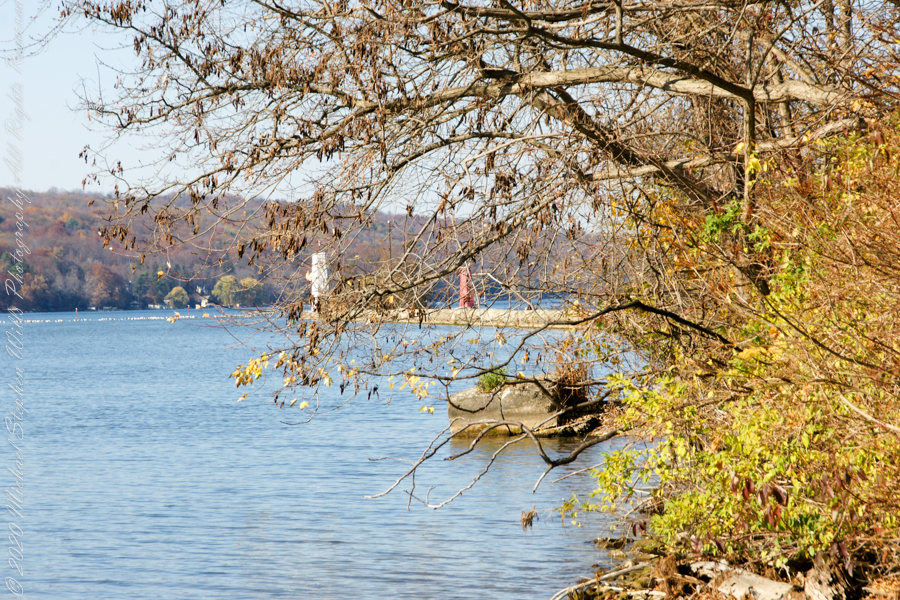
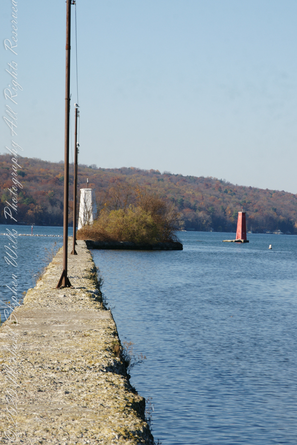
First view of the paired Lighthouses marking the Cayuga Inlet. The white tower is connected to shore by a causeway something less than a quarter mile in length. The red tower marks the other side. These navigation guides allow boats to safely enter the channel exiting the south end of Cayuga Lake. The Erie Canal connects to the north end, allowing access to the Great Lakes and, eventually, the Atlantic Ocean.
The 4-foot-high step up to the concrete causeway path is an insurmountable obstacle to some. I managed to clamber over.
Looking back to shore….
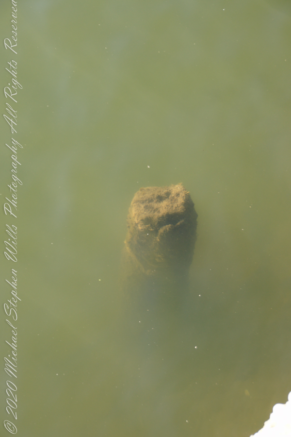
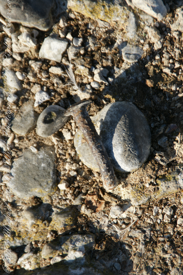
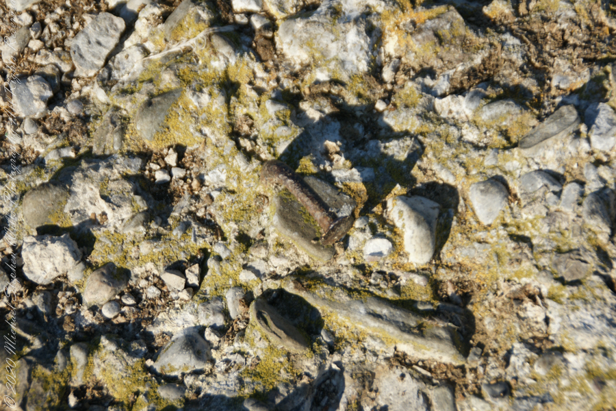
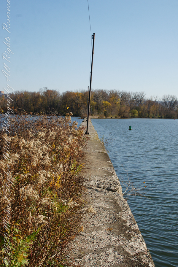
Rusted iron poles support the electric line for the white tower. They remind me of ship masts.
The straight shot back to shore.
Copyright 2022 Michael Stephen Wills All Rights Reserved
November 3rd, 2022, Blessed Us with an azure sky, an Indian Summer Day. During our walks on Cass Park Shorts we’d look across to see hikers emerging from the gold course to walk the Lighthouse causeway. After decades of longing, these Ithaca residents took upon themselves the adventure of finding the path and walking it. This series of posts documents the walk and some treasures discovered on the way.
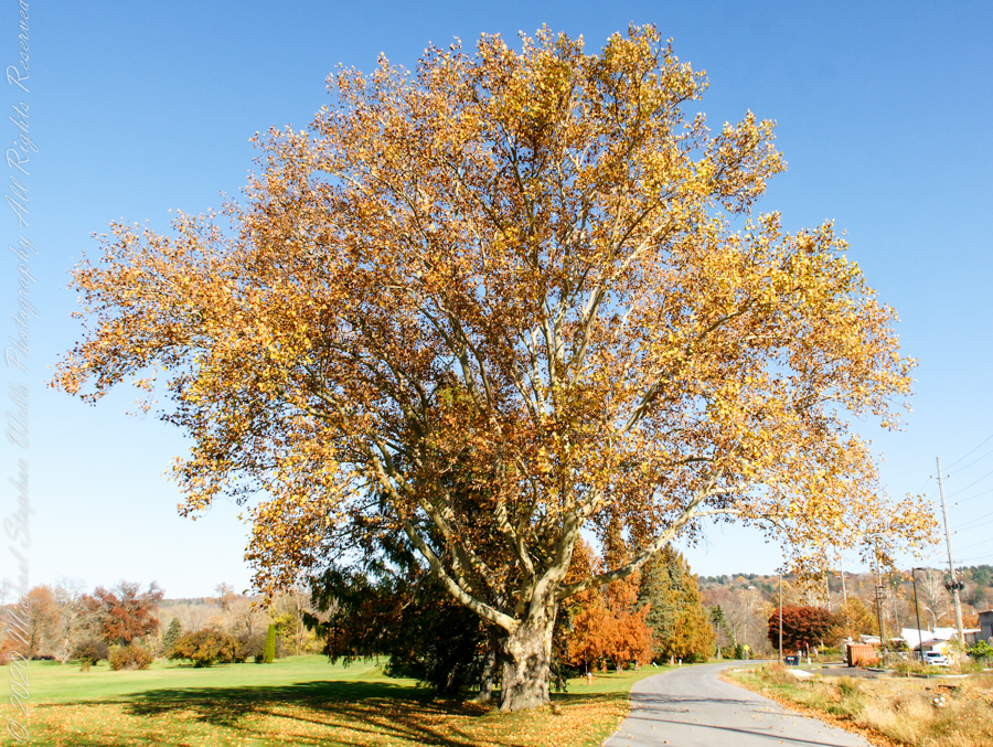
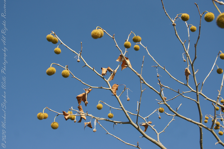
Sycamore, aka Plane Tree
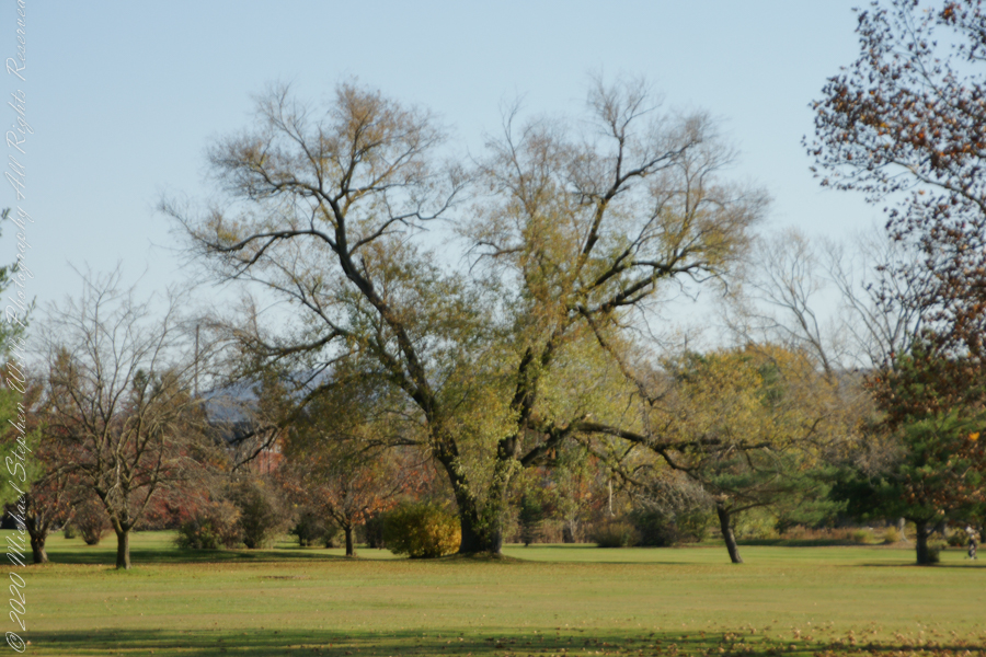
Willow on Cayuga Inlet and Newman Golf Course
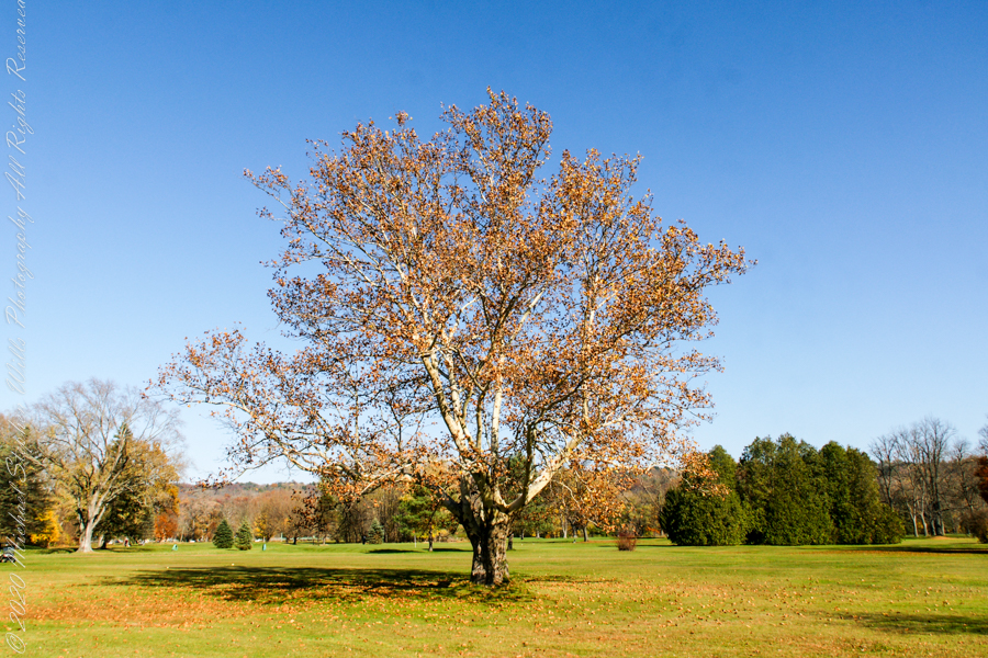
might be another Sycamore on the golf course
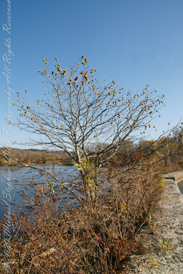
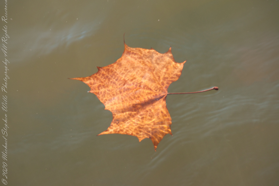
An uncultivated Sycamore sprouting from the causeway leading to the lighthouse “The reason Sycamores are also called “Buttonwood”. Children love to throw these seed heads at each other, sometimes “exploding”The reason Sycamores are also called “Buttonwood”. Children love to throw these seed heads at each other, sometimes “exploding” on impactSycamore leaf floating in Cayuga Inlet
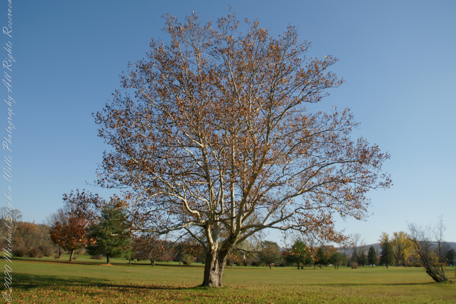
Unidentified tree on golf course
Unidentified tree on golf course
Unidentified tree on golf course
Copyright 2022 Michael Stephen Wills All Rights Reserved
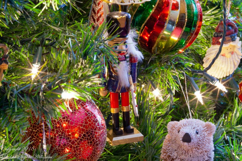
Our Nutcracker wooden figure carries a weight of memories. Early memories are of my sister, Christina’s Sugar Plum Fairy solo for Saint Aidan Parish talent program, Mom’s appreciation of performance of Swan Lake in her pre-child past, a friend of my Mom was a former dancer who taught Christina ballet. Hanging quietly, these memories swirl around the Nutcrackers open maw.
Click this photograph for my Fine Art Photography gallery
Thirteen years ago we observed New Years Day 2009 in the lobby of Winthrop Medical Center, Mineola, New York waiting for the outcome of Mom’s hip replacement surgery grateful the head of Orthopedics was performing the surgery. That year saw large changes played out in the last four years of her life, she never returned to her home of 52 years.
From then on her winters were spent with her daughter Diane in Mesa, Arizona. Mom would call us, amused at the sight of neighbors walking by in 50 degree weather in winter parkas. She was well known in Albertson for her habit of walking everywhere, it was fortunate she never needed to learn how to drive a car: all she needed was readily at hand.
I needed to return to Albertson several times a year to our childhood home. December 2009, Pam and I melded the trip with a day in New York City. Memories of Mom’s enjoyment of Swan Lake drew me to purchase tickets for The Nutcracker. The New York City Ballet has performed The Nutcracker every Christmas season since 1954, when I was one year old. The 56th performance was our first.
As with Dante’s version of hell, the David H. Koch Theater has rings. I sprang for the highest ring, the fourth, the least costly and, optimistically, the best vantage to view the formations of grouped dancers.
A full orchestra is dedicated to each performance, the hall acoustics are fabulous, and we were able to appreciate the scenes, the grouped dancers and, even, the soloists. The last scene of the first act, the Snowflakes (or Snow Crystals), brought tears to my eyes, the music, the scene was impossibly beautiful and brought back some experiences of mine in winter nature.
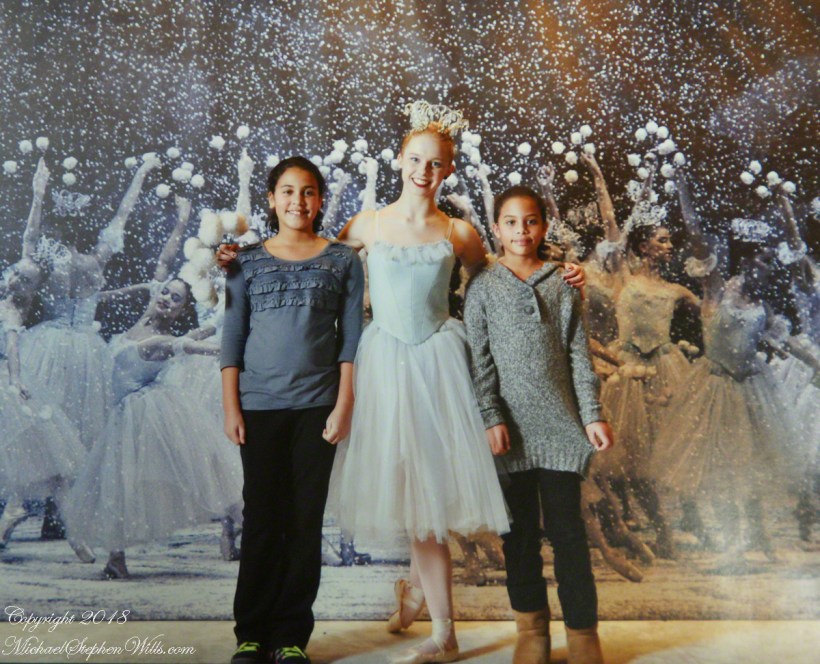
We were hooked after that, immersed in the very real (i.e., non-virtual) alternate reality at least two Sunday afternoon performances each year, seeing all Tchaikovsky’s ballets in the style of Balanchine for which the New York Ballet is famous. For the 59th season of The Nutcracker were brought two granddaughters, took fourth third row orchestra seats. We marveled at the experience. It included, during intermission, a photo session with a character from the performance.
Here they are with a Snowflake. This is a scan of one of the 8 x 10 prints we received from this session.
Nia and Gabby with the Nutcracker Ballet character “Snowflake” during the intermission of a December 2012 performance.
We planned to share a performance of Swan Lake with Mom during the September 2013 season, in her 90th year. Mom passed away in her birth month, June, 2013.
In November 2004, a visit to Canyon de Chelly with guide Hadley Tsosie revealed ancient petroglyphs and ruins, highlighting Navajo culture and the canyon’s unique beauty.
On November 3, 2004 my son, Sean, and I made our way to Chinle, Arizona on the Navajo Reservation at the mouth of Canyon de Chelly.
The next day, driving a rented 4 wheel drive, we arrived at the visitor center, at dawn, and there met Hadley Tsosie who worked as a guide. This is how you do it, if learning about the Canyon is your goal. It is possible to walk, unaccompanied, into the canyon to view the “White House” and this I highly recommend. Tourists can also drive around the rim to various overlooks. This is what most people do.
The canyon is still farmed and the tribe only allows visitors when accompanied by a guide. Only Diné (Navajo) are certified as guides. They know the rights of way and the preferences of the landowners.
We negotiated with Hadley to take us for half a day for our interest in petroglyphs and ruins. It is important to start early when the sun is low in the sky, when directly overhead the details of ruins and petroglyphs are washed out by the light. Catching the late afternoon/evening sun is also an approach that requires detailed knowledge of the route, taking into account the time of year.
Hadley was an excellent choice, though he was our only option on that day. He was fluent in Navajo beliefs, the lore of the canyon and generous in sharing what he knew.
Here is Hadley, approximately 6.2 miles into the canyon with the “Ledge Ruin” behind. We arrived at the junction just in time, before the sun was high enough to wash out the ruin. It is slow going into the canyon what with the deep sand and water that must be negotiated. Hadley did the driving and was expert. We passed other parties bogged down in the wet sand. I do not believe it was luck that kept us moving . We stopped many times to talk and admire the petroglyphs and pictographs.
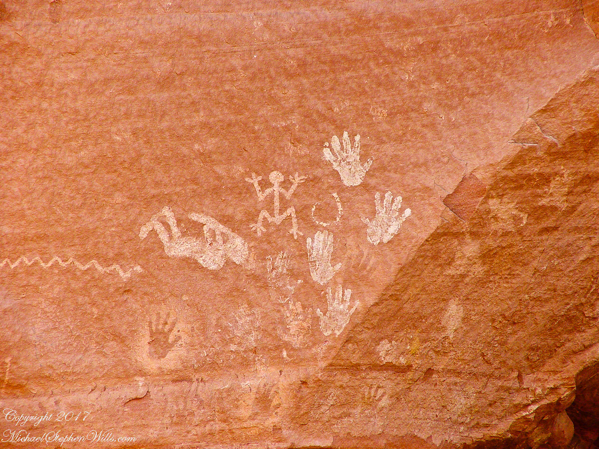
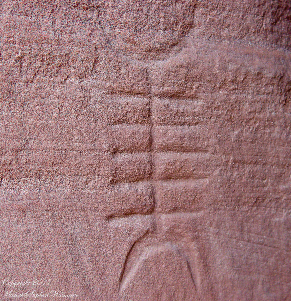
Petroglyphs are symbols incised, or cut, into the surface (the name means petro, “rock”, glyph, “symbol”). In the desert climate of the southwestern USA a thin, dark pigment forms on rock surfaces of overhanging cliffs. The pigment forms from infrequent precipitation, in the form of water, flowing downward over the surface or even dew. The high heat of the desert drives a chemical reaction between water, clays, iron and manganese oxide to form a coating on the rock surface. The dark coating, called “desert varnish”, contrasts with the underlying rock. When it is scraped away a line forms. Many of the petroglyphs were of this form. Others were carved into the rock itself, more time consuming and durable. No one knows when the petroglyphs were made, they were always there are respected. People have inhabited Canyon de Chelly for over a thousand years. The word pictograph has a different meaning when used to describe prehistoric art. The earliest writing were symbols incised in wet clay, then allowed to harden. The pictographs we viewed was prehistoric art, mostly white pigment on the red rock, outlines of hands. There were also kokopelli, the outline of a flute player and jagged lines, symbolizing, Peter told us, lightening.
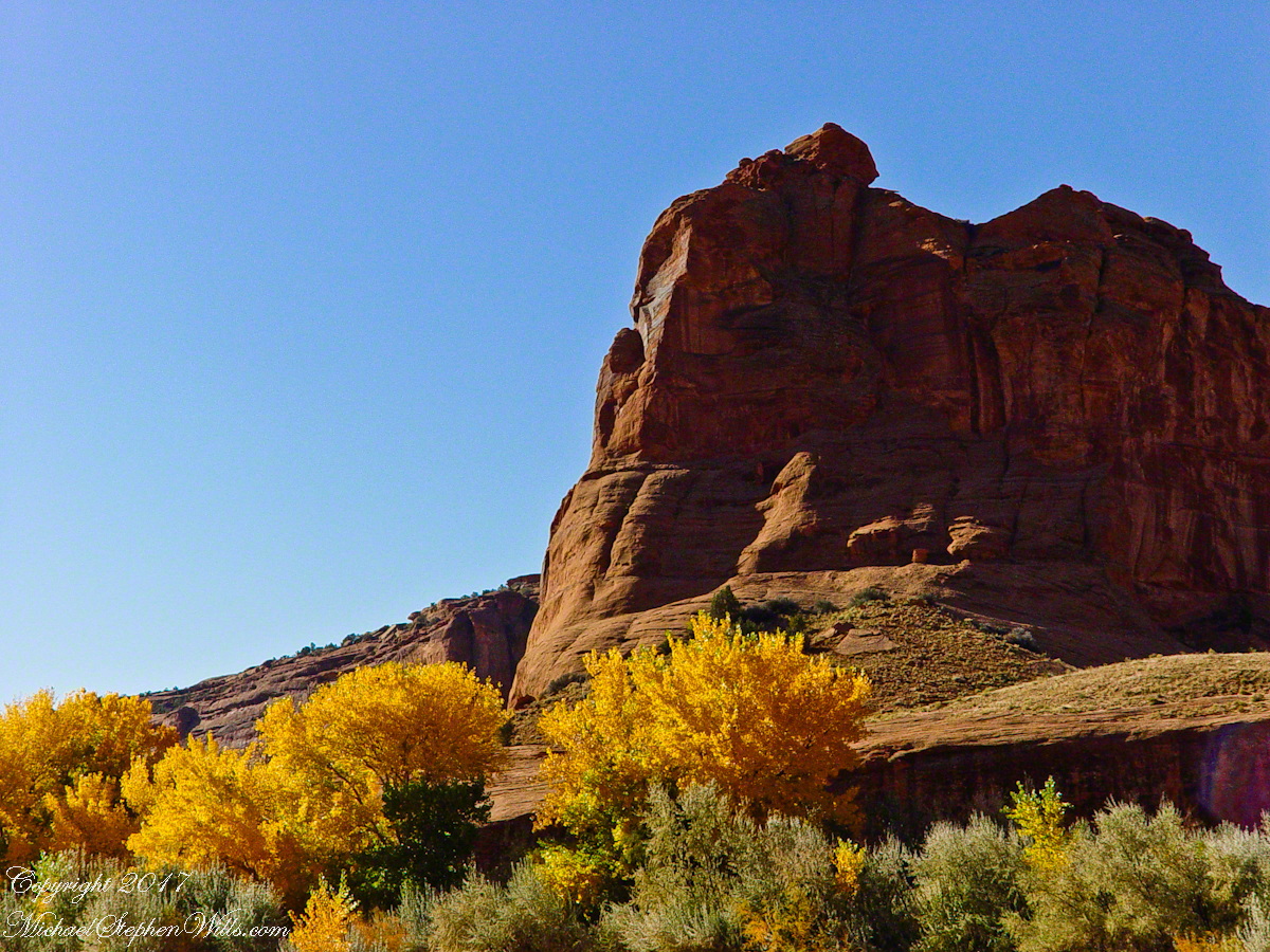
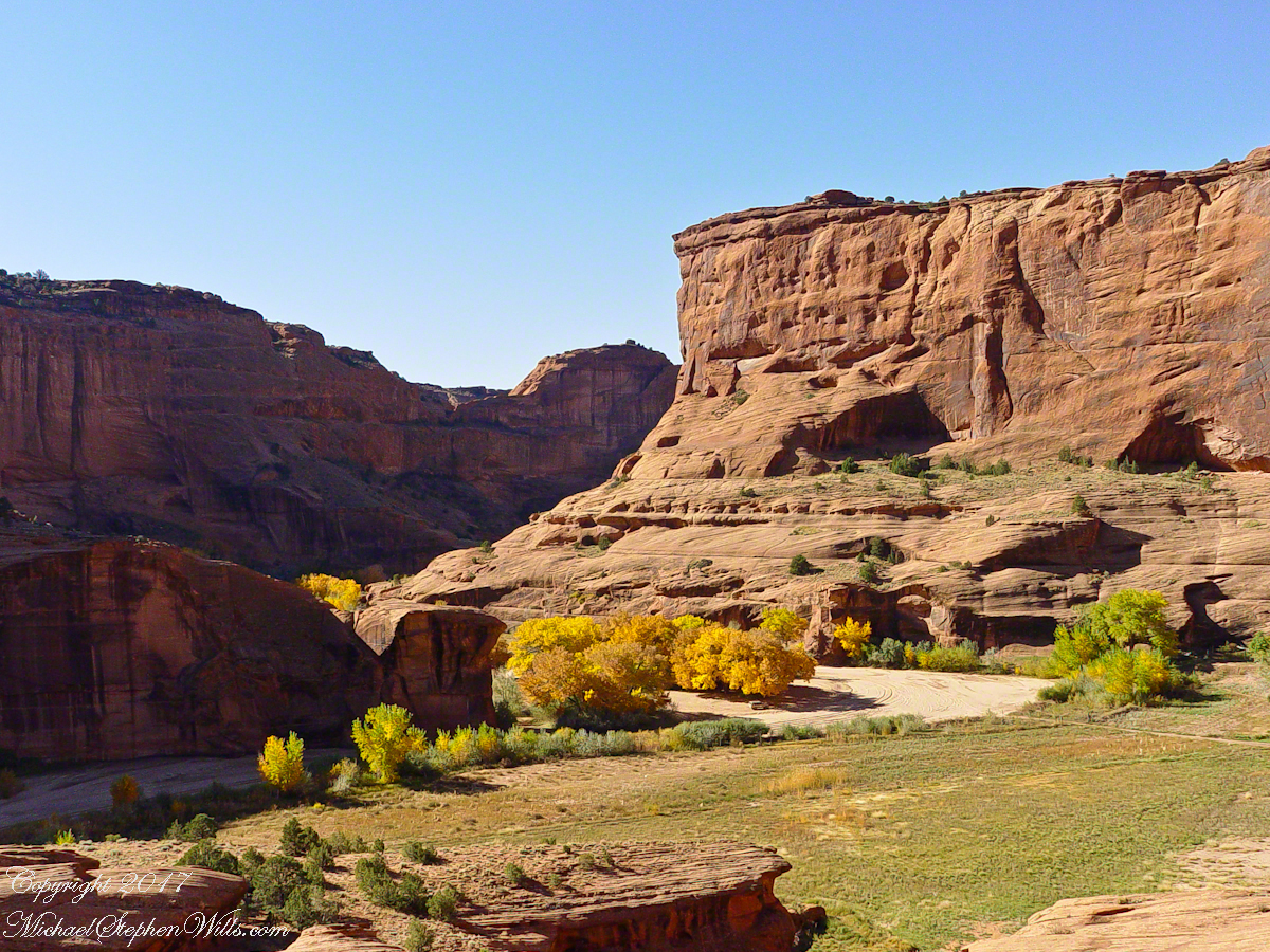
In November the cottonwoods were in fall foliage, a brilliant yellow under a cloudless sky. The sun is lower in the south and rises later. The Navajo Reservation follows daylight savings time, unlike Arizona. This November morning the sun rose around 7:45 am, so if you are not an early riser this time of year is an excellent choice for a Canyon de Chelly tour.
Looking southwest from the Canyon de Chelly visitor center toward the eastern escarpment of Black Mesa of the Hopis.
The village of Chinle is a “census designate place”, in other words it only exists because people live there, it was not formally recorded in “official” records. On the Navajo reservation, people lived here beyond recorded time. It is called in their language “flowing out”, where live giving water flows out from the canyons.
There is a fine Best Western in Chinle, better than most of that brand and the only choice for mile and miles and miles.
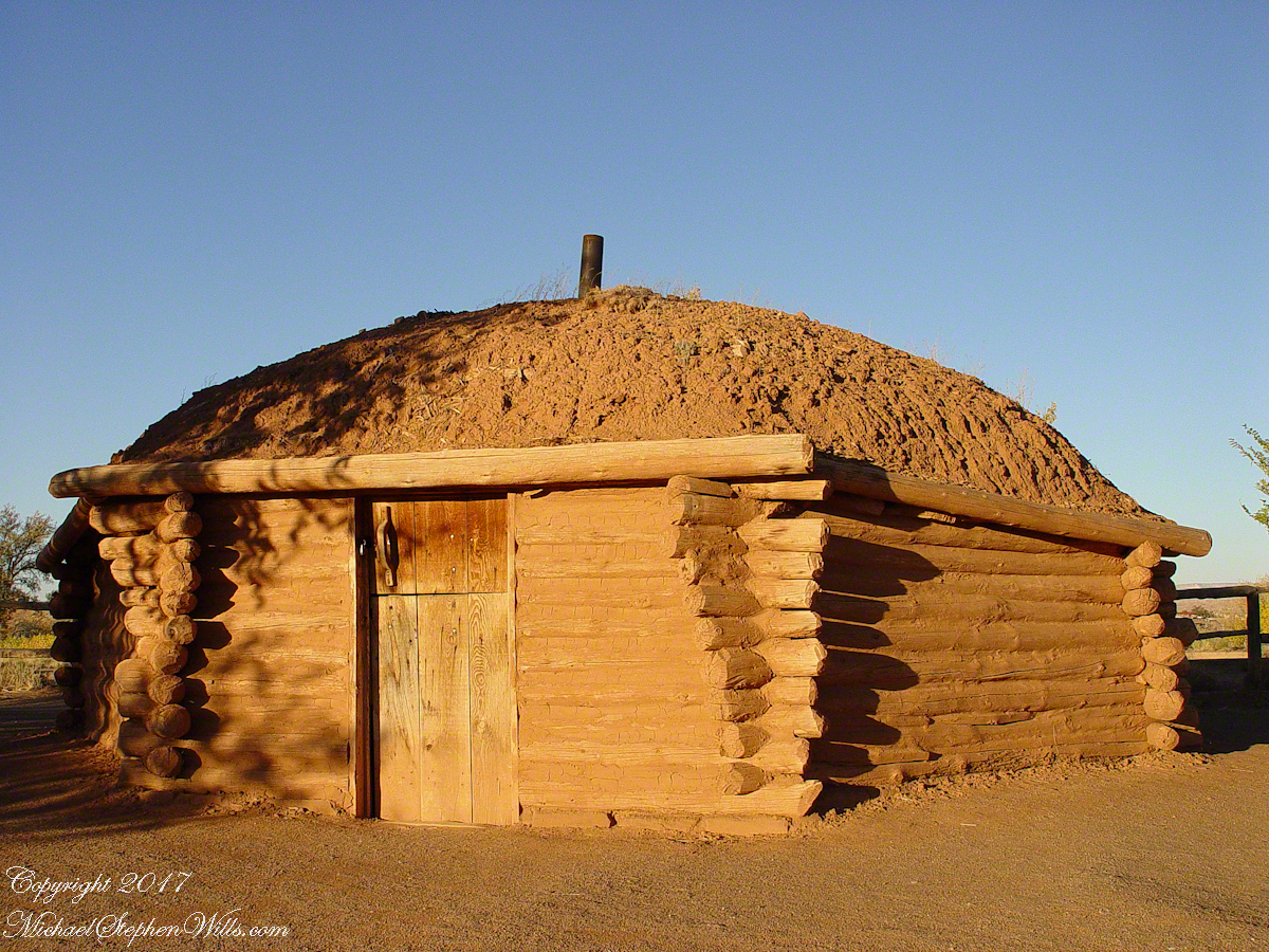
This is a cribbed log hogan. The domed earthen roof keeps the interior cool in hot weather and, along with a fire, warm in the winter. The Navajo hogan entrance faces east.
In Junction Ruin Musings, the previous post, a ruin from the Anasazi people was contemplated. Above is a traditional Navajo dwelling from a later, more secure, time.
A good place to cook, read and sleep in hot weather. The entrance faces east and, for this one, the view was superb.
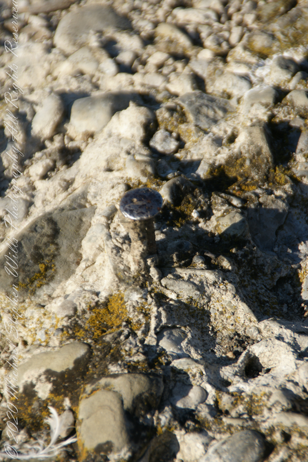
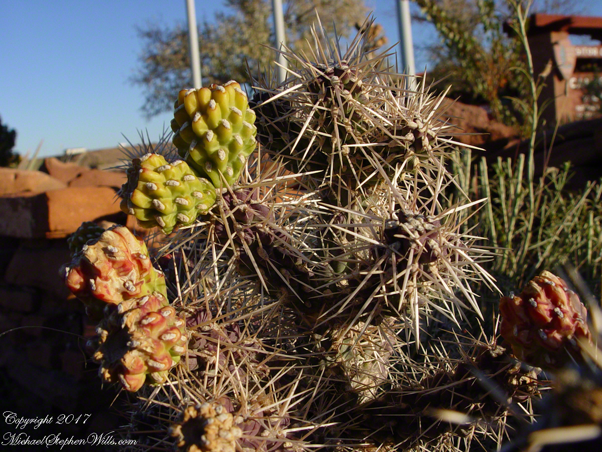
Ouch!! Everywhere in the southwest, watch where you tread.
A Native American, seeing the flute playing Kokopelli, hears in the mind the sonorous melodies of their native flutes carried in as if on the wind. The hands waving in rhythm, “Here we are.”
Canyon de Chelly symbol carved into red sandstone cliff representing a clan sign.
I recall our guide, Peter, describes this as a scorpion.
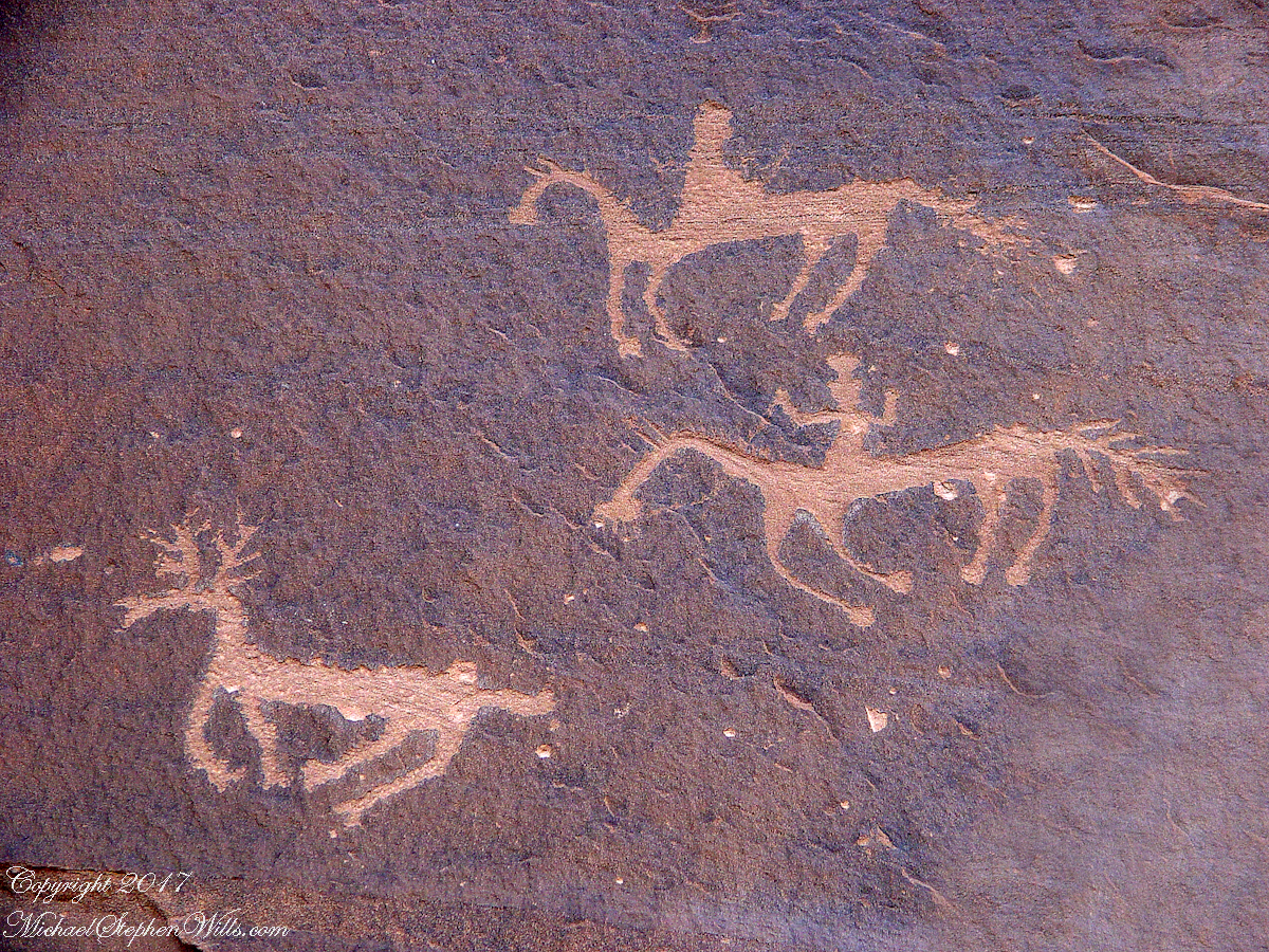
Canyon de Chelly petroglyph, desert varnish over red sandstone. Image is dated by representation of horses, brought by europeans.
The feeling of movement and the story invoked viewing this drawing etched carefully on the rock demonstrates we are in the presence of an accomplished artist. The story of the times for us to learn from.
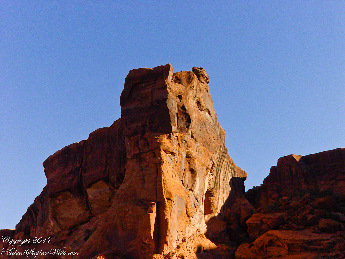
Red sandstone formation on ridgeline, north side of Canyon de Chelly is remember by the Navajo for the story of the Raven Woman.
A Navajo woman, fleeing Apache captors, flew over this cliff, or seemed to. Survival depended on knowing how to run over slickrock without stumbling and to know where and how to disappear into the rocks.
Canyon de Chelly below the first division into tow arms, the junction. This is looking south east. The cottonwoods are in autumn foliage.
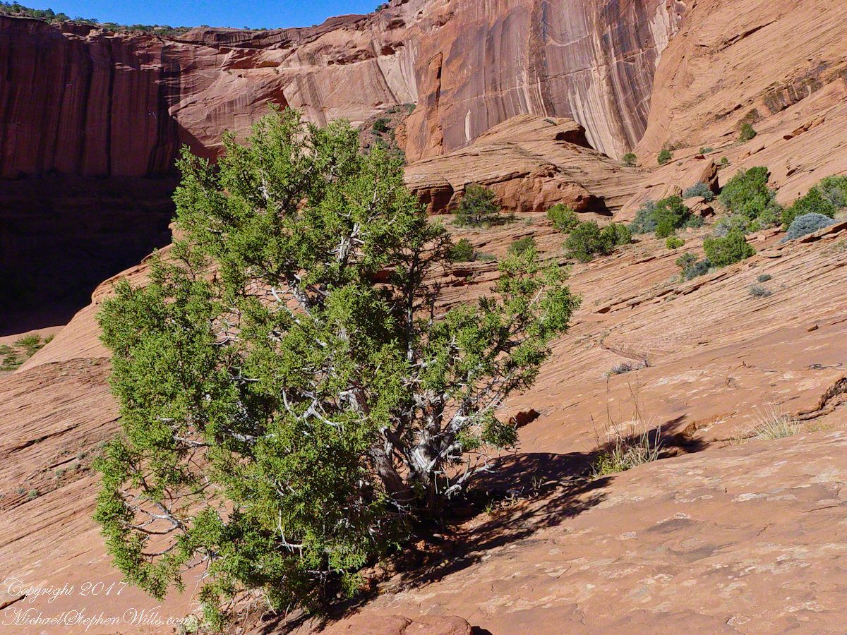
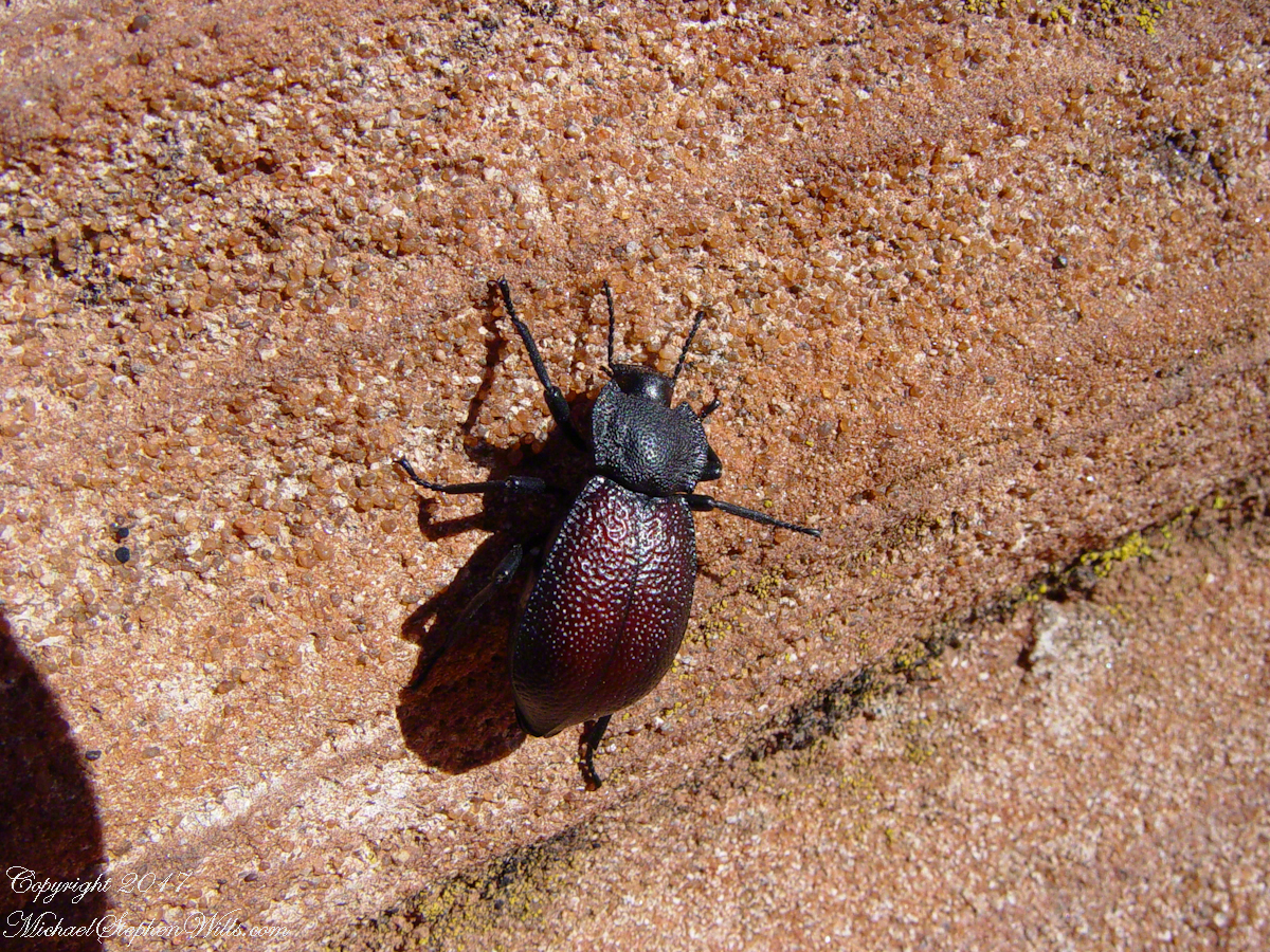
Cahyon de Chelly is is possible here to climb out of the canyon over these lower slopes over what is called slickrock. In the foreground is a juniper tree.Canyon de Chelly vista from a slickrock ledgeA two inch dung beetle crawls up sandstone slickrock, the origin of this stone apparent from the visible sand granules within an apparent clay matrix. The stone grain, described as cross bedded, suggests this was a former dune of wind blown sand composed of remnants of the Ancestral Rock Mountains.
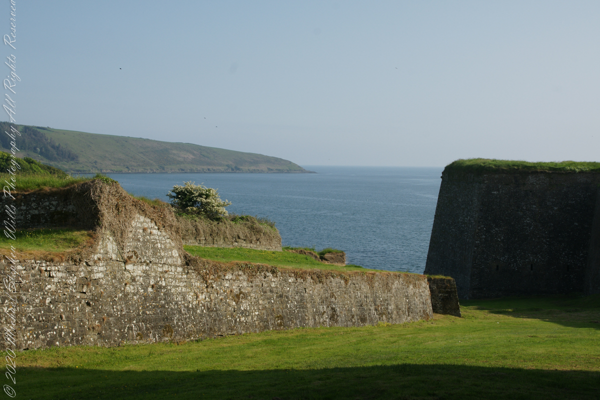
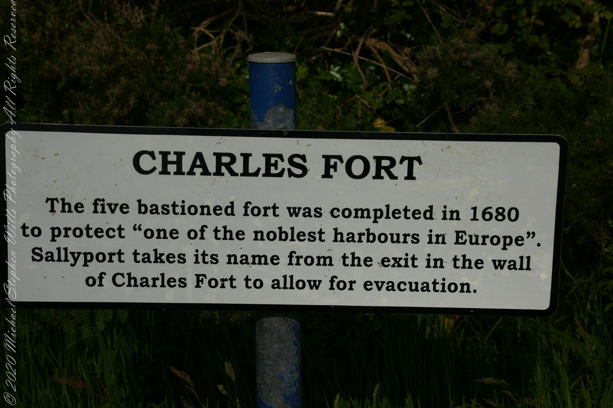
A half mile footpath, marked in red on the following Google Earth view, leads from the Charles fort sallyport, along the shoreline cliffs, surmounted by working farmland and looks toward the Celtic Sea.
To “sally” is to suddenly charge out from a besieged place against the enemy. The word is also used as a noun. It can also be used to describe our walk, as a sally to an unusual place.
The town above the walk is named Sallyport
Here is a view of the Celtic Sea from the Sallyport
From Wikipedia: “The Celtic Sea receives its name from the Celtic heritage of the bounding lands to the north and east. The name was first proposed by E. W. L. Holt at a 1921 meeting in Dublin of fisheries experts from Great Britain, France, and Ireland. The northern portion of this sea was considered as part of Saint George’s Channel and the southern portion as an undifferentiated part of the “Southwest Approaches” to Great Britain. The desire for a common name came to be felt because of the common marine biology, geology and hydrology of the area. It was adopted in France before being common in the English-speaking countries; in 1957 Édouard Le Danois wrote, “the name Celtic Sea is hardly known even to oceanographers.”[3] It was adopted by marine biologists and oceanographers, and later by petroleum exploration firms. It is named in a 1963 British atlas.. A 1972 article states ‘what British maps call the Western Approaches, and what the oil industry calls the Celtic Sea […] certainly the residents on the western coast [of Great Britain] don’t refer to it as such.'”
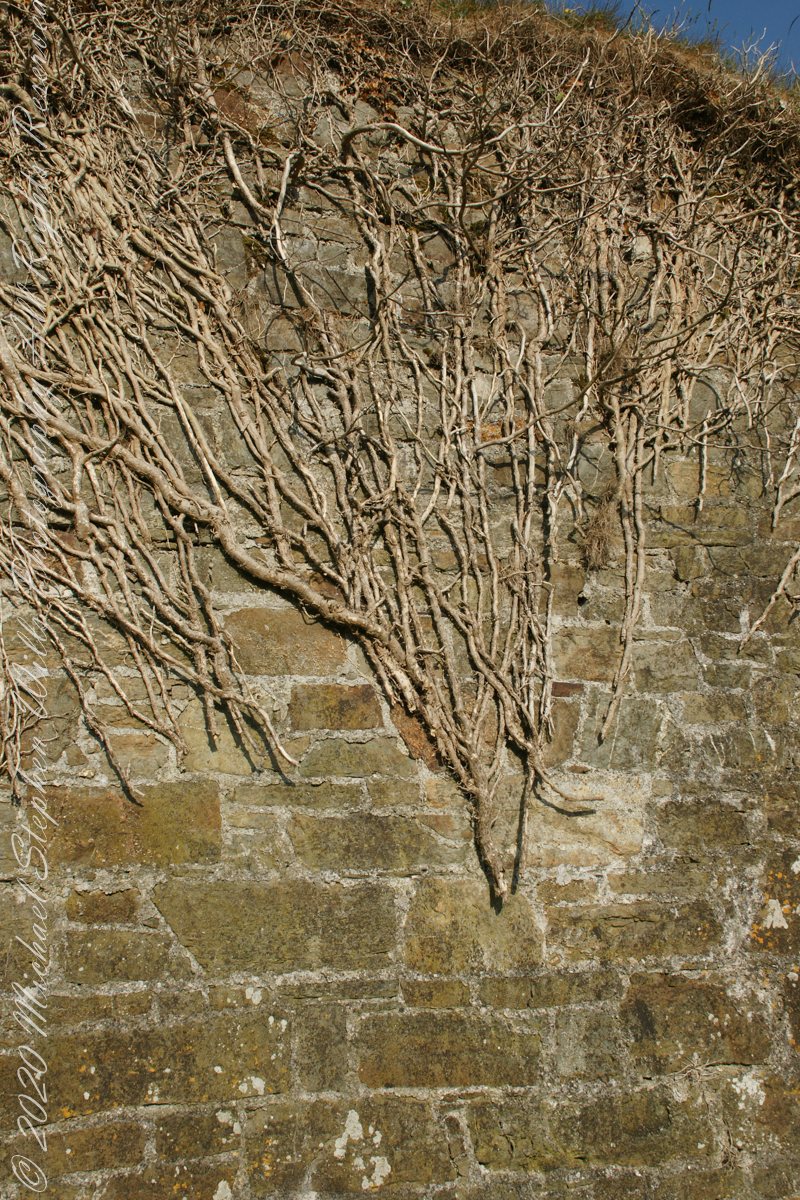
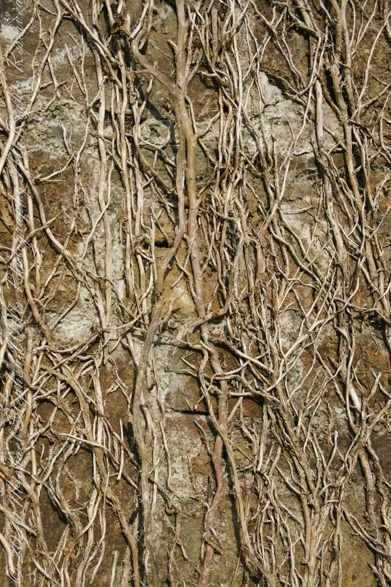
Views of the wall from previous photograph. The vines were separated from roots to preserve the walls, leaving interesting patterns.
The distant land to the right, beyond the walls, is the Old Head of Kinsale.
Informational placards along the walk give background to the views enjoyed by hikers.
Here is the above view.
SONY DSC
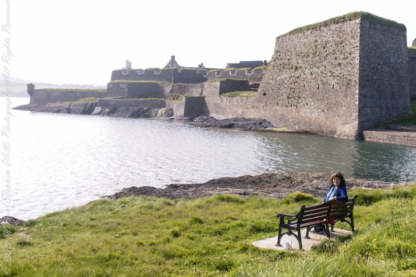
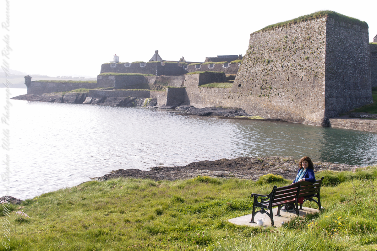
Pam, at start of our walk. Poking above the walls is the Charles Fort Lighthouse. “This lighthouse is a directional light marking the way to safe anchorage close to Kinsale. In 1665 King Charles II granted letters patent to Sir Robert Reading to erect six lighthouses on the coast of Ireland, including one at Barry Oge’s castle, near Kinsale later to become Charles Fort. The original structure would have had a coal fire on its roof. In 1810 powers given to the Commissioners for Barracks and others between 1767 and 1806 were all vested in the Corporation for Preserving and Improving the Port of Dublin or the Ballast Board. This board took over the general lighting and marking of the coast when fourteen lighthouses were transferred to it including that at Charles Fort. This lighthouse, built in 1929, is one of the more recent to be found along the coast, with most dating to the nineteenth century. A new mains powered light at Charles Fort Lighthouse was put into operation on the 14 April 2004 marking the end of a long era of gas and oil powered lights in Ireland.” Quote is from the link provided in references.
May 30, 2014 outside of Charles Fort, Kinsale, County Cork, Republic of Ireland
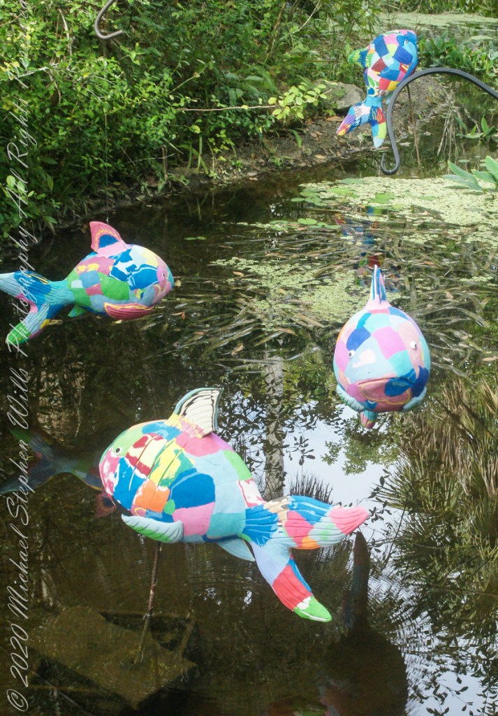
50 recycled flip flops were used by Ocean Sole Africa Project artists to create each Reef Fish sculpture from a 2019/2020 exhibit hosted by McKee Botanical Gardens, Vero Beach, Indian River County, Florida.
Coral reef fish live among or in close relation to coral reefs. Coral reefs form complex ecosystems with tremendous biodiversity. Among the myriad inhabitants, the fish stand out as colorful and interesting to watch. Hundreds of species can exist in a small area of a healthy reef, many of them hidden or well camouflaged.
Reef fish have developed many ingenious specializations adapted to survival on the reefs. Safe habitats, many different species of fish inhabit coral reefs where they are protected from predators and find food. In turn, reef fish eat algae, preventing overgrowth and smothering of the coral animals. Common fish in Caribbean reefs have interesting names: parrot, angel, puffer, surgeon and clown.
Coral reefs occupy less than 1% of the surface area of the world oceans but provide a home for 25% of all marine fish species. Reef habitats are a sharp contrast to the open water habitats that make up the other 99% of the world oceans. Loss and degradation of coral reef habitat, increasing pollution, and overfishing including the use of destructive fishing practices, are threatening the survival of the coral reefs and the associated reef fish.
Copyright 2022 Michael Stephen WillsAll Rights Reserved