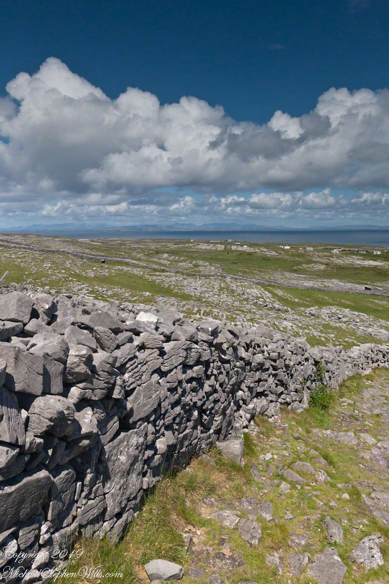
From the heights of Dun Aonghasa the karst, a type of limestone, of Inishmore falls away for the sight of the twelve pins against Galway Bay. These unworked, barren slopes have a pale green covering growing seemingly on air.
On approach to Dun Aonghasa, Cottage Road dips closer to the road for this view of a field with enough dense grass for five cows to feed, the rest on the cushioning green. Where did this come from?
The answer is simple hard work, hundreds, a thousand years of hauling seaweed and sand, mixing it on the barren limestone, allowing the rot of time to work. Hold it down with roots, till and refresh.
From the commanding location of Dun Aonghasa, looking northeast across Inishmore island, we can understand why the ancient builders chose this location.
We also see the transition from exposed limestone to the fields built literally from the ground up (see my post “The How of Soil”). For a closer view of island houses see my posts “Settled In” and “Cottage Road Cottage.”
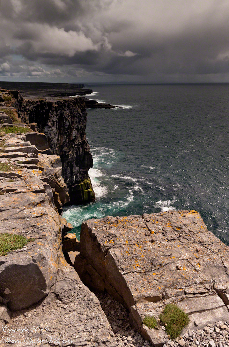
In a previous post, “Inner Ring, at last” we passed over the entrance to the inner enclosure.
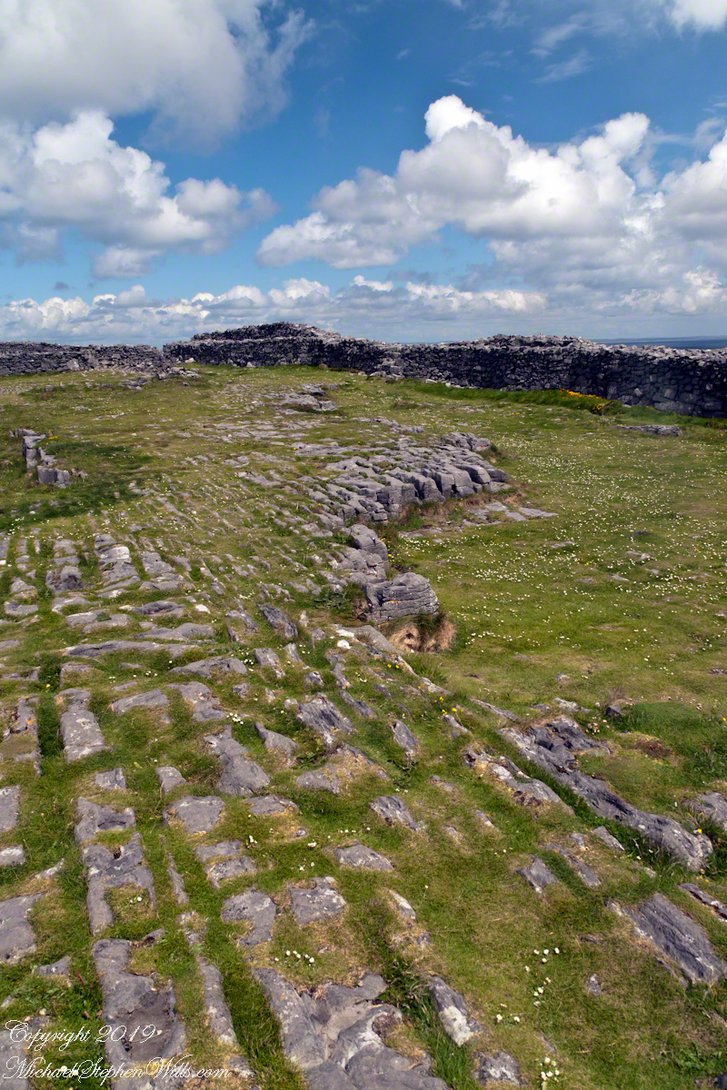
A long path through fields, karst landscapes and outer walls leads to this entrance to the inner ring of Dun Aonghasa (Dun Aengus) of Inishmore, Aran Islands, County Galway, Ireland. The image composition is as a dramatic landscape with the surrounding walls and the cloudscape of an approaching storm.
My previous post, “Inner Ring, at last”, lowered the horizon. Here, we study the base of the inner wall.
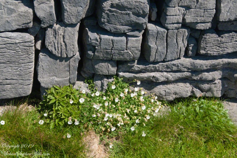
A detail of the interior wall of Dun Aonghasa (Dun Aengus) in springtime. White flowers of Sea Campion (Scientific Name: Silene uniflora) (Irish Name: Coireán mara) set against the ancient dry stone wall. Inishmore, Aran Islands, County Galway, Ireland.
We found Sea Campion throughout the west Ireland coast.
Detail of Dun Aonghasa Dry Stone Wall with White Flowers of Sea
Wishing a blessed All Saints Day (November 1st) for all my readers.
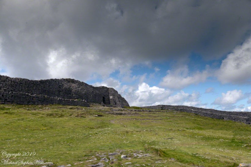
A view to the northwest from within Dun Aonghasa in springtime. The interior a karst formation (see my post, ” Galway Bay View from Dún Aonghasa”), the grikes filled with grass and a sprinkling of white and yellow flowers, a cloudscape rising over the walls. Inishmore, Aran Islands, County Galway, Ireland.
Karst Landscape with Interior Walls of Dun Aonghasa
The exposed limestone of the Aran Islands here transitions to a fertile field of grass, husbanded by generations of islanders. Photograph was taken from the path on Inishmore leading up to Dun Aonghasa.
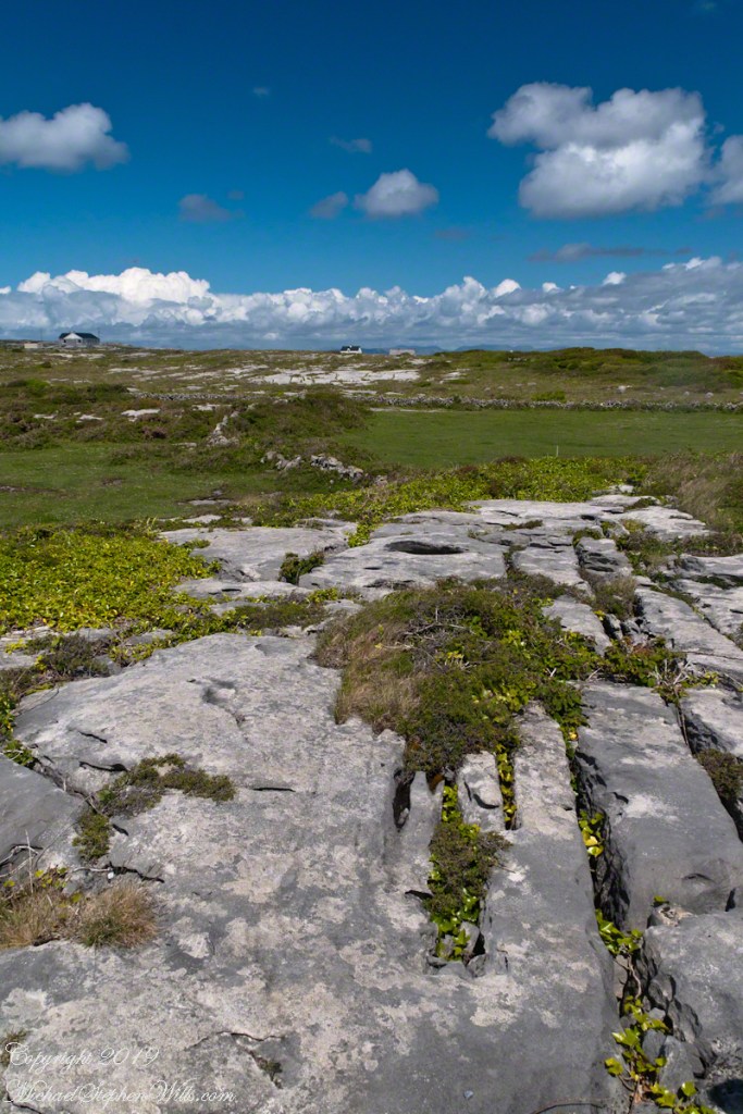
The Aran Islands are an extension of The Burren of Ireland’s Counties Claire and Galway. The word burren is from the Irish Boireann, meaning “great rock.” The glaciers that covered Ireland, retreating about 10,000 years ago, scraped down to the bedrock, exposing wide areas of limestone and dropping, here and there, large rocks. When people came along the foreign nature of the large rocks was recognized, all the more obvious for lying on the horizontally bedded, exposed limestone. We call the foreign rocks erratics. The underlying scoured rock is a pavement for a resemblance to a cobbled roadway.
The incised line, filled with grass and wildflowers, in the following photograph is called a gryke. The body of stone between the grykes are clints. Sometimes, the grykes are cross hatched and the clints resemble cobblestones or flat paving stones.
The view is northeast toward the 12 Bens of Connemara. Inishmore, Aran Islands, County Galway, Ireland
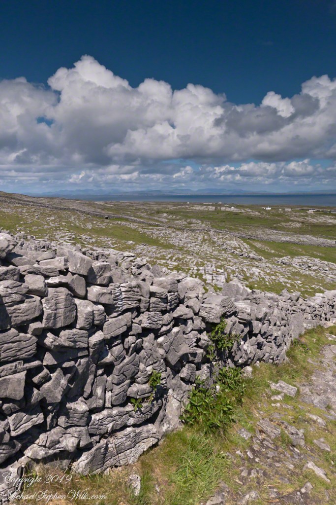
Modern stonework borders the 1/2 mile path to the inner Dún Aonghasa walls, keeping tourists off delicate plants, maintaining the integrity of this ancient site.
The view north, northwest over the walled path to Dun Aonghasa (Dun Aengus) looking across karst landscape, walled fields, farms, the North Atlantic Ocean, coast of Connemara and the 12 Bens (12 Pins) mountains. Aran Islands, County Galway, Ireland.
Admittedly, I over-planned the Ireland trip. For every day possible the venues were pre-booked and paid. In theory planning provides more flexibility when life interrupts.
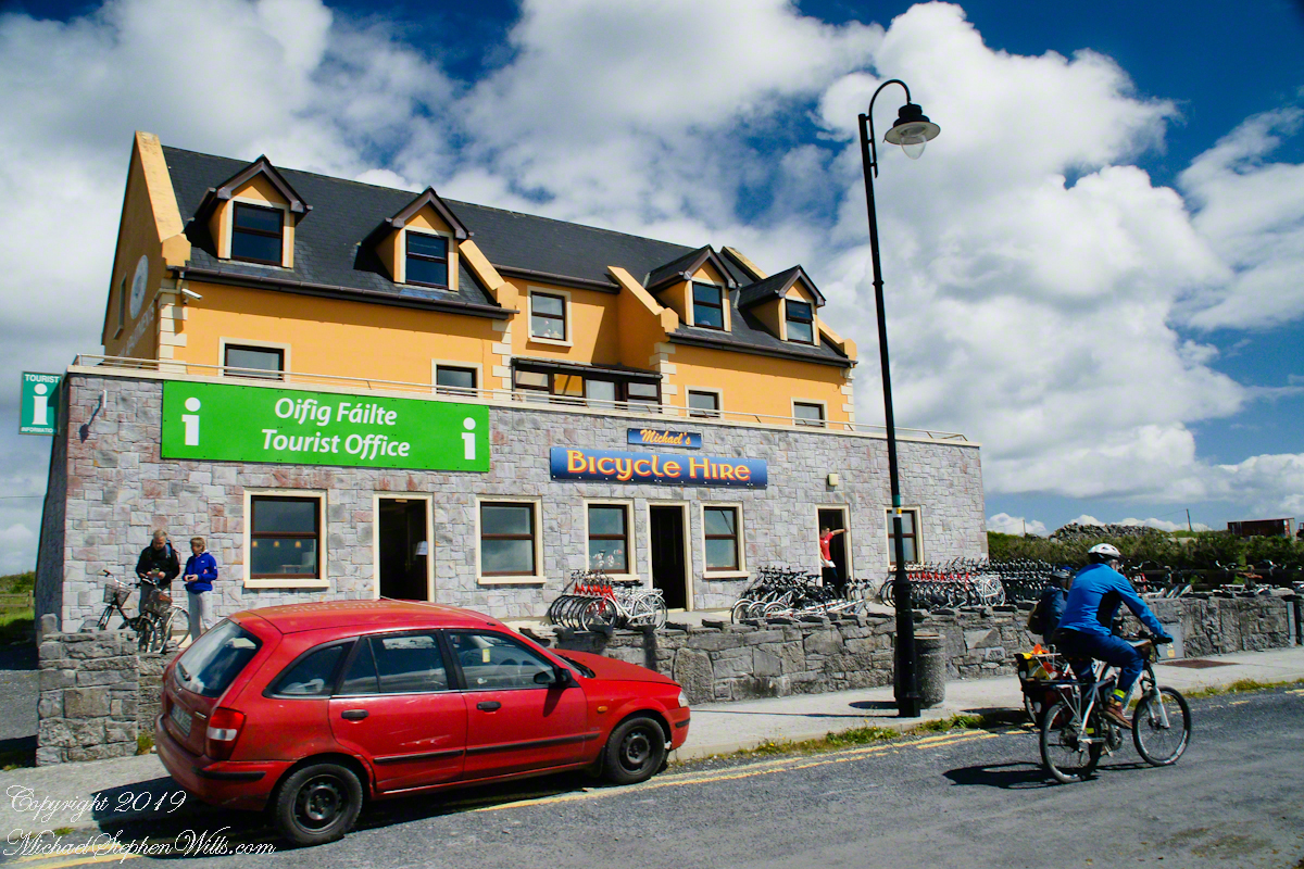
For the Inishmore planning, a perfect day, for me, was tooling around on a bicycle stopping where we pleased with welcome exercise in between. That was unrealistic, the day worked out otherwise.
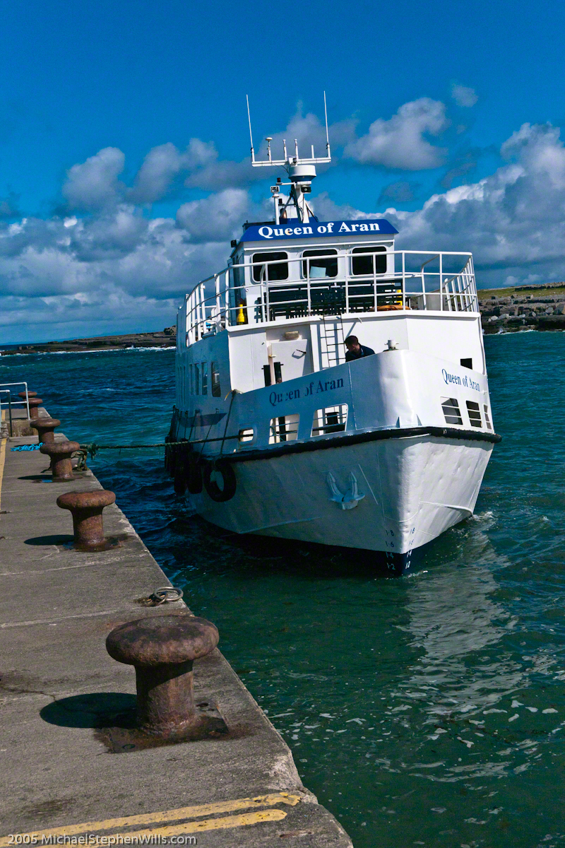
Upon disembarking from Queen of Aran, our ferry out of Doolin, onto the Kilronan quay we walked toward the bicycle rental and Pam refused to bicycle. Her objections were many, safety, impending rain, time. She did have a point about time, the ferry leaves at a set time leaving errant tourists to fend for themselves. We were unused to cycling, still Dun Aonghasa is just over 5 miles from Kilronan, less than an hour round trip. With our starting time of 11:30 am there was 3.5 hours slack for returning to the quay before the 4 pm departure. Plenty of time for wandering the ruins and stopping along the way.
We followed Pam’s advice. Still there were the many bicyclists. Perched on our horse drawn carriage, on the uphill runs, each bicyclist we passed was proof positive to Pam of the wisdom of our choice. I was silently envious of their freedom and overlooked the many mini-buses on the narrow road.
When the day comes to mind, not often, I am left with the guilty feeling of not stopping into the bicycle rental office to cancel the reservation. An email was waiting for me the next day, asking where we were. Thus, the title of this post, “Stiffed.”
Pam’s Response to this post.
Pam’s reasons for not wanting to ride a bicycle around Inishmore: “I hadn’t been on a bike for approximately 20 years. However, if it wasn’t going to rain (it did), if the narrow road was larger, if there weren’t any minibuses loaded to the gills or horse traps sharing the same single lane, I would have considered it. Sitting back and enjoying the beautiful view on our private horse trap and listening to our very knowledgeable tour guide/driver was the highlight of this adventure for me. I am sorry you felt like you didn’t have a choice.”
Pam’s correction of my statement about her being concerned about time: “Time wasn’t a factor in my decision making. I also didn’t have a problem with you biking but there was no way I was going to do that.”
Copyright 2022 Michael Stephen Wills All Rights Reserved
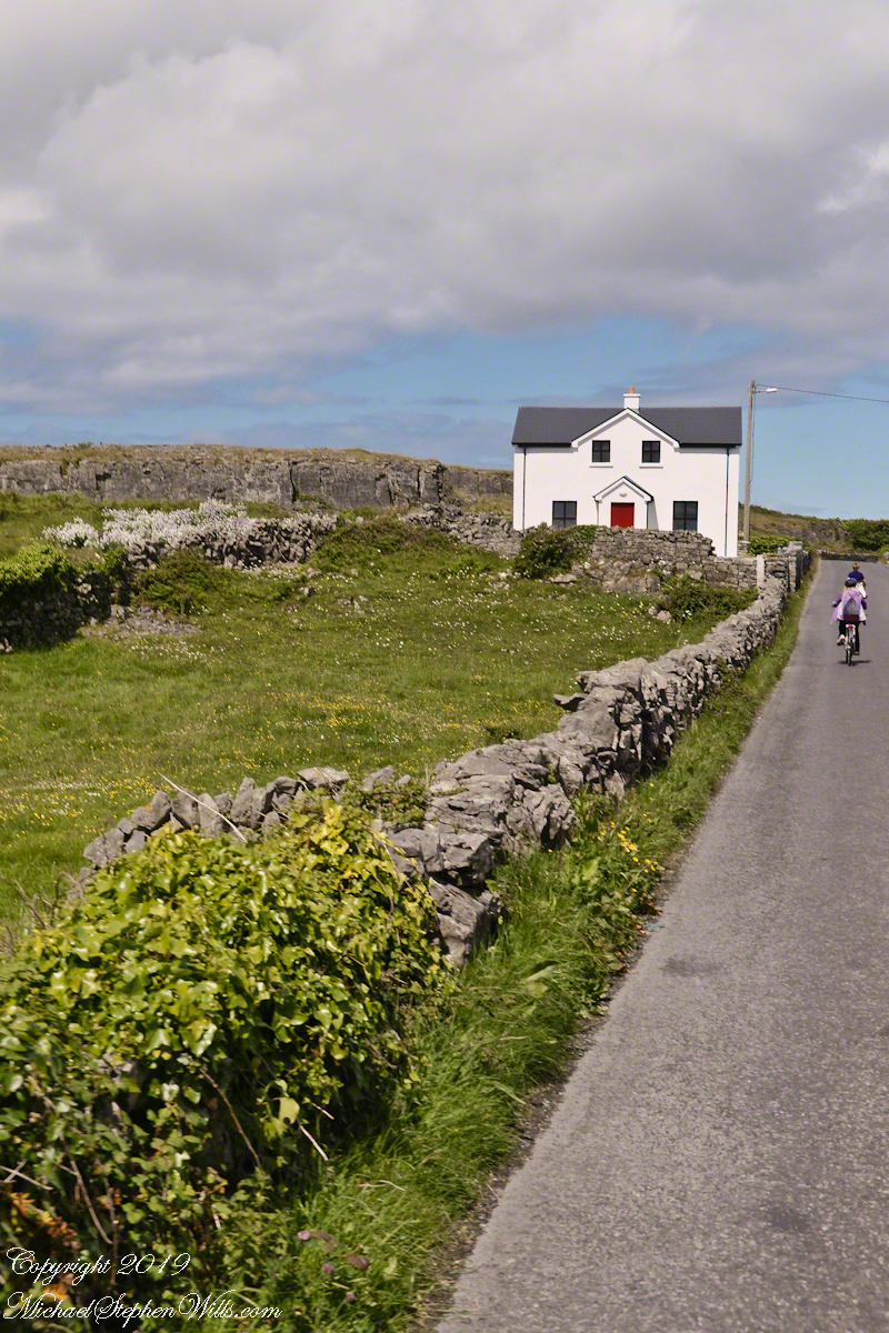
Enjoying travel on a horse trap, a type of carriage, on Inishmore , the largest Aran Island in Galway bay, we headed up Cottage Road from Kilronan, the main island settlement. It was from Kilronan we disembarked from the ferry, hired the driver and trap. Our destination an Iron Age fort, Dun Aengus, and sights along the way.
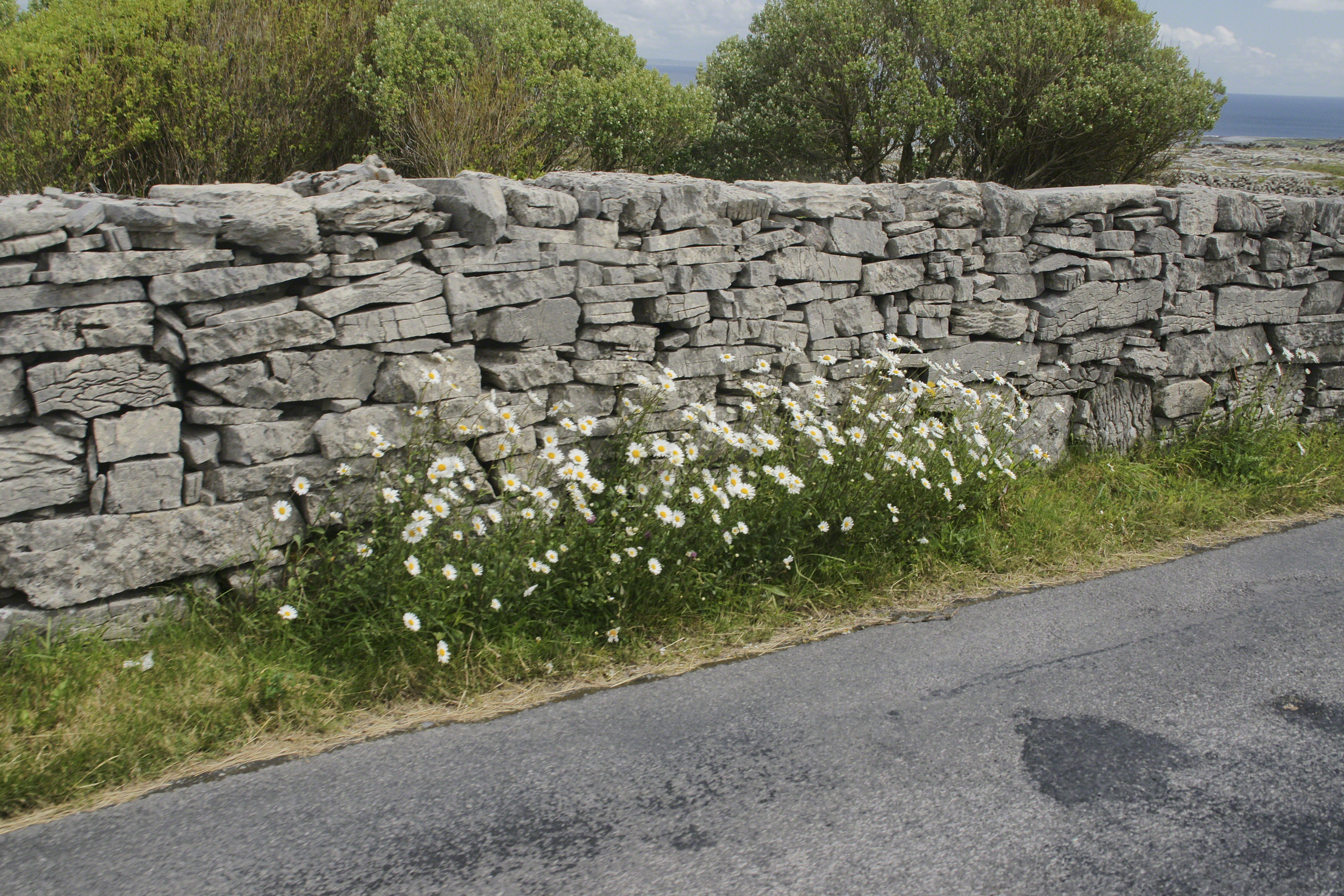
Dry Stone walls abound throughout Ireland. Ancient walls, buried in peat, were discovered in County Mayo and dated to 3,800 BC. This is a field wall on Cottage Road with daisies growing at the wall base.
The wall is composed of stones, not rocks. I have read in places a stone is a rock put to use or shaped by human hands. Other usages have rock and stone used interchangeably. For example, an internet search on “Dry Rock Wall” will return hits on the same. “You pays your money and takes your choice.”
Sources for this post: search Wikipedia for “Dry Stone”.
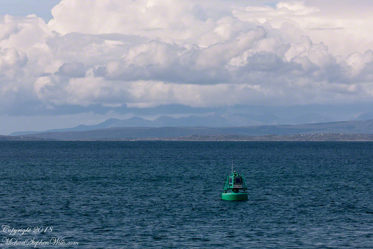
The approach to Killeany Bay of the Aran Island Inishmore is very dangerous, guarded by a Lighthouse on Straw Island to the South and the Killeany buoy to the North.
This view is to the north, northwest from a ferry en route to Inishmaan through Galway Bay. In the distance is the Connemara and the 12 Bens (12 Pins) mountains. Aran Islands, County Galway, Ireland.
There of stories of this buoy coming unmoored. October 27th 2012 it went adrift. An Aran fisherman, Micheál Seóighe (Ml Joyce) and his boat Naomh Beanán tracked it down, hauled it back to the harbor. The buoy was back in service shortly after.
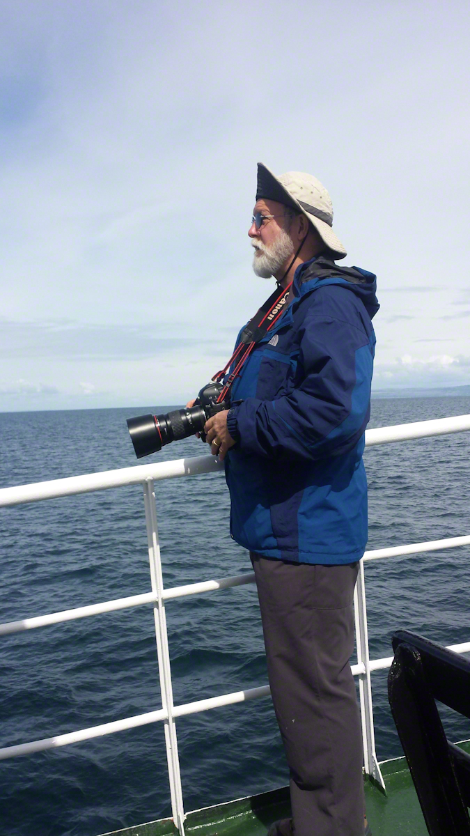
Here is a photograph of me with the camera used. It is a Canon EOS 1Ds Mark III with a Canon lens 200 mm f2.8/L. I am standing on the deck of the Queen of Aran ferry out of Doolin next to the Cliffs of Mohr.
Pam Wills took this photograph with her Samsung Galaxy 4 smart phone.