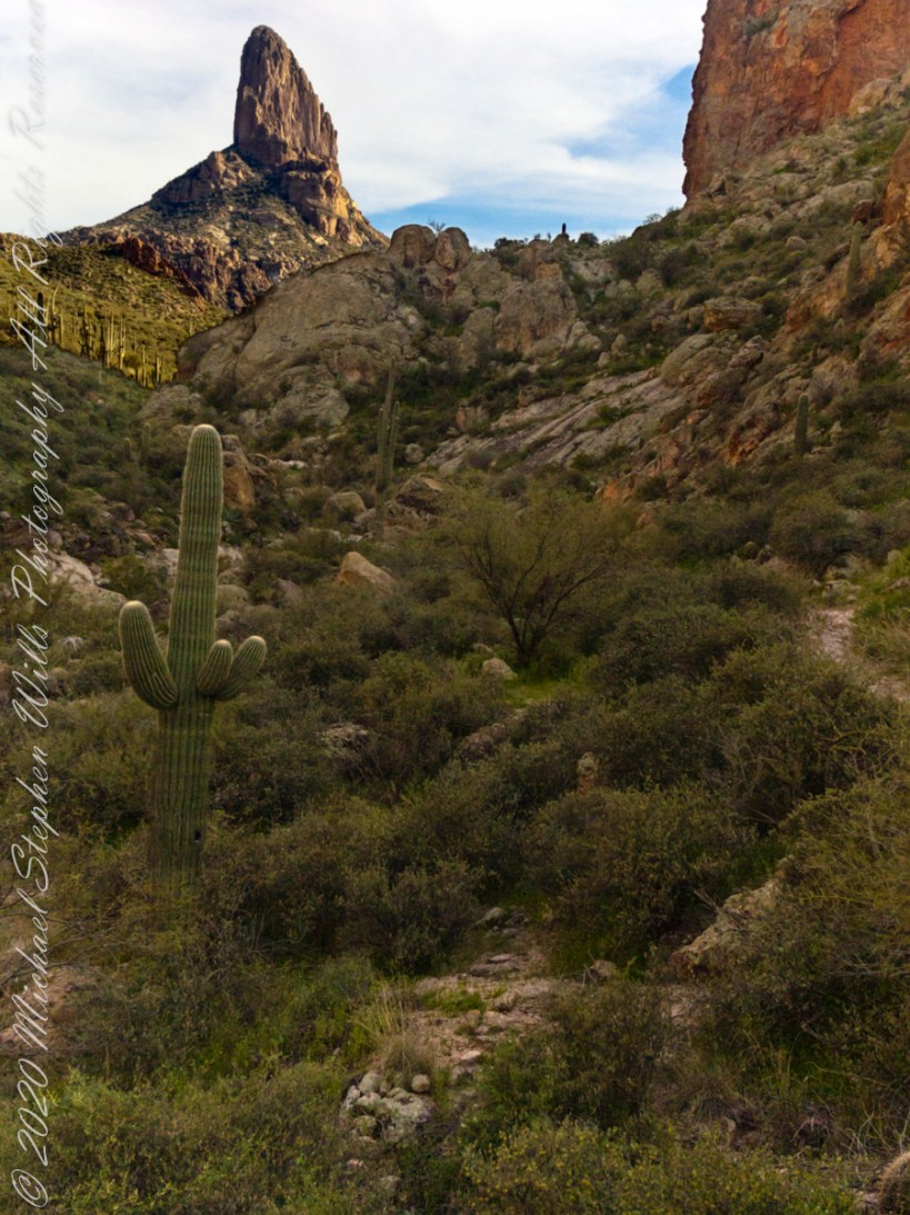
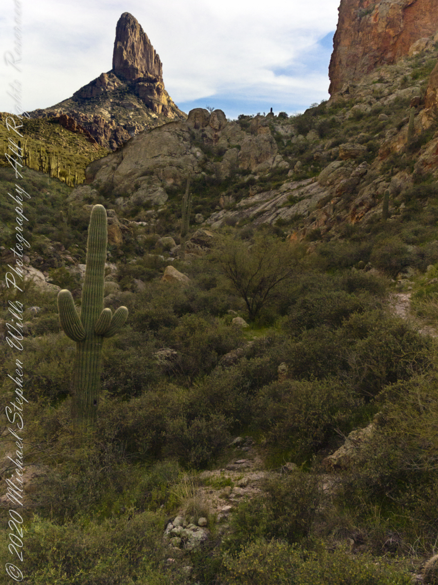
Our eleven-mile trek from Apache Junction ended here between Black Top Mesa and Palamino Mountain. Peralta trail winds up the ridge to right with Weaver’s Needle beyond in the setting sun.
Deep shade combined with the distant sunlit needle made for a difficult photographic capture. In fact, this picture needed significant work in Photoshop. I wore the 8 megapixel Sony F828 to capture the handheld shots of this series. A few days later I dropped the camera while riding Colorado, rendering it inoperable. This was when I acquired my Sony Alpha 700 during downtime in Phoenix. Later, the F828 was repaired at Sony and is still operable.
Click me for more information about this camera.
Copyright 2022 Michael Stephen Wills All Rights Reserved
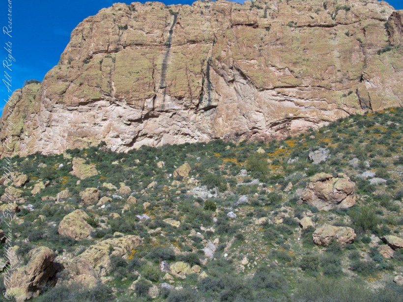
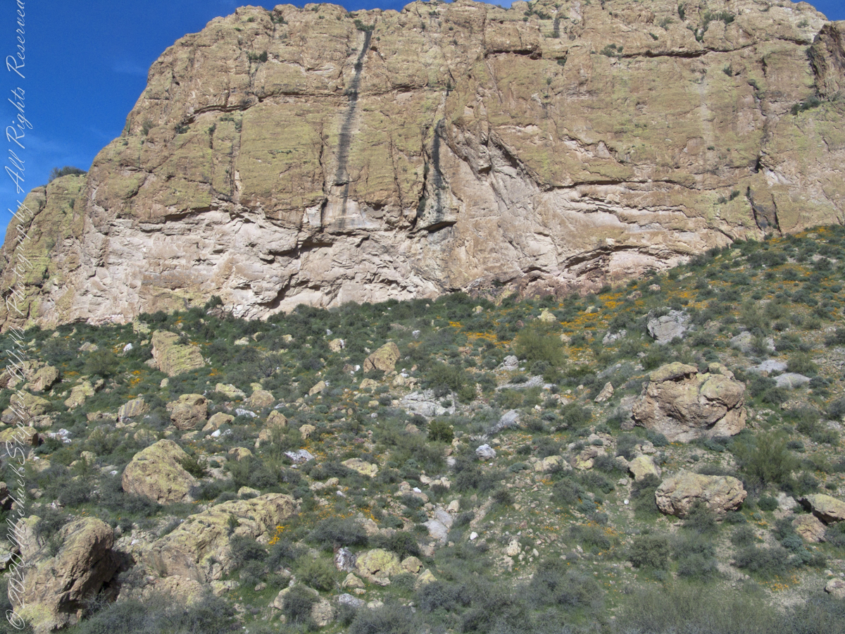
A few minutes after photographing this Stressed Mesquite I looked across the creek to the slope of volcanic rock fallen from the cliff of Black Top Mesa where clumps of dark yellow, in the following photograph of that cliff, mark clusters of flowering Mexican Poppies.
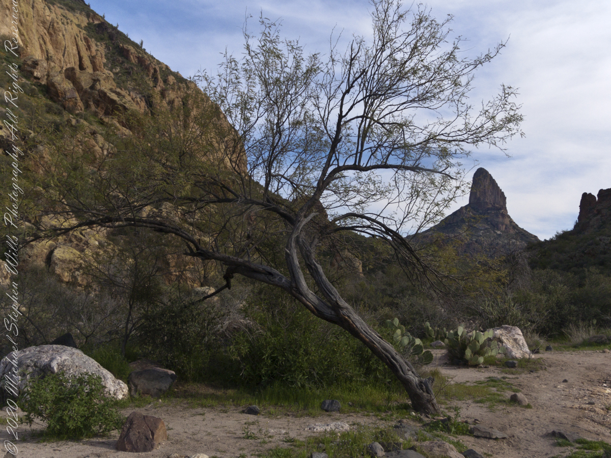
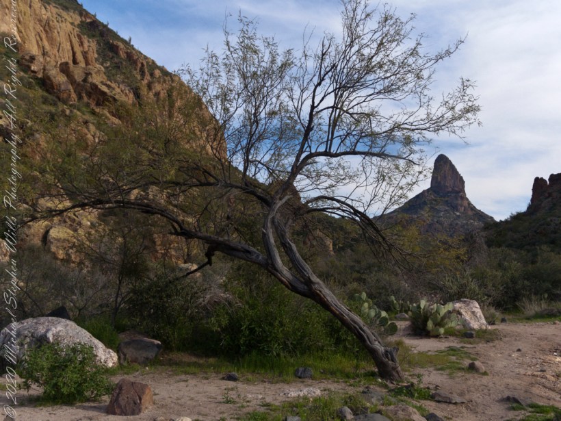
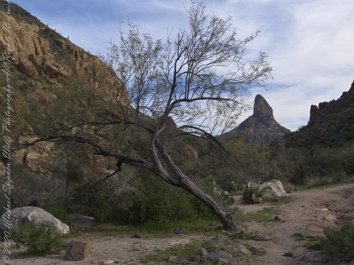
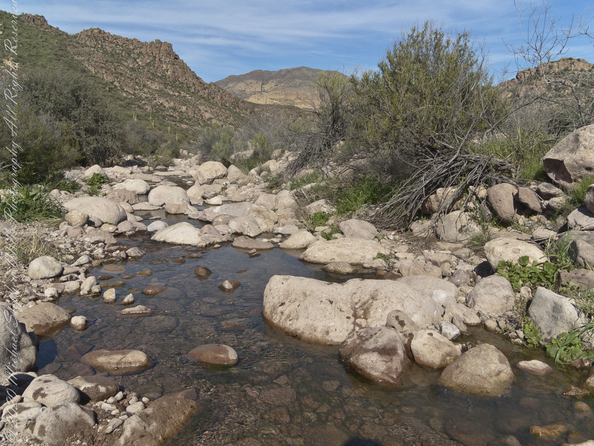
Mesquite, of the genus Prosopis, is a widespread, successful desert shrub that sometimes grows into a tree forms, as you see here. A mesquite tap root can extend 190 feet down to draw on the water table. East Boulder Creek was flowing, in this season, a few feet away. Still, this mesquite is stressed, with a loss of over half of its bark. Dutchman Trail between Black Top Mesa and Palamino Mountain, Superstition Wilderness, Tonto National Forest, Arizona
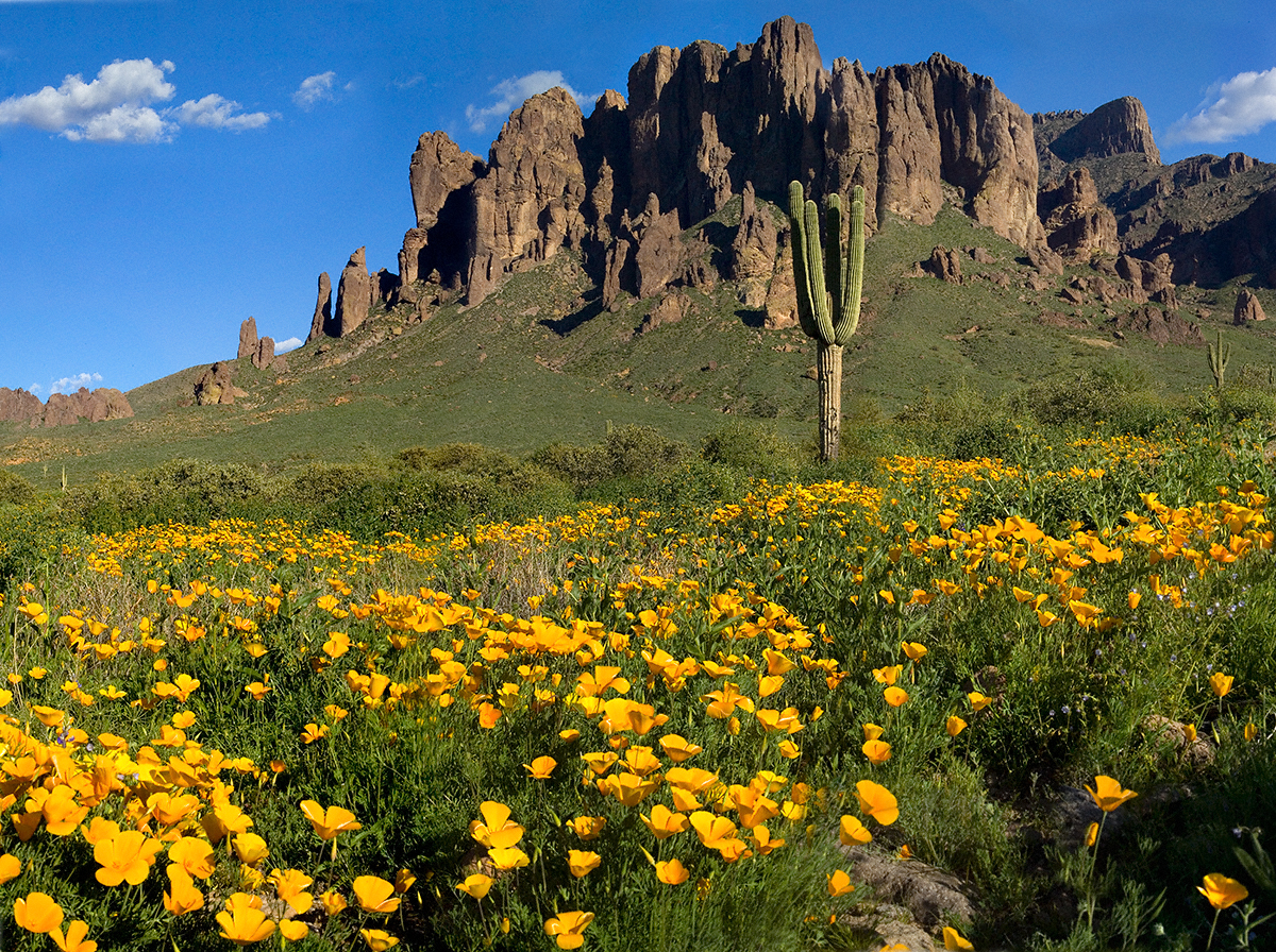
Plentiful winter rains of 2008 trigged a profusion of Mexican Poppies throughout the Superstition Wilderness. Here is a photograph captured after our expedition.
Look carefully for a scattering of color, like gold dust, at the foot of the volcanic cliffs. That is spring blooms of Mexican Poppy (Eschscholtzia californica). This gold wonder is plentiful from the month of late February through April, varying with the rains.
Copyright 2022 Michael Stephen Wills All Rights Reserved
Mesquite, of the genus Prosopis, is a widespread, successful desert shrub that sometimes grows into tree form, as you see here. A mesquite tap root can extend 190 feet down to draw on the water table.
East Boulder Creek was flowing, in this season, a few feet away. Still, this mesquite is stressed, with a loss of over half of its bark. The ever-present Prickly Pear is in the middle distance. I prefer the image with the distant Weavers Needle, a neck of eroded volcanic rock, is brightened by the setting sun. To the left, the light-colored rock of Black Top Mesa is also of volcanic origin.
.
I am here on the Dutchman Trail between Black Top Mesa and Palamino Mountain, Superstition Wilderness, Tonto National Forest, Arizona.
Here is a gallery of post images, making comparison easier. All were taken with a handheld Sony F828. Walking without a pack make it possible for me to wear the camera.
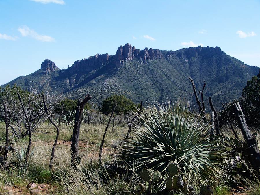
Two Bar Mountain from trail 122 with corral made from mesquite trunks and barbed wire. Yucca and prickly pear in foreground.
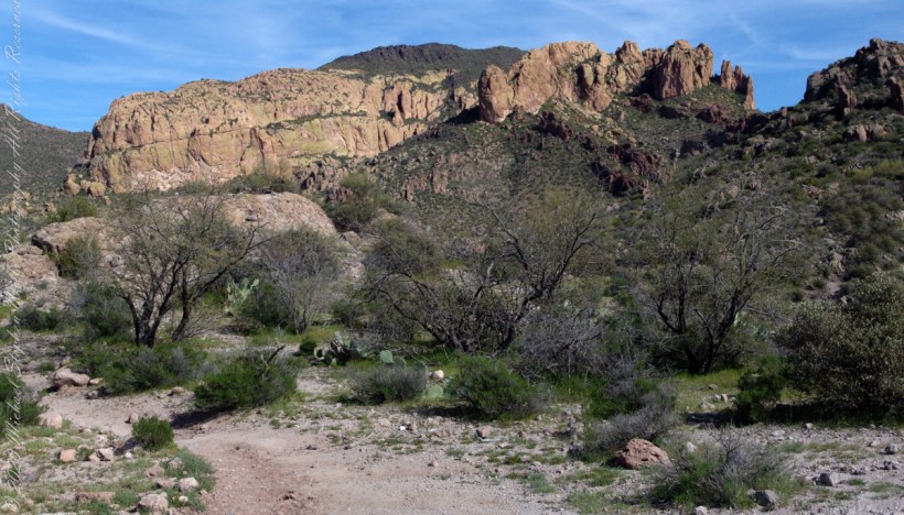
The black basalt of the mesa, for which it is named, is just visible above the lighter colored alternating layers of ash and tuff all remnants of volcanic eruptions 15 to 29 million years ago. We are on the Dutchman trail with the slopes of Palamino Mountain on the right. Ahead, other members of the expedition are just visible.
In this view the late afternoon shadow of Palamino Mountain reveals the defile to which we are headed. Poles of young Saguaro Cactus (Carnegiea gigantean), poke from the black basalt capping Black Top Mesa. Foreground left is Stag Horn Cholla (Cylindropuntia), on the right is Prickly Pear (Optuna).
.
Look carefully for a scattering of color, like gold dust, at the foot of the volcanic cliffs. That is spring blooms of Mexican Poppy (Eschscholtzia californica).
Starting from the First Water Trailhead, the Dutchman trail leads over Parker Pass into a large basin at which the branches, East and West and Little, of Boulder Canyon meet.
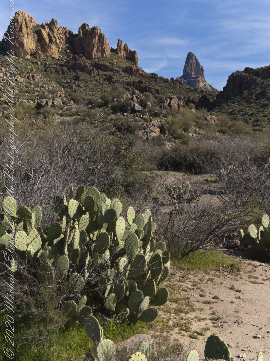
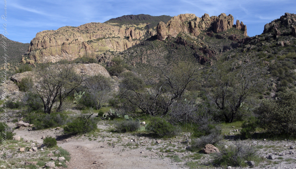
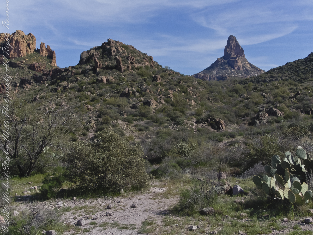
This southeast view is from the widest portion of the basin. You are looking toward Palamino Mountain and the top of Weavers Needle. There’s a path in there up to that Palamino Mountain ridge, note the hoodoos on right.
Dutchman Trail turns right up ahead to proceed between Palamino Mountain and Black Top Mesa, both shown in this photograph. The ridge of the mountain reminds some of a horse and there is an arch, Aylor Arch, on the southern side: here was approach the north side. Aylor is the family name of gold prospectors who set up camp on that south side close to where we will spend the night below Weavers Needle.
View of Palamino Mountain and Black Top Mesa from Dutchman’s trail.
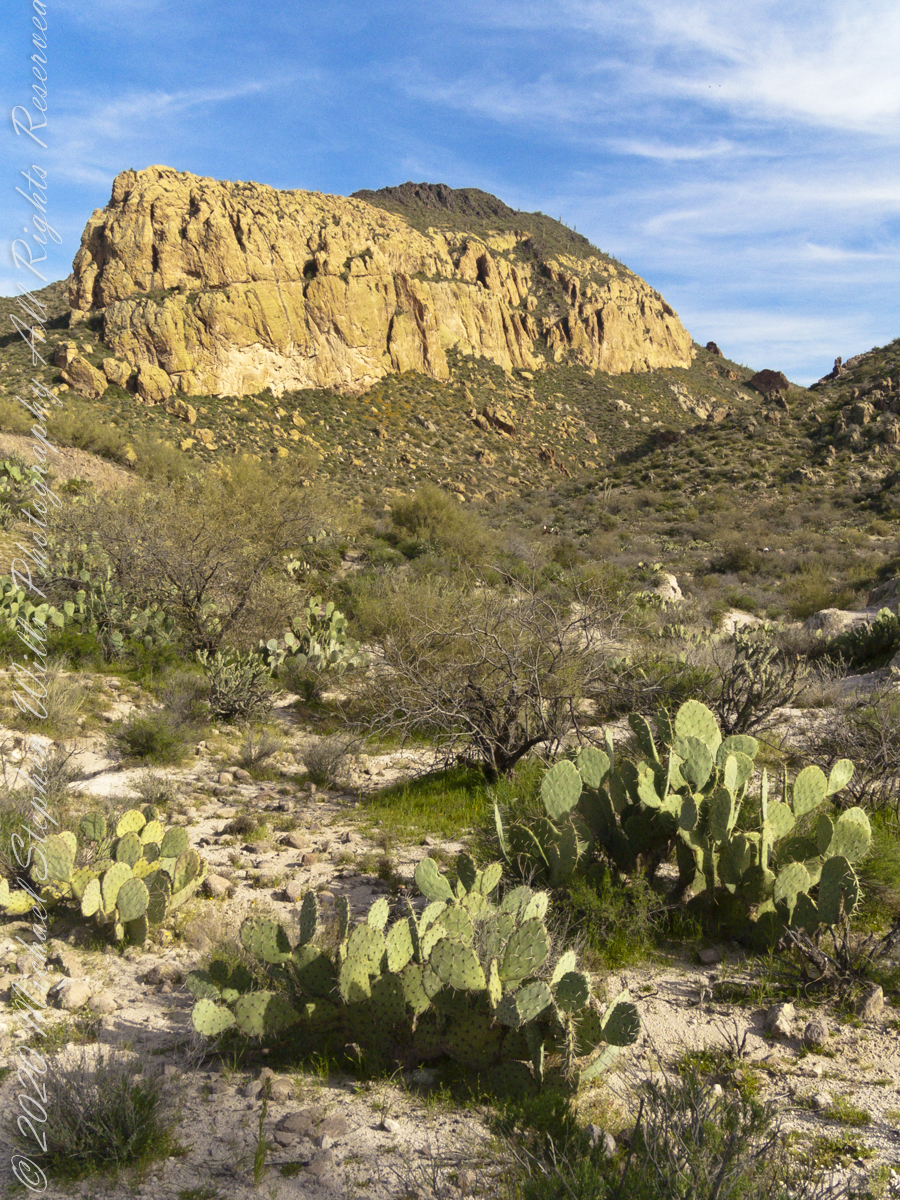
Black Top Mesa is named for a layer of black basalt. Look closely to see the crags on the mesa (the flat-topped mountain) are black. Gold prospectors who combed Black Top Mesa over the years found not one speck of gold.
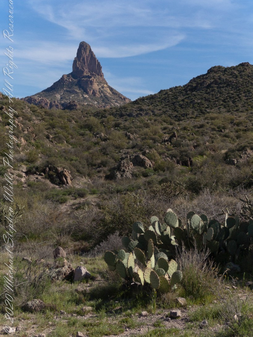
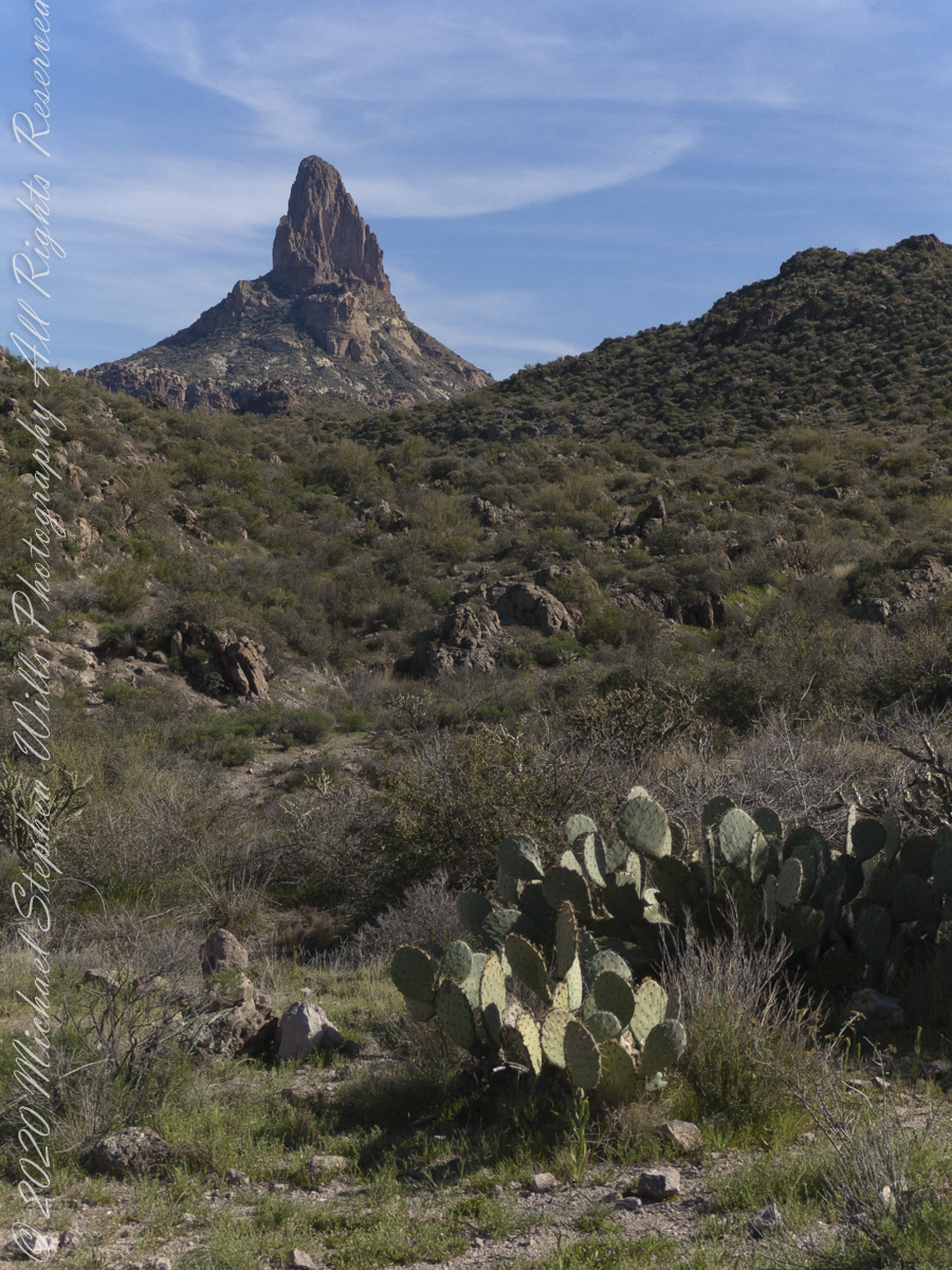
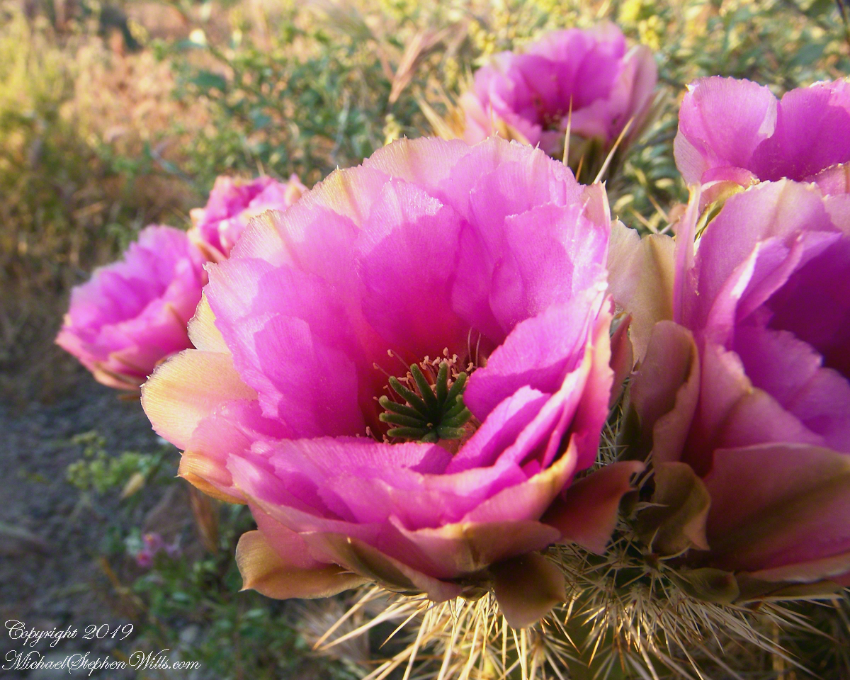
Prickly Pear cactus is in foreground. In season these produce magnificent flowers, see below.
Prickly Pear flowers at the Arizona-Sonoran Desert Museum outside of Tucson, Arizona
East by Southeast a low ridge forms the west side of the canyons above which Weaver’s Needle looms. “Weavers Needle has played a significant role in the stories of the Lost Dutchman’s Gold Mine. The Needle’s shadow reportedly indicates the location of a rich vein of gold, and many treasure hunters have searched for it. The hunt for gold around Weavers Needle has been pursued by hundreds (possibly thousands) of people. Weavers Needle has a large split in the side that makes it look like it has two tops, not one. This can only be viewed from the side.” — wikipedia
To the far left is Palamino Mountain.
Reference: wikipedia “Weavers Needle”
Copyright 2022 Michael Stephen Wills All Rights Reserved
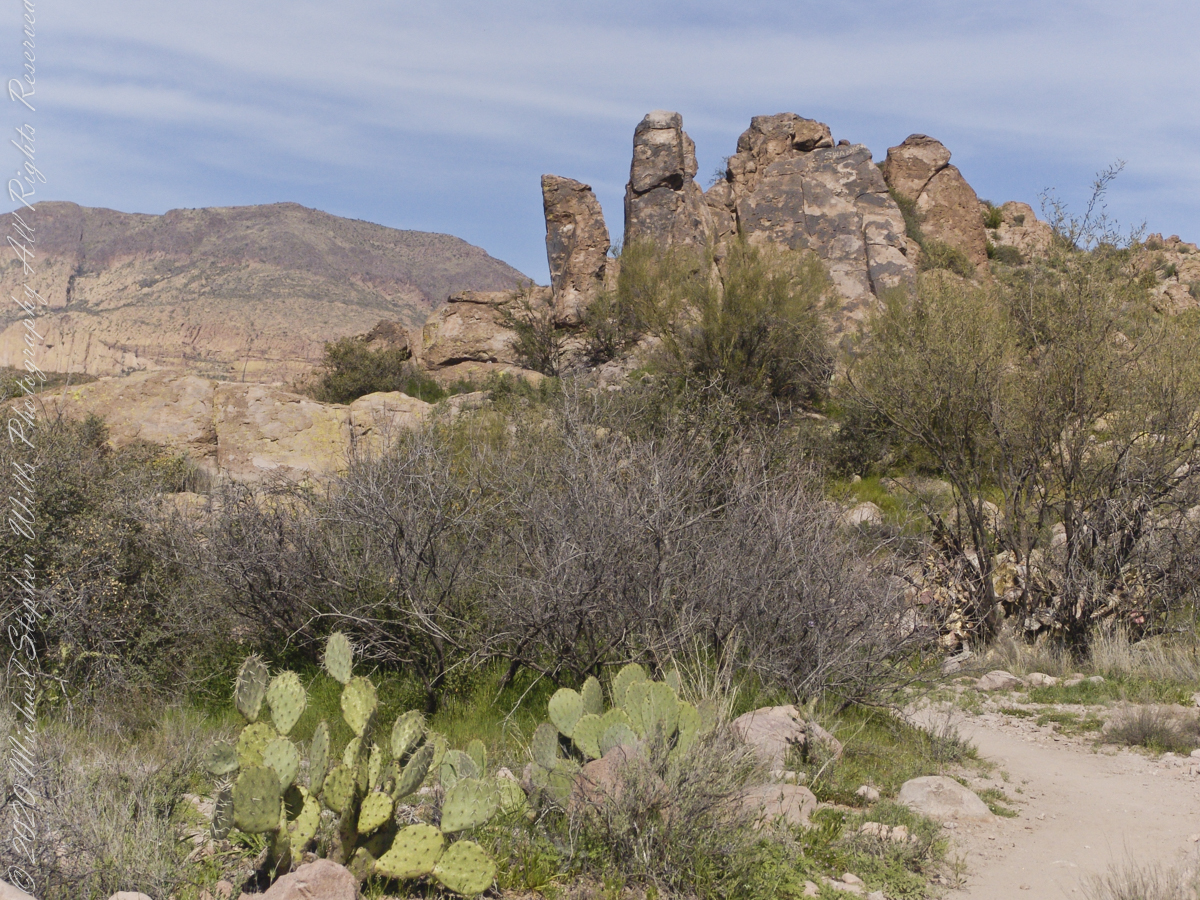
The Dutchman trail curves around this rocky outcrop on the east side of O’Grady Canyon, on the left are two hoodoos, on the right side a vandal has defaced the rock. Prickly Pear Cactus in foreground. Malapais Mountain, in distance. Malapais is from the Spanish term Malpaís, meaning badlands.
Signs and wonders, such as this mysterious “S”, lure people into the Superstitions. Two years after our expedition, July 2010, three men set out from First Water trailhead on a quest for Superstition Gold, never to be seen again. Unprepared for the summer heat, the skeletons of two found January 2011 on the slopes of Yellow Peak, a straight-line mile from this location.
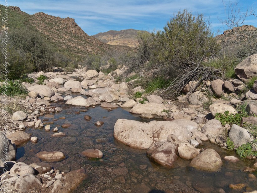
The blessing of desert water flows through a portion of West Boulder Canyon known as O’Grady Canyon, named after “Rattlesnake” Tim O’Grady who prospected the area mid-Twentieth Century.
Even more so as this is an intermittent flow, dry boulders offer no solace in dry seasons. In the distance, beyond a Black Mesa ridge studded with Saguaro cactus, is Malpais Mountain (Spanish, “Bad Country”). Closer, on the right, is the ridge of Palamino Mountain.
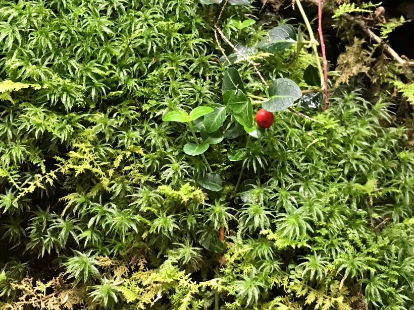
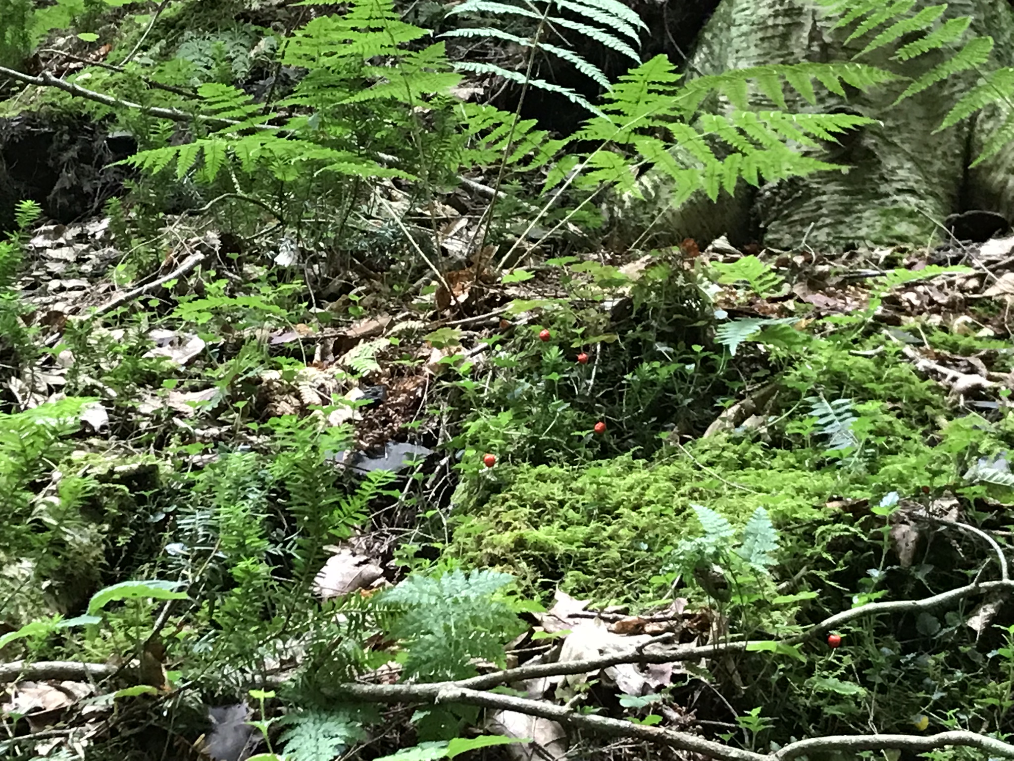
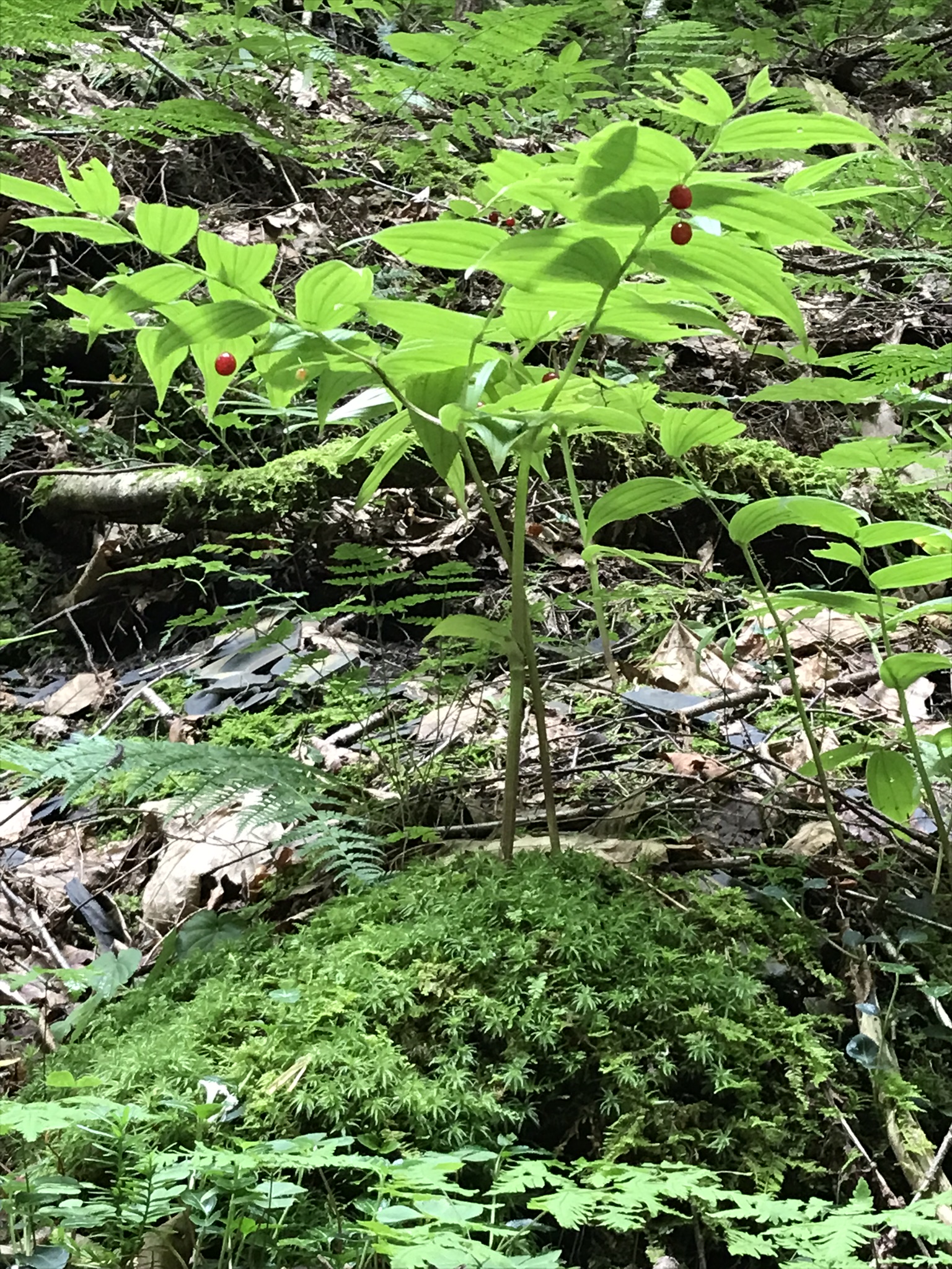
Walking the level the these red might be overlooked hanging sparsely under nodding branches. From the leaf shape you may wrongly identify this as Solomon’s Seal. This specimen, growing on a shale ledge of the glen, reveals sparse red fruit, not the plentiful dark blue of Solomon’s Seal. This is Rose Twisted-Stalk (Streptopus roseus), a member of the Lily family. The two are often found close together. I found no Solomon’s Seal this trip.
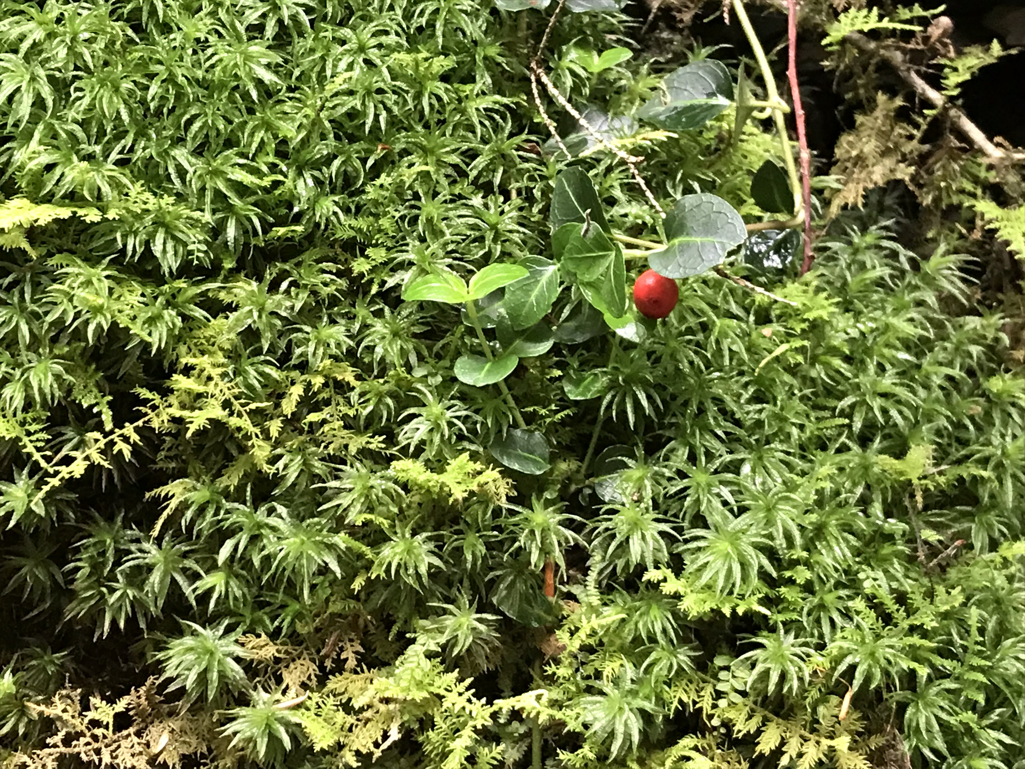
Cranberry?
The moss beneath the Rose Twisted-Stalk is plentiful here beneath the constantly dripping porous shale glen wall, mini swamps. I am not confident enough to following identification to each the red fruit. From the damp location and leaf shape I am guessing this to be mountain- cranberry (Vaccinium vitis-idaea). The first photograph of this posting is an overview.
A shallow grotto
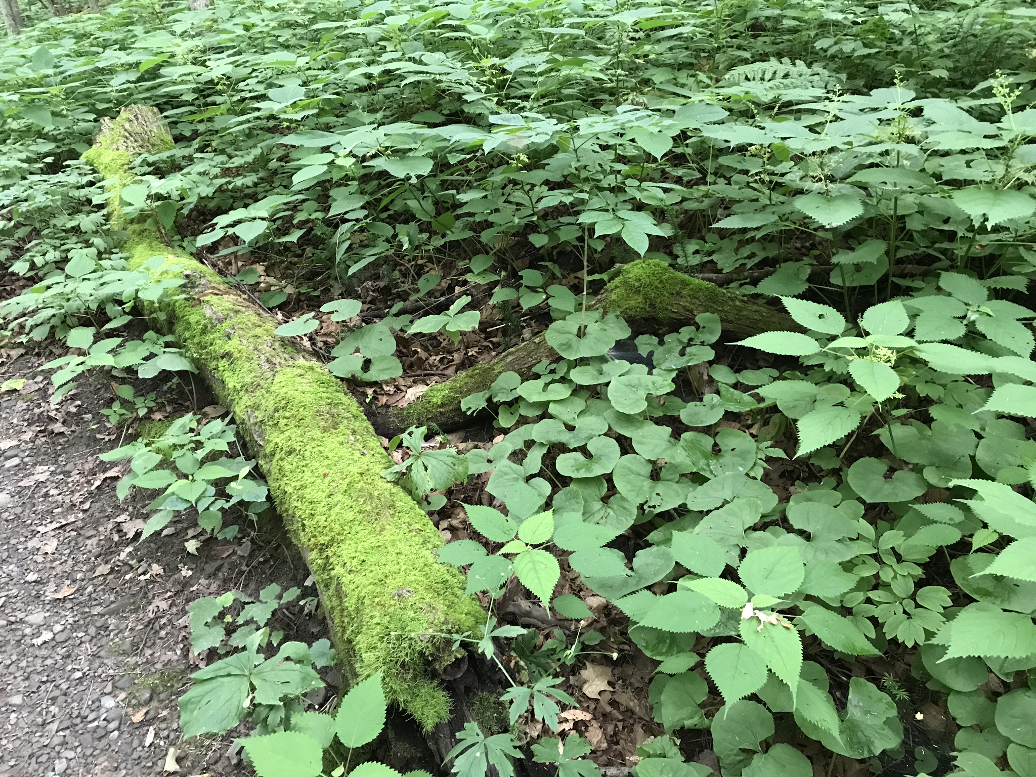
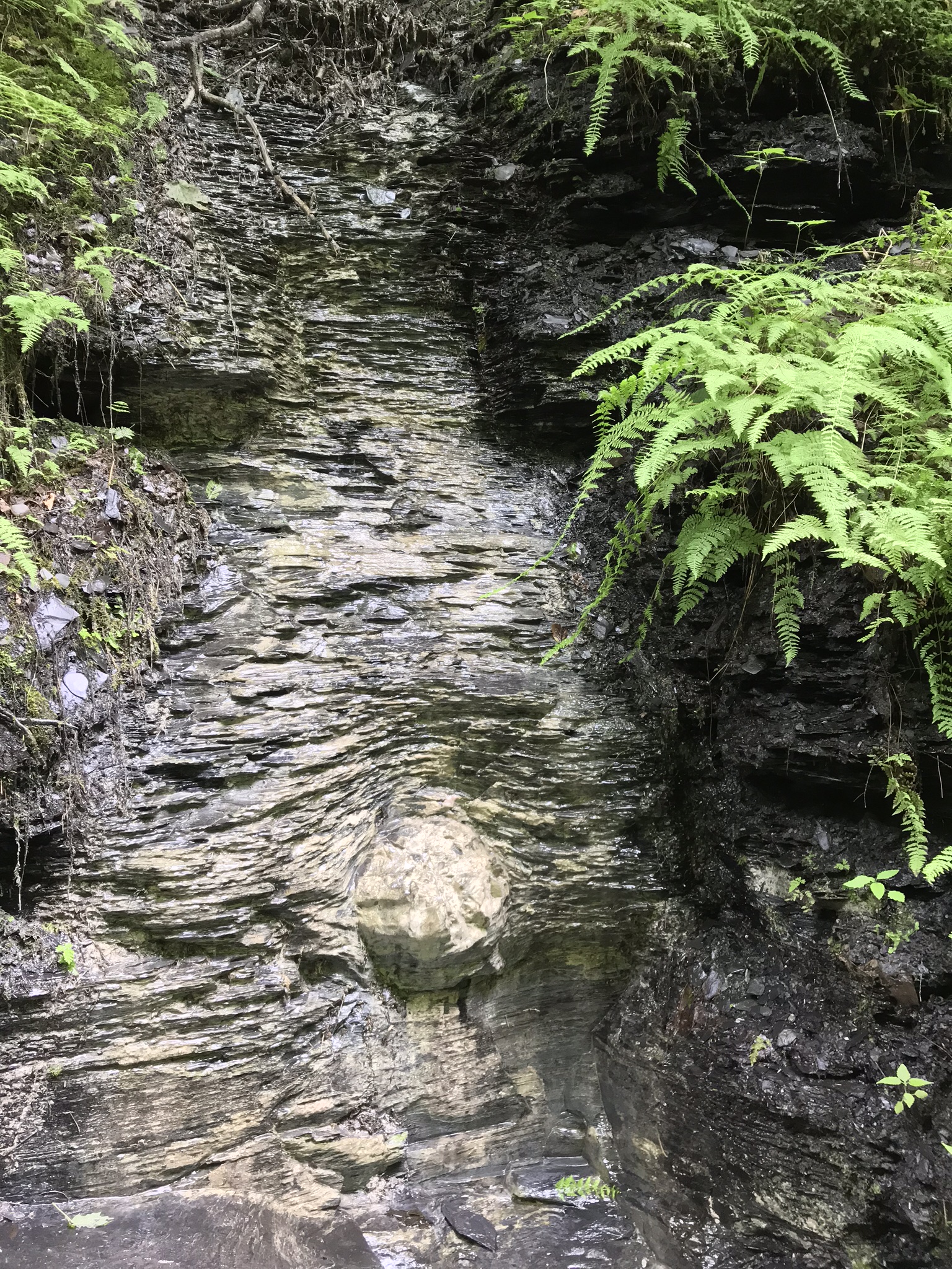
Finely layer shale in the following photograph is sediment eroded over 50 million years from the Arcadian Mountains, washed into the shallow inland sea of the Appalachian Basin. We see here a transition between fine, fragile shale and another, harder, durable sedimentary rock, limestone. There was a stone on the otherwise flat surface of the limestone around which the sediments forming the shale grew.
We see the detail because here is a persistent, sparse spring. The trail builds created a well here to carry the outflow, preventing trail erosion.
Copyright 2022 Michael Stephen Wills All Rights Reserved