Here I am, deep in a past February, in front of an Ithaca Falls frozen but for a small waterfall behind me.
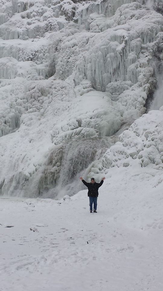

human scale against a frozen waterfall
Here I am, deep in a past February, in front of an Ithaca Falls frozen but for a small waterfall behind me.
Why is the glacier face blue?
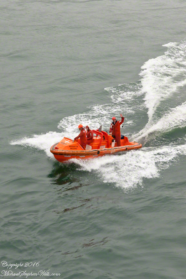
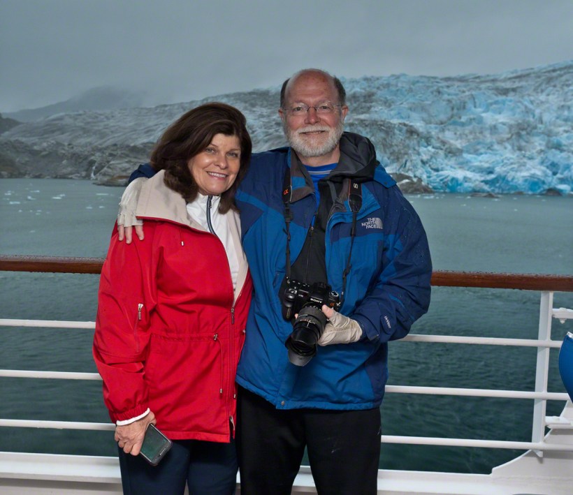
 A glacier is more than ice; not alive, it crawls; not feeling, it groans, cackles, shouts; passive, it is dangerous to approach closely backed as it is by the southern ice field, over a mile high. The ship nudged as close as a half mile from the massed ice, navigating using the bow thrusters to face first port, then starboard and back to port. I was lucky enough to be on the 11th deck, pictured above, when we caught sigh of the fast ship’s launch, manned by ship’s crew.

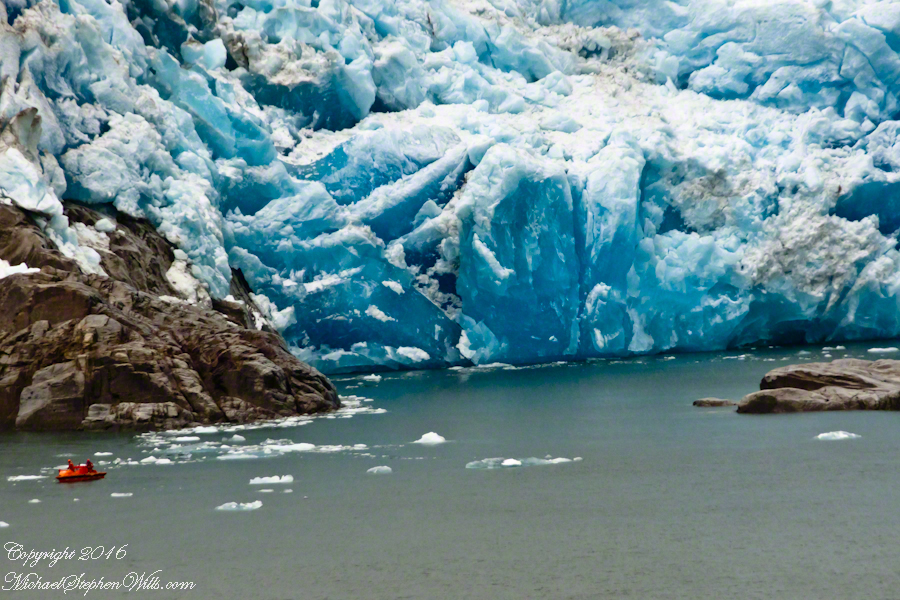
The crew prepared for a run to the rock face, almost 100 feet high, beneath 500 feet of glacier. Enjoy the views! Click any photograph to visit my online gallery. Purchase a photograph from this newly published series or any of my other popular works.


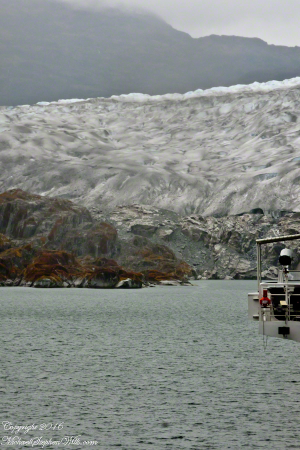
The ship turned and the glacier, 500+ feet high, 0.7 mile wide, came into view on port.
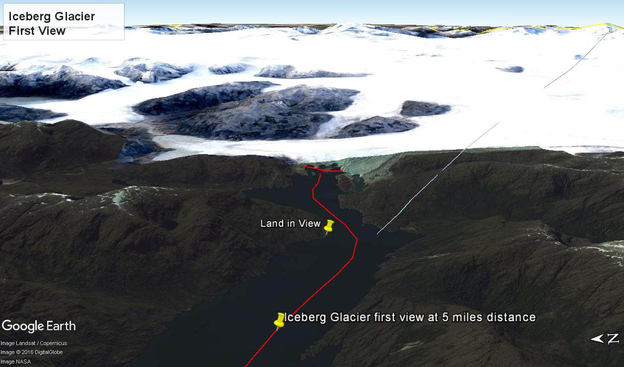
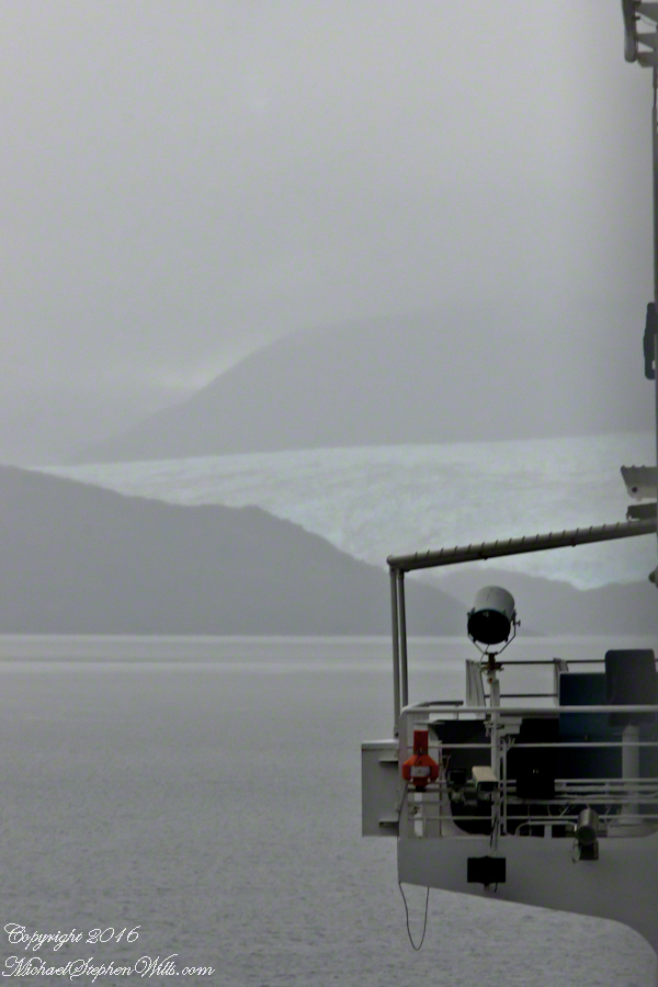
At 5:09 PM (daylight savings time for Chile) the Regatta turned to starboard to navigate around a headland of Farquhar Island. Iceberg Glacier came into view from our port side stateroom terrace. I was set up with the Canon 300 mm variable lens set to 120 mm (1/500 second, F11, ISO500), tripod mounted, to capture the ice from 5 miles distance. The location is marked on the above GoogleEarth view. The red line leading in is our course. On the right, the white line is the boundary between Chilean regions Aisen and Magellan.
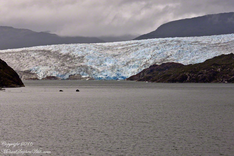
Visible is the .75 glacier front, 500+ feet above the head of Tempanos Fjord. On the GoogleEarth view the front is marked with a red line. Yes, more than 500 feet above the water. In mid-view there are two rocks in the water. Behind them, under the glacier, is a rock face. That rock is 100+ feet tall.
Twenty seven (27) minutes later I used a handheld Sony with variable lens set to 200 mm (1/500 second, F13, ISO800) to capture this image of the ship bridge superimposed on the glacier.

All you see is part of the Bernardo O’Higgins National Park. Named for a founding father of Chile, the country’s first head of state, the park covers 13,614 square miles.
Noticing small miracles, taking the time and effort to capture them…..
These icicles were formed along Fall Creek during the coldest months of February in the Finger Lakes Region of New York State.
The transient nature of these forms is suggested by the thinness of the pedicle joining each bell to the ice lobe of the ledge. Note the golden crystals in the ice lobe.
A visualization of the symbolic power of the numeral three, reflected on itself. Question: what do “threes” mean to you?
Captured with the Sony DSLR-A700, DT 16-105mm F3.5-5.6 lens, hoya circular polarizing filter, mounted on the Manfrotto tripod with ball head.
Click the photograph for my online gallery Ice Bells listing.


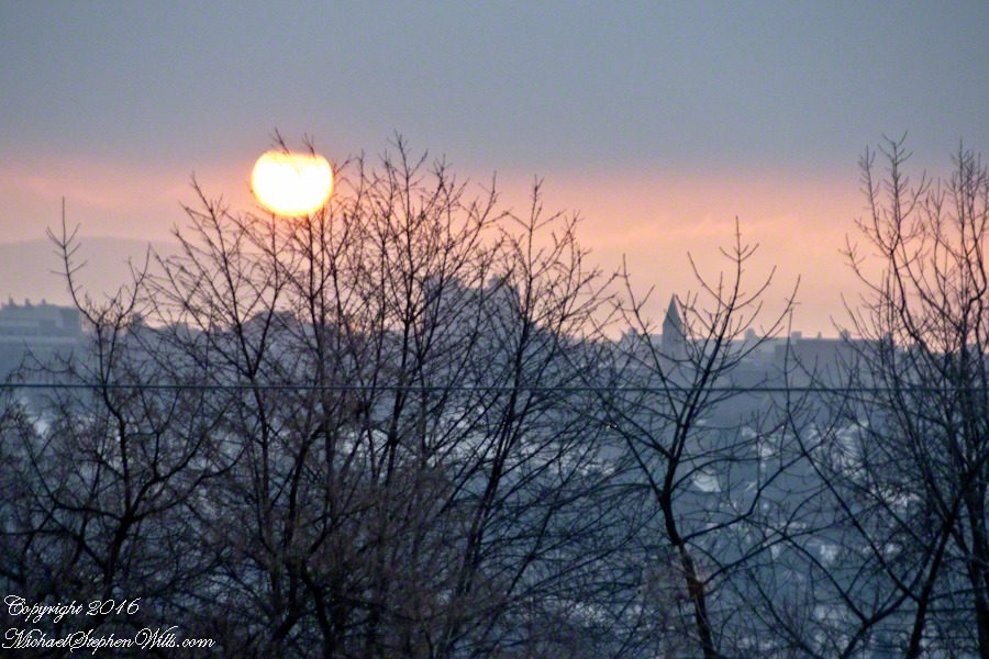
On this spring equinox morning a huge sun, filtered by morning clouds, hangs over East Hill and Cornell University. Taken from our home on West Hill, looking across the valley and Ithaca, New York.
The temperature is a balmy 18 degrees F.
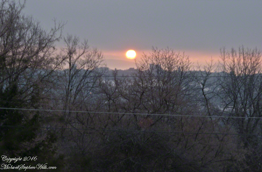
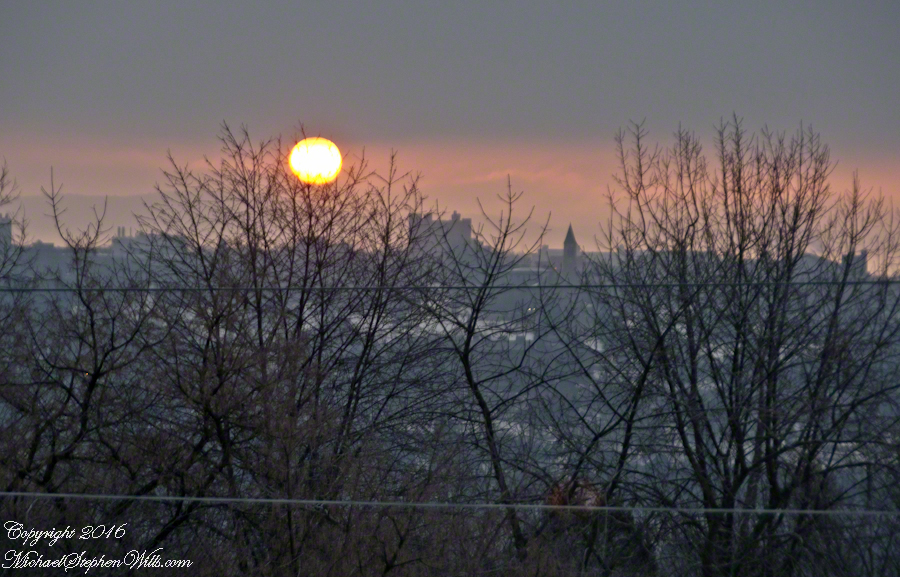
Can you pick out these Cornell landmarks?
— Jenny McGraw Tower
— Lib Slope still covered in snow from last week’s storm.
— the looming fortress shape of Bradford Hall.
experience a glacier of Patagonia
Click this link for my series of posts about Chilean fjords and glaciers we visited February 2016.
Copyright 2021 All Rights Reserved Michael Stephen Wills
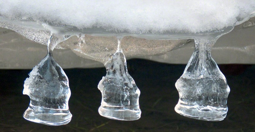
Noticing small miracles, taking the time and effort to capture them…..
These icicles were formed along Fall Creek during the coldest months of February in the Finger Lakes Region of New York State.
The transient nature of these forms is suggested by the thinness of the pedicle joining each bell to the ice lobe of the ledge. Note the golden crystals in the ice lobe.
A visualization of the symbolic power of the numeral three, reflected on itself. Question: what do “threes” mean to you?
Captured with the Sony DSLR-A700, DT 16-105mm F3.5-5.6 lens, hoya circular polarizing filter, mounted on the Manfrotto tripod with ball head.
Click the photograph for my online gallery Ice Bells listing.
In Dawn’s Light, Untouched


just around the corner
What is there, just beyond?
Click Me for another Malloryville post, “Formed By Water.”
