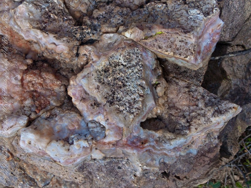
Marled and rose quartz outcroppings such as this appear throughout the Superstitions. The stories are of soldiers and prospectors who return from the wilderness with hoards of gold nuggets picked from quartz.
Marled and rose quartz outcroppings such as this appear throughout the Superstitions. The stories are of soldiers and prospectors who return from the wilderness with hoards of gold nuggets picked from quartz.
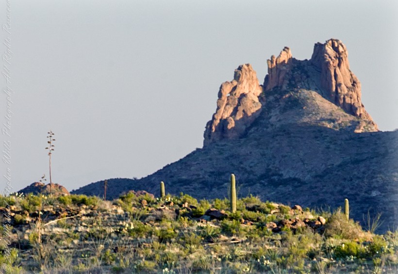
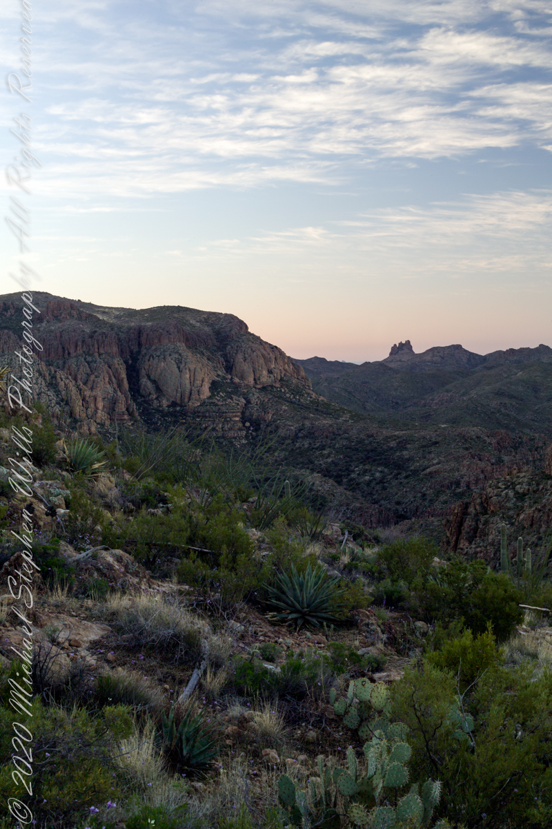
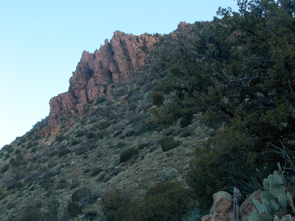
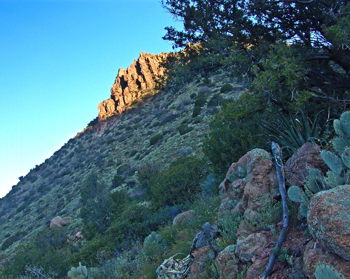
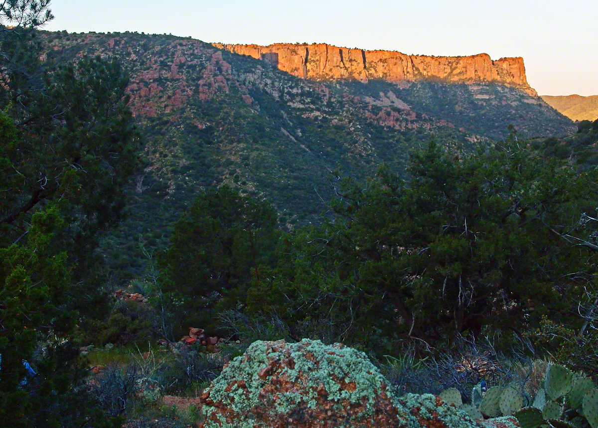
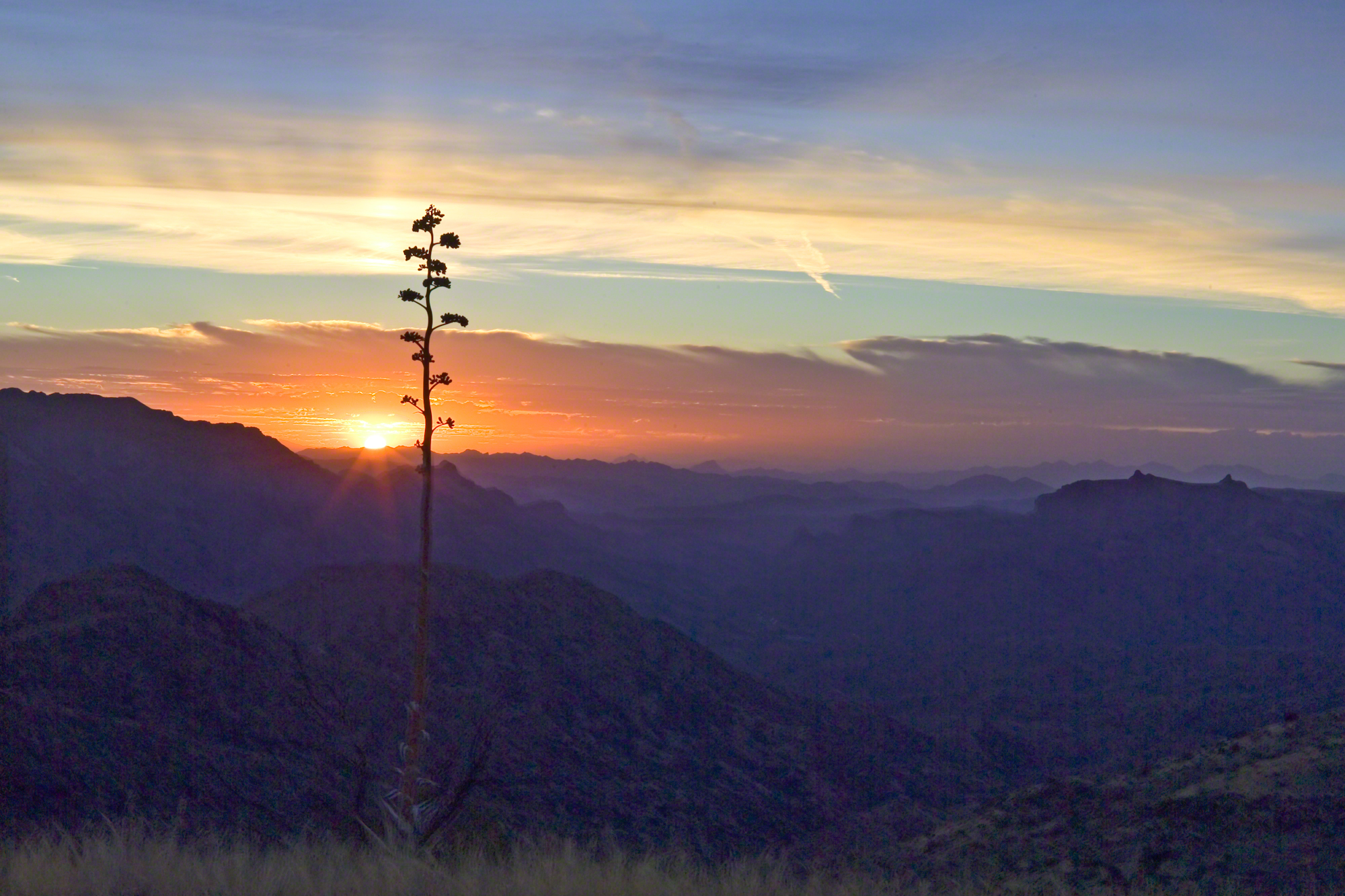
I was a member of an expedition to Peter’s Mesa March 2008, a place central to Superstition Wilderness treasure legends. This is a sunset view, looking south, southwest. Light raking across the desolation and Miner’s Needle creates a fascinating spectacle. Ancient volcanism, apparent throughout the Superstition Wilderness, is here seen in the texture, form and type of rock as well as the mineral deposits. Miner’s Needle, like Weaver’s Needle (not seen in this view), are eroded volcanic summits. Look closely for the “eye” of Miner’s Needle, easier seen in the cropped heading photograph. To this day, hopeful prospectors search for gold nuggets.
There is one form of volcanism present today as an eerie rumble or hiss, similar to an enormous distant jet engine heard now and then during our two days on the mesa, louder and closer than an overhead plane could produce. The view includes many notable Sonoran Desert plants. Many young Saguaro cactus are in the form of green poles. Catching the dramatic light, on the ridge is a tall single flower of an Agave, known as the “Century Plant” it flowers once in a long life and dies.
Peters Mesa is named after “Old Pete” Gottfried Petrasch, father of Hermann and Rhiney Petrasch. Old Pete worked for Jim Bark for awhile in the 1890s doing odd jobs. Irregular employment gave Pete and Sons time to s searched for the Lost Dutchman Mine in the years following the death of the source of the legend, the “Dutchman” Jacob Waltz. The Petrasches were one of the first groups to search for the mine, and gold in general. They covered almost the entire Superstition range in their combined searches.
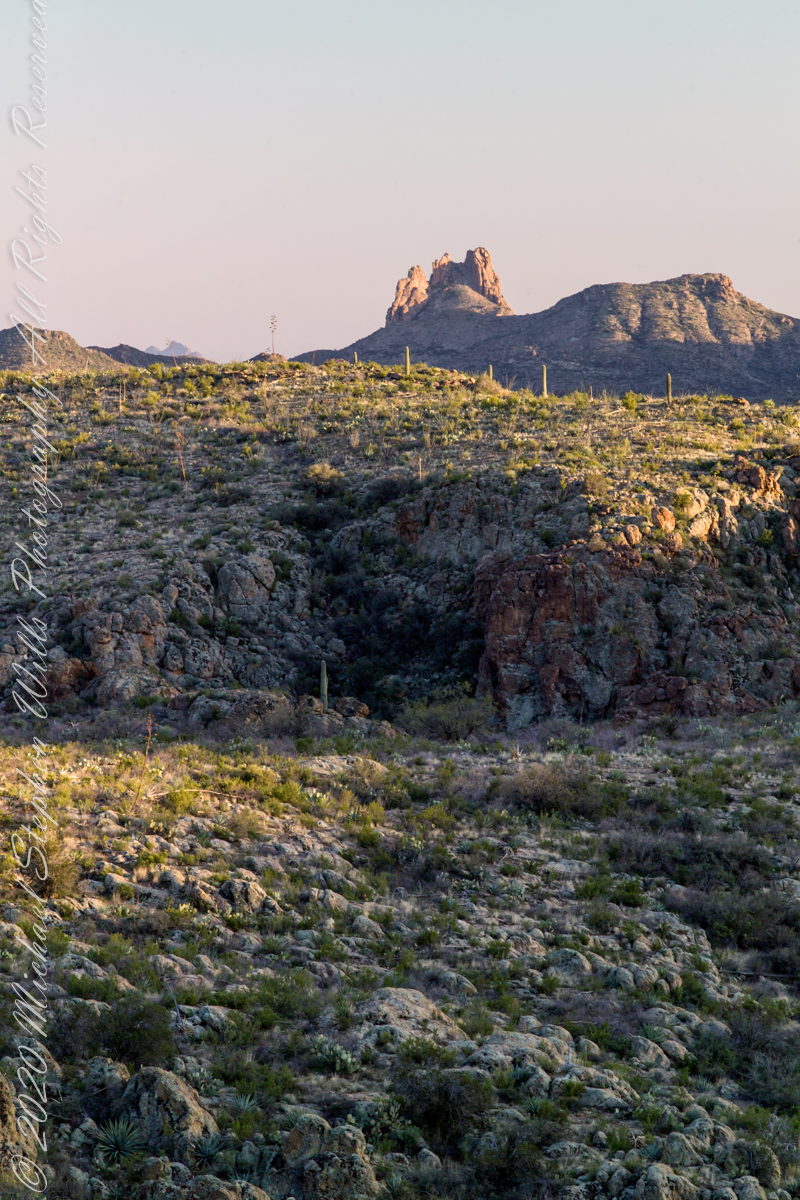
Sunrise looking across Music and LaBarge Canyons to Miner’s Needle
On our first day on the mesa, we came across the remains of one of these camps, on the top of Squaw Canyon, a deplorable junk pile discarded by searchers, presumably disappointed, too lazy to cart it out. That March, we were lucky to find the remnants of winter rains in the form of a meager trickle at the bottom of a shallow draw off Peter’s Mesa trail up from La Barge canyon. We had a good time of it until the trip was cut short by a storm front and torrential rains. We were back in Apache Junction before they hit.
Nugget and Colorado had eaten their fill of the rich early spring grass of the apple orchard, The Searcher pulled together the pair for the return to Pine Creek. Perched on Colorado, the lead held by The Searcher, I listened as he shared survival facts remembered from Peter Bigfoot’s desert survival course. The Reavis Mountain School of Self Reliance, founded 1979, is along same Reavis Gap Trail (#117) we traversed. After descending to Pine Creek and up to Reavis Gap (where I first met The Searcher), it descends to meet Campaign Creek where the survival school is located.
He pointed out on the many flowering Century Plant stalks along the trail. “These are great to roast when young, just as the stalk starts to bud from the center, before it starts to lengthen.” By the time the stalk flowers, as in the following photograph, it is quite tough.
Agave flower spike against the dawn in the nameless canyon west of Two Bar Mountain, Superstition Wilderness, Arizona.
At the base of boulders, shaded from the sun, the ridgeline fern takes hold. Surviving on seasonal water seepage, it dries out during dry spells to later revive and reproduce via spores. As I recall, the dry or fresh form is useful as an analgesic.
An absolute necessity for bushwacking (walking off the path), a pair of rattlesnake proof boots were worn on every expedition. These rose to mid-calf with a layer of lexan, the same as used for bullet proof glass.
Swept from the Saddle
We passed the time in this way, me holding on to the saddle horn bouncing and shifting as Colorado negotiated the rough and steep path down to Pine Creek where the vegetation changed from very sparse to the thick growth you saw in my post “A Peaceful Day at Pine Creek”. On the east side of Pine Creek a trail, unmarked on the maps, follows the creek bed uphill north towards Mound Mountain. In 50 feet or so we passed the side trail to my campsite, our destination was The Searcher’s campsite. I was not paying near enough attention to the surroundings when I looked up to see an Arizona Oak limb headed to my chest. With no time or space to negotiate the obstacle I was left to grab hold and hang on to be swept from the saddle. The branch held my bulk for, at most, a second before giving way.
In bending flexibly before breaking the live Oak wood and centuries of soil underneath the trees softened my fall enough so I was badly shaken and unhurt. Falling a foot or so in any direction would have resulted in serious injury or instant death. Colorado stopped, looking briefly back as I slowly came to my feet. After taking account and letting the circumstance wash over me, I got up and proceeded slowly while we both contemplated my miraculous survival.
Bear Shelter
I now took up the rear as in a few hundred yards the valley wall rose on both sides of the Creek to form a short, narrow pass. The walls fell away just as quickly, the valley floor leveled out and we came to The Searcher’s camp. The bear shelter stood out right away. This was a ten foot high teepee of 4 – 6 inch diameter tree trunks tied with rope, within was a hammock . The three foot wide opening left only one unprotected side while he slept, offering some protection from the all too common roaming bears, most commonly from September to November when mazanita fruit ripens.
Well stocked in every respect, for a wilderness camp. In the following years of roaming the wilderness the camps of other horse people were similar in this way: stoves, comfortable cots, radios, pots and pans all fit into panniers. As a noun pannier is seldom used in the singular because there are always two, one on each side of the horse for balance. I sat on the wide top of one enjoying a cold beer pulled from a bed of ice.
We discussed the benefits and drawback of horses for exploration. I required a gallon and a half of water daily and in the desert wilderness provided for storage of three days, 4 and a half gallons. At 8 pounds each, that is 36 pounds!! Starting out, my pack weighted 90 pounds with a camera and tripod.
There are benefits to having a mode of transport that thinks for itself and drawbacks. Each individual has its own personality and horses do try to get away with what they can. It is wise to limit your dependence on a horse until you know each other well. In retrospect, I was “out on a limb” riding Colorado modified by being led by someone the horse knew well.
It was soon time for me to head back to camp. We set the agenda for the next day, an early start for the hike out. Colorado was to be fully loaded so my riding was not an option, just as well. It was possible to lighten my pack to almost nothing and I looked forward to that.
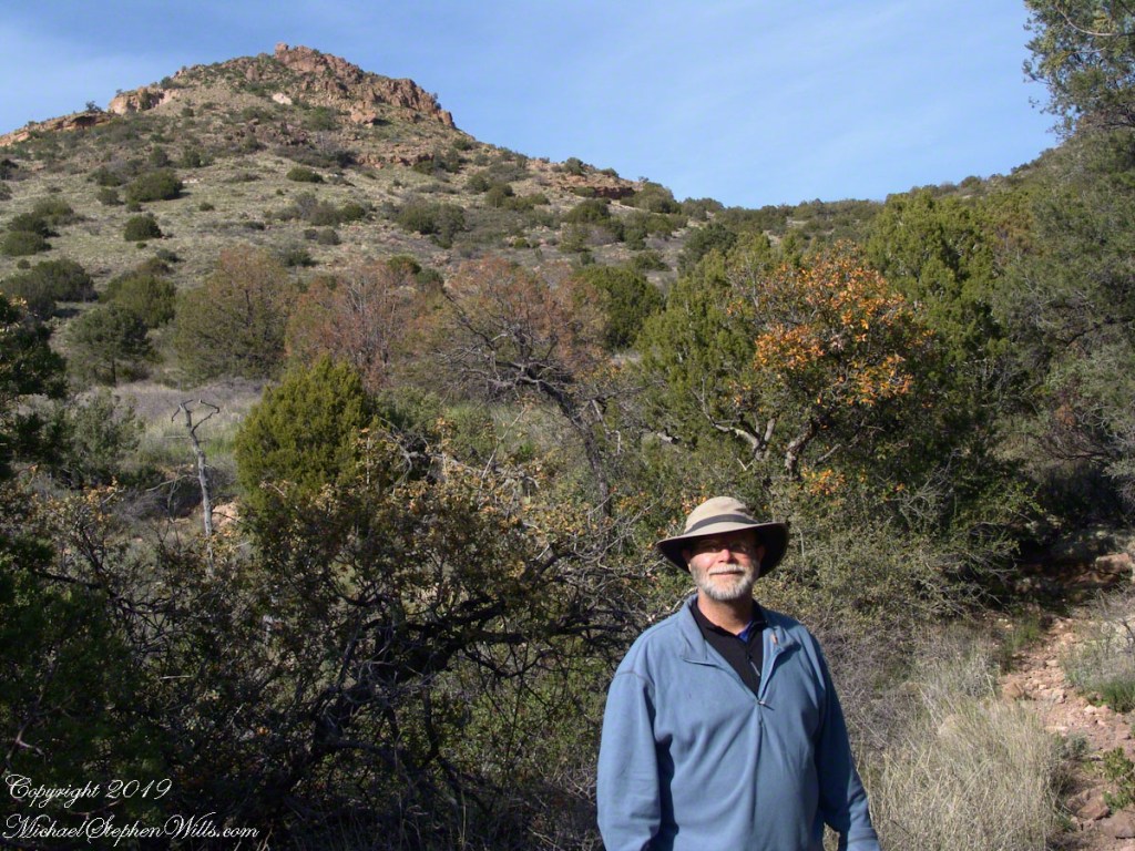
I took some time before dinner to set up the tripod for a self-portrait on my last full day in Pine Creek. The view is northeast from the Arizona Trail near my camp, the ridge overlooks Reavis Gap. I did a version of the view with and without me.
A hellish shriek assaulted the cold 3 am darkness.
The scream was instantly recognizable. Anything but terrified, after a confused scramble I reinserted the pin into a personal security device hung from my backpack. Wrapped in a silly waffle weave blanket, tossing restless in the cold, the pin lanyard hung up then pulled free. Several minutes had passed with that sound flowing out over the canyon, calling all carnivores to breakfast.
I had drifted off with the wind shaking my tent like a drunken prankster and now all was totally and absolutely quiet. In spite of the cold, the inadequate blanket and the imaginary creatures looking for the source of that scream, the next two hours sped by in a fitful doze.
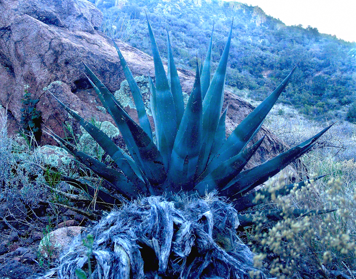
Agave Heart
At 5 am I crawled out to find the thinnest crescent moon imaginable gracing the eastern sky, kept company by a century plant silhouetted against the early dawn light.
Click any photograph for a higher resolution image.
These stalks raise the golden flowers of this agave 10 to 15 feet above the green prickly rosette. Century plant stalks can be seen throughout the Superstitions, even at the high elevations among towering Ponderosa Pine.
Here is an agave in predawn light I caught on the next day, in Pine Creek canyon.
Agave in PreDawn Light
The leaves are used as needle and thread with the very sharp tip as the needle and the long leaf fibers, when properly dried and shredded, as thread. These leaves guard the agave heart from the harvest. A poke from an agave spike can be deep and painful.
The young shoots of the stalks are a succulent delicious treat raw. Roasted, the agave heart is a fresh, somewhat sweet delight. The earliest residents of this desert left numerous roasting pits on the mountain slopes, located where the agave still grows.
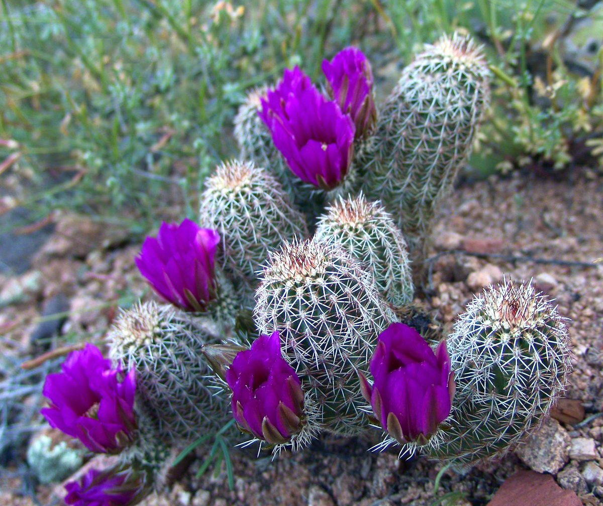
Dawn and the Pretty Hedgehogs
Although cold, the still dry air felt marvelous and even distant objects appeared absolutely clear. In this environment the spread of sun with its rising is a ritual. Here’s a photograph of the canyon walls a few minutes before the sun reached them.
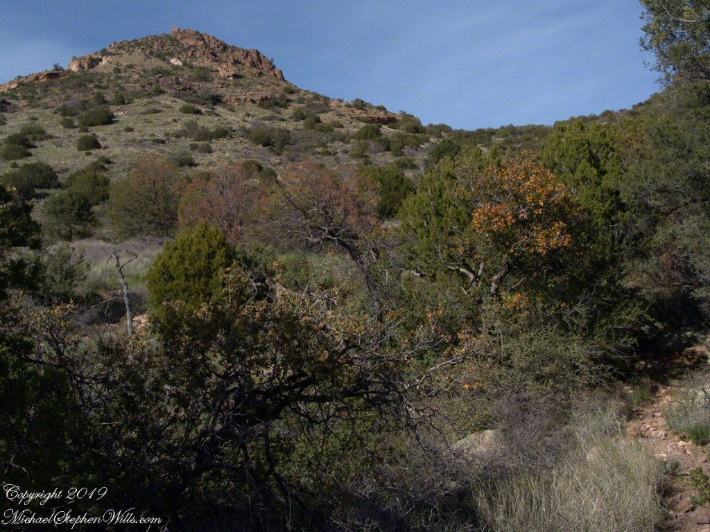
Slopes of Two Bar Mountain in PreDawn Light
And, a few minutes later, as the sun passed the ridges of Two Bar Mountain.…
Dawn on the Slopes of Two Bar Mountain
By the way, that’s a desiccated agave stalk to the lower right, on the rocks.
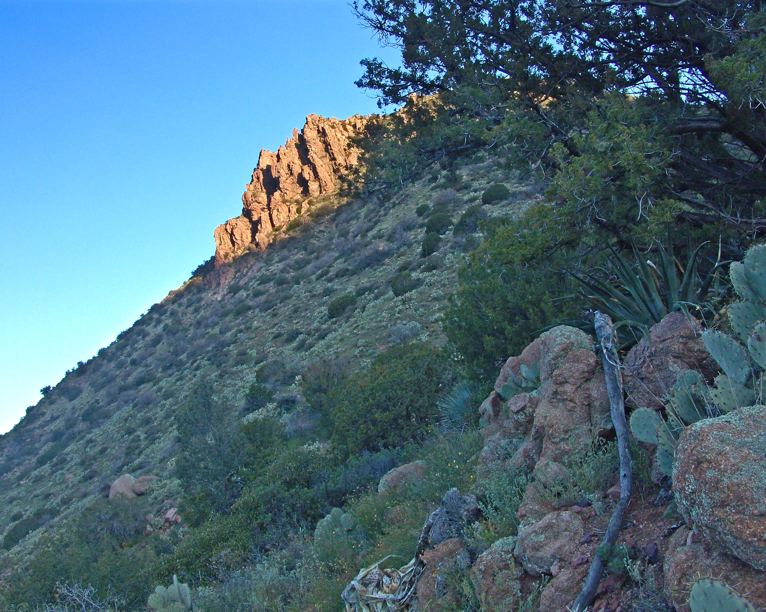
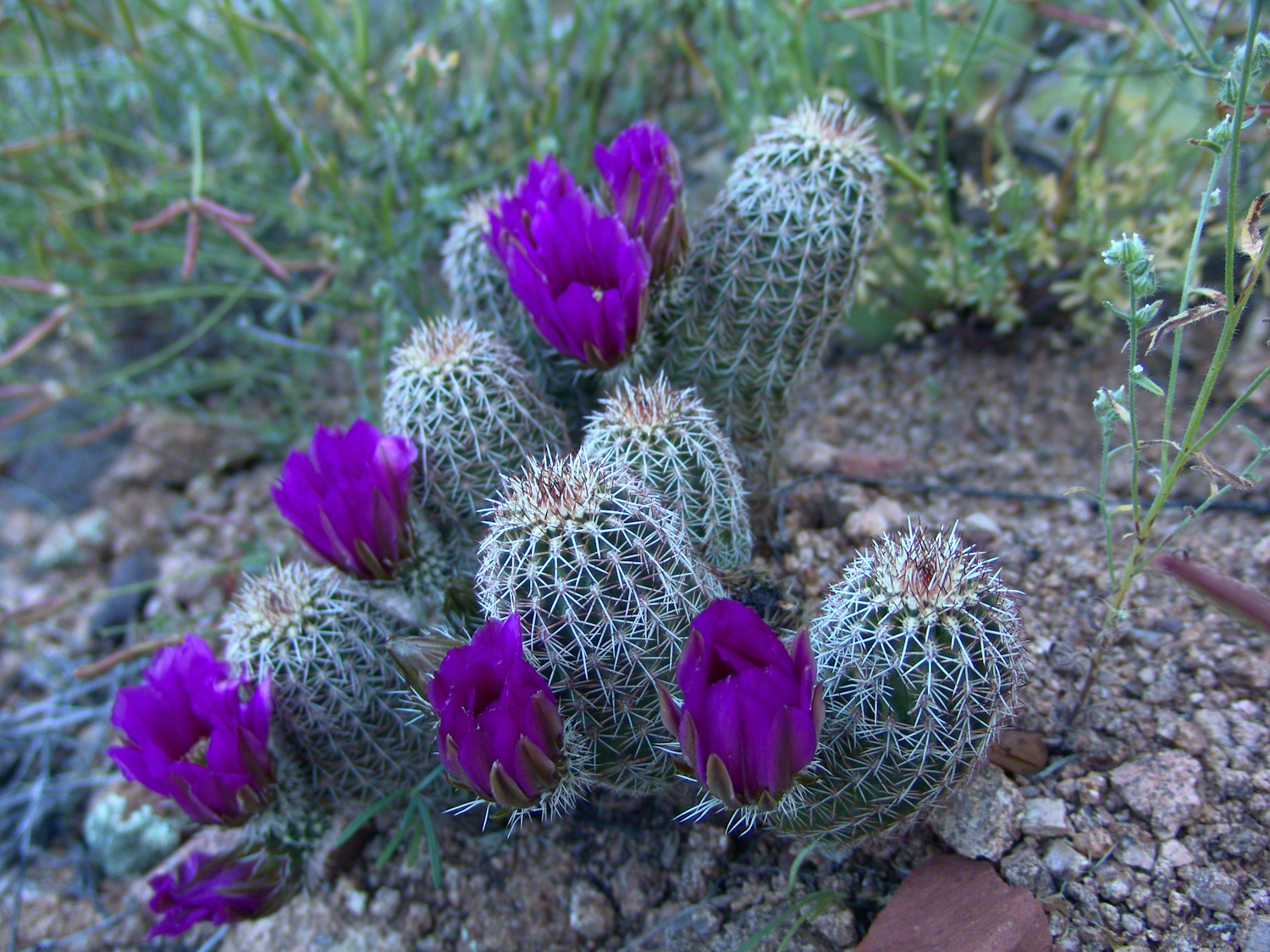
At my feet, spread at intervals on the brown red broken rock, small Hedgehog cacti bloomed lavender.
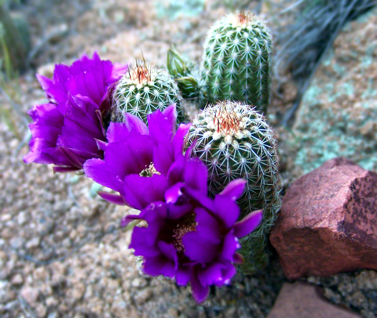
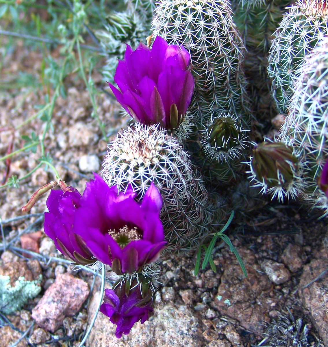
Lavender Hedgehog BlossomsLavender Hedgehog BlossomsLavender Hedgehog Blossoms with Buds
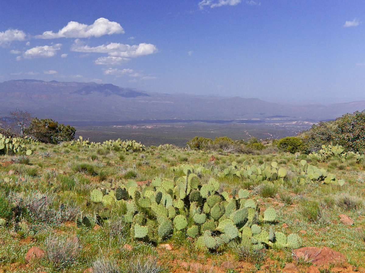
Cacti, such as the blossoming lavender Hedgehog seen above, require a space which enjoys full sunlight for most of the day. The thick grown of juniper trees limited sunlight and compete with the cacti for water. This image will give you an idea of the extent of the juniper growth.
Nameless Canyon in the Dawn
Looking into Nameless Canyon
In the above photograph you are looking west over a canyon that is unnamed on maps. The dramatic flat ridge bathed in light is a landmark marking the canyon of Reavis Falls, on the far side in this view. Make your way down the canyon where is joins Reavis Creek, turn left and the falls are a few miles upstream. This is NOT the easiest path to the falls.
As the sun rose I needed to prepare for the day’s trekking, but took one more portrait of this lovely nameless canyon traversed by an almost non-existent path.
Nameless Canyon Morning
This season, a cold stream ran at canyon bottom. Flowing among the rocks the water produced peals of a crystal bell, but this was not my last memory of this place.
In the “Nameless Canyon Morning” image, on the left there is the almost vertical (no exaggeration) canyon wall I climbed in 4.5 hours that morning. It traversed 800 feet altitude in less than a mile. The path was substantially longer because it followed the contour lines of the land in long loops called switchbacks. As I proceeded up the canyon wall, to the southeast, above the opposite canyon wall, the memorable Four Peaks gradually appeared. Here’s the view from my lunchtime perch…..
Four Peaks from Nameless Canyon
This view looks over the basin of Reavis Creek and includes the, out of sight, 140 foot high Reavis Fall, the highest free fall in Arizona.
The four mile climb up the 2,000 foot eastern Superstition Wilderness bajada and escarpment consumed the morning and much of the afternoon. It was the 80 pound backpack that did it. Ten days of supplies, tent, equipment and 3.5 gallons (28 pounds) of water; enough food for a trek across the Superstition Wilderness, water enough for two days. One day in, one day out if the water could not be replenished. Mine was a water commitment, enough water storage to allow two days to trekking to another source.
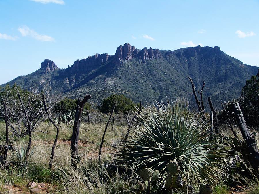
Two Bar Mountain from Tule Canyon trail with corral made from mesquite trunks and barbed wire. Yucca and prickly pear in foreground.
Here the canyon rim view from atop the escarpment…..
Here I found the huge mountain lion track in the dry mud from the spring rain, where water pooled and the cat drank.
…over trail 122, the Tule Canyon Trail, looking out from the wilderness. Tule Canyon trail is very lightly used and only present in the form of occasional cairns. There is a red rock cairn in the midground. Theodore Roosevelt Lake of the Salt river is in the distance, as is the dirt road to the trail head. A settlement is visible, on the right.
A rancher formed a cattle watering hole by damming an ephemeral stream and that day the pool held some water. Shortly after a rain a large mountain lion had approach the pool for a drink, leaving a footprint in the now dry mud.
I knew a mountain lion attack was improbable: I ran more risk of being run down on a New York City sidewalk by a madman or, even more so, of having a heart attack. Still, during my brief lunch I faced east, looking over Apache Lake for the possibility of a cat leaping up from the canyon. On all other sides was an open area until, a quarter-mile uphill, there was a thick growth of Manzanita reaching to the ridge.
After that climb to the escarpment rim I was in a race to reach a safe campsite at an unknown location, the other side of Two Bar ridge, before sunset at 6:46 pm mountain time. Yes, the time was exact to the minute. If sunset found me on the mountain side or ridge, rapid fall of darkness would force me to set camp.
The following photograph was taken the winter of February 2006 from a campsite below Castle Dome on Reavis Ranch Trail. A red line, starting to the left, is Trail 119, my path along Two Bar mountain ridge, beneath the mountain peaks, with switchbacks into a nameless canyon.
Overview of my path to the nameless canyon behind Two Bar Mountain.
Ahead of me was a 400 foot ascent in a half mile to Two Bar Ridge, two miles along the glorious ridge providing endless views to the west and northwest. An 800 foot descent to a nameless canyon below Two Bar Mountain. This left no time for photography!!
This photograph, taken 4 miles to the west and 10 months later, is similar to what I enjoyed, and dreaded, that day. A flowering century plant stalk grows at the end of the plant’s long life, usually 10 – 30 years. After death, the plant is reborn through suckers from its roots.
A Superstition Wilderness Sunset from a February 2006 backpack.
My hope was to find some flat terrain in that canyon, for a camp site. If only there was time enough to reach it. My progress was bedeviled by sudden gusts of wind, grabbing like a large cat, throwing off-balance.
The west wind was whipping the bushes as I entered the Manzanita. Here is a photo of the plant from a later backpack to the Rincon Mountain Wilderness. Yes, the trunk is a dark, rich red. “Manzana” is apple is spanish, the plan is named “Little Apple” for the small green fruits much loved by bears.
A mature Manzanita growing along the Miller Trail of the Rincon Mountain Wilderness. There is an enlargement of the flowers, to the right.
Manzanita leaves were thick around me snapping in the wind, making it seem at all moments a large creature was moving. The trail was difficult and several times I needed to turn back to find it, all the while climbing continuously.
On ridge was the highest point for a hundred or more miles to the west, so the wind was free to run which it did in huge gusts. You can get an idea of the openness from the Superstition sunset photo. For awhile the Manzanita acted as protection, then I descended along the west face of the Two Bar Mountain ridge.
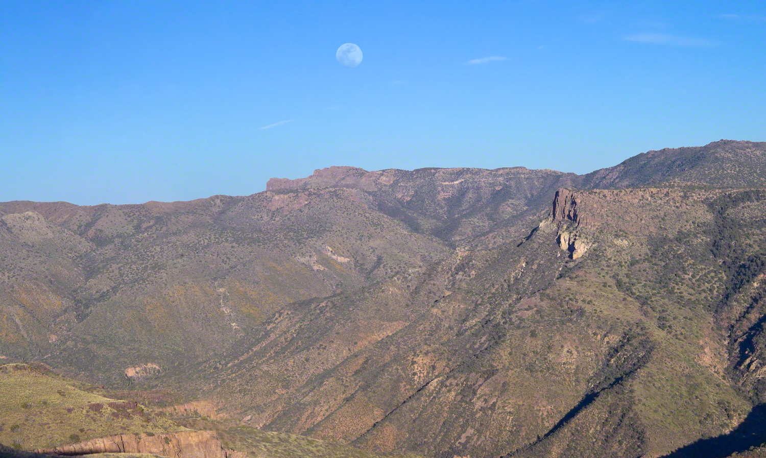
Two Bar Mountain and Ridge from Lime Mountain with rising moon.
My hat tie-down were tested on that two miles of ridge, the brim was molded around the right side of my head. The backpack acted as a sail so that it was taken in the wind gusts, affecting my balance.
On mountain trails the path is full of stones of all sizes and, aside from the occasional rattlesnakes, critter scat or, at lower elevations, Gila monsters, it is the rock that forces hikers to look four steps ahead, planning moves carefully to avoid falls. The 80 pound backpack, wind, rocks, high perch and, not forgetting the prickly pear cactus and jumping cholla, all slowed me to less than a mile an hour. I was jumpy walking through that Manzanita and this slowed me down more.
Trail 122 joins Trail 119 on Two Bar Ridge. On the ridge a substantial barbed wire fence separates federal land from the working ranch. Where the trails crosses, the fence has a break. The hiker needs to wend through a simple maze impassable to cattle.
Of all the trail, this is the most clearly marked. Fences have deep historical significance for the western United States. Range wars were fought between men who had different beliefs about land use and ownership. Many historians associate the building of barbed wire fences with the passing of the Old West.
Up until the fence, cattle grazing visibly damaged the land and plants. After the fence, the land was free to become as it was since the beginning of time. Up here, there’s wonderful grass that was, in this season after heavier than normal winter rains, was lush and green.
The trail followed the fence for a ways, then descends steeply into a fold of the land, leaving me in shade as the sun, low in a cloudless sky, raked over the mountainside with a brilliant golden light. The Two Bar Mountain and Ridge with Moon photograph, above, gives an idea of the effect.
Below, the canyon floor seemed a mass of prickly pear cactus groves. I decided the lower canyon wall was the best choice for camp…as unlikely as that sounds.
Here, the trail was anything but straight and almost invisible, descending in looping curves called switchbacks.
Here’s a photo from the following morning. I found a small shelf on a ridge overlooking the canyon floor, amongst wonderful shrubby Juniper trees. Tiny hedgehog cactuses were covered in lavender blooms. There is a decrepit stalk of a Century (yucca) plant lying over the rock.
Morning view from my camp in a nameless canyon below Two Bar Mountain.
On approaching the shelf, the air turned suddenly cold as the sun fully set and the wind gained even more in strength flowing up the canyon and over Two Bar Mountain. Stony ground made it impossible to stake the tent, instead I used small boulders to fix the corners and sides of the tent. Once inside, I was grateful for an excellent mat to protect me from the small jagged stones at one with the ground. The tent walls held back the wind. I forgot to back an excellent sleeping bag for the trip. Instead of buying one in Phoenix, my sister lent me a light waffle weave blanket. “What was I thinking???” It was a restless, cold night. The sun was very welcome the following day.
Peter’s mesa is at the center of Superstition Wilderness treasure legends. I was a member of an expedition to the top of the Mesa March 2008. This is a sunset view, looking south, southwest. Light raking across the desolation and an approaching storm behind Miner’s Needle create a fascinating spectacle. Ancient volcanism, apparent throughout the Superstition Wilderness, is here seen in the texture, form and type of rock as well as the mineral deposits. Miner’s Needle, like Weaver’s Needle (no seen in this view), are eroded volcanic summits. Look closely for the “eye” of Miner’s Needle, backlit by the storm cloud itself lit by the setting sun. To this day, hopeful prospectors search for gold nuggets around the Needle. There is one form of volcanism present today as an eerie rumble or hiss, similar to an enormous distant jet engine. We heard now and then during our two days on the mesa, louder and closer than a overhead plane could produce. The view includes many notable Sonoran desert plants. Many young Saguaro cactus are in the form of green poles and, on the rim of the ravine running left to right below the closer ridge, an excellent specimen with multiple arms. Catching the dramatic light, on the ridge is a tall single flower of an Agave, known as the “Century Plant” it flowers once in a long life and dies.
Peters Mesa is named after “Old Pete” Gottfried Petrasch, father of Hermann and Rhiney Petrasch. Old Pete worked for Jim Bark for awhile in the 1890s doing odd jobs. Irregular employment gave Pete and Sons time to s searched for the Lost Dutchman Mine in the years following the death of the source of the legend, the “Dutchman” Jacob Waltz. The Petrasches were one of the first groups to search for the mine, and gold in general. They covered almost the entire Superstition range in their combined searches.
On our first day on the Mesa we came across the remains of one of these camp, on the top of Squaw Canyon. This was only deplorable junk a presumably disappointed bunch of searchers were too lazy to cart out. That March, we were lucky to find the remants of winter rains in the form of a meager trickle at the bottom of a shallow draw off Peter’s Mesa trail up from La Barge canyon. We had a good time of it until the trip was cut short by a storm front and torrential rains. We were back in Apache Junction before they hit. This panorama is from our last evening on the Mesa. As the sun set I put the Kodak DSLR with a 50 MM lens on a Manfrotto tripod and hiked a mile higher onto the mesa for a view of Miner’s Needle. I quit only after the last light was extinguished by the approaching front. My reward for persistence was this dramatic light ennobling a craggy desolation. This is a composite of several images, combined using Photoshop. I have since invested in a Canon 24 mm wide angle lens.