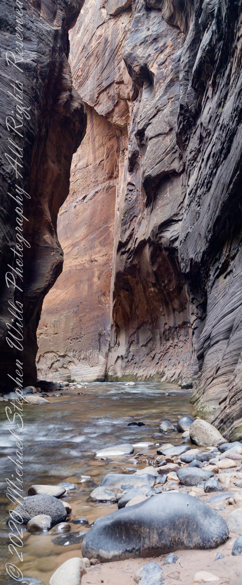
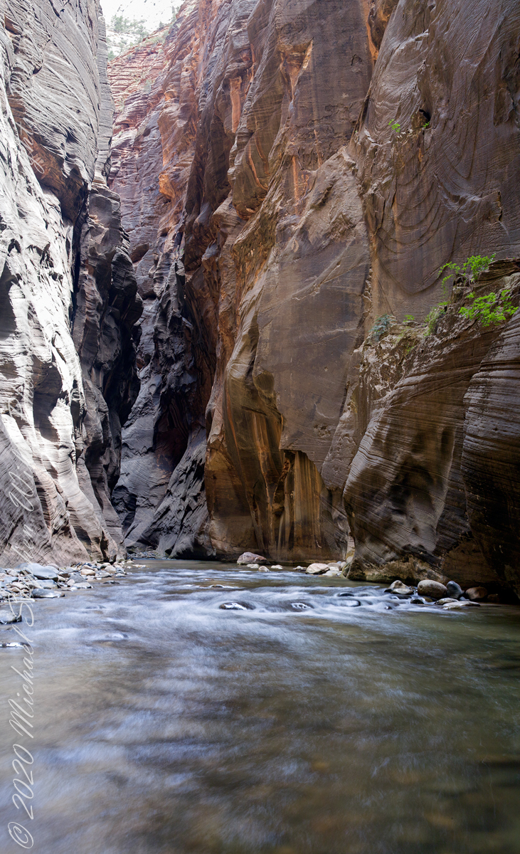
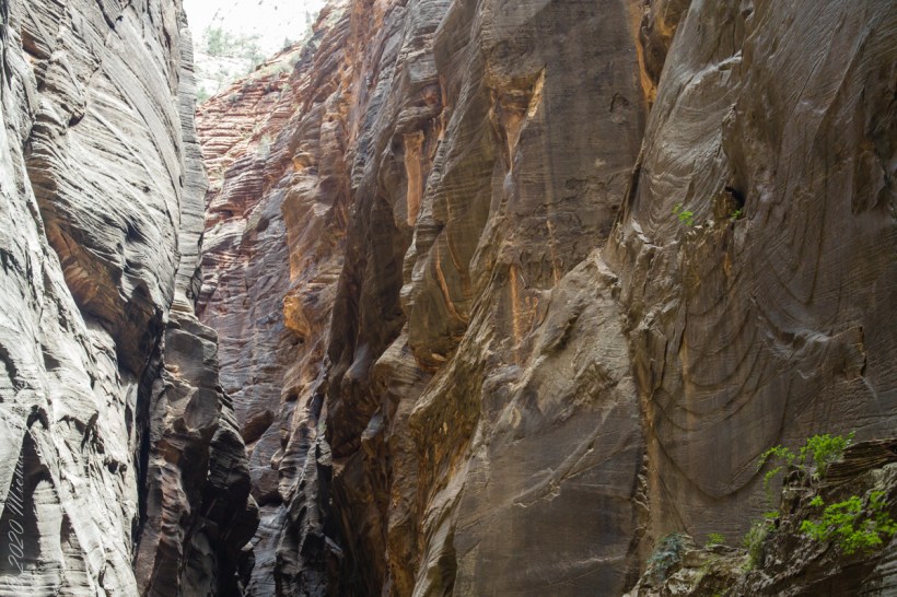
I combined two 50 mm exposures for this view of an interesting rock and beetling canyon walls. Upstream from here it is a day’s walk to reach ground safe from flash floods, downstream at least one hour. Narrows of Zion National Park, Utah
Copyright 2021 Michael Stephen Wills All Rights Reserved
In the nature of fame, today Watkins Glen is the best known of the Finger Lakes State Parks. The International Speedway of that name enhanced and amplified name recognition during the post war years. Founded in 1948, the course used public roads of the town until the inevitable happened, an accident and the death of a seven year old child in a group of sidewalk spectators when a racer lost control.
The glen predates the race by 12,000+ years formed at that time from glaciation using materials from distant eons . Watkins Glen was known as a tourist attraction from the 19th century for the resort hotel on the south gorge rim, acquired and developed by New York State in the first years of the 20th century.
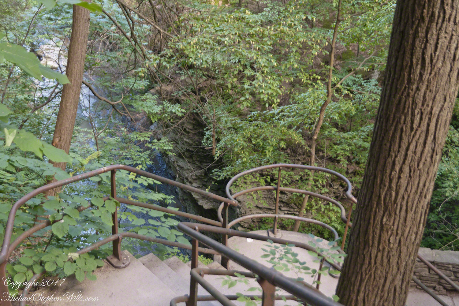
From a gate off “Lovers Lane” a sturdy flight of concrete steps with custom made handrails lead to an observation platform over the gorge. This feature will be known to many future generations……
…….the fine grained concrete is worthy of a Roman wall, the heavy iron handrails were built to specification as flowing curves unlike what is done today: built as modules and accommodated on site.
In the 20th century the fame of Watkins Glen attracted the road race, the popularity of racing enhanced park attendance. Today, the gorge trail of crowded summer weekends. On Tuesday, August 1, 2017 Pam packed a picnic lunch and we made a late start for a weekday visit. The upper entrance is enhanced by mature trees, oak, elm, hemlocks. We had our picnic under these on a moldy picnic table enhanced with a green striped table cloth and fresh coffee.
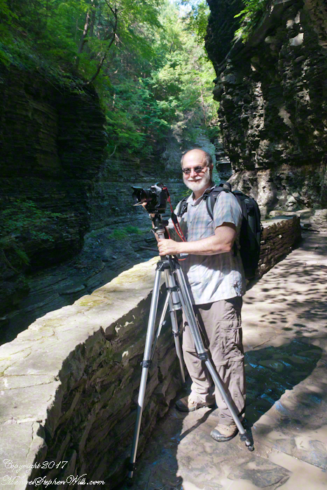
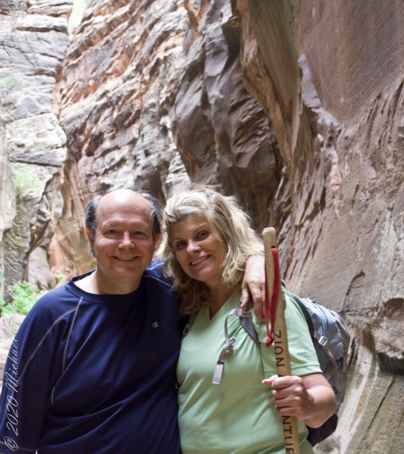
Pam is my personal photographer. Here is an example of her work.
To give me my due, I did the driving and carried the 30+ pound pack into the gorge.
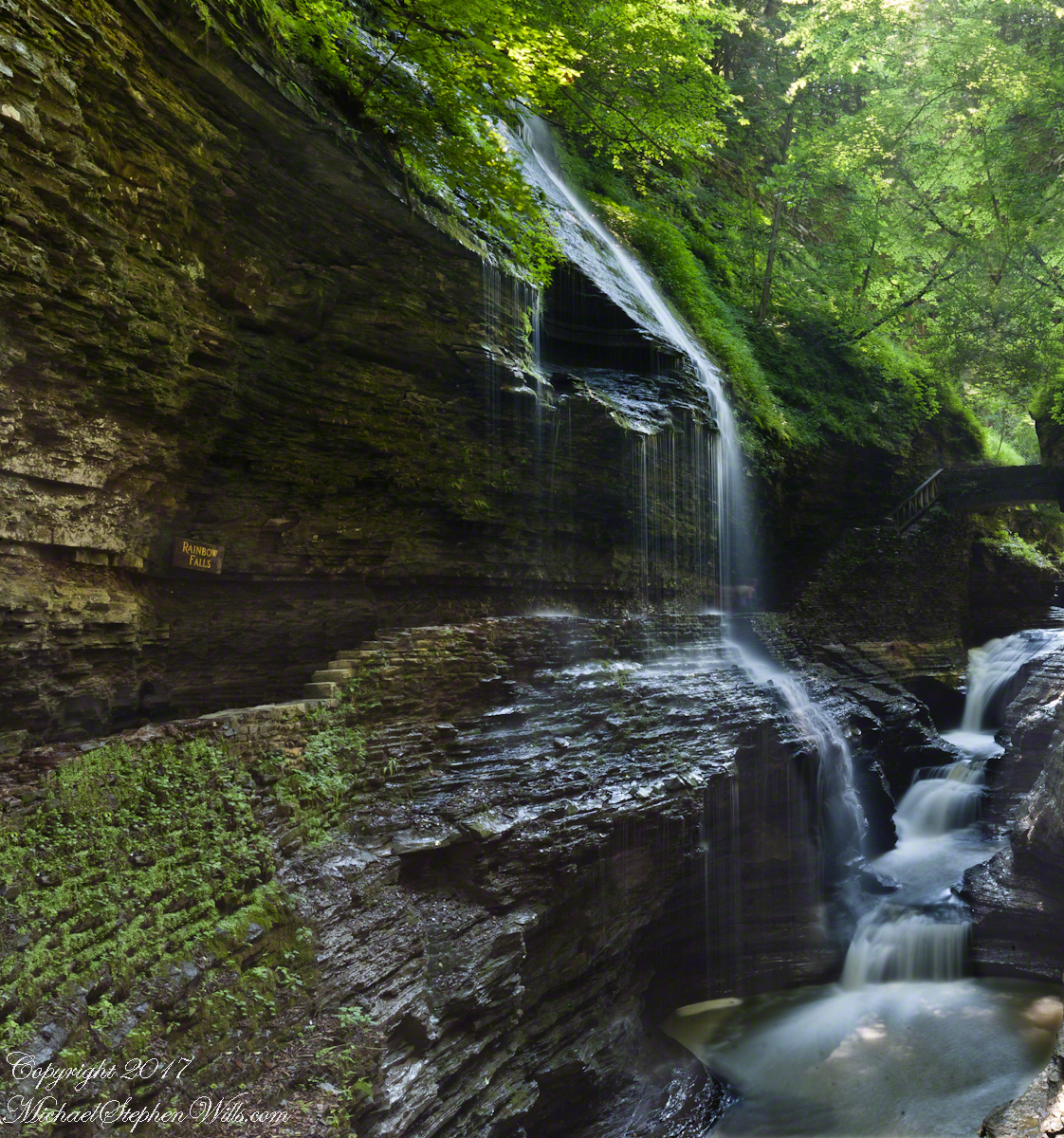
Pam captured me in position downstream from Rainbow Falls with a Manfrotto tripod with hydrostatic ball head on which is mounted a Canon EOS 1Ds Mark III and Canon EF 24mm f1.4 II USM lens, Tiffen nd 0.9 filter.
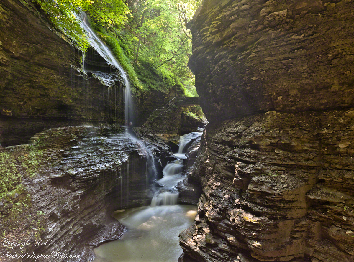
It was coming up to 4 pm eastern daylight savings time, the sun still high overhead. I needed to carefully choose a position for a frame in the wide angle lens without hot spots. Here are two results.
The sun was just of the gorge rim, to the right. Rainbow Falls forms from the tributary to Glen Creek cascading over the gorge walls.
Visitors walk under the falls where falling water eroded the soft, underlying stone to form an overhang.
Copyright 2021 Michael Stephen Wills All Rights Reserved
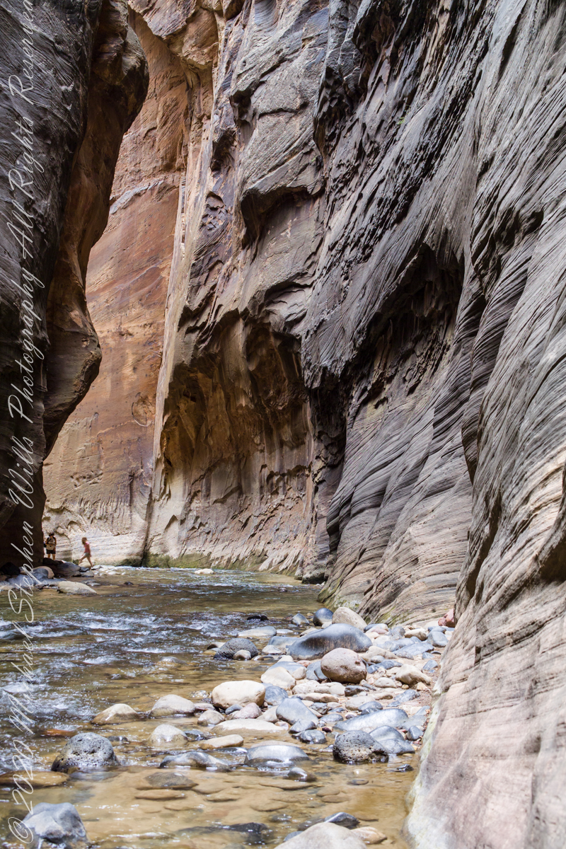
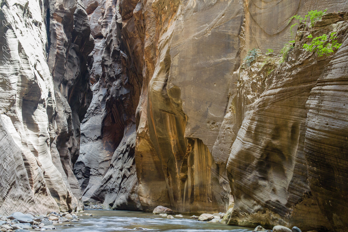
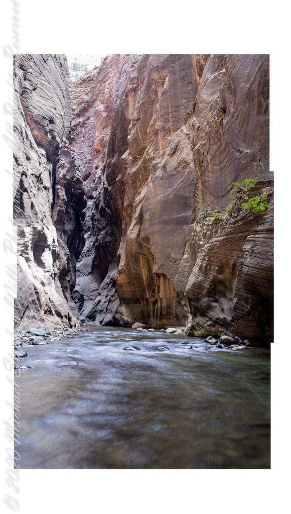
This long exposure blurs the two distant human figures looking downstream toward junction of Orderville Canyon, around corner. Narrows of Zion National Park, Utah
Copyright 2021 Michael Stephen Wills All Rights Reserved
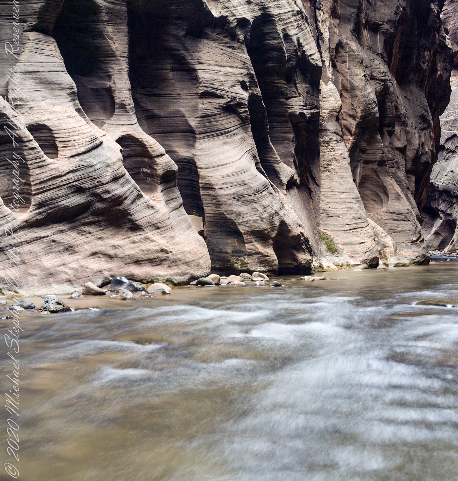
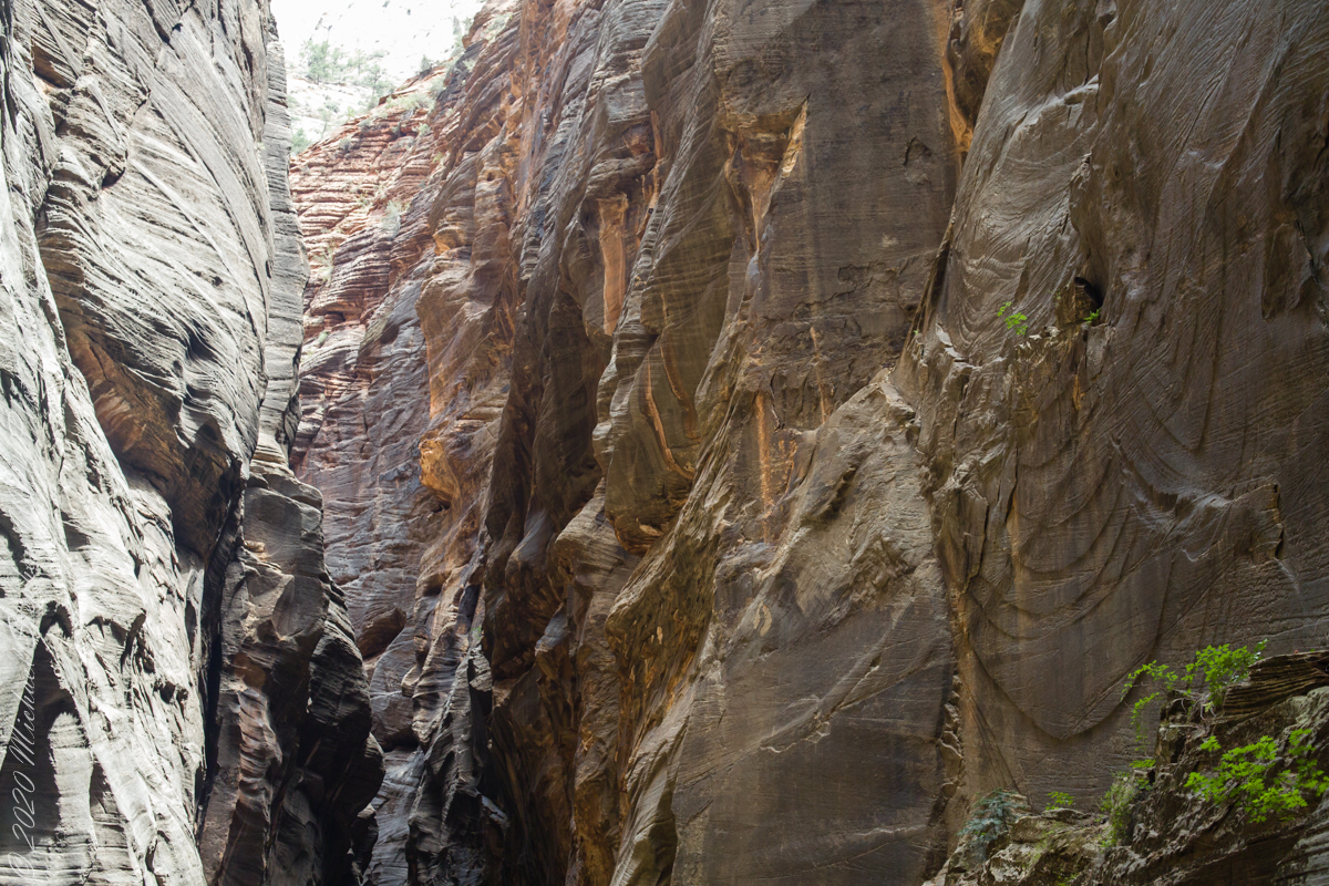
The pronounced cross-bedding (diagonal layering) of this Navajo Sandstone wall exposed by Virgin river erosion is the effect of wind drifting sands of the largest known sand desert formed in the Jurassic era lasting for 56 million years (185 million years ago). This photograph contrasts the ever new Virgin River with this ancient rock, deepening shadows suggest the depth of time.
Copyright 2021 Michael Stephen Wills All Rights Reserved
My research for Zion Narrows I included a useful map. Perusing the the National Park Service web site I could find nothing for the Narrows. This week, while perfecting the three file merge, I kicked around in “google” and found this map hidden away in a section devoted to dedicated canyoneers planning multiple day backpacks through the entire canyon. These trips are from the “top down” and, I suppose, they do not want to expose the information to day trippers.
Anyway, I downloaded the map and present it here. You can either click on the hyperlink or click “download” to view the map. The file is a 2.5 MB pdf, if you want to download it. The trail accessible from the park proper starts from the bottom. Pam and I made it to just beyond where Ordway canyon joins, about 2 hours from the start. Note there are NO places to escape a flash flood beyond this point and, below, we learned from observation there are few places and many of these were for hikers more, lets say, nimble than Pam and myself.
Our first day was spent hiking up to the narrowest section of Zion Canyon, called “Wall Street,” where the gorge walls are 1,000 feet high. There, the river is 20 feet across in places and not much wider anywhere. There is NO high ground to escape flash floods, only the high, unforgiving canyon walls.
As we were planning to venture beyond the tame sidewalk of “The Riverside Walk”, our first stop was to an outdoor supply store in Springdale to rent canyoneering shoes, to wade the river comfortably and safely, a sturdy stick to improve stability and free advice on current conditions for the potential of flash floods. You can see the stick in this portrait, mid-narrows. This was July, with a danger of torrential downpours, and we were nervous about this; however, proceeded anyway.
Several miles in, I set up the Manfrotto 468Mg studio tripod with the Kodak DSC pro SLR-c (the “c” specifies compatibility with Canon lenses) and the Canon 50 mm f/1.4 USM lens. Here we look downstream, the way we came. I waited for a clear shot w/o fellow hikers coming up from behind. This was before investing in a wide-angle lens. My plan was to stitch the three shot together.
Click on each photograph for a larger view, in new tab.
Bottom
Middle
Top
Rough draft of the combination.
The work remaining on the rough draft are to match the edges as close as possible, smooth out the differences until the joins are indiscernible.
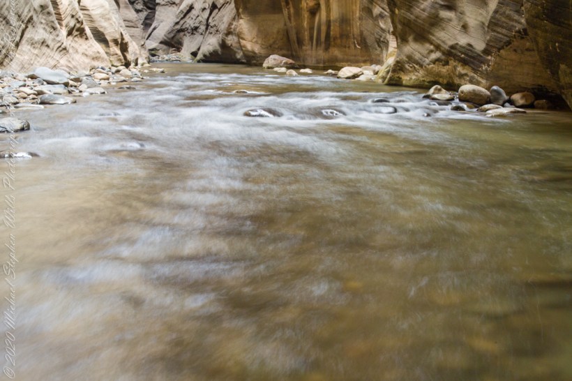
Here are the same photographs as a slide show. I enjoy how the long exposure blurred water lead the viewer into the gorge walls.
Captured with a Kodak DCS Pro SLE/c dslr and a Canon EF 50 mm f/1.4 lens stabilized with the Manfrotto Studio Tripod model 475 and the 468 Hydrostatic ball head.
Copyright 2021 Michael Stephen Wills All Rights Reserved
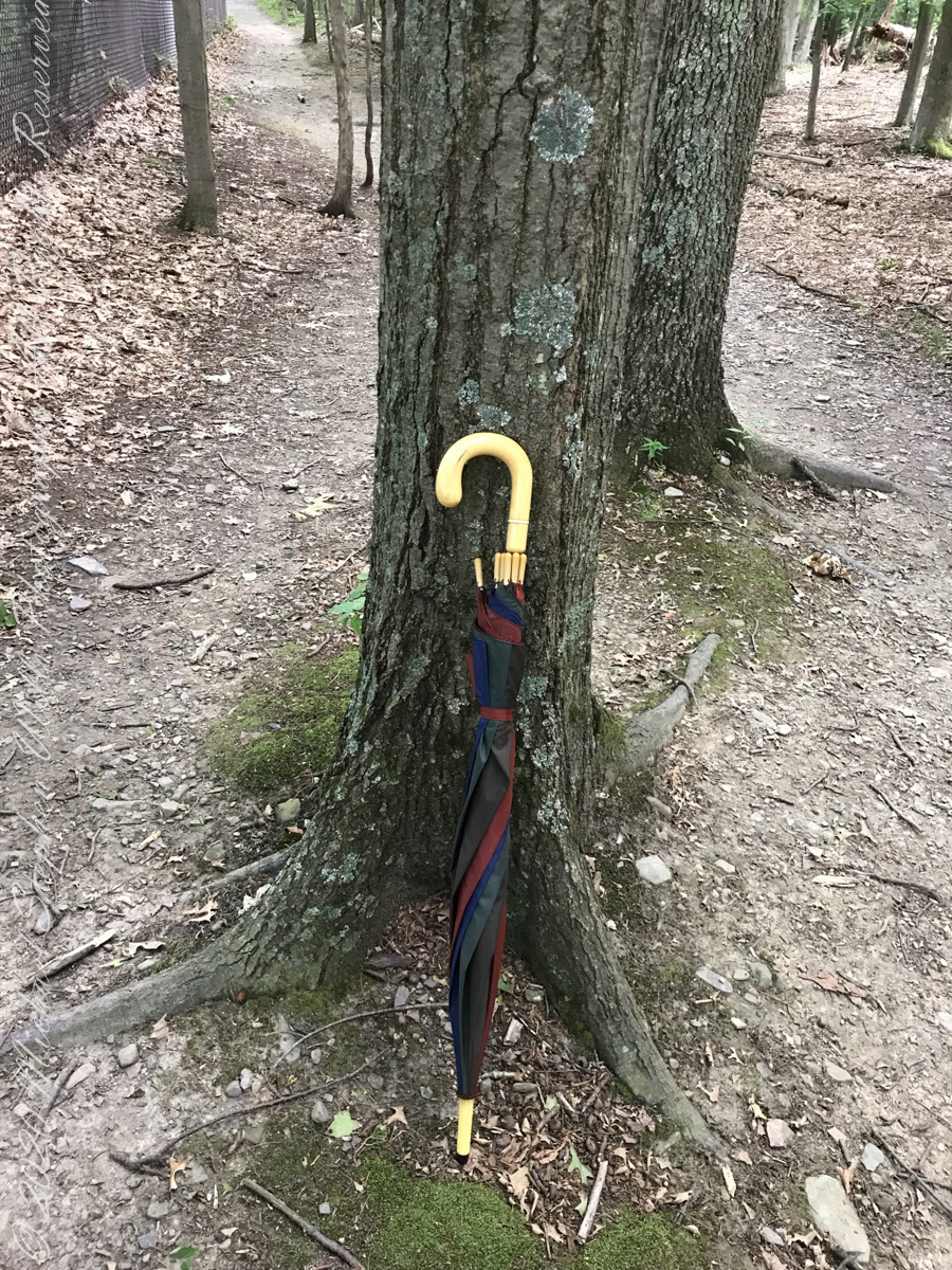
Constant winds from thunderstorm updrafts, I brought along an umbrella just in case.
Click photograph for slide show. To do this from WordPress Reader, you need to first click the title of this post to open a new page.
Maple Tree
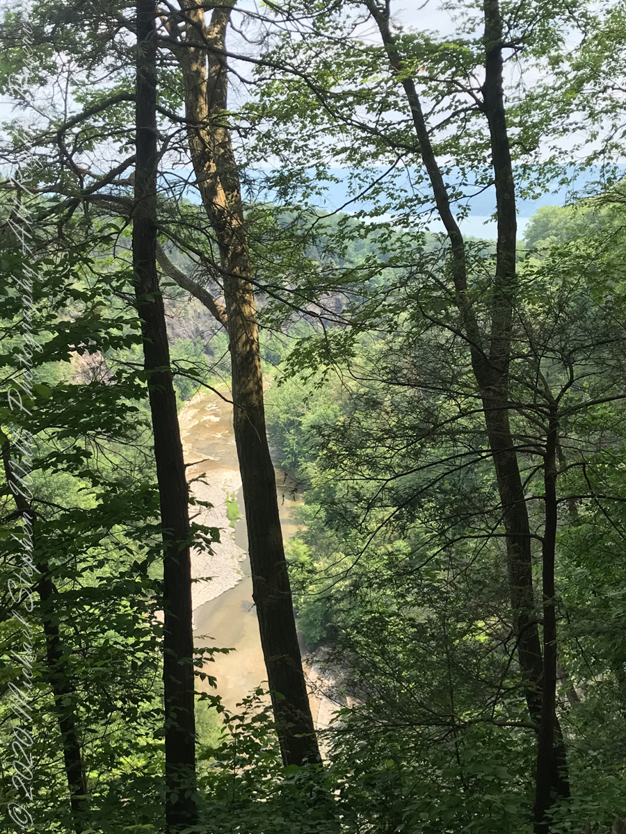
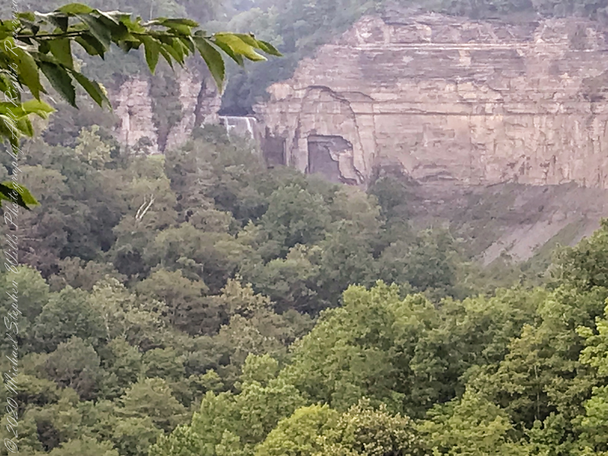
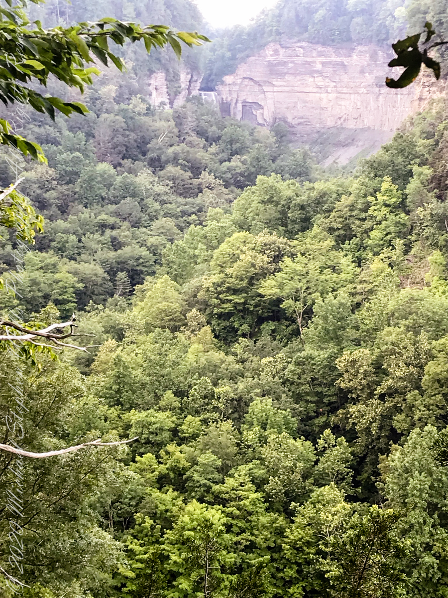
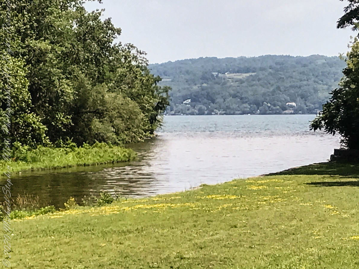
View from the South Rim Trail. The water flowing from Taughannock Falls to Cayuga Lake.
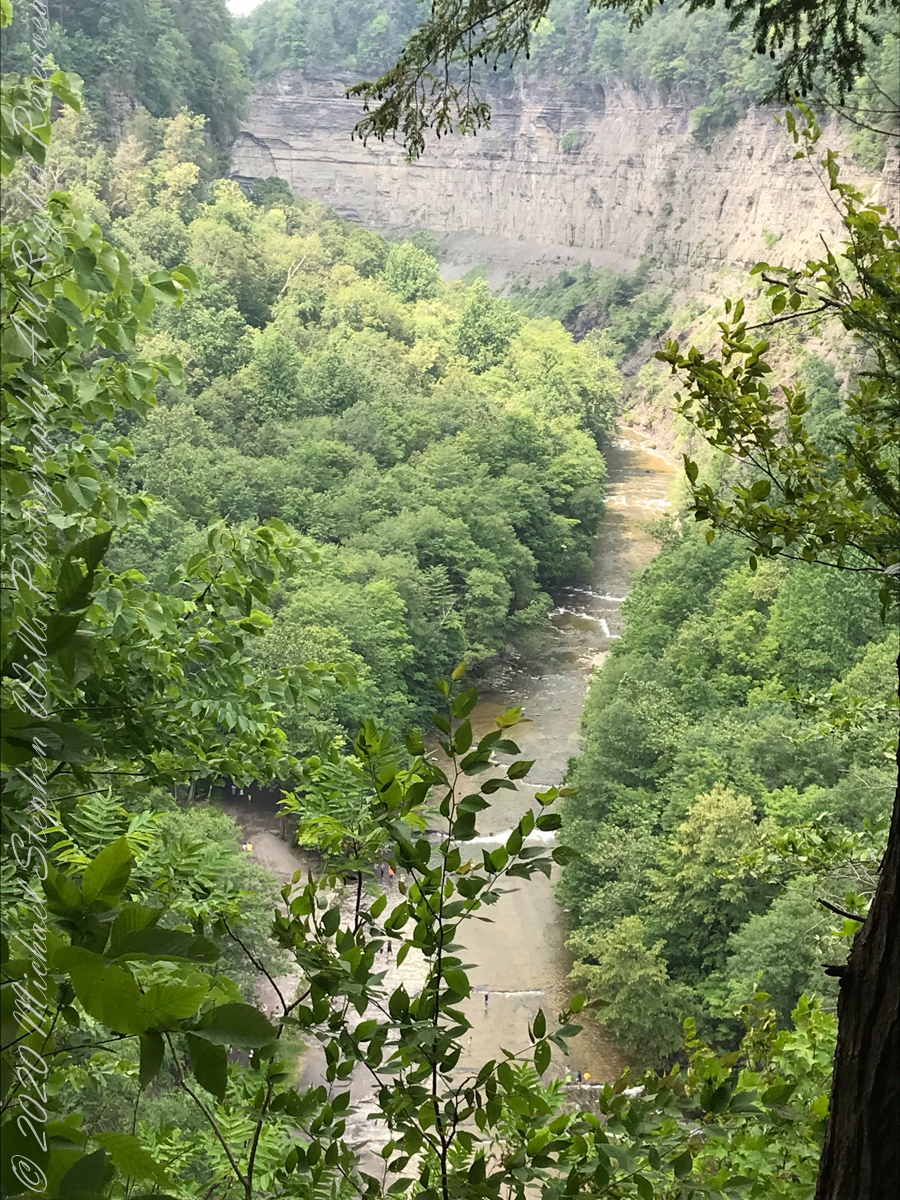
The steep, high gorge walls below the falls on a humid July morning.
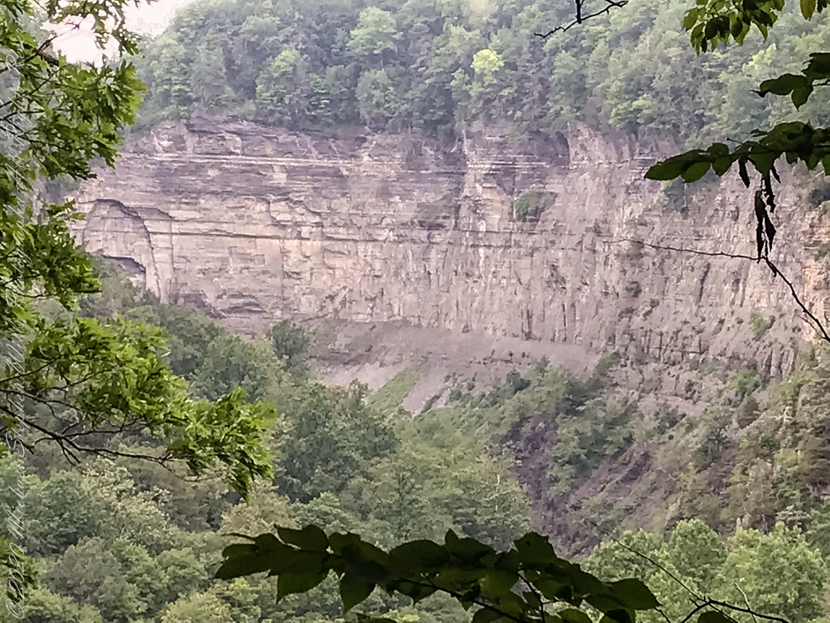
gorge walls
My umbrella
Taughannock falls in distance
Taughannock Falls in distance
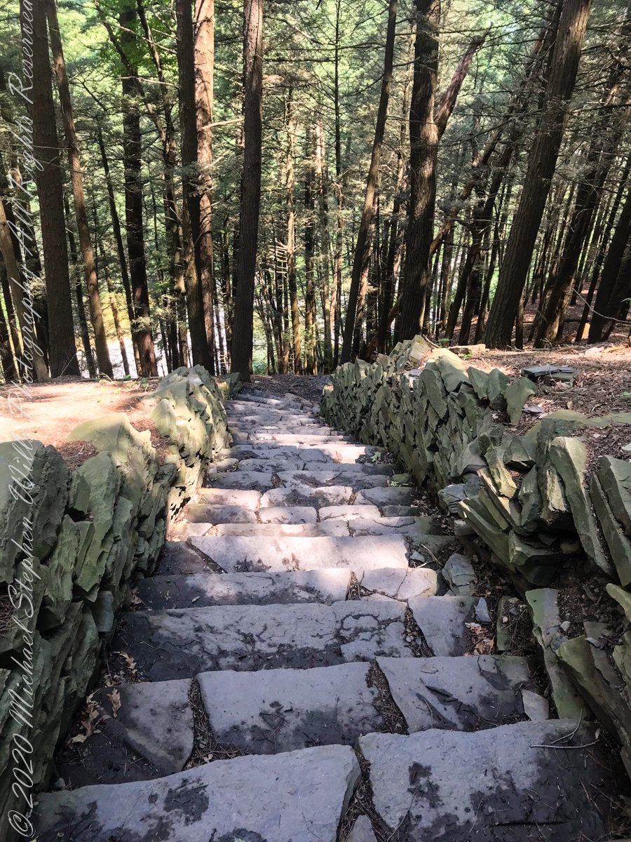
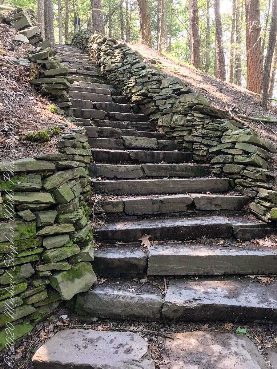
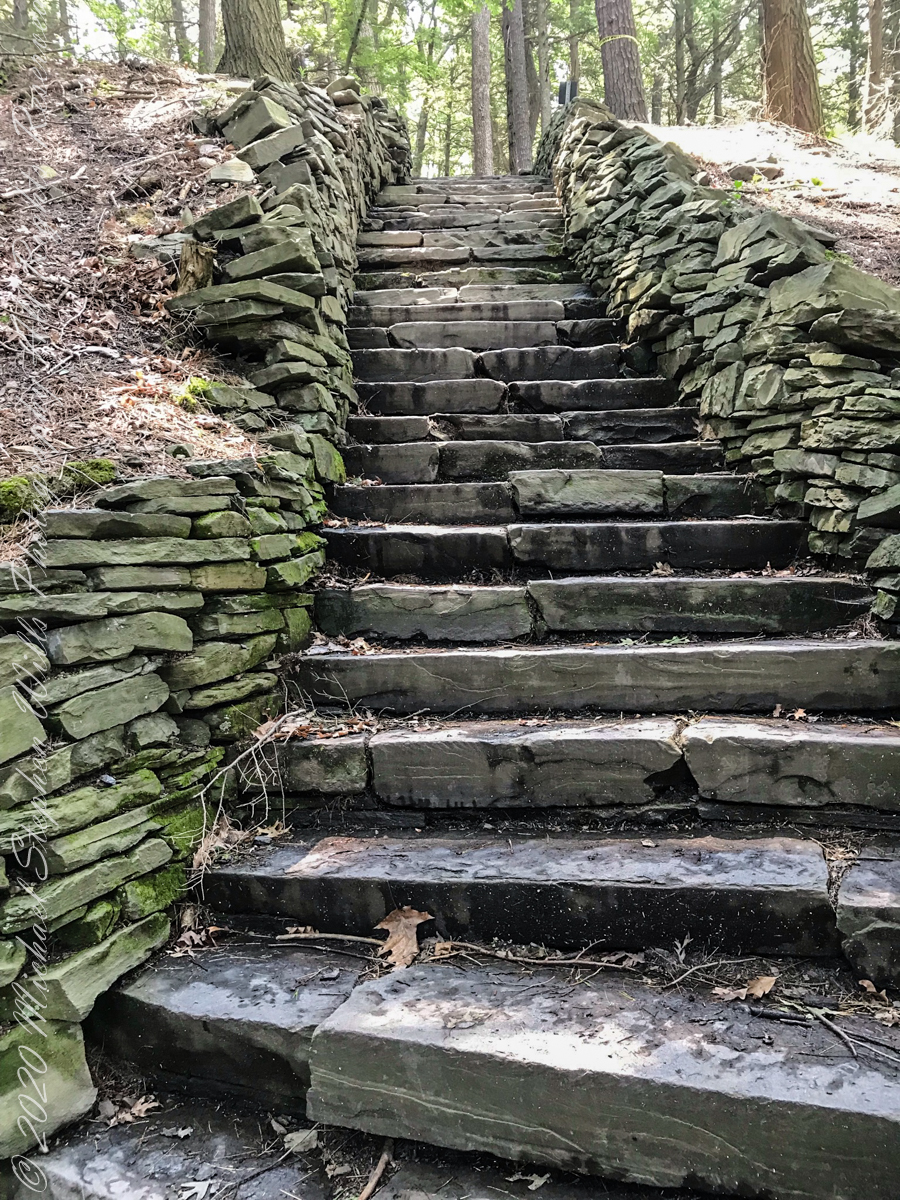
South Rim Stairs built by the Civilian Conservation Corps in the 1930’s
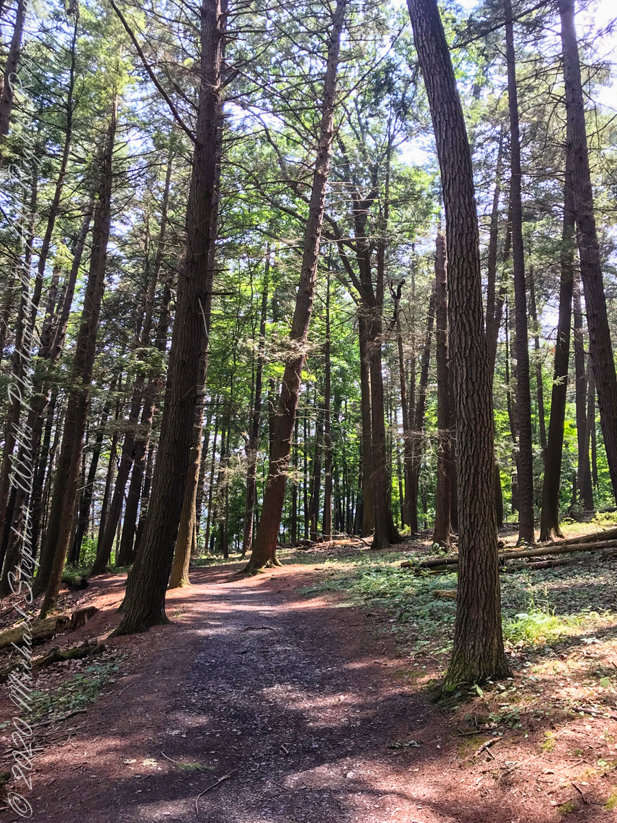
Pine Forest at foot of stairs
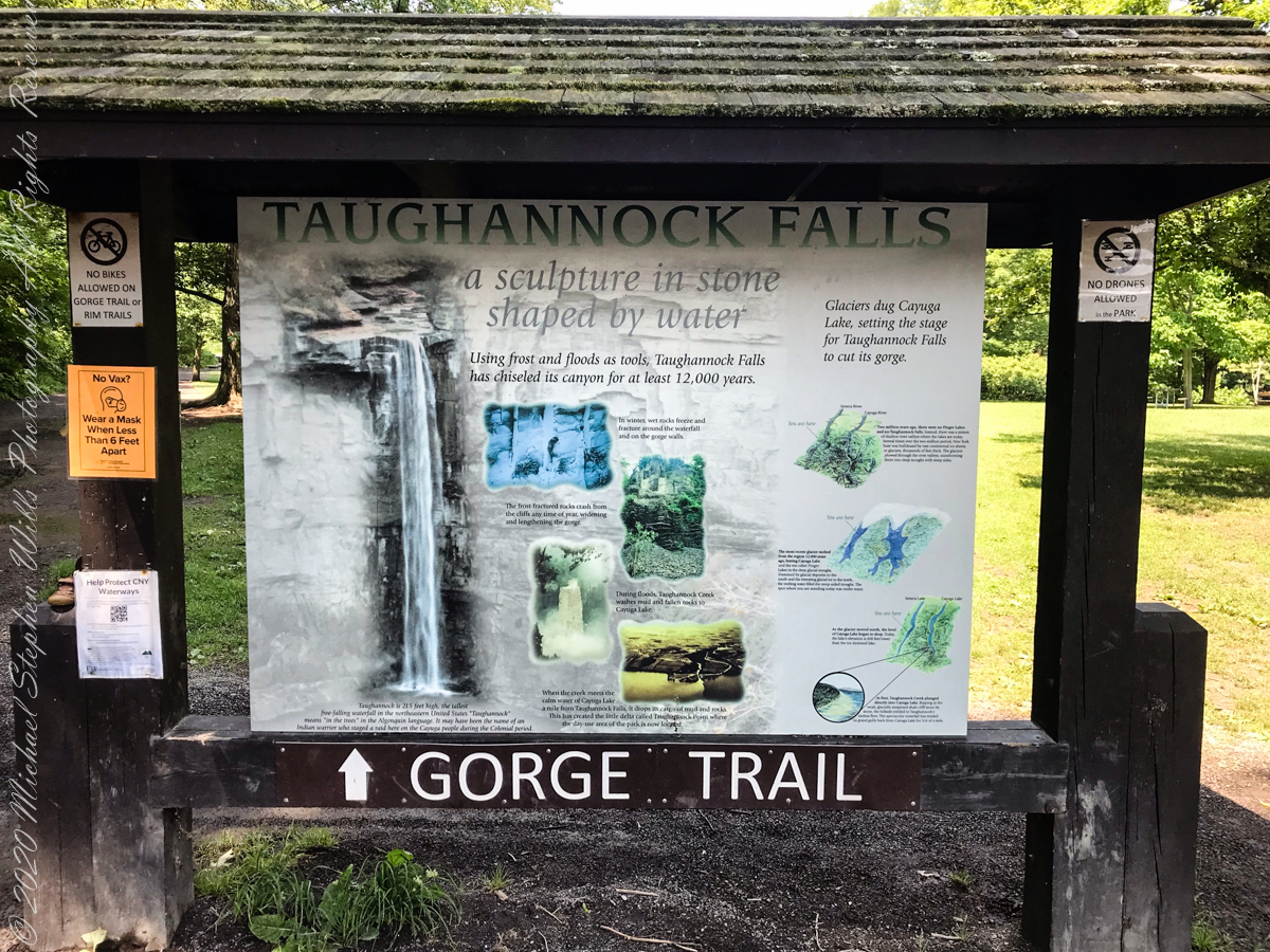
An interesting presentation at the Gorge entrance
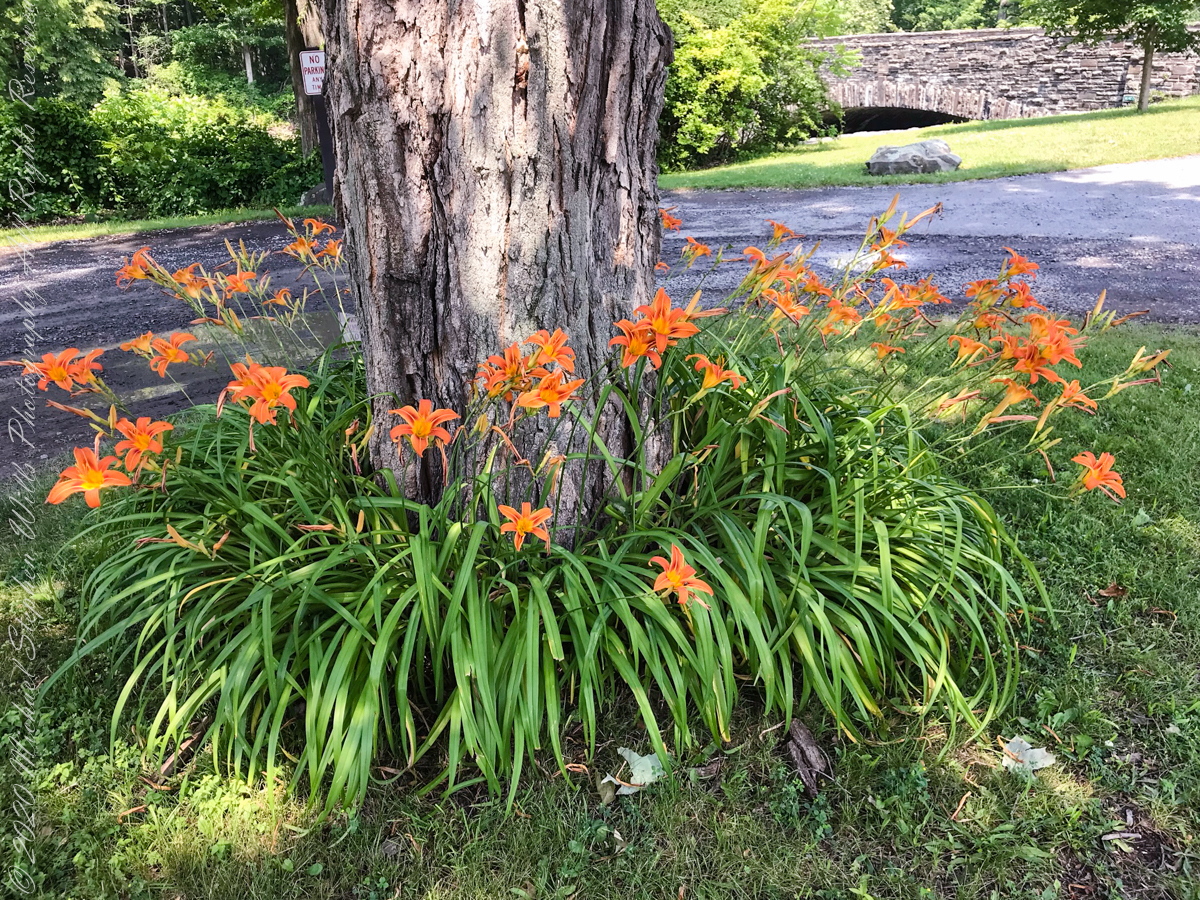
Tiger Lilies
brown creek water meets Cayuga Lake (900 feet deep)
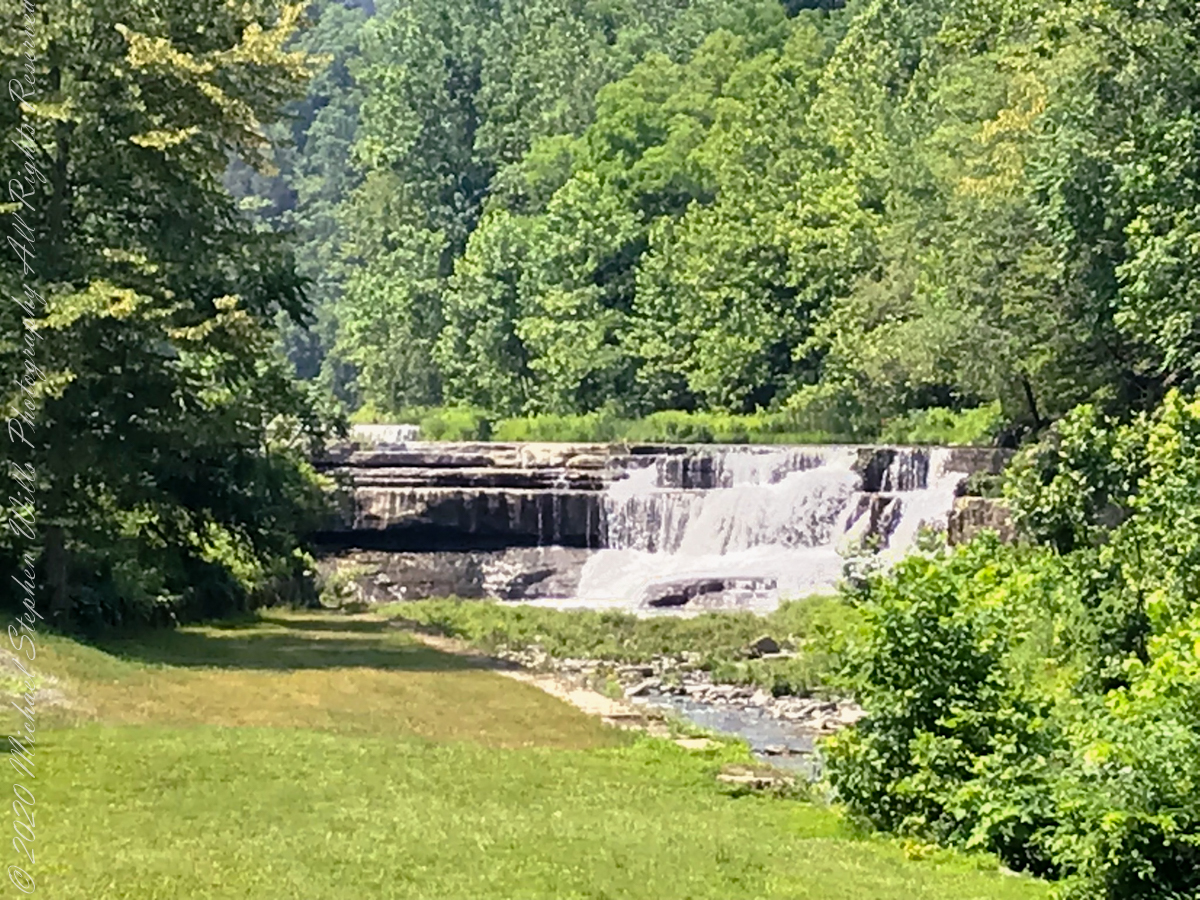
Last waterfall of Taughannock Gorge
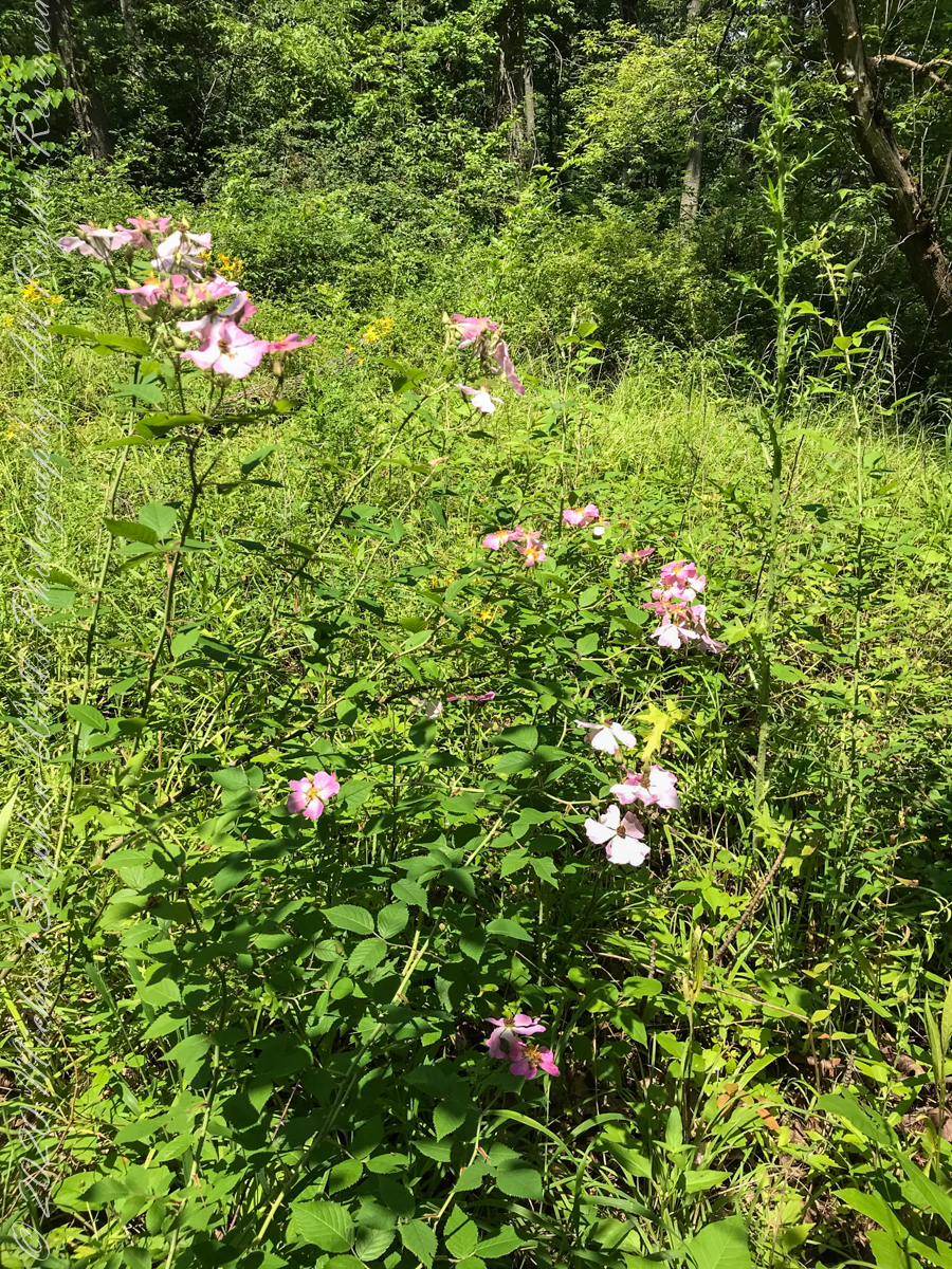
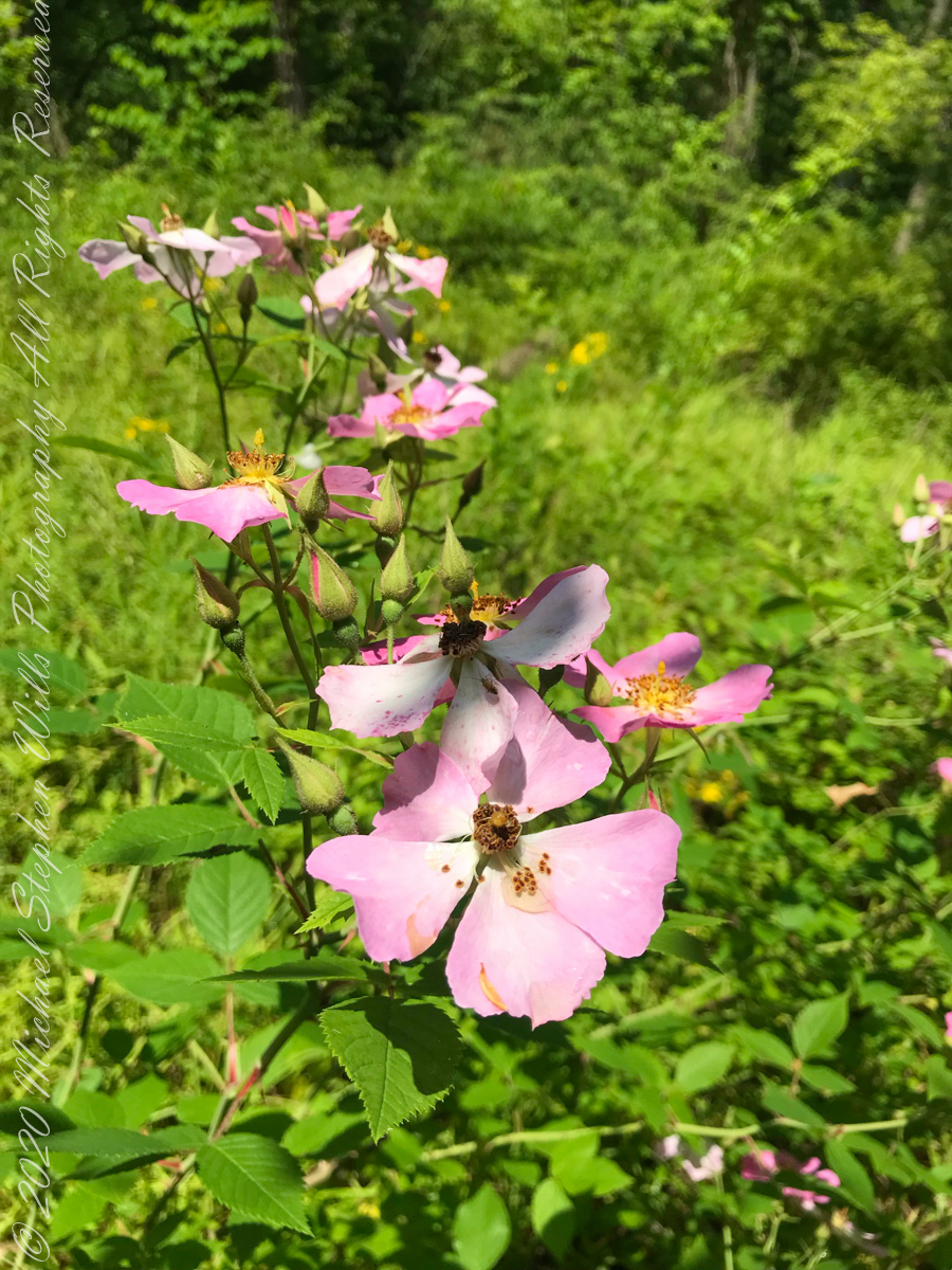
wild roses
Wild rose blooms
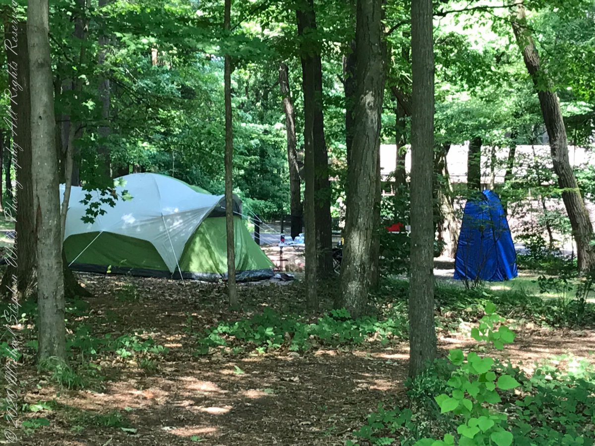
camping on North Rim
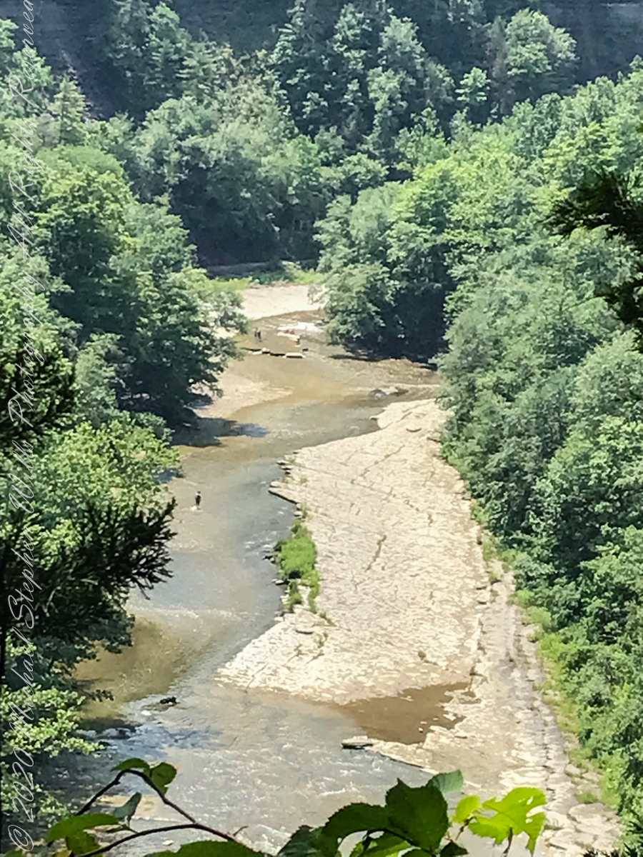
North Rim Gorge view
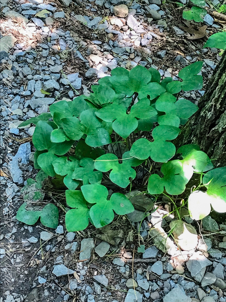
Lobe leaved Hepatica
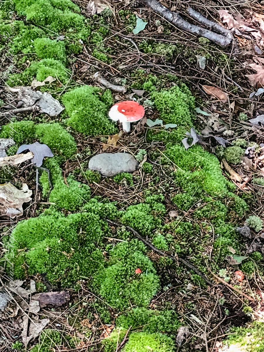
Mushroom and Moss on the “wetter” north rim
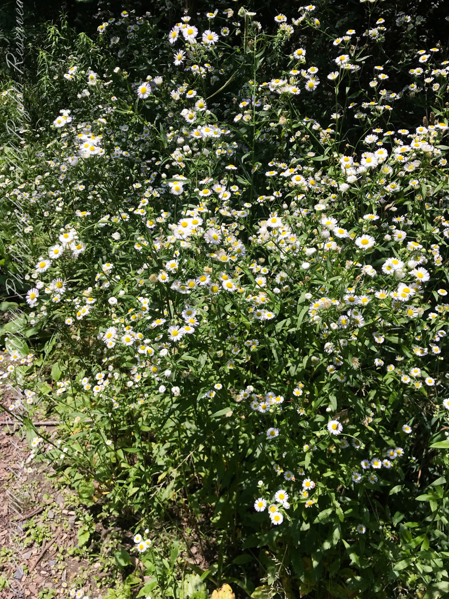
asters, an invasive species
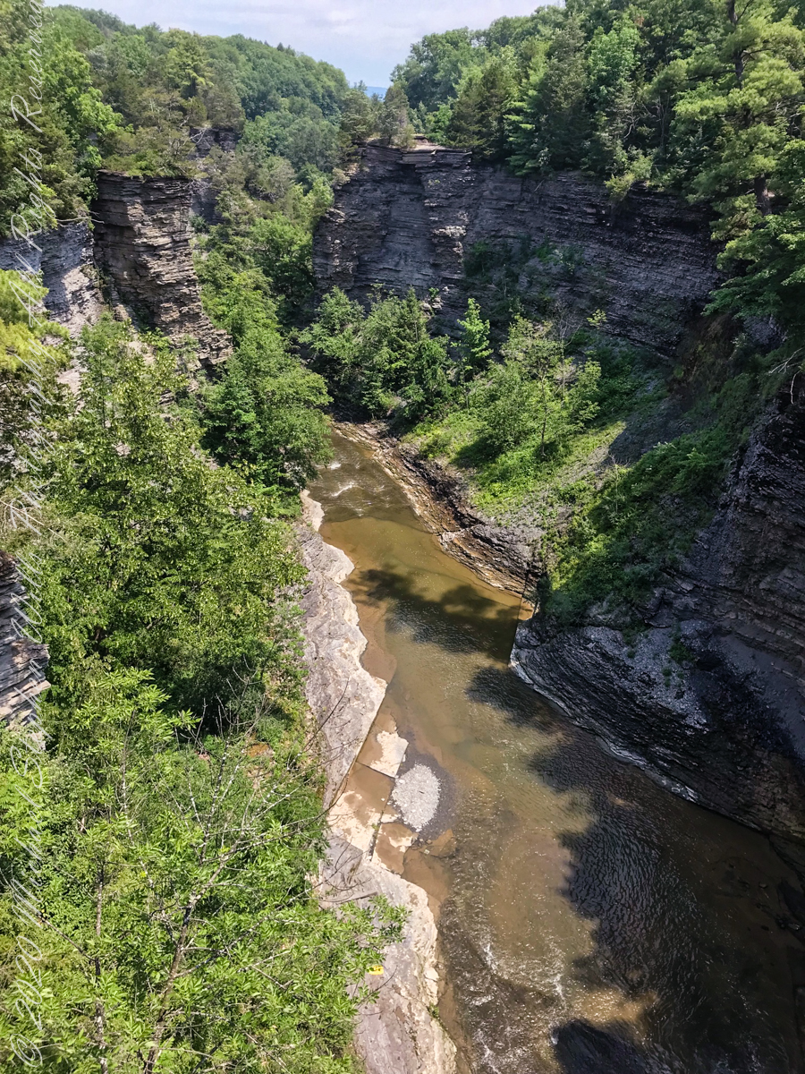
The dramatic and virtually inaccessible gorge above Taughannock Falls
Click the “Watch on YouTube” for a larger format view and more information about each video.
Taughannock Falls Gorge on a humid summer morning
Hemlock Forest on South Rim Trail
Taughannock Falls Gorge from South Rim Trail
Taughannock Falls from South Rim trail
View of Taughannock Falls Gorge from the North Rim trail on a humid summer (July) morning. Turkey Vultures circle overhead…they are there most summer days.
View of the first waterfall of Taughannock Gorge from the railroad bridge linking the North and South Rim trails on a humid summer (July) morning. This large waterfall empties to the gorge above the 210+ foot Taughannock Falls.
Copyright 2021 All Rights Reserved Michael Stephen Wills
Effects of these dual waterfalls is deeply refreshing for the people on the narrow walkway underneath.
ISO 160, 1.3 sec at f/ 8.0
Photograph two of this Hanging Garden series has the aspect shifted slightly to include the sheer cliff hovering over the waterfalls. A low ISO and tamped down diaphragm (f/8) resulting in longer exposure (1.3 sec) impart a presence for two low volume waterfalls.
Captured with a Kodak DCS Pro SLE/c dslr and a Canon EF 50 mm f/1.4 lens stabilized with the Manfrotto Studio Tripod model 475 and the 468 Hydrostatic ball head.
Copyright 2021 Michael Stephen Wills All Rights Reserved
Visitors to Zion on a narrow path beneath this vast overhanging cliff of Navajo sandstone.
ISO 160, 0.8 sec at f/ 8.0
Changing the camera angle from the last “Hanging Garden” photograph, with visitors, here the visitors are less apparent, overawed by the waterfall. A low ISO and tamped down diaphragm (f/8) resulting in longer exposure (0.8 sec) captures and blurs just enough the fine waterfalls.
Captured with a Kodak DCS Pro SLE/c dslr and a Canon EF 50 mm f/1.4 lens stabilized with the Manfrotto Studio Tripod model 475 and the 468 Hydrostatic ball head.
Copyright 2021 Michael Stephen Wills All Rights Reserved