Torr Head Stories V

The Way South –

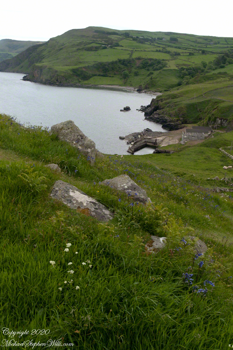
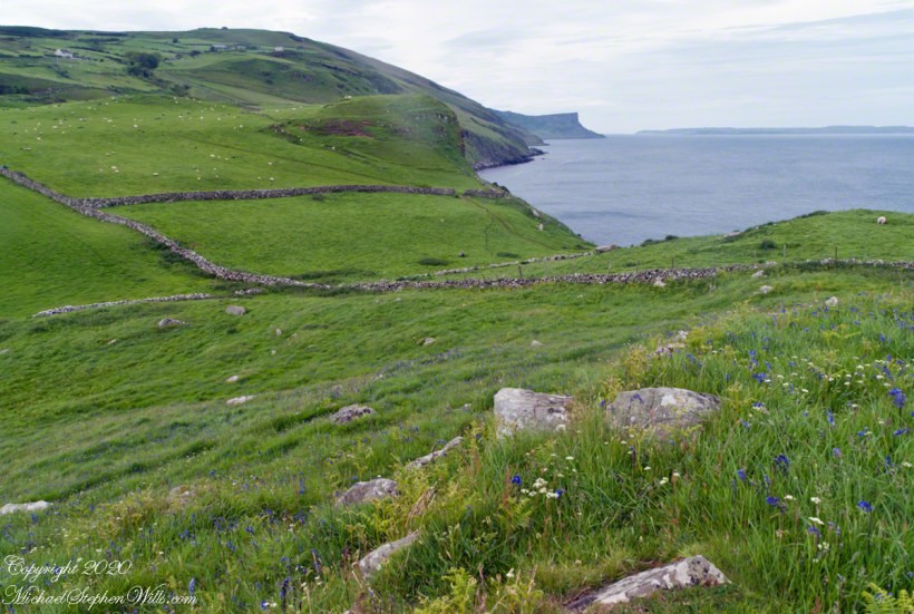
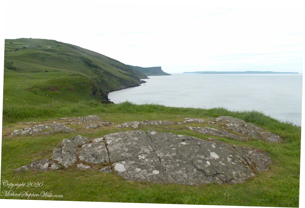
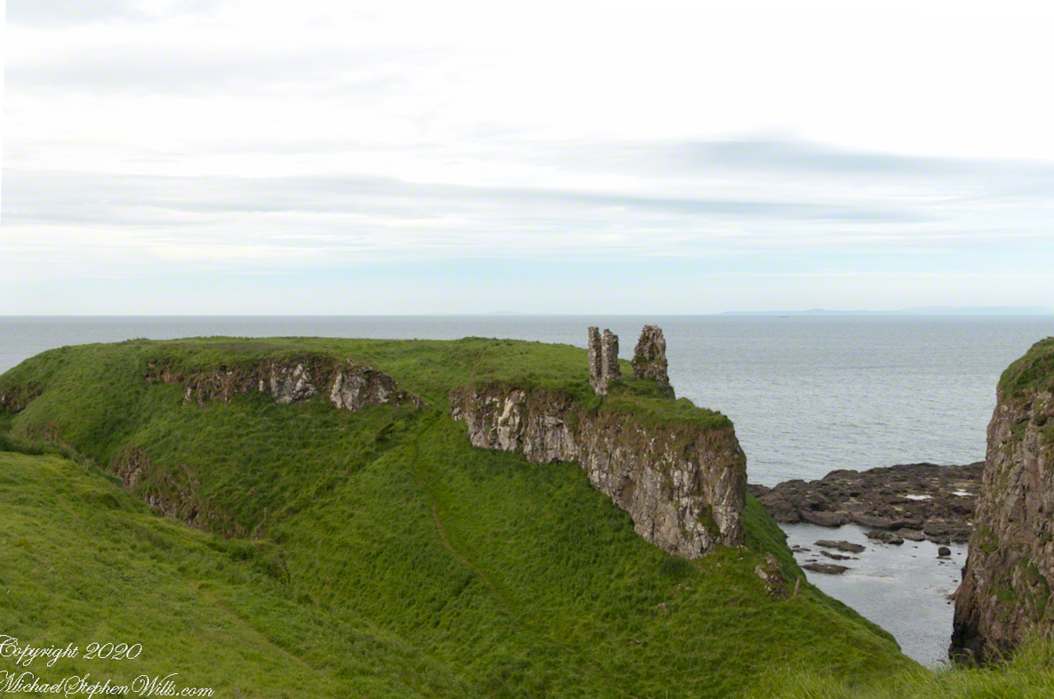
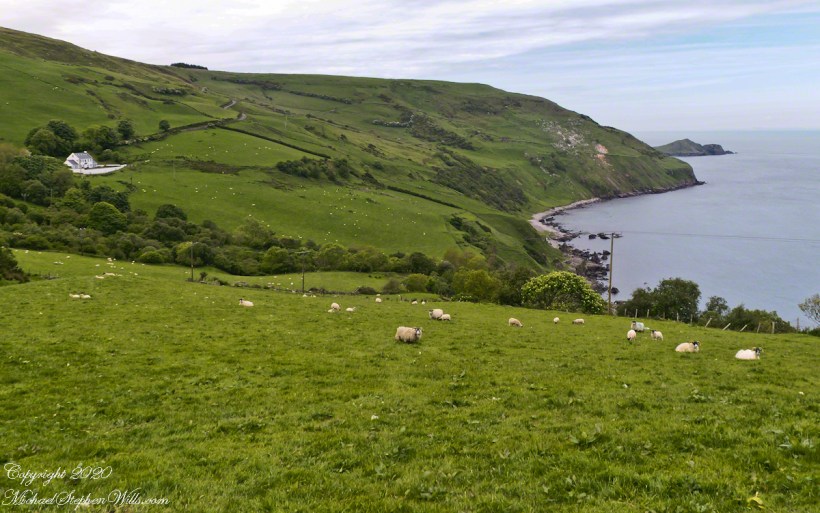
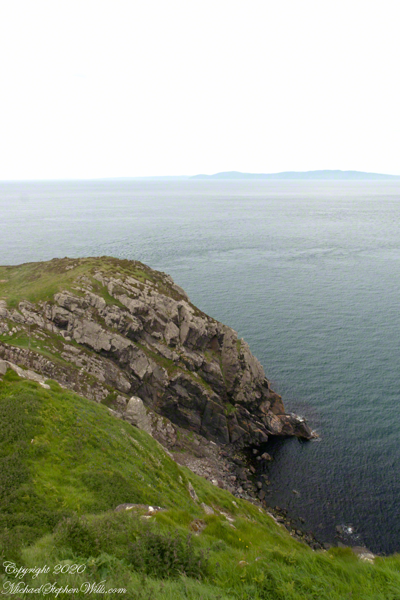
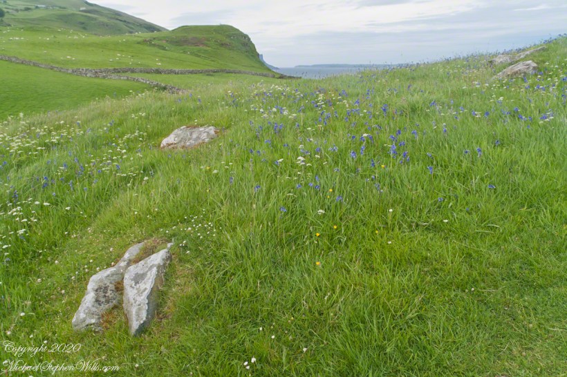
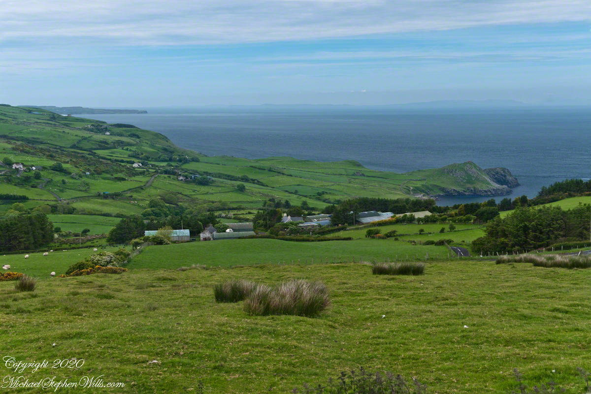
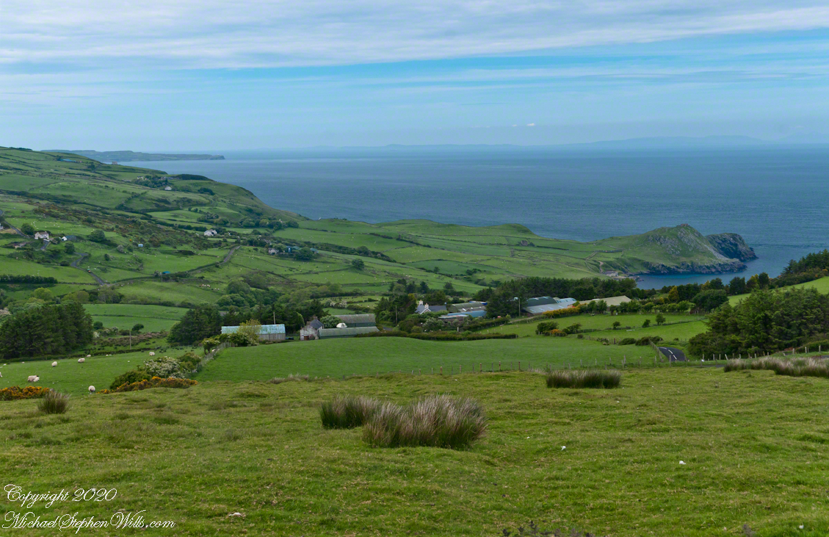
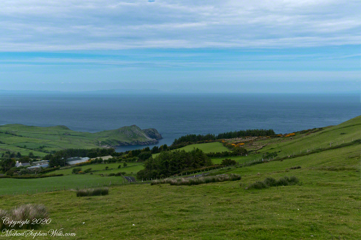
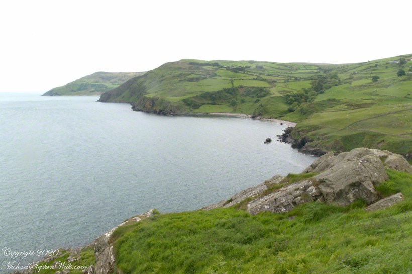
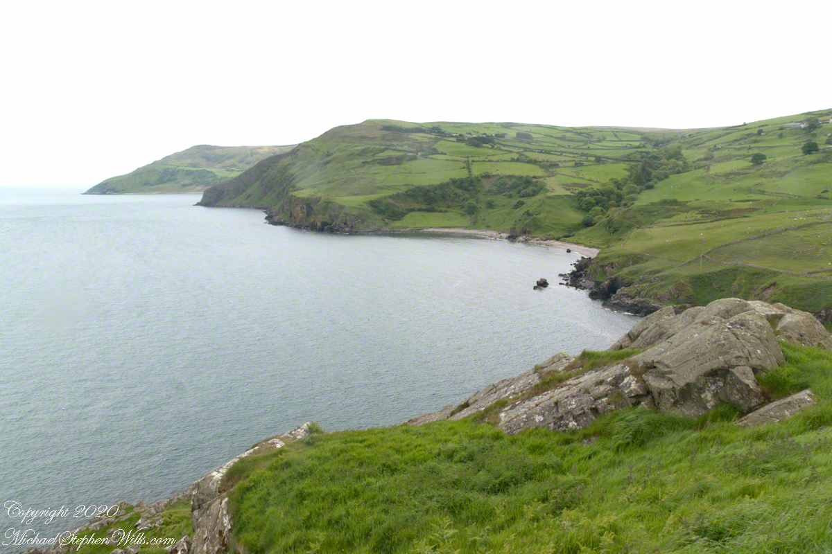
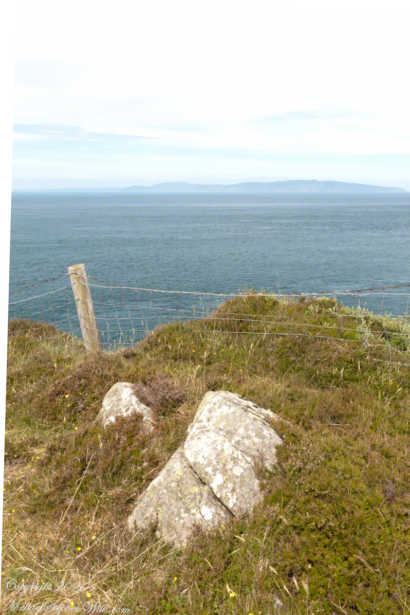
Scottish influences touched the landscape covered by yesterday’s post, today we continue on this subject with these south facing views from Torr Head. The far ridge of Torrcor marks Loughan Bay.

A townland on the other side of Torrcor hill (and townland) has an eponymous ruin, Altagore Cashel. Mores the pity we did not visit this site, a thick drystone enclosing wall from the 5th century (you can see photographs from another site at this link). Cashel is from the Irish Caiseal, a circular, defensive fort (“ring fort”).

Books such as “Antrim and Argyll: Some Aspects of the Connections” tell of connections over the millennia, clan associations between the islands and ring forts such as Altagore Cashel.

Explore my photography on Shutterstock for use with your blogs.

Copyright 2022 All Rights Reserved Michael Stephen Wills

Torr Head Stories IV

Salmon Run

Late spring and summer, weekdays, a net is stretched across the bay to catch salmon nosing up the coast, searching for their home spawning stream, here called Altmore Burn. “Burn” is a Scottish term for a fresh water source, evidence of the influence 12 miles across the north channel.

The small harbor seen here from Torr Head is for the salmon fishery. Small boats will seek shelter here from the wind and tides strong enough to roar in passing the Head, like a fast flowing river.

Click me for the first post of this series.

Copyright 2022 All Rights Reserved Michael Stephen Wills

Torr Head Stories III

Neolithic Passage Tomb

Taking in a flower meadow, foreground, coaster sheep pastures, the photograph, below, looks north from Torr Head. The high hill, midground, is Greenanmore, notable for a the largest passage tomb of the Antrim Glens. Locally known as “Barrach’s Tomb,” for the Red Branch knight of the 1st Century AD fort on Torr Head, tree ring research of the mid-20th Century dates these tombs in the neolithic The hilltop passage tomb was an ancient relic when the mortar of Barrach’s Torr Head fort was drying.

When I enlarge the original photograph, visible on the ridge is a decommissioned Cold War listening post, the tomb is near that. The distant land across the North Channel water is Rathlin Island.

Click photograph for a larger view. To do this from WordPress Reader, you need to first click the title of this post to open a new page.

Click me for the first post of this series.

Copyright 2022 All Rights Reserved Michael Stephen Wills

Torr Head Stories II

Ancient Castles and Raithlin Island

Knights of the Red Branch appear towards the end of “Deirdre and the sons of Uisneach”, a tale from 1st century AD Ireland, as protectors of the lovers Dierdre and one of the sons of Uisneach, named Naoise. The two fled to Rathlin Island, seen in the distance in the following photograph.

From Rathlin Island they passed over the Irish Sea to Scotland where they lived happily for a term of years.

Click me for an earlier Torr Head post “A Bit About Torr Head.”

Barrach’s fort no longer exists, a Coast Guard Station was built over the site. There are other intact ruins on this picturesque coast. Here is one close to the Giant’s Causeway, Dunseverick Castle.

Copyright 2022 All Rights Reserved Michael Stephen Wills

Torr Head Stories I

Mysterious Barrach, Knight of the Red Branch

Torr in Irish is a steep rocky height. Likewise, Corr means odd, uneven, rounder, convex, curved, peaked, projecting, smooth. Combined Torcorr is the townland where we stopped on the Torr Road, halted by our wonder at this sight.

In the distance, Torr Head projects into North Channel, the closest land to Scotland. Following the coast, the cliffs in front of Torr Head are home to numerous sea birds such as Fulmars (family Procellariidae) nad Oystercatchers (family Haematopodiadae). Along the rock beaches next Eider Ducks (genus Somateria). You might see the Common Buzzard (species Buto buteo).

Click photograph for a larger view. To do this from WordPress Reader, you need to first click the title of this post to open a new page.

Click me for an earlier Torr Head post “A Bit About Torr Head.”

In the following photograph Torr Head seen from immediately above. I stand on the ancient site of Barrach’s fort, a knight of the Red Branch. After some internet research I cannot find another reference to this knight, other than the information placard on Torr Head.

A Bit About Coolranny Townland

Neat and tidy

2014, the count of townlands on and around the island of Ireland was 61,098 with most of Irish Gaelic origin predating the Norman invasion, first recorded in 12 century church records. The names have a pride of place reflected in the beauty of the namestones along Torr Road.

Click photograph for a larger view. To do this from WordPress Reader, you need to first click the title of this post to open a new page.

The 82 acres of Coolranny forms a slice of land running from a ridge to Loughan Bay off the North Channel of the Irish Sea across from Scotland.

See this post for a description of wildflowers flowering here in the month of June.

A spic and span cottage on Torr Road, maybe the rectory for the Saint Mary’s Star of the Sea church.

An informative placard.

Here is a slideshow of this post’s images. To visit from WordPress Reader, you need to first click the title of this post to open a new page.
Copyright 2022 All Rights Reserved Michael Stephen Wills

Torr Head Wildflower Meadow

can you see any other flowers/plans in this photograph? Please leave a comment if you do.

We parked below the Coast Guard station, headed toward the height of Torr Head. I was stopped in my tracks by the hillside meadow wildflower profusion. 

Here are a few I identified, listed by common name: Bluebell, Daisy, Meadow Buttercup, Sea Campion, Yarrow.  We love daisies and buttercups around home.  We spotted Sea Campion on the Dingle Peninsula, as well.  Yarrow is common through Ireland.  I don’t recall seeing bluebells anywhere else. 

It was the bluebells in this photograph that clued me into why I took a photograph of the hillside.  The view north takes in coastal sheep pasture looking on a portion of North Channel and the Irish island Rathelin.

The web page I used for identification was wildflowersofireland.net . Great information and links to the Botanical Society of Britain and Ireland with a distribution map.

Copyright 2022 All Rights Reserved Michael Stephen Wills

A Bit About Torr Head

the information board is not to be outdone

Twenty five minutes before the photos of Pam on Torr Head we enjoyed this view from high above. The placard captures and explains a great deal.

There is at least one tanker ship traversing the North Channel. You can just make out the Torr Road we followed through those farm buildings to the parking near the Coast Guard Station.

Here is a post published last year with more views of this coast.

Here is a gallery for easier flipping between photographs. To do this from WordPress Reader, you need to first click the title of this post to open a new page.

Copyright 2022 All Rights Reserved Michael Stephen Wills

Gorge Exploration

Fillmore Glen State Park, Moravia, New York

Late August last I captured these photographs and videos on the fly using an Iphone7 while Pam and I walked Fillmore Glen State Park, Moravia, New York. Click me for “The Space Station and the Waterfall,” another glen exploration.

Ephemeral Waterfall

Metal Intrusion

Spring thaw washed away the gorge wall, this functional metal bridge will outlast all but the most catastrophic gorge wall disruptions.

Graceful Waterfall Overview

Flora

White Baneberry, aka “Dolls Eyes,” a fascinating plant, entirely poisonous.

All parts of all Baneberry varieties (red and white) are highly poisonous, the bane of Baneberry. The berries are deadly. Ingestion of as few as two berries by children will cause death from cardiac arrest. Six for an adult.

Landscape Features

Overview, Spillway and Pond

Copyright 2022 Michael Stephen Wills All Rights Reserved

Greetings from Torr Head, Northern Ireland

Pam is standing on the closest point on Ireland to the Mull of Kintyre, Scotland, framed by the Irish Sea, blue from reflected sky on a June day.

Click photograph for a larger view. To do this from WordPress Reader, you need to first click the title of this post to open a new page.

From a June 6, 2014 day spent among the Antrim Glens of Northern Ireland.

Copyright 2022 All Rights Reserved Michael Stephen Wills