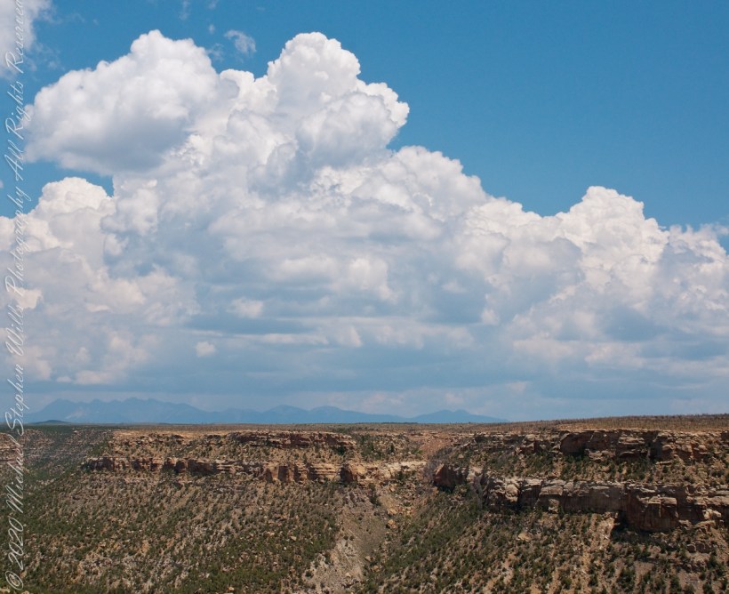
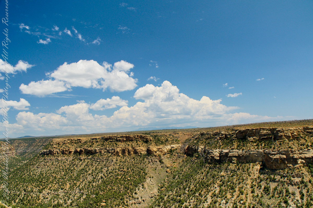
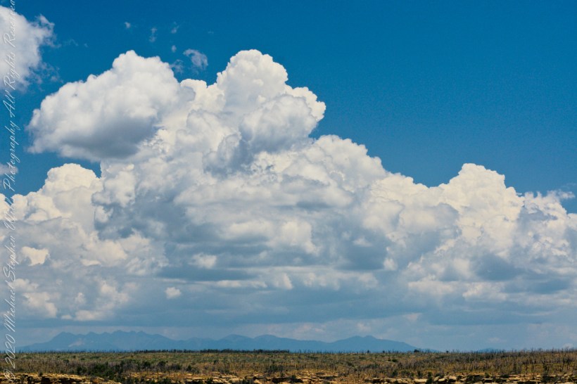
Round Tower of the Cliff Place

Imagine

Overviews

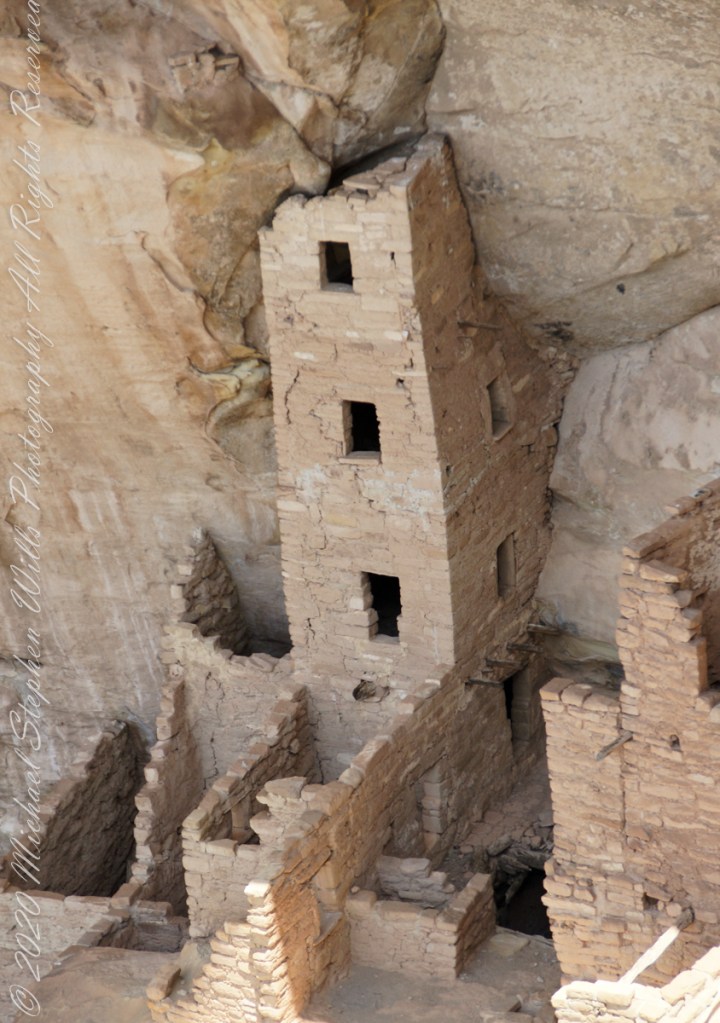
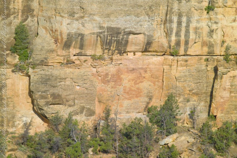
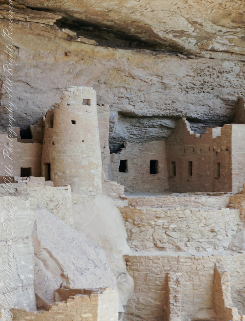
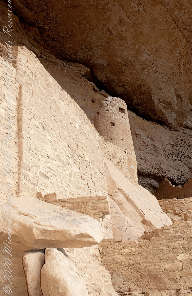
Looking over my photographs from Mesa Verde National Park I find the Cliff Palace Round Tower to be a unique structure. You can see it in this shot taken from the Cliff Palace Loop overlook…..

The Round Tower is on the upper left, between two kivas (appearing to be two round pits). The round shape of the tower is not readily apparent from this angle.

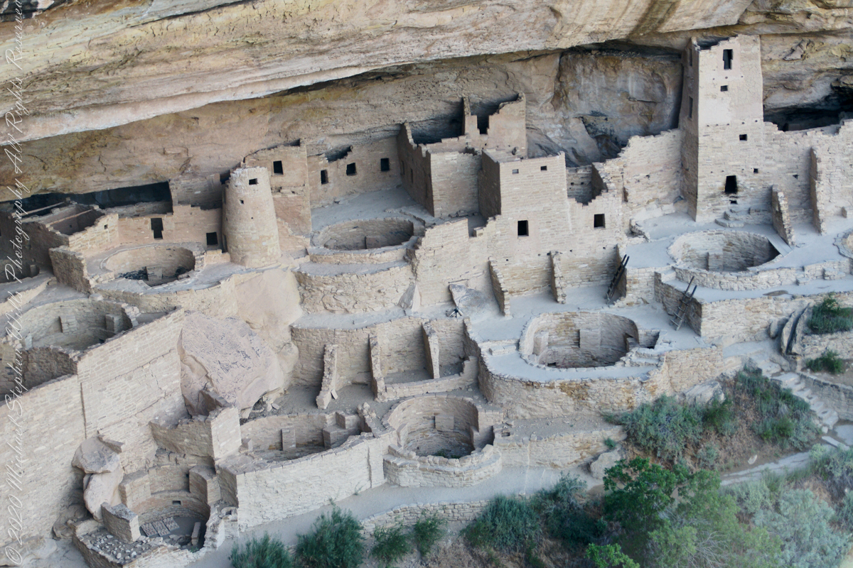
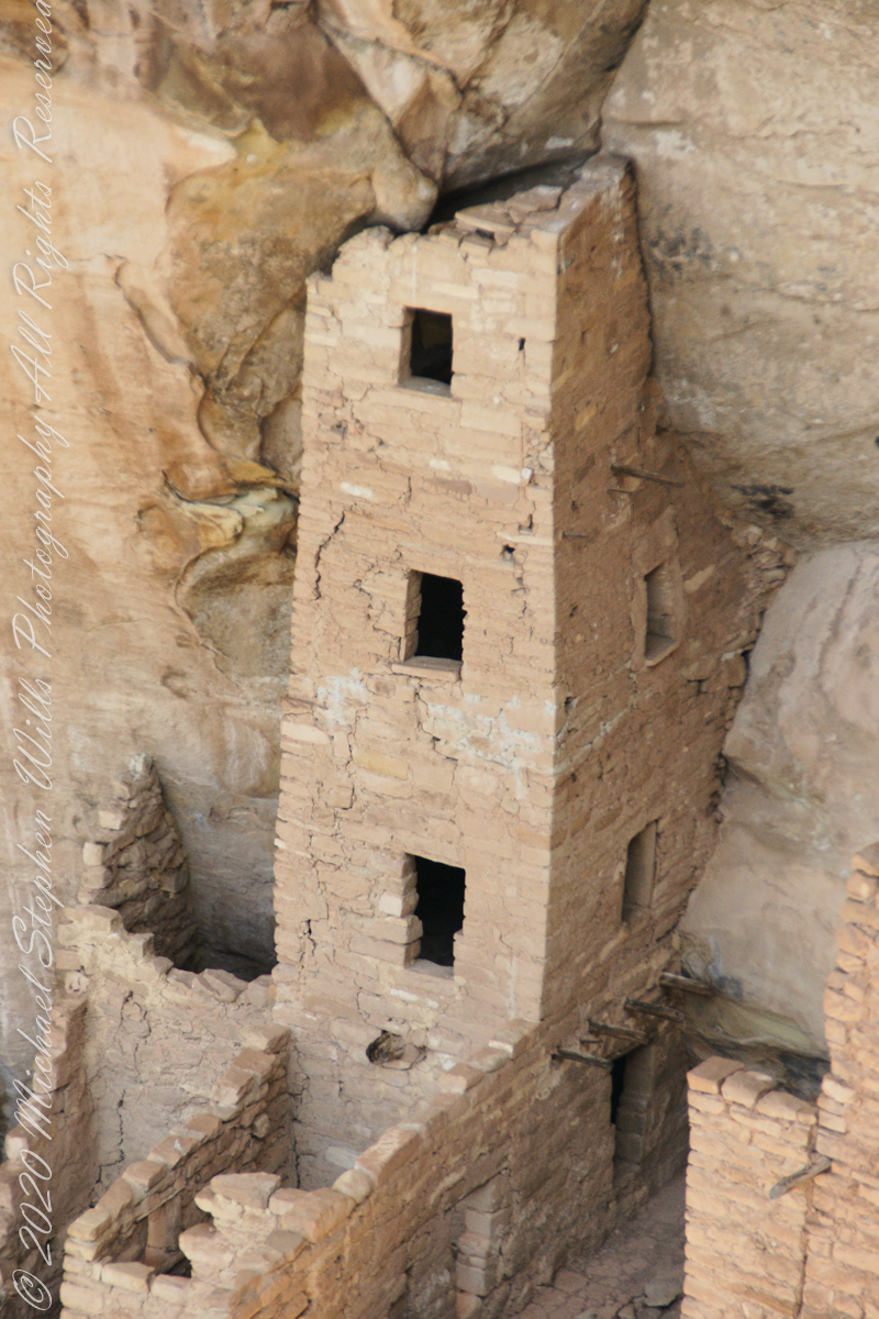
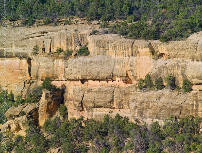
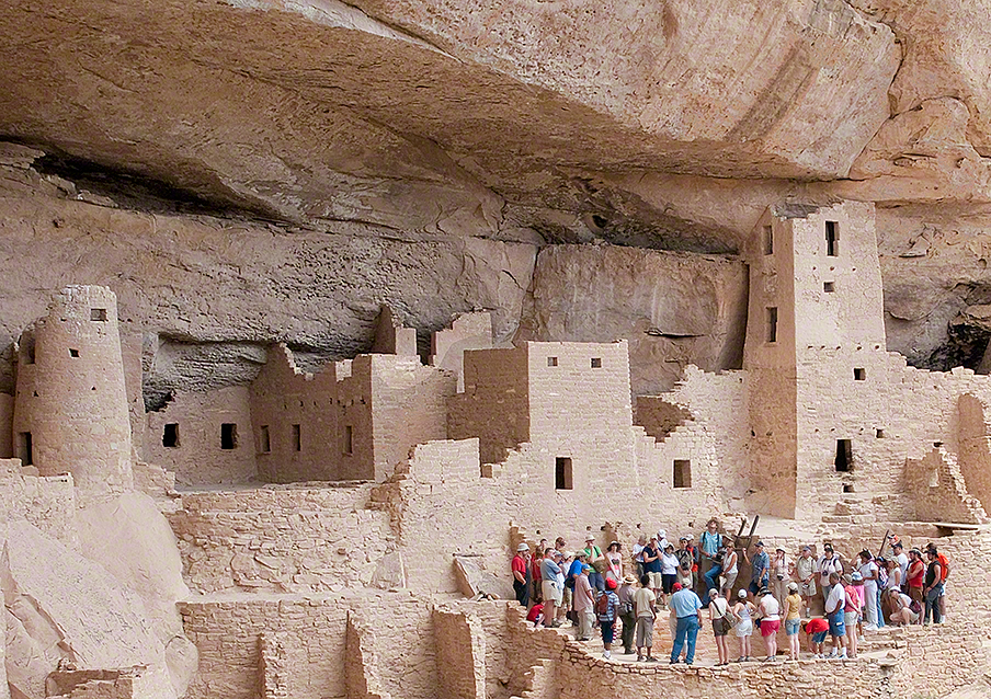
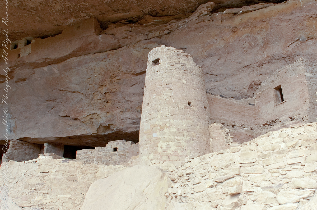
It is easier to see here from this photograph taken from the Cliff Palace footpath from the mesa top.

The Round Tower is on the left.

Here is a closer view, with surrounding structures for context.

Click me for more Mesa Verde works in my Fine Art Gallery

Inspiration and Influence

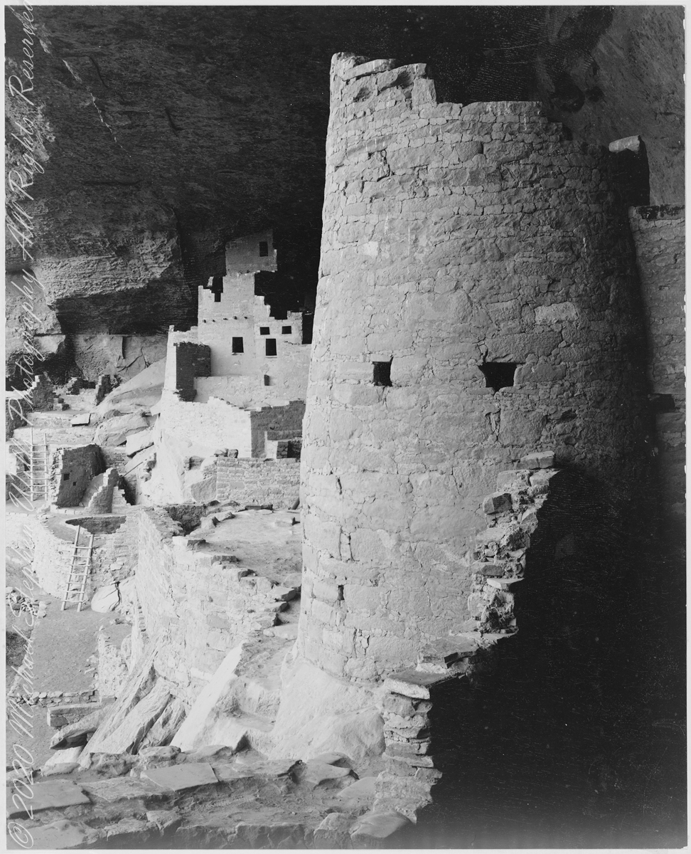
In 1941 the National Park Service commissioned noted photographer Ansel Adams to create a photo mural for the Department of the Interior Building in Washington, DC. The theme was to be nature as exemplified and protected in the U.S. National Parks. The project was halted because of World War II and never resumed.

The holdings of the National Archives Still Picture Branch include 226 photographs taken for this project, most of them signed and captioned by Adams (the following photograph had neither title or caption). Almost all are in the public domain, as is the following image. Adams was allowed free access to the ruins and had the luxury of time to stage perfect lighting.

The creator compiled or maintained the parent series, Ansel Adams Photographs of National Parks and Monuments, between 1941–1942. Ansel Adams provided no caption to this photograph; this information was compiled by Michael Stephen Wills from the United States National Archives Catalog “Series: Ansel Adams Photographs of National Parks and Monuments”.

Mary Elizabeth Jane Colter’s Desert View Watchtower (1932), on the Grand Canyon’s South Rim, was inspired in part by this round tower. She traveled throughout the southwest to find inspiration and authenticity for her buildings. The architecture of the ancestral Puebloan people of the Colorado Plateau served as her model. This particular tower was patterned after those found at Hovenweep and the Round Tower of Mesa Verde. Colter indicated that it was not a copy of any that she had seen, but rather modeled from several cliff dwellings.

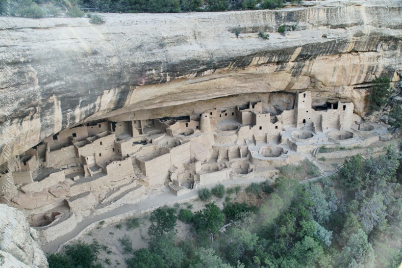
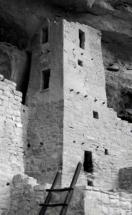
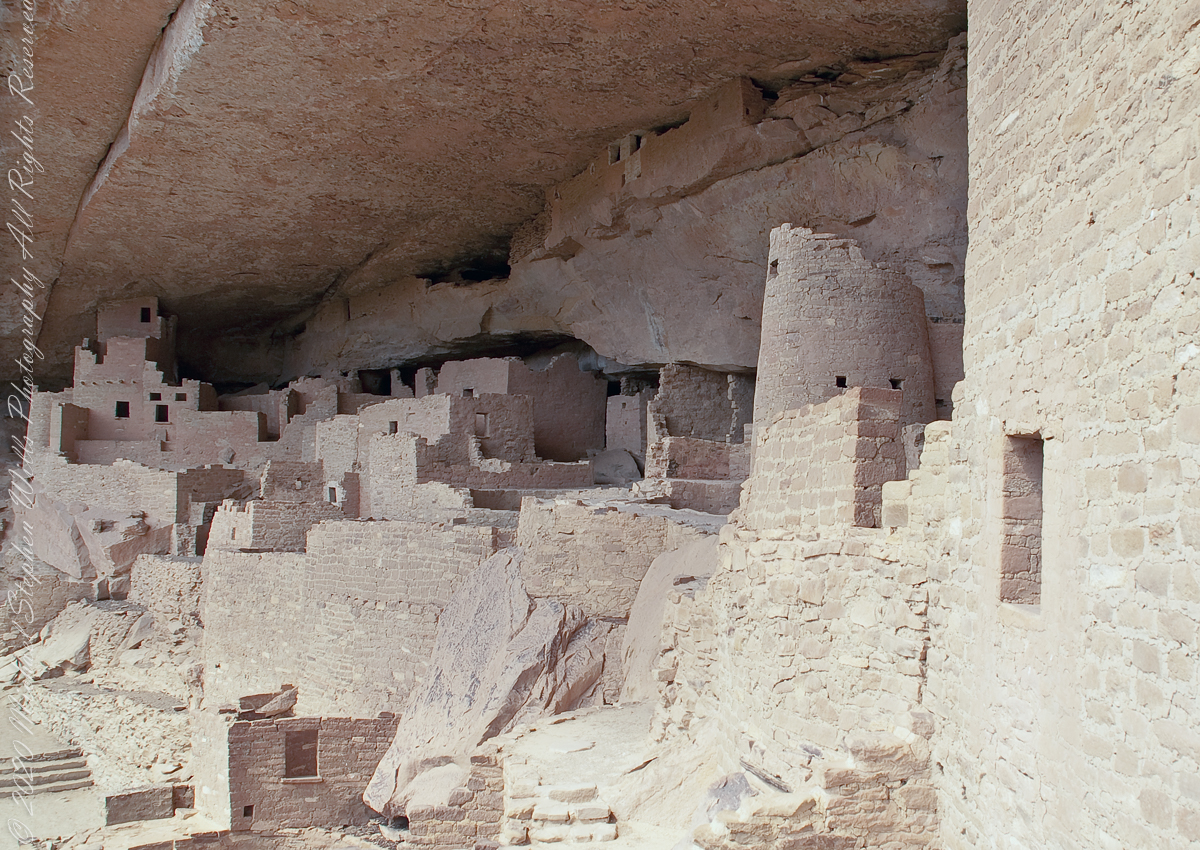
The following photographs are my closest approximation to Ansel Adams composition. Taken during a public Ranger guided tour of Cliff Palace, I was standing next to the Square Tower (see my post “Square Tower as Viewed from the Kiva.”

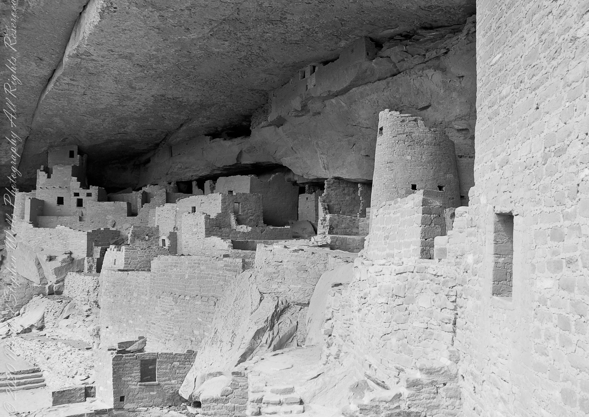
The same image produced as Black and White.

Extension

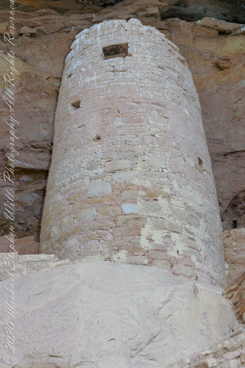
The Round Tower is more compelling when viewed from below, in the following photographs.

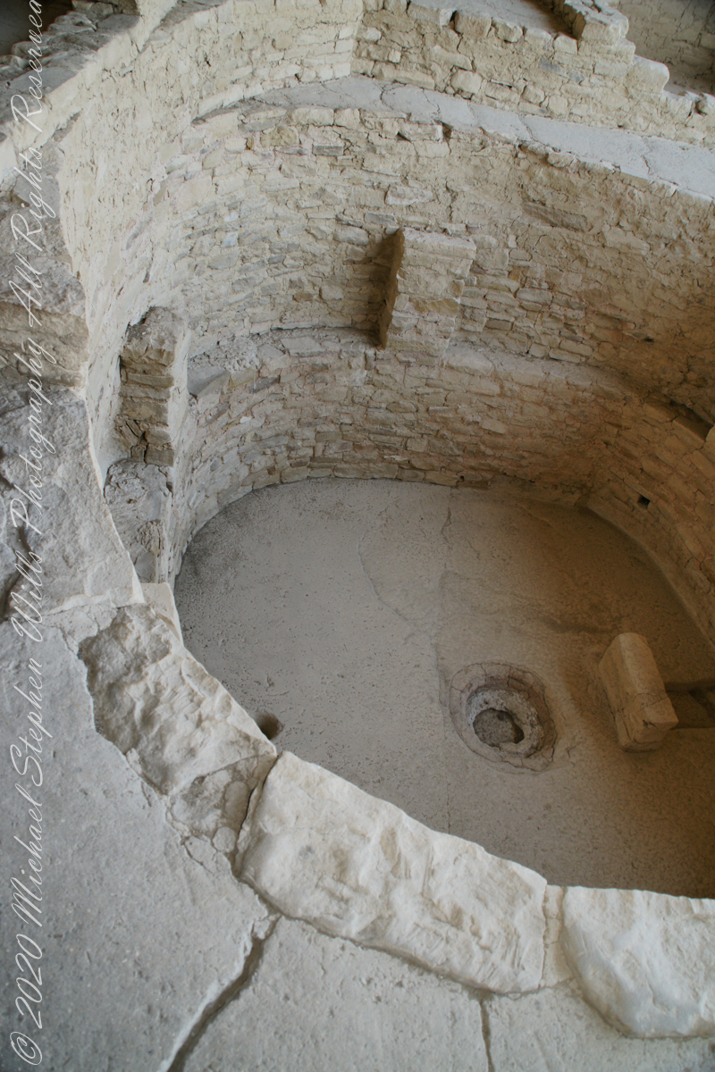
Looking through these images I challange you, the reader, to compare the Round Tower with the right angles, straight walls of the other above ground structures and, then, the round Kivas in the grounds, essentially the Round Tower is an extension of the round kiva and sipapu toward the heavens.

Click Me for more background on the discovery and excavation of the Cliff Palace

Copyright 2023 Michael Stephen Wills All Rights Reserved

Square Tower House

Viewed from Mesa Top Loop Road

Featuring the tallest standing structure in the park, an intact kiva roof, original plaster and paint, and plentiful rock art, Square Tower House is one of Mesa Verde’s most impressive cliff dwellings.

Click me for more Mesa Verde works in my Fine Art Gallery

Located off the Mesa Top Loop, at the head of Navajo Canyon, this cliff dwelling is only accessible on a ranger guided tour, for a fee. Tickets for the tour are limited, so get them before your arrive. There is a viewing point just off the loop road. Mesa Verde National Park, Montezuma County, near Cortez, Colorado.

The two rooms here are what seems to be a round wall, possibly a kiva ruin, on the left and a single story building, on the right, being the single wall with an opening for access. They probably blocked the opening in cold weather to conserve heat. It is possible this site had a special use and was occupied for a limited period of time each season/year.

Copyright 2023 Michael Stephen Wills All Rights Reserved

Around the Kiva

Imagine

Discovery

Imagine yourself as Richard Wetherill in December 1888 rounding up stray cattle on a mesa top, in a snow storm, riding through a very familiar pinyon and juniper forest.  You ride to the mesa edge overlooking a huge canyon and, in the distance and through the snow, see a this “magnificent city.”

Click me for more Mesa Verde works in my Fine Art Gallery

Today

The site is protected and access restricted to these tour groups.  I skipped the lecture, as interesting as it was, to use the time to capture the images in these blogs.  Here is an overview of the northeastern Cliff Palace, including the square (see previous blog) and round towers with the tour group gathered around one of the Cliff Palace kivas.

Sipapu

Here is a close-up of the kiva floor of the Balcony House.  Sipapu is a Hopi word for the small hole or indentation in the floor of kivas used by the Ancient Pueblo Peoples and modern-day Puebloans. It symbolizes the portal through which their ancient ancestors first emerged to enter the present world.

The sipapu is the smaller pit in the floor to the left (north side) and partially blocked by the kiva wall. The larger is a firepit. The small wall to the right is placed to deflect airflow from a floor vent.

Click Me for more background on the discovery and excavation of the Cliff Palace

Copyright 2023 Michael Stephen Wills All Rights Reserved

Square Tower as viewed from the Kiva

Cliff Palace Access

Pam and I arrived at Mesa Verde early one summer morning in July and spent time understanding the landscape of the ruin sites and the lighting.  I made a mental visit plan and decided to arrive at the cliff palace mid-afternoon and it turned out, of the tour times available, this was the best.  It is possible to make special arrangements for access, to take photographs, and maybe I will give this a try in my next life.

Click me for more Mesa Verde works in my Fine Art Gallery

Four Stories

This four-story square tower, located at the south end of the alcove, at one time reached the ceiling. Access to the upper rooms was provided by hatchways in the lower room roofs.

What about that T-shaped door?

On the fourth floor, a T-shaped doorway suggests a balcony because that type of opening in the wall, designed to minimize the area, was used as a doorway.

Bend over Backwards

Inside the tower are well preserved wall paintings.  To view them, you side in that lower opening, facing outwards and, bending backwards, look up into the tower.  You need to hold onto the wall to do this and its the only time we were allowed to touch the ruin.

The Kiva

The modern wooden ladder rises from a kiva platform.  Notice the level of wear on the top of the ladder posts.  There are three kivas visible from the tower and at a later time I might post about these.

Copyright 2023 Michael Stephen Wills All Rights Reserved

Summer Views from Chapin Mesa

North-Northeast to the San Juan Mountains

Chapin Mesa is the site of the Mesa Verde Anasazi ruins Balcony House and Cliff Palace.  These are the views you see before the descent below the cliff rim to visit Balcony House.

These views from the Chapin Mesa rim are companions to two photographs of Balcony House, taken on the same morning. You are looking northeast across Soda Canyon, to a thunderstorm building above the San Juan mountains in the distance. Route 550 from Durango to Silverton climbs passes into these peaks, on the way to Telluride. Chapin Mesa is part of Mesa Verde National Park.

The following fine art image is a combination of the previous photographs

Click me for more Mesa Verde works in my Fine Art Gallery

Copyright 2023 Michael Stephen Wills, All Rights Reserved

The Ancient Doors to Mesa Verde

Two Ancient Cliff Swellings

The Anasazi (“ancient ones”) constructed 15 rooms on a 10 foot deep cliff alcove and used a toe-trail (literally a series of depressions in the rock used to gain traction) to climb to the mesa top (shown in this photograph) and the canyon.

A toe-trail security feature is the necessity to start using the correct hand/foot combination, otherwise there will be a point from which it is impossible to proceed. There are 15 rooms here: a kiva, on the far left, a multi-story building, on the right, with 4 upper rooms and 10 ground floor spaces. They probably blocked the openings in cold weather to conserve heat.

Click me for more Mesa Verde works in my Fine Art Gallery

The Anasazi had gardens on the mesa top or the canyon, plus they hunted and gathered wild foods. In the gardens, they planted corn, bean, squash and watermelon in the rich soil. They also gathered wild plants and herbs such as bee-weed, ground cherry, milkweed, cattail, wolf berry and sedge grass Cliff dwelling alcoves include a seep spring, a seam in the rock through which a small amount of water flowed. Imagine the difficulty of hauling water every day if there was not a water source in the alcove.

Can you find the unnamed ruin also in this canyon, we call it “Cliff Canyon”? These ruins are outside the national park boundary, inside the Ute Mountain Ute Indian Reservation.

House of Many Windows

The “window” of this cliff dwelling (ruin) was actually a door!! The Anasazi (“ancient ones”) constructed two rooms in this narrow cliff alcove.

The two rooms here are what seems to be a round wall, possibly a kiva ruin, on the left and a single story building, on the right, being the single wall with an opening for access. They probably blocked the opening in cold weather to conserve heat. It is possible this site had a special use and was occupied for a limited period of time each season/year.

Cliff dwelling alcoves include a seep spring, a seam in the rock through which a small amount of water flowed. Imagine the difficulty of hauling water every day if there was not a water source in the alcove. The large juniper to the left attests to a water source, since it grows from a shared crevice.

The protective alcove was deeper in the past. The desert varnish (the dark marking) above the alcove marks a place where water seeps from the cliff and, in cold weather, expands under the overlying rock, causing it to fall. Can you see where the cliff face has fallen above the ruin? The lack of desert varnish shows the rock fall was relatively recent.

Copyright 2023 Michael Stephen Wills All Rights Reserved

Point Lookout at Dawn, Mesa Verde

Dramatic Entrance

This dramatic butte at the entrance to Mesa Verde National Park, golden in the first light of a July morning.  My wife, Pam, and I were on this road in the pre-dawn hours.  Our delight with this surprise view was worth it.

Click me for more Mesa Verde works in my Fine Art Gallery

In this Point Lookout area, near the park’s entrance, the Mancos Shale is about 2,000 ft thick, and this is what this butte is composed of. Mancos Shale is the lowest formation of the park and is a thick sequence of gray to black marine shale containing minor tan siltstone and fine sandstone beds. On steep slopes, such as those near the northern and eastern boundaries of the park, this formation is prone to landslides and debris flows. This is the base of the butte. The lovely golden rock is Point Lookout Sandstone of the Mesaverde Group, a predominantly yellowish-gray or pale-orange, fine- to medium-grained marine sandstone, approximately 300-400 ft thick. The Point Lookout Sandstone forms much of the cap rock in the northern park area.

I reworked the above image into this Fine Art image of Point Lookout.

Reference: http://esp.cr.usgs.gov/info/meve/

Copyright 2023 Michael Stephen Wills All Rights Reserved

World Portal

Sipapu is one of the largest natural bridges known.

Part of the Natural Bridges National Monument in Utah, a place inaccessible until the “uranium boom” of the 1950’s and the road was only paved in 1976.

We visited on a July day of thunderstorms, which you see building here.  If you look closely at the base of the bridge, you can see the railings my wife and I used to climbed the steep sides of White Canyon.

We hiked a few miles along an unmaintained trail.  On the way we passed ancient cliff dwellings. The area is a maze of canyons throughout which these ruins are scattered.

Sipapu is a Hopi word for the small hole or indentation in the floor of kivas used by the Ancient Pueblo Peoples and modern-day Puebloans. It symbolizes the portal through which their ancient ancestors first emerged to enter the present world.

A natural bridge is formed through erosion by water flowing in the stream bed of the canyon.

Sipapu Bridge is 268 feet across and, standing in the stream bed, it is 220 feet above your head. That is white Permian sandstone, after which White Canyon is named.

Copyright 2023 Michael Stephen Wills All Rights Reserved

A Gorge Trail Summer Standout

Use it to make a refreshing summertime tea.

Monarda didyma is also known as crimson beebalm, scarlet beebalm, scarlet monarda, Eau-de-Cologne plant, Oswego tea, or bergamot. A wildflower native to the Finger Lakes, Crimson beebalm is extensively grown as an ornamental plant, both within and outside its native range; it is naturalized further west in the United States and also in parts of Europe and Asia.

It grows best in full sun, but tolerates light shade and thrives in any moist, but well-drained soil. As suggested by membership in the Lamiaceae (mint) family, Beebalm, as an aromatic herb, has a long history of use as a medicinal plant by many Native Americans, including the Blackfoot. The Blackfoot people recognized this plant’s strong antiseptic action and used poultices of the plant for skin infections and minor wounds.

An herbal tea made from the plant was also used to treat mouth and throat infections caused by dental caries and gingivitis. Beebalm is a natural source of the antiseptic thymol, the primary active ingredient in modern commercial mouthwash formulas. The Winnebago used an herbal tea made from beebalm as a general stimulant. It was also used as a carminative herb by Native Americans to treat excessive flatulence. As a matter of local interest, Iroquois of Oswego, New York, made the leaves into a tea, giving the plant one of its common names.

It is 9:30 am on a July morning Robert H. Treman Park, Ithaca, Tompkins County, Ithaca, New York,

References

Wikipedia, “Monarda didyma”

“The Botanical Garden, Vol II” Roger Phillips and Martyn Rix, Firefly Books, 2002. Page 284

Copyright 2023 All Rights Reserved Michael Stephen Wills

Portrait of a Navajo Guide

In November 2004, a visit to Canyon de Chelly with guide Hadley Tsosie revealed ancient petroglyphs and ruins, highlighting Navajo culture and the canyon’s unique beauty.

On November 3, 2004 my son, Sean, and I made our way to Chinle, Arizona on the Navajo Reservation at the mouth of Canyon de Chelly.

The next day, driving a rented 4 wheel drive, we arrived at the visitor center, at dawn, and there met Hadley Tsosie who worked as a guide. This is how you do it, if learning about the Canyon is your goal. It is possible to walk, unaccompanied, into the canyon to view the “White House” and this I highly recommend. Tourists can also drive around the rim to various overlooks. This is what most people do.

The canyon is still farmed and the tribe only allows visitors when accompanied by a guide. Only Diné (Navajo) are certified as guides. They know the rights of way and the preferences of the landowners.

We negotiated with Hadley to take us for half a day for our interest in petroglyphs and ruins. It is important to start early when the sun is low in the sky, when directly overhead the details of ruins and petroglyphs are washed out by the light. Catching the late afternoon/evening sun is also an approach that requires detailed knowledge of the route, taking into account the time of year.

Hadley was an excellent choice, though he was our only option on that day. He was fluent in Navajo beliefs, the lore of the canyon and generous in sharing what he knew.

Here is Hadley, approximately 6.2 miles into the canyon with the “Ledge Ruin” behind. We arrived at the junction just in time, before the sun was high enough to wash out the ruin. It is slow going into the canyon what with the deep sand and water that must be negotiated. Hadley did the driving and was expert. We passed other parties bogged down in the wet sand. I do not believe it was luck that kept us moving . We stopped many times to talk and admire the petroglyphs and pictographs.

Petroglyphs are symbols incised, or cut, into the surface (the name means petro, “rock”, glyph, “symbol”). In the desert climate of the southwestern USA a thin, dark pigment forms on rock surfaces of overhanging cliffs. The pigment forms from infrequent precipitation, in the form of water, flowing downward over the surface or even dew. The high heat of the desert drives a chemical reaction between water, clays, iron and manganese oxide to form a coating on the rock surface. The dark coating, called “desert varnish”, contrasts with the underlying rock. When it is scraped away a line forms. Many of the petroglyphs were of this form. Others were carved into the rock itself, more time consuming and durable. No one knows when the petroglyphs were made, they were always there are respected. People have inhabited Canyon de Chelly for over a thousand years.
The word pictograph has a different meaning when used to describe prehistoric art. The earliest writing were symbols incised in wet clay, then allowed to harden. The pictographs we viewed was prehistoric art, mostly white pigment on the red rock, outlines of hands. There were also kokopelli, the outline of a flute player and jagged lines, symbolizing, Peter told us, lightening.

In November the cottonwoods were in fall foliage, a brilliant yellow under a cloudless sky. The sun is lower in the south and rises later. The Navajo Reservation follows daylight savings time, unlike Arizona. This November morning the sun rose around 7:45 am, so if you are not an early riser this time of year is an excellent choice for a Canyon de Chelly tour.

Click for the next posting in this series, “Junction Ruin Musings”

Enter your email to receive notification of future postings. I will not sell or share your email address.