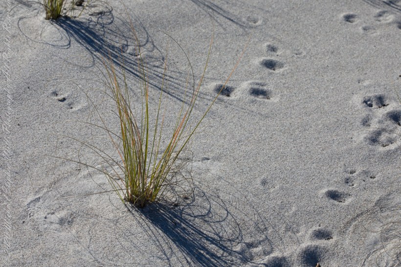
At first glance, Northerners may mistake this for fine snow blown on a bitter wind; but no, this is indeed a north wind, the temperature is above freezing, the material is beach sand. Keeping the sand in place is a concern for Brevard County.
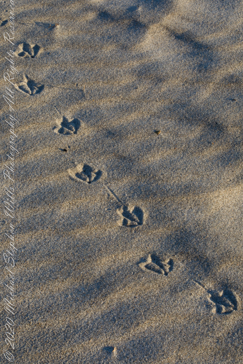
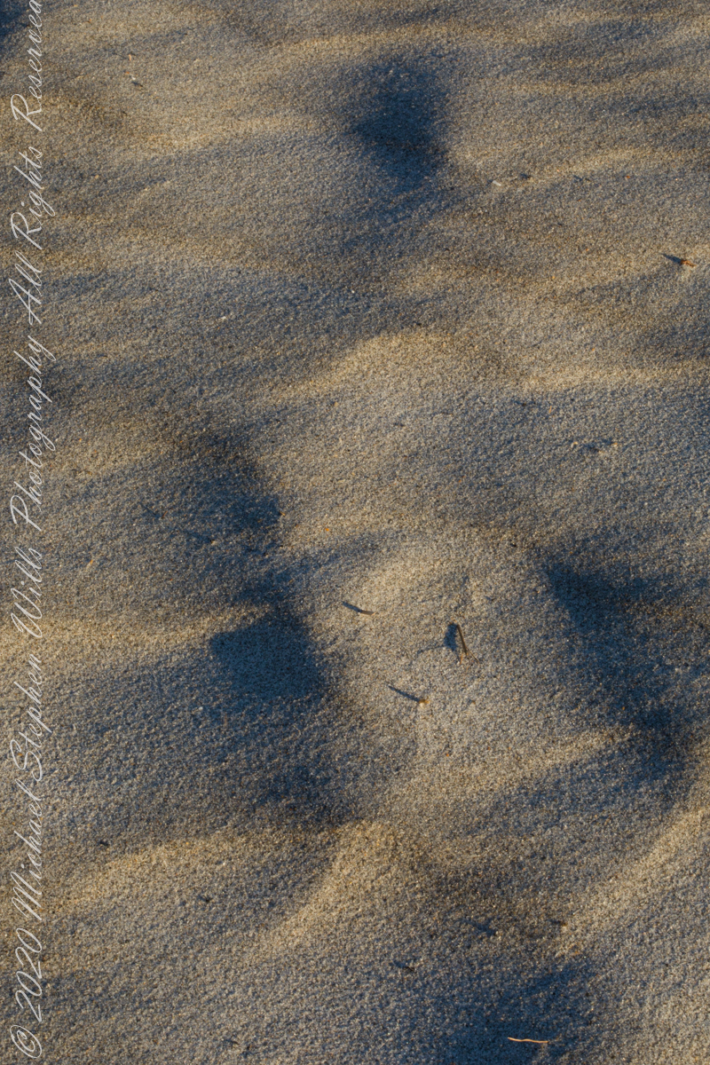
A gull walked through wind textured beach sand, see here in early morning light. Dawn light on beach sand textured by wind, see here in early morning light.
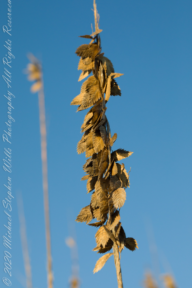
Golden brown infructescences (seed heads) of Sea Oats grass on stalks growing from dunes, seen here in early morning light, are one element of this plant beneficial to the goal of keeping beach sands in place. Tall stalks and broad leaves catch blowing sand. Deep roots hold the plants in place, shallow root systems hold sand in place to form dunes.
Returning after staying away for COVID-19, we found new plantings of Sea Oats by the county.
Planting of Sea Oats.
Copyright 2022 Michael Stephen Wills All Rights Reserved
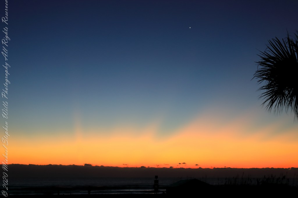
Use your pinky finger to apprehend the sky dome. Imagine yourself at sea, out of sight of land, on a calm day. Keeping your arm extended, place your pinky-tip on the horizon due east, raise your arm directly overhead. The average sized pinky-tip will have spanned 90 of its lengths. The distance measured from the horizon to directly overhead, the zenith, is 90 degrees of sky dome, about one pinky-width per degree, one-fourth of the entire 360 degrees of sky around your spot on the globe.
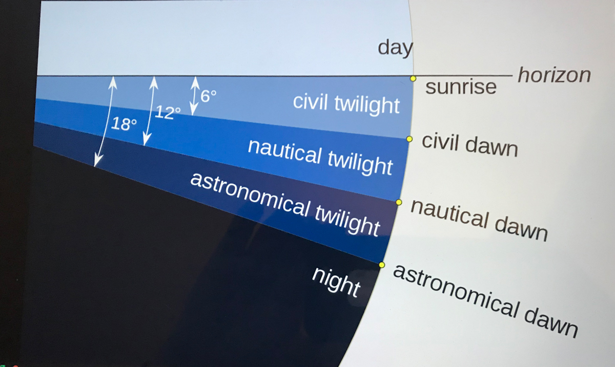
The apparent width of the sun disk from earth covers 1/2 degree of sky dome. The disk center point moves 15 degrees per hour (360/24 = 15). Using these facts to estimate time to sunset is relatively straightforward. Estimating time to dawn from the sky is more difficult. This graphic, “Twilight-dawn subcategories,” is a way to grasping what happens. Your position on the earth globe affects the experience. For example, at northern latitudes above 60°34′ summer nights never become darker than civil twilight because the sun’s midpoint never drops lower than 6 degrees below the horizon. Civil twilight lasts all night long summer times in parts of Sweden and Finland.
Attribution: “Pmurph5, CC BY-SA 4.0 , via Wikimedia “
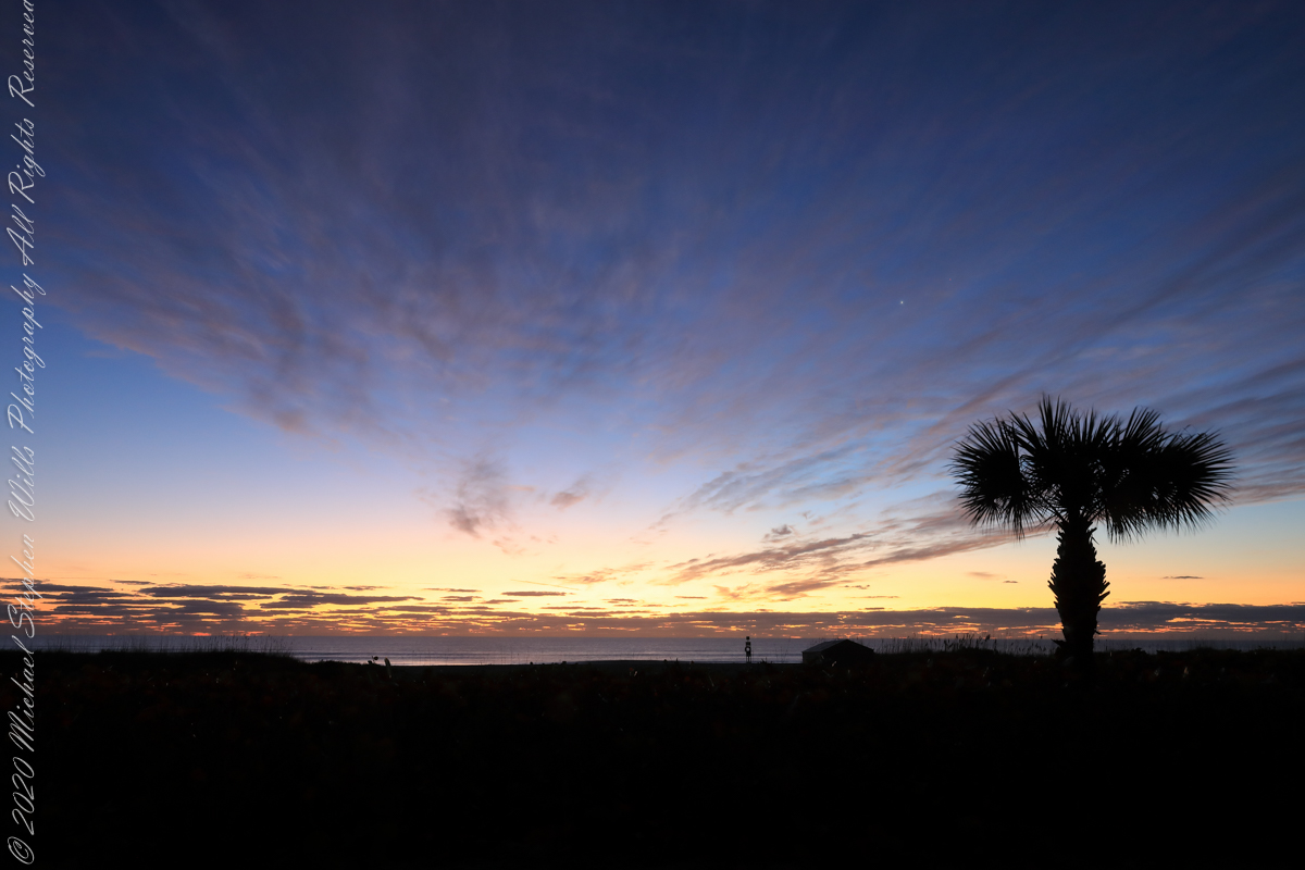
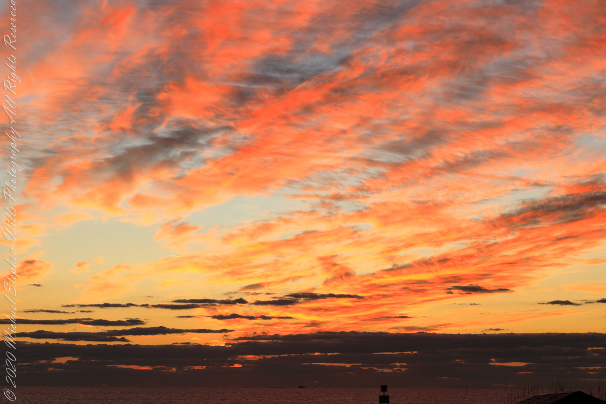
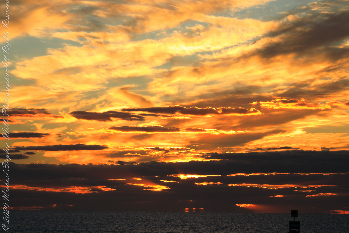
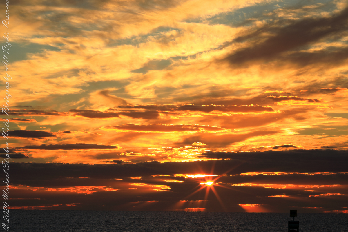
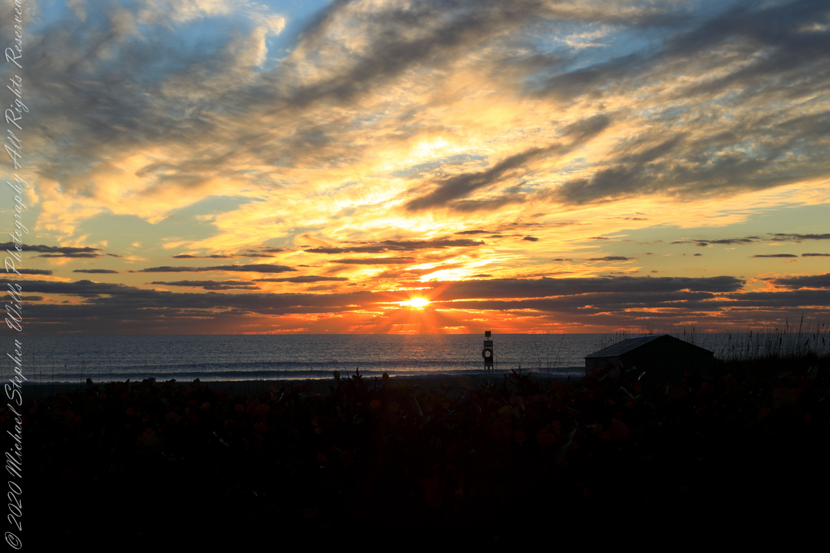
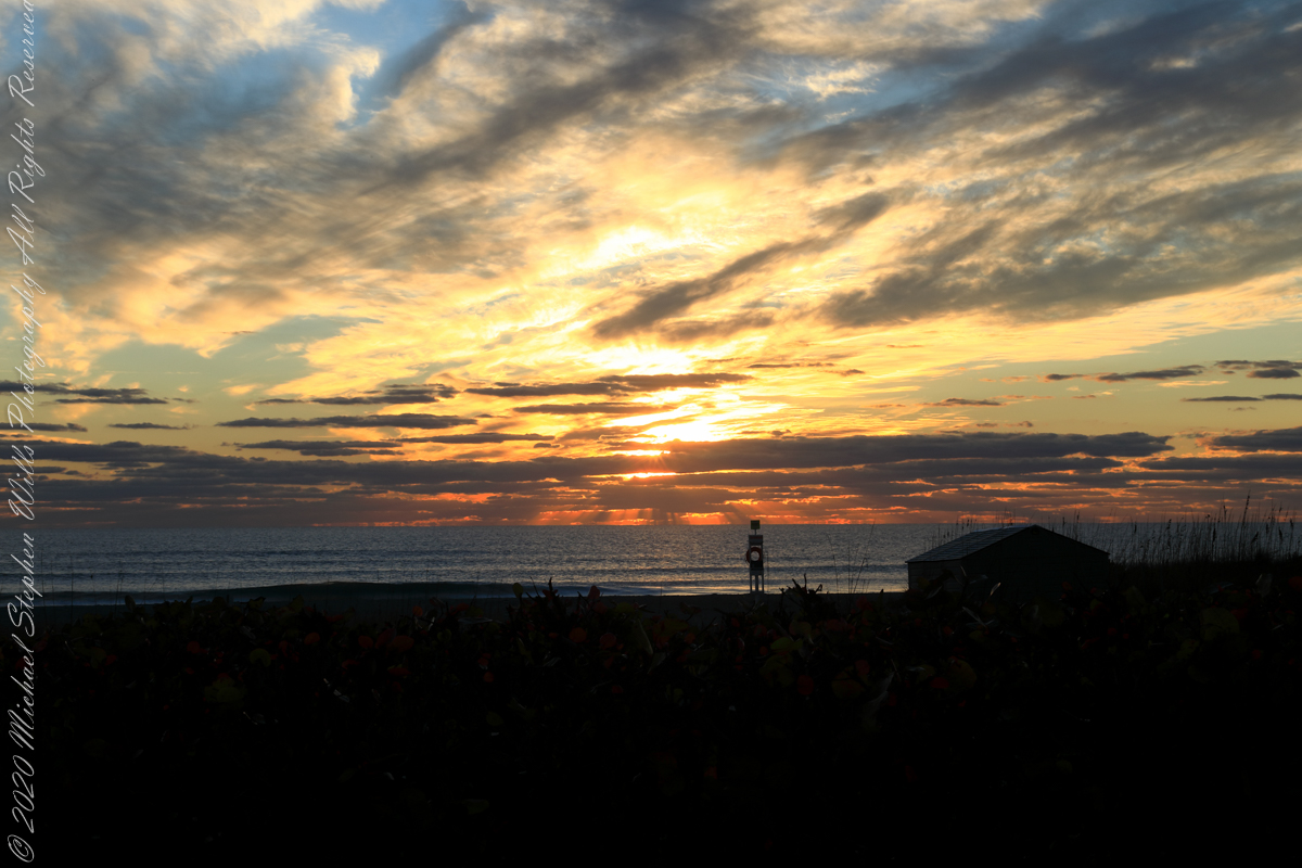
The date-time stamp on the first photograph of this series is 6:46:23 am, Cocoa Beach sunrise for February 1st was 7:09:40, 00:23:17, 23.283 minutes in decimal notation, later. This duration divided by 60 minutes in an hour and multiplied by the sun’s apparent velocity across the sky (15 degrees per hour) and minus the .25 degree between sun’s center and disk edge, gives the sun’s center as 5.57 degrees below the horizon: this is a photograph of the sky a minute or so after the sun passed civil dawn into civil twilight. I am not more exact because this calculation does not account the deviation of the sun path from due east at this latitude, lengthening civil twilight duration by almost a minute.
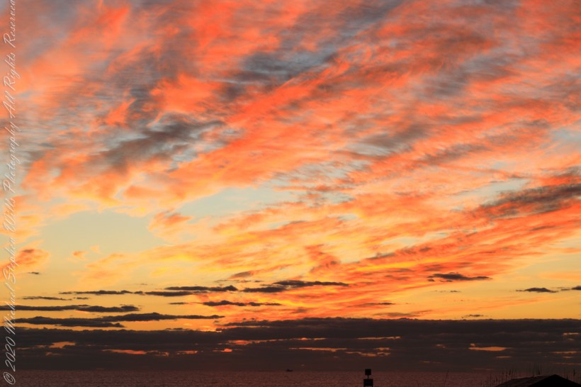
Edge of Civil Twilight: dark clouds soon to take light
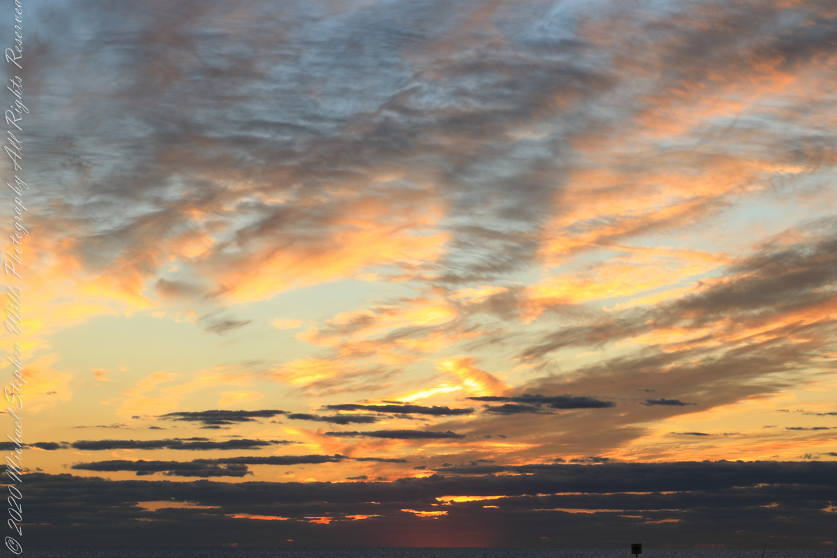
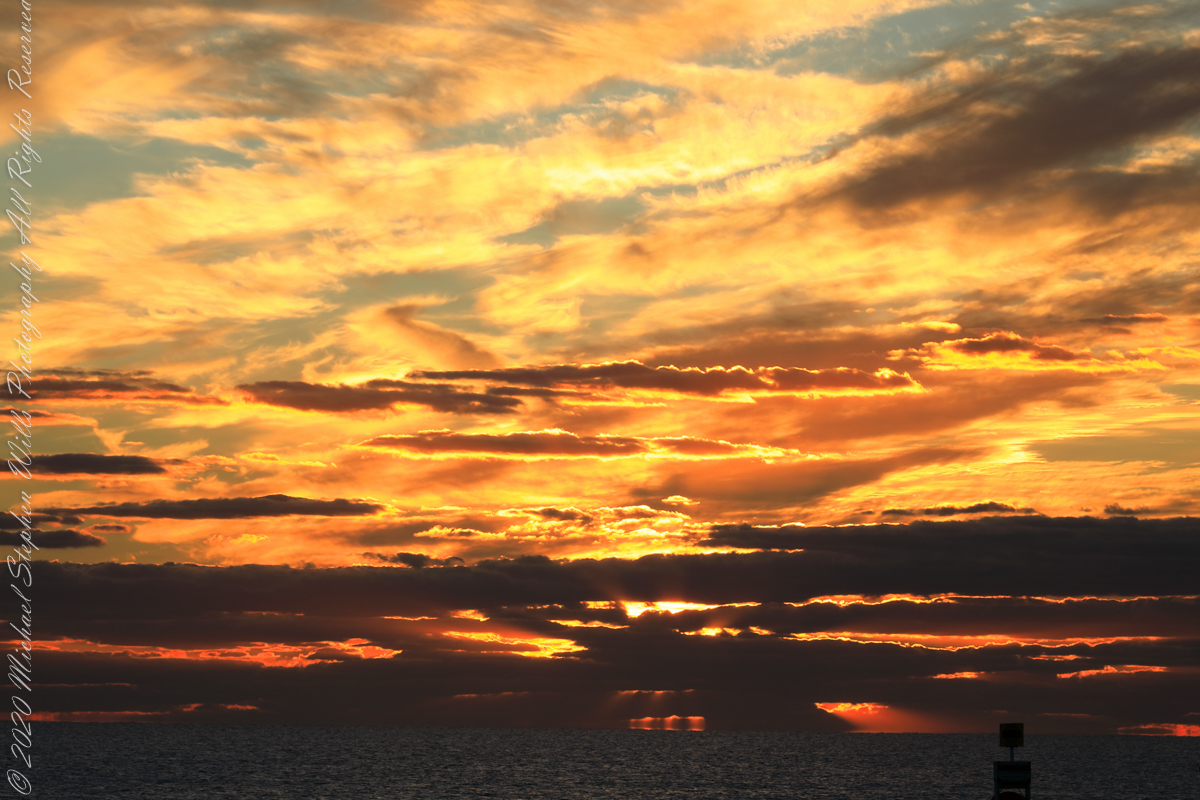
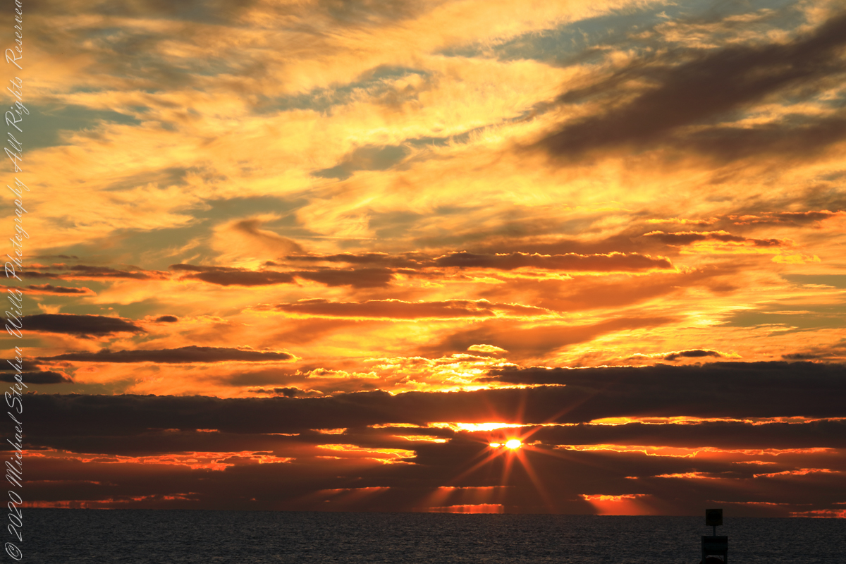
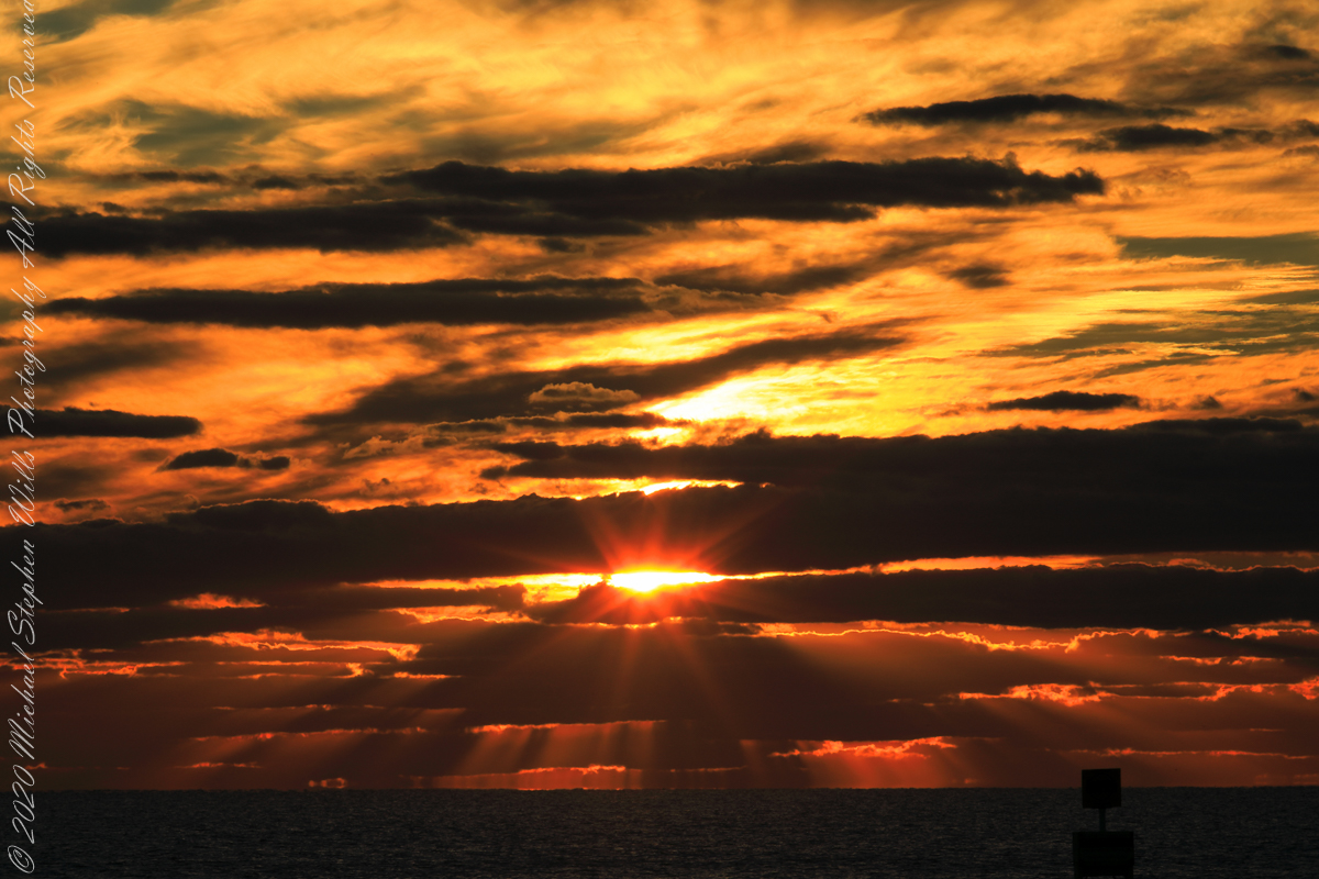
The following photograph is time-stamped 7:05:06, 4.567 minutes until sunrise, sun center is just below the horizon, setting the dark clouds of the previous photograph fleetingly on fire.
Civil Twilight at the edge of sunrise
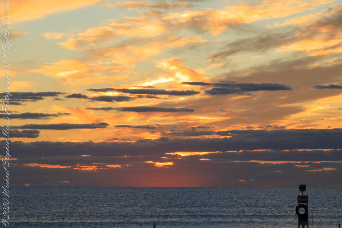
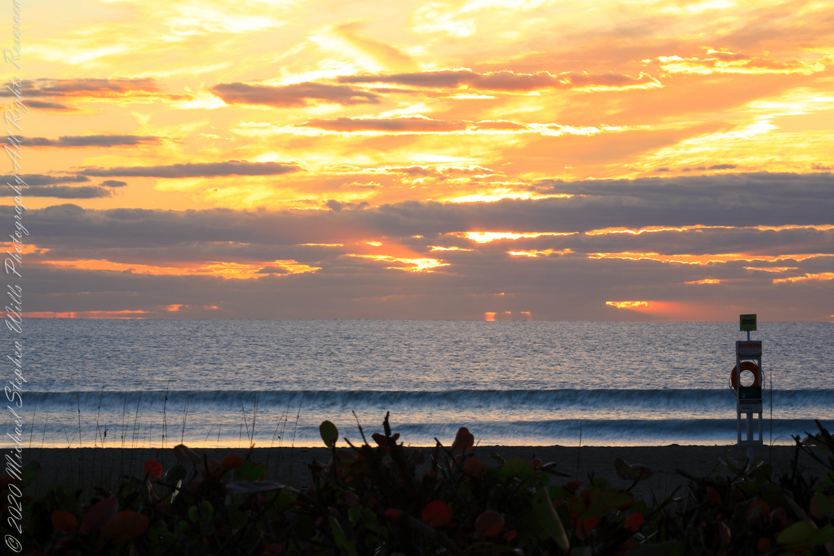
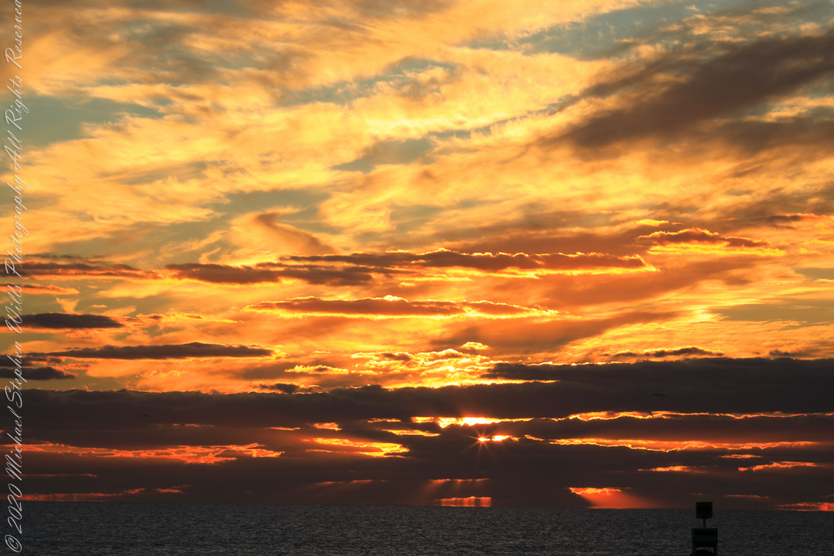
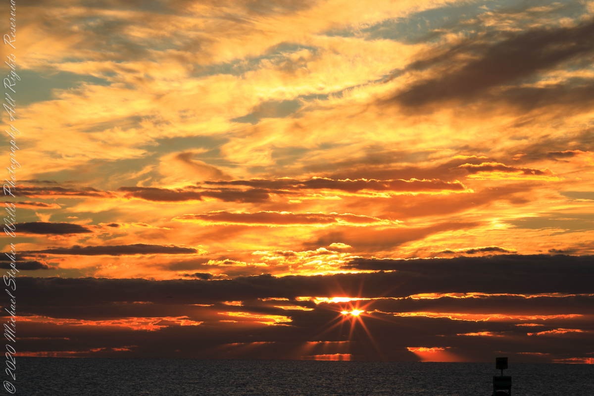
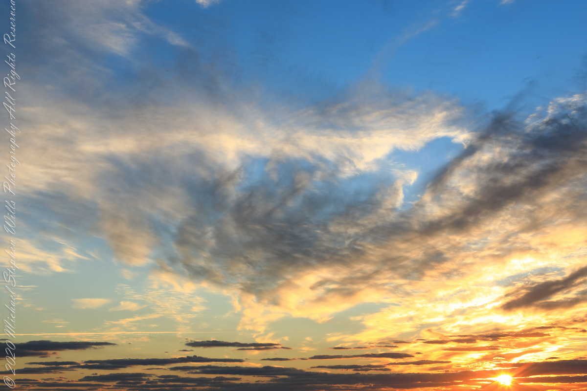
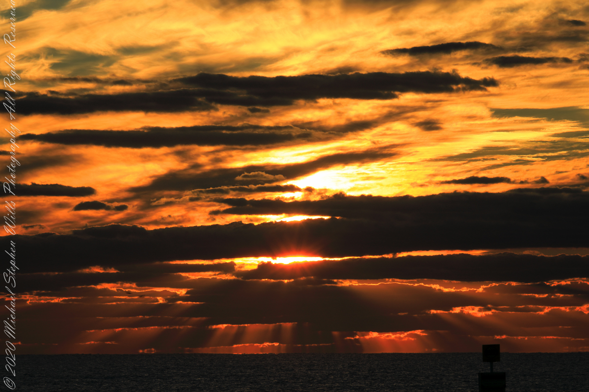
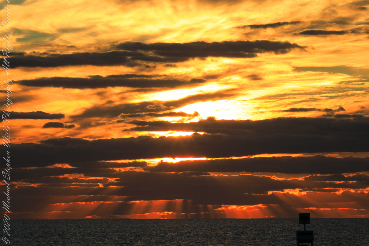
Sunrise has passed in the following photographs, obscured by clouds and making for a great light show. Enjoy!!
References
“Dawn” Wikipedia page, the graphic “Twilight-dawn subcategories,” and the descriptions of subcategories came from this page.
Copyright 2022 Michael Stephen Wills All Rights Reserved
Even on vacation I rise early to better enjoy the day. This year’s escape from the Ithaca winter, at Cocoa Beach, up at 5 am with a beach chair and oranges in hand I walked in darkness from our beach side resort to the tide high point. My time occupied by sky watching I peeled, and ate, oranges while locating stars through the wind blown clouds. When the barely perceptible dawn light began I packed it up to find Pam, who asked to be awake for sunrise.
This day, we ate breakfast from ready to eat food purchased from the Publix market close by on Atlantic Avenue, and caught up with the news craziness. We had a day at the Kennedy Space Center planned after the sunrise walk.
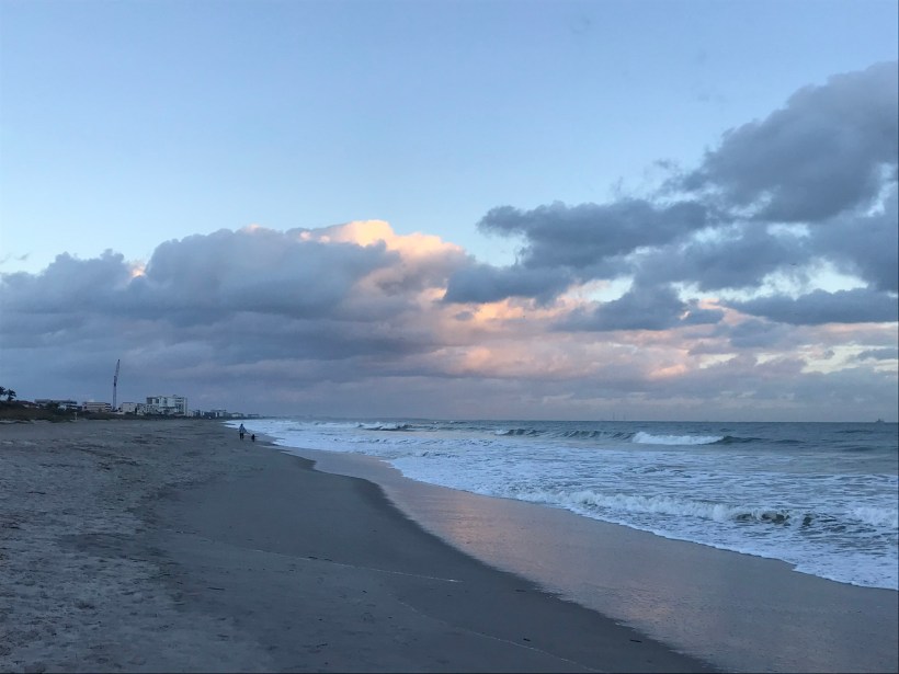
Here is our view while walking north along the tide line. In the far far distance are the Kennedy Space Center Vehicle Assembly building and a space launch gantry. Follow the shoreline to find the pier.
We walked nowhere near the pier, barely visible, not to mention Sam Shepard park. The pier and park are a day’s walk. We had a few hours free before our “Lunch with an Astronaut” event at Kennedy Space Center.
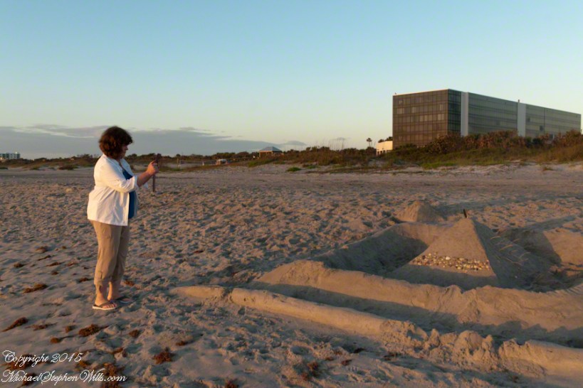
The highlight of this sunrise walk was this large sandcastle on the beach in front of a condominium, the Hilton is to the left. Lori Wilson Park is out of sight to the left. A great feature of the park, for us since the International Palms were we stayed is next to it to the north, was the park life guards.
So, we approached this sandcastle from the north. It survived the high tide to a new day, obviously it required time and resources to build. The day before was a big beach day. Wednesday was a brilliant, summer-like day for the first of March.
A little closer, the footsteps inside the first moat are interesting.
Pam next to the castle provides scale
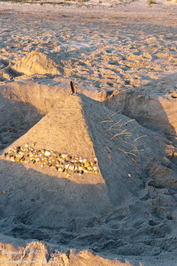
Here is the central pyramid. I enjoy the dawn light on the grasses. That is a sea gull feather on the apex.
Decorative sea shell band facing the ocean.
The destiny of all our human conceits. Impermanence is part of the beauty of sand castles.
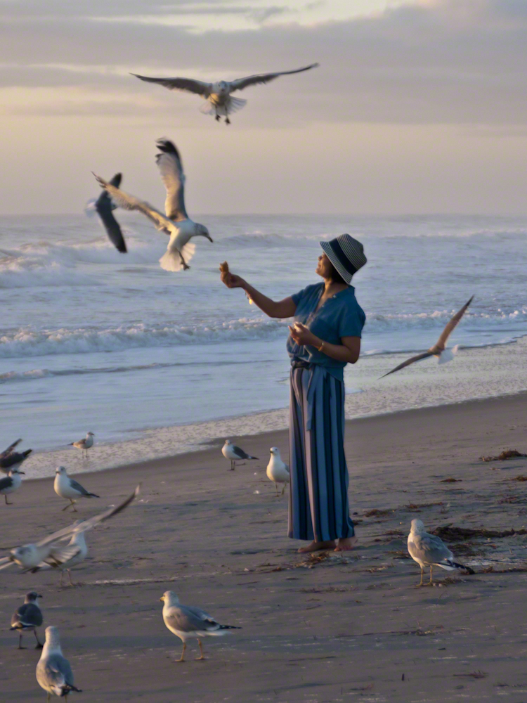
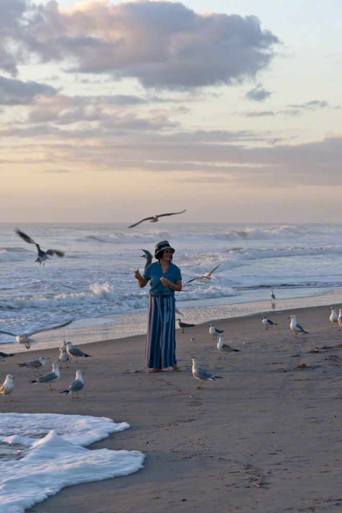
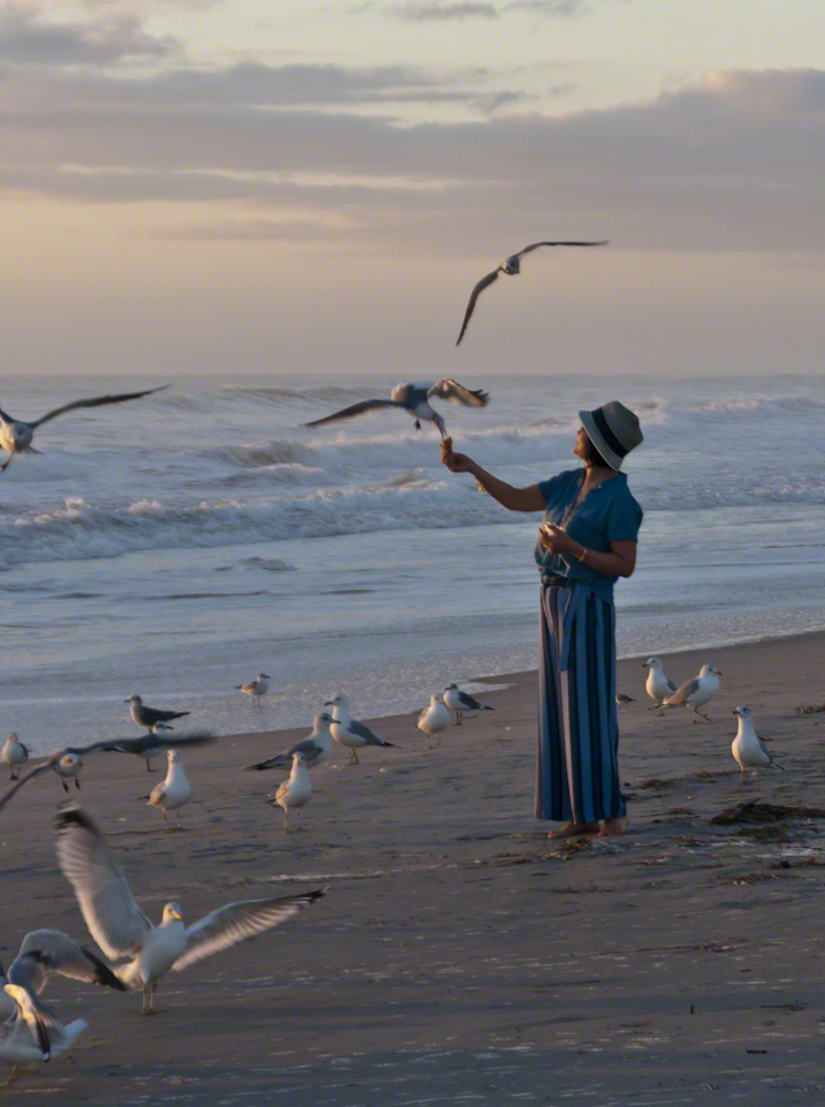
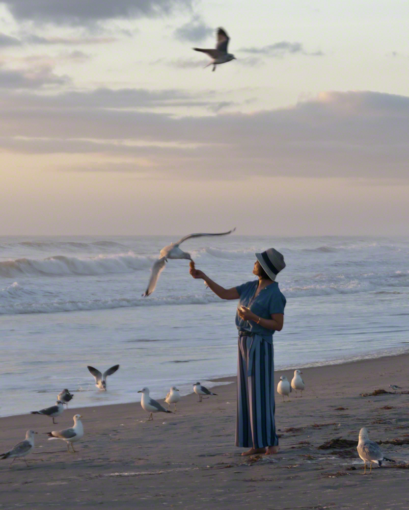
When Pam read my post “Black Skimmers Feeding” she asked, “Where is the photo of resting Skimmers?”
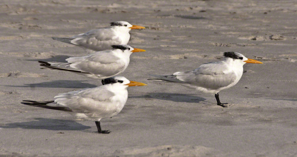
To answer her question, I looked through Cocoa Beach photographs and discovered I did NOT capture the Skimmers resting. Instead, here are a related species, the Royal Tern (scientific name: Thalasseus maximus), whose behavior is similar in that it exclusively feeds from the water. There was a wind that morning and these individuals face into it. These birds are, from a human point of view, well behaved, unlike the opportunistic gull.
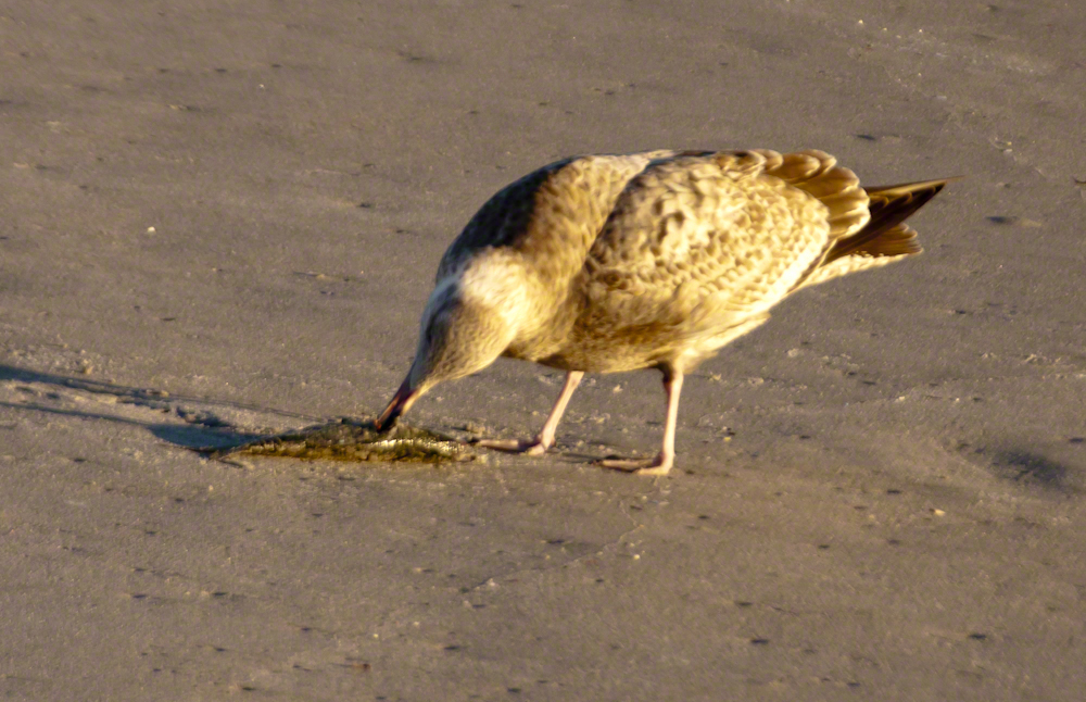
I searched around the web for identification of this gull without success.
It dines on a dead fish washed up by the surf. In my previous posting I used the word “grifting” to describe gull behavior, again this is from the human point of view. Gulls are notorious for stealing food from unwary beach goers, brazening walking over to unguarded chips (any kind), for instance, grabbing them and flying off. If the chip stash is large, this sets off a nasty feeding frenzy when tens of gulls swoop in and grab.
Here is a series of photographs, demonstrating this behavior.
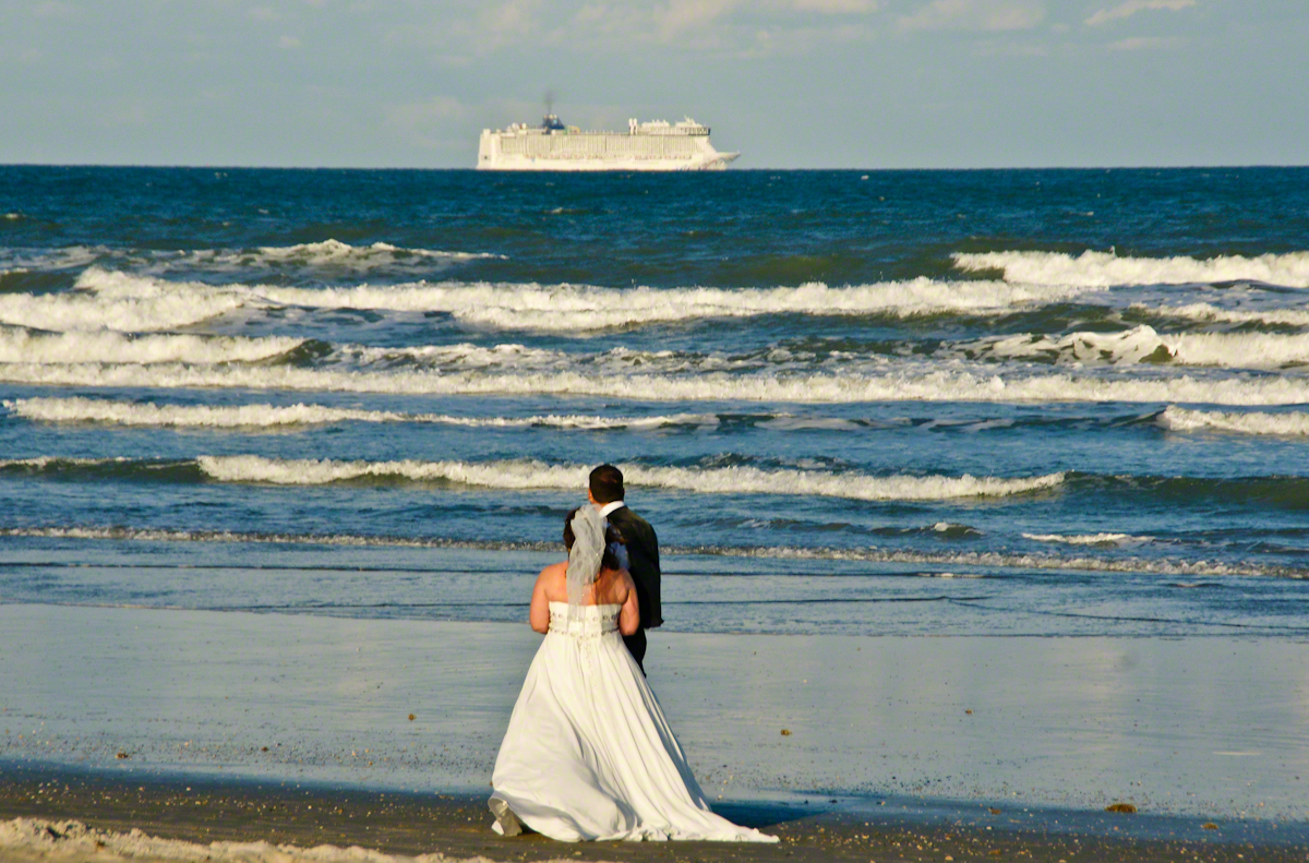
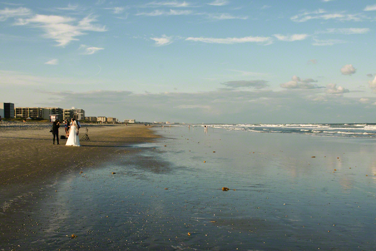
With grandchildren in the Miami Area and a sister in Daytona Beach, Florida was on my mind this morning and memories of this beautiful experience on Cocoa Beach came to mind. After an eventful day touring the NASA launch control center, Pam and I took an evening walk during the golden hour, me with camera in hand.
Full in expectation of catching the passing scene with lots of shot I set to full size jpeg mode using a Sony Alpha 700 dslr with a DT 18-200mm f3.5-6.3 lens. The light was exceptional, so I did not expect much post production work.
My first impression was of the line of cruise ships heading south from Port Canaveral, the starboard side lit perfectly behind human denizens of the Cocoa Beach shore, in full enjoyment mode. A synergy of the images struck me. I took a few experimental shots then, as we progressed down the beach front this unusual tableau came into view.
Newlyweds on Cocoa Beach give rapt attention to a distant cruise ship, it looks like an elegant child’s toy.
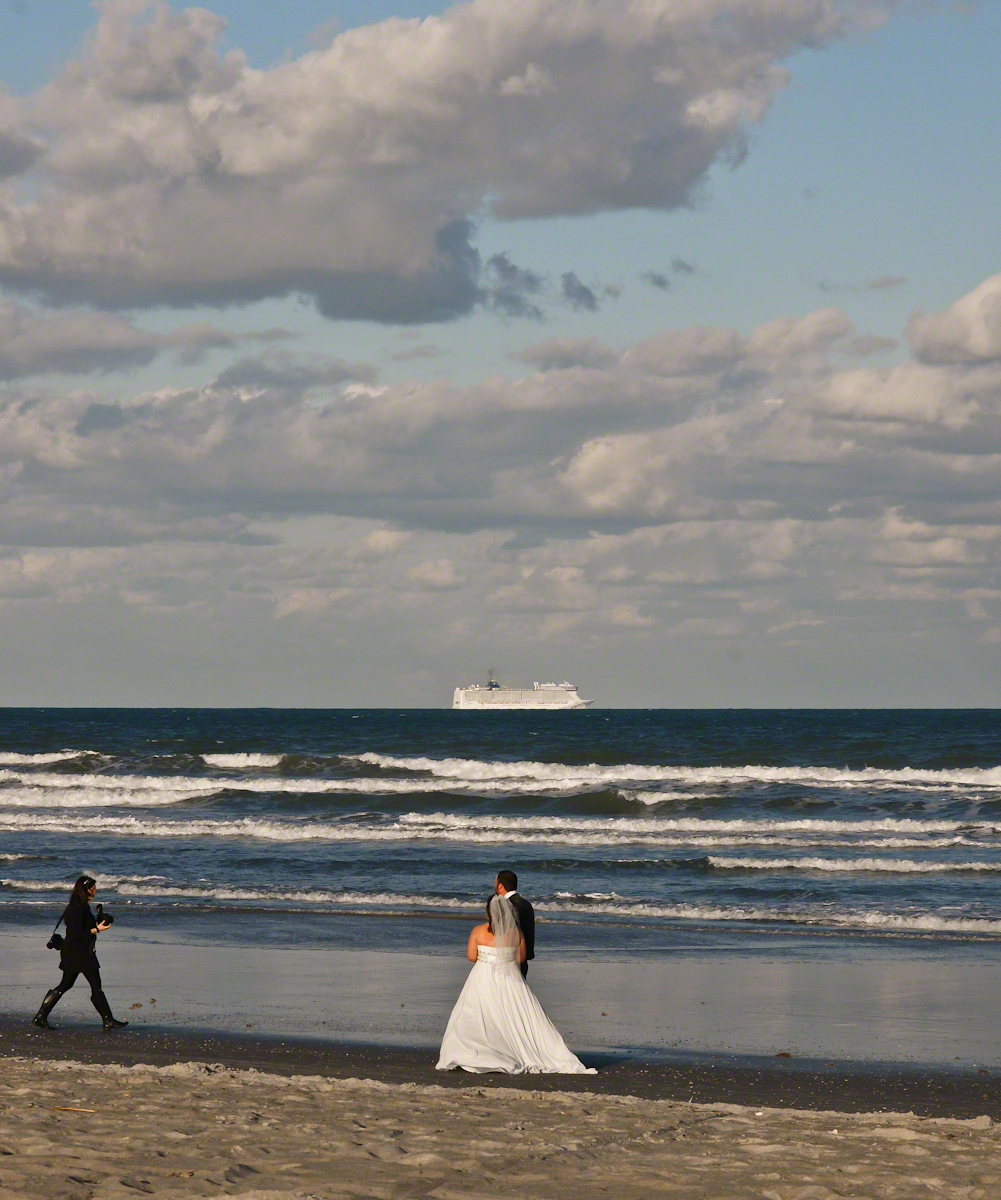
The session proceeded smoothly and professionally, it was a pleasure to watch. I felt no compunction for capturing these private moments on a public beach, the transcendence of the images reflect well on all participants.
Bride and groom pose while photographer composes the shot, her assistant behind.
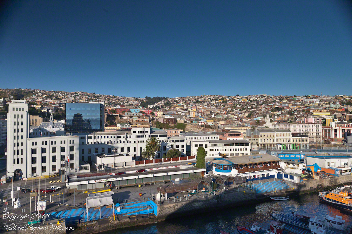
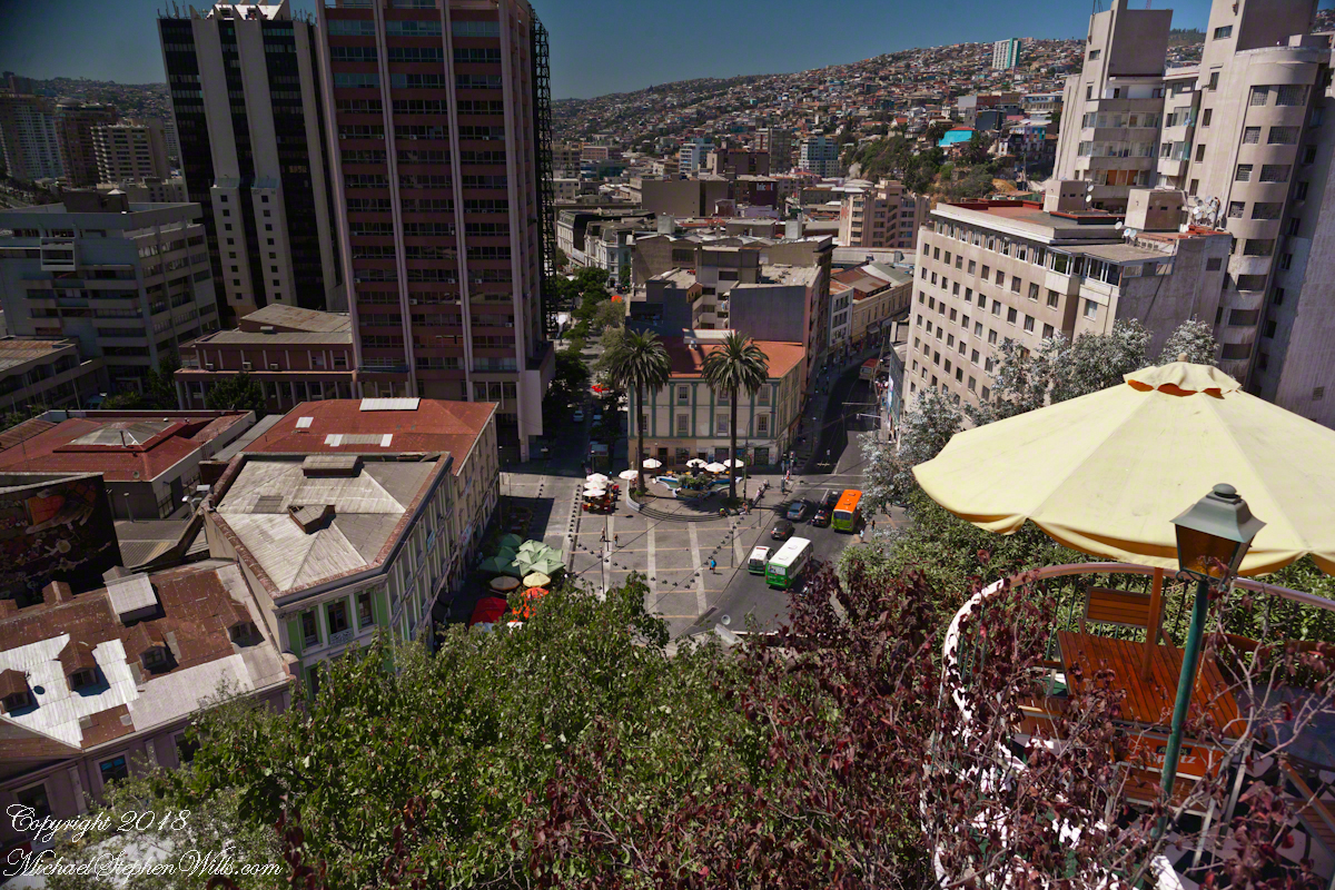
To begin with an epilogue to my last post, “Our Fifteen Minutes of Fame on Conception Hill” , our meeting with the El Mercurio reporter never appeared. Inquiries to the newspaper were promptly and courteously replied to, there was nothing. They suggested a search of the online archive and only a January 2014 fashion show, the article featured a photo from the same terrace. After our pleasant time we walked off some calories on Gervasoni Promenade, a showcase of city harbor and hillside views.
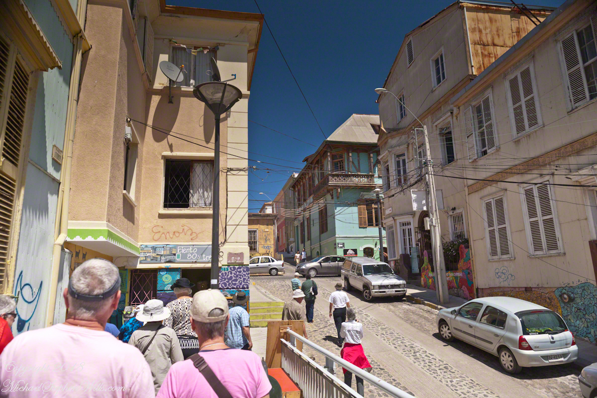
Most city visits on this cruise we traded independence and flexibility for the convenience of the guided tour. Ricardo, our guide, was a knowledgeable, good humored companion to our small group. After we left the promenade for Calle Conception Ricardo was most helpful.
It was here I entered a photographic fugue, losing touch with my surroundings through concentration on capturing the moment.
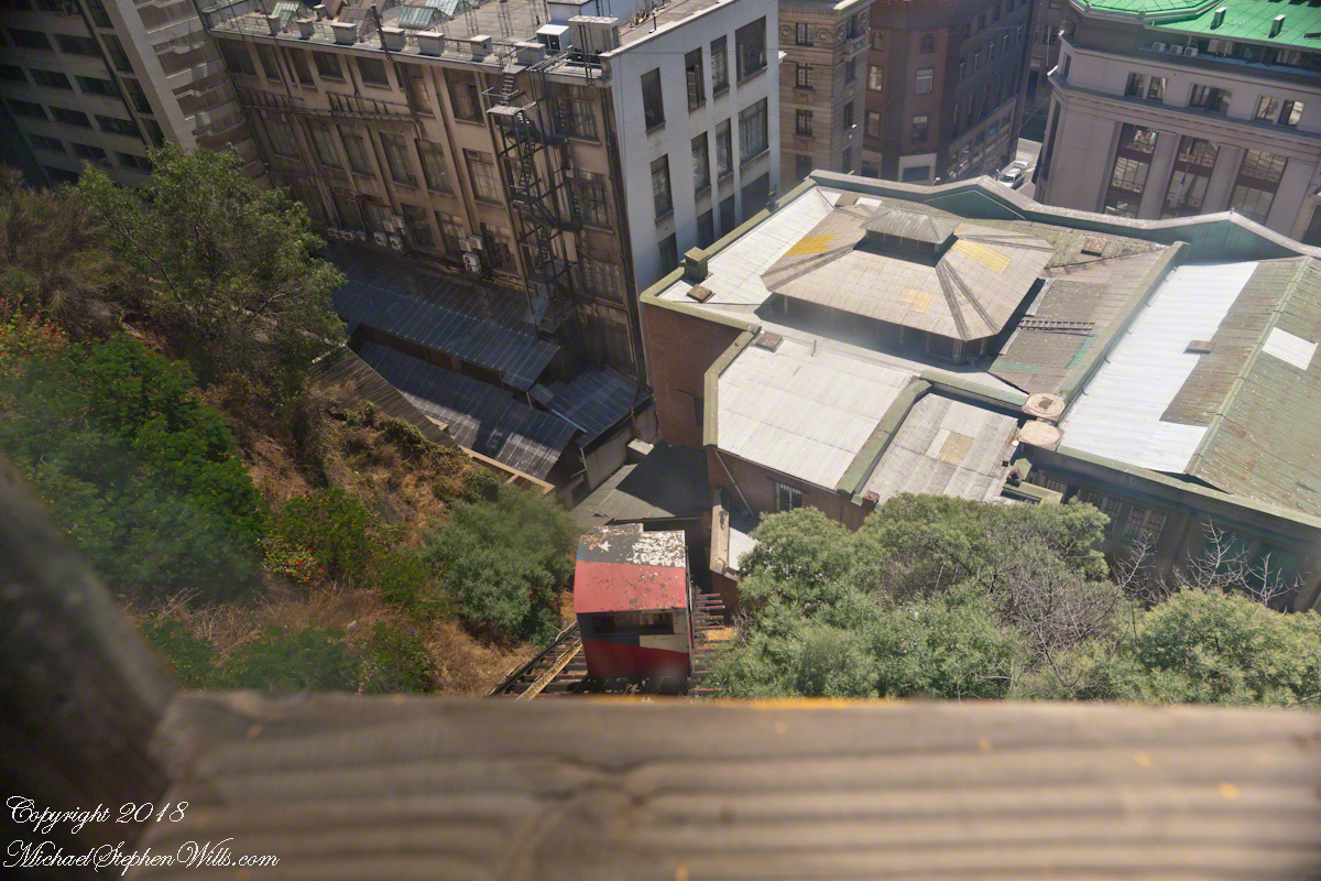
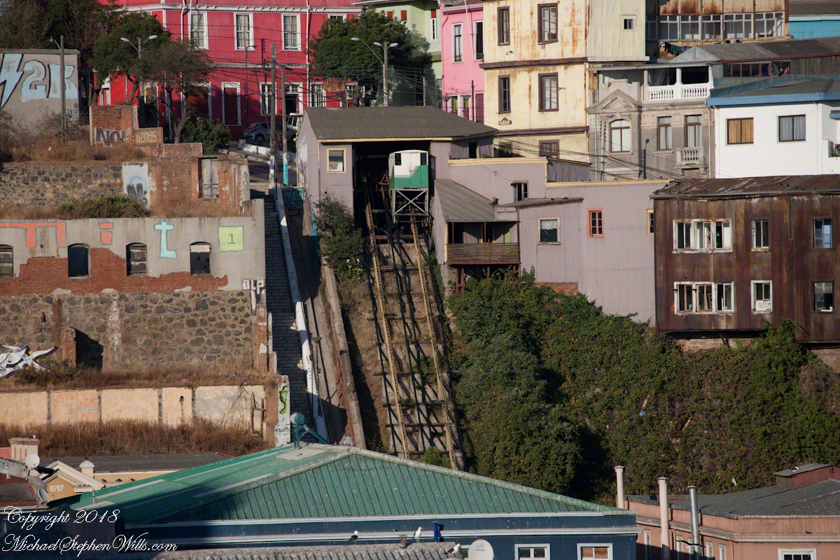
I walked ahead of Pam, expecting her to follow, and caught the view of the arriving care of the Conception funicular.
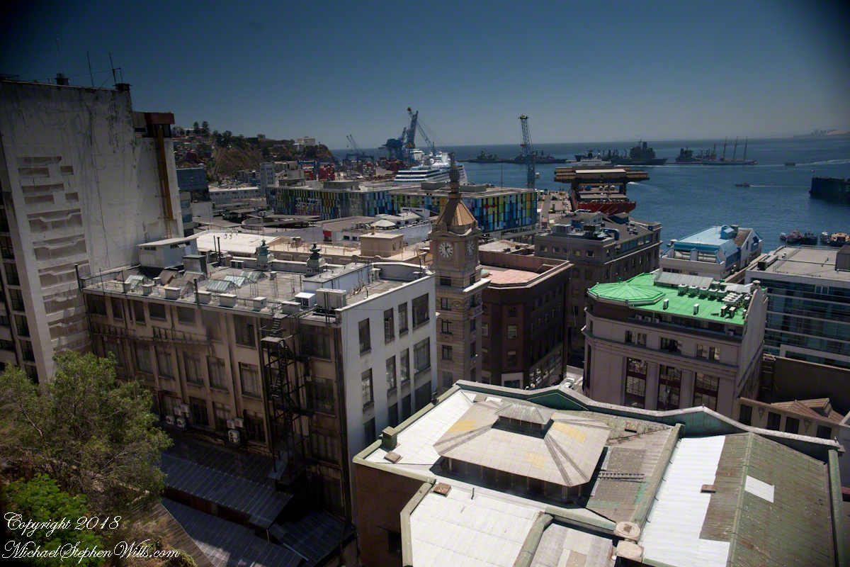
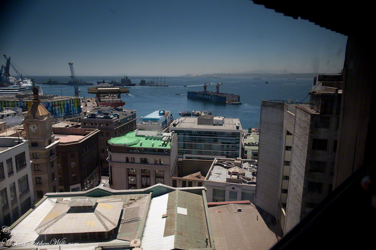
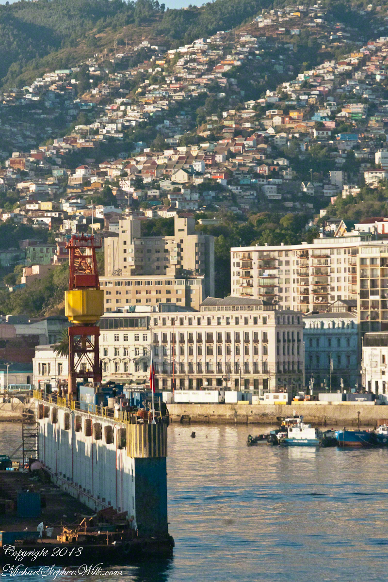
Wow, that’s the Regatta at dock. Other elements of this vista are the harbor, of course, then the famous Turri clock tower. Hmmm, almost 1:30 pm.
I was fascinated by the view of a drydock the Regatta passed while docking early that morning. It is the red structure with the letters “Sociber”, it even has a Facebook page!!!
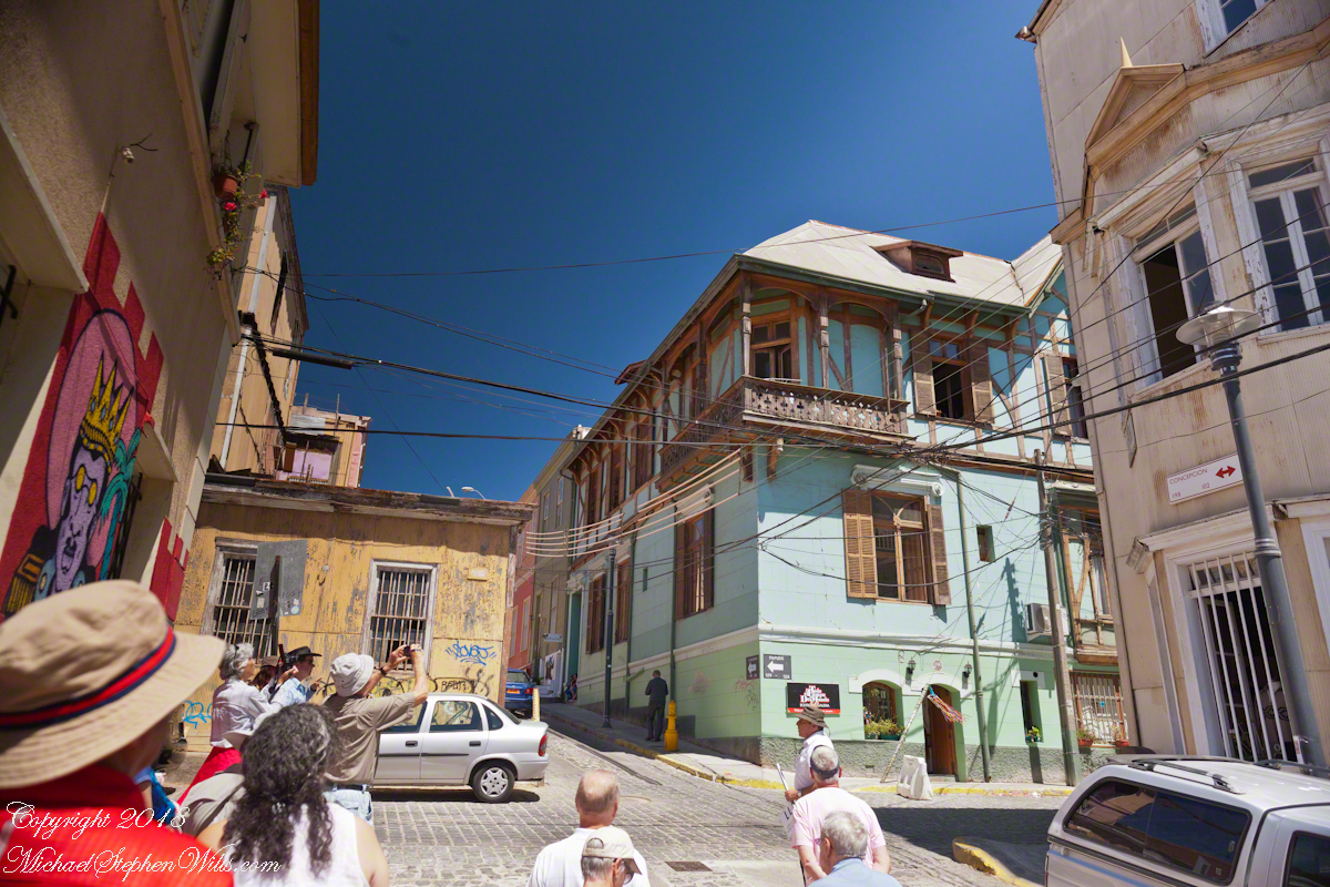
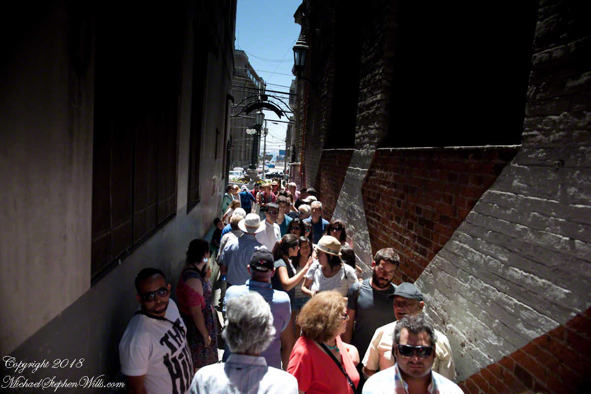
Once at street level the experience of the crowd on the alley opening onto Calle Prat, waiting for the ride up, brought back reality. “Where’s Pam?” I could not go back up because of the crowd, the views from the car fell from my mind.
I was on the street, disoriented and alone.
I fell back on photography to pass the time. Nowhere near the charm of Cerro Conception, typical downtown urban environment.
A man approached the family across Prat, “What is going on?” I wondered when the tour bus arrived. Still no Pam.
Oh, it is an ice cream vendor. Delicious. “Where’s Pam?” Ricardo not around, either. Back on the bus, waiting, a younger member of the tour was an Irish wag who declaimed on the benefits of freedom, even temporary.
Finally, Ricardo arrived followed by a few other tour members and Pam. Whew!! I’ll never live down “deserting” her. She was not able to find the entrance to the Conception funicular. Along with a few others they kept each other company until Ricardo rounded them up. That was a long 20 minutes (reading from the photograph metadata), I was worried. As I mentioned, at the time I was clueless about my whereabouts. Reviewing the numerous photographs, I found the “Servicio Nacional de Aduanas” (National Customs) building across the where Calle Esmeralda joins with Cochrane and pieced it together from there.
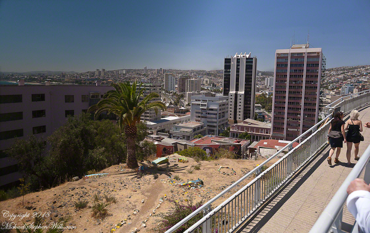
About the Conception funicular, that morning while the Regata docked I caught this view of Valparaiso hillside. It is a microcosm of the Andean topography, ravines cut through the heights. This is when I noted the Sociber drydock, it is on the lower left…look down into it — the business is to sell that dry space in the middle of the harbor for ship repair. The space and be flooded, opened to allow entry of a ship, then drained for work on the hull or whatever.
The city pioneers adapted to this terrain. As a entrepreneurial endeavor, in 1882 Mr. Liberio E. Brieba Pacheco founded the Mechanical Elevators Company of Valparaíso. Conception funicular opened the following year to facilitate the urbanization of Alegre and Concepción hills. Conception funicular is closed for repairs currently, from 1883 until recently this, the oldest and first funicular of Valparaiso lifted people from the downtown Plan (plain) to the hilltop for a small fee.
Funicular is derived from latin “funis” for rope. It is an elevator that runs two counter balanced cars on a rails on a steep, less than vertical, slope. As one car rises the other lowers.
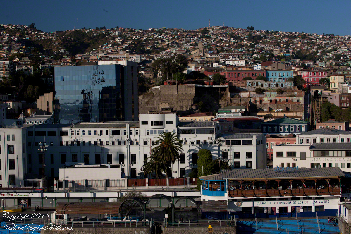
Here are some views of the Conception funicular and environs as seen from the upper Regatta deck. First, a 24 mm wide angle view. Look to the center for the rails and one car at the top. Above are the buildings of Cerro Conception (Conception Hill).
The funicular emerges from downtown on the right in the following view. The prominent church is Parroquia Perpetuo Socorro, just above the midpoint. It rises from Cerro Cordillera, above Cerro Conception. A Catholic church founded by the Redemptionist Fathers, the first stone was laid down 1905. Learning from the devastating earthquake of 1906, the engineer Juan Tonkin chose construction of Oregon pine and concrete to stand tall today. What a view (I’ve seen photographs).
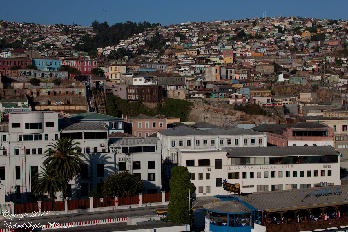
A view a bit to the right, many of the colorful exteriors are zinc panels brought from early sailing ships, repurposed as siding.
After the wide angle shot I used the variable “zoom” lens for the rest. Here is a close view of the Conception funicular. The business of building and running these services thrived, over the years up to 29 funiculars and one elevator, served the city portenos (people of the port). In 2018 seven are in operation, nine are under a process of restoration and modernization, including Conception.
Copyright 2022 Michael Stephen Wills All Rights Reserved
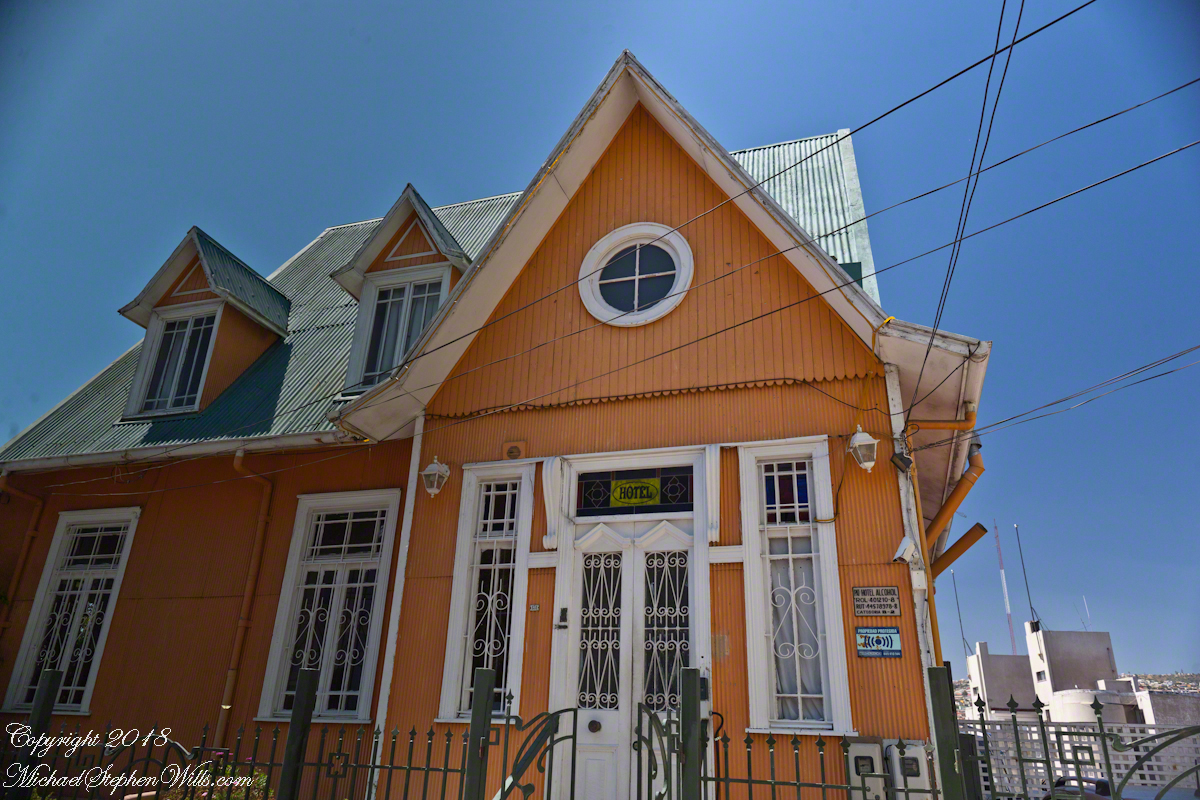
Posting about our departure from Valparaiso, Chile (see Valparaiso Departure III “The Sunset”) brings us to the time spent wandering this World Heritage Site, added to the UNESCO list in 2003. Within the amphitheater of hills is Cerro Conception (Conception Hill), historically settled by English and German immigrants. The façade of the Hotel Brighton, a building from the 19th century heyday of Valparaiso when it was a stopping point for shipping through the Straits of Magellan, reveals why so many of the buildings are alike: all are constructed from materials dropped off from sailing ships.
The theme of the Hotel Brighton evokes thoughts of immigrants remembering their origins, emigres claiming a spot of real estate to mold a sense of place for themselves. This goes both ways, Valparaiso, Indiana was formerly Porterville of Porter County. The motive force behind the renaming were the memories of the retired Captain David Porter, the sole survivor of an attack on his ship USS Essex by the British frigates Phoebe and Cherub in the War of 1812, within sight of Valparaiso. Fifty eight (58) United States Marines lost their lives in that sea battle. To point out the obvious, Captain Porter is the namesake of Porter County.
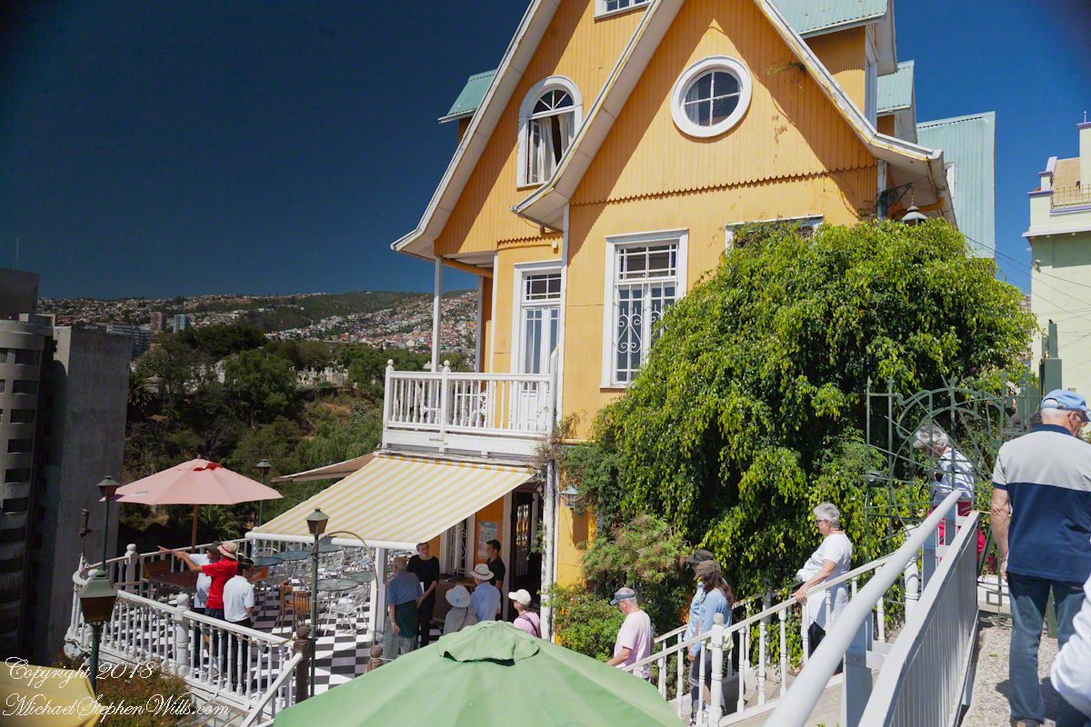
Pam corrects me when I say we “stopped for lunch” at the Hotel Brighton, pointing out we “only” had a glass of red wine and an empanada. Both were tasty, even more so with this marvelous view looking north into the other hills of the city. The yellow umbrella is on the hotel restaurant terrace.
I missed capturing the signature wrought iron gate forming the word “Brighton” among decorative scrolls. Built on the edge of Conception Hill it overlooks the coastal plain almost all of which is man-made.
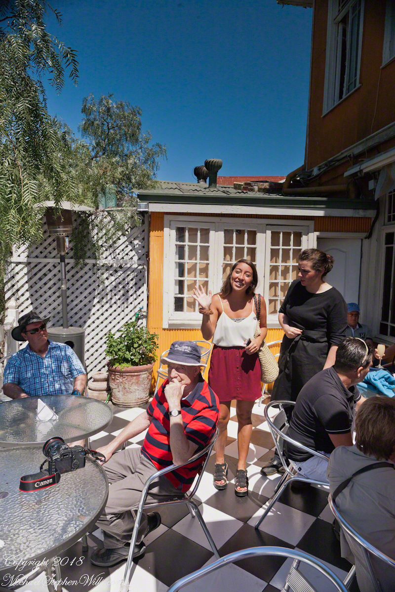
During our refreshment, this young lady (see photograph below) introduced herself as a reporter for El Mercurio. Accompanied by a photographer, she interviewed us and we had our photograph taken, I returned the favor with the following photograph saying the story might appear in the next edition. Standing next to her, with a puzzled look, is our waitress who was from the States.
El Mercurio de Valparaiso is the oldest continuously published Spanish language newspaper in the world. In my research for these photographs I discovered the newpaper officers were a short walk from the landing of the Ascensor Conception.
Copyright 2022 Michael Stephen Wills All Rights Reserved
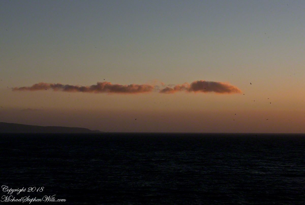
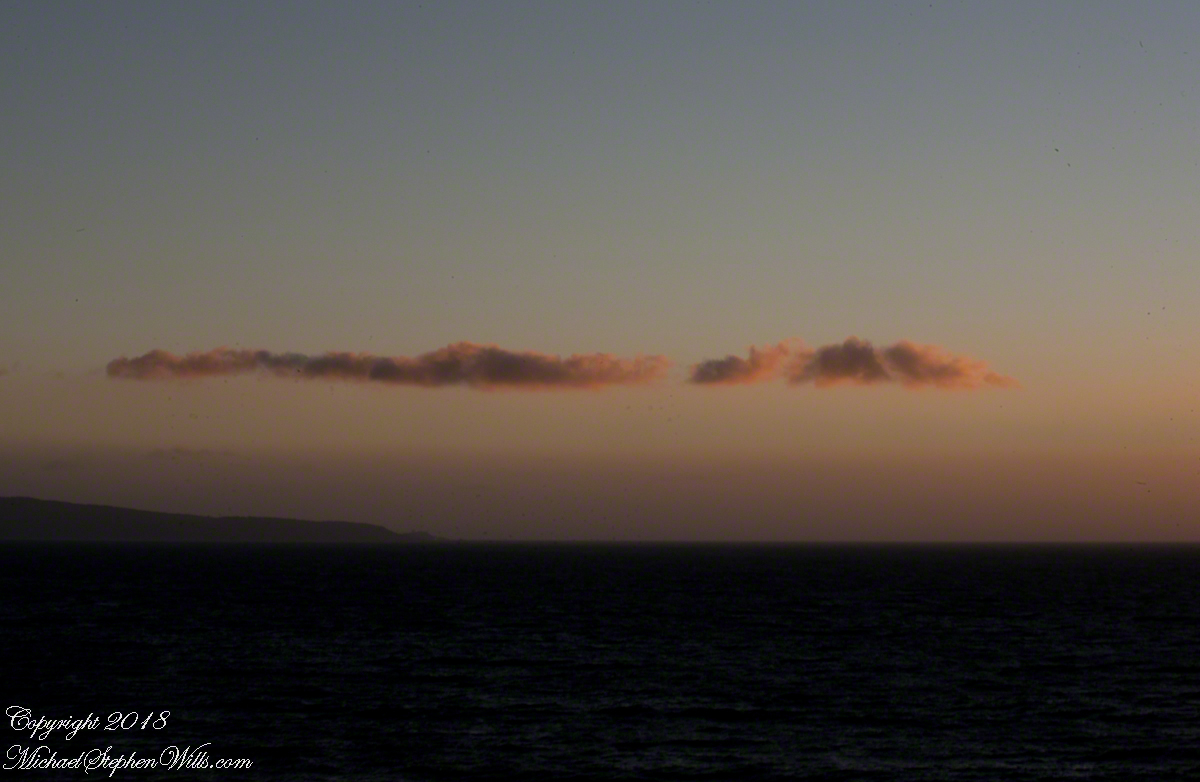
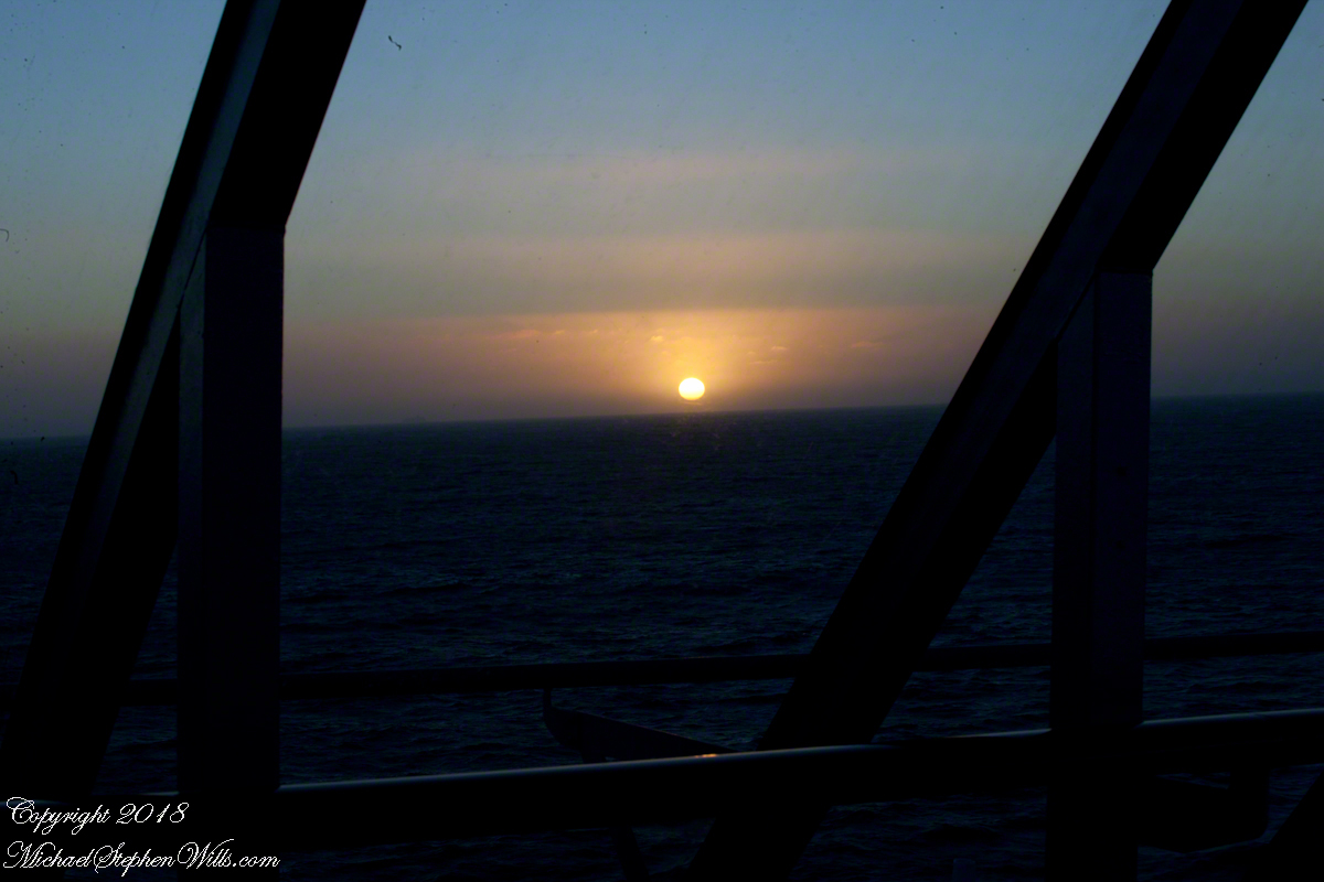
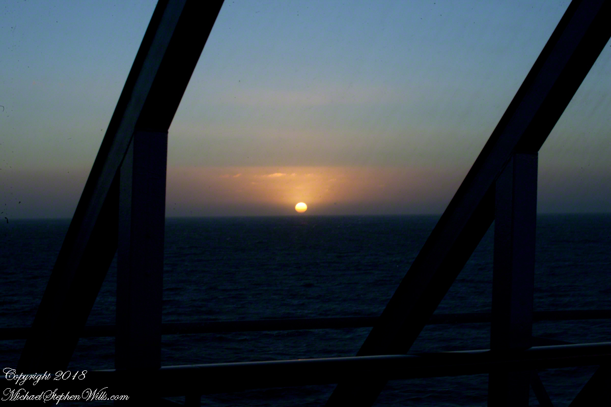
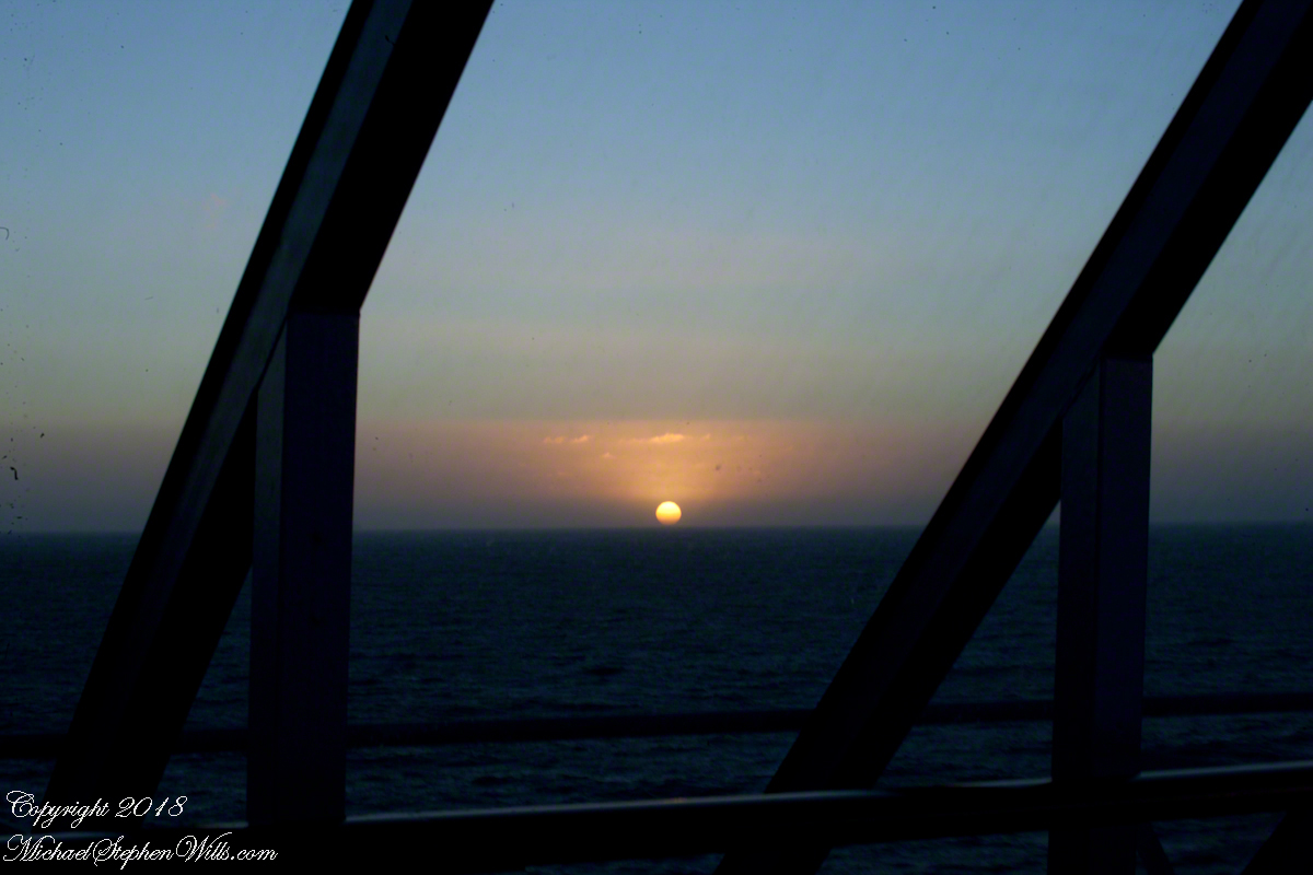
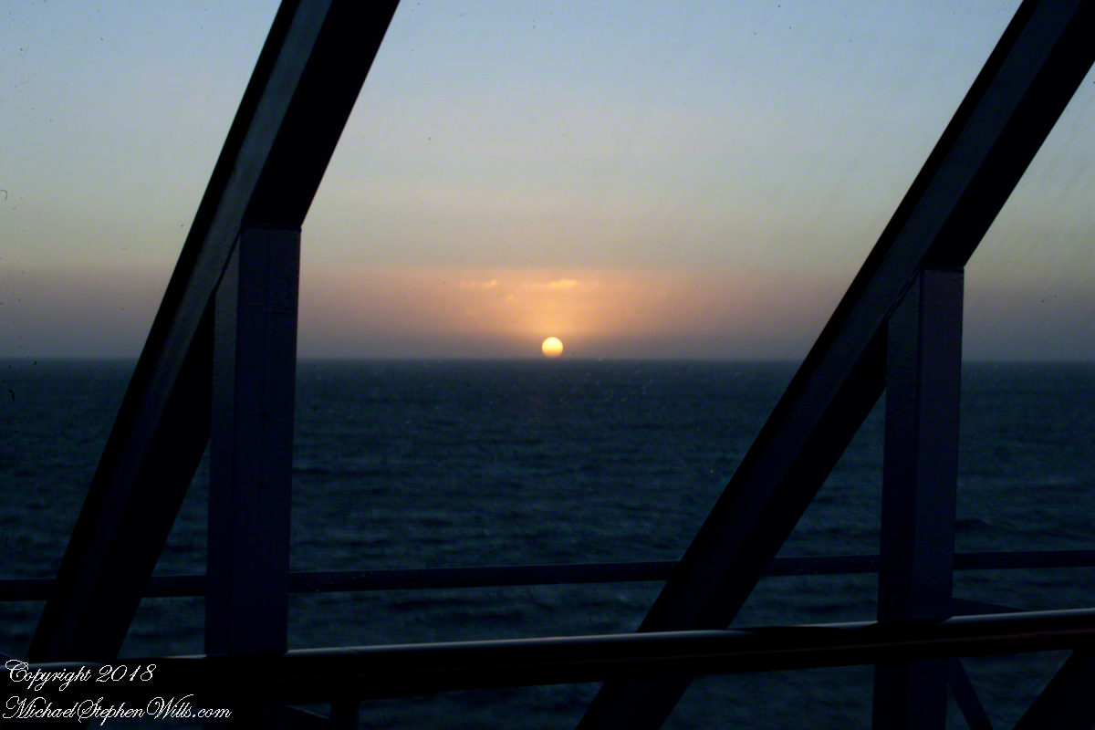
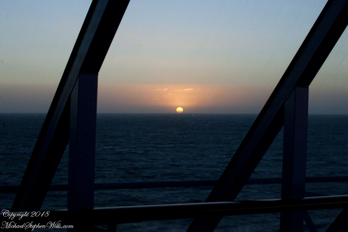
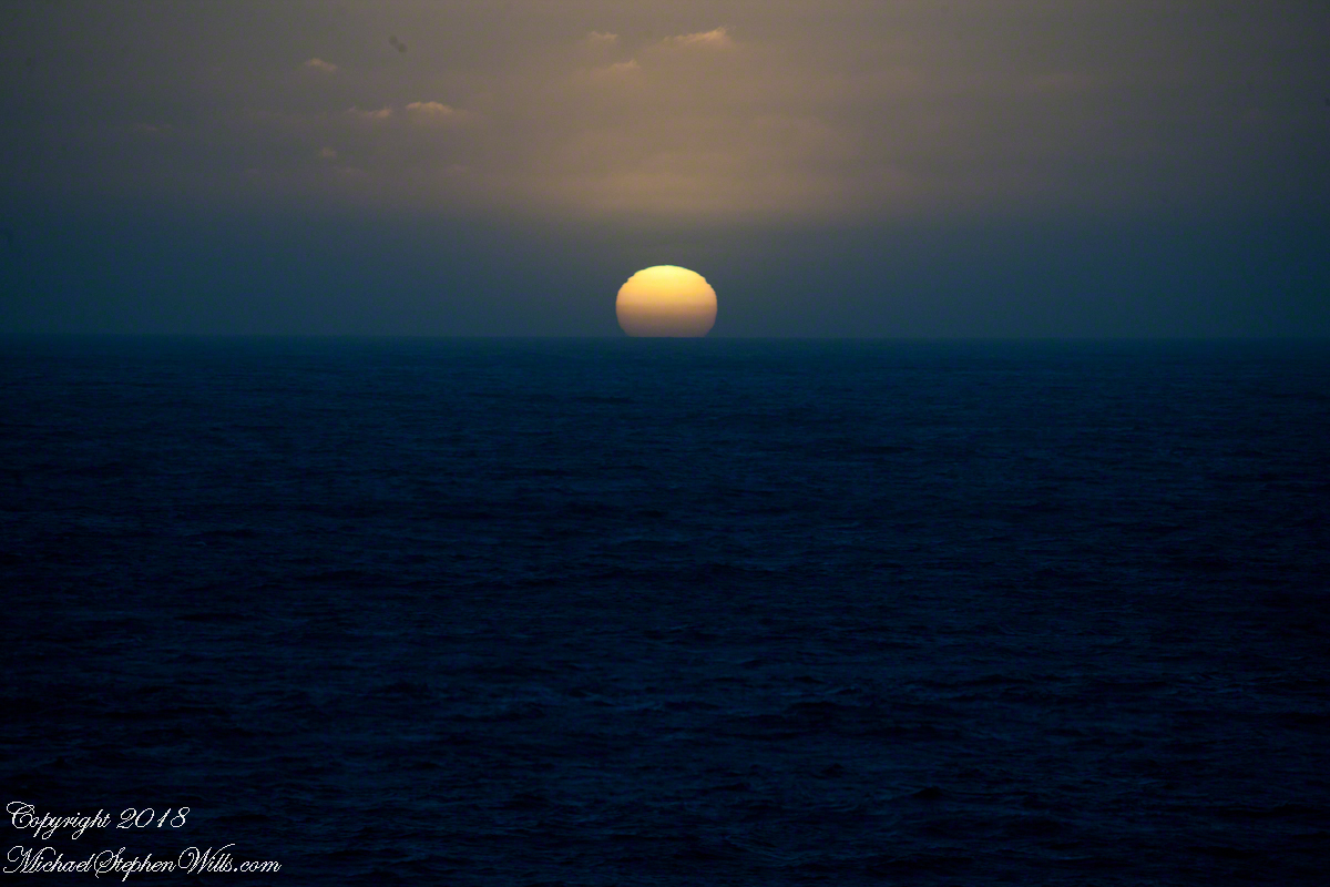
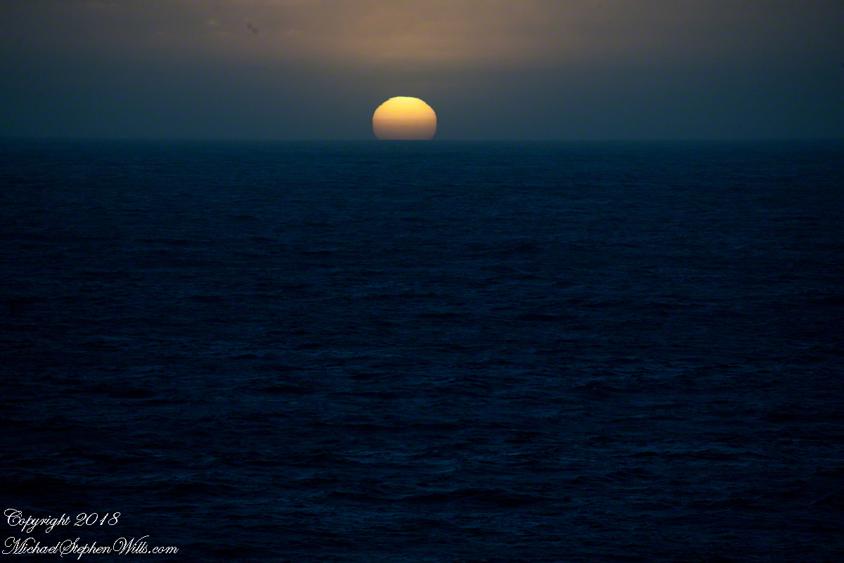
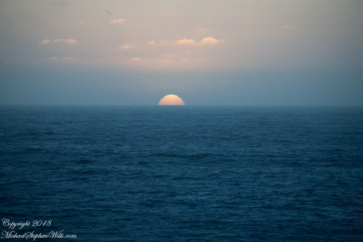
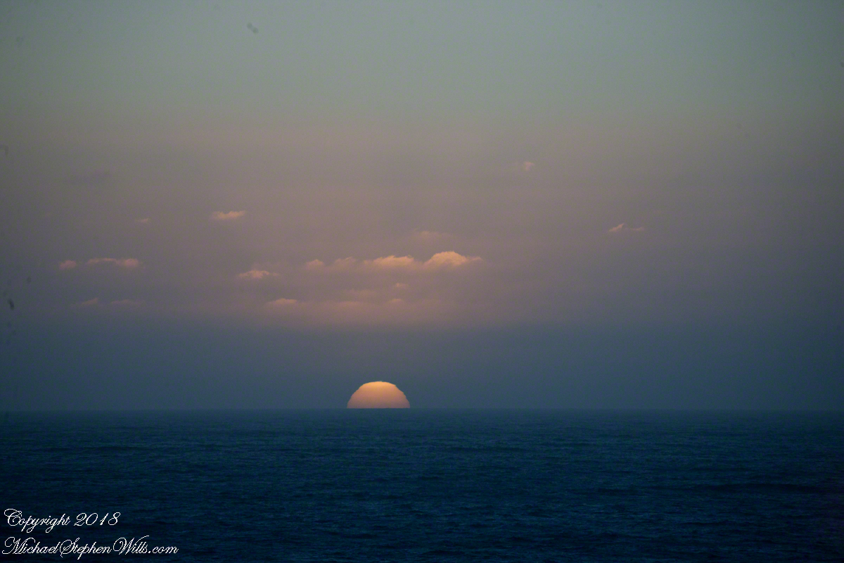
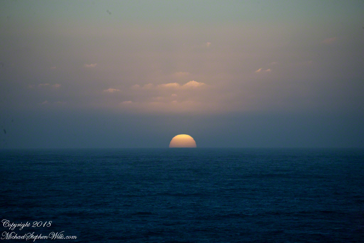
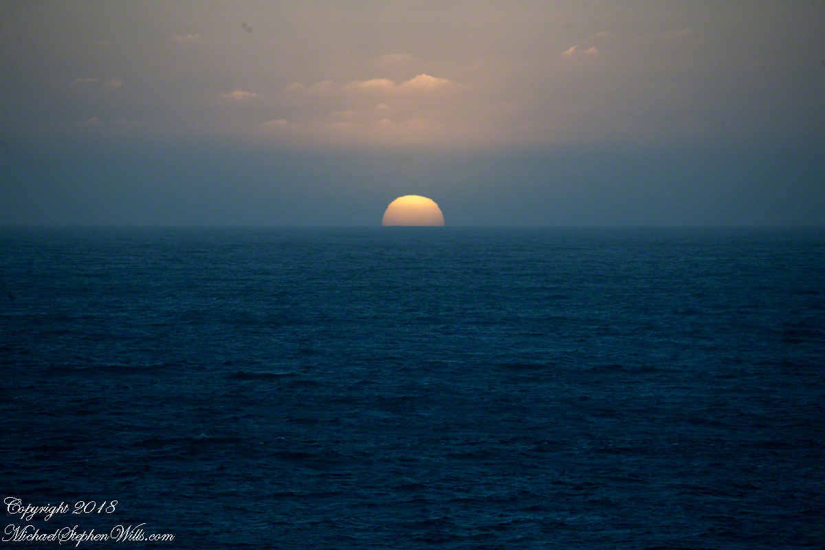
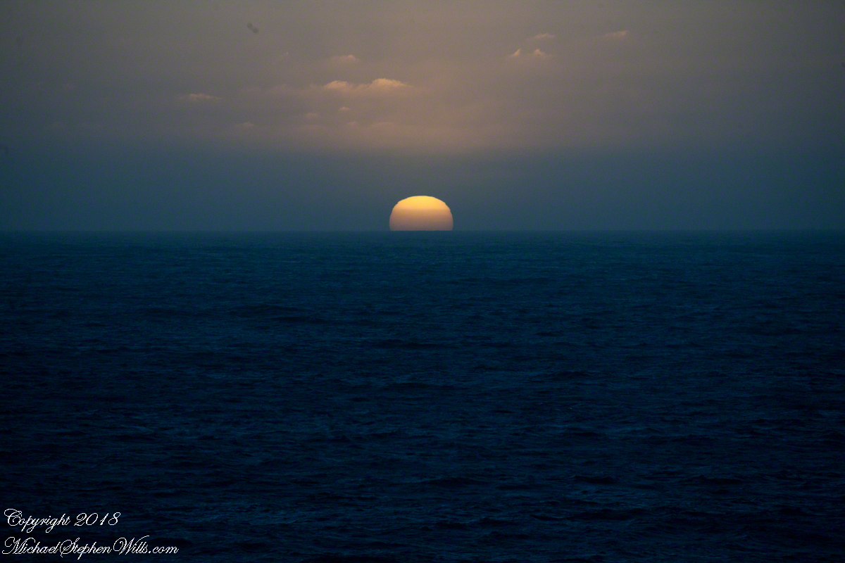
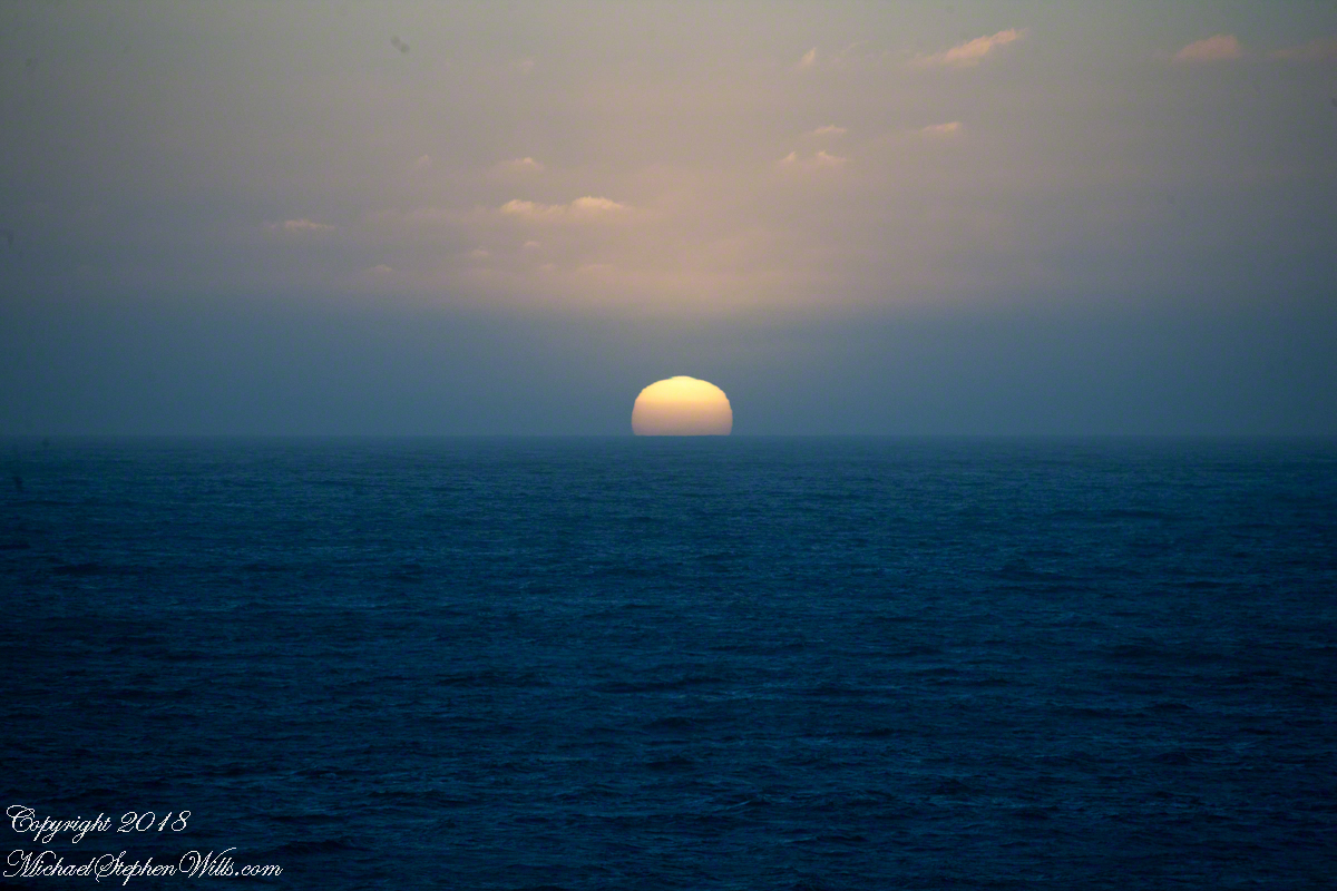
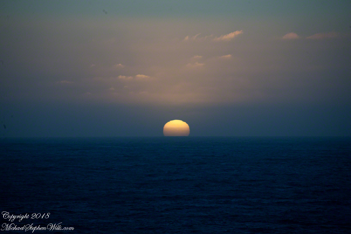
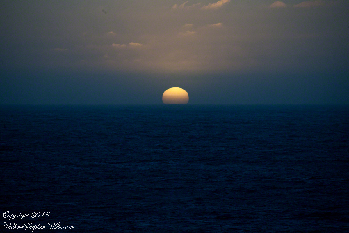
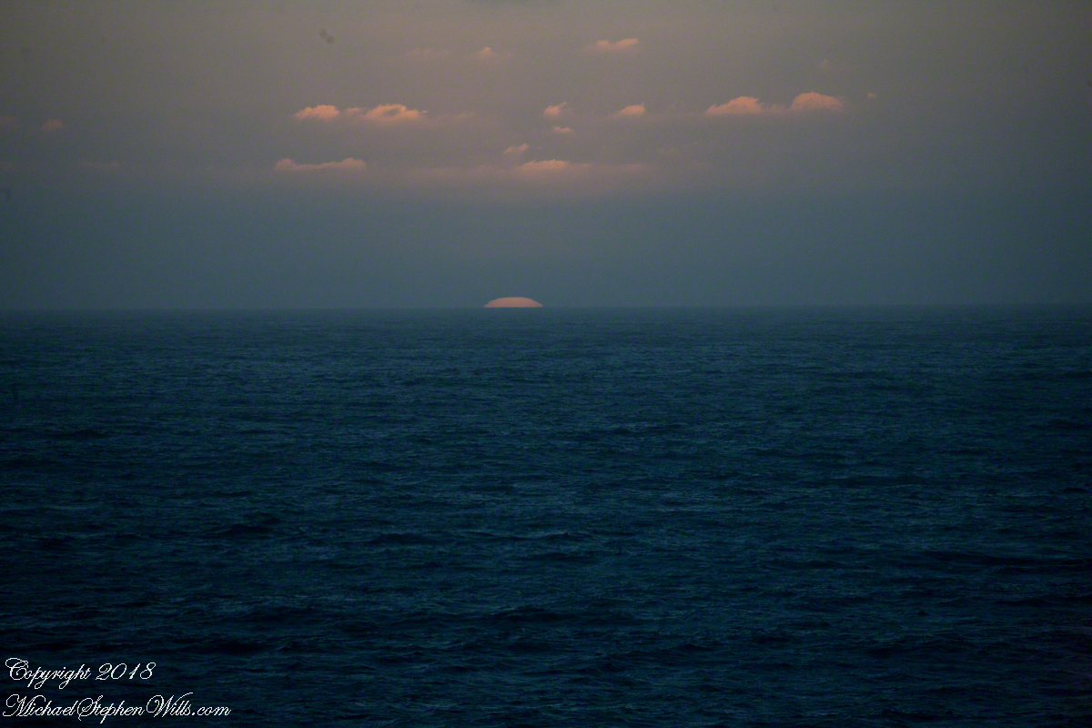
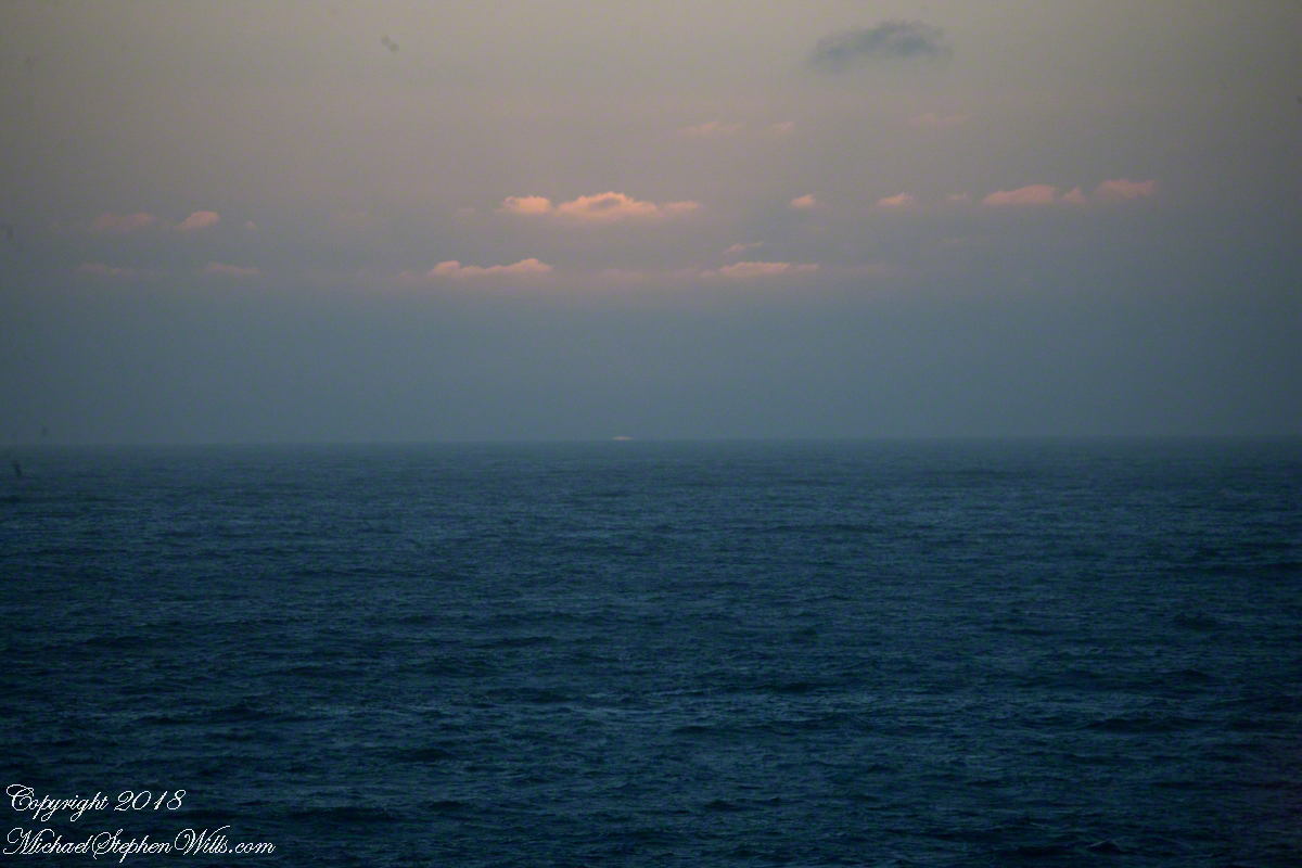
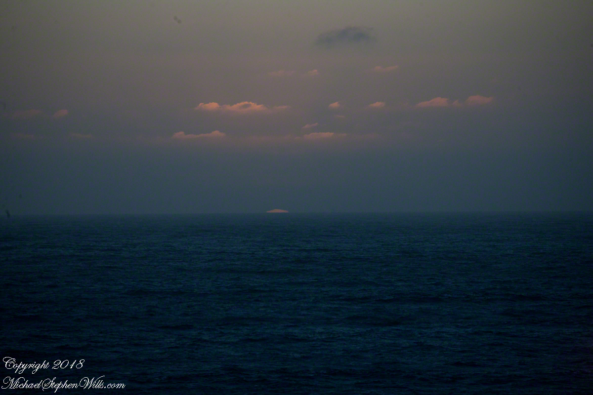
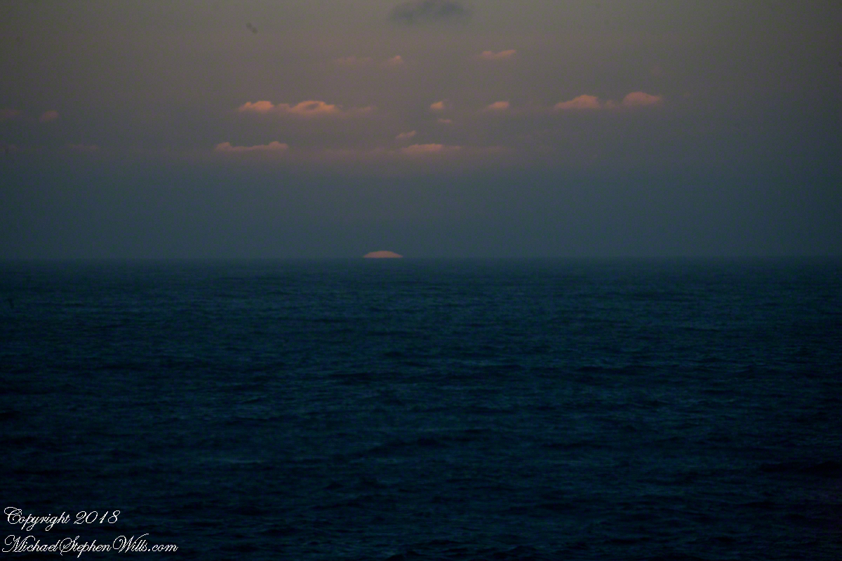
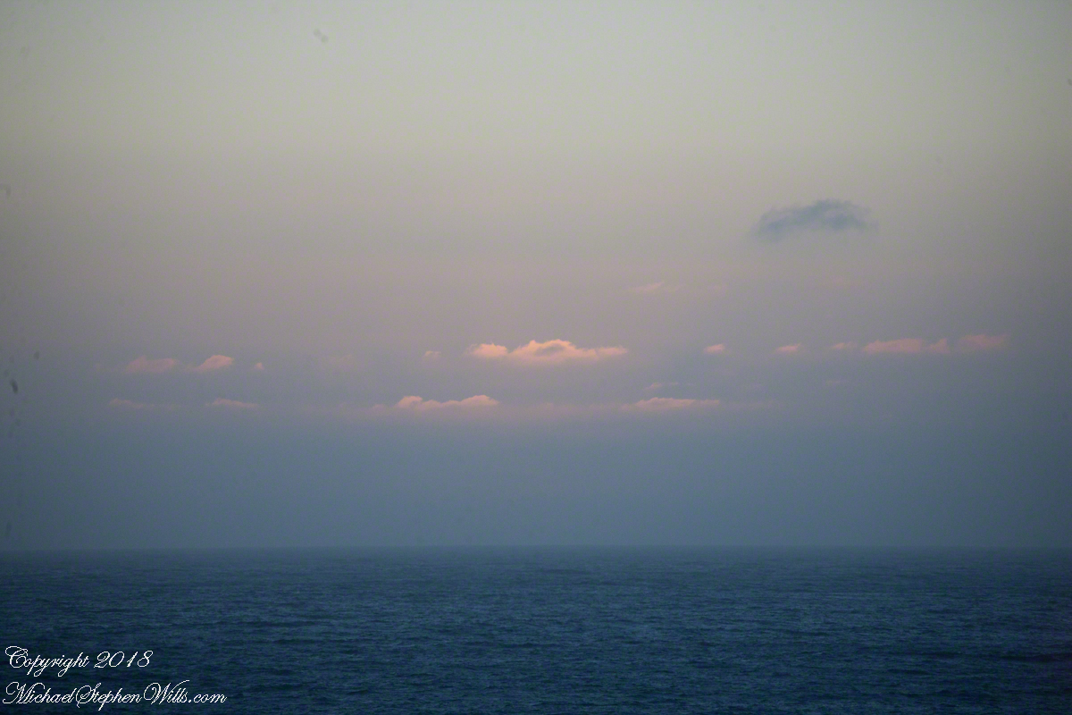
Two minutes after capturing the last light on Concon Point, see “Valparaiso Departure II”, turning the camera 180 degrees, to the south, looking along the Chilean coast, to capture birds on the wing headed toward shore at day’s end. Remembering other times,
waiting for darkness
with a sky map, studying it to make sense of the stars.
How far? How large?
Light from our star, eight minutes old,
grazed the earth’s rim the breath of a moth wing ago.
Connect the dots, stories of heroes, monsters.
Our star, as we know it now
Singular, alone,
Progress, an illusion to be understood
No less mysterious for that
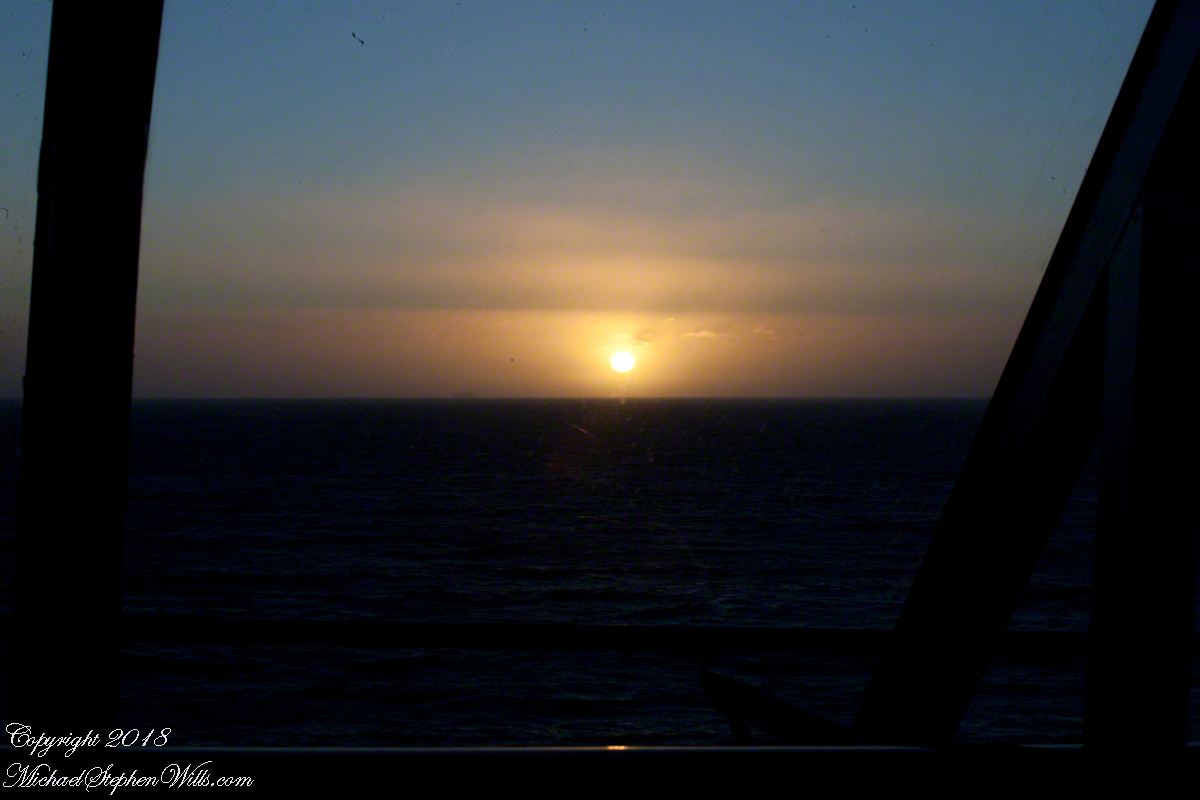
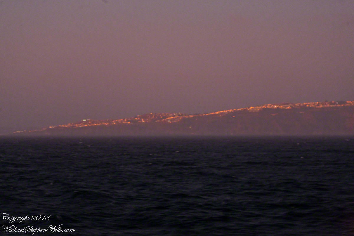
Look back to the sheltering headland of Valparaiso, glowing.
Copyright 2022 Michael Stephen Wills All Rights Reserved