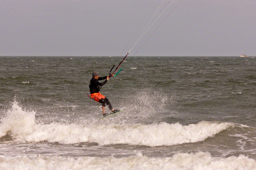
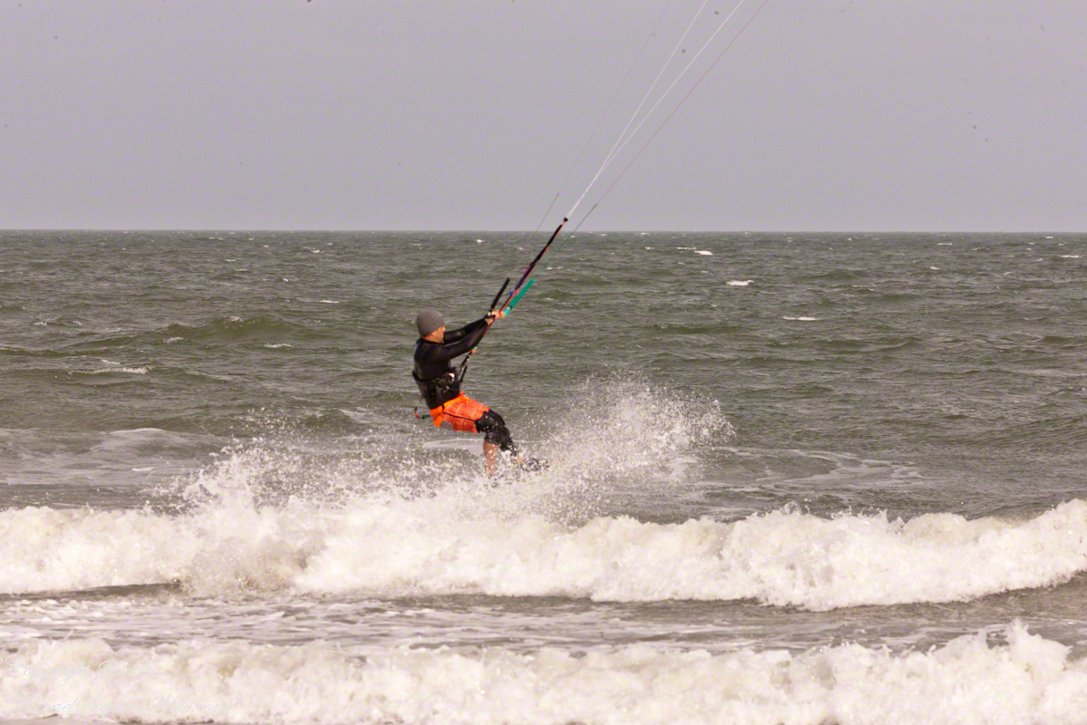
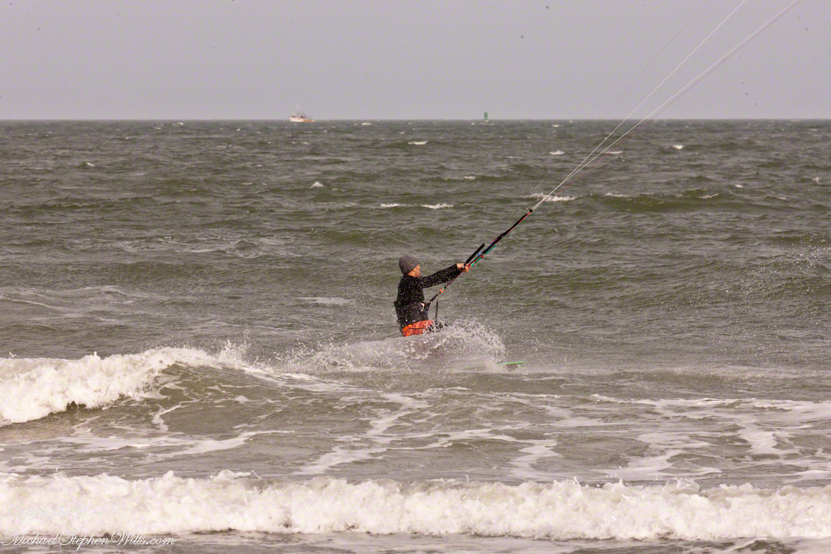
For a change of scene we visited Cape Canaveral, the beach at Cherie Down Park were an informal gathering of Kite Surfers was underway. Here is a series of action shots, one second elapsed from first to last.
Click any photograph for my Online Galleries
Conditions were excellent: good northerly wind, the sun overcast and, it being afternoon, in the west. Surfers stayed relatively close to shore, near their starting point. I had packed the “heavy gun” camera with a tripod.
Panning the scene (swiveling on the tripod), the camera in rapid exposure mode, I pressed the shutter release and held it down.
The surfer was captured mid-jump to landing.
Copyright 2022 All Rights Reserved Michael Stephen Wills
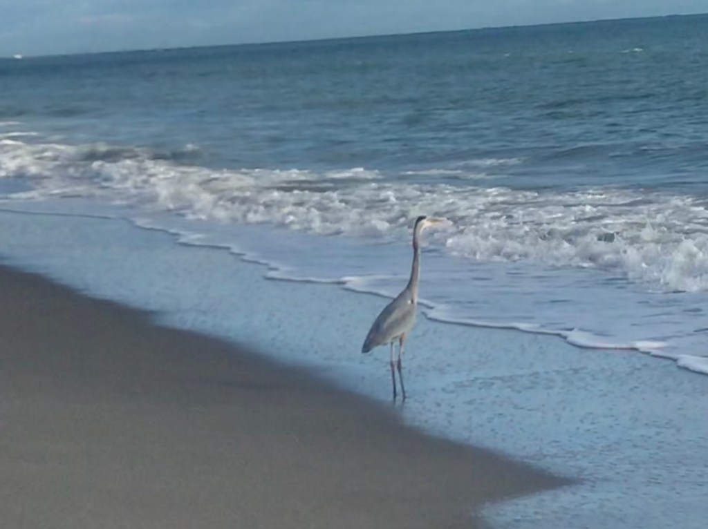
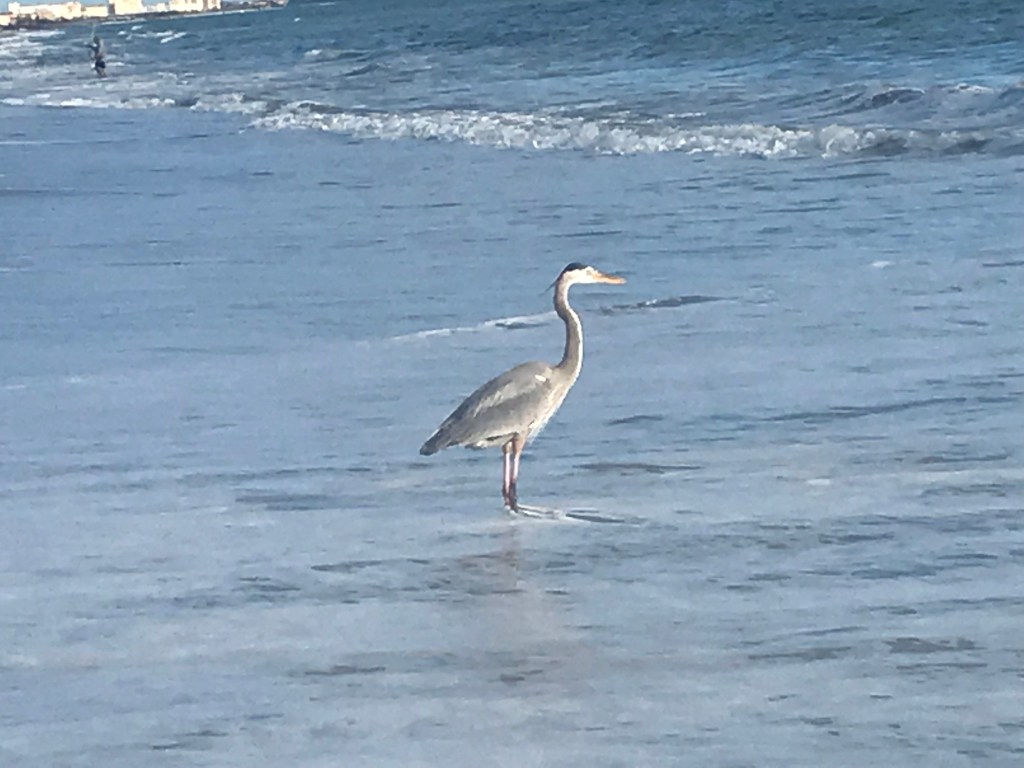
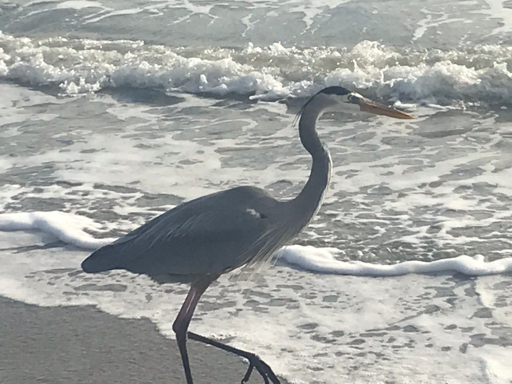
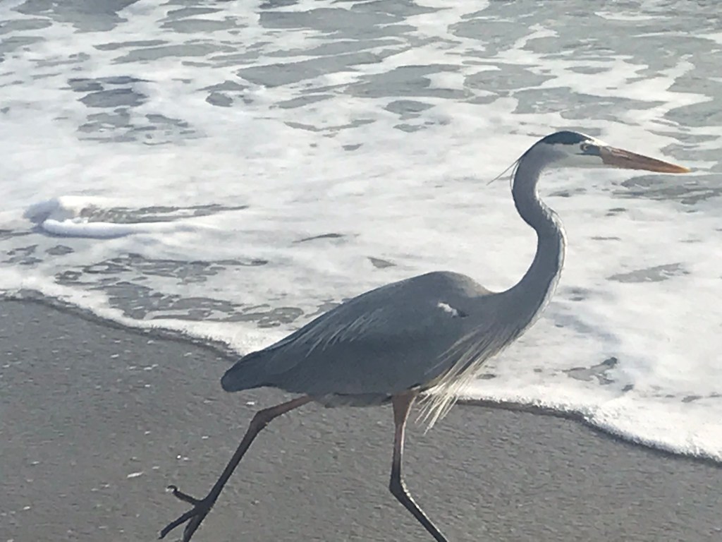
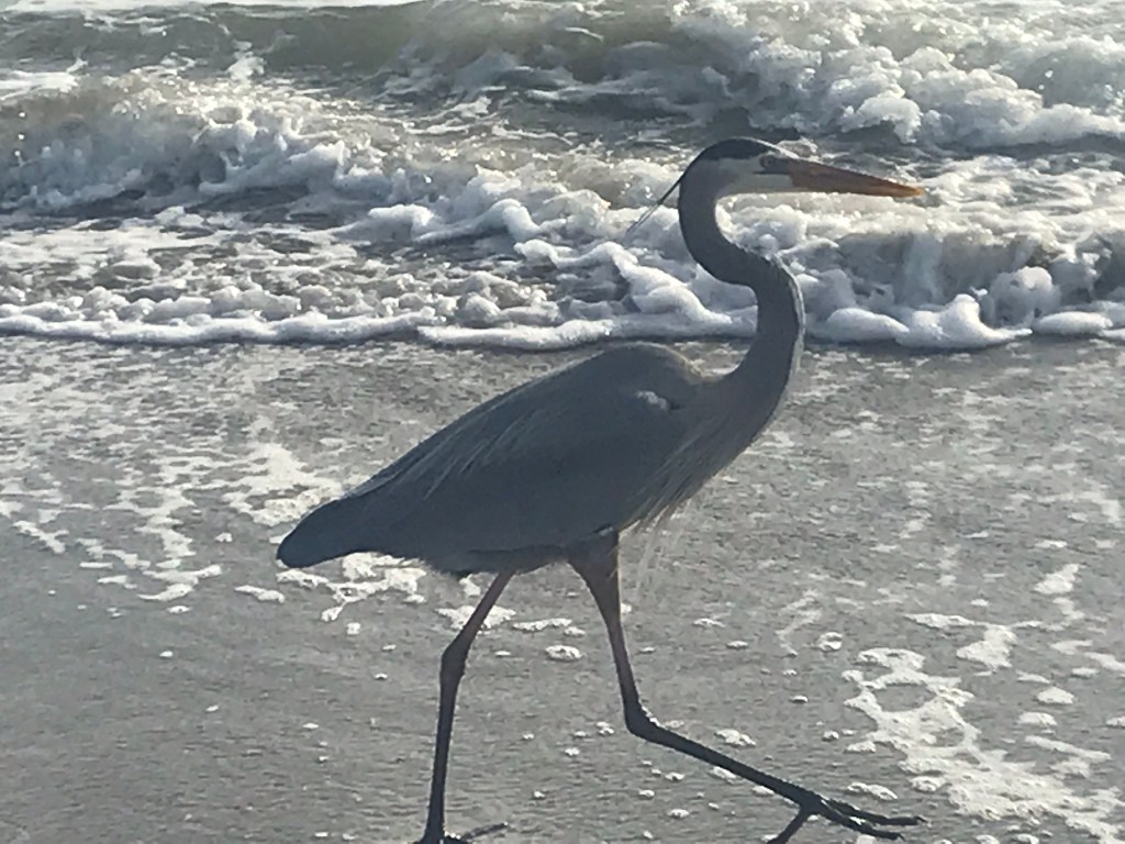
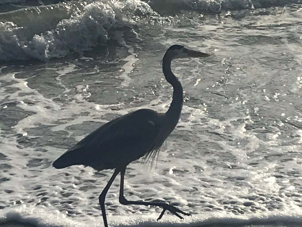
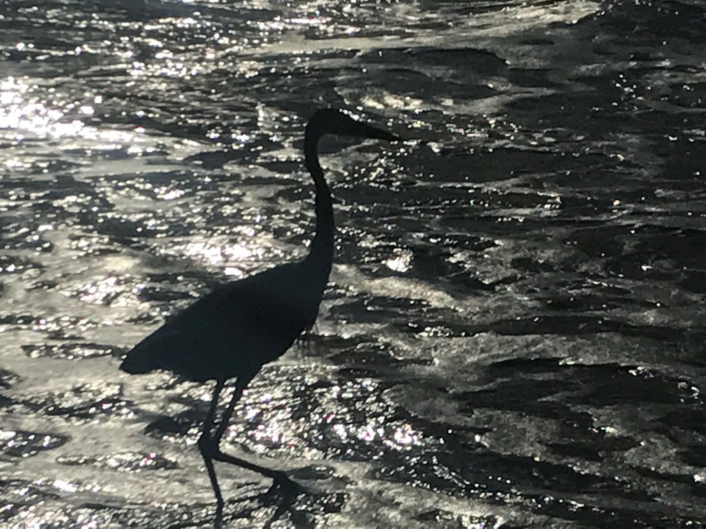
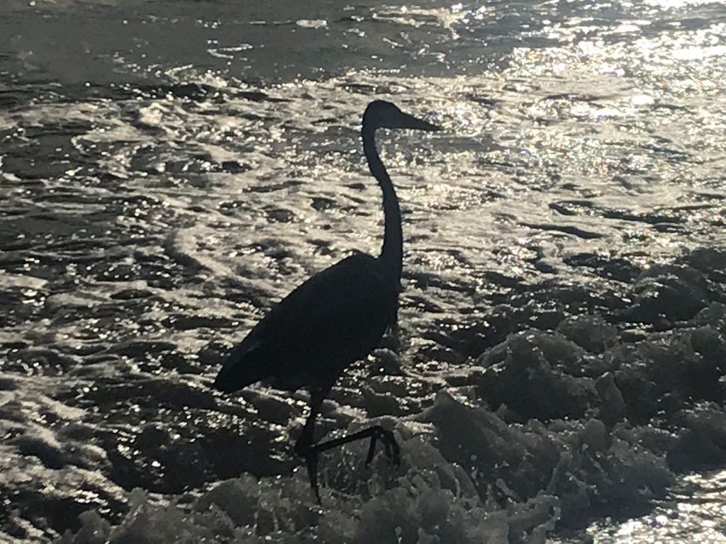
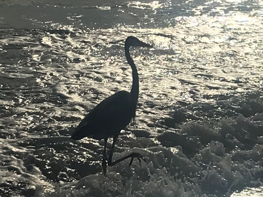
Time was on our side on these leisurely strolls on Cocoa Beach. depending on the weather, tides and the direction chosen, we encountered Herons.
Here is a series of meetings with two individuals, both young. For the stills the larger approached from the north, working the surf. I experimented with standing very still with minimal hand/arm motions. Intent on the food search, this heron approached steadily without apprehension…..
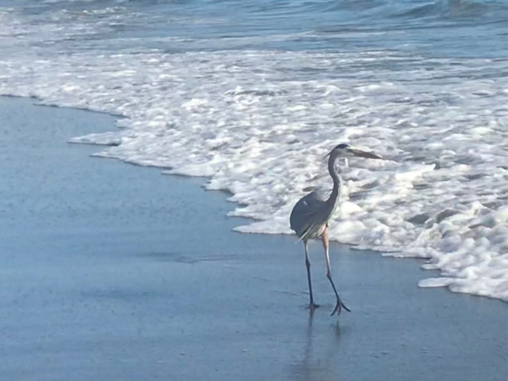
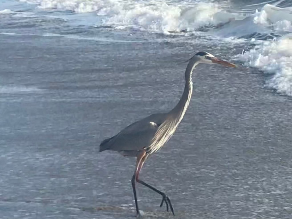
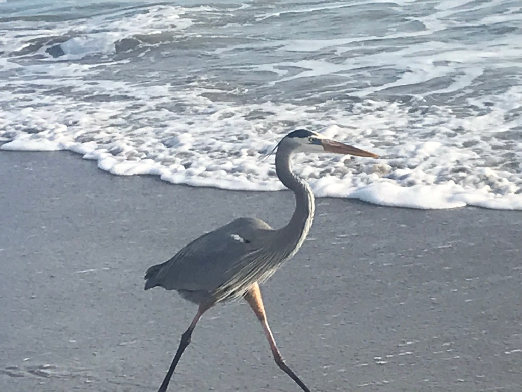
Until a distance of eight feet, then it stopped hunting proceeding at a slightly faster, though stately pace, to approach no more than four feet away. I chose a position in the surf, the Heron needed to either fly over or approach between myself and the final break of the waves. There is a sand bar near shore where the wave break, then continue to break again.
In approaching from the south, here in the norther hemisphere, the sun was to my back until the heron passed when the photographs changed from somewhat backlit, never in the full sun because this is the east coast of Florida, morning. On passing the photographs have a pronounced back lit aspect.
Here is brief video of a fully lit not fully grown individual at the prime time for photography, the evening golden hour with sun in the west.
I positioned closer this time, it is wary throughout the clip. It is possible to feel the strength of the surf, the slow unhurried pace of each stride.
Sunday afternoon, July 25, 2021 I heard back from the Butterfly identification team. If only I had taken prompt action at the time. Here is the email:
From: Butterfly Identification Team <identifymybutterfly@gmail.com> Sent: Sunday, July 25, 2021 3:06 PM To: Michael Wills <msw8738@hotmail.com> Subject: Re: Moth that emerged from cocoon today. Photo attached Hello, It looks like a female Gypsy Moth and a cocoon for that same species. It is an invasive moth and huge pest, and it is found in your state. This year, northeastern states seem to be experiencing growth in the Gypsy Moth population. Thank you for sharing your photos with us. The male looks different from the female and the faster it is identified, the better. Sincerely, ButterflyIdentification.org
Click photo to open a larger version in new browser tab. If you are in WordPress Reader, you need to open the full post to do this.
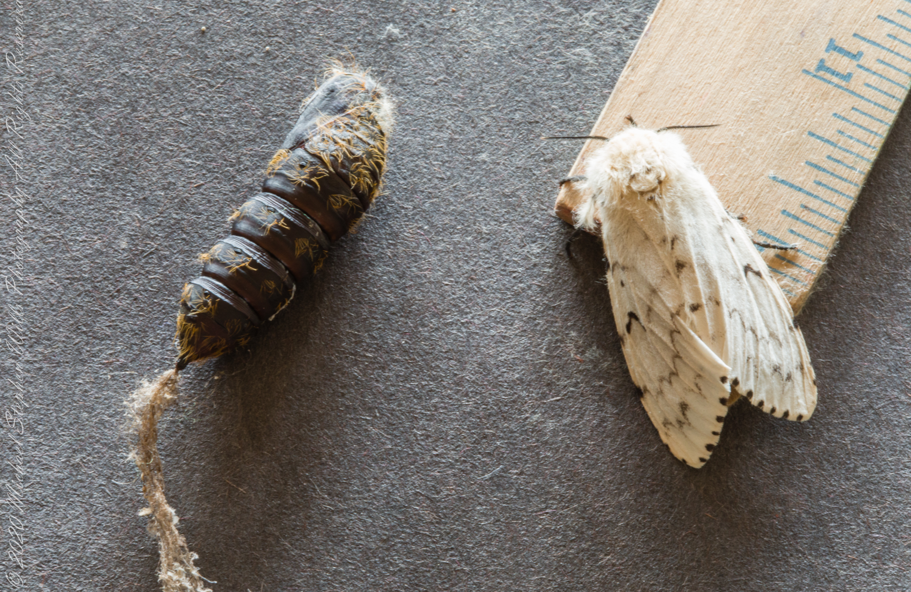
Moth on a ruler (for scale) with the cocoon it emerged from, to left.
As noted in the first posting, I released the moth. I needed to take swift action last year: identify and remove egg clusters. This spring our legacy oaks, favored by Gypsy moths, were chewed up and the caterpillars, when landing on exposed skin, cause a nasty rash.
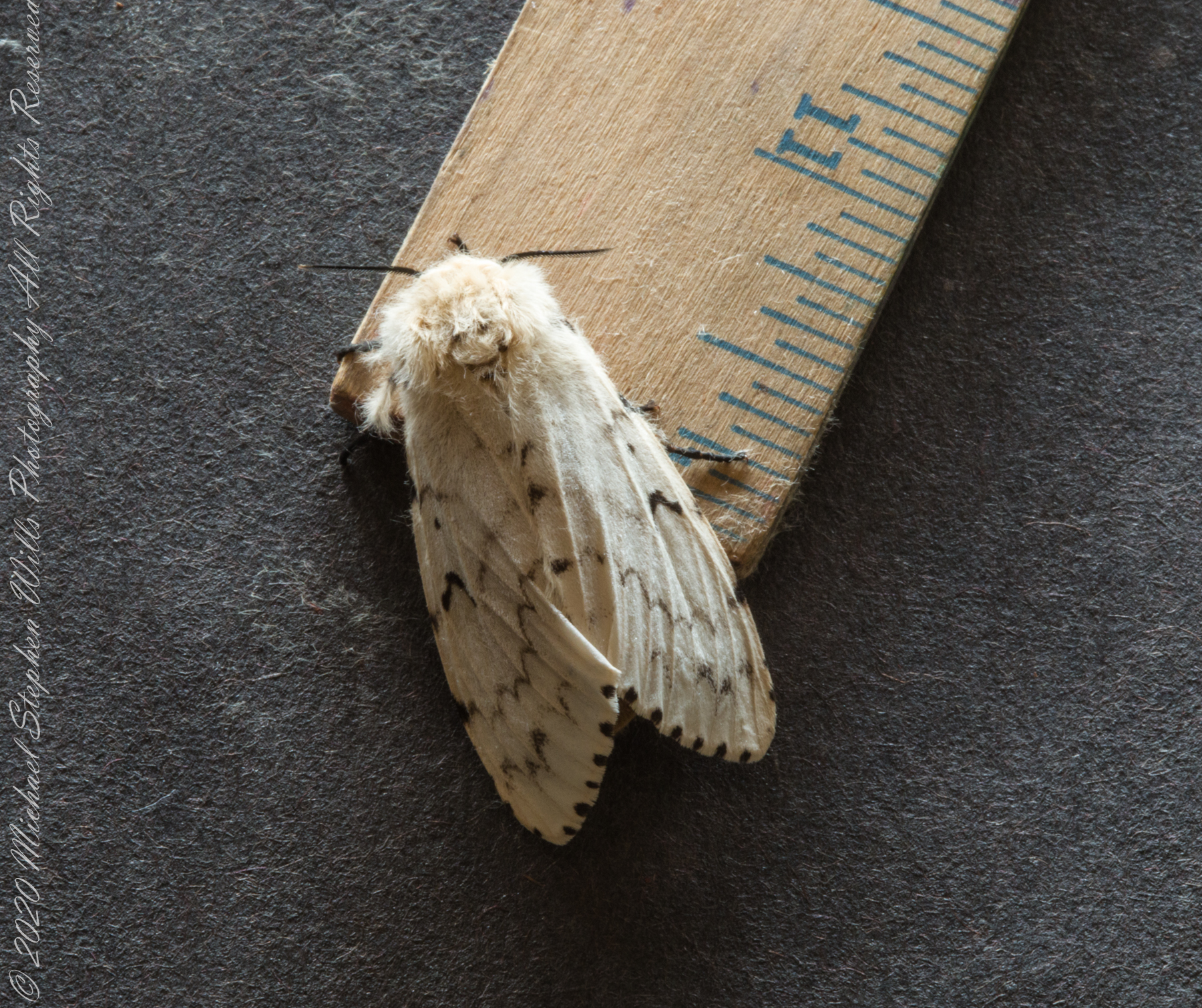
A moth on a ruler (for scale) a little after emerging from coccoon.
Copyright 2022 Michael Stephen Wills All Rights Reserved
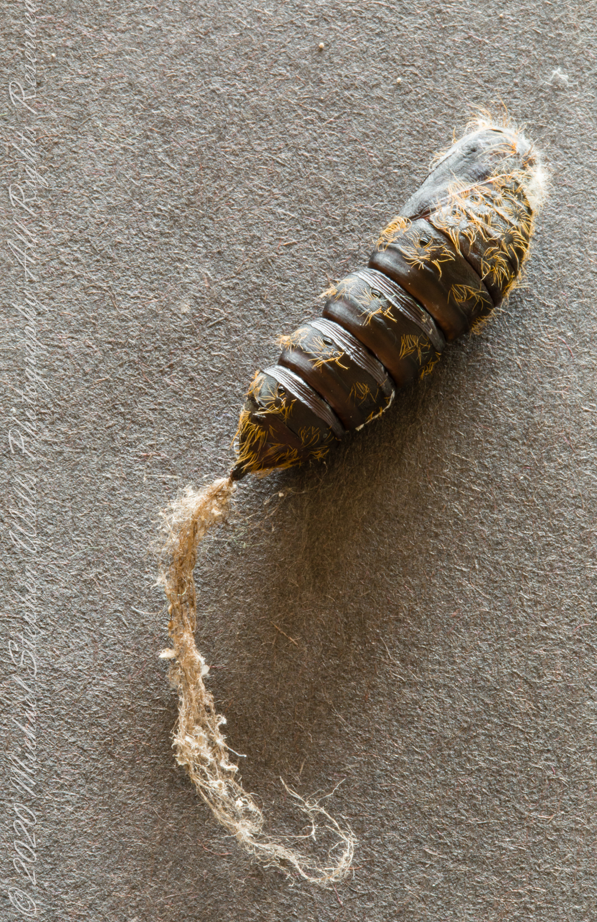
No polite way to say it, a moth emerged from what appears to be, photographed below, a dried-out dog turd. I discovered the cocoon early June 2021 ago hanging under a bird bath I was cleaning. Curious, I collected it. There it was hanging in a mesh collection cage until a few weeks later…..
Click photo to open a larger version in new browser tab. If you are in WordPress Reader, you need to open the full post to do this.
Post-emergent moth cocoon
When this fluffy moth, beige with chocolate markings appeared. The cocoon, now a dried out husk has no apparent breaks where the insect emerged.
Moth on a ruler (for scale) with the cocoon it emerged from, to left.
The moth, surprisingly inactive, remained so until released in the evening. It did not fly away when I released it. Instead, it dropped out of site into a juniper bush. I tried to identify it without success.
A moth on a ruler (for scale) a little after emerging from coccoon.
Copyright 2022 Michael Stephen Wills All Rights Reserved
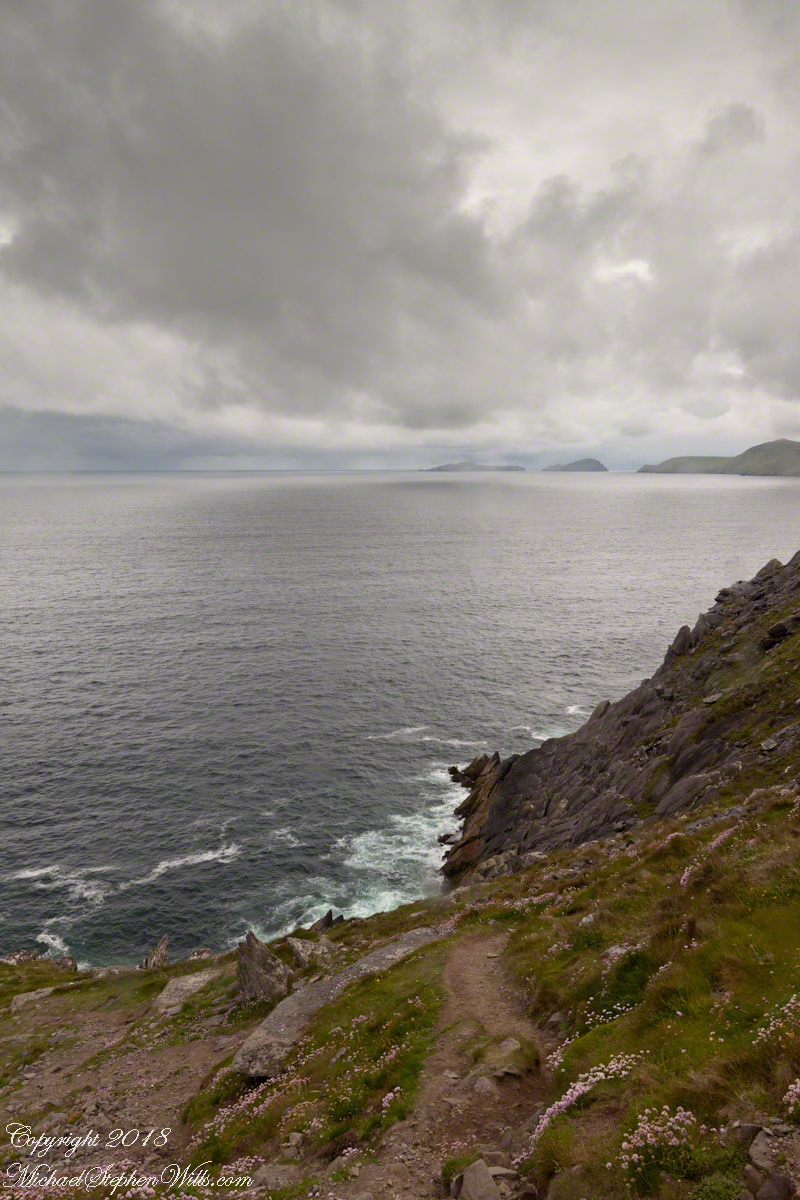
On the Dingle Peninsula, County Kerry, Ireland photograph taken from Slea Head Drive (R559), looking west down the cliff toward the North Atlantic Ocean breaking on the rocks. In the distance, Slea Head and the Blasket Islands. In the forground, the wildflower of Red Clover (Scientific Name: Trifolium pretense) (Irish Name: Seamair dhearg).
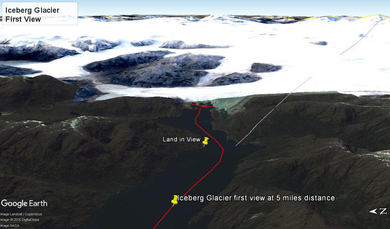
At 5:09 PM (daylight savings time for Chile) the Regatta turned to starboard to navigate around a headland of Farquhar Island. Iceberg Glacier came into view from our port side stateroom terrace. I was set up with the Canon 300 mm variable lens set to 120 mm (1/500 second, F11, ISO500), tripod mounted, to capture the ice from 5 miles distance. The location is marked on the above GoogleEarth view. The red line leading in is our course. On the right, the white line is the boundary between Chilean regions Aisen and Magellan.
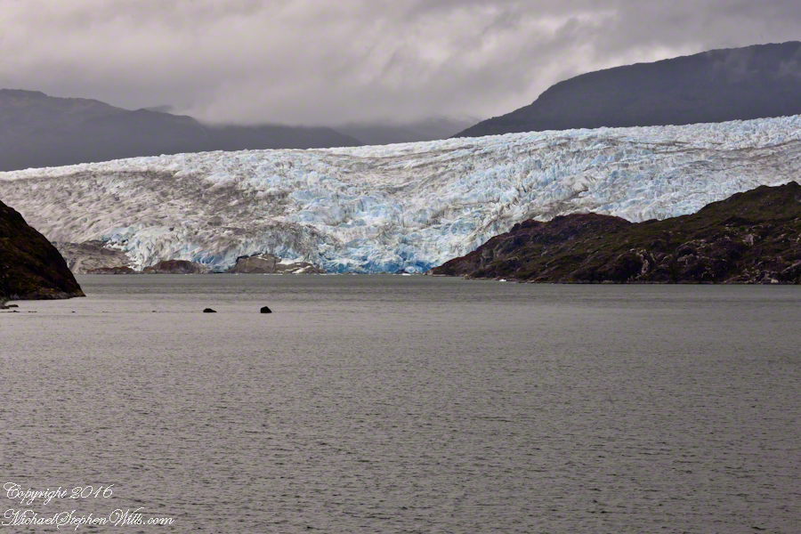
Visible is the .75 glacier front, 500+ feet above the head of Tempanos Fjord. On the GoogleEarth view the front is marked with a red line. Yes, more than 500 feet above the water. In mid-view there are two rocks in the water. Behind them, under the glacier, is a rock face. That rock is 100+ feet tall.
Twenty seven (27) minutes later I used a handheld Sony with variable lens set to 200 mm (1/500 second, F13, ISO800) to capture this image of the ship bridge superimposed on the glacier.
All you see is part of the Bernardo O’Higgins National Park. Named for a founding father of Chile, the country’s first head of state, the park covers 13,614 square miles.
Copyright 2022 Michael Stephen Wills All Rights Reserved
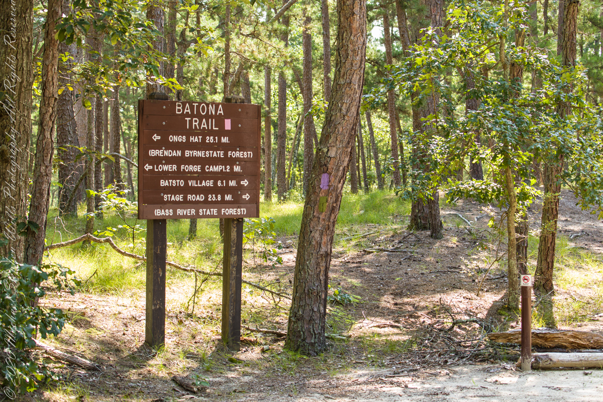
These photographs were taken the last days of August 2021, the 26th and 27th, while exploring Burlington County, New Jersey, with my sister. I will be writing about our Thursday and Friday for awhile, starting with today’s installment.
Quaker Bridge Road traverses the wilderness of Wharton State Forest with a beginning off Route 206, Atsion Mansion. Our planning included Jeep Wrangler rental, only high-clearance 4-wheel vehicles are appropriate, the road surface is humpy sand, water filled holes abound. Still, sitting there at the start, with Atsion Mansion house in view, I waited awhile until a high clearance tour bus packed with adventurers, kayaks passed into the pines and out of sight. We proceeded an uneventful ~4 miles to Quaker Bridge at a stately 5 miles per hour, invoking four-wheel drive low gear a mile or so in.
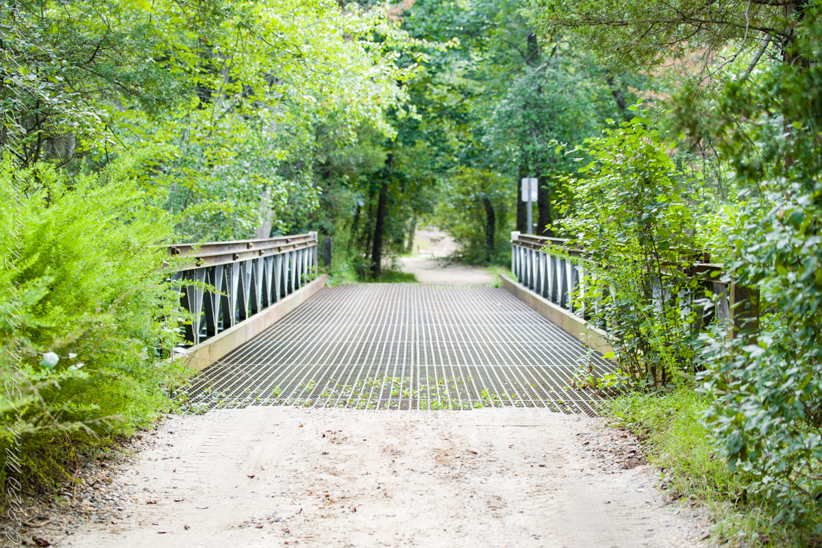
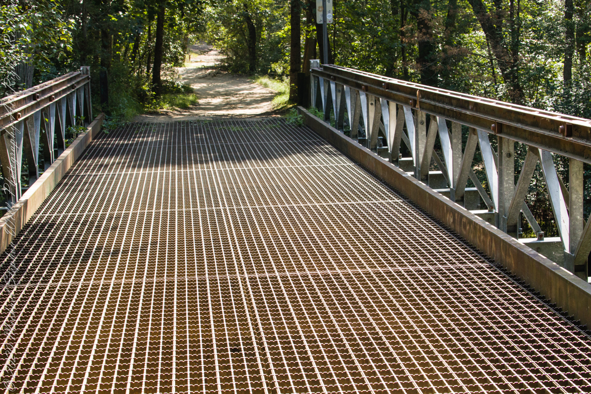
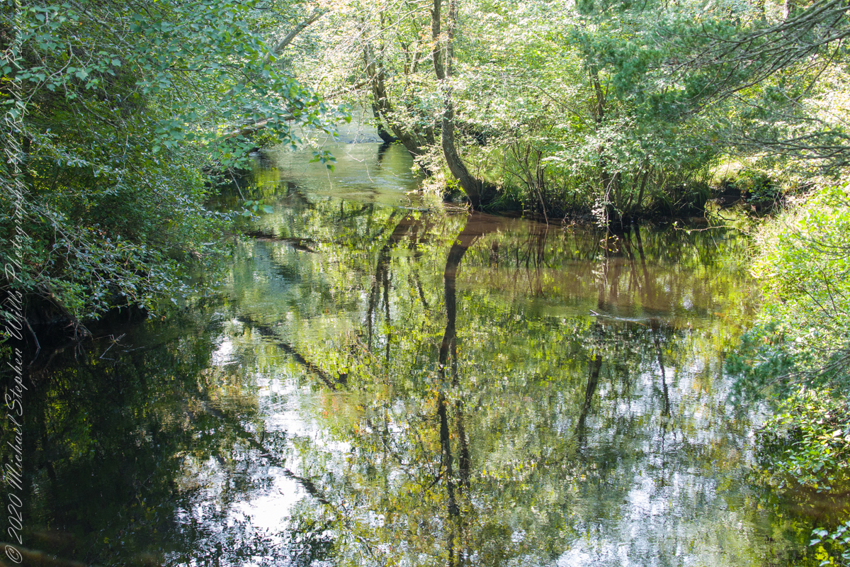
Here is Quaker Bridge over Mullica River today, facing East.
Mullica River from Quaker Bridge facing downstream
Quaker Bridge road was a well traveled main route through the Pines for almost a hundred years with an inconvenient crossing of The Mullica at this point. During the year 1774, some sa 1772, West Jersey Quakers travelling to the Little Egg Harbor Yearly Meeting, started “a day early”, built a bridge. From a c.1940 photograph it is clear in that “day” they felled large trees for pilings, smaller trees, pines and cedars, for the other bridge elements. Since then, the crossing has been called “Quaker Bridge.”
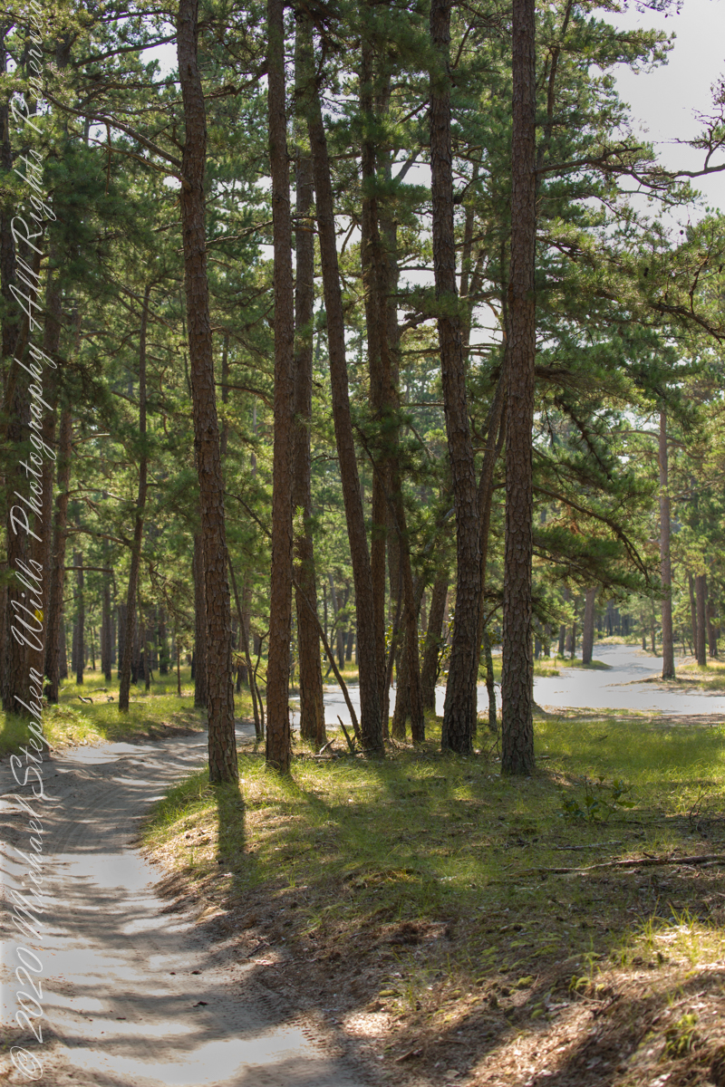
Over time, the east side became a resting place, with at least one Inn/Tavern. Here is the east side today.
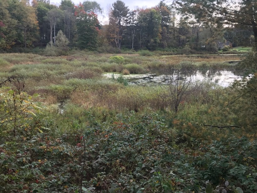
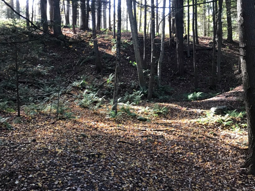
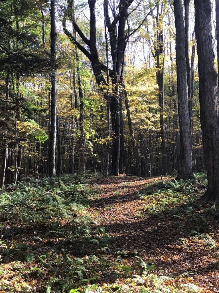
Even without hospitality and bustling humanity, after 4 miles of dreary road from Atsion this spot carries a sense of lightness, the well spaced straight pines over several acres conveying peace and rest. Over 35 miles from the ocean, the white sand presents as beach. There is a reason for this feeling, a 15 million year reason.
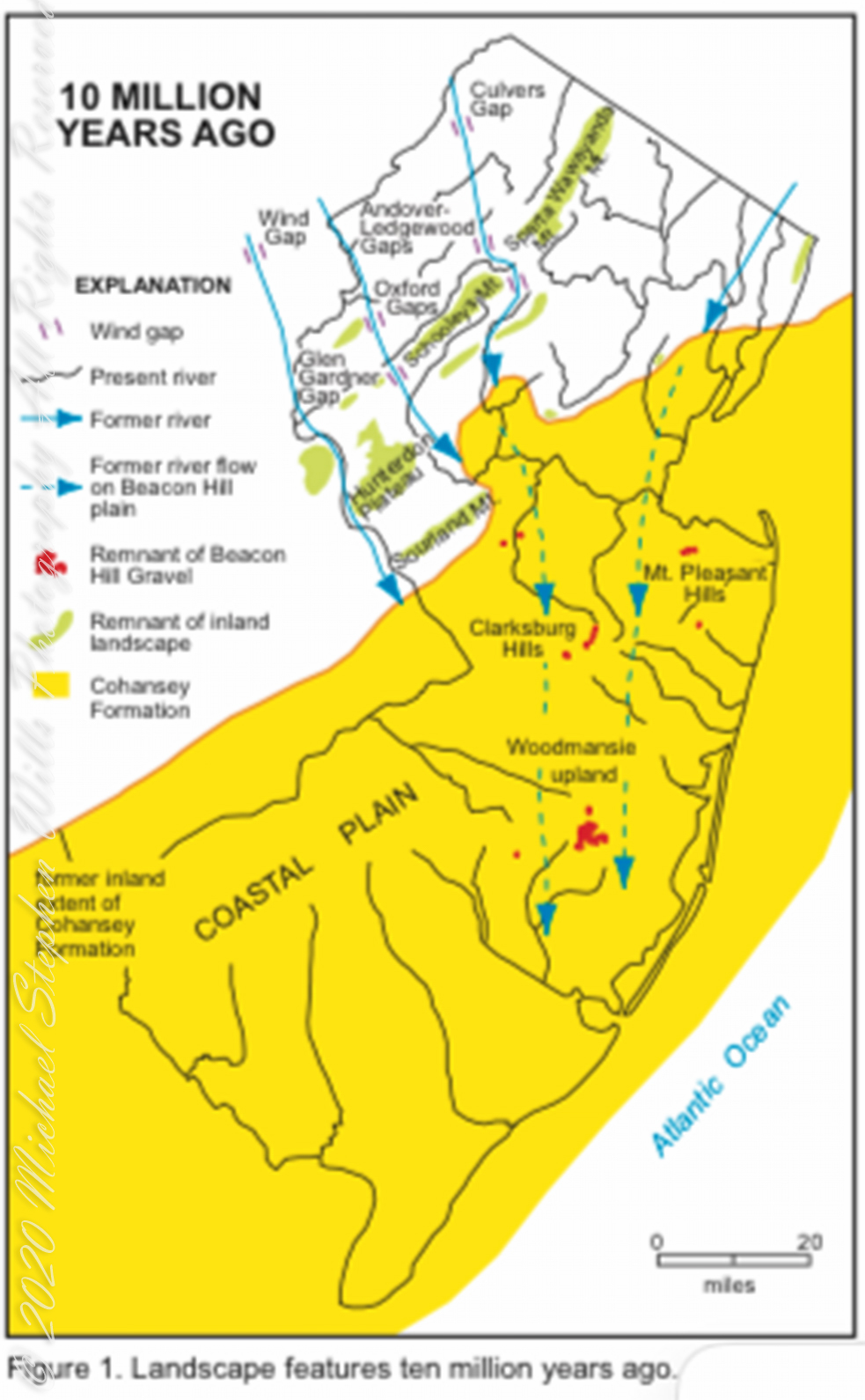
Visual presentation of Pinelands geologic origins, from New Jersey Geologic Survey, Scott Stanford author, 2005.
Between 15 and 10 million years ago the earth climate turned colder, so much water evaporated from the oceans to fall as snow and ice in the polar regions ocean levels fell 150 to 250 feet. As the ocean fell away, over eaons, mountains to the west were ground down, pulverized by the elements to flow, gather on the exposed plain. The white “beach” sand we see today, at Quaker Bridge and other Pinelands places, are surfaces of this “Cohansey” sands and clay ranging in thickness from 25 feet in the west to more than 300 feet at the Atlantic Ocean.
Over millions of years the land raised to become the drainage patterns we see today. The renewable resources of “bog iron” and water spring from this history.
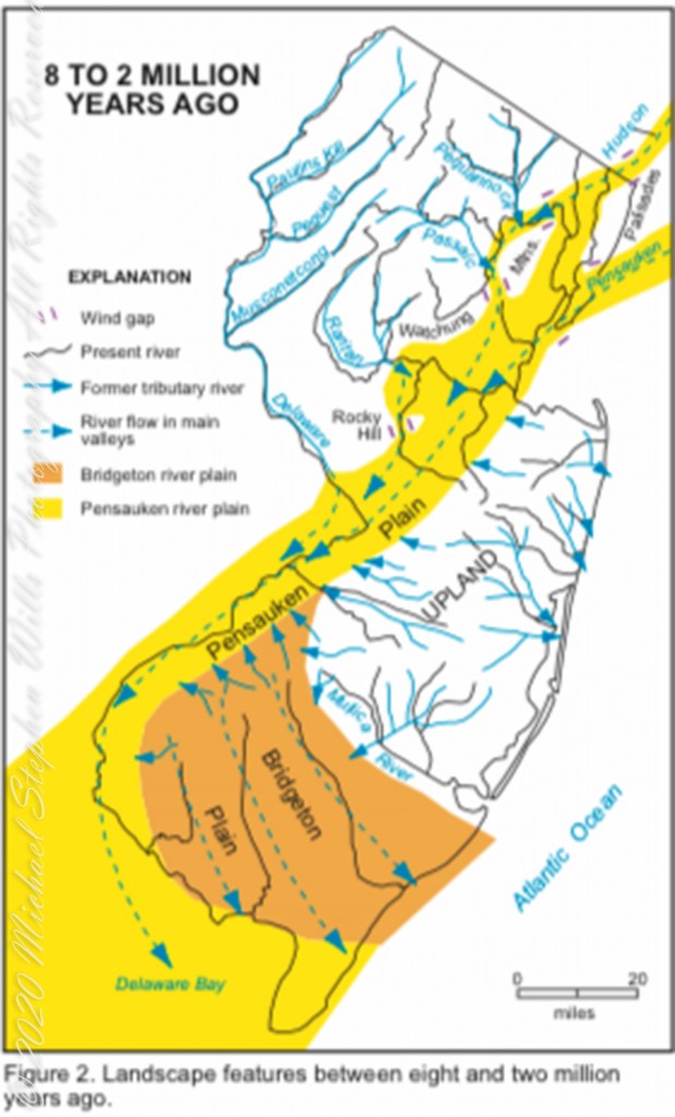
Visual presentation of Pinelands geologic origins, from New Jersey Geologic Survey, Scott Stanford author, 2005.
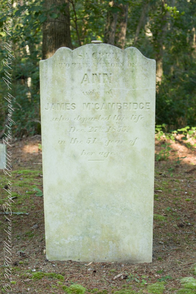
Standing there I imagined Great Great Grandmother Ann (Milley) McCambridge resting on the journey from the McCambridge home near Speedwell. I placed the pebble, collected from Long Island Sound, on Grandmother Ann’s headstone the evening of August 26th. Click this link for more about Ann McCambridge.
Sacred to the Memory of ANN wife of James McCambridge who departed this life December 27th 1855 in the 51st year of her age.
Reference
I found Quaker Bridge background in “Heart of the Pines, ghostly voices of the Pine Barrens” by John E. Pearce, pp 748 – 750, Batsto Citizens Committee, 4110 Nesco Road, Hammonton, N.J. 08037-3814.
I am happy to share a breakthrough in my family research of our time in Western New Jersey, 225 years for my branch from the 1677 landing of the Kent on Rancocas Creek until my grandfather left for Asbury Park.
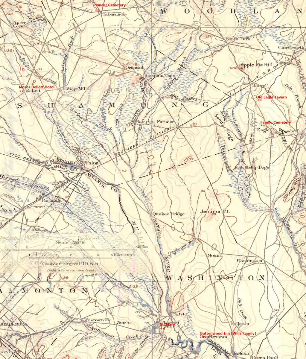
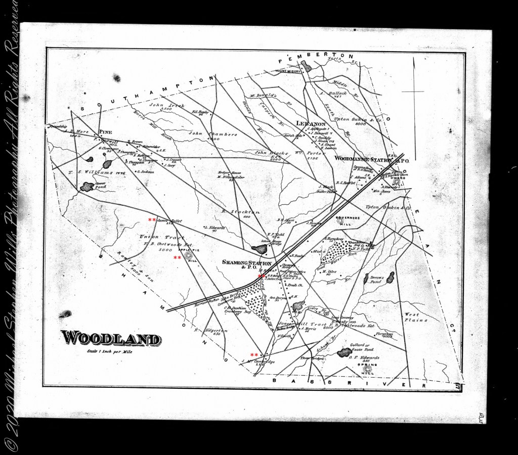
In this rectangle (10 miles by 15 miles) taken from the 1900 US Geological Survey, Rancocas Quadrangle, New Jersey topographic map is shown, upper right hand corner, Apple Pie Hill the starting point of this history where the author John McFee climbed the fire watchtower there, a view encompassing endless acres of pines. I learned an ancestor, third great-grandfather James McCambridge and his wife Mary owned the Old Eagle Tavern less than two miles south of there. The site is marked in red.
The Eagle Tavern existed for 28 years under various owners and names when James and Mary took over in 1926 serving a clientele, workers and visitors, from the struggling Speedwell Ironworks. Samuel Richards was a brother of Jessie Richards who owned the Batsto Ironworks and who provided the land for St. Mary of the Assumption (see my post Pineland Connections V). St. Mary’s is marked in red, bottom center. Samuel purchased Speedwell December 23, 1833 from Ann Randolph, made improvements and started operations without success before closing for good.
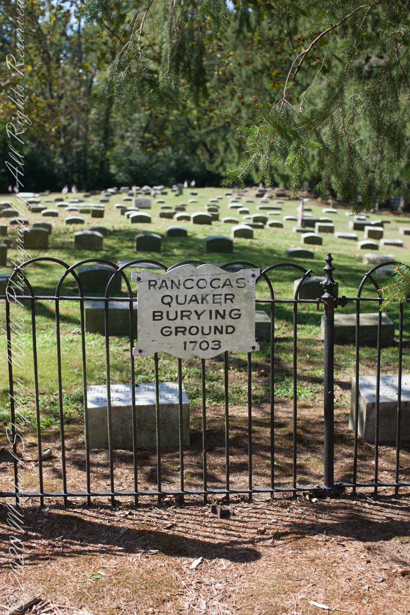
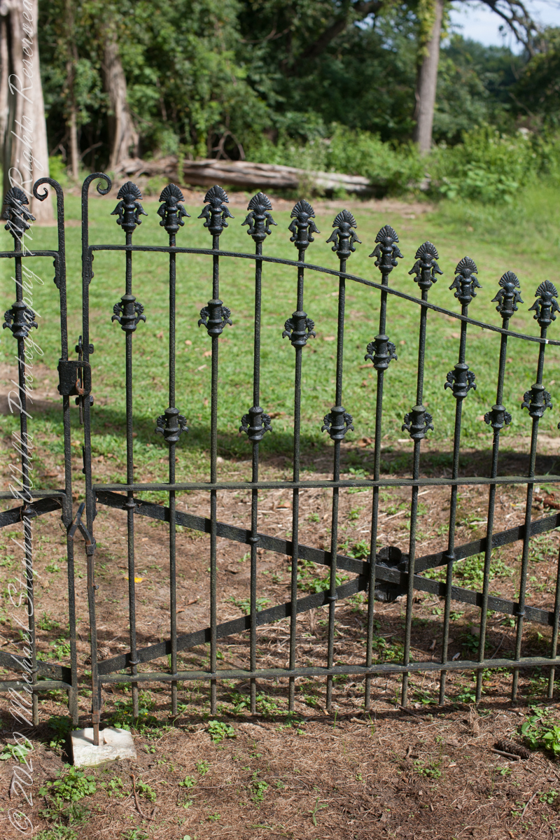
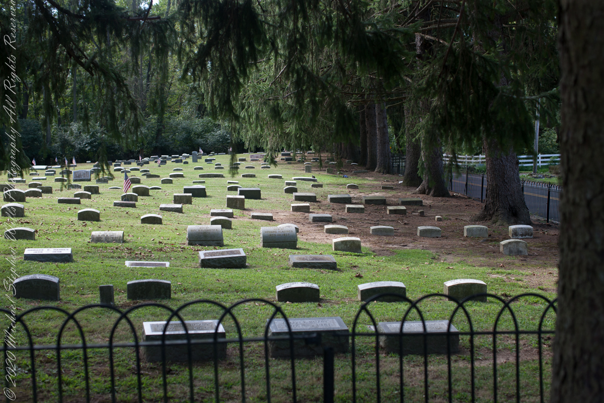
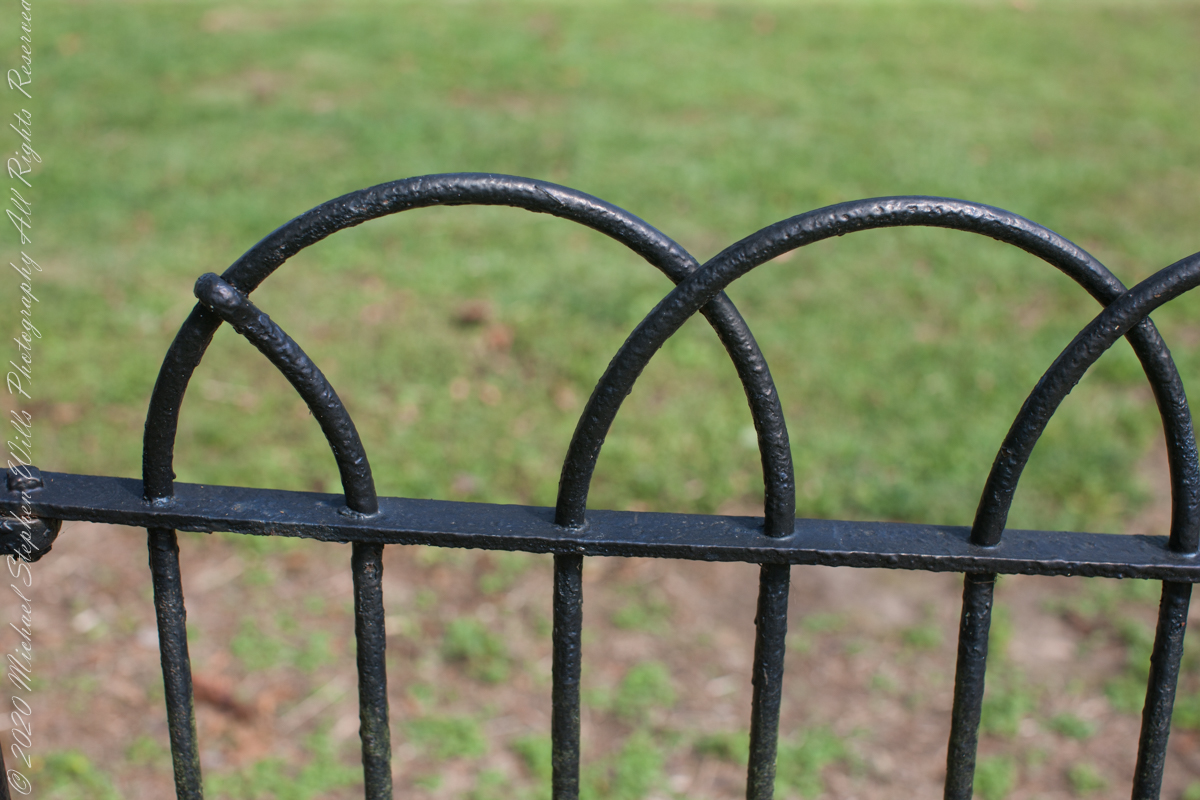
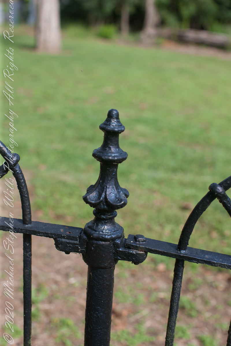
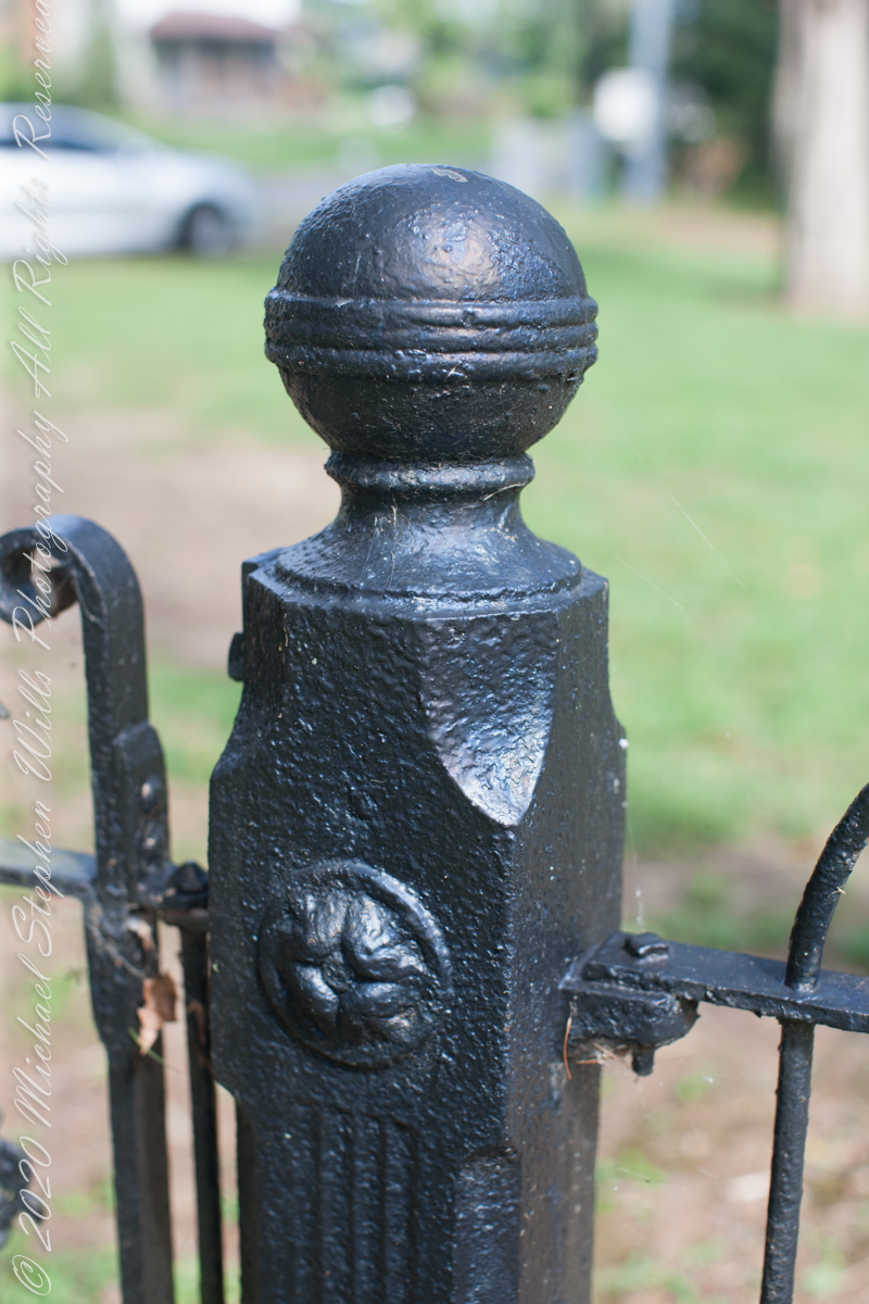
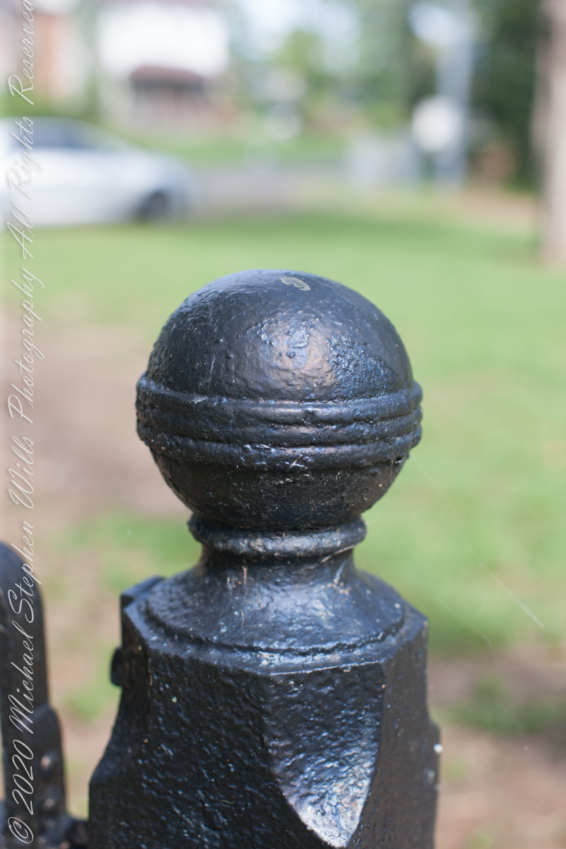
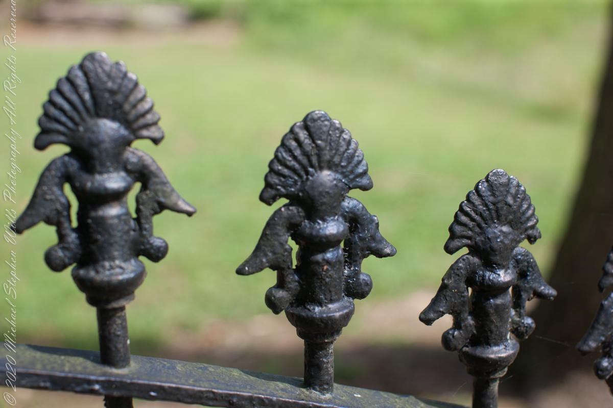
Entrance sign and overviewIron GateFence and burialsfilialIron fence postFilial of Iron Fence PostFilialThe Rancocas Quaker Burial Ground is surrounded by an iron fence, almost certainly of local origins. Here are my photographs of this exceptional ironwork.
On June 30, 1850, James McCambridge purchased Speedwell from the estate, eight years after Samuel’s passing, for $1,750. At this time he had accumulated over 2,000 acres. In this same year his son, James and wife Ann (Milley) (see my post Pineland connections VI) are listed on the US Census. The family lived either in the Eagle Hotel or close by raising nine (9) children: John (20), Mary Ann (16), James (15), Sarah Jane (14), my great grandmother Margaret (11), William (8), George (6), Edward (5) and Catherine (3). The younger James is employment was making charcoal for the ironworks, most likely for Atsion where Ann was employed. By the 1860 US Census Ann had passed away at the age of 50 and James (97) was living with the younger James and family.
Here is a land ownership map from 1876 on which I marked with red asterisks James McCambridge, Apple Pie Hill, and the Delletts, the family of the second greatgrandmother, Mary Dellett. Dellett landownership is also indicated on the rectangle topographic map.
Around the 1850 US census George and Mary Wills lost their two month old son, Charles (See my post Pineland Connections III) who is buried in a family cemetery, land owned by James McCambridge marked in red on the rectangle topographic map. Charles was my greatUncle.
George and Mary Wills, second greatgrandparents
Another breakthrough was identification of the Buttonwood Hill Tavern, Crowleytown as the hotel run by George Wills on the 1850 census. Marked in red on the rectangle topographic map. There was not yet a family union between McCambridge and Wills. That would come with great grandparents George Wills and Margaret McCambridge. The family connection at this time was their shared Roman Catholic faith and Saint Mary of the Assumption church.
I found this information in the book “Heart of the Pines, ghostly voices of the Pine Barrens” by John E. Pearce, Batsto Citizens Committee, 4110 Nesco Road, Hammonton, N.J. 08037-3814.
Copyright 2021 Michael Stephen Wills All Rights Reserved
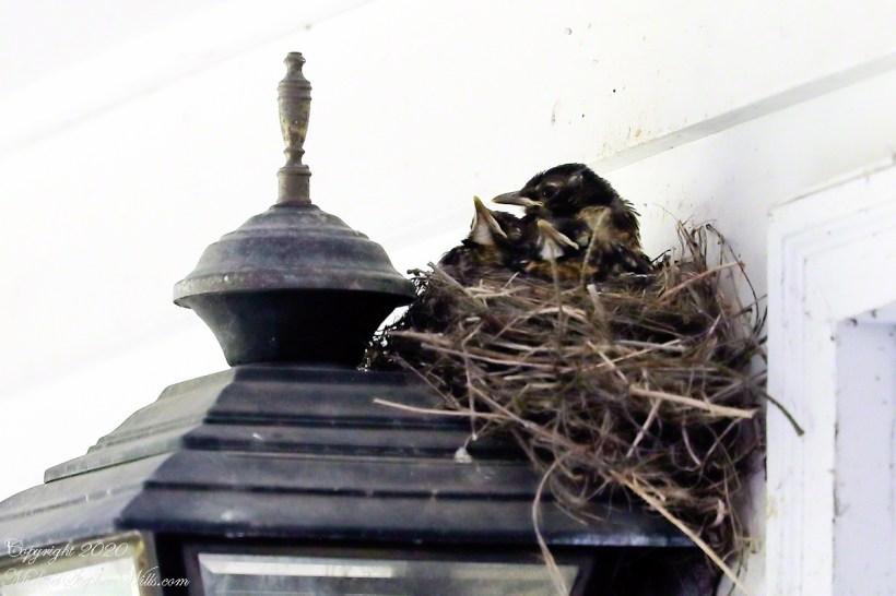
Our backyard robins returned this year. Pam, remembering the “miss” they made on her roses, tore down the first bits of nest on our carriage light. They persisted and I implored her to “have a heart,” agreeing to look after their mess. Here she is in the second day, note how she shimmies to form the nest bowl.
Copyright 2021 All Rights Reserved, Michael Stephen Wills