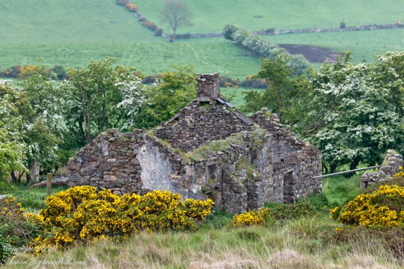
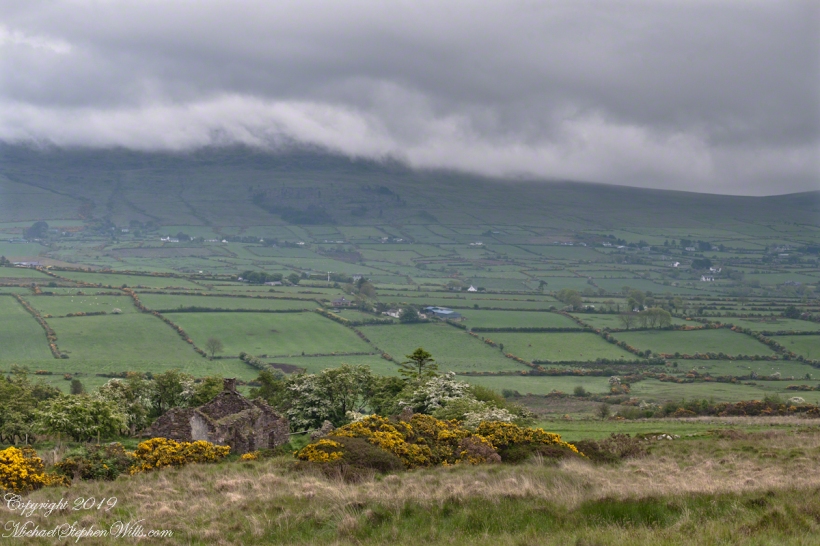
Farmhouse Ruin, Slievenaglogh
Two views
Two views
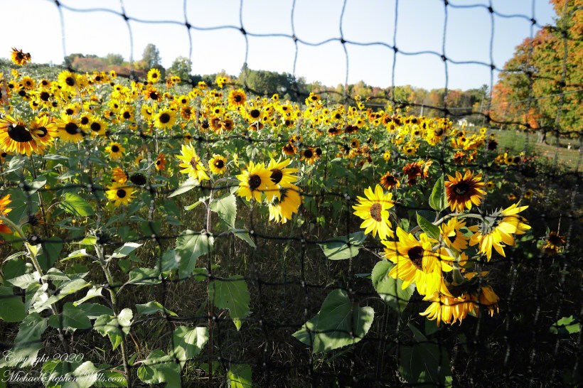
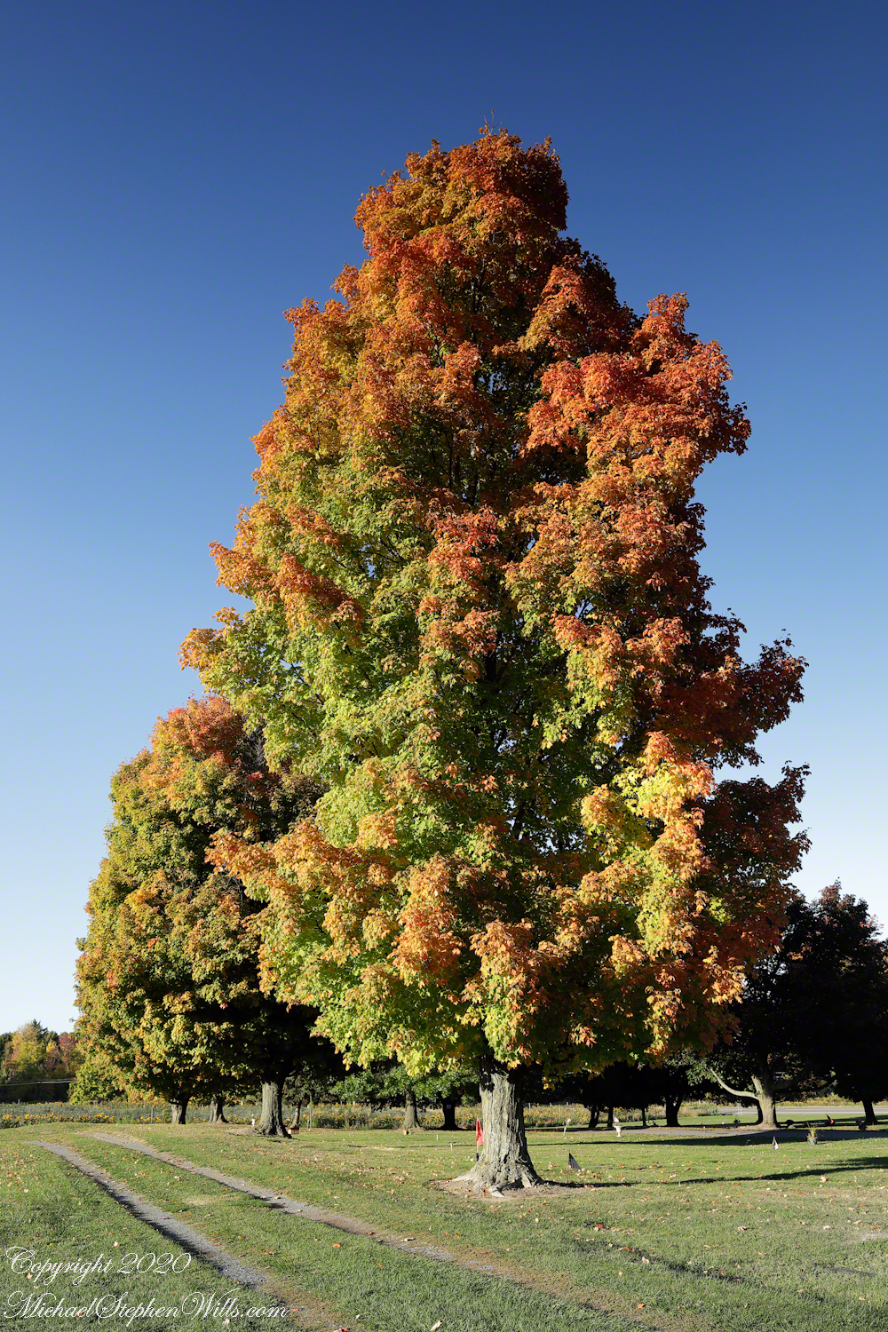
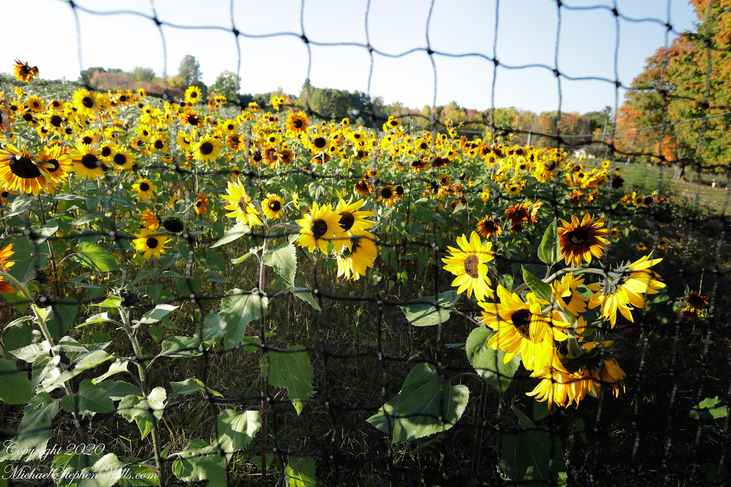
The post describes a photographic expedition featuring a sunflower field and maples at Frear Memorial Park, and explores the notable Frear family’s history in Ithaca, New York.
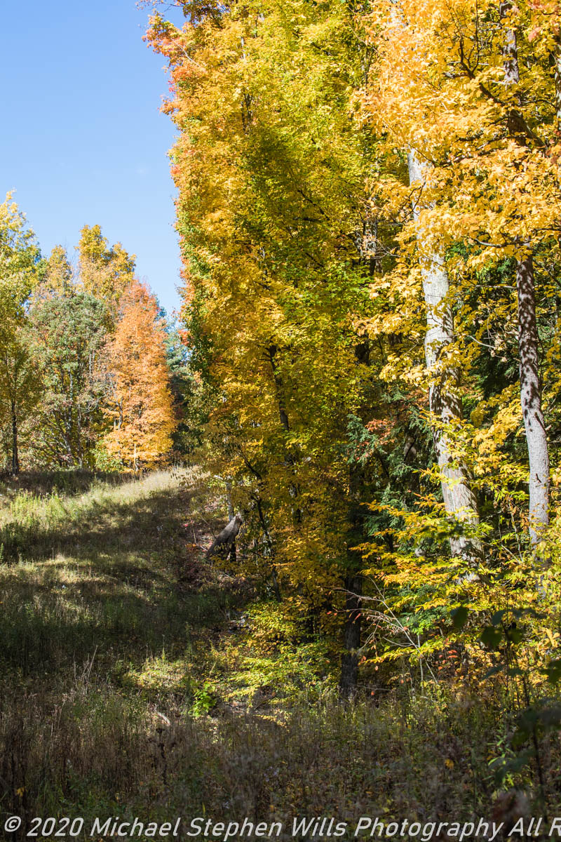
Descending Hayts Road toward Cayuga Lake in the course of a photographic scouting expedition I spotted a mature linear maple tree planting forming the western edge of Frear Memorial Park. This day Pam and I headed out at day’s end, stopping here to capture the turning maples.
A sunflower field was a hidden surprise. The 24 mm “wide angle” lens was mounted on a Canon EOS 5D Mark IV dslr on a light carbon fiber tripod.
The Frear family has a notable presence in Ithaca, New York’s history. One significant member was William Frear, a well-known businessman who lived his entire life in Ithaca. He ran a candy store and a photograph gallery, and was involved in the county fair. William passed away in 1915 at his daughter’s home on East Buffalo Street in Ithaca.
In terms of the Frear family’s broader historical context, the name was found in the USA, the UK, Canada, and Scotland between 1840 and 1920, with the most Frear families in the USA recorded in 1880. Remarkably, in 1840, about 67% of all recorded Frear families in the USA were living in New York, indicating a significant concentration of the family in the state.
The family tree of William Frear includes his parents Baltus Frear (1793–1881) and Lavina Westerveldt Frear (1800–1868), his spouse Ann Amelia Hopkins Frear (1838–1906), and his children Baltus W Frear (1865–1885), Donna Frear Luker (1868–1929), T Wilbur Frear (1874–1874), and Edward Hughson Frear (1876–1910).
This snapshot of the Frear family in Ithaca provides a glimpse into their lives and contributions to the local community during the 19th and early 20th centuries.
Additionally, there is a Frear Park in Troy, New York. Donated by the family of William H. Frear in June, 1917, Wright Lake and Bradley Lake, located in the park were named for members of the Frear Family. The Frear Family was originally from France where the name was as Frere. The Frere’s moved to England to escape prosecutions, where the spelling of the name was changed to Frear. The family was founded in the United States by Joseph Frear, Grandfather of William H. Frear of Troy, New York.
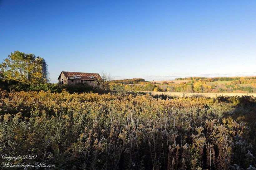
Sere Goldenrod
West Hill, Ithaca, resolves to this plain here sere goldenrod, abandoned barn, silo, distant hills. We headed out from home as sunset approached.

I was reading the story of Jacob and Laban and encountered the word “Mizpah” is Hebrew for “watchtower”. It is used to refer to an emotional bond or covenant made between two people with God as their witness, often symbolized by a pile of stones marking an agreement. Mizpah sounds similar to “Mitzvah,” often used to mean “a good deed,” and is related to the Aramaic word “tzavta,” which means to attach or join. This term is commonly used to describe any charitable act and has deep roots in Jewish tradition and texts, such as the Jerusalem Talmud.
The relationship between “Mizpah” and “Mitzvah” seems to be more linguistic and symbolic rather than direct. Both terms originate from Semitic languages and carry connotations of connection and covenant. “Mizpah” symbolizes a bond overseen by God, while “Mitzvah” refers to actions that connect individuals through good deeds, potentially strengthening communal bonds.

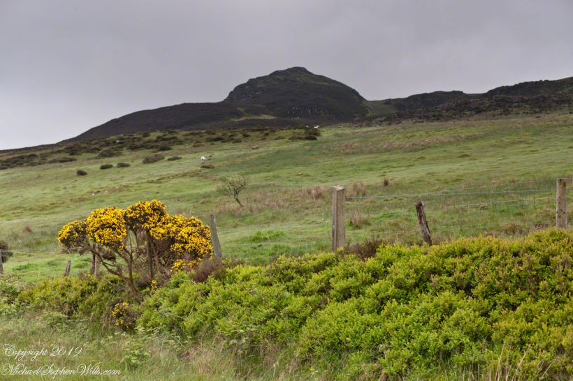
View of Slieve Foy
This the fourth of a series of landscape photographs taken from this position.

The distant ridge, Slieve Foy, is the site of a mythic battle from the epic “The Cattle Raid of Cooley” (Irish: Táin Bó Cúailnge).
Pam and I did a circuit of the island, returning to the home of my Mom’s first cousin. Our last full day on Ireland a cousin took us on the Tain Trail, over Maeve’s Gap of Slieve Foy and into Carlingford town.
Our route is partly visible to the right of the ridge, hidden in low clouds.


Rural Scenery
These are the second and third of a series of landscape photographs taken from this position. See the previous post for the first.
I visited here early morning of the Monday Pam and I embarked on a trip around the island of Ireland.
Arrived the previous Saturday when, after some sites between Dublin airport and the Cooley Peninsula, we met my Mom’s first cousin who had invited us for a visit. We had a grand time meeting them.
The ruin in this view is on the slopes of the peak. Some of these ruins are former homes with the replacement nearby. This appears to be an abandoned farm.
Click Me for the first post of this series.
Click me for the next post of this series.

It goes on and on and on
Slievenaglogh is the name of a peak on the Cooley Peninsula of County Louth, Ireland near to the birthplace of my Mom, Proleek, a few townlands to the west.
On the northeast slope of Slievenaglogh peak (Irish: Sliabh na gCloch) on the road from Mullaghattin Townland to Riverstown.
Here we look northeast from the Slievenaglogh Townland, the valley between Slieve Foy and Slievenaglogh peaks.
The view includes Little River, Ballycoly Townland and Castletown River.
Adjacent is a sheep pasture with a farm ruin behind the yellow flowered gorse (whin bush, scientific name Ulex).
Slieve Foy is the far ridge lost in clouds. Early morning, late May 2014.
Former farm land
Sandbank Road climbs from the valley of Ithaca city to the rural peneplain on the way to Buttermilk Falls, we passed the sign for this preserve many times, today we explored this place, new to us. The trail descends to Lick Creek canyon.
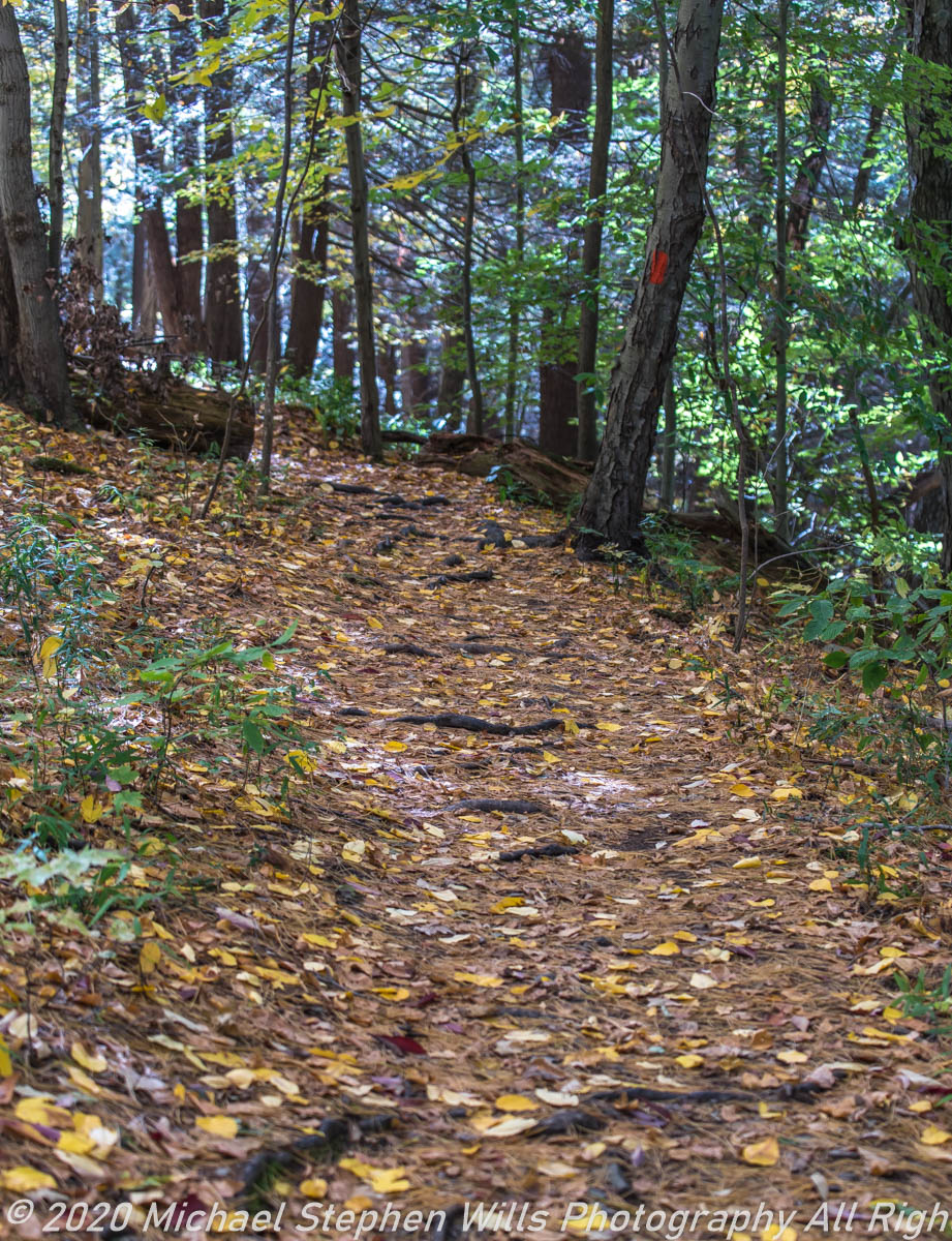
We stopped to enjoy the open space of a powerline clear cut where the trail intersects the creek bed. Here we turned, following the water.

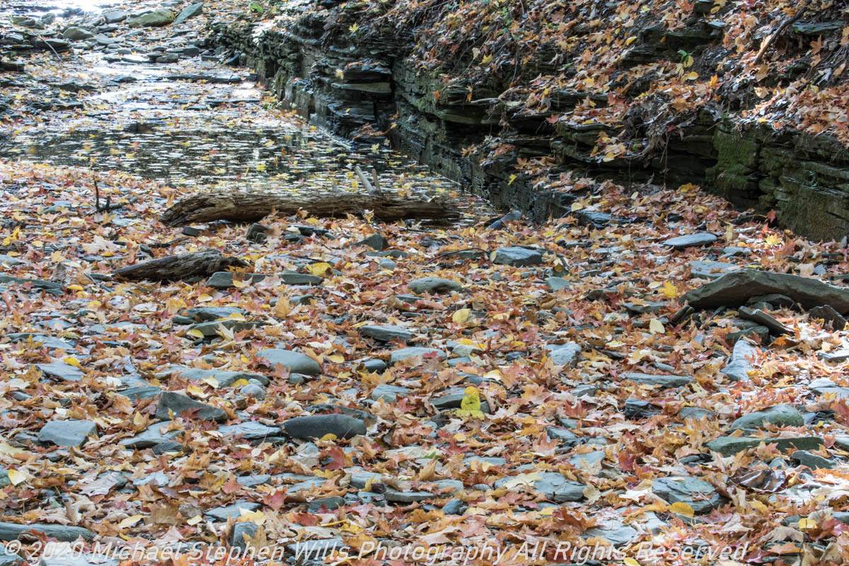
Off trail to the creek bed.
A Cooley Peninsula Valley on a May Morning
On the northeast slope of Slievenaglogh peak (Irish: Sliabh na gCloch) on the road from Mullaghattin Townland to Riverstown. This day I swapped lenses and took in the same general direction for each. This is the first and last of a series using the Canon EF 50mm f/1.4 USM lens and I pulled in the shots from the Canon 24mm f1.4 L II USM lens, published in previous posts.
Here we look northeast from the Slievenaglogh Townland over the valley between Slievenaglogh and Slieve Foy peaks. Slieve Foy is the far ridge lost in clouds.
This is the first and last of a series using the Canon EF 50mm f/1.4 USM lens.


The view includes Little River, Castletown River, Ballycoly and Glenmore Townlands. Adjacent is a sheep pasture with a farm ruin behind the yellow flowered gorse (Whin bush, scientific name Ulex).

Early morning, late May 2014.
