Portrait of a Navajo Guide

In November 2004, a visit to Canyon de Chelly with guide Hadley Tsosie revealed ancient petroglyphs and ruins, highlighting Navajo culture and the canyon’s unique beauty.

On November 3, 2004 my son, Sean, and I made our way to Chinle, Arizona on the Navajo Reservation at the mouth of Canyon de Chelly.

The next day, driving a rented 4 wheel drive, we arrived at the visitor center, at dawn, and there met Hadley Tsosie who worked as a guide. This is how you do it, if learning about the Canyon is your goal. It is possible to walk, unaccompanied, into the canyon to view the “White House” and this I highly recommend. Tourists can also drive around the rim to various overlooks. This is what most people do.

The canyon is still farmed and the tribe only allows visitors when accompanied by a guide. Only Diné (Navajo) are certified as guides. They know the rights of way and the preferences of the landowners.

We negotiated with Hadley to take us for half a day for our interest in petroglyphs and ruins. It is important to start early when the sun is low in the sky, when directly overhead the details of ruins and petroglyphs are washed out by the light. Catching the late afternoon/evening sun is also an approach that requires detailed knowledge of the route, taking into account the time of year.

Hadley was an excellent choice, though he was our only option on that day. He was fluent in Navajo beliefs, the lore of the canyon and generous in sharing what he knew.

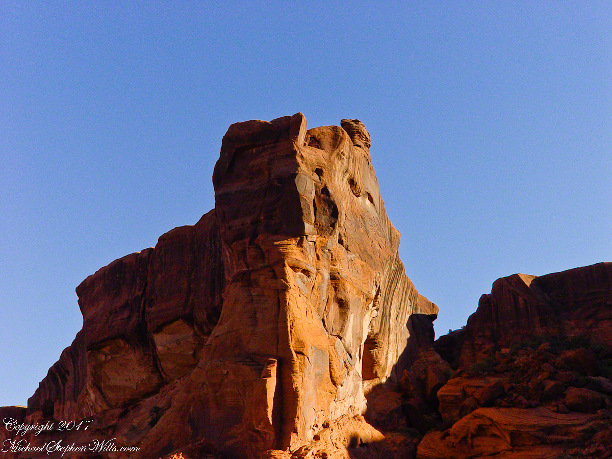
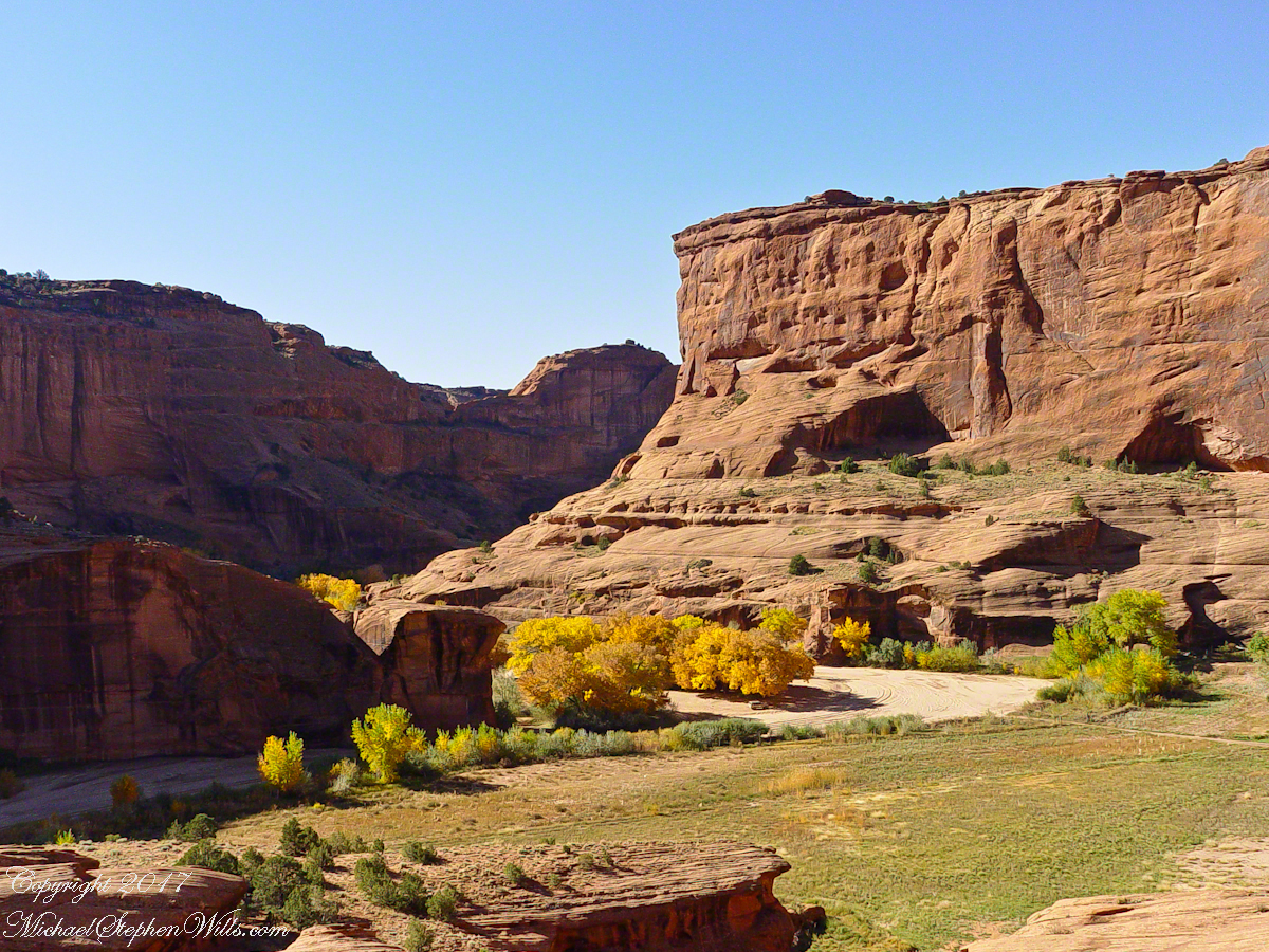
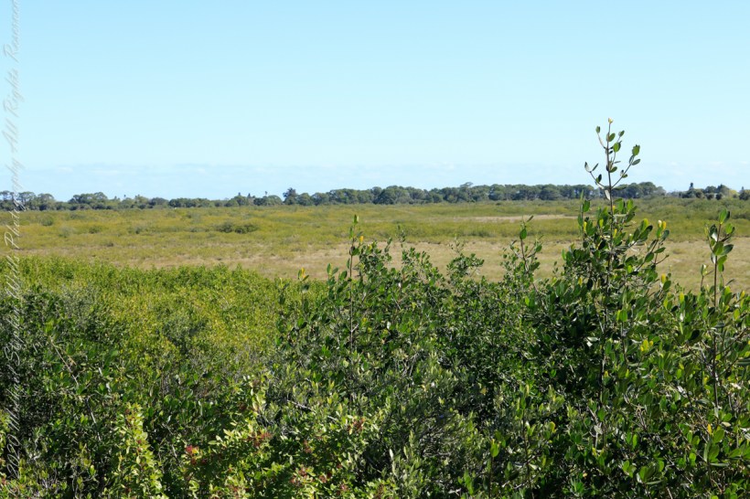
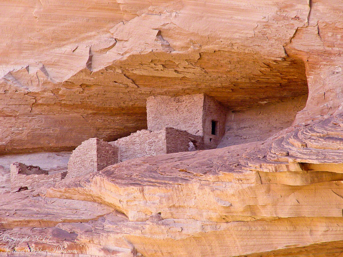
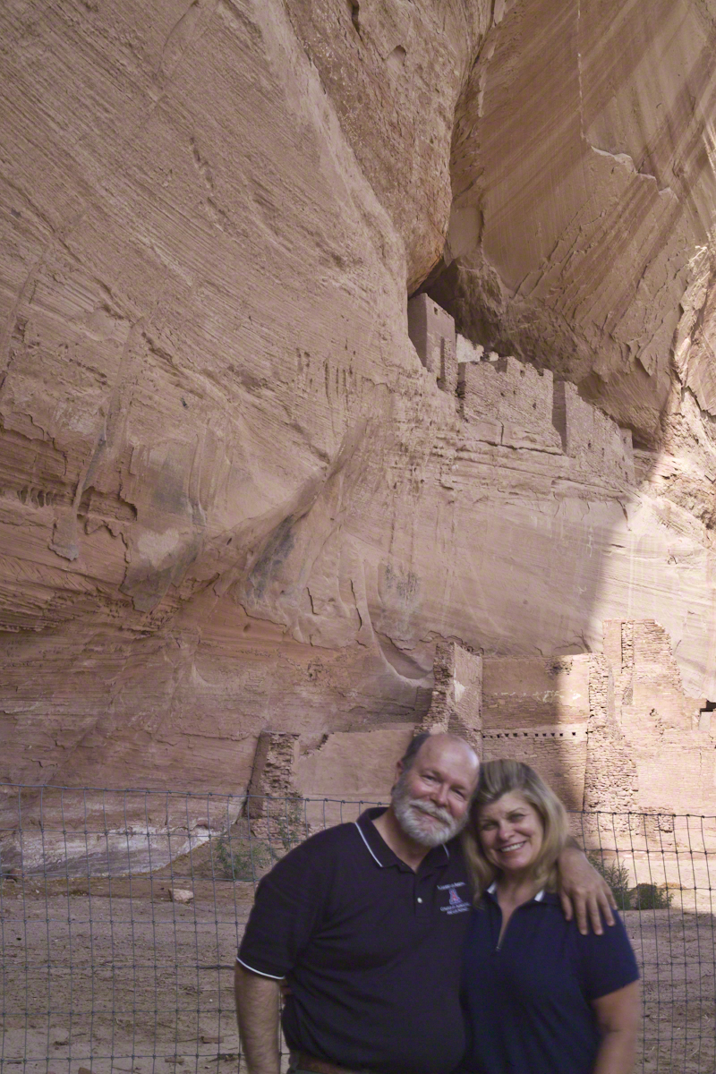
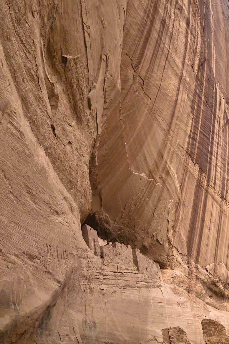
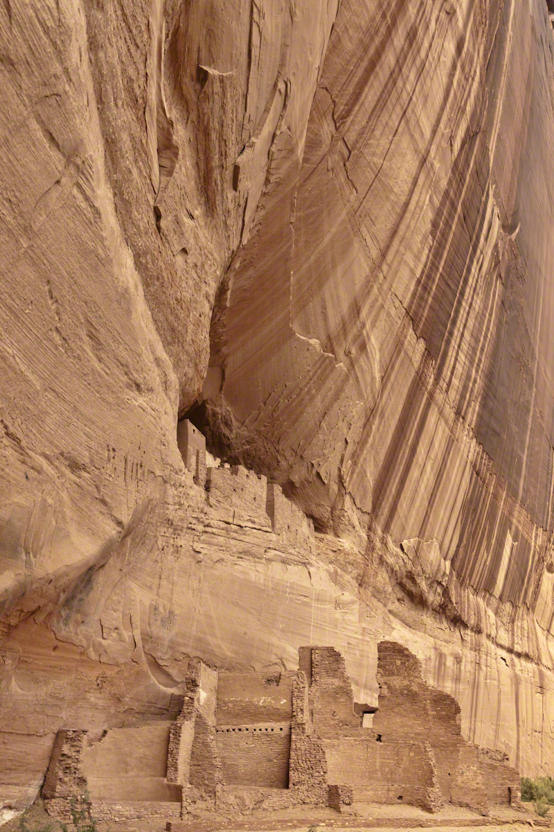
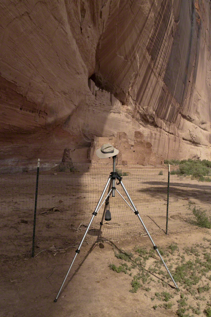
Here is Hadley, approximately 6.2 miles into the canyon with the “Ledge Ruin” behind. We arrived at the junction just in time, before the sun was high enough to wash out the ruin. It is slow going into the canyon what with the deep sand and water that must be negotiated. Hadley did the driving and was expert. We passed other parties bogged down in the wet sand. I do not believe it was luck that kept us moving . We stopped many times to talk and admire the petroglyphs and pictographs.

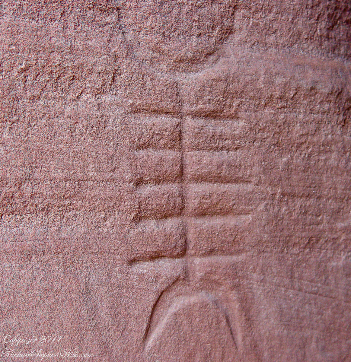
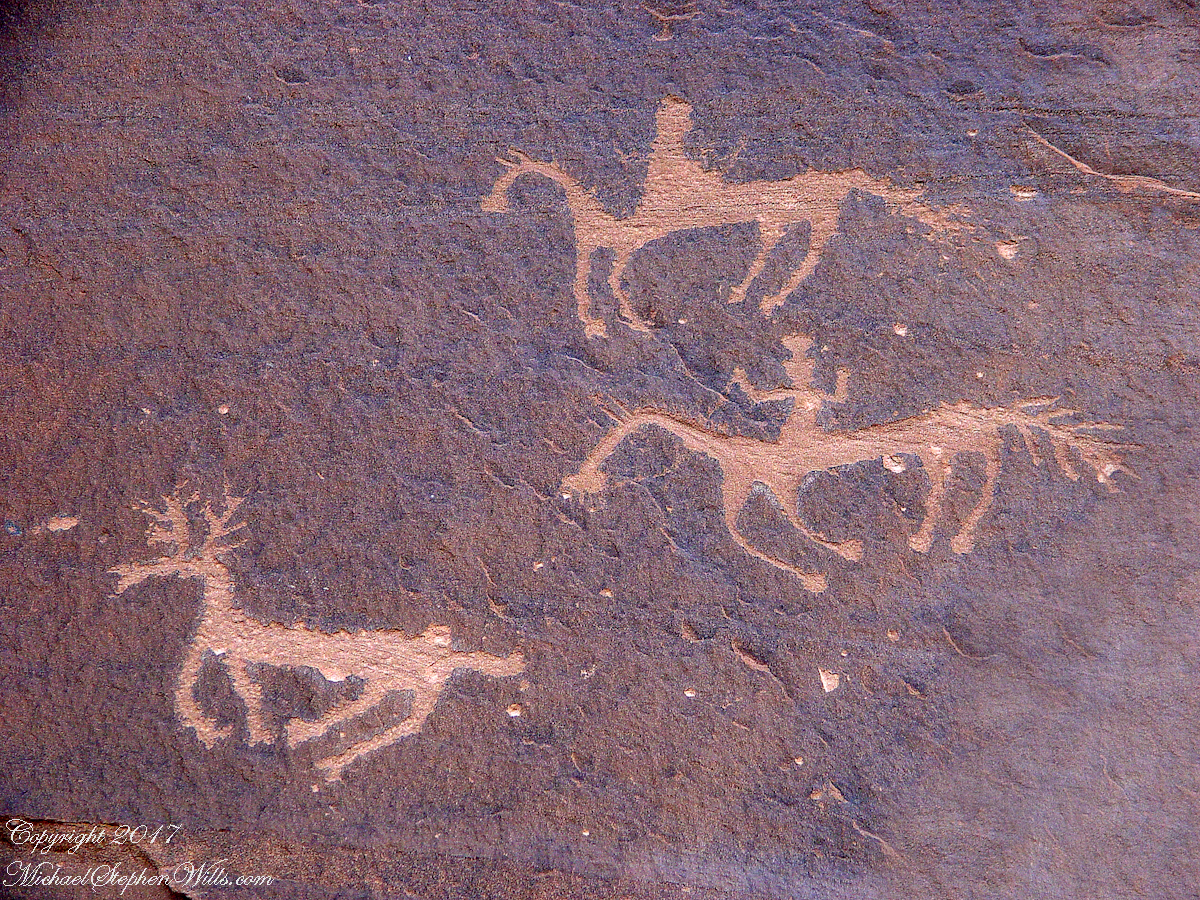
Petroglyphs are symbols incised, or cut, into the surface (the name means petro, “rock”, glyph, “symbol”). In the desert climate of the southwestern USA a thin, dark pigment forms on rock surfaces of overhanging cliffs. The pigment forms from infrequent precipitation, in the form of water, flowing downward over the surface or even dew. The high heat of the desert drives a chemical reaction between water, clays, iron and manganese oxide to form a coating on the rock surface. The dark coating, called “desert varnish”, contrasts with the underlying rock. When it is scraped away a line forms. Many of the petroglyphs were of this form. Others were carved into the rock itself, more time consuming and durable. No one knows when the petroglyphs were made, they were always there are respected. People have inhabited Canyon de Chelly for over a thousand years.
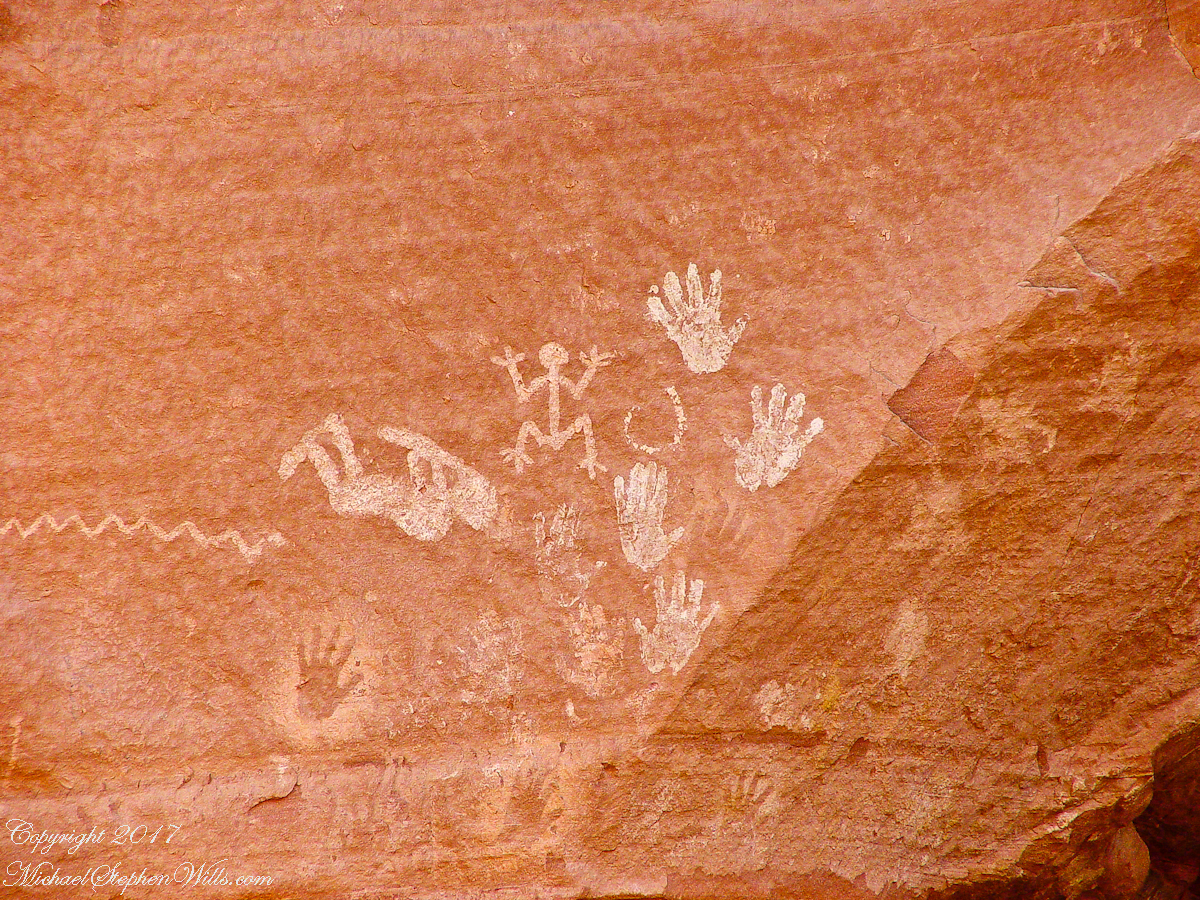
The word pictograph has a different meaning when used to describe prehistoric art. The earliest writing were symbols incised in wet clay, then allowed to harden. The pictographs we viewed was prehistoric art, mostly white pigment on the red rock, outlines of hands. There were also kokopelli, the outline of a flute player and jagged lines, symbolizing, Peter told us, lightening.

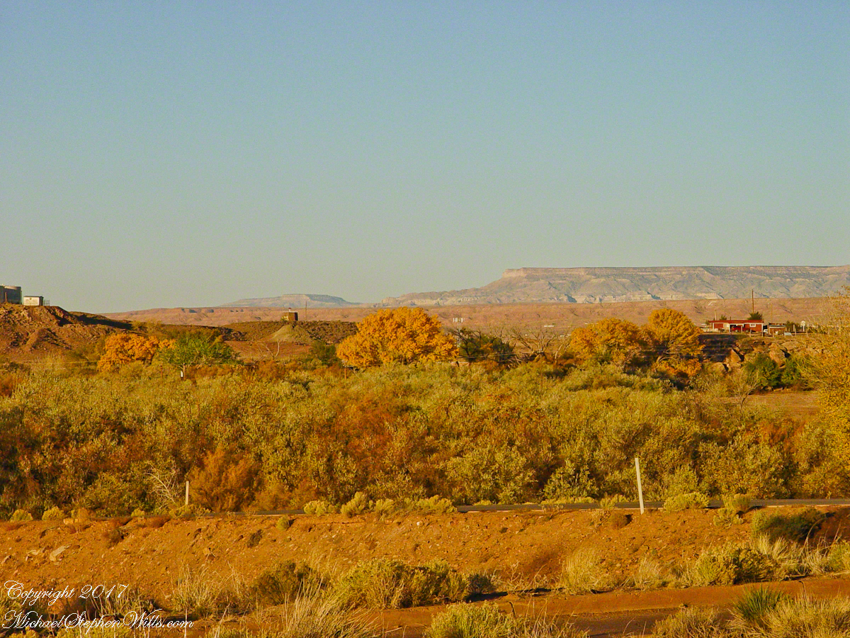
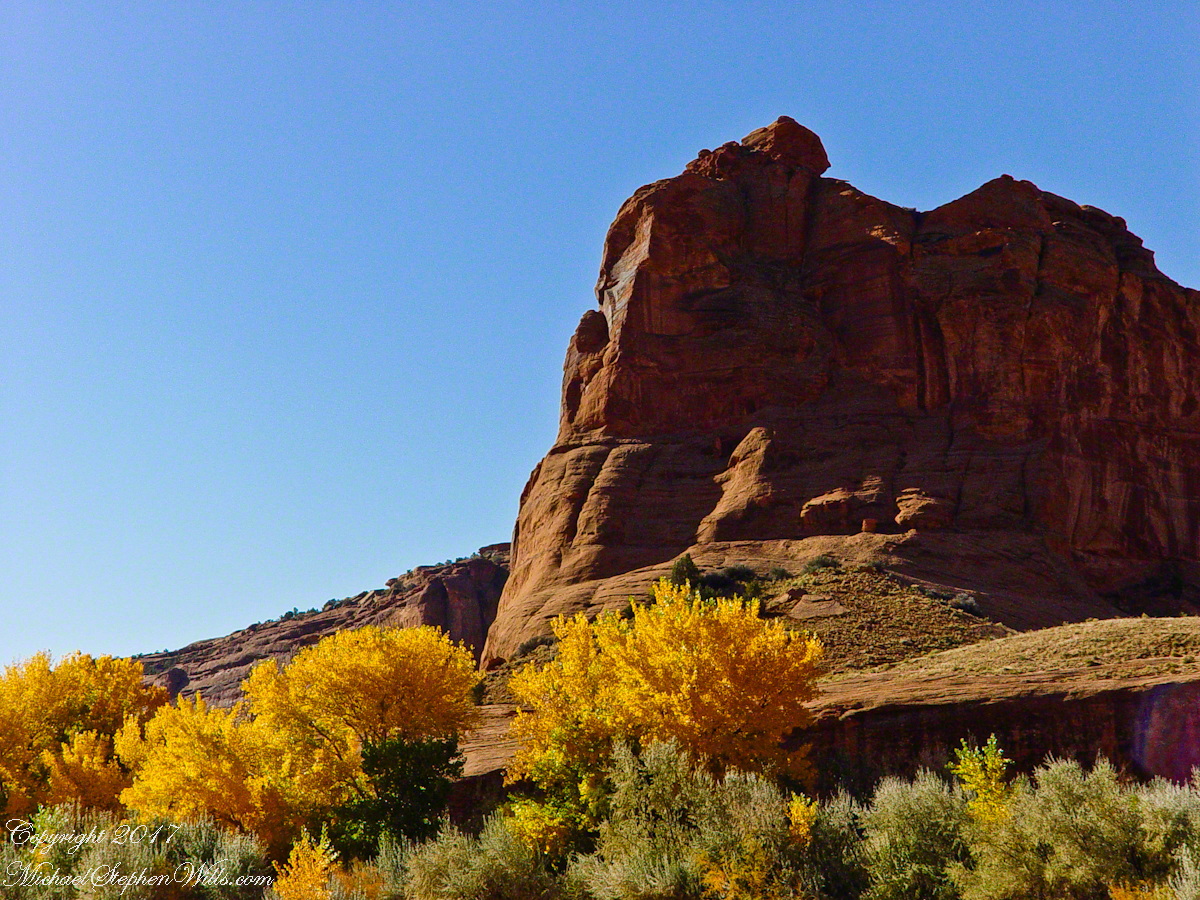
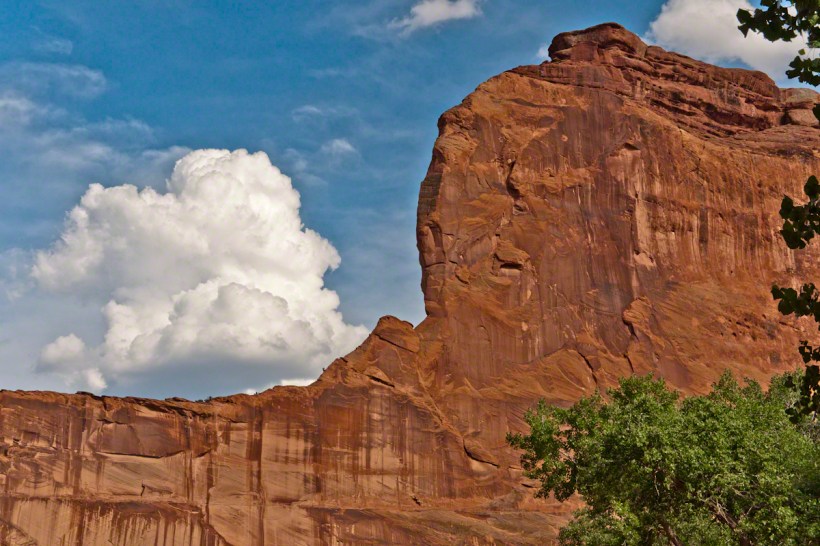
In November the cottonwoods were in fall foliage, a brilliant yellow under a cloudless sky. The sun is lower in the south and rises later. The Navajo Reservation follows daylight savings time, unlike Arizona. This November morning the sun rose around 7:45 am, so if you are not an early riser this time of year is an excellent choice for a Canyon de Chelly tour.

Click for the next posting in this series, “Junction Ruin Musings”

Enter your email to receive notification of future postings. I will not sell or share your email address.

Canyon of Music, Wind, Light

there if you want to see it

Canyon de Chelly View
Looking southwest from the Canyon de Chelly visitor center toward the eastern escarpment of Black Mesa of the Hopis.

The village of Chinle is a “census designate place”, in other words it only exists because people live there, it was not formally recorded in “official” records. On the Navajo reservation, people lived here beyond recorded time. It is called in their language “flowing out”, where live giving water flows out from the canyons.

There is a fine Best Western in Chinle, better than most of that brand and the only choice for mile and miles and miles.

Navajo Hogan
This is a cribbed log hogan. The domed earthen roof keeps the interior cool in hot weather and, along with a fire, warm in the winter. The Navajo hogan entrance faces east.

In Junction Ruin Musings, the previous post, a ruin from the Anasazi people was contemplated. Above is a traditional Navajo dwelling from a later, more secure, time.

Ramadan for shade
A good place to cook, read and sleep in hot weather. The entrance faces east and, for this one, the view was superb.

Ouch!!
Ouch!! Everywhere in the southwest, watch where you tread.

Click for my OnLine Gallery of Arizona photography
Pictographs Canyon De Chelly

Music

A Native American, seeing the flute playing Kokopelli, hears in the mind the sonorous melodies of their native flutes carried in as if on the wind. The hands waving in rhythm, “Here we are.”

Clan Sign Petroglyph
Canyon de Chelly symbol carved into red sandstone cliff representing a clan sign.

I recall our guide, Peter, describes this as a scorpion.

Desert Varnish Petroglyph
Canyon de Chelly petroglyph, desert varnish over red sandstone. Image is dated by representation of horses, brought by europeans.

The feeling of movement and the story invoked viewing this drawing etched carefully on the rock demonstrates we are in the presence of an accomplished artist. The story of the times for us to learn from.

Raven Woman
Red sandstone formation on ridgeline, north side of Canyon de Chelly is remember by the Navajo for the story of the Raven Woman.

A Navajo woman, fleeing Apache captors, flew over this cliff, or seemed to. Survival depended on knowing how to run over slickrock without stumbling and to know where and how to disappear into the rocks.

South Cliffs below Junction
Canyon de Chelly below the first division into tow arms, the junction. This is looking south east. The cottonwoods are in autumn foliage.

Light

Click for my OnLine Gallery of Arizona photography

Juniper o Slickrock
Cahyon de Chelly is is possible here to climb out of the canyon over these lower slopes over what is called slickrock. In the foreground is a juniper tree.
Breadth, Light, Shadow
Canyon de Chelly vista from a slickrock ledge
Beetle on Slickrock
A two inch dung beetle crawls up sandstone slickrock, the origin of this stone apparent from the visible sand granules within an apparent clay matrix. The stone grain, described as cross bedded, suggests this was a former dune of wind blown sand composed of remnants of the Ancestral Rock Mountains.

Wind

Click for the first posting of this series, “Portrait of a Navajo Guide”.

Click for the next posting in this series, “Moon Fin”

Copyright 2022 Michael Stephen Wills Photography

Balloon over Home

Waiting for the Whooooosh

Whoosh….whoosh. Taking out the garbage Monday evening, July 15th, 2019 I heard the unmistakable sound of a liquid propane burner. As the propane is gasified and ignited, the flame and exhaust are directed into the balloon, all under control of the human operator. What a sound!!

These past years, hot air balloons started launching from West Hill and, when the breeze (balloons never launch in winds, as far as I know) is right the balloon and gondola full of passengers drift in the direction of our home. More than one time, directly overhead, I estimate 200 feet away. We could clearly see and converse with the passengers. What fun.

Each previous viewing I regretted not filming the balloon as the vision floated away. Last Monday, I dropped everything (not literally, I did leave the garbage in the bin), mounted the Canon lens EF 70-300mm f/4-5.6L IS USM on a EOS 1Ds Mark III body, returning to the north side of our property as the balloon emerged from the trees, only the envelope visible.

We have enjoyed this balloon before, the envelope pattern evokes a classic Navajo Rug, the colors really pop against the blue sky.

Why the Whooooosh?

Tourists and local residents pay $230 per person for the experience of floating silently over Finger Lakes landscape with a launch from Trumansburg, ending up over Ithaca, in its valley surrounded by hills. Cayuga Lake is visible the entire flight, to the east, then northeast as the path reaches Ithaca. As they approached the balloon elevation was not so high relative to our home. You can see this clearly in the first photograph. With the zoom on 300 mm I was almost able to look into the basket, each of the four riders (the operation, looking at a cell phone, and three passengers) was recognizable.

There are three propane burners, two in front and the edge of a third just visible between the front pair.

Ethereal silence and reveres are broken when the burner lights up. Here it appears only one burner is running, sending the craft high above us.

Seven of the forty images are shared here. The duration was three minutes. With a goal of capturing the action, I had the camera on burst mode, with the shutter pressed the exposures run serially, in close succession.

I perfected these seven photographs to represent the perfection of this colorful event as it passed from the northwest, disappearing in the tree line to the southeast.

I am listening for the next event, camera and lens ready.

Post script….it was my usual early morning blogging time when I heard the familiar Whooooosshh, whoooosssshhh, grabbed my IPhone for a video and captured the following. You will hear the gondola occupants chatting. The burner was turned on at 1:03 when the balloon was fairly distant. The Whoooosssshhhh is low, but audible.

Today, they were headed North/Northwest in the opposite direction from Monday and are backlit. Enjoy!!

Copyright 2022 Michael Stephen Wills All Rights Reserved

Ulumay Wildlife Sanctuary

Brevard County Park on Merrit Island

Ulumay is the name of the Native American settlement of the Ais people decimated by disease after the arrival of Europeans. The park is a natural lagoon and bird rookery linked with canals created for mosquito control and surrounded by a manmade dike. A trail on the dike provides access to the waterways for the fisherman, birdwatchers, and paddlers.

This informative placard, placed at the entrance. Note the 600 park acres is surrounded by residential properties.

I left Pam at the entrance, seen below at the words “Ulumay Wildlife”; she had a reasonable concern about alligators. It is quite possible to find a large specimen blocking the one and only trail. “What? Me Worry?” When pursued by an alligator, remember to zig-zag.

“Flora and Fauna”

Waterways, sightings

Second Stand

Third Stand

No sightings of alligators or manatees.

White House Overlook

Thunderhead and Red Rock

Whitehouse Overlook At Sunset
The Whitehouse Ruin of Canyon de Chelly is just visible at left in the far cliff, in the notch of the near cliff. The ruin trail is visible on the canyon floor. Notice the road following the canyon and the plantings with house on the right.

The landscapes I capture, like the face of a missing friend, fade gently from memory. My piece “Moon Fin Canyon de Chelly” became a mysterious vision. I remembered the context, the canyon topology was lost until I constructed the panorama, above, from three shots taken one evening, July 2008, from a cliff near the White House Overlook. Five years after my visit with Sean Wills, Pam and I returned to Canyon de Chelly to walk the same path.

At that time, a 50 mm lens was my widest angle, so I would take multiple images in sequence and use Photoshop later to construct a panorama. This past Sunday afternoon I spent stitching together my work from 2008.  In doing so I see “my fin”, in the center, bordered by the canyon road, is attached to the White House Ruin cliff via a thin ridge.

During that session a photogenic thunderhead, lit by the evening, hovered behind the fin as the gibbous moon did that long ago evening.

Click to visit Rock Fin with Thunderhead in my OnLine Gallery

Rock Fin and Thunderhead

Ledge Ruin Musings

a window in time

Canyon de Chelly, on the map, is shaped like a Y or a chromosome.  A chromosome as the walls of the canyon carry the heritage of the people who made this place their home over millennia.  A Y as in the letter ship, a foot and two arms.

6.2 miles from the canyon mouth, where the road ends at Chinle, above the branch, on the north cliff, is this photogenic ruin, called the Ledge Ruin.  In my previous posting, this ruin forms the backdrop of Peter Tsosie’s portrait.  Peter is the header image of this posting.

Junction Ruin

Difficult to believe, seeing it for the first time.

Difficult to see, a tiny nook in an enormous cliff, the structures formed from the same rock as though what remained after the cliff fell away.

Difficult to comprehend life there, what drove them to this effort? Fear, certainly, concern for their safety and security.

We know it by our name.  Their name included the word “home.”

Click for the first posting in this series, “Portrait of a Navajo Guide”.

Click for the next posting of this series, “Canyon of Music, Wind, Light”

White House Ruin

iconic image

November 2003 my son, Sean, and I drove up route 191 from the Petrified Forest National Part to arrived at Chinle on a November afternoon. In 2003 my photography kit included a Sony Point and Shoot 5 MP camera with filters, an over the shoulder (purse type) bag and an inexpensive “Kmart” tripod.

We found the White House trailhead, hiked down essentially alone as the sun set at 5:20 pm.  At that time, a thick stand of Russian Olive trees choked the wash.  We stopped at this point in the gathering dark.  I took this distant shot of the White House Ruin against the Russian Olive autumn foliage.  A stand of Cottonwoods growing near the canyon wall had yet to turn their brilliant yellow.  At that time, the White House Ruin was painted white.

WhiteHouseRuin20080718-3

When Pam and I visited July 2008, in the intervening 4 years, 9 months the Russian Olives were removed as an invasive species, the ruin was no longer white.

There is one highway headed south in the Four Corners region of Northern Arizona, the same route 191 Sean and I took.  In 2008 Pam and I came from Colorado south on 191, also arriving late afternoon.

That July day the sun set 8:33 pm as the Navajo Reservation observes daylight savings time. My goal was to photograph the White House Ruin I missed in 2003. We arrived at the trail head. My photography kit was expanded from 2003, now included a Kodak DSC Pro slr/C, the “C” meaning “Canon” lens mounting, a Sony 700 alpha slr (I only use a variable lens), Manfrotto tripod with hydrostatic ball head, and the backpack style Lowe camera case. With the tripod it is over 25 pounds.

With this on my back I was prepared to boogie down the trail. At the height of tourist season there were many more people at the trailhead. Pam, being a friendly person, started a conversation while I ploughed ahead along the flat canyon rim. It is solid red sandstone, beautiful, generally level with enough unevenness to require attention. When Pam saw how far ahead I was she tried to catch up, tripped, fell hard.

I backtracked to Pam and we pulled it together. She thought, maybe, the fall broke a rib. We descended, slowly, together. Here we are in front of the ruin. The sun, low in the sky, is moving below the south canyon wall. This is a perfect time and I used both cameras.

Mike and Pam at White House Ruin
Mike and Pam Wills with the White House Ruin, Canyon de Chelly, July 2008

The sweep of cliff and desert varnish was my intent to capture. Here it is through the Canon 50 mm lens.

WhiteHouseRuin200807-8
Click link for this White House photograph in my Online gallery.

I captured this version with the Sony Alpha 700 slr, the variable lens set to widest angle.

White House Ruin
Click link for this White House photograph from my online gallery.

Here the camera setup waits out the sun…..

Whte House Ruin Setup
Camera, protected by hat, mounted on Manfrotto Tripod at the White House Ruin, Canyon de Chelly. July 2008
Click for the first posting of this series, “Portrait of a Navajo Guide”.

Click for the next posting of this series, “Family Trek.”

Copyright 2021 Michael Stephen Wills Photography

Moon Fin

Gibbous Moon and Red Rock

Driving from the Petrified Forest National Park my son, Sean, and I arrived at Chinle, Arizona the evening of Monday, November 2, 2003.  No time to rest or eat after checking into the Best Western he and I reached the White House overlook and trail head with the sun low in the sky, the sun sets 6:45 pm these last few days of Daylight Savings.  The Navajo Reservation observes Daylight Savings, so the click jumps crossing the border from Arizona to Reservation.

I was 50 at the time and with Sean graduated from SUNY Maritime and fresh from a tour at sea we made good time to the canyon floor.  I wanted to catch the White House in the setting sun.

One morning, 14 years later, I published a fine art photograph from that trip.

Looking along the canyon, over thick stands of Russian Olives, I caught the risen moon, in gibbous phase, against a mid-canyon freestanding fin of red sandstone of the southern canyon wall. Today, those trees are gone, removed as an invasive species.

Click for my OnLine Gallery “Memories Dreams Reflections”

Copyright 2021 Michael Stephen Wills Photography

Marvelous Rocks

a ghost story

Texas CanyonGranite2007-5

Texas CanyonGranite2007-1

Weathered granite boulders greet visitors to the Triangle T Ranch.

Texas CanyonGranite2007-2

Texas CanyonGranite2007-3

Your imagination roams among the natural forms.

Texas CanyonGranite2007-4

A tableau of figures keep silent watch with the ghosts of Texas Canyon.
Copyright 2020 All Rights Reserved Michael Stephen Wills