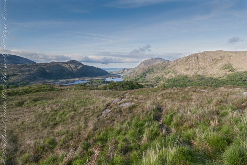
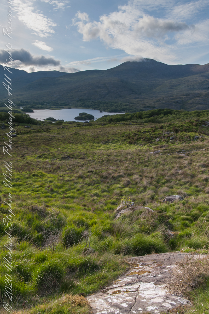
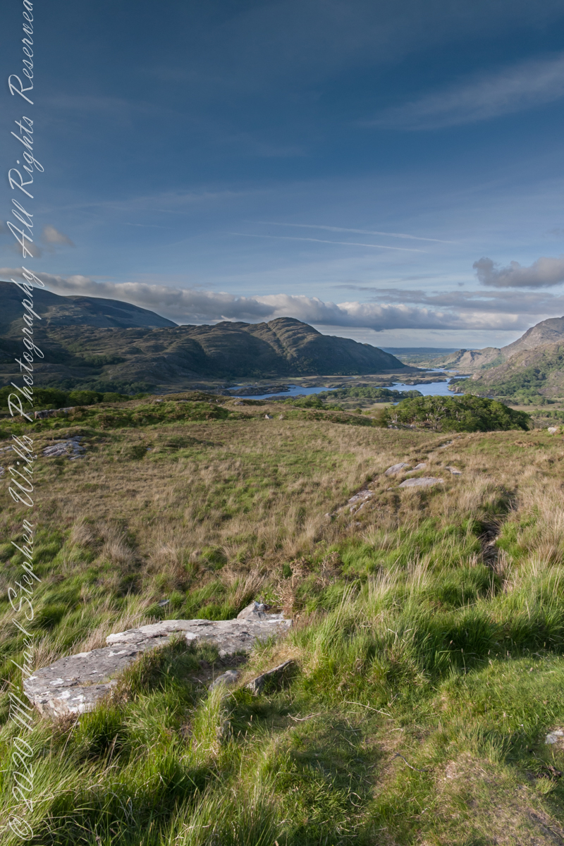
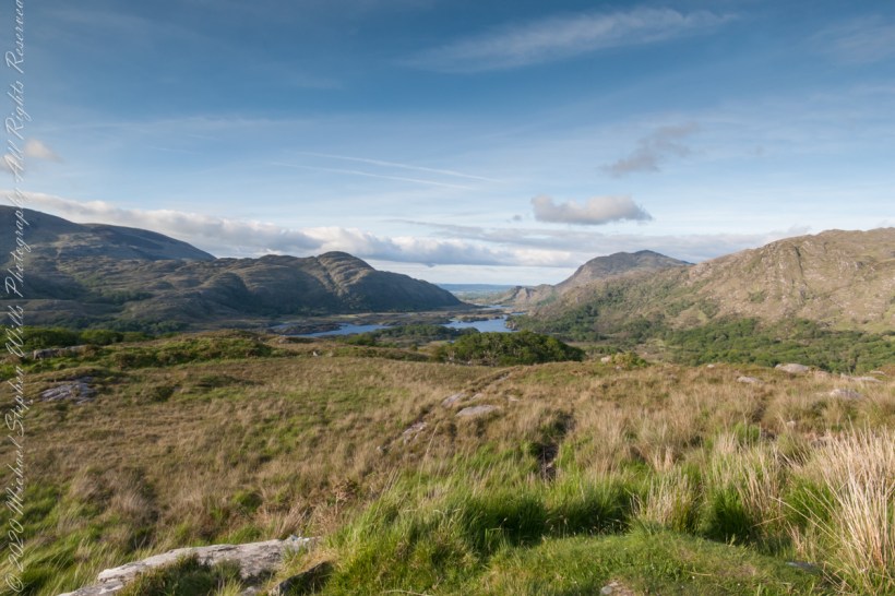
Here we are, on the road from Kenmare to Killarney, N71, part of the Ring of Kerry around the Iveragh Peninsula. The view was celebrated by Queen Victoria’s Ladies-in-Waiting during an 1861 tour of Ireland
We are almost done with this series….sorry to leave this place.
Click pic for larger view in a new browser tab. If you are in WordPress Reader, open the post to use this feature.
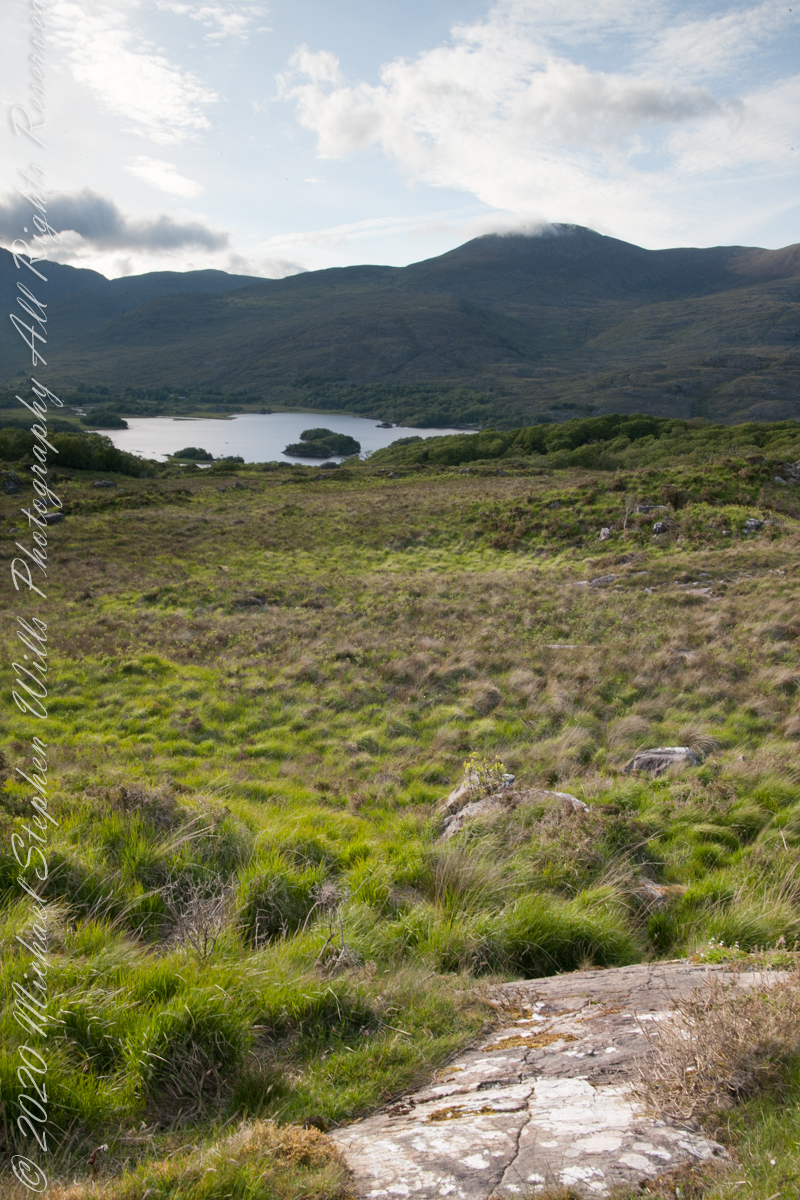
Ladies View, Killarney National Park, Derrycunihy Townland, County Kerry, Republic of Ireland.
Copyright 2021 Michael Stephen Wills All Rights Reserved
Here we are, on the road from Kenmare to Killarney, N71, part of the Ring of Kerry around the Iveragh Peninsula. The view was celebrated by Queen Victoria’s Ladies-in-Waiting during an 1861 tour of Ireland
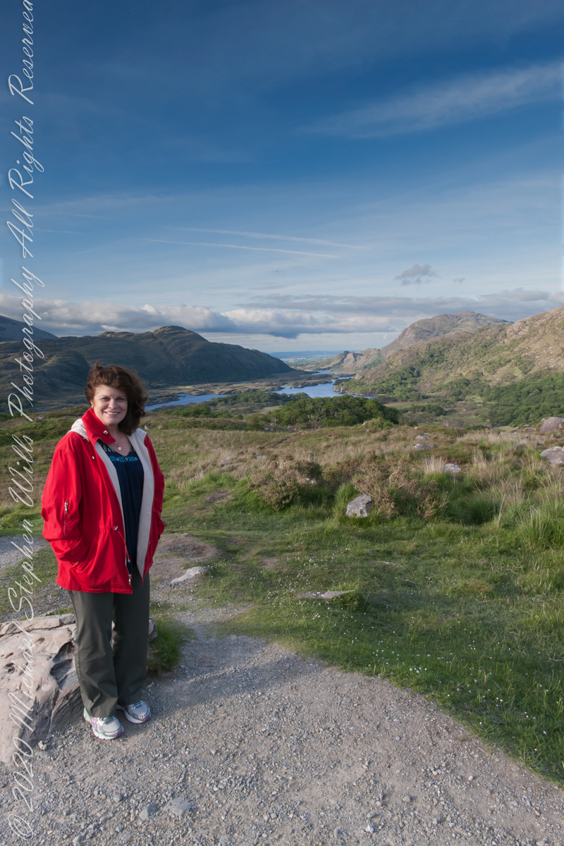
My wife saw the title of this series and asked, “What ‘Ladies’ are these you are so interested in.” “Why YOU, silly, was the response. And here she is!!
Click pic for larger view in a new browser tab. If you are in WordPress Reader, open the post to use this feature.
Ladies View, Killarney National Park, Derrycunihy Townland, County Kerry, Republic of Ireland.
Copyright 2021 Michael Stephen Wills All Rights Reserved
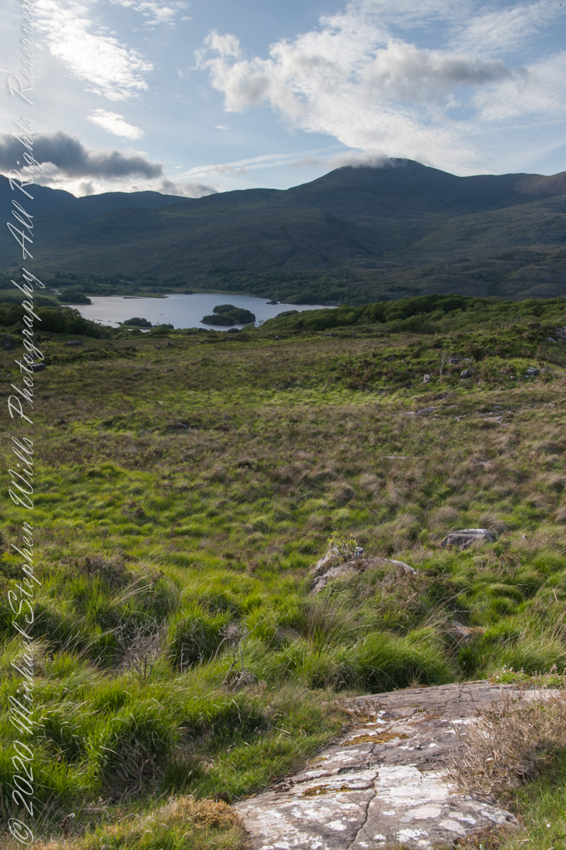
Here we are, on the road from Kenmare to Killarney, N71, part of the Ring of Kerry around the Iveragh Peninsula. The view was celebrated by Queen Victoria’s Ladies-in-Waiting during an 1861 tour of Ireland
Click pic for larger view in a new browser tab. If you are in WordPress Reader, open the post to use this feature.
Ladies View, Killarney National Park, Derrycunihy Townland, County Kerry, Republic of Ireland.
Copyright 2021 Michael Stephen Wills All Rights Reserved
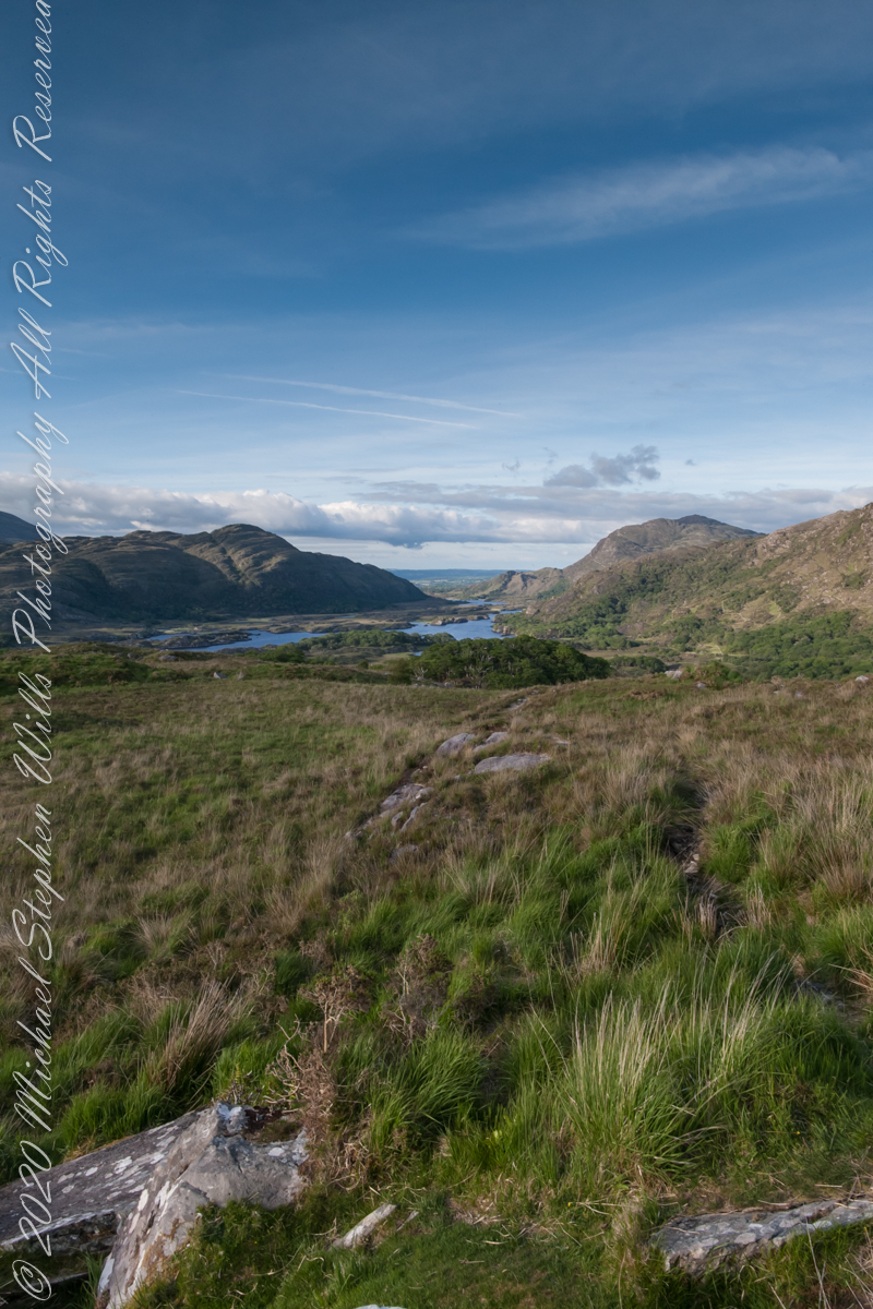
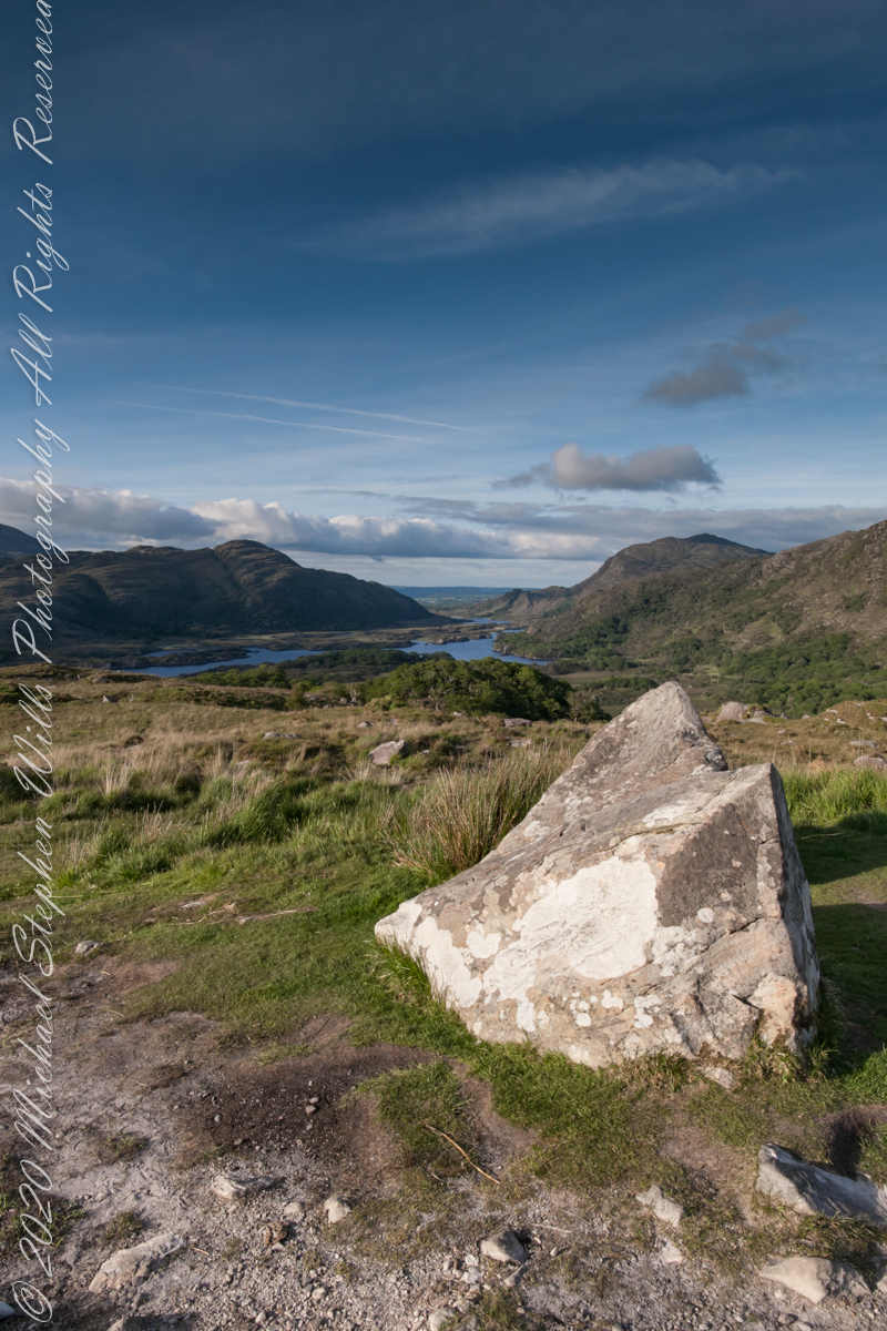
Here we are, on the road from Kenmare to Killarney, N71, part of the Ring of Kerry around the Iveragh Peninsula. The view was celebrated by Queen Victoria’s Ladies-in-Waiting during an 1861 tour of Ireland. Today’s view is different, the others were facing northeast toward Muckross Lake. Here the view faces north, with Upper Lake of Killarney in view. Owengarriff River connects the lakes.
Here is present three versions of the same file with various handling of atmospherics.
Click pic for larger view in a new browser tab. If you are in WordPress Reader, open the post to use this feature.
Version 1
version 1
Version 2Version 2
Version 3Version 3
Version 1Version 2Version 3Side by Side Comparison
Copyright 2021 Michael Stephen Wills All Rights Reserved
I received notice of IStock acceptance of select photographs from my last posting, “Wilderness Textures”, was accepted. Click to view my IStock Portfolio, including photographs from today’s posting included in the acceptance notice.
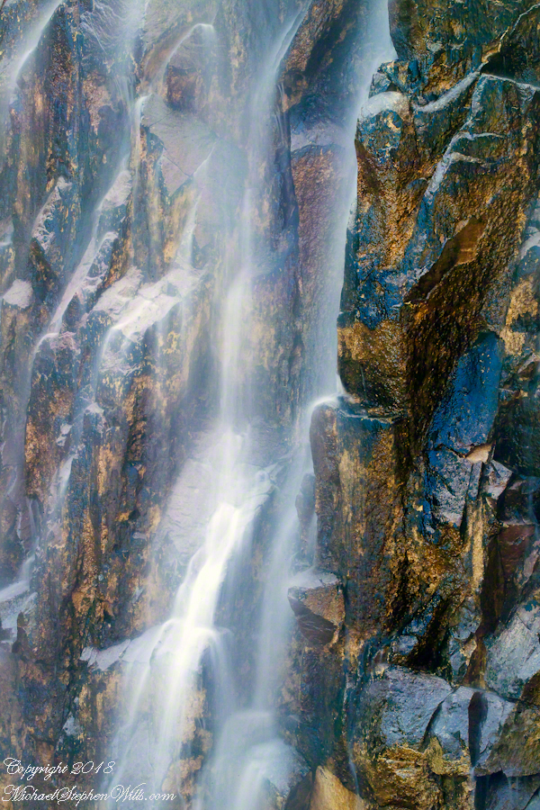
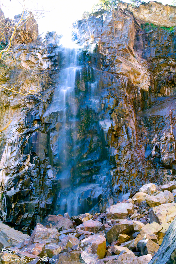
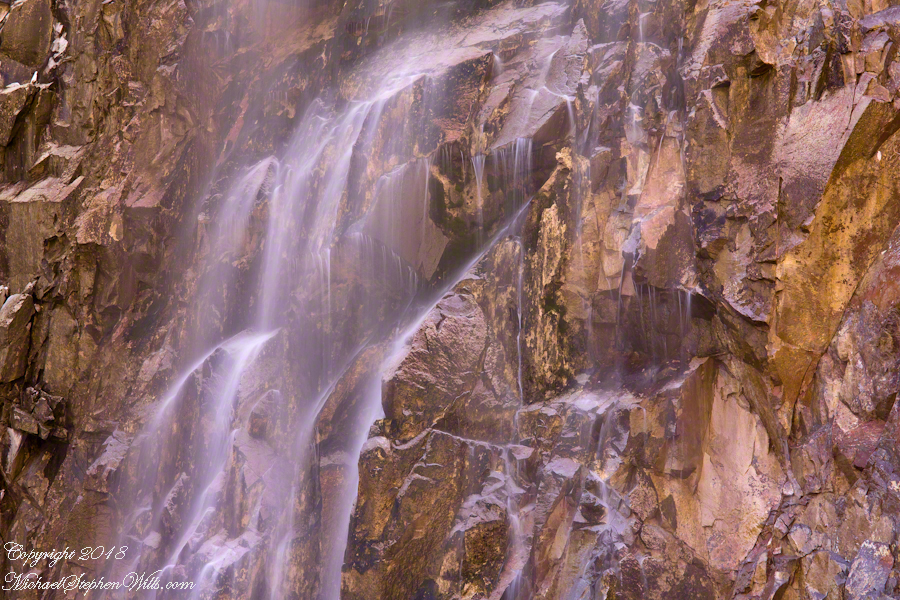
In this post I move up the Reavis Creek canyon from where the last posting, “Wilderness Textures”, was sited to the foot of Reavis Falls. With the first photograph you look up at the falls from the head of the canyon carved by the creek over eons. The rock wall, the canyon “head”, is thick with microorganisms, fungi, mosses.
Click Any Photograph for my Fine Art Gallery
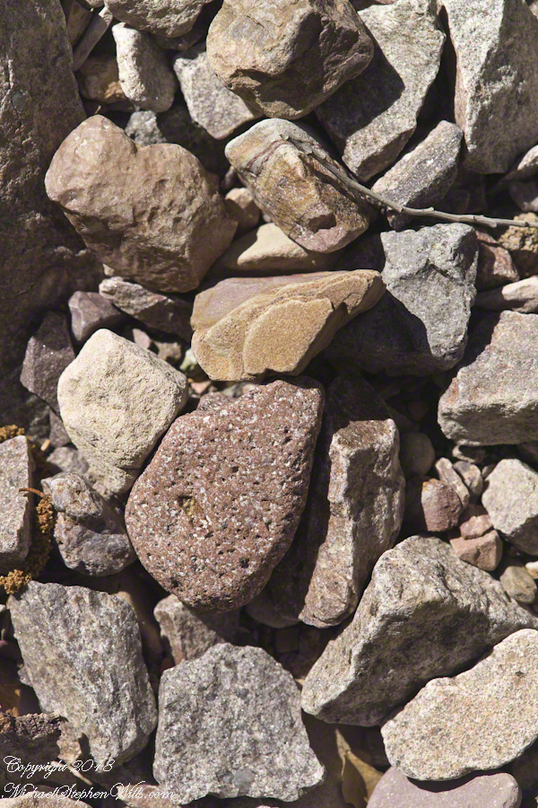
In the foreground is a jumble of boulders, some washed down at flood time, spread wide at the bottom of the falls, piled to a jumbled height of 15 feet.
Talus is the geological term for this formation. Derived from the Latin word for slope (talutum) the definition, from the Oxford English Dictionary, is “A sloping mass of detritus lying at the base of a cliff or the like consisting of material fallen from its face.”
Click Any Photograph for my Fine Art Gallery
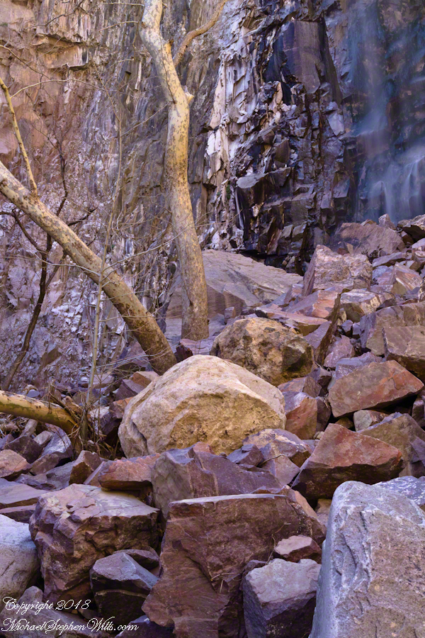
The ankle bone is also called talus, from the French word for heel, I bring it up because climbing this chaotic, unstable jumble is a way to break your ankle. The route to Reavis Falls, a climb up one side of Lime Mountain then down the other on a non-existent (lightly marked) trail, is rated difficult and impossible with a broken leg or ankle. I was alone and very careful to check each rock for stability before putting my weight on it.
A climb of the talus pile was necessary to view the pool at the waterfall base, for this photograph.
Click Any Photograph for my Fine Art Gallery
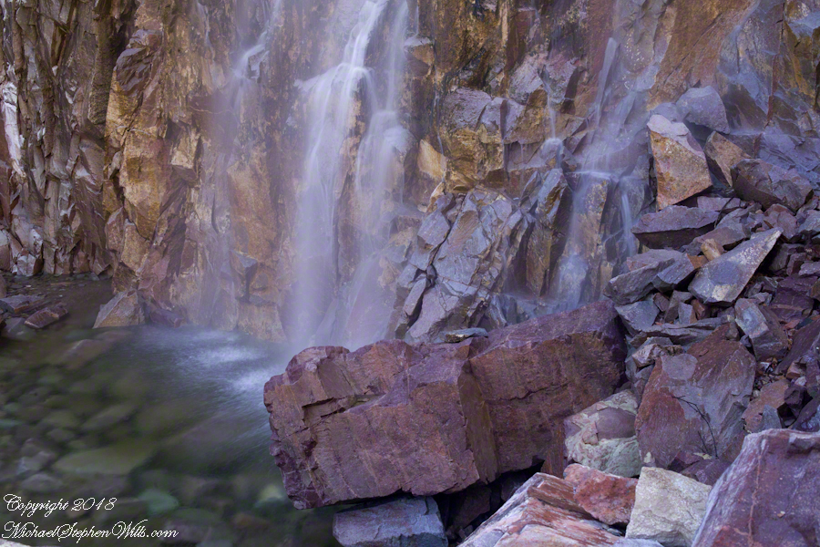
A more artistic vertical format version, below, captured with the Canon EF 100mm “macro” lens. All shots are using the Kodak DCS pro SLR-c (the “c” designated Canon lens compatibility) and a Manfrotto studio tripod with a hydrostatic ball head. The horizontal format shot was captured with a Canon EF 50mm f/1.4 USM lens. I prefer the vertical version, artistically, because the talus jumble is all but cropped out while the upper corner of the angular basalt boulder is left as an interesting focal point. The boulder, not being in the spray, is in focus to contrast with the basalt wall behind the water.
Click Any Photograph for my Fine Art Gallery
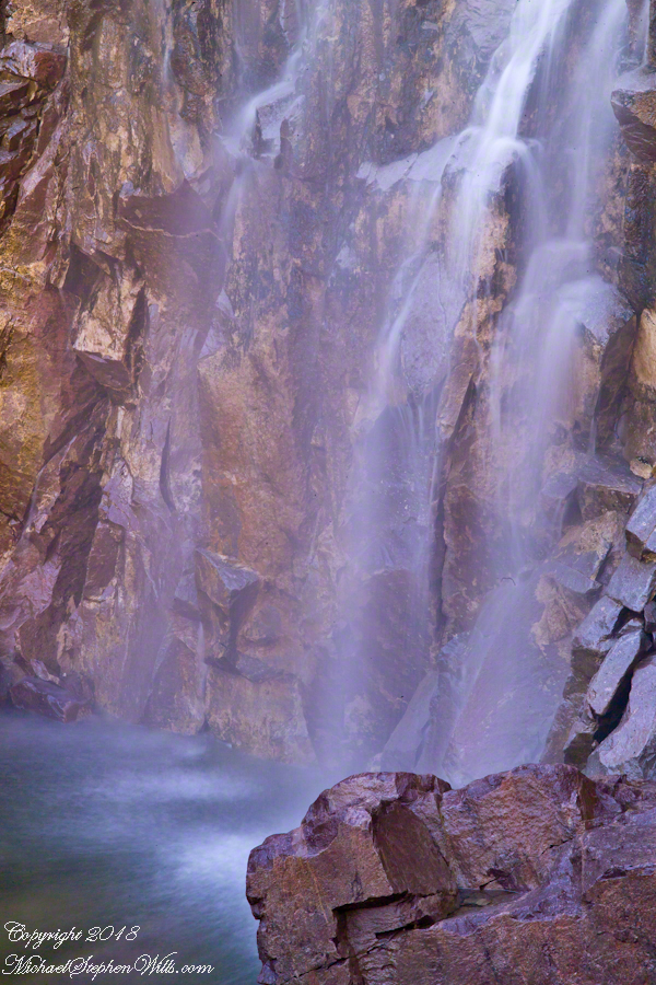
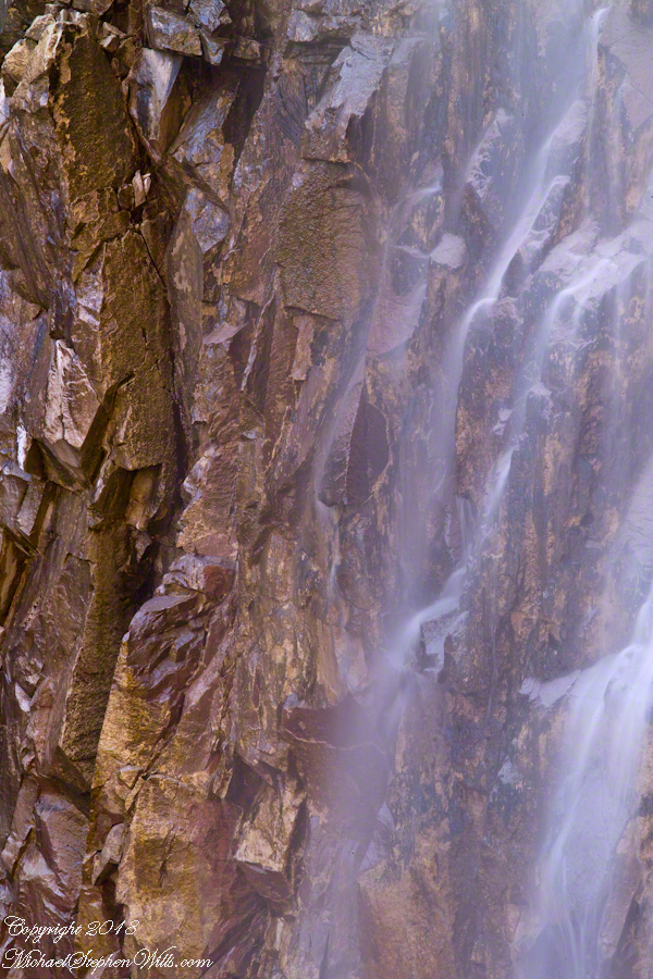
I captured a series of shots from this precarious vantage point, working up from the pool to the brim of the waterfall.
Click Any Photograph for my Fine Art Gallery
My goals was a composite photo of the falls. I have yet to succeed with this project. Maybe I will give it one more shot in spite of having learned the hard lesson the best photographs are a single moment captured in a single frame.
Click Any Photograph for my Fine Art Gallery
I find in this series the vertical aspect is more artistic. The water volume, of the falls, at this time of year offers only the finest of sprays with most of the basalt rock wall only moist. The 100mm “macro” lens allowed me to include only the falling water with a bit of the moist wall for contrast.
In the following version I experimented with color, moving from the narrow range of hues, to more contrast.
Here we are, on the road from Kenmare to Killarney, N71, part of the Ring of Kerry around the Iveragh Peninsula. The view was celebrated by Queen Victoria’s Ladies-in-Waiting during an 1861 tour of Ireland
Click pic for larger view in a new browser tab. If you are in WordPress Reader, open the post to use this feature.
Ladies View, Killarney National Park, Derrycunihy Townland, County Kerry, Republic of Ireland.
Copyright 2021 Michael Stephen Wills All Rights Reserved
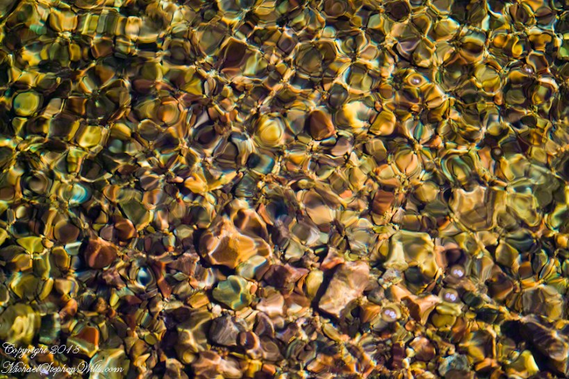
These abstracts are some of my photographic output from four days and nights spent alone in the remote eastern Superstition Wilderness. For the first three days I met not a soul, all these images were captured on a single afternoon spent in the canyon below Reavis Falls, a jumble of landslides, flood debris and boulders. There is no trail. The few people who enter the canyon must negotiate around boulders, crossing Reavis Creek many times.
Click Any Photograph for my Fine Art Gallery
My backpack kit included a full sized Manfrotto studio tripod with hydrostatic ball head. The benefits more than outweighed the effort (I was a lot younger in 2008) when the Canon EF 100mm (macro) lens is mounted on a Kodak dSLR body, allowing me to take crisp shots. The tripod legs can be adjusted to precise positions for stability.
I can feel the bright afternoon desert spring sunshine in this photos. It was after the spring floods, the flow of Reavis Creek and ample still but slow. Gathering in pools over the rough stones of the creek bed, the water absolutely clear.
I held the shot over many minutes, capturing ever changing diffraction patterns.
We see in all these photos, not a homogenous blend of stones from a shared geology. Reavis Creek washes over diverse geologies: volcanic, ancient igneous extrusions, sedimentary and metamorphic are jumbled together.
Click Any Photograph for my Fine Art Gallery
This is a series of photographs of smooth, white igneous boulders with shadows of still leafless sycamore and cottonwood trees.
Graceful shadows
Strong, demonstrative shadows.
Click Any Photograph for my Fine Art Gallery
A leaning cairn, not a trail marker….
A 15 foot high jumble of stones piled at the bottom of Reavis Falls, carried over by the floods.
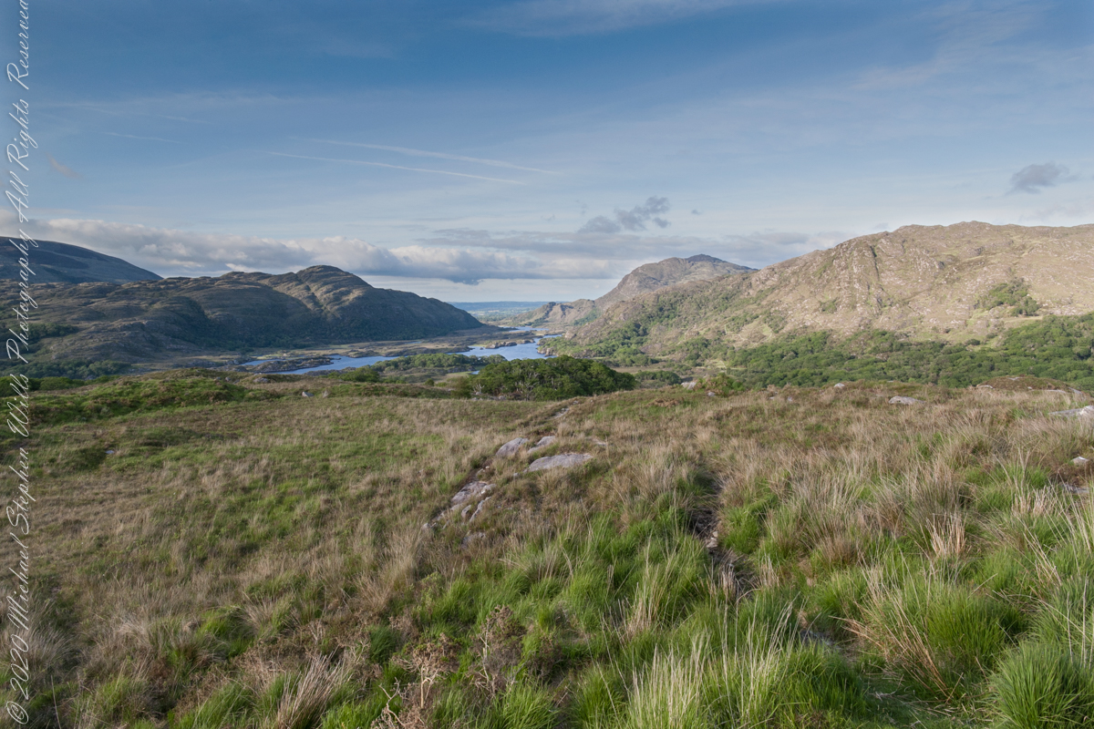
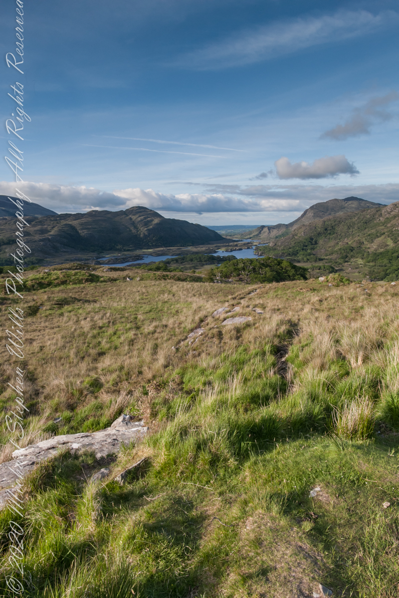
Here we are, on the road from Kenmare to Killarney, N71, part of the Ring of Kerry around the Iveragh Peninsula. The view was celebrated by Queen Victoria’s Ladies-in-Waiting during an 1861 tour of Ireland. Here we see Muckross Lake and the Owengarriff River connecting the lakes.
Click pic for larger view in a new browser tab. If you are in WordPress Reader, open the post to use this feature.
Ladies View, Killarney National Park, Derrycunihy Townland, County Kerry, Republic of Ireland.
Copyright 2021 Michael Stephen Wills All Rights Reserved
Here we are, on the road from Kenmare to Killarney, N71, part of the Ring of Kerry around the Iveragh Peninsula. The view was celebrated by Queen Victoria’s Ladies-in-Waiting during an 1861 tour of Ireland
Click pic for larger view in a new browser tab. If you are in WordPress Reader, open the post to use this feature.
Ladies View, Killarney National Park, Derrycunihy Townland, County Kerry, Republic of Ireland.
Copyright 2021 Michael Stephen Wills All Rights Reserved