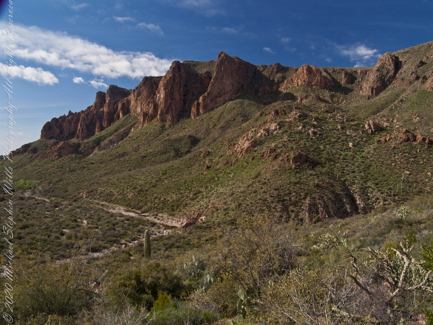
Dutchman Trail follows the outflow of two springs along the canyon floor: Music Canyon and LaBarge springs. Here we are climbing Peters Trail to the eponymous mesa and facing south / Southeast, looking down on Dutchman Trail.
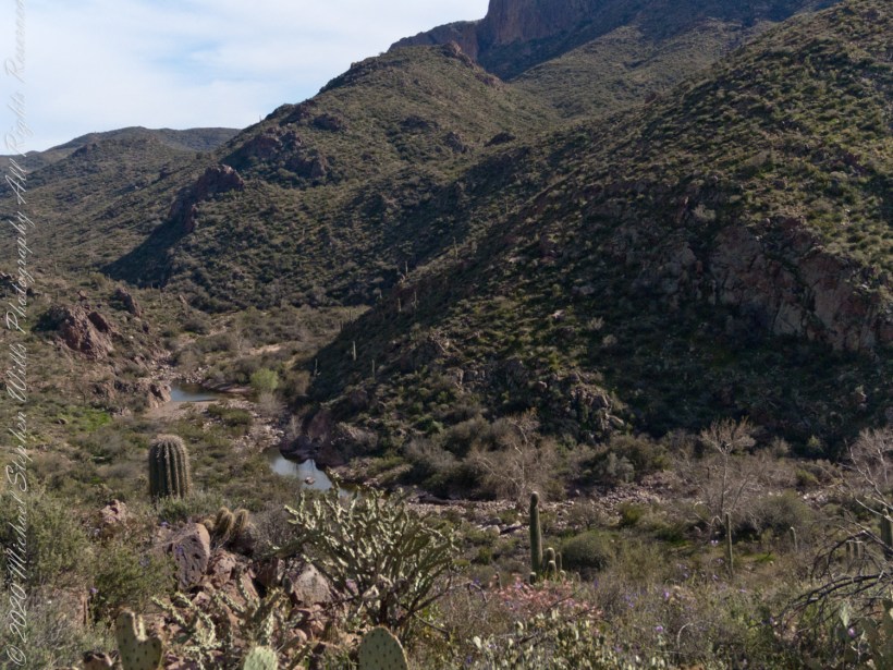
This is rough country below Bluff Spring Mountain. Stag Horn Cholla cactus is lower right with Prickly Pear cactus scattered in the brush. Poles of young saguaro cactus are scattered around the lower slopes.
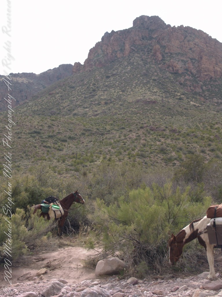
After a respite among the cool spring waters, we headed up Peters Trail for the top of Peter’s mesa where, for all we knew, there was no water.
In this photograph I face northwest, looking down on Dutchman Trail. The peak, upper center left, is Black Mountain. The cleft of Charlebois Canyon is lower middle right. Stag Horn Cholla cactus is lower right with Prickly Pear cactus scattered in the brush. Poles of young saguaro cactus are scattered around the lower slopes. Look carefully and you can make out the pooled water of our rest stop.
Copyright 2022 Michael Stephen Wills All Rights Reserved
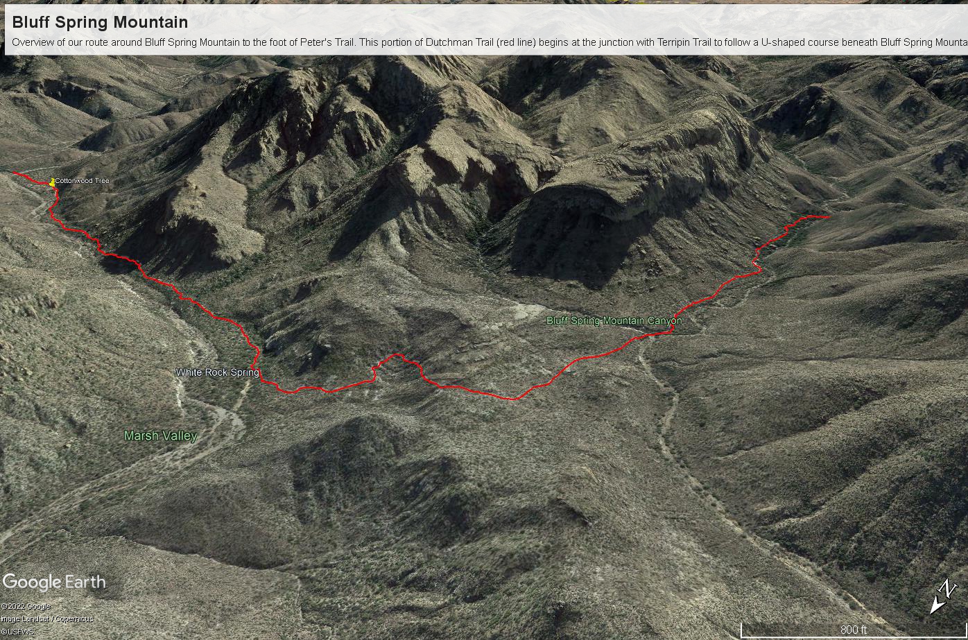
Here is a recap of the last few Superstition Wilderness posts. The expedition route, in red, starts on the right where Dutchman and Terrapin trails meet. The total distance is 2.6 miles. Photograph timestamps tell me about 2 hours passed — 1.3 miles per hour in this rough country.
Here is a gallery of photographs from this portion of our expedition.
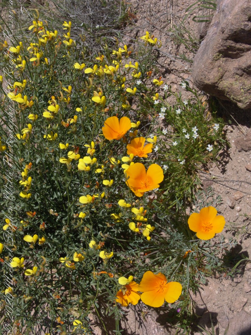
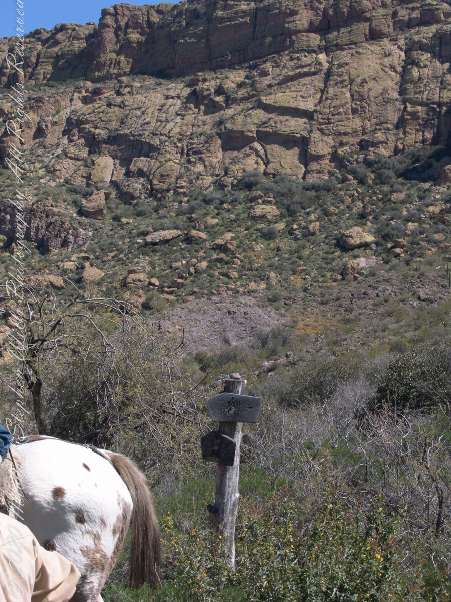
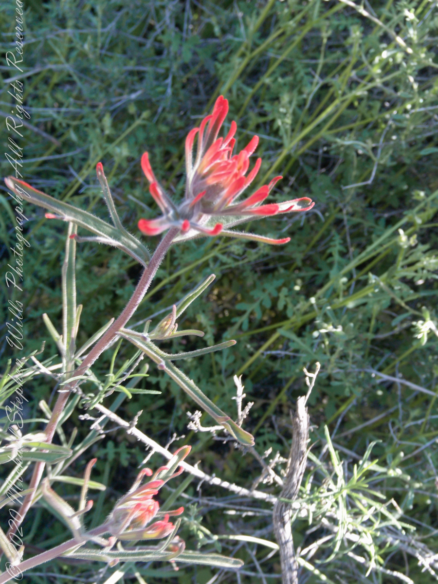
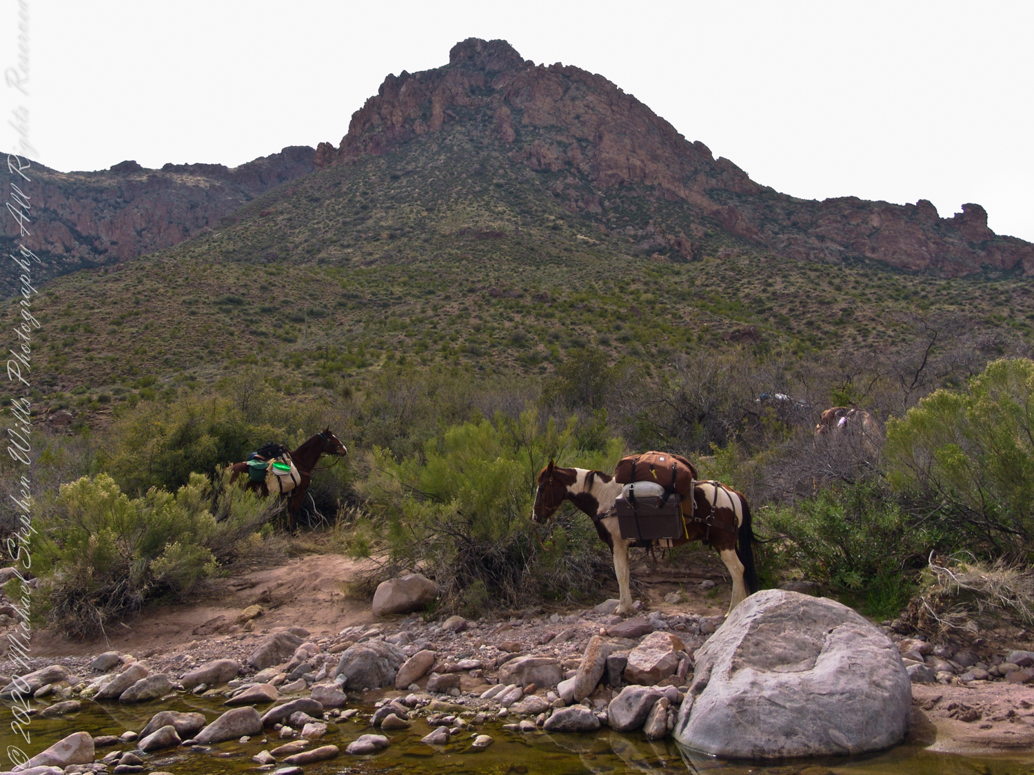
The beetling cliffs off Bluff Spring Mountain loom over where Terrapin and Dutchman trails meet. Patches of yellow are Mexican Poppies blooming on the talus slope. Terrapin Trail climbs the ridge, to right, Here is where I caught up with mounted expedition members, the spotted rump of an Appaloosa figures prominantly next to the sign post. Superstition Wilderness, Tonto National Forest, ArizonaTerrapin Trail almost immediately starts a climb up to an eponymous pass between Bluff Springs Mountain and Weavers Needle. From here, it is the best way into the mountain. The trail name is a misnomer, as terrapin (Malaclemys terrapin) turtle habitat is near the ocean. There is a desert tortoise (Gopherus agassizii) you might encounter during the rainy season as they are otherwise inactive. Superstition Wilderness, Tonto National Forest, ArizonaAl Conant at Terrapin and Dutchman trails. His Appaloosa is enjoying fresh grass. Superstition Wilderness, Tonto National Forest, ArizonaThe bright yellow flowers on right are a member of the pea (Fabaceae) family named Wright’s Deervetch (Acmispon wrightii) I am able to pick it out from many similar flowers due to the characterictis narror leaves with small hairs. These start out yellow, turning to red with age eventually forming brown seed pods. Mexican Poppy (Eschscholtzia californica) to the right. The small white flowers are Chickweed (Minuartia macrantha) of the family Carnation (Caryophyllaceae) . These are growing along Dutchman trail, March 2008, at the base of Bluff Spring Mountain. Superstition Wilderness, Tonto National Forest, ArizonaView from Dutchman Trail between Black Top Mesa and Bluff Springs Mountain, approaching White Rock Spring and LaBarge canyon. Looking Northwest, in the distance is Malapais Mountain behind Red Hills. Volcanic rock and Cholla cactus in foreground followed by Prickly Pear and Saguaro cactus. Superstition Wilderness, Tonto National Forest, ArizonaCastilleja is the genus name of this flower, also known as Prarie Fire. There are over 200 species throughout the Americas. On the Dutchman Trail, LaBarge Canyon, Superstition Wilderness, Tonto National Forest, ArizonaLost gold mine legends tell of Saguaros bearing secret markings leading to the hidden location of rich gold mines. This specimen lives in LaBarge Canyon, along the Dutchman trail.View North / Northwest on Dutchman Trail between Bluff Spring Mountain and Peter’s Mesa. The creek flowing from Charlebois, Music Mountain and LaBarge springs nourishes this Fremont’s Cottonwood (Populus fremontii) and other riparian flora. The tree is flanked by volcanic rock from an ancient eruption. Coordinates: 33°27’29.60″N , 111°20’56.23″W, LaBarge Canyon, Superstition Wilderness, Tonto National Forest, ArizonaColorado at the foot of Peter’s Trail near Charliebois CanyonBehind Colorado and “Ed’s Horse” (don’t recall the name) is Bluff Spring Mountain.
Copyright 2022 Michael Stephen Wills All Rights Reserved
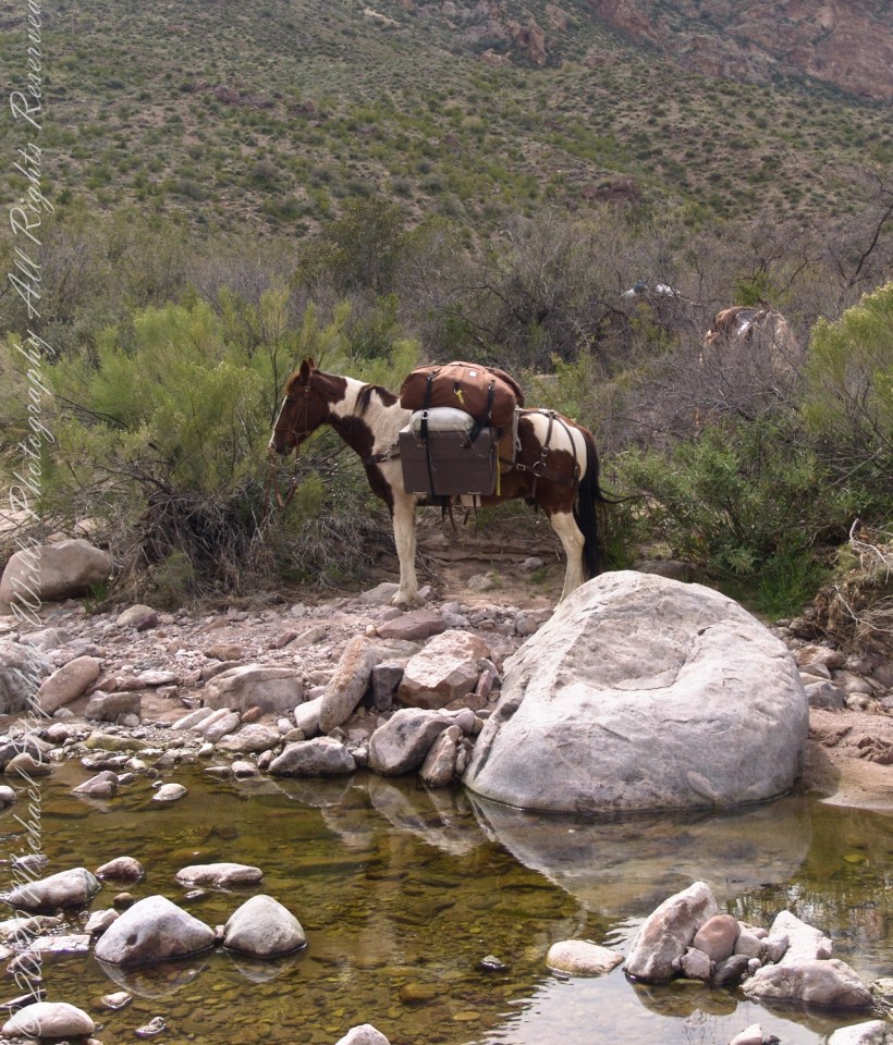
The expedition party rested where Dutchman Trail intersected the creek, full of flow from Charlebois Canyon, Music Canyon and LaBarge springs. We filled the water reservoirs in preparation for the climb up to the night’s camping spot on Peter’s Mesa, a 1,300 foot climb over 1.2 miles.
Behind Colorado and “Ed’s Horse” (don’t recall the name) is Bluff Spring Mountain.
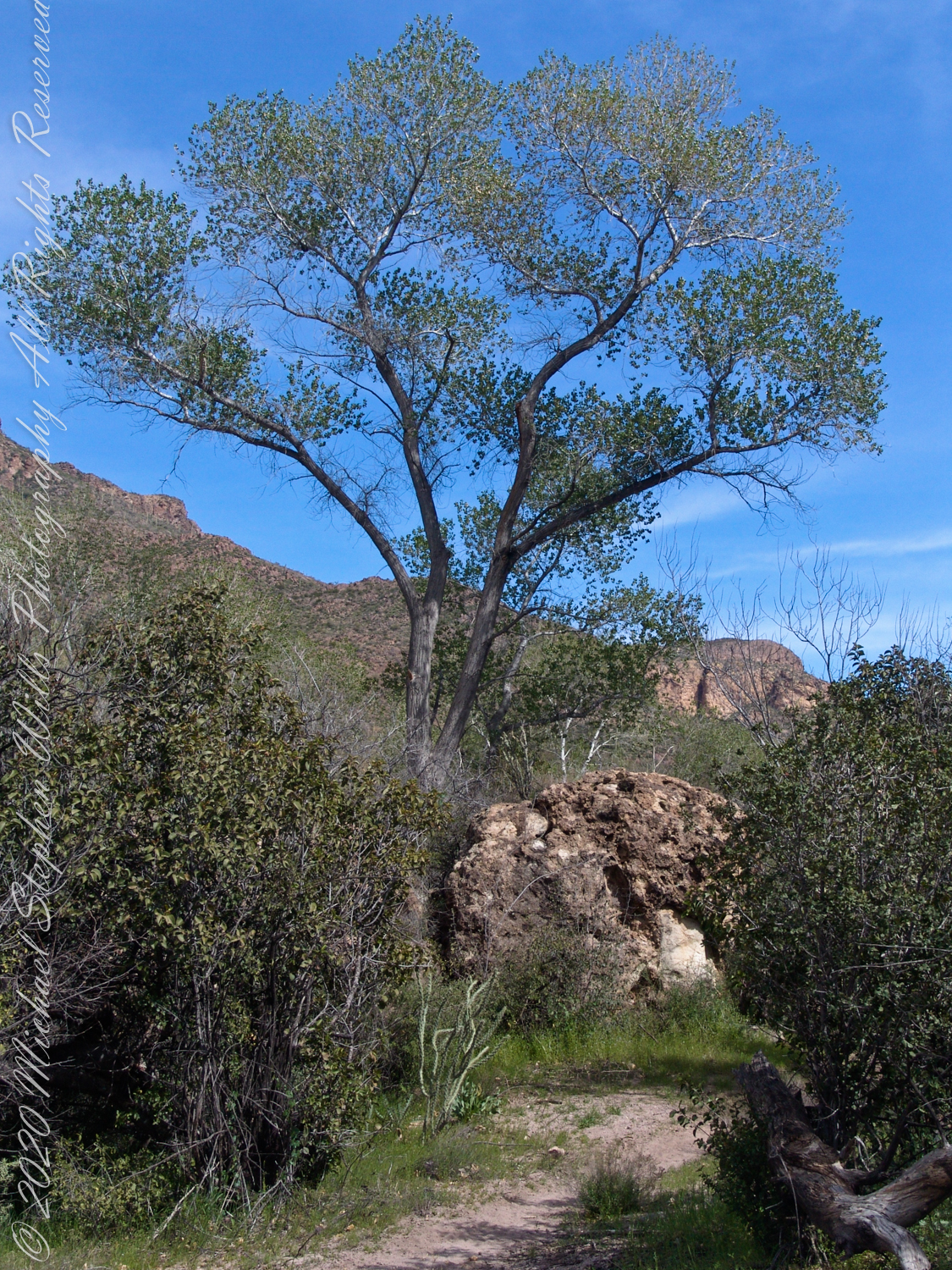
A view to west on Dutchman Trail between Bluff Spring Mountain and Peter’s Mesa. The creek flowing from Charlebois, Music Mountain and LaBarge springs nourishes this Fremont’s Cottonwood (Populus fremontii) and other riparian flora. The tree is flanked by volcanic rock from an ancient eruption.
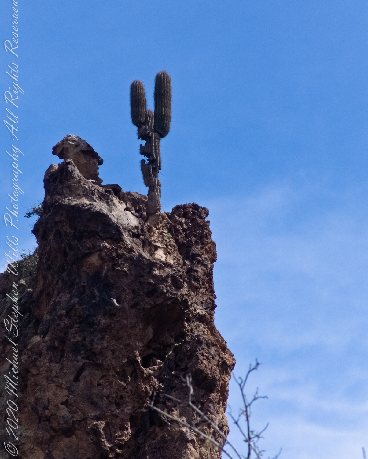
Lost gold mine legends tell of Saguaros bearing secret markings leading to the hidden location of rich gold mines. This specimen, perched on an ancient volcanic boulder, lives in LaBarge Canyon along the Dutchman trail.
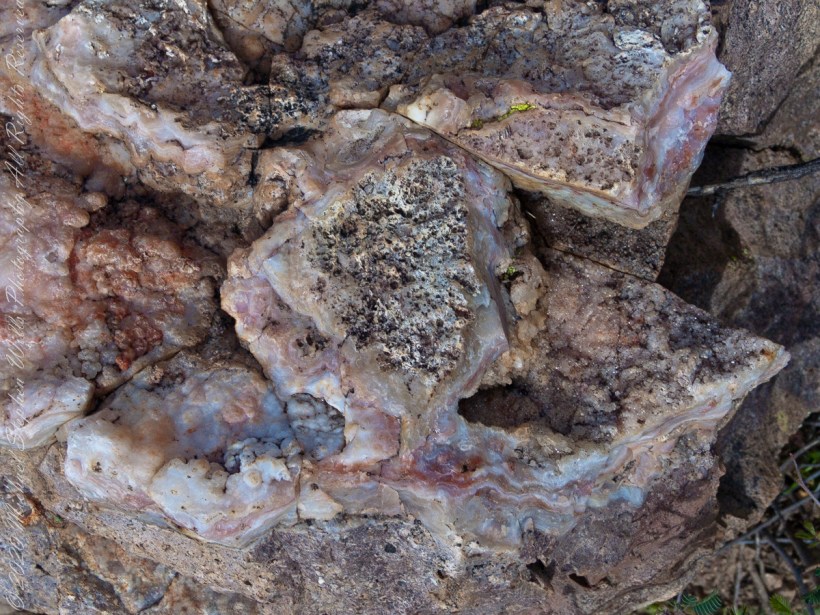
Marled and rose quartz outcroppings such as this appear throughout the Superstitions. The stories are of soldiers and prospectors who return from the wilderness with hoards of gold nuggets picked from quartz.
Marled and rose quartz outcroppings such as this appear throughout the Superstitions. The stories are of soldiers and prospectors who return from the wilderness with hoards of gold nuggets picked from quartz.
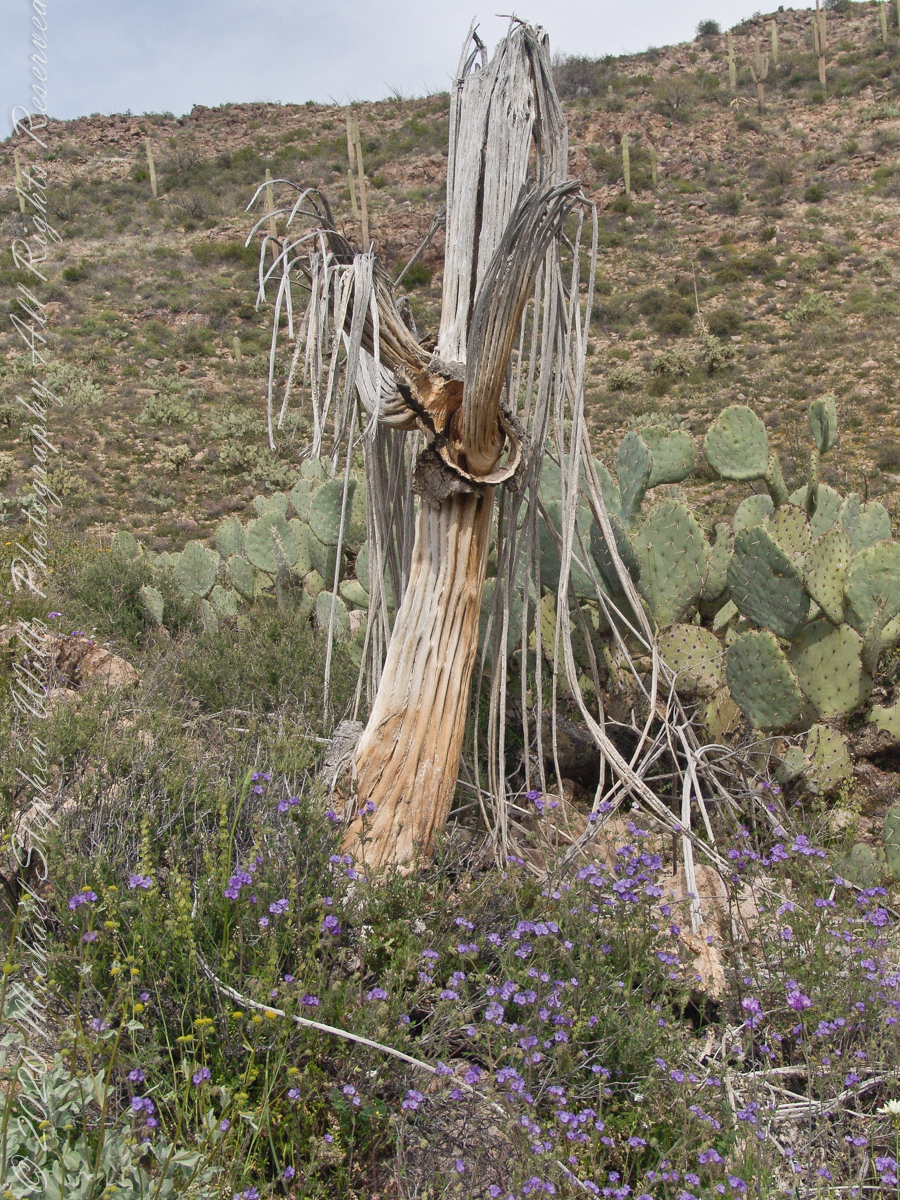
In my experience to come across the denuded ribs of an expired Saguaro cactus is to find a single one among thousands of flourishing, many-armed giants. Fourteen years ago, when this photograph was taken March 2008, a drought hung over Arizona since 1994, fourteen years. One documented effect of twenty-eight drought years is fewer young saguaro now survive into adulthood, the number of standing specimens is slowly decreasing.
On the slopes of Peter’s Mesa, Superstition Wilderness, Arizona
Here we are below the rim of Peter’s Mesa of the Superstition Wilderness. Blue Dicks flourish as the feet of the long-expired giant, the wildflowers grow from corms long used as food by Native Americans. Behind is a large stand of Prickly Pear cactus whose fruit, called tunas, is another food source.
Copyright 2022 Michael Stephen Wills All Rights Reserved
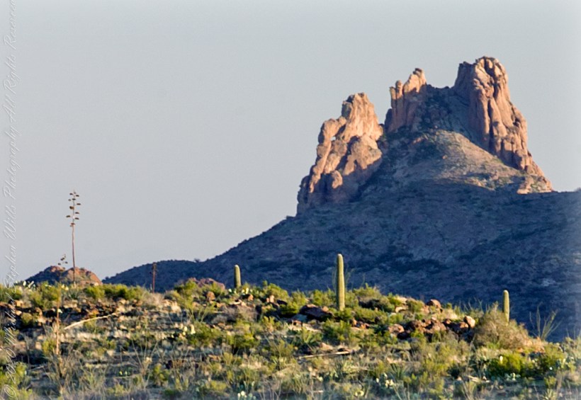
I was a member of an expedition to Peter’s Mesa March 2008, a place central to Superstition Wilderness treasure legends. This is a sunset view, looking south, southwest. Light raking across the desolation and Miner’s Needle creates a fascinating spectacle. Ancient volcanism, apparent throughout the Superstition Wilderness, is here seen in the texture, form and type of rock as well as the mineral deposits. Miner’s Needle, like Weaver’s Needle (not seen in this view), are eroded volcanic summits. Look closely for the “eye” of Miner’s Needle, easier seen in the cropped heading photograph. To this day, hopeful prospectors search for gold nuggets.
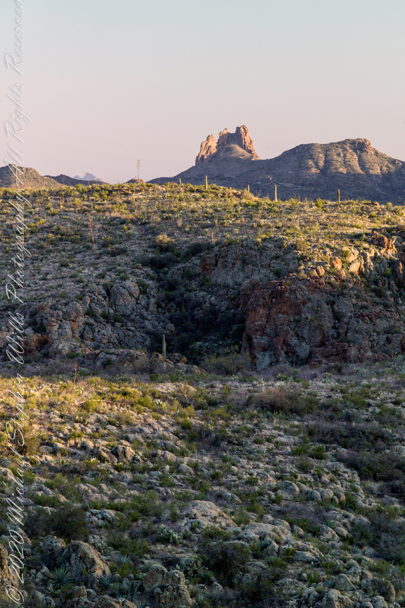
There is one form of volcanism present today as an eerie rumble or hiss, similar to an enormous distant jet engine heard now and then during our two days on the mesa, louder and closer than an overhead plane could produce. The view includes many notable Sonoran Desert plants. Many young Saguaro cactus are in the form of green poles. Catching the dramatic light, on the ridge is a tall single flower of an Agave, known as the “Century Plant” it flowers once in a long life and dies.
Peters Mesa is named after “Old Pete” Gottfried Petrasch, father of Hermann and Rhiney Petrasch. Old Pete worked for Jim Bark for awhile in the 1890s doing odd jobs. Irregular employment gave Pete and Sons time to s searched for the Lost Dutchman Mine in the years following the death of the source of the legend, the “Dutchman” Jacob Waltz. The Petrasches were one of the first groups to search for the mine, and gold in general. They covered almost the entire Superstition range in their combined searches.
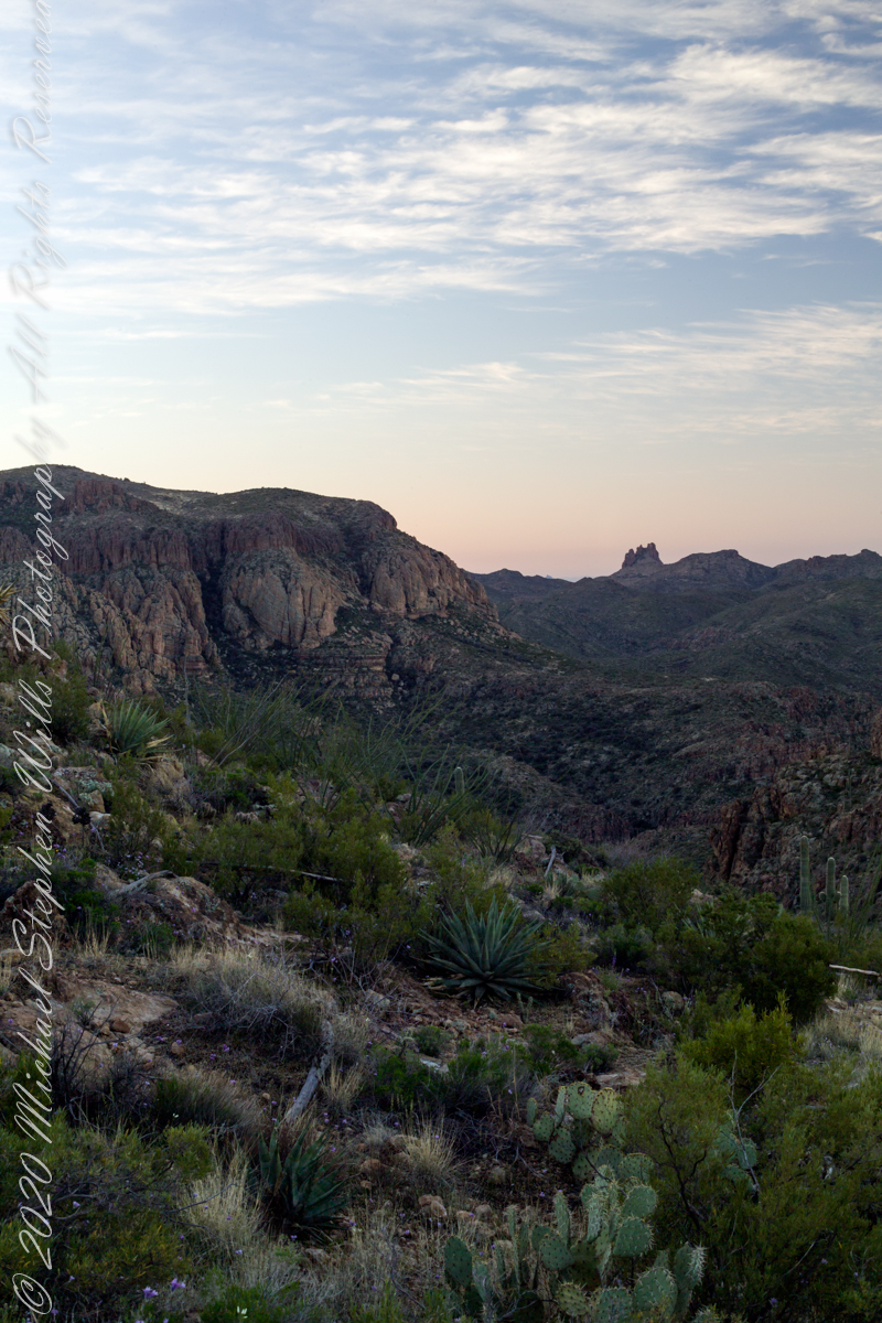
Sunrise looking across Music and LaBarge Canyons to Miner’s Needle
On our first day on the mesa, we came across the remains of one of these camps, on the top of Squaw Canyon, a deplorable junk pile discarded by searchers, presumably disappointed, too lazy to cart it out. That March, we were lucky to find the remnants of winter rains in the form of a meager trickle at the bottom of a shallow draw off Peter’s Mesa trail up from La Barge canyon. We had a good time of it until the trip was cut short by a storm front and torrential rains. We were back in Apache Junction before they hit.
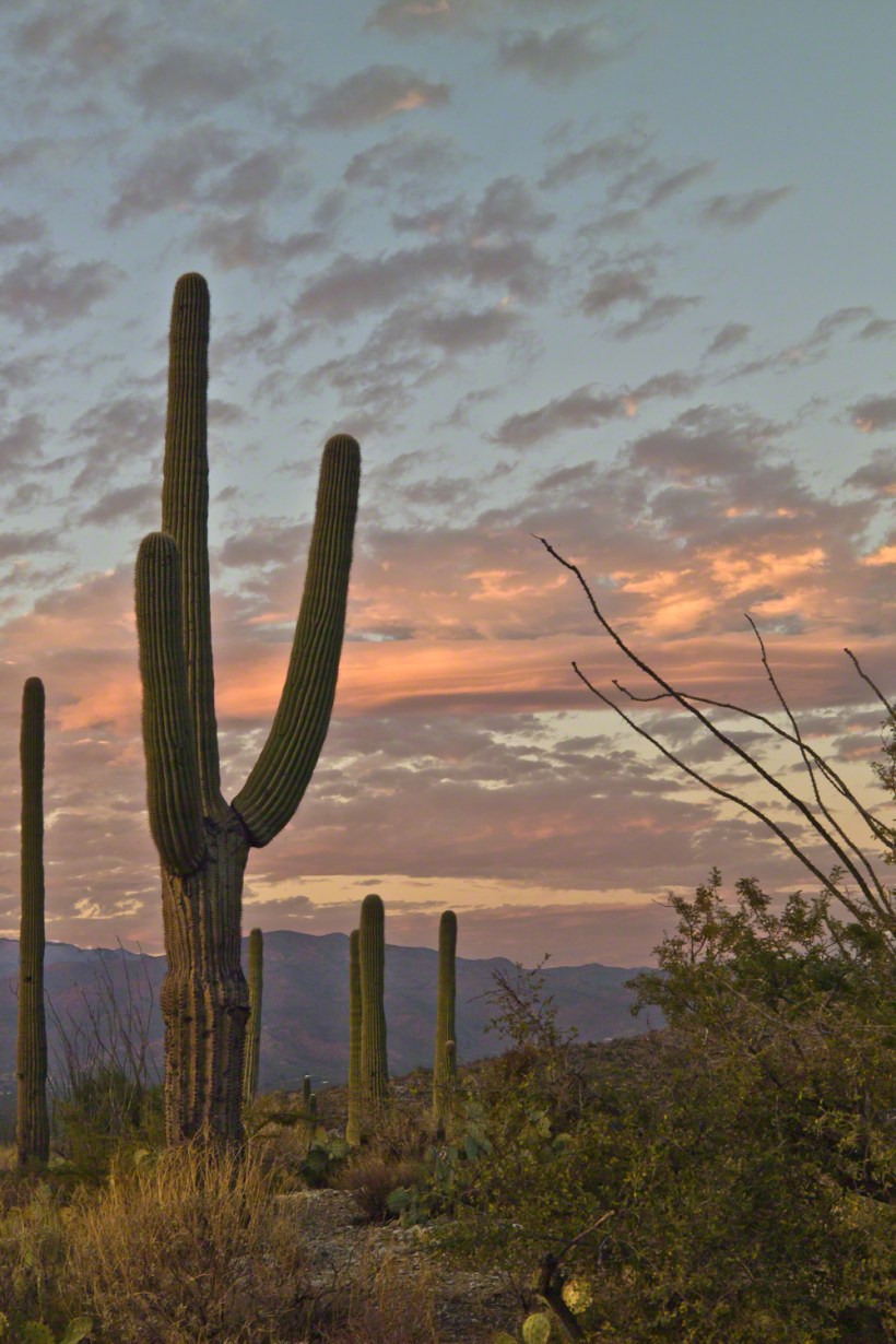
November is a special time for the ranges and basins of southern Arizona deserts. Climb a bajada of foothills, face west and wait for the sunset. That is what I did this day, November 3, 2005. East of Tucson the Saguaro National Monument at the foot of the Rincon Mountain Wilderness is where I parked, unpacked the photo gear and climbed the side of the Tanque Verde Ridge for a favorable view. Weather was pushing high level moisture from the west, clouds were developing.
You see here a shot from that session. In the distance, looking across Tanque Verde, are the Santa Catalina mountains. Months since the last rainfall, the giant Saguaros are using internal moisture reserves drawn up from a shallow root system, the flesh is less plump, the supporting structure of the ribs, always evident, are more pronounced. The last light catches these ribs in relief against a dramatic sky.