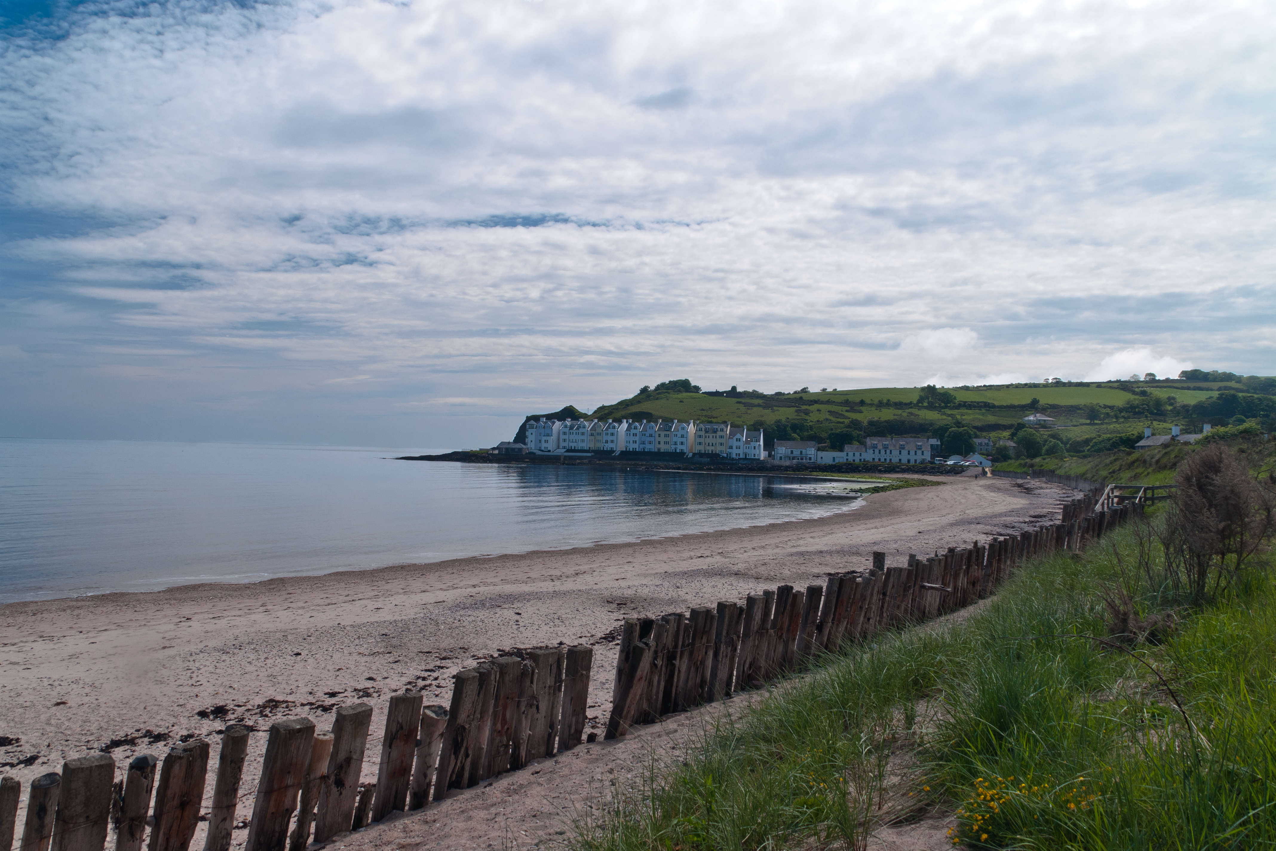
Cushendun (from Irish: Cois Abhann Doinne, meaning “foot of the River Dun”) is a small coastal village in County Antrim, Northern Ireland. It sits off the A2 coast road between Cushendall and Ballycastle.
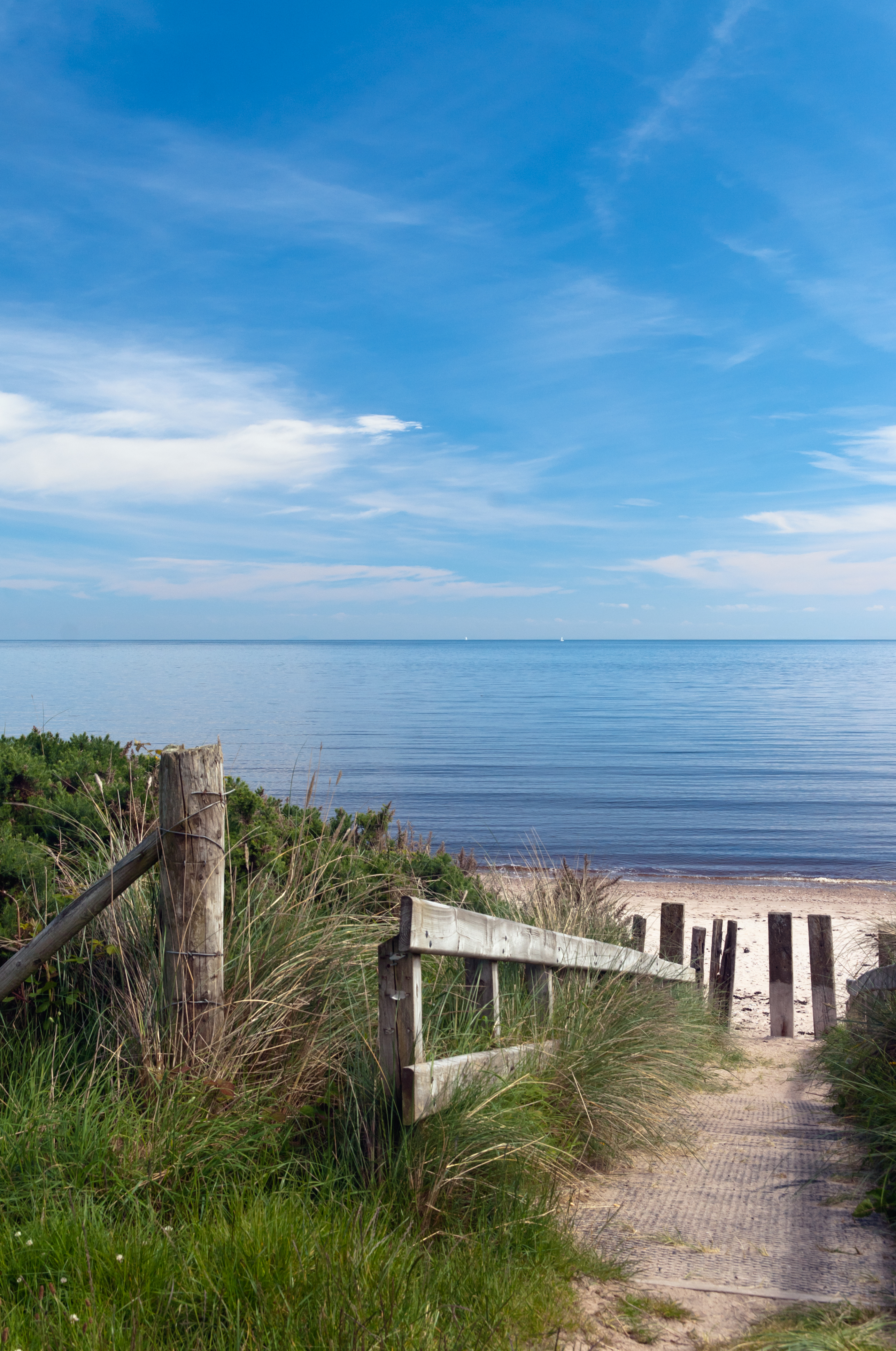
It has a sheltered harbor and lies at the mouth of the River Dun and Glendun, one of the nine Glens of Antrim. The Mull of Kintyre in Scotland is only about 15 miles away across the North Channel and can be seen easily on clear days.
In the 2001 Census it had a population of 138 people. Cushendun is part of Causeway Coast and Glens district.
SONY DSC
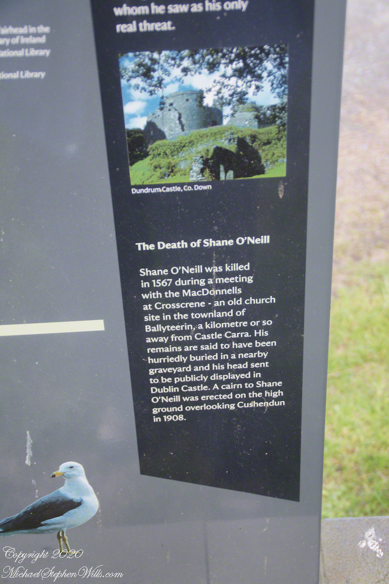
Here are several of the information placards near the harbor explaining some local history.
.
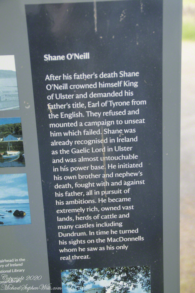
Ballyteerin townland, where Shane O’Neill was killed, is on the road to Torr Head.
Reference: Wikipedia, “Cushendun.”
Enter your email to receive notification of future postings. I will not sell or share your email address.
Copyright 2025 All Rights Reserved Michael Stephen Wills
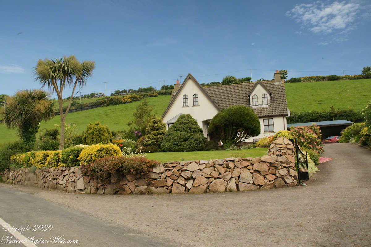
Join me in reminiscing about a memorable trip to Ireland, marked by the now-closed Breezemount House B&B and the scenic Dunseverick Castle Ruin. Dive into my journey and the advice that shaped it
“Falcon Heavy is a partially reusable super heavy-lift launch vehicle[a] that can carry cargo into Earth orbit, and beyond. It is designed, manufactured and launched by American aerospace company SpaceX.“
“The rocket consists of a center core on which two Falcon 9 boosters are attached, and a second stage on top of the center core. Falcon Heavy has the second highest payload capacity of any currently operational launch vehicle behind NASA’s Space Launch System, and the fourth-highest capacity of any rocket to reach orbit, trailing behind the SLS, Energia and the Saturn V.“
“SpaceX conducted Falcon Heavy’s maiden launch on 6 February 2018, at 20:45 UTC. As a dummy payload, the rocket carried a Tesla Roadster belonging to SpaceX founder Elon Musk, with a mannequin dubbed “Starman” in the driver’s seat. The second Falcon Heavy launch occurred on 11 April 2019, and all three booster rockets successfully returned to Earth. The third Falcon Heavy launch successfully occurred on 25 June 2019. Since then, Falcon Heavy has been certified for the National Security Space Launch (NSSL) program.“
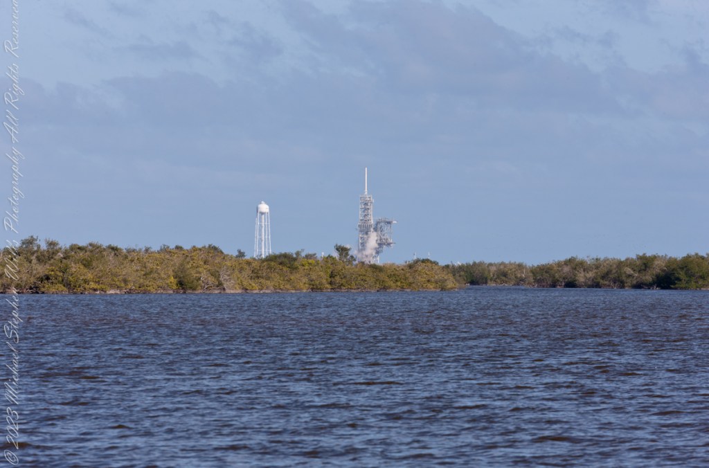
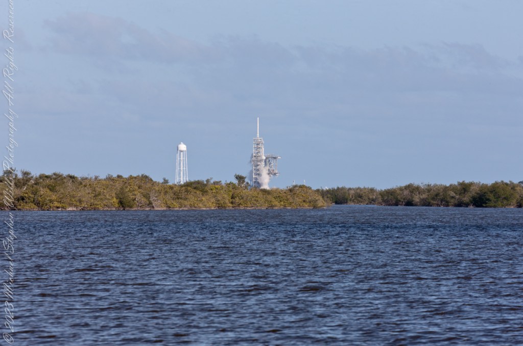
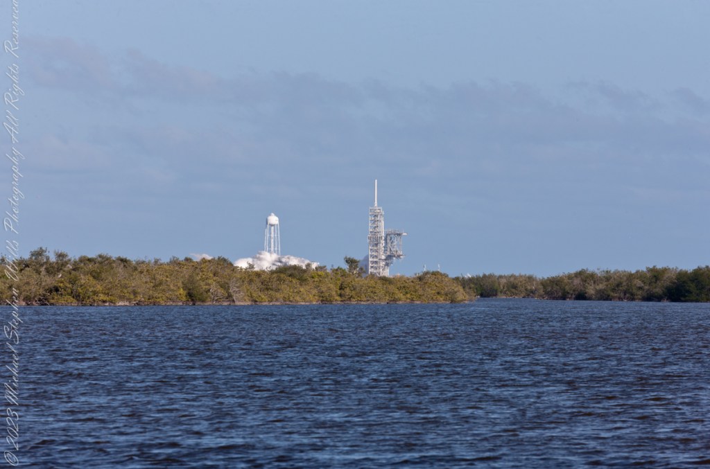
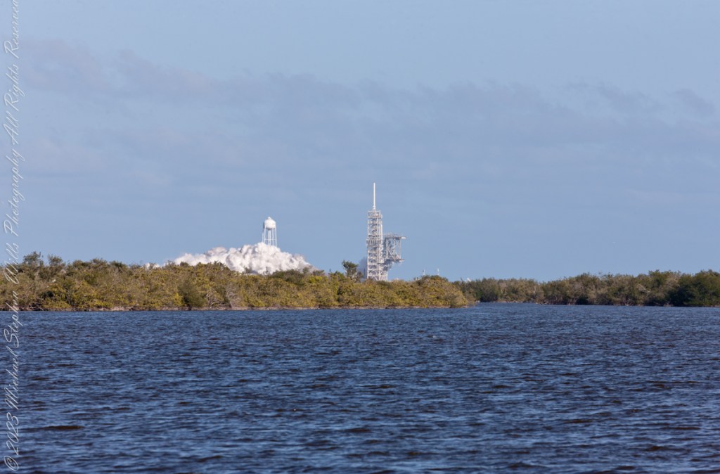
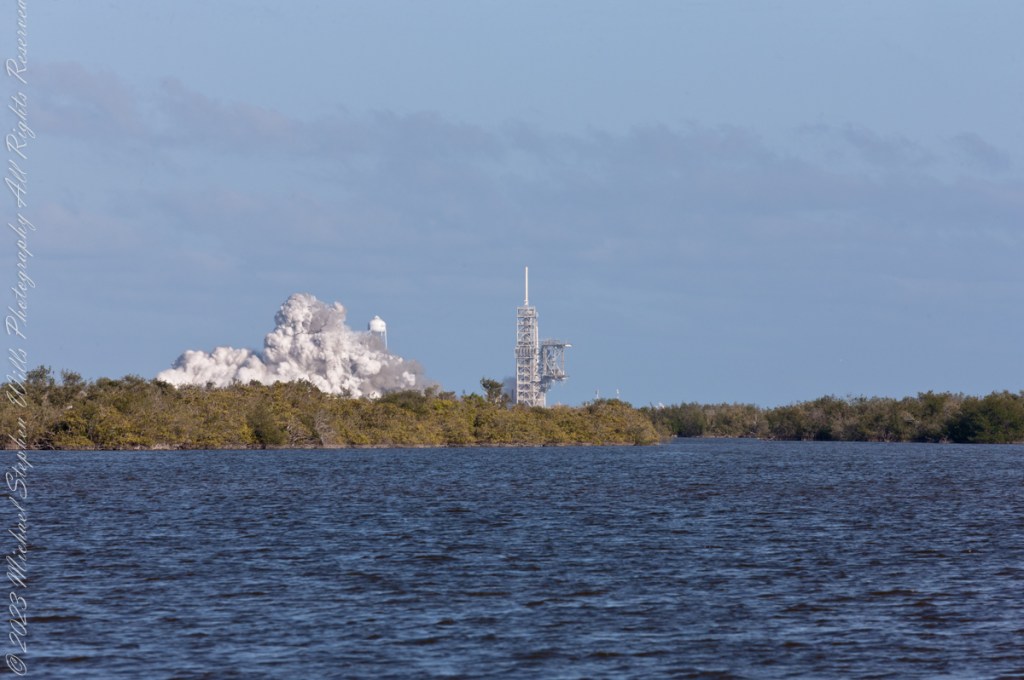
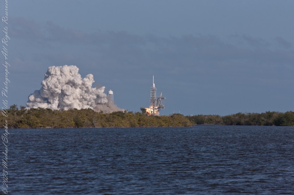
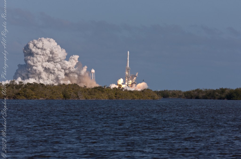
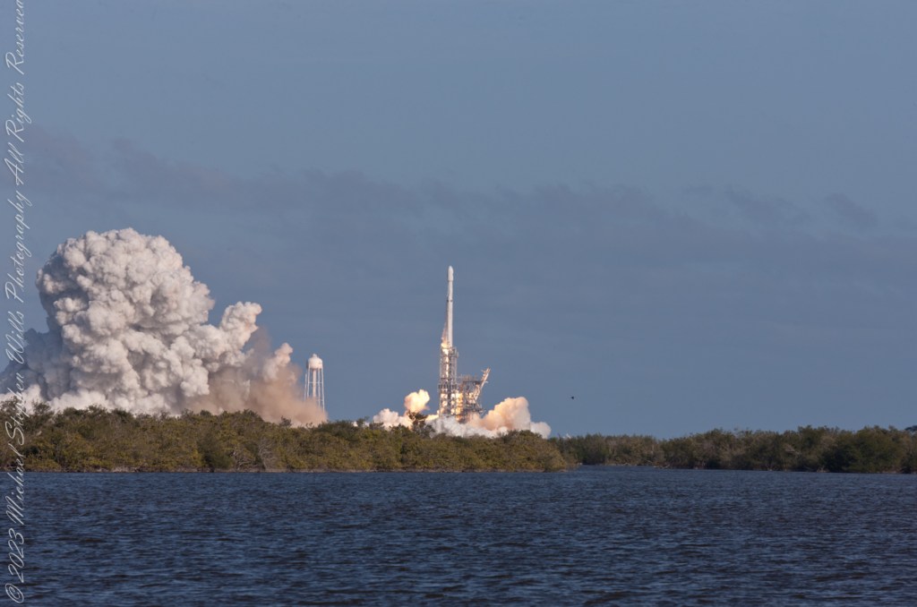
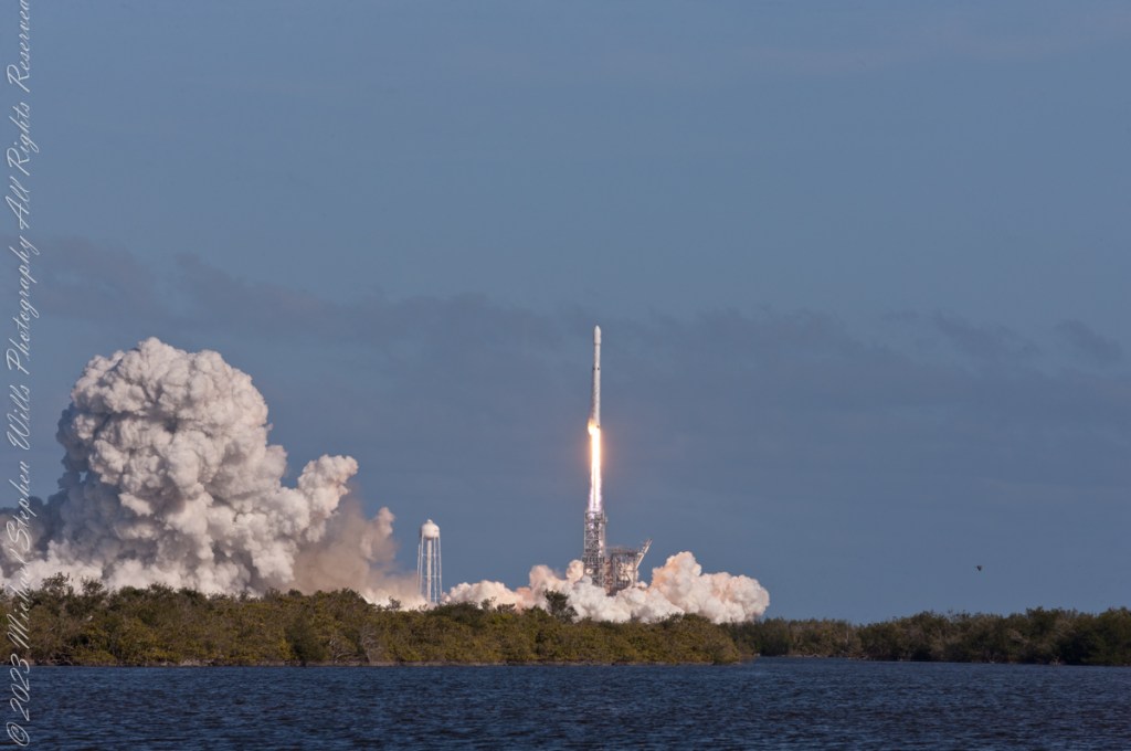
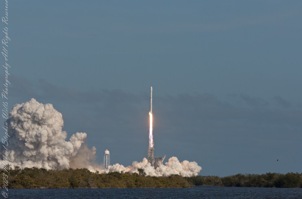
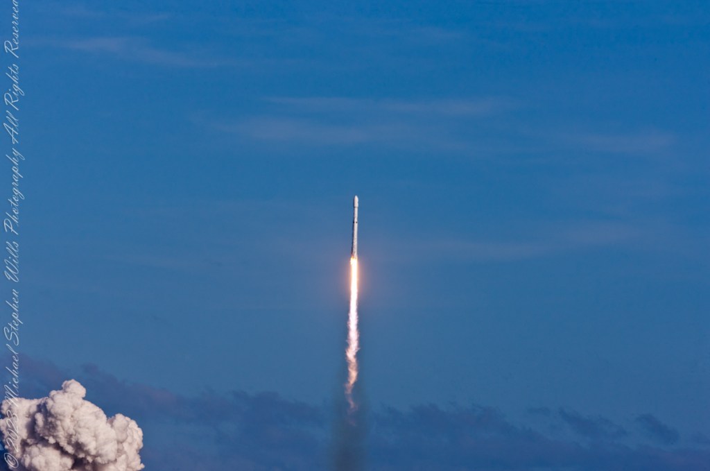
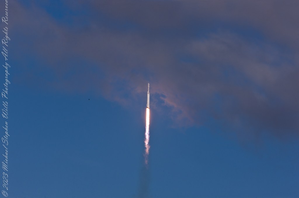
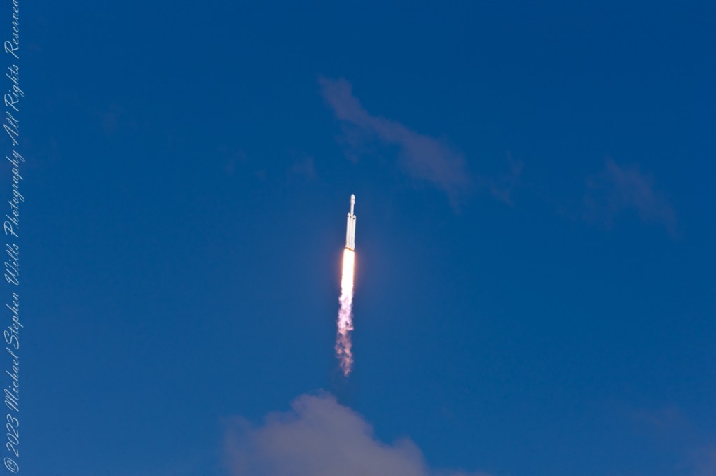
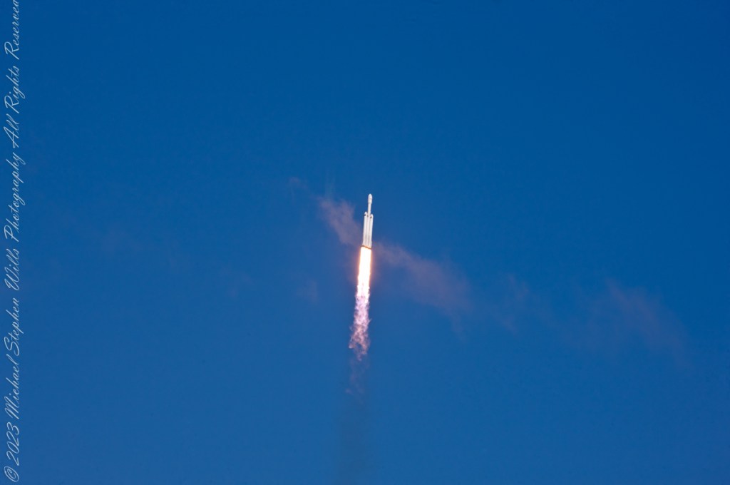
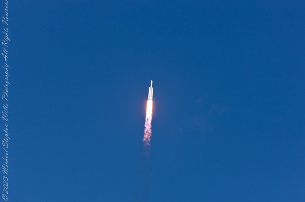
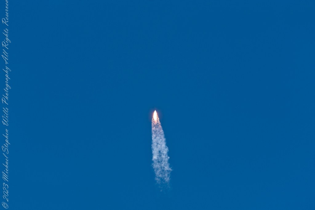
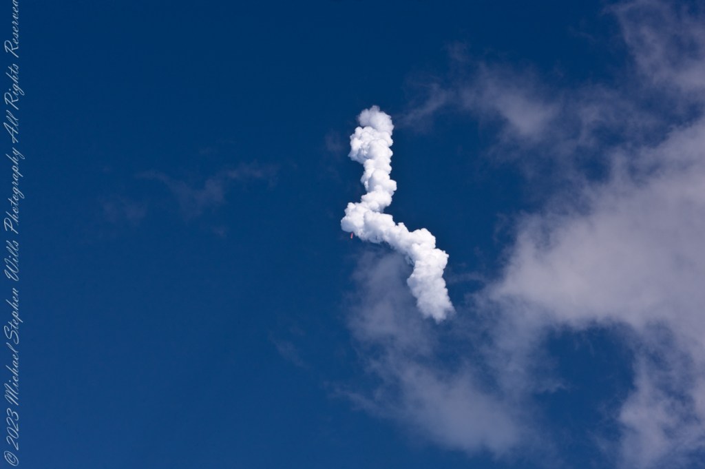
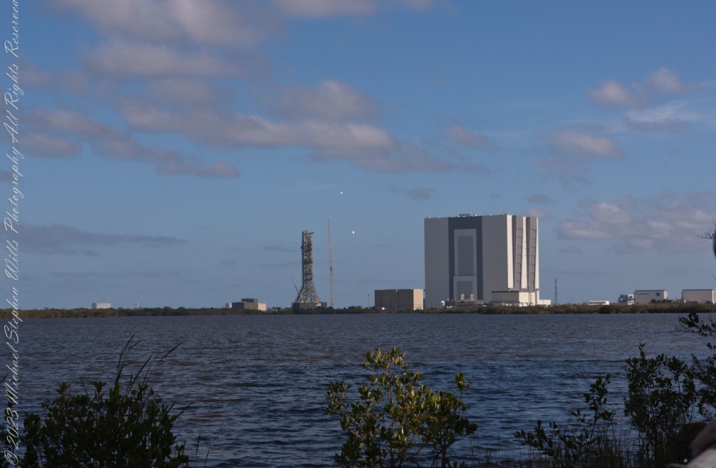
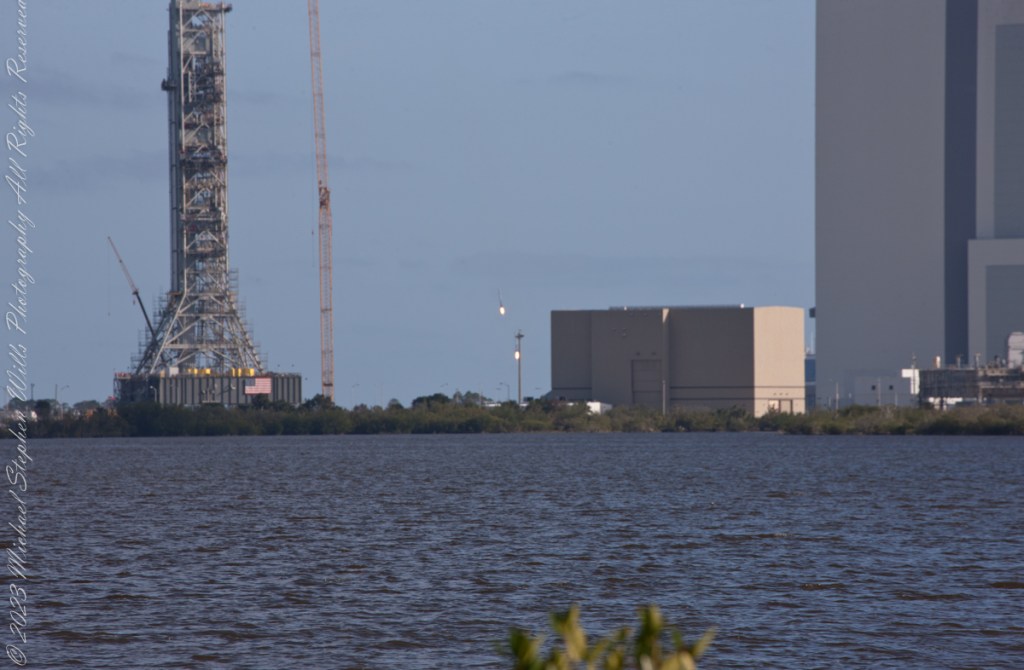
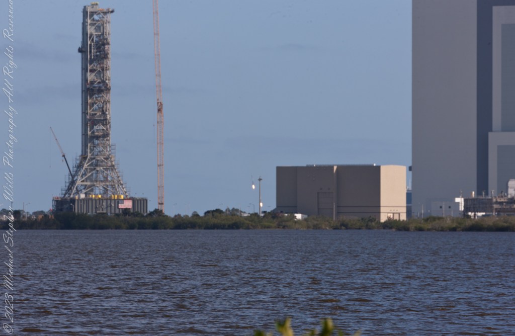
February 6, 2018 fuel venting during fueling of the Space X Falcon Heavy 19 minutes 25 seconds prior to launch. The rocket hidden by the launch tower. Taken from Kennedy Space Center Apollo-Saturn V Center looking across the Banana River to Launch Complex 39A, 3.9 miles away.Pam and Mike Wills in place at a prime spot for the SpaceX Falcon Heavy Launch. Kennedy Space Center, Apollo-Saturn V Center. February 6, 2018. 00:10:49 before launch.February 6, 2018 fuel venting, fueling complete 1 minute 20 seconds prior to launch. The rocket hidden by the launch tower. Taken from Kennedy Space Center Apollo-Saturn V Center looking across the Banana River to Launch Complex 39A, 3.9 miles away.February 6, 2018 Space X Falcon Heavy, 3 seconds prior to launch. The rocket hidden by the launch tower. The cloud is water released into the launch platform under pressure from the water tower. Taken from Kennedy Space Center Apollo-Saturn V Center looking across the Banana River to Launch Complex 39A, 3.9 miles away.February 6, 2018 Space X Falcon Heavy, launch 2 seconds prior to launch. The rocket hidden by the launch tower. The cloud is water released into the launch platform under pressure from the water tower. Taken from Kennedy Space Center Apollo-Saturn V Center loking across the Banana River to Launch Complex 39A, 3.9 miles away.February 6, 2018 Space X Falcon Heavy engine ignition. The moment of engine ignition, the rocket hidden by the launch tower. Taken from Kennedy Space Center Apollo-Saturn V Center loking across the Banana River to Launch Complex 39A, 3.9 miles away.February 6, 2018 Space X Falcon Heavy, launch plus 1 second. Ignition visible, tower connections falling away. Rocket nose visible to right of tower lightening rod. Taken from Kennedy Space Center Apollo-Saturn V Center loking across the Banana River to Launch Complex 39A, 3.9 miles away.February 6, 2018 Space X Falcon Heavy, launch plus 2 seconds. Rocket lift-off fully underway. Taken from Kennedy Space Center Apollo-Saturn V Center looking across the Banana River to Launch Complex 39A, 3.9 miles away.February 6, 2018 Space X Falcon Heavy, launch plus 4 seconds. Rocket not yet clear of launch tower. Taken from Kennedy Space Center Apollo-Saturn V Center looking across the Banana River to Launch Complex 39A, 3.9 miles away.February 6, 2018 Space X Falcon Heavy, launch plus 5 seconds. A heron flies to the right of launch tower. Taken from Kennedy Space Center Apollo-Saturn V Center looking across the Banana River to Launch Complex 39A, 3.9 miles away.February 6, 2018 Space X Falcon Heavy, launch plus 6 seconds. Rocket is just clear of launch tower. At 230 feet in 6 seconds it is travelling at 26.1 miles per hour. A heron flies to right of launch tower. Taken from Kennedy Space Center Apollo-Saturn V Center looking across the Banana River to Launch Complex 39A, 3.9 miles away.February 6, 2018 Space X Falcon Heavy, launch plus 7 seconds. Rocket is clear of the launch tower. Taken from Kennedy Space Center Apollo-Saturn V Center looking across the Banana River to Launch Complex 39A, 3.9 miles away.February 6, 2018 Space X Falcon Heavy, launch plus 7 seconds. Taken from Kennedy Space Center Apollo-Saturn V Center looking across the Banana River to Launch Complex 39A, 3.9 miles away.February 6, 2018 Space X Falcon Heavy, launch plus 8 seconds. Taken from Kennedy Space Center Apollo-Saturn V Center looking across the Banana River to Launch Complex 39A, 3.9 miles away.February 6, 2018 Space X Falcon Heavy, launch plus 9 seconds. Taken from Kennedy Space Center Apollo-Saturn V Center looking across the Banana River to Launch Complex 39A, 3.9 miles away.February 6, 2018 Space X Falcon Heavy, launch plus 12 seconds. Taken from Kennedy Space Center Apollo-Saturn V Center.February 6, 2018 Space X Falcon Heavy, launch plus 20 seconds. The rocket has rolled a few degrees, all boosters are visible. The Taken from Kennedy Space Center Apollo-Saturn V Center.February 6, 2018 Space X Falcon Heavy, launch plus 25 seconds. All boosters are visible. Taken from Kennedy Space Center Apollo-Saturn V Center.February 6, 2018 Space X Falcon Heavy, launch plus 26 seconds. All boosters are visible. Taken from Kennedy Space Center Apollo-Saturn V Center.February 6, 2018 Space X Falcon Heavy, launch plus 32 seconds. A boosters are visible. Taken from Kennedy Space Center Apollo-Saturn V Center.February 6, 2018 Space X Falcon Heavy, launch plus 1 minute 11 seconds. The boosters have throttled back. Taken from Kennedy Space Center Apollo-Saturn V Center.February 6, 2018 Space X Falcon Heavy, launch plus 1 minute 57 seconds. The cloud was formed from the throttled back boosters. The rocket is visible near center of frame. Taken from Kennedy Space Center Apollo-Saturn V Center.February 6, 2018 Space X Falcon Heavy, launch plus 6 minutes 37 seconds. Firing thrusterrs of the two returning boosters are visible a bit above the center of frame. Taken from Kennedy Space Center Apollo-Saturn V Center.February 6, 2018 Space X Falcon Heavy, launch plus 7 minutes 50 seconds. Both boosters visible firing thrusters between the SLS Launch Tower and NASA Vehicle Assembly Building. Taken from Kennedy Space Center Apollo-Saturn V Center loking across the Banana River.February 6, 2018 Space X Falcon Heavy, launch plus 8 minutes 2 seconds. Both boosters visible firing thrusters between the SLS Launch Tower and NASA Vehicle Assembly Building. Taken from Kennedy Space Center Apollo-Saturn V Center loking across the Banana River.February 6, 2018 Space X Falcon Heavy, launch plus 8 minutes 3 seconds. Both boosters visible firing thrusters between the SLS Launch Tower and NASA Vehicle Assembly Building. Taken from Kennedy Space Center Apollo-Saturn V Center loking across the Banana River.
“Falcon Heavy was designed to be able to carry humans into space beyond low Earth orbit, although as of February 2018, SpaceX does not intend to transport people on Falcon Heavy, nor pursue the human-rating certification process to transport NASA astronauts. Both Falcon Heavy and Falcon 9 are expected to eventually be superseded by the Starship launch system, currently being developed.“
“On 6 February 2018, after a delay of over two hours due to high winds, Falcon Heavy lifted off at 20:45 UTC. Its side boosters landed safely on Landing Zones 1 and 2 a few minutes later. However, only one of the three engines on the center booster that were intended to restart ignited during descent, causing the booster to be destroyed upon impacting the ocean at a speed of over 480 km/h (300 mph).“
“Initially, Elon Musk tweeted that the Roadster had overshot its planned heliocentric orbit, and would reach the asteroid belt. Later, observations by telescopes showed that the Roadster would only slightly exceed the orbit of Mars at aphelion.“
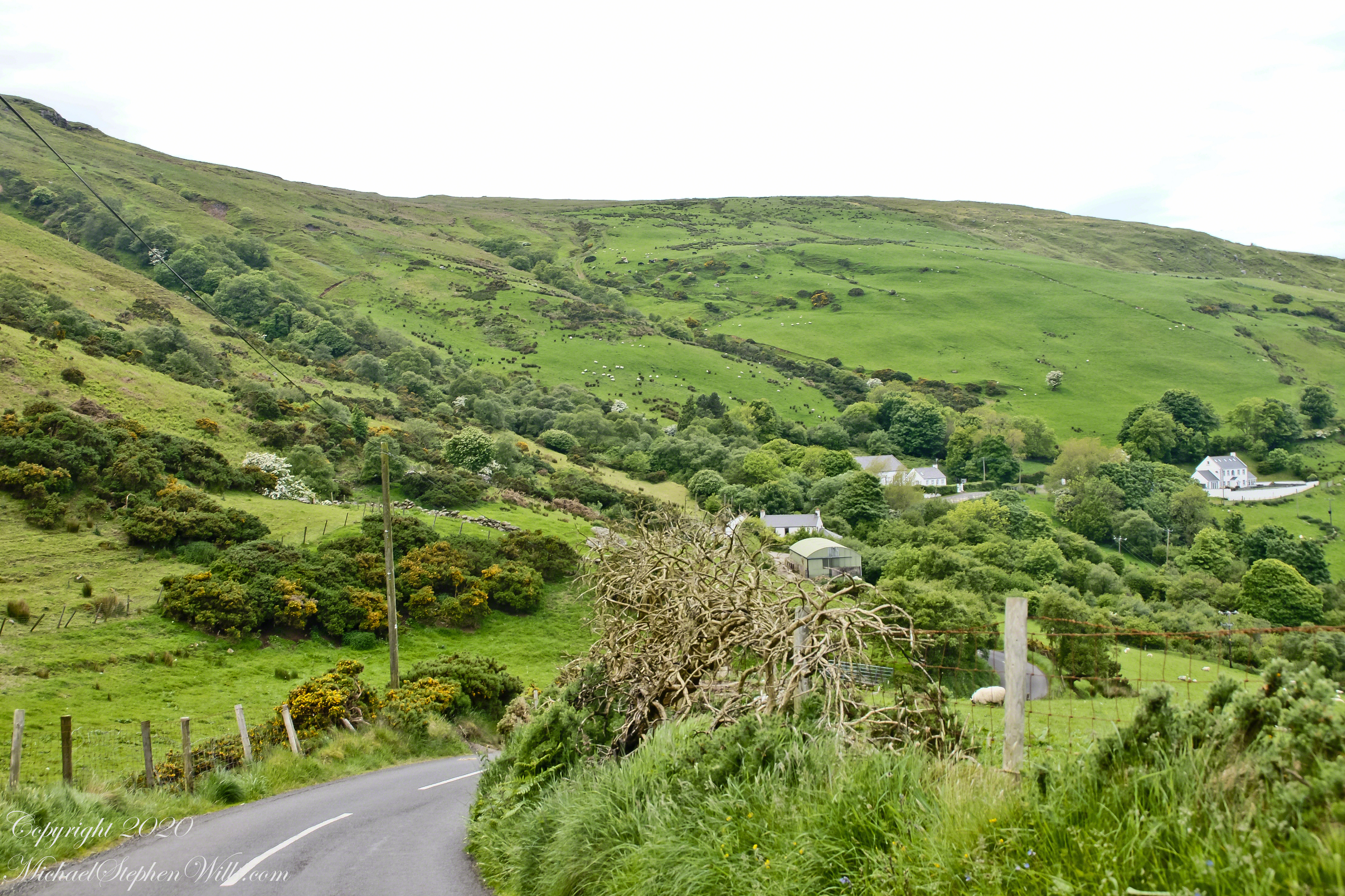
This photograph from the bottom of the Torr Road hill takes in Coolranny Townland. a slice of land running from the ridge to Loughan Bay. We see a number of hawthorne trees in flower, yellow flowering Whin Bush, houses and the Roman Catholic church Saint Mary’s Star of the Sea.
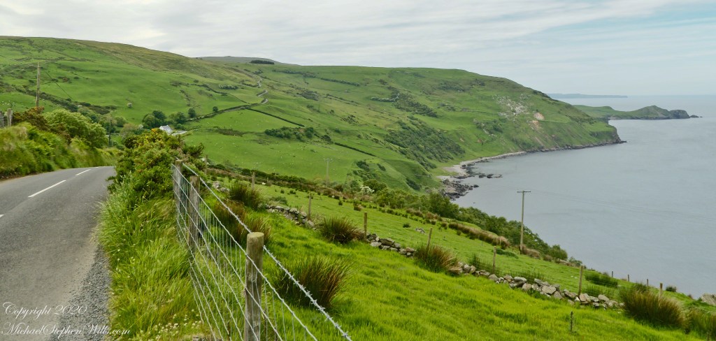
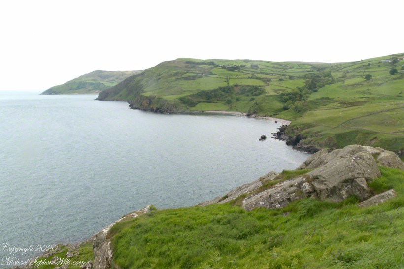
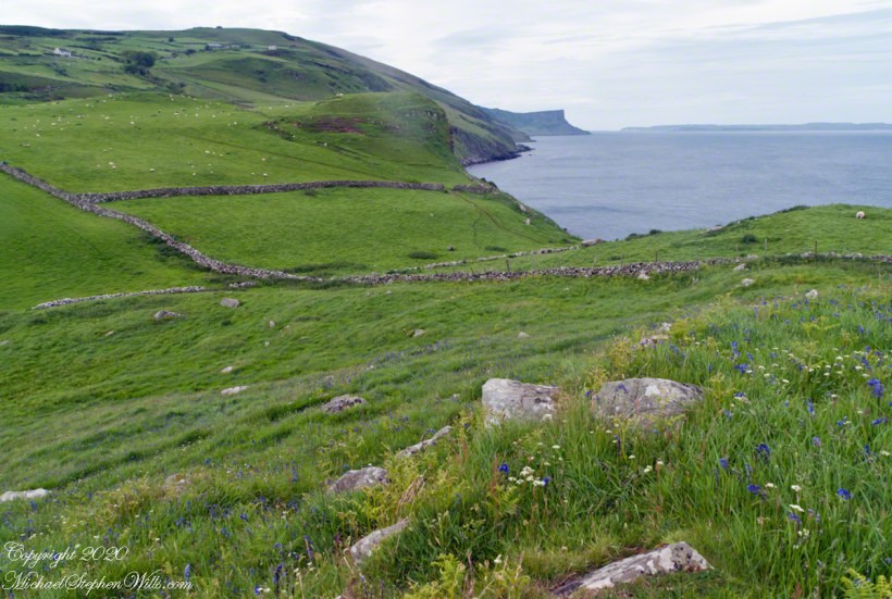
Tor in Irish is a steep rocky height. Likewise, Corr means odd, uneven, rounder, convex, curved, peaked, projecting, smooth. Combined Torcorr is the townland where we stopped on the Torr Road, halted by our wonder at this sight. In the distance, Torr Head projects into North Channel, the closest land to Scotland. Following the coast, the cliffs in front of Torr Head is home to numerous sea birds. The curved bay is named Loughan, the rocky sand beach are ruins of cottages emptied by Irish emigration. The white building is Saint Mary’s Star of the Sea Roman Catholic Church. County Antrim, Northern Ireland.
View of Coolranny townland with Saint Mary’s Star of the Sean Roman Catholic Church from Torcorr townland, Torr Road . County Antrim, Northern Ireland.
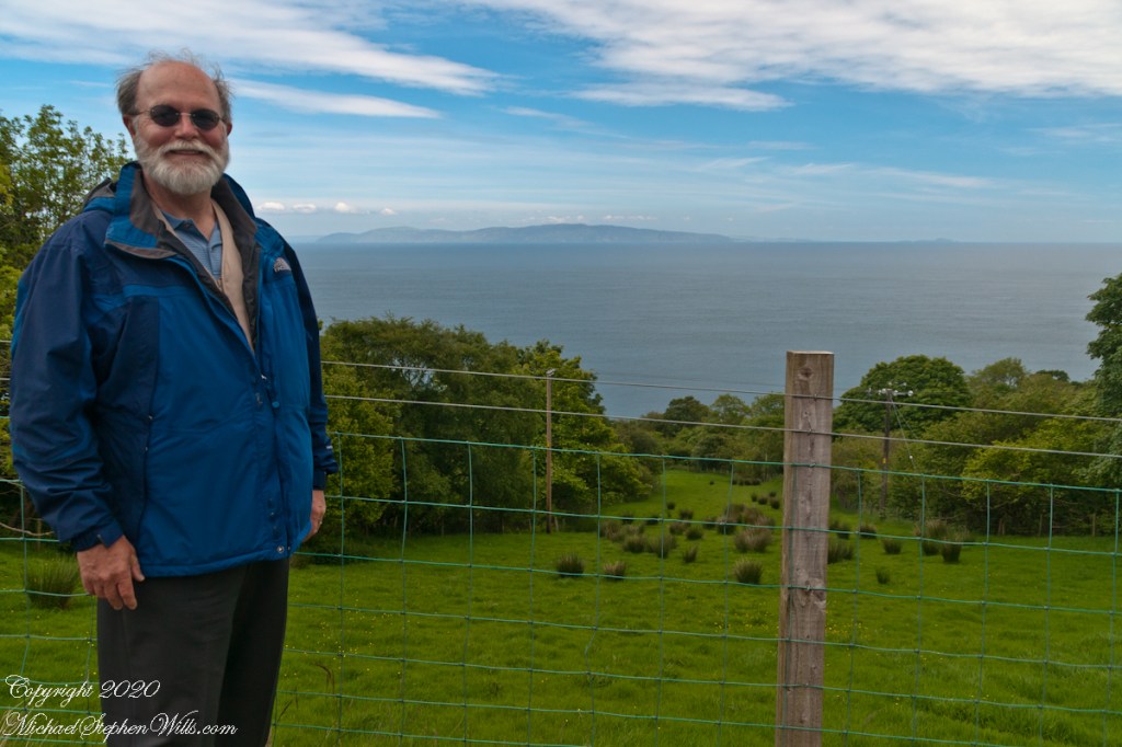
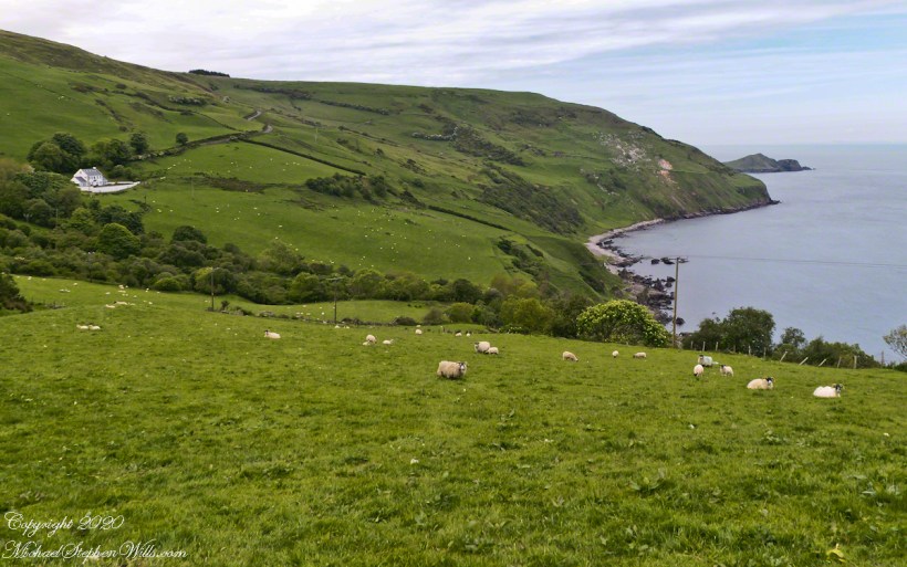
The photograph of the header, taken by Pam, is from either Coolranny or Loughan Townland, looking across a sheep pasture, the North Channel of the Irish Sea toward the Mull of Kintyre, Scotland just twelve miles distant.
Here is a slideshow of this post’s images. To visit from WordPress Reader, you need to first click the title of this post to open a new page.
Tor in Irish is a steep rocky height. Likewise, Corr means odd, uneven, rounder, convex, curved, peaked, projecting, smooth. Combined Torcorr is the townland where we stopped on the Torr Road, halted by our wonder at this sight. In the distance, Torr Head projects into North Channel, the closest land to Scotland. Following the coast, the cliffs in front of Torr Head is home to numerous sea birds. The curved bay is named Loughan, the rocky sand beach are ruins of cottages emptied by Irish emigration. The white building is Saint Mary’s Star of the Sea Roman Catholic Church. County Antrim, Northern Ireland.View of Coolranny townland with Saint Mary’s Star of the Sean Roman Catholic Church from Torcorr townland, Torr Road . County Antrim, Northern Ireland.On the way to Torr Head we stopped at this spot in Coolranny Townland to take in this view of the Irish Sea. The land overlooks Loughan Bay toward the Mull of Kintyre and Sanda Island, Scotland. County Antrim, Northern Ireland.
Copyright 2023 All Rights Reserved Michael Stephen Wills
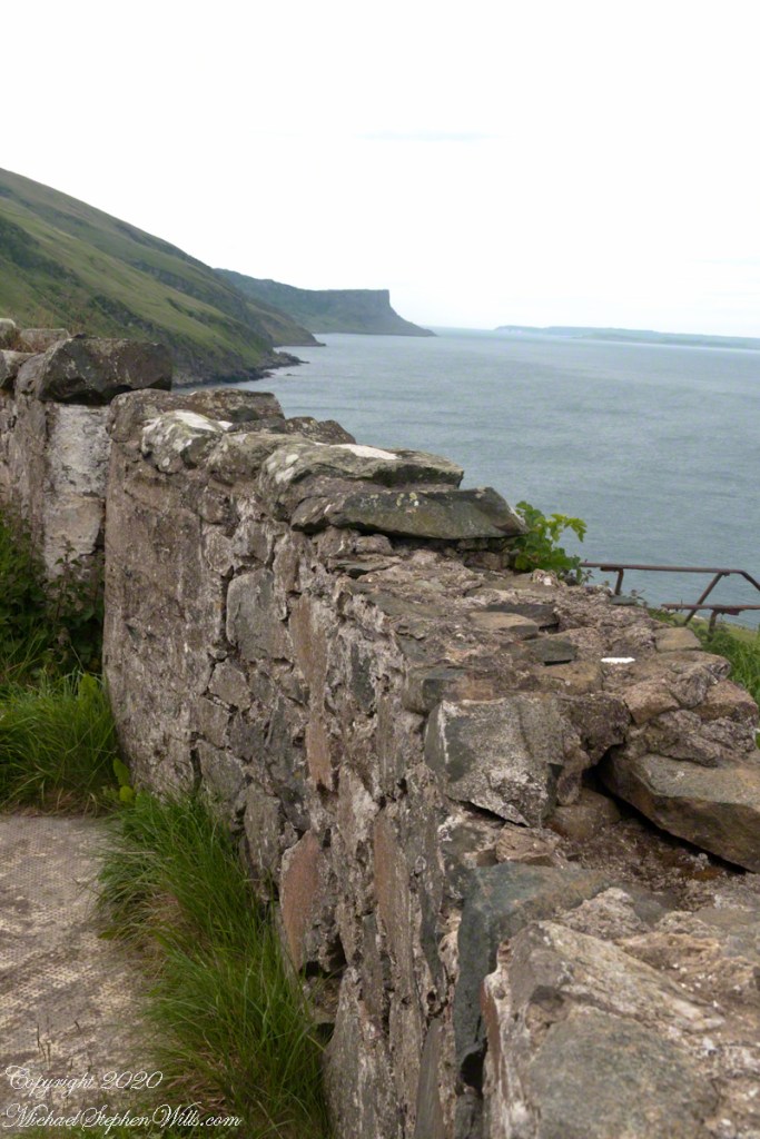
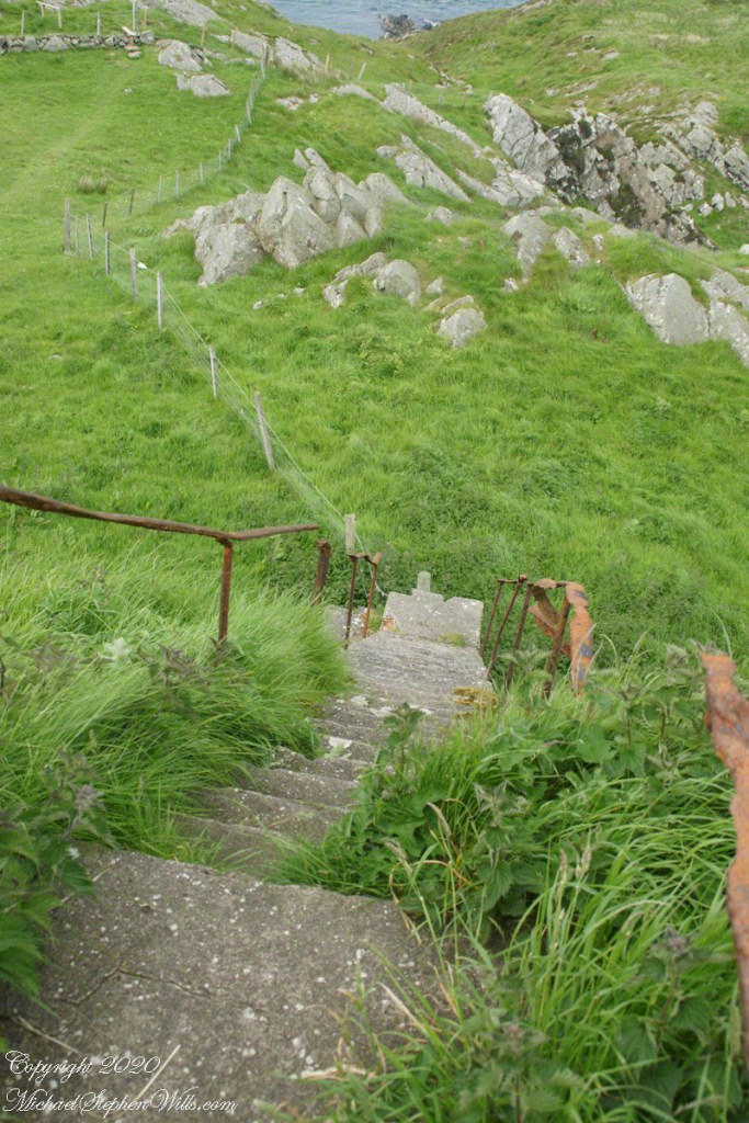
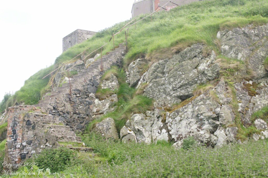
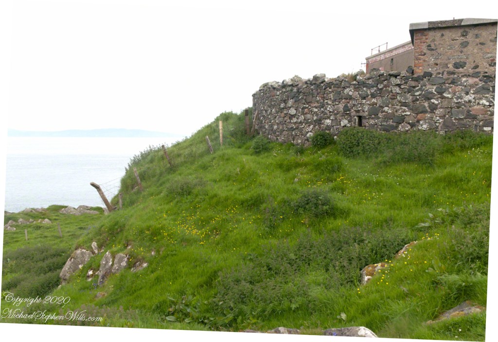
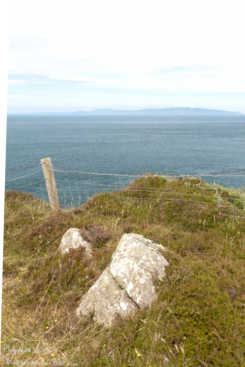
Weathered masonry at the height of Torr Head was there to serve the custom house and as support for a spotting station where ships transiting the Strait of Moyle (Irish Sruth na Maoile), the 12 miles of water to the Mull of Kintyre.
Lloyd’s of London, vitally interested in the appearance of ships’ progress crossing the oceans, had notice of passage via semaphore (and, later, Marconi’s “wireless”). Destination ports were copied in.
Scottish influences touched the landscape covered by yesterday’s post, today we continue on this subject with these south facing views from Torr Head. The far ridge of Torrcor marks Loughan Bay.
A townland on the other side of Torrcor hill (and townland) has an eponymous ruin, Altagore Cashel. Mores the pity we did not visit this site, a thick drystone enclosing wall from the 5th century (you can see photographs from another site at this link). Cashel is from the Irish Caiseal, a circular, defensive fort (“ring fort”).
Books such as “Antrim and Argyll: Some Aspects of the Connections” tell of connections over the millennia, clan associations between the islands and ring forts such as Altagore Cashel.
Argylshire Scotland across the North Channel from Torr Head
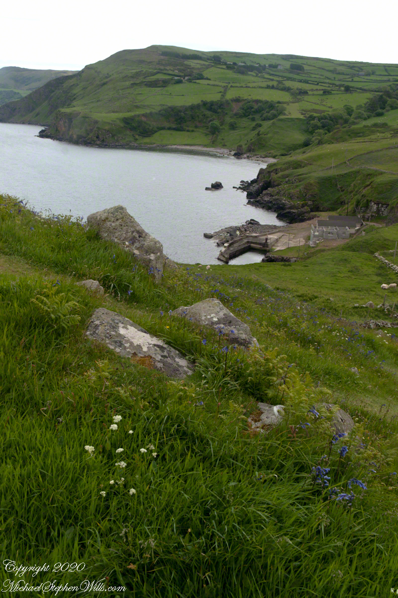
Late spring and summer, weekdays, a net is stretched across the bay to catch salmon nosing up the coast, searching for their home spawning stream, here called Altmore Burn. “Burn” is a Scottish term for a fresh water source, evidence of the influence 12 miles across the north channel.
The small harbor seen here from Torr Head is for the salmon fishery. Small boats will seek shelter here from the wind and tides strong enough to roar in passing the Head, like a fast flowing river.
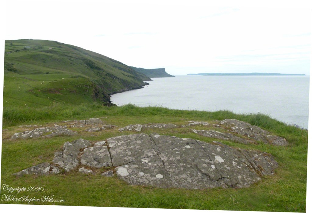
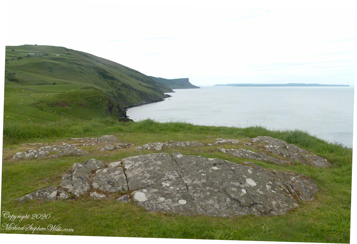
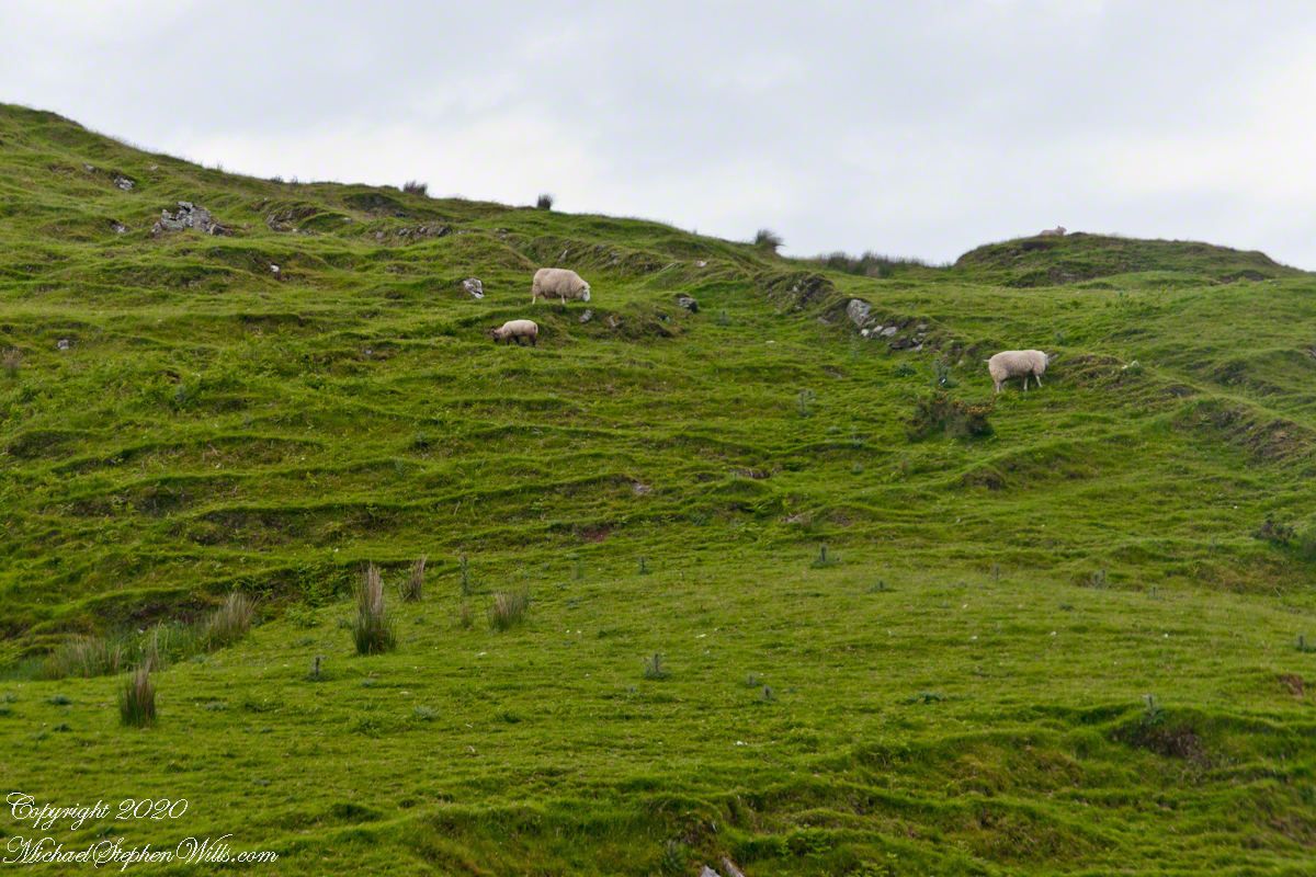
Taking in a flower meadow, foreground, coaster sheep pastures, the photograph, below, looks north from Torr Head. The high hill, midground, is Greenanmore, notable for a the largest passage tomb of the Antrim Glens. Locally known as “Barrach’s Tomb,” for the Red Branch knight of the 1st Century AD fort on Torr Head, tree ring research of the mid-20th Century dates these tombs in the neolithic The hilltop passage tomb was an ancient relic when the mortar of Barrach’s Torr Head fort was drying.
When I enlarge the original photograph, visible on the ridge is a decommissioned Cold War listening post, the tomb is near that. The distant land across the North Channel water is Rathlin Island.
Click photograph for a larger view. To do this from WordPress Reader, you need to first click the title of this post to open a new page.
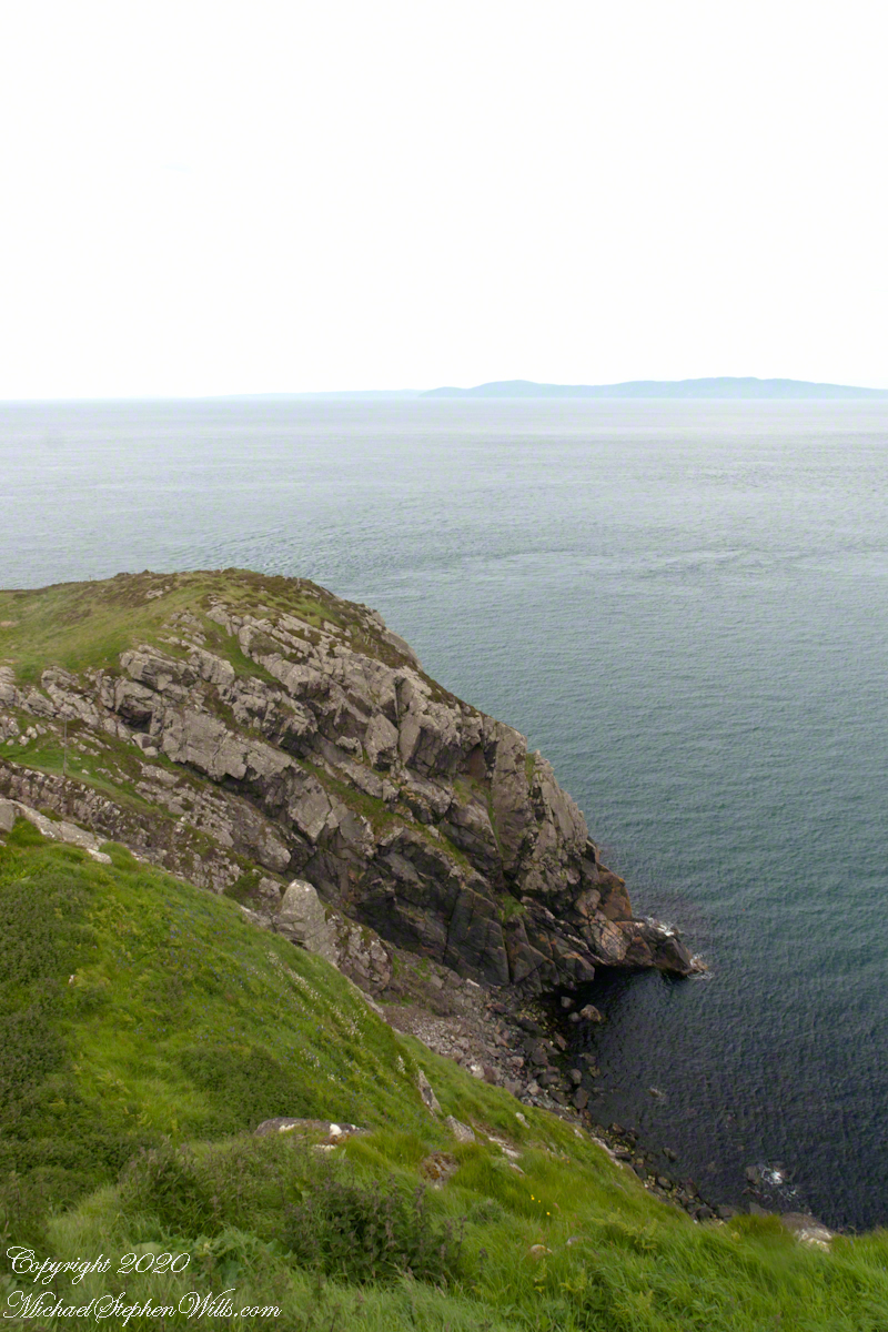
Knights of the Red Branch appear towards the end of “Deirdre and the sons of Uisneach”, a tale from 1st century AD Ireland, as protectors of the lovers Dierdre and one of the sons of Uisneach, named Naoise. The two fled to Rathlin Island, seen in the distance in the following photograph.
Distant Rathelin Island from Torr Head
From Rathlin Island they passed over the Irish Sea to Scotland where they lived happily for a term of years.
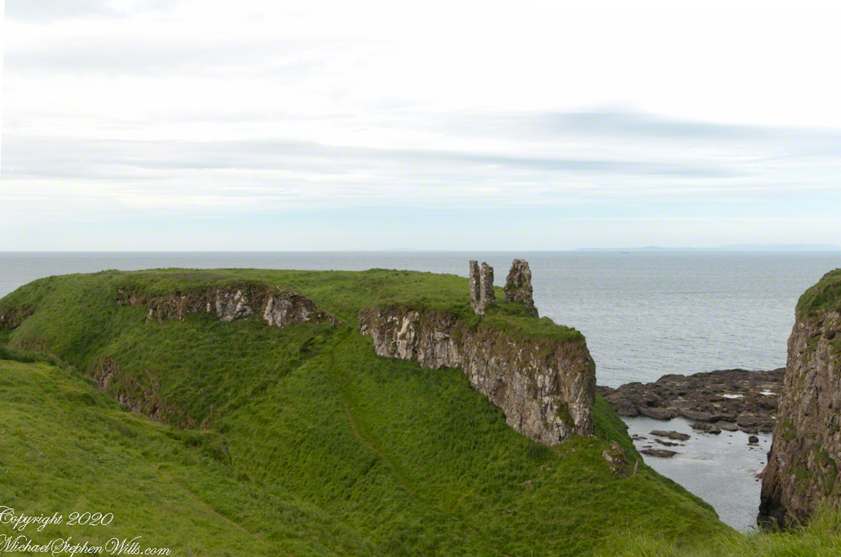
Barrach’s fort no longer exists, a Coast Guard Station was built over the site. There are other intact ruins on this picturesque coast. Here is one close to the Giant’s Causeway, Dunseverick Castle.
Dunseverick Castle
Copyright 2022 All Rights Reserved Michael Stephen Wills
Torr in Irish is a steep rocky height. Likewise, Corr means odd, uneven, rounder, convex, curved, peaked, projecting, smooth. Combined Torcorr is the townland where we stopped on the Torr Road, halted by our wonder at this sight.
In the distance, Torr Head projects into North Channel, the closest land to Scotland. Following the coast, the cliffs in front of Torr Head are home to numerous sea birds such as Fulmars (family Procellariidae) nad Oystercatchers (family Haematopodiadae). Along the rock beaches next Eider Ducks (genus Somateria). You might see the Common Buzzard (species Buto buteo).
Click photograph for a larger view. To do this from WordPress Reader, you need to first click the title of this post to open a new page.
In the following photograph Torr Head seen from immediately above. I stand on the ancient site of Barrach’s fort, a knight of the Red Branch. After some internet research I cannot find another reference to this knight, other than the information placard on Torr Head.
Copyright 2022 All Rights Reserved Michael Stephen Wills