Canyoneering to Reavis Falls

No signposts in the wilderness

Reaching Reavis Falls, once you find the canyon mouth, is three-fourths of a mile of boulder hopping and bushwacking over and around landslides, deep pools and fallen trees.  Odds are you will be the only person in the canyon for weeks, if not months.  Expect to be surprised. In this chapter you will (finally) visit the falls themselves.

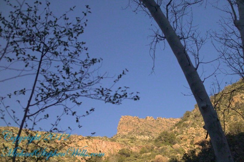
A Camp in the Canyon

Click me for the chapter about the environment around the mouth of Reavis Canyon below the falls.
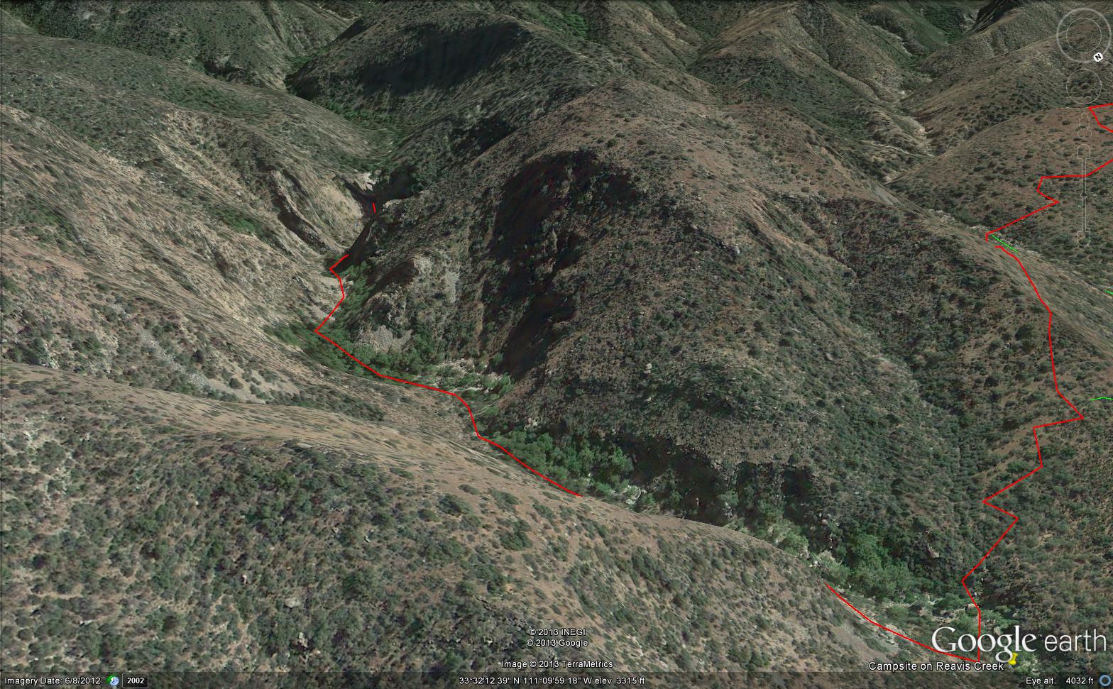
The Last Mile

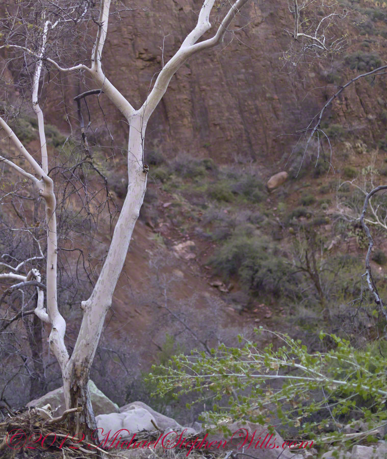
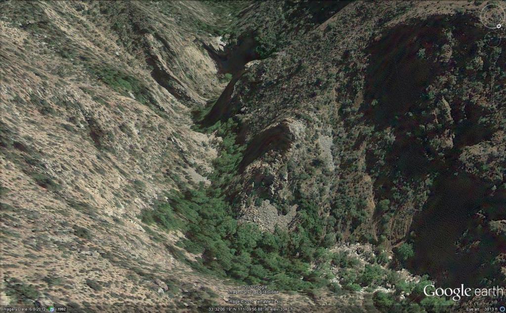
Here is an overview of the last third mile of Reavis Canyon.  You can see the wall of the falls nestled in the folds of ridges towards the top, just off center.

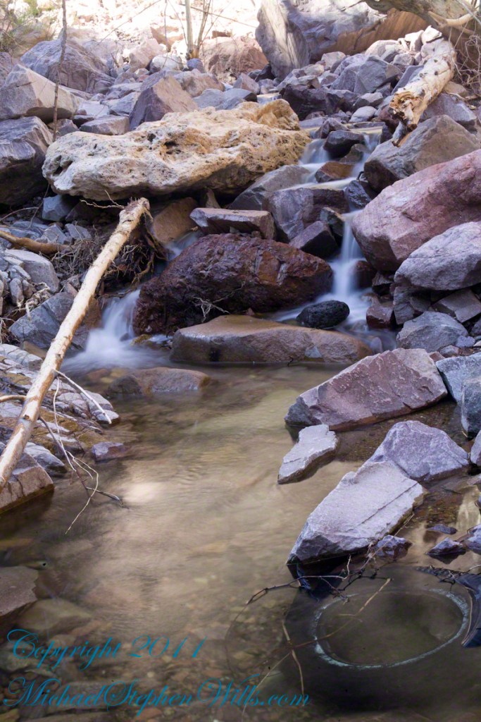
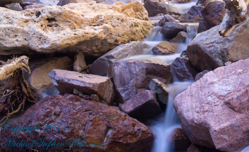
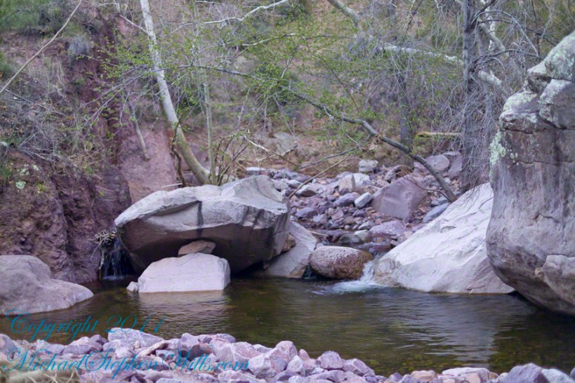
On the lower right is a large landslide and, below there, it is complete chaos.

The vegetation grows shoulder to shoulder with interleaved branches.  You will not get through there.  The solution is to find a way around, usually over and around house-sized boulders.

The image was captured from Google Earth


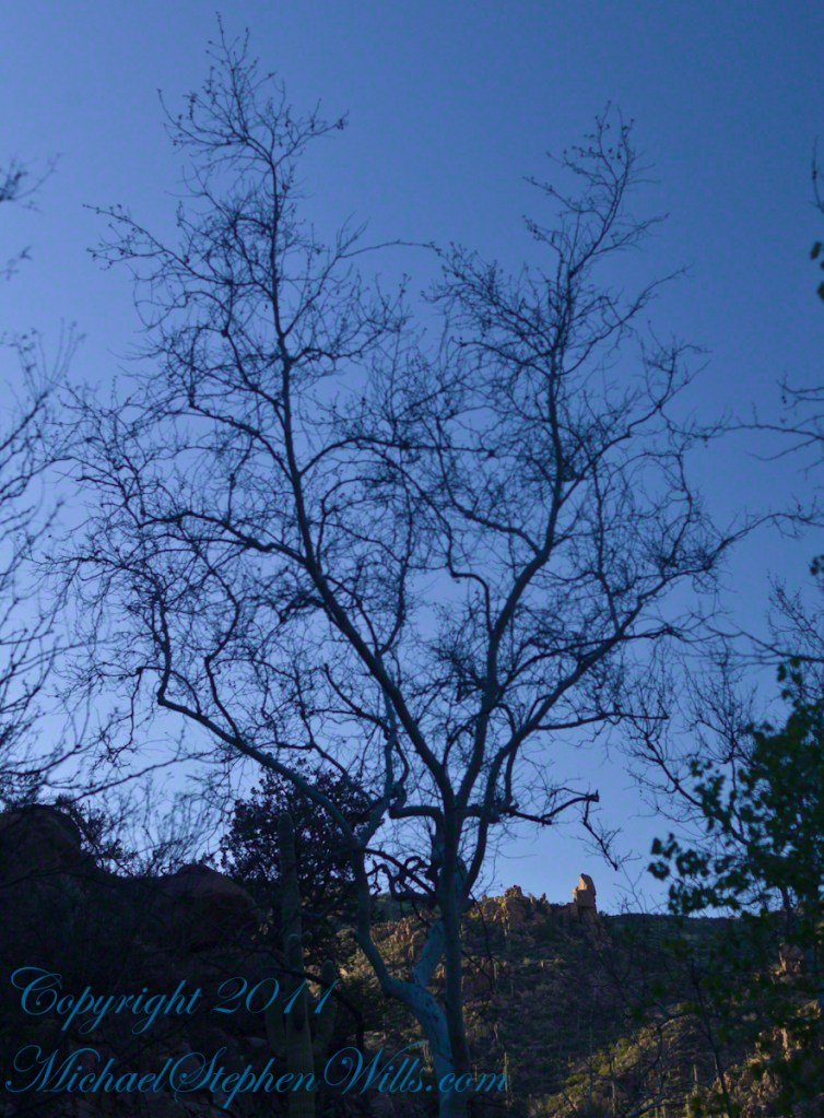
After almost two hours of picking my way, there was a flicker of light.  The fall waters were sparkling in the sunlight high above the cottonwood trees, in full Mach bloom, and the still leafless Arizona Sycamores.

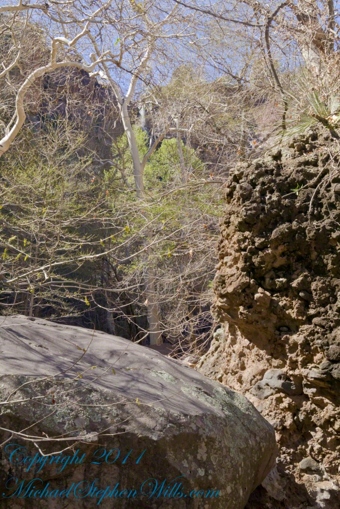
This was my view of Reavis Falls from the canyon on a March day before the Arizona Sycamores have leaved. The falls are the tiny patch of white to the left of midline where the earth meets the sky. Jumbles of infallen boulders and thick growth of sycamores, oaks and fully leaved cottonwoods cloak the falls.

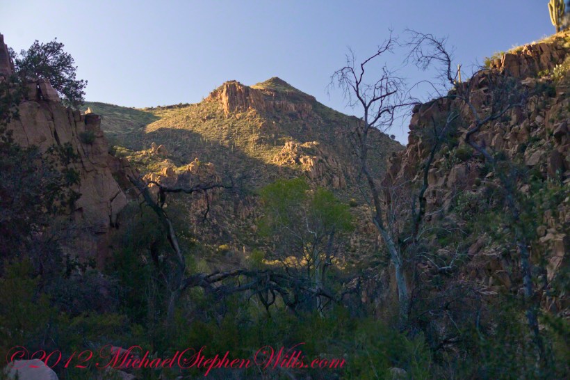
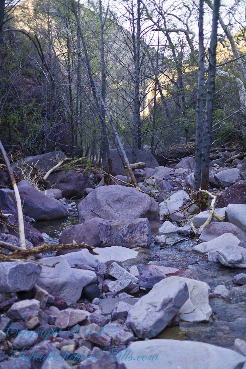
Another 30 minutes of canyoneering brought me to the foot of the falls.

At the Foot of Reavis Falls

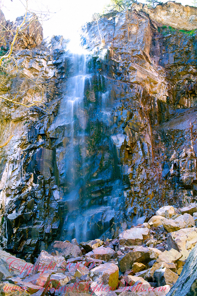
Looking up at Reavis Falls from a 20 foot tall mound of talus.

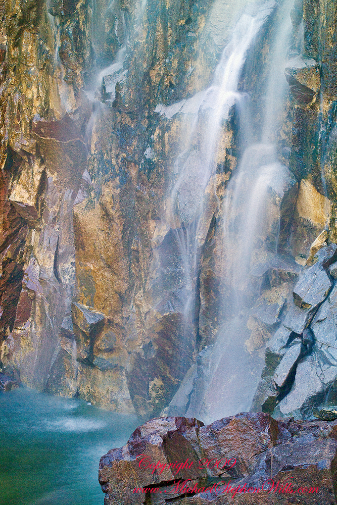
These are boulders  washed down at flood time.

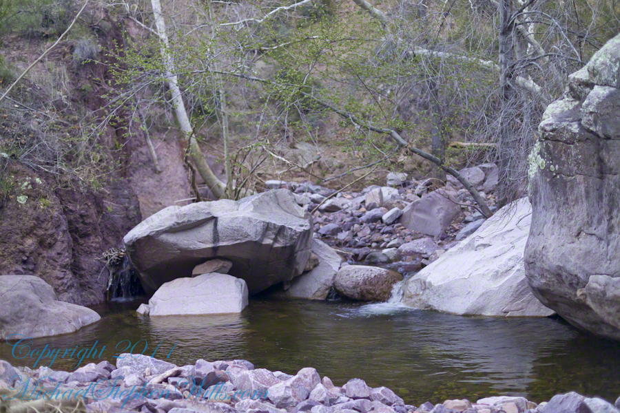
The rock wall is thick with microorganisms, fungi and mosses.

After clambering around the talus pile I found this angle….

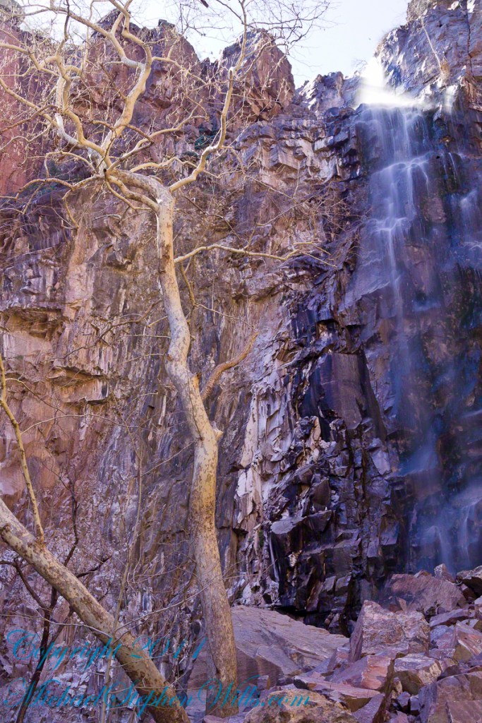
An Arizona Sycamore, before the spring leafing, at the Foot of Reavis Falls

Talus at the Foot of Reavis Falls

The Reavis Falls talus is large boulders carried down Reavis Creek and washed over the falls at flood time as well as blocks fractured from the cliff face.  You can see the base of the Sycamore from the previous photograph.

The falls are formed where Reavis Creek flows over a solid mass of rock.  The talus is composed mostly of this red rock.  From the edge of this cliff to the base, where the falls hit the canyon floor, is all of 140 feet.  This is a far as you can proceed into the canyon without some serious climbing skills.

It is possible to climb around the canyon by climbing up the ridge from which I captured the Cedar Basin Hoodoos.  See my posts below for this location (you need to work it our for yourself).

This is NOT the last post of the series.  From here I will focus on the beauty of Reavis Falls and the canyon that holds them.

It was a four-day expedition so there are a few chapters covering the approach to the Falls:

Lime Mountain Morning

Two Bar Mountain View

Evening on Two Bar Mountain

Among the desert wildflowers

Superstition Wilderness Dawn

Dry Juniper Descent

Hoodoos on the Descent to Reavis Falls

Cedar Basin Hoodoos

Reavis Canyon Camp

Reavis Canyon Rivulets and Rocks

Copyright 2023 Michael Stephen Wills All Rights Reserved

Reavis Canyon Rivulets and Rocks

Canyon of Wonder and Beauty

Born from Eruption and Flood

The Superstition Wilderness was born from volcanic eruption and in some places (Peters Mesa) the earth still rumbles.

Here in Reavis Canyon it is the huge spring runoff that builds the environment, grinding and scouring the canyon. In my chapter The Mouth of Reavis Canyon is the story of this aspect of the canyon.

The history of this spot is written on these volcanic and igneous rocks and boulders, the uprooted tree roots and fresh water.

The tire must have washed down from Reavis Ranch.

A Canyon of Wonder and Beauty

In this chapter I present, in the header, the lovely dawn sky of that day, and a tiny corner of a rock jumble in Reavis Creek.   There is a large format version of the sky in my previous post, “The Mouth of Reavis Canyon.”

Rivulets and Rocks

Copyright 2023 Michael Stephen Wills All Rights Reserved

The Mouth of Reavis Canyon

Canyon Hazards and Beauty

In this chapter we enter the Mouth of Reavis Canyon below Reavis Falls and examine the beauty and danger of this remote canyon.

See Reavis Canyon Camp for more of my expedition to Reavis Falls.

Dawn on the day I entered Reavis Canyon

Dawn light above the outline of the prominent cliff above Reavis Canyon and Falls the morning of my last day in the canyon.

You might recognize the outline of this cliff from the chapter  Two Bar Mountain View or Evening on Two Bar Mountain.

Here is the same view, in daylight. As I hiked toward the canyon mouth below Reavis Falls, looking up I saw this prominant cliff against the sky.

Here is the path I took toward the falls.  The campsite is to the lower right, the falls are toward the center and left.  My approach to the camp is on the right, moving toward the top.  For another view of this location see Reavis Canyon Camp.

The mouth of Reavis Canyon below the falls is choked with vegetation and infallen rocks and boulders.  The far slopes are thick with the poles of young saguaros. There are hoodoos, as well.  In the photograph, below, one hoodoo is catching morning light.  See the chapters Hoodoos on the Descent to Reavis Falls and Cedar Basin Hoodoos for more views of the hoodoos around Reavis Falls.

Hoodoos visible from the mouth of Reavis Canyon below the falls. Look toward the far slope.

Flood damage in Reavis Canyon below the falls. Note the scouring at the base of these trees and the broken limbs. This is NOT a place to be in spring thaw.

Massive spring flooding scours the canyon floor.

Flood damage in Reavis Canyon below the falls.

There is beauty to be found, as well. Freshly fallen rough rocks contrast with water smoothed boulders and the water surface.

Copyright 2023 Michael Stephen Wills All Rights Reserved

Cagey Character

On a splayed perch

A Great Blue Heron spotted from Bear Trail during a family hike, perched on a splayed root of a tree undercut by flooding, fallen into Buttermilk Creek bed.

A heron recurves its long neck while perched. Adult herons have few natural predators and are rarely preyed upon due to their large size and sharp beak, but bald eagles (Haliaeetus leucocephalus) are known to attack great blue herons at every stage of their lifecycle from in the egg to adulthood.

Copyright 2023 Michael Stephen Wills All Rights Reserved

Overwhelmed by Driftwood

Fishing with chaos

Treman lake is formed by a dam on Buttermilk Creek, the trail around the lake is less frequented and popular with the locals, climbing up and down the glacially formed hills.  Some popular resorts maintain trails that feed into the park.

A footbridge framed by hemlock trees traverses Buttermilk Creek where the East and West Treman Lake Trails meet. This season, 2019, this bridge was overwhelmed by driftwood piled up by spring flooding, impassable. We pick our way across the creek bed and over the water. Little ones needed a carry. An adult fisherman, to right of driftwood, provides perspective.

August 20129, Buttermilk Falls New York State Park, Ithaca, Tompkins County, New York.

Copyright 2023 Michael Stephen Wills All Rights Reserved