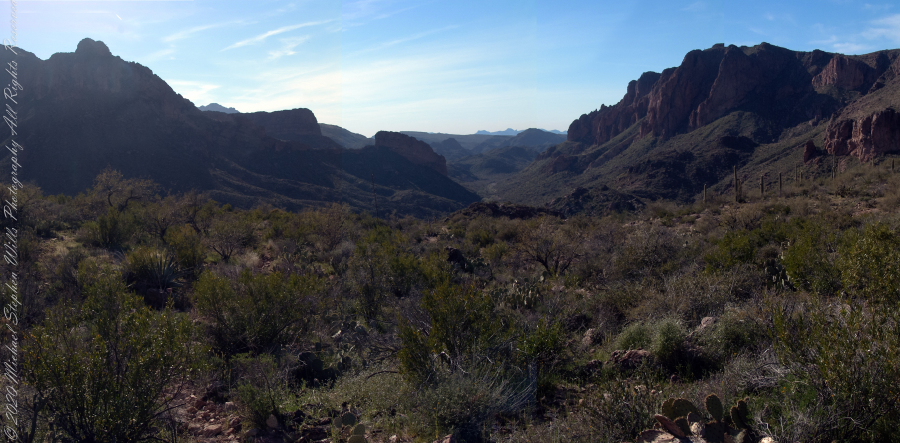
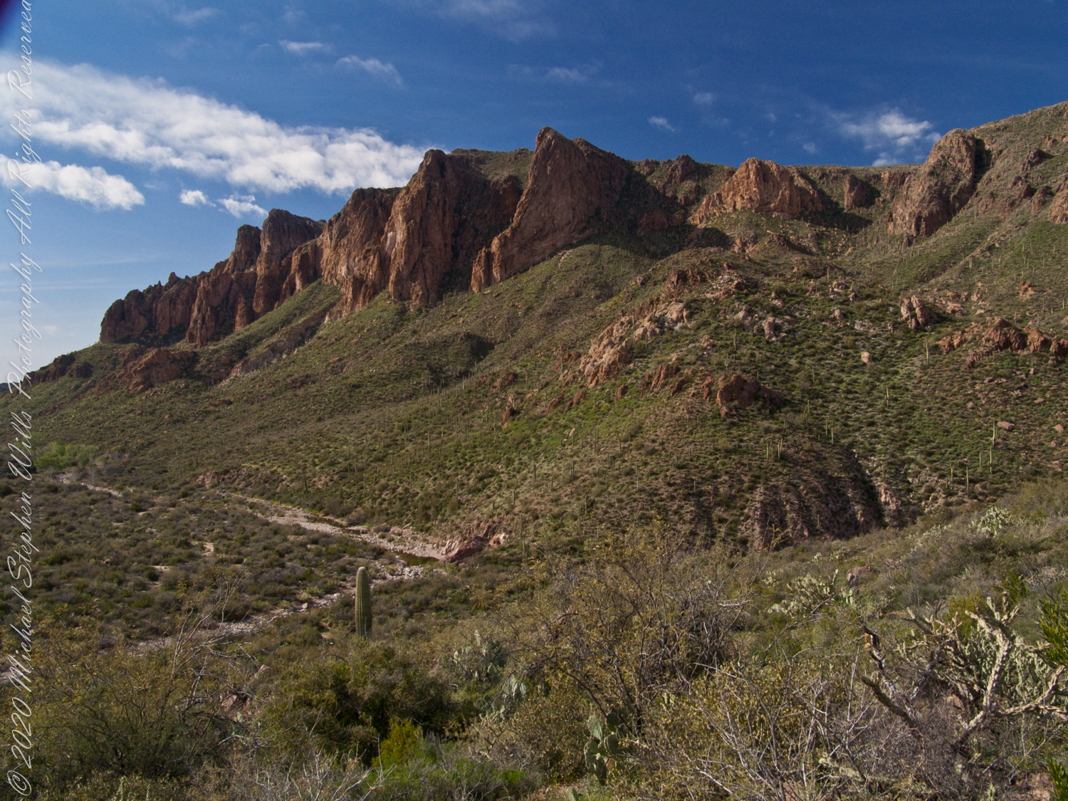
View North / Northwest from Peter’s Mesa. At our feet is a mature Saguaro Cactus towering over Charlebois Canyon, to the right Black Mountain. Bluff Spring Mountain, middle distance, then Black Top Mesa. Flatiron Peak, of the famed Superstition Mountain, is in distance. Photographed from Peter’s Trail on a March afternoon 2008. Superstition Wilderness, Tonto National Forest, Arizona
Bluff Spring Mountain, middle distance, then Black Top Mesa. Flatiron Peak, of the famed Superstition Mountain, is in distance. Photographed from Peter’s Trail on a March afternoon 2008. Superstition Wilderness, Tonto National Forest, Arizona
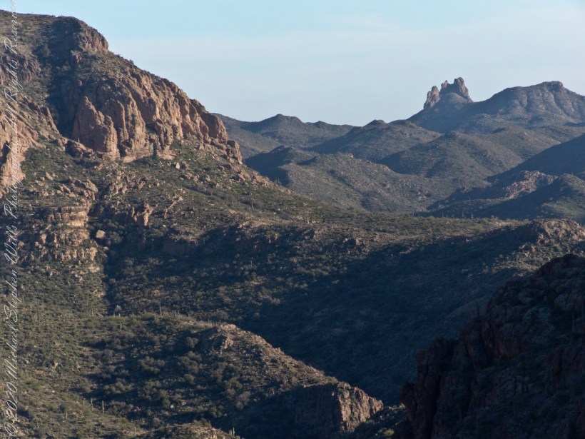
The eye of Miner’s Needle is clear in both these South / Southeast views from Peter’s Mesa looking across the Music Canyon.
Morning
Many wildflowers, sprinkled like stars through the foreground of the morning photograph with Prickly Pear, Cholla and Saguaro cactus. Beware of “Jumping Cholla”, named for its seeming ability to attack passers-by. Another name, “Hanging Chain Cholla”, is more appropriate. Each chain with many hooked barbs is lightly attached to the branch, ready to snag a ride from unwary hikers.
Light rakes across the landscape in the evening photograph, taken from another vantage point on Peter’s Mesa. Miner’s Needle is four (4) miles away “as the crow flies,” i.e., line of sight distance.
View North / Northwest from Peter’s Trail looking back the way we came. Black Mountain on right, Bluff Spring Mountain left with LaBarge Canyon running to the Red Hills center. On a March afternoon 2008.
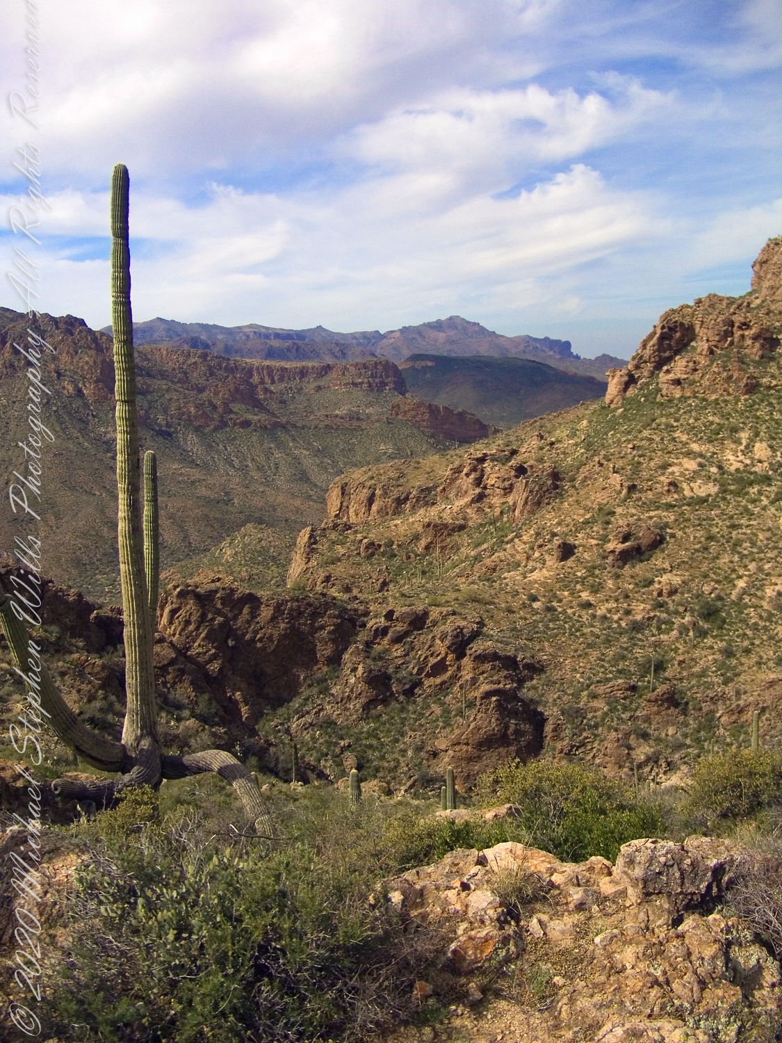
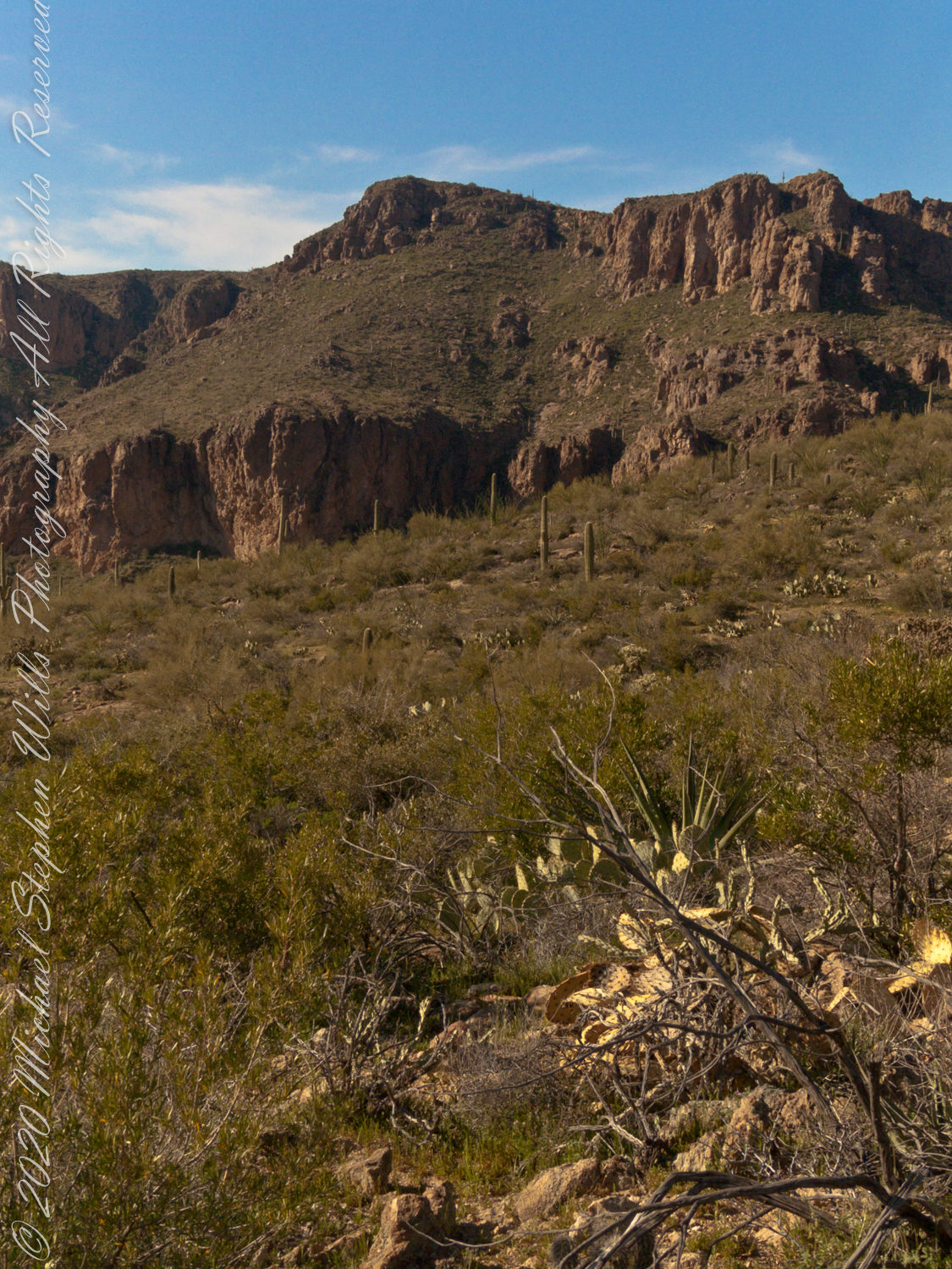
Here we are climbing Peters Trail to the eponymous mesa and facing East to Music Mountain. Scattered in the brush are desiccated and live Prickly Pear cactus. Poles of young saguaro cactus like randomly placed telephone poles poke up around the lower slopes.
The first published record of Music Mountain is by Ray C. Howland of Mesa Arizona who sent a letter to “Everybody’s Magazine” that appeared in a feature called “Everybody’s Meeting Place: Where writers, readers and the editor gather for informal discussion,” May 1928, Volume 58, Issue 5, page 173. I reproduce Howland’s letter here with minor editing:
“I am in the deserts and mountains of Arizona most of the time. I go into town once each month for mail and provisions. I meet many things as I ramble around, many strange things, things that are beyond my ability to comprehend. One particular was in my mind as I read your printed thought in the back of Everybody’s. Far in the Superstition Mountains of Arizona, in the deepest, most rugged canyon, there are three caves halfway up a great yellow bluff. In these caves are mud dwellings. There are not the cliff-dwelling as found in other parts of Arizona.
The mud walls of these dwellings were made by people with very small hands. The handprints of these ancient masons remain as though they were made yesterday. Just below these caves a beautiful pool of crystal-clear water lies between grassy banks. Tall ghostlike sycamores grow there in great numbers.
I have camped many times beneath those sycamores. It is a beautiful spot. Such a difference between there and the hot desert that lies fifteen miles to the south.! As one lies there, just at twilight, begins the most wonderful music one could imagine. I have never heard music that could compare to it, vague, elusive at times, then again of greater volume. It is my opinion that no living being could record it.
The music is, I believe, beyond description. It seems to take you out of your moral self and transport you back ages and ages, almost to the beginning of things. For the time being one feels as though he were in another world.
I have often tried to solve this little private mystery. I can’t explain it. I can’t even describe it intelligently.
You will probably say as you read this that is is the wind among the pinnacles, caves, trees, etc. that make this wonder phenomenon. It cannot be, for usually there is no breeze in the mountains at twilight. It is still as a tomb except for that music. Besides when the breeze is blowing at any other hours of the day there is no sound.”
Here is a copy of that issue for you to see for yourselves.
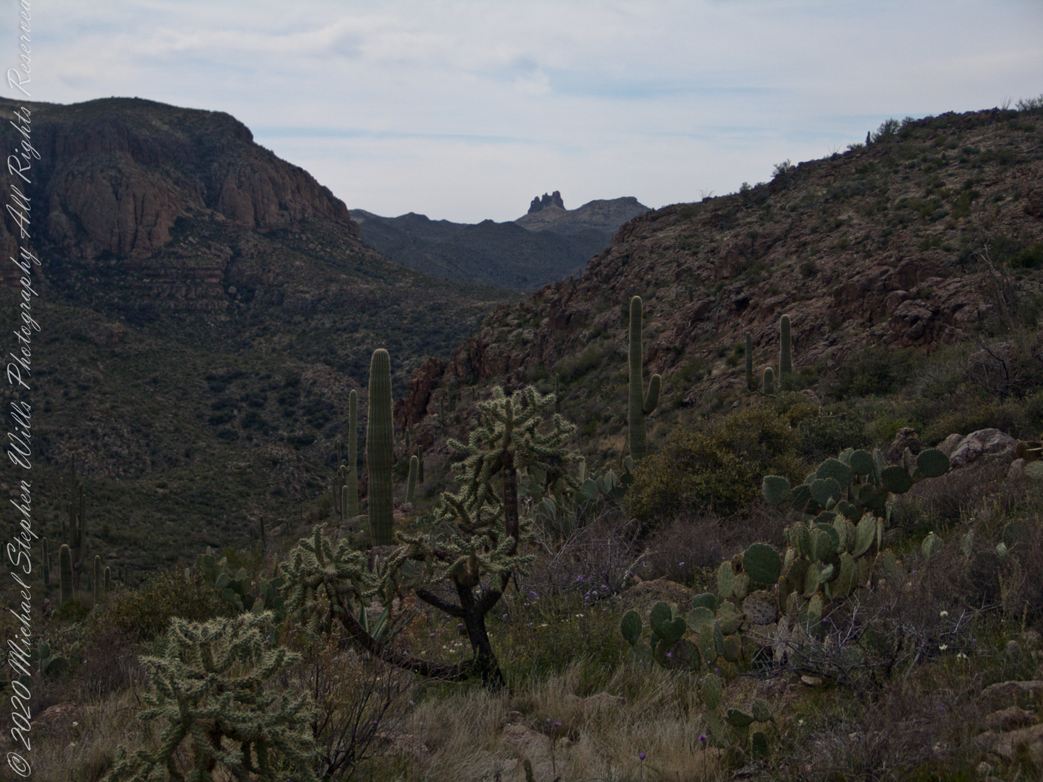
In my photographs the bluffs described by Howland are seen clearly in the distance. During our expedition we were never able to visit the caves, though Dave described the location, caves, and dwellings. On Peter’s Mesa are remains of pits where Apaches and Yavapais gathered hearts of agave to roast. We visited a small cave in the side of Peter’s Mesa showing signs of high heat and possibly used for roasting agave.
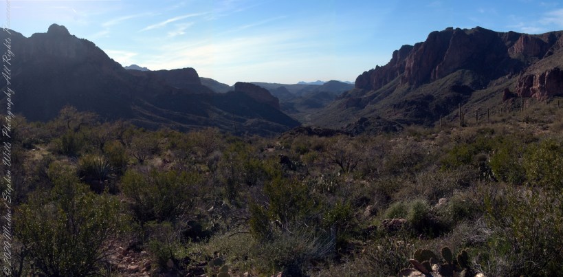
Dutchman Trail follows the outflow of two springs along the canyon floor: Music Canyon and LaBarge springs. Here we are climbing Peters Trail to the eponymous mesa and facing south / Southeast, looking down on Dutchman Trail.
This is rough country below Bluff Spring Mountain. Stag Horn Cholla cactus is lower right with Prickly Pear cactus scattered in the brush. Poles of young saguaro cactus are scattered around the lower slopes.
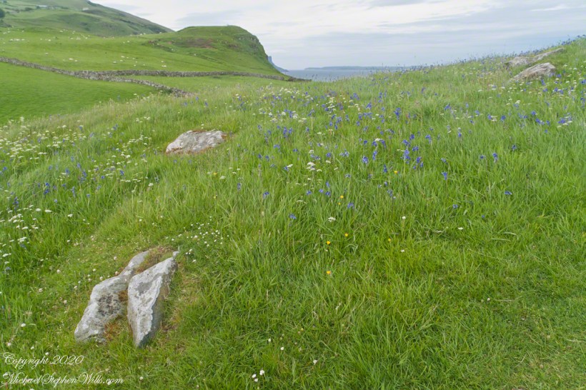
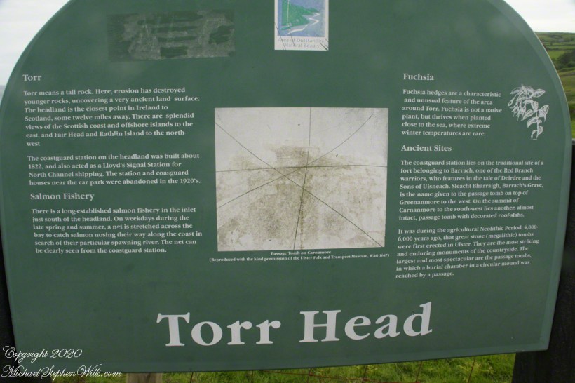
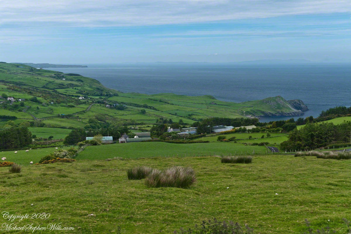
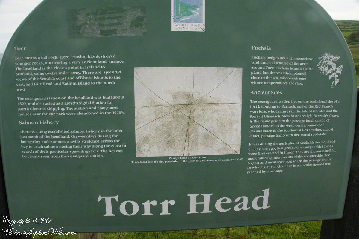
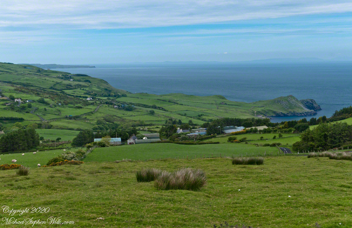
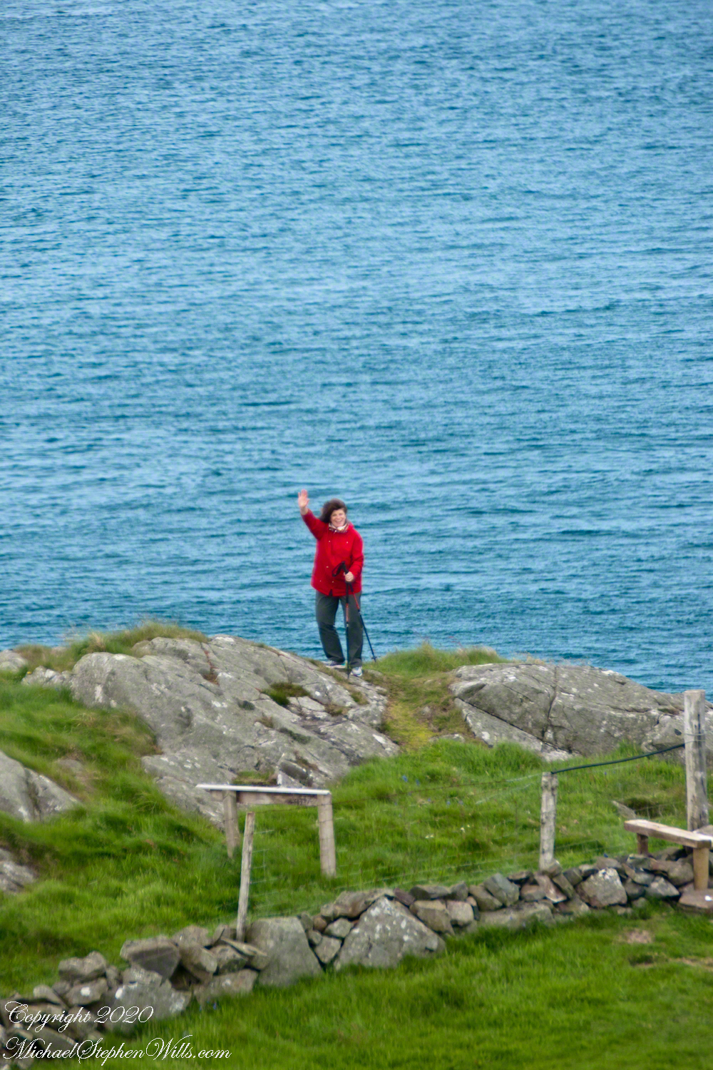
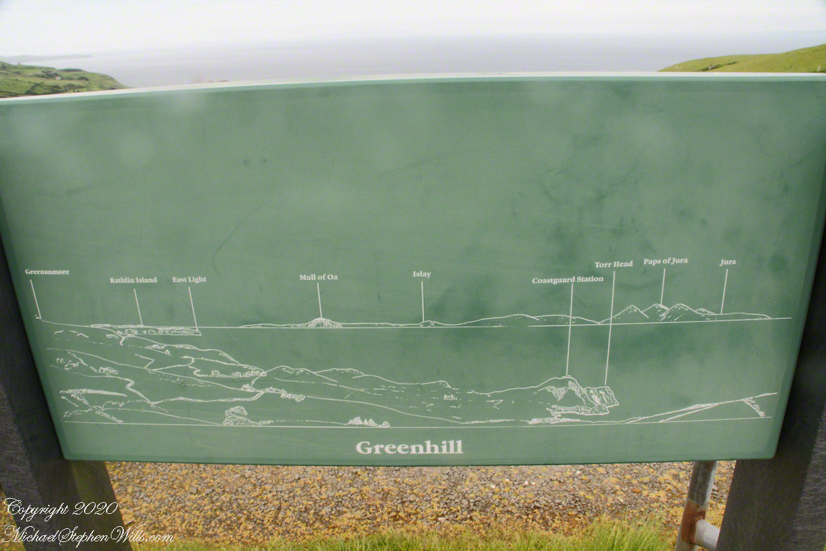
We parked below the Coast Guard station, headed toward the height of Torr Head. I was stopped in my tracks by the hillside meadow wildflower profusion.
Here are a few I identified, listed by common name: Bluebell, Daisy, Meadow Buttercup, Sea Campion, Yarrow. We love daisies and buttercups around home. We spotted Sea Campion on the Dingle Peninsula, as well. Yarrow is common through Ireland. I don’t recall seeing bluebells anywhere else.
It was the bluebells in this photograph that clued me into why I took a photograph of the hillside. The view north takes in coastal sheep pasture looking on a portion of North Channel and the Irish island Rathelin.
The web page I used for identification was wildflowersofireland.net . Great information and links to the Botanical Society of Britain and Ireland with a distribution map.
Copyright 2022 All Rights Reserved Michael Stephen Wills
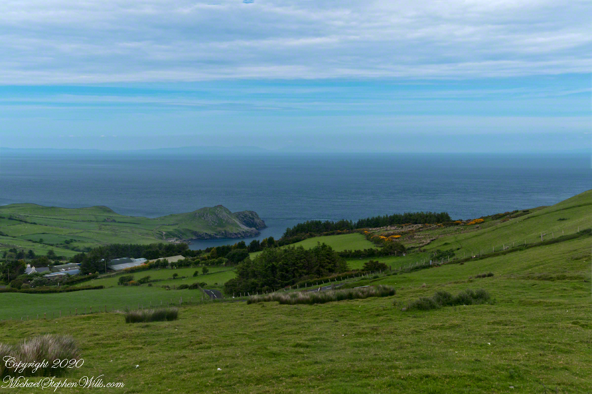
There is at least one tanker ship traversing the North Channel. You can just make out the Torr Road we followed through those farm buildings to the parking near the Coast Guard Station.
Here is a gallery for easier flipping between photographs. To do this from WordPress Reader, you need to first click the title of this post to open a new page.
Copyright 2022 All Rights Reserved Michael Stephen Wills
After a respite among the cool spring waters, we headed up Peters Trail for the top of Peter’s mesa where, for all we knew, there was no water.
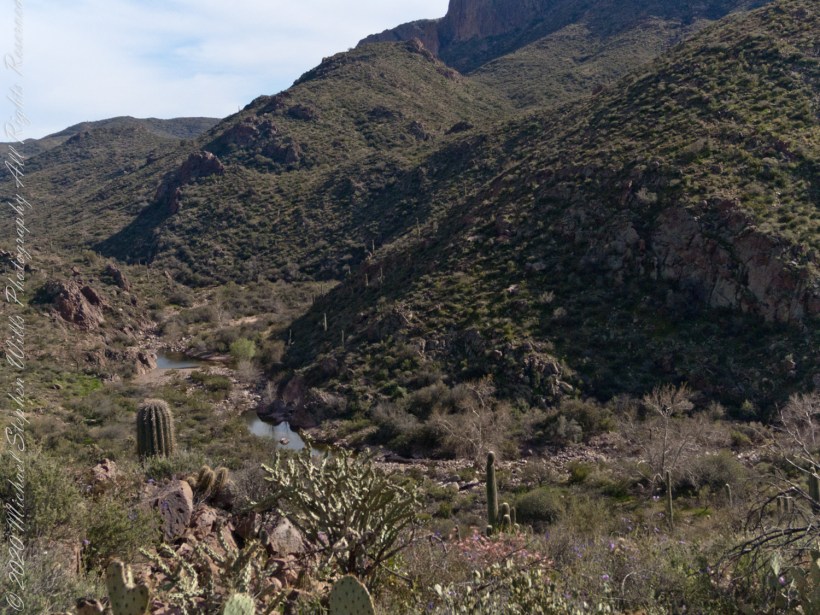
In this photograph I face northwest, looking down on Dutchman Trail. The peak, upper center left, is Black Mountain. The cleft of Charlebois Canyon is lower middle right. Stag Horn Cholla cactus is lower right with Prickly Pear cactus scattered in the brush. Poles of young saguaro cactus are scattered around the lower slopes. Look carefully and you can make out the pooled water of our rest stop.
Copyright 2022 Michael Stephen Wills All Rights Reserved
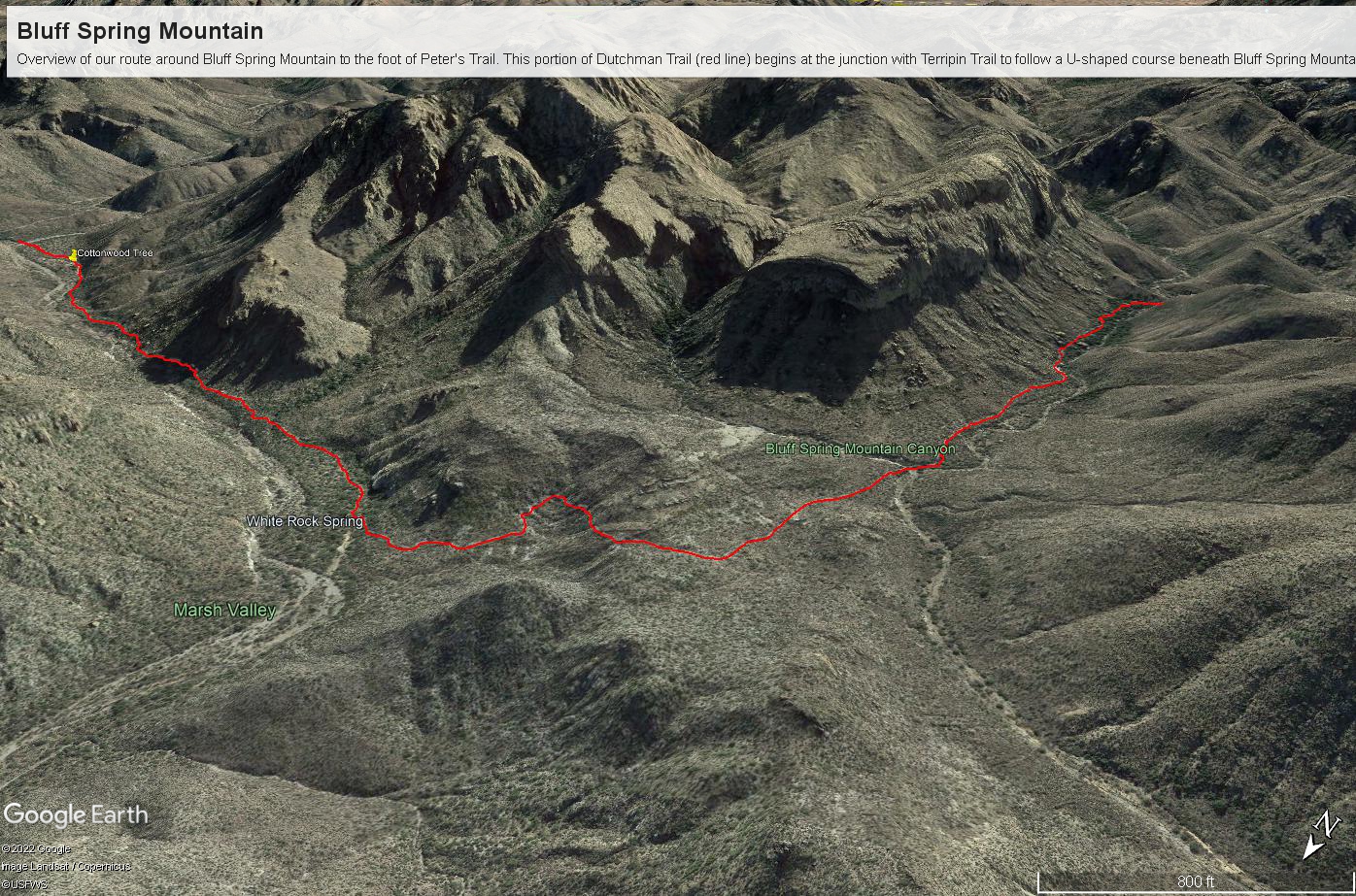
Here is a recap of the last few Superstition Wilderness posts. The expedition route, in red, starts on the right where Dutchman and Terrapin trails meet. The total distance is 2.6 miles. Photograph timestamps tell me about 2 hours passed — 1.3 miles per hour in this rough country.
Here is a gallery of photographs from this portion of our expedition.
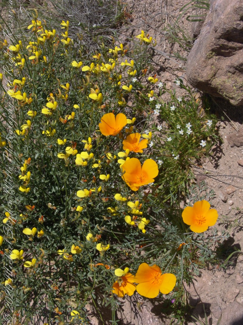
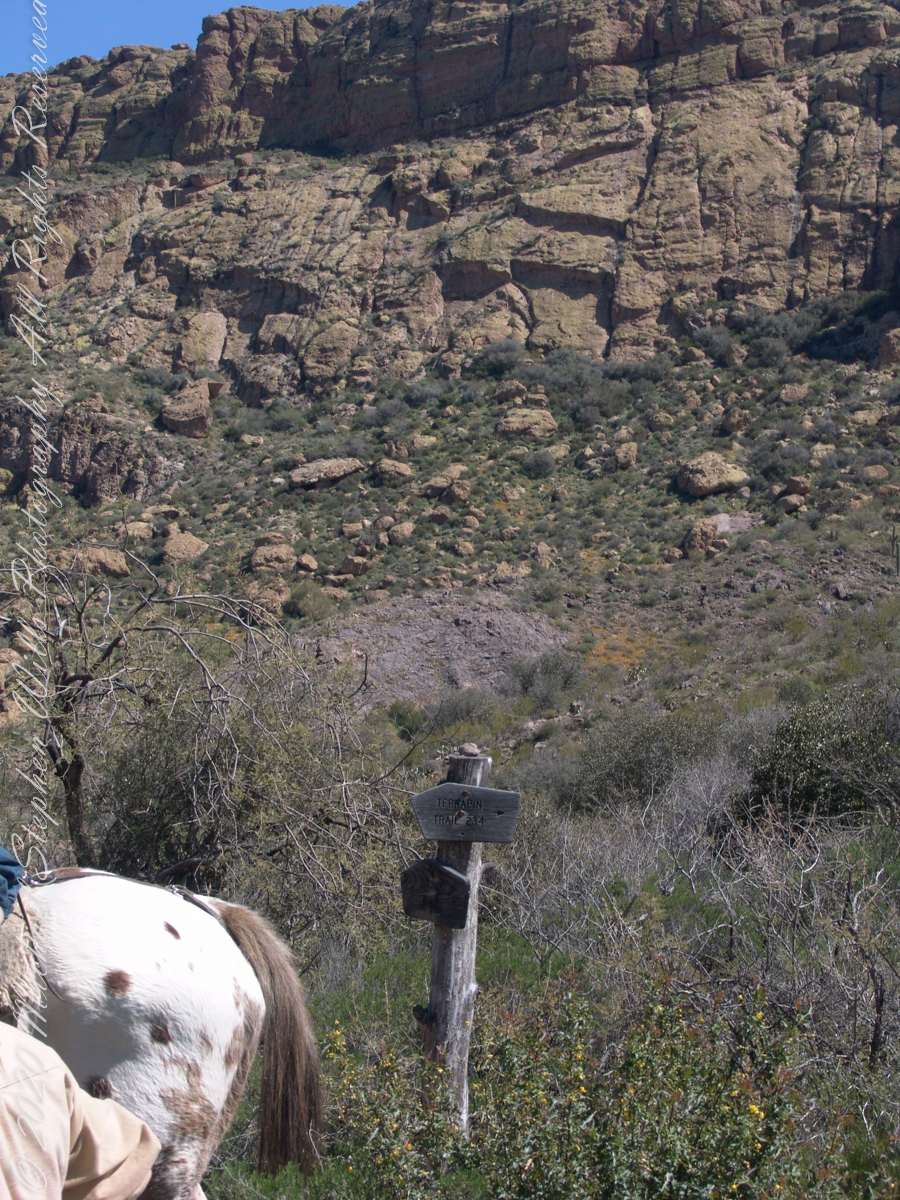
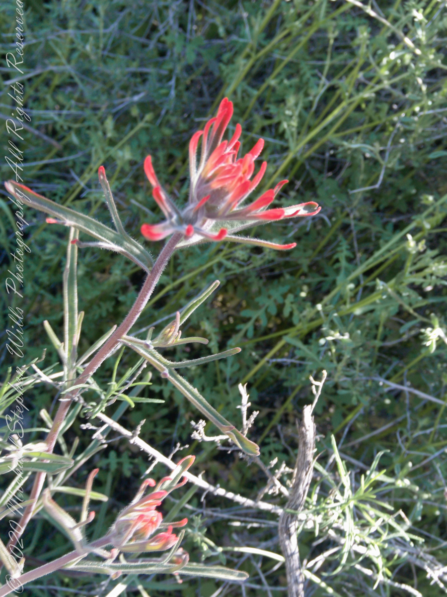
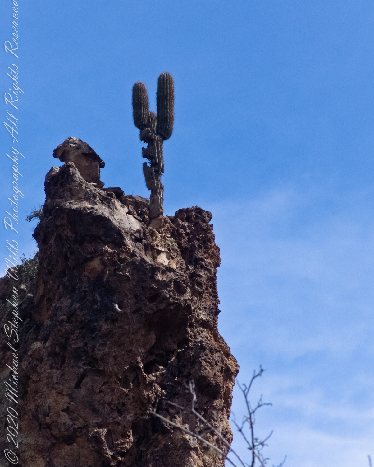
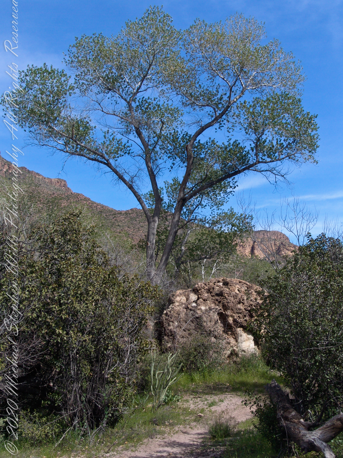
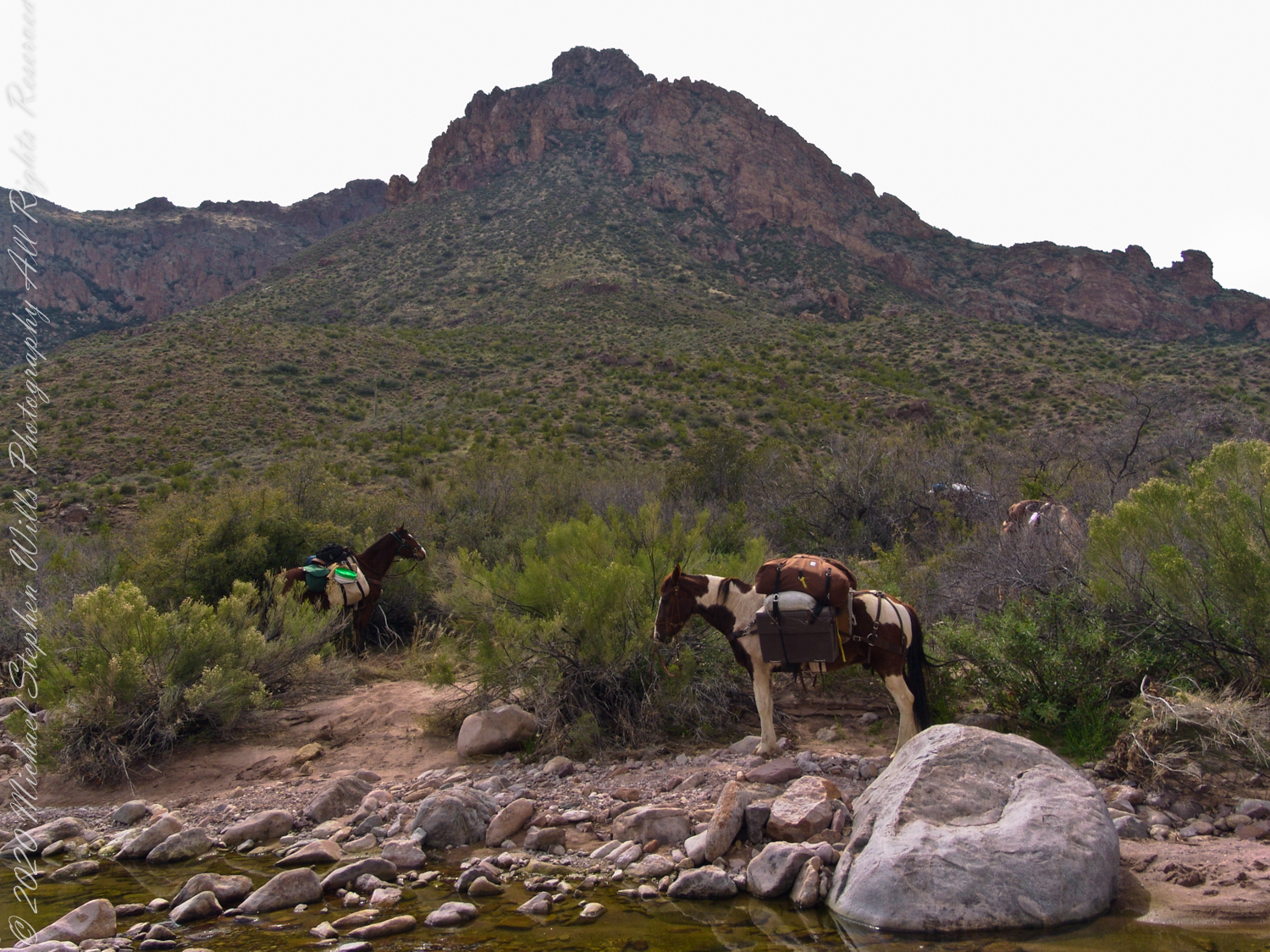
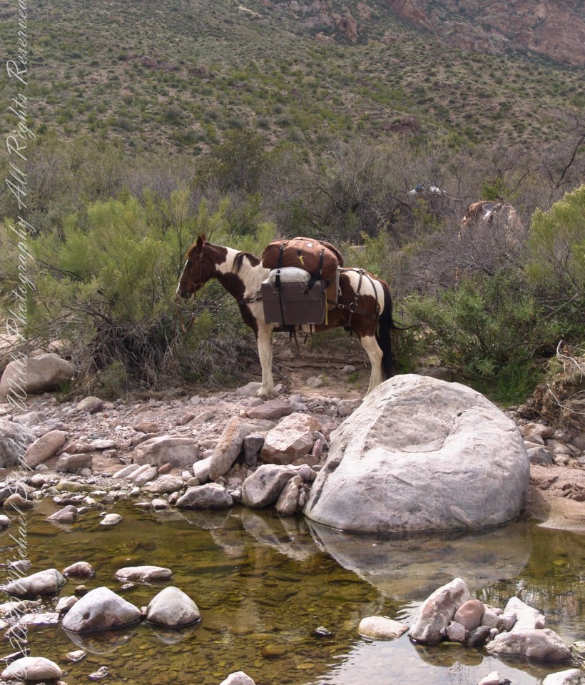
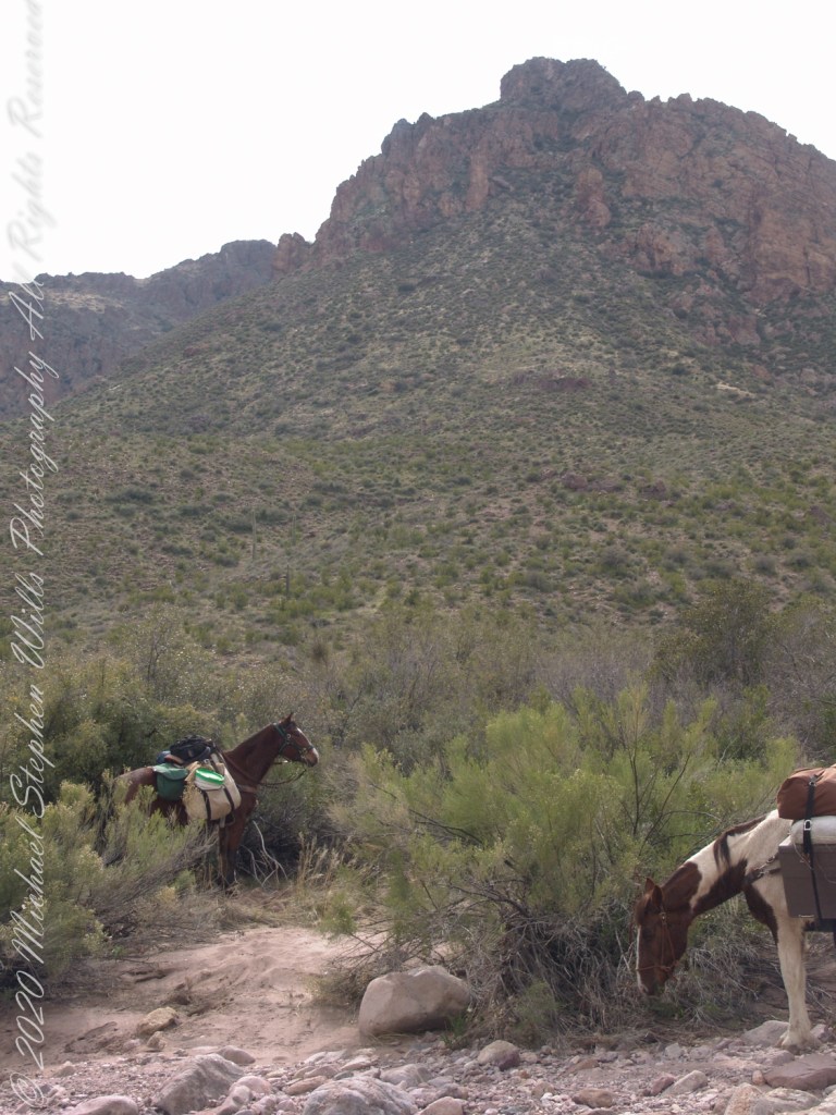
The beetling cliffs off Bluff Spring Mountain loom over where Terrapin and Dutchman trails meet. Patches of yellow are Mexican Poppies blooming on the talus slope. Terrapin Trail climbs the ridge, to right, Here is where I caught up with mounted expedition members, the spotted rump of an Appaloosa figures prominantly next to the sign post. Superstition Wilderness, Tonto National Forest, ArizonaTerrapin Trail almost immediately starts a climb up to an eponymous pass between Bluff Springs Mountain and Weavers Needle. From here, it is the best way into the mountain. The trail name is a misnomer, as terrapin (Malaclemys terrapin) turtle habitat is near the ocean. There is a desert tortoise (Gopherus agassizii) you might encounter during the rainy season as they are otherwise inactive. Superstition Wilderness, Tonto National Forest, ArizonaAl Conant at Terrapin and Dutchman trails. His Appaloosa is enjoying fresh grass. Superstition Wilderness, Tonto National Forest, ArizonaThe bright yellow flowers on right are a member of the pea (Fabaceae) family named Wright’s Deervetch (Acmispon wrightii) I am able to pick it out from many similar flowers due to the characterictis narror leaves with small hairs. These start out yellow, turning to red with age eventually forming brown seed pods. Mexican Poppy (Eschscholtzia californica) to the right. The small white flowers are Chickweed (Minuartia macrantha) of the family Carnation (Caryophyllaceae) . These are growing along Dutchman trail, March 2008, at the base of Bluff Spring Mountain. Superstition Wilderness, Tonto National Forest, ArizonaView from Dutchman Trail between Black Top Mesa and Bluff Springs Mountain, approaching White Rock Spring and LaBarge canyon. Looking Northwest, in the distance is Malapais Mountain behind Red Hills. Volcanic rock and Cholla cactus in foreground followed by Prickly Pear and Saguaro cactus. Superstition Wilderness, Tonto National Forest, ArizonaCastilleja is the genus name of this flower, also known as Prarie Fire. There are over 200 species throughout the Americas. On the Dutchman Trail, LaBarge Canyon, Superstition Wilderness, Tonto National Forest, ArizonaLost gold mine legends tell of Saguaros bearing secret markings leading to the hidden location of rich gold mines. This specimen lives in LaBarge Canyon, along the Dutchman trail.View North / Northwest on Dutchman Trail between Bluff Spring Mountain and Peter’s Mesa. The creek flowing from Charlebois, Music Mountain and LaBarge springs nourishes this Fremont’s Cottonwood (Populus fremontii) and other riparian flora. The tree is flanked by volcanic rock from an ancient eruption. Coordinates: 33°27’29.60″N , 111°20’56.23″W, LaBarge Canyon, Superstition Wilderness, Tonto National Forest, ArizonaColorado at the foot of Peter’s Trail near Charliebois CanyonBehind Colorado and “Ed’s Horse” (don’t recall the name) is Bluff Spring Mountain.
Copyright 2022 Michael Stephen Wills All Rights Reserved
The expedition party rested where Dutchman Trail intersected the creek, full of flow from Charlebois Canyon, Music Canyon and LaBarge springs. We filled the water reservoirs in preparation for the climb up to the night’s camping spot on Peter’s Mesa, a 1,300 foot climb over 1.2 miles.
Behind Colorado and “Ed’s Horse” (don’t recall the name) is Bluff Spring Mountain.