A Peaceful Day at Pine Creek

Explore a remote location of the eastern Superstition Wilderness

….continued from the chapter “Two Meetings.”

The spring gales persisted through my late afternoon arrival in Pine Creek, into the night and next morning. Protected from the west wind by the rising land, the tent was not buffeted like I described in the chapter “A Dry Piece of Paradise.” The song of soughing pines was my last impression of the evening and the first of the next morning.

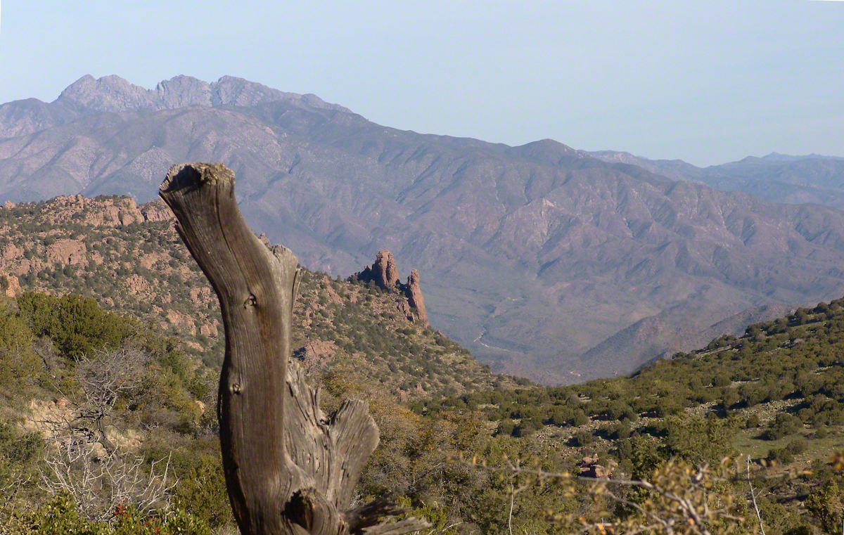
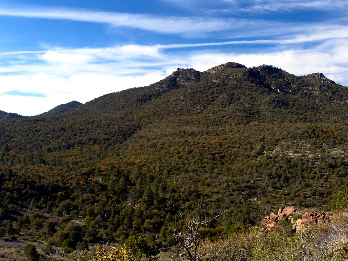
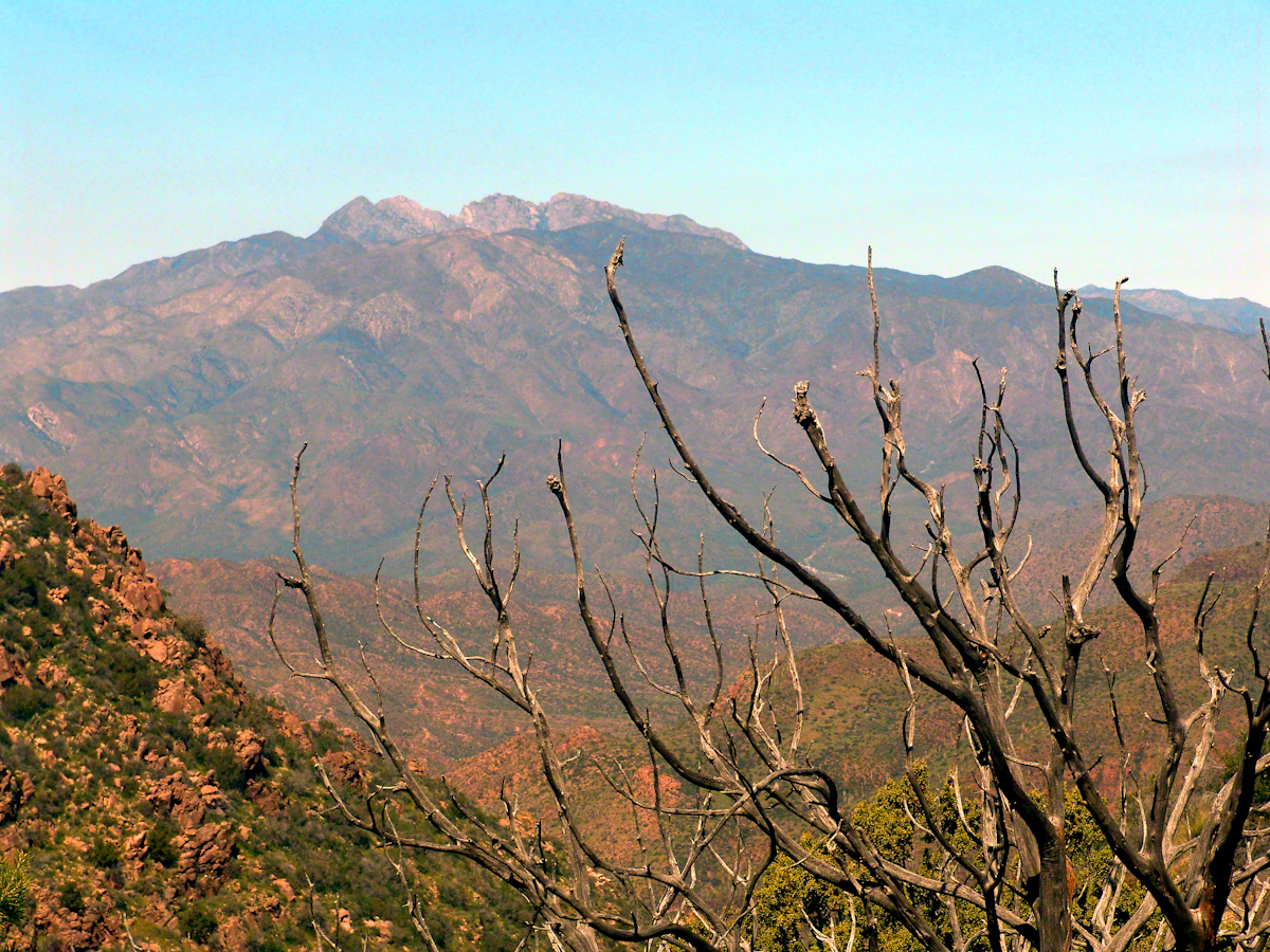
Where the Arizona trail crosses, Pine Creek flows at 4,600 foot elevation through a canyon of broadly sloping sides. The flow originates at the foot of Mound Mountain to the southwest, at 6,253 feet the highest elevation in the Superstitions. There are 5,500 foot peaks to the east and west. The land falls away to the north giving great views of the Four Peaks Wilderness.

I chose a flat site to camp above the creek among Arizona White Oak, Arizona Sycamore, Ponderosa Pine and Manzanita. Of these, it’s Manzanita fruit for which the bears come in the summer. Manzanita thickets made approach to the camp site difficult from all directions but the path. Bear sign was thick among this growth. Go to my chapter, “Racing the Sun,” to see the red barked Manzanita and pink blossoms from which grow tiny green fruits that ripen summertime into a bright red, like tiny apples. Indians used this bland tasting fruit containing five hard seeds for food and a cider beverage.

Well before dawn I grabbed warm clothes, hat, camera to head out for a full day of leisure.

On a shallow rise above Pine Creek I took the two shots of agave (Century Plant) stalks in dawn light. These start the chapter, “A Dry Piece of Paradise.” One dry agave flower is to the left in this North view, looking down the creek not far from the creek crossing.

Click any photograph for a larger view
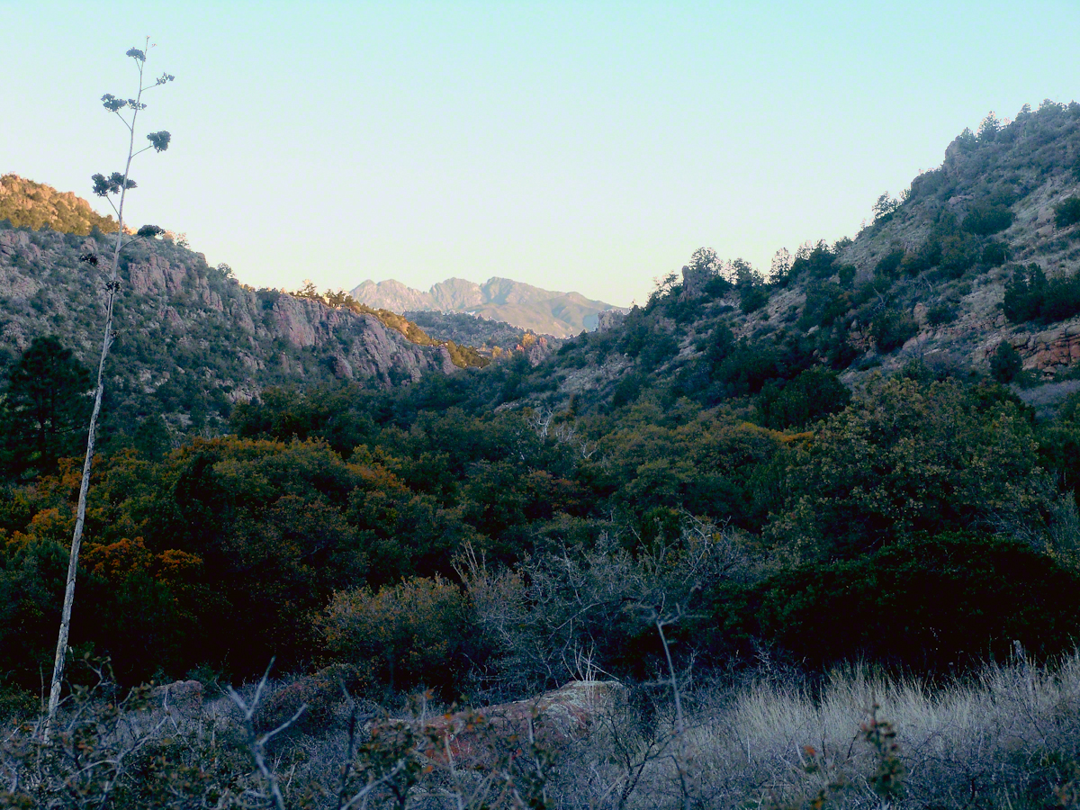
North View from Pine Creek, early morning

In the photograph notice how the canyon narrows as the creek flows north, the walls rising above it for hundreds of feet.

When I climbed about 200 feet above the creek to a ledge that provided great views, the protective canyon walls fell away and wind gusts threatened to up end the light tripod. It was necessary to anchor it with the daypack and I tied down my hat as well.

Shadows of night lie below, dominated by Four Peaks Wilderness. A unique long flat ridge is behind the near dramatic ridge above Pine Creek. This view leads me to daydreams. The long ridge is clearly visible in two photographs titled “Nameless Canyon in the Dawn” and “Nameless Canyon Morning” of my post “A Dry Piece of Paradise.”  A view from the west is available in my post “Racing the Sun.” Look at the photograph captioned, “Overview of my path to the Nameless Canyon behind Two Bar Mountain,” the flat ridge is just above the shadow of Castle Dome. The view from that spot must be incredible across the lower Reavis Creek valley. From here it is a day trip 4+ mile roundtrip bushwhack over the cliffs above Pine Creek.
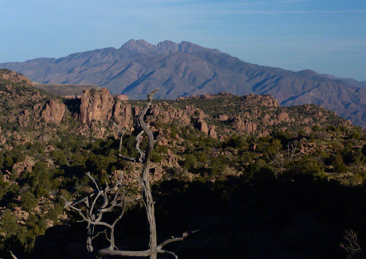
North View from Pine Creek

Those evergreens in the following photograph are Oneseed Juniper (“Shagbark Juniper”) of the three species common to the Superstitions, this has this spherical, bushy appearance. Here the elevation is just high enough for junipers because there are none down below. The trail crosses Pine Creek to ascend the lower slopes of these red cliffs, following it around to the west and over to the next valley, Reavis Ranch, a distance of 3.5 miles. In my “Two Meetings” blog is a sweeping view of Pine Creek Canyon, from the southern approach.

For most people a 400+ foot climb over these steep cliffs is impossible. Fortunately, a saddle to the right of this photograph is a possible route.
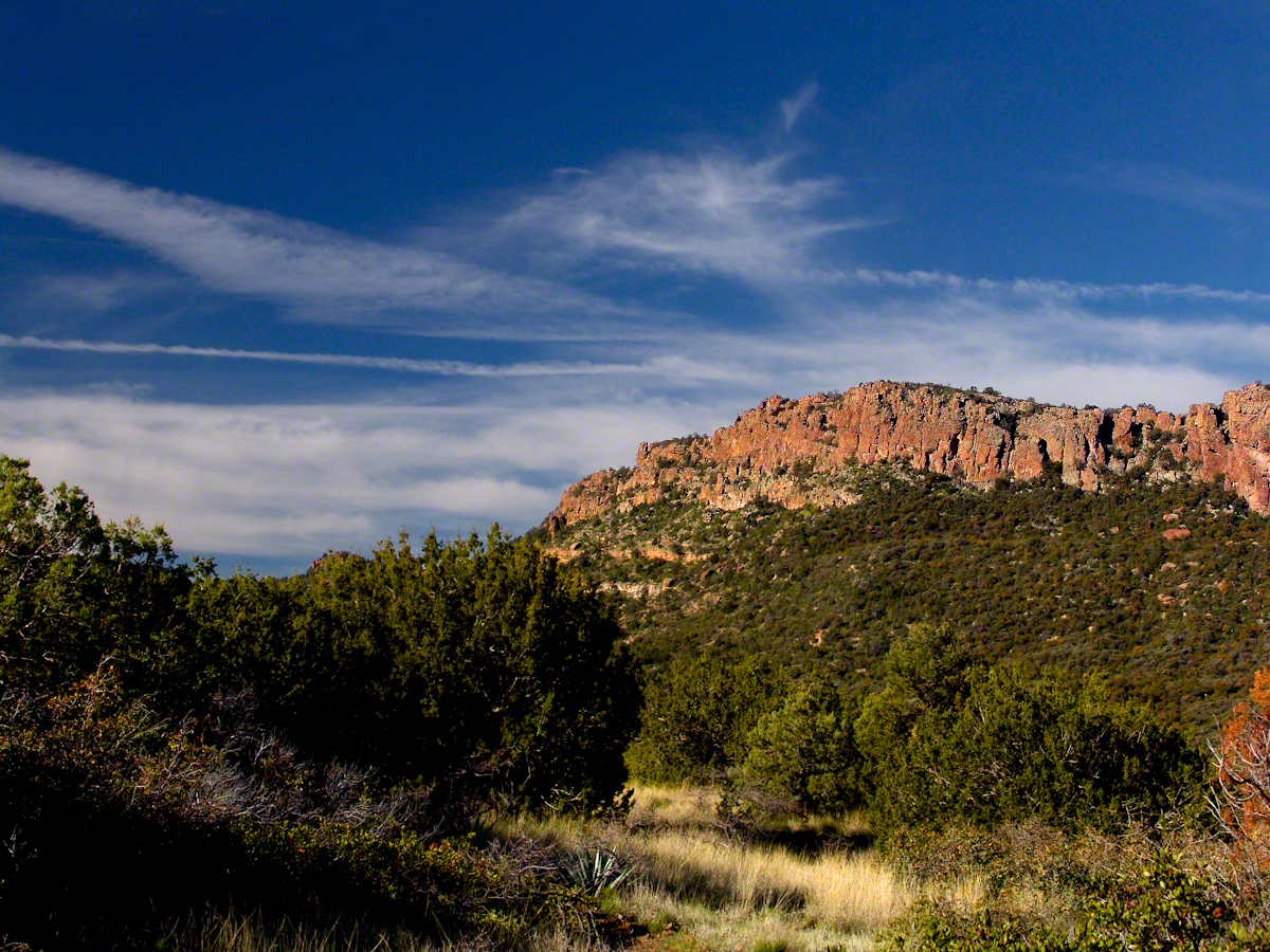
Southwest View from the Arizona Trail above Pine Creek

The saddle is 100 feet lower without cliffs. Still, this entrance to remote, fascinating locations is a steep 300+ climb.
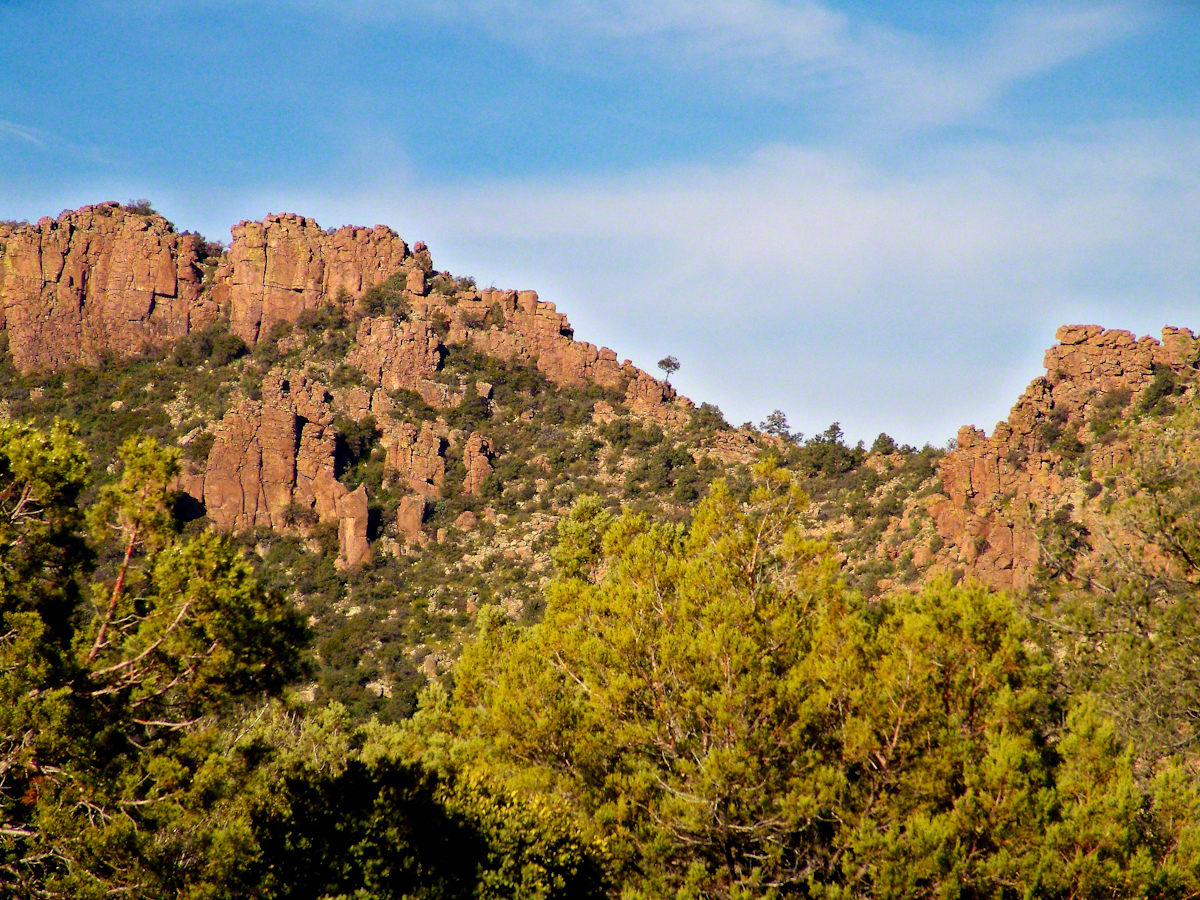
A Saddle breaks a line of cliffs

“The Searcher” arrived around this time riding the buckskin gelding and leading a pinto. He saw me and my camera equipment and stopped for a chat. His plan was to follow the trail I came up yesterday to find a rumored camp with good water. The howling wind made conversation difficult. I wondered where his camp of last night was located, since there was no sign of him. Before I could ask, his cowboy hat flew away with a wind gust. He hopped off the gelding, “That’s my best beaver hat.” After a quick brush and tie-down they were off.

Heading back down to the creek, here is a macro of lichen that covered the crumbling surfaces of boulders that littered the slope.
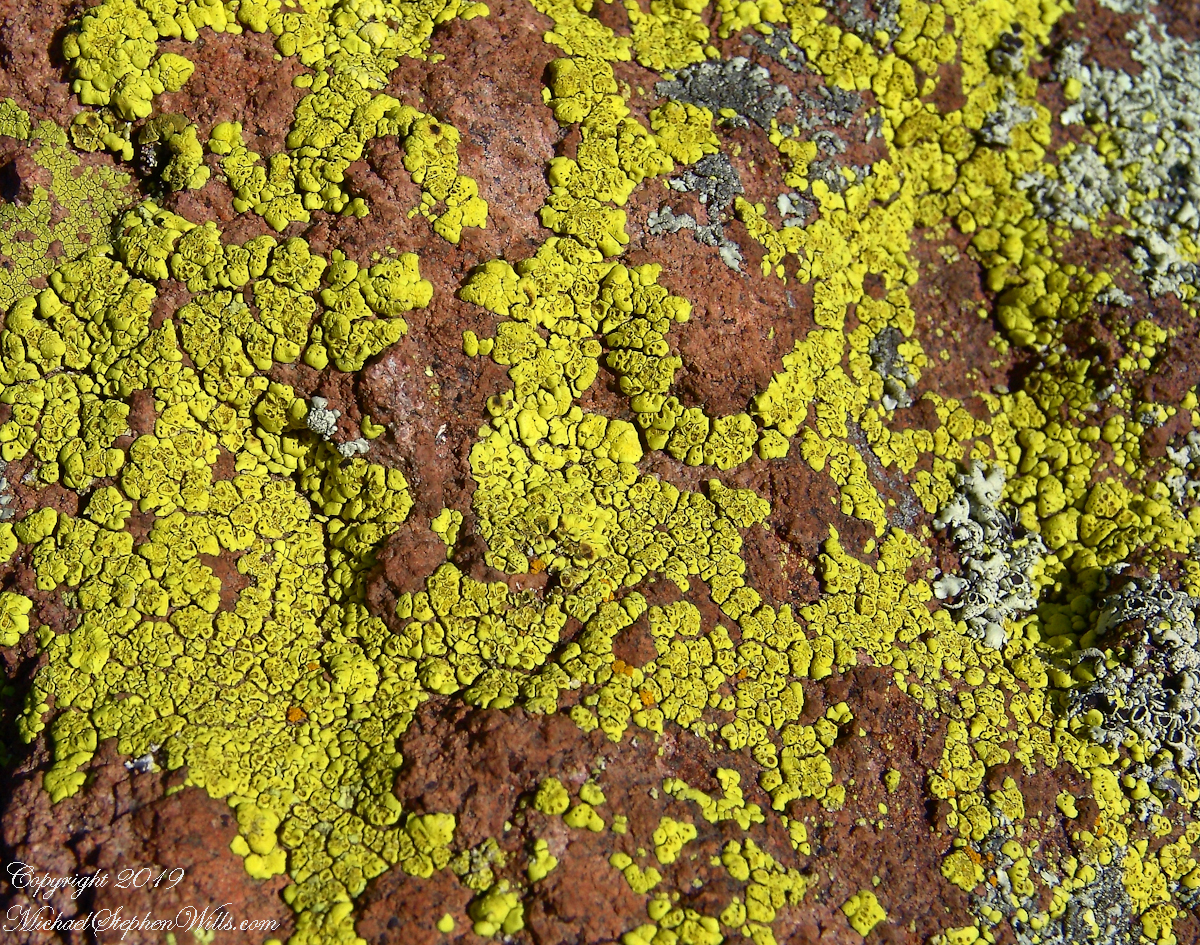
Nature’s Abstract

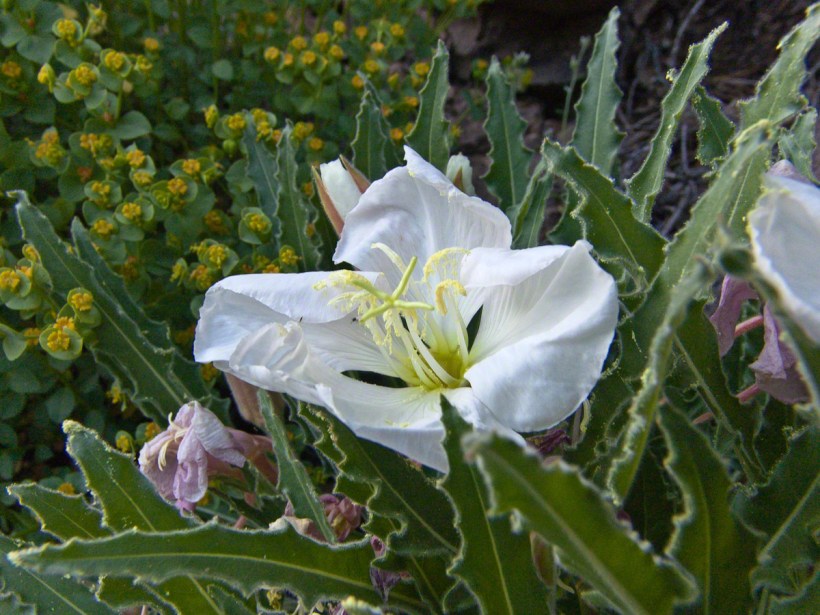
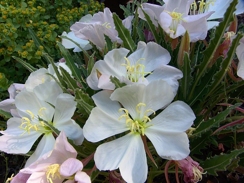
During the previous night fresh primrose blossoms opened, this one flourishing in the earth of a south facing slope. There is a reddish spent blossom at lower left. The soil here formed over eons by the action of the creek water, atmosphere and plant life. I have more about the Primrose and these yellow flowers in the background in my “Two Meetings” blog.
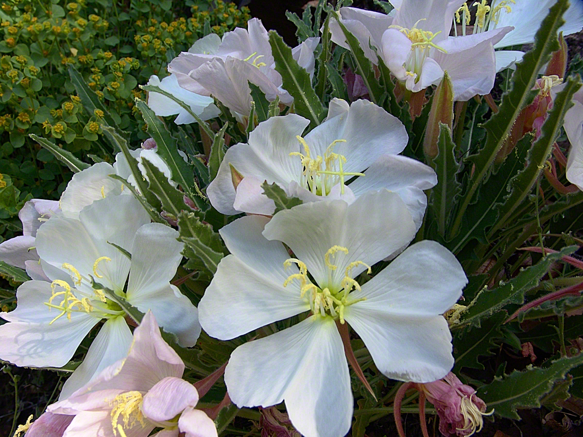
Pine Creek of the remote eastern Superstition Wilderness hosts this wild Tufted Evening Primrose.

Turn left (up stream) where the Arizona Trail crosses Pine Creek and jump boulder to boulder for a hundred feet or so and you come to this view. The creek bank, covered by vegetation, rises on both sides and makes it difficult to leave the creek. Those are Arizona White Oak leaves floating along the large foreground boulder.
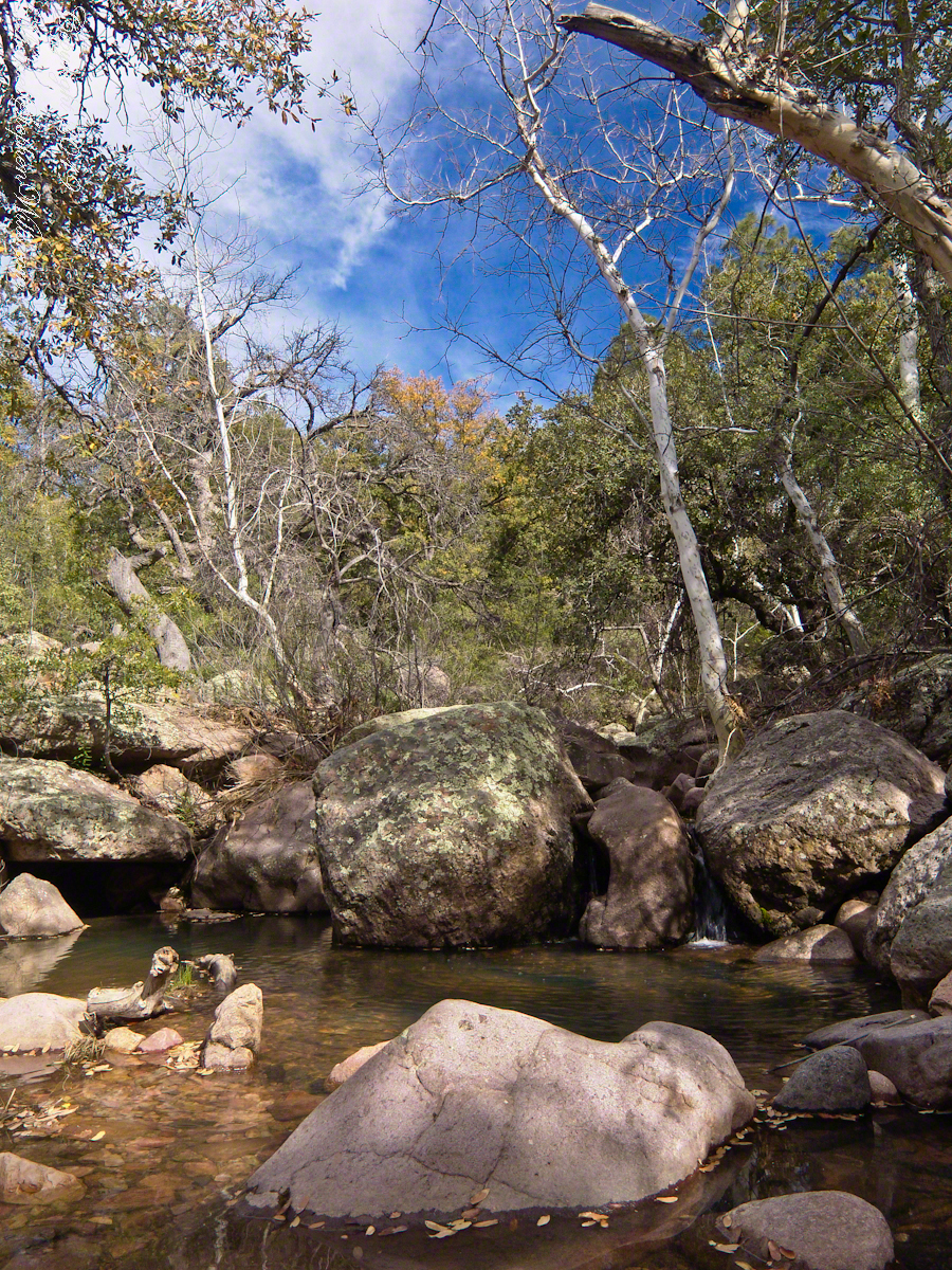
Pine Creek Pool with Young Arizona Sycamores

This is a very young Arizona White Oak, common species growing along the creek. The leaves are not what you’d expect from an oak, being 2 – 3 inches long in the shape of a lance blade and without obvious lobes Mature Arizona White Oak has a rough bark and, at most, 24 inch trunks.
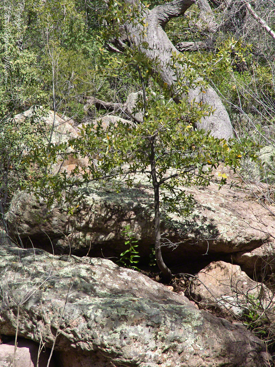
Arizona White Oak

There are better examples of grand Arizona Sycamores along the perennial Reavis Creek. Pine Creek does not flow in the driest seasons, this tree sloughed its branches in order to survive. You can see from the many young Sycamores in the Pine Creek Pool photograph the previous photo the sycamores are successful in this environment.
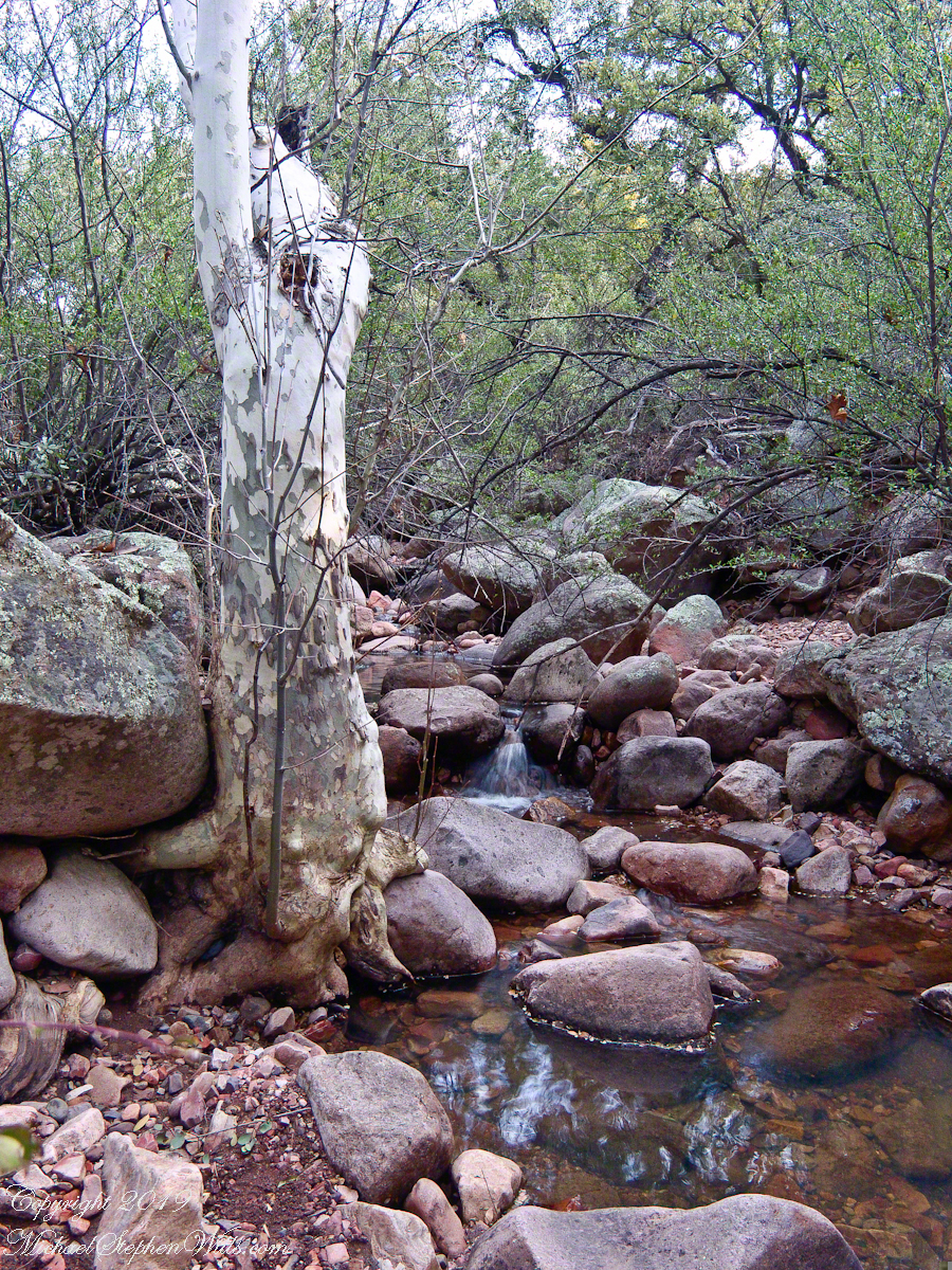
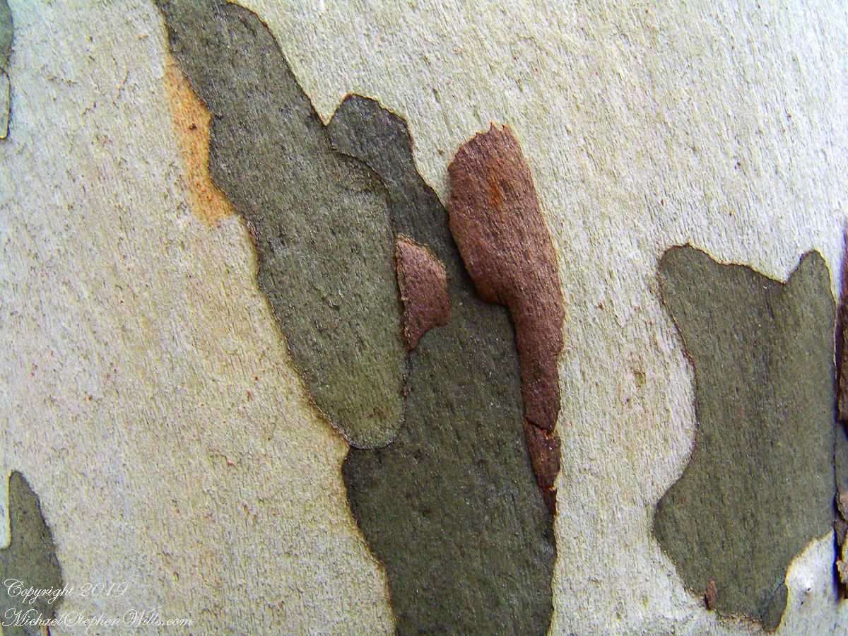
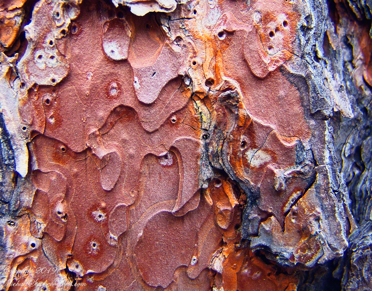
I spent some time with this Sycamore, capturing abstract patters of the bark.
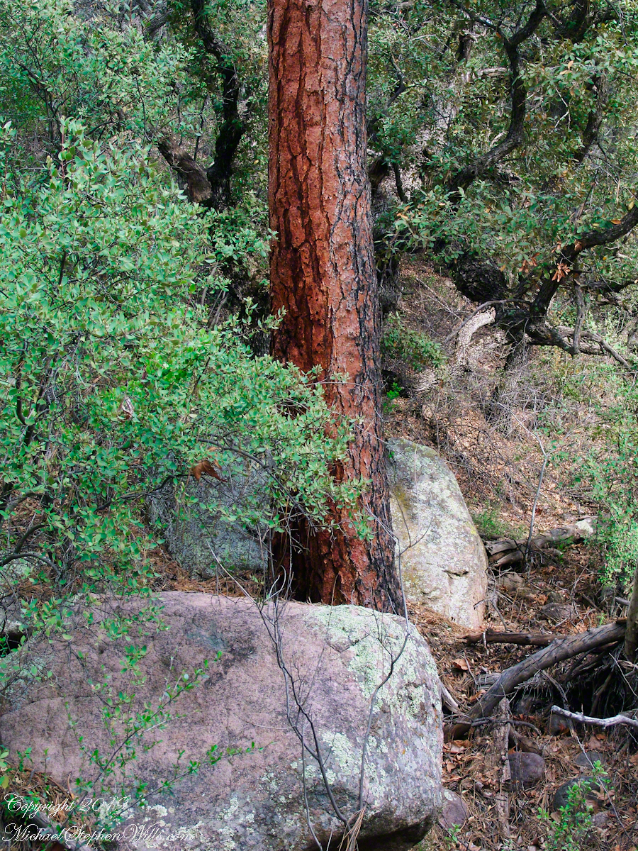
The abundance of Ponderosa Pines here demonstrate the species thrives at this altitude and dry environment. This specimen grows on the creek bank. Those are shrubby Arizona Oaks around the trunk.
Abstract patterns in the bark of this Ponderosa. The popular and scientific name (Pinus ponderosa) for this species is from the dense weight of the wood.
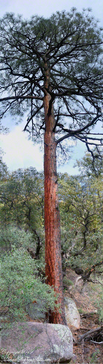
The tree is over 100 feet tall. I patched together four shots for this view.
In the afternoon I explored the Arizona Trail to Reavis Ranch. It crosses the creek to ascend the cliff in broad switchbacks. Eventually it follows a contour below a cliff with fine views of Pine Creek Canyon. I turned back to leave the hike to Reavis Ranch for another day.
Click me for the next episode, “Sycamores and Riparian Space.”

Click me to visit Michael Stephen Wills Online Arizona Gallery.

Copyright 2026 All Rights Reserved Michael Stephen Wills

Two Meetings

First view of Pine Creek

Continued from the chapter “A Dry Piece of Paradise.”

Imagine a bowl with steep sides, rough and sharp in places.

Look along the bottom and see a silver stream, sparkling and singing through rocks.

A figure is clinging to the upper side, almost to the rim.

The figure is me in the setting of my blog, “A Dry Piece of Paradise”. Here is my view from that spot.

View from the rim of Nameless Canyon

Hiking along this bowl rim I came to a clearing in the juniper and Manzanita bushes, with a fire ring and pile of roughly broken wood with outstanding views on all sides. This tradition of leaving wood is a welcome intrusion of human kindness and sympathy in this wilderness. We gather wood for total strangers, people we will never meet, to potentially save them in a rainy, cold darkness.

At noon Pine Creek was two miles ahead as I looked into a steep descent, a wide canyon and open range of low oaks, almost shrubs, and small juniper trees. Later, well along the trail, I stepped over Walnut Spring, a silent thread of water through a thin blaze of trees, yellow flowers and continued toward Reavis Gap and Pine Creek on Oregon Ed’s recommendation.

“Even a blind man could find water there this year,” Ed claimed.

Ed’s van was parked at the Superstition Wilderness Tule trailhead when my sister dropped me off the morning before. She noted the van thickly coated with dust over grey primer with an Oregon license plate and changed her plan to accompany me the first mile or so for fear the van’s owner was lurking inside.
It was just as well Diane stayed behind because I met Ed two miles up the trail that first day. From the start, Ed was too outgoing and his pack more empty than light. He chatted me up on how “blue my shirt was”, seen from above, about his trips from Oregon to Arizona a few times a year, about his claim to be returning from a five day round trip to Tortilla Flats.

Ed’s good news about how the usual springs were flowing was welcome. Then, Ed expected me to give him some water for this information. This expectation of his was irrational, given his reports of good water sources. Plus, Ed was only a few miles from his van showed no physical signs of needing water.
I was to discover, a few hours in the direction he claimed to have walked, a flowing stream.

Ed’s attitude changed upon his spotting my .45 in a tactical holster strapped to my leg. Thirty seconds later he was heading down the trail. I had no water to spare and was relieved I didn’t need to escort Diane back to her car. Maybe Ed was an anti-gun advocate, but my conclusion was he had some lurking to do, back at the van.

While planning this trip I imagined “Reavis Gap” to be a narrow trail between towering peaks. While walking under the water heavy pack I elaborated on this expectation, but coming on the gap I walked through and into the reality of this photograph, taken from a point looking over the gap and down into Two Bar trail. This was the site of my first meeting with “The Searcher.”

North from Reavis Gap

“The Gap” itself is a high, narrow ridge over a 7,000 foot high valley with peaks, ridges and the occasional hoodoo. That rock formation in the mid-distance includes a hoodoo. It was this hoodoo that introduced me to the gap, being what I saw first high above in the distance from Walnut Spring, a silent thread of water through a thin blaze of cottonwood trees and yellow flowers.

Here’s a link to a video I did of a vast field of Wild Oats which covered Reavis Gap that season.

I first saw the “The Searcher” on that high, narrow ridge above Two Bar trail. I guessed he was a mounted park ranger; from the wide brimmed hat he was holding and the loose fitting shirt. From a half mile away his golden brown mount was standing steady, apparently at rest. Walking up that long, moderate grade my feet hurt and the 70+ pound pack, heavy with water, was chafing. Eager to climb the steep ridge ahead, between me and Pine Creek, I passed the signpost marking the juncture of Two Bar and Reavis Ranch trails and headed up that rocky ridge.

The clatter of horse hooves came up behind much sooner than expected. Turning, I came upon the unexpected site of two horses. The mounted stranger was not a park ranger, but a well dressed cowboy on a western saddle, riding a buckskin gelding.

Behind them, on a lead, was a brown and white pinto loaded with panniers.

I was polite and climbed up on the rocks, off the path, to let them by.

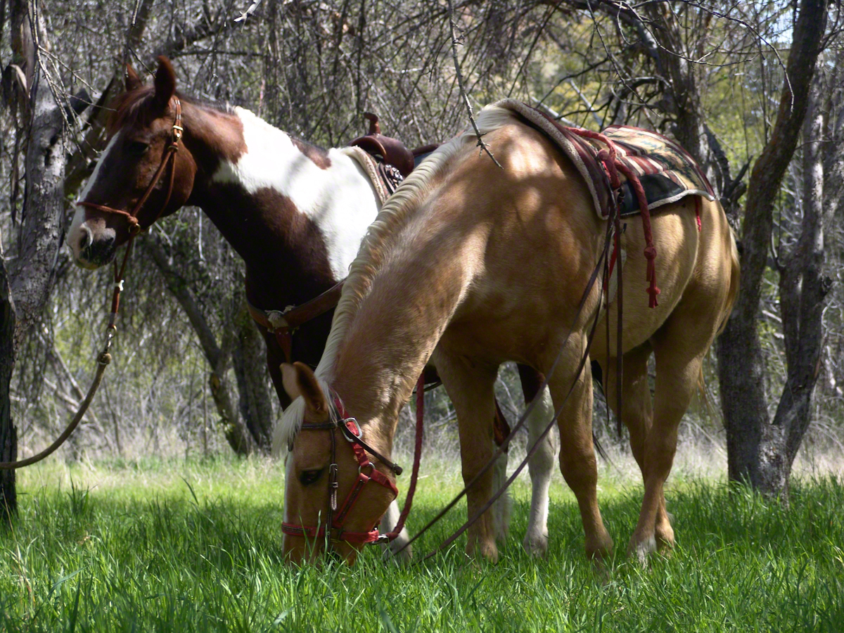
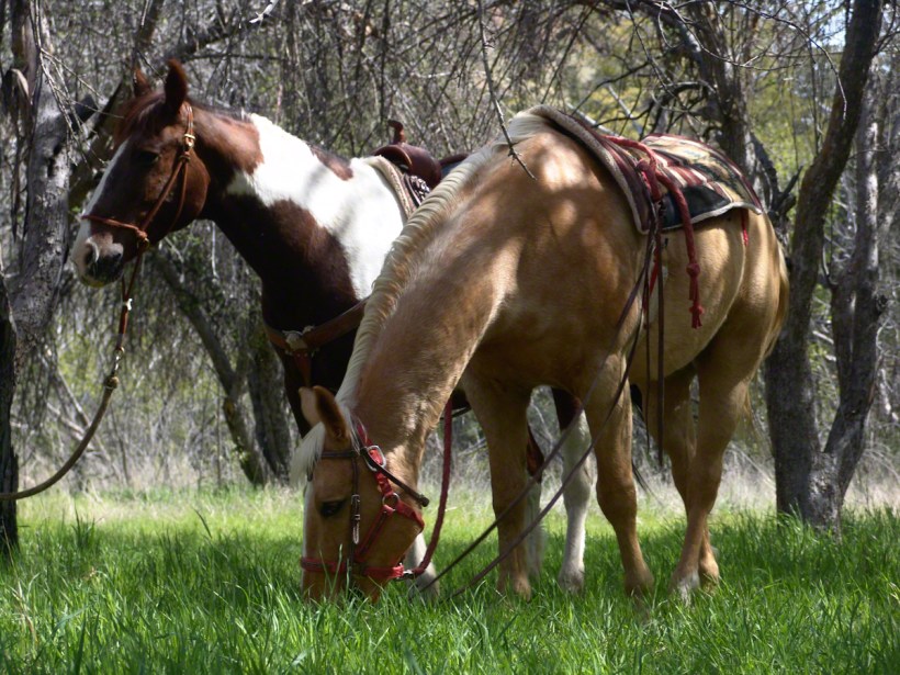
Here’s a photograph of these horses, taken a few days later.
“Colorado and Nugget, grazing at Reavis Ranch”

Enjoying the lush grass of the Reavis Ranch apple orchard, Colorado and Nugget graze.

Our chat was brief, but practical and meaningful: where we came from and conditions along the way. The stranger, who I came to call “The Searcher”, inquired about conditions in the very steep bowl behind Two Bar Mountain. He planned to camp overnight and do a Two Bar Mountain daytrip the next day, but would not if the trail was washed out by that spring’s heavy rains.

I replied the trail was obliterated in spots and even though I could pass his horses might not get by. His reply, “If you got up, so can they.” And with that he gave the buckskin a nudge and they were soon out of sight, over the ridge.

Fifteen minutes later this was my view of Pine Creek, a valley of steep sides sloping to a stream of cool water with mountains and sheer cliffs on all sides. Part of The Arizona Trail.

From a vantage point overlooking Reavis Gap tot he north. This is the view of Pine Creek, to the south.

Just before reaching Pine Creek I passed a southeast facing bank sheltering a garden of tufted evening primrose and a member of the crassulaceae family both in flower. The white flower is the primrose and the yellow the crassulaceae. I was so moved by the beauty of this patch, after trekking for seven hours through endless rocks, cactus, juniper and oak, I unloaded my pack and captured this shot. As the name suggests, the flower is an evening bloom that wilts in the day’s heat. That’s why the flower is a bit floppy in this late afternoon photograph.

Note flower b

The crassulaceae is a succulent, similar to a kalanchoe, with tiny flowers composed of tiny yellow balls.

In future chapters you’ll see more of Pine Creek, visit the wilderness apple orchard at Reavis Ranch, learn more about The Searcher and an ancient, circular, rock wall on a peak overlooking Reavis Gap.

Here is a gallery of photographs from this post for you to flip through. Enjoy!!

Click me for the next episode, “A Peaceful Day at Pine Creek.”
Copyright 2021 All Rights Reserved Michael Stephen Wills

Napoleonic Era Signal Tower

19th Century Technology

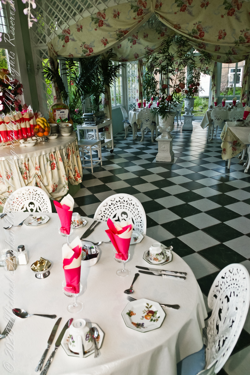
Our day of touring Kinsale and environs, the last day of May 2014, began with this elegant breakfast by Marantha House near Blarney, our base for County Cork.

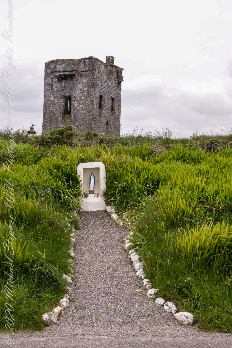
On the way to the Old Head of Kinsale. Located in Knocknacurra on the Kinsale side of Bridge Kinsale on R600. Looking toward the peninsula of Castle Park Village and James Fort. Coordinates 51°41’40.1″N 8°31’42.0″W

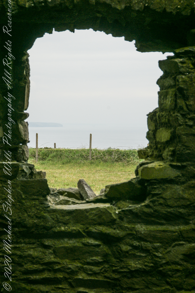
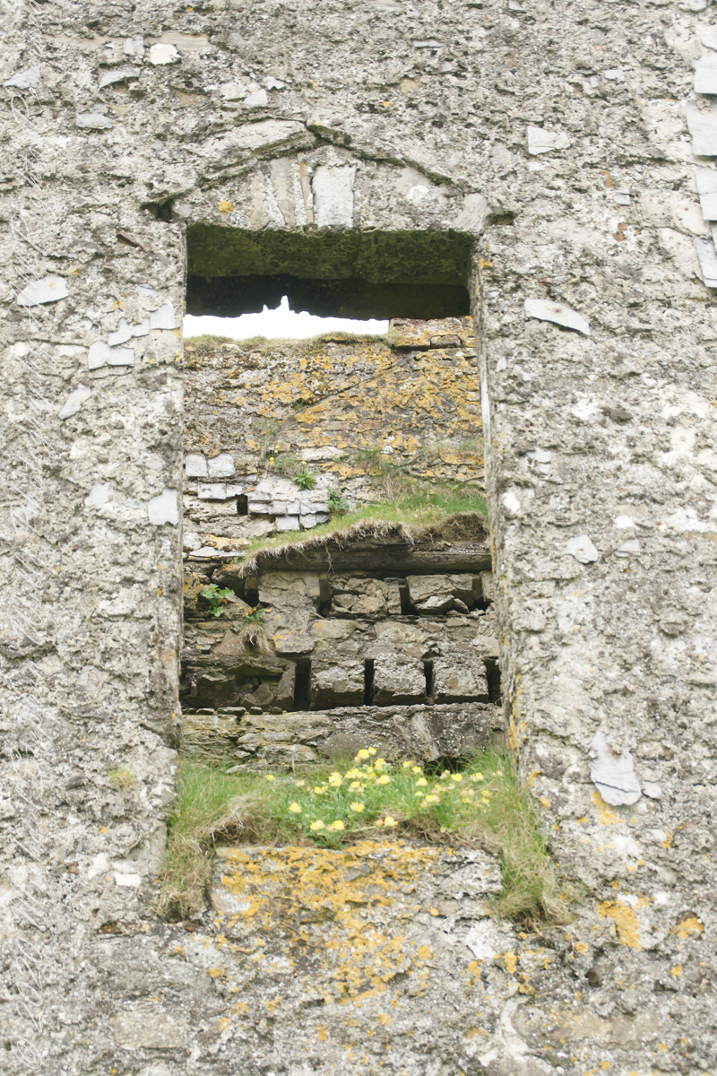
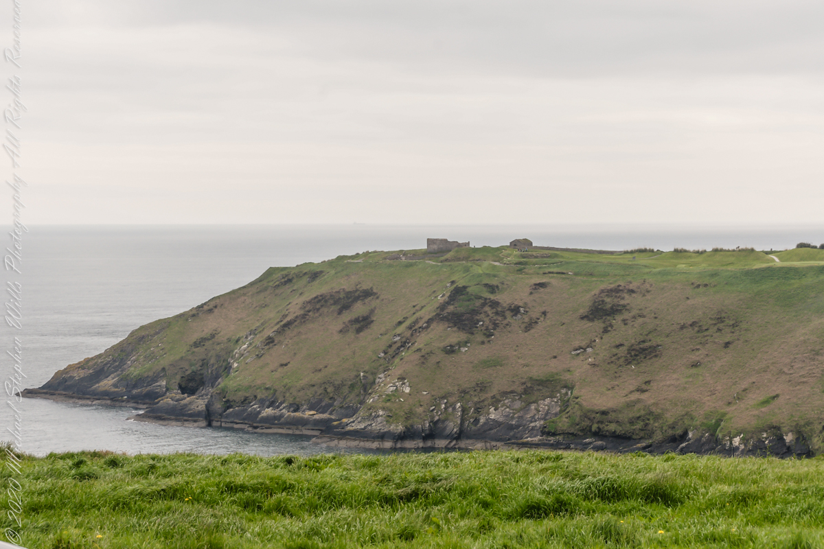
This tower, at the apex of the Old Head ring route, has extensive views. The next station at Seven Heads, to the southwest, is visible against the skyline on a clear day. These are two of the 81 stations planned for this signaling system implemented in the first years of the 19th century when a French naval invasion was a possibility.
The Kinsale tower is just over nine meters high, with walls up to 80 cm thick. Records show a signal crew was in place in 1804 and the tower finished the following year, though severely affected by dampness. When Napoleon was defeated by Wellingtons forces at Waterloo, 1815. With the diminished threat these expensive installations were neglected. The 1899 Ordnance Survey map lists the site as being in ruins. During our 2014 visit the local community was renovating the tower and the work appears complete sometime before 2021.


References
Click me for Irish Times 2013, “Ireland’s Napoleonic-era signal towers.”

Copyright 2021 Michael Stephen Wills All Rights Reserved

Loughcrew Hill View

On the Ground in County Meath

The popular name of the Loughcrew megalithic site is, “The Hill of the Witch” (In Irish, Sliabh na Caillí). In lore sites such as this are associated with The Others (“fairies”), living lives parallel and invisible to ours, touched now and then with resolutely ill effect to our side though sometimes theirs as well. Resolute as in these meetings are fated to end poorly unless…..unless the mortal knows the rules. “If you are ever in an Other’s mansion for a party never, ever eat or drink anything. Eating or drinking will condemn you to an eternal round of parties. You will dance till dropping every night.” Rules such as that, and others, can be used to turn the tables, gain an advantage, of beings from the Other Side.
The story of my wife, Pam, how our lives came to be touched by this afternoon of May 27, 2014, is parallel to the tales of mortals benefiting from contact with The Others. The immediate source was the passing of my mother, Catherine Ann Wills (McCardle), at the age of 90. Mom’s passport gave her place of birth as Proleek, a place in Louth. My maternal grandmother, Mary Catherine McCardle (Mills) spoke with a brogue, less a lilt than a down to earth and kind warmth. I remembered the stories of Mom’s passage to Canada with her mother and father in 1926 at the age of three. The Ireland connection with my father was less direct as I never met his mother as an adult and we seldom spoke of her. It was left to me in the time between my Mom’s passing, an invitation for a visit from our cousin’s in County Louth, and our arrival May 2014 to understand more about Elizabeth (Duffy) Wills, my paternal grandmother.
In this way, I discovered Elizabeth came from a family of Dunderry, County Meath, Ireland, her parents Matthew and Teresa (Plunket) Duffy; our tour of Ireland came to start from a bed and breakfast near Trim, County Meath, with Dunderry up the road. May 27th, we planned as an exploration of all things County Meath, to include Loughcrew, the highest point of the county in the west.
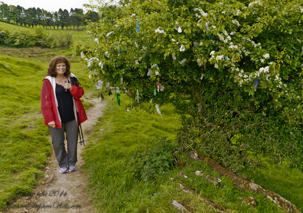
Along the steep path to the hilltop a hawthorn tree covered with flowers and offerings welcomes visitors. May is the month for decorating hawthorns, the blossoms are also known as “Mayflowers” as in the ship the pilgrims sailed to Plymouth Rock.

Click the photograph to open a new window/tab of my Online Gallery.
Pam and Hawthorn– CLICK ME!!!!

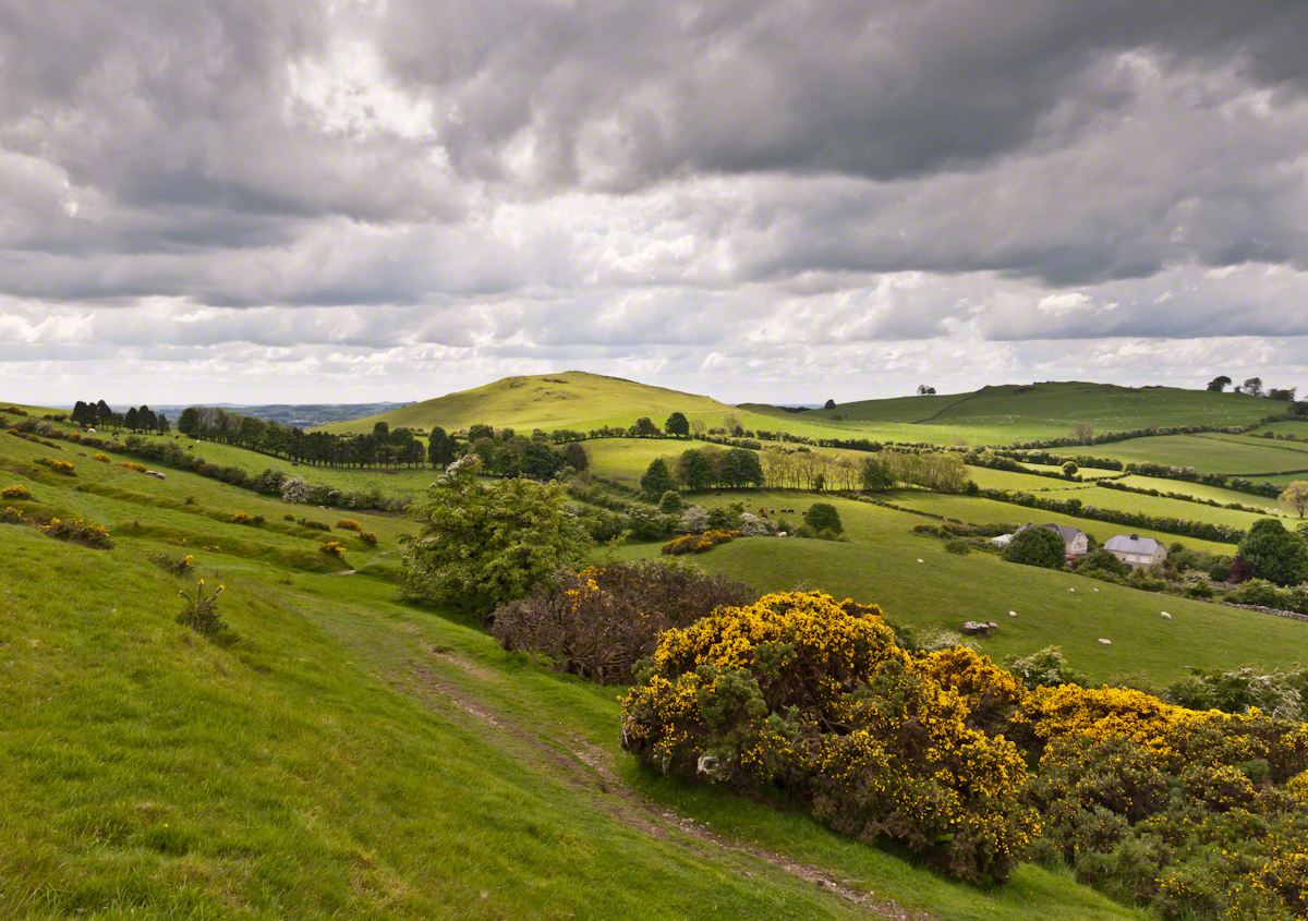
As if we entered a gateway, when pausing and turning high on the hill, this view was revealed, otherworldly in its fullness, scope and wonder as though we passed to the other side to the fairies.
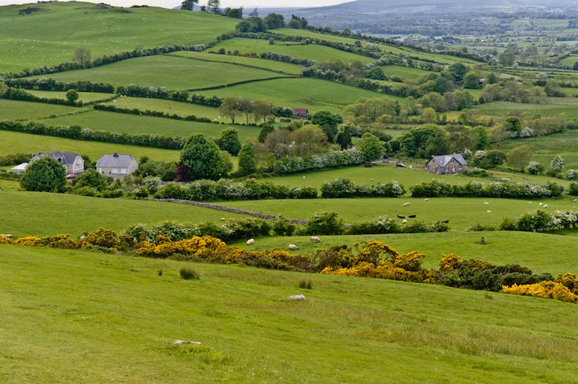
Cairnbane East of the Loughcrew Cairns site, County Meath Ireland, is also known as Hag’s Mountain. We are looking south, southwest from the north side toward Cairnbane West. Flowering yellow whin bush, also known as gorse, is in foreground; white flowering hawthorn trees in distance. No elements of this photograph hint at the year 2014.

Hag's– CLICK ME!!!!

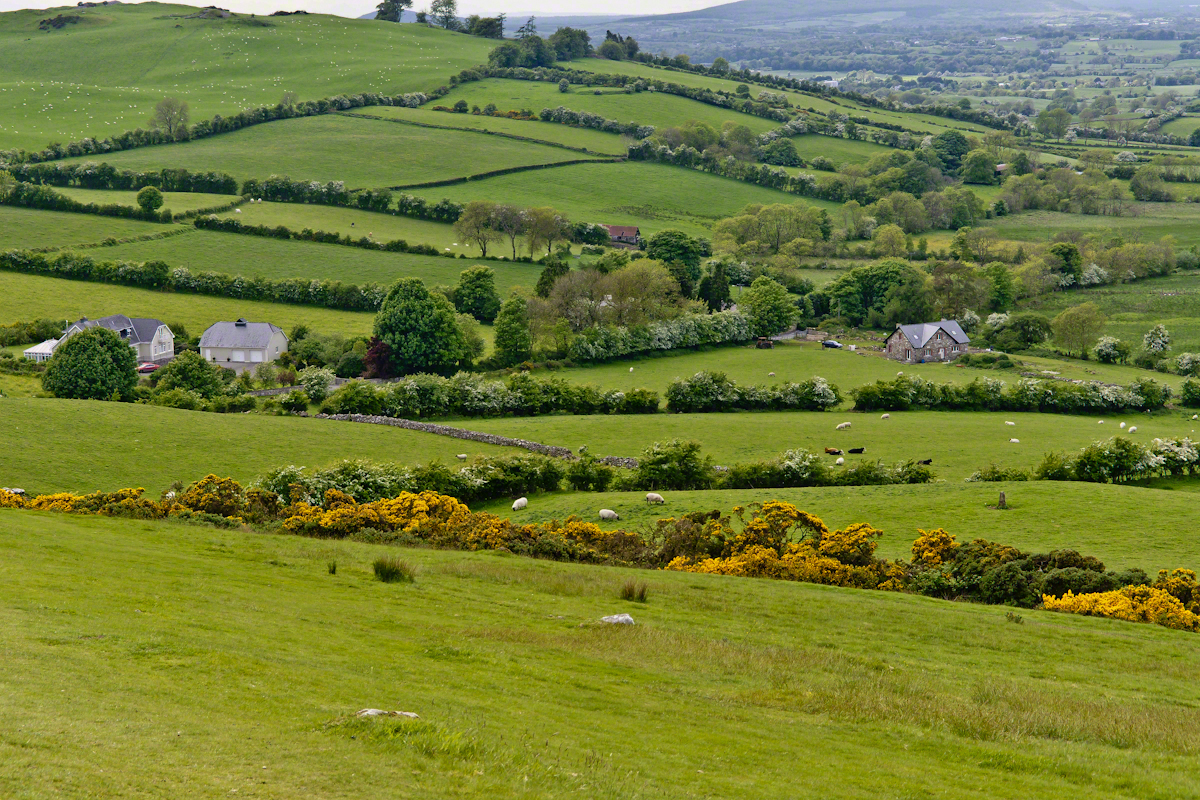
A solitary standing stone below the trail to the Loughcrew site surrounded by whin bush in yellow flower and white blooms of hawthorn hedge rows. A fieldstone fence, farmhouses, a patchwork quilt of fields completes the view.

Hag's– CLICK ME!!!!

Meanwhile, in the real world, when Pam and I complete our round of the island to return to my cousins in County Louth, they told us, on this day, two young men were discovered parked next to a nearby lough, murdered during a drug deal gone bad.

Click for another Ireland posting

Copyright 2021 Michael Stephen Wills All Rights Reserved

Pinelands Connections VI

Running the numbers

……continued from “Pinelands Connections I.

Genealogy is a numbers game, in part. Looking back from myself the number of progenitors increase by the formula x = 2^y (2 raised to the y power) where y is the number of generations back. Generation one (my parents) is 2^1 = 2. We have 2^4 = 16 double great grandparents, 8 pairs. Four pairs on my father’s side, four pairs on my mother’s. Saint Mary of the Assumption Cemetery contains one pair of my father’s side, James McCambridge and Ann Milley. The cemetery in Tabernacle contains the other, George Wills and Mary Dellett.

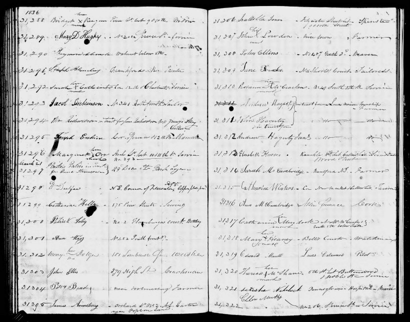
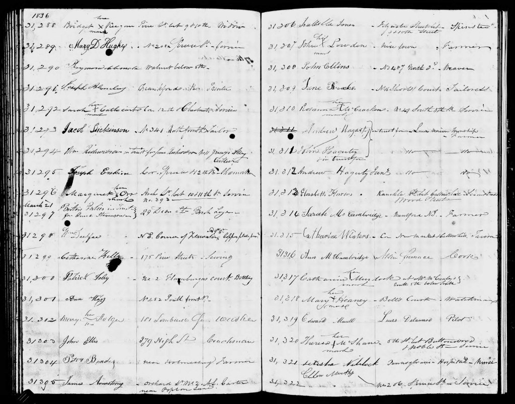
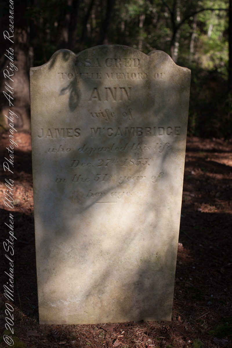
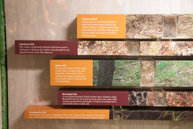
A dry ledger entry reveals a side of Great, great grandmother Ann McCambridge (Milley). The wife of James McCambridge had, under her own name, a savings account with the Philadelphia Saving Fund Society. Ann was a forward thinker to invest in this, the first savings institution of the United States, in the twentieth year of its existence. Work outside the home, as a cook, was her source of funding. We can also infer from the ledger information Ann’s employer was Atison furnace.

Times were prosperous in Atsion. Thomas Gordon, in his Gazetteer of the State of New Jersey, tells of the size and scope of the works at Atsion in 1834:

Atsion, post-town and furnace, on the Atsion River, partly in Galloway Township, Gloucester County, probably in Washington Township, Burlington County, 9 miles above the head of navigation, 12 miles from Medford, 17 from Mount Holly, on the road leading to Tuckerton, and 57 from Trenton. Besides the furnace, there are here, a forge, gristmill, and three sawmills. The furnace makes from 800 to 900 tons of casting, and the forge from 150 to 200 tons of bar iron annually. This estate, belonging to Samuel Richards, Esq., embraces what was formerly called Hampton furnace and forge, and West’s Mills, and contains about 60,000 acres of land. There are about 100 men employed here, and between 6 and 700 persons depending for sustenance upon the works.

Nineteen years later, Ann passed away two days after Christmas at the young age of 51, her savings may have provided for the elaborate headstone inscription. She left her husband of twenty six years and nine children, the family is listed below with ages from the 1850 U.S. census. Her fifth child, Margaret, my great-grandmother, was sixteen at Ann’s death. The youngest, Catherine, was eight.

James McCambridge Age 44

Ann McCambridge Age 44

John McCambridge Age 20

Mary Ann McCambridge Age 16

James McCambridge Age 15

Sarah Jane McCambridge Age 14

Margaret McCambridge Age 11

William McCambridge Age 8

George McCambridge Age 6

Edward McCambridge Age 5

Catherine McCambridge Age 3

James McCambridge and Ann Milley were born the same year, 1805, in or near the Pinelands. The married at the age of twenty two, February 25, 1829. A son, John, was born 18 months later, August 7, 1830. In 1850 James supported his wife and nine children as a “collier”, producing charcoal for the furnaces. He lived on for 31 years with their children.

From Bog Iron “ironmasters of the Pine Barrens made cannonballs by the thousand and sent them by wagon over the sand roads and on to the Continental Army at Valley Forge and elsewhere. They brought in seashells for flux, and used charcoal from the pinewoods to fire their forges and furnaces. They made cannon as well as shot, and they ordnance the War of 1812 as well as the American Revolution. The twenty-four-pounders (cannons) with which Stephen Decatur armed his flagship when he took his Marines to Algiers, Tunisia, and Tripoli were cast at Hanover Furnace (later named Atsion),in the Pine Barrens, in 1814, and Decatur himself were there to supervise the casting and test the product……Ironworkers in the pines made the steam cylinder for one of John Fitch’s experimental steamboats, and they made the wrought-iron fence that once surrounded Independence Hall….Iron stoves that bear the town name Atsion over their fuelling doors were made in a community that had a population of seven hundred in the early nineteenth century and has a population of fifteen today.” from “The Pine Barrens” by John McPhee, November 25, 1967.

Pinelands Connections VII

References

Atsion Furnace https://www.njpinebarrens.com/atsion-part-2-prosperity-and-decline/

Philadelphia Saving Fund Society Encyclopedia of Greater Philadelphia | PSFS (philadelphiaencyclopedia.org)

Copyright 2021 Michael Stephen Wills All Rights Reserved

Skellig Peek

A Trinity of Skellig Images

Now’s time to share a trinity of images from a morning spent about the Skellig Islands May 2014.

Pam and I have many stories from that day, a favorite is from the parking lot of Portmagee where we met the fast boat to the island. I prepared for the day by making a reservation for our ride. We traveled from Killarney, where an early morning breakfast feast spread by The Killarney Royal Hotel fortified us for the adventure. Throughout our tour, experiencing Ireland was like taking blinders off, this first experience on The Ring of Kerry was no exception, driving on a tight timeline to reach Portmagee with minutes to spare, every turn of the road presented a new delight.

Grateful to have made it to Portmagee, we quickly pulled our kit together. As I closed the bonnet, Pam exclaimed “our umbrellas.” At this point of the story we laugh together. Umbrellas indeed. I had a dim clue of what lay in store for us and insisted the umbrellas be left behind, a counter-intuitive decision for a rainy Irish day the Wild Atlantic Way. Regardless of the time, we needed a bathroom break as there will be no facilities on the fast boat or the World Heritage Site where there is no space for human waste products.
Click any photograph for my Online gallery.
Skelligs from Valentia Island
I was here perched on a cliff of Valentia Island across from Portmagee looking southwest across Valentia Sound.
The humor is in our welcome aboard the fast boat, like a fishing boat with a small cabin and small deck dominated by the engine hatch. We crowded on, handed a full set of fisherman slickers. This is a heavy coat with hood and pants, all waterproof. Our close timing guaranteed the worse seat, away from the cabin in the open. It was a new experience for us and we felt a sense of dread as the craft left the protection of Valentia Sound into the open Atlantic Ocean.

We faced a west wind, driving 12+ foot waves, as the boat breached each wave the crest went over the cabin in a waterfall of salt water. Up and down, up and down. Thankfully neither of us lost breakfast as some did. I do not have photographs of the trip out or the approach to the island, my equipment was safely packed away.

In the above photograph you see the entire course of our approach to the island, a bit more than 10 (land) miles from Portmagee. We toured Valentia Island that afternoon.

Click any photograph for my Online gallery.
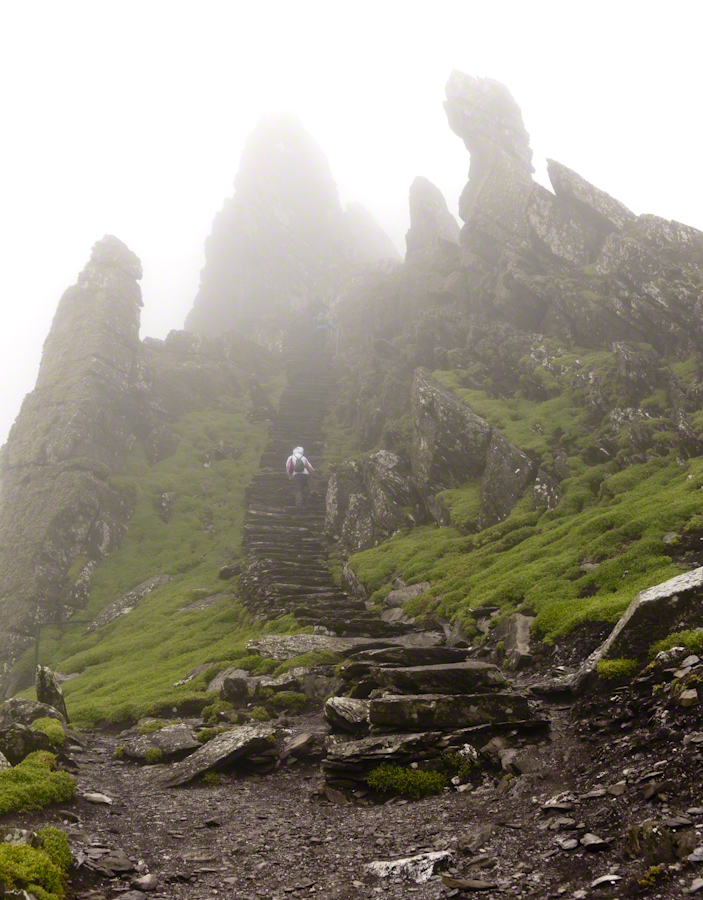
Skellig Steps
Climbing the side of Skellig Michael, approach to the peak and monastery.

There is a fair climb to the top to view the former monastery buildings. The steps are uneven and, when wet as it was that day, slippery.  I wore a waterproof North Face shell with hood for the low threatening clouds.  There was no rain as such, a constant fog on the top kept all exposed surfaces wet.

From the point on, until the top, was the most exposed and uncomfortable (frightening, chilling…you get the idea).  Spare yourself the experience if you are afraid of open spaces and heights.  Here was a stiff wind blowing from the right, on the left the cliff falls away to the ocean.  Ahead, the path narrows to about 10 inches with a cliff wall on one side, the precipice on the other.  Then come the monastery entrance and rock wall safety.

Click any photograph for my Online gallery.
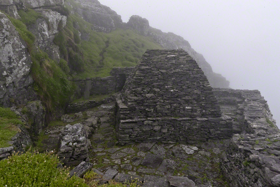
Monk Cell
Monk Cell, Grave and Cross

This single image gives a succinct impression of the monastery setting.  The bee hive shaped stone monk cell requires a stooped crawl to enter.  Inside, the space is small and, thankfully, dry.  The structure keeps out the rain and wind, a marvel of stone construction. This cell is off to the side, on a cliff balcony, over the wall an ocean precipice.

My closing advice is to plan your time wisely.  The ship boards in less than an hour, in that time you climb the 700 steps and explore.  There are people all over the place, in waves. To capture the structures without humans, you need to wait until the cohort become bored and leaves.  There will be a space before the next wave of tourists breaks. Leave enough time to descend the steps safely.  People have suffered fatal falls on the steps and cliffs, it is easy to do.  Make your personal safety a priority.

Click for another Ireland Posting, “On the River Cong.”

Copyright 2021 Michael Stephen Wills All Rights Reserves

Pinelands Connections V

Saint Mary’s of the Pines (St. Mary of the Assumption)

……continued from “Pinelands Connections I.

The Pinelands chemical reactions / iron furnaces of Part III are elements of the warp and weft of our family’s story. Saint Mary Assumption (“Saint Mary’s of the Pine”) Roman Catholic church was another. Family members comprise 60% (60 percent) of the burials, comprising these family names: Dellett (see Pinelands Connections I), Milley, Wills, McCambridge.

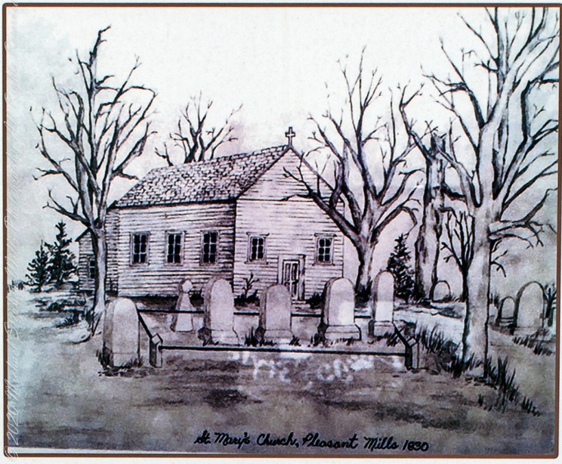
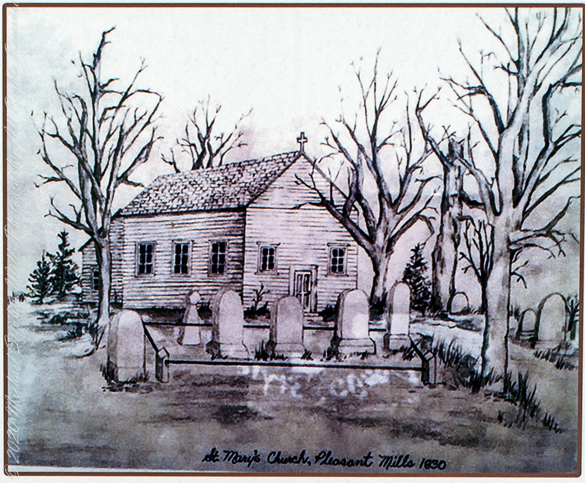
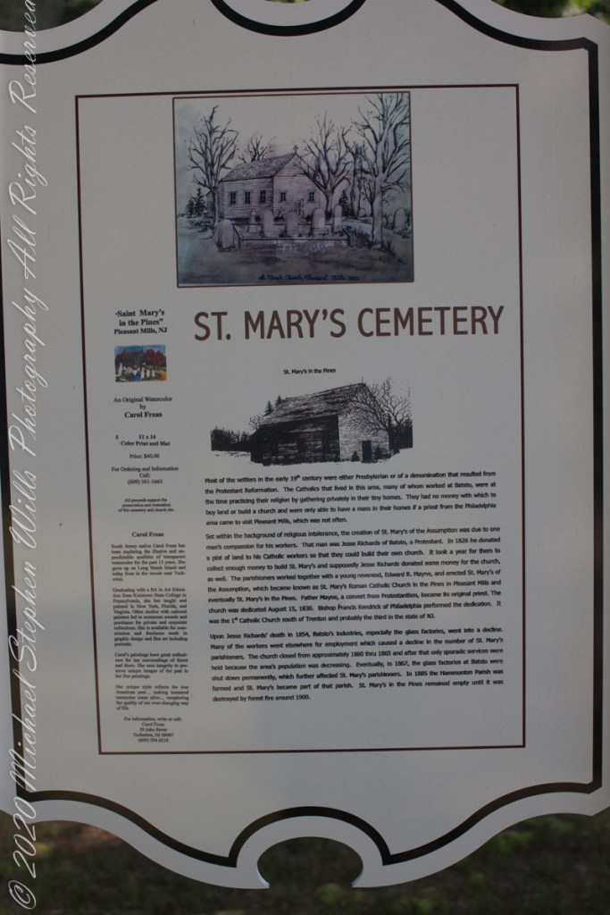
“Most of the settlers in the early 19th century were either Presbyterian or of a denomination that resulted from the Protestant Reformation. The Catholics that lived in this area, many of whom worked at Batsto, were at the time practicing their religion by gathering privately in their tiny homes. They had no money with which to buy land or build a church and were only able to have a mass in their homes if a priest from the Philadelphia area came to visit Pleasant Mills, which was not often. Set within the background of religious intolerance, the creation of St. Mary’s of the Assumption was due to one man’s compassion for his workers. That man was Jesse Richards of Batsto, a Protestant. In 1826 he donated a plot of land to his Catholic workers so that they could build their own church. It took a year for them to collect enough money to build St. Mary’s and supposedly Jesse Richards donated some money for the church, as well. The parishioners worked together with a young reverend, Edward R. Mayne, and erected St. Mary’s of the Assumption, which became known as St. Mary’s Roman Catholic Church in the Pines in Pleasant Mills and eventually St. Mary’s in the Pines. Father Mayne, a convert from Protestantism, became its original priest. The church was dedicated August 15, 1830. Bishop Francis Kendrick of Philadelphia performed the dedication. It was the first Catholic Church south of Trenton and probably the third in the state of New Jersey. Upon Jesse Richards’ death in 1854, Batsto’s industries, especially the glass factories, went into a decline. Many of the workers went elsewhere for employment which caused a decline in the number of St. Mary’s parishioners. The church closed from approximately 1860 through 1865 and after that only sporadic services were held because the area’s population was decreasing. Eventually, in 1867, the glass factories at Batsto were shut down permanently, which further affected St. Mary’s parishioners. In 1885, the Hammonton Parish was formed and St. Mary’s became part of that parish. St. Mary’s in the Pines remained empty until it was destroyed by forest fire around 1900.” From the sign “St. Mary’s Cemetery, St. Mary’s in the Pines”).

The historical sign includes an offer in support of the preservation and restoration of the cemetery and church site. An original water color (pictured above) by Carol Freas, 11×14 color print and mat, Price $40.00. For information, write or call Carol Freas, 39 John Street, Tuckerton, NJ 08087 (609) 294-0218

Pinelands Connections VI

Copyright 2021 Michael Stephen Wills All Rights Reserved

Pinelands Connections IV

Bog Iron

This series starts here “Pinelands Connections I.

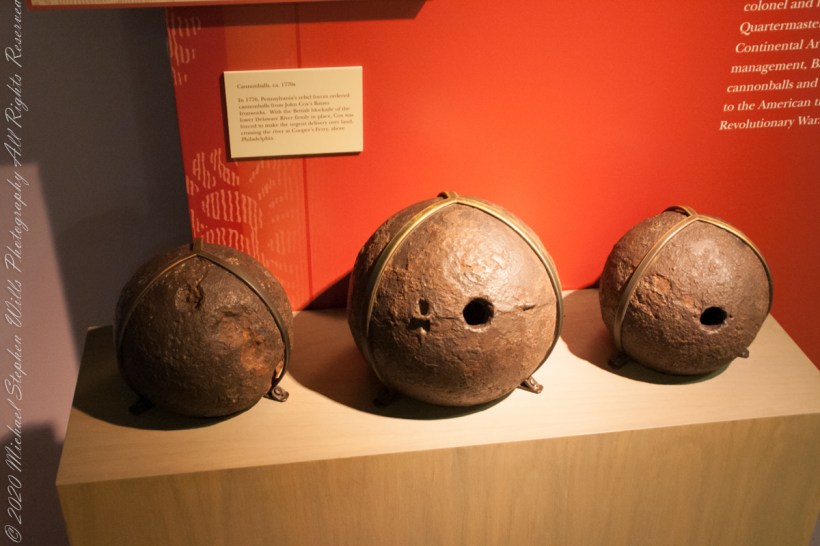
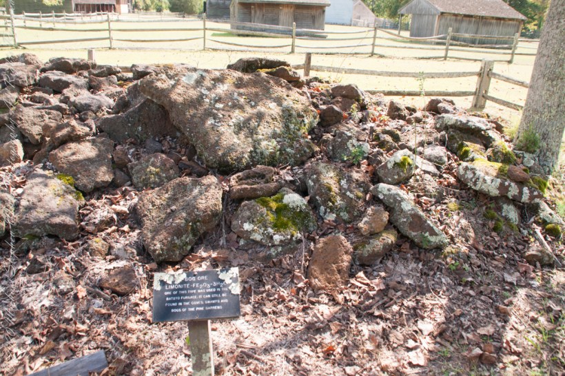
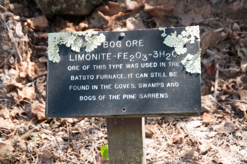
“There was also iron in the Pinelands. Most of the now vanished towns in the pines were iron towns — small, precursive Pittsburghs, in every part of the forest, where fine grade of pig and wrought iron were made. One of the geological curiosities of the Pine Barrens is that rainwater soaking down through fallen pine needles and other forest litter takes on enough acid to leach out iron from the sands below; the dissolved iron moves underground into the streams, where it oxidizes on contact with the air and forms a patch of scum on the surface that is partly rust brown and partly iridescent blue, and resembles an oil slick left by an outboard motor; drifting over to the edges of the streams, this iron-oxide film permeates the sands and gravels of the riverbanks and cements them together into a sandstone composite that has been known for centuries as bog iron. From it ironmasters of the Pine Barrens made cannonballs by the thousand and then them by wagon over the sand roads and on to the Continental Army at Valley Forge and elsewhere.” From The New Yorker magazine, November 26, 1967, “Profiles, The Pine Barrens I” creative non-fiction by the great John McPhee.

“In 1770, a Philadelphian named John Cox was a member of the first Committee of Correspondence and a member of the Council of Safety. With the coming of war, he became a lieutenant colonel and, eventually, assistant quartermaster general of the Continental Armies. His ironworks at Batsto flourished on war contracts from the Quartermaster Corps. In 1778, Cox sold Batsto for forth thousand pounds — a capital gain of about sixteen hundred per cent……Batsto was to reach its most developed stage in the eighteen-thirties and eighteen-forties, when the town had a population of eight hundred. Batsto is one of the few iron towns that remain in the Pine Barrens. …..The state has restored its water-powered sawmill, and sawyers cut white cedar there and make cedar shingles for use in restoration of Batsto buildings.” From The New Yorker magazine, November 26, 1967, “Profiles, The Pine Barrens I” by John McPhee.

Competition from more productive sources of iron and the coal-fired Pittsburg furnaces brought down the Pinelands iron works at their height. By 1848 the furnace at Batsto was cold.

Click me for Pinelands Connections V

Copyright 2021 Michael Stephen Wills All Rights Reserved

Pinelands Connections III

A presence today

“Driving along a sand road between the vanished town of Calico and the vanished town of Munion Field, we passed a house that was so many miles from any other house that Fred said, with evident admiration, “He got well in away from everybody, didn’t he?” Fred made a similar remark every time we passed a house or cabin that was particularly deep and alone in the weeds. Getting — or staying — way from everybody is a criterion that apparently continues to mean as much to many of the people in the pines as it did to some of their forebears who first settled there. Tories, for example, fled into the pines during the American Revolution. People with names like Britton and Brower, loyal to the King, and sometimes covered with feather and tar, left their homes in colonial cities and took refuge in the Pine Barrens. Also, during the eighteenth century, when the farmlands of western New Jersey were heavily populated with Quakers, the Pine Barrens served as a catch basin for Quakers who could not live up to the standards of the Quaker code….” From The New Yorker magazine, November 26, 1967, “Profiles, The Pine Barrens I” creative non-fiction by John McPhee.

……continued from “Pinelands Connections II.

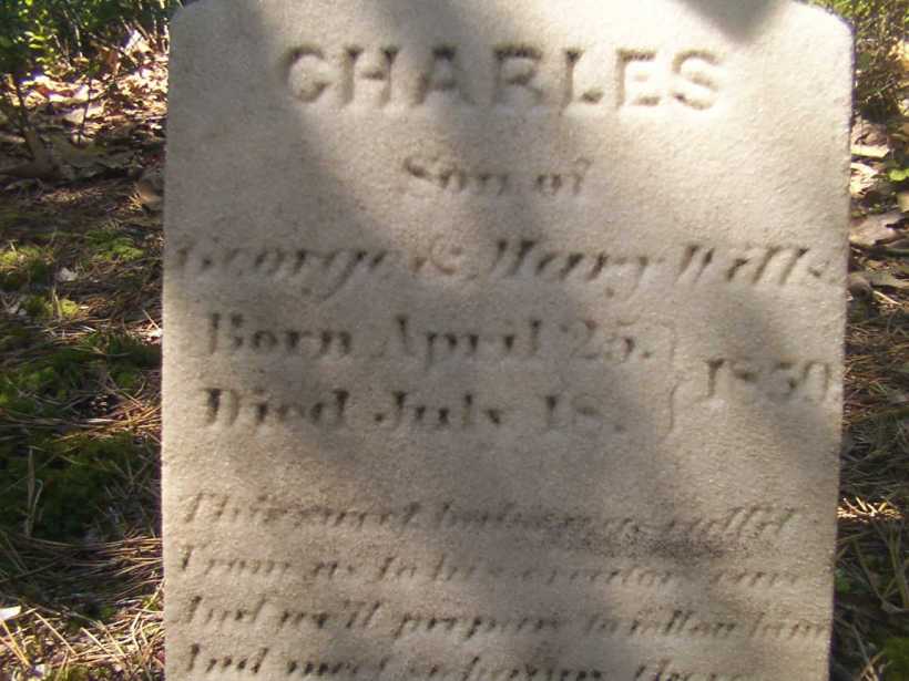
Vanished like the towns of Washington, Calico, Munion Field are the reasons that led to the union of the Quaker George Wills and Mary Dellett, daughter of James, emigrant from Northern Ireland. It is reasonable to surmise George, separated from the Quakers, sought refuge in the pines as a young man.

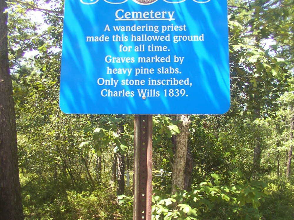
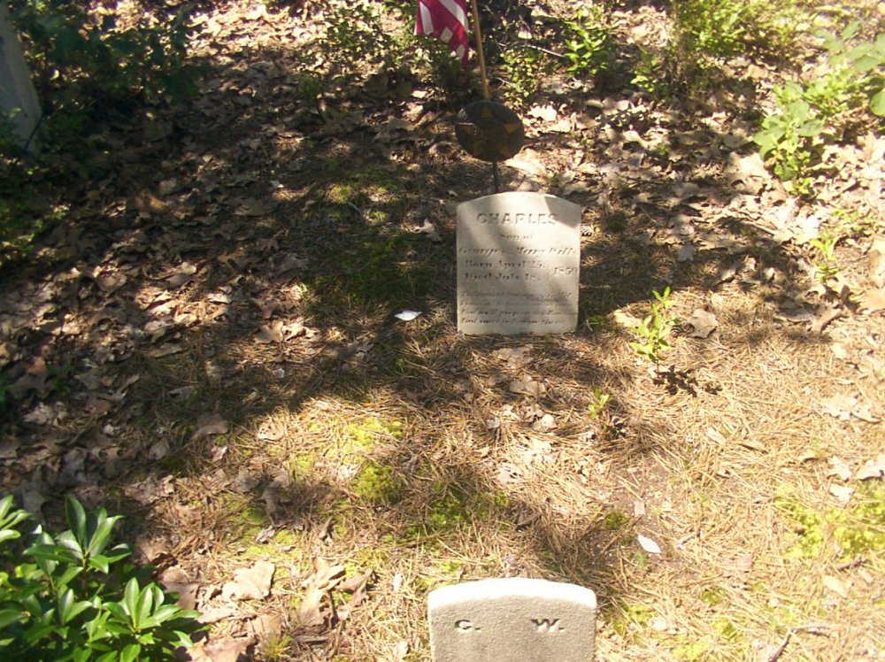
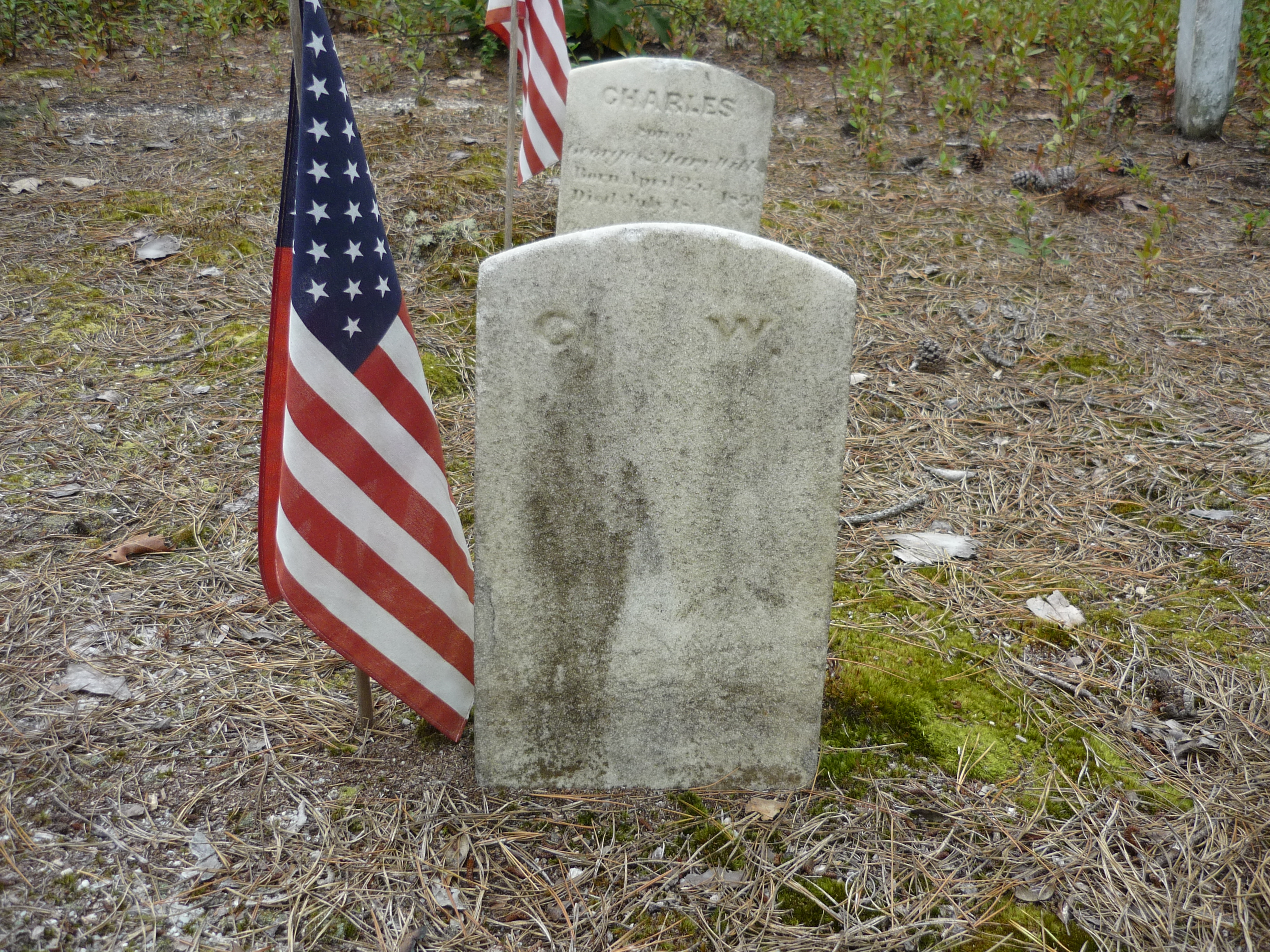
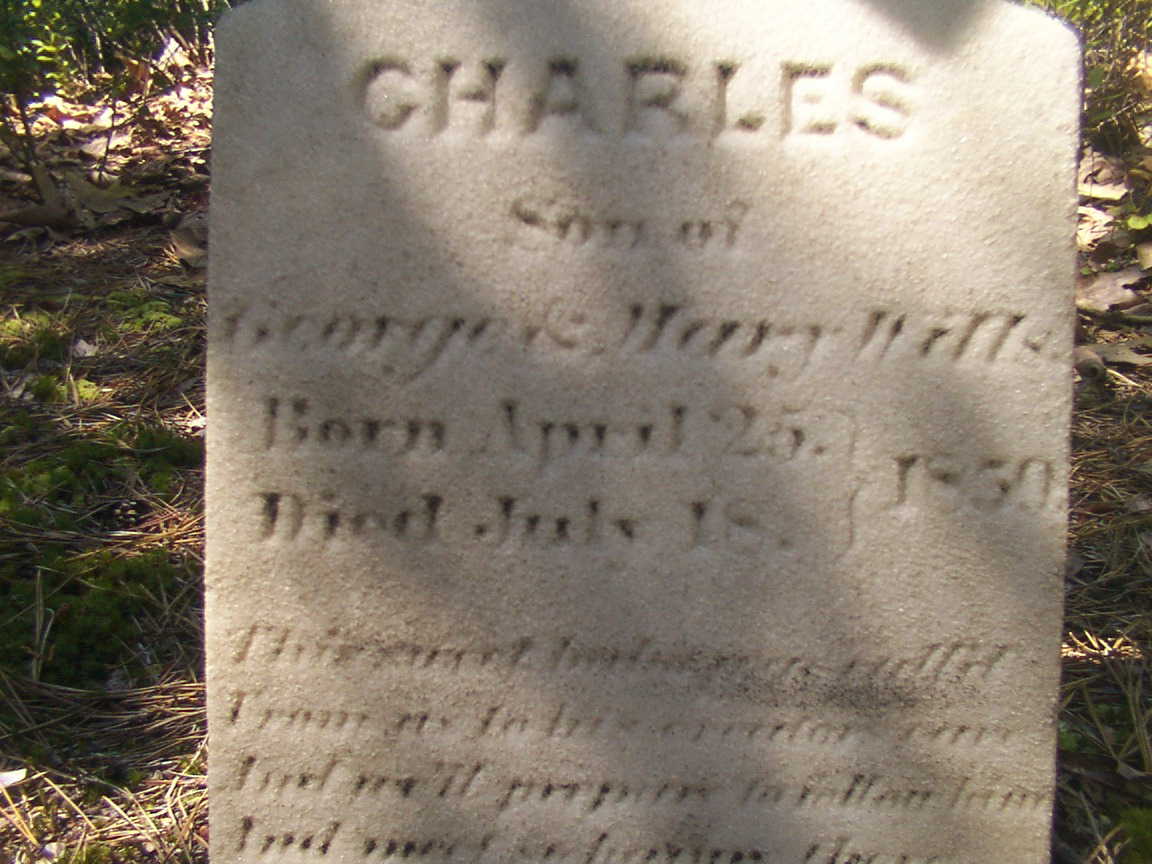
We can tease grief and loss from the records and landscape, When Joseph C. Clark visited George and Mary on August 24, 1850 to record the persons living there, if the U.S. Constitution prescribed the recording of the grief he experienced, the record would show Charles missing from the list. Follow the sand path, “Eagle Road” three miles north where he lays in the ground of the family cemetery, having passed just days before the 1850 census was taken.

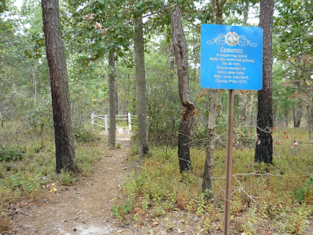
The loss of a cherished presence can be inferred from the use of precious marble to mark his resting place. The heavy pine slabs of his companions long since vanished.

As with the Wills Hotel, the Wills Family Cemetery is best found through global coordinates: 39°45’49.7″N 74°34’01.4″W

Click me for Pinelands Connections IV

Copyright 2021 Michael Stephen Wills All Rights Reserved

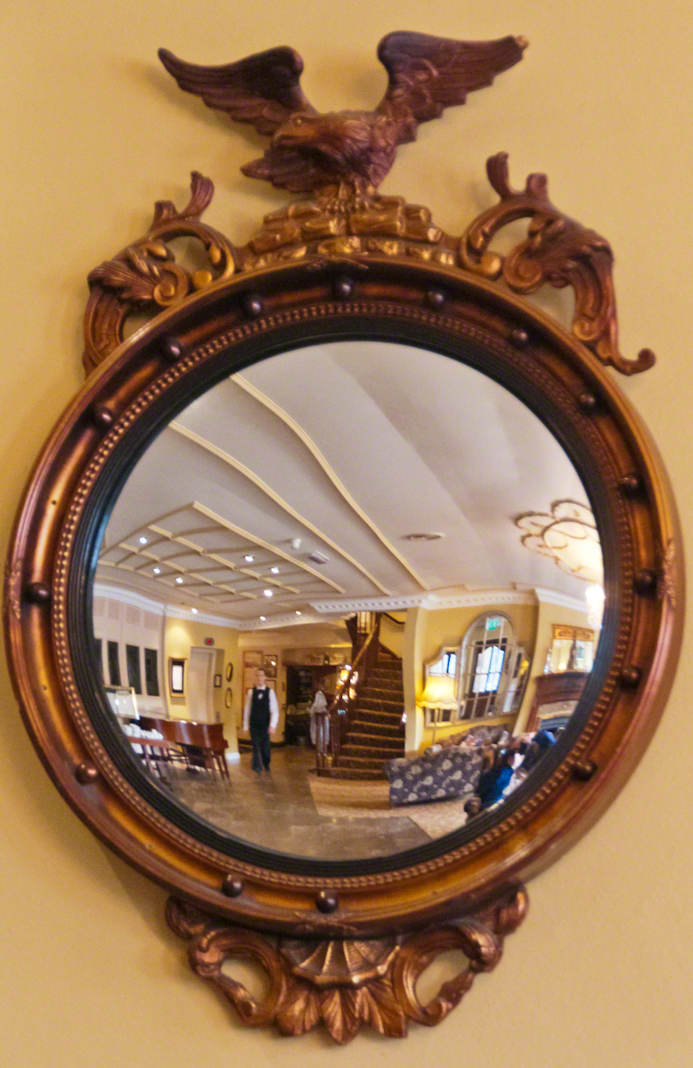
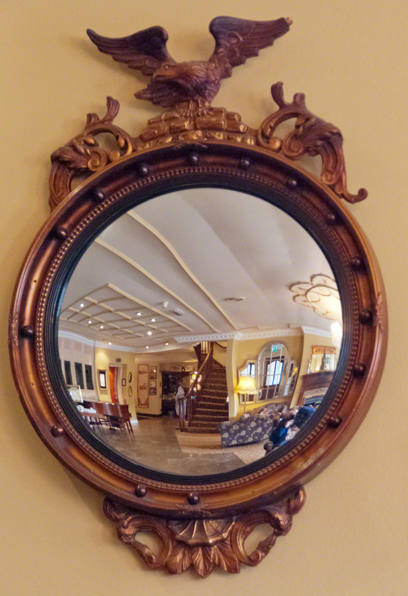
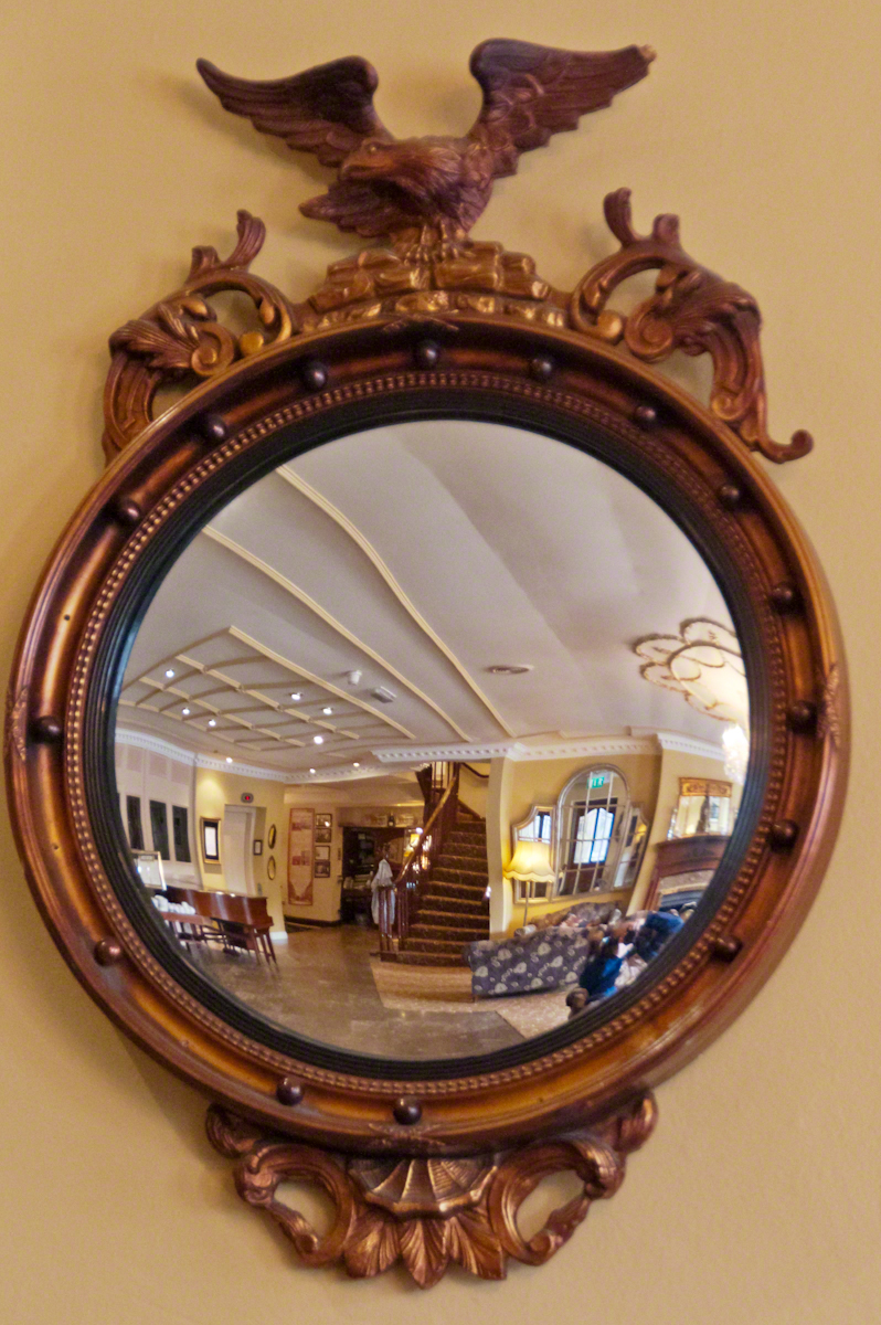
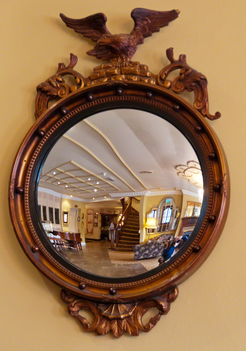
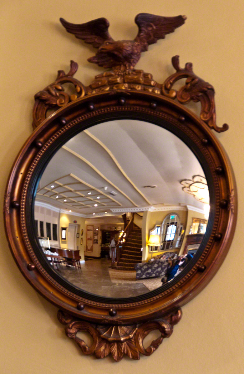
Framed Convex Mirror, Killarney Royal Hotel

The morning of our day on the Dingle Peninsula I left the room early, my Sony Alpha 700 in hand, while Pam finished her preparations.  The elevator deposited me in the lobby and I proceeded to capture images of the Killarney Royal Hotel, our base for three nights.

This marvelous “antique” mirror caught my eye. We are used to seeing convex mirrors in the upper corners of elevators, strategically located at hallway junctions, automated teller machines and parking garages all with the intention of providing a wide, fisheye, view to detect unsavory, lurking types and danger.

Click any photograph to open my Online Gallery in a new window/tab.
Framed Convex Mirror– CLICK ME!!!!

This spotless, framed convex mirror is from a older, saner time.  Such objects came in use from the 1400’s (15th century). When all glass was blown, a convex surface was easier to produce than a flat and, since all glass was expensive to produce, a convex mirror was a popular luxury item, an expensively framed status symbol.

Framed Convex Mirror– CLICK ME!!!!

As the mirrors were an element of elite surroundings, art came to include them as objects in the midground, the surface reflecting back to the viewer a different viewpoint. An opportunity for an artist to demonstrate virtuosity. Examples are Jan van Eyck’s “Arnolfini Portrait” and the left wing of the Werl Triptych by Robert Campin.

Framed Convex Mirror– CLICK ME!!!!

Known as the “sorcerer’s eye” from the all encompassing view and, in keeping with our modern uses, even back then also called a”banker’s eye.”  Symbolically, the 15th century paintings used a pristine mirror to represent the Immaculate Conception.

Framed Convex Mirror– CLICK ME!!!!

The five images here are the final result of trial and error, working out the details of using a flash in the relatively low light of the morning lobby, avoiding my reflection, maintaining a sharp focus throughout the field, capturing the unique details of the frame without distortion and the mirror’s wide angle view.  I gave up on the flash and, instead, did this series at f5.6 and the ISO incremented 800 to 3,200. As such, the exposure ranged from 1/5 to 1/25 of a second. All shots were handheld.

Framed Convex Mirror– CLICK ME!!!!

I hope you enjoy the results. This was a promising start to our memorable day of exploration.

Here’s the next installment of our Dingle Exploration….

Here’s a previous Ireland posting…..

Copyright 2021 Michael Stephen Wills All Rights Reserved