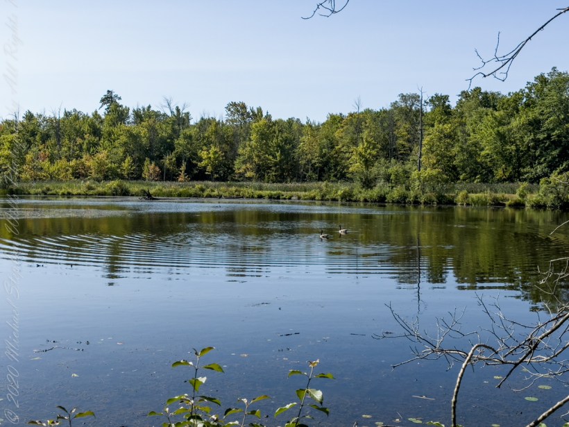
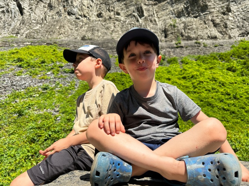
Thursday last, grandsons Sam and Rory and I visited Sapsucker Woods, enjoying a late summer morning. From the north side on Wilson Trail, these Canada geese landed on the pond.
In North America, nonmigratory Canada goose populations have been on the rise. The species is frequently found on golf courses, parking lots, and urban parks, which would have previously hosted only migratory geese on rare occasions.
Owing to its adaptability to human-altered areas, it has become one of the most common waterfowl species in North America. In many areas, nonmigratory Canada geese are now regarded as pests by humans.
They are suspected of being a cause of an increase in high fecal coliforms at beaches. An extended hunting season, deploying noise makers, and hazing by dogs have been used to disrupt suspect flocks.
A goal of conservationists has been to focus hunting on the nonmigratory populations (which tend to be larger and more of a nuisance) as opposed to migratory flocks showing natural behavior, which may be rarer.
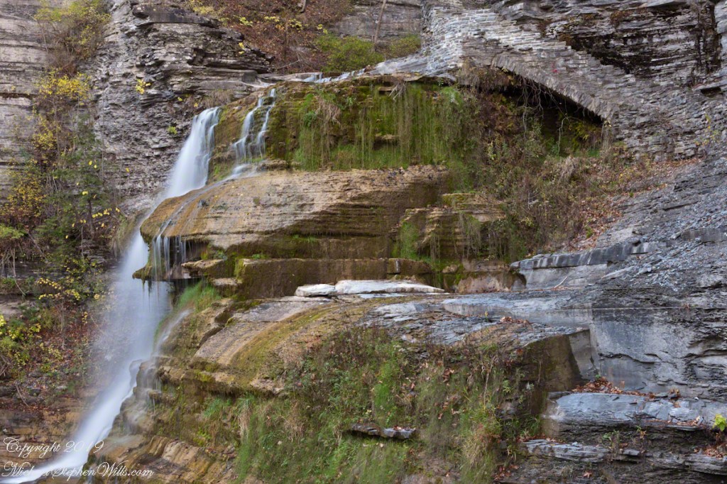
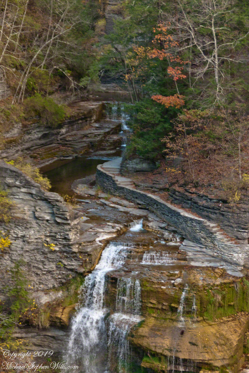
Pam examining thick moss growth on the sedimentary rock of Treman gorge. These layers of shale, sandstone, siltstone formed at the bottom of a broad, shallow sea over 380 million years ago.
Click photograph for a larger view. To do this from WordPress Reader, you need to first click the title of this post to open a new page.
Pam examines the moss
Towards the bottom of the 223 Cliff Stair steps moss takes over the Devonian shale of the cliff wall surface. Here, the cliff shelters the wall from sunlight 365 days a year.
Cliff Stair Wall, autumn Moss
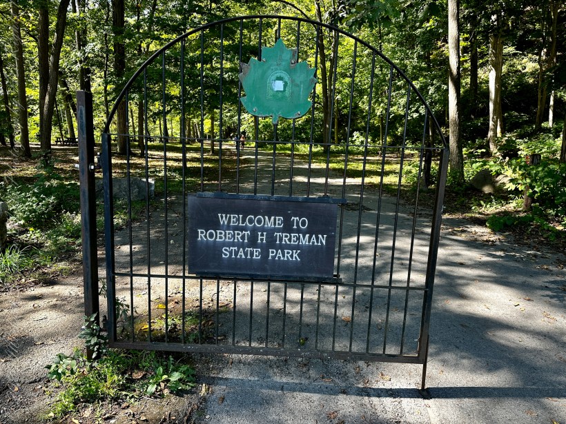
Robert H. Treman New York State Park.
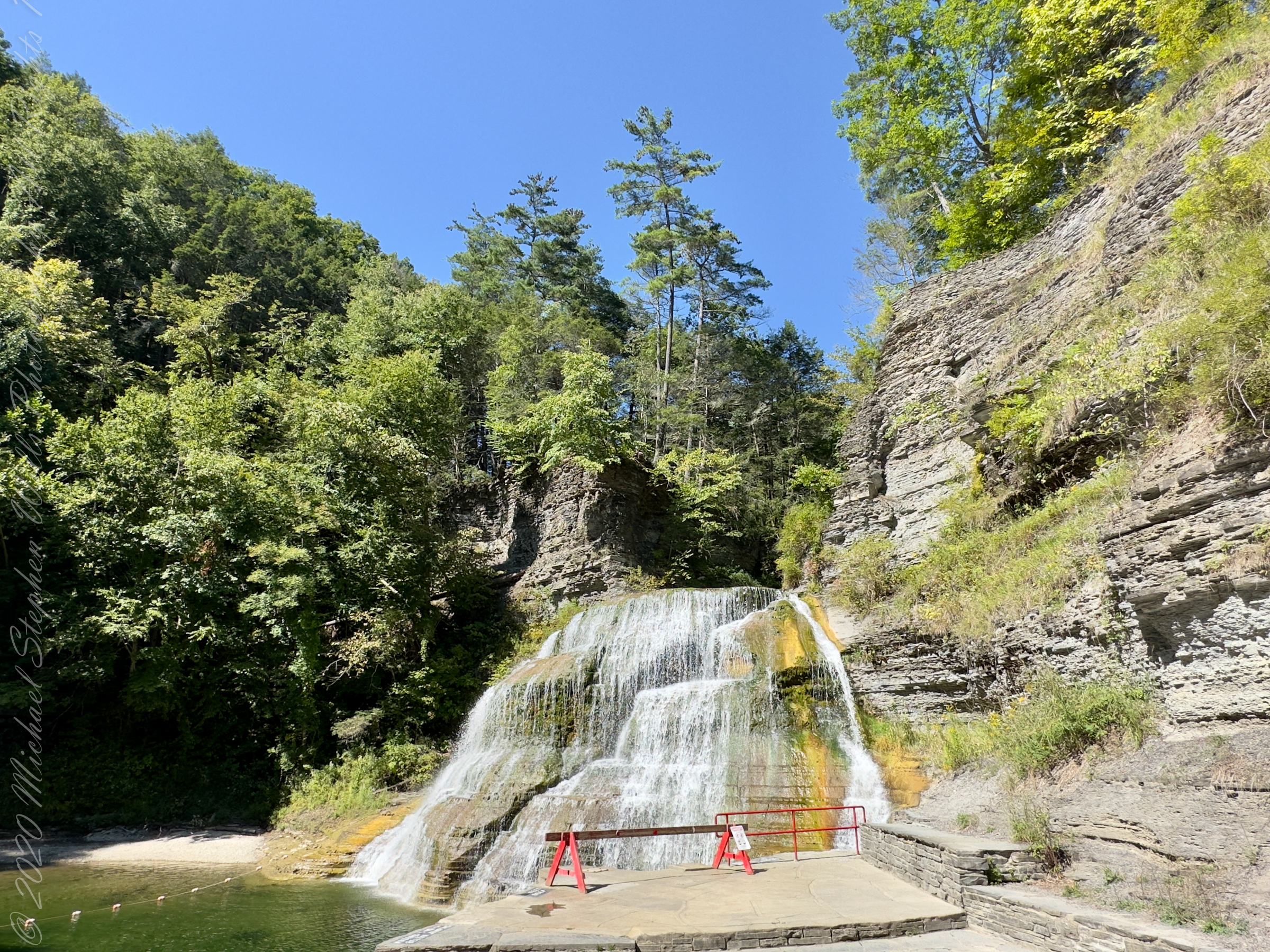
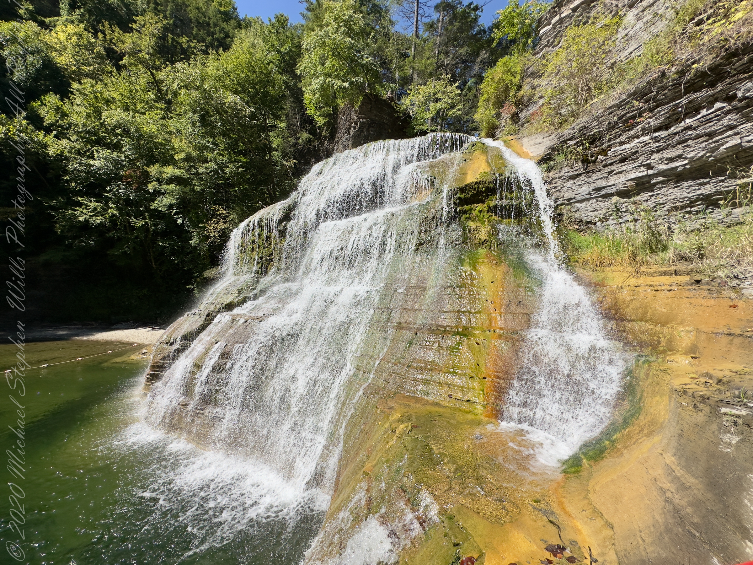
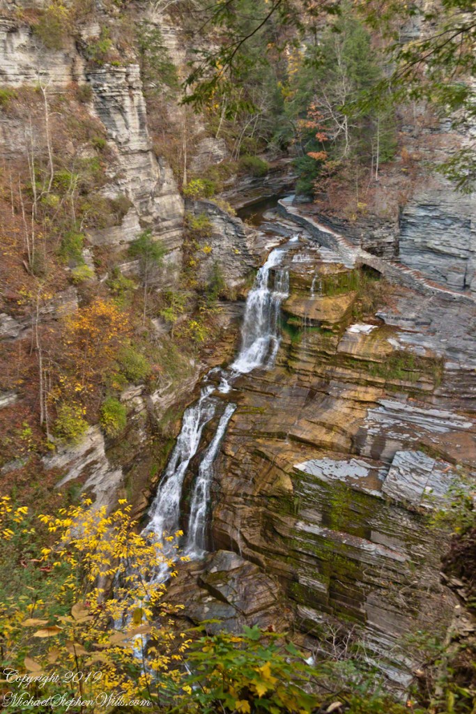
Click for a slideshow of this sequence Lucifer Falls and Cliff Stair Views
Brink of Lucifer FallsLucifer Falls Overlook from the Gorge TrailLucifer Falls from Rim Trail OverlookPam on the Cliff StaircaseUnidentified TreeThis geranium species (scientific name Geranium robertianum) are also called “Herb-Robert” for a reputed ability to ward off disease and, in the Scottish Highlands, “red-shanks” for the deep red color of the stalks, seen in this photograph. Robert H. Treman New York State Park. Source, “How to Know the Wildflowers” by Mrs. William Star Dana, 1989, Houghton Mifflin, Boston.Autumn foot BridgeWoman on Footbridge, ContemplationOver the bridge
Copyright 2023 All Rights Reserved Michael Stephen Wills
This geranium species (scientific name Geranium robertianum) are also called “Herb-Robert” for a reputed ability to ward off disease.
Click photograph for a larger view. To do this from WordPress Reader, you need to first click the title of this post to open a new page.
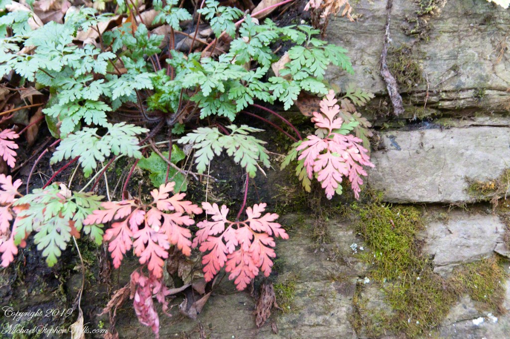
Cliff Stair Wall, autumn Geranium and mosses
Scottish Highlands residents call these wild geraniums “red-shanks” for the deep red color of the stalks, seen in both photographs.
This geranium species (scientific name Geranium robertianum) are also called “Herb-Robert” for a reputed ability to ward off disease and, in the Scottish Highlands, “red-shanks” for the deep red color of the stalks, seen in this photograph. Robert H. Treman New York State Park. Source, “How to Know the Wildflowers” by Mrs. William Star Dana, 1989, Houghton Mifflin, Boston.
Robert H. Treman New York State Park.
Source, “How to Know the Wildflowers” by Mrs. William Star Dana, 1989, Houghton Mifflin, Boston.
Click for a slideshow of this sequence Cliff Stair Views
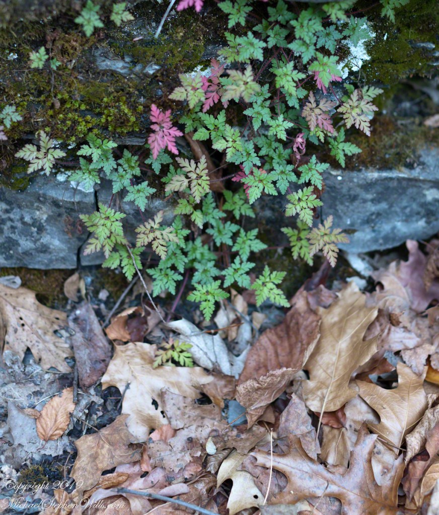
Lucifer Falls from Rim Trail OverlookLucifer Falls from Rim Trail OverlookUnidentified TreePam on the Cliff StaircaseCliff Stair Wall, autumn with fern generationsCliff Stair Wall, autumn Geranium and mossesThis geranium species (scientific name Geranium robertianum) are also called “Herb-Robert” for a reputed ability to ward off disease and, in the Scottish Highlands, “red-shanks” for the deep red color of the stalks, seen in this photograph. Robert H. Treman New York State Park. Source, “How to Know the Wildflowers” by Mrs. William Star Dana, 1989, Houghton Mifflin, Boston.Wild geranium leaves tinged with autumn color above a gathering of spent oak and elm leaves. Robert H. Treman New York State Park of the Finger Lakes Region.
Copyright 2023 All Rights Reserved Michael Stephen Wills
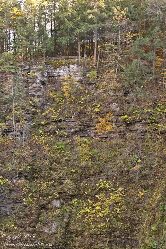
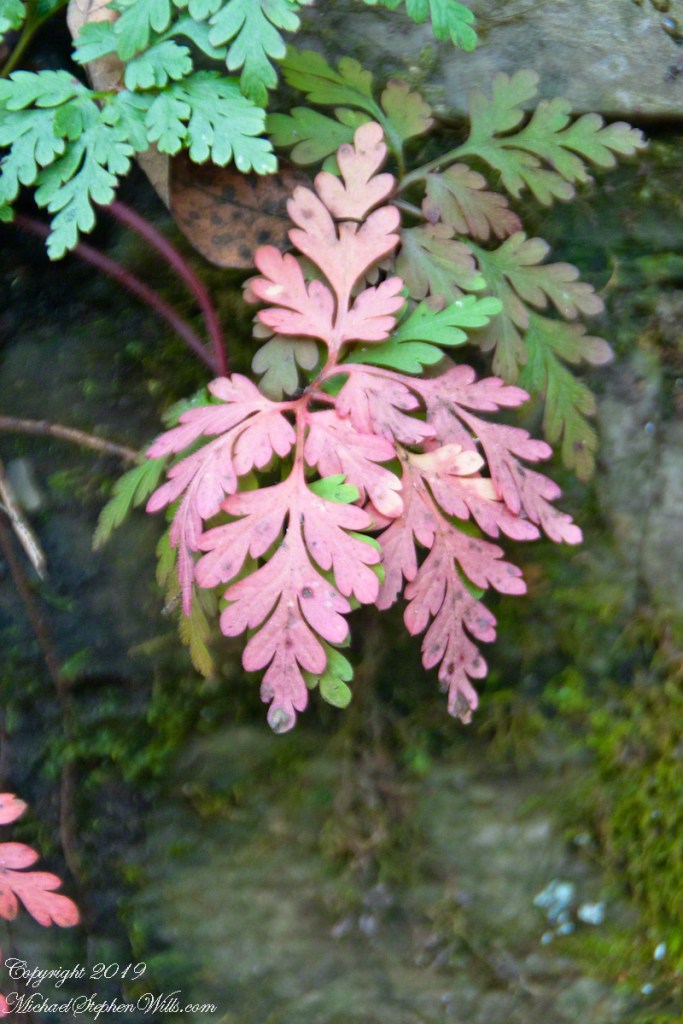
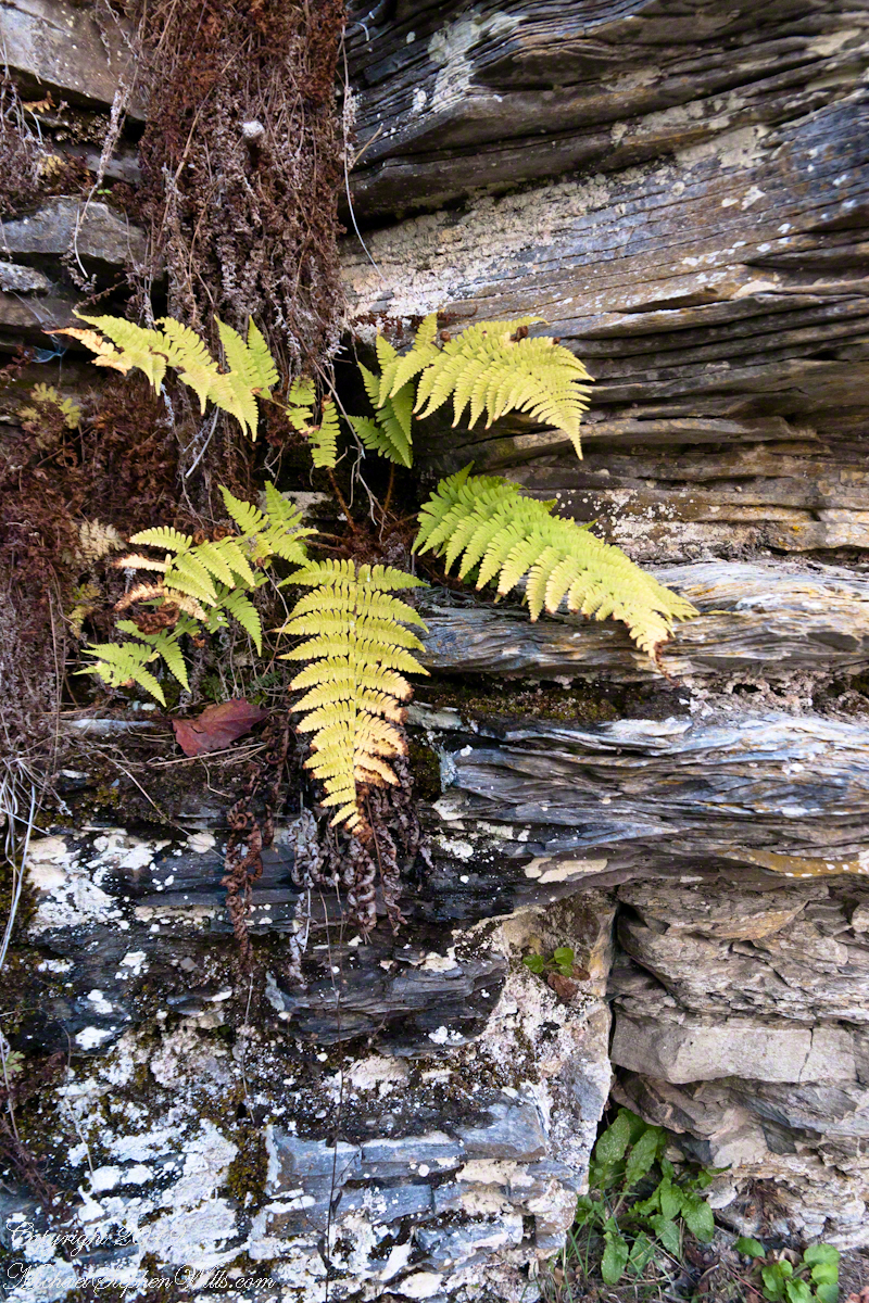
Each autumn, species of fern turns yellow towards a winter death. Here we see growing from Devonian shale, both the yellowed and desiccated fern fronds. Robert H. Treman New York State Park.
Click photograph for a larger view. To do this from WordPress Reader, you need to first click the title of this post to open a new page.
Cliff Stair Wall, autumn with fern generations
Click for a slideshow of this sequence Cliff Stair views
Lucifer Falls from Rim Trail OverlookPam on the Cliff StaircaseCliff Stair Wall, autumn with hemlock
Copyright 2023 All Rights Reserved Michael Stephen Wills
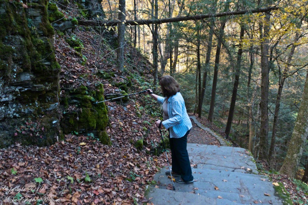
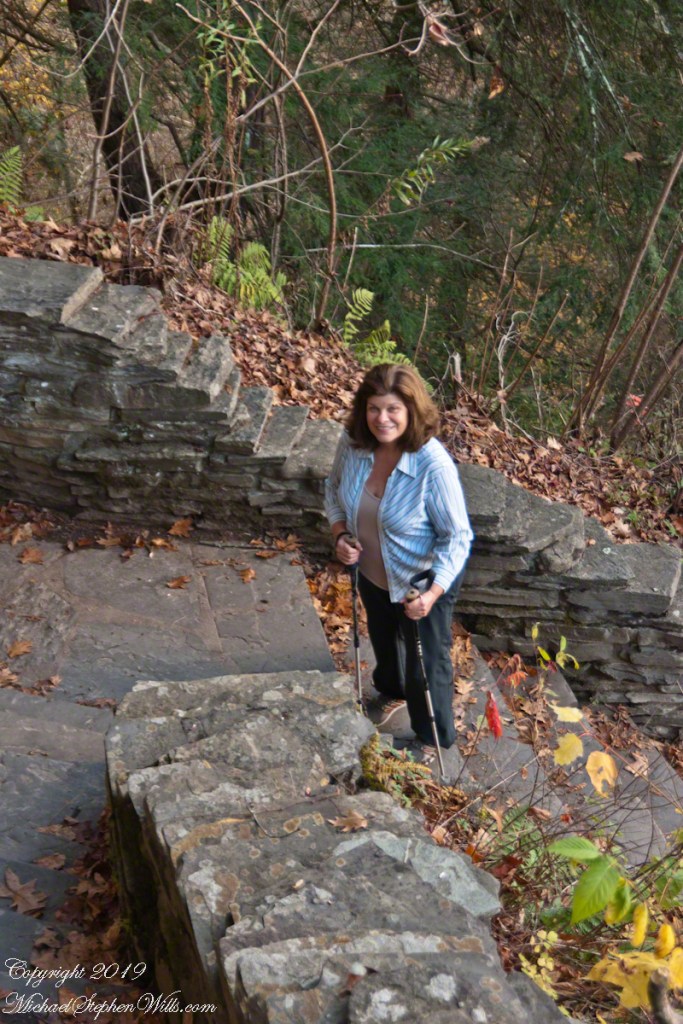
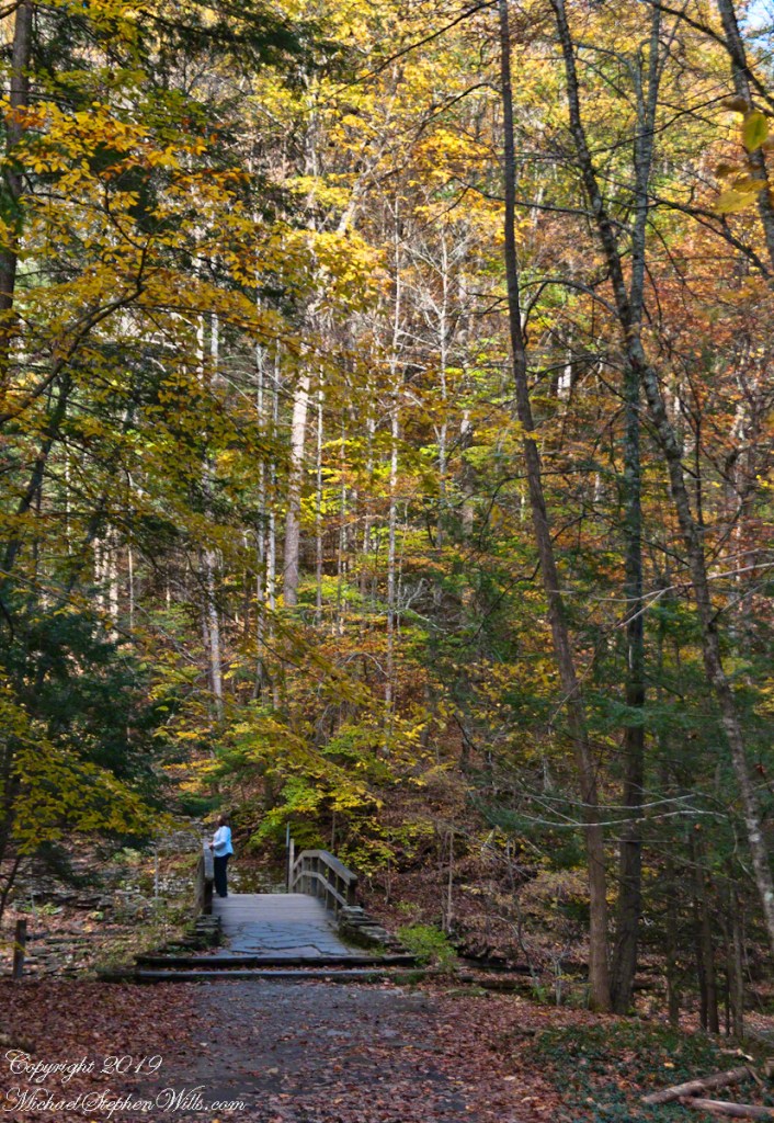
On a day in late October 2017 Pam and Mike did a photography walk. Here is Pam pausing to pose during a descent into the gorge on the cliff staircase after visiting the overlook high above Lucifer Falls, Robert H. Treman New York State Park in the Finger Lakes Region.
Click photograph for a larger view. To do this from WordPress Reader, you need to first click the title of this post to open a new page.
Pam on the Cliff Staircase
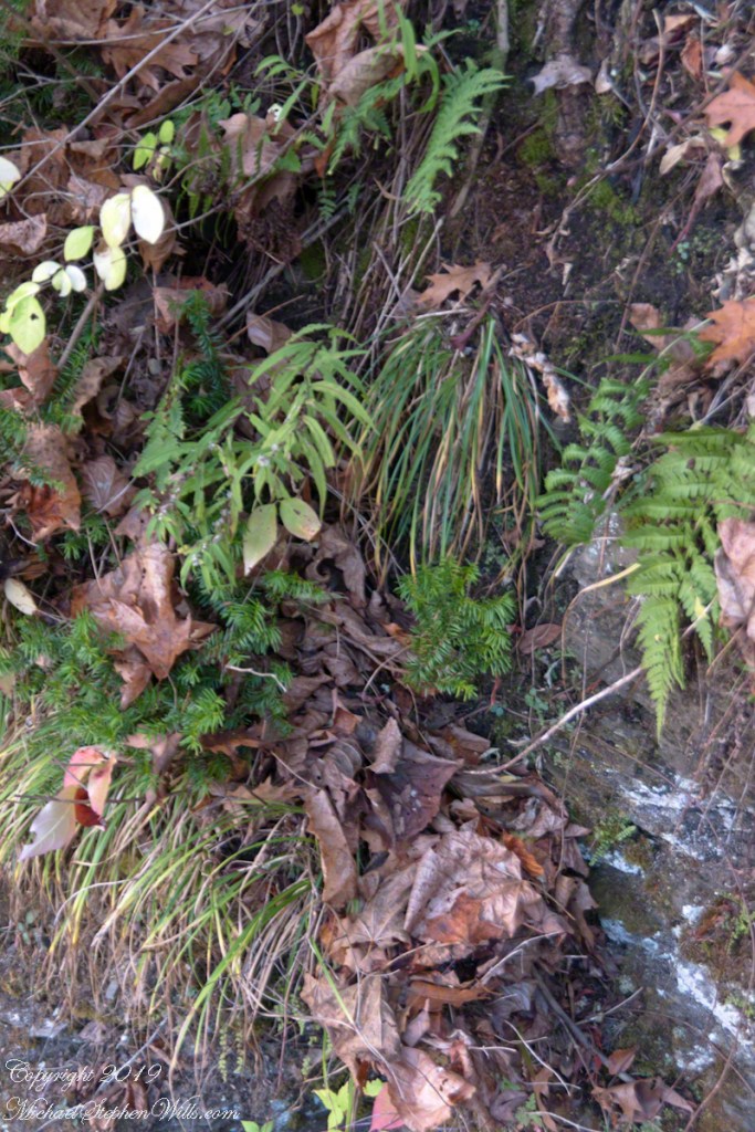
Grasses, hemlock saplings, goldenrod, spent leaves and ferns on the wall of the 223 Cliff Stair steps.
Cliff Stair Wall, autumn with hemlock
Click for a slideshow of this sequence of Lucifer Falls view from the overlook.
Pam on the Cliff StaircaseCliff Stair Wall, autumn with hemlock
Copyright 2023 All Rights Reserved Michael Stephen Wills
Several possible sources have been proposed for the name Taughannock, all of which describe Native American origins. One translation suggests that the name is derived from a combination of Iroquois and Algonquin terms meaning “great fall in the woods”. An alternate theory suggests that the name may refer to a Lenni Lenape (Delaware) chief named Taughannock who died near the falls during a battle.
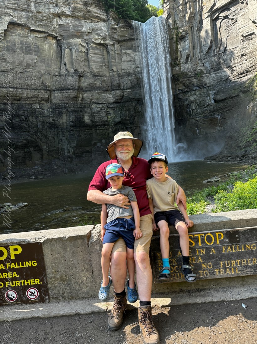
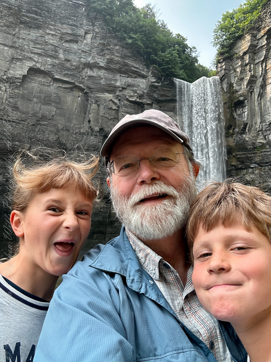
A nice lady offered to take the photo….challenged to keep it straight.
During the second half of the nineteenth century, steamboats, railroads and Victorian hotels were built in the region to serve tourists who traveled to view the falls. By 1925 the hotels were failing due to a decline in tourism, and New York State began acquiring land to form a park.
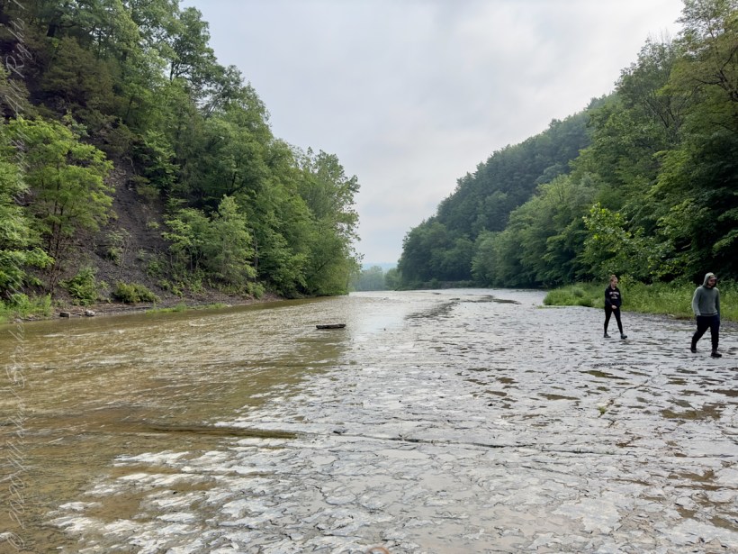
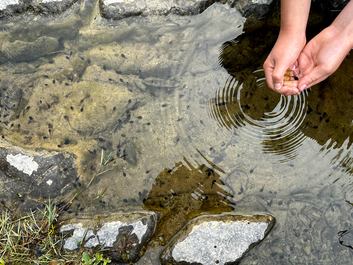
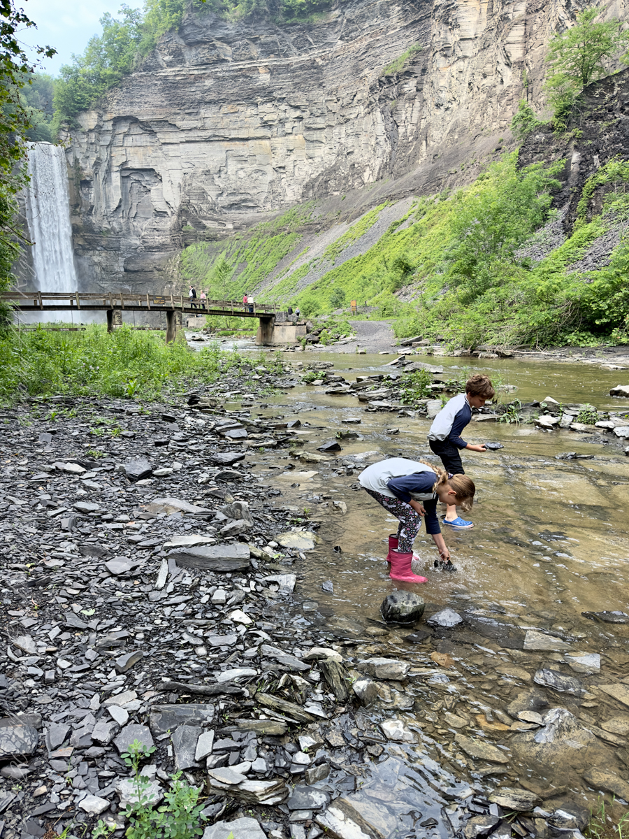
Pollywogs!! Catch and release
J.S. Halsey built a two and a half story hotel in 1850, known variously as the Cataract Hotel or Taughannock House (or simply as Halsey’s Hotel) at the Taughannock Falls Overlook.
Visitors could reach the hotel by taking a train to Cayuga Lake, take a steamboat across the lake to Goodwin’s Point, then finally board a stagecoach to reach the hotel. The hotel site today is the location of the park visitor center and parking lot.
Enjoy!!
Copyright 2023 Michael Stephen Wills All Rights Reserved
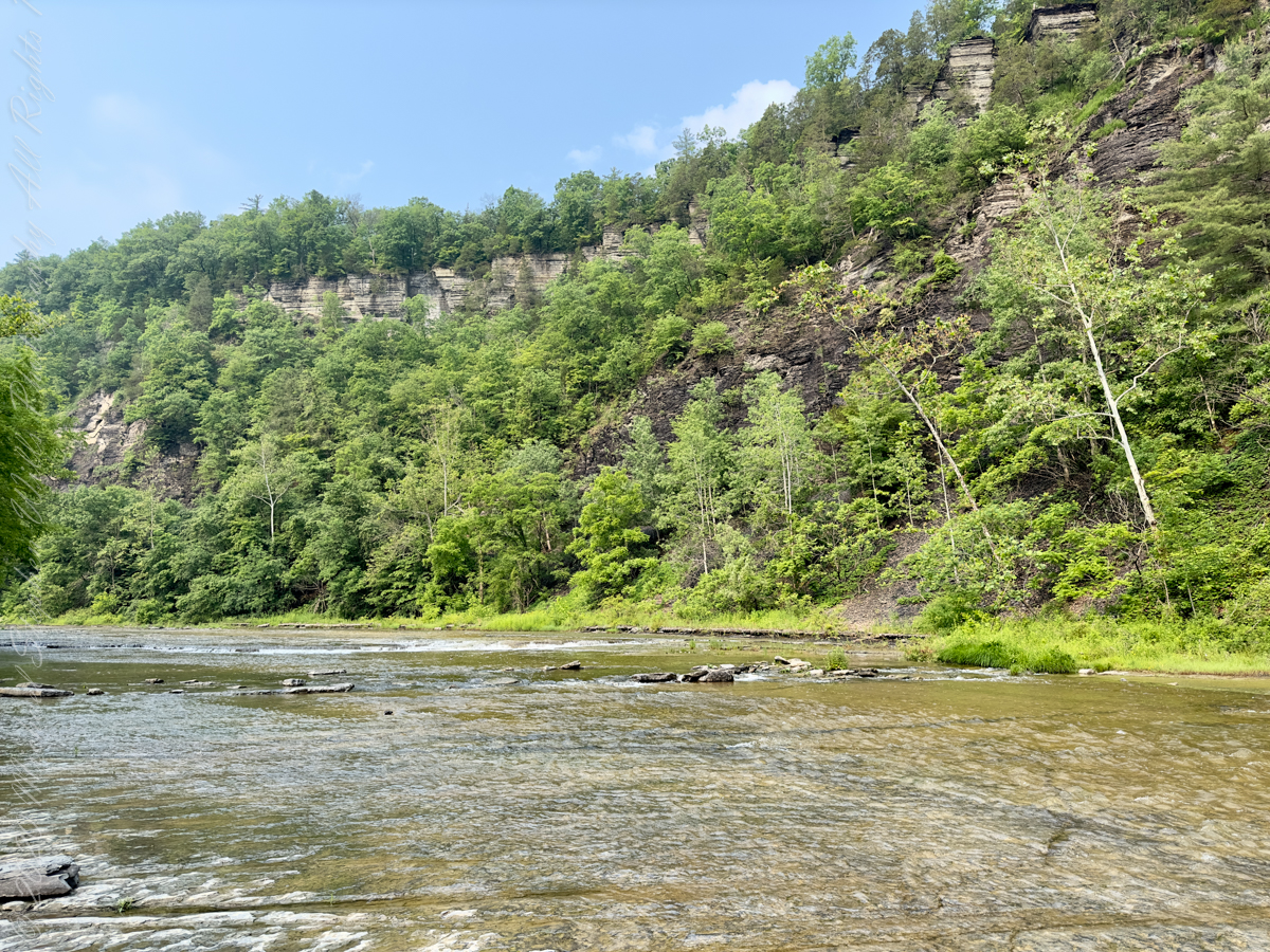
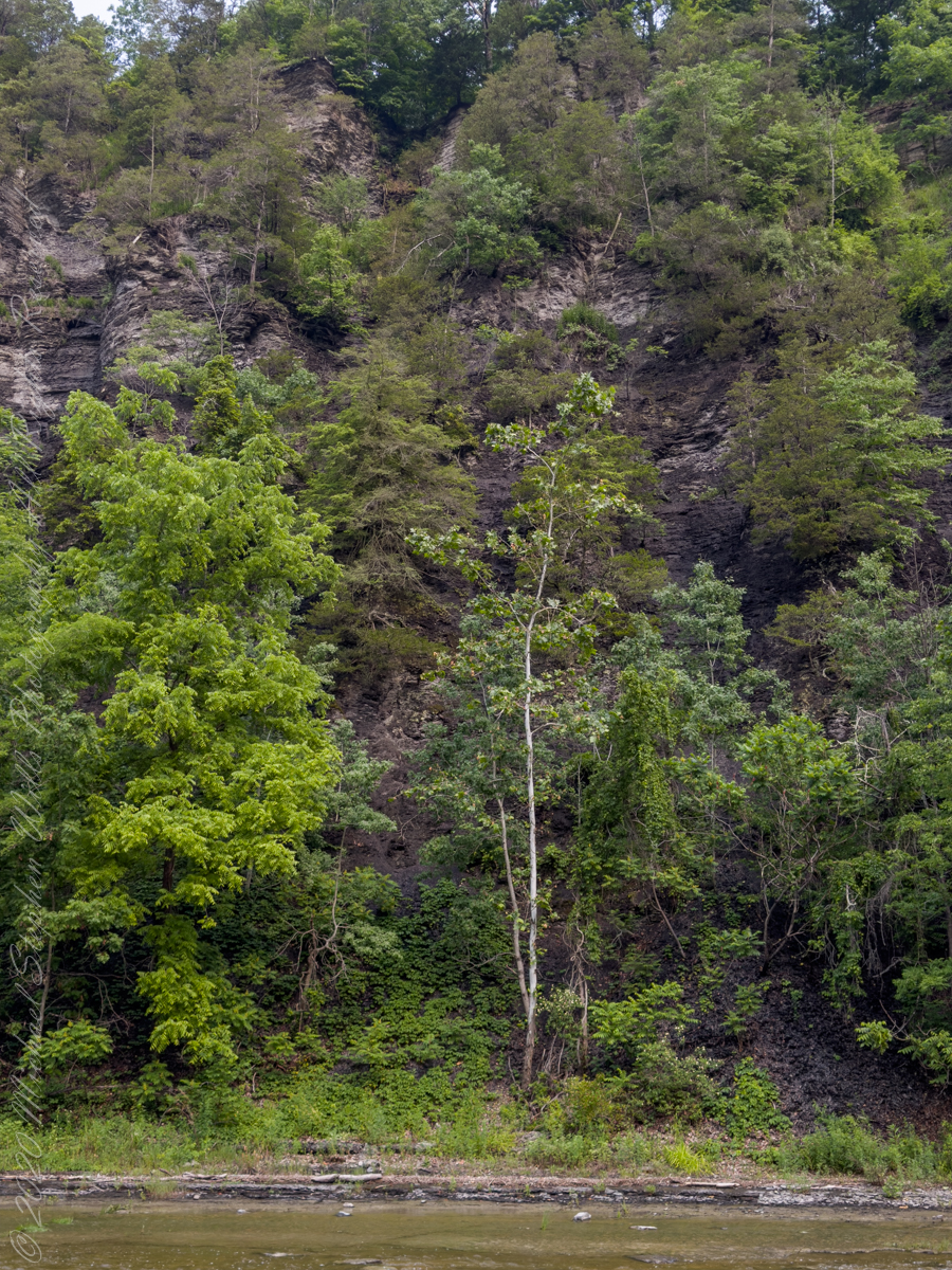
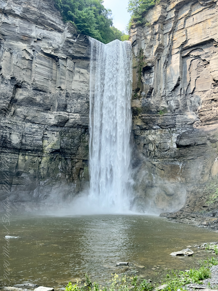
The waterfall and gorge comprise an example of a hanging valley, formed where Taughannock Creek’s stream-carved valley meets the deeper glacially carved valley that contains Cayuga Lake.
The gorge has continued to retreat westward from Cayuga Lake as easily eroded shale near the fall’s base is worn away by the stream, which supports erosion-resistant siltstone and sandstone found in the upper portions of the gorge.
Pollywogs!! Catch and release
Annual freeze and thaw cycles also act upon small faults in the rock, causing large sections to occasionally break away, further expanding the gorge.
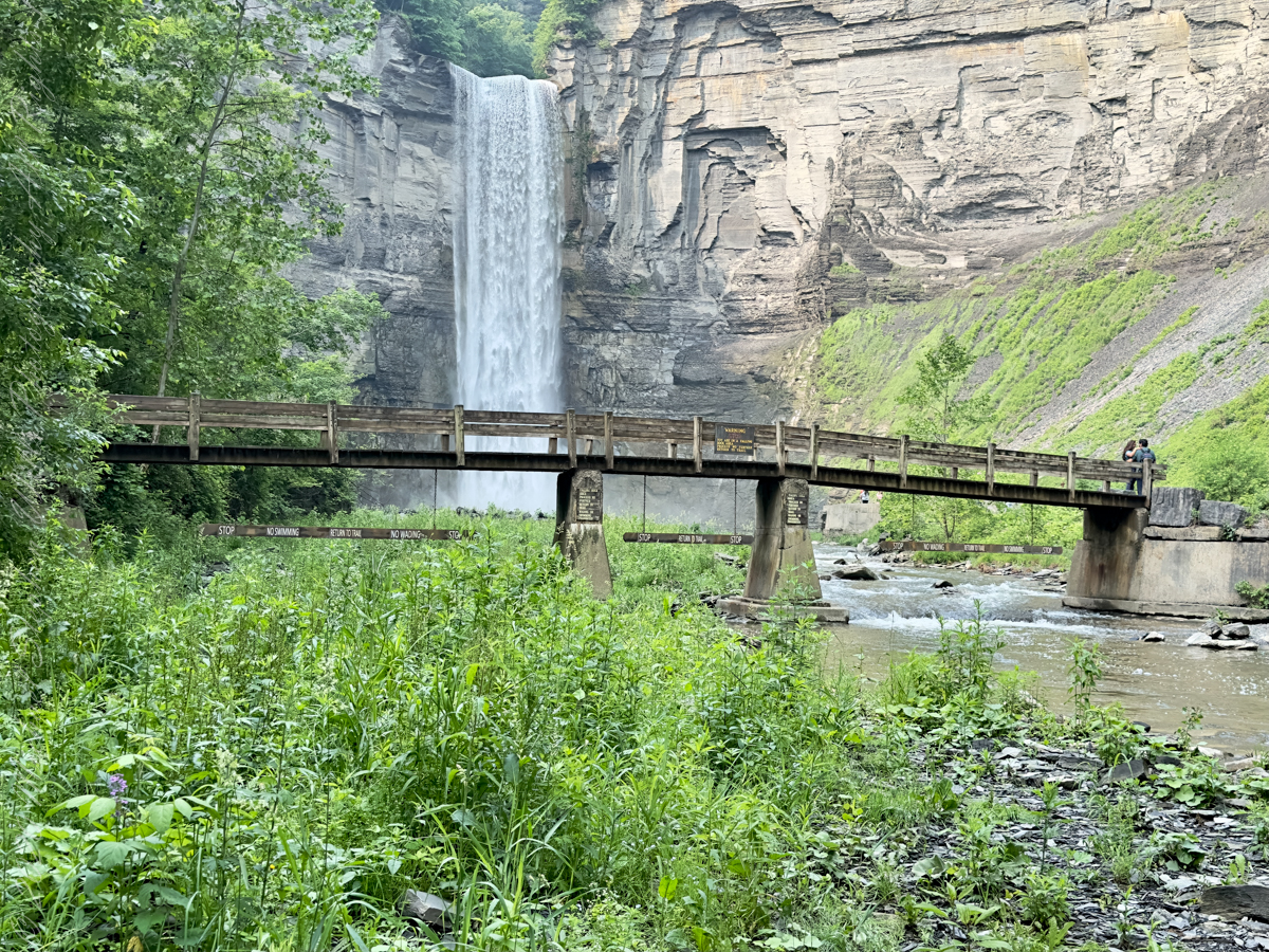
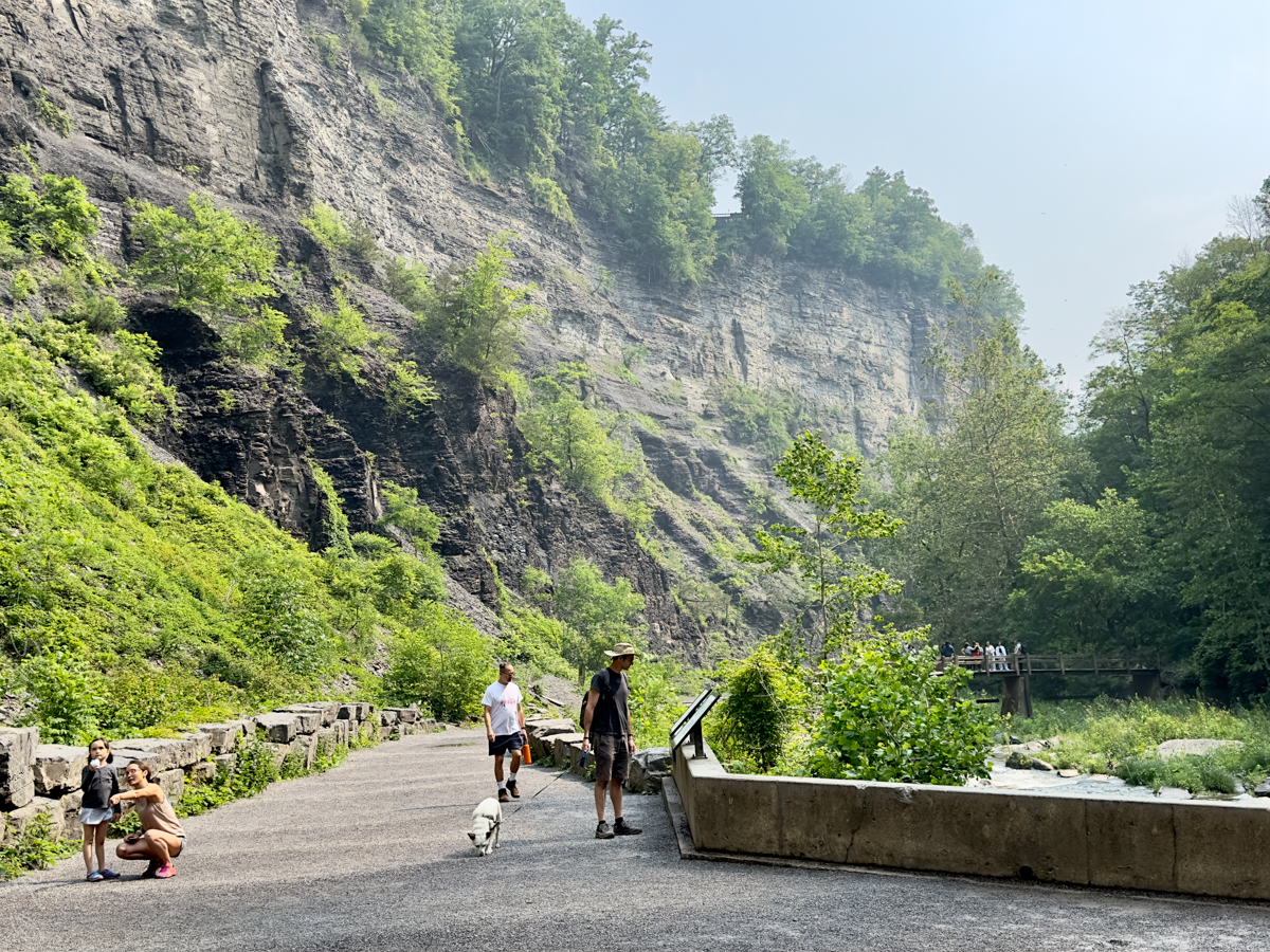
Taughannock Falls’ main cataract is a 215-foot drop (66 m), making it 33 feet (10 m) taller than Niagara Falls. It is the tallest single-drop waterfall east of the Rocky Mountains. The waterfall is located along Taughannock Creek, which flows through a long gorge with cliffs up to 400 feet (120 m) high.
Enjoy!!
Copyright 2023 Michael Stephen Wills All Rights Reserved
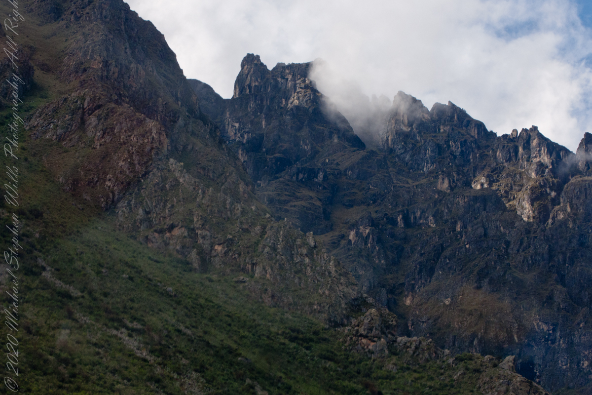
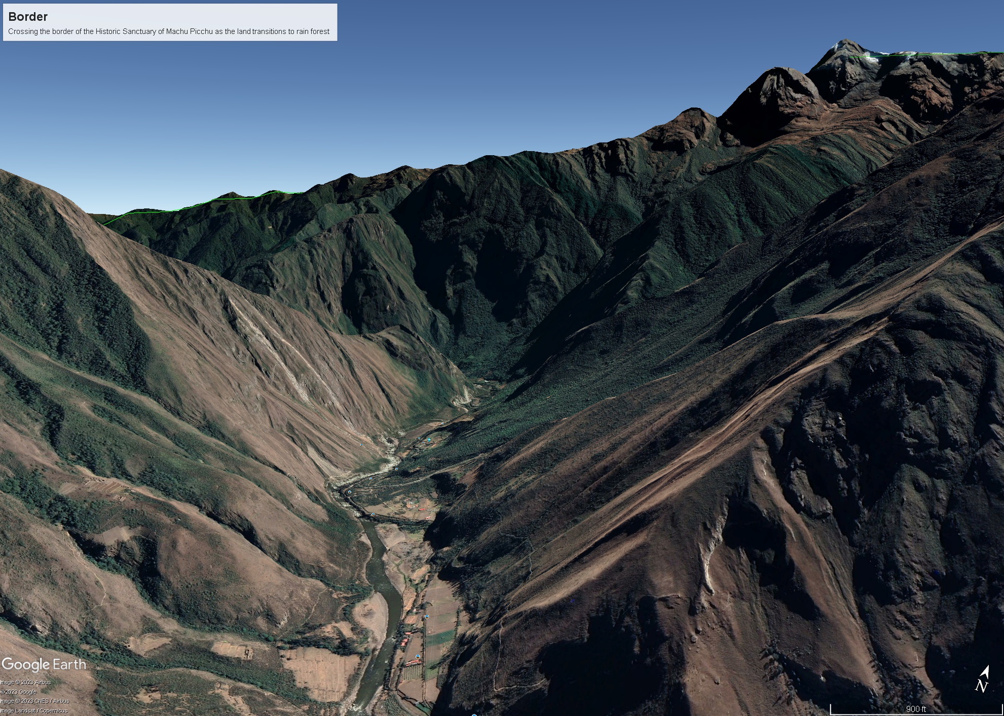
As we crossed the border of the Historic Sanctuary of Machu Picchu the valley walls rose steeply on either side, the land transitioning to rain forest.
Google Earth We approach the border of the Historic Sanctuary of Machu Picchu
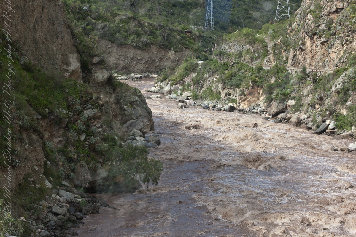
We entered a short tunnel through a mountain ridge, providing us this close view of the Urubamba River.
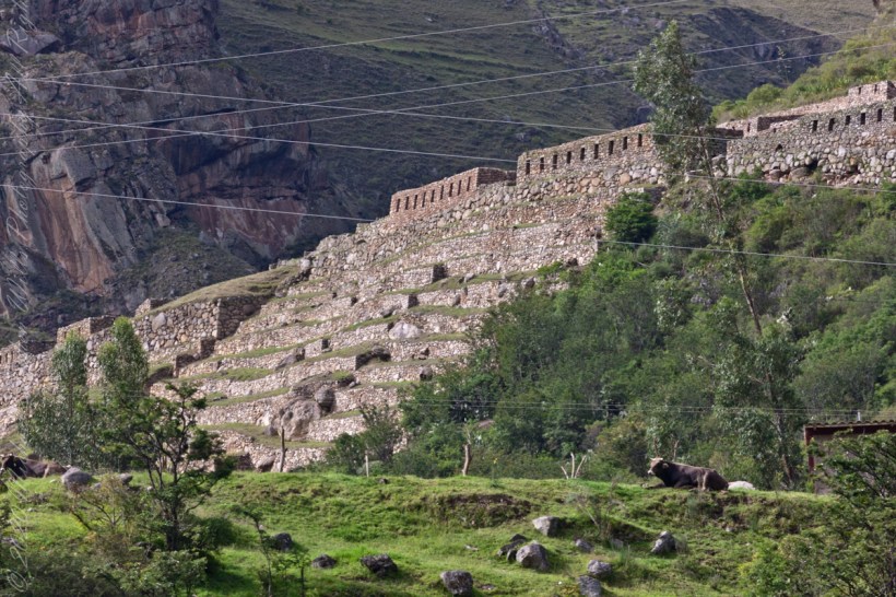
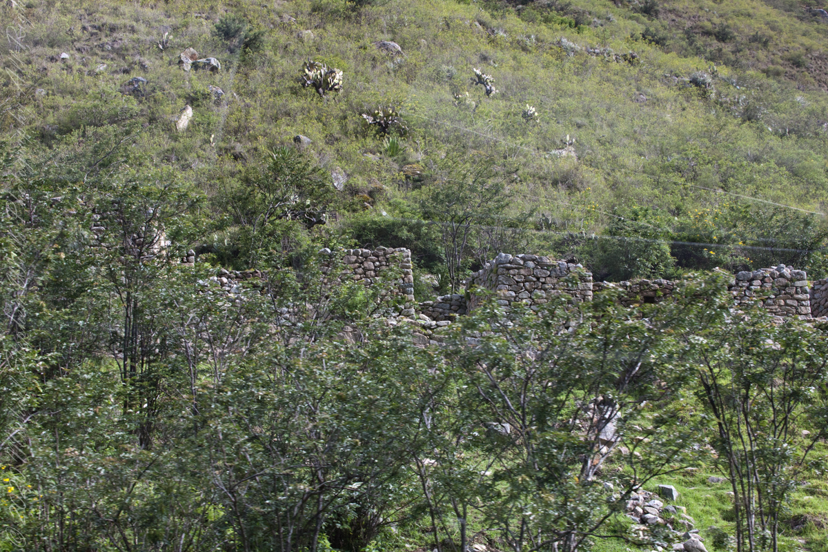
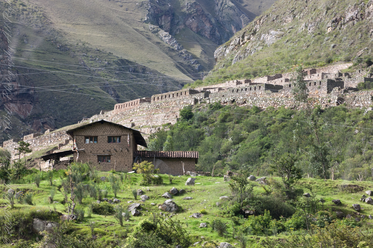
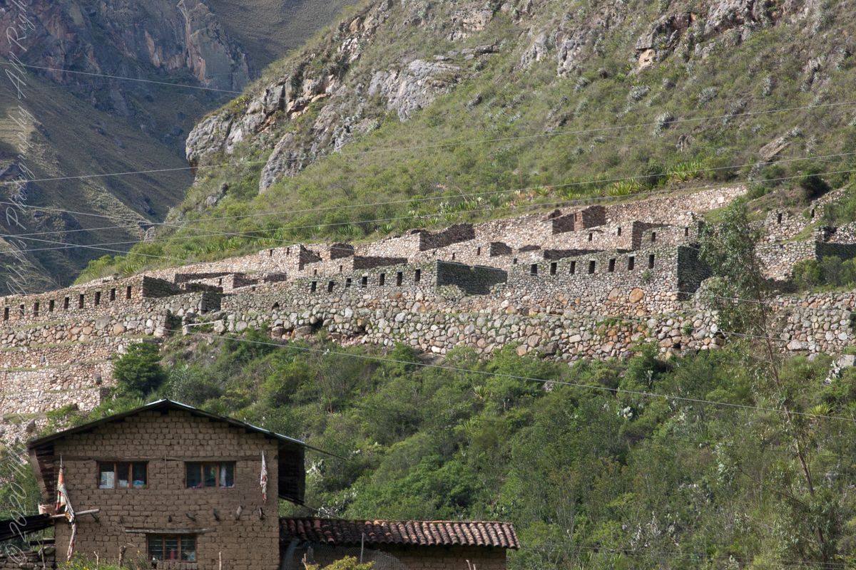
Next we came upon the Toronto Ruins.
The Toronto complex includes seven (7) archaeological groups and is in front of the Q’ente Complex, separated only by the Urubamba River, possibly they were independent chiefdoms with a strong economic bond.
The seven (7) archaeological groups are Torontoy: The local farmers call it Inkaperqa or Inca raqay, alluding to what they see. In this place we can find a main doorway, several groups of enclosures, patios or free areas separating the buildings, vestiges of a liturgical bath and a central enclosure with a lithic piece of more than 40 angles that joins other twenty-eight pieces with exact interlocking in the joints.
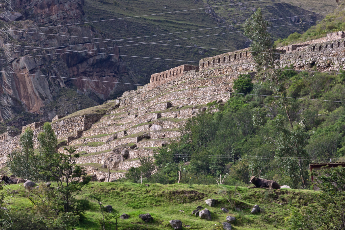
Salapunku: means hall door in the Inca language, because what is most obvious is a wide door that is on a platform that runs as a street in front of the wall. Behind the door we find cyclopean platforms and plains with remains of stairways, interior roads and remains of aqueducts. Qhanabamba translates to pampa where the grass “qhana” grows. It is at the height of Km. 85 of the railroad line. We can find a series of one-story buildings and a two-story building which is the largest. Wayrajpunku: meaning windy door (alluding to a windy place). In this group we find remains of buildings and a partially standing enclosure, there are vestiges of aqueducts, paths and overcrowding of canted stones that were part of constructions.
Pincha Unuyuj: Here were made the best hydraulic works of the zone, the crystalline waters that descend, appear channeled by wide lithic channels; also we find from the bank of the river a succession of parallel platforms, a road that leads to an adoratory carved in the rock insitu, ascending some houses and an observation tower. Qoriwayrachina It means gold winnowing. We can find the following: A huge staircase with more than one meter wide, semicircular ramparts, platforms as retaining walls and a vertical slope worked that is on the turbulent waters of the river.
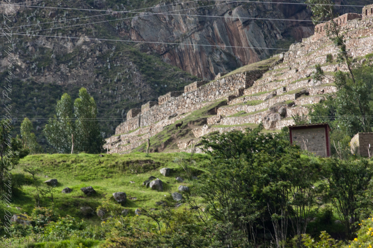
Retamayuj, having a broom, in this group we can find long platforms with semi-cyclopean walls, tombs that are desecrated at the base of the mountain and others intact. In 2008 A team from Peru’s National Institute of Culture (INC) working on the ruins of Torontoy in the Historic Sanctuary of Machu Picchu, discovered the tomb of an Inca with full funerary regalia. The gender and age of the tomb’s owner has not yet been determined but found with the body were a number of decorated ceramics and two pins.
Copyright 2023 Michael Stephen Wills All Rights Reserved