Island Romance

Happy Valentine’s Day with the original Moby Dick

Thinking about the Aran Islands for my posts, “Killeany Bouy” and “Inisheer Welcomes the 2014 Gaeltacht Irish Football champions” brought me back to Isla Mocha.

Herman Melville’s thoughts were in and around this island off the central Chilean coast when he penned “Moby Dick” in the mid-nineteenth century while sitting in the city of Boston.  He was brought Moby Dick not only by his own experiences on a whaling ship, almost certainly Melville owned a copy of Jeremiah N. Reynolds’ “Mocha Dick: Or The White Whale of the Pacific: A Leaf from a Manuscript Journal,” an true-life account of adventures around Isla Mocha.  Sometime around 1810 Reynolds personally experienced encounters with Mocha Dick after the crew of an Antarctic expedition mutinied, stranding him at Valparaíso, Chile where he remained for two years.

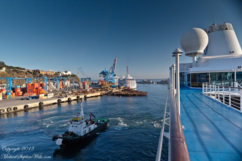
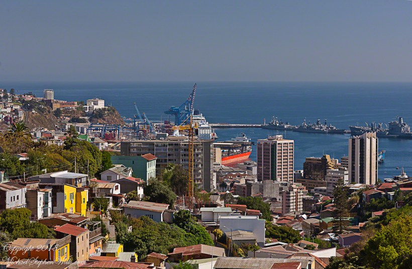
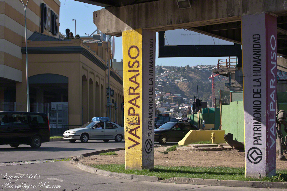
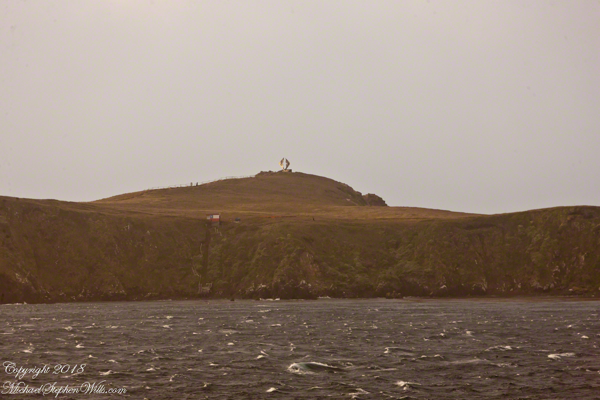
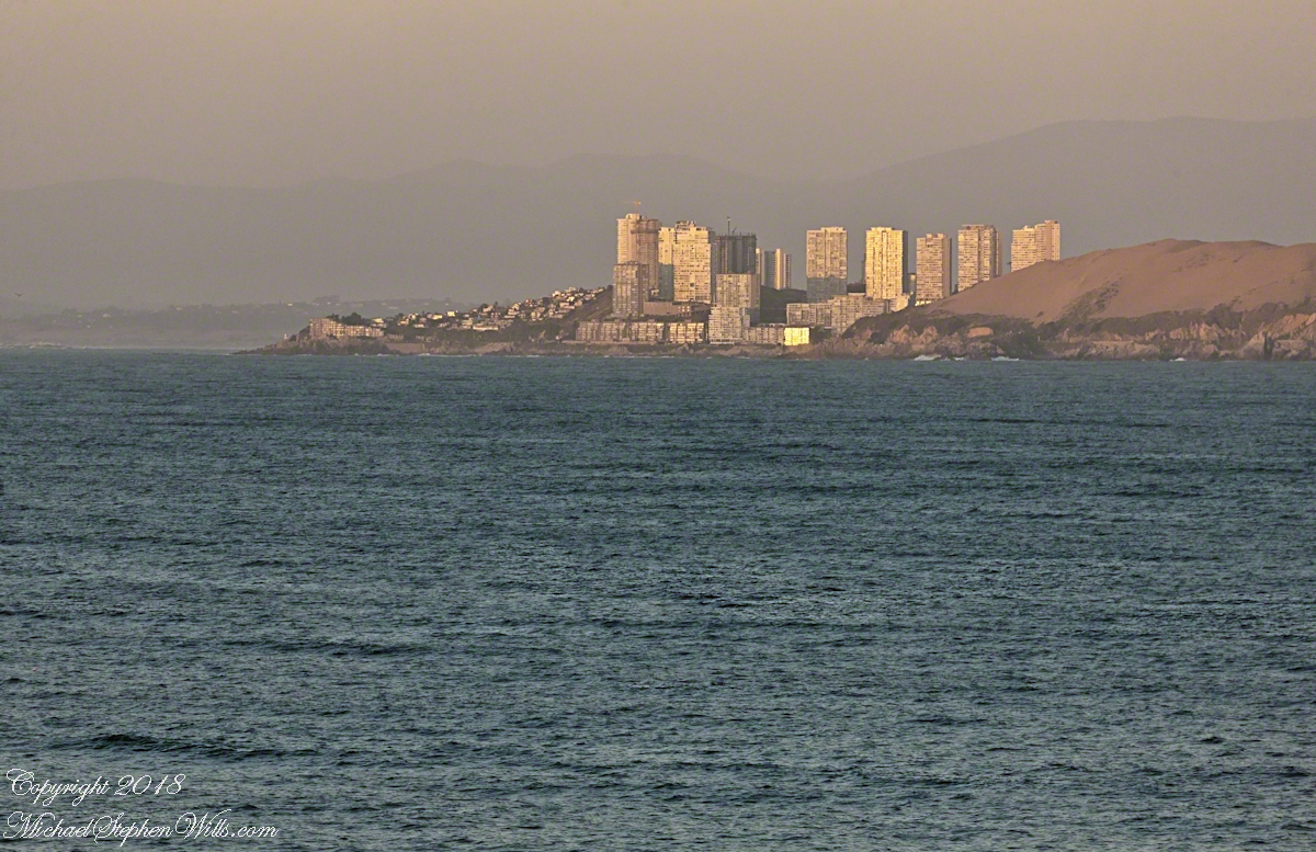
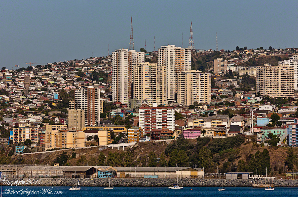
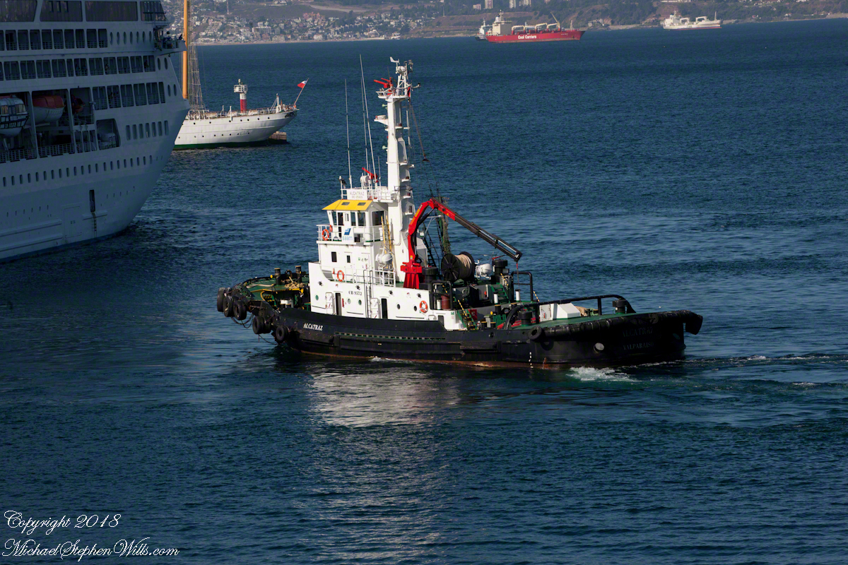
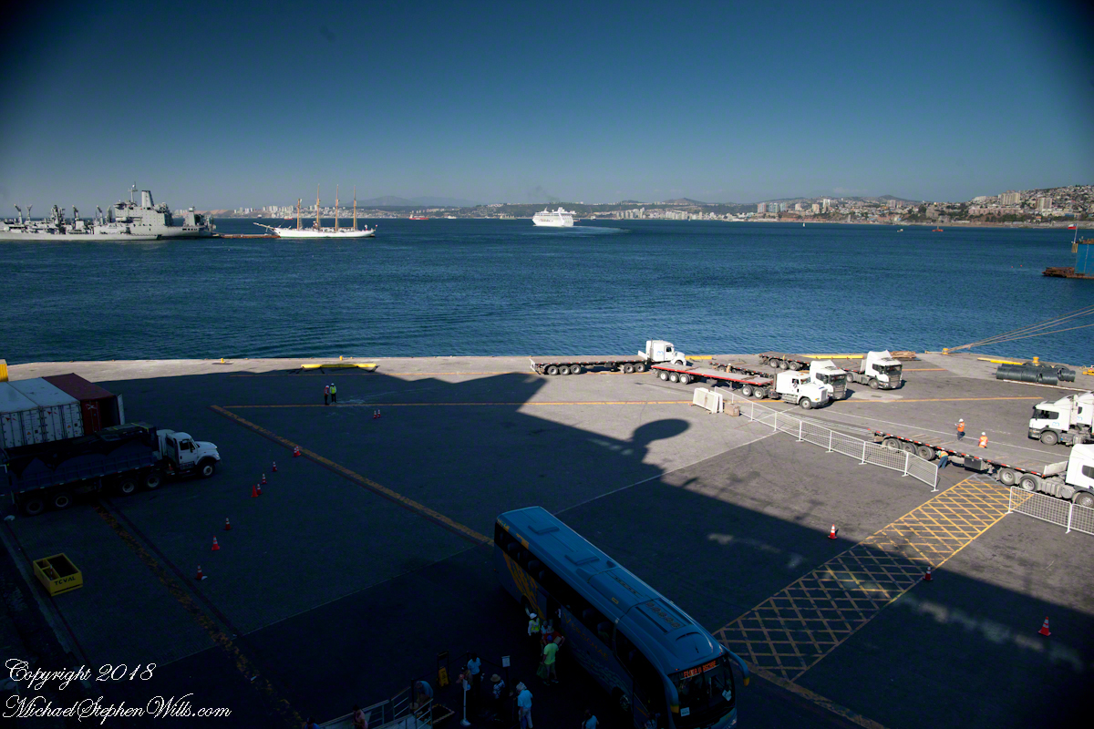
Located  38°21’45.62″S,  73°55’6.91″W, around 8 miles in size north to south, 3.5 miles east to west Isla Mocha is surprisingly simple to find.  A ridge of mountains run the north south axis, just 20 miles off the coast, a ship following the coast will find it easily, as I did from the balcony of the Oceania Regatta during a “sea day” of travel between Valparaiso and Puerto Montt.

MochaIslandGoogleMpasNarrow

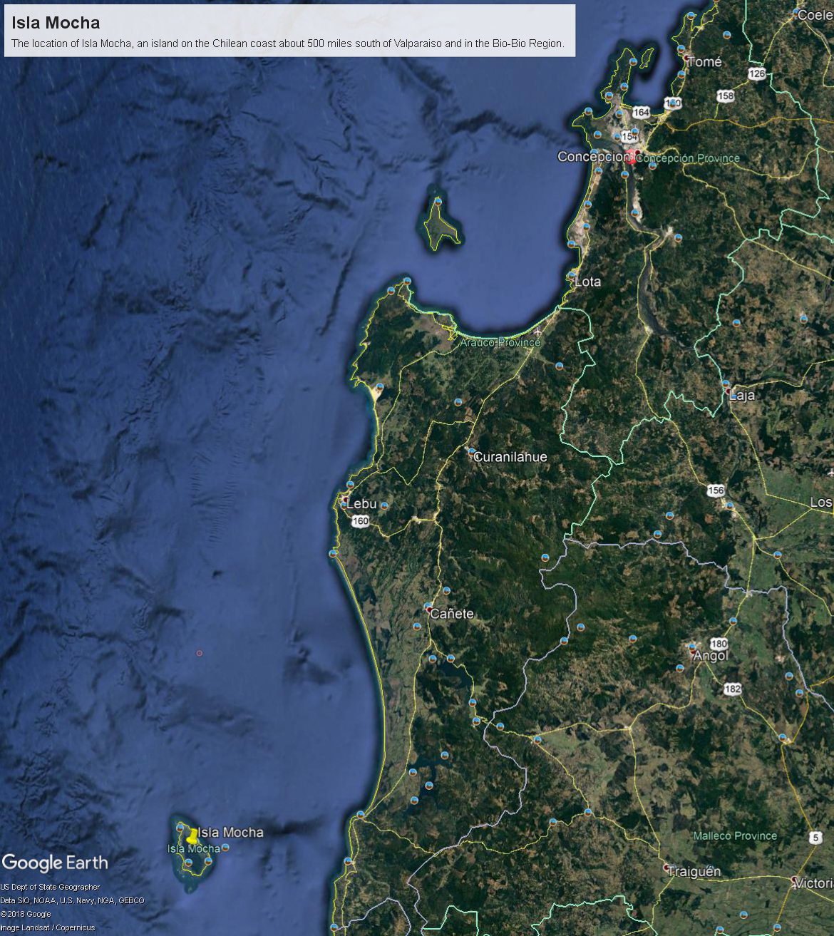
Since waking that day I was on the lookout for Isla Mocha.  In preparation for our month-long cruise around South America every mile of our itinerary was scoured for interesting sights, experiences and information.  When I first learned of Isla Mocha (Mocha Island in English) and the connection with Melville reading about it in Boston, just as I was in Ithaca, one of my goals for that day was to catch sight of Isla Mocha as it rose from the horizon.

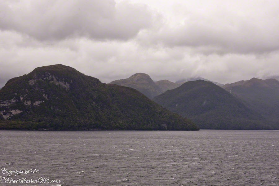
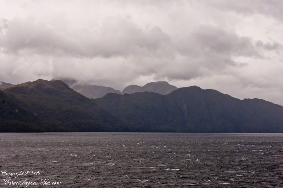
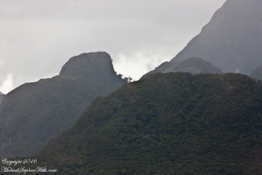
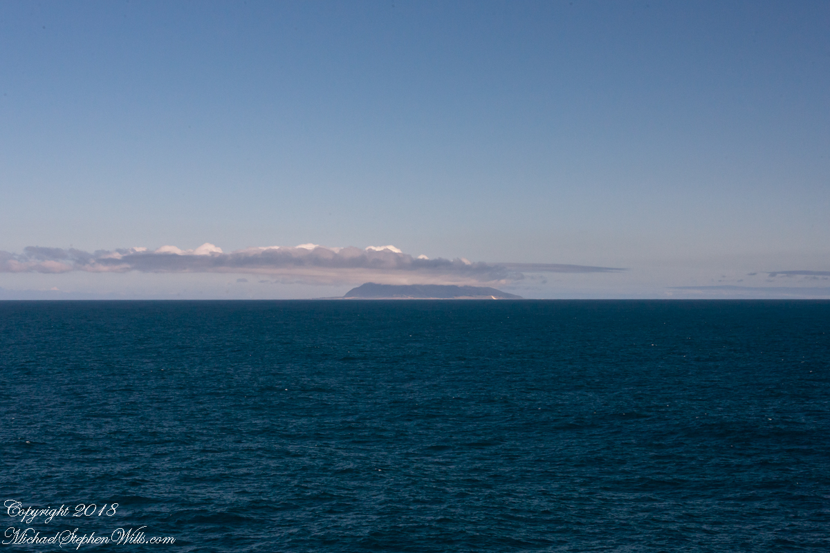
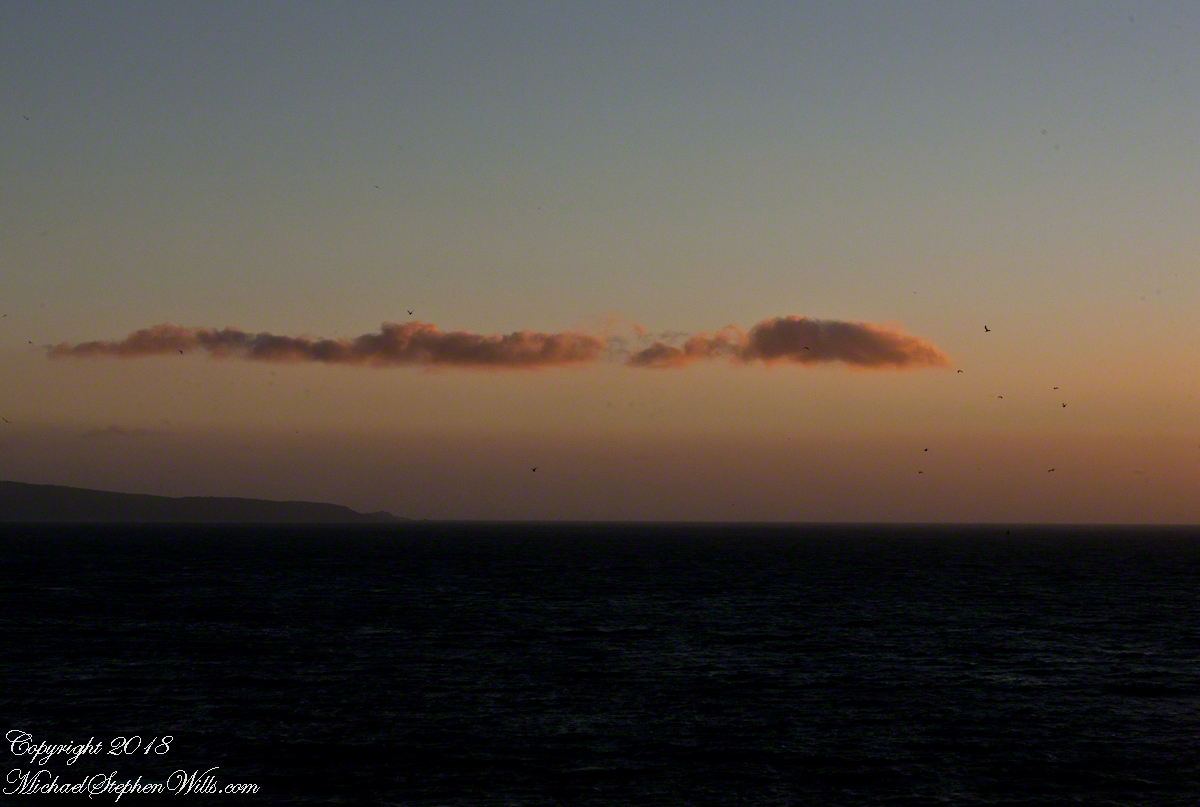
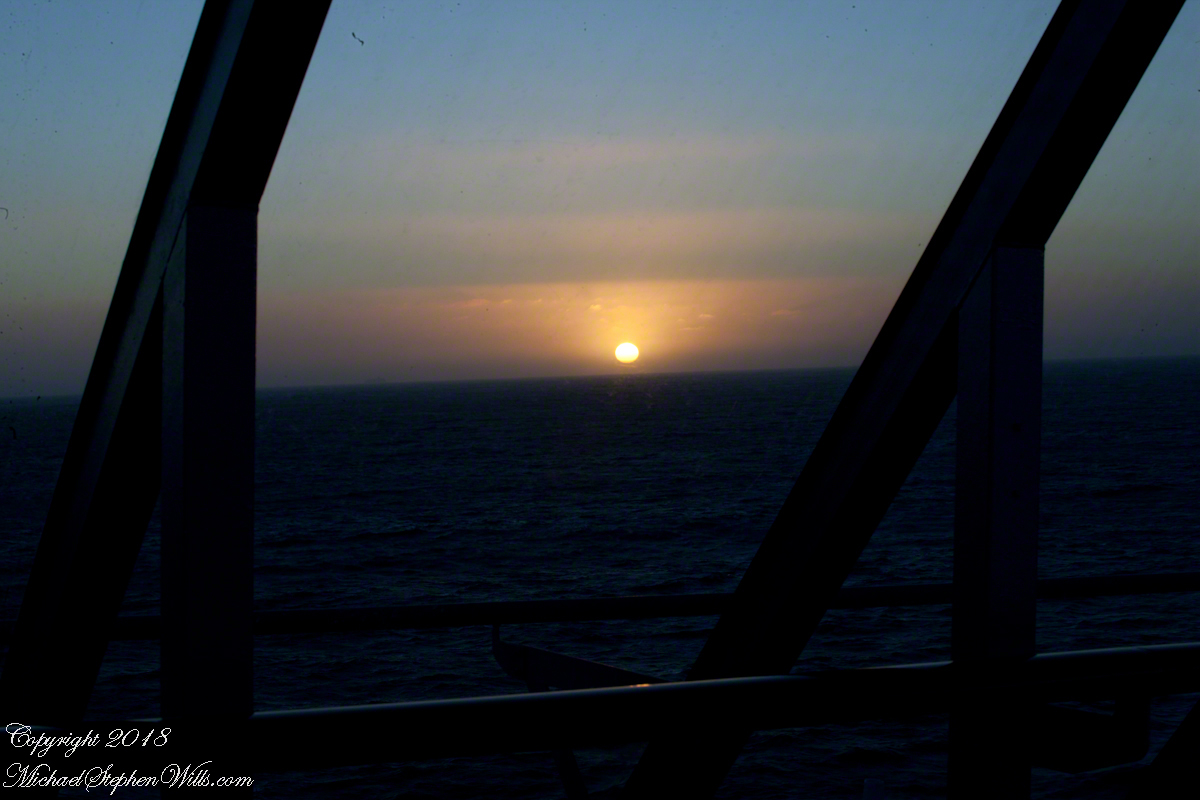
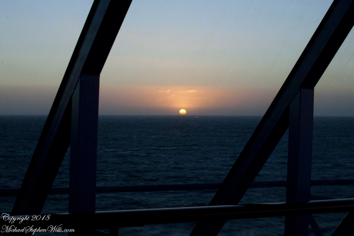
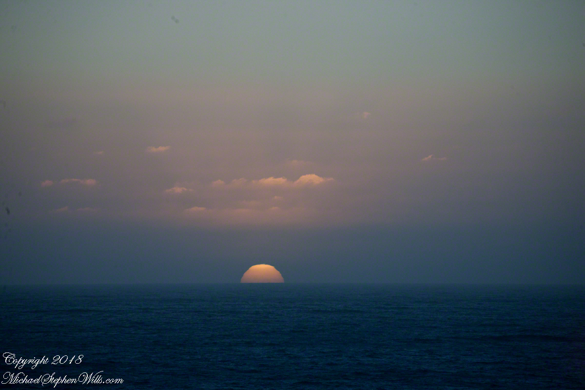
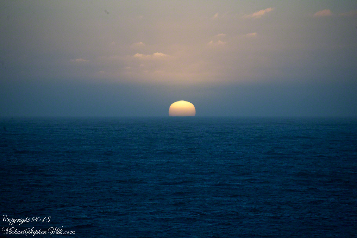
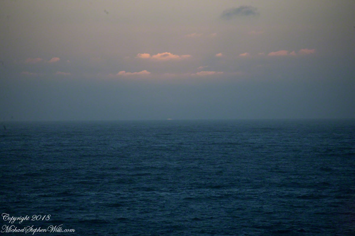
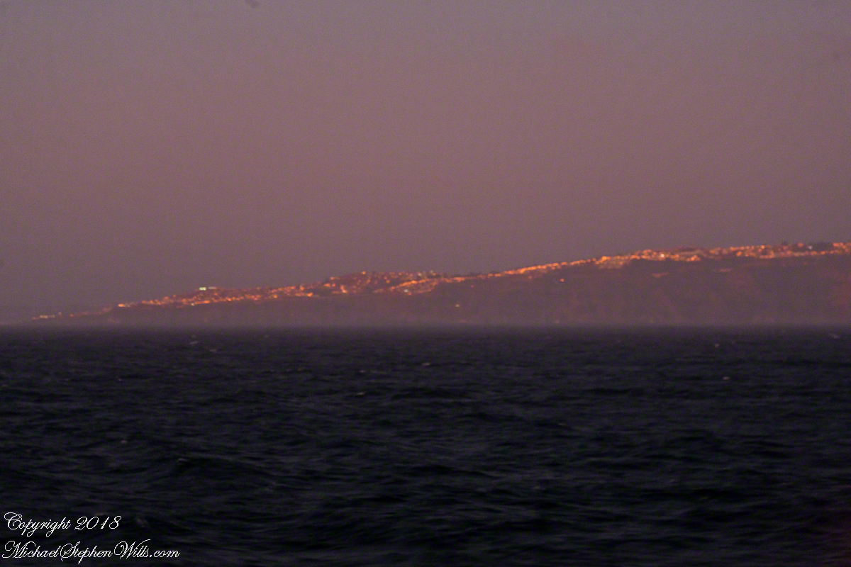
My goal was made easier for the cloud formation from the island mountains.  Here is my first photograph, taken from our balcony on the port side.  I chose the port side just for the landward view as the ship progressed southward on the western coast of South America.  The Canon EOS-1Ds Mark III was tripod mounted with an EF 70-300 f4-5.6L variable lens set to 70 mm.  We are northwest of the island with the coast just visible.

Isla Mocha First Sighting

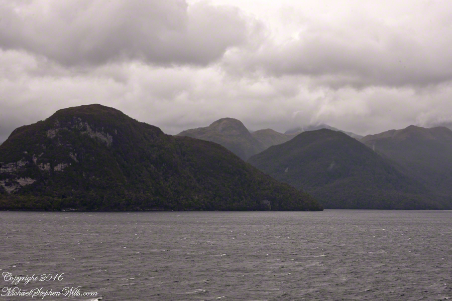
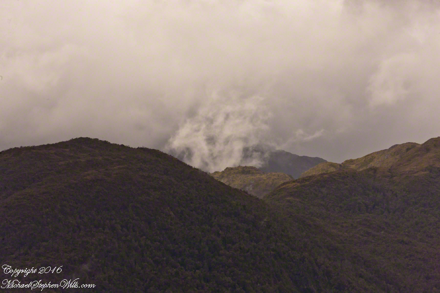
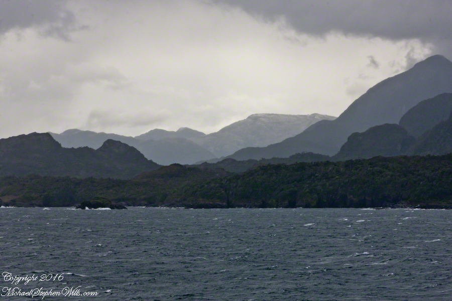
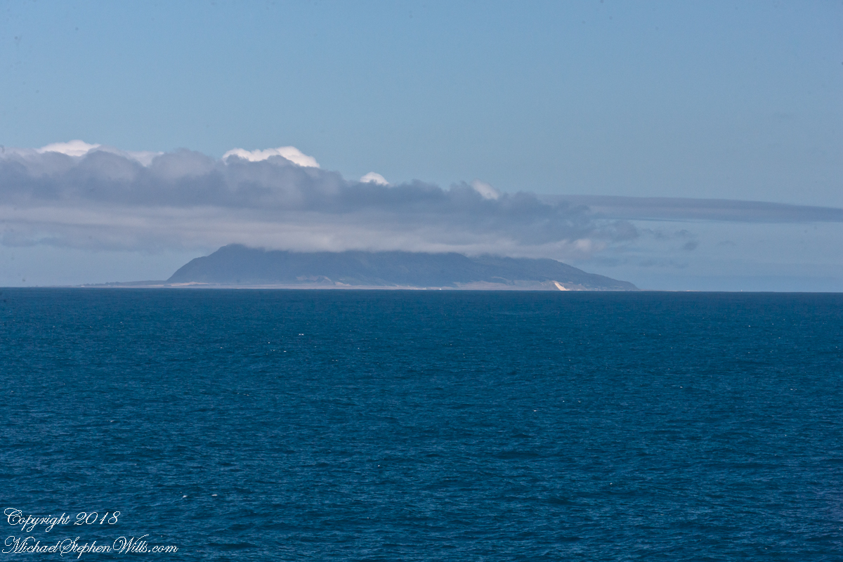
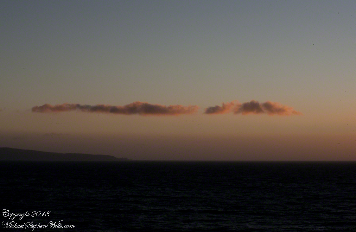
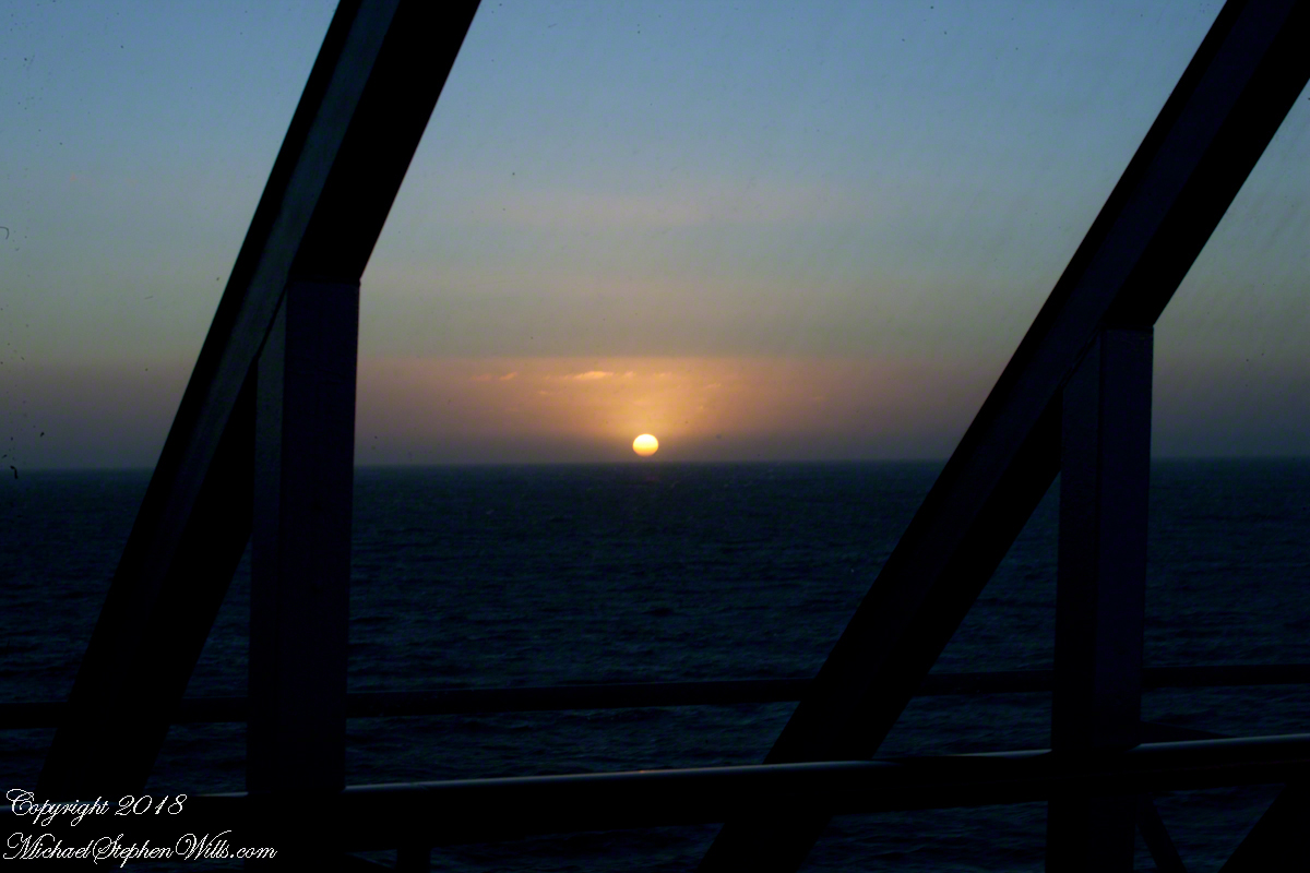
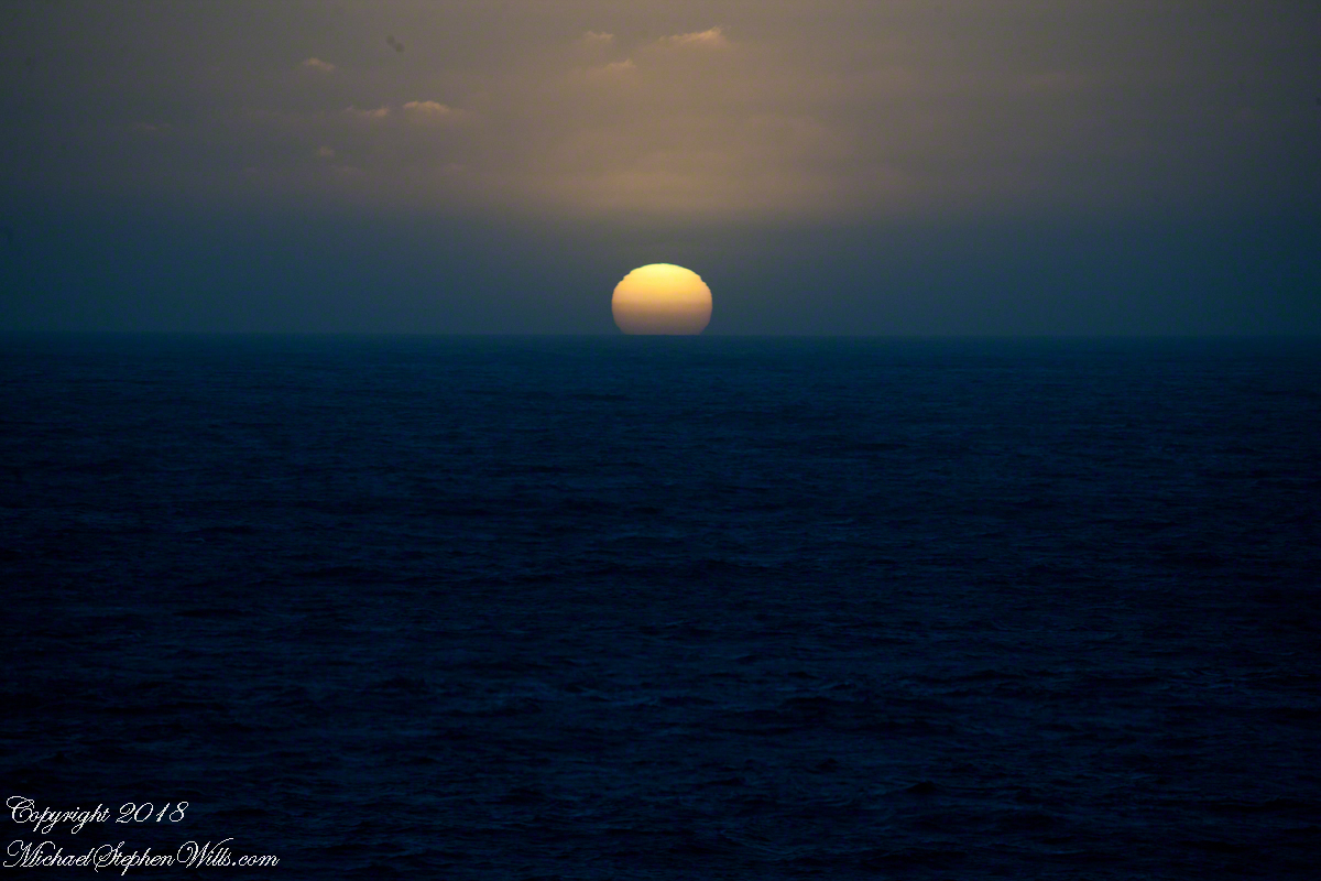
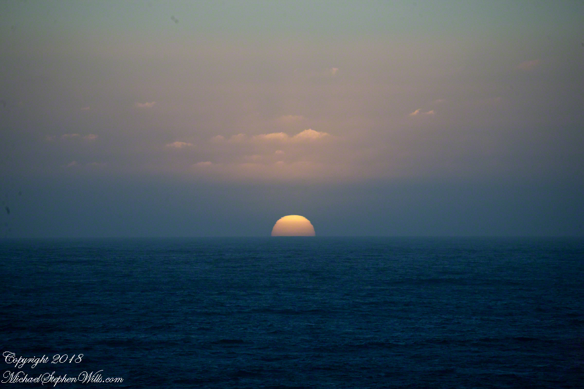
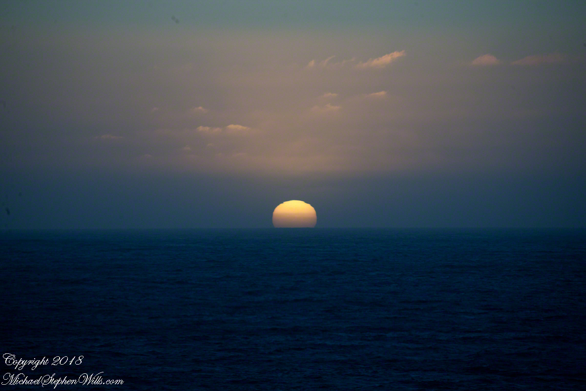
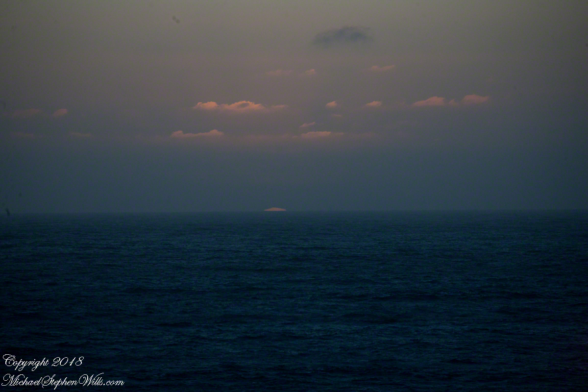
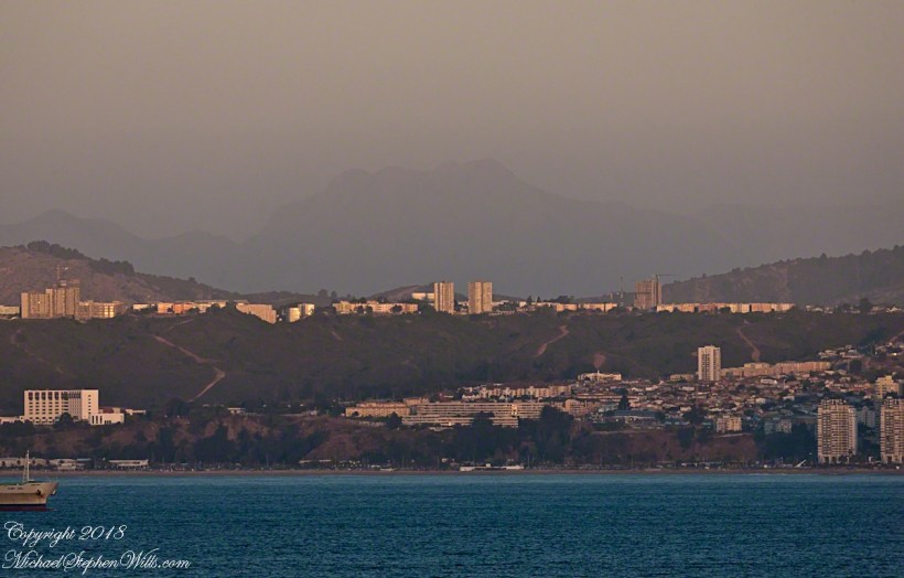
Another view with 188 mm focal length.  The ship must have turned eastward, as the view progressed the island came closer.  It was a fantastic thought to cruise above the subduction zone where the Nazca plate dives beneath the South American Plate.  In the distance, on a clear day, the volcanic cones Villarrea and Quertrupillan are visible.

RomanceOfIslandsMochaIsland2016-2

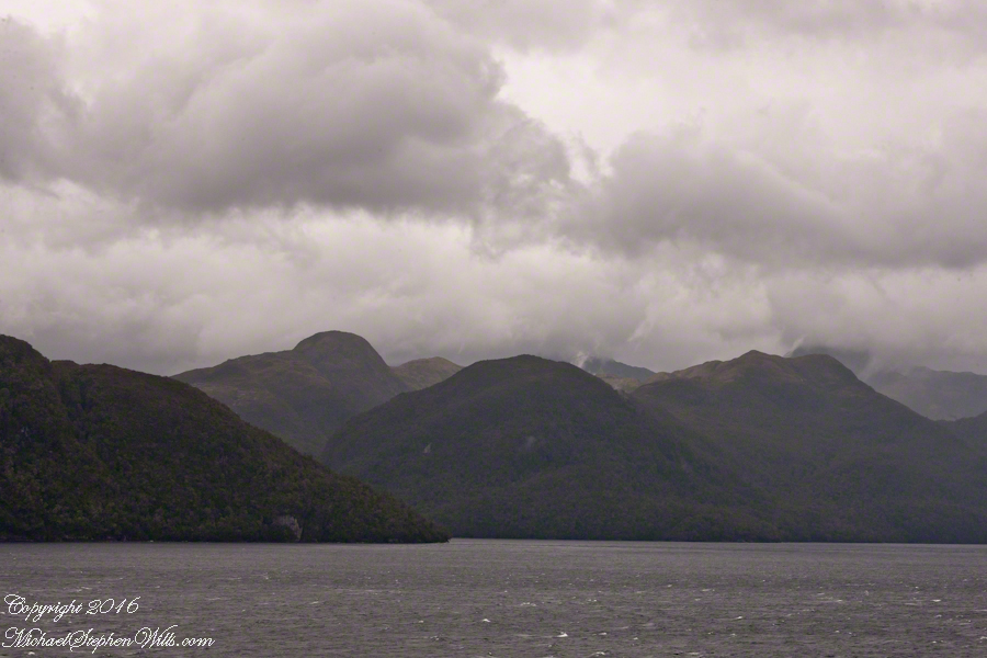
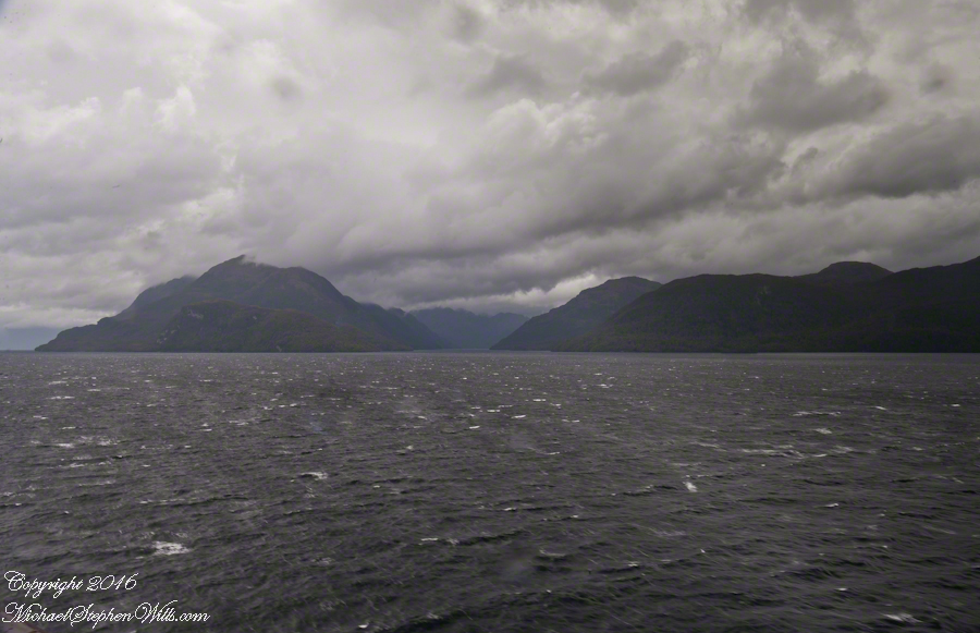
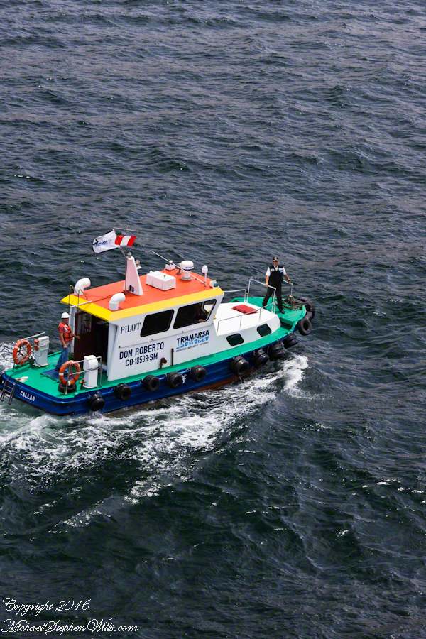
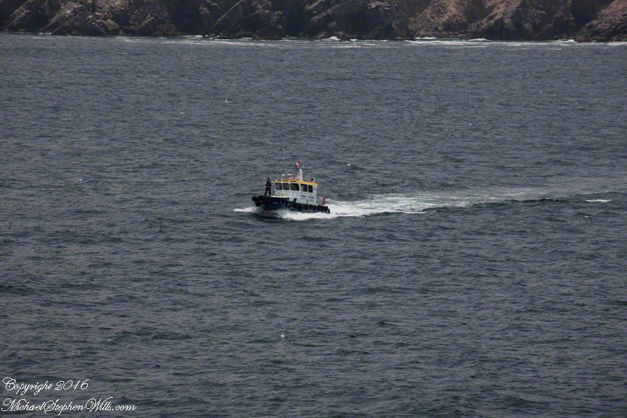
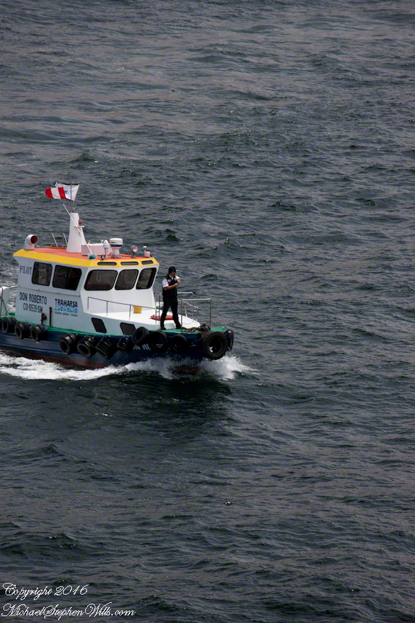
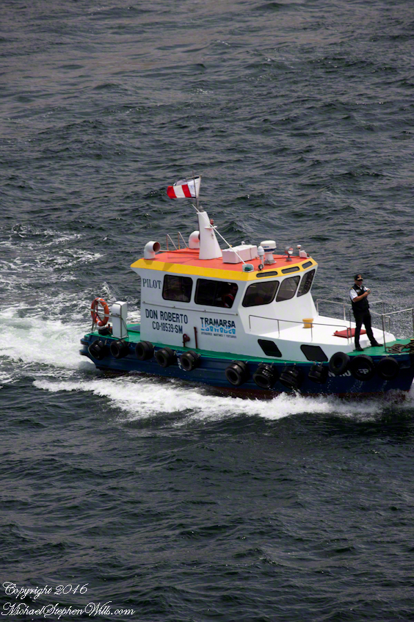
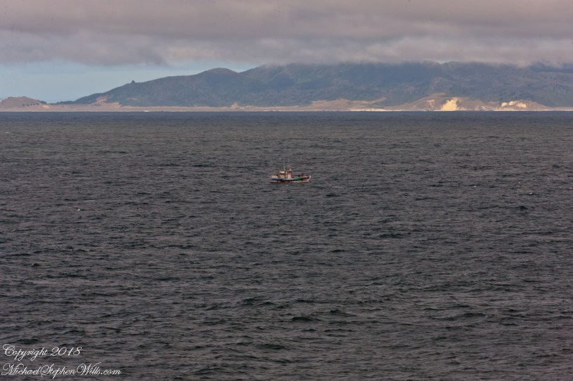
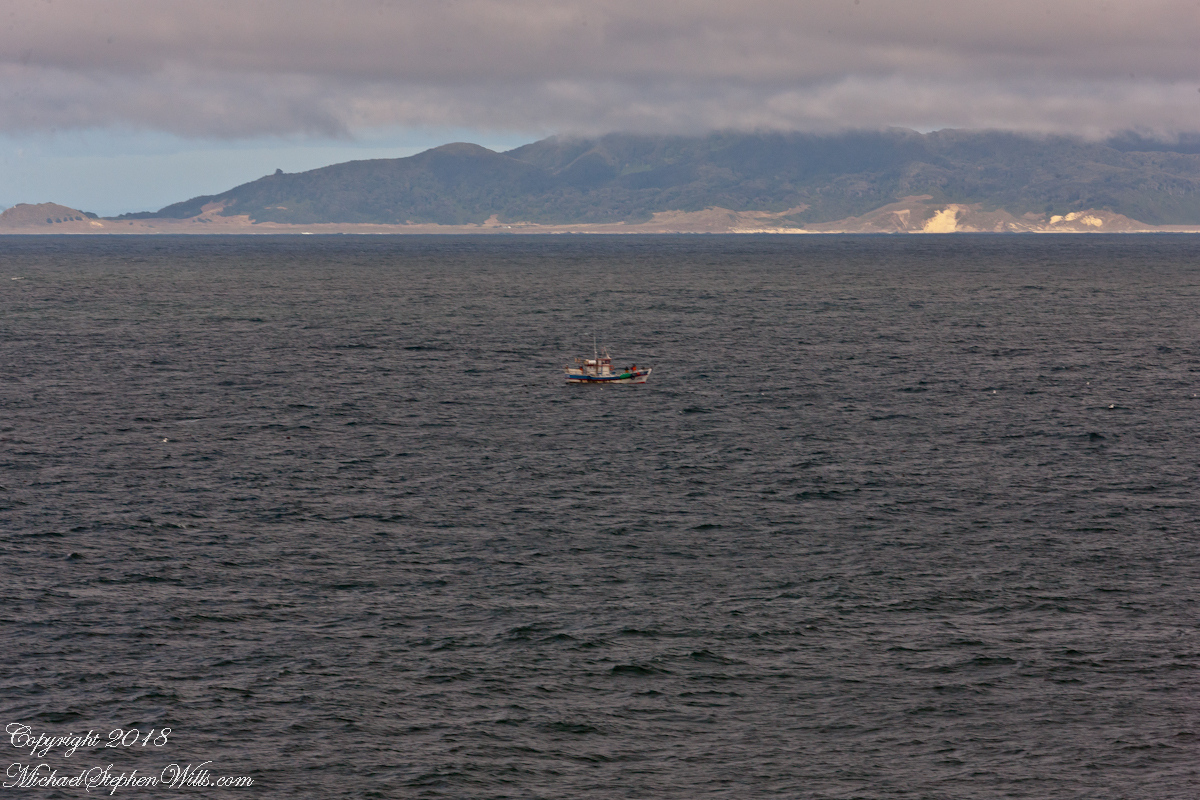
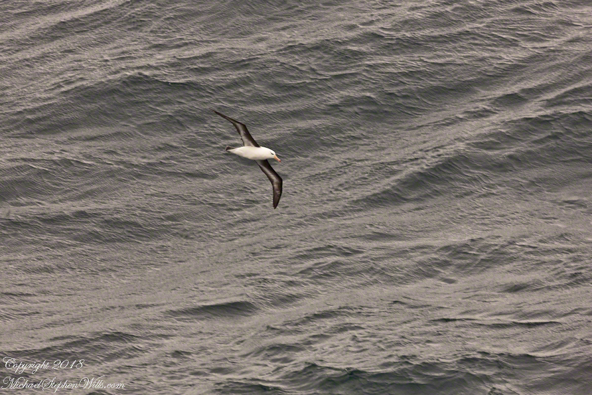
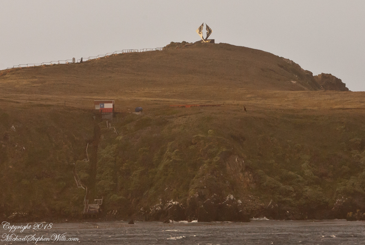
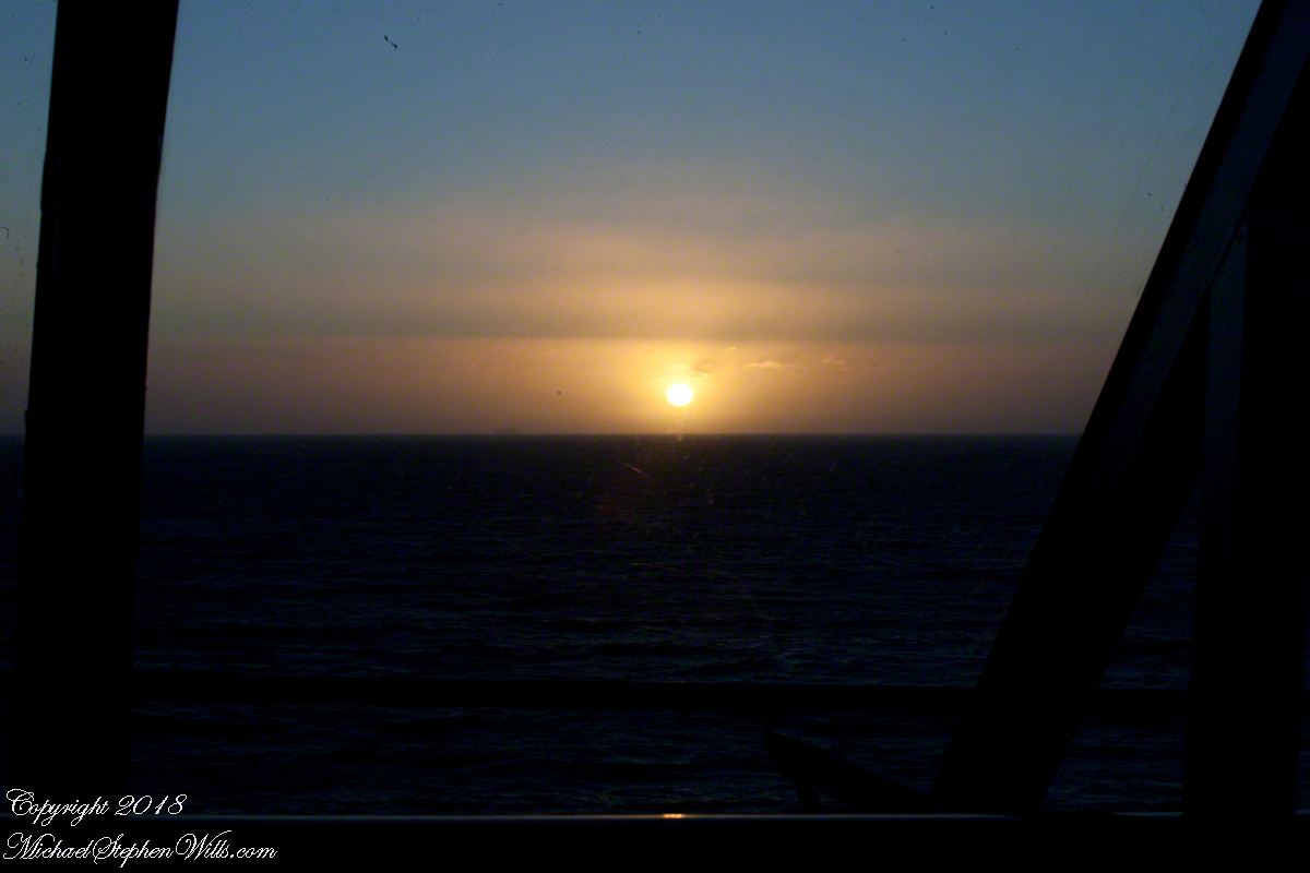
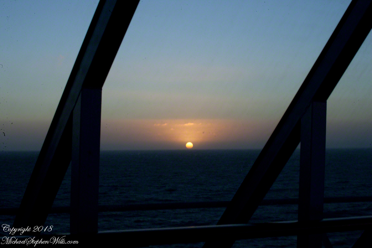
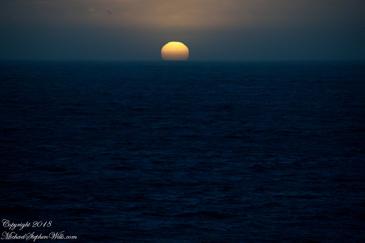
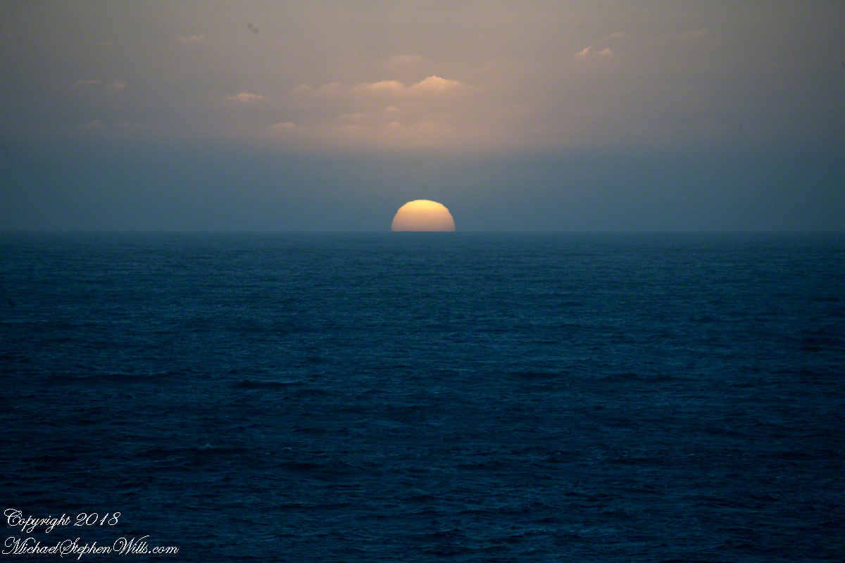
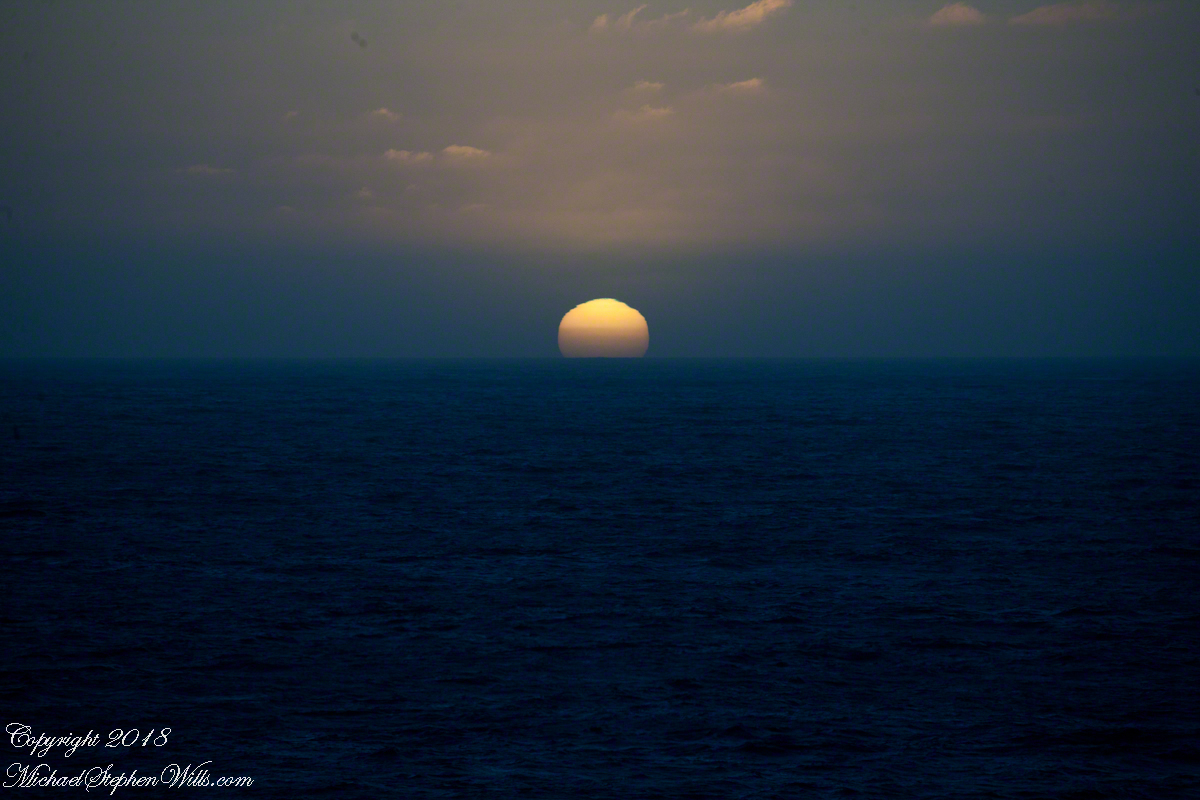
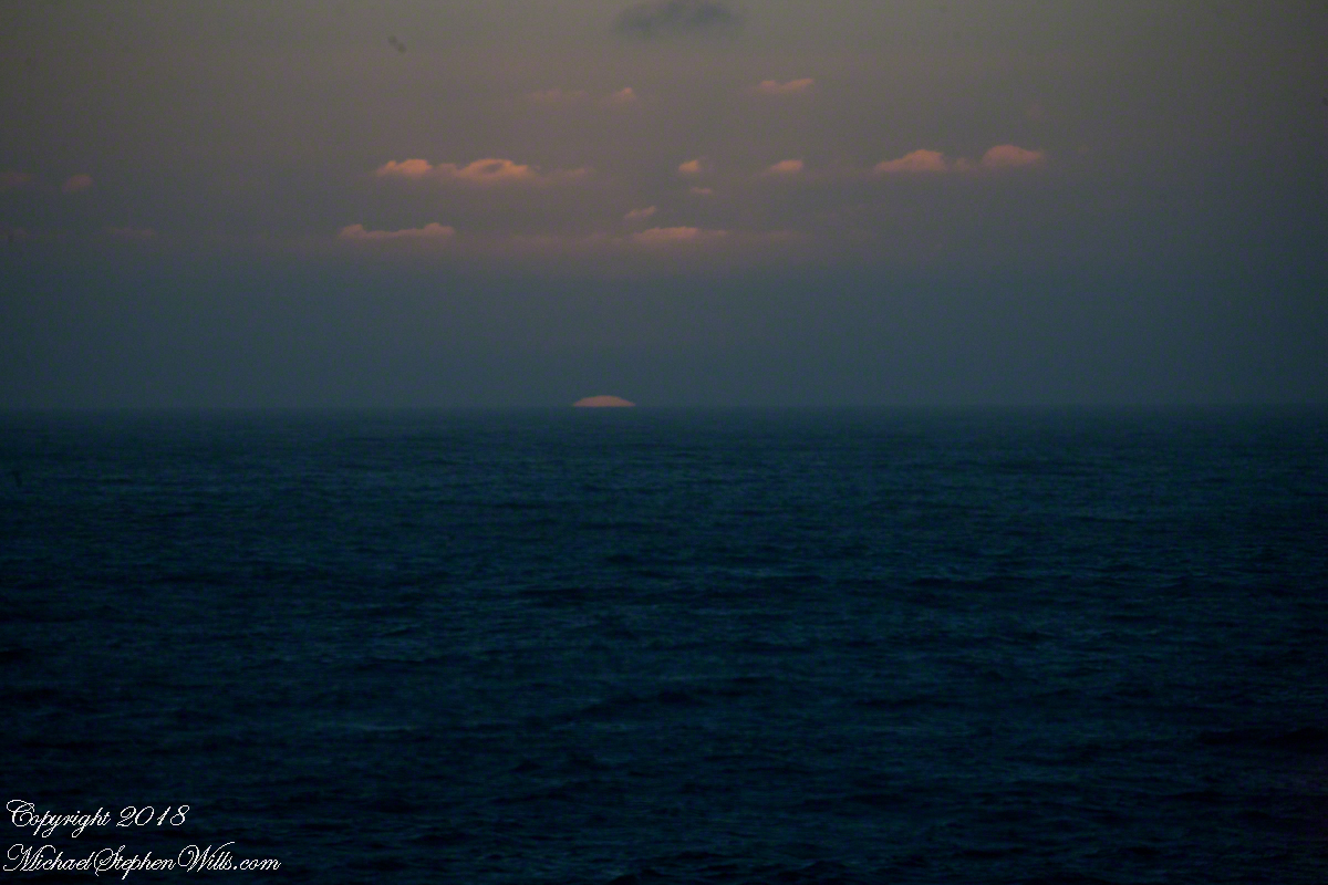
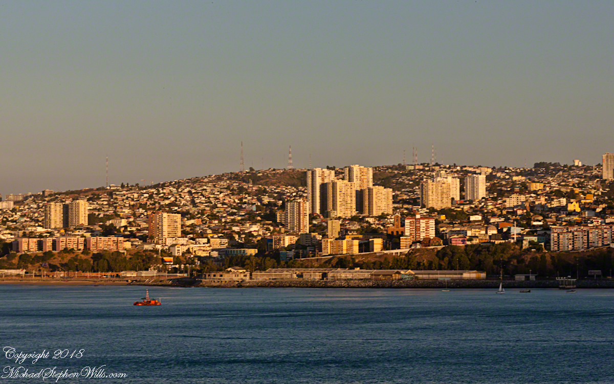
With the island due east, only a few miles away, the lens at 221 mm focal length.  A fisherman is having an easier day in a calm sea.  The indigenous people told stories of the souls of the dead travelling west to Isla Mocha.  Pirates used the island as a resupply base.  The fishing boat was the only sign of life.

RomanceOfIslandsMochaIsland2016-3

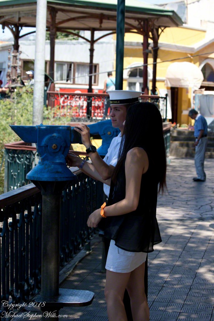
That was February 14th Valentine’s Day.  With Isla Mocha passing into the distance I changed for an evening with Pam.  Here we are headed to dinner, somewhere off the coast of Chile’s Lakes (and volcano) region.

Valentines Day 2016

Valparaiso Connections VIII

Captain Arturo Prat and Chilean Naval Tradition

Captain Arturo Prat and the Esmeralda

After reading my last post “Valparaiso Connections VII” why Captain Pratt was so honored by the nation?  

From the starboard side of the Regatta while docking at Valparaiso. On the right is the port with shipping containers, beyond are the Chilean Navy frigates 
Almirante Blanco Encalada and
Almirante Latorre at anchor.

On that morning, May 21, 1879 the two Chilean ships blockading Iquique port were surprised by two Peruvian warships from the port of Callao, the monitor Huáscar and armored frigate Independencia.

View west from La Sebastiana, former residence of Neruda, on Florida Hill.  We look over the city, docks and Chilean Naval Vessels to the Pacific Ocean.


Arturo Prat commanded the Chilean corvette Esmeralda. 
 Carlos Condell de la Haza  was Covadonga’s commander.

CS Almirante Blanco Encalada (FF-15), a modern frigate of the Chilean Navy at anchor.  With the Durante Point lighthouse, several fast fishing boats returning with their catch. 

The Chileans are outgunned by the Peruvians in armored ships.  Condell fled in the Convadonga, pursued by the Independencia.  This was the wiser course and most militarily effective because, following the Convadonga into shallow waters the deeper draft Independencia lost advantage when it ran aground and was lost. 

We did not have time to explore the National Maritime Museum.

Prat stood ground in the middle of the bay, any canon shots simply bounced off the heavily armored Huascar.  The Esmeralda suffered shot after shot until the command of the Huascar, Captain Graf, decided to ram the Esmeralda to force a surrender and safe useless death.

Naval Cadet with friend viewing the ships at anchor.

At the first ram to the stern, as the ships were in contact, Prat ordered an attack, “Let’s board, boys.”  In the confusion only two seamen joined   Prat.  One failed to board, Prat and Petty Officer Juan de Dios Aldea attacked.  Dios Aldea was mortally wounded.  Prat continued to advance alone, to the amazement of the Peruvians, awed at his courage.  Prat was gunned down on the deck of the Huascar. 

He crew watched in horror.  When the Esmeralda was rammed again, this time in the bow, Sublieutenant Ignacio Serrano lead  of 10 Chileans to board for an attack with machetes and rifles.  They were massacred by the mounted Gatling gun, only Serrano survived.  

The example of Prat and his crew is taught today.  Arturo Pratt is the most common street name, as well as plazas, buildings.  Four major warships were named after him.  The current active ship is the frigate FFG 11, the Capitan Prat.  The Chilean naval academy is named 
Escuela Naval Arturo Prat.  His portrait is on the 10,000 peso Chilean note.

Lighthouse on Punta Duprat

Valparaiso Connections II

the Chilean difference

Ricaro’s name tag reads, “Oceania Cruises, your world, your way.”  I began my two previous blogs with Ricardo, “Valparaiso Separation” and “Valparaiso Connections I.” There’s a lot to be said for the Oceania tours.  Every one lead by a knowledgeable native of the host country, fluent in English, we became familiar, some more than others, with them personally, one non-representative example.  As were progressed down the coast from Iquique to Cape Horn we met a cross section of Chileans.  Unlike other countries, in Chile we met only unsmiling guards on the streets, no protest rallies.


As the tour bus is about to turn down Varparaiso’s Argentina Avenue, here is a flash forward to an elaborate demonstration tableau in the Plaza de Mayo, the Casa Rosada as a backdrop, rose as in the color of bull’s blood used as pigment.  The protest was in support for veterans and causalities of the ill considered 1982 Falklands War.  We zoomed by the Parque De La Memoria, dedicated to the 30,000 people “disappeared” by the same military dictatorship of the Falklands War debacle.

http://bit.ly/MichaelsGalleries

Our entry to both Valparaiso and Buenos Aires was a cruise over the secret graves of thousands dropped, alive, into the ocean from military aircraft.

What is most chilling is the silence about this throughout our travels in Chile.  No memorials, no protests, silence, only stone faced military guards.

The following is from Basílica y Convento de San Francisco de Lima, beneath which are catacombs piled with disarticulated skeletons buried and cared for in the Catholic tradition .

In Lima’s Plaza de Armas we witnessed this peaceful demonstration by pensioners protesting low payments.  To be honest, around this time, in Chile, there were huge demonstrations, hundreds of thousands in Santiago, about the same issue.

The Lima crowd was peaceful.

Watched by a heavy contingent of armed police supported by large “paddy wagons” to cart people away.  The vehicle marked “Prodegur” (i.e., prosecution) was one of them.  Given the history of government disappearances in the region, how brave the demonstrators must be.

Our vehicle turns onto Argentina Avenue, passing under Spanish Avenue and these supports bruiting the “Patrimony of Humanity” status of Valparaiso.

Turning onto Argentina Avenue, the overpass support columns announce Valparaiso’s status as a World Heritage Site. It is the old city around the port which holds this designation.

Other murals feature the zinc panels of the Old Town and cultural opportunities.  I noticed the pictured flooring is identical that of Hotel Brighton, see “Our Fifteen Minutes of Fame on Conception Hill.”

I wonder how a man of a certain ago scrapes his knees, these appear to be homeless people.

Two men carry on conversation on Avenue Argentina, Valparaiso during the weekend Avenue Argentina street fair.

They gives us big smiles and waves when they spotted me / us.  The people were open and friendly.

Valparaiso Connections I

The Albatross and Valparaiso

We’ll start in the parking lot of the Valparaiso Passenger Terminal, introduced in my last posting, “Valparaiso Old and New”.  The terminal was our first stop in Valparaiso, it services cruise ship passengers, it was in the parking lot we met Ricardo, a guide and city native.  In his late sixties, Ricardo lived through numbing changes:  the political turn left and election of Allende, followed by a military coup d’état (called golpe de estado in Spanish) and rise of a military officer, Pinochet, to dictator.  From the 70’s through 80’s Pinochet ruled, abolishing the congress in Santiago, enjoying ruthless suppression of opponents with the full support and assistance of the military.  In the late 80’s Pinochet allowed a return to democracy, a new constitution with a bi-cameral (two houses) congress in Valparaiso and elected president.  Ricardo was quiet about these times, as are most Chileans and we did not press him.

Click any photograph to open my Fine Art Gallery.

The bus passed a carved wooden statue of the albatross, near the terminal entrance.  A bird of the southern ocean, familiar to mariners for the habit of following ships, this aspect of soaring the a familiar posture.

Here is a specimen in this posture following the Regatta on February 22 as we traversed the Southern Atlantic between the Falkands and Punta del Este.  That day, many albatross soared among the 20+ foot waves, the wingtips very close to the water surface.


The day before, February 21, the Regatta approached the southern most point of the western hemisphere, Cape Horn, coming within a mile of the landing point and monument.  At the top you can see the steel sculpture of the outline of an albatross set in a stone plinth.

A cropped version of the above image, the albatross outline is easier to see.  Also visible, at the cliff base, the landing, stairs, a platform painted as a Chilean flag, the railings leading up to the Albatross Monument.

All of this to emphasize the unique position and reason for being of Valparaiso of the eastern South Pacific, made evident by the recurring motif of an albatross soaring among the waves.  This retired anchor, close to the albatross sculpture, on our way to Argentina Avenue and the weekend street fair (to be continued).

Valparaiso Departure III “The Sunset”

The Sun’s Progress

Two minutes after capturing the last light on Concon Point, see “Valparaiso Departure II”, turning the camera 180 degrees, to the south, looking along the Chilean coast, to capture birds on the wing headed toward shore at day’s end.
ValparaisoDeparture-22
Remembering other times,

ValparaisoDeparture-23

waiting for darkness

ValparaisoDeparture-24

with a sky map, studying it to make sense of the stars.

ValparaisoDeparture-25

How far?  How large?

ValparaisoDeparture-26

Light from our star, eight minutes old,

ValparaisoDeparture-27

grazed the earth’s rim the breath of a moth wing ago.

ValparaisoDeparture-28

Connect the dots, stories of heroes, monsters.

Our star, as we know it now

ValparaisoDeparture-31

Singular, alone,

Progress, an illusion to be understood

No less mysterious for that

ValparaisoDeparture-45

Look back to the sheltering headland of Valparaiso, glowing.

ValparaisoDeparture-47

Valparaiso Departure II

View of Aconcagua Mountain at Sunset

After the Ocean Princess sailed off toward its destiny in my last posting, “Valparaiso Departure I,” Pam and I left the deck for dinner to return two hours later for the Regatta’s departure in the magic sunset hour.

This first photograph is 22 minutes before sunset as the ship swung into a course along the northern shore of Valparaiso Bay.  The city grew along the bay shore, starting from the city center in the southern cup and into the north.  We are looking southeast across a lighthouse named “Club de Yates”, identified from the red fiberglass tower, a triangular daymark, toward the north end of Valparaiso.

Click this link for my Fine Art Photography gallery.

ValparaisoDeparture-17

Here we see a different city altogether, the fourth largest of Chile and also within the Valparaiso Region and the Greater Valparaiso Area, named Vina Del Mar (Vineyard of the Sea).  The view is almost due east and, from here, it is difficult to discern why it is also called “La Ciudad Jardin” (Garden City), it is do densely populated.  North Valparaiso ends with a ridge with Vina Del Mar the next valley.  Look carefully along the shore to find the Punta Gruesa lighthouse with a red band on a white metal tower daymark.  By way of scale the tower is 56 feet high.  Follow Punta Gruesa to the right for the ridge separating Vina Del Mar (the taller apartment buildings, from Valparaiso.

The distant mountain is huge, visible from 95 miles away.  More about it later.  

ValparaisoDeparture-18

The previous photographs were using a tripod mounted Canon EOS-1Ds Mark III with the Canon 70 – 300 mm f4-5.6 L IS USM lens set to 108 mm focal length, taken 15 seconds apart.  I then swapped  the EF 24 mm f 1.4 L USM lens for the following photograph of the pilot boat heading to a rendezvous with the Regatta, having dropped off “our” harbor pilot.  It will wait beyond the harbor to bring the pilot back home.  The photograph is 7 minutes after the previous.  Punta Gruesa and the lighthouse and the Vina Del Mar apartment towers are just visible, having lost the sun.

Click this link for my Fine Art Photography gallery.

ValparaisoDeparture-19

On the northern tip of Valparaiso Bay Punta Concon, the City of Concon and tall sand dunes also called Concon reflect the sun’s light 10 minutes before sunset.  The city is the fastest growing in Chile, 106% between 1992 and 2010 (28,157 to 50,000).  The Regatta is now well underway and I returned to the “long” lens here set to the 3oo mm focal length maximum.

On the other side of Punta Concon (Concon Point) the Aconcagua River flows into the Pacific.  Although the river has the same name as Aconcagua Mountain, the head waters are in Chile, 12 miles from the slopes of the mountain in Argentina.

ValparaisoDeparture-20

A swivel of the camera brings Aconcagua Mountain into view.  This former volcano, dead now for 8 – 10 million years is the highest mountain in North and South America.  The next highest peak is in the Hindu Kush, 10,000 miles to the northeast.  That said, Aconcagua is less challenging than Denali of Alaska and so many people attempt it each year human excrement is a major pollutant there.  We are looking here over the Vina Del Mar Valley 95 miles to Aconcagua Mountain in Argentina.

Click this link for my Fine Art Photography gallery.

ValparaisoDeparture-21

Copyright 2022 Michael Stephen Wills All Rights Reserved

Valparaiso Departure I

Thoughts on Departures

Late afternoon of our departure from the Chilean port city Valparaiso,  Pam and I enjoyed entertainments on the Regatta.  This painting of a ship under sail brings to mind the history of Valparaiso, as a place only reachable by ship, clinging to a narrow ledge on the Andes, barely existing for centuries, repeatedly destroyed by earthquakes until the 19th century brought sailing vessels such as this, growth and prosperity.  Major earthquakes hit the years 1730, 1822, 1839, 1873, 1906, 1907.  After 1907, the city was rebuilt anew in the modern form.  The inhabitants must enjoy spot, naming it “Vale of Paradise.”

Click this link for my Fine Art Photography gallery.

ValparaisoDeparture-1

While, in the 21st century the city enjoys a refreshment of an influx of artists and visitors such as the Regatta, the danger of the next massive quake is ever present and unpredictable.

As we enjoyed the artwork….

ValparaisoDeparture-13

….a pianist entertained us.

ValparaisoDeparture-14

As usual, I was carting photography equipment to capture the moments as the afternoon moved towards…

ValparaisoDeparture-15

….the scheduled departure among still life painting in the style of the Dutch masters.

Click this link for my Fine Art Photography gallery.

ValparaisoDeparture-16

That day I chose the upper decks as the best vantage point.  From there, Pam and I viewed the departure of a similar ship to the Regatta, the “Ocean Princess.”  It must have been the last voyage of the Princess under that name as, the same year, it was acquired by the Oceania line, refurbished, relaunched as the “Sirena”.

The Chilean navy base and Naval Academy is there.  The Ocean Princess navigated around this docked destroyer…..

ValparaisoDeparture-2

…with the assistance of the tugboat Alcatraz, a name derived from the Spanish word for pelican as in “La Isla de los Alcatraces” (Island of the Pelicans) where the former Alcatraz prison was built in San Francisco Harbor.  Spanish speakers think of birds when viewing the tub boat.  Americans think of prisoners (escaping) and San Francisco.  Unlike San Francisco Harbor, Valparaiso Bay is a semi-circle open to the ocean, the harbor is on the southern, north facing (away from the ocean) shore, protected by a long (3,000 foot) breakwater along which the Chilean war ships dock.  We are viewing the Alcatraz after most of the work for the Ocean Princess departure was done.

ValparaisoDeparture-3

The north end of the bay is residential, behind the towers are homes arrayed on the hillside, the only land available.

Click this link for my Fine Art Photography gallery.

ValparaisoDeparture-4a

Much of the harbor and city business district, in the foreground (below), on the south side is on land reclaimed from the sea.

ValparaisoDeparture-5

All around the Regatta was a working port.  Here rolls of cable (wire?) are prepared for hoisting onto a cargo ship.  Note the hawsers, taught under the strain, between the workmen and the ship hull.

ValparaisoDeparture-6

Passengers board the Regatta from the last tours.  I expect this is the trip to Santiago.  Most of the dockings the Regatta was surrounded by the port, the only way to access the city was on a tour bus as the port activity made walking too dangerous.

Click this link for my Fine Art Photography gallery.

ValparaisoDeparture-7

I can only guess the role the Alcatraz is playing here…..

ValparaisoDeparture-8

…. probably it is positioned to give the Ocean Princess a nudge if the harbor pilot misjudges the turn around the breakwater and warships.  In a harbor, a ship’s crew passes control to a harbor pilot who knows the navigation challenges much better than is possible for them.

ValparaisoDeparture-9

Today, as 99.9% of all days, the pilot makes the turn safely.  Here is a better view of the warship.

ValparaisoDeparture-10

Looking back toward the harbor, the crane is hoisting those rolls, the tug boat “Lauca” framed by the superstructure of (I think) the crane.

ValparaisoDeparture-11

The Ocean Princess is will under way, as shown by the long wake.  As luck will have it, When the Regatta follows the sun will be much lower, the light better for photography.  At the stern of the warship, the masted vessel is a training ship for the Chilean Naval Academy.

Click this link for my Fine Art Photography gallery.

ValparaisoDeparture-12

Copyright 2022 Michael Stephen Wills All Rights Reserved 

The Scale of Iceberg Glacier

Why is the glacier face blue?

 CLICK ME!!!!

Glacier Scale
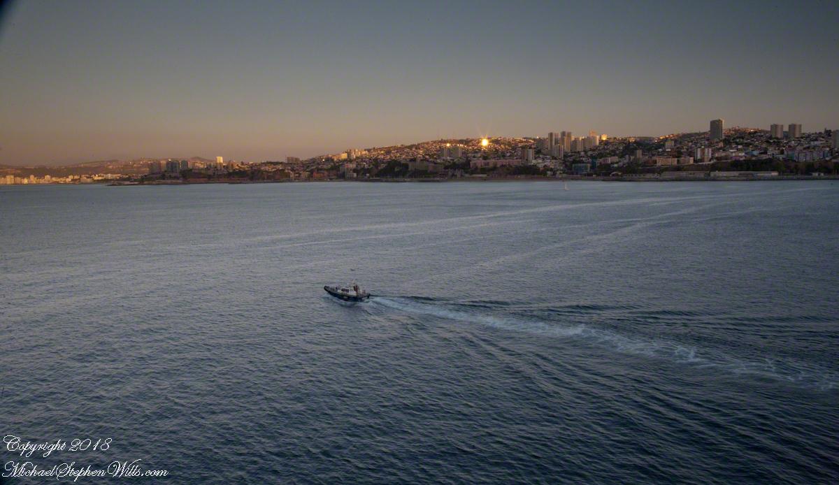
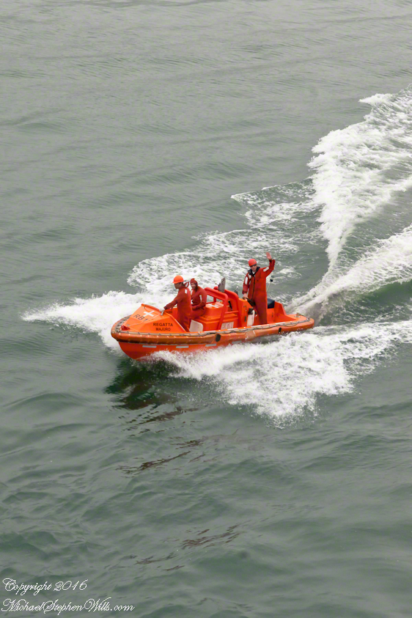
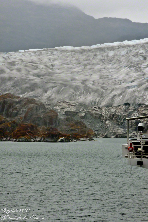
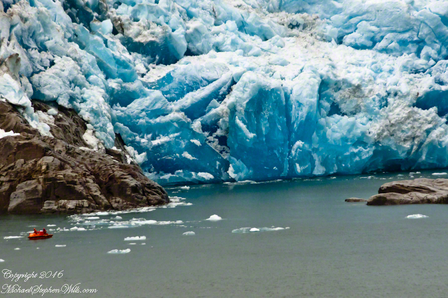
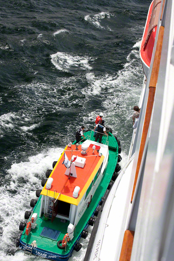
A glacier is more than ice; not alive, it crawls; not feeling, it groans, cackles, shouts; passive, it is dangerous to approach closely backed as it is by the southern ice field, over a mile high. The ship nudged as close as a half mile from the massed ice, navigating using the bow thrusters to face first port, then starboard and back to port. I was lucky enough to be on the 11th deck, pictured above, when we caught sigh of the fast ship’s launch, manned by ship’s crew.

Iceberg Glacier Scale
Three person ship launch and glacier base at head of Tempanos Fjord

The crew prepared for a run to the rock face, almost 100 feet high, beneath 500 feet of glacier. Enjoy the views! Click any photograph to visit my online gallery. Purchase a photograph from this newly published series or any of my other popular works.

 CLICK ME!!!!
 CLICK ME!!!!
 CLICK ME!!!!
 CLICK ME!!!!
 CLICK ME!!!!
 CLICK ME!!!!
 CLICK ME!!!!
 CLICK ME!!!!
 CLICK ME!!!!
 CLICK ME!!!!
 CLICK ME!!!!
 CLICK ME!!!!
 CLICK ME!!!!
 CLICK ME!!!!

Maritime Pilots, Scout Island, Scout Canal

About maritime pilots and the Chilean Fjords

Want More? Visit my Online Gallery

On our way to Fjord Tempanos and the Iceberg Glacier…..

Background: on a ship, facing the bow (front), starboard is right and port is left).

In the 8 miles from Tarn Bay and Sombrero Island lands press closer, higher, islands increase in number.  This is a listing of some of the islands we passed. These names reflect the history of Chile, the waves of immigrants touch the land with memories. After some of the names, below, I provide in parentheses the derivation.

On starboard was the northern Wellington Archipelago (English General): Pinochet (the Chilean dictator), Penguin, Juan Stuven (Spanish and German), Chang (the far east), Millar (German).

On port, the names have a military flavor: Zealous, Scout, Scylla (Sea Monster of Greek mythology), Alert, Orlebar (British Officer Augustus Orlebar).

These port side island names reflect what is on the minds of mariners as navigational options narrow with the channel.  Innumerable channels, points, mid-channel islets, all looking very much the same, a potentially confusing jumble.  Chilean maritime law demands ships have on board, working from the bridge, a certified Chilean maritime pilot to transverse the country’s dangerous channels and fjords.  The combination of stopping distance (multiple nautical miles) and the loss of steering when a ship moves slowly make it essential to know, exactly, the route ahead.  It was a Chilean maritime pilot who help keep us safe.

A great personal hazard for pilots is boarding the ship from the pilot boat.  From our stateroom terrace we observed fast pilot boats in all seas approach the Regatta miles from port, the pilot on the bow, pull up alongside.  Without a harness, the pilot transfers from boat to ship.  We observed this several times from our stateroom veranda.

Here are shots of the pilot boat approaching the Regatta off the Peruvian port of Matarani. The boat was mirrored by the colorfully painted houses of Peru.

Don Roberto Approaches the Regatta
A fast pilot boat from Matarani approaches the Oceania Regatta. On the bow, the pilot will transfer from boat to ship. On board he will work with the Regatta crew to safely navigate the approach to the Matarani harbor and dock. The whiteness on the land is diatomaceous earth.
Don Roberto, Maritime pilot, approaches the Regatta
The whiteness on the land is diatomaceous earth.

A cautious approach. In the third shot the boat turns to slowly approach the Regatta.

Alongside, boat crewmembers joint Don Roberto on the bow to assist in the transfer. I am not sure which of the two blue uniformed persons was “our” pilot.

I did not capture the boarding of the pilot who served the Regatta through the Chilean Fjords.  Was is at Puerto Montt?  Puerto Chacobuco?  I am not sure.  I do know a maritime pilot was on board as the channel narrowed to 2 miles, named Scout Channel were we passed Scout Island.  I was facing generally east from our port side stateroom veranda while capturing these photographs as the Regatta headed south.

Scout Island and Canal
Scout Island. The water is Scout Channel

The peak on Scout Island is about 2,100 feet. The smaller peaks in front are about 1,200 and 1,500 feet. All rise straight up from Scout channel.

Scout Island
Scout Island lies on the Scout Canal
Scylla Island
Lying just south of Scout Island, Scylla Island is between our ship, in the Scout Canal, and the Kruger Canal. The Kruger is short, between Islands Scout, Orebar, Zealous, Porcia and Tito.
Islet Alert and Orebar Island
Islet Alert is between Canal Scout and Canal Kruger. On the far left there are waves breaking on Pilot Point of Orebar Island, marking the northern end of a small bay, named Hale. You can see the bay behind Islet Alert. On the far left there are waves breaking on Pilot Point

Want More? Visit my Online Gallery