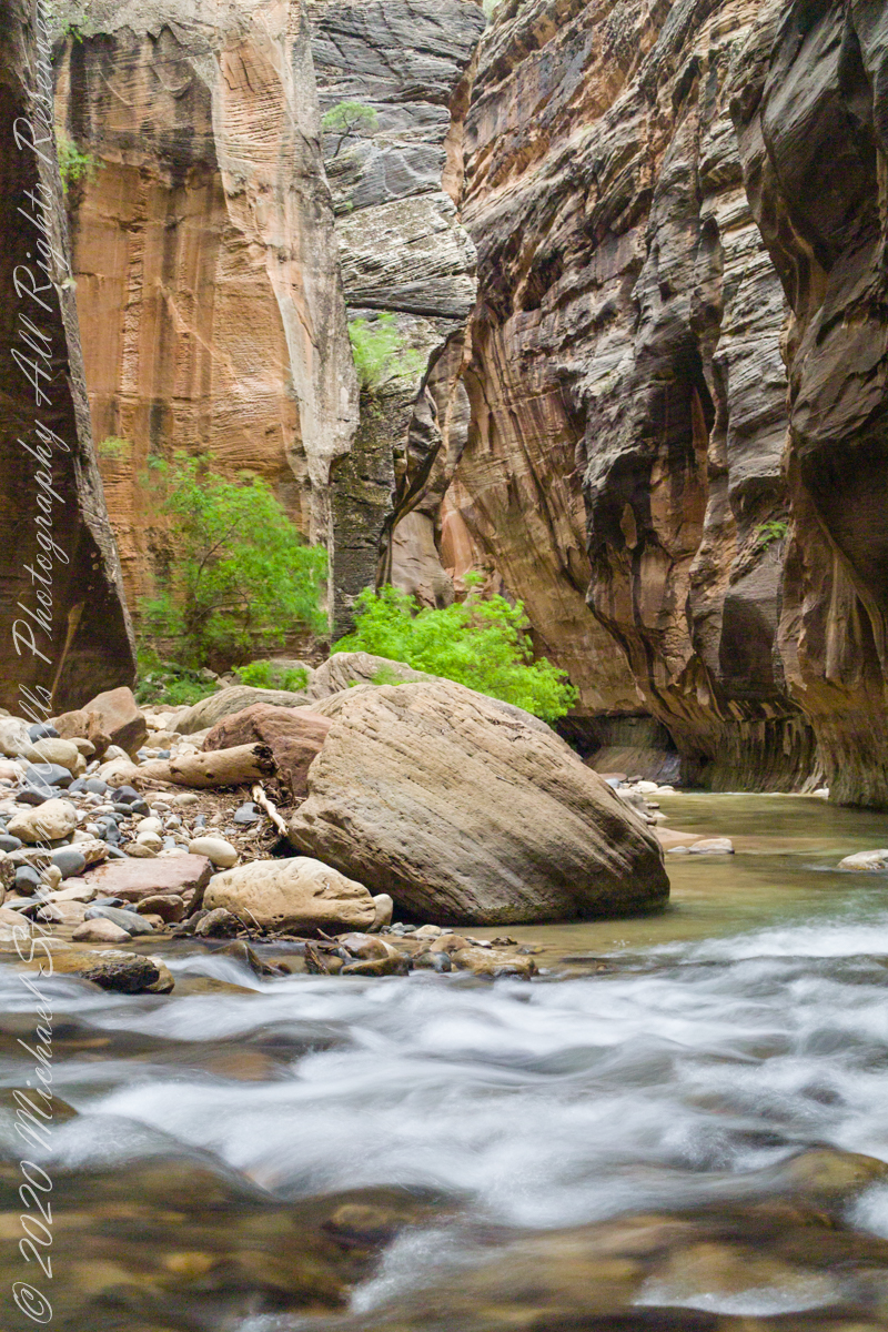
The first of three long exposures of the Virgin River from the Narrows on the way back to Pam. Earlier on Pam headed back, concerned about thunderstorms and the possibility of flash floods. I hung on, for the perfect photo. I came pretty close here, with the flowing water coming aound this outcrop of picturesque boulders, canyon turning sharply right up ahead.. The Narrows, Zion National Park, Springdale, Utah
Copyright 2021 Michael Stephen Wills All Rights Reserved
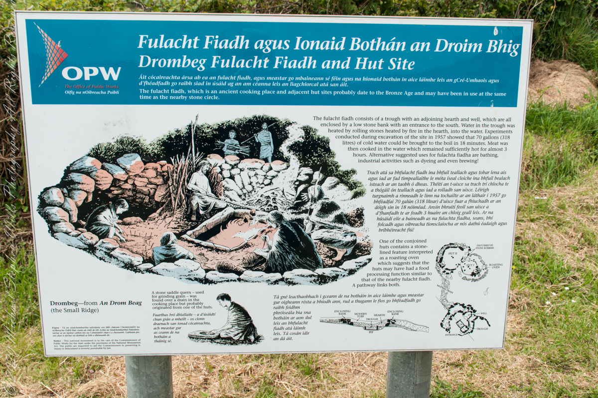
The previous post was an overview the Fulacht Fiadh associated with the Drombeg Stone Ring of County Cork, Republic of Ireland.
In this post, we explore the elements of these fascinating remnants from the late Bronze Age, over 3,000 years ago.
Click pic for a larger view, in a new tab. When using WordPress Reader, you need to open the post first.
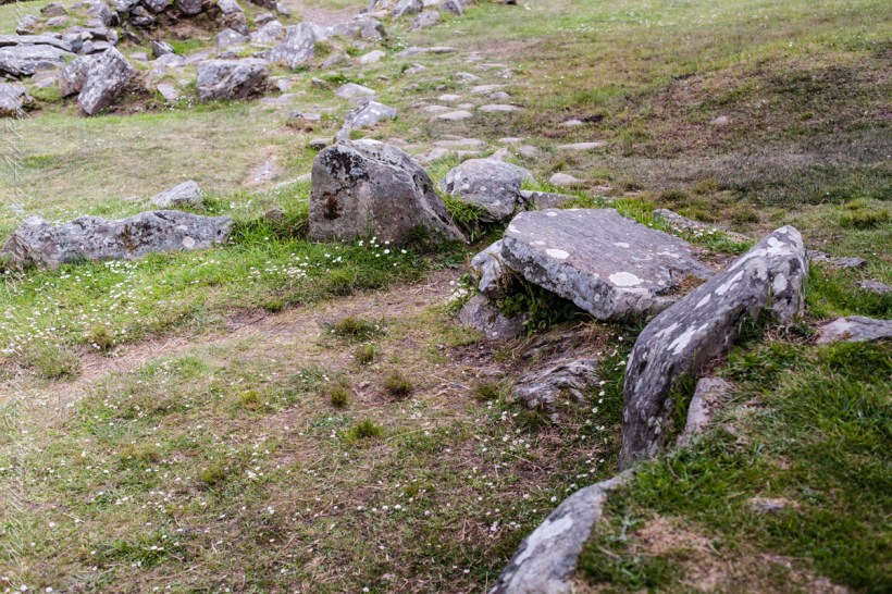
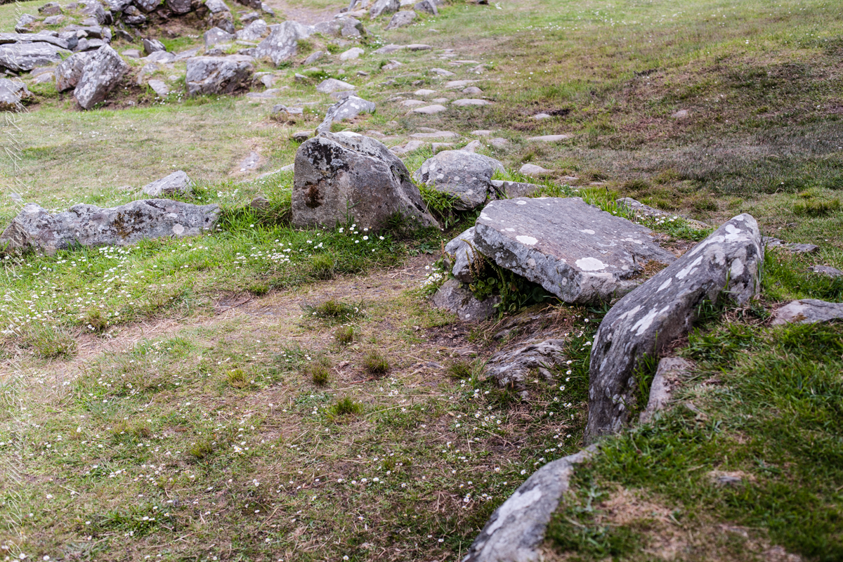
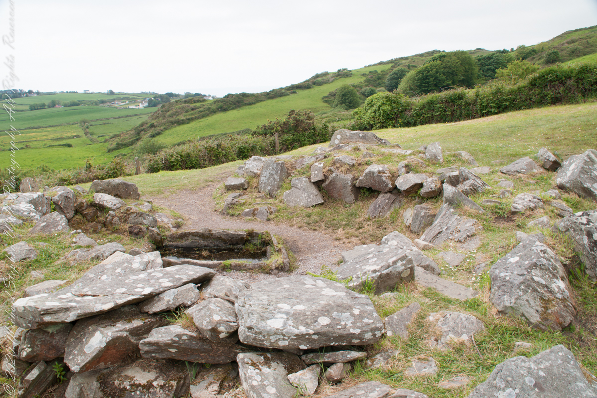
rock- lined pit
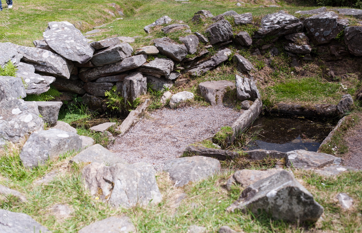
It is amazing the rock wall survived human need for the valuable wall stones. Portions were stolen, though for the most part we can see enough to understand.
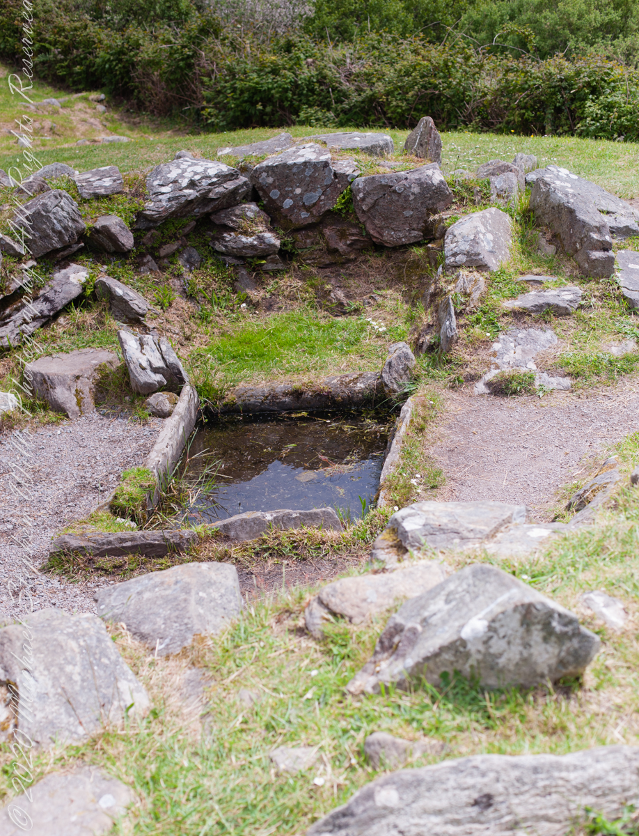
rock- lined pit and hearthView of entrance to the south from above the spring, visible is the rock lines cooking pit filled with ground water.
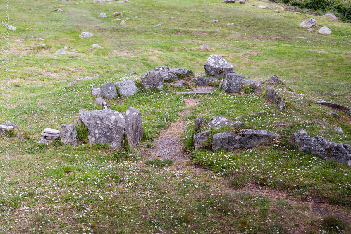
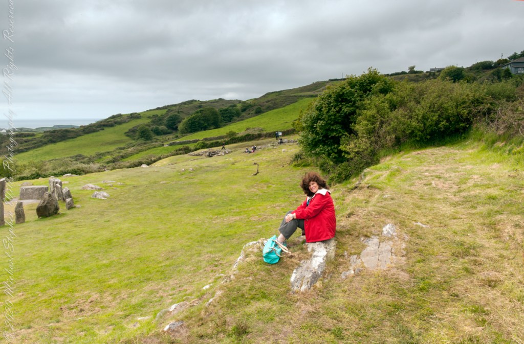
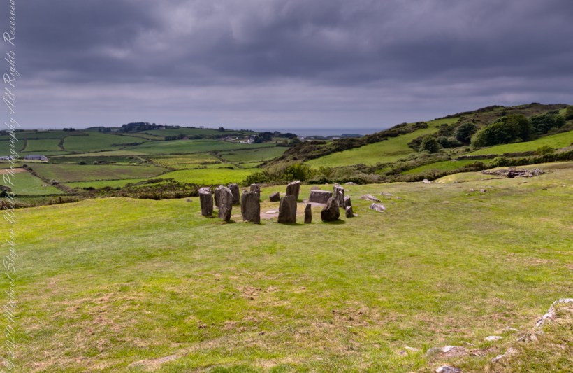
Notice the groupings of visitors in the middle distance of Pam’s photograph, gathered around remains of late Bronze age elements.
Click pic for a larger view, in a new tab. When using WordPress Reader, you need to open the post first.
There is a sign to explain…
Trach atá sa bhfulacht fiadh le brutháil teallach agus tobair lena ais agus atá dúnta ag falla cloiche íseal le hiontráil soir. Líonadh an traid trí clocha te a théamh ar theallach agus a n-aistriú isteach sa traid lán le huisce fuar. Léiríodh le turgnamh a rinneadh le linn na tochailte ar an áit i 1957 gur féidir 70 galún (318 lítear) d’uisce fuar a thabhairt chun boil in 18 nóiméad. Ansin bhíodh feoil ann is a cócaireacht. Maireann an t-uisce seo te ar feadh 3 n-uaire an chloig. Cuirtear úsáidí eile sa bhfulacht fia ar aghaidh, mar shampla folcadáin, ceardaíocht amhail ruaimniú agus grúdaireacht.
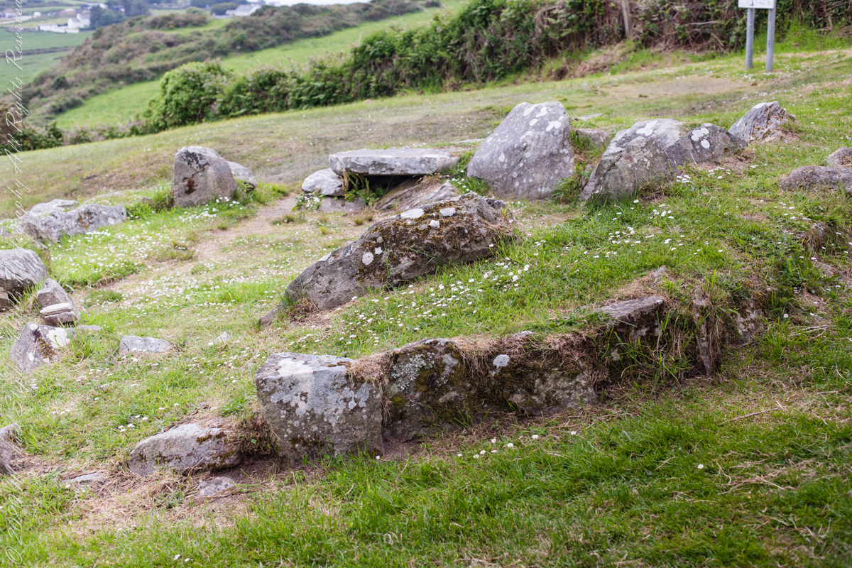
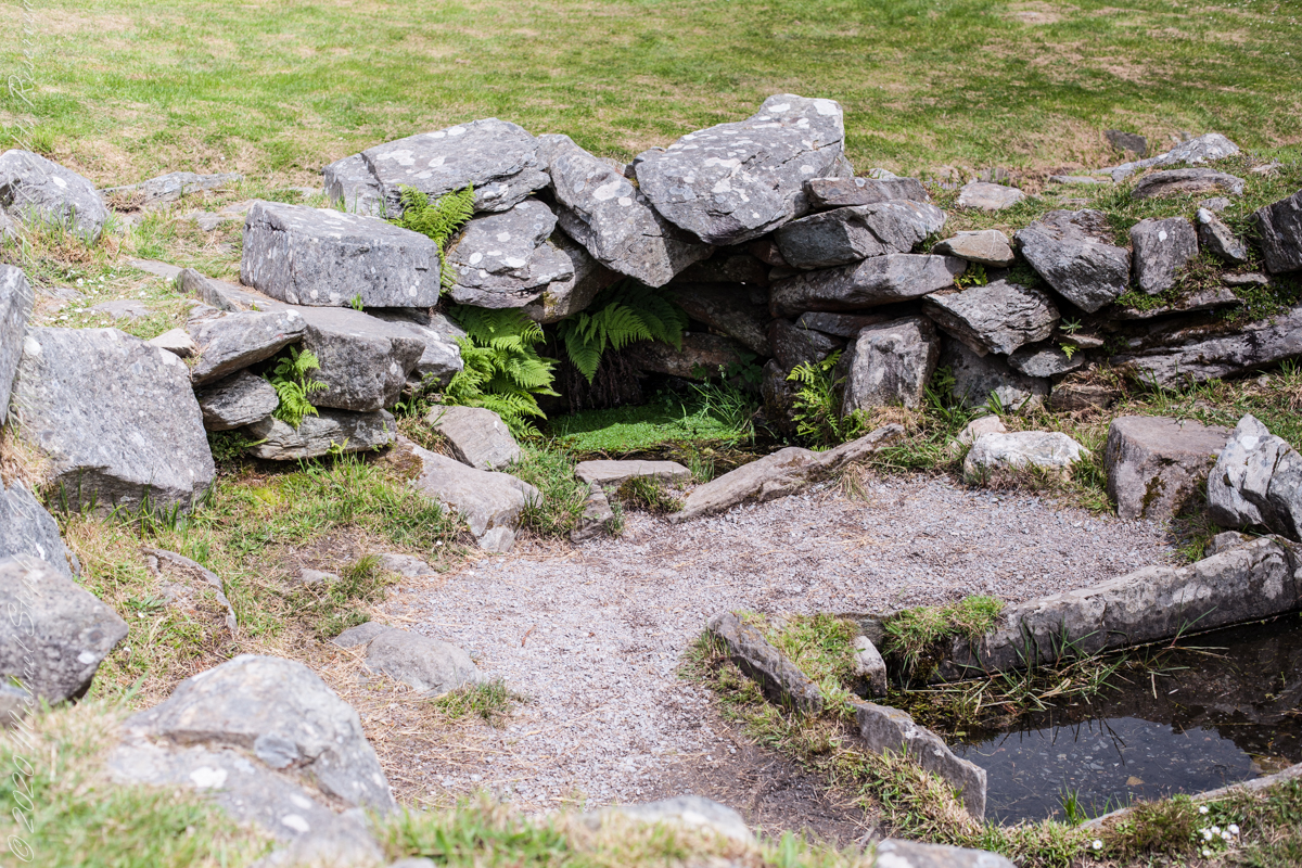
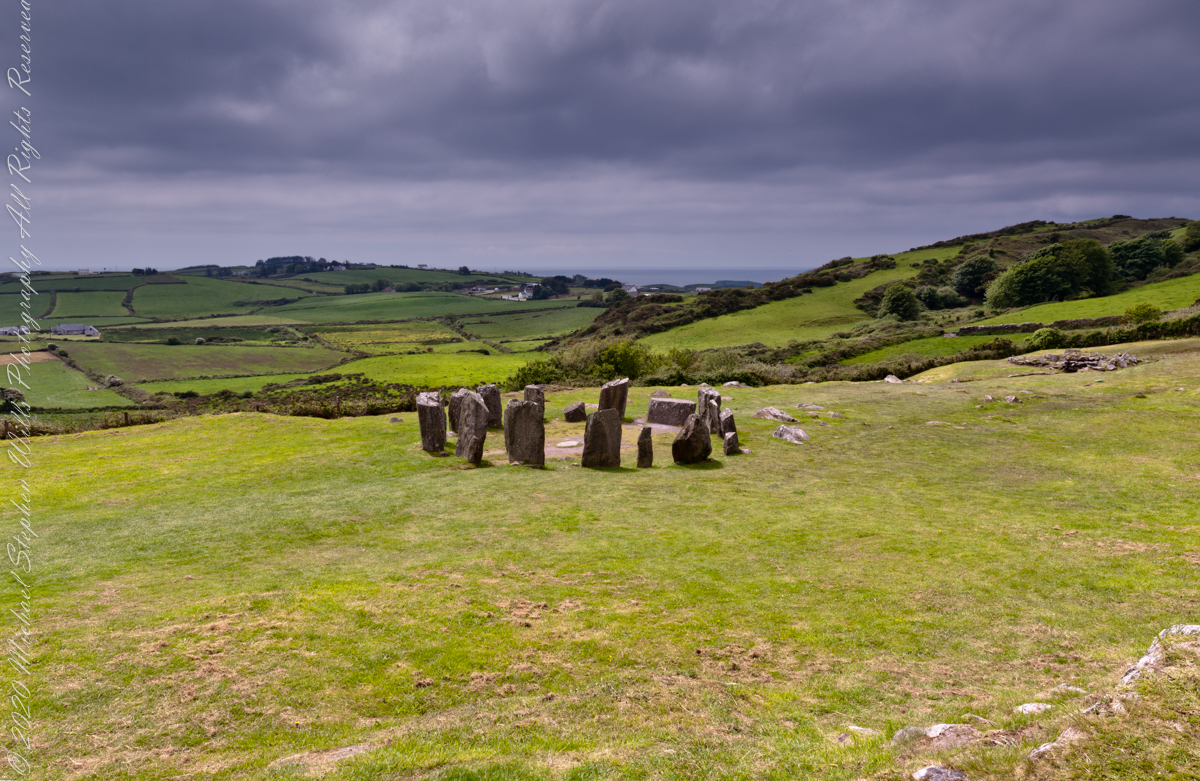
In modern Ireland the word fulacht means barbeque and the archeological sites with characteristics in common, such as a water source, health and pit, are named “Fulacht fiadh,” derived from Old Irish sources. In all cases the link is to some kind of preparation activity involving heat and moisture. Found throughout Ireland, Great Britan and the Isle of Man where the sites are called burnt mounds. The Drombeg Fulacht fiadh exemplifies all characterists. There is a horseshoe shaped rock walled/banked, now a remnant, enclosure, entrance to the south. In the middle is a pit, at Drombeg lined with rock, a spring on one side, a hearth on the other. A stone saddle quern, used for grinding grain, was nearby Adjacent huts, rock walls with post holes, do not suggest a settlement, but rather a temporary use.
View of entrance to the south from above the spring, visible is the rock lines cooking pit filled with ground water.
Pam posing with wind blown hair on the rock outcrop I used to achieve site overviews. In medium distance, other visitors gather around another site feature.
Click pic for a larger view, in a new tab. When using WordPress Reader, you need to open the post first.
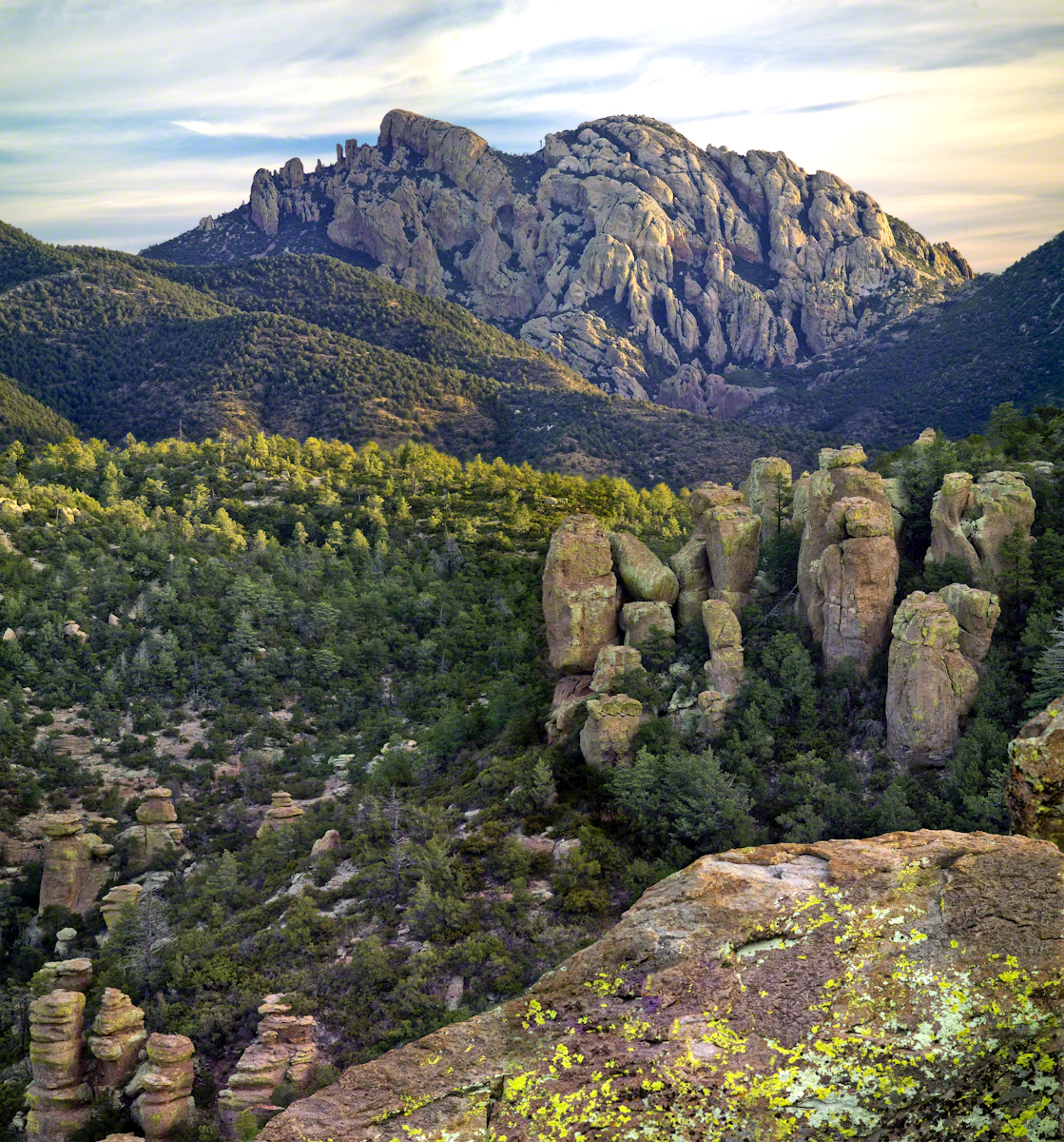
From 2004 through 2011 I visited Arizona every Autumn, October or November. As a University of Arizona Alumni Board member for the College of Agriculture and Life Sciences we had a meeting during “homecoming” and a fund raising event. I’d come early or stay later for getting acquainted with Arizona, more than was possible as an undergraduate. In 2007 I camped for several days Chiricahua National Monument of the remote south eastern corner of the state.
The park empties out this time of year, for some reason. The weather is perfection with clear skies, moderate daytime temperatures, cool nights. This time of year the Arizona White Oak acorns ripen and fall. The campground has aluminum picnic tables, the falling acorns made a loud plunks throughout the night. This would annoy some people. Me, it is a great memory.
The following two images are great memories from my first morning.
Click any photograph for my Online gallery.
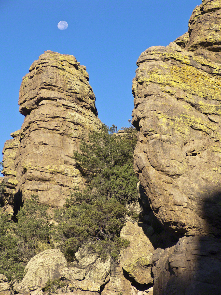
These formations hovered over the trail on my first morning. The rising full moon was an unplanned bonus.
I experimented this trip with a breakfast of granola with dried whole milk. It was delicious (for me) and got me out on the trail quickly. This first morning I clicked my hiking poles together to scare away bears as I walked in the pre-dawn dark. The preparation and extra effort paid off with this photograph.
Click any photograph for my Online gallery.
I met one hiker who was a harbor pilot from Hamburg, Germany. He came just to view a particular rock formation that was, literally, the rubber bath duck. It is several miles to the site, a moderate hike with significant elevation gain. He took his snapshot with a little camera and was on his way.
The following is my masterpiece from the trip. Imaging the effect of seeing this image on settlers. That same first day I turned a corner and there this was…it took a few minutes to comprehend what I saw, it was so incredible and, for me, unexpected. It first, the only perception is a huge rock dome of rough rock, then, slowly, the image of a native American profile forms in the mind. Cochise Dawn
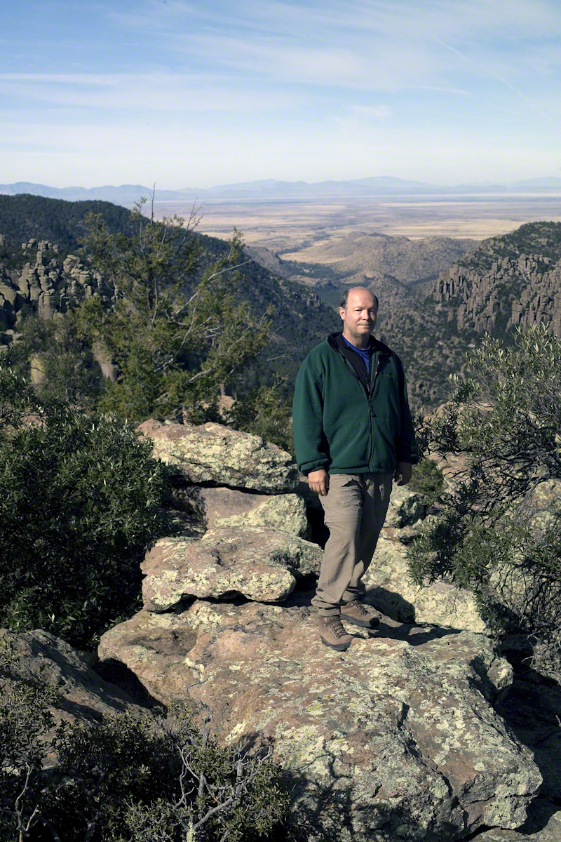
During the session for Cochise Dawn I turned the camera for the view northwest and did a self portrait. In the distance are the Galiuro Mountains and Wilderness. Tucked alongside is the Aravaipa Canyon Wilderness, hosting one of the few perennial streams of Arizona.
Copyright 2017 Michael Stephen Wills All Rights Reserved
In my post Canyon of Music, Wind, Light I shared a different photograph of this beetle crawling on sandstone, naming it as a “dung beetle”. I had assumed it was one from once having seen a beetle in an Arizona desert pushing a ball of dung around. This morning, to confirm my assumption, I searched for images of “Arizona Dung Beetle” and was dismayed to find this beetle shares no characteristics with the photographs. Absent smoking gun evidence, sadly lacking in this photograph, I have to admit my “dung beetle” attribution is in error.
Supporting the beetle, the luminous surface of the red sandstone named “de Chelly,” sunlight reflects from durable remnants of the ancestral Rocky Mountains wore to these bits of rock, piled to mountainous dunes by the winds of tens of thousands years, polished to smoothness each against the others.
Mysterious abrasion and grooves in a de Chelly sandstone cliff, Canyon de Chelly.
The above photograph is a detail from the brightly lit cliff of the following photograph. The desert varnish and underlying rock was weathered over thousands of years, the sand grains falling to the canyon floor.
The soil of the canyon is composed of these bits of the ancestral Rocky Mountains. What appears to be a white road in the above photograph is not man-made, it is the dried bed of a stream. When a waterway is dry like this, only flowing with rains, it is called a wash. When water fills the wash of the Canyon Del Muerto, the polished sand granules become a dangerous morass, sucking down horses, people, anything unlucky enough to step into it. Every movement, struggling for freedom, pulls the victim deeper down until the wet sand closes over the head and suffocation and death ensues.
Stairs cut into the sandstone cliff of Canyon de Chelly
The waters Canyon De Chelly National Monument naturally form a vast Y into the Defiance Plateau, naturally because two major streams merge into one canyon a few miles above Chinle. On both our guided trips, heading east from Chinle there is a branch. On the right De Chelly canyon continues. On the left is Canyon Del Muerto. The photos in this post are all from “The Canyon of the Dead”, what the name means translated into English.
No, it is not named this because of the quicksand. Conditions for quicksand are present throughout canyons of the southwest. It is history of human occupation for which this canyon was named. I will cover it in a future posting. For now, I will say the above views are from the spot featured in “Family Trek.”
My first visit, in 2003, while my son Sean climbed the rocks with our guide, I was left to document the wondrous surroundings. The above shallow cave is reached by that stairway carved into the precipitous ledge. The access to the cave is via those naturally occurring ridges of the cross bedded sandstone. It is another example of De Chelly sandstone formed from the windblown edge of a monstrous ancient sand dune.
A solid block of De Chelly sandstone formed from the central bulk of a sand dune.
Here is another example of rock formed from the solid body of the sand dune, that unbroken and un-striated cliff. Below is the cross-bedded, windblown sand.
Autumn lights up the floor of Canyon De Chelly, the foliage rivals the cliffs for wonder at this time.
As we proceeded generally east from the climbing spot of “Family Trek”, driving by the golden cottonwood foliage I asked the guide to stop for these photographs.
Canyon walls
Soon the cliffs hid the sun.
Notice the modern water distribution system (pipe) at the foot of cliff on right. These vast tracks of shadow adjacent to bright sunlight are a fact of life for canyon dwellers, a source of joy and wonder.
The canyon here is rather like the Narrows of Zion, without the water.
November 2003 my son, Sean, and I drove up route 191 from the Petrified Forest National Part to arrived at Chinle on a November afternoon. In 2003 my photography kit included a Sony Point and Shoot 5 MP camera with filters, an over the shoulder (purse type) bag and an inexpensive “Kmart” tripod.
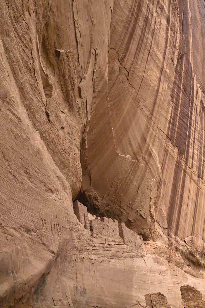
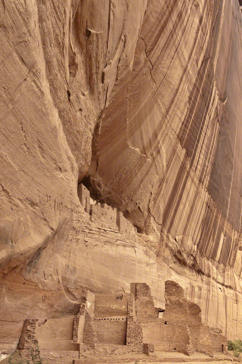
We found the White House trailhead, hiked down essentially alone as the sun set at 5:20 pm. At that time, a thick stand of Russian Olive trees choked the wash. We stopped at this point in the gathering dark. I took this distant shot of the White House Ruin against the Russian Olive autumn foliage. A stand of Cottonwoods growing near the canyon wall had yet to turn their brilliant yellow. At that time, the White House Ruin was painted white.
When Pam and I visited July 2008, in the intervening 4 years, 9 months the Russian Olives were removed as an invasive species, the ruin was no longer white.
There is one highway headed south in the Four Corners region of Northern Arizona, the same route 191 Sean and I took. In 2008 Pam and I came from Colorado south on 191, also arriving late afternoon.
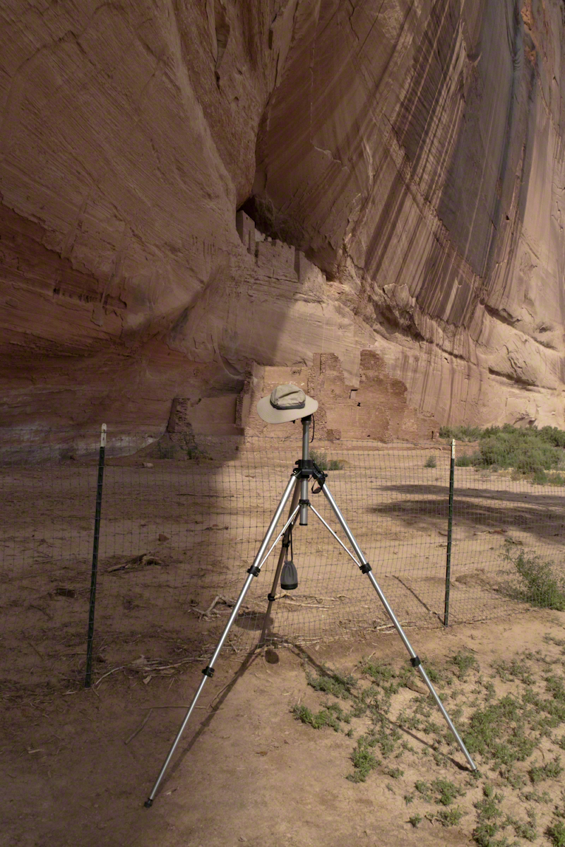
That July day the sun set 8:33 pm as the Navajo Reservation observes daylight savings time. My goal was to photograph the White House Ruin I missed in 2003. We arrived at the trail head. My photography kit was expanded from 2003, now included a Kodak DSC Pro slr/C, the “C” meaning “Canon” lens mounting, a Sony 700 alpha slr (I only use a variable lens), Manfrotto tripod with hydrostatic ball head, and the backpack style Lowe camera case. With the tripod it is over 25 pounds.
With this on my back I was prepared to boogie down the trail. At the height of tourist season there were many more people at the trailhead. Pam, being a friendly person, started a conversation while I ploughed ahead along the flat canyon rim. It is solid red sandstone, beautiful, generally level with enough unevenness to require attention. When Pam saw how far ahead I was she tried to catch up, tripped, fell hard.
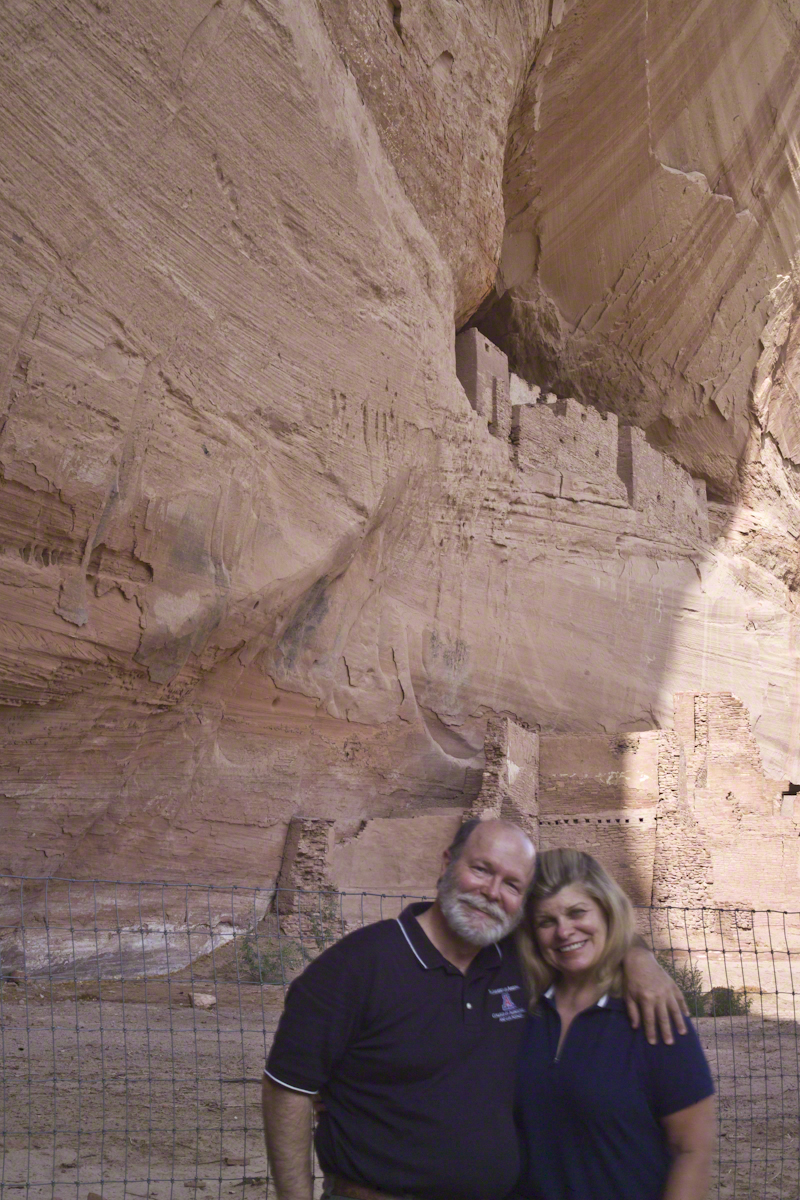
I backtracked to Pam and we pulled it together. She thought, maybe, the fall broke a rib. We descended, slowly, together. Here we are in front of the ruin. The sun, low in the sky, is moving below the south canyon wall. This is a perfect time and I used both cameras.
Mike and Pam Wills with the White House Ruin, Canyon de Chelly, July 2008
The sweep of cliff and desert varnish was my intent to capture. Here it is through the Canon 50 mm lens.
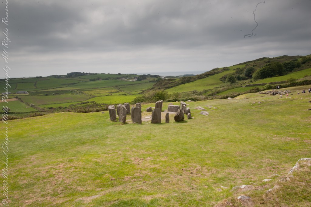
The photograph shared the last Drombeg posting needed hours of reworking before it was ready for submission to Stock Photography services. Ireland photography is my “money maker”, so the effort is work this.
Today, I share the image as it existed in camera, to the final product. The most detailed work was removing the human figures in the upper right corner. The camera sensor was problematic, with an light accumulation of dust. Below are the two images, each alone and as slideshow for flipping back and forth.
What differences can you observe? (comments, please)
Click any pic for a larger view, in a new tab, or a slide show. When using WordPress Reader, you need to open the post first.
Here is one of my finest photographs from that morning. The ocean view is a reason Drombeg is one of the most popular neolithic sites.
The Celtic Sea is close to this site, unoccupied since 800 BC, may be as old as 1100 BC according to radiocarbon dating from 1957 excavations. Thirteen of the original seventeen stones form a circle 31 feet across. Two portal stones face a recumbent stone, together forming a axis pointing to the sun position at sunrise on the winter solstice. One of the most visited Neolithic sites in Ireland, it required some patience to achieve an image without human figures.
Click any pic for a larger view, in a new tab, or a slide show. When using WordPress Reader, you need to open the post first.
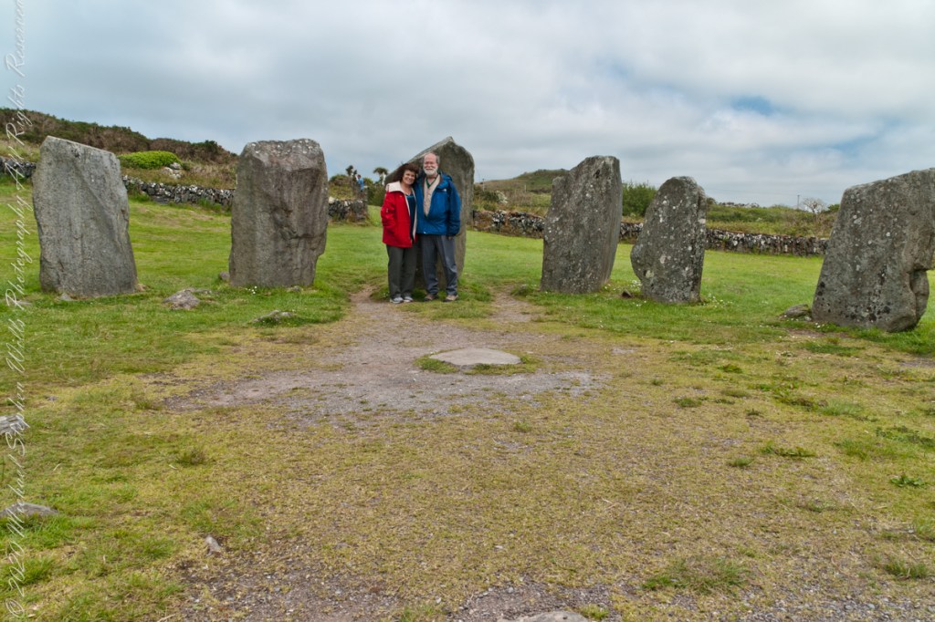
The camera is set on a tripod positioned in front of the recumbent.