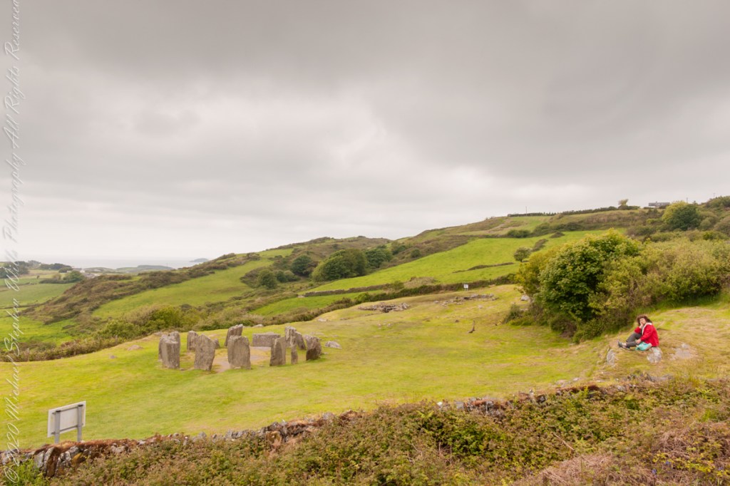
The Celtic Sea is close to this site, unoccupied since 800 BC, may be as old as 1100 BC according to radiocarbon dating from 1957 excavations.
Click any pic for a larger view, in a new tab, or a slide show. When using WordPress Reader, you need to open the post first.
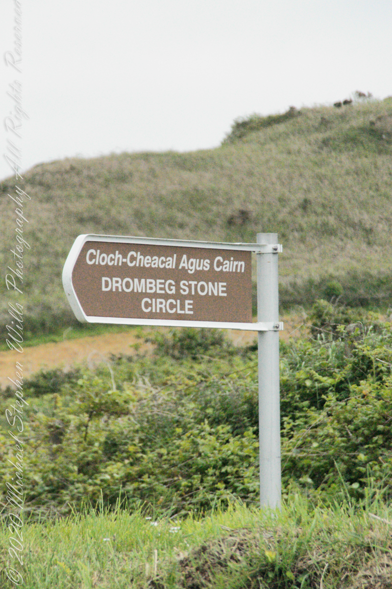
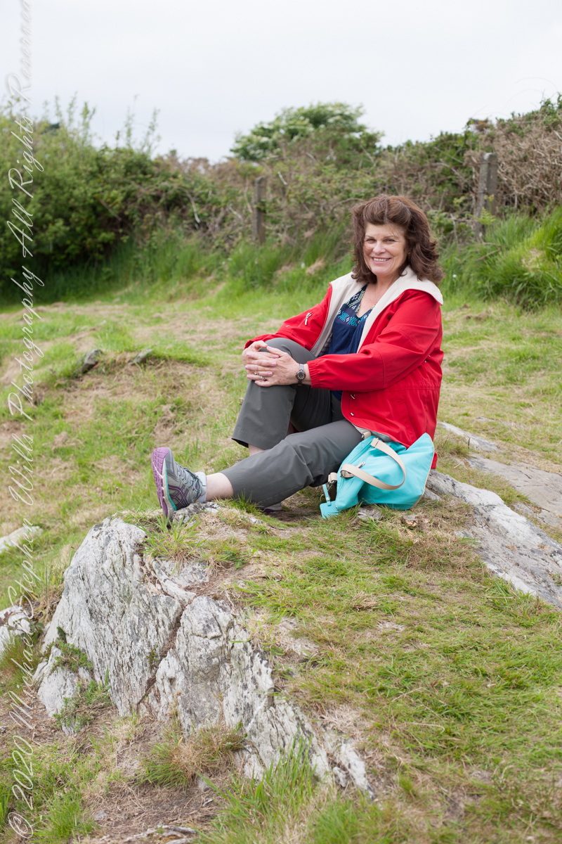
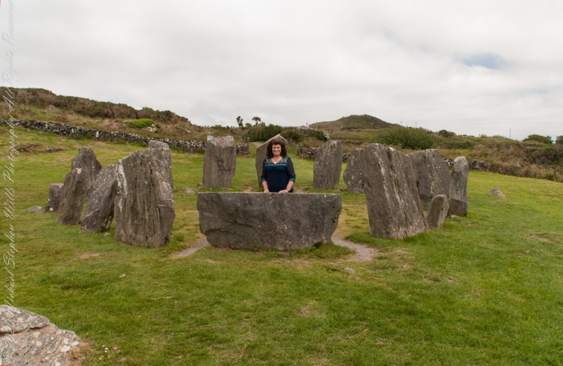
Road sign ourside the Drombeg Circle site, County Cork, Republic of IrelandPortrait of Pam during our 2014 visit to the Drombeg Stone Circle of County Cork, Republic of Ireland
The Celtic Sea is close to this site, unoccupied since 800 BC, may be as old as 1100 BC according to radiocarbon dating from 1957 excavations. Thirteen of the original seventeen stones form a circle 31 feet across. Two portal stones face a recumbent stone, together forming a axis pointing to the sun position at sunrise on the winter solstice. One of the most visited Neolithic sites in Ireland, it required some patience to achieve an image without human figures.
Seventeen closely placed stones with an axis pointing south-southwest toward the setting sun, formed by two “entrance” stones, one directly behind Pam, the second to the left. The recumbent in front of her forms the third axis element.
The path features in the past three posts is behind the entrance stones.
Click any pic for a larger view, in a new tab, or a slide show. When using WordPress Reader, you need to open the post first.
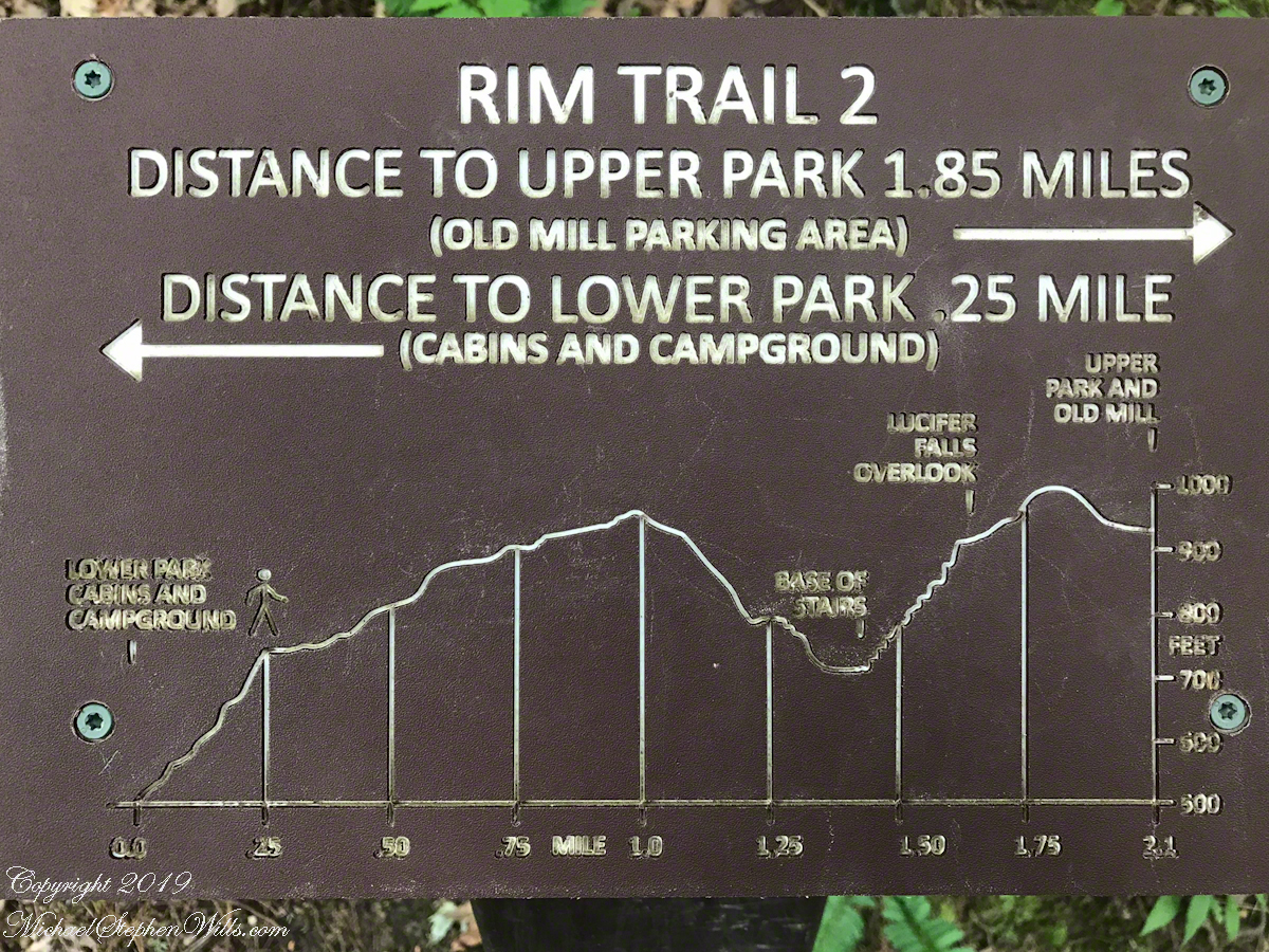
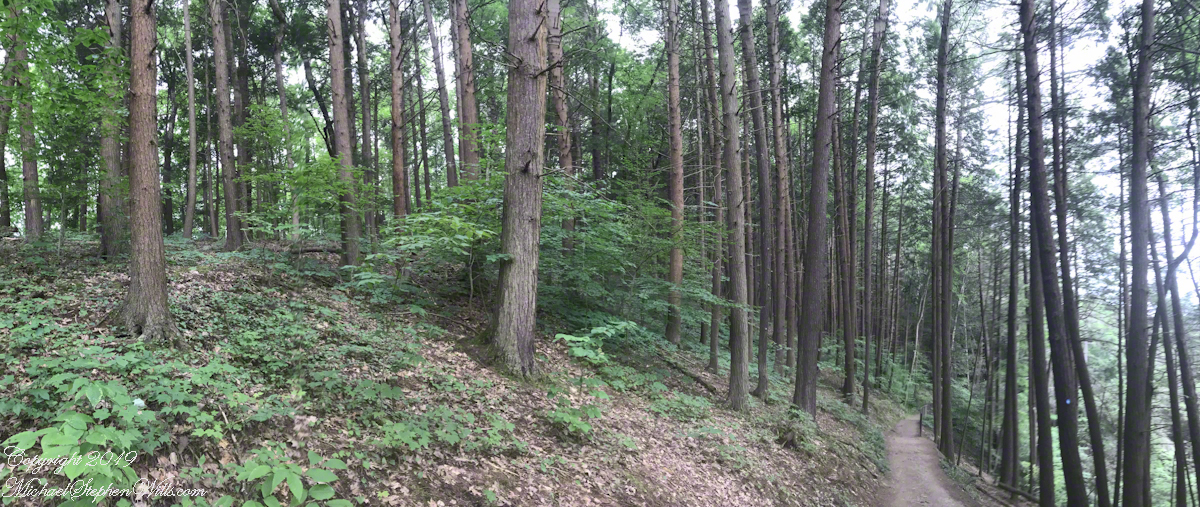
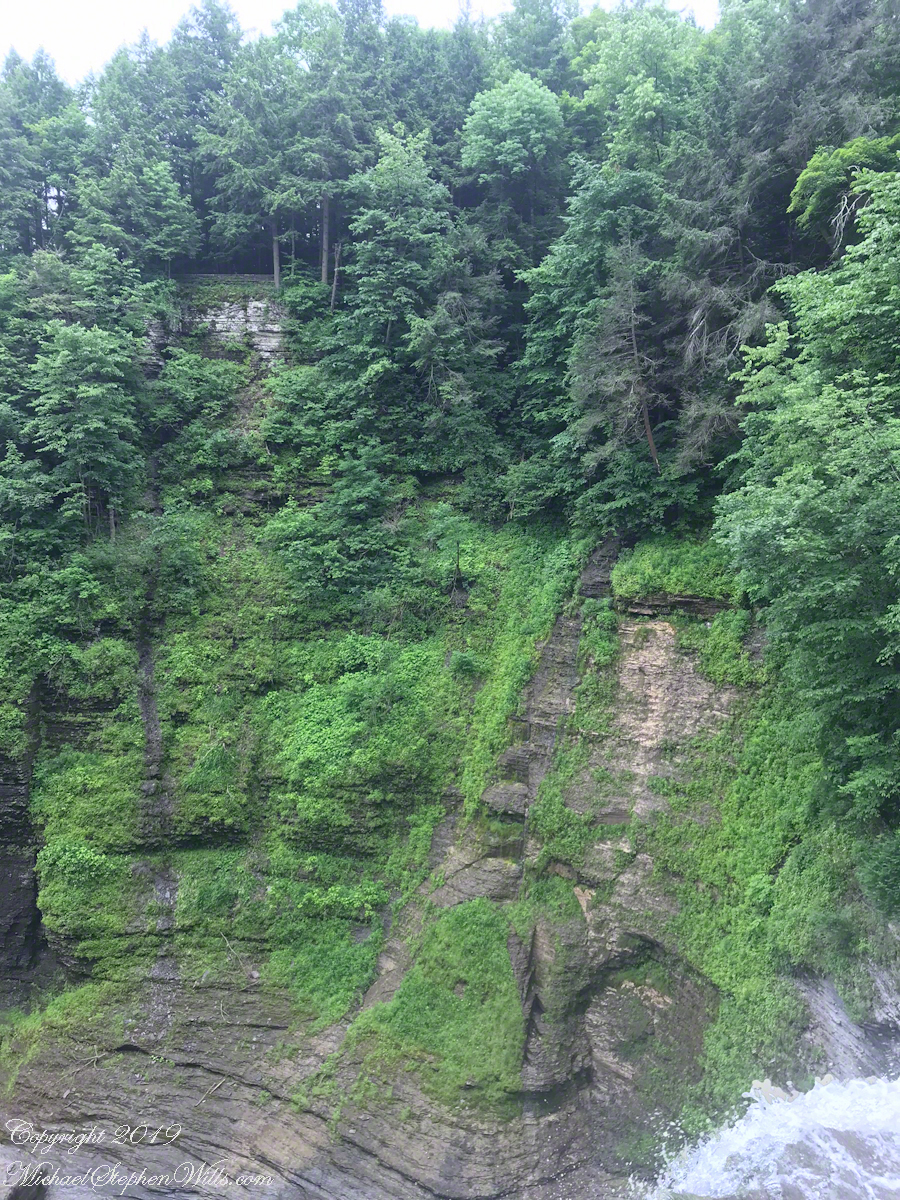
Travelling light, using IPhone captures during a 4.6 mile walk on the Gorge and North and South Rim Trails of Taughannock Falls New York State Park, Finger Lakes Region near Ithaca, New York. A few waterfalls and sights along the way. Distance is from the “Health” app on my phone.
A “Rim Trail” follows the edge of the gorge. The “Gorge Trail” is within the gorge, along side the creek and ends at the 200+ foot waterfall.
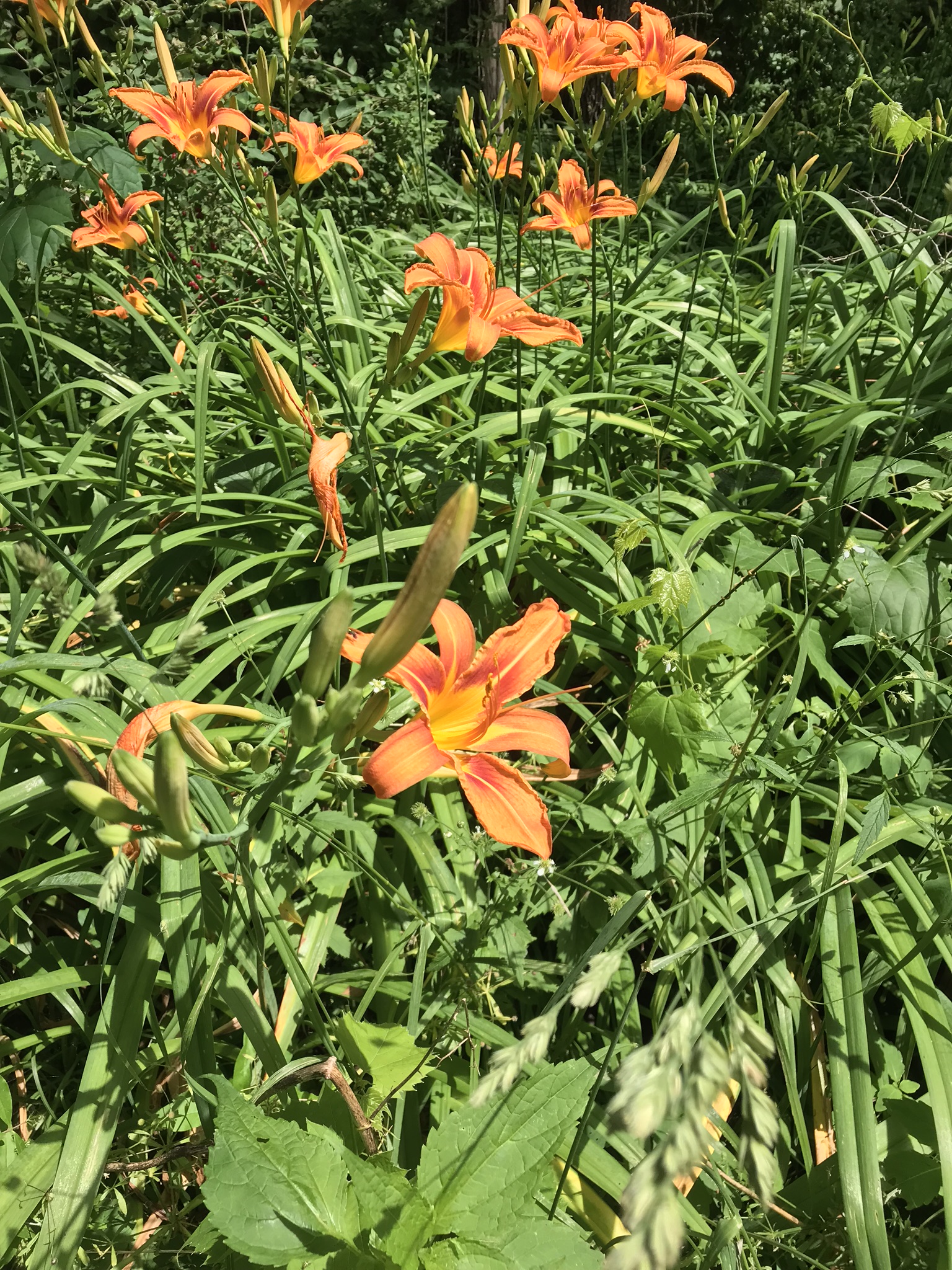
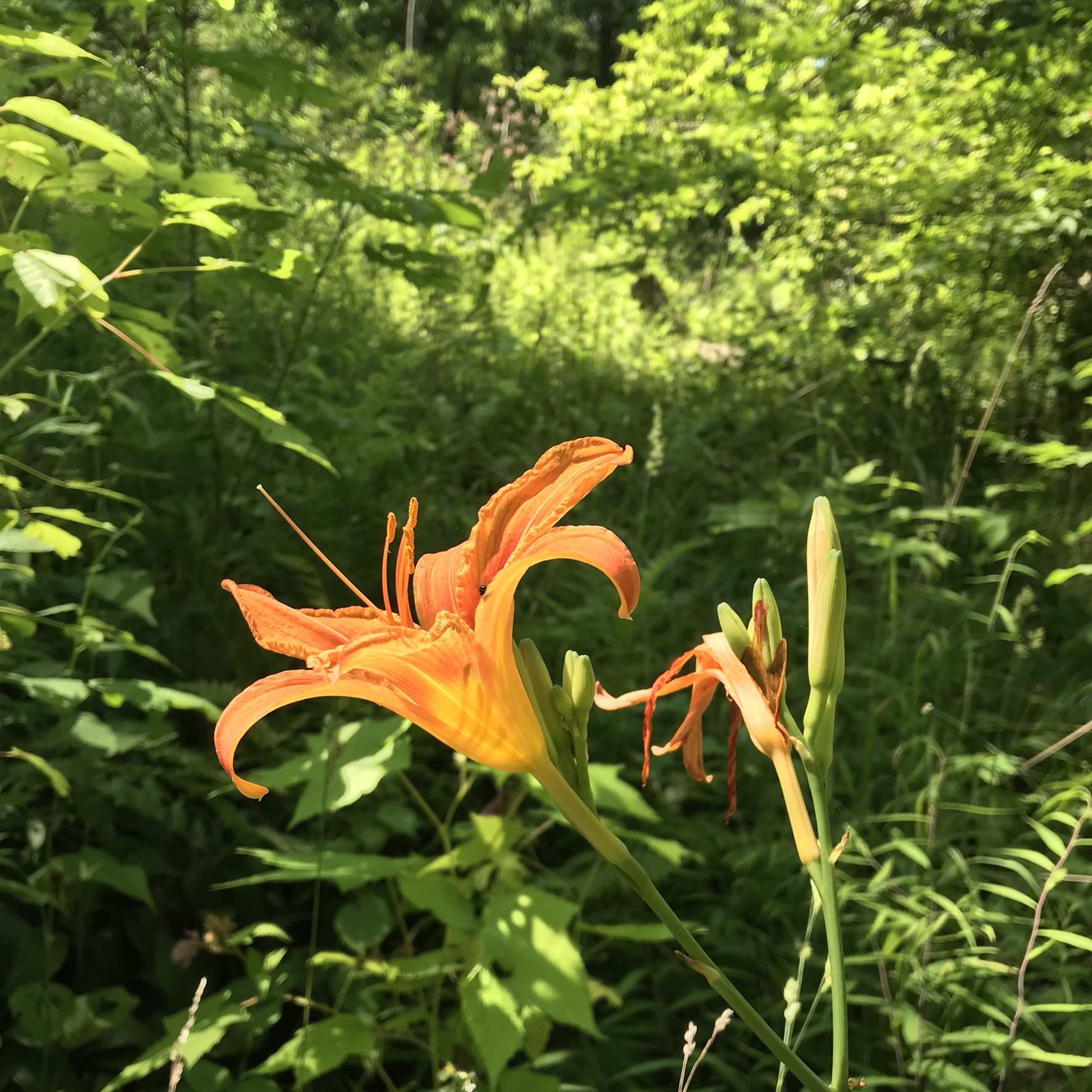
This was the day Tiger Lilies bloomed along the roads the entire 13 miles. This stand was at the beginning of the South Rim trail.
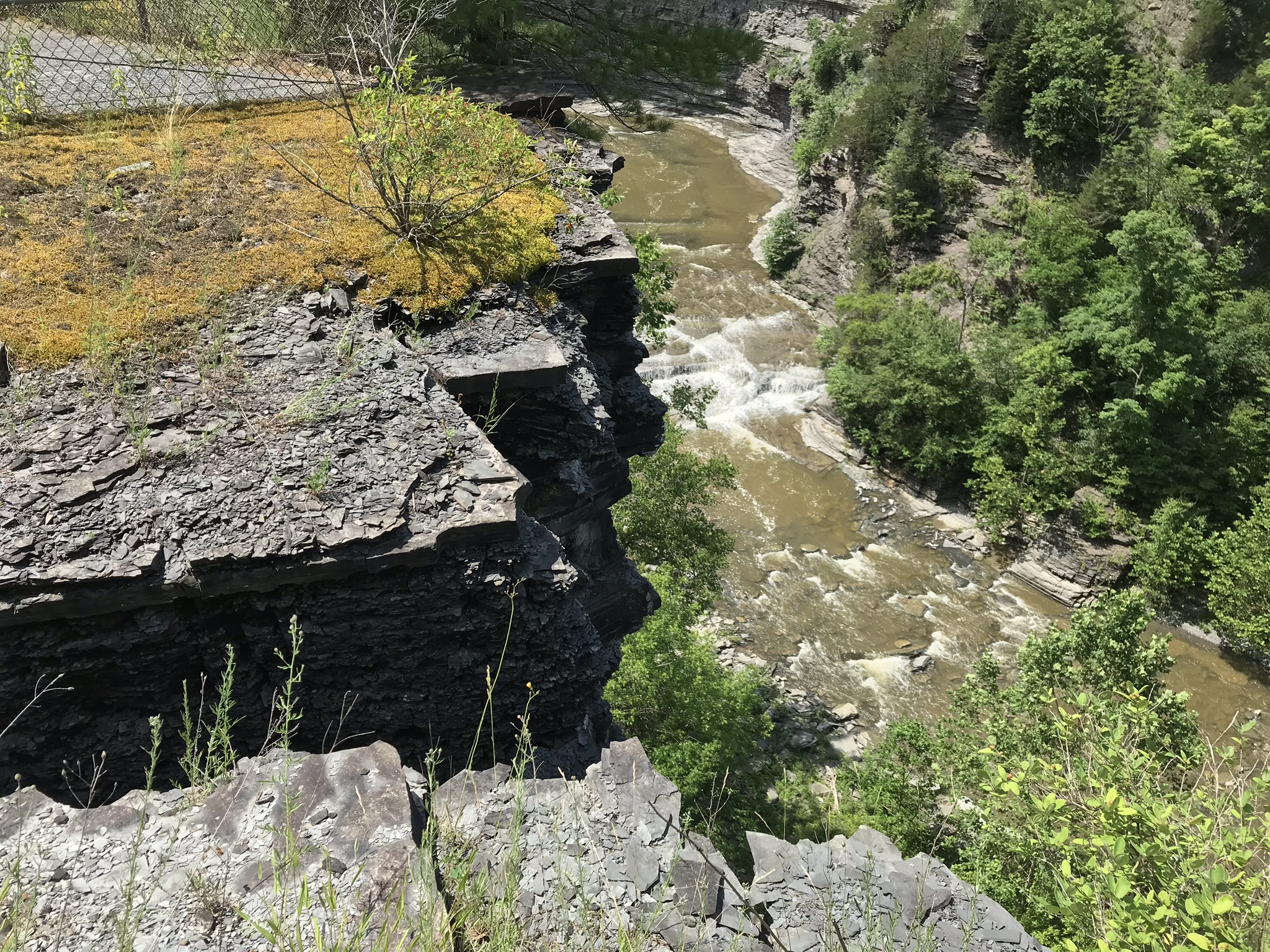
A few steps farther the trail opens up to the expanse of the gorge above the waterfall, a place to contemplate the age of these rock gazing into the open space. There is no access to the bottom of the gorge here.
On days like this, the experience carries me away, enjoying the moments and forgetting the phone in my pocket. When I come to, it is the bottom of the South Rim trail at the entrance to the Gorge Trail and the hordes walking to the falls on a Sunday afternoon. This waterfall welcomes everyone at the beginning.
The vantages I choose usually exclude the crowds, here is a video of the observation platform beneath the 215 foot Taughannock Falls. Any closer and the camera lens is covered with mist. Feels great on this hot day.
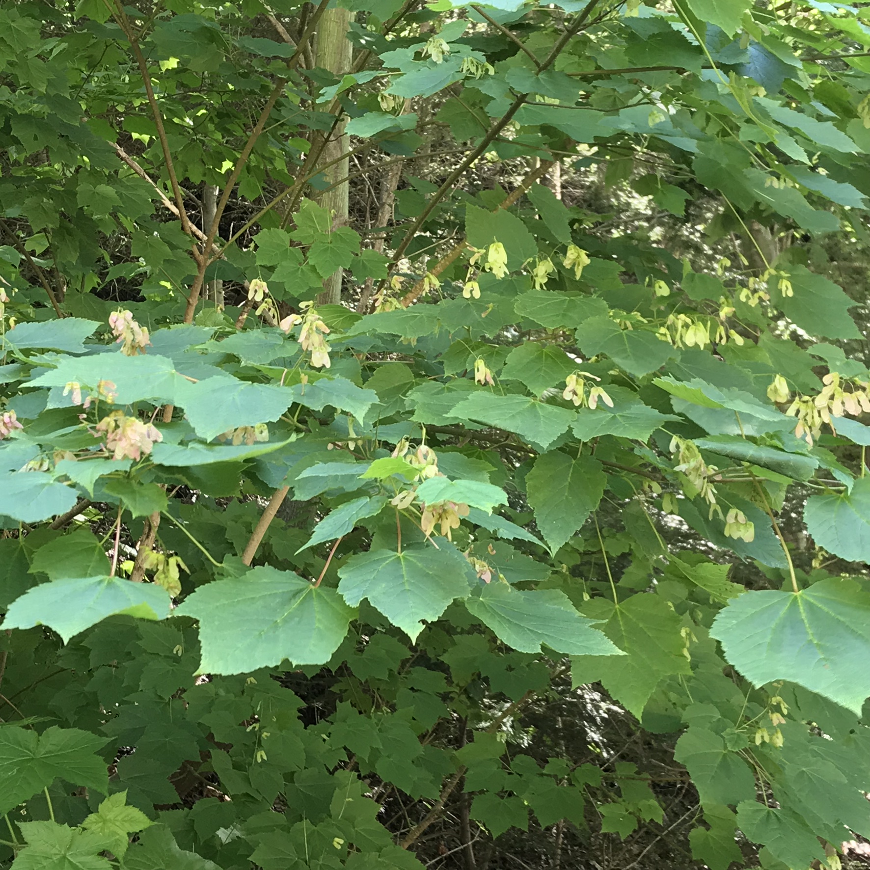
I capture this tree growing along the Gorge Trail for later identification. It has fruits similar to a maple tree. Called samaras and also known as helicopters, maple keys, whirlybirds, and polynoses these must distinguish this tree as a member of the genus Acer though the leaf shape gives me doubts. Here the gorge changes direction almost 90 degrees from, generally, north/south to east/west. There is plenty of sunlight here and the tree has taken root in the talus of the cliff face.
I researched it and discovered the scientific name is Acer pensylvanicum and more commonly known as Moosewood. There is a “famous” restaurant in Ithaca, named Moosewood, so now I know there is indeed a tree growing locally by that name. The restaurant is near the commons of Ithaca and is 100% vegetarian. The last time Pam and I at there we were packed like sardines, like some collective, and we’ve never been back. The food is good and the basis of their fame is a cookbook by the same name.
Backlit lilies found on the climb up the North Rim trail.
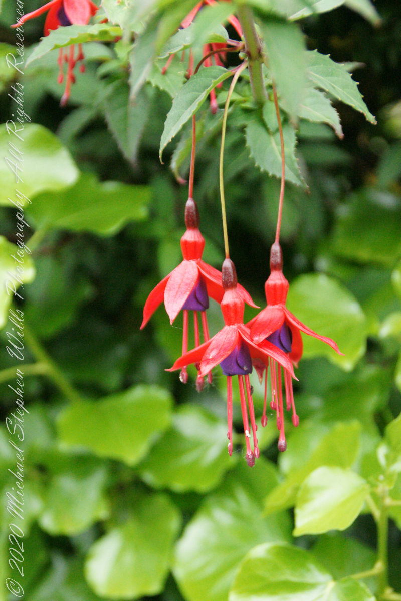
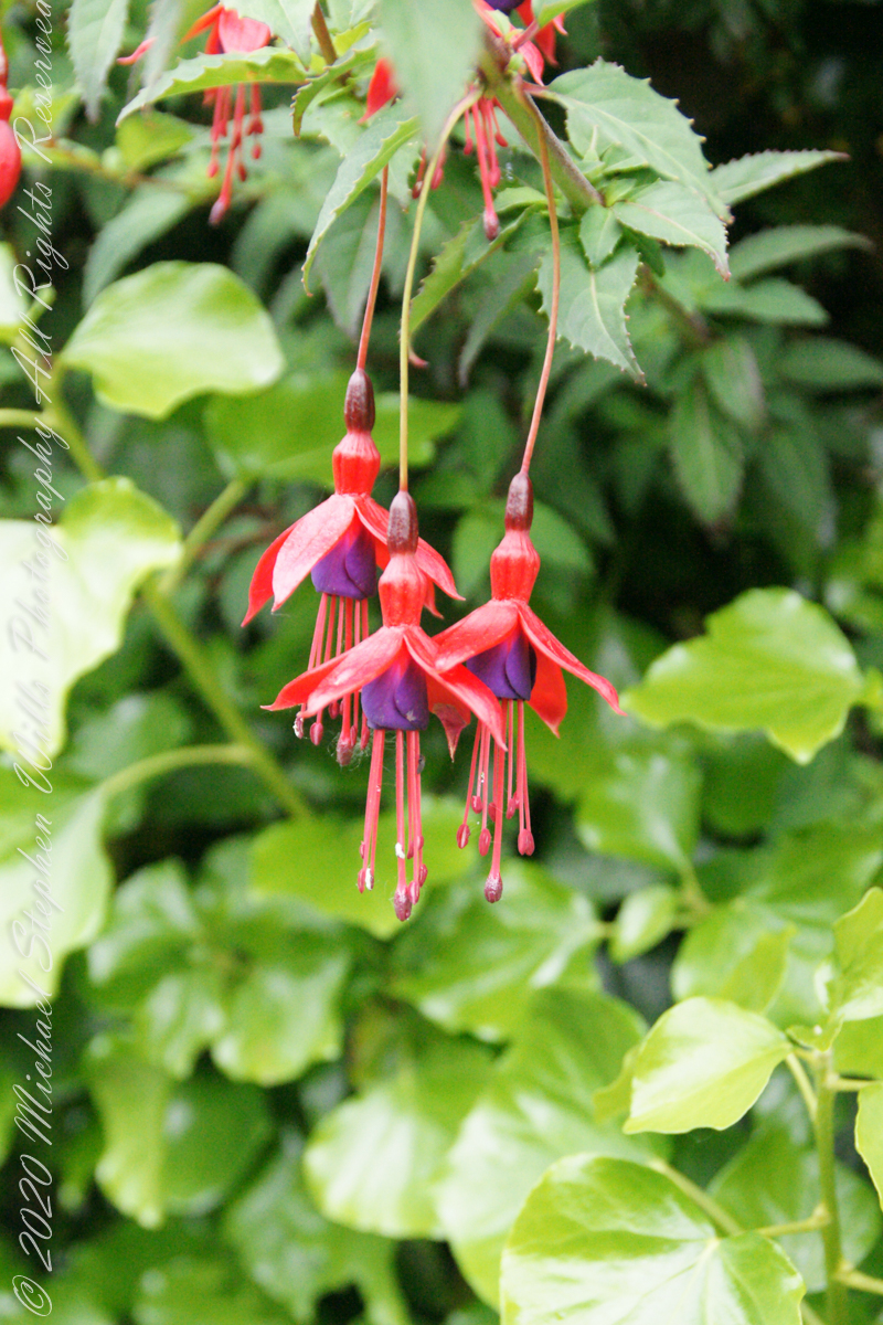
It is not surprising to find this non-native shrub growing along the path to Drombeg Stone Circle. English gardens featured fuchsia since the late 18th century. The ocean view is part of the charm of this place, the resulting milder climate suits the flourishing of exotic species of plants native to South America, the Caribbean and New Zealand.
Click any pic for a larger view, in a new tab, or a slide show. When using WordPress Reader, you need to open the post first.
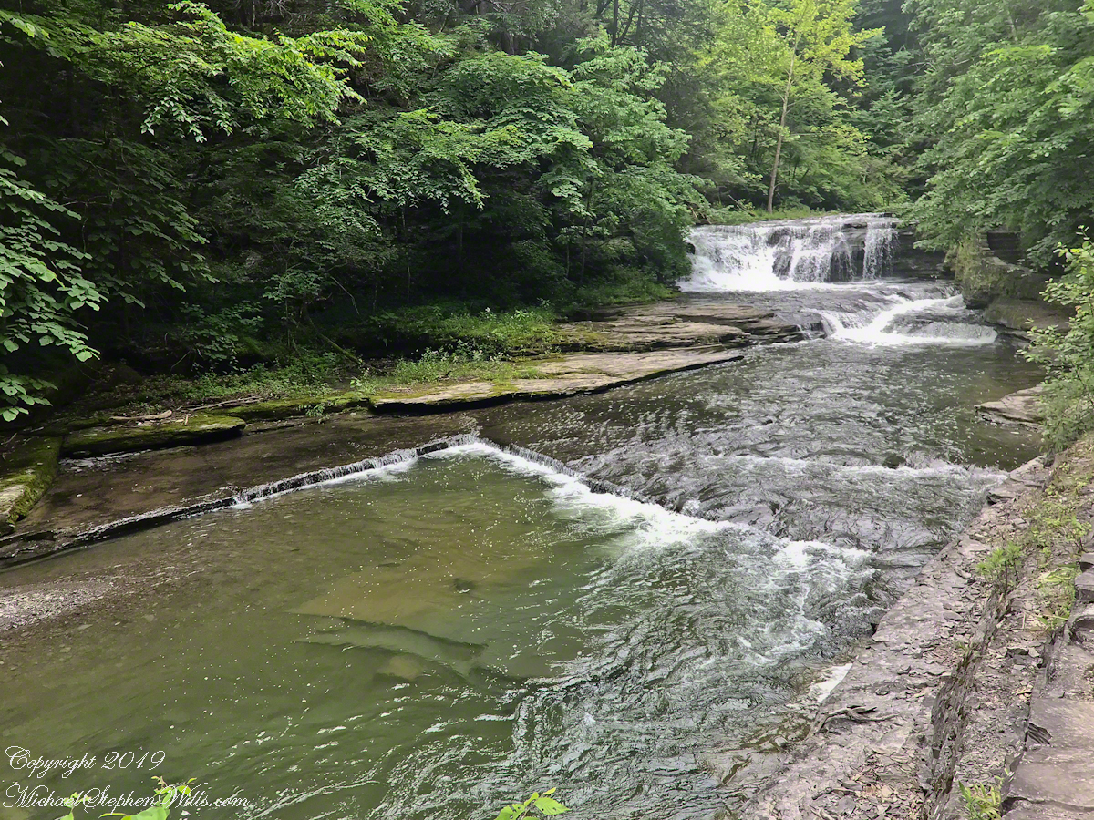
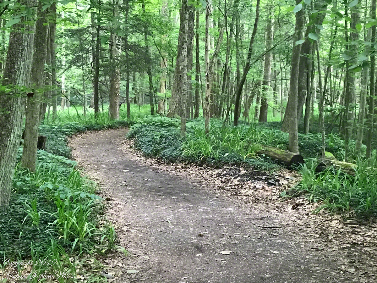
Travelling light, using IPhone captures during a 5.7 mile walk on the Gorge and South Rim Trails of Robert H. Treman New York State Park, Finger Lakes Region near Ithaca, New York. A few waterfalls and sights along the way. Distance is from the “Health” app on my phone.
One of many waterfalls along the Gorge TrailLooking back to the above waterfallEnchanted Trail
Birdsong and enchanted placeBayberry?The power of flowing water (flood stage)
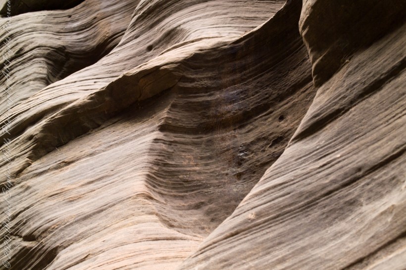
Mysterious alcoves through cross-bedded Navajo Sandstone, 15 feet, or more, above the streambed. I use mysterious in the sense I wished the formations were mysterious, standing there with nowhere to climb, witnessing the effects of floods that high above. The location is The Narrows just above Orderville Canyon junction, Zion National Park, Springdale, Utah
Copyright 2021 Michael Stephen Wills All Rights Reserved
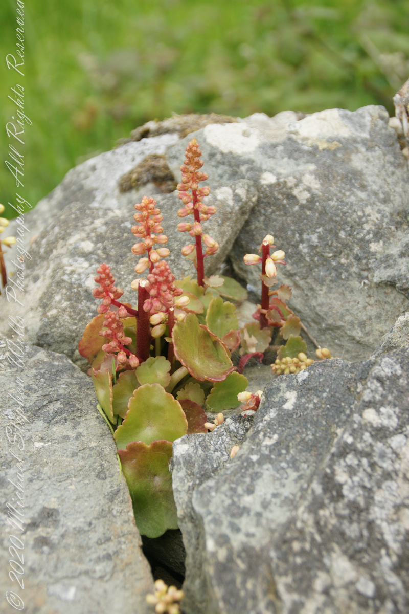
This unidentified spring of racemes, fleshy leaves and stalks, grew from the rock wall of the entry path to Drombeg Stone Circle. Here the climate is strongly influenced by the Celtic Sea, milder winters allow exotic plants to flourish.
My appraisal is this is in the Crassulaceae family, possibly the genus Kalanchoe or, more probably Umbilicus, from the fleshy, round, succulent leaves and form of the flowers. Species of Umbilicus are native to Western Europe and known to favor rock walls.
Click any pic for a larger view, in a new tab, or a slide show. When using WordPress Reader, you need to open the post first.
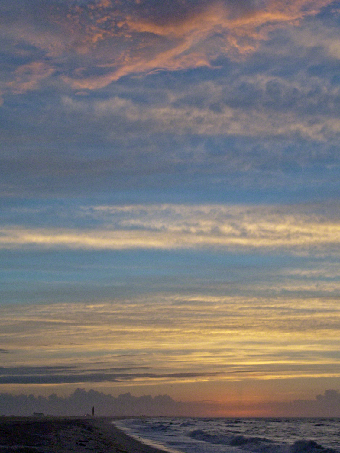
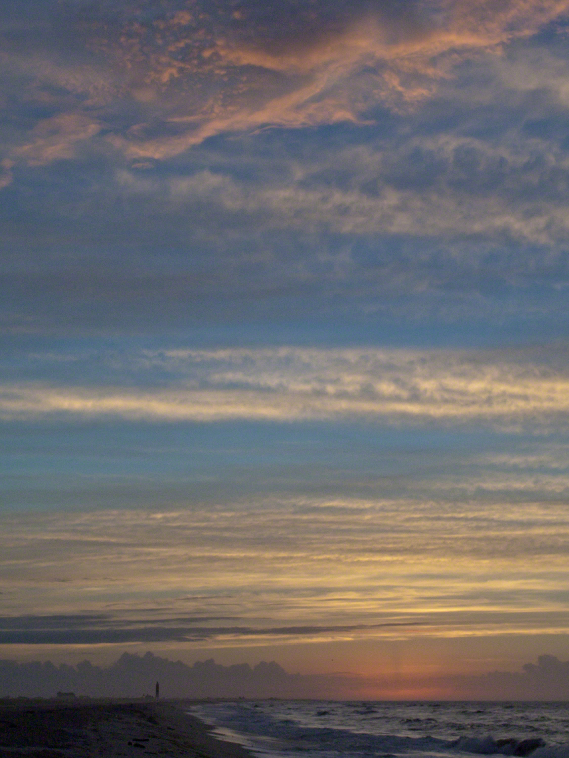
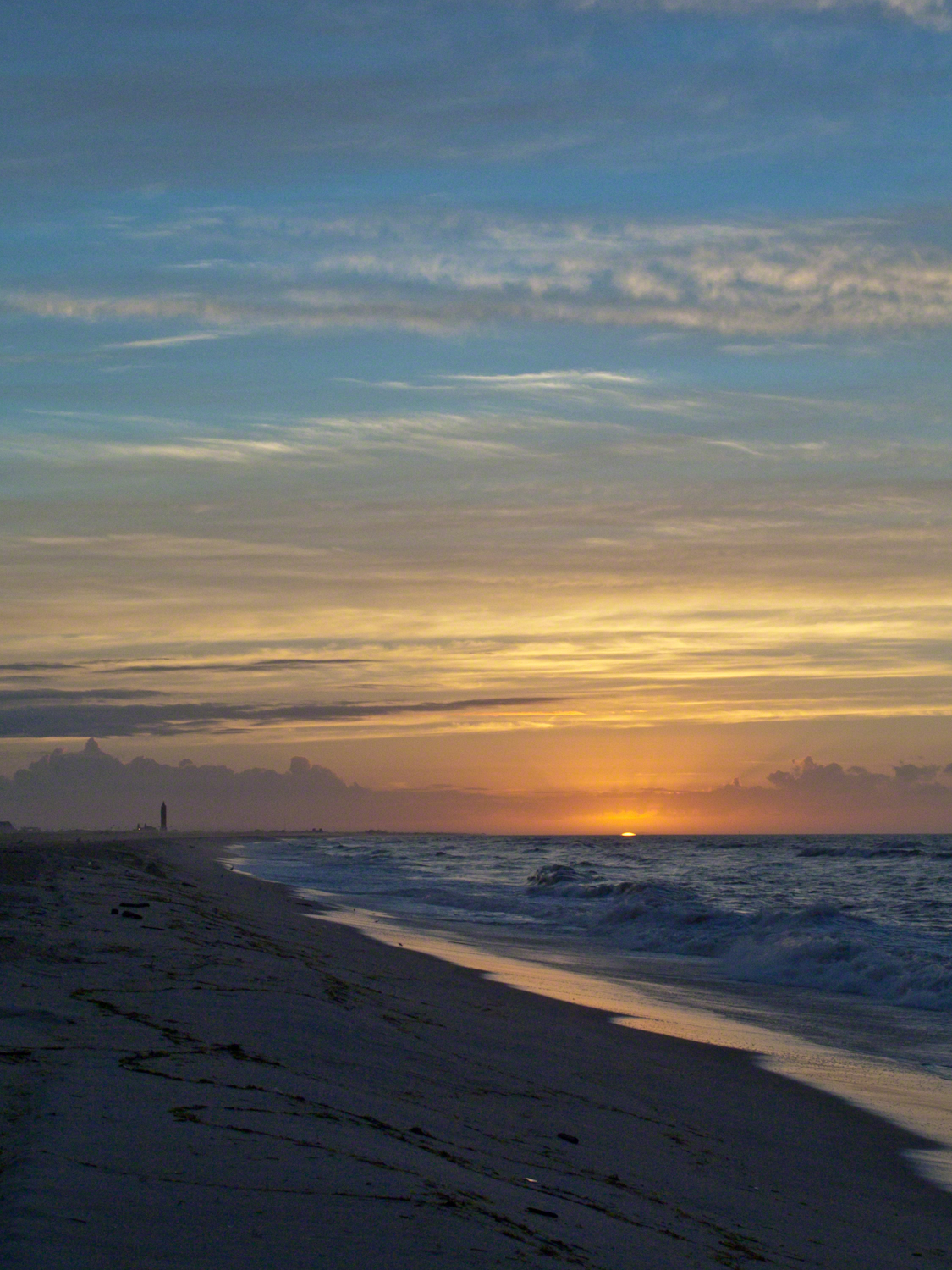
Hurricane Katrina approached the Gulf Coast and New Orleans as the sun rose on the West End of Jones Beach on Long Island, August 28, 2005. This amazing sunrise was an element of the unusual atmospheric effects that are evidence of the power of this storm.
The featured image (heading this blog) is my print, “Katrina Sunrise”. This work is enjoyed by hundreds of my clients. Use the link, below, to acquire your own. Custom framing is available.
The following images are the rough drafts taken in the early morning hours. The beach was literally deserted as I mounted the camera and framed the view for this series. Many image captions include the file time stamp, for example 6:07:13 is 6 am and 7 minutes 13 seconds.
6:07:13 First image of the set. Below the horizon the sun lights the upper atmosphere.6:07:34 As the sun approaches the horizon the lower clouds catch light. My Camera was a Sony DSC-F828 tripod mounted with a polarizing filter.6:07:56 I panned slightly to the east. ISO was set to 64 throughout.6:08:16 Gradual brightening. The lens is 7.1 – 51.0 mm f/2.0-2.8.6:08:38 All levels are brighter. It seems those low clouds will block the horizon. That was not the case. The variable focal length is 15.6 mm.6:09:05 It is happening!!!! Exposure was set to automatic on a f stop of 8.0. It was 1/3 second for this image.6:14:34 The view is panned west. That is the Robert Moses water tower of Jones Beach State Park looking like a rocket ready to blast off.6:15:15 Will those low clouds block the sun? Looks promising.6:16:11 Clouds on the upper margin catching the sun. Horizon brightening….. Exposure 1/20 second.6:14:39 This will be a disappointment if that sun does not show. Exposure 1/25 second.6:18:27 Almost there….1/15 second exposure….6:19:07 Quick framing adjustment to bring the lighting of shore margin into the composition. The final version was created from two images captured seconds after this.As the sun rose a rainbow formed in the western sky.
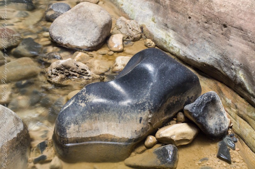
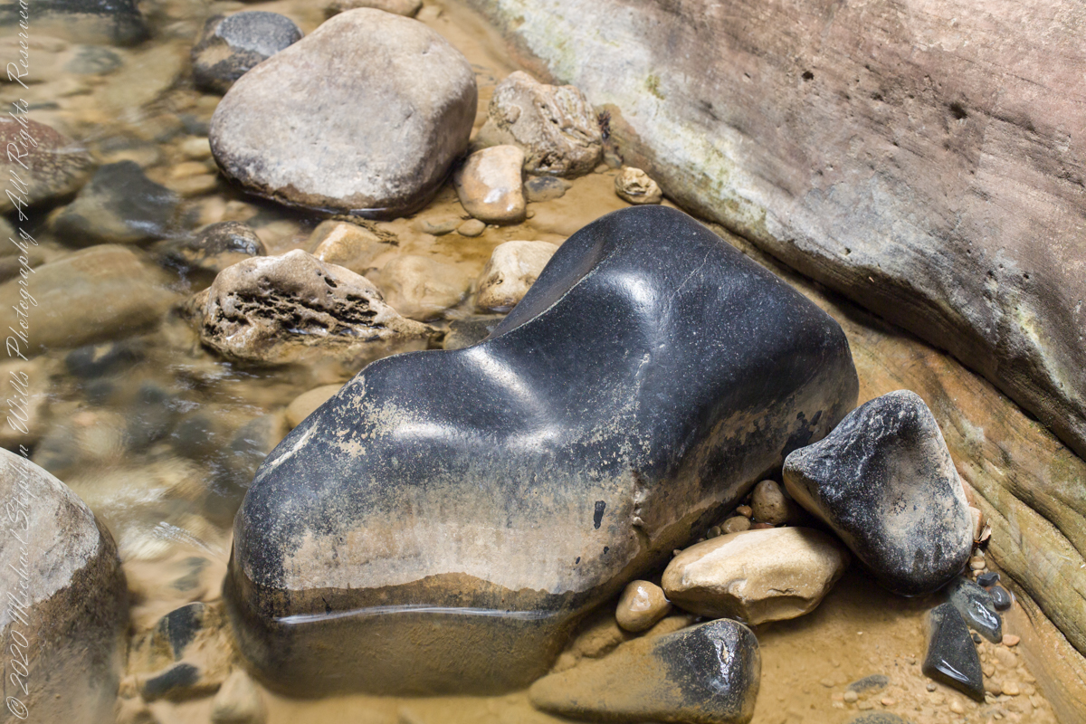
This polished basalt, the product of volcanic eruptions and eons-long weathering, is common on the Virgin River bed. Zion National Park, of The Narrows just above Orderville Canyon junction.
Copyright 2021 Michael Stephen Wills All Rights Reserved